Category Archives: 2010 Summer Road Trip – Yellowstone and More

2010 Sep 1-6 – Days 21-26 – Hardin, MT to home (Fort Benton)

This is the final entry on my 2010 Road Trip blog.

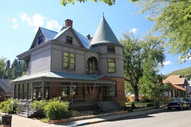
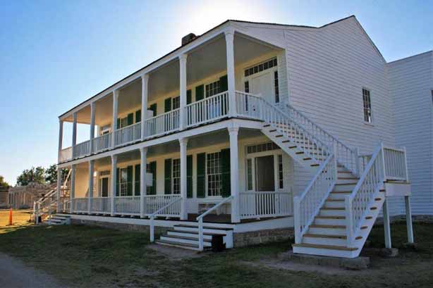
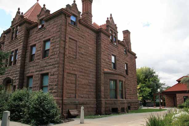
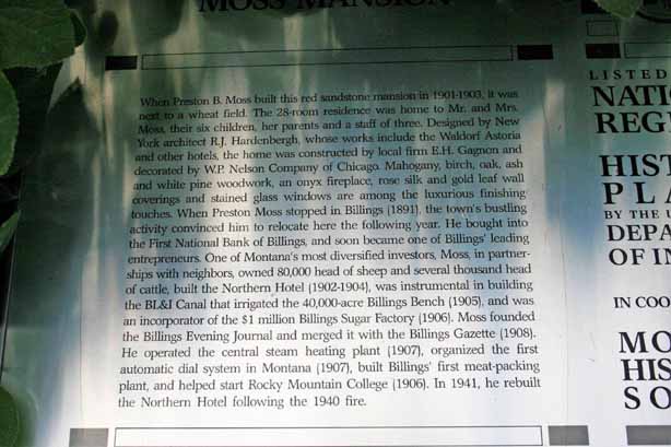
We had spent the night in Hardin, MT, a few miles east of Billings.   The next day, as we drove through Billings we stopped to tour the beautiful Moss Mansion.  No photos allowed inside unfortuantely but even the outside and garden were pretty nice. 
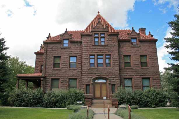
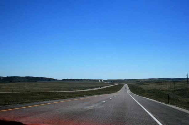
Our drive that day took us to Great Falls.  Once we make the decision to head for home John tends to get in destination mode and we don’t spend a lot of time finding stops of interest; so we pretty much have driving days.

From Great Falls we went back to Fort Benton. Since we were not able to tour the fort and museum on our way down to Yellowstone we stopped in again on the way back to BC.

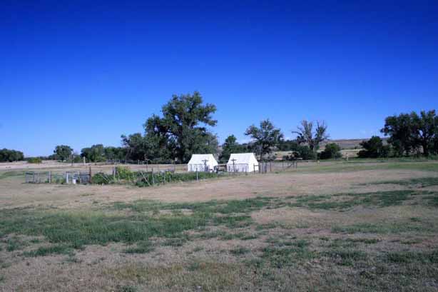
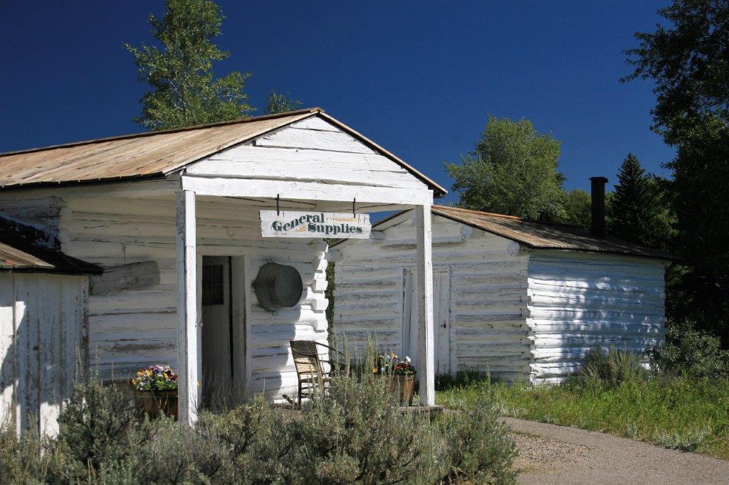
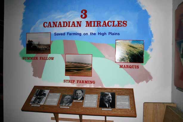
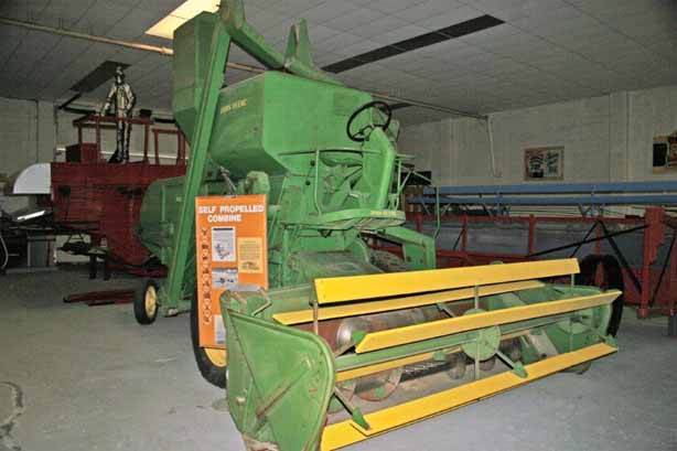
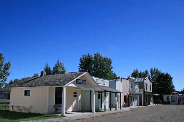
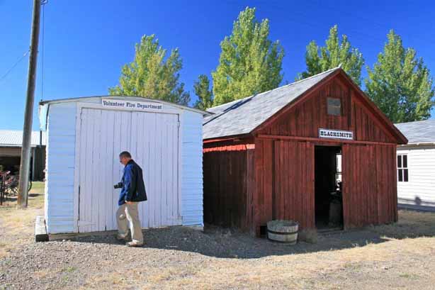
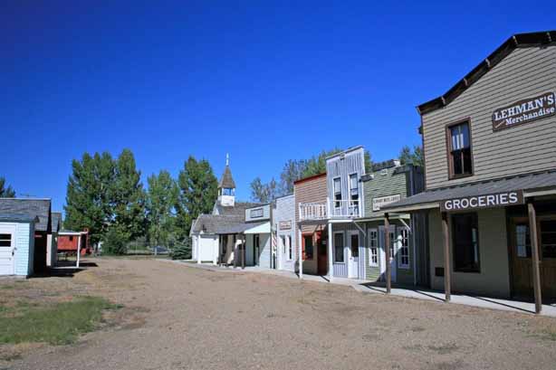
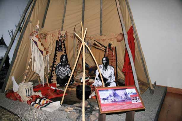
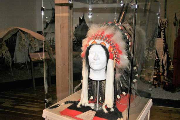
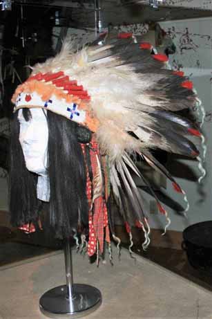
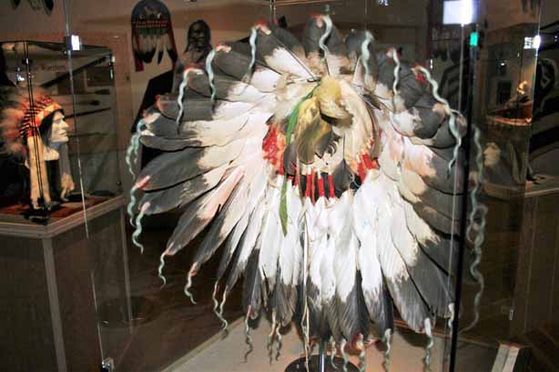
At Fort Benton there is also the Museum of the Northern Great Plains which had interesting exhibits and a ‘typical’ town heritage street. 
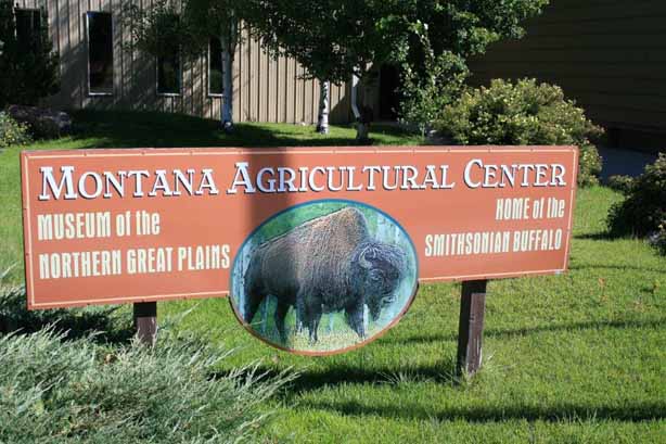
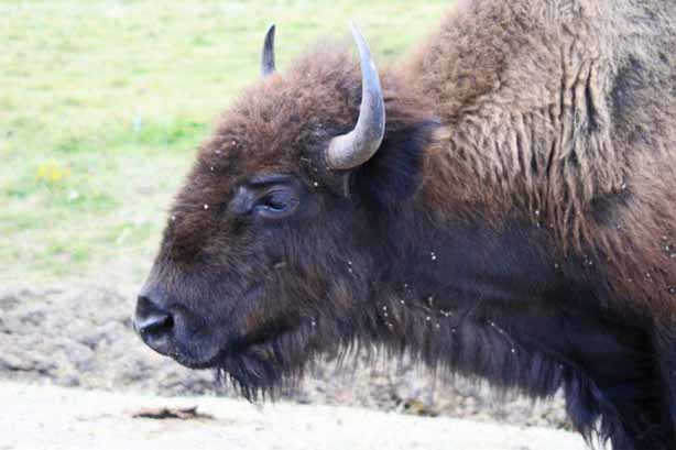
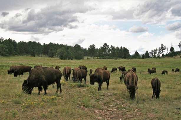
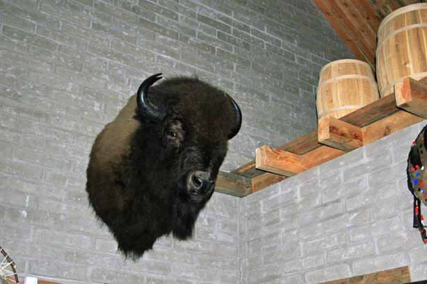
In the museum is a taxidermy group of six buffalo.  These animals were collected by a man named Hornaday in 1886 on behalf of the National Museum in Washington, DC, when the species was on the brink of extinction, in order to preserve an example of these great creatures.  The animals were on display in the Smithsonian for 70 years and the big bull’s image was the model for several national symbols and issues. Coins, paper currency, postage stamps, the Great Seal for the Department of the Interior, and the National Park Service badge all bear his likeness.  The group was returned to Ft. Benton in 1955 but was put in storage until the it was completely restored in 1996 in the original positions and put on display. 
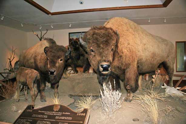
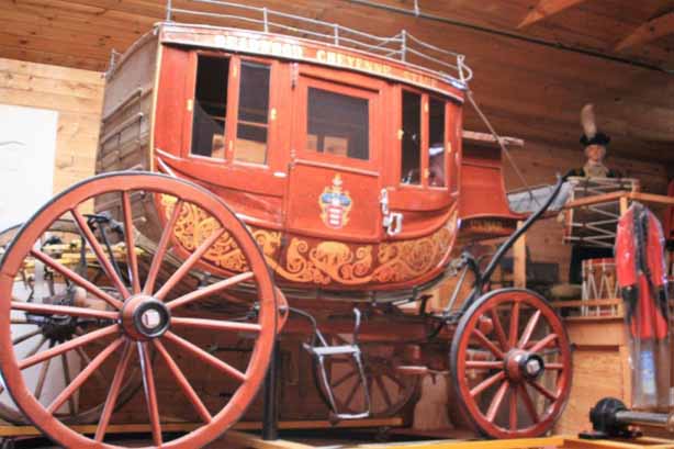
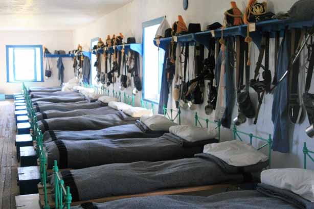
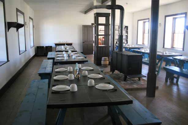
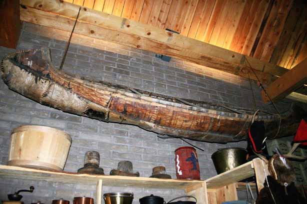
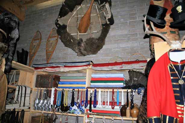
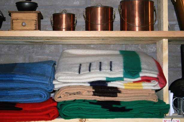
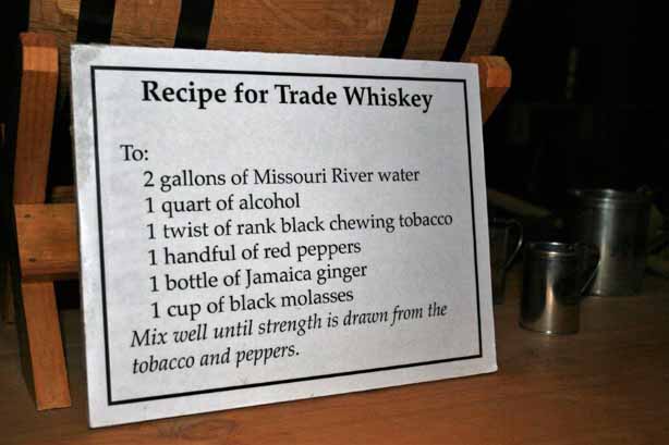
After we toured the museum and town we entered the fort.  Fort Benton was established in 1846, a full generation before the Civil War, and was the last fur trading post on the Missouri River before a 642-mile overland trek on the Mullan Road that would get you to Walla Walla, Washington. Inside the replicated trading post we were greeted by the ‘trader’ who gave us the lowdown on the items that were the common goods kept in stock. 
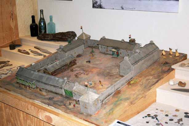
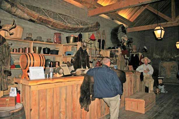
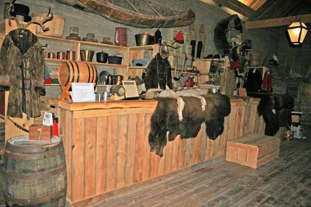
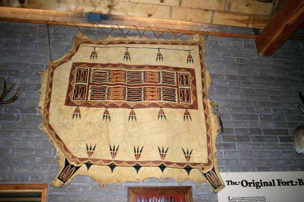
John ‘wore’ a hide as a demonstration. 
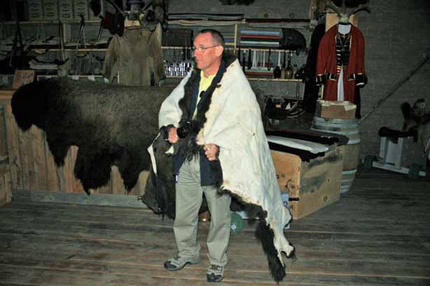
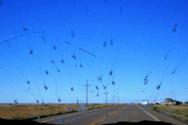
The one constant as we drove around Montana and Wyoming that summer (and I would think every summer) is the massive number of mosquitos that meet their end on the truck and windshield.  It was a daily chore to clean them off. 
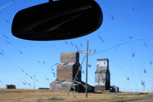
We spent the night in Havre, then Spearfish, ID, then Nelson, BC and finally, after three weeks, we were home again.  This endeth the blog.  Thanks for tagging along.

2010 Aug 31 – Day 20 – Gillette, WY to Hardin, MT (Little Bighorn)

My Daddy’s “Drive North America” books says, “Montana’s Crow Indian Reservation is the site of perhaps the most famous event in Plains Indian history.  Here, in 1876, along the cottonwood-shaded banks of the Little Bighorn River, Lt. Col. George Armstrong Custer made his legendary last stand – a rout of some 260 soldiers of the 7th Cavalry by almost 3,000 Sioux andCheyenne warriors.”

Another of Dad’s travel books, “Handpicked Tours of North America,” describes the situation like this: “The Cheyenne, a few Arapahos and Sioux  under the Sioux warrior Sitting Bull trespassed on Crow land in the biggest congregation of Indians ever assembled on the plains. The brochure I picked up at Monument gives some background: “The Lakota and Cheyenne left their reservation in the Black Hills in frustration over the invasion of their given lands by thousands of gold seekers who swarmed into the area in violation of the Ft. Laramie Treaty.  The government tried to keep the prospectors out to no avail and also tried to buy the land from the Indians to circumvent hostilities; also without success. Thus the indians resumed raids on settlements and travelers along the fringes of Indian domain.  They were ordered to return before Jan 31, 1876 or be treated as hostiles “by the military force.”  When the Indians did not comply, the army was called in to enforce the order.  Some Crow scouts accompanied the U.S. Cavalry units as they set out to force the trespassers back onto their own reservations.” “The Bureau of Indian Affairs, misjudging the situation, told the army that only 800 warriors were involved. The fact was that 10,000 to 12,000 Indians had joined Sitting Bull’s forces, including some 4,000 warriors who were among the best cavalrymen on earth, many of them armed with the latest repeating rifles, which they had obtained from reservation traders.”

“Unknown to Custer, another army unit had encounterd the natives on Rosebud Creek, east of Little Bighorn.  The army had been fought to a standstill and forced to withdraw.  This success further encouraged Sitting Bull to continue into Little Bighorn Valley and set up camp.”

“Custer was leading one arm of a pincer movement, and had rushed his cavalry unit into a position where he could block an expected Indian retreat as another army unit advanced.  He located the Indian camp at dawn on June 25 and divided his regiment into three battalions to surround and attack a superb, eager-to-fight army, which he was unaware outnumbered him five or six to one.”

The Little Bighorn Battlefield National Monument encompasses the land where the battles took place.  There are paved pathways on a self-guided interpretive trail that winds through the tall grass and past the grave markers.  The Rangers in the visitor’s center willingly answer questions and explain the events of the battle. “After the battle the bodies of Custer and his command were hastily buried in shallow graves at or near where they fell.  In 1877 the remains of 11 officers and two civilians were transferred to eastern cemeteries. Custer’s remains were reinterred at West Point.  In 1881 the remains of the rest of the command were buried in a mass grave around the base of the memorial shaft bearing the names of the soldiers, scouts and civilians killed in the battle.  In 1890 the Army erected 249 headstone markers across the battlefield to show where Custer’s men had fallen.  In 1999 the National Park Service began erecting red granite markers at known Cheyenne and Lakota warrior casualty sites throughout the battlefield to provide a balanced perspective of the fierce fighting that occured here in 1876.”There is now a memorial area commemorating the Indian’s that fought and a marker to honor the Cavalry horses that were intentionally shot to provide some amount of cover from the arrows and bullets. Little Bighorn Nationa Monument is also the site of Custer National Cemetery which is a military burial place still in use today. Once again, I was awed and moved to be walking the ground of an historical event I had learned about in grade school and seen immortalized on screen.


2010 Aug 30 – Day 19 – Lead, SD to Gillette, WY (Devils Tower)

A few miles west of Lead, SD is Roughlock Falls, created by Little Spearfish Creek.  The water flows down a spectacular chasm then tumbles off a 50 foot limestone ledge in a series of cascades.  It is very pretty and one of the most-photograph spots in South Dakota’s Black Hills.

We turned north after visiting the falls and drove up to the old cattle drive staging town of Belle Fourche (beautiful fork); named by French explorers from New France (much of Quebec and the Acadian pennisula – New Brunswick, Nova Scotia, Prince Edward Island – and Newfoundland), where the Belle Fourche and Redwater Rivers join the Hay Creek.  The area was a major fur trading center in the early days and later it was a way-station on the stagecoach line from Medora, ND to Deadwood, SD.

For 14 years (1876-1890) an enterprising fellow named  Seth Bullock bought up properties as homesteaders ‘proved up’ and sold out.  When the railroad refused to pay the high prices demanded by the near-by community of Minnesela to ship the ranchers cattle to the packing plants, Seth offered them free right-of-way through his property if they would build a terminal on his land, near where the present Belle Fourche Livestock Exchange is located.  The first shipment of cattle left Belle Fourche for the east in 1890 and by 1895 2,500 carloads of cattle per month, in the peak season,  were sent eastward, making it the world’s largest livestock-shipping point.  Even today Belle Fourche serves as a large trading area for local farmers and ranchers.

I wrote this historical tidbit because just before we left home to begin this road trip we had watched an old John Wayne western movie, “The Cowboys,” in which a rancher had all of his hands desert him to go to the gold fields and he had to, reluctantly, hire young boys to drive his cattle herd to Belle Fourche.  I was quite tickled to be in the same place.  So many of the beloved cowboy movie sets from my youth became real on this trip.

Another historical side note: In 1959 the  U.S. Coast and Geodetic Survey designated a point 20 miles north of Belle Fourche as the geographic center of the United States.  Until then the center of the US was Smith Center, Kansas but with the inclusion of Hawai’i and Alaska the middle point had to be re-configured. (Aren’t you glad I read all this stuff?)

At Belle Fourche we turned west and re-entered Wyoming.  The sky was very grey near Hulett. About 45 miles from the border is Devils Tower National Monument, America’s first; designated by Teddy Roosevelt in 1906. The tower is actually the core of a volcano exposed after millions of years of erosion.The base of the tower is cluttered with huge bolders that are pieces of the columns that have fallen off the sides. We walked the mile and a quarter trail all the way around.  The tower is 865 feet high and is featured in many Native American legends. It is a popular climbing spot and we watched several different pairs of climbers navigate the columns.  You have to look very closely to see the climbers just above the trees in the wider shots.  Brave fellows.

By the time we left the sun was lower and cast a lovely golden glow on to the tower.  It was a fascinating place to visit.  The curves at the bottom of the columns were amazing, especially when you consider how large the rocks are.

We spent that night in Gillette, Wyoming and the next day we drove north through Sheridan into Montana and the site of the Battle of the Little Big Horn.

2010 Aug 29 – Day 18 – Keystone, SD to Lead, SD (Mt. Rushmore and Deadwood)

About six miles west of Keystone is the ‘oh-so-famous’ Mount Rushmore National Memorial.  The story goes that a New York lawyer, Charles E. Rushmore, visited the Black Hills on business in 1885 and asked a local prospector the name of the 6,000-foot peak.  The peak had no name and the prospector facetiously answered “Mount Rushmore,.  The name stuck and was never changed.

Gutzon Borglum, the sculptor, arrived in 1927 on a commission from the federal government to carve the likenesses of four U.S. presidents – Washington, Jefferson, Lincoln and Theodore Roosevelt – on the granite face of the mountain.  Each face is about 60′ high.  It took 14 years and 400 workers to finish the memorial.  Completion day was Oct 31, 1941.  (Korczak Ziolkowski who designed and began the Crazy Horse Memorial also worked with Borglum on Rushmore.)

The faces are visible from a fair distance as you drive toward them.There is a nice plaza and entrance gate behind which all of the flags of the U.S. states are flying.

Once we had taken a dozen or so photos we headed north to Deadwood. Deadwood is a famous (perhaps infamous is a better word) gold rush town.  The entire city is a National Historic Monument.  The famous Wild Bill Hickok and Calamity Jane are buried at Mt. Moriah Cemetery on the hilltop above the town.   Mt. Moriah Cemetery has special permission from the federal government that allows them to never lower the flag. Deadwood was decimated with a smallpox epidemic in 1878 and the graves of many children bear witness to the tragedy.During the gold rush era about 250 Chinese immigrants arrived in the area.  Most worked in the service industries rather than the mines themselves and there is a section in the cemetery that was the final resting place of many.

The city of Deadwood is not very big.  I think the populations is about 1300.  Over 300 buildings were destroyed by fire in 1879 so much of the town rose again from the ashes. Being such a cowboy fan in my youth it was really great to be in a place featured in so many stories and movies.

After leaving Deadwood we continued west to Lead, site of the Homestake Mine.  Homestake for many years was the longest continuously operating gold mine in the United States.  It opened in 1877 and ceased running in 2002.  There is now a visitor’s information center with mining history and equipment displays. The Open Cut was the name of the absolutely massive pit mine that was the bread and butter of Homestake for generations. We spent that night in Lead and the next day moved north to Belle Fourche, SD and turned west again back into Wyoming to see the Devil’s Tower before going to Gillette for the night.

2010 Aug 28 – Day 17 – Custer, SD to Keystone, SD (Crazy Horse and Needles Highway)

A short distance from Custer is the Crazy Horse Memorial.  This gigantic figure is the singlehanded creation of sculptor Korczak Ziolkowski.  By the time it is completed it is estimated that 10 million tons of granite will have been blasted from Thunderhead Mountain. Korczak was completely self-taught.  He never took a formal lesson in art, sculpture, architecture or engineering.  One of his pieces “Paderewski – Study of an Immortal,” won first prize by popular vote at the 1939 New York World’s Fair.   Lakota Chief Henry Standing Bear saw the sculpture and wrote to Korczak saying, “My fellow chiefs and I would like the white man to know the red man has great heroes also,” and invited Korczak to come to South Dakota to carve Crazy Horse.

The artist was 40 years old and had only $174 when he arrived in the Black Hills on May 3, 1947 to accept the invitation.  The first blast took place June 3, 1948 and removed 10 tons of rock from the mountaintop.  Korczak was a firm believer in the free enterprise system and felt Crazy Horse should be built by the interested public and not the taxpaper.  Twice he turned down offers of federal funding.

There is now a huge complex at the site with a clear view of the ongoing construction.  The Indian Museum of North America, the Indian University of North America, and an Education & Conference Center, plus a visitor’s complex with a restaurant and art gallery give tourists plenty to see.  The project is completely funded by visitor’s fees and donations.

Korczak died in 1982.  He understood that the project was larger than the lifetime of one person and left detailed plans to be used with his scale models to continue his work.  His wife Ruth, who previously had worked mainly on raising their ten children, funding, bookkeeping and public relations, continued to direct the project until her death in 2014.  The CEO of the Crazy Horse Memorial Foundation Board of Directors, plus two of Korczak and Ruth’s children (Jadwiga and Monique) have directed the work since.  His daughter Monique Ziolkowski is also a renowned sculptor and her works as well as several of her father’s are on display in the gallery.                                    “Brothers” by Korczak – 1935 (on loan)

      “Wild Bill Hickok” by Monique Ziolkowski and James Borglum

Korczak had begun working on the head of the horse first but after his death Ruth changed the schedule to complete Crazy Horse’s head first hoping the 87.5′ face would encourage tourists to come and see the project and bring in funding.  After the chief’s head was finished in 1998 the Crazy Horse Memorial became one of the top ten tourist attractions in South Dakota. The workers are now blocking out the 22-story high horse’s head and it is expected to take decades to complete.  The painted outline (which is 6 feet wide) on the mountain shows the 45-foot ear and the 16-foot wide eye which will be about 260 feet below the head of Crazy Horse. The 1/34 scale model on the viewing terrace gives the visitor a close-up look at what the finished memorial will look like.  The poem will also be carved in the side of the mountain. This custom-painted motorcycle and 1860’s stagecoach from the Deadwood-Cheyenne route were on display in the Visitor’s Center. After we left Crazy Horse we drove the Needles Highway on our way Keystone. This 20 mile section of road has hairpin turns, narrow tunnels and granite spires along the roadside.   The small parking area at the base of the ‘Needle’s Eye’ was packed with cars.  Clambering around on the rocks is a favourite pass time while people wait for vehicles to navigate the tunnel.  The most fun was watching the bus come through.  The mirrors were tucked in and that driver inched his way through with virtually no room to spare.

 We met a herd of Bison that had no issues with holding up traffic.        I loved this directional sign.  Where are we going exactly?This big fellow was right at home walking down the middle of the road. It wasn’t anywhere near Christmas yet this Pronghorn its horns decorated for the holiday.

And a very friendly group of free range donkeys stopped traffic in order to have a visit (and hopefully, some snacks I would suspect).
There was plenty of wildlife to see that day.  We encountered some deer and more pronghorns before finally reaching Keystone, SD for the night.

2010 Aug 27 – Day 16 – Torrington, WY to Custer, WY (Wind Cave)

Wind Cave National Park in South Dakota was established January 9, 1903.  The park isn’t huge, only 28,000 acres and most people  that come here spend their time underground, even though there is plenty of wildlife to see roaming the grasslands.There are 53 miles of explored passages in Wind Cave, making it the third longest cave in the United States and the seventh longest in the world.  The cave is a ‘dry’ cave, meaning there is no moisture creeping through the limestone rocks that create stalagtites and stalagmites.  It does, however, have many unusual mineral formations, including the world’s best collection of boxwork; a calcite formation resembling irregular honeycombs. A distinctive feature of Wind Cave is a strong wind that rushes in and out of the mouth of the cave equalizing air pressure between the inside passageways and the atmosphere outside.  Because it is a cave system the park is open all year round and the temperature underground stays ‘relatively’ constant.

Most caves are thought to have little to no change in temperature but the noticeable wind movement at the entrance to this cave system prompted a study in 1984-85.  A concluding summary was:  “The real weather (i.e. daily changes in the cave’s atmospheric conditions) of Wind Cave is driven by the wind. Few caves experience the volume of airflow which Wind Cave exhibits. On average, almost 1,000,000 cubic feet of air enter or leave the cave per hour when the Walk-In Entrance is open! That’s enough air to completely fill a cave 10 feet wide, 10 feet tall, and almost 2 miles long! Since it takes a long time for a volume of air this large to warm or cool to cave temperature, temperature changes can occur surprisingly deep into the cave on days when the cave is inhaling. The Wind Cave Climate Study of 1984-85 showed that with the Walk-In Entrance open in the winter, temperatures could fluctuate by over 12°F as far into the cave as the Post Office (over 500 feet from the entrance). The entire Half-Mile Tour route is almost always cooler than the 55°F deep cave temperature, mostly due to cold air brought into the cave during the winter. So much for constant temperatures at Wind Cave!”

Tours are led by Park Rangers and if you are claustrophobic you had best stay topside.  Many of the passages are narrow and you need to duck or dodge to avoid formations.  Even the shorter tours include as many as 450 steps up and down.  You descend 200′ below the surface on the tour we took.

I love caves and Wind Cave was quite different from many others we have toured.
                 Wind Cave’s famous calcite boxwork formations.
  Since I like take photographs I lingered at the back of the group to avoid too many bodies in my shots.  This however, did create lots of pictures of John’s back in his Disney “Grumpy” hoodie.

2010 Aug 26 – Day 15 – Casper, WY to Torrington, WY (Register Cliff)

John and I really have to plan another trip to Wyoming.  When I look at the map I see so many historical or geologically interesting places I would like to visit.  Unfortunately, even though we are retired we can’t just keep traveling forever; there are commitments at home that need to be looked after – at least once in awhile.  The main purpose of this trip was Yellowstone National Park and the rest of the journey was finding interesting things to see on the way back to BC.  We, therefore, missed quite a few ‘stops’ along the route we took across the state.

One place we did take a bit of a side road to see was Ayres Natural Bridge State Park. The swallows like the little overhangs in the rock face.The ‘bridge’ was an impressive span across the river. Wyoming has lots of mountains, buttes and bluffs, but it is also cattle  country with wide-open flat land as far as you can see.Several states have preserved sections of wagon wheel ruts created by the pioneers traveling the Oregon Trail.  The half-mile long Wyoming section along the North Platte River near Guernsey is considered the best preserved over the entire route.  Wagon wheels, pack animals and people wore down the sandstone ridge to a depth from two to six feet during the mass exodus westward between 1841-1869.  The area was declared a National Historic Landmark in 1966.

The route over the ridge was chosen to avoid the marshy ground at the river’s edge.  Looking at the depth of the ruts and the uneveness of the ground made me very glad I did not have to travel the trail.  It must have been an incredibly uncomfortable, rocking journey as the wagon wheels naturally fell into the ruts caused by former passages and your team would have no choice but to bounce along over the rocks and dents.  I am sure most people would have gotten out of the wagon and walked beside the team to avoid the discomfort.  It was very interesting to see and it helped put into perspective the endurance and hardships of our pioneer ancestors. Not too much further down the highway we took another by-road to see Register Cliff.Register Cliff is one of three prominent ’emigrant’ recording areas (the other two are Independence Rock near Alcove, WY – 170 miles west – and Names Cliff at Green River, WY – a further 158 miles west, not too far from the Utah border). The sandstone cliff was a key navigational aid along the Oregon Trail and assured people they were on the correct path to the South Pass through the mountains and not heading into some impassable terrain.  It was the first overnight stop out of Fort Laramie on the journey west. It became common practice for people to carve their names on these rocks as they travelled the Oregon and California Trails.  Since a tenth of the 500,000 emigants died, mostly of disease, having a record that you made it at least this far was a solace to family or friends that journeyed after you. A long section of the oldest writings on the cliff was behind wire fencing to protect it from all the idiots that feel it necessary to carve their names in the sandstone in these modern times – even if it destroys names written 150 years ago. Our last stop of the day before Torrington was Fort Laramie.  Fort Laramie was the site of a trading post established by William Sublette around 1834.  After the post was purchased by the American Fur Company in 1836 it became a major fur trade center.  In the 1840s Fort Laramie became a well-known stopping point for large emigrant parties following the Oregon Trail.  Owners of the post capitalized on its strategic location by selling supplies to travelers while its traders carried on a dwindling fur trade with the Indians.  As the Indian troubles escalated in the 1850s and 60s Fort Laramie became the site of treaty councils and served as a base of operations for protection of the emigrants heading through.  The stream of homesteaders slowed during the 60s, diminishing the need for protection of the travelers.  In later years it served as a buffer between whites and defiant Indians in the area and as a stop on the stage-coach line on the Cheyenne-Deadwood road to the gold fields of the Black Hills.  The fort was abandoned in 1890 and its buildings sold a public auction.

Soldier Barracks.                                    Old Bedlam, bachelor officers quarters.

The government began work to save and restore the fort in 1936.  After all but one of the buildings was sold in 1890 they were used as family dwellings, businesses and livestock barns, or the lumber and construction materials were stripped for homestead buildings. Today the fort contains 19 restored buildings around the parade grounds, giving the visitor a good idea of life on the frontier.  (The fort was never pallisaded.  A stone or log wall with block houses was planned but funding never came through so no protective encasement was ever built.)  The fort became part of the National Park system in 1938.The fort was also well known as a major post on the short-lived Pony Express. Fort Laramie is located about 20 miles west of Torrington, WY not far from the Nebraska border.  We spent the night in Torrington and then headed north and east into South Dakota.


2010 Aug 25 – Day 14 – Jackson, WY to Caspar, WY

Our day between Jackson and Caspar was pretty much a drive day.  We passed some beautiful buttes and hills but made only one short historical stop.

We left Grand Teton National Park via the east boundary near Moran Junction and drove through the Togwotee Pass and the Continental Divide.   I snapped this photo of the escarpment in the side mirror.  The escarpment rises to 9544′ and is actually eroding northward. We drove through the Wind River Indian Reservation and alongside the Wind River most of the way to Riverton. Twelve miles past Togwotee Pass is a white marble sculpture honoring the ‘tie hacks,’ mostly Scandinavians, that logged, cut, and shaped over 10 million railway ties between 1914 and 1946.

               The Breccia Cliffs had some stunning colours. The St. Edwards Catholic Church was near the small community of Shoshoni east of Riverton, and after that, it was grassland the rest of the way to Caspar where we spent the night.

2010 Aug 24 – Day 13- Grand Teton National Park

Compared to the 2.2 million acres of Yellowstone, Grand Teton National Park is small at 310,000 acres. The entrance to the park lies a scant 5 miles north of Jackson.I must honestly say though, that I was underwhelmed.  It was a lovely day, the sun was out, and the mountains were beautiful against the clear blue sky.  However, I live in British Columbia, Canada about an hour or so from the western foothills (tall mountains themselves) of the Canadian Rocky Mountains, which will take you a few hours to drive through, and display one majestic snow-capped peak after another around every bend.  The Tetons were a short, albeit high, series of mountains that you could see the start and finish of from a hillside viewpoint. But the impressive thing about the Tetons is that they just rise up out of the valley floor with no foothills at all.  The mountains are a fault-block range, meaning they were created when two blocks of the earth’s crust began to shift along a fault line, one tilting down and while the other went up.  And they have risen about 30,000 vertical feet from underneath the valley floor.  Most of the peaks in the Teton range are between 11,000′ and 12,000′ above sea level so the sight is impressive.

All of the park roads are in the valley so it is only the backcountry hikers – and there are many trails – that go into the mountains.   A couple of days before we had driven to Jackson from Yellowstone down the length of Jackson Lake and through Antelope Flats on the east side of the Snake River; both areas within Grand Teton National Park.  This day our route was along North Teton Park Road which loops past several lakes closer to the mountains on the west side of the Snake and joins the highway we already travelled part of the way up from the south end of Jackson Lake.

Our first stop was Menor’s Ferry Historic Site.  William D. Menor came to the valley in 1894 and took up his homestead beside the Snake River.  Here he constructed a ferry that became a vital crossing for the early settlers of the Jackson Hole.  His land parcel contained a white-washed cabin with a general store, storage shed and smokehouse, barns, a blacksmith shop, a garden and irrigated hayfields and pastures. A half-mile spur off the Teton Park Road will lead you to the Chapel of Transfiguration.  It was built of logs in 1925 and the Episcopalian chapel is probably one of the most photographed houses of worship in the United States due to the view of Grand Teton (13,766′) perfectly framed in a window above the altar. There are a series of three connecting lakes on a short loop drive – Jenny Lake, String Lake, and Leigh Lake (which is reached by a hiking trail). We took a trail up to Jackson Point Overlook And further along took the turn and drove to Signal Mountain Summit for an extensive view of the valley and Snake River.Not far from the turn-off, back on the main road, we stopped at Jackson Lake Dam and Reservoir.

Located near the eastern boundary of the national park is the Cunningham Homestead, added to the National Register of Historic Places in 1973.  John and Margaret Cunningham staked a claim for the Bar Flying U Ranch in the 1880’s.  The cabin is one of the few remaining structures from the homesteading era. After drought ruined his crops and cattle prices fell after World War I, Cunningham and a neighbour drafted a petition signed by 97 other area ranchers proposing a buy-out of ranches to create a national recreation area for public enjoyment.  In 1928 he sold his land to the Snake River Land Company which later donated 35,000 acres for expansion of the National Park.  At the time the park was only comprised of the Teton Mountains.  The land deal with the ranchers enabled much of the valley, including Jackson, to become part of the park. We spent the night in Jackson and headed southeast toward Caspar in the morning.

2010 Aug 23 – Day 12 – Jackson, Wyoming

Well.  Finally, we left Yellowstone and all my long, photo-heavy blogs.  After our busy four days in the park we took it easy on our first day in Jackson.

Jackson Hole is the name of the valley where the town of Jackson is located.  Many people wrongly refer to the town as Jackson Hole. In fur trade jargon, a Hole, is an open valley surrounded by mountains. The main attractions in Jackson, aside from its old-west vibe and history, are the elk antler arches at the four corner entrances to the town square. They were erected in the 1960’s and are being replaced or re-furbished as needed. The National Elk Refuge borders the town of Jackson so a constant supply of antlers is available for the arches.  The difference between antlers and horns, by the way, is that antlers fall off naturally each year and are solid.  Horns have to be cut off and are hollow.

When I was young there were many wonderful western movies starring John Wayne, James Stewart, Sam Elliott and others.  I loved cowboy shows and when we got a TV the Lone Ranger and Gunsmoke were two of my favourite series.  Obviously I am also a country music fan and the 1963 Johnny Cash/June Carter hit, “Jackson” is one of my favs. It was not written with Jackson, Wyoming in mind (I think the song writer was thinking of Jackson, Tennesse) but I still had the song lyrics in my head every day.  And, even though Jackson’s roots are steeped in the fur trade and mountain men like Jim Bridger and Jedediah Smith rather than cattle ranching and cowboys, I still loved being there.

Grand Teton National Park boundary is only about 5 miles from Jackson and the town is about 60 miles from the south entrance to Yellowstone.  These two popular parks bring over 2 million tourists to the area every year.

All we did was wander around town a bit and watch the street ‘gunfight’ show.  The Jackson Hole Playhouse cast performs the show every evening at 6:15, Monday through Saturday.  It has been a tourist staple since 1957.

Earlier in the day we had purchased tickets to the dinner theater performance of “Annie Get Your Gun,” so after the street show we walked down to the Playhouse for dinner and some good, old-fashioned western entertainment.

A fun fact: In 1920 the first all-woman city government was elected in Jackson (council and mayor) which promptly appointed women to the posts of city marshall, clerk and treasurer.

We enjoyed the quiet day before we took off the next day to check out the Grand Tetons.