There was no blog for Day 31 – June 22. We spent the day visiting our son and daughter-in-law and her family.
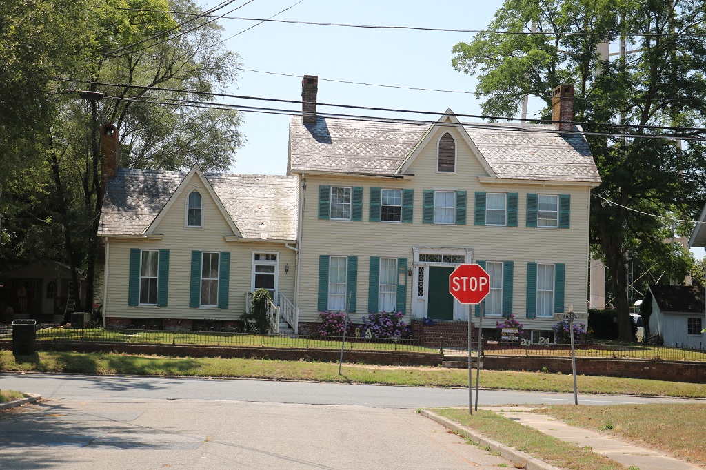
This will also be my last blog for this trip and it is nothing exciting. I took very few photos today. We did no stops of interest. We drove from the Outer Banks along country roads past trees and crops and through small towns to arrive at our hotel in Sanford at 5 pm.
It is a six hour drive on the Interstate from Nags Head on the Outer Banks to Charlotte, but who wants to do that? We purposely put in an extra day between the end of the wedding festivities and our flight home so we had the option of taking a slower route if we chose. And, of course, that is what we chose.
Sanford is only about 2 hours from our son’s mother-in-law’s home in Charlotte so we are going there tomorrow for a last visit before we fly home to BC and they fly home to Texas on Tuesday.
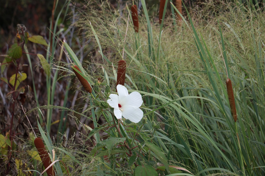
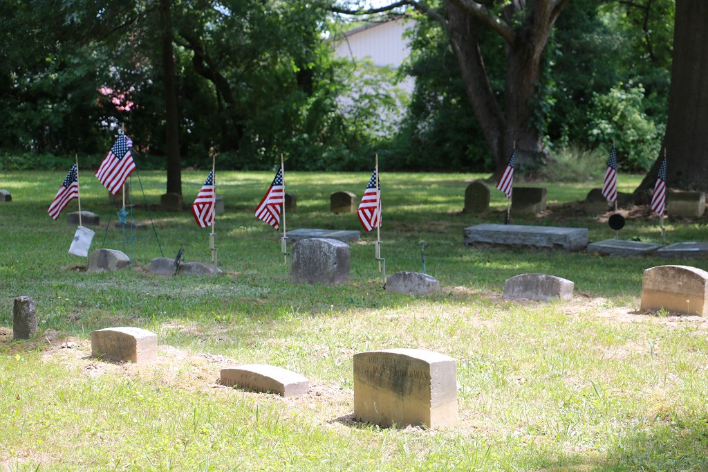
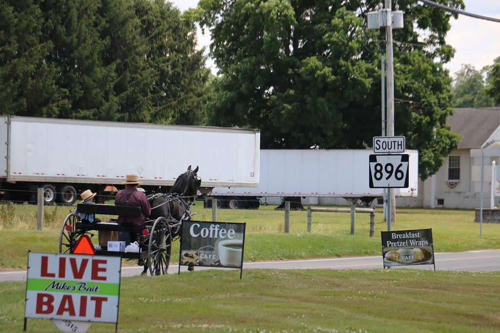
We saw lots of these pretty white flowers blooming among the bull rushes as we drove past all the marsh land this morning.
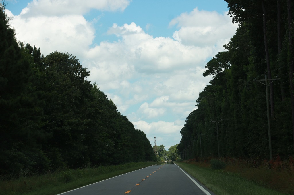
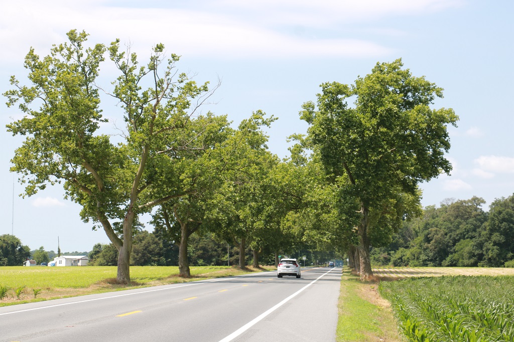
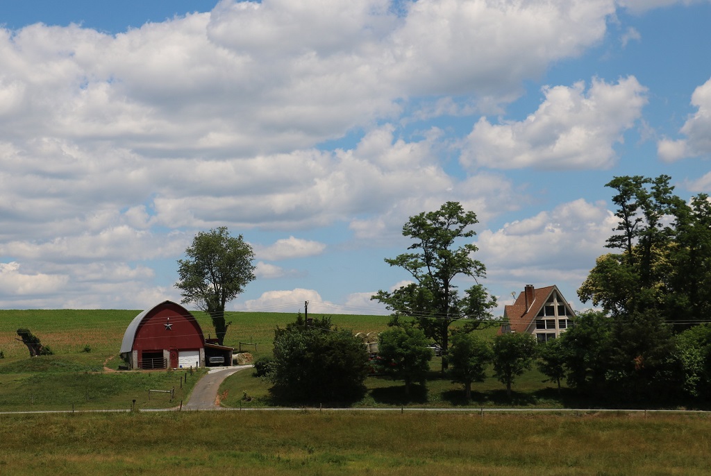
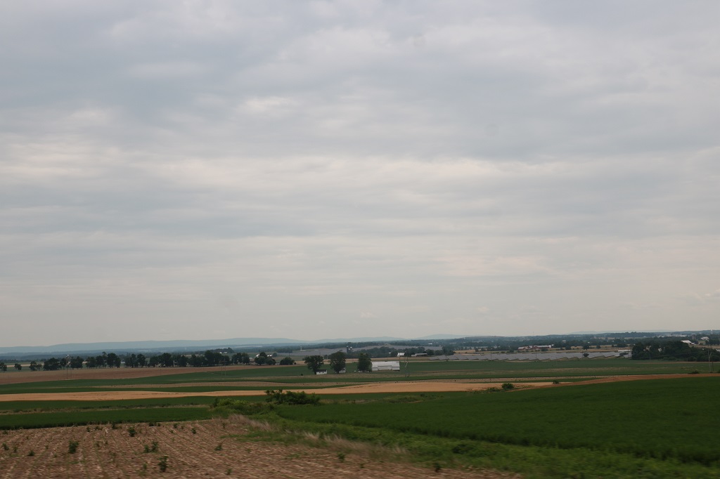
If we weren’t driving past a farm crop we were driving along tree-lined roads.
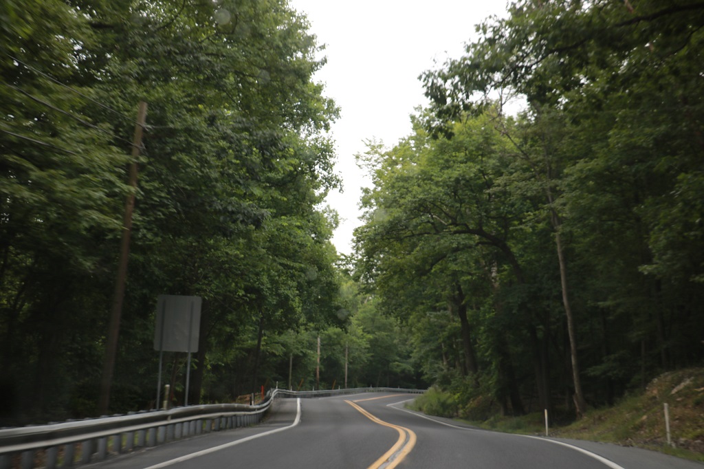
Many times as well we drove through the lovely canopies created when the trees practically meet across the road span. I love those.
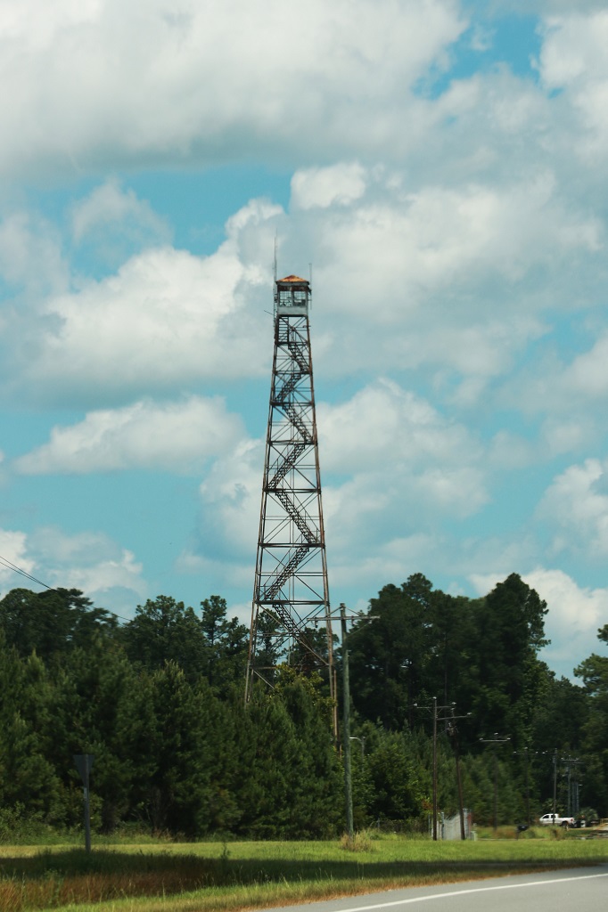
We have seen several of these fire towers on our travels around on this trip and two of them today. Too many stairs for me but I would love to be up there to check out the view.
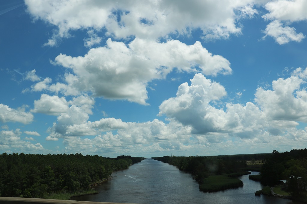
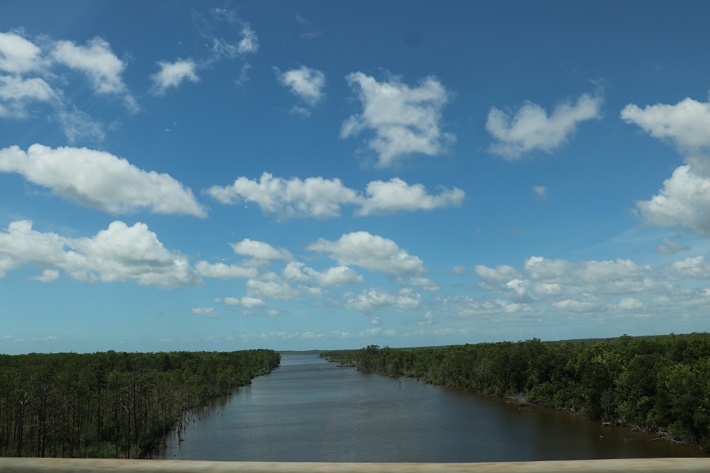
I did not get the name of this waterway as we drove over the bridge. Saw several of these straight river channels today as well.
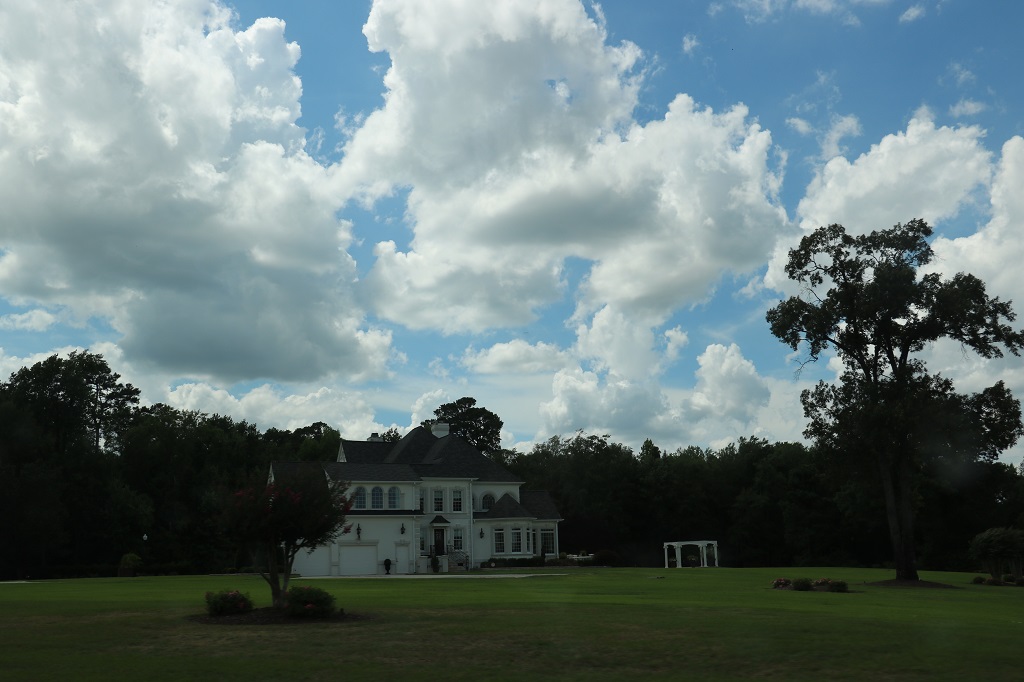
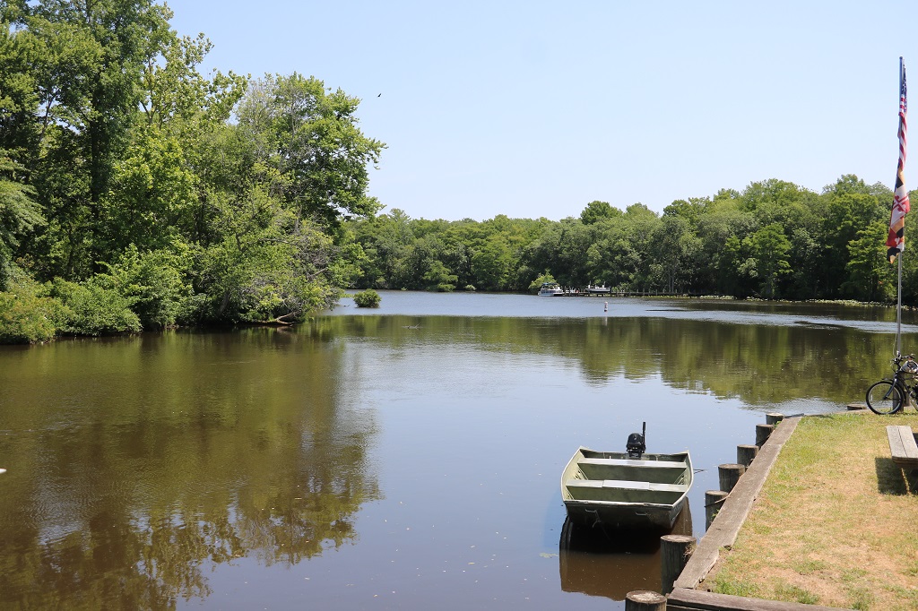
Besides the acres of mown lawn around this huge house they had a beautiful big pond as their view.
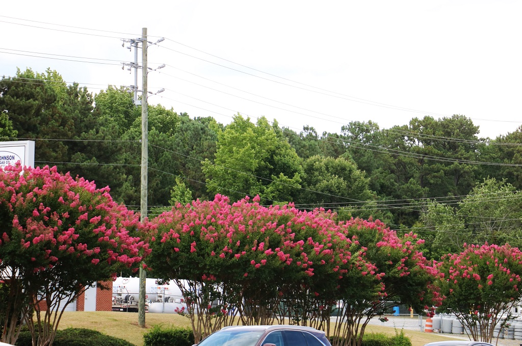
We have seen many of these lovely pink lilac-looking trees but I never had an opportunity to catch a photo of them as we drove by when they were close to the road. I spotted these as we were stopped at a traffic light.
So, that is all folks. As I said, we will visit with our son and daughter-in-law and granddaughter at Carrie’s mom’s house tomorrow, then drive to a hotel near the airport for the night. Well some of the night. We have to drop off our rental car before we check in, so we need to be at the airport about 3:30 am in order to do that and check in the required 2 hours before our 6 am flight to Atlanta and Calgary and then back to BC. We have put almost 4800 miles on our rental car. Thanks for travelling along.
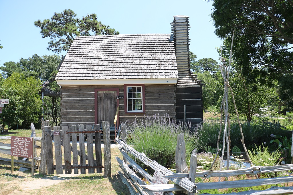
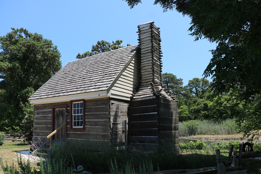
Today was the day of the wedding that provided the excuse to do a road trip of the southern states. We spent time in our hotel room for half the morning then drove north to Corolla to see the Wild Horse Museum. It was about 28 miles up the road and the speed limit is 35 mph the whole way so it is a nice quiet drive. All the sea front communities just run into one another; Nags Head, Kill Devil Hills, South Shore, Duck, and then Corolla.
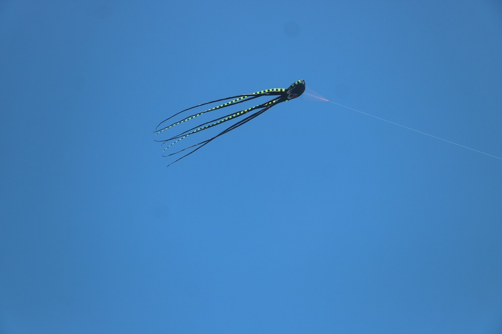
This big octoupus-like kite is anchored above a building.
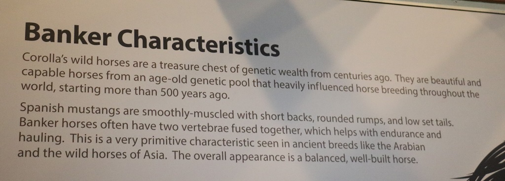
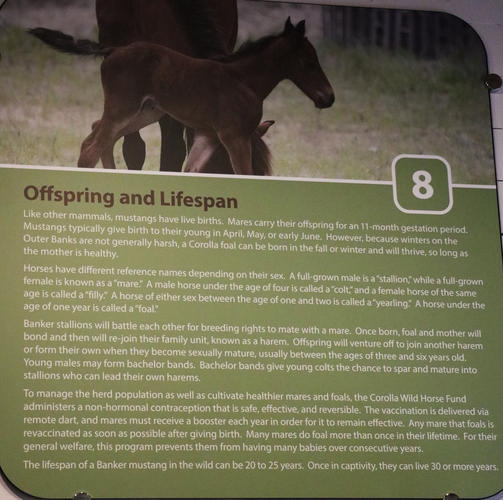
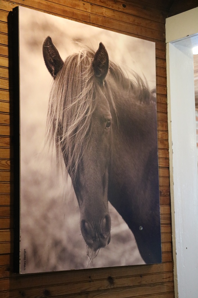
The museum was a converted house that is as much store as museum. The museum component was placards on the walls of each of the rooms of merchandise that told you about the Outer Banks horses and horses in general.
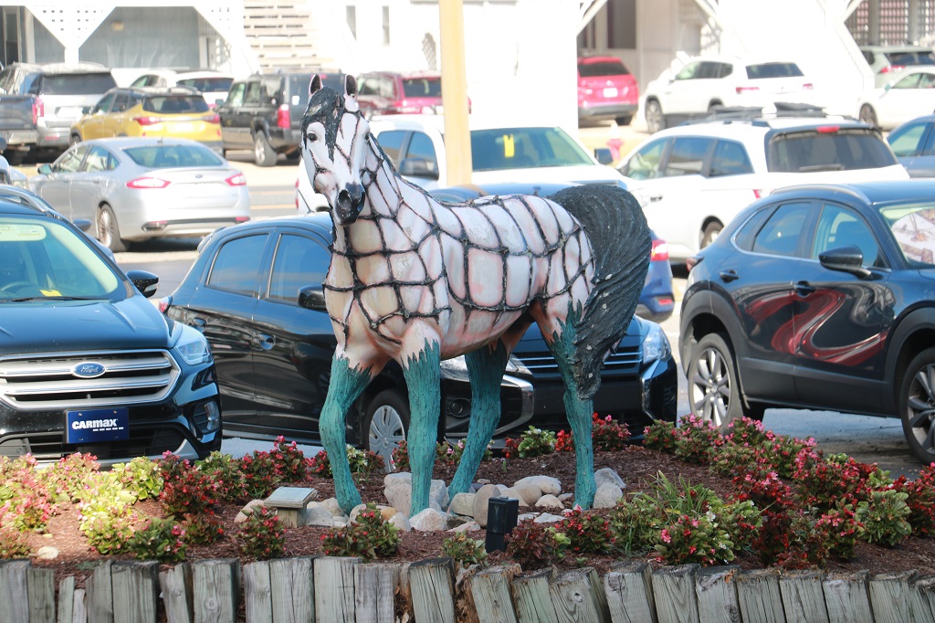
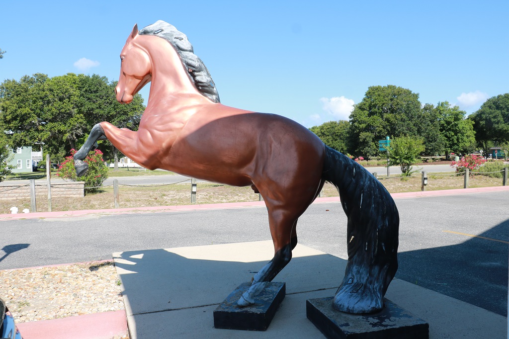
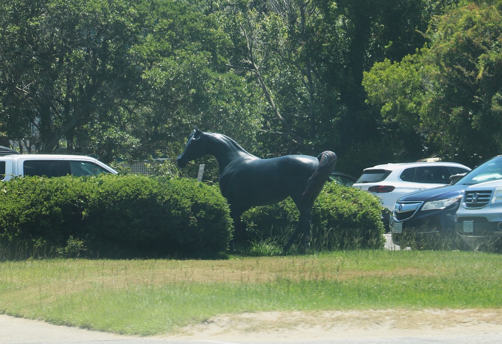
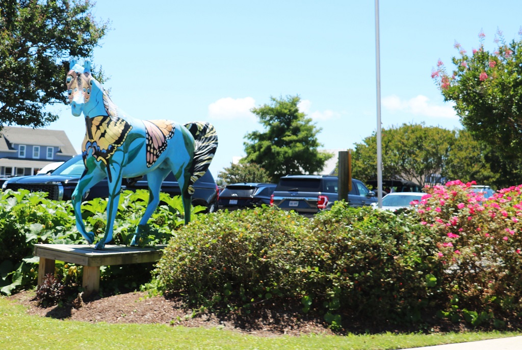
North Carolina designated the Colonial Spanish Mustang as the official state horse in 2010. We have seen quite a few painted horse sculptures in business parking lots or in front of buildings.
This one is at our hotel.
They are hard to see but this one has wings like Pegasus.
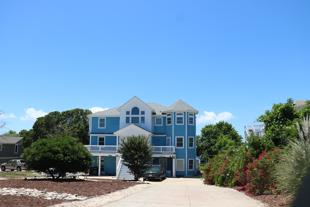
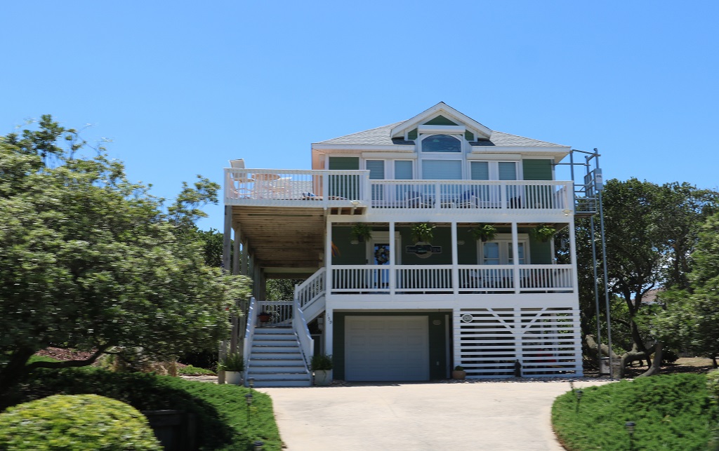
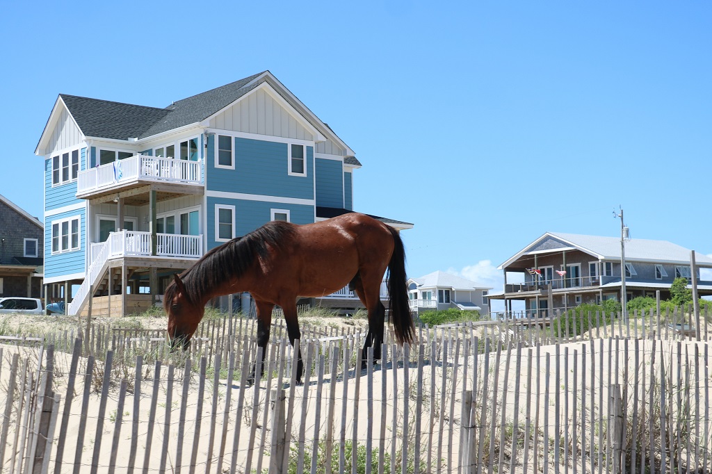
The Outer Banks are a very, very popular summer holiday destination. There are many very large houses that are rented by family groups or friends. They are very expensive but I guess when the cost is shared by several families or groups it seems reasonable to a lot of folks. For me $30,000 for a house for a week, even divided by five is pricey indeed. And $30,000 is low to moderate for many of these properties. And there are hundreds of them in all these seaside communities. I am sure that is not the average price for a rental, there must be lesser priced ones, but when we were looking for a place to stay here for the wedding festivities, John saw plenty of rentals in the $30-45,000 range per week.
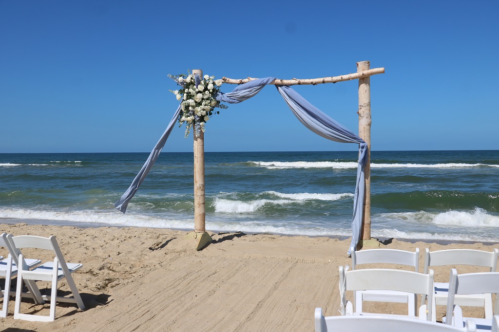
The wedding took place on the beach at 4:30. Our grandaughter did an awesome job as flower girl.
Tomorrow there is a farewell party at the pool by the cottages that the family and close friends of the couple are renting and we will go over and visit, therefore I am not sure there will be any ‘blog-worthy’ things tomorrow. Sunday everyone leaves to head to their homes in Arizona, Florida, Michigan, New York, Massachucetts, etc. We will be leaving the Outer Banks as well and driving some backroads to get closer to Charlotte so we have a short drive on Monday to the hotel at the airport for our 6 am flight home on Tuesday morning.
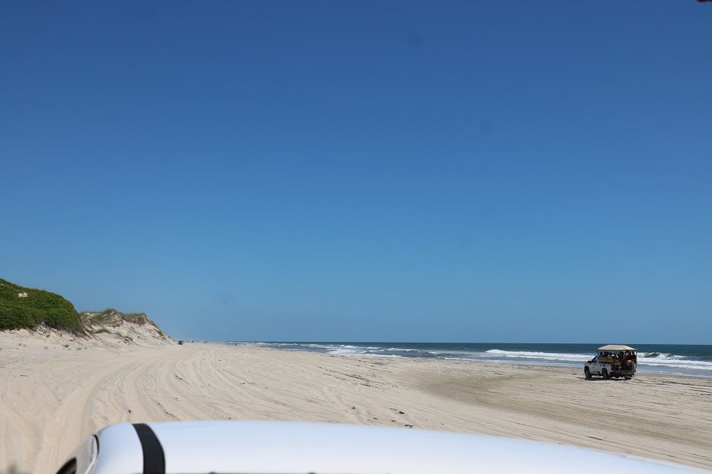
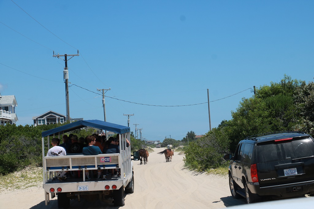
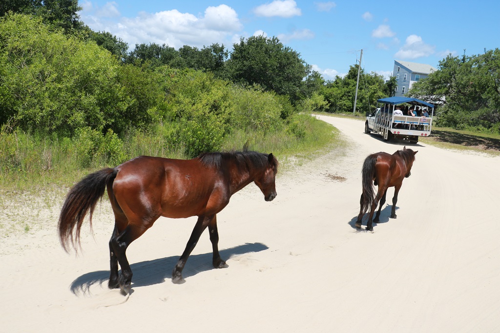
We were up early. Joseph and Carrie and Eloise were picking us up at our hotel at 8:30. It was about a one hour drive north to the tour place to go see the wild horses and we had to be there 20 minutes early for our 10:30 tour. We actually arrived quite early as the drive was not as long as Carrie had been told; but early is much better than late.
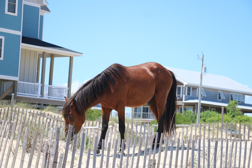
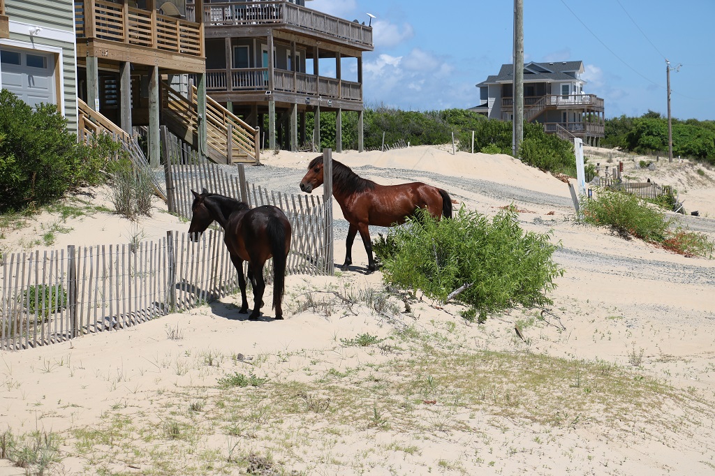
There was another three-generation family on our truck. Grandparents, parents and two young kids. We were taken further up the highway then moved off onto the sand by the shore. There are lots of houses (about 800) built in the dunes and the bumpy beach is the only way in and out so people drive over it to work and back every day. Most of the houses are rentals, but about 100 or so people live there all year round.
I was surprised by the number of people that drove the coast and spent the day at the beach as well. Since the horses are protected I thought there would be restricted access to where they live, but no, they just ignore the people and vehicles. But no development other than residential houses are permitted and I think that is so because the lots were already surveyed and some built on before the horses arrived from further up the coast. When the highway was paved and access to the Outer Banks became easy, vehicle traffic quickly increased and quite a few of the horses of the Corolla herd were killed on the road. They were used to wandering all over, even into the small towns.
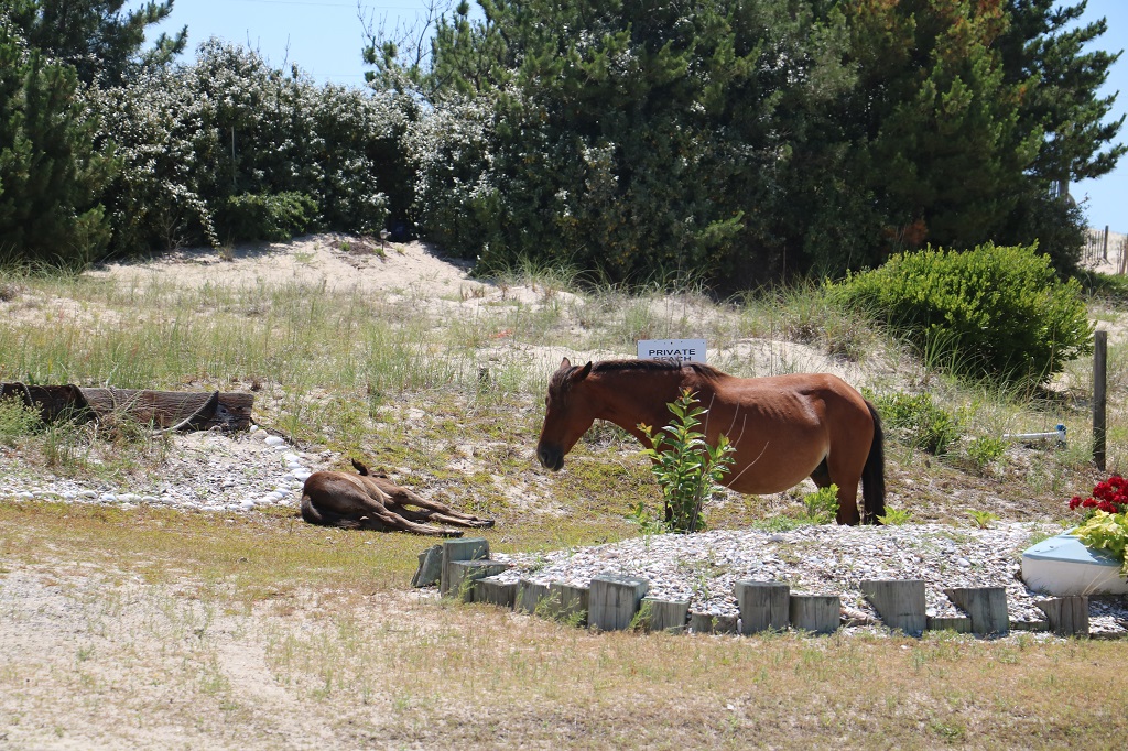
Years ago there used to be about 5000 of them that roamed long stretches of the coast. At one time they were considered a nuisance and a bounty was placed to kill them. The population is now about 150. They had 10 foals this year. One died but the other nine are doing well. They have all been named with names beginning with E so there was an Eloise foal.
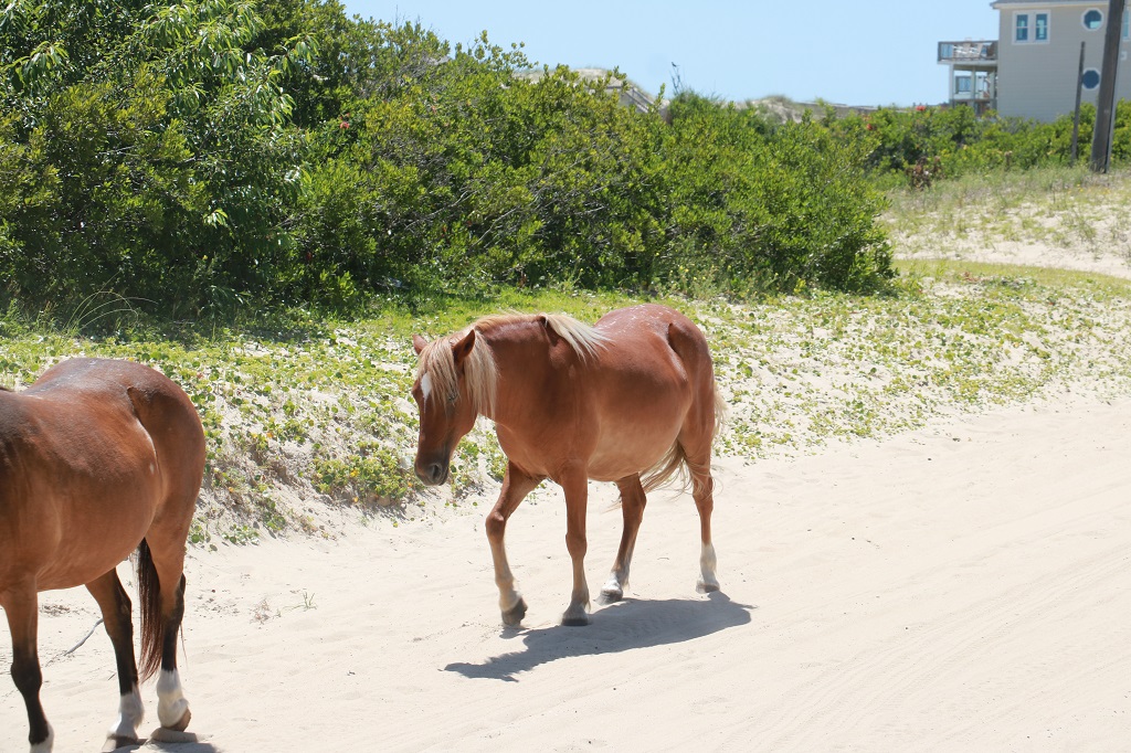
It wasn’t long before we spotted our first horse. They are descended from Spanish horses brought by the conquistadors about 500 years ago. When the Spanish arrived they brought along horses that they would put off near the coast from the ships and they would swim to shore (it was actually a Spanish law that all colonizing ships had to have horses on board.) Of course, when the men left they could not take the horses back onto the ships so they were left behind. They have done DNA testing and they all have a line back to one mare. No domesticated horses have been introduced to their bloodlines. They go right back to the Colonial Spanish horse.
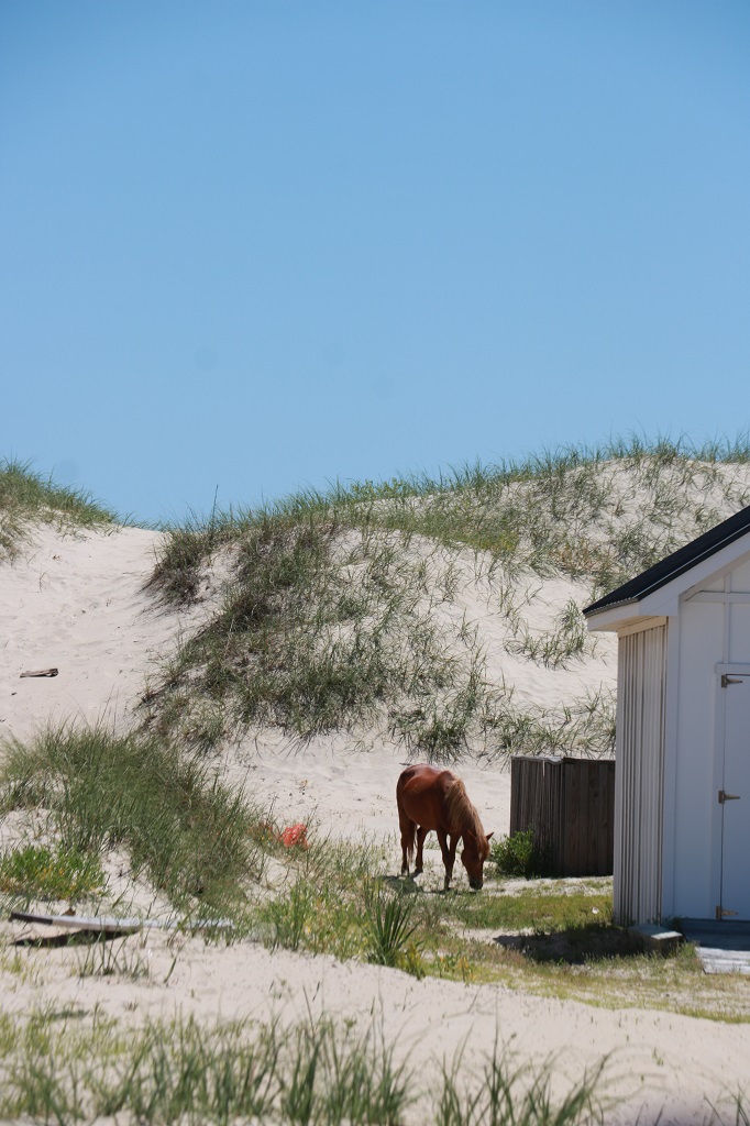
Over the many years of living on the dunes their digestive system has adapted to the special grasses and other plants that grow there. They cannot absorb sugars or other normal-type horse feed, or apples and carrots. The will develop colic and will roll to try relieve the stomach ache pain and twist their intestine and often die. At least once a year they lose a horse from it eating something it cannot tolerate. Part of the problem is the bags of trash from the rental houses that they get into.
There is a group of volunteers that patrol the beach and watch for any horse in distress or injured since the stallions do fight over the mares. There is a refuge up-island where any injured or sick animal will be taken to be treated; but once they have left their harem group and the beach they cannot be brought back (the other horses would not accept them again) so they will live the remainder of their lives at the Grandy refuge.
The law is Do not feed. Do not touch. Stay 50′ away.
People will put low sand fences around their house to keep the horses out (why I don’t know as they have no landscaping to protect). And, of course, the horses can hop over it easily.
The horses are smaller than the usual domestic horse we are used to. They are about 12-15 hands high whereas most of the horses we encounter will be 15-18 hands. So they fit between a pony and a ‘regular’ horse.
This foal was having a nap. We drove past the pair on our way back and they had moved to a different part of the yard and the foal was stretched out flat again with mom hovering beside it.
Just like on an African safari where elephants have right-of-way, the horses control the ‘road’ here too.
We were on the dunes for about an hour and a half going up and down bumpy ‘roads.’ Eloise loved it and laughed and laughed. The other two kids, especially the young boy, did not like it so much. Eloise is going to Disney World in October on a girls trip with her mom, aunt, grandma and cousin so I think she will enjoy the rides a lot.
We spent the afternoon in our hotel room. I did photos and wrote my blog. After dinner we drove back to Nags Head for the wedding Welcome Party which was also set up in the parking area by the rented cottages.
Eloise stuck my camera through the balcony rail and took some photos of the guests.
There was all kinds of food, an open bar, and live music. A really nice evening. The wedding rehearsal went quite well, except Eloise forgot to toss the flower petals. We will see if she remembers at the wedding tomorrow. Her other grandma will be walking down the aisle with her, and her mom will be sitting near the front where she can be seen, so I think she will do okay.
We have come full circle and are back in North Carolina. We managed to drive though 17 states (counting North Carolina where we started) and are now settled at our hotel on the Outer Banks for the next four days for wedding festivities and family visiting. Our 4-year old granddaughter is the flower girl at her big cousin’s wedding on Friday and we were kindly invited to attend.
Being us, if we were to fly from BC to NC we would make a trip out of it so we came a month early and toured around many of the southern states we had never been to. As of now there are only 2 USA states we have not been in: Conneticutt and Rhode Island and 7 we have not found a geocache in because we had not begun the hobby when we drove through many of the north eastern ones on our way home from our cross-Canada drive in 2014. Who knows, we may figure out how to get them someday.
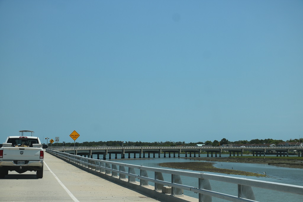
We left our hotel in Chesapeake, Virginia at 10. There is pretty much one divided highway that runs down the ever-narrowing spit of the Outer Banks so we had no side roads we could take. The traffic was not too bad even though the Outer Banks are an extremely popular vacation spot. It is not uncommon to pay $30-$45,000 to rent a big house to have the family here for a week’s holiday!
We crossed the Albermarle Canal as we reached the northern part of the Outer Banks. It was completed in 1859.
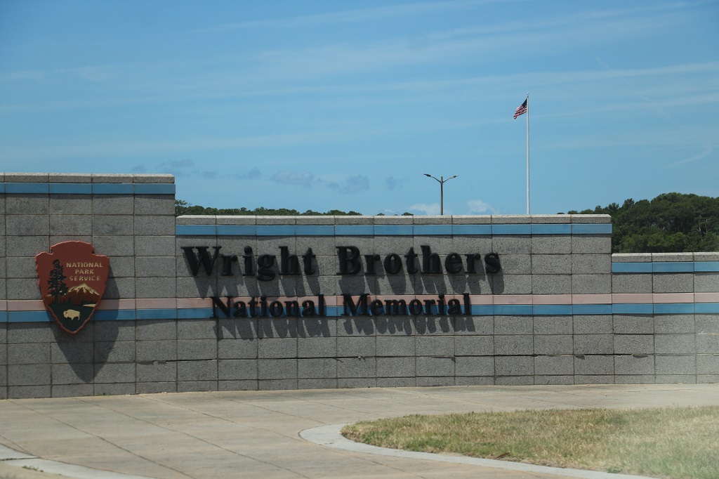
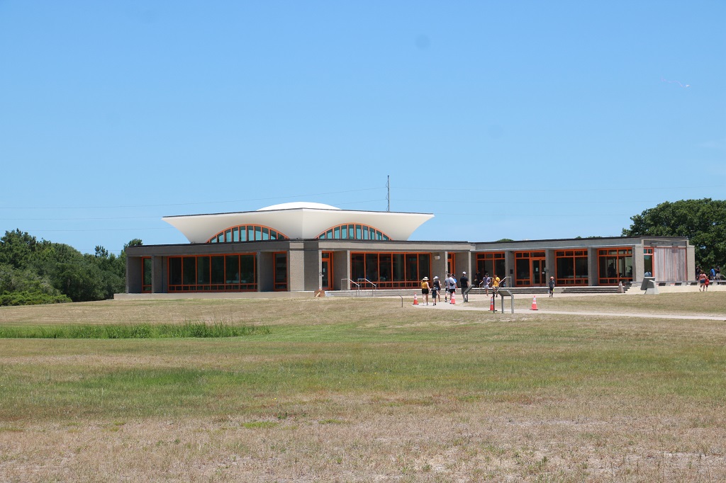
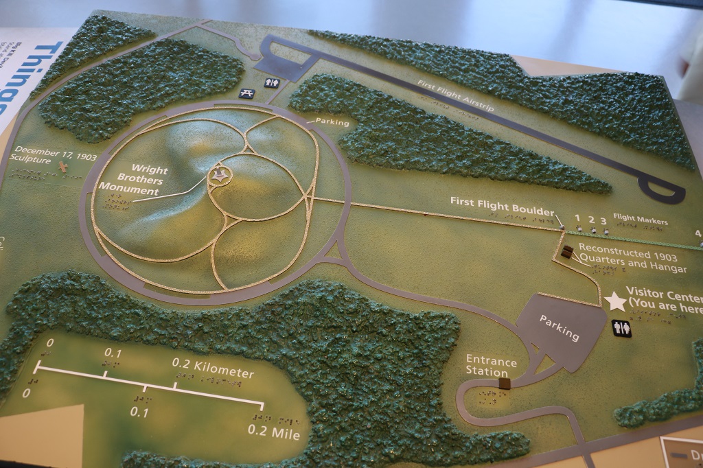
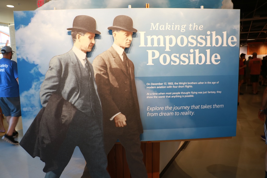
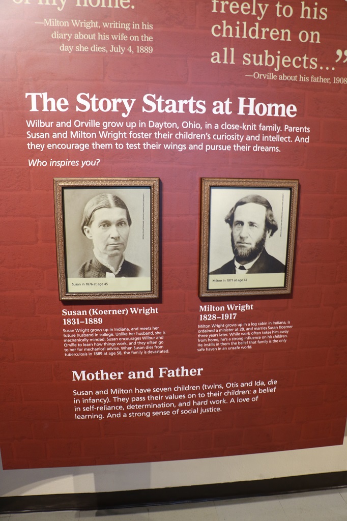
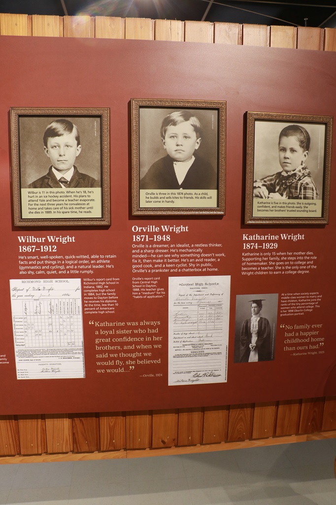
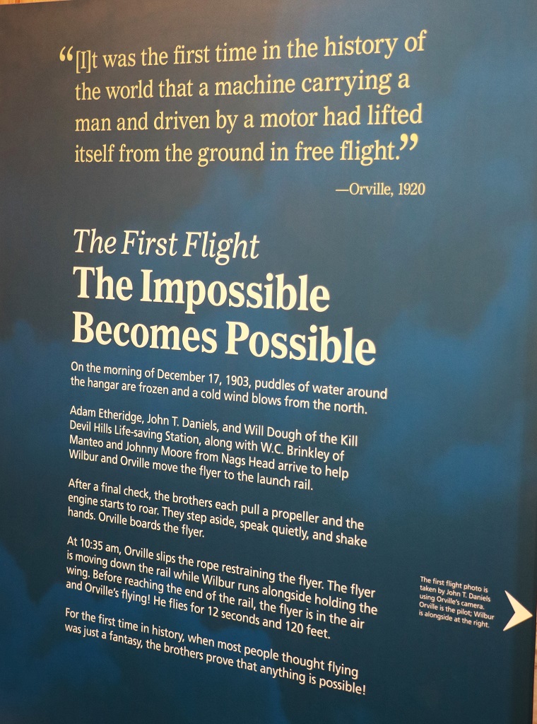
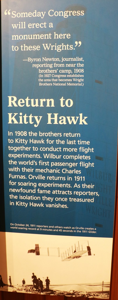
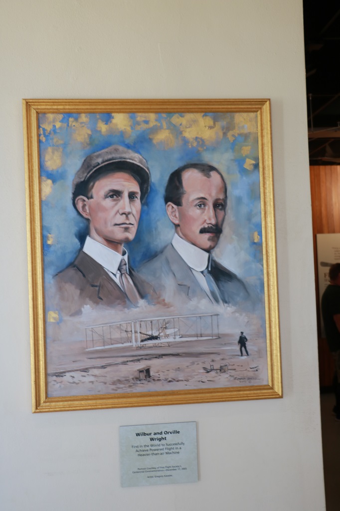
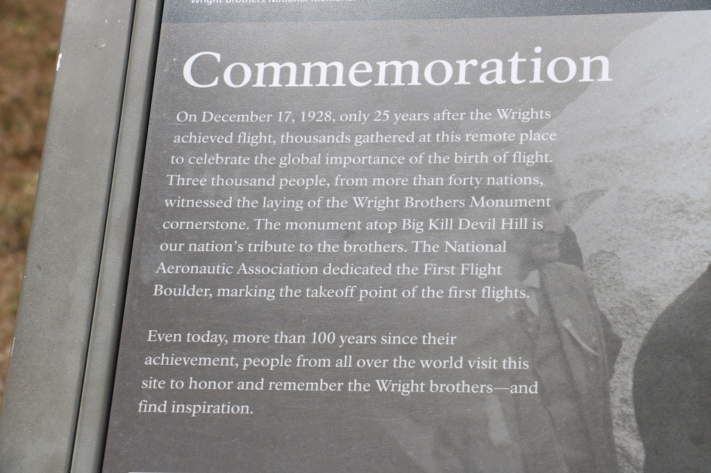
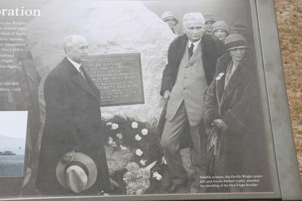
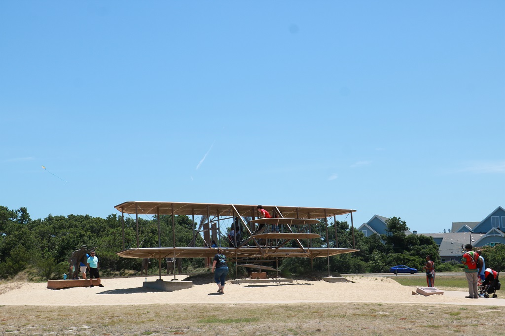
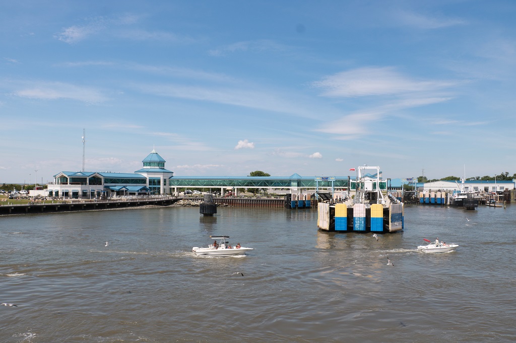
We stopped at Kitty Hawk at the Wright Brothers National Memorial before we drove down to Nags Head (about 10 minutes more driving) to locate the property that our son and his wife and our granddaughter and other family members are staying in for the week of the wedding.
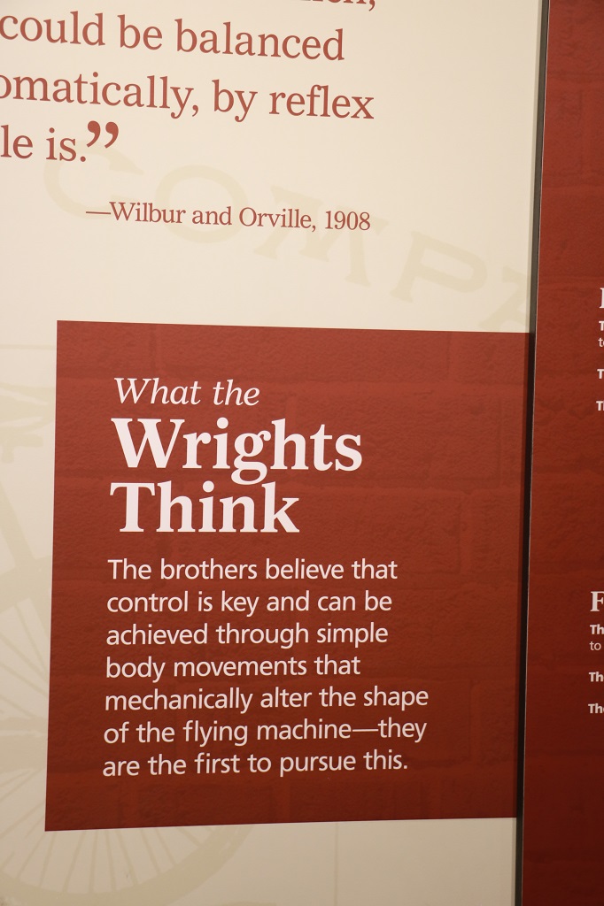
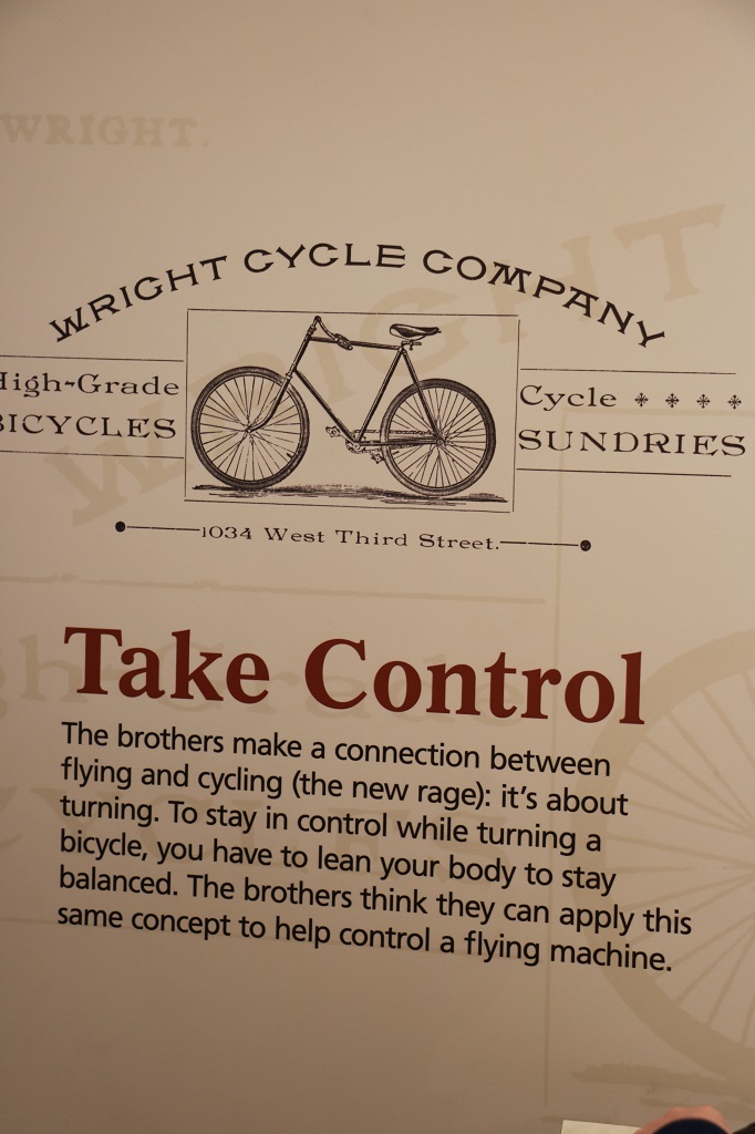
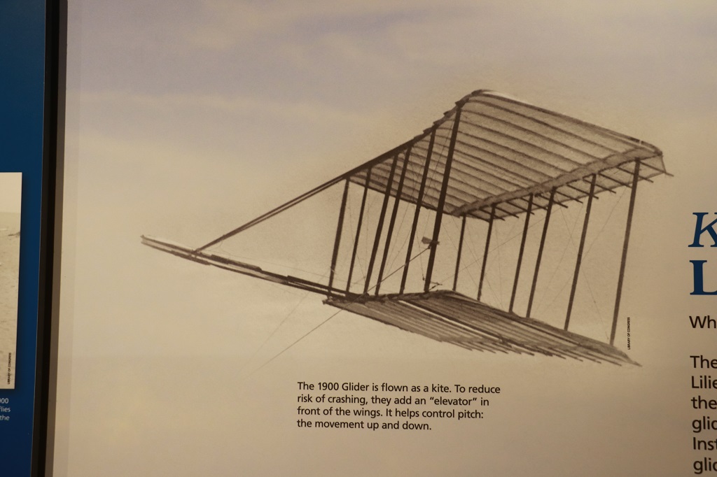
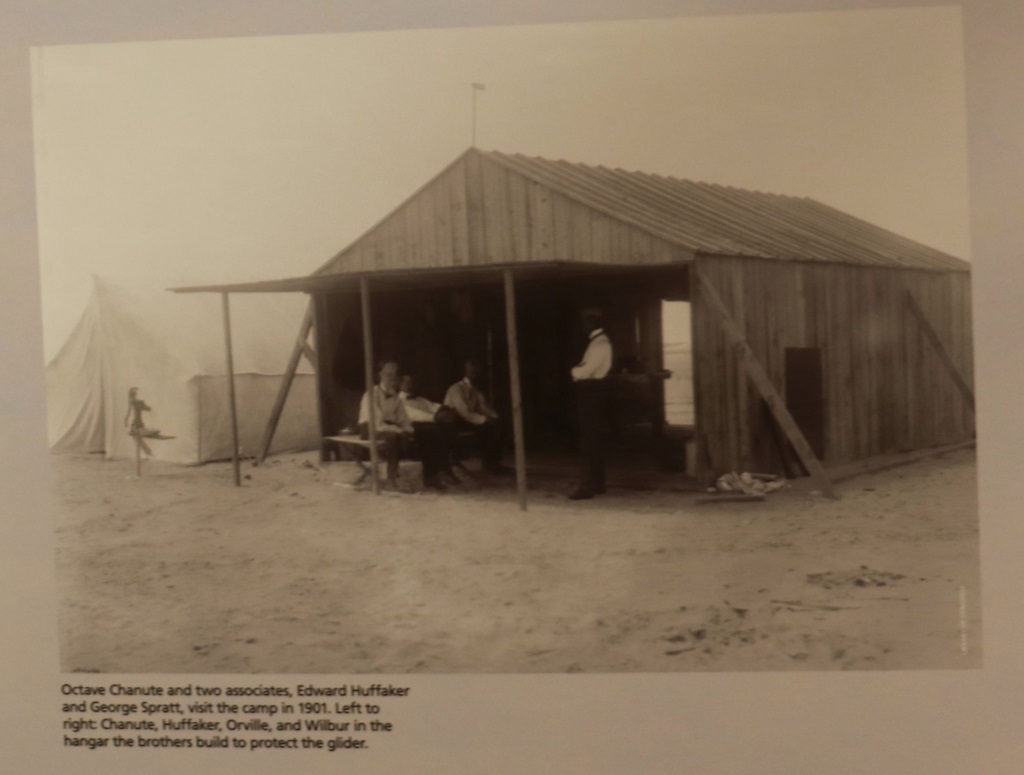
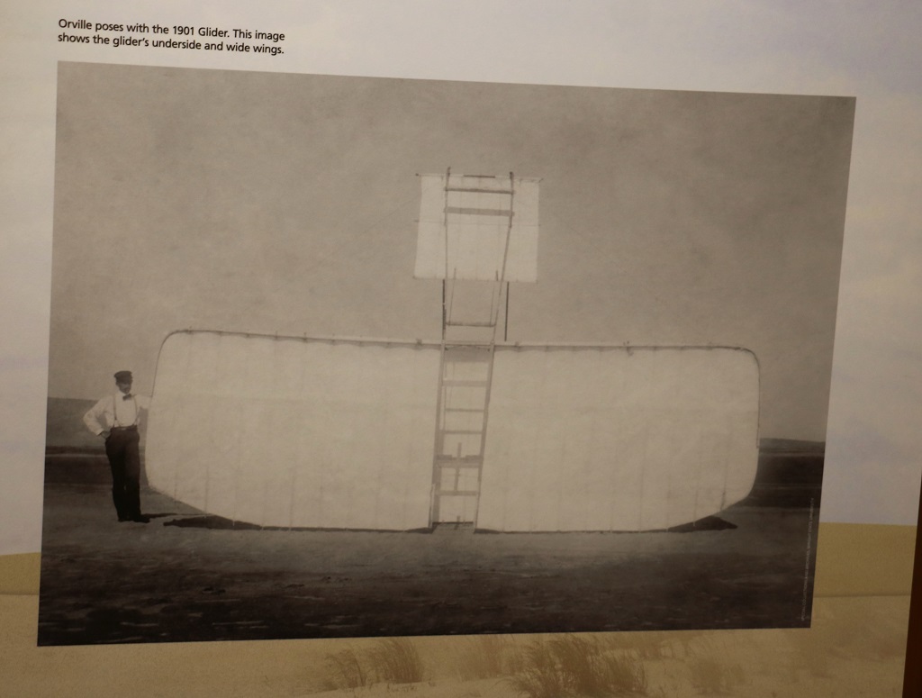
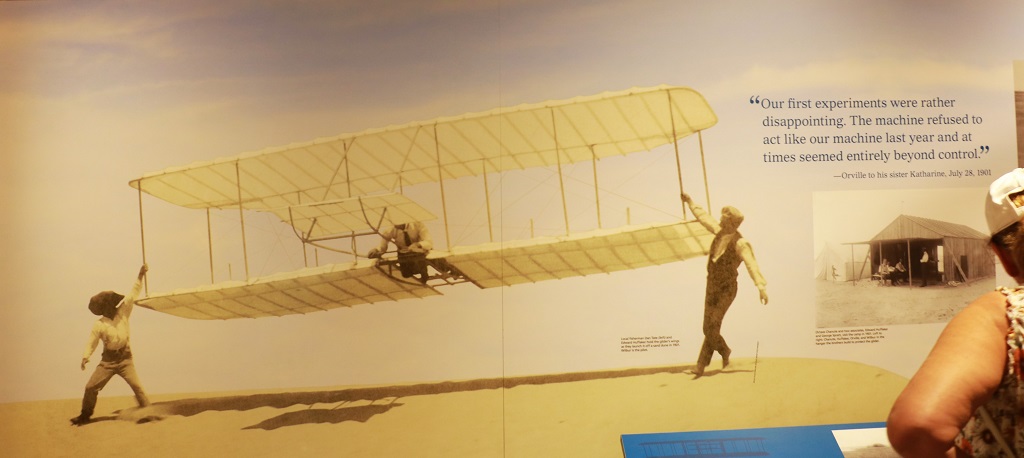
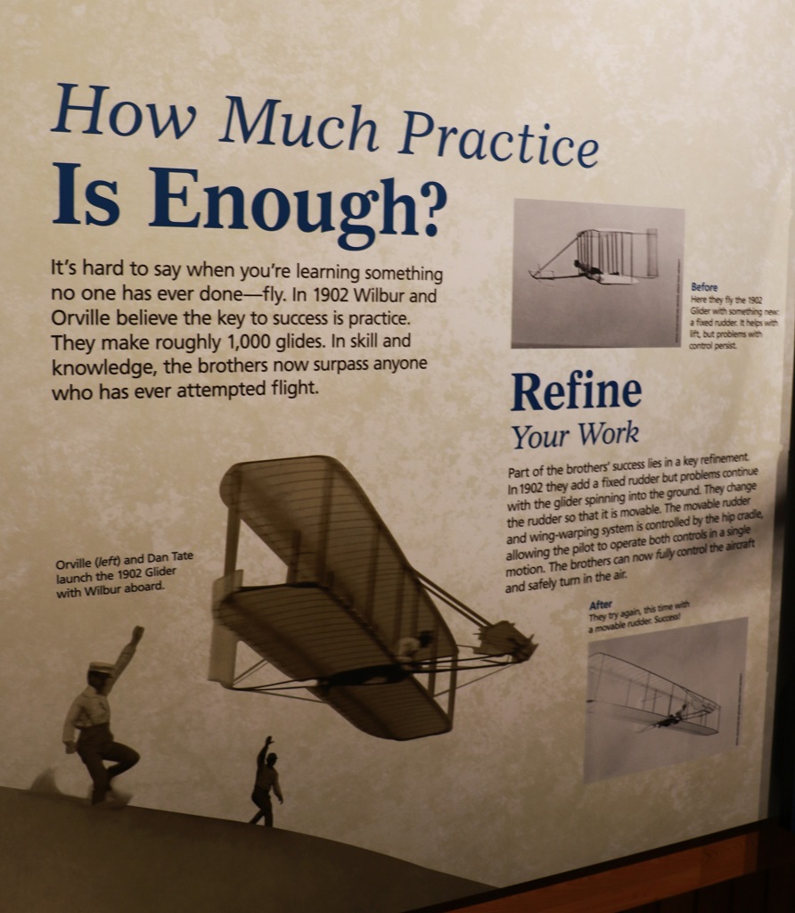
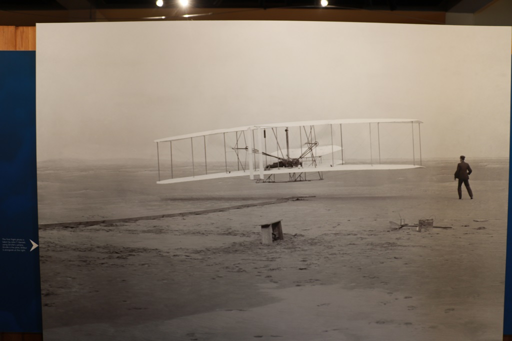
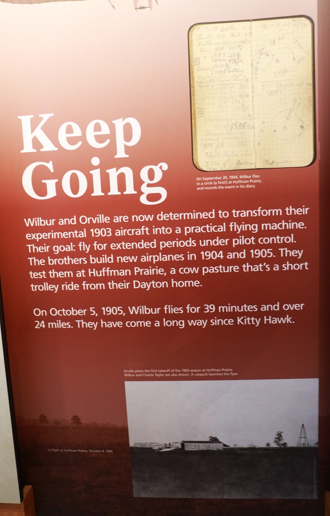
Inside the Visitor’s Center there were very interesting displays of the four-year journey of Wilbur and Oroville Wright as they experimented and tested and refined their gliders and then the propulsion-powered glider that eventually proved heavier-than-air flight was possible.
They constantly adjusted ideas, studied birds, reworked theories and perfected their glider so it could be manouvered. But to have controlled flight you need an engine. Gasoline engine technology had recently advanced to where its use in airplaines was feasible. But they could not find one suitably light so they designed and built their own. They also designed and built a wind tunnel to use for testing theories and used the data to perfect the first effective airplane propellor, one of their most original and purely scientific achievements.
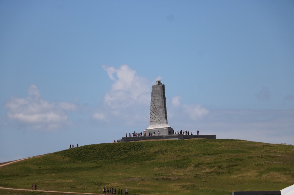
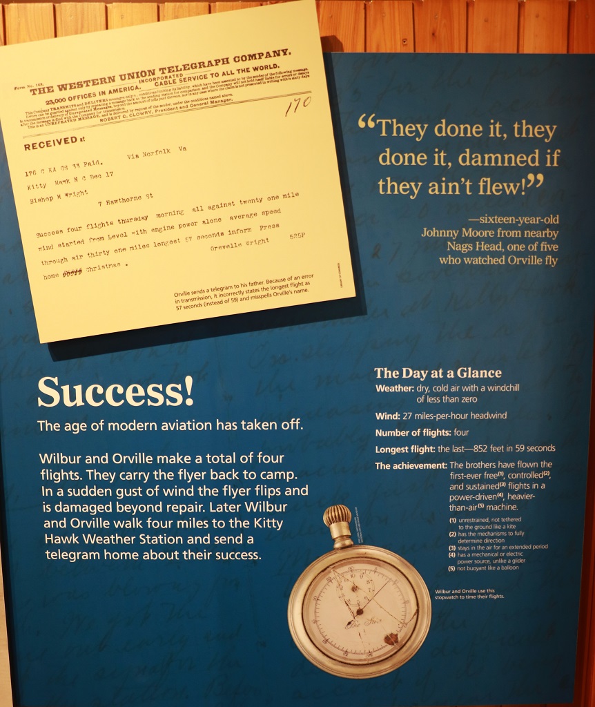
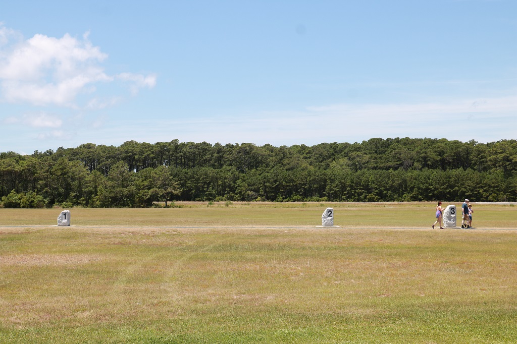
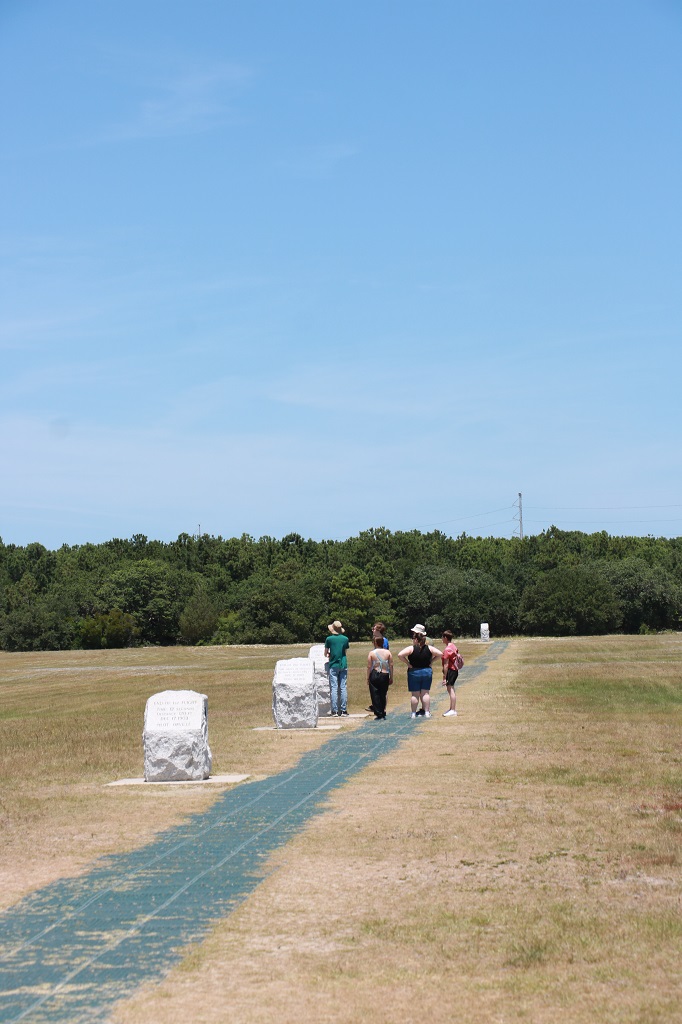
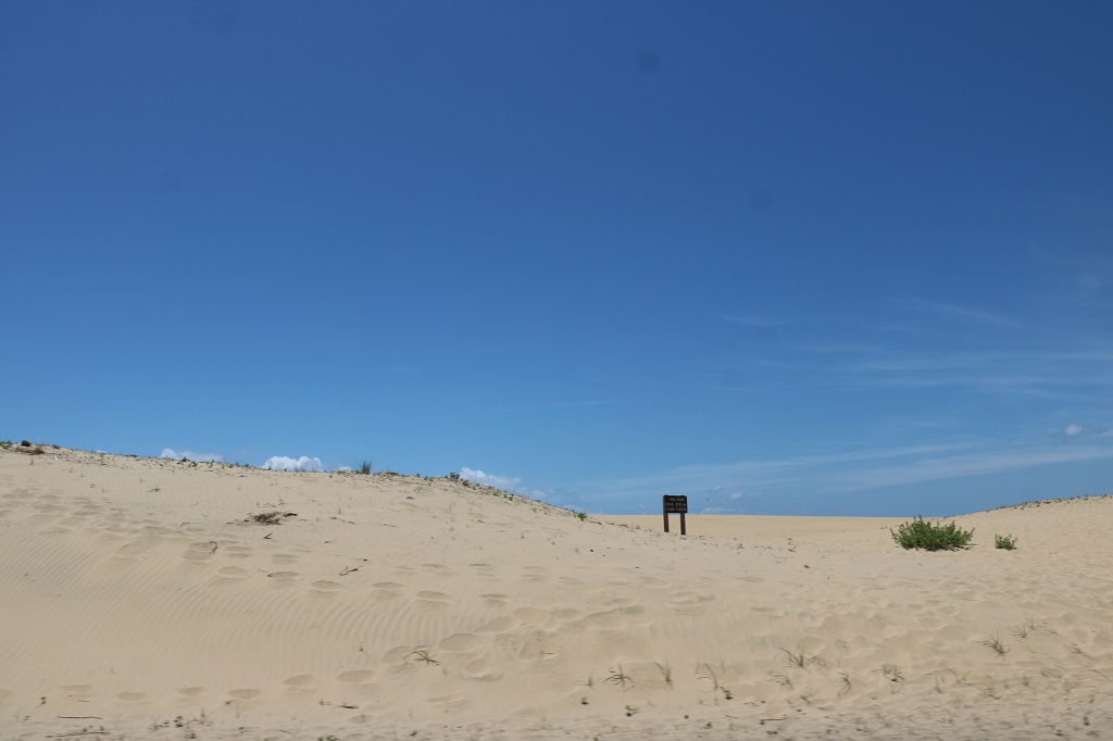
The first three flight distances were pretty close together. The fourth one (see marker at the end of the path by the trees) lasted 59 seconds and went 852 feet (almost 260 meters). It was not quite the length of an airliner, but plenty far enough to prove it was possible to fly.
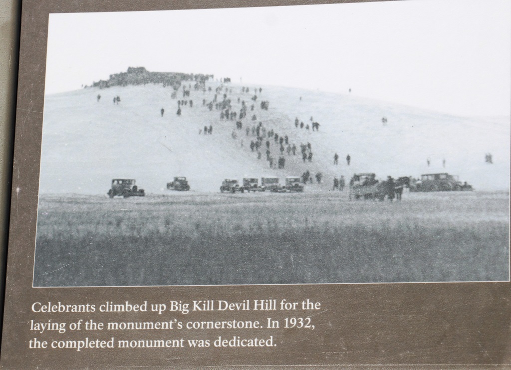
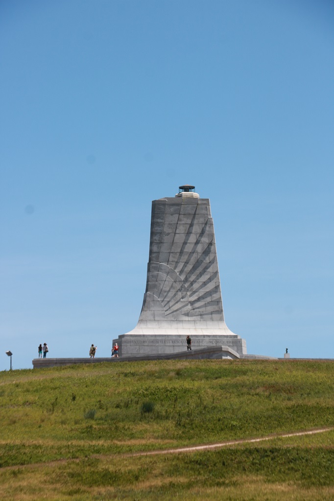
With my gibbled joints I was unable to climb to the top of Big Kill Devil Hill to see the 60′ monument, but the road goes all around it so we drove that before we left the memorial.
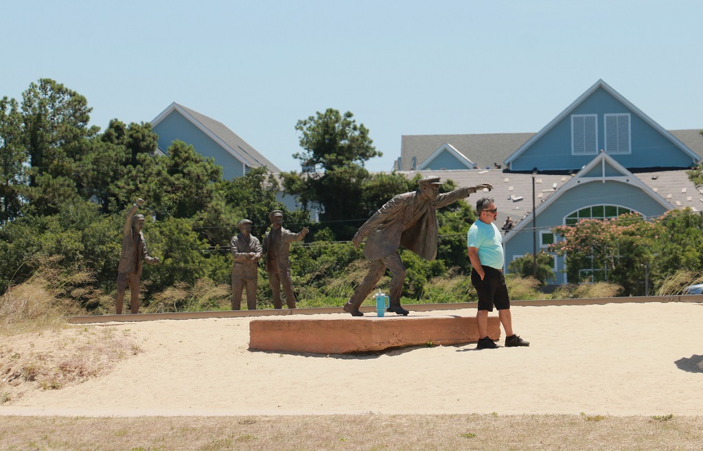
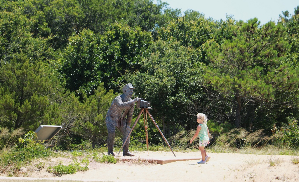
On the far side of the memorial hill there is a set of bronze sculptures that commemorate the world-altering event – the airplane, the men and even the photographer.
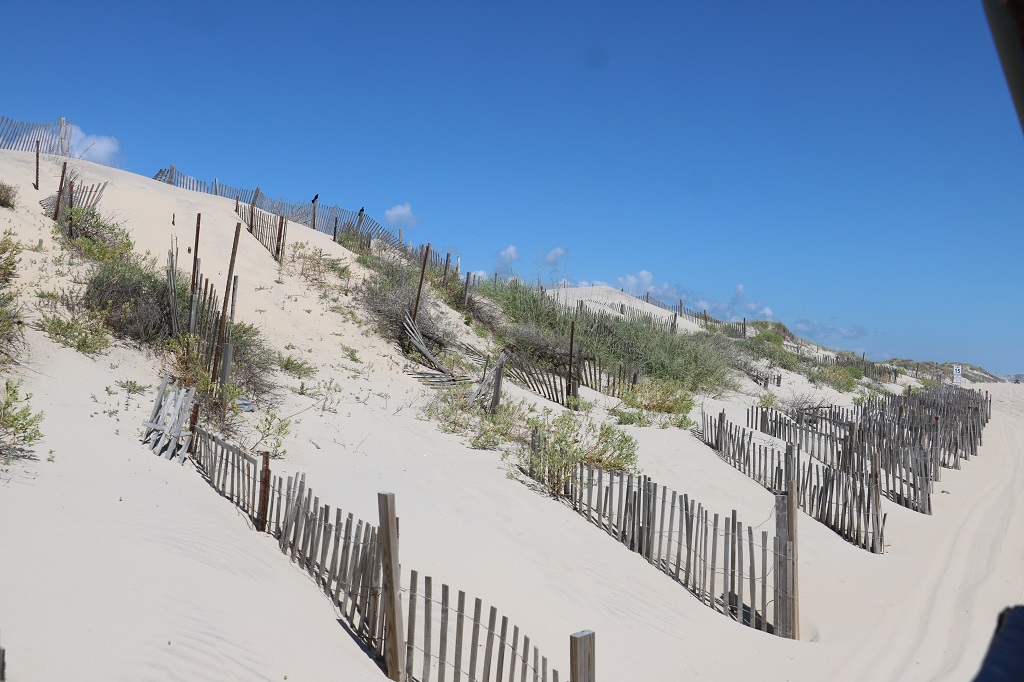
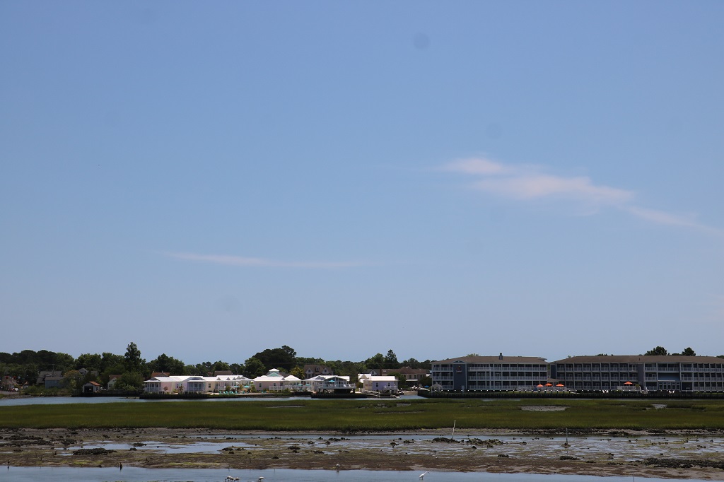
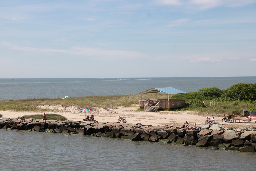
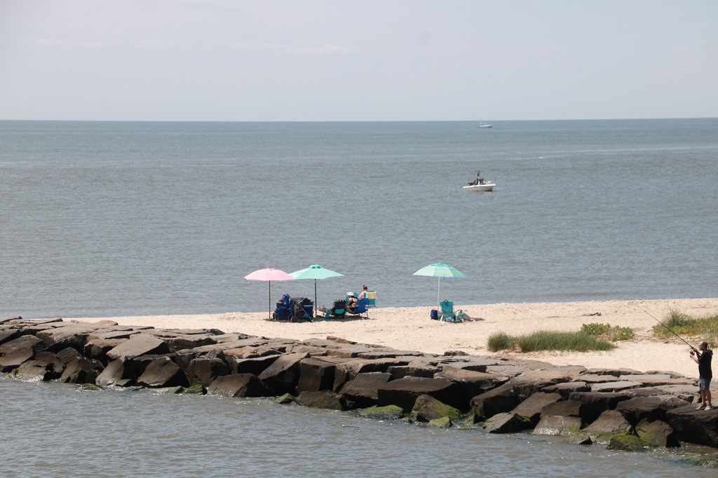
The Outer Banks are a series of islands comprised of sand, sand and more sand. With lots of houses, restaurants, hotels, and beach activity shops. And wild horses; which we will go see tomorrow.
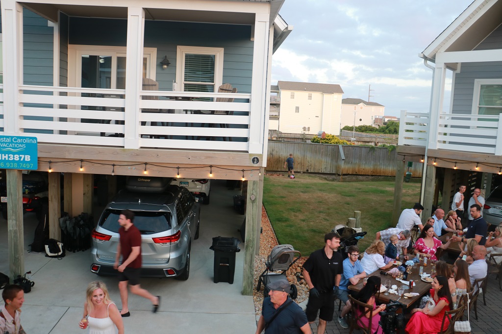
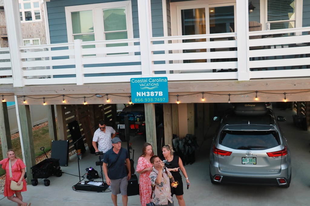
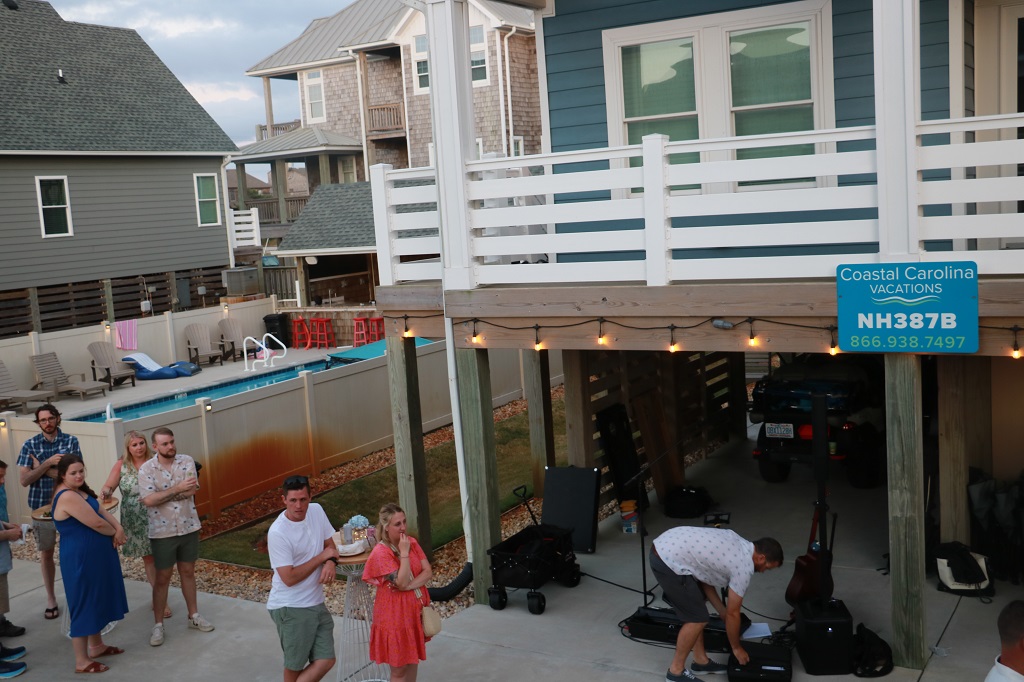
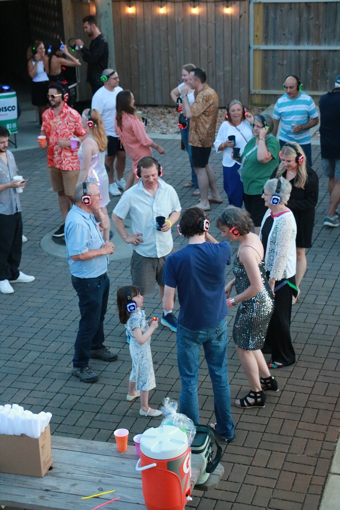
We arrived at the wedding venue and block of six-bungalows that family and close friends of the bride and groom are staying in for the week. Our son, his wife and daughter, mother-in-law, sister and brother-in-law, and brother-in-laws parents are in one house. The bride & groom and some other relatives and friends are in another. The grooms parents and siblings are in another, etc. We spent the afternoon visiting and were invited to stay for dinner. At 8 pm the parking lot between all the houses was turned into a silent disco party. The DJ provided headphones for participants that had three different channels you could switch to and listen to three different songs. You selected what you wanted and danced away with no noise to disturb the neighbours. You were invited to wear 70s appropriate clothing, which many of the guests did.
We left about 9 to drive 10 minutes up the road to our hotel and check in. We had to be up at 7 to be ready at 8:30 for Joseph and Carrie and Eloise to pick us up for our 10:30 am wild horse safari. The venue was about an hour away from Nags Head and you were requested to be there 20 minutes early.
We just made breakfast this morning and since we did not have to be anywhere in a hurry, we lingered a bit so did not leave the hotel until 10:30. These past few days have been ‘spares’. When we were driving around we did not know how long it would take us to go from place to place when considering distance, sightseeing and geocaching so we kept a few days in reserve in case we took longer or chose to stay longer somewhere.
We finished the majority of the big loop that will bring us back to North Carolina tomorrow with a few short driving days. So we have meandered some back roads and been more diligent in finding geocaches than we were near the beginning of the journey. It has been nicer for John to not have to ‘be somewhere’.
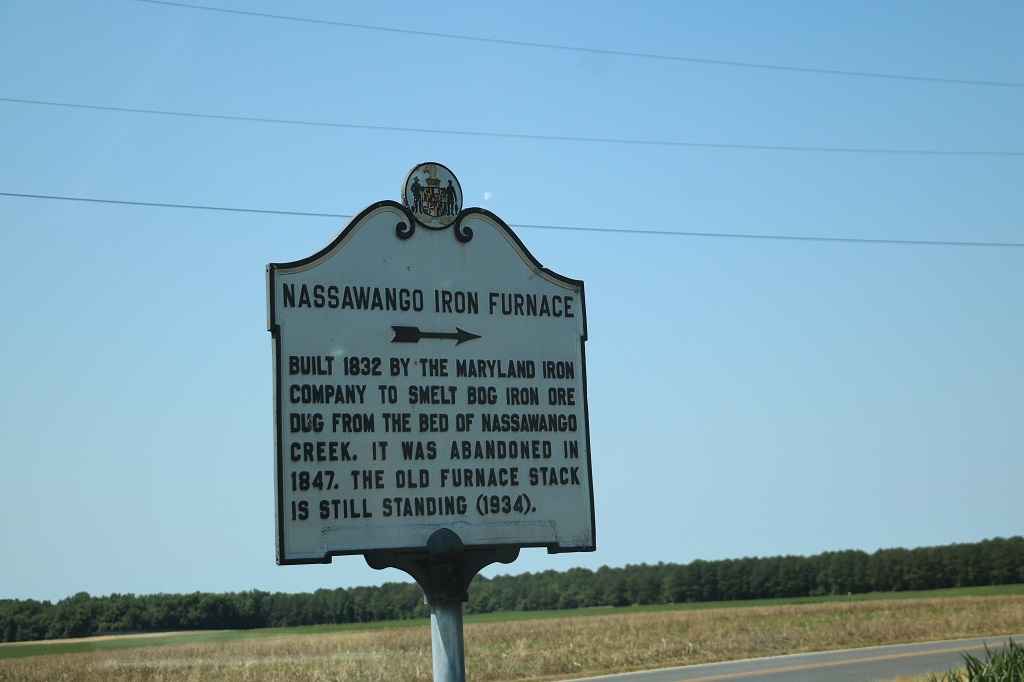
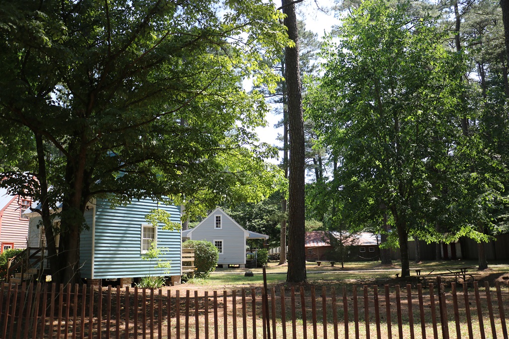
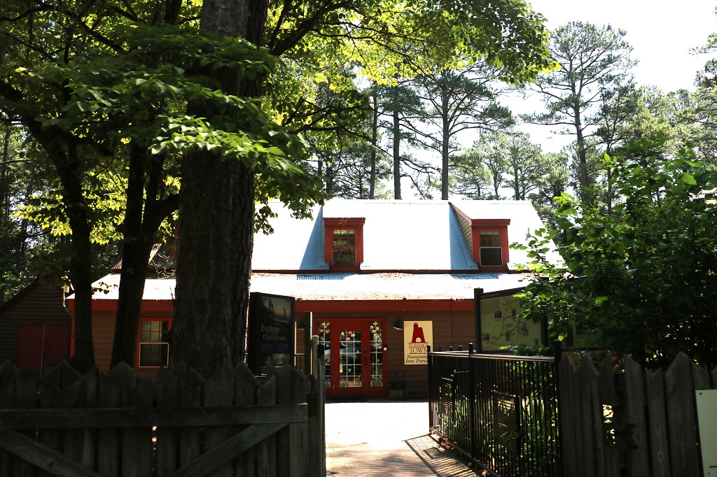
Delmar is only about 150 miles (240 km) from Chesapeake, Virginia where we were to spend the night, and an intersate highway goes straight down from one place to the other. There are quiet roads that diverge, of course, so we drove one of those after leaving the Salisbury, Maryland area. There was an historic site called Nassawango Furnace and Historic Town. that we decided to check out, but when we got there we discovered it is only open on weekends. We just took a few photos of the buildings we could see. No sign of the furnace though. It must be back in the woods.
About 300 families lived in the company town when the furnace was smelting bog iron. No trace of any of the original houses remains. They believe they were located where the parking lot is now.
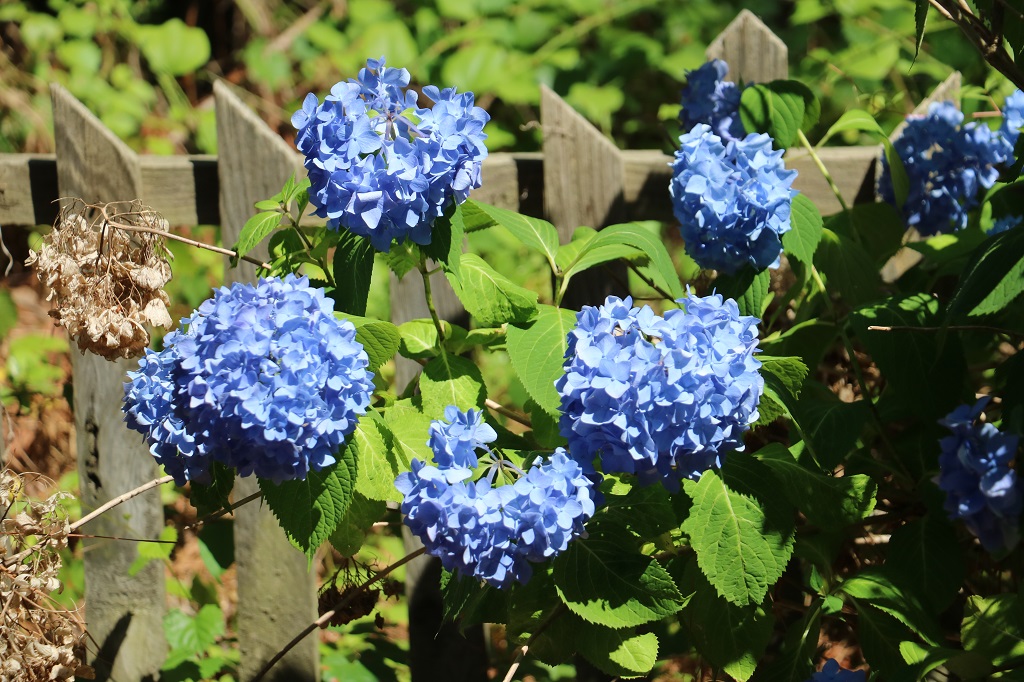
The hydrangeas were lovely.
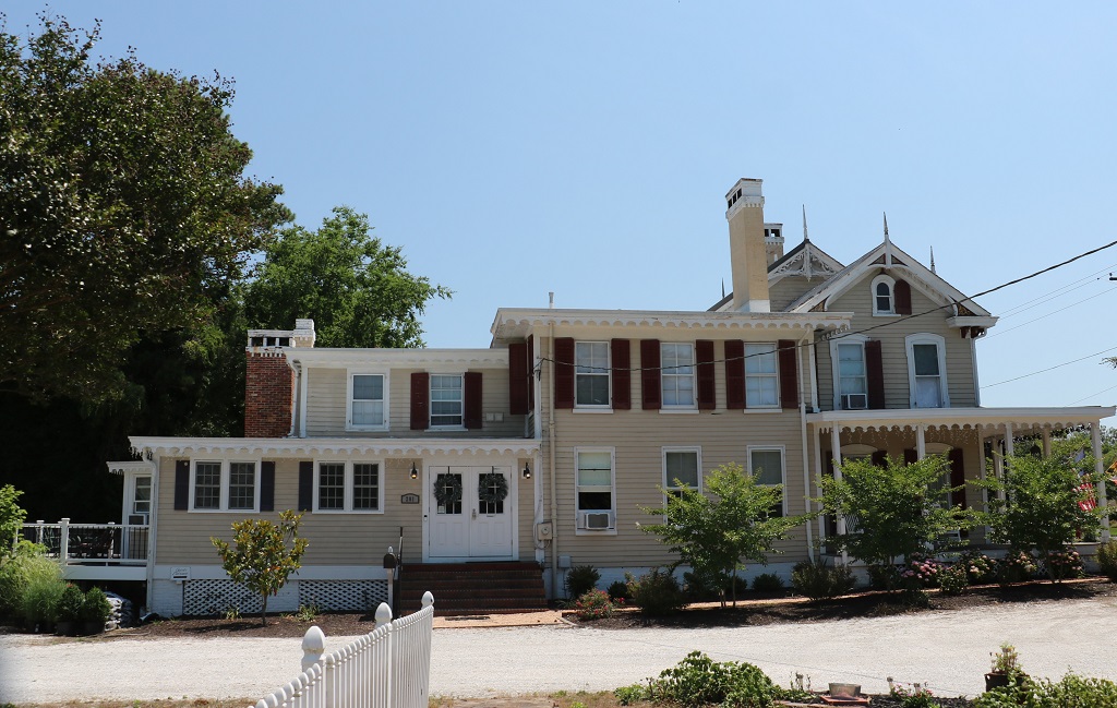
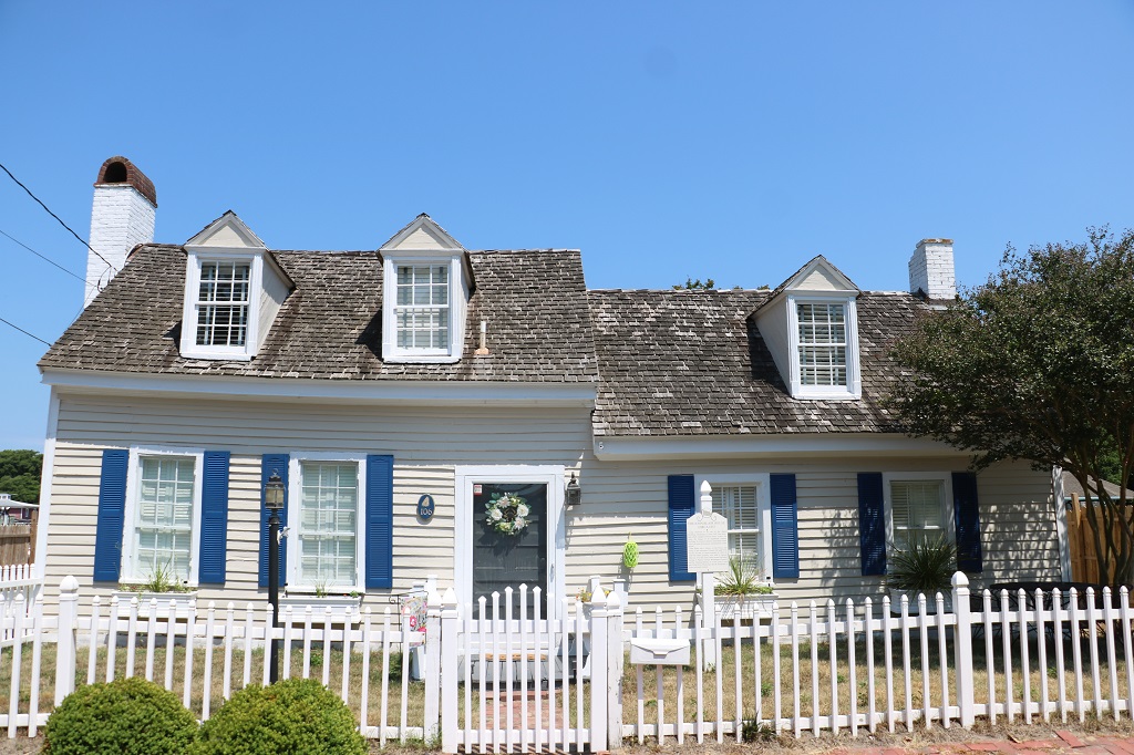
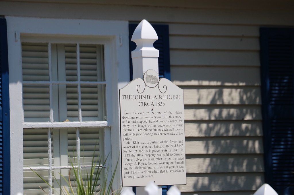
We stopped in a small town called Snow Hill for a couple of geocaches and also did a five-part Adventure Lab that took us on a tour of the historic buildings.
River house is a bed and breakfast now.
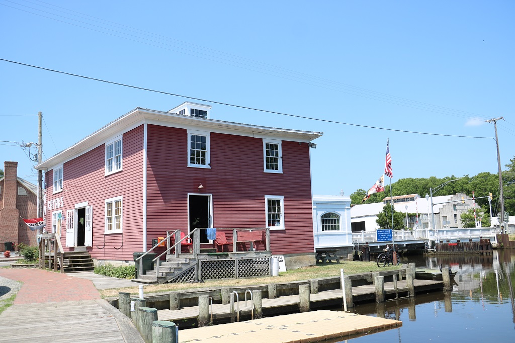
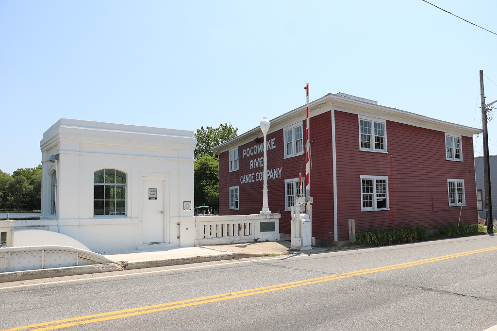
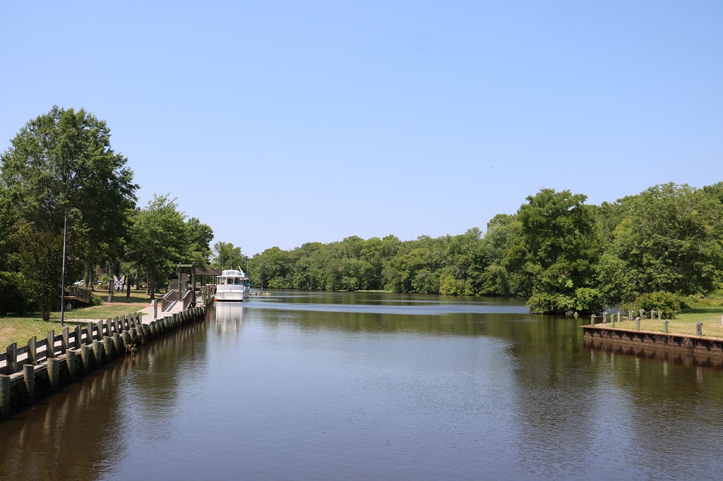
The slow-moving Pocomoke River is a popular canoe and kayaking place.
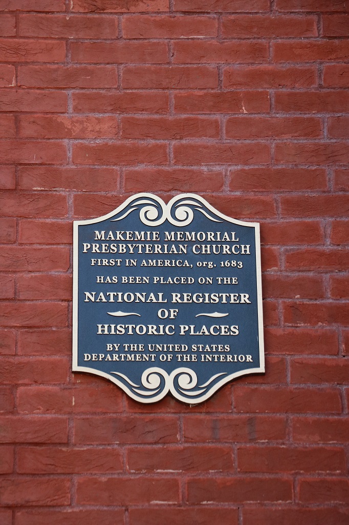
One of the buildings we went to was the Makemie Presbyterian Church. Turns out it was the first Presbyterian Church built in the United States. We have also been to the first Presbyterian Church built in Canada at Niagara-on-the-Lake.
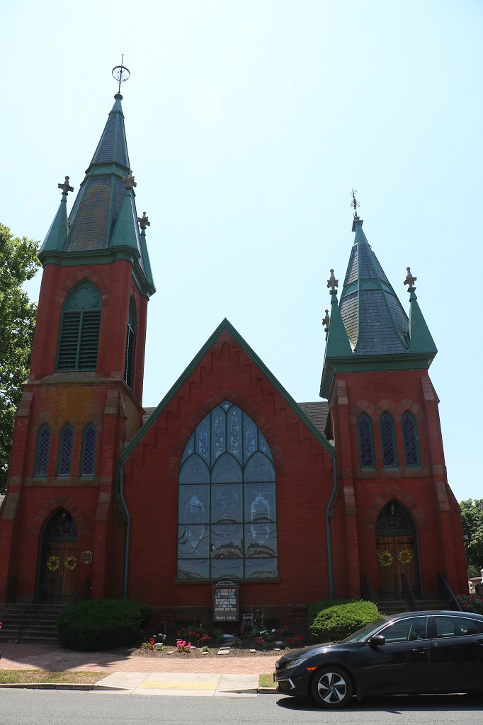
This was originally a Catholic Church but is now an art museum in Snow Hill.
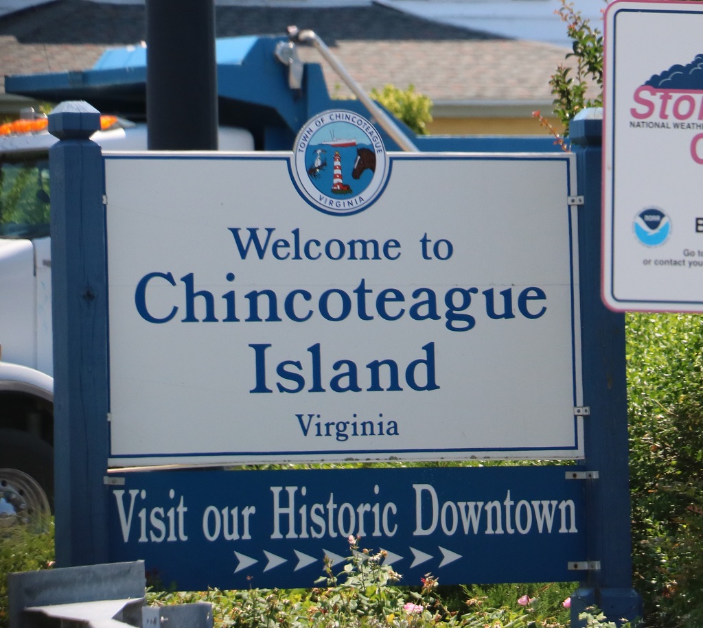
After we finished exploring Snow Hill we decided to do some driving for awhile. Not long after we passed into Virginia (again, back road. No Welcome sign. Sate number 17) I was looking for roads to detour on so as to avoid a boring drive down the Interstate. On the Atlantic side of the long narrow spit that makes up the east coast of southern Virginia I spotted a road to Chincoteague Island.
When I was young I mostly read comic books. It wasn’t until about age 10 or 11 that I discovered novels. And the first novels I read were about horses and written by Marguerite Henry. “King of the Wind” was my favourite. I read it at least 15 times. It is a novelized account of the original Godolphin Arabian stallion that is said to be the “Father of the Thouroughbred.” Marguerite Henry also wrote “Justin Morgan Had a Horse,” about the beginning of the Morgan horse. “Born to Trot” about a championship trotter race horse, and her first book, written in 1947. was called “Misty of Chincoteague” about one of the wild ponies on Chincoteague Island! There is a four or five book series about Misty.
John, turn here…. and across the causeway we went. The ponies are all protected in a wildlife reserver and you have to pay a fee to even reach the part of the island where they live, but we did some exploring of the town anyway. Major summer vacation place too. (And I was okay with not going to see the wild ponies because on Thursday when we are at Nag’s Head, North Carolina and getting together with family before the wedding on Friday, we are all going out on the dunes to see their wild ponies!)
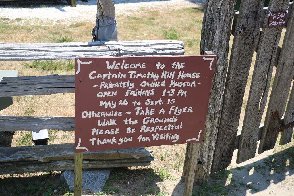
Before we went searching for a few geocaches we drove to the Captain Timothy Hill House; reputed to be the oldest house on the island. It is only open on Fridays, but we didn’t need to see the inside anyway.
I have never seen a chimney like this.
There were a couple of geocaches in a nature preserve so we found them before driving off the island and heading south.
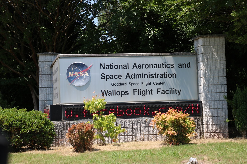
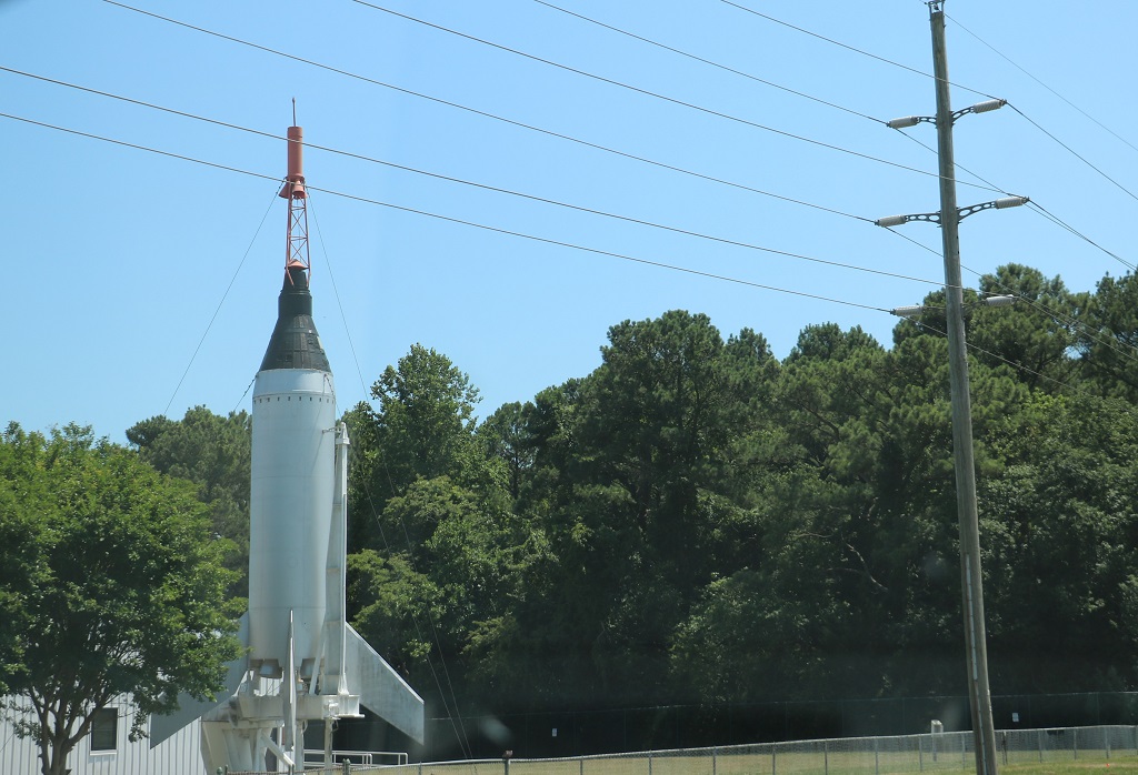
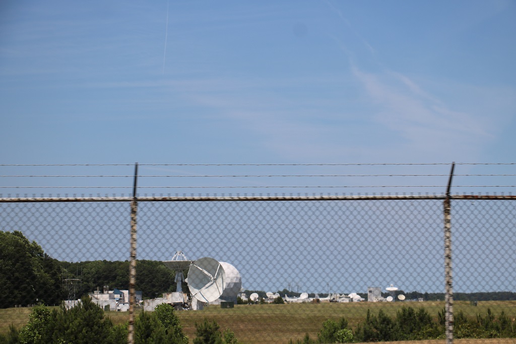
The NASAWallops Flight Facility and Visitor Center are located near the town of Chincoteague and Assateague Island National Seashore.
They must have about a hundred different types and sizes of satellite dishes pointing in every possible direction.
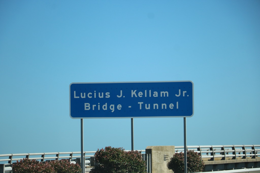
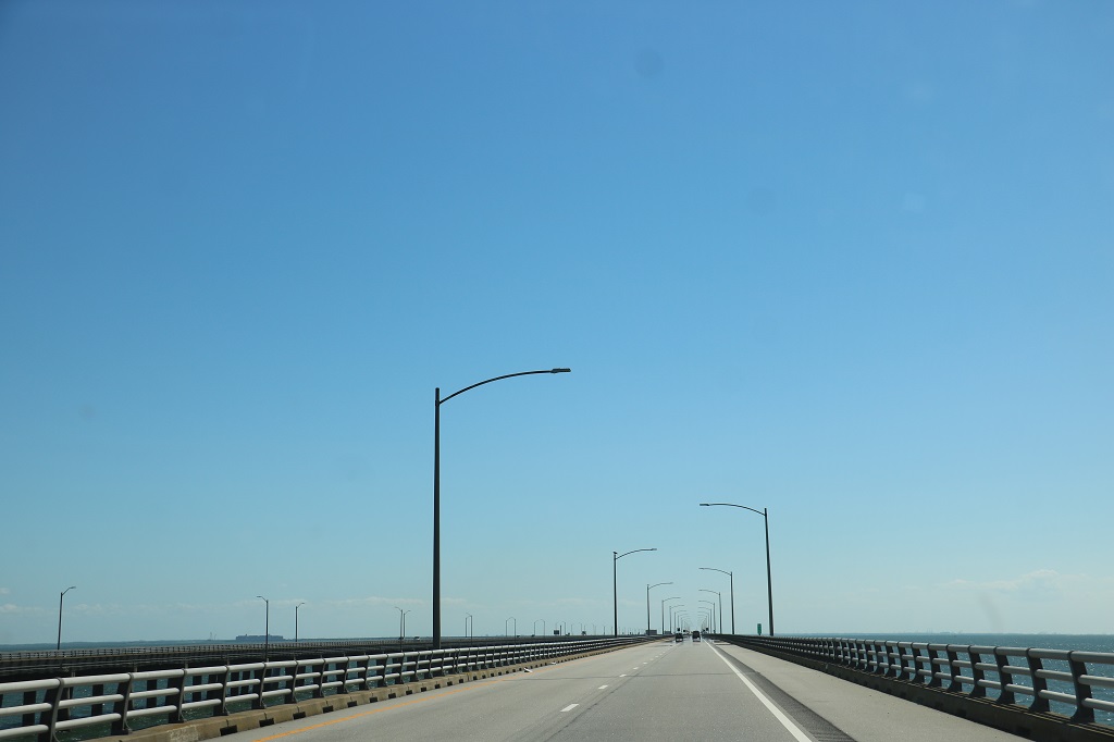
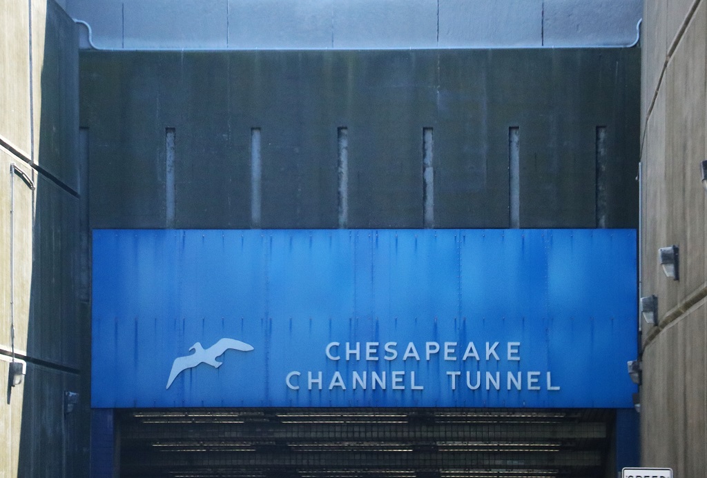
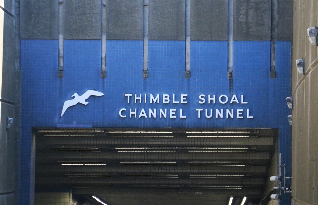
After we left Chincoteaque we did not have much choice but to drive the rest of the way down the ever-narrowing spit to Chesapeake Bay and across the 17.6 mile (28.3 km) Bridge Tunnel. There are actually two bridges – two lanes in each direction except where they narrow to one lane through the two underwater tunnels. The bridge tunnel cost about $1.58 billion in 2023 dollars and 3.5 million vehicles cross it every year. At $16.00 per vehicle the the bridge tunnel earns the investors $56.000,000 per year. It was an absolute marvel of engineering.
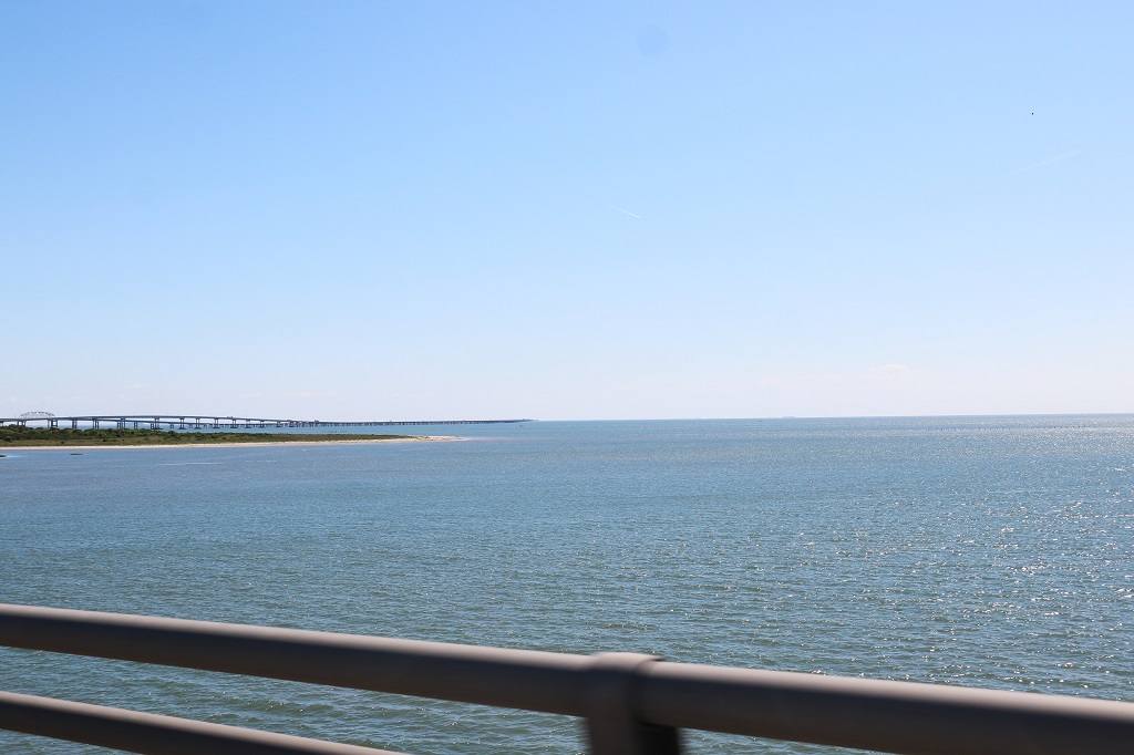
The black line disappearing into the horizon to about mid-center of the photo is the bridge.
Open water as a far as you can see on both sides.
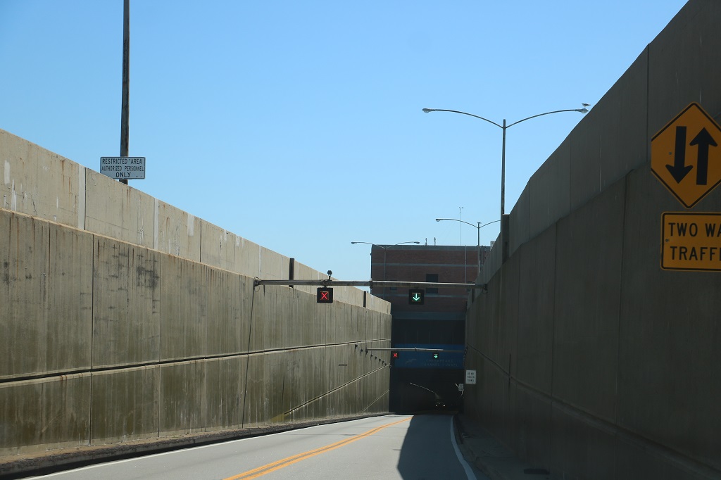
The road reduces to two lanes through the tunnels and they go downhill under the ocean quite steeply before climbing out again to split into the two lane bridges. There are two tunnels that allow seafaring craft to navigate Chesapeake Bay unhindered.
There was construction work going on at the entrance to the second tunnel.
Immediately you leave the bridge tunnel you are in the combined cities of Norfolk, Virginia Beach, and Chesapeake and the dreaded multi-lane freeways. Thankfully we only had about 10 miles of it before we exited to our hotel.
We will be stuck in it again as we leave to go to Nag’s Head, North Carolina. That too is a short driving distance. We plan to stop at the Wright Brothers National Memorial in Kitty Hawk before making our way to the house our son, daughter-in-law, granddaughter and members of Carrie’s family are staying for the week either side of Friday’s wedding. So, family visiting time tomorrow! Yay!
It is a 30 minute drive across the Delaware-Maryland border to get to Delmar, which is practially on the border (hence the name Del for Delaware and Mar for Maryland) and where we were to spend the night. But we planned to tour around Maryland a bit and find a few geocaches while we went along. We found a few regular geocaches on our way to an earthcache at the southernmost point of Delaware and then headed north and west to explore roads and find some more geocaches.
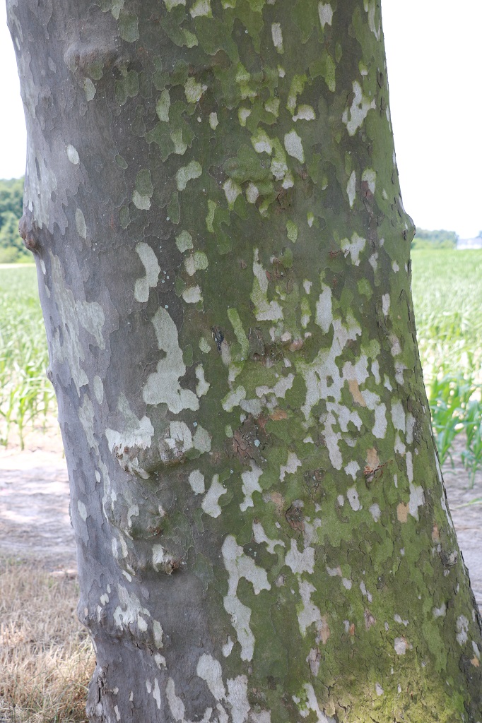
I don’t know the name of these trees, but I liked the bark.
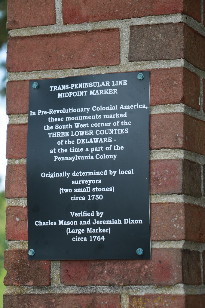
The earthcache was called Middle-Point Mason-Dixon Marker. Earthcaches are points of geological or historical interest (there is no container with a log paper to sign) and you must send the cache owner the answers to the questions they ask based on the information given in the cache description or from your observations at the site. I like them because you always learn something new.
Charles Mason and Jeremiah Dixon were surveyors. The Mason-Dixon line is a demarcation line separating four U.S. states, constituting parts of the borders of Pennsylvania, Maryland, Delaware and West Virginia. They did the survery between 1763 and 1767 as part of the resolution of a border dispute involving Maryland, Pennsylvania and Delaware. This dispute was caused almost a century earlier because of the somewhat confusing proprietary grants by King Charles I to Lord Baltimore (Maryland) and by his son King Charles II to William Penn (Pennsylvania and what later became parts of Delaware). Considering the simple tools they had to work with the line is remarkably straight.
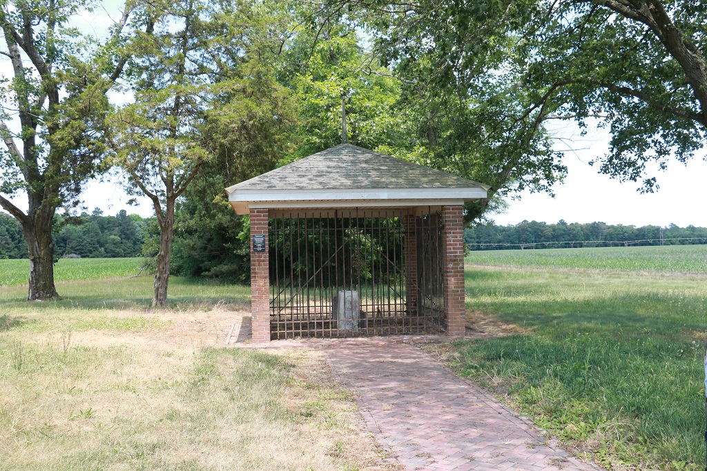
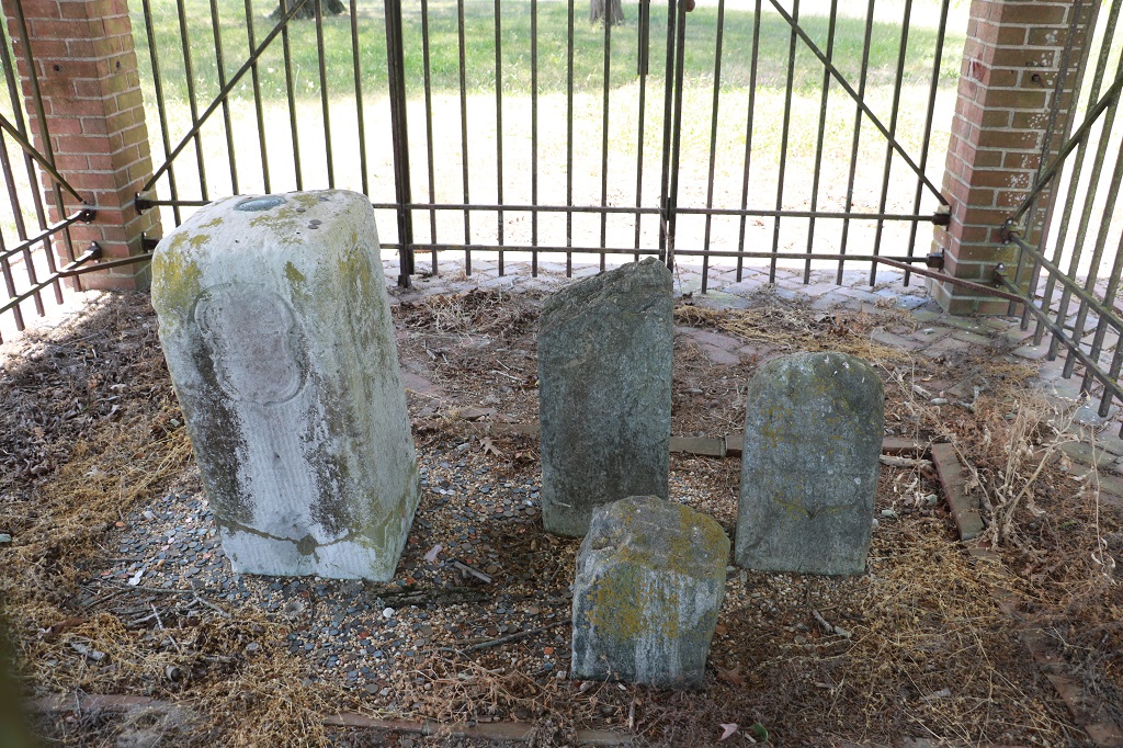
The official stone is the large white limestone one. The other three were placed near it by others. One was found in a field, one was a marker that was dug up nearby when a road was being worked on and the third was an original marker for the boundary that was off by about 32″.
This was the first monument marker for what became known as the Mason Dixon line and marks its southernmost point. They set stones like this every mile and would place a ‘crownstone’ every five miles. (It was called a crownstone because there was a crown on the crest of Lord Baltimore who was given the land of Maryland by the king.)
Mason and Dixon set about 300 of these large limestone markers along the boundary they surveyed. They were quarried in England on the Isle of Portland. Each weighed about 500 lbs and stood from 3 1/2′ to 5′ high before being set.
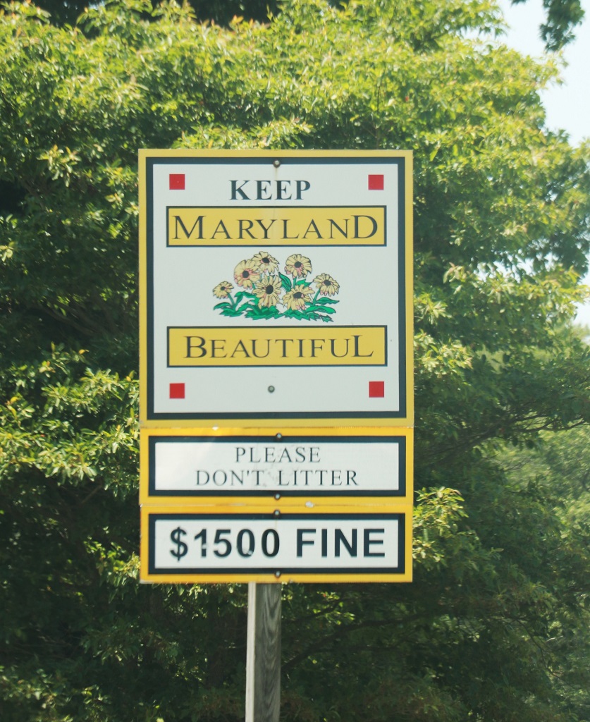
We did not see a Welcome to Maryland sign but this will count. State #16.
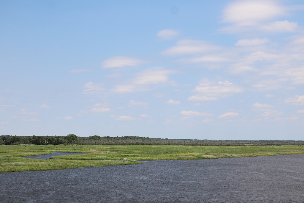
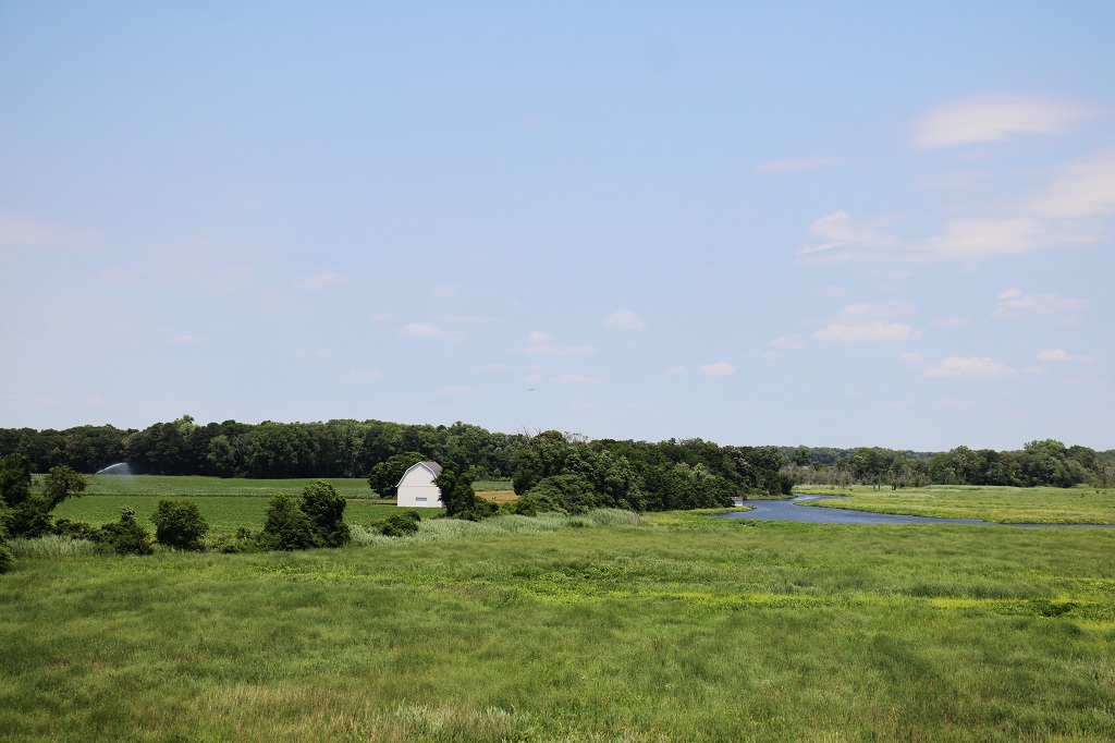
There is a massive marshland that runs along the east side of Maryland. It stretches in and out for miles. Most of the area is protected as the Blackwater National Wildlife Refuge. We drove past and through it off and on all day.
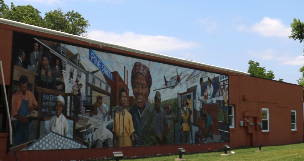
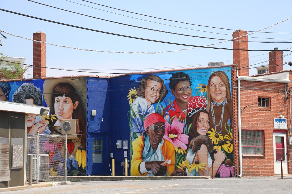
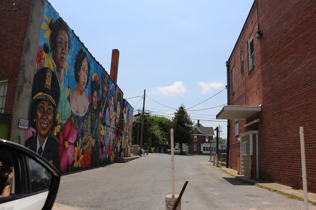
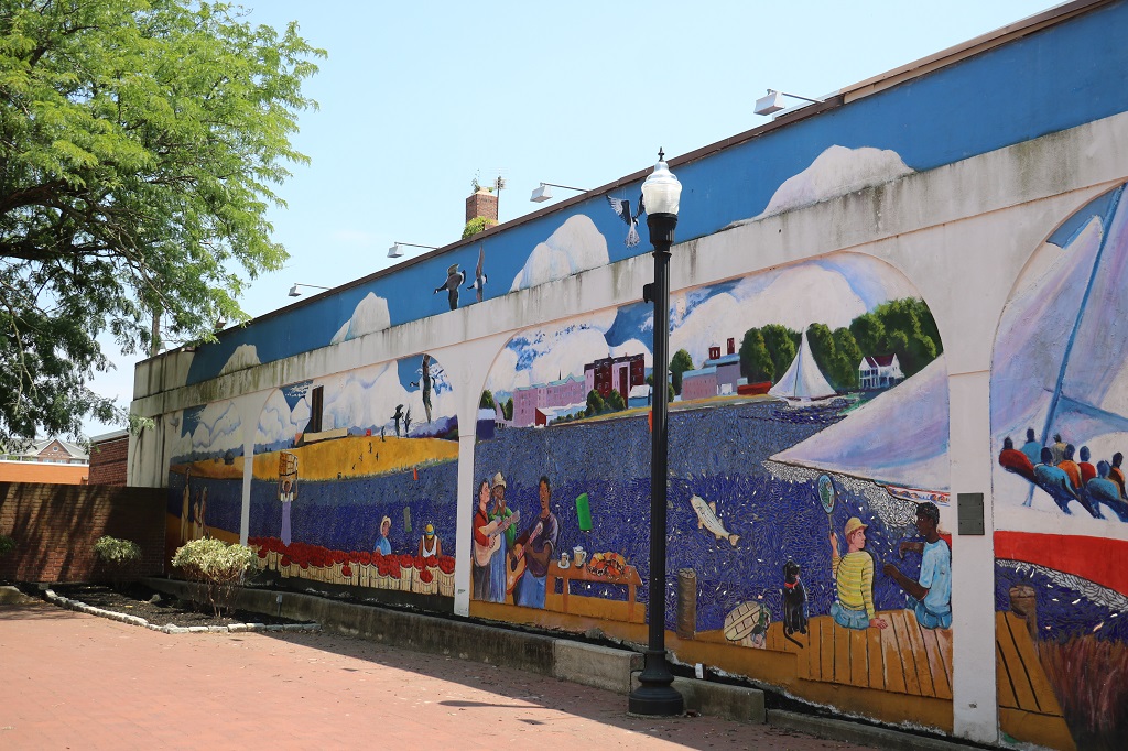
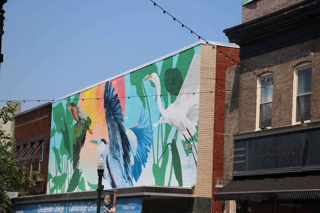
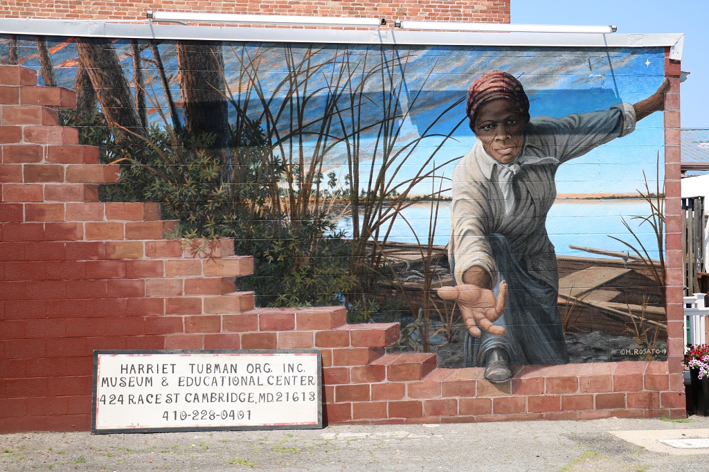
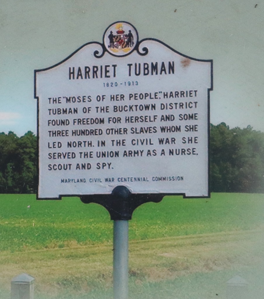
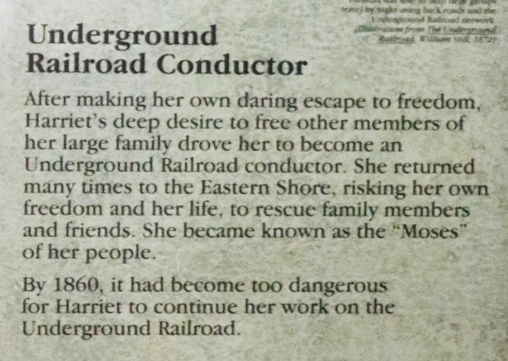
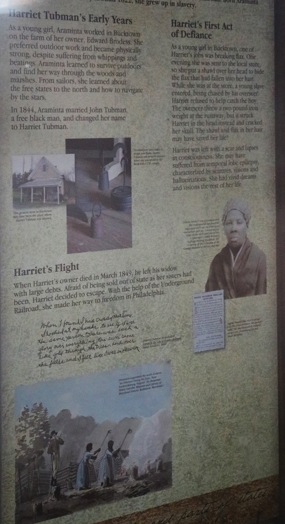
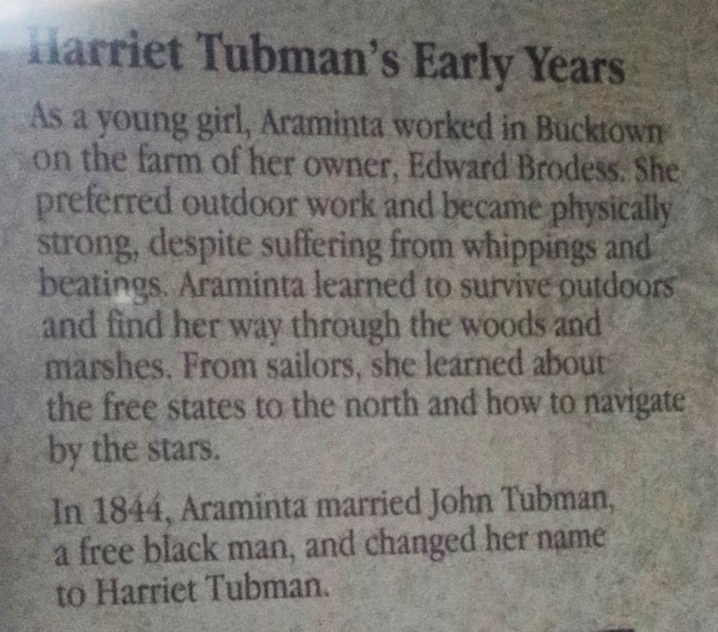
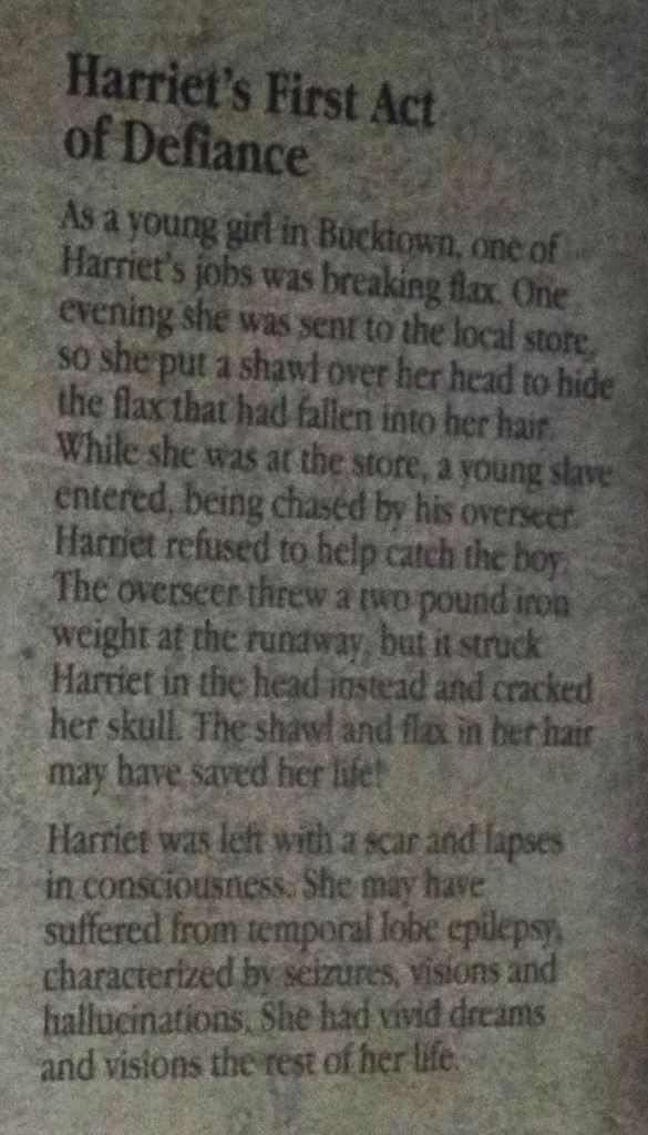
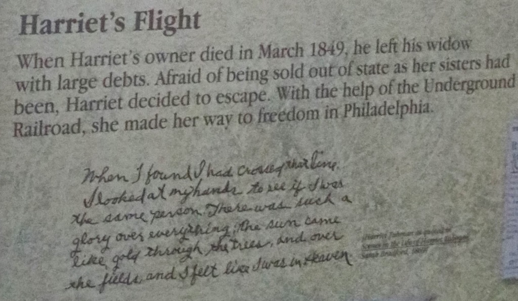
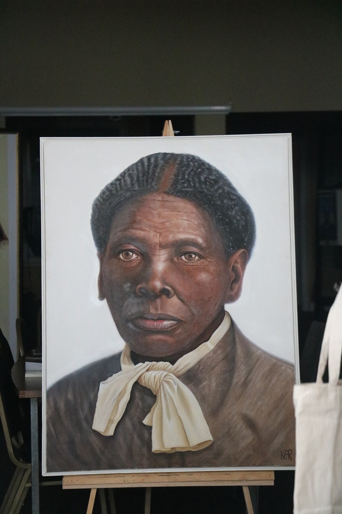
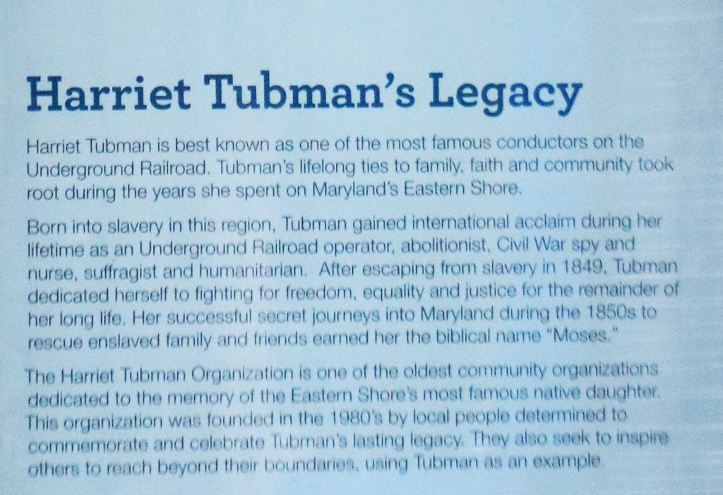
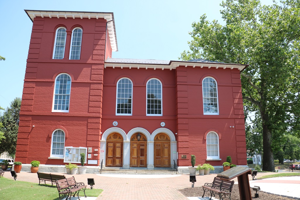
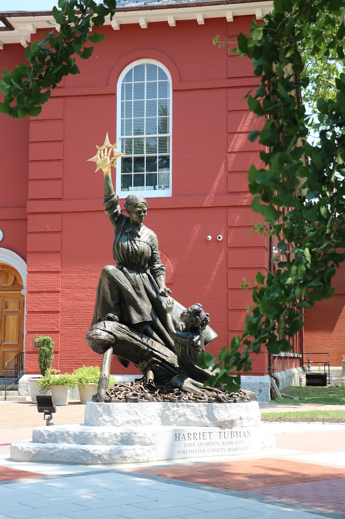
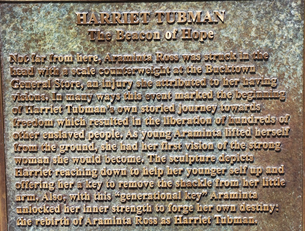
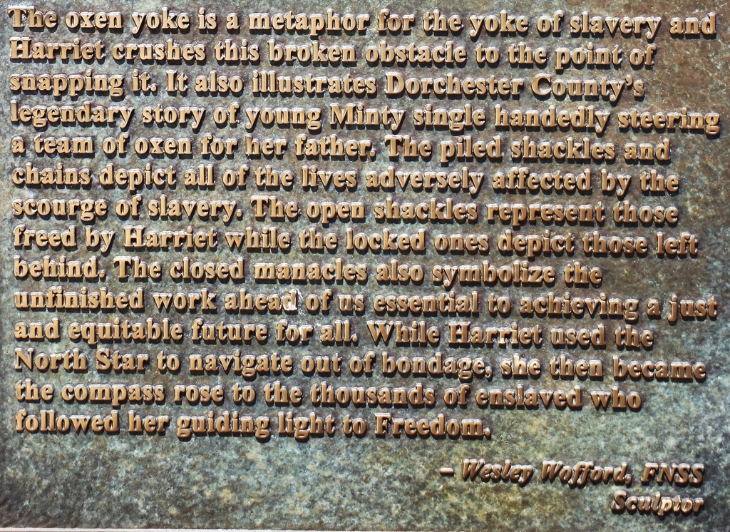
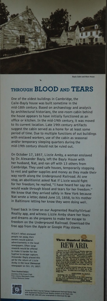
We followed a line of geocaches and ended up in Cambridge. A fortuitous location as this is where Harriet Tubman was born a slave and escaped and became the “Moses” of the Underground Railway that helped slaves from the south escape to the north and freedom. There are about 30 lovely murals around the town and many of them have her featured in them.
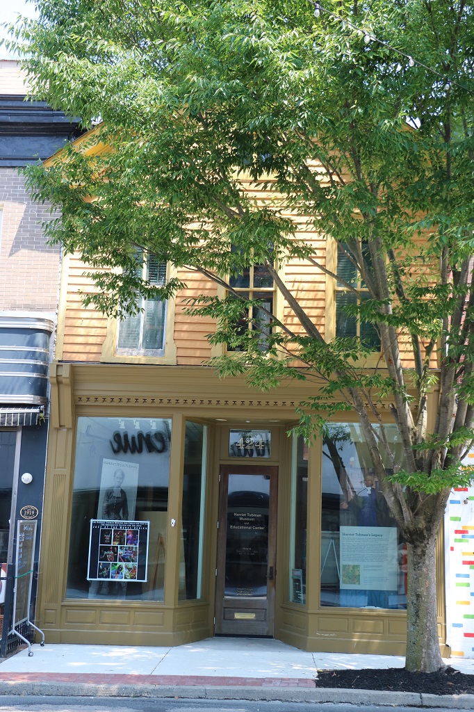
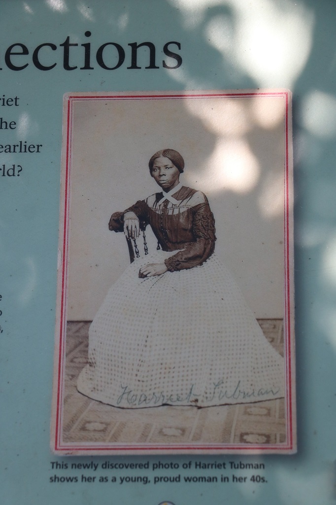
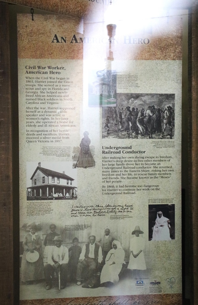
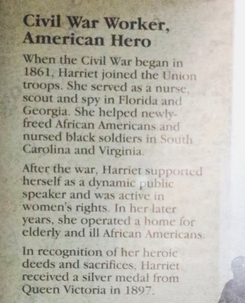
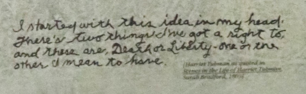
There was also a Harriet Tubman museum, but it was closed and we later drove past a National Park Harriet Tubman Visitor’s Center that was also closed. Nonetheless I found quite a bit of information about her life by taking photos of the posters through the glass of the museum door. They are not the clearest pics but I tried to sharpen them up a bit. Some bits were unreadable though.
Harriet was her mothers name.
In honor of the bicentennial year of Tubman’s birth (2022), a sculpture called, A Beacon of Hope, has been permanently installed at the Dorchester County Courthouse, a place where enslaved ancestors were auctioned, and Tubman’s niece was rescued.
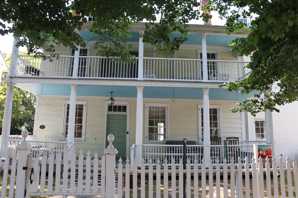
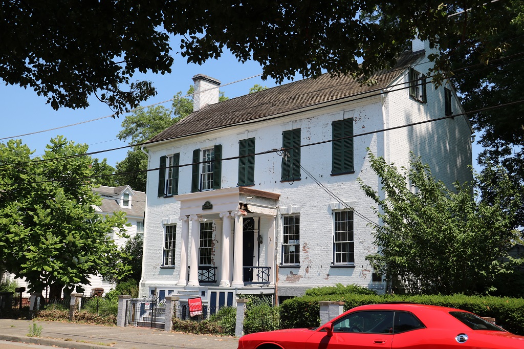
Just up the street and on the other side from the courthouse I noticed there was an information sign in front of this house. So, of course, I had to go see what it said.
This nice house was across the street and for sale.
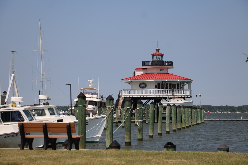
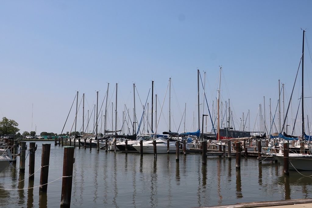
We drove up to the marina and found another cache at the WW I and II memorial.
The Choptank River lighthouse
After a Dairy Queen ice cream treat for lunch we headed a bit further west and ended up wandering through the Blackwater Marsh for over an hour trying to find the road that would take us south to Salisbury and nearby Delmar where our hotel is.
There were portions of the road that were covered in water and you could easily see water right at the edges. I took a couple of photos but the windshield was so wet from navigating the water that they did not turn out. Definitely not a good place to go off the road.
We eventually found our way back to the main road and headed south to Salisbury and then up to Delmar near the border for the night. Another good day of exploring and information.
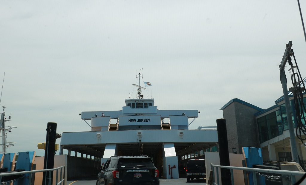
We did not have a long distance to go today but had to be at Cape May at the southernmost point of New Jersey at 1:30 to take the ferry across the Delaware bay back to the state of Delaware – which was the first state to ratify the US Constitution, so is state #1 of the United States of America.
The drive from Carney’s Point to Cape May takes less that 2 hours so we had a few hours to waste so we headed west toward the Delaware Bay and meandered down country roads.
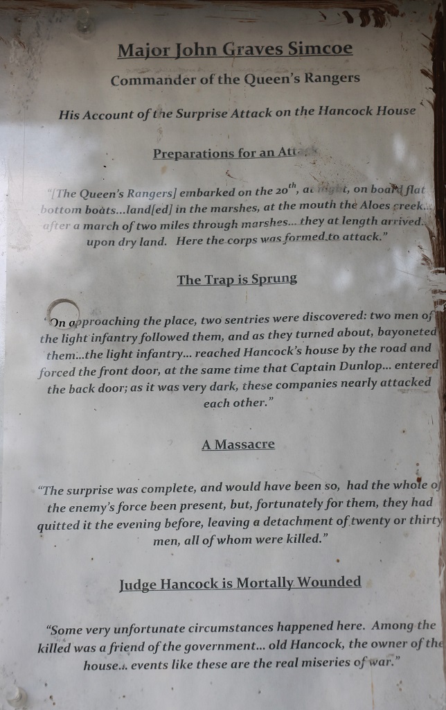
We stopped to take a few photos of Hancock House which is a state historic site. The house is no longer open except by appointment but we wandered all around. It was the site of a massacre in March 1778. There was a short writeup on a bulletin board.
I looked up Hancock House on the internet and this is the more detailed report: “Throughout the 18th century and during the American Revolution, English Quakers who were largely opposed to violence and armed conflict inhabited Salem County. This stance inevitably brought the tragedy of war to hearth and home.
The winter of 1777/78 found George Washington and his army encamped at Valley Forge, Pennsylvania. The British occupied Philadelphia. Both armies needed food and supplies. In February of 1778, General Washington ordered a foraging expedition to be conducted. After moving through parts of Pennsylvania and Delaware, General Anthony Wayne was detached from the main force and crossed the Delaware River into Salem County, New Jersey. He gathered cattle and other supplies before returning to Valley Forge. A month later, Sir General William Howe dispatched 1500 British and Loyalist troops under Colonel Charles Mawhood to do the same. Mawhood’s foraging activities met with considerable resistance from the Salem and Cumberland County militias. A brief skirmish at Quinton’s Bridge on March 18, 1778 left the British frustrated and unable to cross the Alloway Creek to gain access to fertile fields below Salem. On the night of March 20, 1778, Colonel Mawhood sent Major Simcoe and his Queen’s Rangers to lead a surprise attack at Hancock’s Bridge. With local Tories (British Loyalists) and their slaves acting as guides, approximately 300 troops of the Queen’s Rangers made their way down the Delaware River by boat and landed at the mouth of the Alloway. Making their way through the marshes, they surrounded the militia stationed at the bridge. At approximately five o’clock in the morning of March 21, 1778, the attack began. The Rangers attacked the entrenchments at the creek and the Hancock House, believing it was the militia’s headquarters. Everyone inside the house was bayoneted; not a shot was fired. Among the 10 killed and five wounded, was Judge William Hancock. He died several days later.”
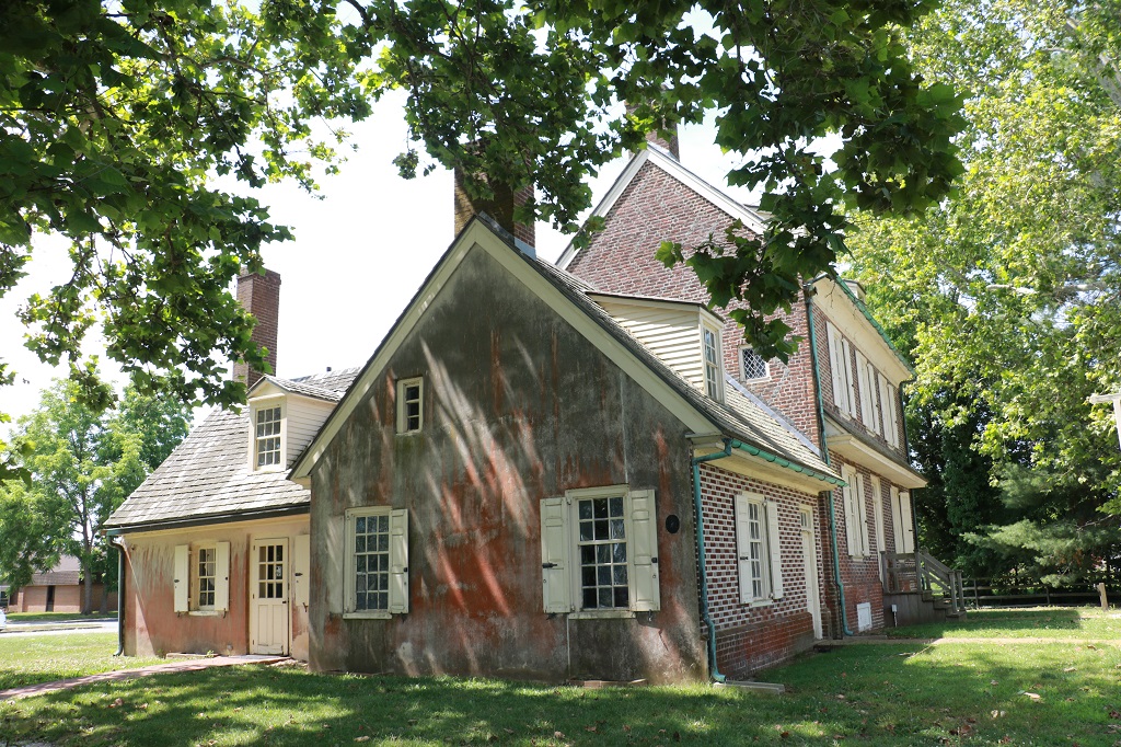
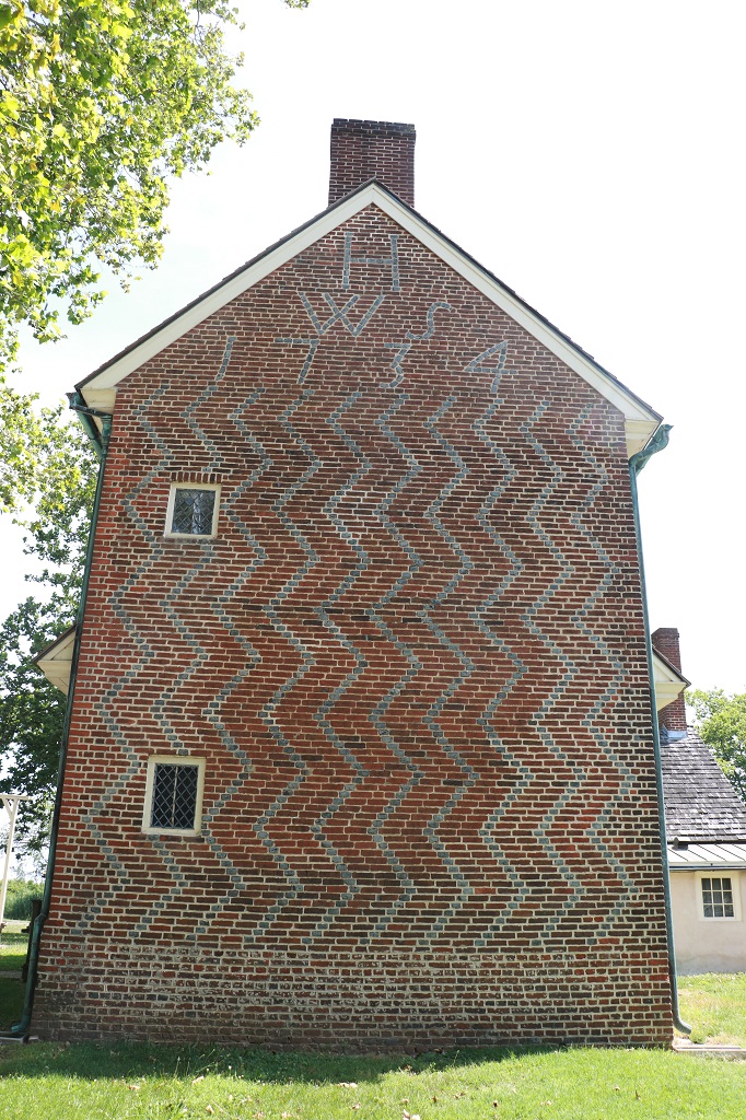
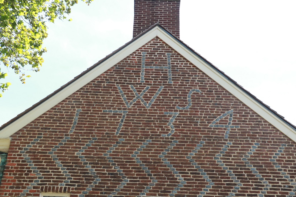
The house was built in 1734 by William & Sarah Hancock, a prominent Salem County Quaker family. The house is an excellent example of English Quaker pattern-end-wall brick houses associated with the lower Delaware Valley and southwestern New Jersey.
The initials stand for Hancock, William and Sarah. Amazing that it was built in 1734!
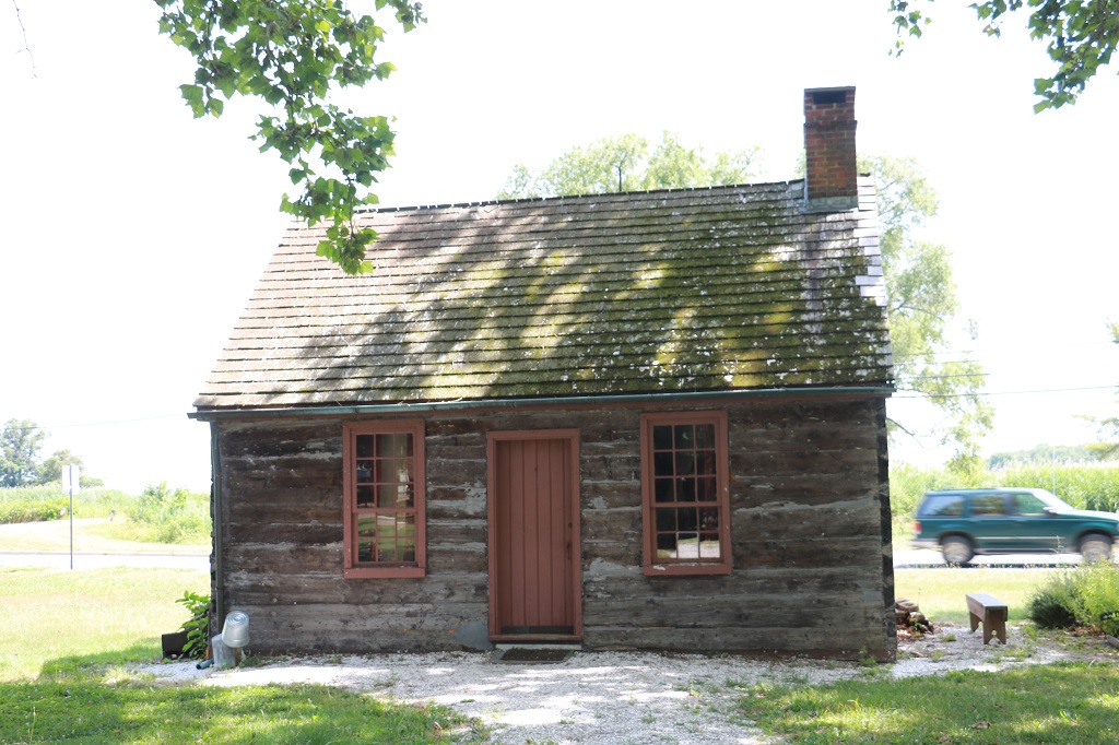
This little log cabin was also on the property, but there was no information about it.
As we drove the roads we would be on the lookout for geocaches. There was one not far down the road from the Hancock House and it turns out many members of the Hancock family, including William and Sarah are buried there. We found the cache as well. And a few more along the way.
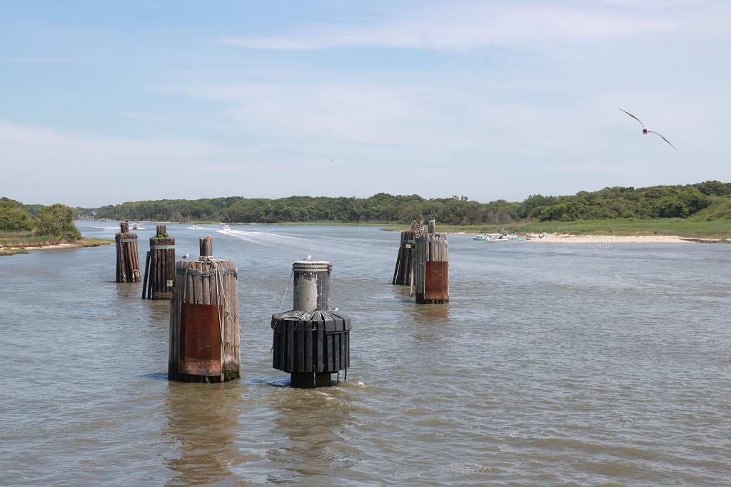
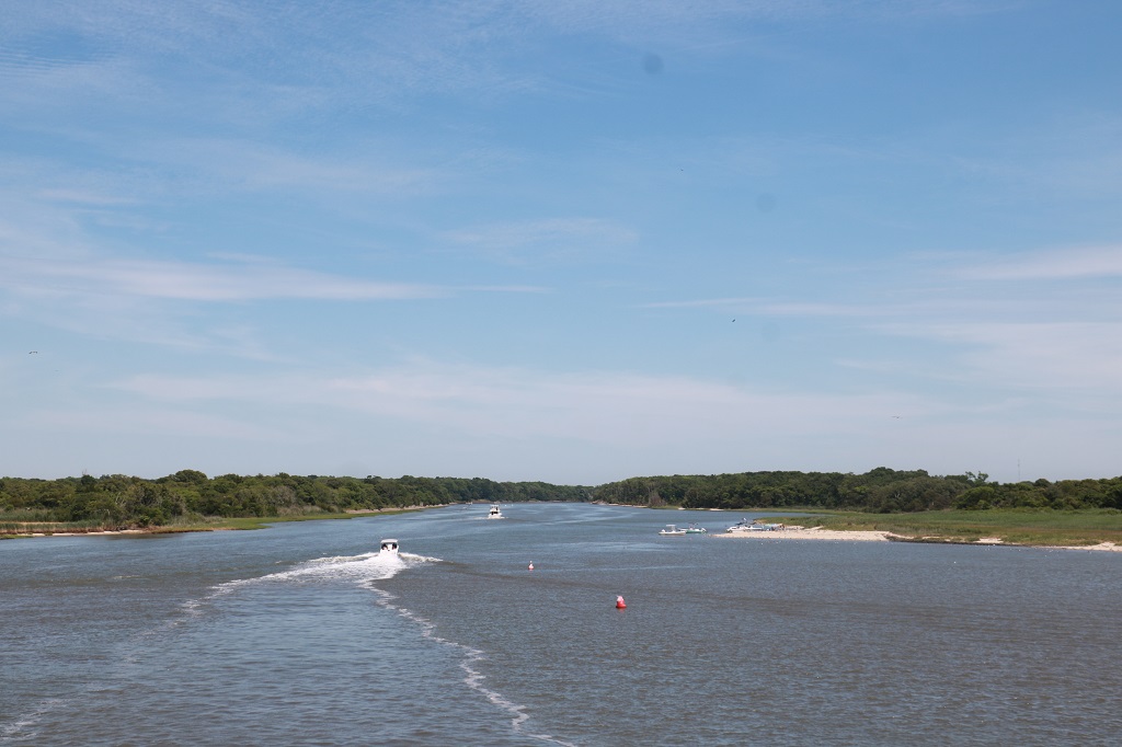
We boarded the ferry at Cape May at 2 pm for a 2:30 sailing. The crossing to Lewes, Delaware took 85 minutes and we had sunshine and calm sea all the way.
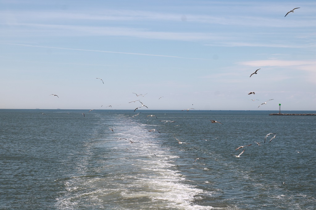
The seagulls followed the boat all the way across.
I saw the Welcome to Delaware sign at the Lewes ferry terminal as we were driving off the ferry, but noticed it too late to snap a photo. Boo.
The drive to Millsboro where we are spending the night only took about a half hour so we were in our hotel room at 5.
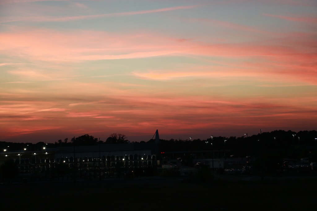
For once our hotel room faces west with a nice view of the sunset.
Tomorrow we also have a short drive into Maryland so we will be doing the same thing as today; wandering along quiet roads, enjoying the countryside and finding a few geocaches.
After the long, information overload day in Gettysburg we had a scenic driving day today. We plotted a route of country backroads that would take us out the eastern border of Pennsylvania into Delaware and across the bridge to New Jersey.
It was a late night last night to get half of my blog done after we got to our hotel at 8:30. I don’t do midnight bedtimes very often. Sadly staying up late does not equate to sleeping in late. I was up at seven and spent some time resizing Gettysburg photos before John got up. We were still breakfasted and out of the hotel by 10.
The first stop was a tire shop. After we left Charlotte, NC we had to get the left rear tire fixed because it had a screw in it and was losing air. As we drove around Gettysburg, the dash lit up with a warning that the same tire was low on air again. We went to a tire shop in Hanover and sure enough; there was a nail in it now. They were able to fix it right away and we were on our way again in about a half hour.
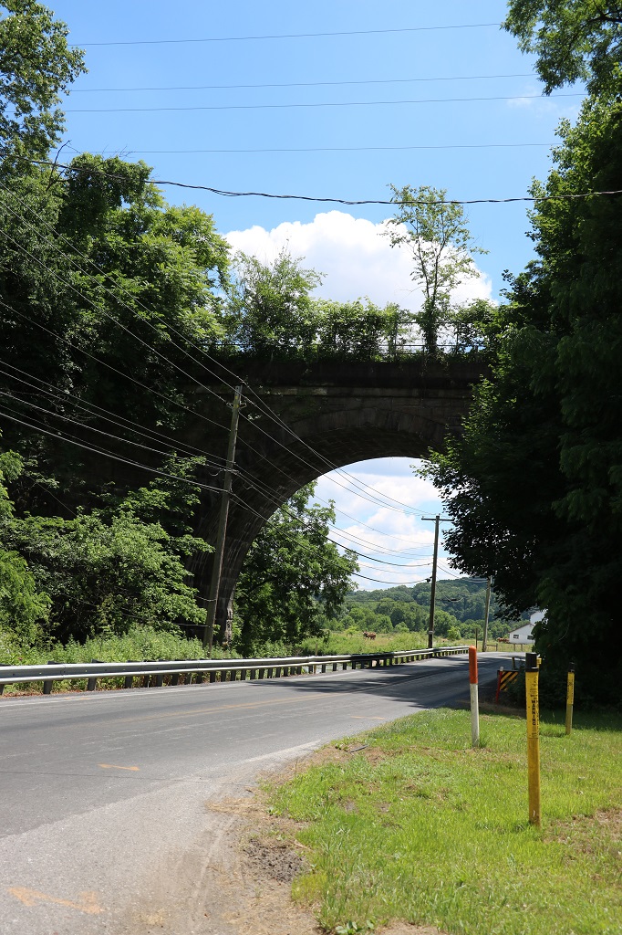
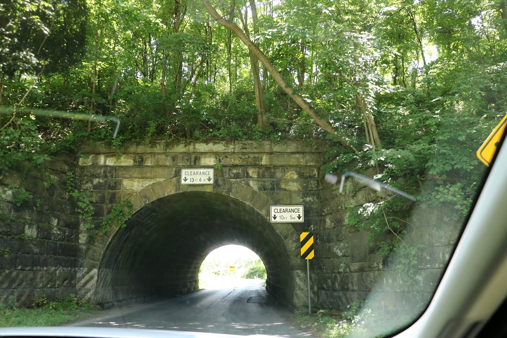
Near the town of Shrewsbury we encountered a one-lane railroad bridge we had to drive under.
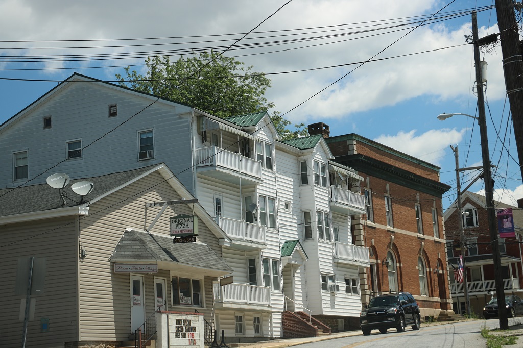
Buildings as we drove through Stewartstown.
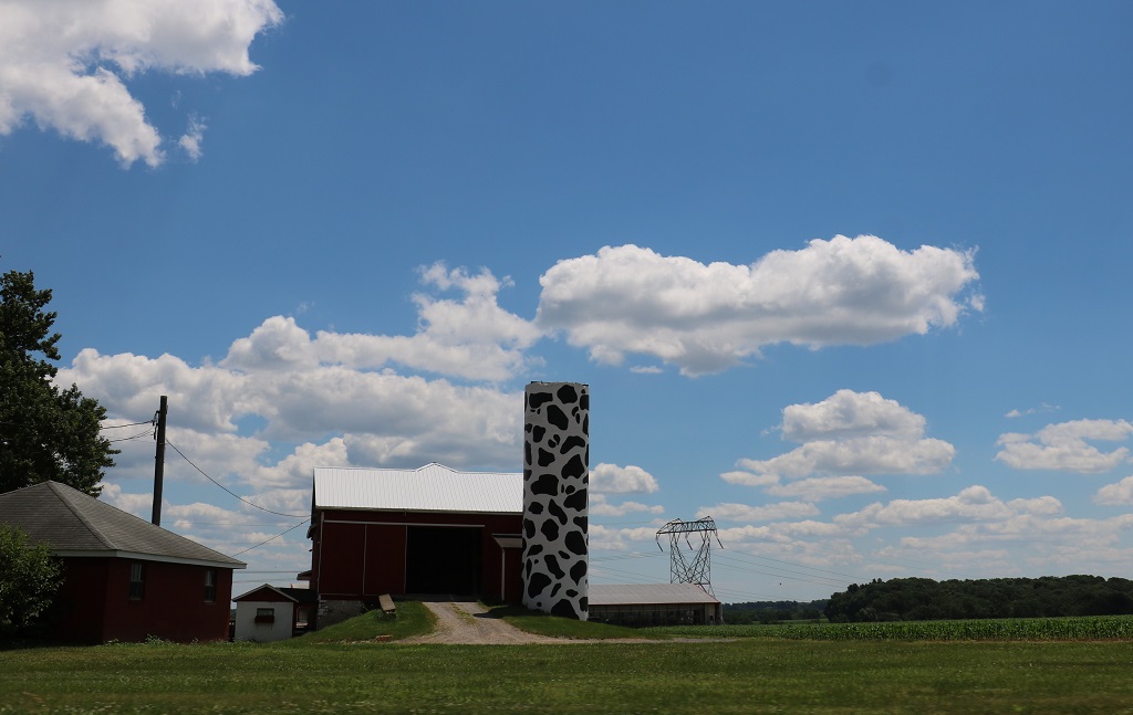
Farms and barns near Woodbine. We passed many corn fields today.
Crossing the Susquehanna River.
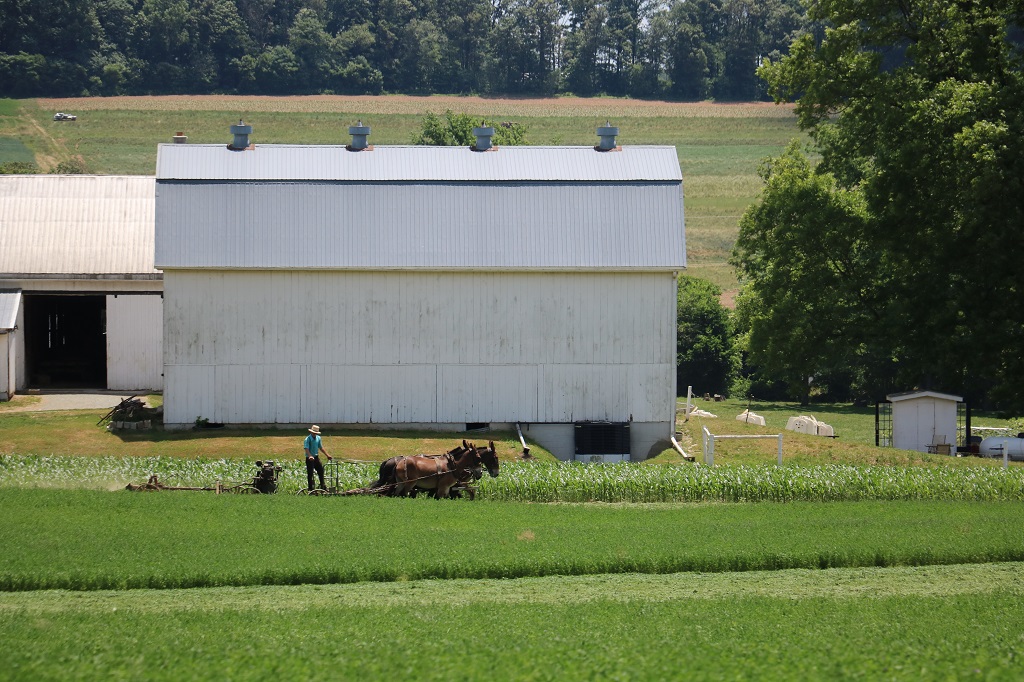
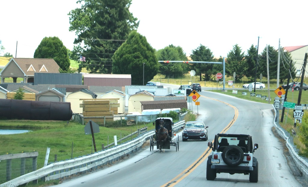
Quarryville was Amish country and in the space of a few miles we saw horse/mule teams working in the fields and horse and buggies heading into town.
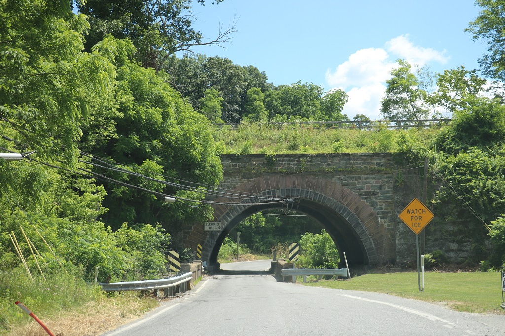
A couple more passes under old railway lines.
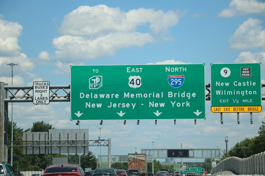
We entered Delaware at 2 pm and took a few minutes to find a geocache. We will be back in Delaware tomorrow and will try find a few more, but we entered the state at the very bottom corner and it was only took about a half an hour until we crossed the toll bridge into New Jersey. The rental car has a sticker for toll roads and bridges and the toll cost will go to Budget and be added to our account when we drop off the car.
Pick a lane and a state.
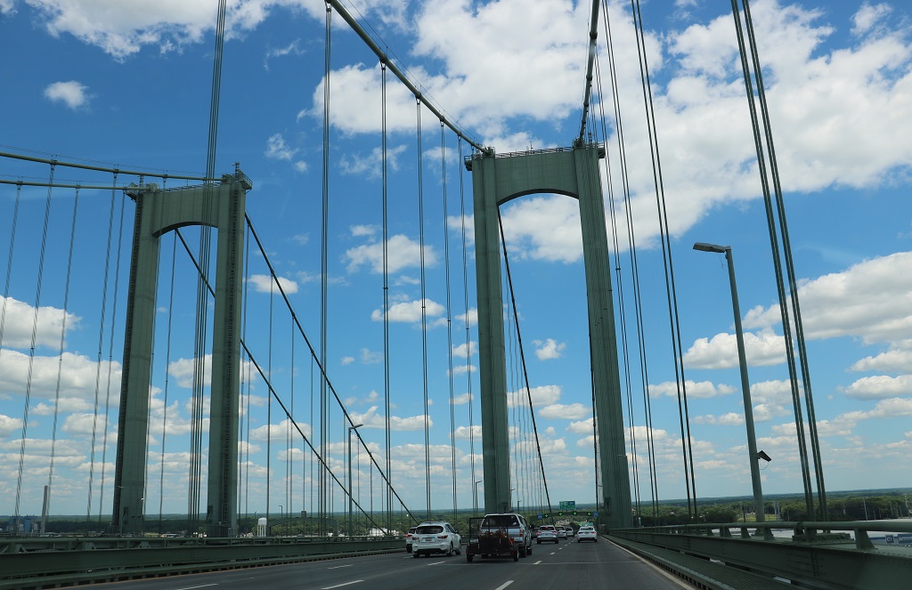
The Delaware Memorial Bridge between Delaware and New Jersey.
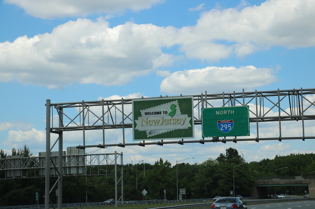
Once again the small country road we were on when we entered Delaware did not have a welcome sign. It was state number 14 and New Jersey is state number 15 on this trip.
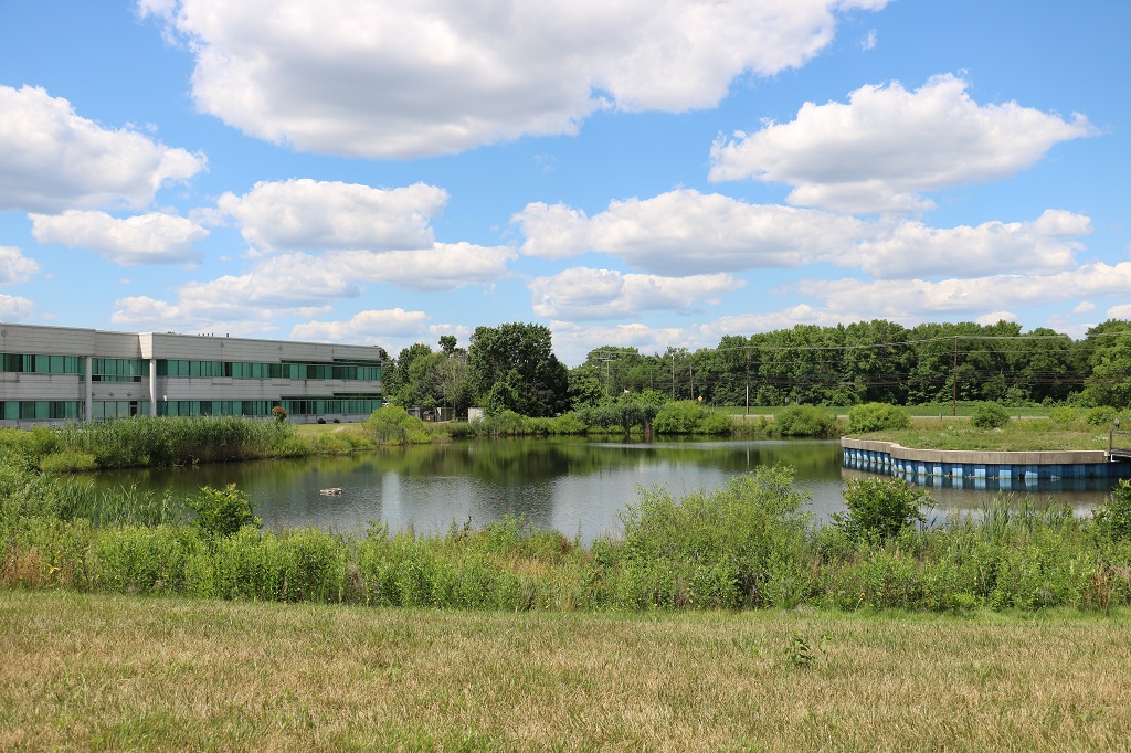
We found our hotel but did not check in. We went to find a couple of nearby New Jersey geocaches first. One was hidden in the bushes over on the right, but we could not find it.
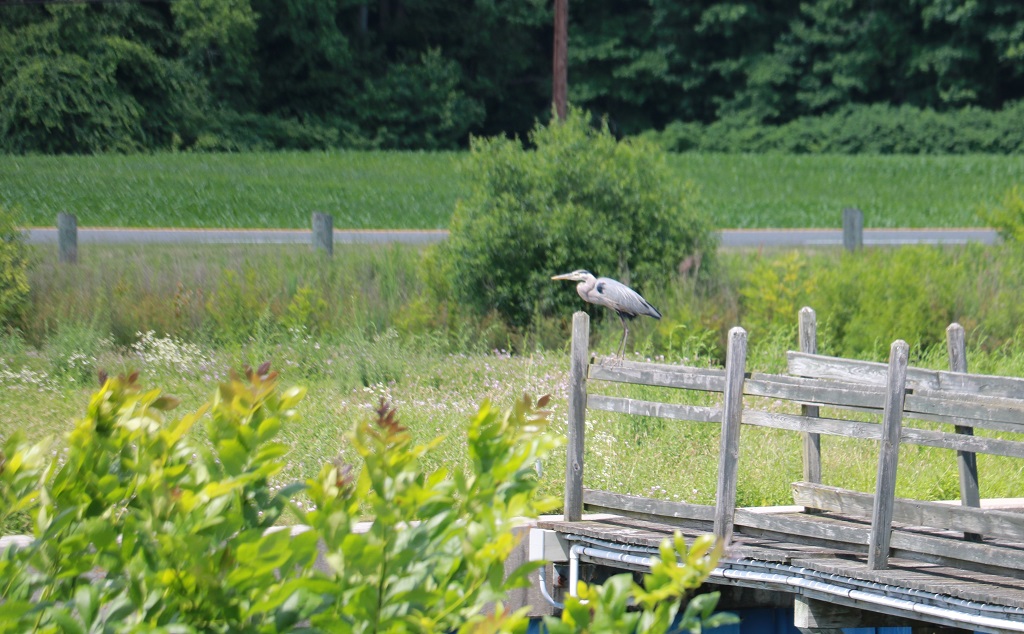
We did see this nice heron though.
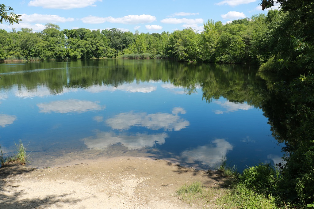
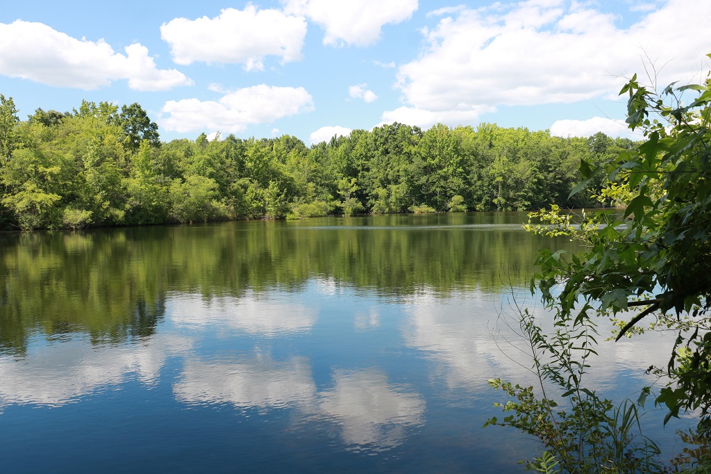
And we found two geocaches hidden around Sadler’s Pond, which had lovely reflections today.
We checked into our hotel about 4. I worked on my Gettysburg blog until dinner and then completed it afterward, then selected and resized photos for today’s blog.
Tomorrow is a semi-free day. We plan to do a slow meander down New Jersey locating a few geocaches and then catch the 2:30 ferry across Delaware Bay back into the state of Delaware to spend the night in Millsboro.
This blog will be long and full of photos of monuments and placards. Continue at your own risk. And you better like history.
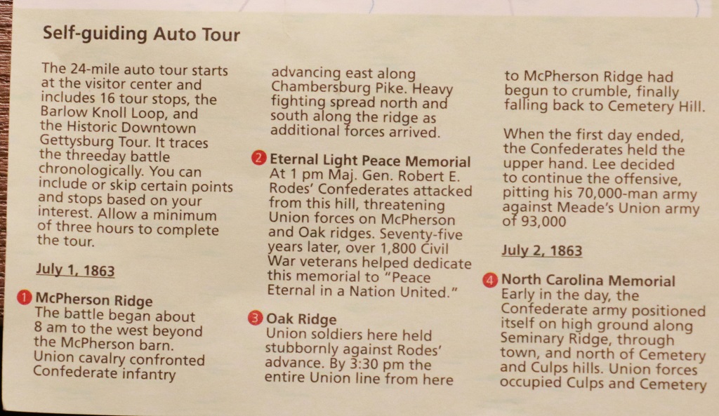
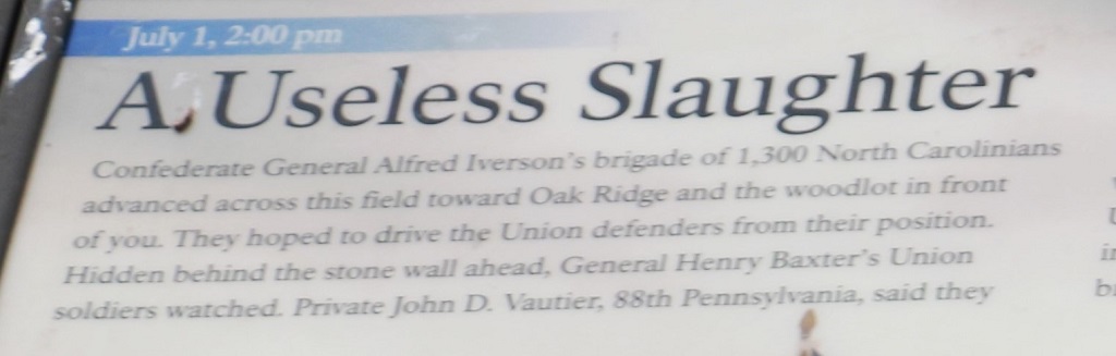
We elected to do the self-guided Auto Tour first and then see if we wanted to do the museum and films the next day. By the time we spent three hours driving around all areas of the three days of engagement that made up the Battle of Gettysburg, and heard the descriptions of who did what and when for the days of July 1, 2, 3, 1863 we decided we did not need to go back to the Visitor’s Center on Saturday. I am sure I would have loved the museum and the films but the Auto Tour gave us so much information via the 16 points of commentary we decided we were okay to move on. Shocking, I know, since you all know how much I love museums, but I was brave.
We heard a ton of info and I hope the things I write here will be correct. Please feel free to check things out with historical records if you think I have written something wrong.
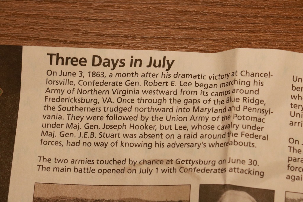
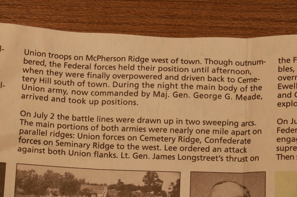
I always thought the Battle if Gettysburg was the final battle of the American Civil War. I am sure we were taught otherwise in History class when we studied it, but I had forgotten. There was actually no battle planned by the Confederate army, nor the Union army at this location. At the end of the three horrendous days of loss of life, the Union routed the Southern forces and Gettysburg became the tide-turning battle of the war that would end on April of 1865.
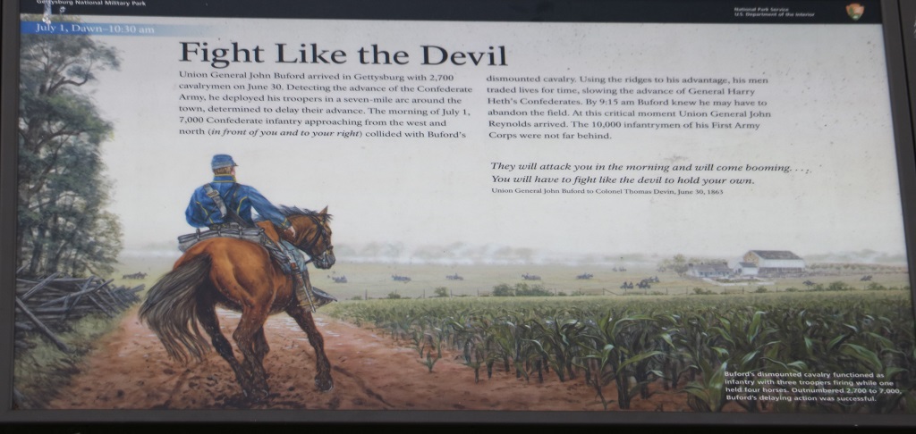
General Lee’s Confederacy had achieved some success in pushing back the Union forces during several engagements in the South. There was quite a bit of discouragement among the men and the officers in the Northern ranks because of this. Lee decided he needed to push north into Pennsylvania and get the Union army to follow him and then he would engage in a major offensive to defeat them once and for all in northern territory and end the war with the suceded Southern states victorious and able to form a separate nation. His plan worked in that the Union army did follow him north into Pennsylvania, however neither side really knew where the other forces were until some Confederate scouts chanced upon a Union camp near Gettysburg on June 30. Lee decided to use the opportunity to capture the town.
Gettysburg would be an excellent location to hold for the Southern states as there were 10 roads around the town that would be crucial for supply lines for the Confederacy during the rest of the war.
General Robert E. Lee had 75,000 men stretched across 60 miles of Pennsylvania and more were arriving. The Union army had 95,000 men about 35 miles south of the Confederates. Read those numbers again!
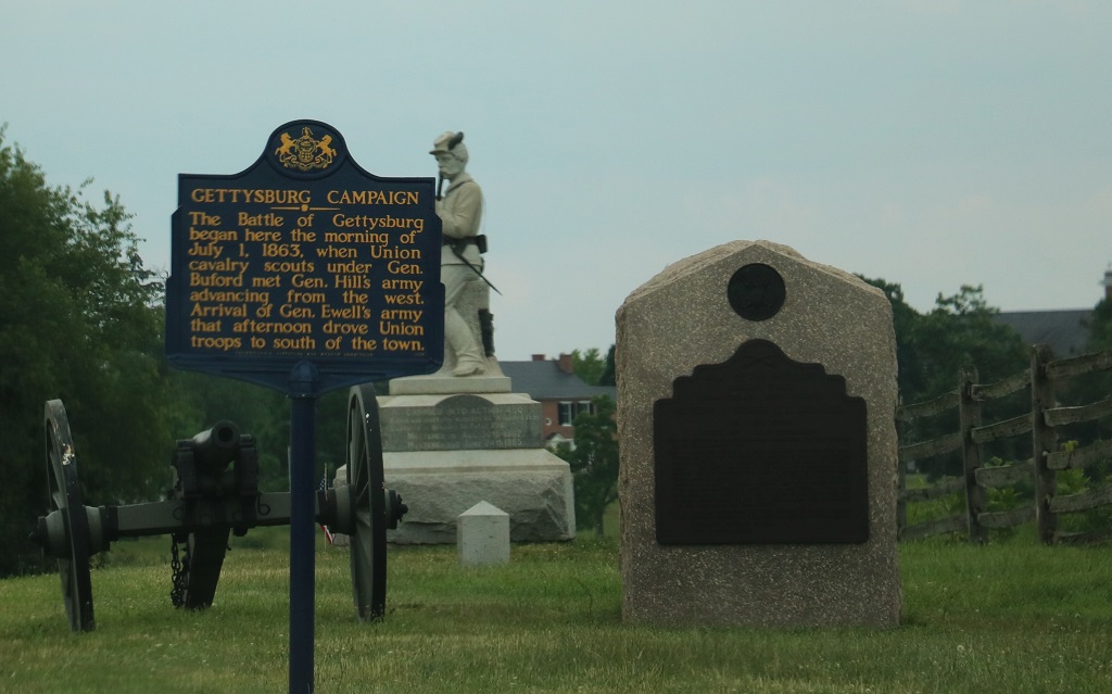
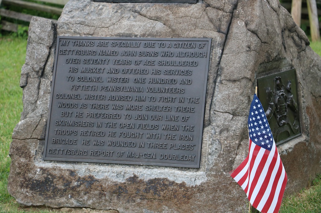
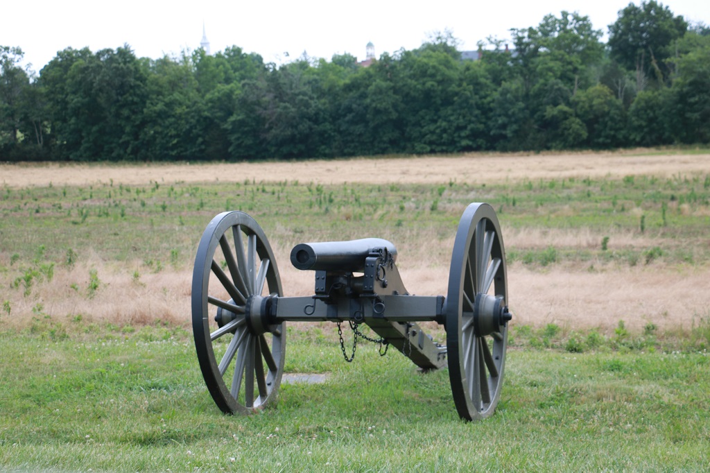
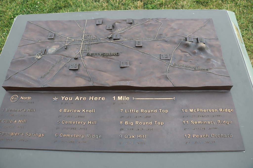
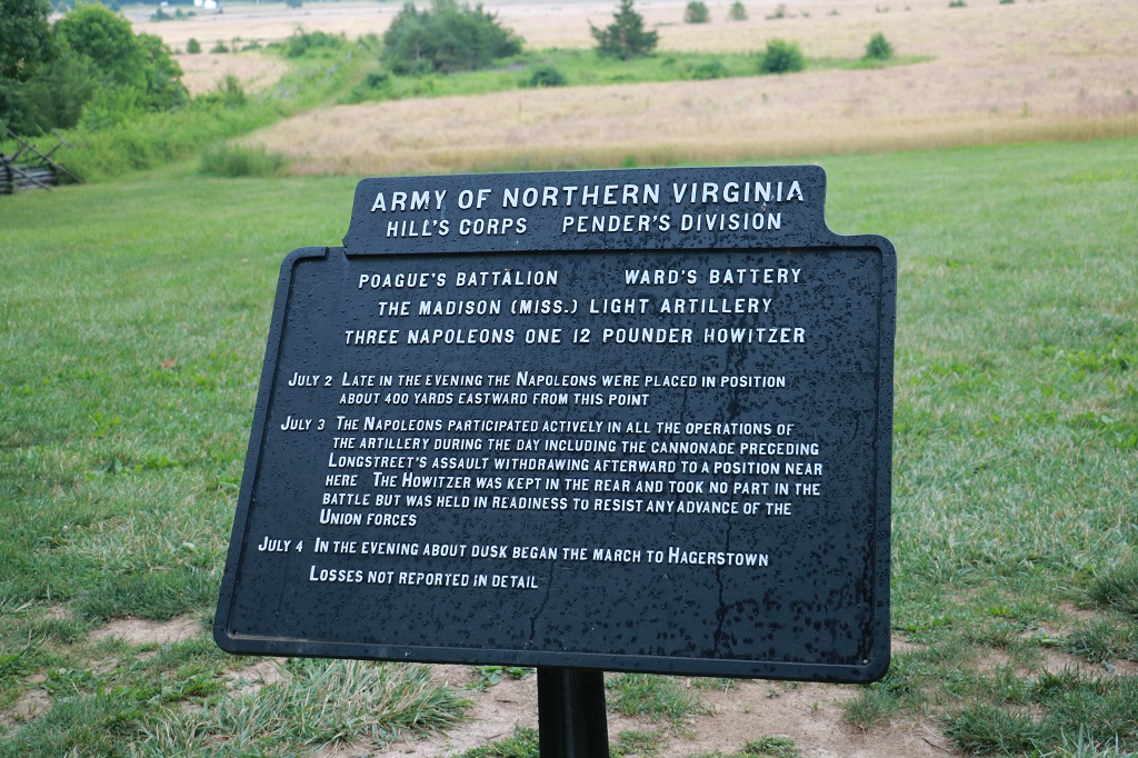
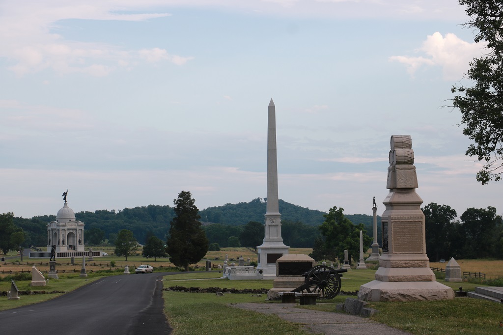
The Battle of Gettysburg is one of the most well documented battles in the world. The National Military Park comprises 6,000 acres. There are about 1,300 monuments and memorials throughout the site. There are also bronze plaques that detail the actions of every division, corp, and battalion of both sides for all three days. There are also descriptive plaques about the different cannons that the different forces used or had access to during the battles each day. A person would need to spend days to read all the information on all of them. Most of them also note how many men made up each army division or group and how many died, were wounded or were never found when the three days were concluded.
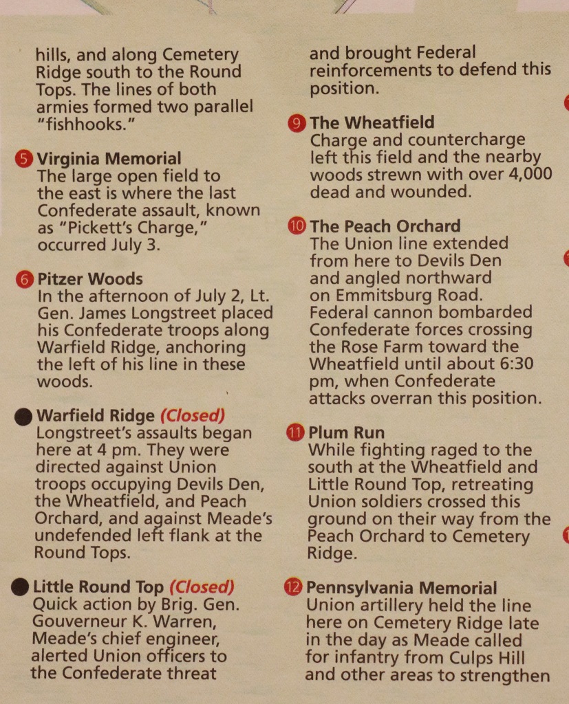
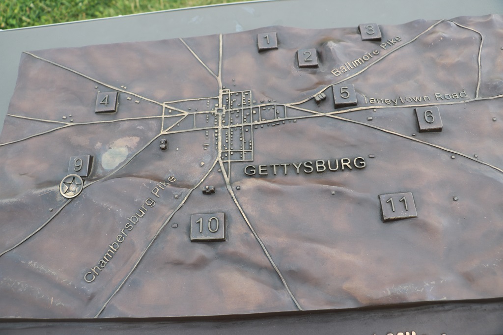
I took a photo of the map of the Auto tour and pictures of the short bit of info printed about each stop. The tour was in chronological order of what happened on each of the three days, so we overlapped places on our journey.
Here goes:
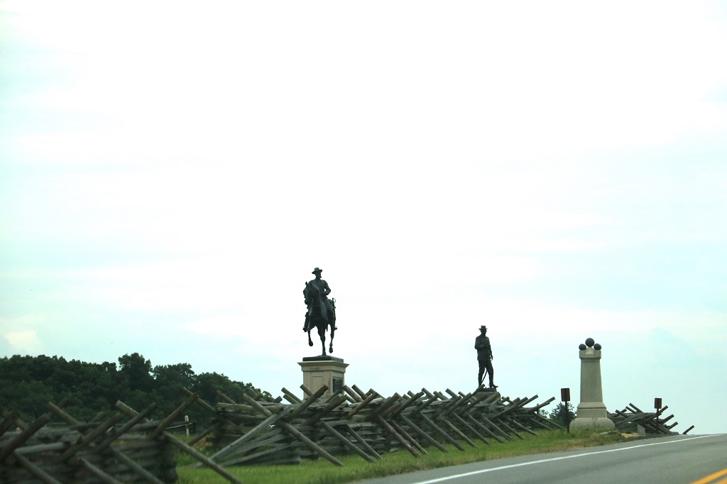
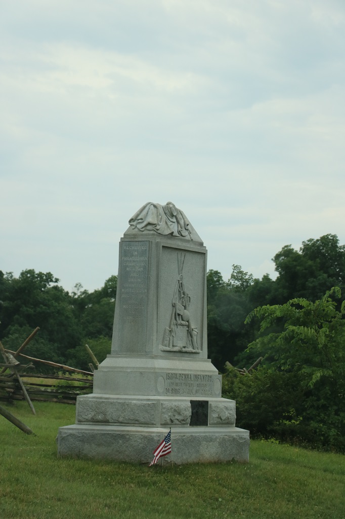
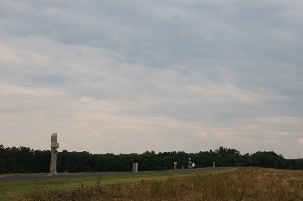
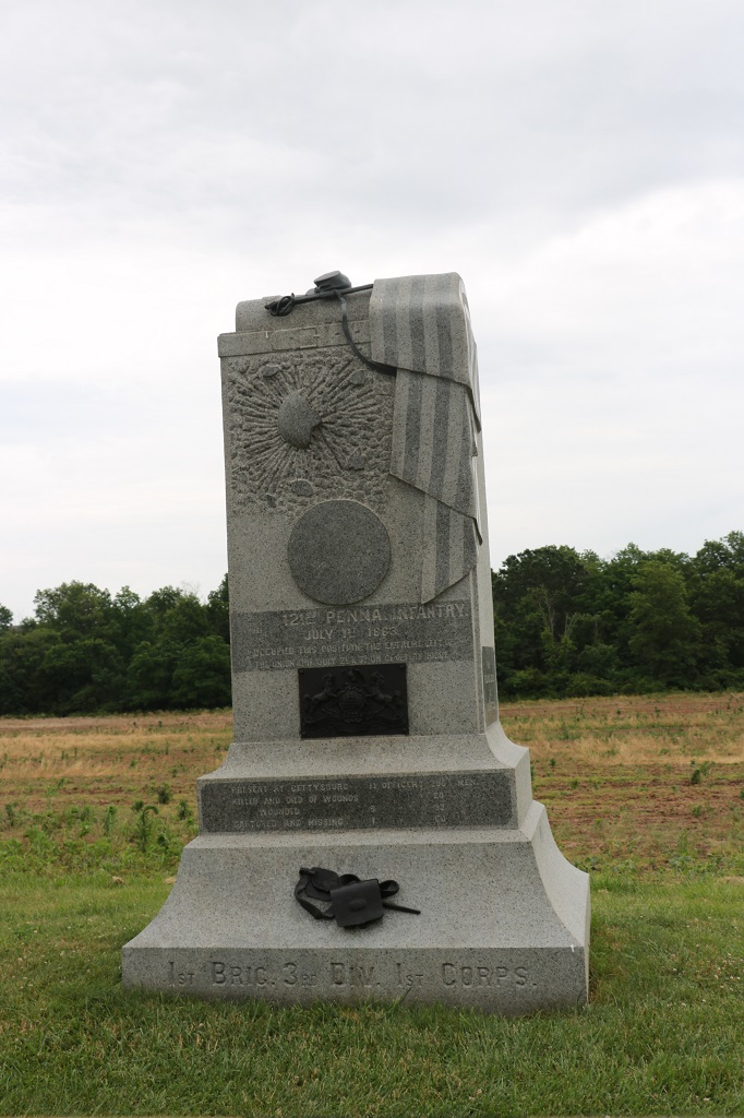
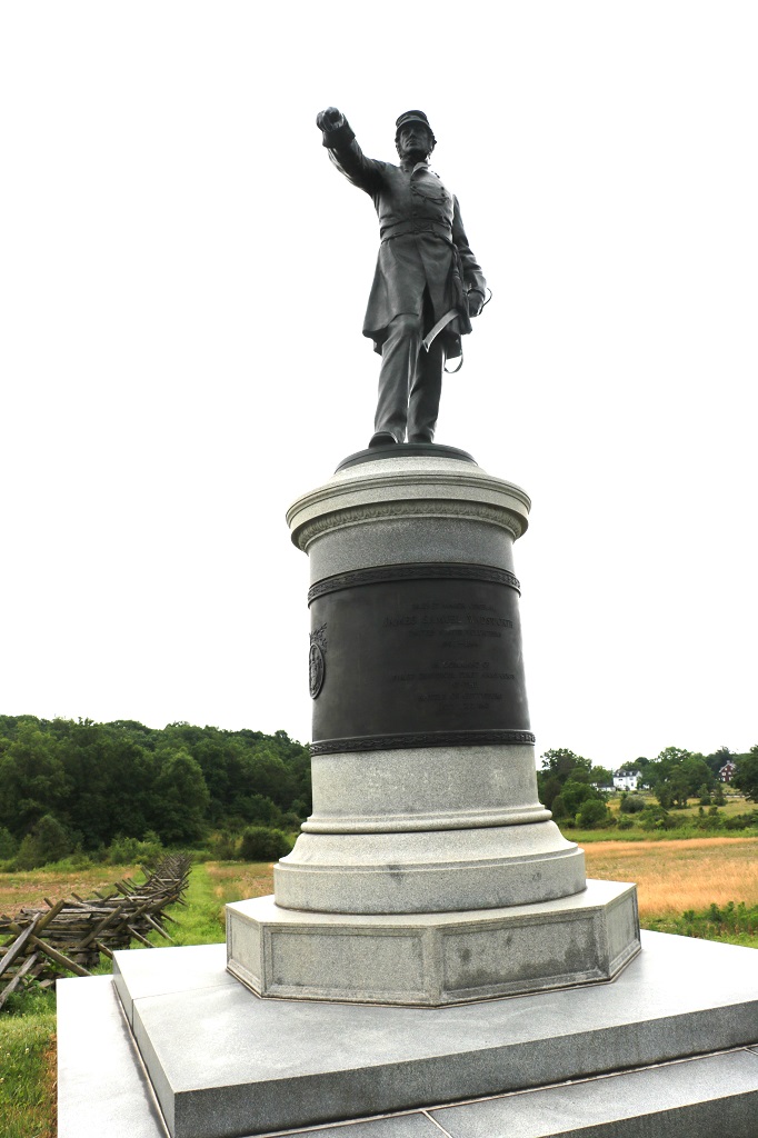
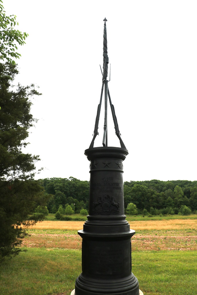
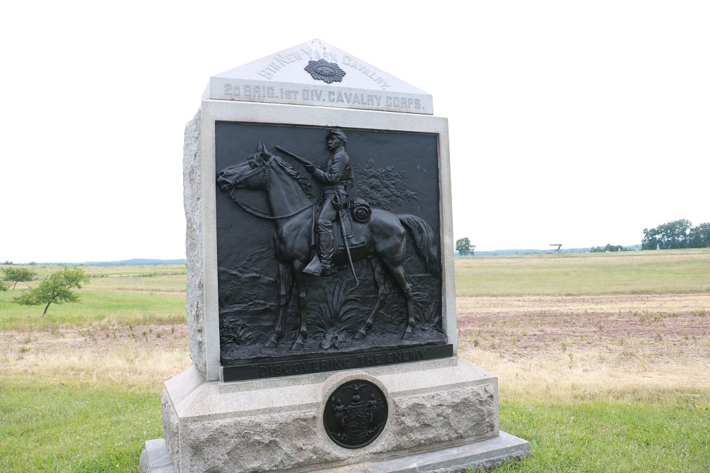
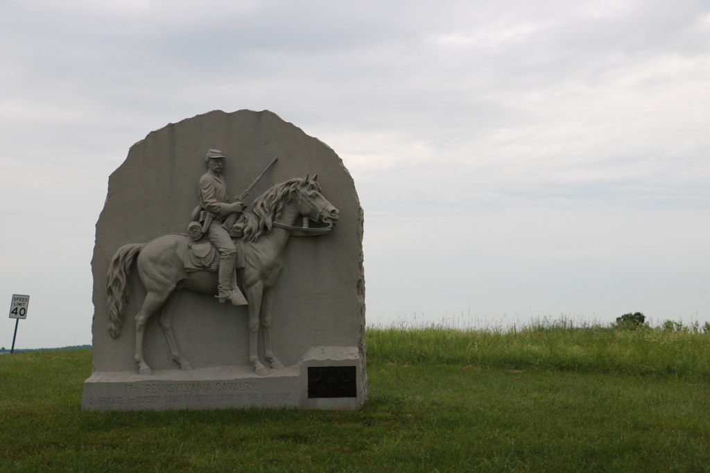
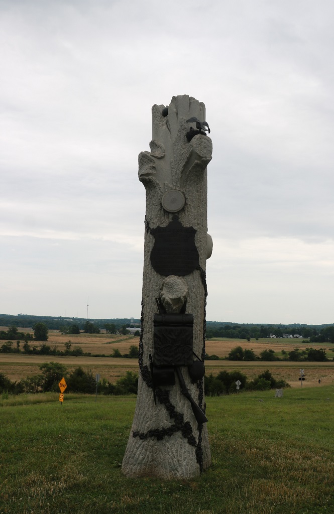
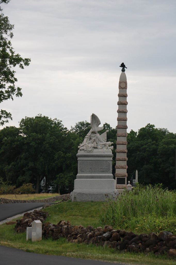
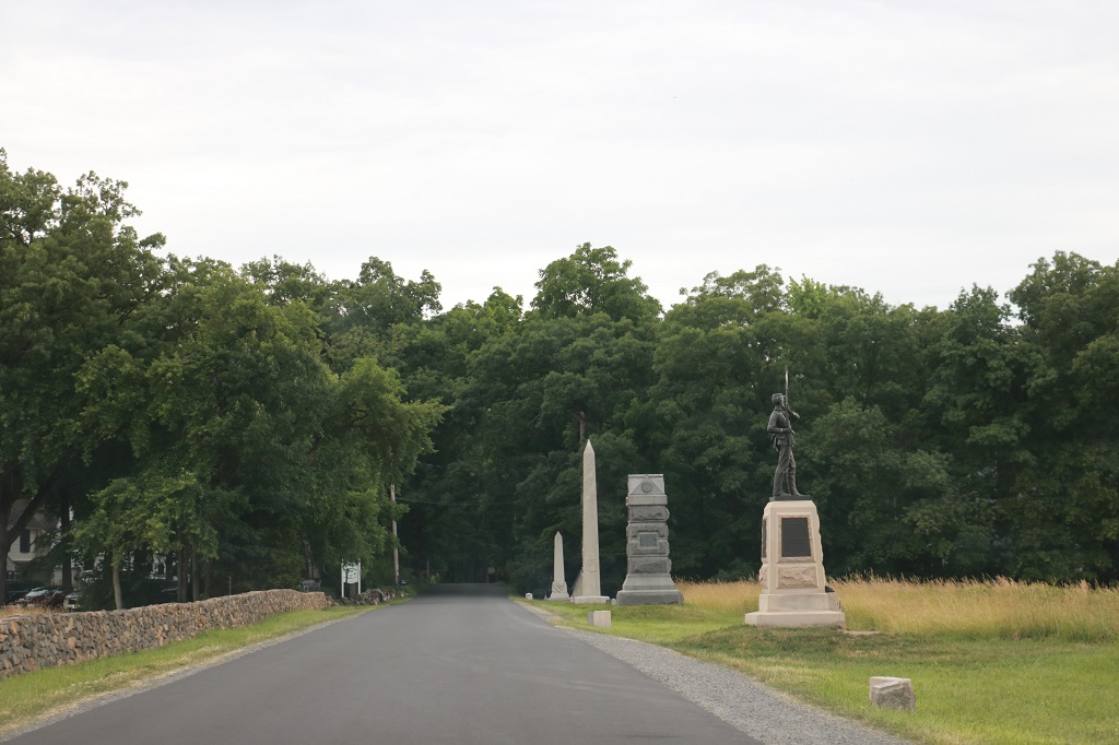
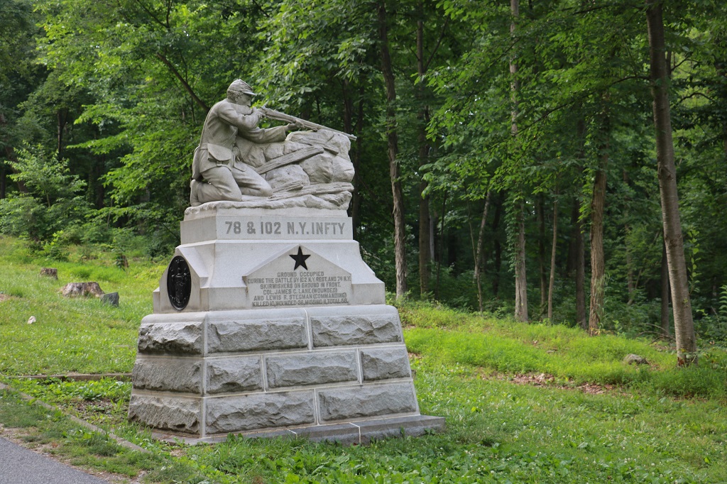
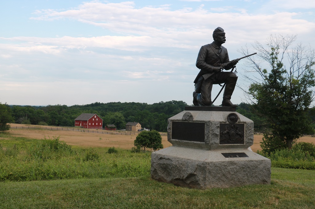
Over the years memorial monuments have been erected by all of the states that engaged in the battle, and the various military forces in their particular divisions, or corps have also added memorials. They line both sides of the roads, are further into the fields, even in the woods. It is really quite amazing. Some are very elaborate, others are very simple. All are heartfelt.
We had taken too early of a turn into the park on our way to the Visitor’s Center and drove past all the above monuments before we actually started the Auto Tour. The tour was downloaded to John’s phone via a QR code at the Visitor’s Center and an audio commentary would begin at each of the 16 stops. I wasn’t about to try figure out where the above monuments should be inserted to be in the correct order as per the Auto Tour. I had a hard enough time on the tour restricting myself from photographing everything we drove by. Or worse yet having John stop so I could read everyting. The Auto Tour takes a minimum of three hours and the gates to the park close at sunset. We arrived at 3 PM so there was no way I could see everything. No one could in one day anyway.
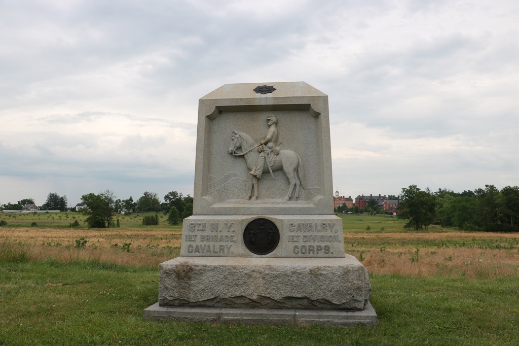
We started the Auto Tour about 4 and finished it just after 7. Photos of monuments and placards begin now. There is no rhyme or reason to the ones I photographed. I just liked them – well except Cavalry – they had to be selected of course. And even though there are MANY in this blog, I photographed even more.
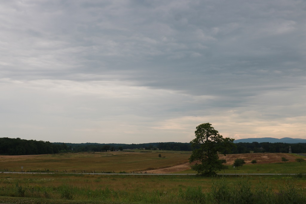
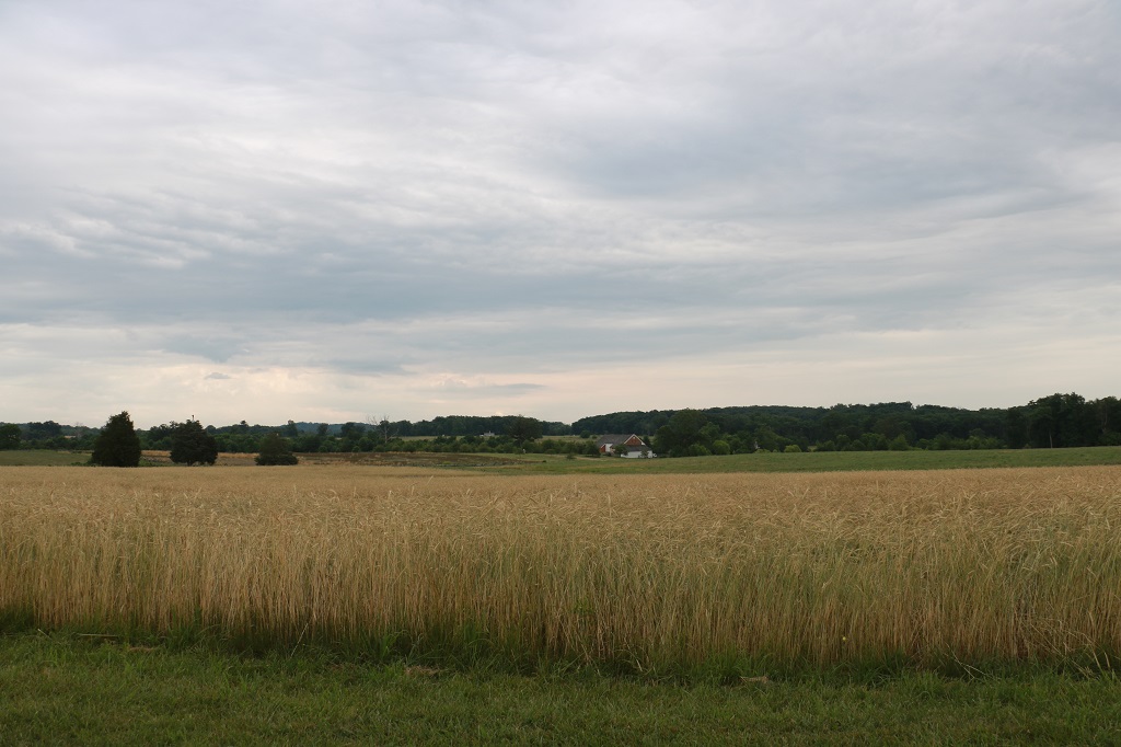
I did try to take some pictures of the scenery as well so it is not all monuments and placards.
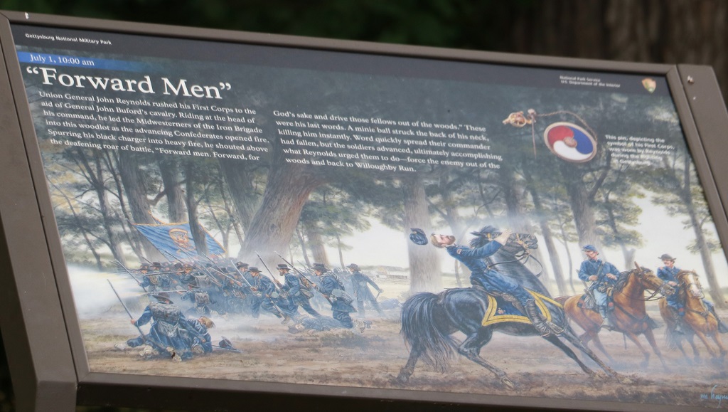
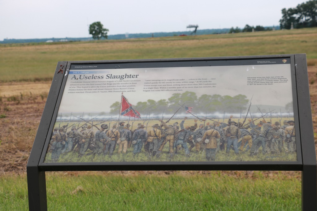
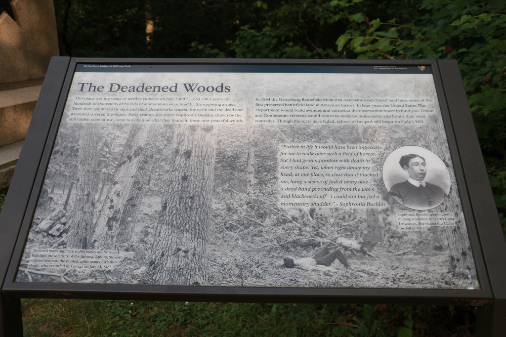
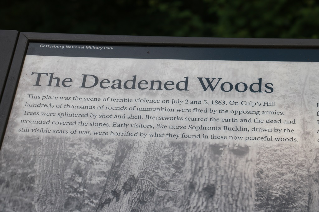
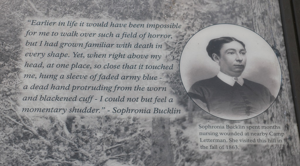
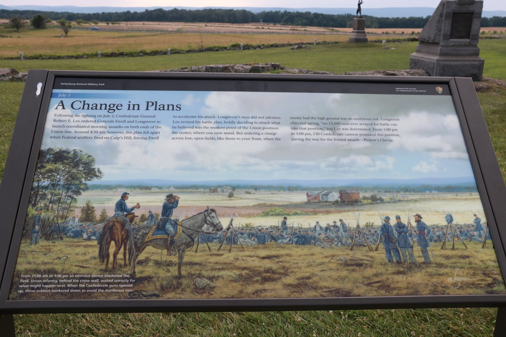
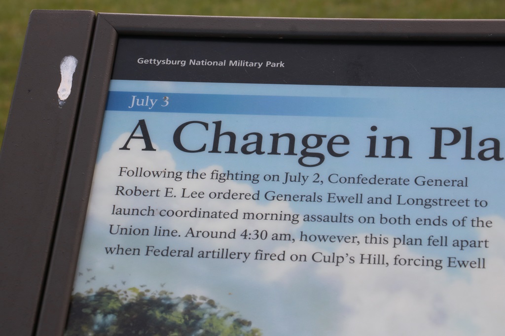
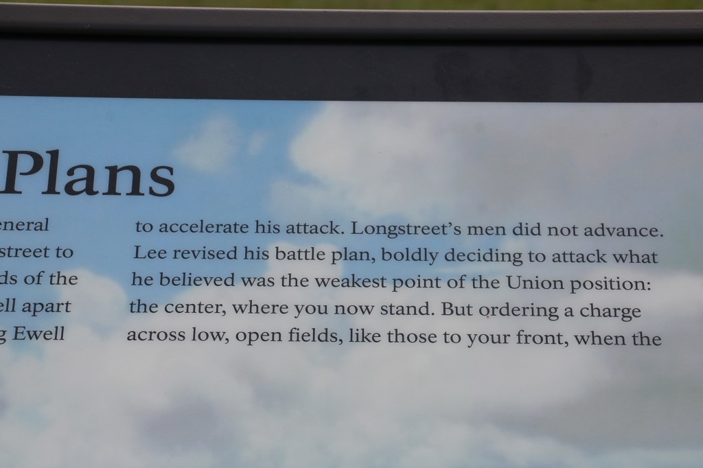
For most of the information boards I take a photo of the entire thing and then take pics of the text so it is easier to read without having to zoom in. Many of the pictures on the placards help grasp the significance of the information they contain. The two below got missed in the individual shots. Sorry.
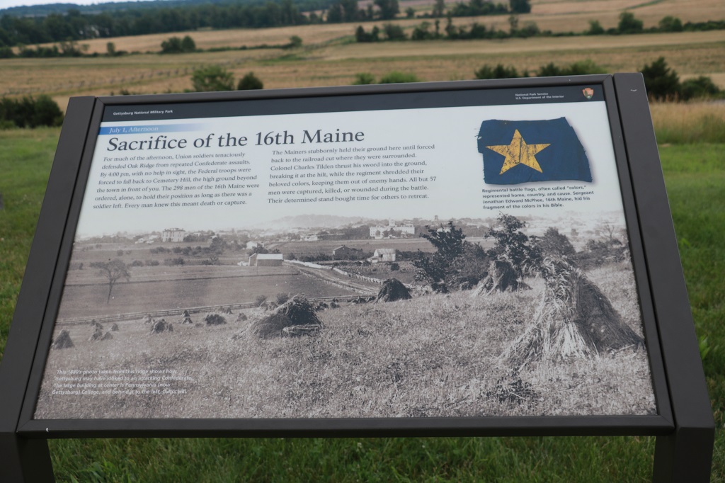
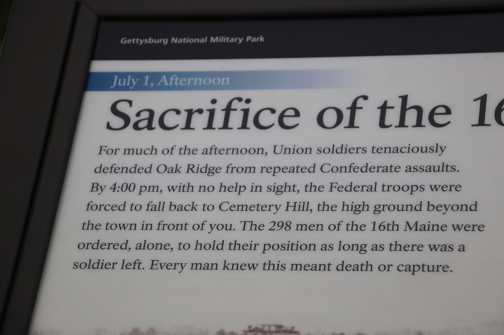
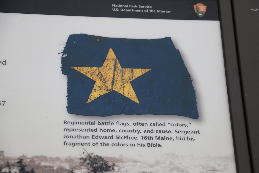
If you can make it out, note the date and time on the plaques that show the progress of each days battles.
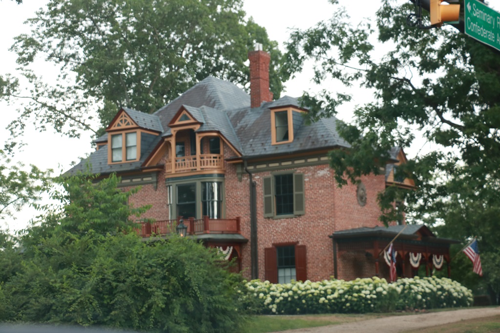
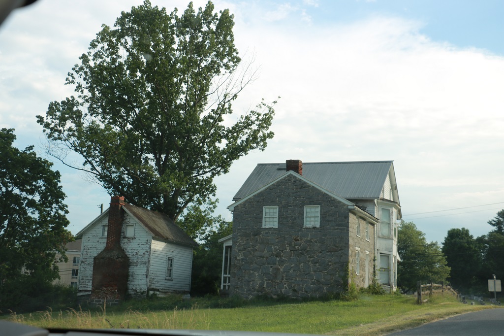
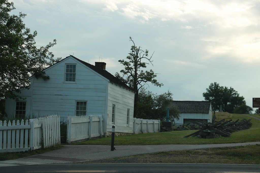
There are quite a few private houses that are surrounded by the Military Park.
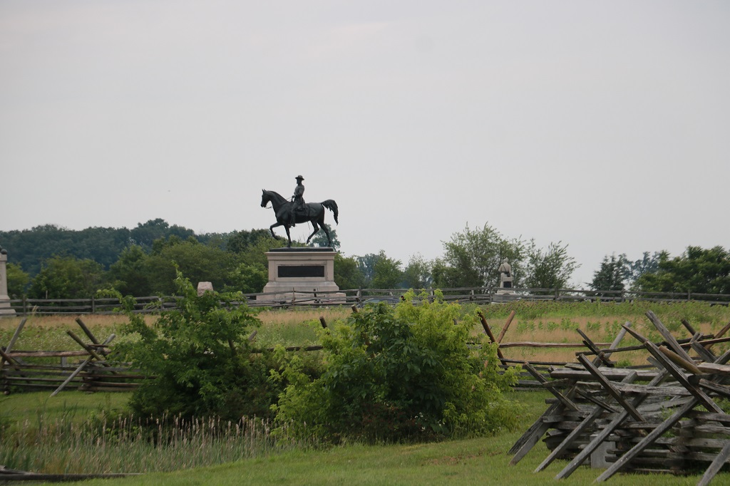
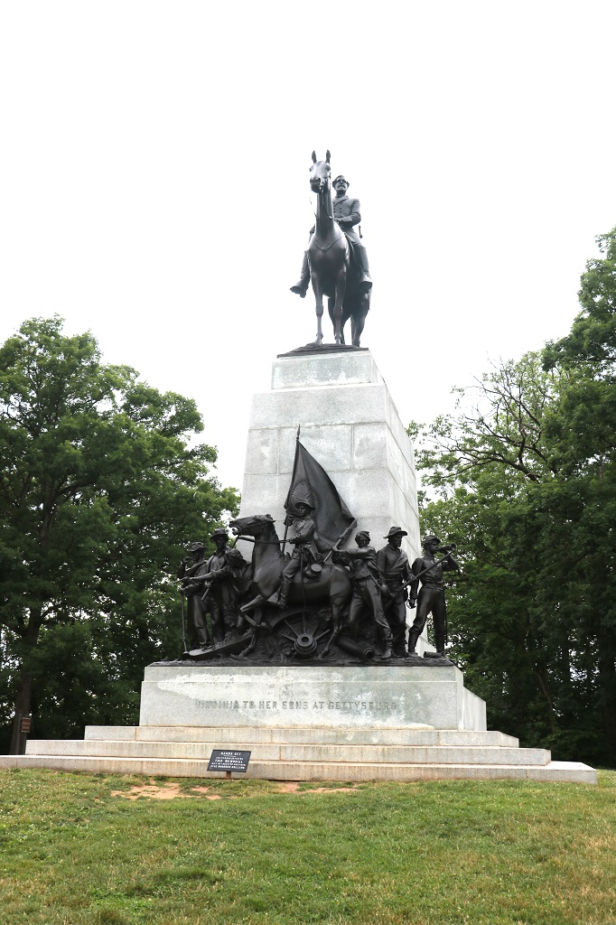
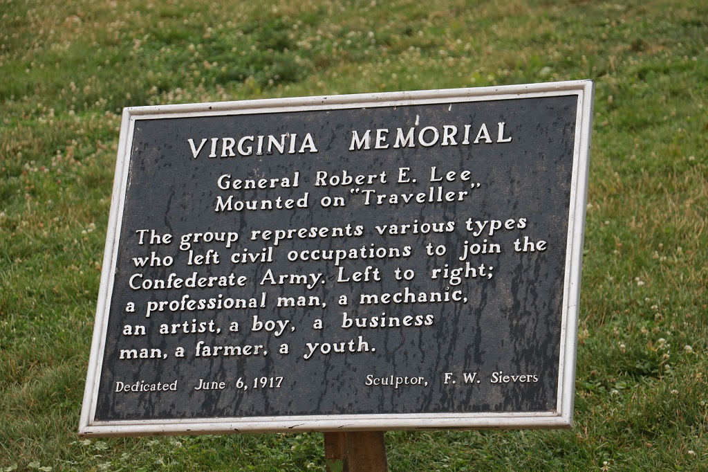
Memorial of the State of Virginia to the Virginia Troops at Gettysburg. General Robert E. Lee is on top on his horse Traveler and it is said to be the best likeness of Lee ever done. This is the largest Confederate momument and was the first Confederate State monument in the park. It was actually quite controversial at the time, since the Unites States forces won the battle.
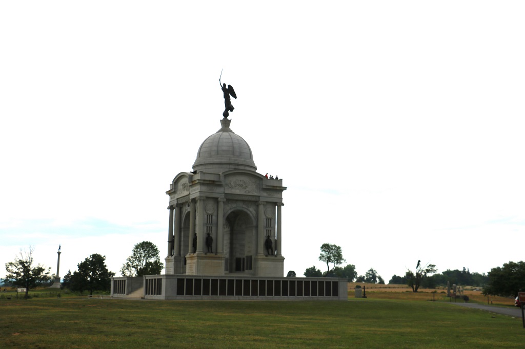
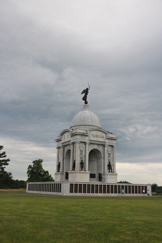
The Pennsylvania Monument is the largest in the park and unique in that the panels around the base contain the names of all 35,000 Pennsylvanian men who fought at Gettysburg. If you look closely you can see people near the base of the dome on the observation deck.
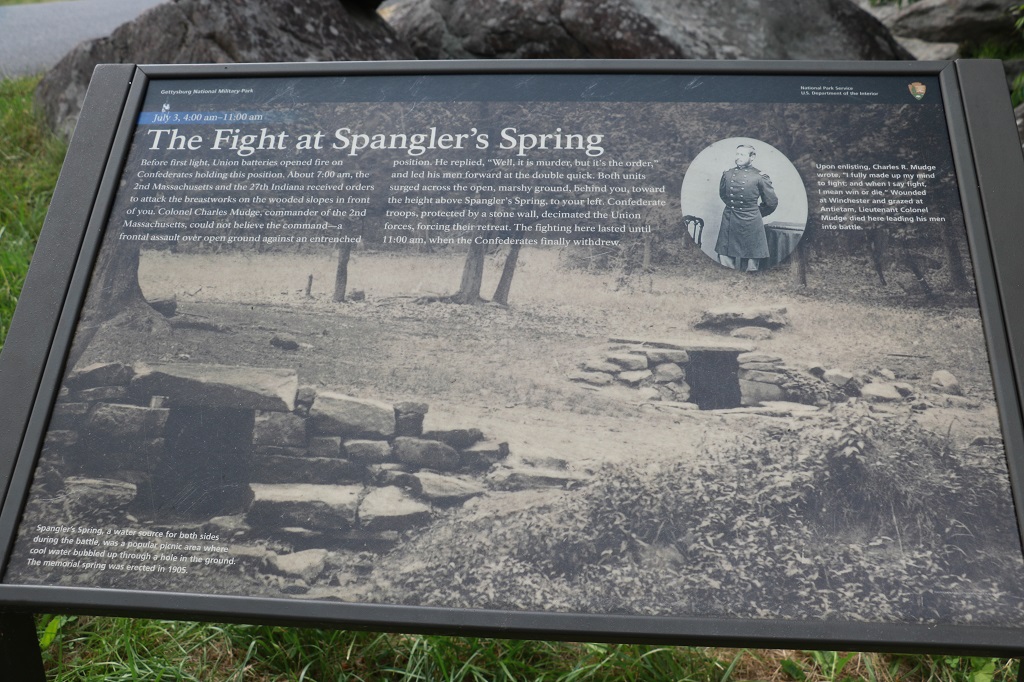
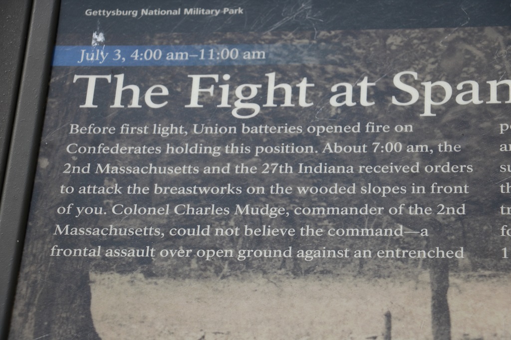
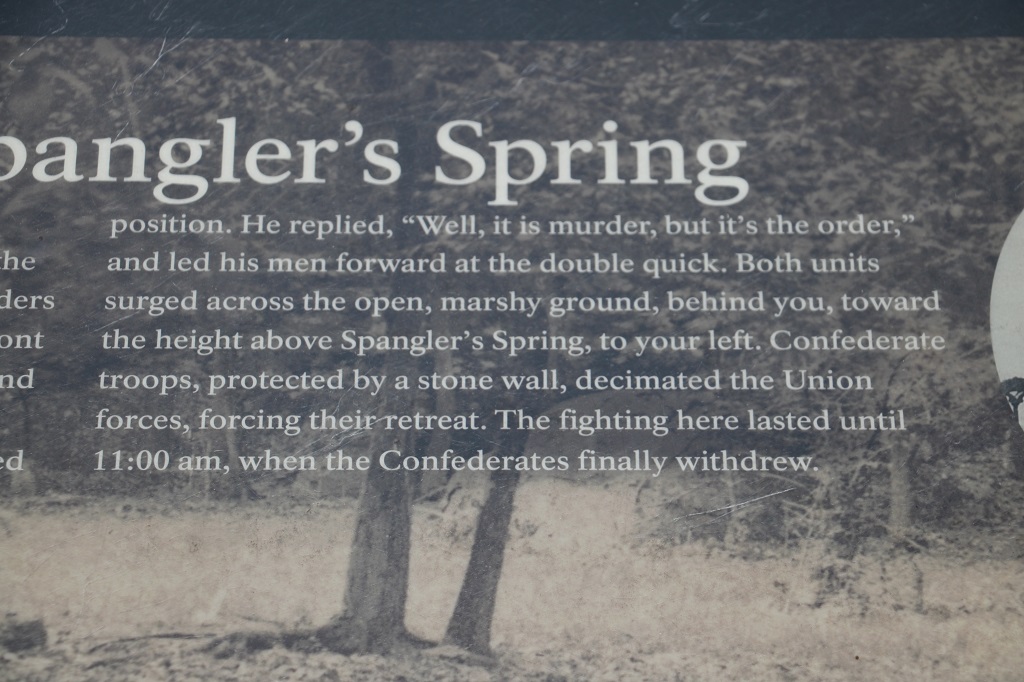
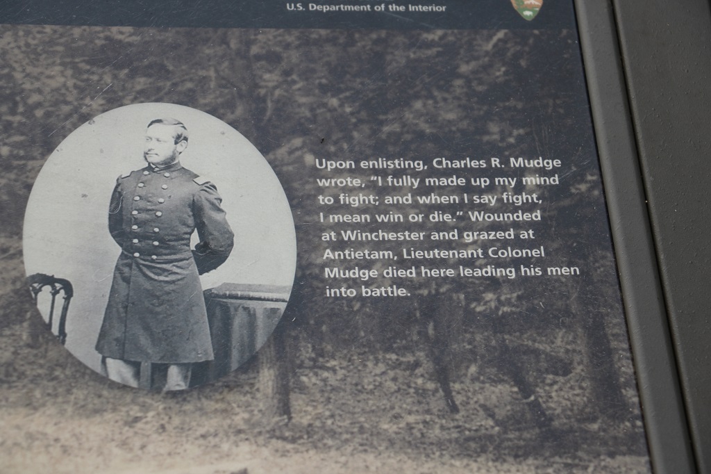
These fellows in Confederate dress were erecting a small campsite near Spangler’s Spring. I don’t know if some type of re-enactment was to take place or what.
The casualty rates were so high with so many thousands of wounded that every church, school, barn or large building in the area was commandeered as a field hospital.
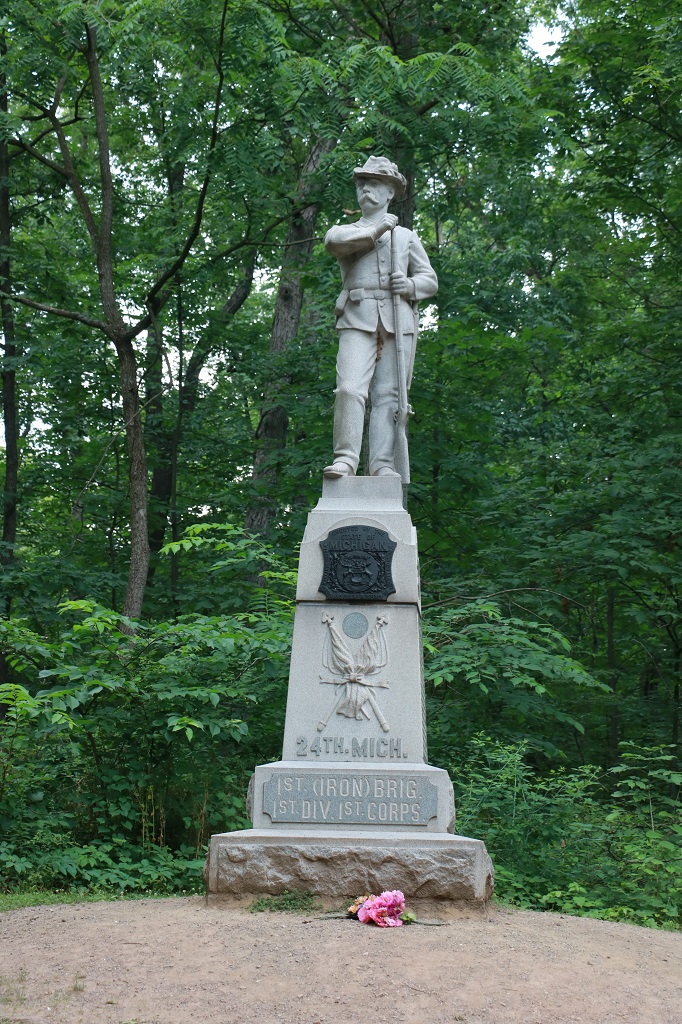
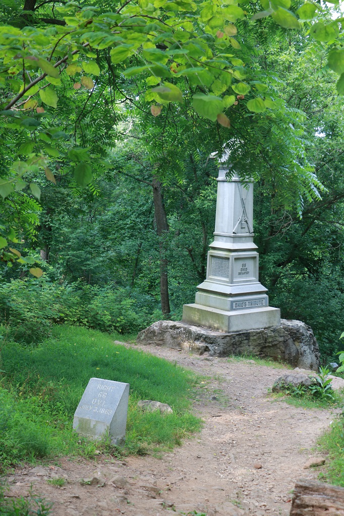
John is halfway up the third flight of stairs. There were 96 steps. He was nice and counted them. He knew that was something I would do. While he was climbing to the top I went down a short rugged path in the woods and found the Ohio Mounument.
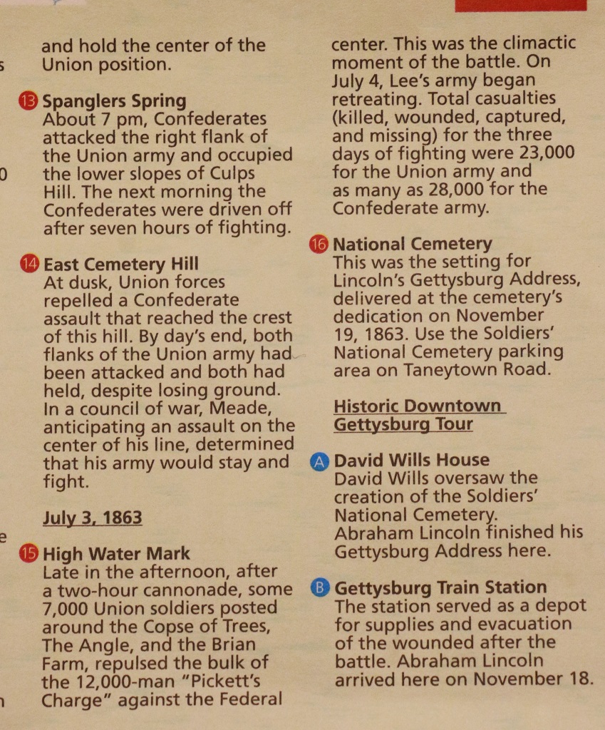
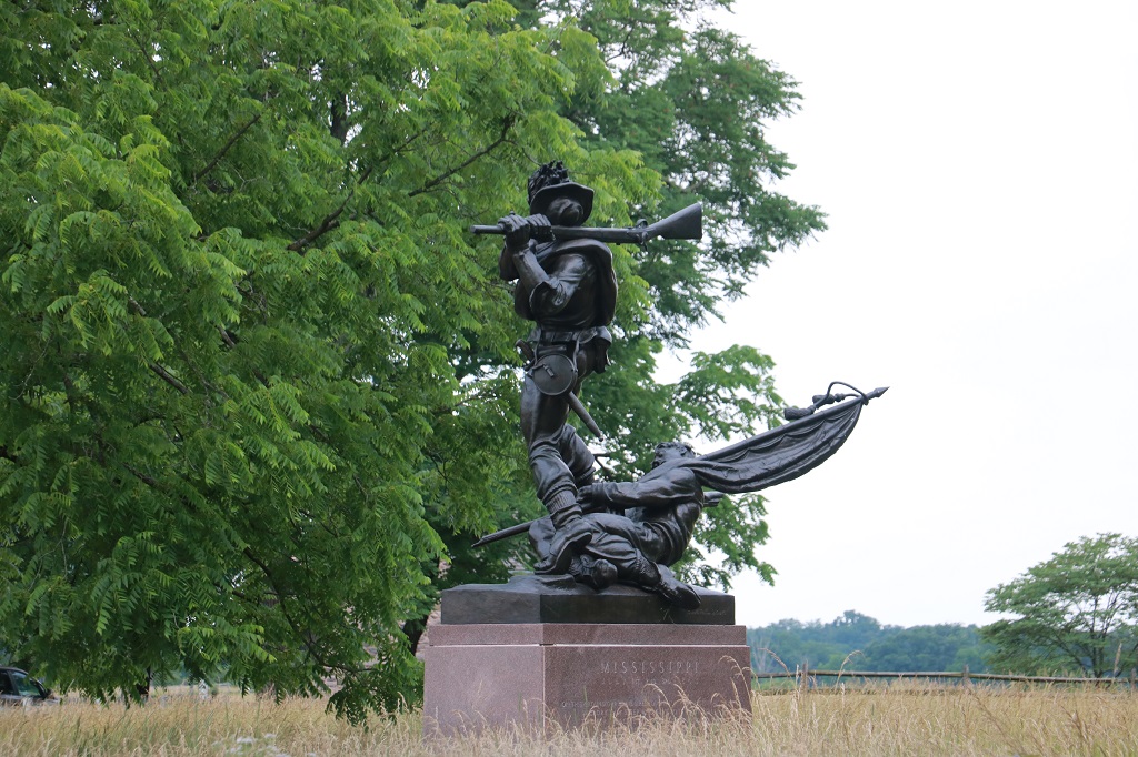
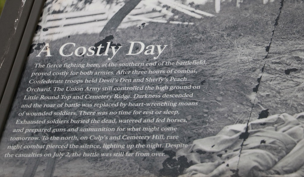
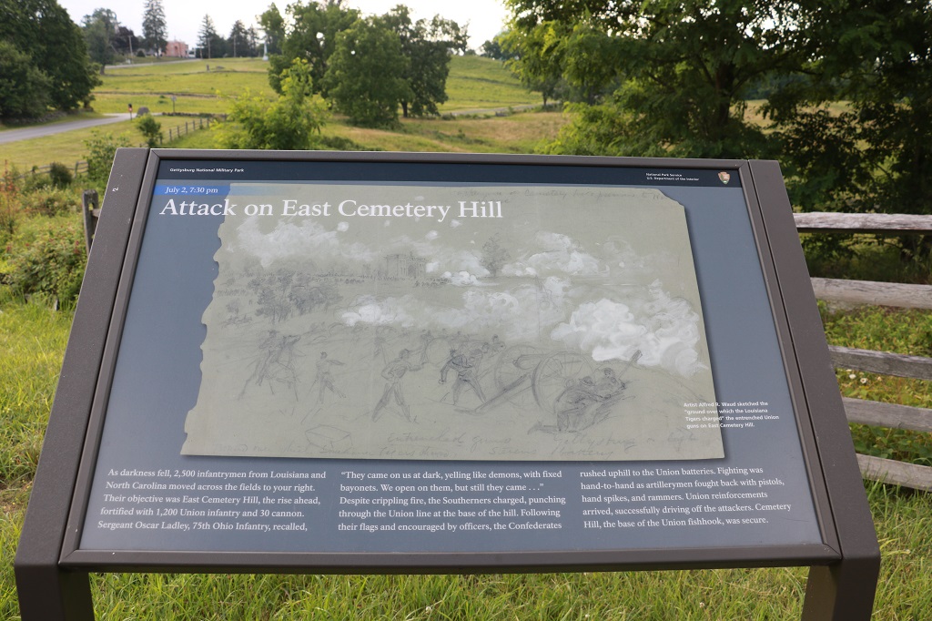
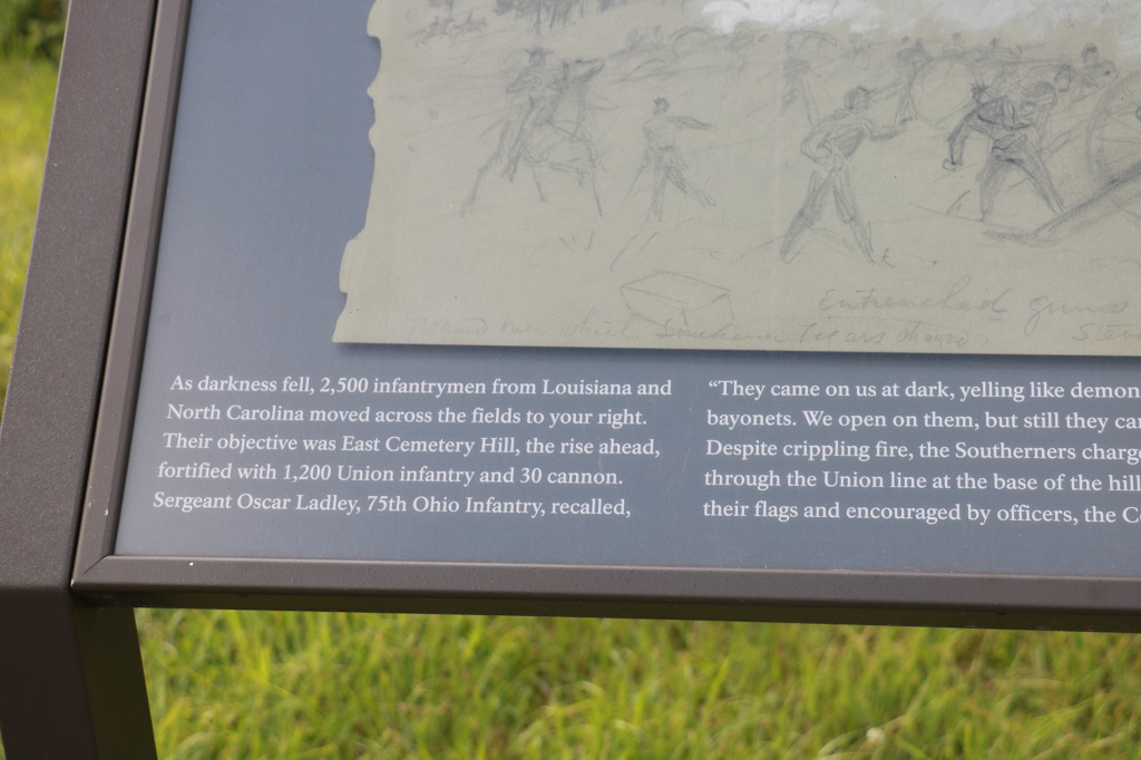
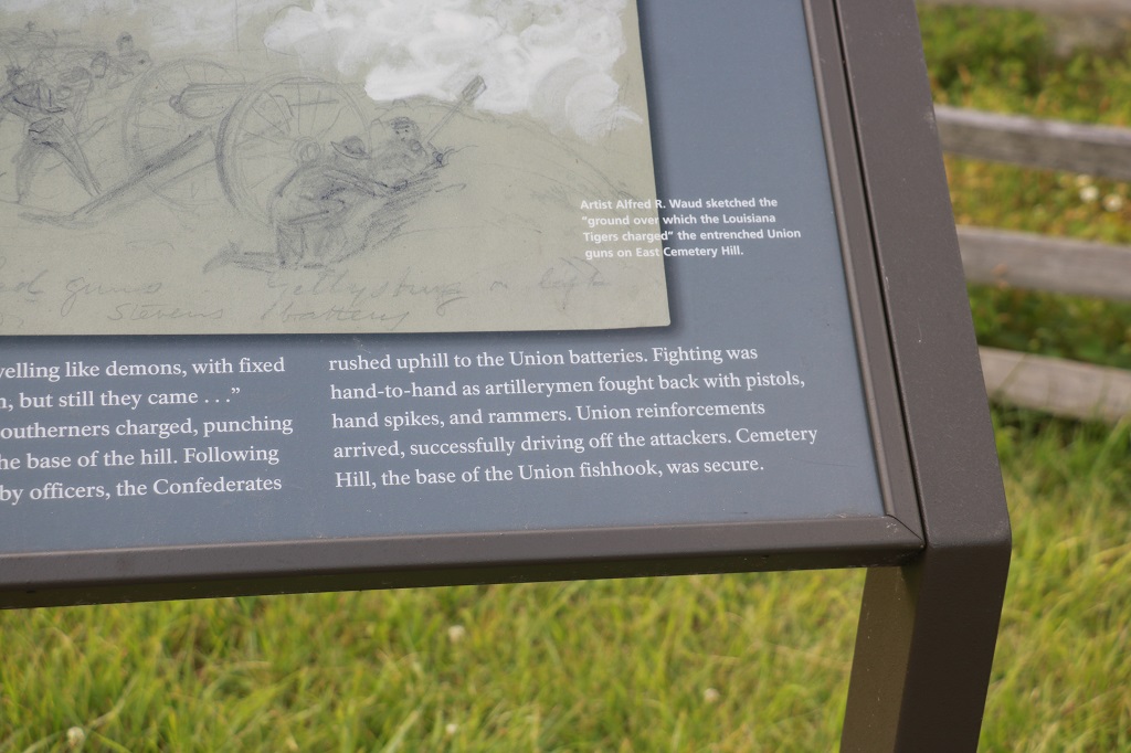
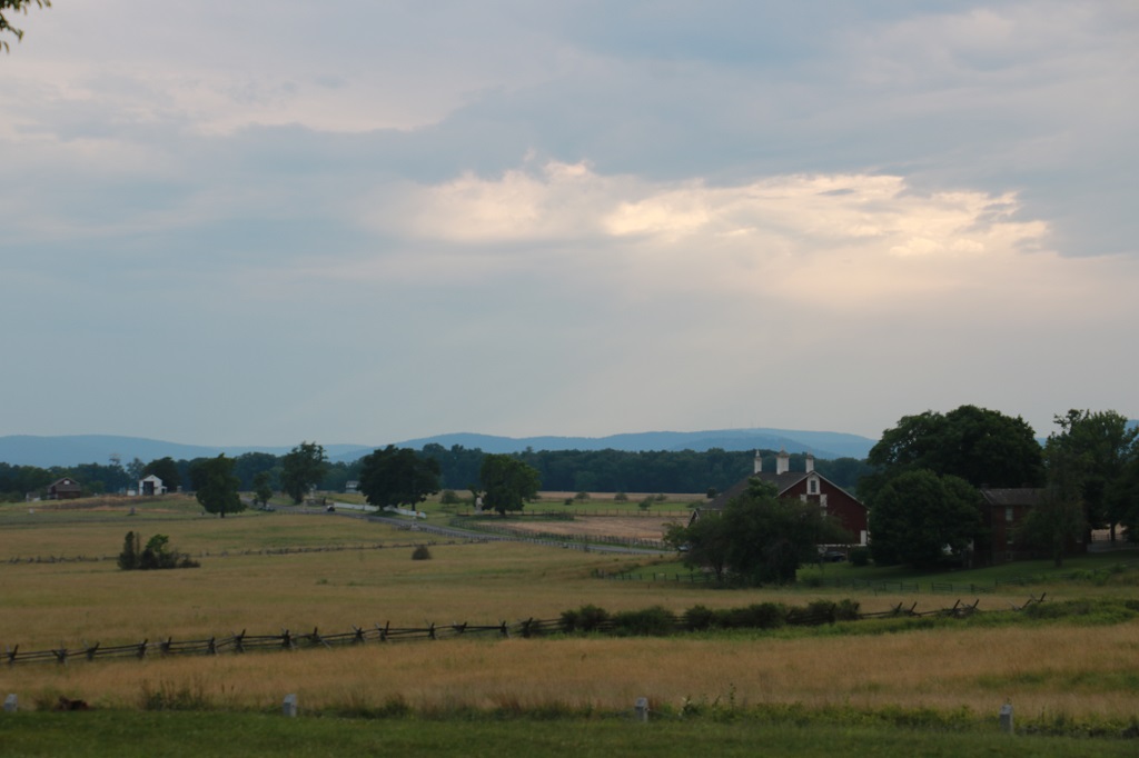
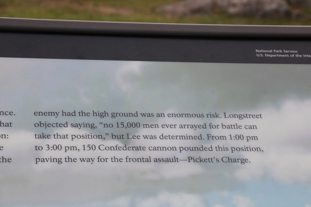
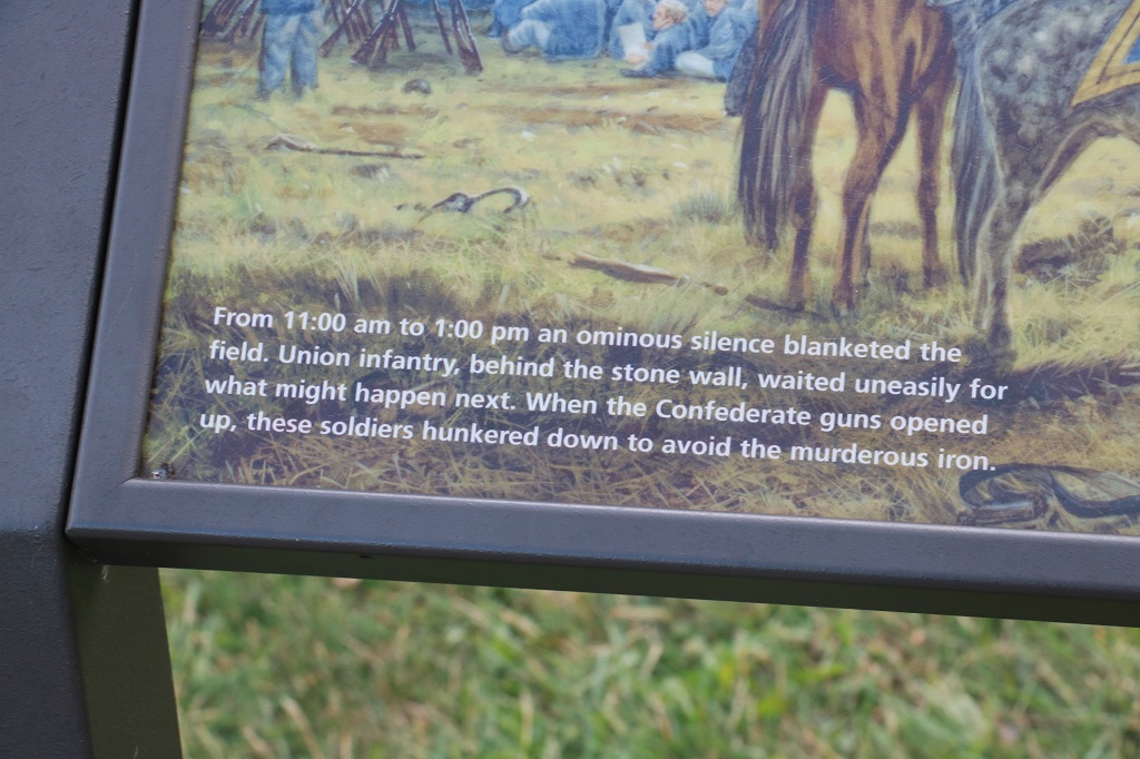
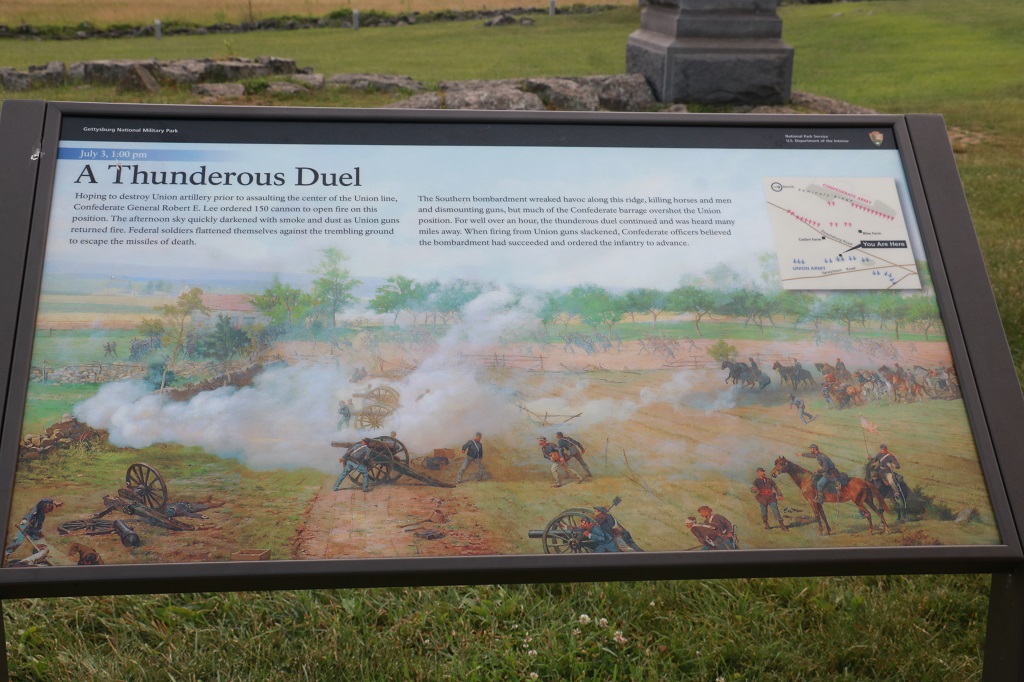
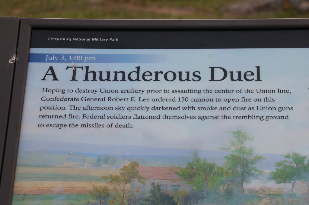
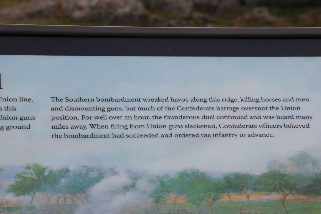
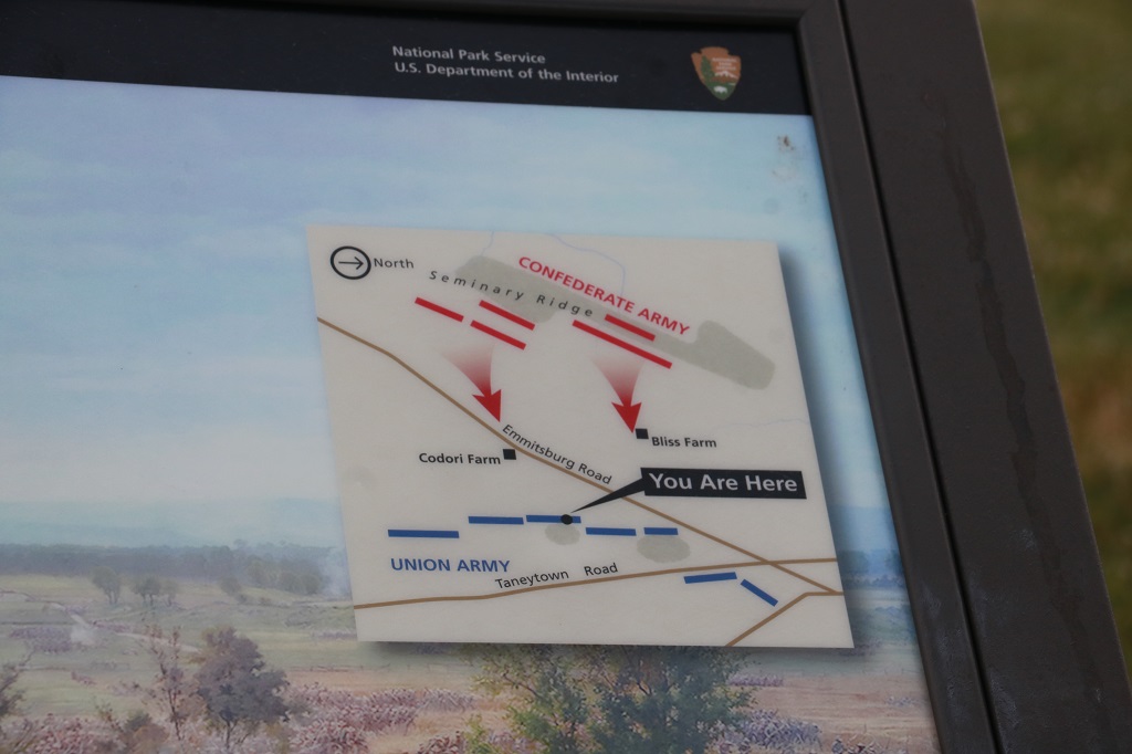
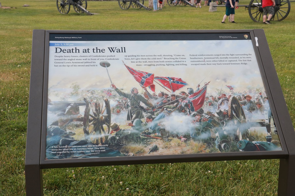
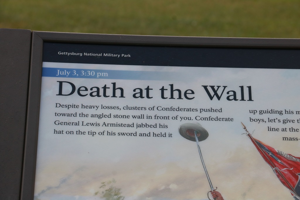
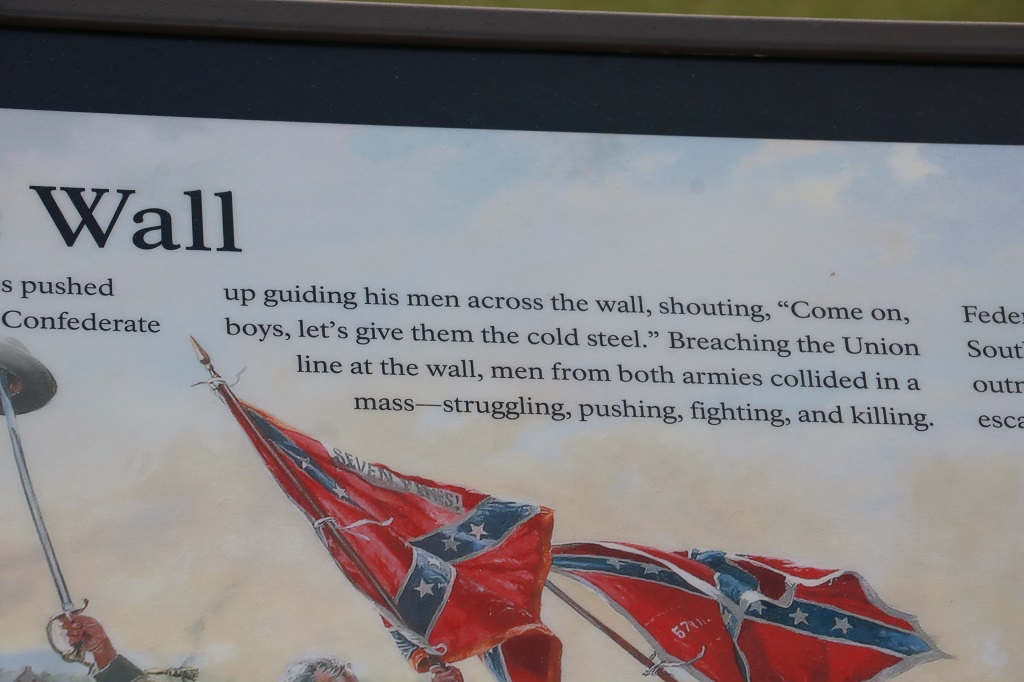
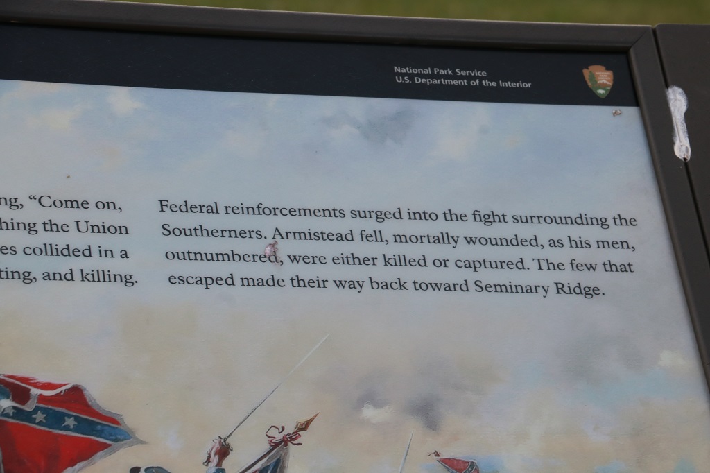
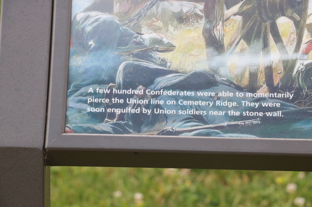
The field behind this monument is the scene of “Pickett’s Charge” when 12,000 Confederate soldiers crossed open ground to attack entrenched Union forces. The South had spent 2 hours using 150 cannon to bombard the Union line hoping to destroy their artillery and create large breaks so the foot soldiers could overrun them. They advanced in the belief this had been successful. But all the smoke created by such sustained shelling made it impossible to actually aim and many of the shots sailed right over the ridge. About 3 Confederate shells hit Cemetery Ridge per second for 2 hours. The names of all the regiments who repelled the attack are in the book of the monument.
General Lee had put General James Longstreet in charge of the battle plan to make a huge charge in order to take the day and win the battle. Longstreet told Lee he did not believe the plan would succeed with the number of men he had. It is said, that when the cannon bombardment was over and it was time to send the army across the field, Longstreet could not even verbally give the order and just nodded assent.
And with that the Battle of Gettysburg was over at a loss of thousands of men killed, wounded or missing. The repulsed Southern army retreated and the tide of the war had turned.
There were 51,000 casualties at the Battle of Gettysburg. 7,000 killed outright on the battlefield. over 32,000 wounded. United States dead totaled 3,155. Confederate deat 3,903. Wounded US 14,529. Confederate 18,735. There were also 5.365 missing or captured US troops and 5.425 missing or captured Confederate. Gettysburg was by far the bloodiest conflict of the war.
The physically and mentally defeated Southern army began a long and tortuous march homeward, hampered by their many wounded and the steady rain that caused flooding on the Potomac River. General Meade, leader of the Union forces, did not elect to follow and re-engage to probably force a total surrender. Something that President Lincoln was not happy about because he did not want the war and wanted it ended quickly. It dragged on for almost two more years.
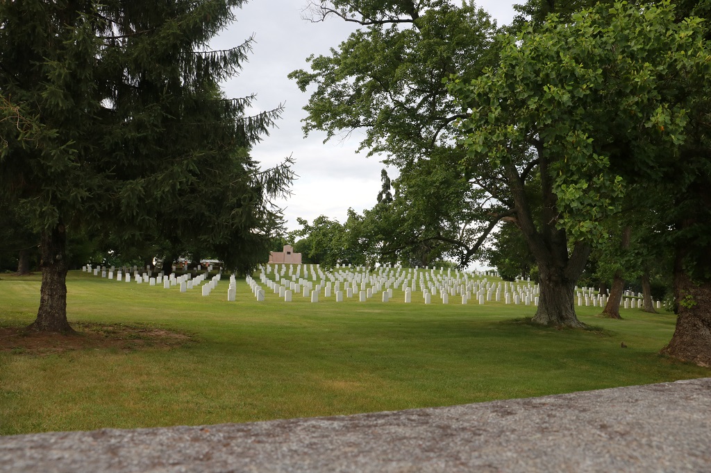
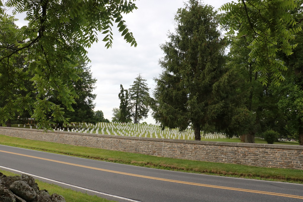
Tjere are 3,500 Union soldiers buried in the Soldier’s Cemetery. Only 949 of them are know and have names on the markers. They are buried by State in a semi-circle so no one has more honor than another. After the battle was over and General Lee and his surviving troops retreated, the Union soldiers buried the Confederate dead; often in shallow mass graves of 20-30. Sadl, due to the heavy rains over the next few days many of the graves were uncovered and ravaged by hogs and carrion birds.
As we learned in Natchez there was a concerted effort by a team to repatriate Confederate soldier’s remains to cemeteries in the South. Weaver, a Philadelphia physician, began the formal removal of Gettysburg’s Confederate dead. He exhumed from the battlefield and shipped south, mainly to Richmond, the bodies of thousands of men — so many that Richmond’s Hollywood Cemetery has a Gettysburg Hill.
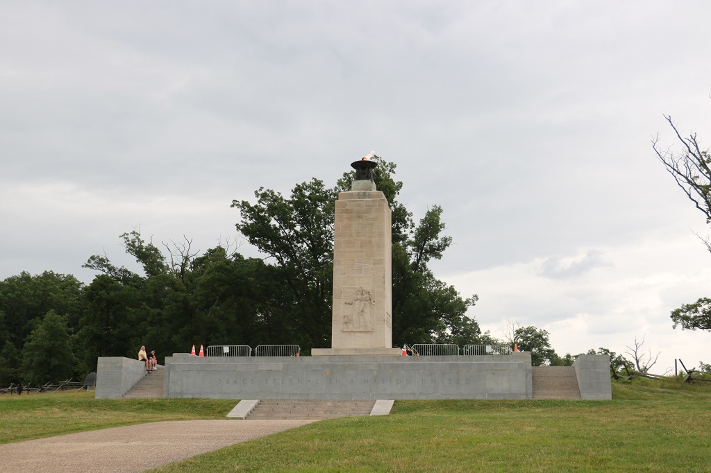
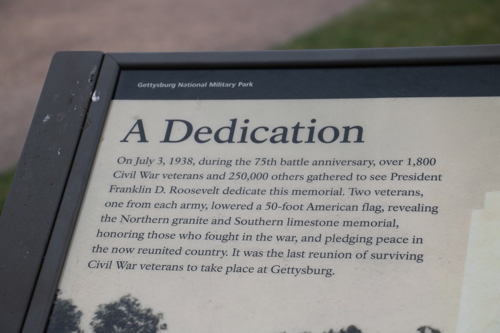
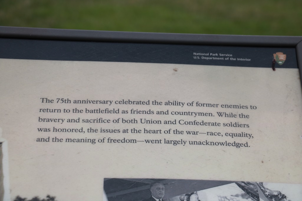
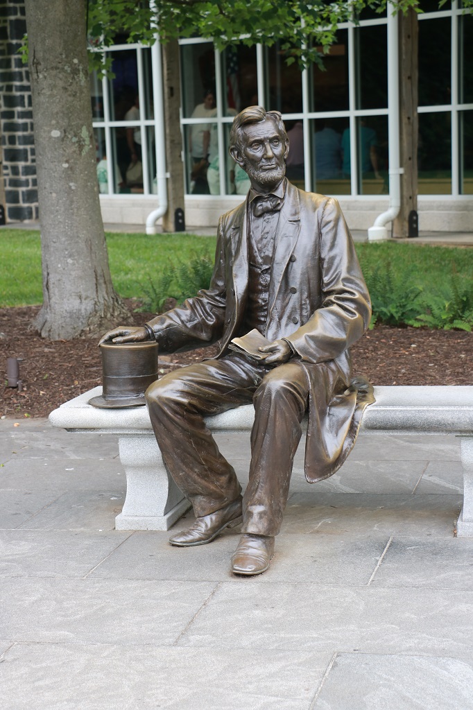
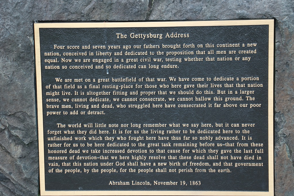
It was to the commemoration ceremony of the Soldier’s Cemetery on Nov. 16, 1863 that President Abraham Lincoln was invited to attend and speak. He finished writing his remarks in a nearby hotel the night before and on that day delivered what has become know as The Gettysburg Address. The person that spoke before him – I can’t remember his title or name – gave a rousing address for 2 hours. Lincoln spoke 272 words in 2 minutes and they have become immoratalized around the world.
We left the Military Park at 7:30, found somewhere to have dinner and checked into our hotel at 8:30. The longest day we have had so far. But my brain was full of interesting history.
The Gettysburg site reminded me very much of Culloden in Scotland that we visited in 2013 where the English virtually destroyed the Scottish clans and imposed crushing rules about speaking Gaelic, wearing tartans, etc. And they took away the Scot’s lands and gave them to absentee English lords. The battlefields stuck me as devastatingly similar.
We decided we had soaked up enough Gettysburg history and would not go back to the Visitor’s Center tomorrow to see the museum and films. Instead we will head further east and cross into Delaware briefly before entering New Jersey for the night.
I took 209 photos today. It was a very busy day. We left my cousin’s condo at 10 and continued our trip eastward towards Gettysburg. We were going to stay two nights there, but Plan B is now in affect and we will be moving on again tomorrow. This day will also be split into two parts. We did not leave the Gettysburg National Miliarty Park until 7 PM, then found a place for dinner and did not check into our hotel until 8:30 – which makes it very late to up writing a blog after I have sorted, edited and resized all the photos I think I will use.
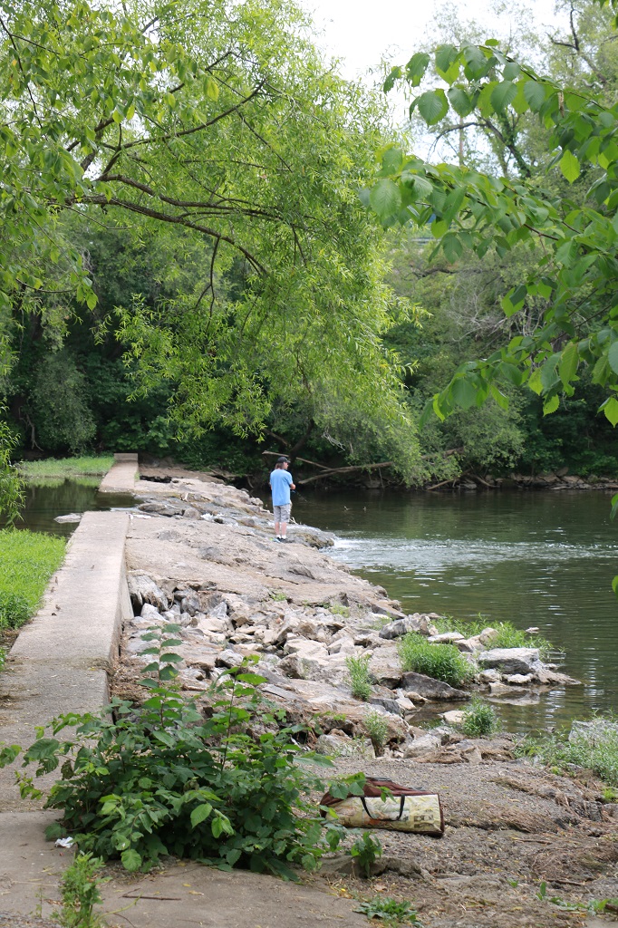
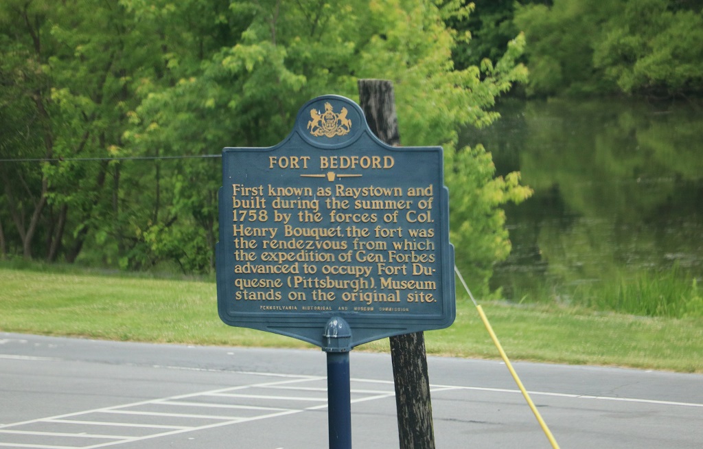
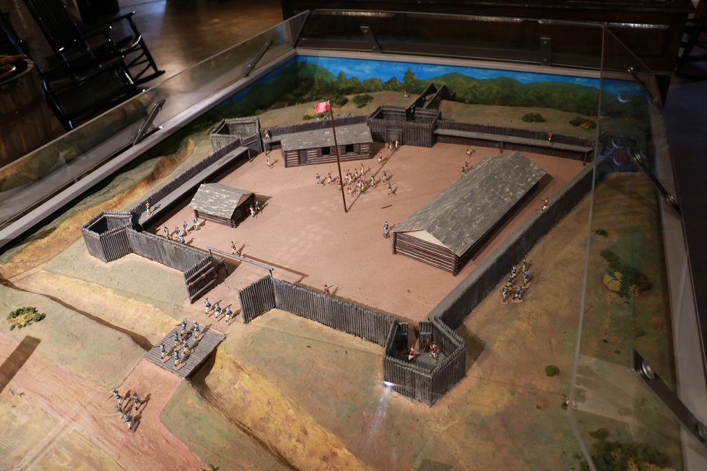
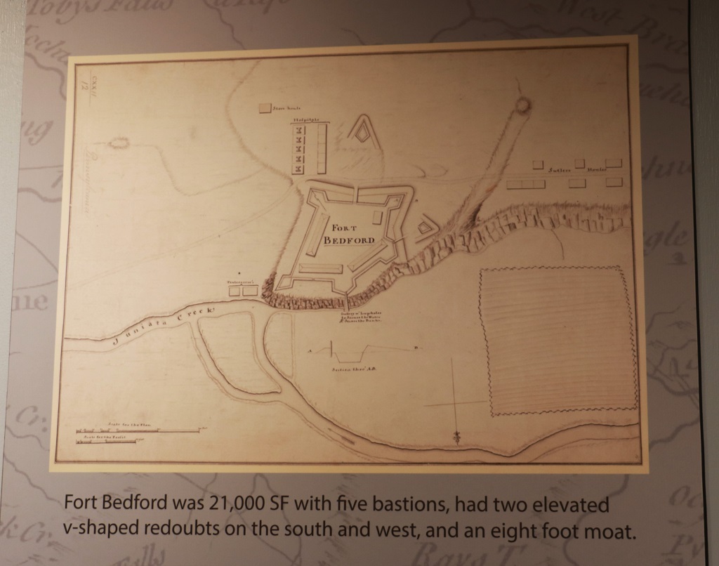
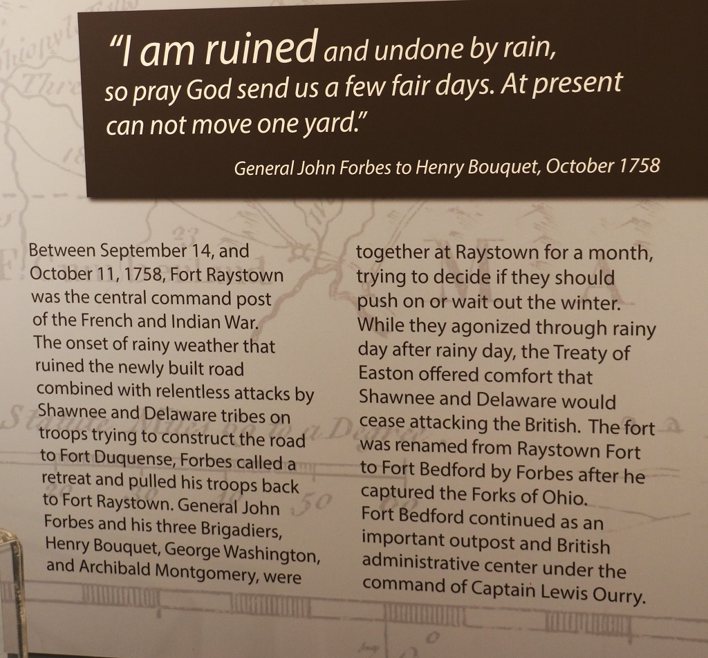
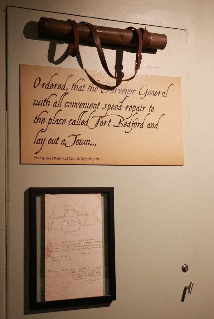
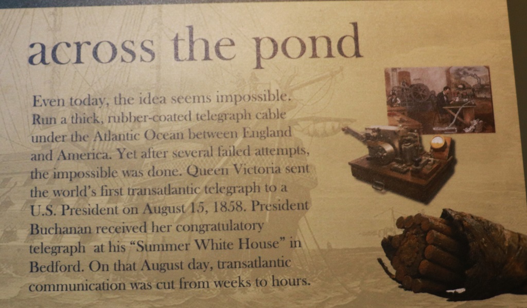
Bedford is about one third of the way between Somerset and Gettysburg. There was a strategic fort built there that was a crucial link in the British chain of fortified supply depots.
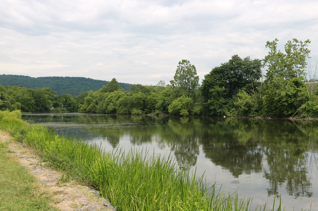
There was a nice little river flowing in front of the Fort Museum.
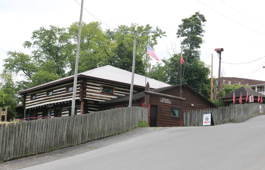
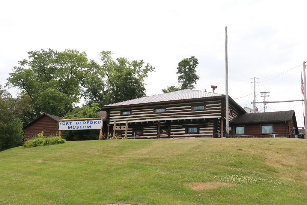
Nothing of the original fort remains. And it was much larger than the one made for the museum. They were fortunate that an archaeological excavation found evidence of the old wooden foundation.
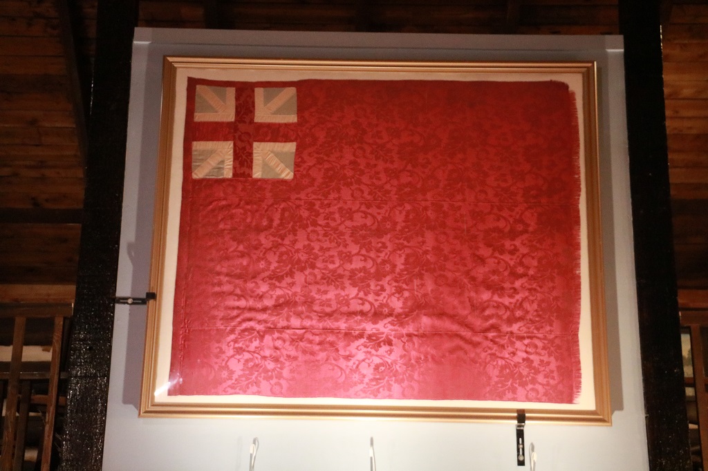
This British flag has been authenticated as from the time period of the fort.
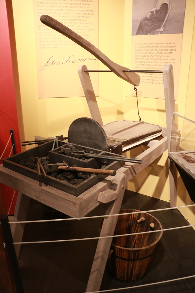
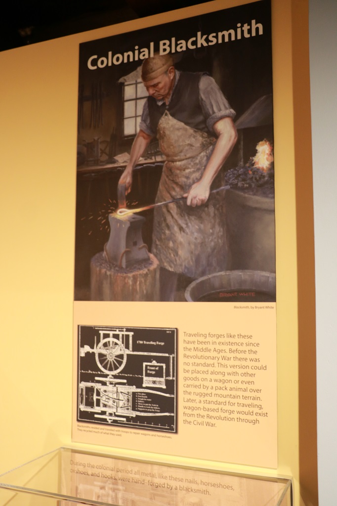
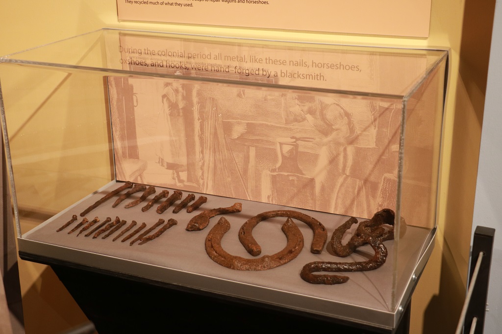
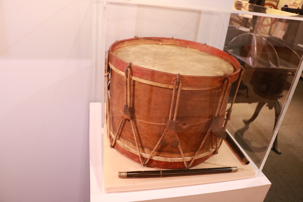
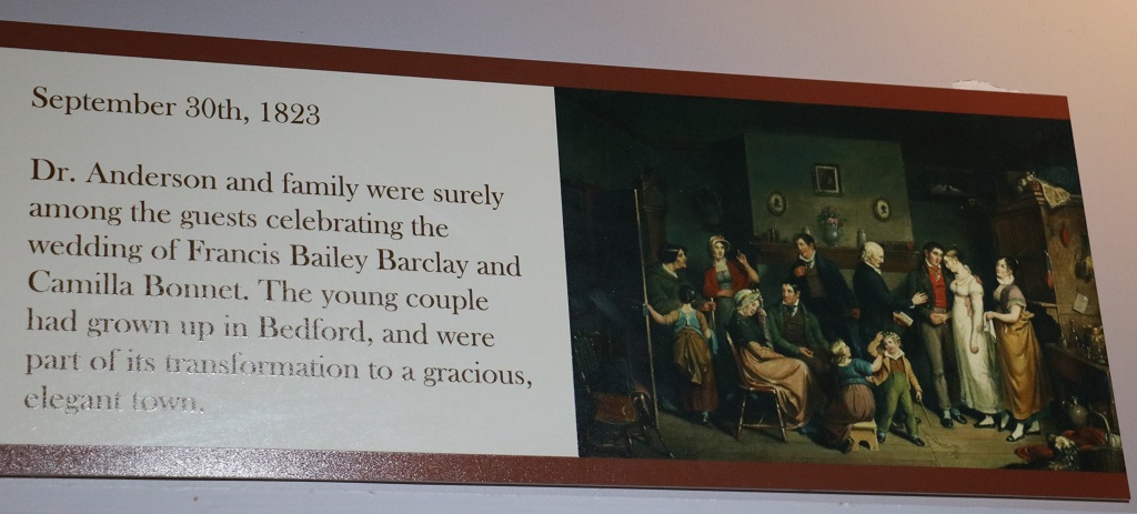
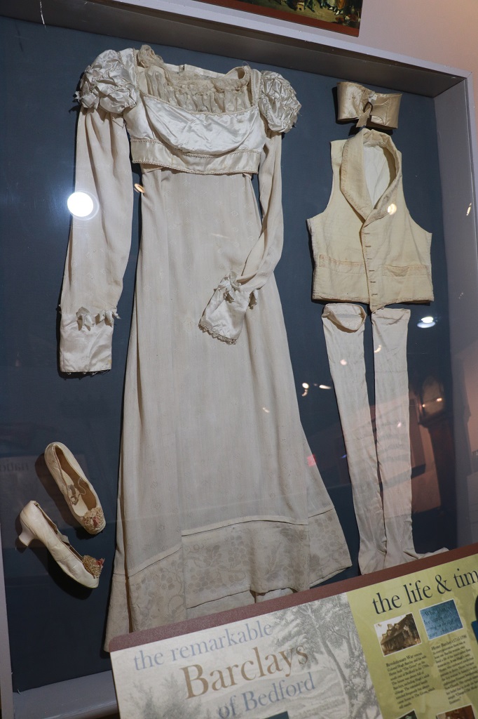
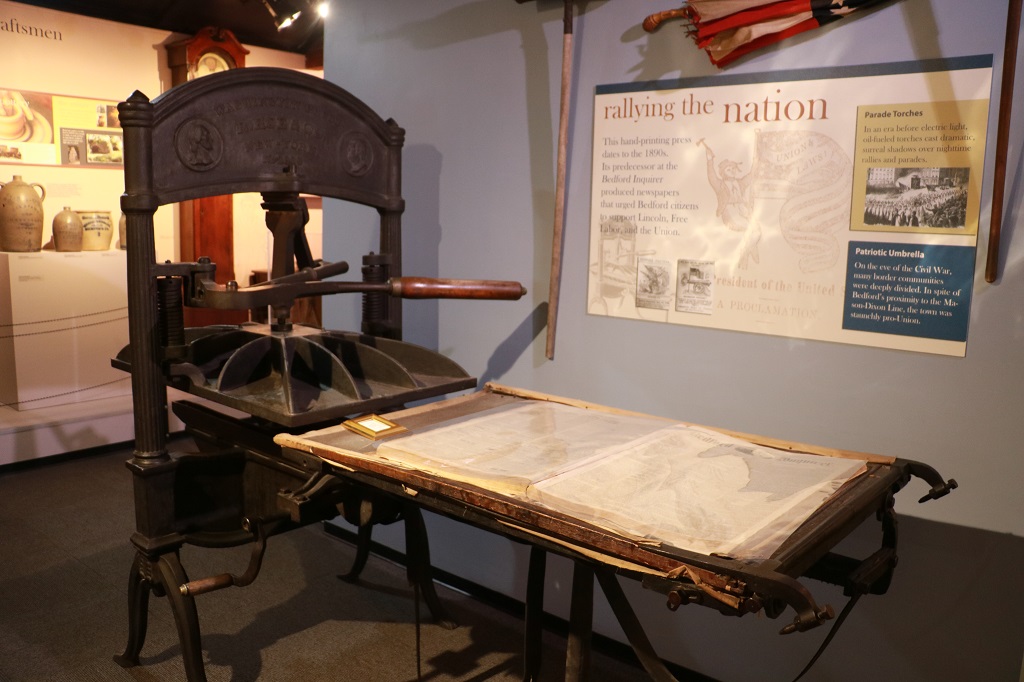
There were three rooms in the fort museum with displays about the fort, about the town of Bedford, about the Native American life in the area, and about the peoples lives during the period.
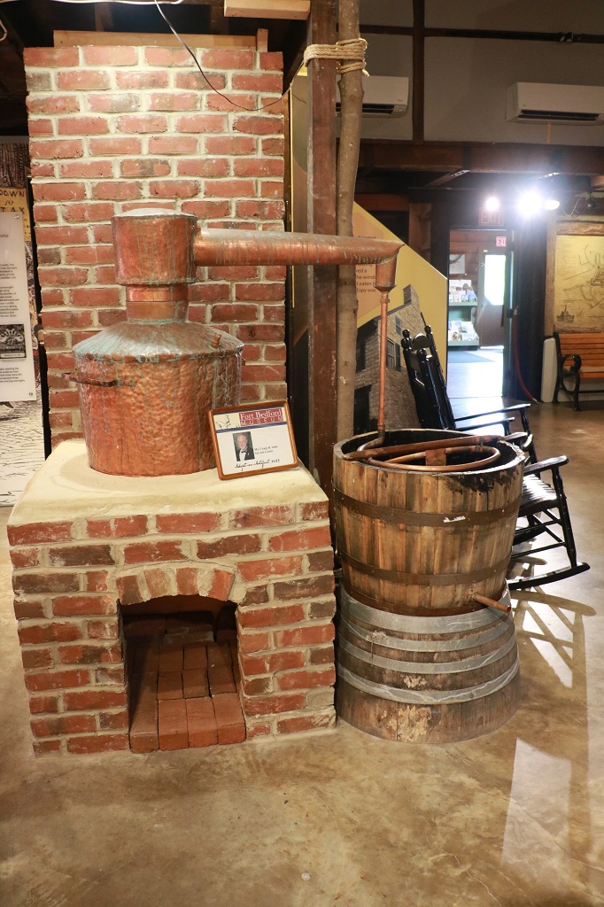
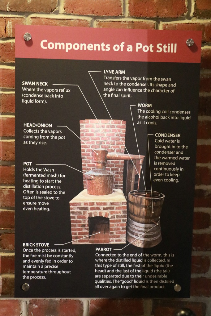
The Bedford area was heavily involved in distilling bootleg whiskey during Prohibition.
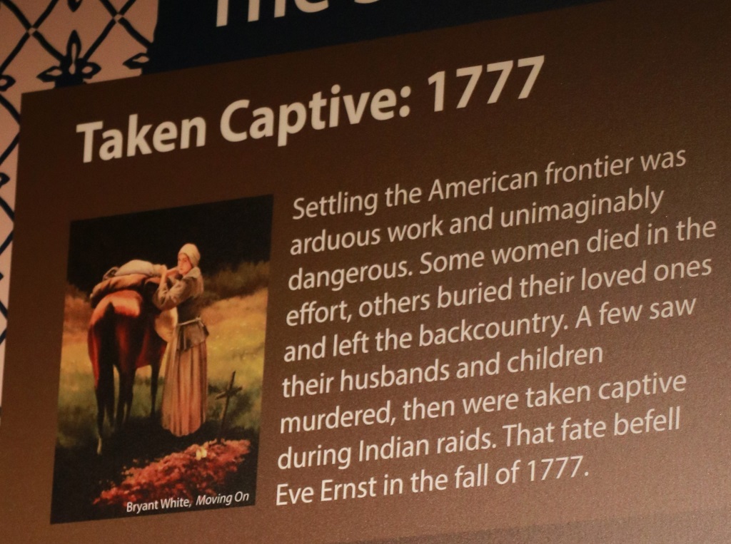
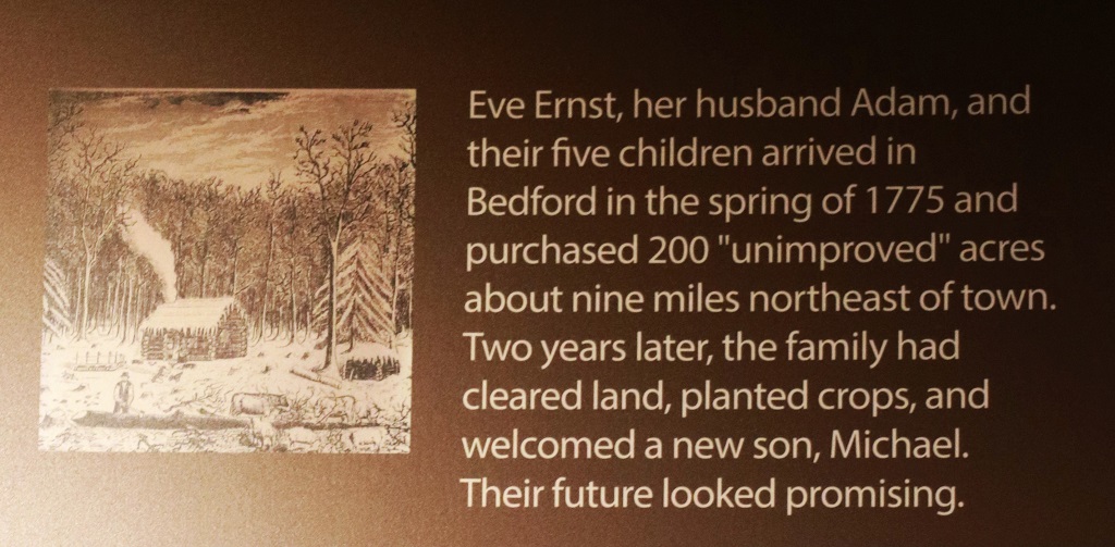
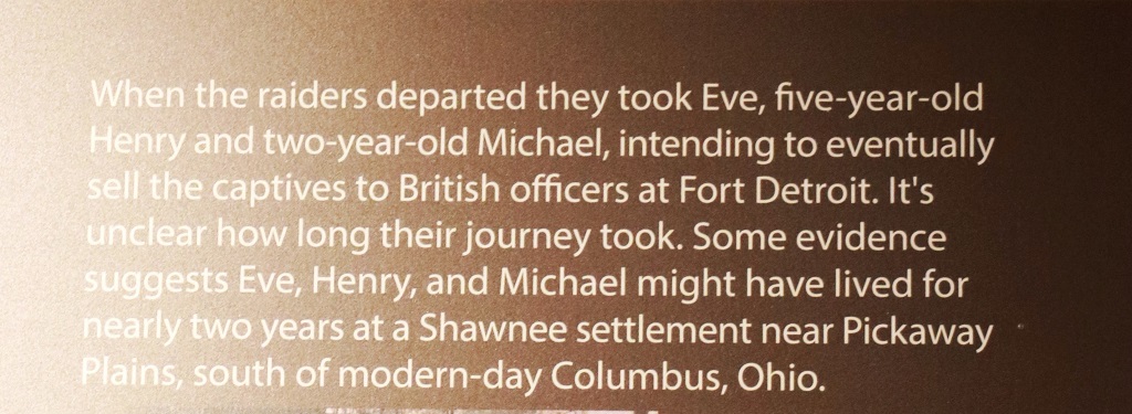
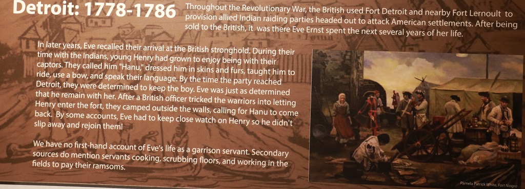
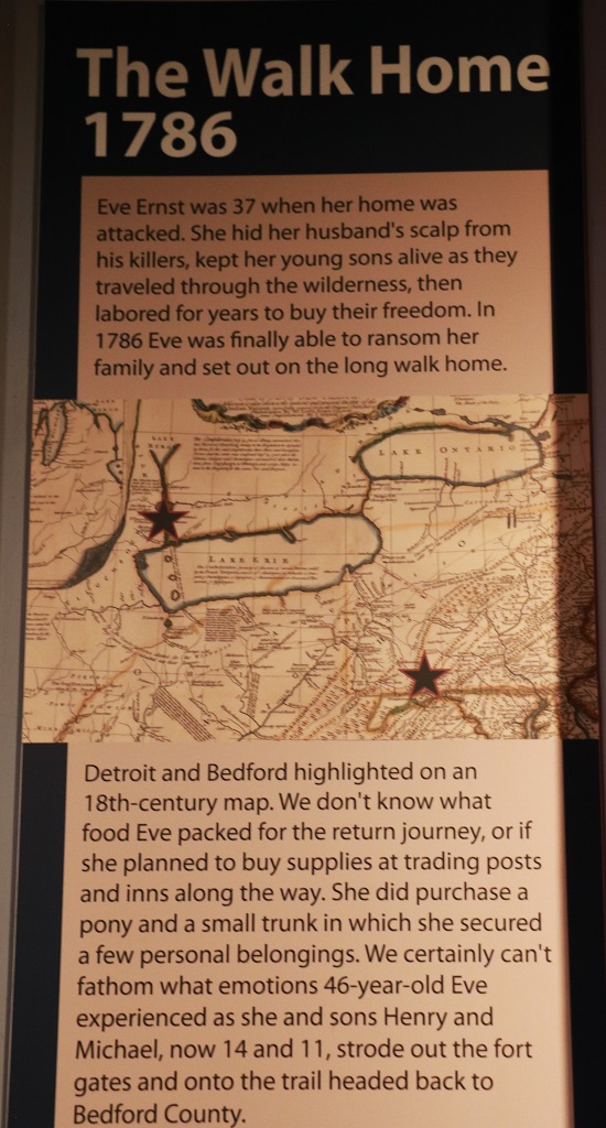
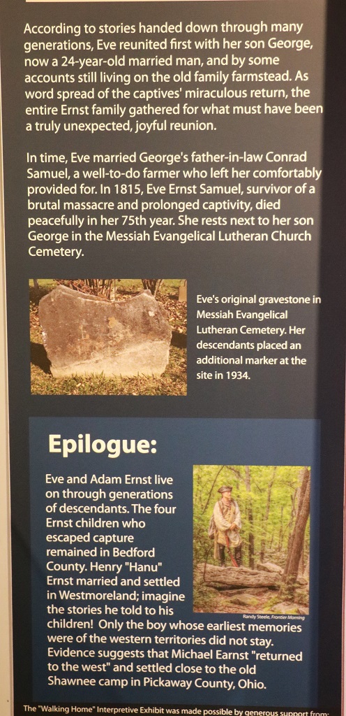
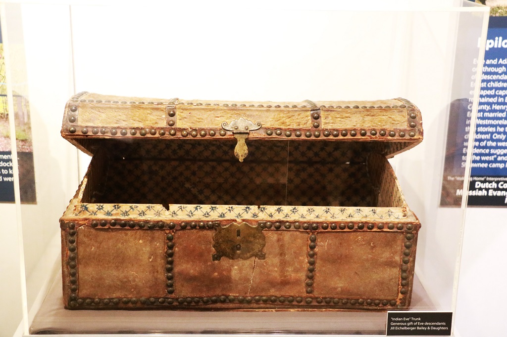
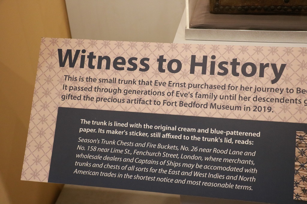
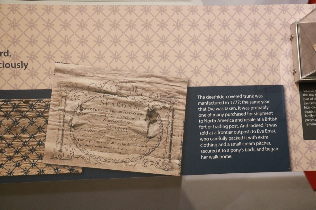
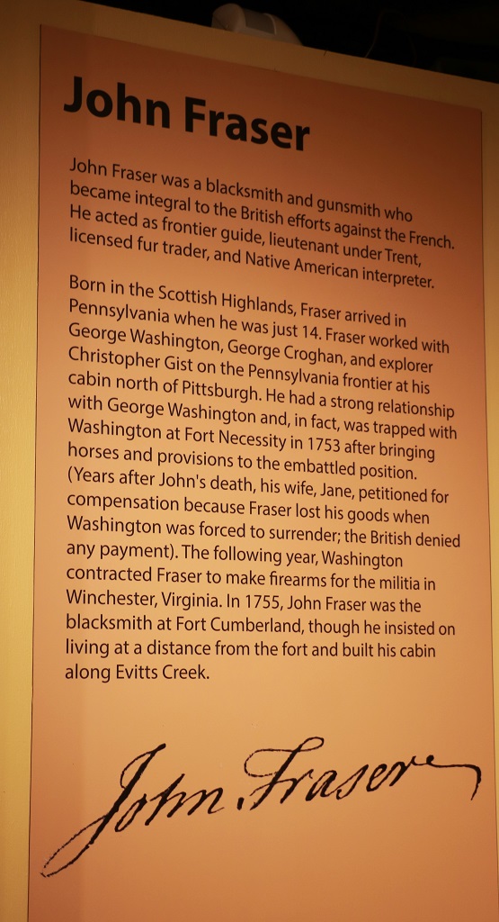
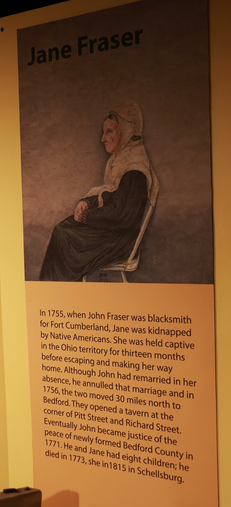
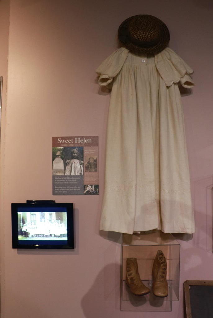
One of the display sections told the story of Eve Ernst who had been captured by Shawnee Indians and who had walked home.
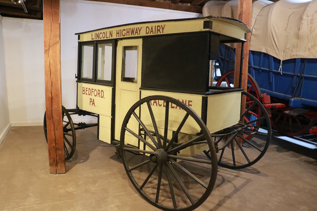
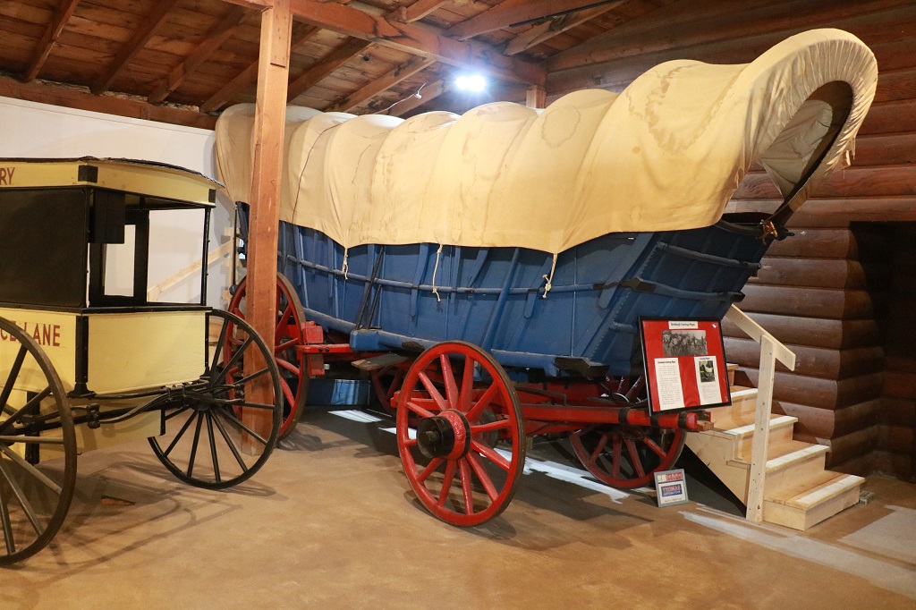
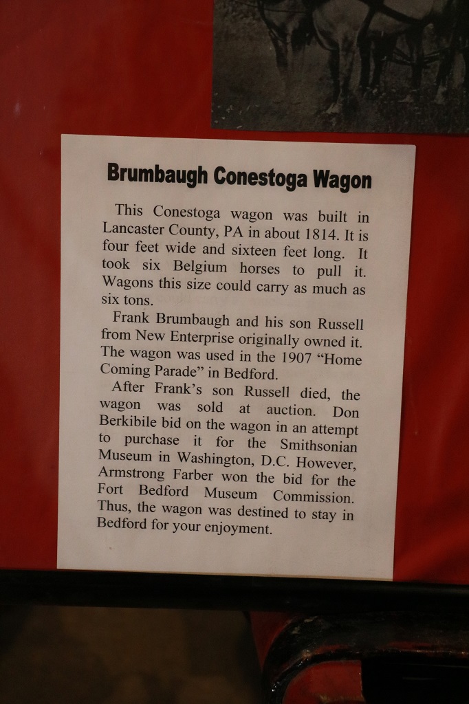
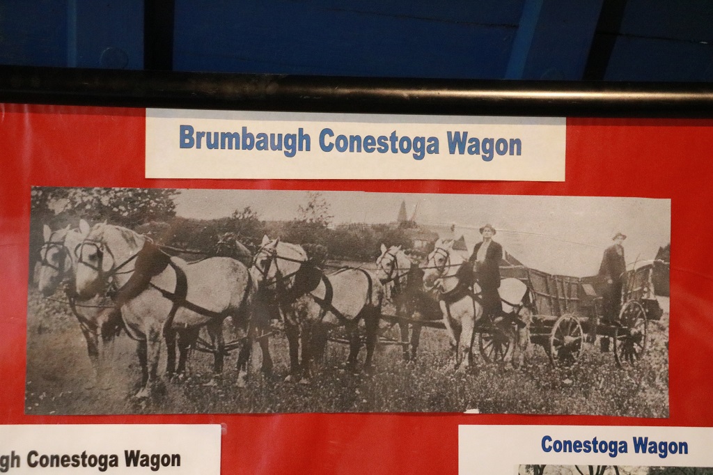
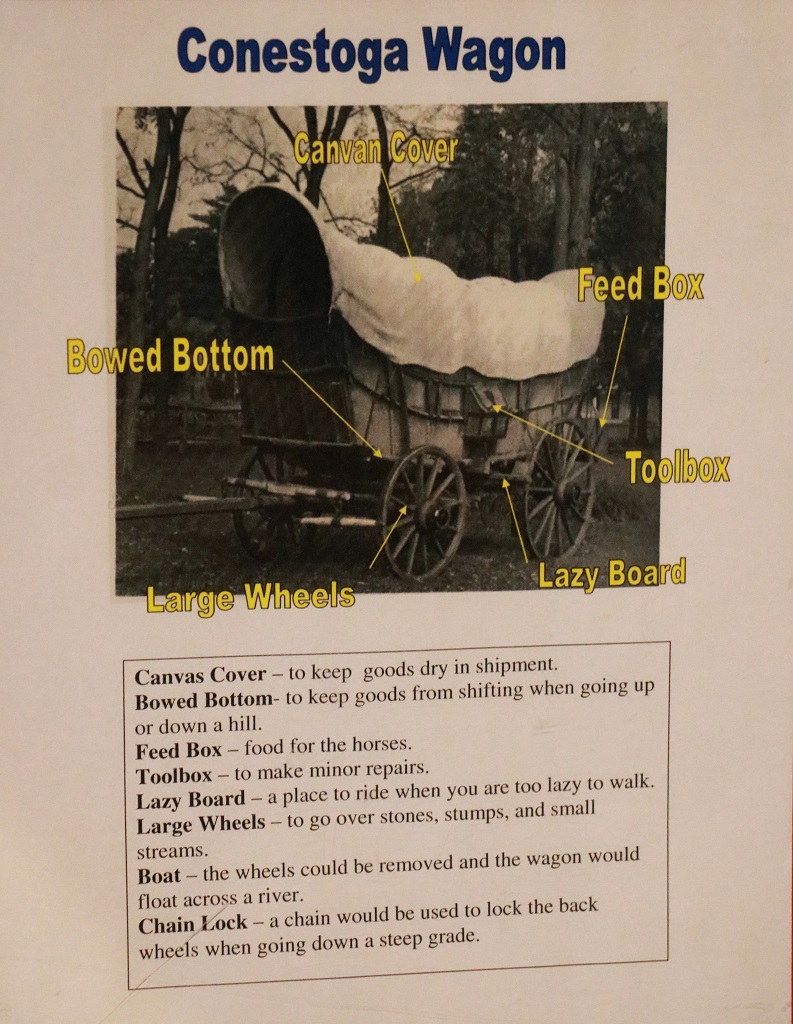
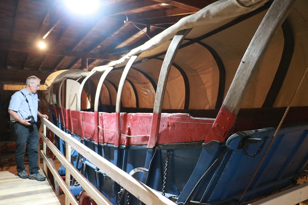
I was really surprised at how long and how deep the wagon was. No wonder it took a six-horse team to pull.
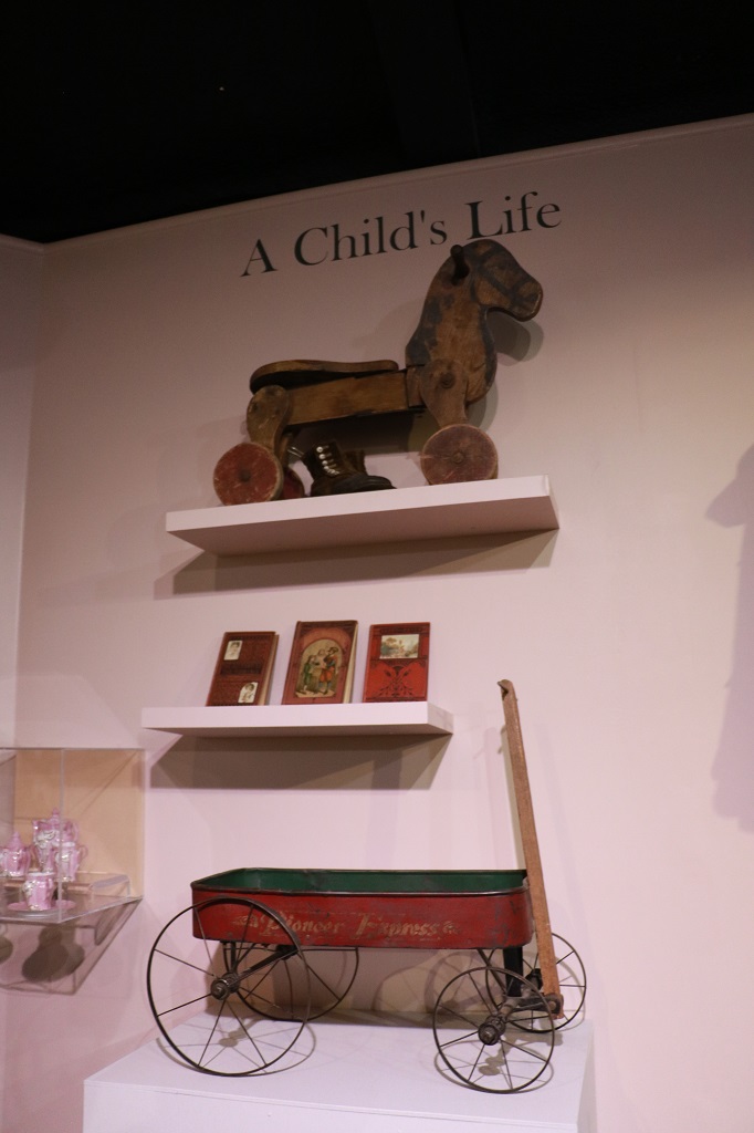
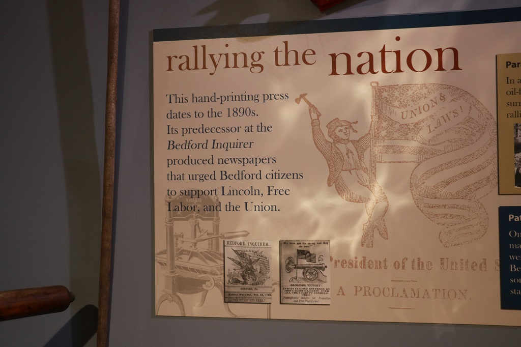
The third room right at the back of the fort museum was a relatively new dsection and really well set out with nice displays from bygone days.
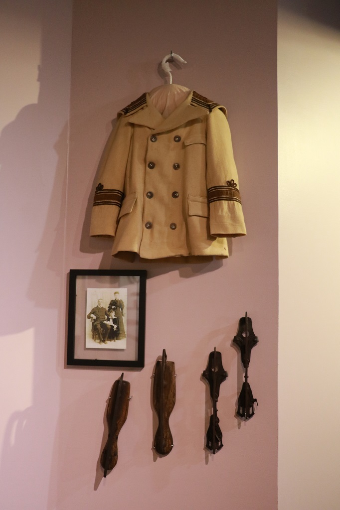
These are skates.
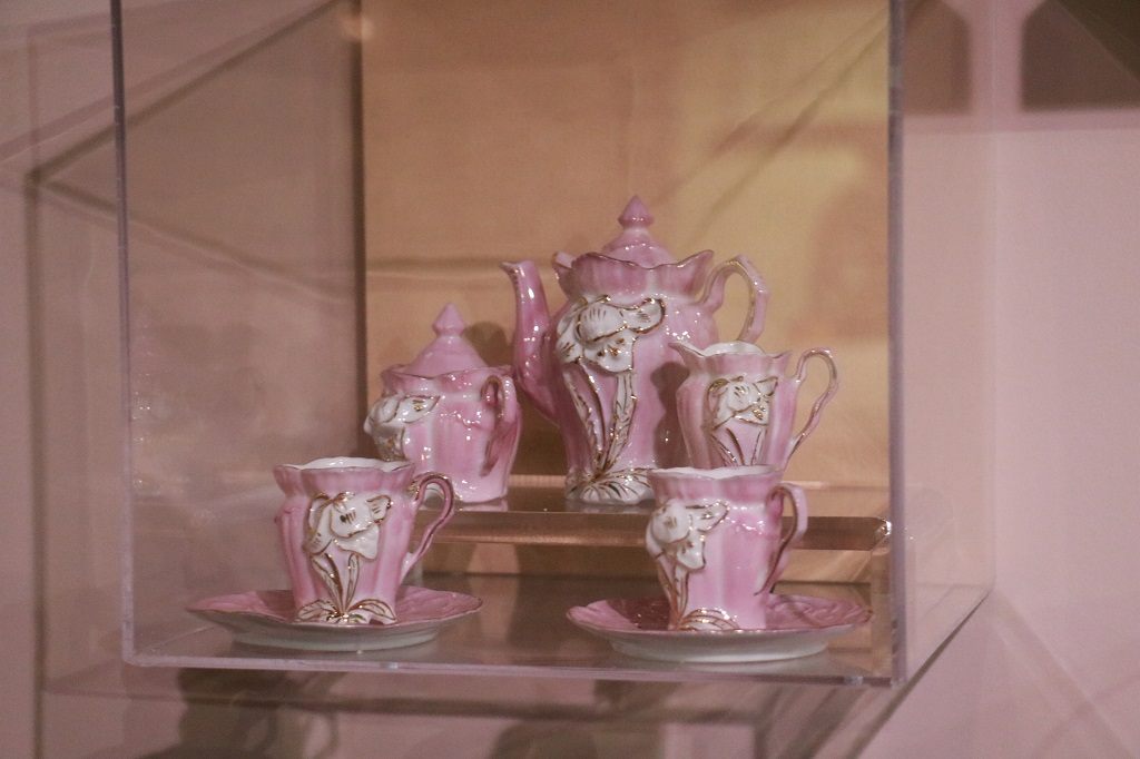
A little girl’s beautiful tea set.
We left Bedford about noon. On our drive today we passed quite a few nice big dairy farms and several large chicken barns. As we continued east we had to go up and over two summits that had very steep grades up and down and a lot of tight curves. No large trucks are allowed to take the route and there are runaway lanes for any others. Another, “I wish I was on my motorocycle” day for John. But you would have to stay sharp. There were several sections with 8% grade down winding corners.
The Sideling Summit was 2195′ (669 meters) and theTuscarora Summit was 2123′ (647 meters) above sea level.
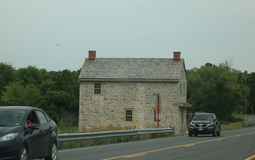
This was an old Toll House at St. Thomas.
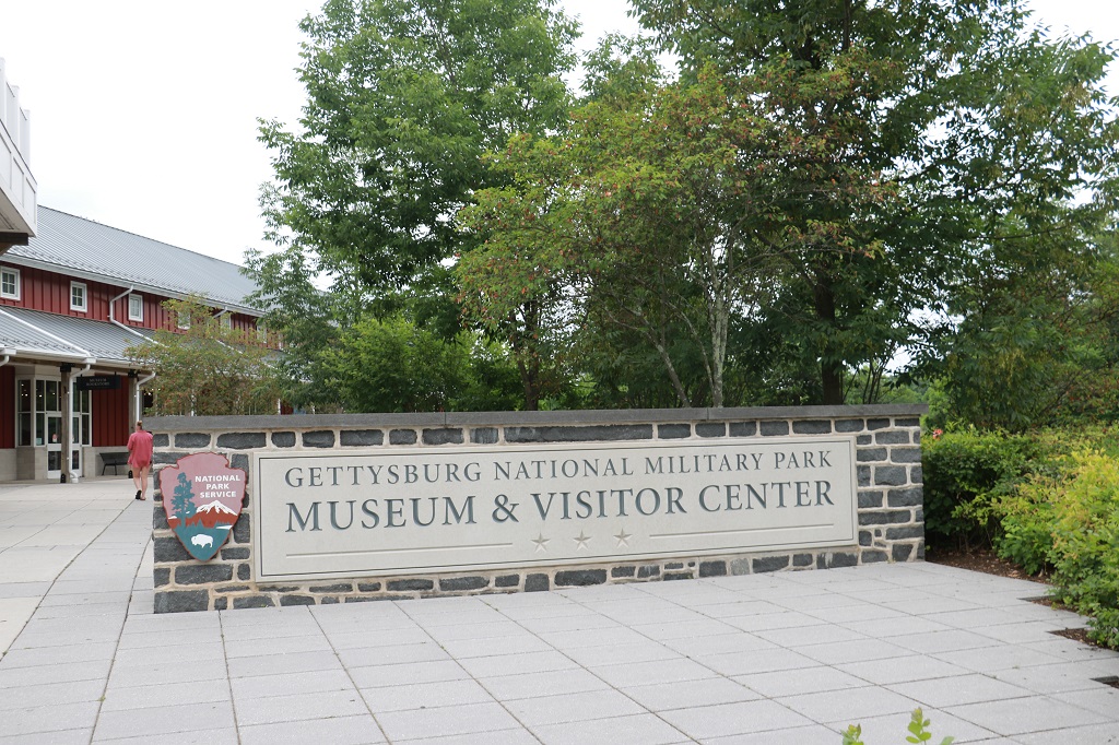
We arrived at Gettysburg at 3 PM and went to the Visitor’s Center where we downloaded the 16-part Auto Tour that gives a chronological description of the Battle of Gettysburg that took place on July 1, 2, & 3, 1863 and was a defining battle in the American Civil War. Part 2 tomorriow.