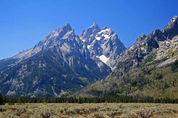
Compared to the 2.2 million acres of Yellowstone, Grand Teton National Park is small at 310,000 acres. The entrance to the park lies a scant 5 miles north of Jackson.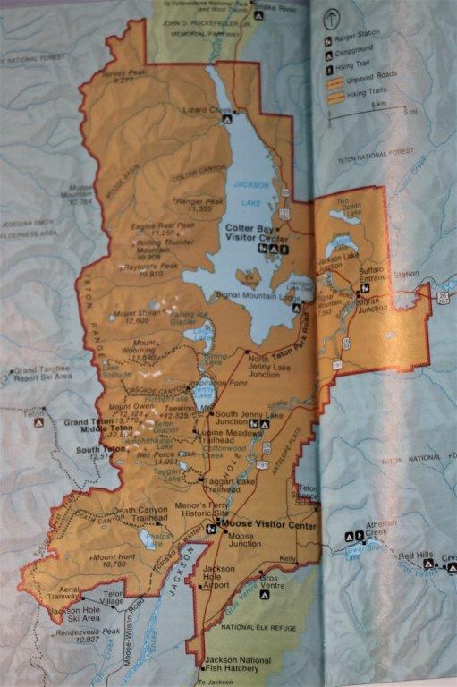 I must honestly say though, that I was underwhelmed. It was a lovely day, the sun was out, and the mountains were beautiful against the clear blue sky. However, I live in British Columbia, Canada about an hour or so from the western foothills (tall mountains themselves) of the Canadian Rocky Mountains, which will take you a few hours to drive through, and display one majestic snow-capped peak after another around every bend. The Tetons were a short, albeit high, series of mountains that you could see the start and finish of from a hillside viewpoint.
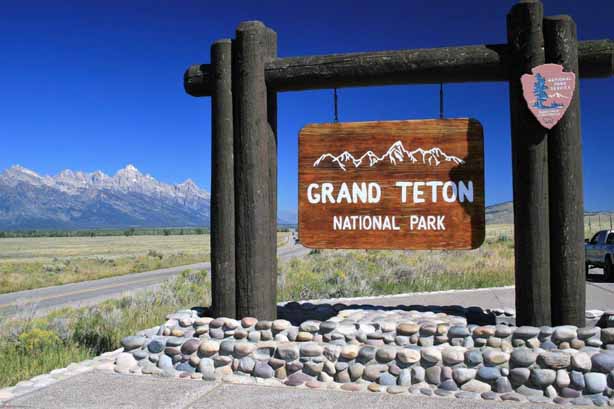
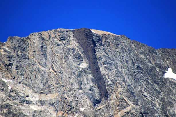
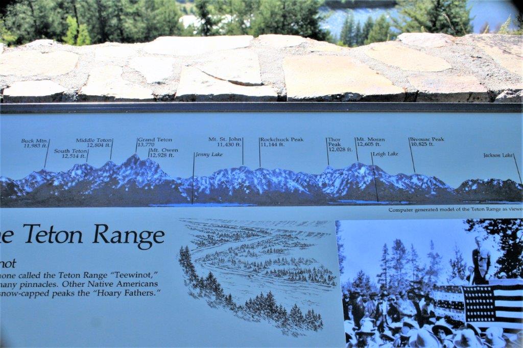
 But the impressive thing about the Tetons is that they just rise up out of the valley floor with no foothills at all. The mountains are a fault-block range, meaning they were created when two blocks of the earth’s crust began to shift along a fault line, one tilting down and while the other went up. And they have risen about 30,000 vertical feet from underneath the valley floor. Most of the peaks in the Teton range are between 11,000′ and 12,000′ above sea level so the sight is impressive.
All of the park roads are in the valley so it is only the backcountry hikers – and there are many trails – that go into the mountains. A couple of days before we had driven to Jackson from Yellowstone down the length of Jackson Lake and through Antelope Flats on the east side of the Snake River; both areas within Grand Teton National Park. This day our route was along North Teton Park Road which loops past several lakes closer to the mountains on the west side of the Snake and joins the highway we already travelled part of the way up from the south end of Jackson Lake.
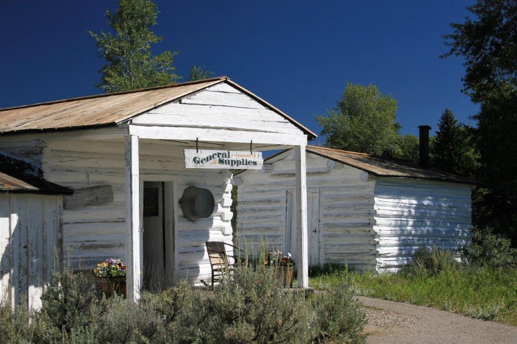
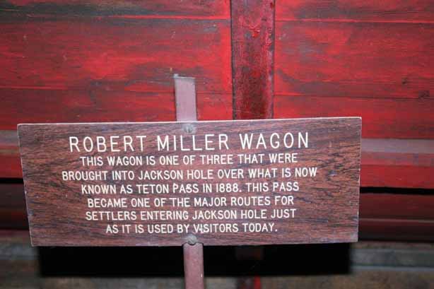
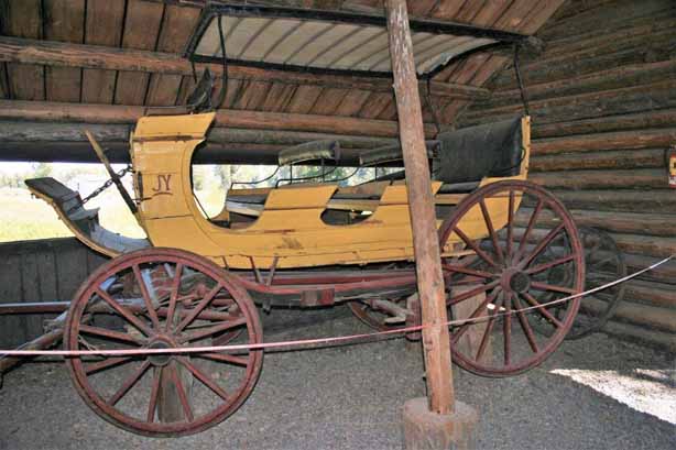
Our first stop was Menor’s Ferry Historic Site. William D. Menor came to the valley in 1894 and took up his homestead beside the Snake River. Here he constructed a ferry that became a vital crossing for the early settlers of the Jackson Hole. His land parcel contained a white-washed cabin with a general store, storage shed and smokehouse, barns, a blacksmith shop, a garden and irrigated hayfields and pastures.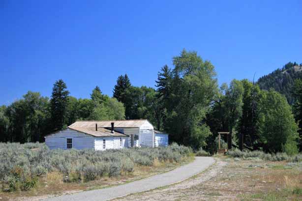

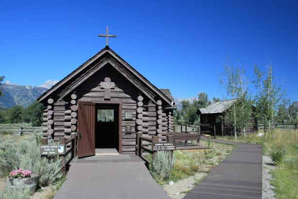
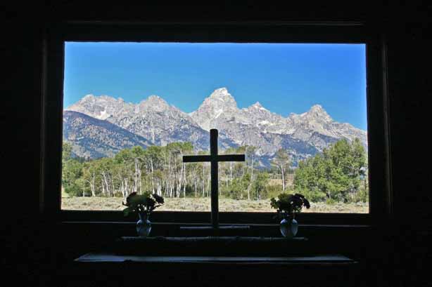
 A half-mile spur off the Teton Park Road will lead you to the Chapel of Transfiguration. It was built of logs in 1925 and the Episcopalian chapel is probably one of the most photographed houses of worship in the United States due to the view of Grand Teton (13,766′) perfectly framed in a window above the altar.
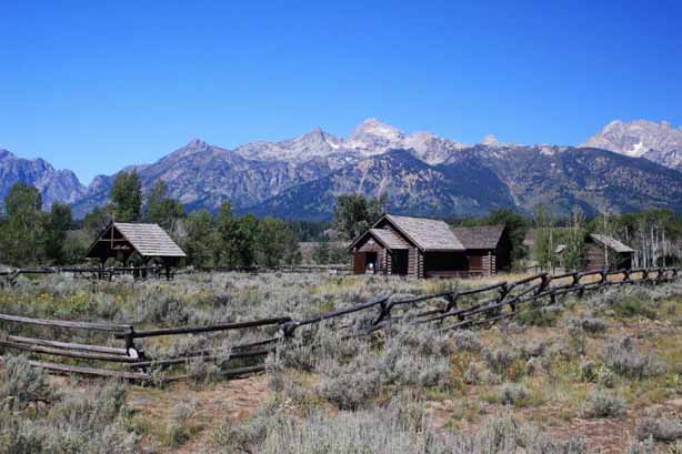
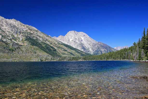
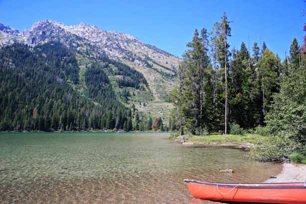
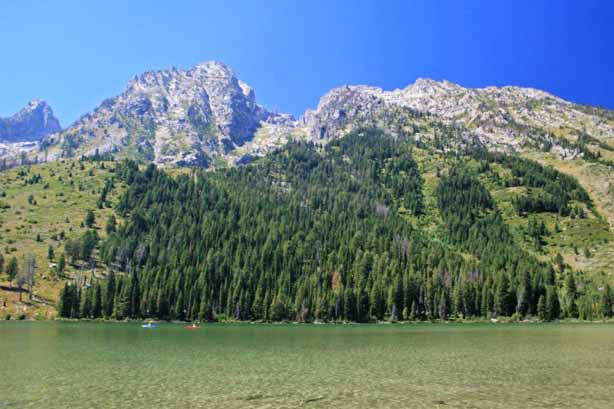
 There are a series of three connecting lakes on a short loop drive – Jenny Lake, String Lake, and Leigh Lake (which is reached by a hiking trail).
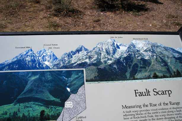
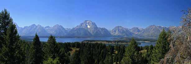
 We took a trail up to Jackson Point Overlook
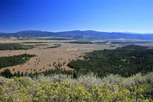
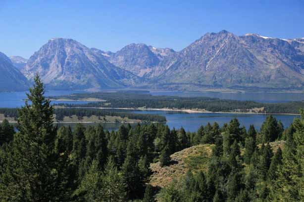
 And further along took the turn and drove to Signal Mountain Summit for an extensive view of the valley and Snake River.
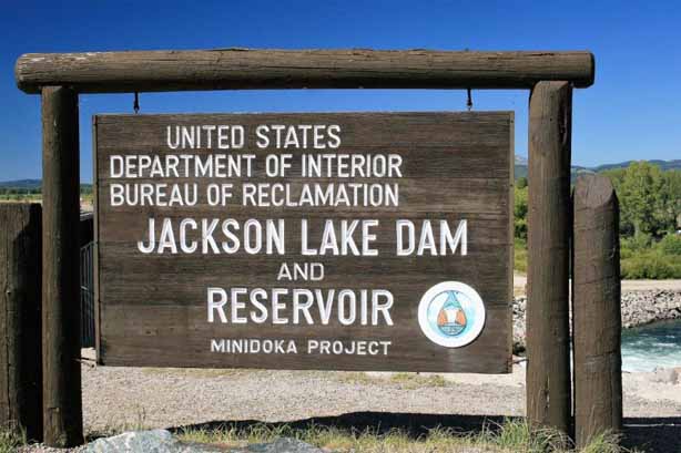
 Not far from the turn-off, back on the main road, we stopped at Jackson Lake Dam and Reservoir.
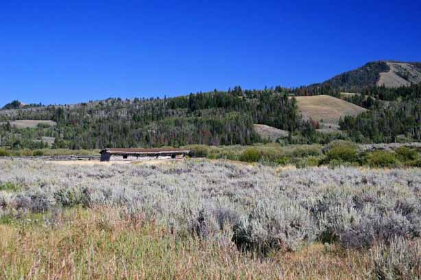
 Located near the eastern boundary of the national park is the Cunningham Homestead, added to the National Register of Historic Places in 1973. John and Margaret Cunningham staked a claim for the Bar Flying U Ranch in the 1880’s. The cabin is one of the few remaining structures from the homesteading era.
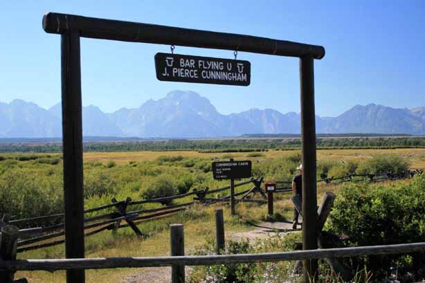

 After drought ruined his crops and cattle prices fell after World War I, Cunningham and a neighbour drafted a petition signed by 97 other area ranchers proposing a buy-out of ranches to create a national recreation area for public enjoyment. In 1928 he sold his land to the Snake River Land Company which later donated 35,000 acres for expansion of the National Park. At the time the park was only comprised of the Teton Mountains. The land deal with the ranchers enabled much of the valley, including Jackson, to become part of the park.
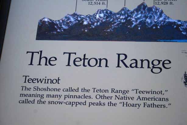

 We spent the night in Jackson and headed southeast toward Caspar in the morning.
