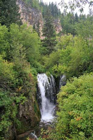
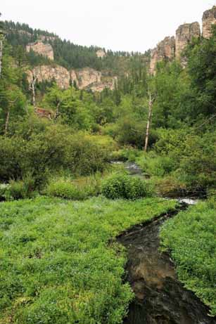
A few miles west of Lead, SD is Roughlock Falls, created by Little Spearfish Creek. The water flows down a spectacular chasm then tumbles off a 50 foot limestone ledge in a series of cascades. It is very pretty and one of the most-photograph spots in South Dakota’s Black Hills.

 We turned north after visiting the falls and drove up to the old cattle drive staging town of Belle Fourche (beautiful fork); named by French explorers from New France (much of Quebec and the Acadian pennisula – New Brunswick, Nova Scotia, Prince Edward Island – and Newfoundland), where the Belle Fourche and Redwater Rivers join the Hay Creek. The area was a major fur trading center in the early days and later it was a way-station on the stagecoach line from Medora, ND to Deadwood, SD.
For 14 years (1876-1890) an enterprising fellow named Seth Bullock bought up properties as homesteaders ‘proved up’ and sold out. When the railroad refused to pay the high prices demanded by the near-by community of Minnesela to ship the ranchers cattle to the packing plants, Seth offered them free right-of-way through his property if they would build a terminal on his land, near where the present Belle Fourche Livestock Exchange is located. The first shipment of cattle left Belle Fourche for the east in 1890 and by 1895 2,500 carloads of cattle per month, in the peak season, were sent eastward, making it the world’s largest livestock-shipping point. Even today Belle Fourche serves as a large trading area for local farmers and ranchers.
I wrote this historical tidbit because just before we left home to begin this road trip we had watched an old John Wayne western movie, “The Cowboys,” in which a rancher had all of his hands desert him to go to the gold fields and he had to, reluctantly, hire young boys to drive his cattle herd to Belle Fourche. I was quite tickled to be in the same place. So many of the beloved cowboy movie sets from my youth became real on this trip.
Another historical side note: In 1959 the U.S. Coast and Geodetic Survey designated a point 20 miles north of Belle Fourche as the geographic center of the United States. Until then the center of the US was Smith Center, Kansas but with the inclusion of Hawai’i and Alaska the middle point had to be re-configured. (Aren’t you glad I read all this stuff?)
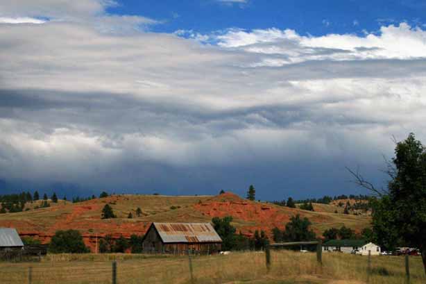
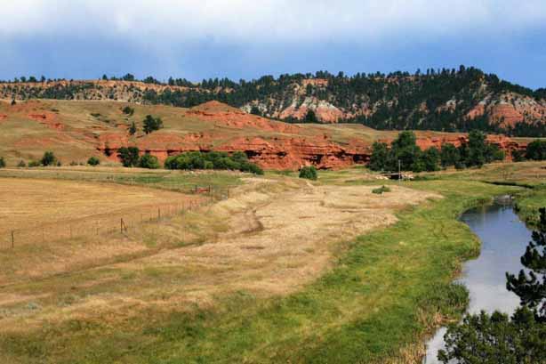
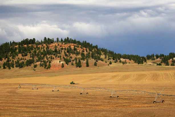
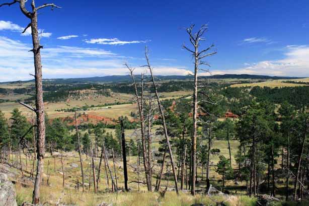
At Belle Fourche we turned west and re-entered Wyoming. The sky was very grey near Hulett.

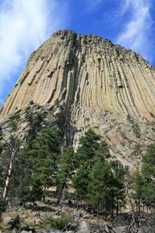
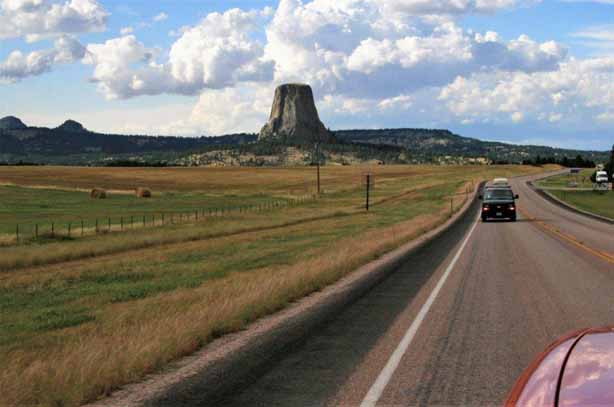
 About 45 miles from the border is Devils Tower National Monument, America’s first; designated by Teddy Roosevelt in 1906. The tower is actually the core of a volcano exposed after millions of years of erosion.
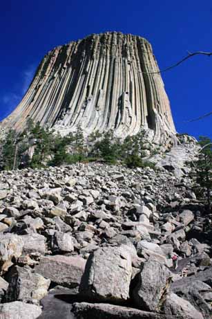
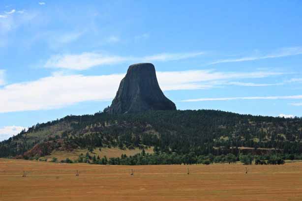 The base of the tower is cluttered with huge bolders that are pieces of the columns that have fallen off the sides.
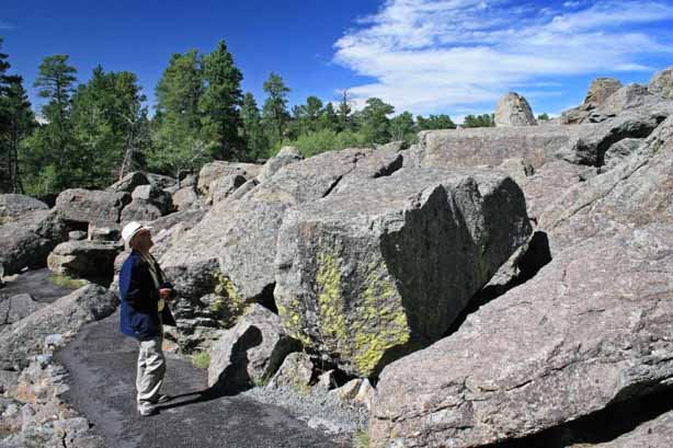
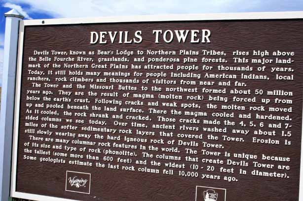
 We walked the mile and a quarter trail all the way around. The tower is 865 feet high and is featured in many Native American legends.

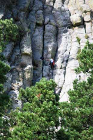
 It is a popular climbing spot and we watched several different pairs of climbers navigate the columns. You have to look very closely to see the climbers just above the trees in the wider shots. Brave fellows.
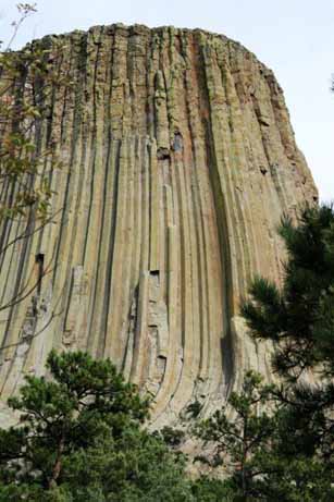
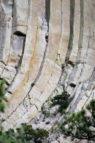 By the time we left the sun was lower and cast a lovely golden glow on to the tower. It was a fascinating place to visit. The curves at the bottom of the columns were amazing, especially when you consider how large the rocks are.


 We spent that night in Gillette, Wyoming and the next day we drove north through Sheridan into Montana and the site of the Battle of the Little Big Horn.
