2015 Aug 31 – Day 38 – Boston Day 3

My feet hurt!  Warning: long day, long blog.

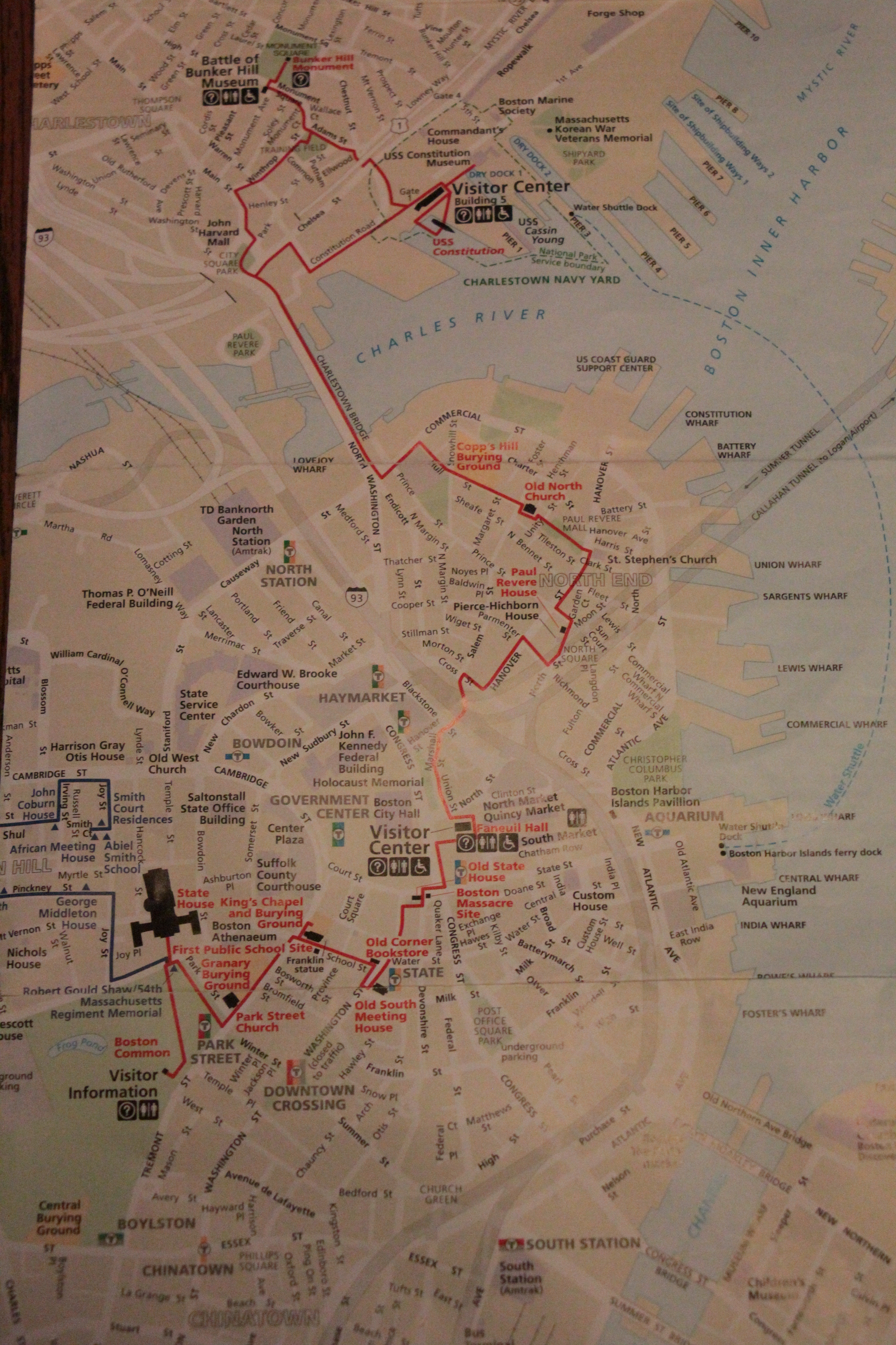
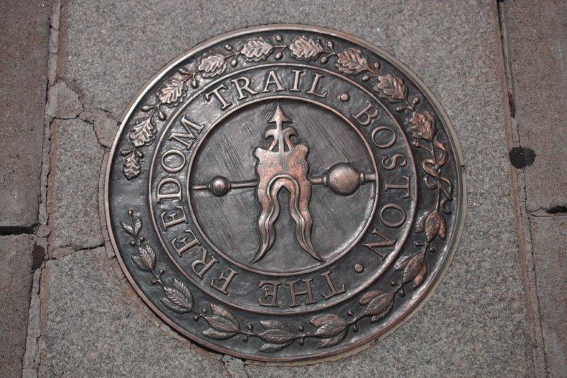
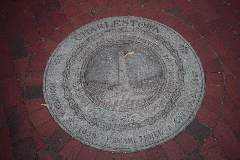
The number one tourist attraction in Boston is the Freedom Trail.  In the 1870s Bostonians prudently began saving colonial and Revolutionary era buildings that were critical in the struggle against British rule.

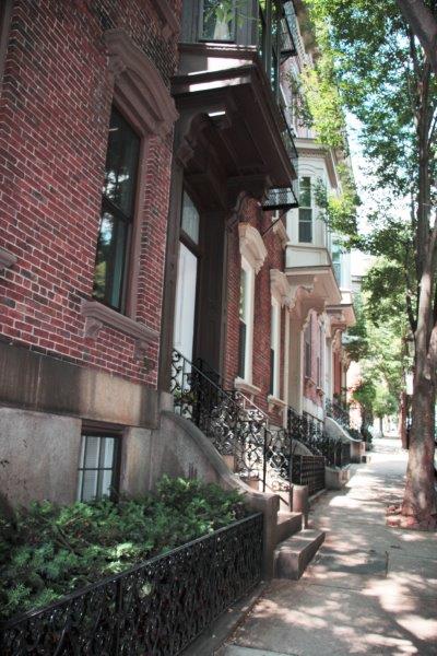
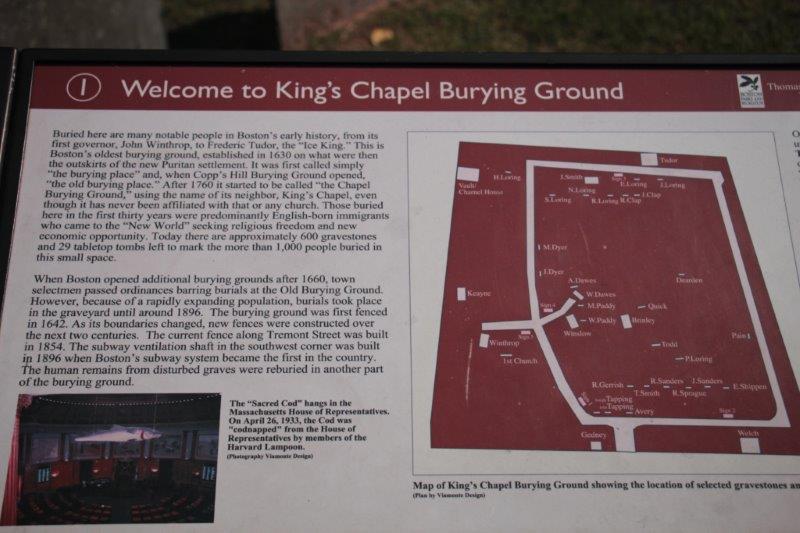
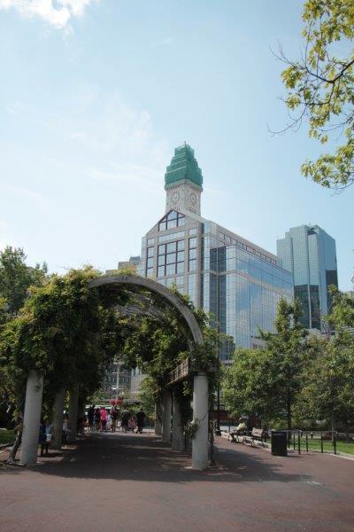
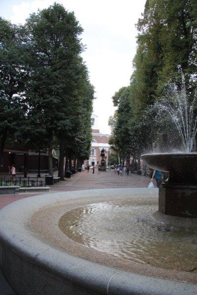
In 1951 a  member of Old North Church suggested to a reporter that a trail would help visitors to find Boston’s historic places and would boost tourism; and the Freedom Trail was born.  In June 1951 with the support of the mayor and the Chamber of Commerce the city placed identifying signs at 12 historic sites.  Over the years the Freedom Trail has expanded (there are now 16 sites) and the signs have been augmented by a red strip of brick in the sidewalk or sometimes a red line.  The trail runs from the Boston Common through the Government Center and the North End,  and across the bridge over the Charles River to the  Navy Yard in Charlestown – a distance, they say, of 2 1/2 miles.  Of course that does not take into account the steps through the museums, churches, burying gounds, houses and historic buildings.

IMG_2413

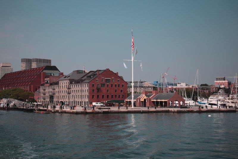
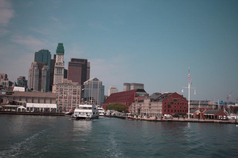
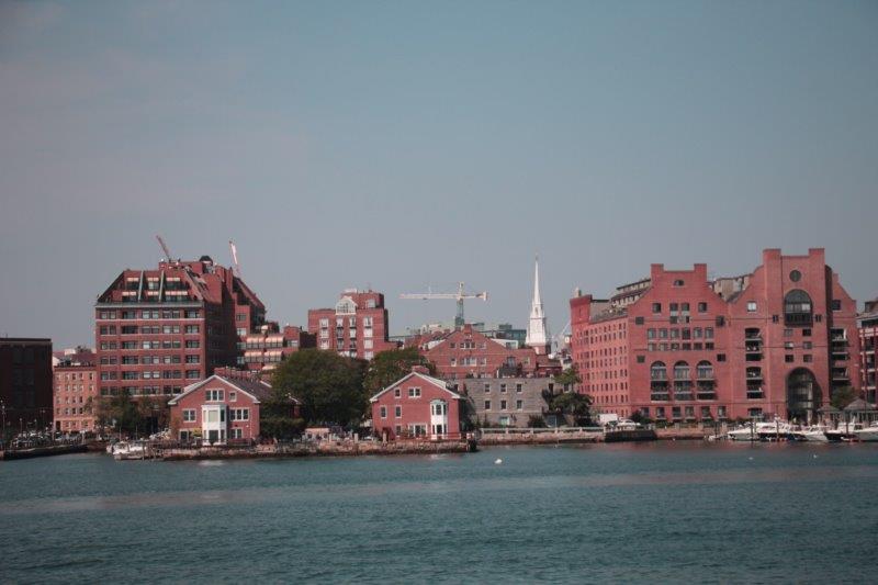
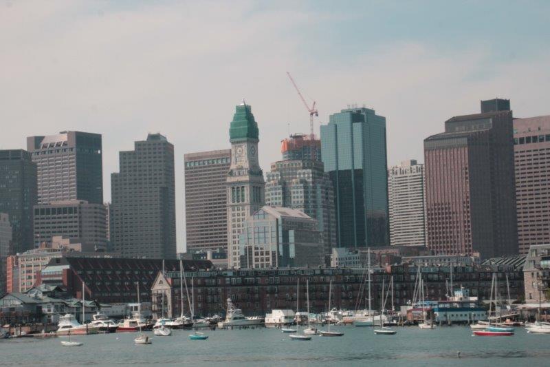
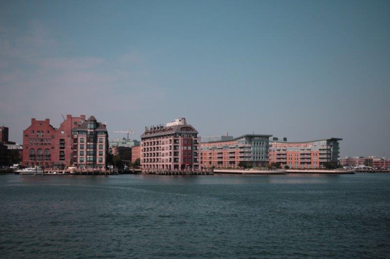
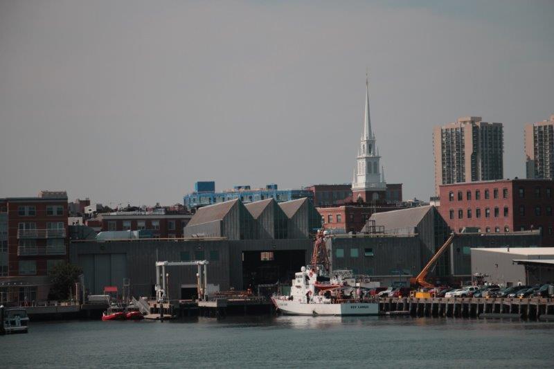
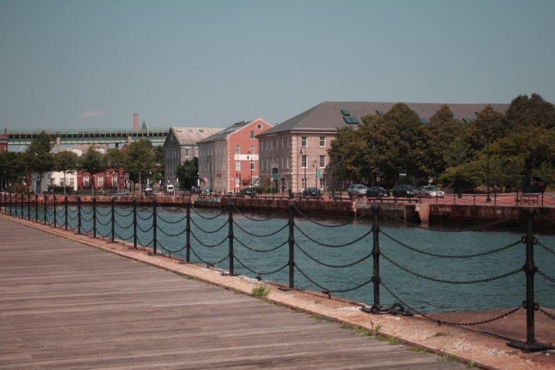
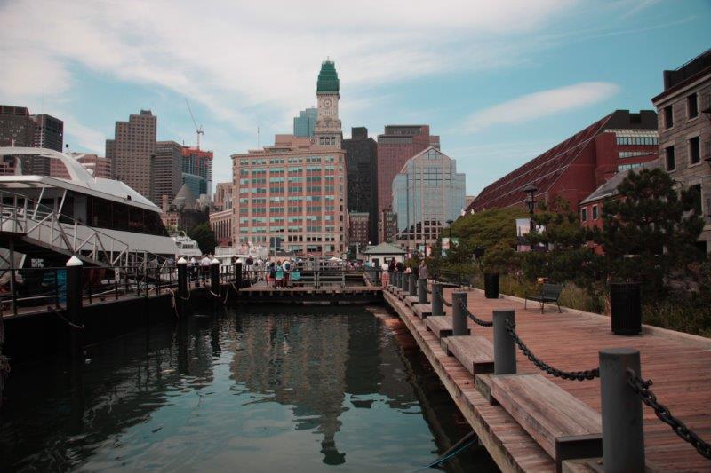
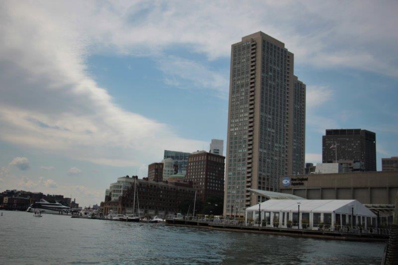
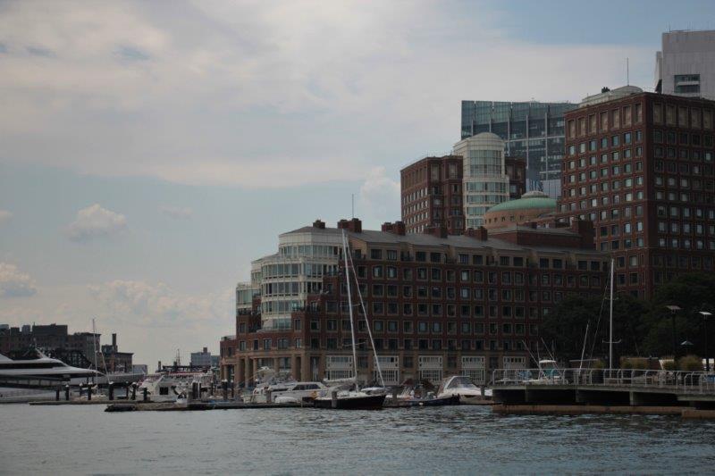
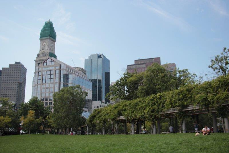
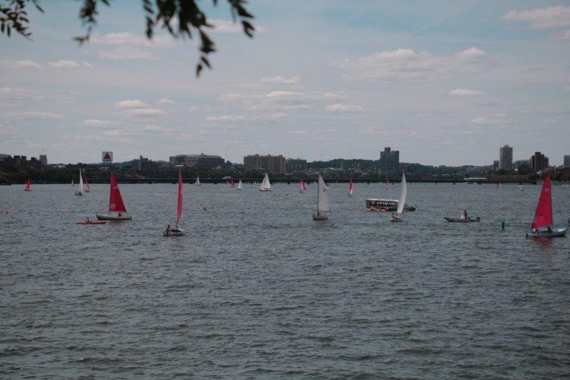
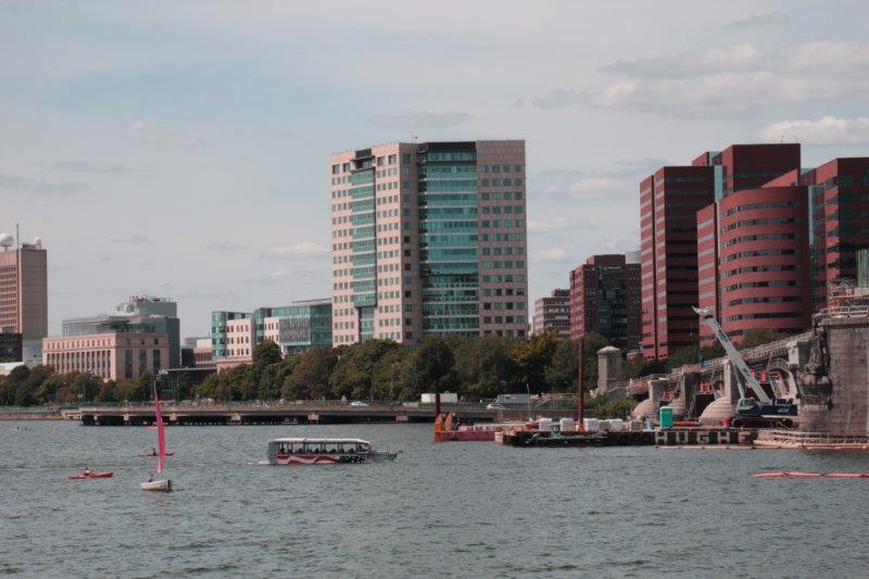
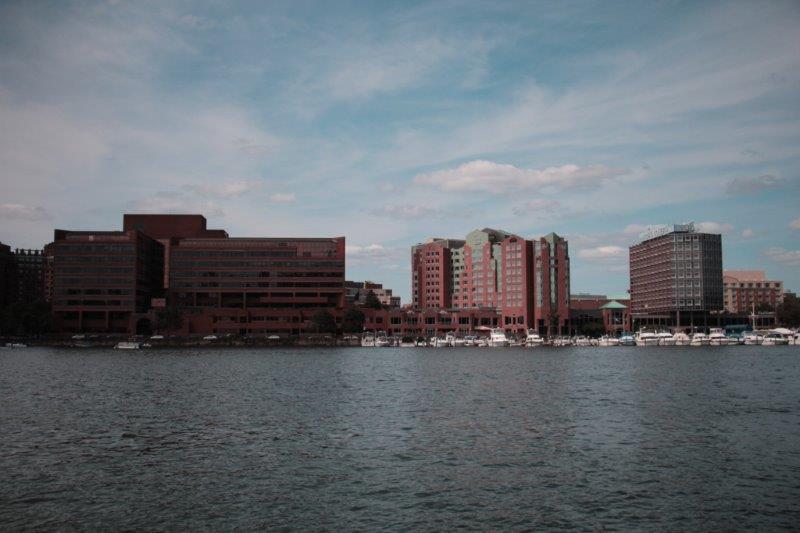
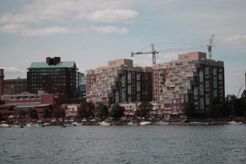
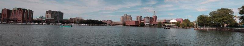
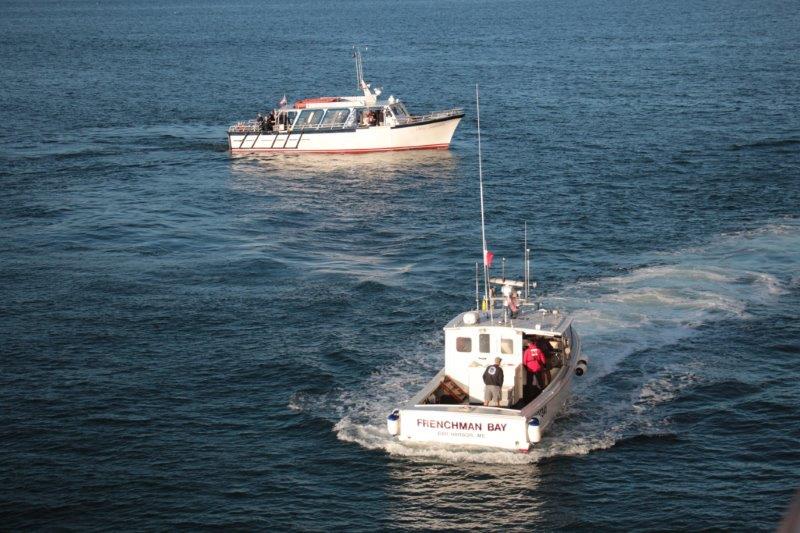
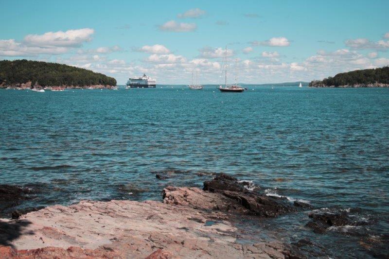
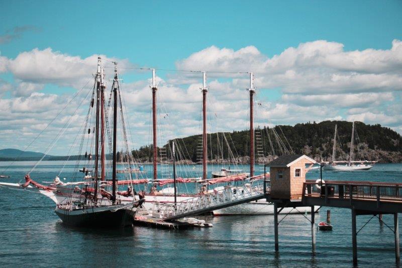
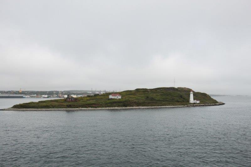
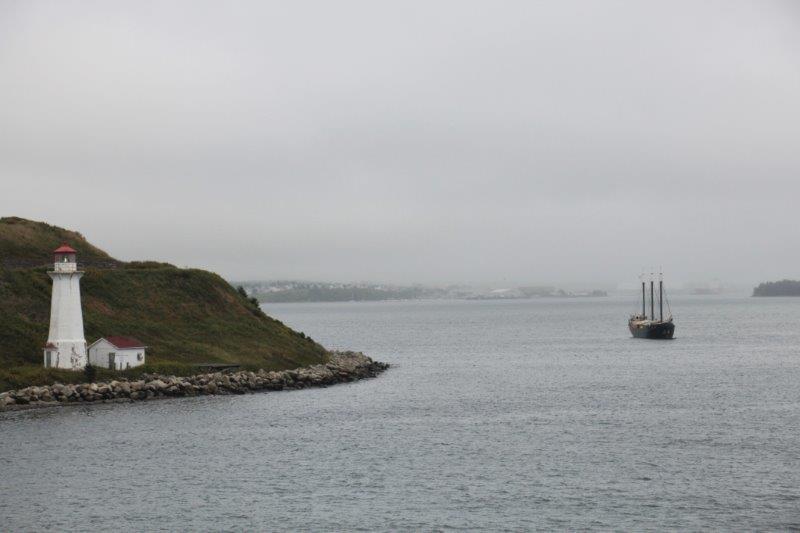
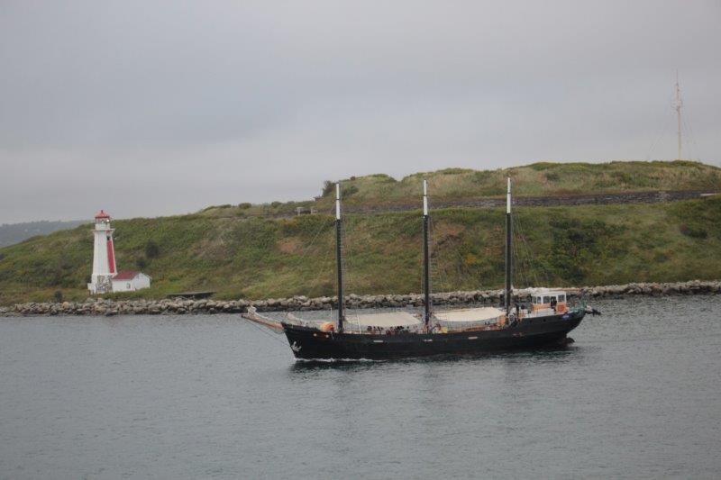
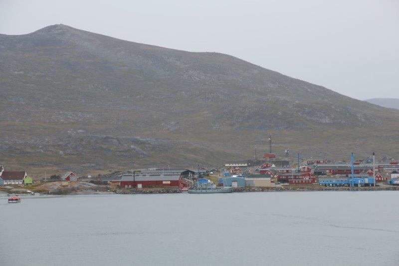
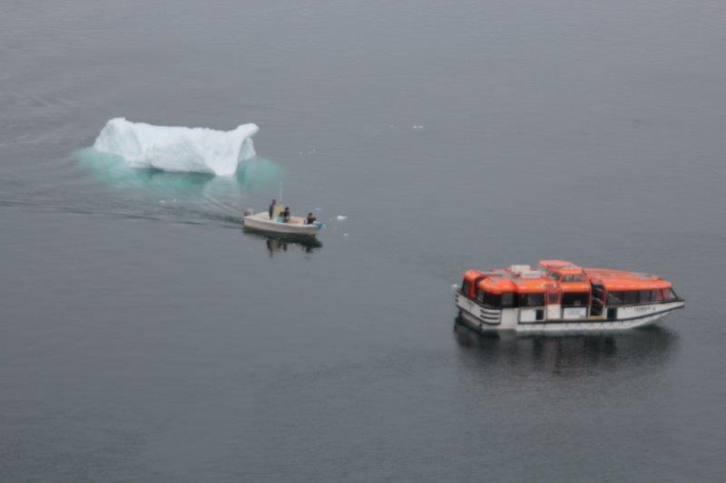
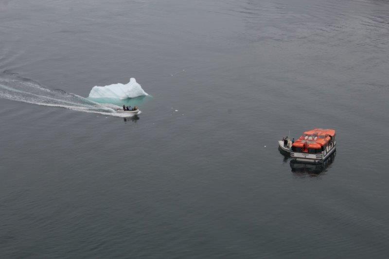
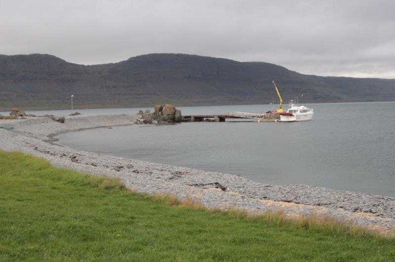
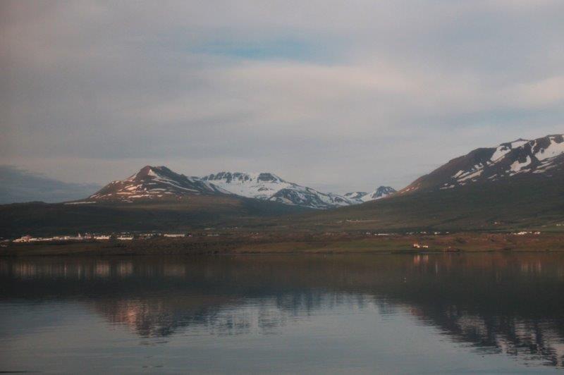
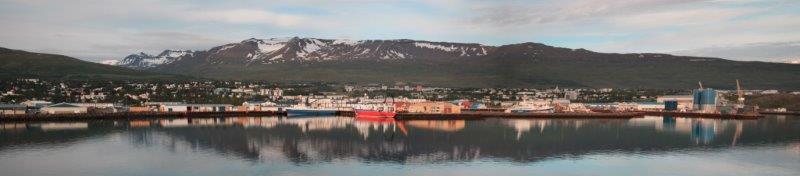
We left our condo about 11 and took the T back to the stop at the Aquarium just as we did yesterday.  Once there we located the T Water Taxi stop and waited about 15 minutes for the boat to arrive that would take us up the Boston Inner Harbor over to Charlestown. It was a beautiful warm sunny day again with temperatures expected to be around 30C (90ish F).  The city skyline looked great from the boat.

IMG_2186 IMG_2187 IMG_2188 IMG_2189 IMG_2190 IMG_2192 IMG_2196 IMG_2195 IMG_2201
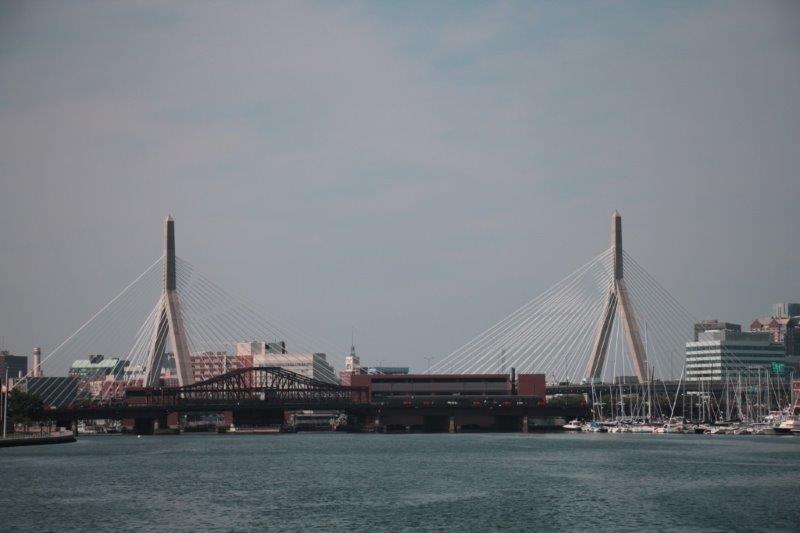
The Freedom Trail,’properly’done starts in the Common and ends at the USS Constitution and Bunker Hill Monument.  (not a rule, of course, but the brochures always list the sites in that order). We decided to do it in ‘reverse order’ so we would be walking closer to our living area as we travelled. Then if we tuckered out we could quit and start at the Common end and go back to where we left off  on another day.

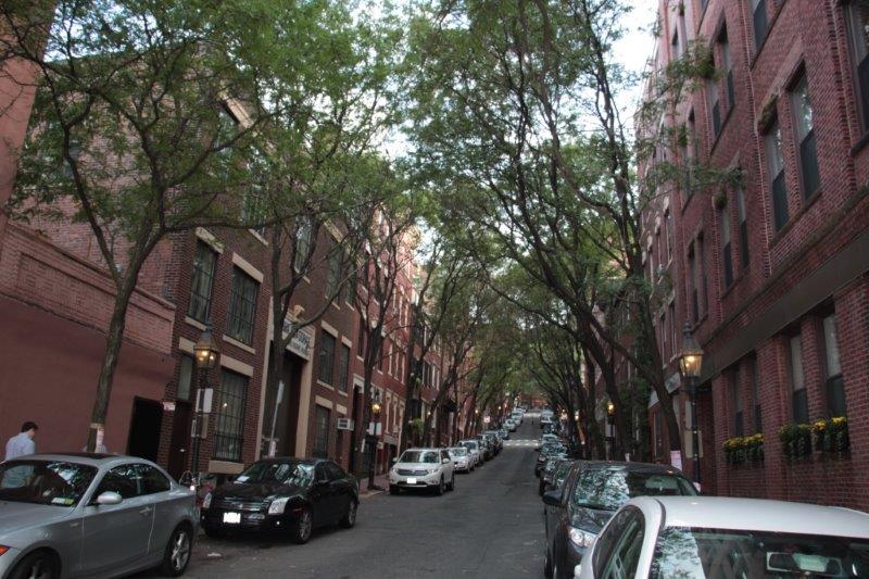
As it happened we managed to go the distance all in one day – but we may pay the price tomorrow when we try move.  Some of our success has to be attributed to our walk with Mike, Anne and Christina yesterday as a few of the places we checked out are listed on the Freedom Trail and we did not need to do them again today.

My head is crammed full of American Revolutionary history and I was reminded all day of the large report I did on the subject for 12th grade history class.  I refuse to type all night so you are just going to have to read some of the information yourself.

It is our policy when travelling to take a photograph of the signs at places so we remember what photos belong  where and I often also take a photo of the ‘description’ plaque.  Today you will need to read some of those plaques if you want more information.  I am not going to type it all out in this blog.  Did I mention my feet hurt?  I will need to get them elevated for awhile before I will be able to sleep tonight.  You can read or not – your choice.

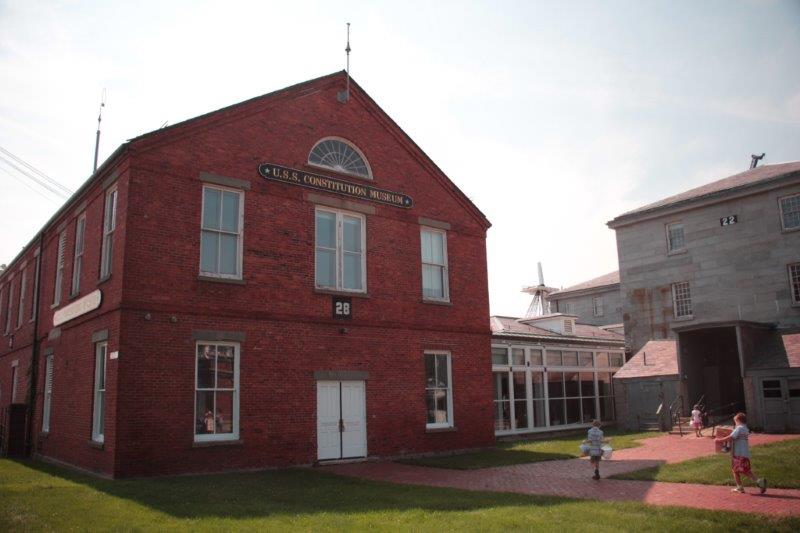
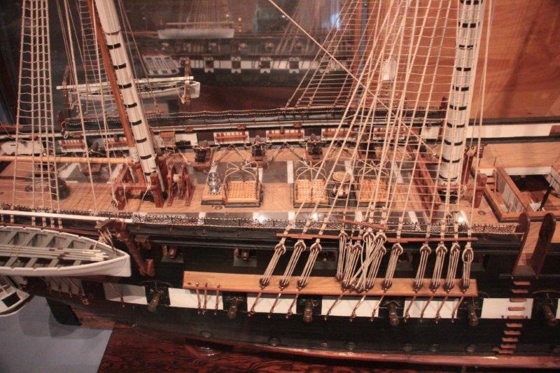
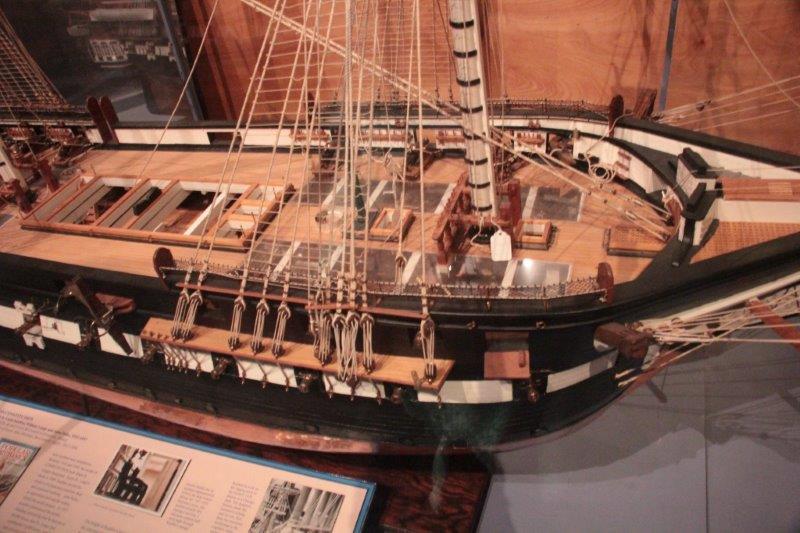
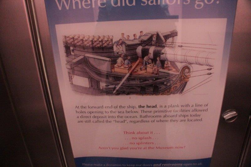
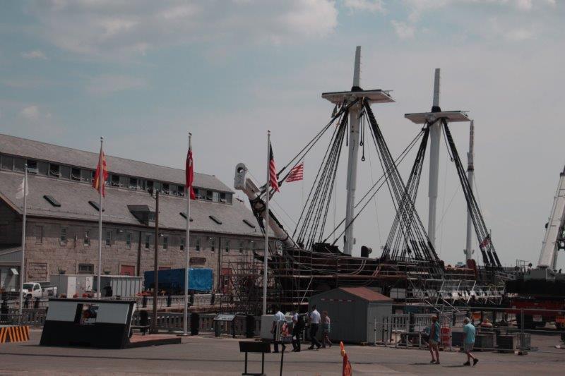
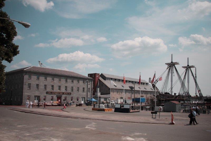
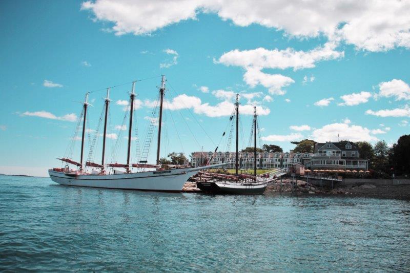
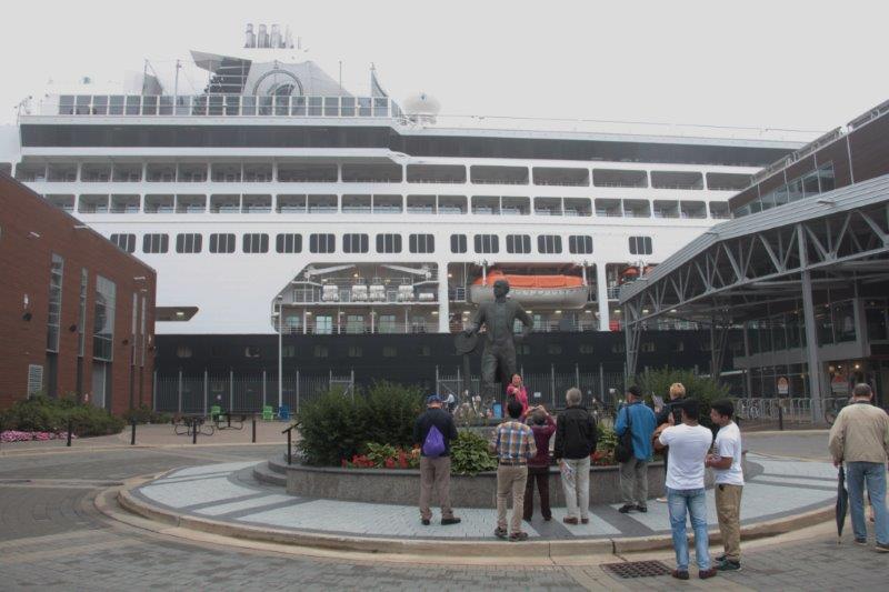
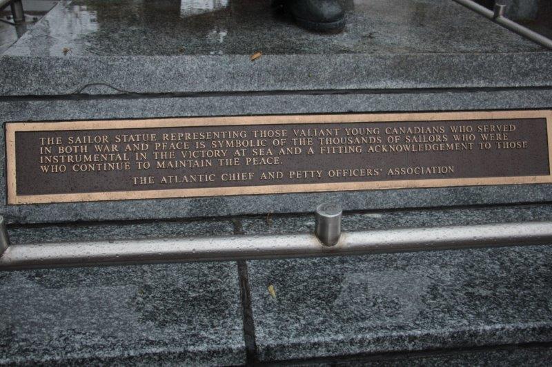
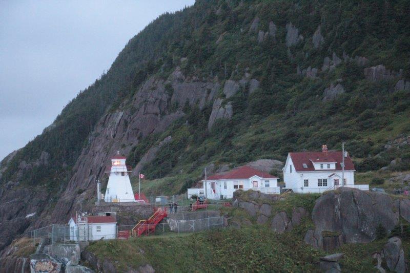
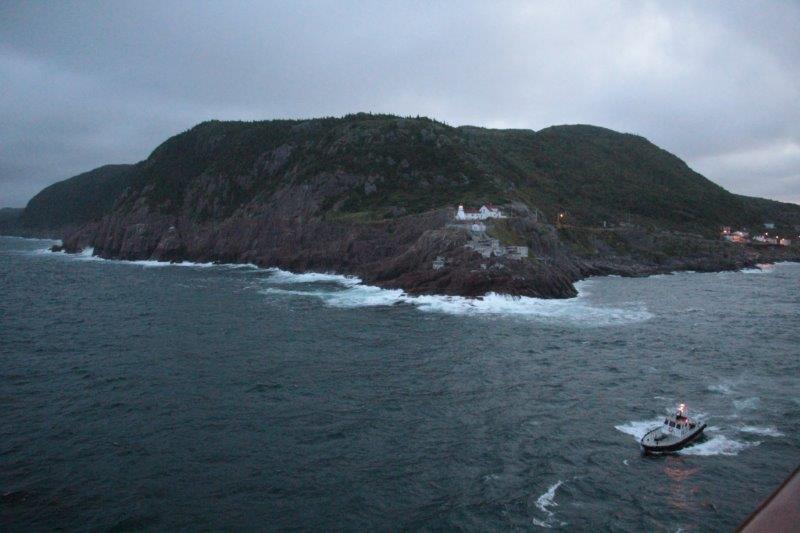
  1. USS Constitution – one of six ships authorized by the Naval Act of  1797 and built in the North End of Boston.  She is a wooden-hulled, three-masted heavy frigate and was launched in 1797.  She saw action against the Barbary pirates at Tripoli to open American trade routes in the Mediterranean, in the War of 1812  when she  captured numerous merchant vessels and defeated five British warships, and In 1840 after the ship was decommissioned from active war service she circled the world on a part-diplomatic, part-scientific mission.  Constitution is the oldest commissioned warship afloat in the world.  She is currently in dry dock undergoing a major restoration and will not be open for touring until 2018.  We did however go through the Constitution museum.  The Constitution (aka Old Ironsides) is the epitome American symbol of freedom and courage and is revered by the nation.

IMG_2207 IMG_2208 IMG_2213 
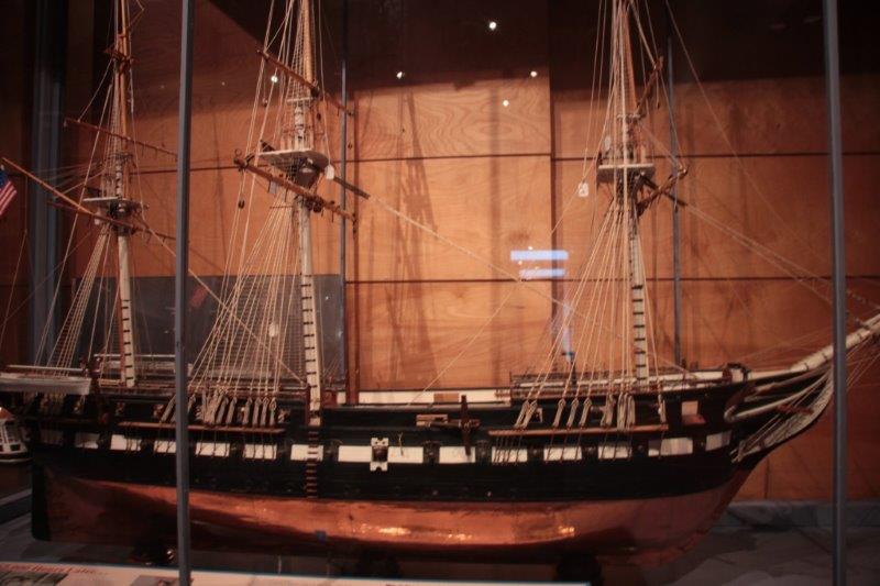
This model took a combined time of 62,000 hours over many years by three main model builders. It is a 1/24 scale and everything on it works.IMG_2215 IMG_2216 IMG_2217 IMG_2218 IMG_2212 IMG_2221 IMG_2229 IMG_2222 IMG_2228

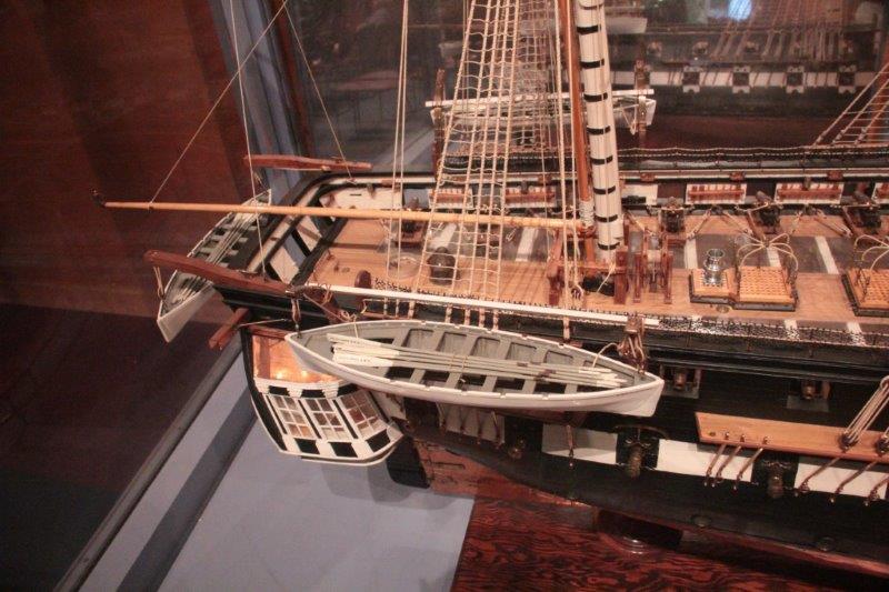
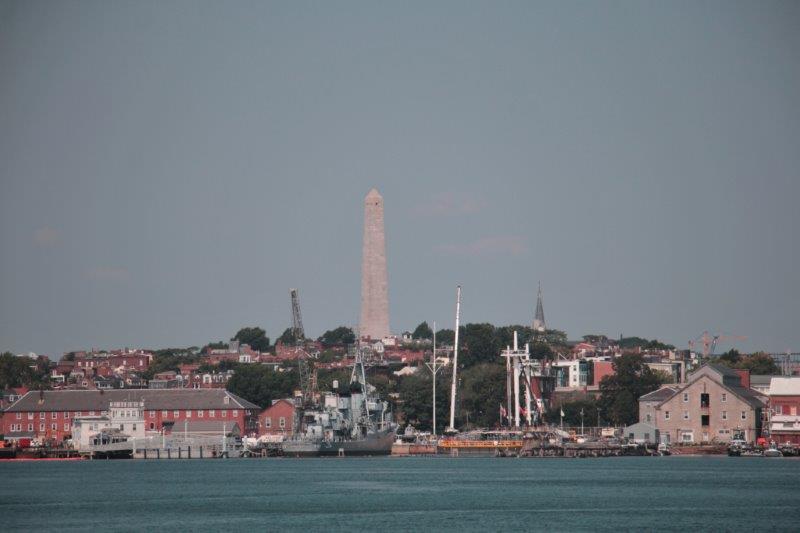
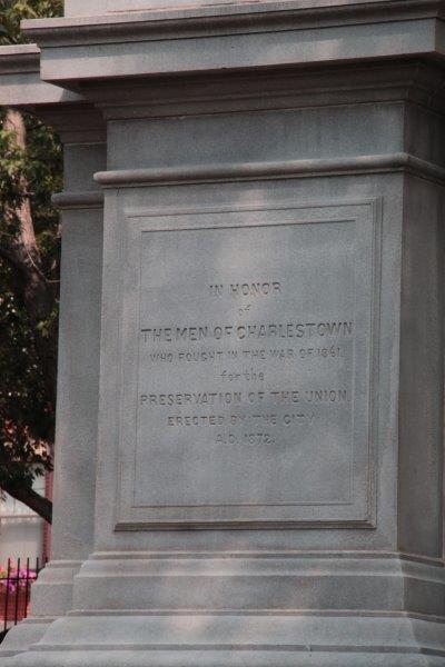
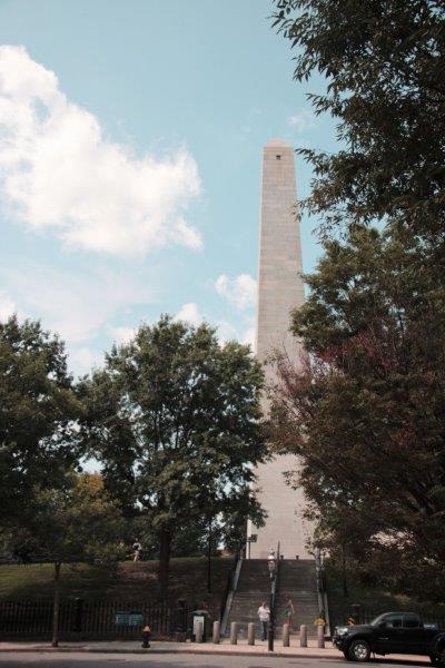
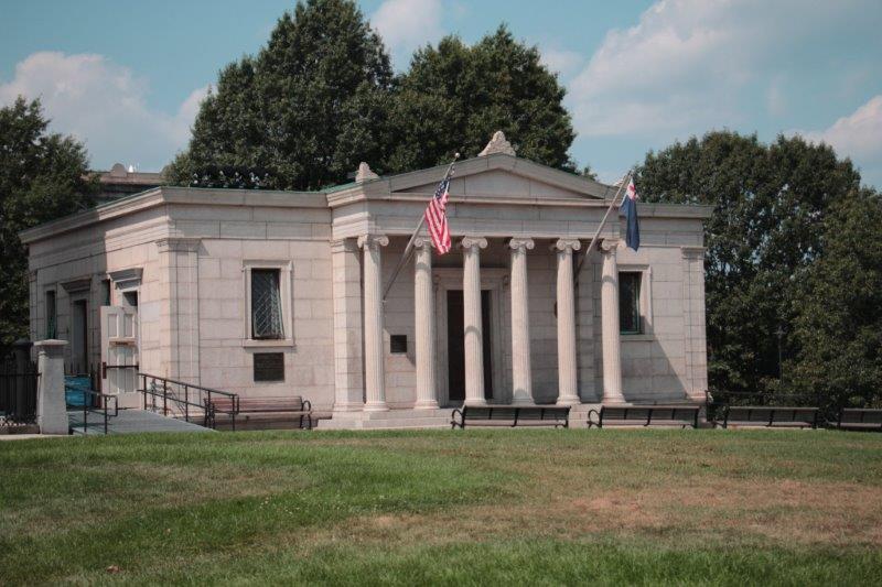
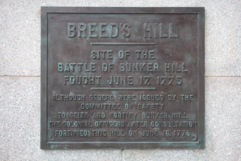
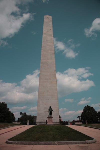
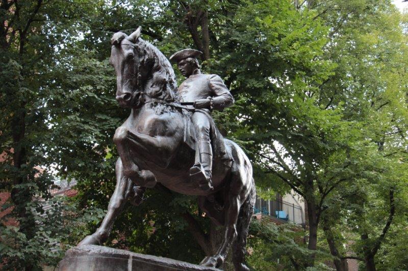
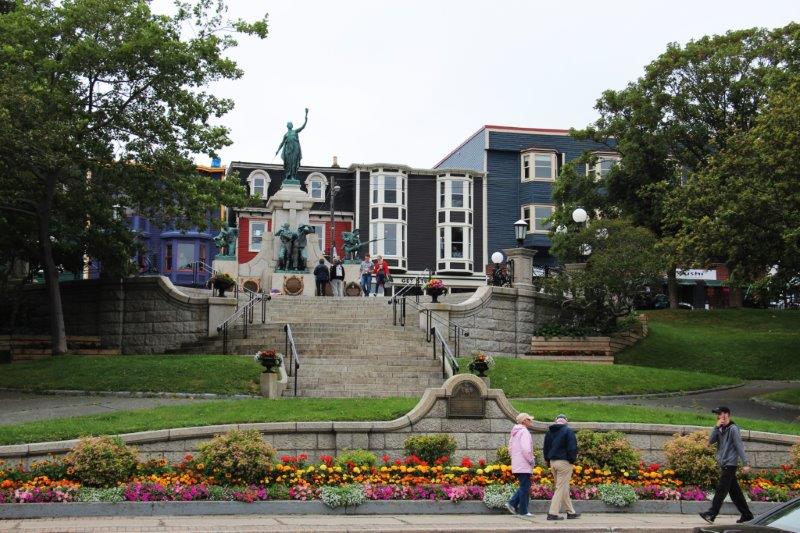
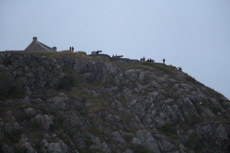
2.  Bunker Hill Monument (technically the final/first stop of the Freedom Trail after the Constitution). Dedicated in 1843 (on the 100 anniversary of the battle) the monument is 221 feet tall, made of granite and has 294 steps to the top.  It sits atop Breed Hill, the site of the first battle of the Amerian Revolution. (Unfortunately due to the heat of the day the Park Rangerhad just closed the tower to climbers.  Maybe we can get back out there another day  before we leave and climb to the top.)  Bunker Hill was an American defeat against superior British forces – 2000 against 1000 colonialists.  Although the British won the battle 1,000 of her men were wounded or killed.  British General Clinton said, “It was a hill too dearly bought.”   The colonists realized they had fought one of the finest armies in the world and and had turned them back twice.  It was a pivotal event and was a tremendous encouragement to the revolutionary movement and symbolizes American determination and fortitude.

IMG_2236 IMG_2237 IMG_2238 IMG_2242 IMG_2239 IMG_2240 IMG_2244 IMG_2247 IMG_2253 IMG_2252 IMG_2256

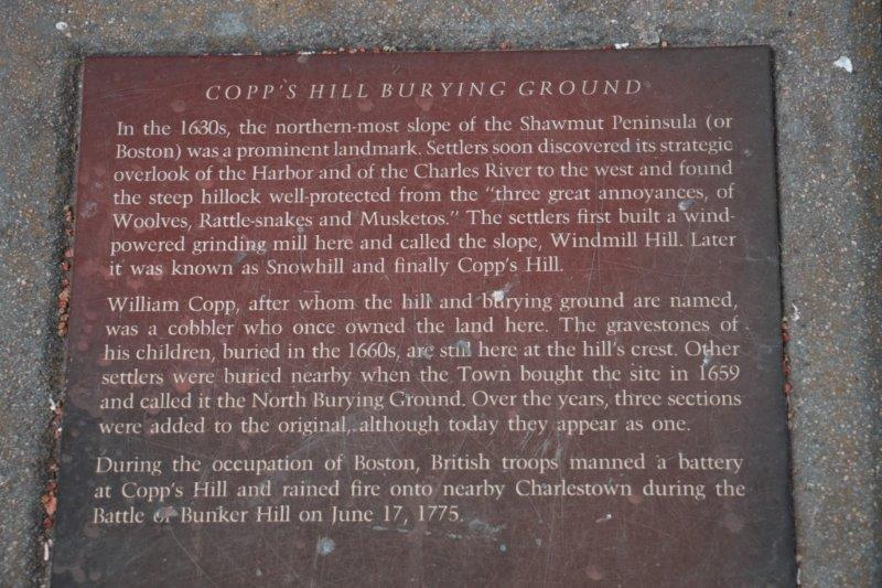
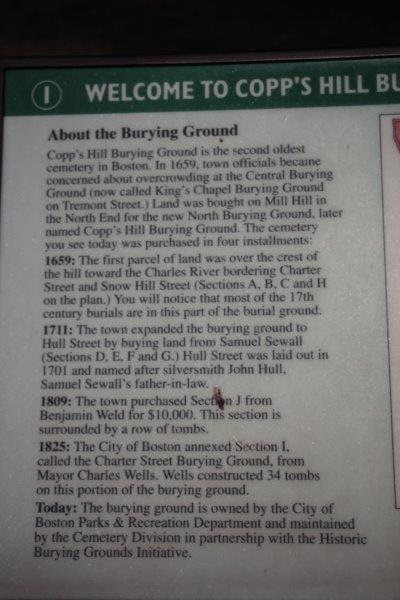
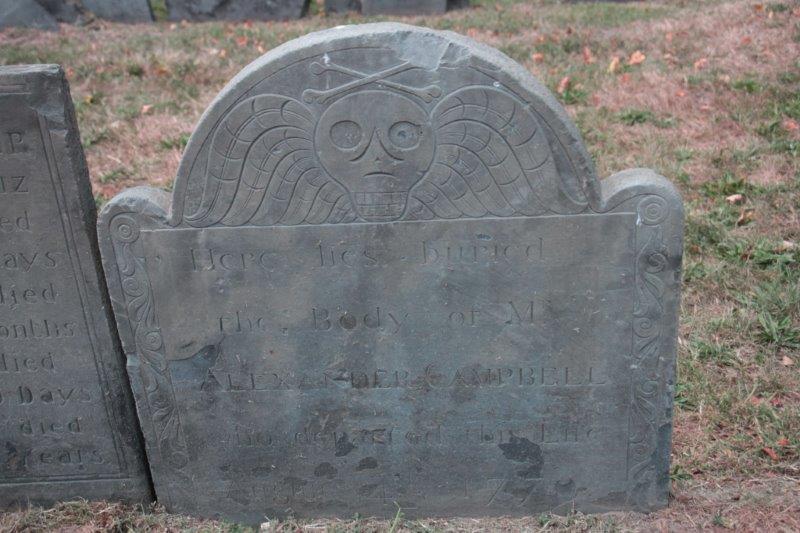
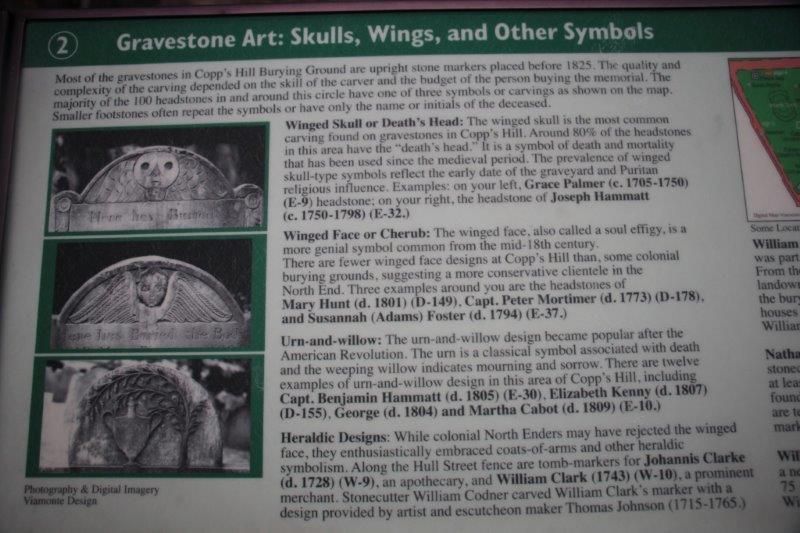
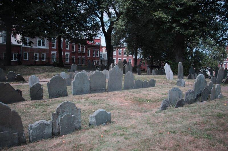
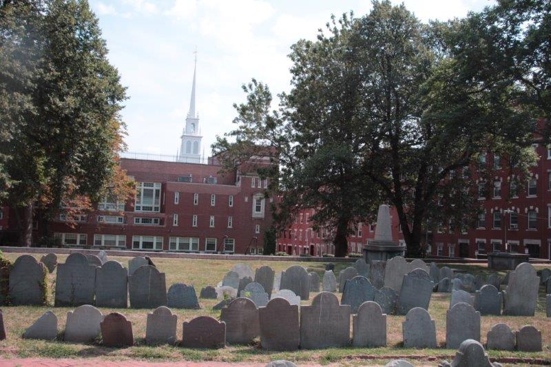
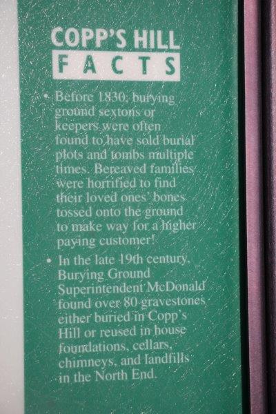
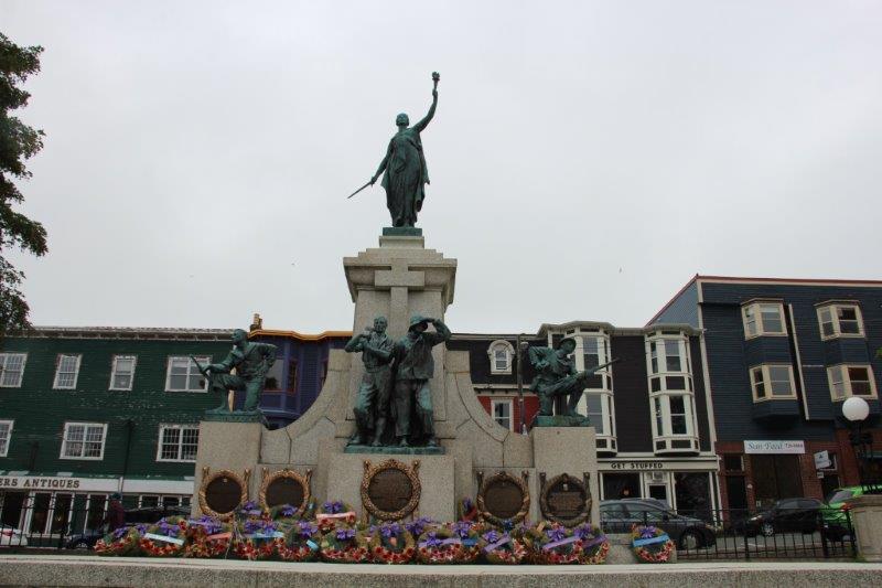
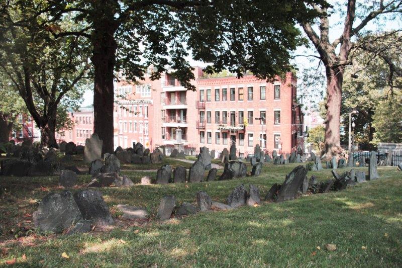
3. Copp’s Burying Ground – Opened in 1660 it is the burying ground of thousands of free Africans who lived nearby. The cemetery was used by the British for target practice before the revolution and from here they rained heavy fire upon the colonists on Breed Hill.

IMG_2259 IMG_2263 IMG_2264 IMG_2268


This one is for you TrishIMG_2269 IMG_2271

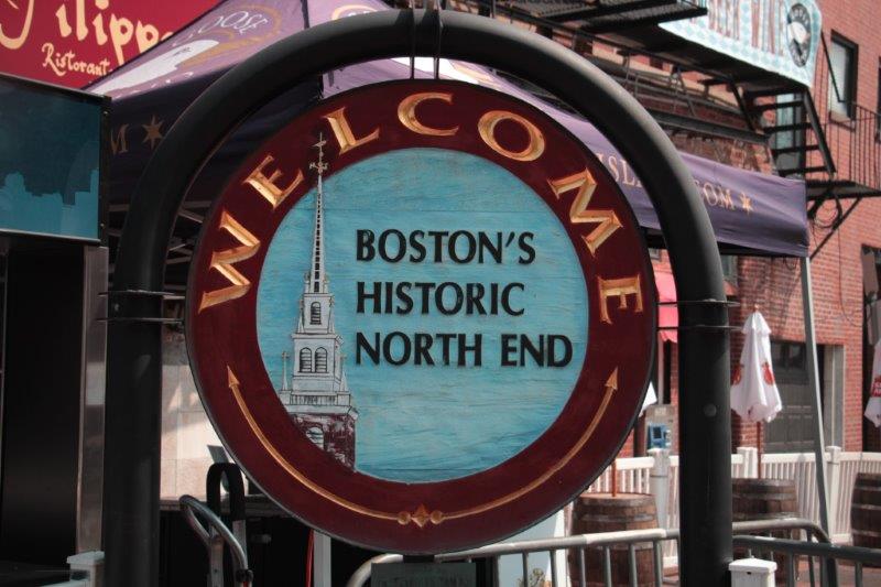
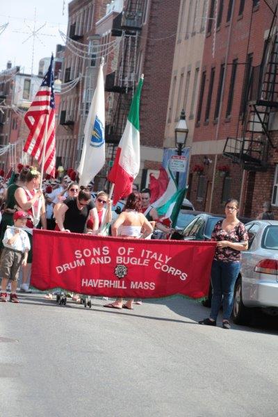
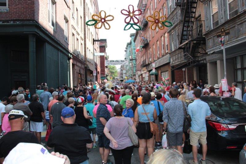
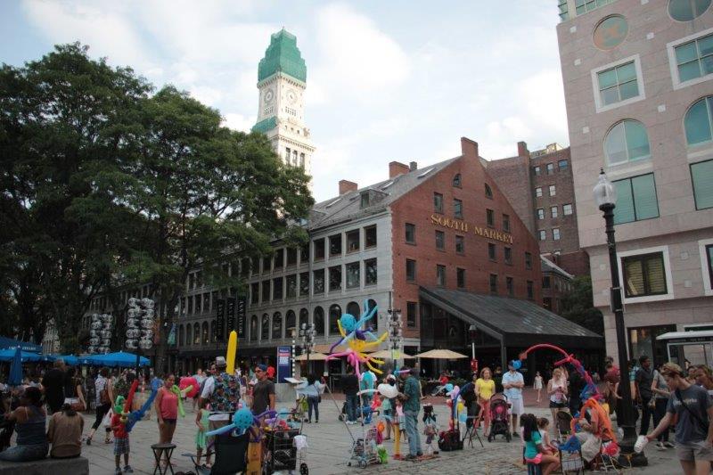
Some of the decorations from the weekend festivities. IMG_2272 IMG_2273 IMG_2274 IMG_2275 IMG_2278 IMG_2279 IMG_2281 IMG_2284 IMG_2285 IMG_2286
IMG_2288IMG_2280 IMG_2283

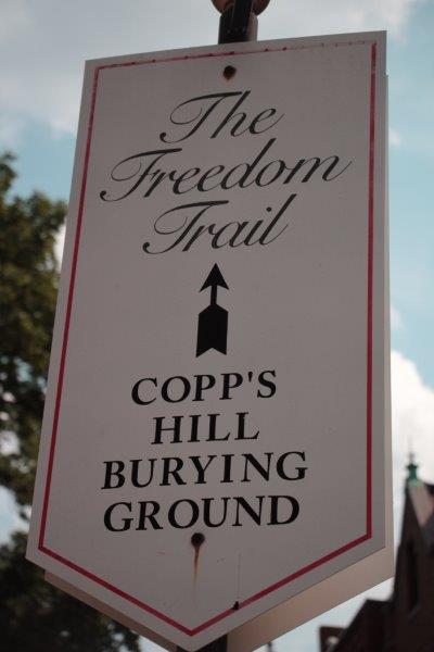
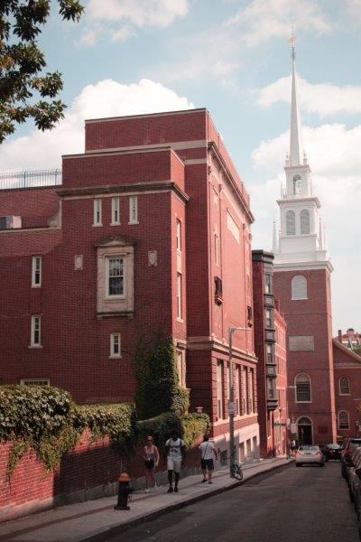
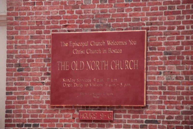
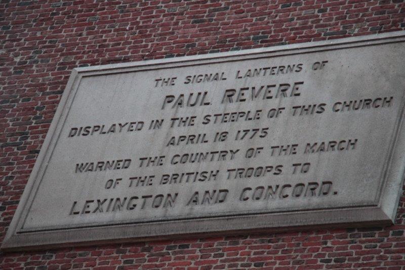
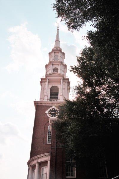
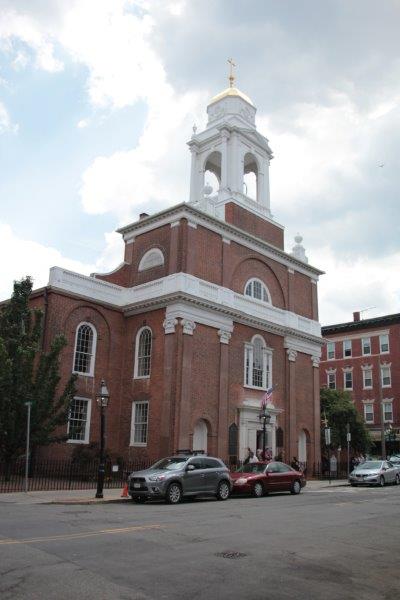
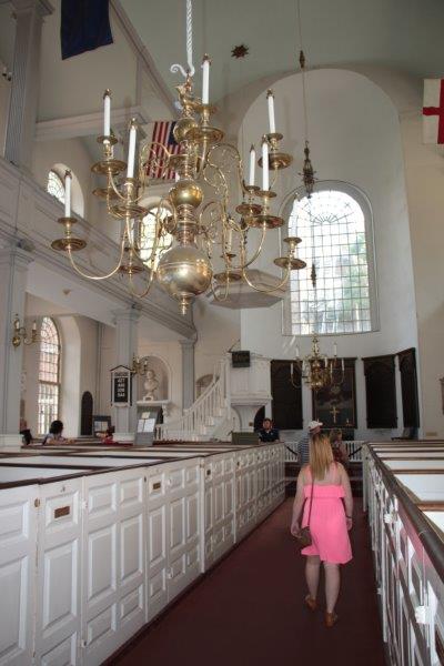
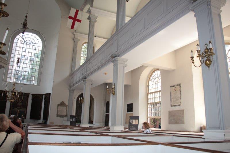
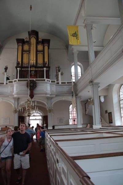
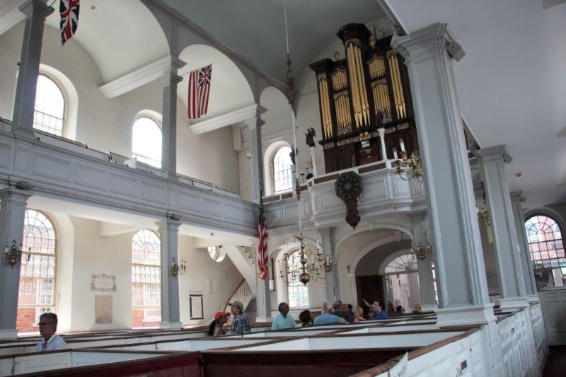
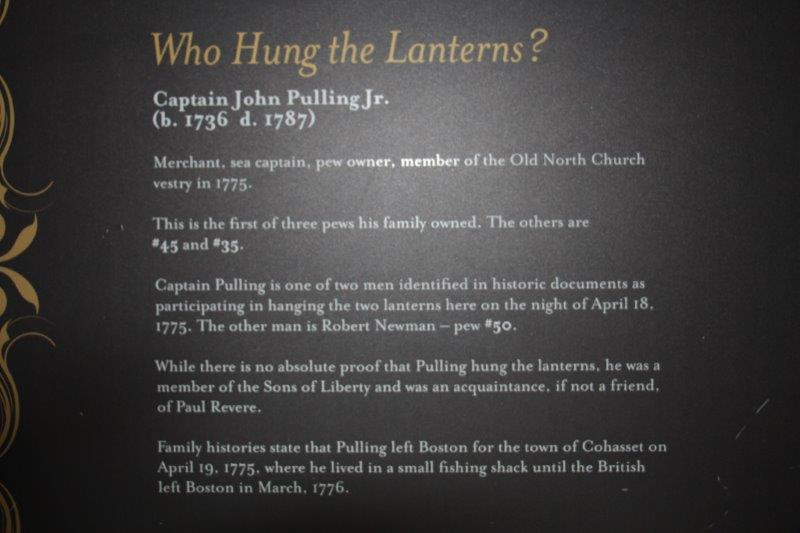
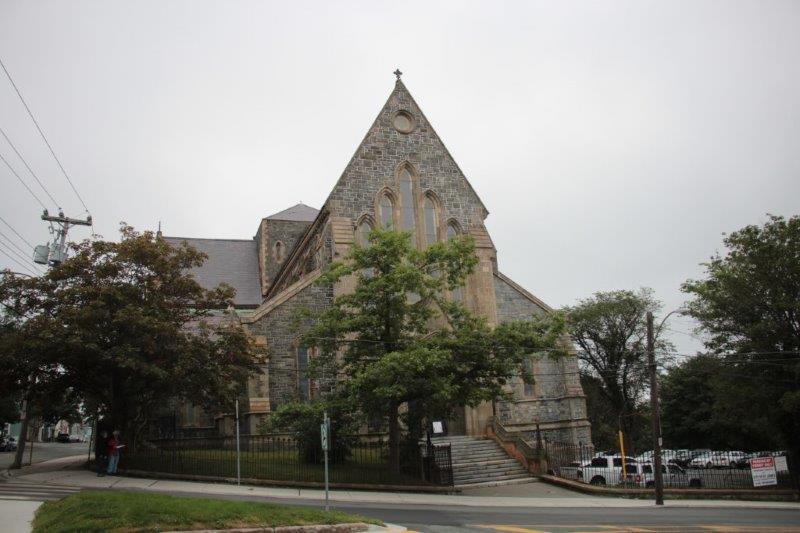
4. Old North Church – Built in 1723. Where the two lanterns were hung in the steeple to warn of the advancing British army.  We toured the inside yesterday.

IMG_2289 IMG_2292 IMG_2293

IMG_2302 IMG_2304

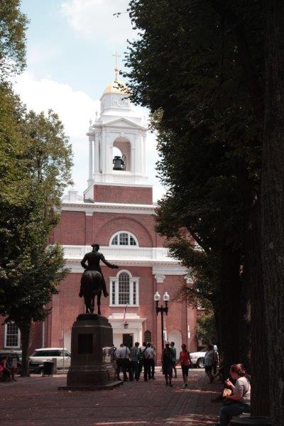
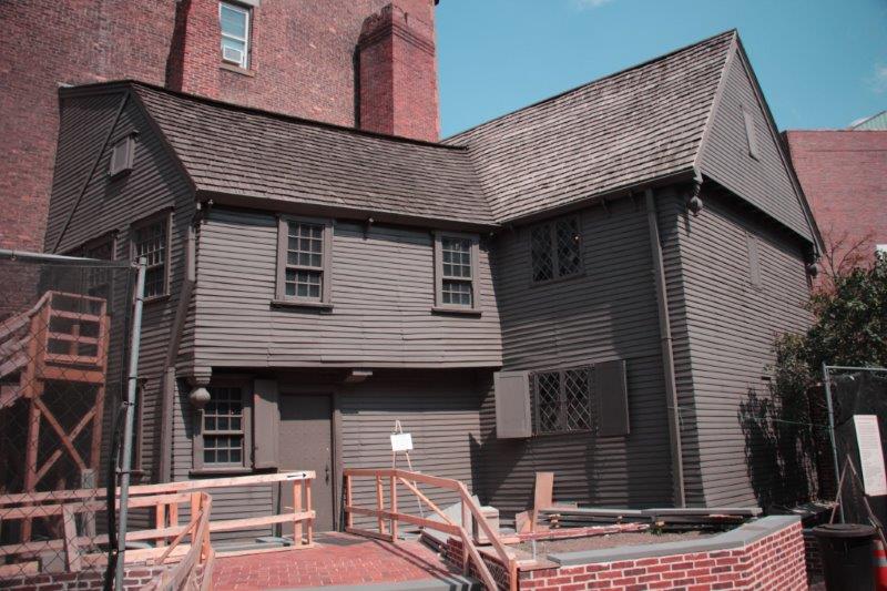
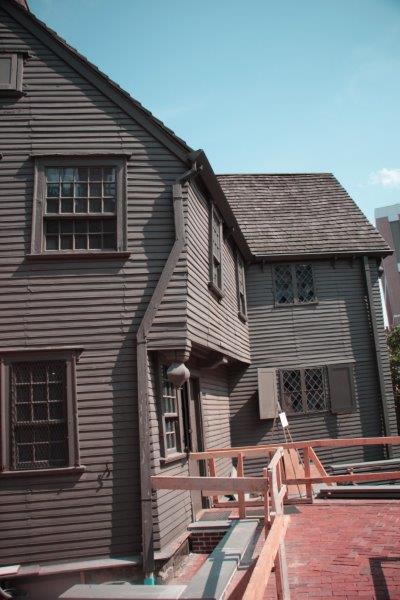
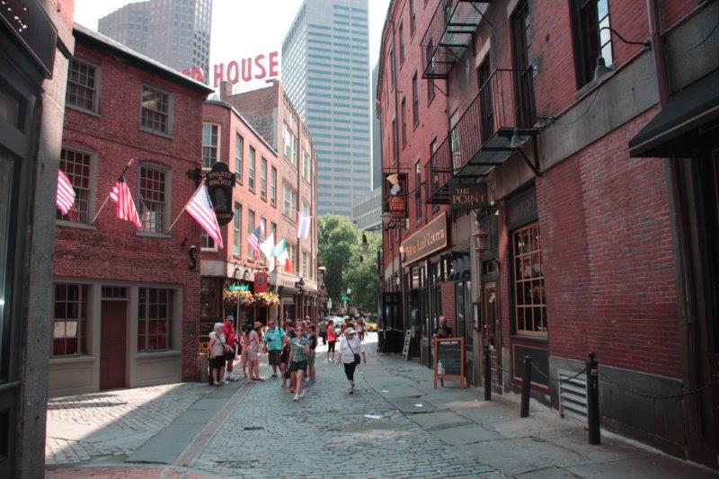
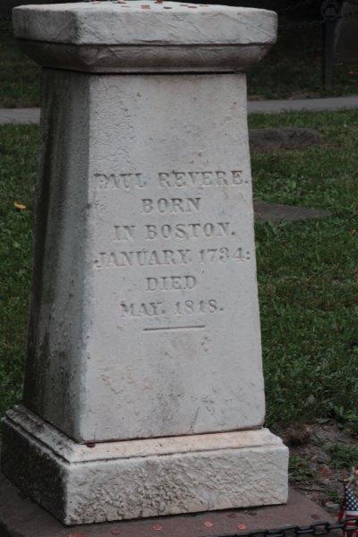
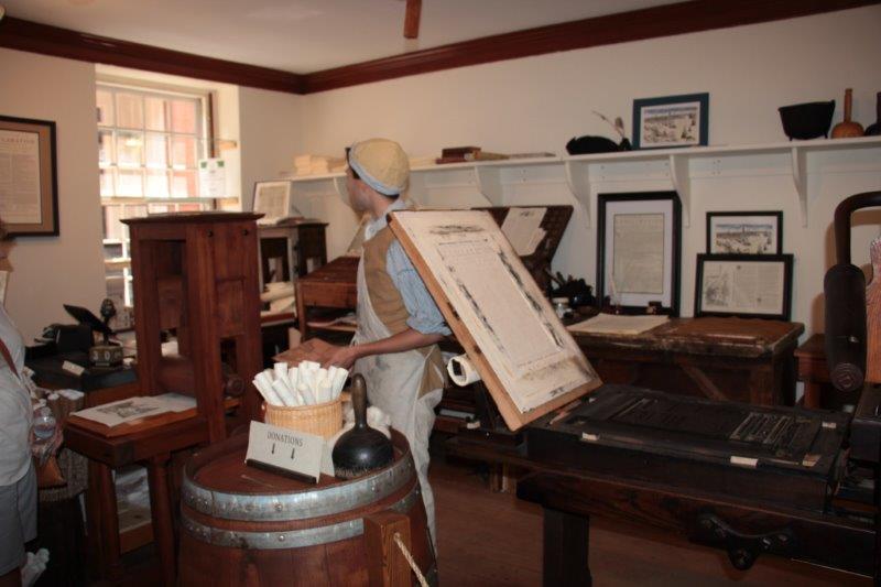
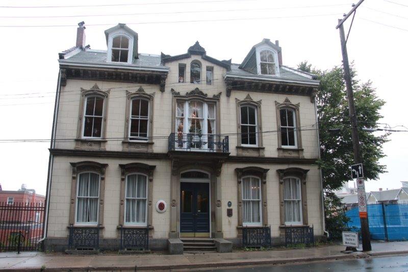
5. Paul Revere House.  The goldsmith (silversmith really) and engraver and patriot lived in this house.  His first wife died not long after the birth of their 8th child and Revere married again 6 months later and fathered 8 more children.  Even after they moved out of the house Revere continued to own it and rented it out.  It was built about 1680 and the Revere’s owned it from 1770-1800.  It was saved from demolition by a member of Paul Revere’s descendants and is maintained and staffed by the Paul Revere Memorial Association.  No photographs were allowed inside.

IMG_2305 IMG_2306 IMG_2313 IMG_2308 IMG_2310

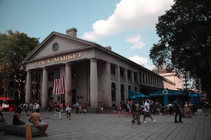
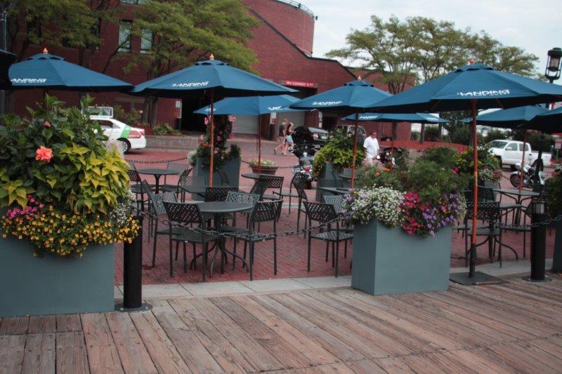
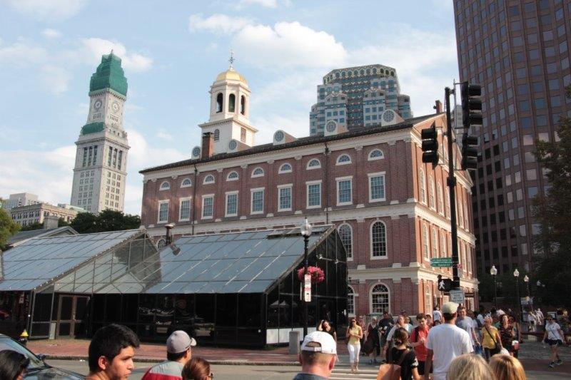
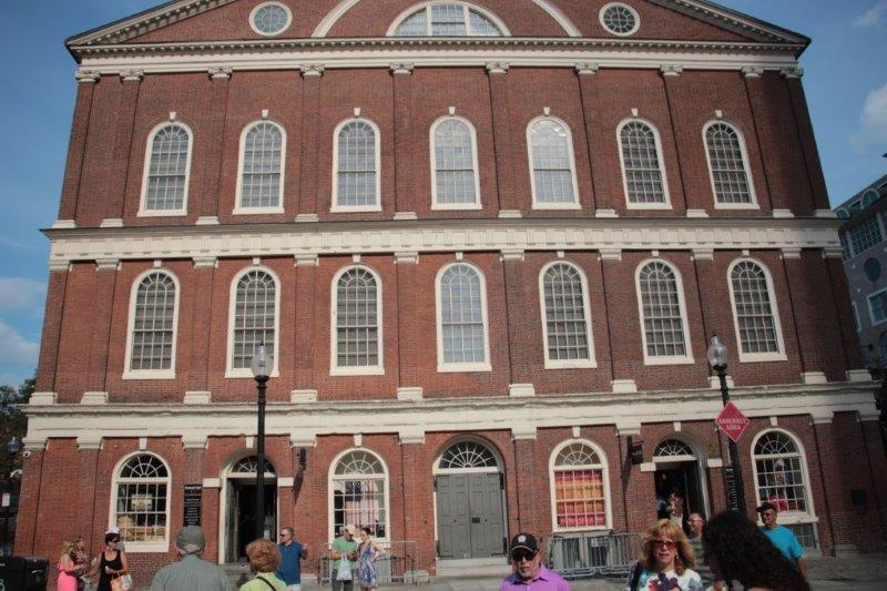
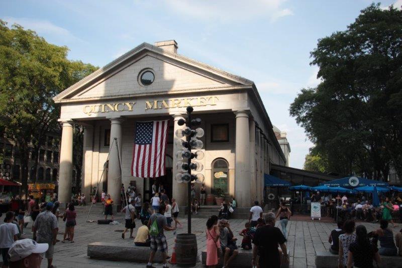
6.  Faneuil Hall and Quincy Market.  Been there, done that yesterday.

IMG_2317 - Copy IMG_2319 - Copy IMG_2324 IMG_2320 - Copy IMG_2321 - Copy

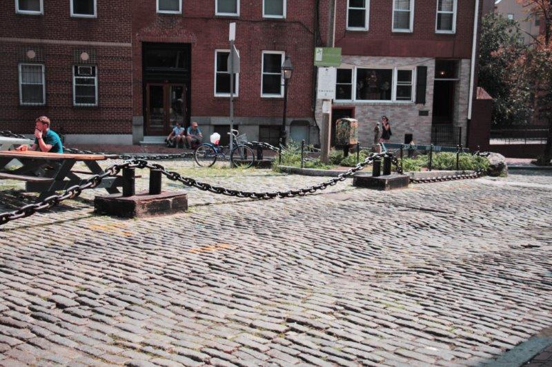
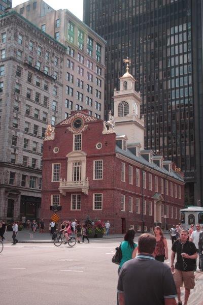
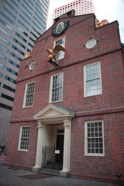
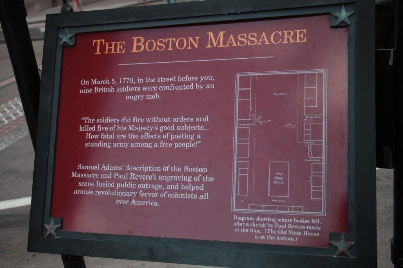
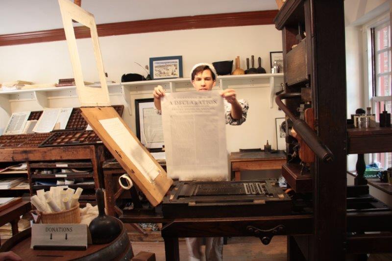
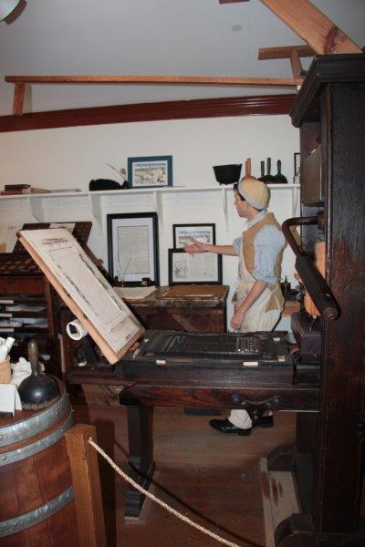
7. and 8. Old State House and the Boston Massacre Site. Built in 1713 this landmark was the seat of colonial and state government as well as the merchants exchange.  Here, on March 5, 1770 British soldiers fired into a crowd of patriot Bostonians, killing five.  Paul Revere’s printed engraving of the site sparked much antagonism against the ruling British.  A circle of cobblestones depict the original site. The first reading of the Declaration of Independance was given from the balcony of the Old State House in July 1776 by John Hancock.

IMG_2325 IMG_2335 IMG_2333 IMG_2331 IMG_2330 IMG_2334

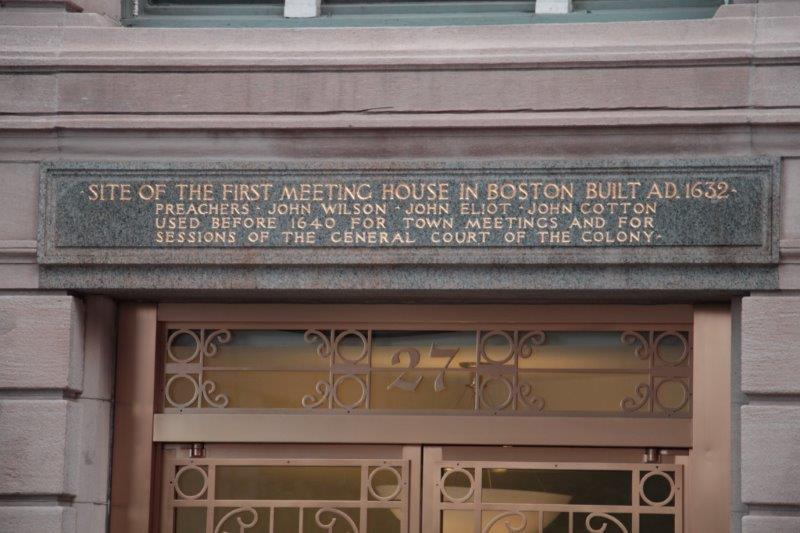
This sign was above the door on the building across the street from the Old State House.


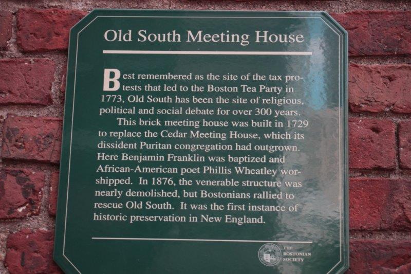
9.  Old South Meeting House.  Built in 1729 as a Congregational (Puritan) Church this building is famous for the fiery meeting that led to the Boston Tea Party incident, which caused the port to be closed and brought the country a step closer to rebellion.  It was saved from destruction in 1876 and was the first successful historic preservation effort in New England.  The building is now a haven for free speech, an active meeting place and a museum. We did not do the tour inside.

IMG_2337

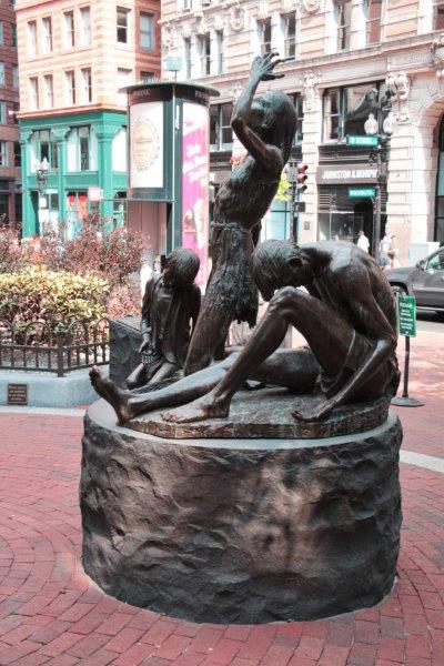
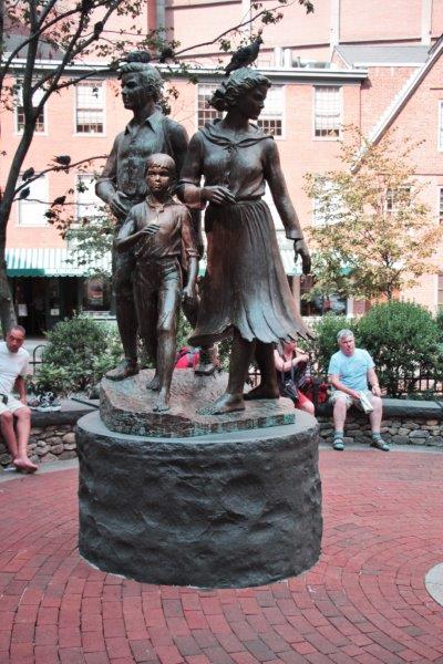
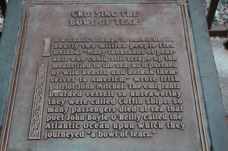
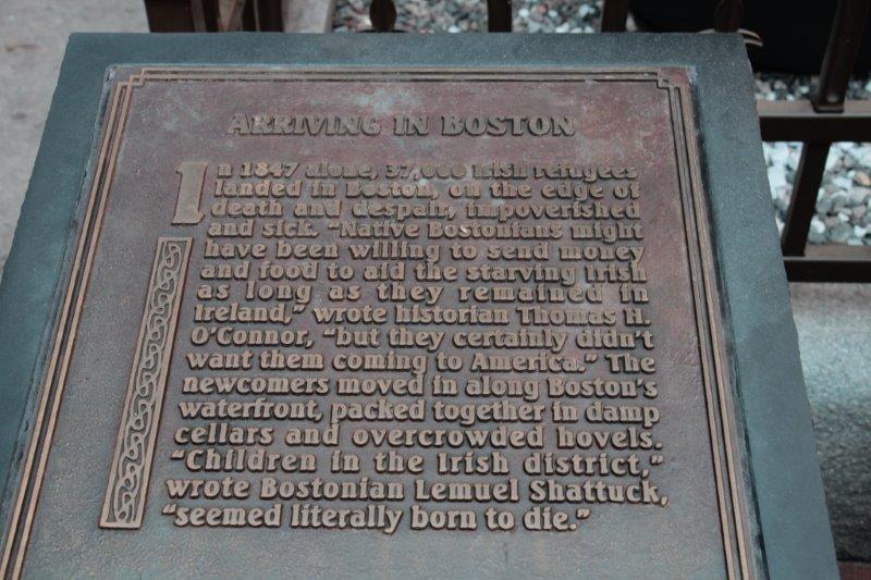
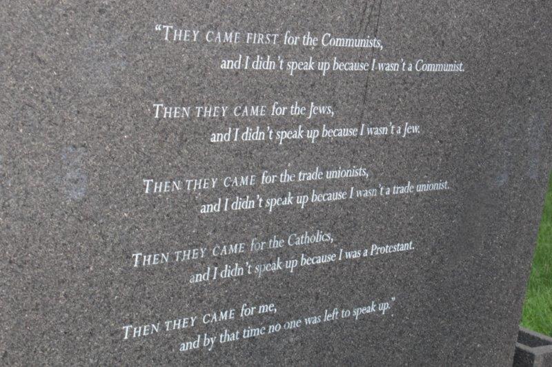
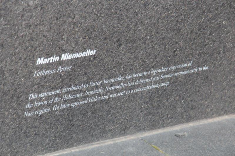
Nearby the Meeting House was the poignant  Irish Famine Memorial.

IMG_2339 IMG_2338 IMG_2342 IMG_2341

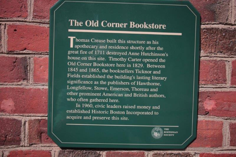
10.  Old Corner Bookstore.  Built in 1712 for Thomas Crease it was the literary center of the mid-1800s. Ralph Waldo Emerson, Henry Wadsworth Longfellow, Harriet Beecher Stowe, Oliver Wendall Holmes, Louisa May Alcott, Nathanial Hawthorne, Henry David Thoreau and many others brought their manuscripts here to be published by Ticknor and Fields Co.  It is now an Italian restaurant.

IMG_2343
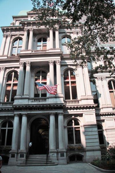
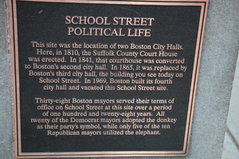
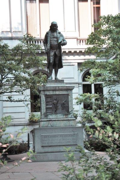
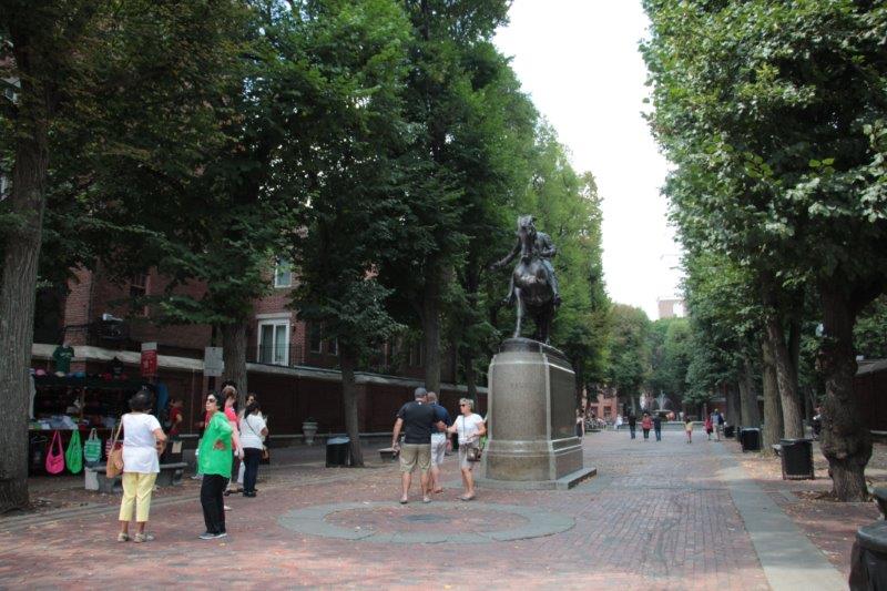
11. Franklin Statue and Boston Latin School Site.  There is a plaque on the wall commemorating the location of the first school in Boston.  The Latin School, the oldest public school in America, was established by Puritans in 1635.  Sam Adams, John Hancock  and Benjamin Franklin all attended the school.  Franklin’s statue graces the courtyard of the old City Hall that was erected on the site and is now a swanky steak house.

IMG_2345 IMG_2347 IMG_2350 IMG_2353

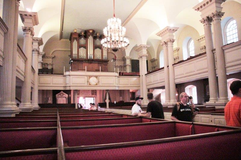
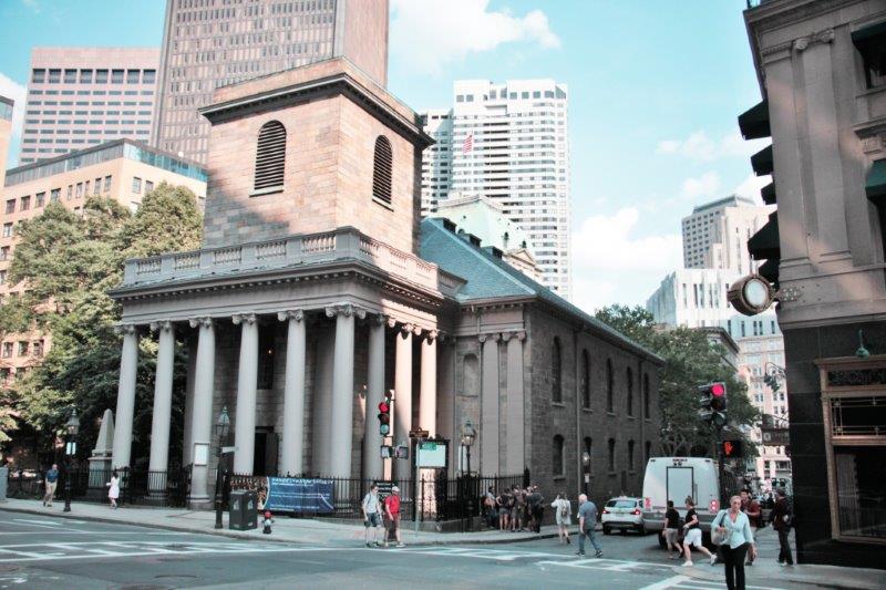
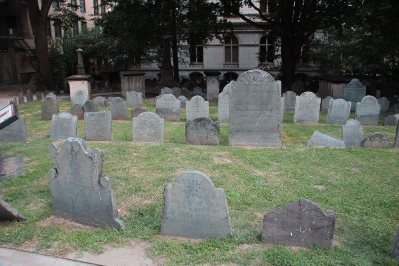
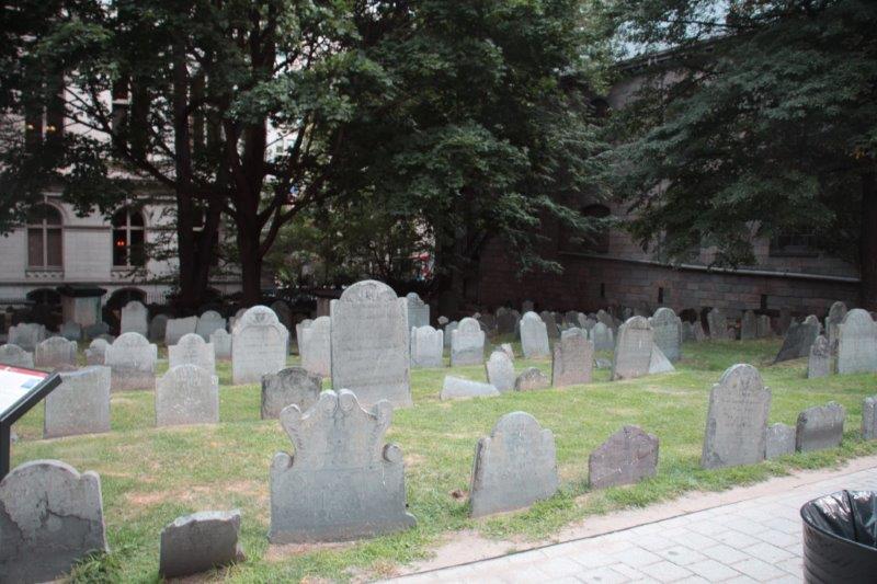
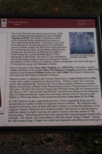
12.  King’s Chapel Burying Ground.  Boston’s original burying ground.  The King’s Chapel Anglican Church at the corner of the cemetery was built much later and graves were dug up to make room for the church and again later to make an addition to the buildings. It was an Anglican church and very unpopular with Bostonians even before the cemetery desecration – and very much so afterward.IMG_2363 IMG_2355 IMG_2360 IMG_2359 IMG_2358 IMG_2374 IMG_2369 IMG_2372 IMG_2368 IMG_2365

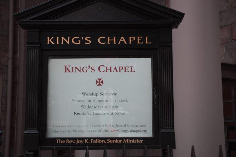
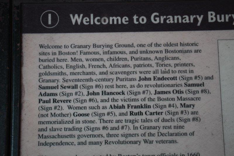
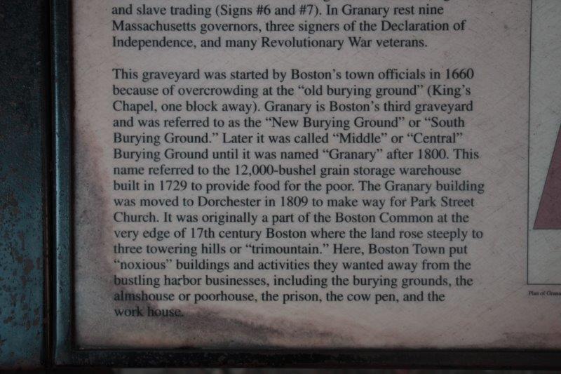
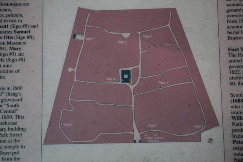
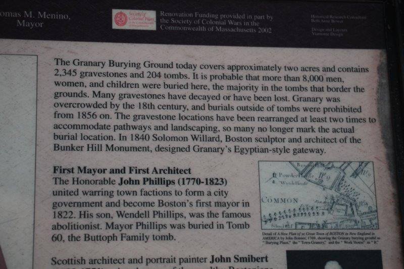
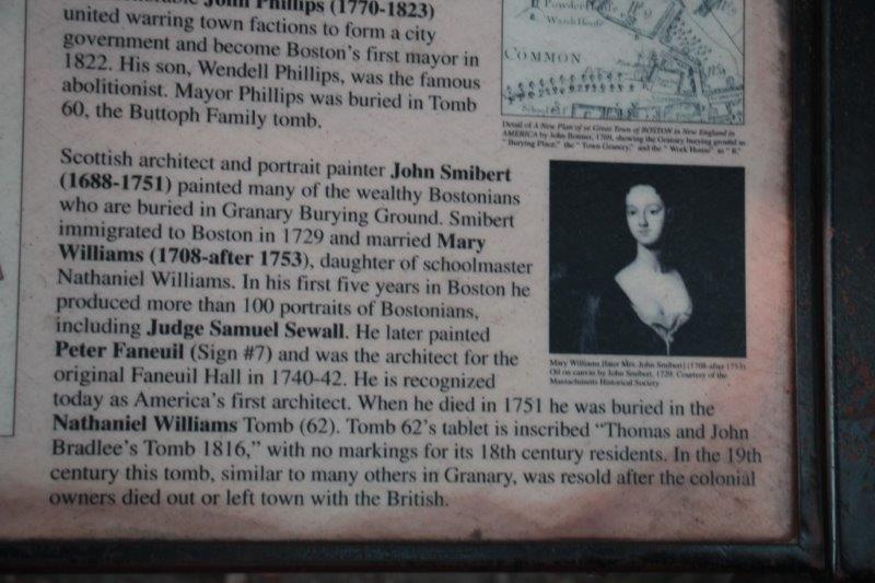
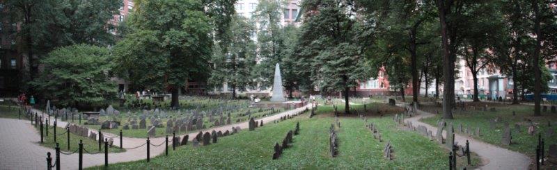
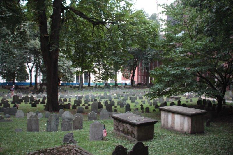
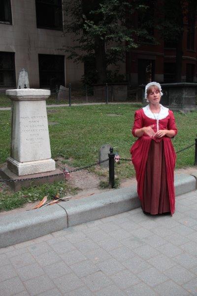
13.  Granary Burying Ground.  Boston’s most famous cemetery. Many notable patriot’s are buried here: Paul Revere, John Hancock, Samuel Adams, Robert Treat Paine, James Otis, and the five men killed in the Boston Massacre.  Also Mother Goose, Ben Franklin’s parents and whole families of settlers ravaged by fire and plague are interred here next to the Park Street Church.

IMG_2375 IMG_2376 IMG_2377 IMG_2378 IMG_2379 IMG_2380 IMG_2390 IMG_2394 IMG_2398 IMG_2399

14.  Park Street Church.  The spire of this 200 year old church (built in 1809) has long been a landmark for downtown shoppers.  The carillon sounds twice a day and the hymn “America” was first sung here July 4, 1831.  William Lloyd Garrison, the abolitionist, gave his first anti-slavery speech here in 1829.  The church was not open to the public since it was a weekday, but Sunday services are still held.  It was also almost impossible to get a photo of because of the close streets and neighbouring buildings.

IMG_2400

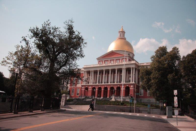
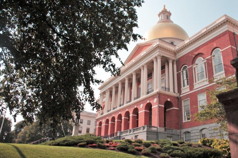
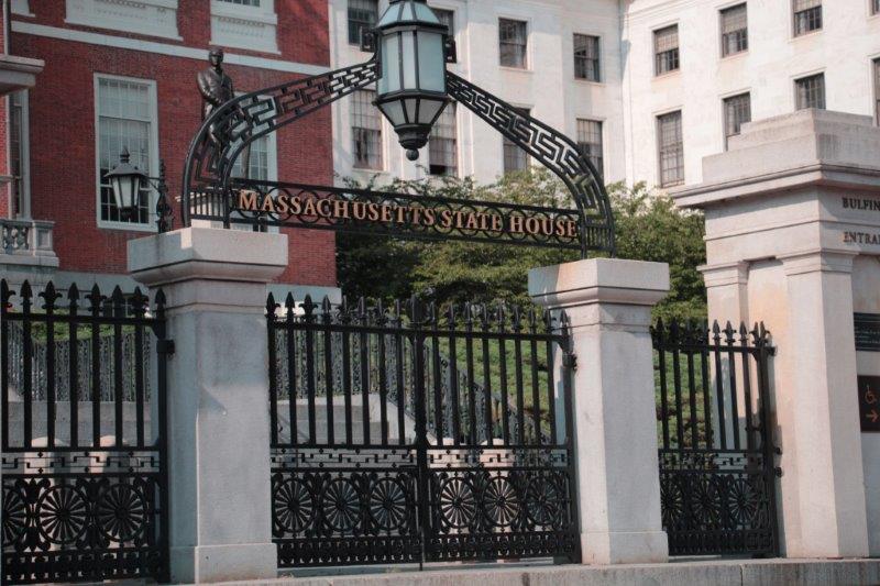
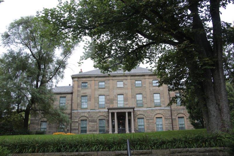
15.  State House.  Built on land originally owned by John Hancock the new State House was designed by renowned architect Charles Bulfinch.  It was built in 1795 (Samuel Adams and Paul Revere laid the cornerstone) and has 23.5 carat gold leaf covering the original copper dome that was placed by Paul Revere.  The State House is open daily for tours but we were too tired by this time to trek through it.

IMG_2403 IMG_2407 IMG_2411

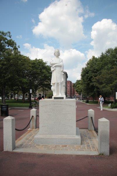
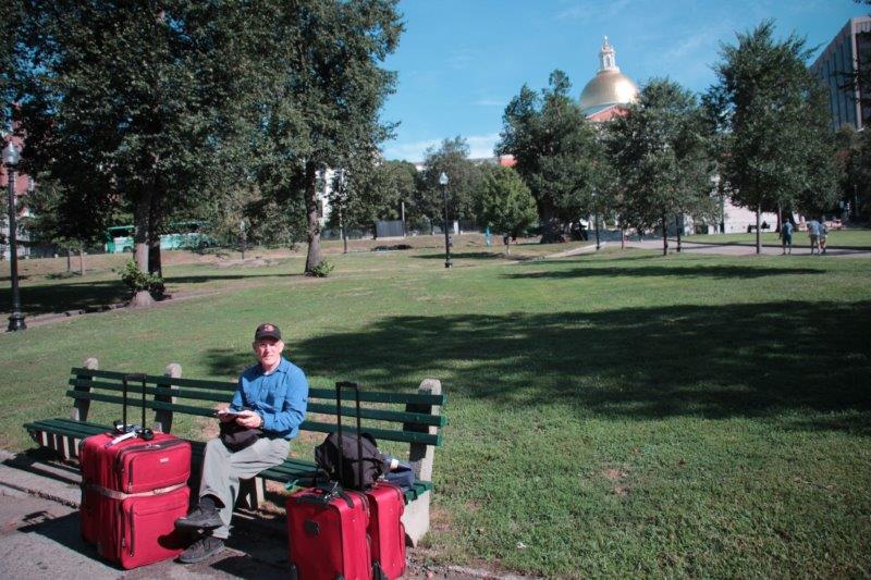
16.  Boston Common.  America’s first public park. Originally purchased in 1634 as a training field for militia and for feeding cattle.  Been there.  Plan to go back and explore the Public Gardena and the Frog Pond.

I AM ALL DONE – AND ALL DONE IN.  But it was a very good day.


2015 Aug 30 – Day 37 – Boston Day 2

We slept until 8:30, had breakfast, checked email and Facebook and, at about 11 set off to find the Bowdoin Subway Station.  We can ride the T for three stops and be at the New England Aquarium in the North End area of Boston.  We were to meet up with Mike and Anne and Christina in the lobby of the Marriott Long Wharf at 12:30.  Since we had no idea how long it may take us to get there and to find the hotel once we arrived  we decided to leave in lots of time and just see the sights in the area to use up whatever spare time we had. IMG_2181

This is the street where our apartment is located
IMG_2057


Pretty much every street in Beacon Hill looks similar to this.


It took us about 10 minutes to walk from the apartment to the subway station, and  another 10 minutes to get to the Aquarium stop where we discovered the Marriott Long Wharf as soon as we exited the station.  We had an hour before our meeting so we walked off to explore this area of Inner Harbor with all the different wharves and marinas and old brick buildings.  The Whale Watching tours, city harbour tours, the ferries to the Boston Harbor Islands and different parts of the area all come and go from the North End wharf district so it is a busy place.

IMG_2060 IMG_2063 IMG_2064 IMG_2066 IMG_2069 IMG_2071 IMG_2072 IMG_2073 IMG_2079 IMG_2080 IMG_2083There are 38 miles of walkways around Boston’s many harbours so  one has plenty of places to explore.  When it was getting close to our meeting time we walked  through Christopher Columbus park and into the Marriott Long Wharf – a lovely hotel with a huge lobby on the second floor and many inviting seating areas.  One section over in the corner was set up like a home library and I really liked the deep round-topped leather chair.  Don’t know how I will get it home though.

IMG_2089 IMG_2091 IMG_2092 IMG_2094 IMG_2096 IMG_2086 (2)

Anne is the  sister of our daughter-in-law Carrie and she and her husband Mike live about an hour outside of Boston.  Their daughter Christina lives and works in Boston and their son Sean has just moved to North Carolina to attend High Point University.  We met the family in 2013 when we all got together for the wedding of our son Joseph to Carrie and we had really hoped we would be able to have a visit with them while we were in their area.

The North End has several of the things on my “I want to see” list but we were more interested in spending some time with Anne, Mike and Christina than rushing from spot to spot to see things. We plan to do the entire Freedom Trail while we are here so will be back in the area another day anyway.

One of the first places we all strolled into was Paul Revere park with the statue of the famous patriot on his horse as immortalized in Henry Wadsworth Longfellows (1808-1882) poem, “The Midnight Ride of Paul Revere,” that I remember memorizing in grade school. The house he lived is nearby but we will see it another day.

IMG_2097 IMG_2099 IMG_2102 (1) IMG_2106We next stopped in at Captain Jackson’s Historic Chocolate Shop and the adjoining print shop where a young fellow was printing copies of the Declaration of Independence with a Revolutionary-era printing press.  They also have in the shop  the only original engraving press in the USA  plus a replica that they use to demonstrate how Revere and other engravers printed their pictures and broadsheets. On the other side of the entry was the chocolate shop where they make chocolate the old -fashioned way, using all the various ingredients – cinnamon,  nutmeg, red peppers and 8 or 9 others; all except sugar which was very expensive back then and people who could afford to have sugar would add it to their chocolate drink after it was served.

IMG_2108 IMG_2109 IMG_2110 IMG_2111Old North Church is the famous building where the two lanterns were hung in the window of the steeple to warn the Bostonians that the British were coming (via the sea – one lantern if by land, two lanterns if by sea) to clamp down on the revolution of America against British rule –  Boston Tea Party and all that.  They still  conduct two services every Sunday and a descendent of Paul Revere still owns a pew.

IMG_2113 IMG_2114 IMG_2116 IMG_2118 IMG_2124After we left the church we went in search of somewhere to have lunch.  This area of Boston is the Italian section and as we passed an intersecting street Anne said, “Look, St. Anthony is coming.”

Aug 28-30 is the 96th annual ‘Feast of Feasts’ in Boston. Begun in 1919 by Italian immigrants in honour of St. Anthony, the patron saint of the  area of Italy where they came from, it is the largest Italian religious festival in New England.  There are parades, decorations in the streets, marching bands, strolling singers, street entertainers and great Italian food everywhere.  The highlight is the 10 hour procession of St. Anthony through the streets bedecked in ribbons that people clip money to whenever the statue is lowered to change the bearers, who are all members of the St. Anthony Society.

IMG_2126 IMG_2135


IMG_2127 IMG_2131


Lot and lots of people.


We located a restaurant, had a delicious Italian lunch and began walking in the direction of Mike’s Pasty Shop where the best Cannoli in all of Boston is made.  The crowd inside the shop is wall to wall and there was a long line of people on the sidewalk waiting for the brave souls to re-emerge.  Christina said that the line wasn’t too bad today. Often those waiting to place their orders stretch far out in the street. Today they all managed to squeeze inside.  I stayed outside, John and Mike came out a while later and Anne and Christina came out with three boxes of goodies, having survived the experience..IMG_2137 IMG_2140 IMG_2142


IMG_2126 IMG_2145 IMG_2134The next thing we saw was also on my list along with Old North Church and that was the New England Holocaust Memorial.  Erected in 1995 it is an outdoor memorial consisting of six tall pillars representing the six million Jews (11 million men, women and children altogether) killed by the Nazis in 6 main death camps over six years (1939-1945).  Each of the towers is made of 24 panes of glass; 22 of which are etched with numbers and 2 are inscribed with messages.  The numbers are all 7 digits to symbolize the tattoos put on each  prisoner’s arm as part of the  de-humanizing numerical system employed by the Nazis

.IMG_2151 IMG_2154 IMG_2152 IMG_2153After we left the memorial we went over to Faneuil Hall and the Quincy Market.  Faneuil Hall was built in 1742, the gift of wealthy merchant Peter Faneuil as a place for public meetings and a public market.  Quincy Market, along with North Market and South Market, is the local farmers market of food, wine and cheese and every manner of food stuff you can think of.  Faneuil Hall has the souviner shops and other little niche stores.

IMG_2168 IMG_2170 IMG_2172 IMG_2173Once we finished taking a quick wander through the markets it was time to say good-bye to Anne, Mike and Christina.  We really had a nice afternoon with them and appreciated their giving up their Sunday afternoon to come into town to see us.  Ten minutes after we had done our  good-bye hugs and said our farewells I realized I had never taken a photo of them, nor had I have someone take a pic of the five of us – which I did plan to do..  Brilliant!  But other than that discrepancy it was a wonderful day.  Thank you so much!


2015 Aug 29 – Day 36 – Boston Day 1

We were off the ship at 9 am this morning and, because we were off so early,  managed to get one of the waiting taxis.  Apparently only City of Boston Taxis can pick up fares within the cruise terminal.  Independent taxis can drop people off but they cannot get a new fare.  The Boston City Taxis line up for fares when the ships come in but once they have found a fare they don’t come back automatically for another one.  So if you get off the ship later in the morning you must phone for a taxi ;and wait for it  to come get you.

We had the taxi driver drop us off at Boston Common – the oldest public garden in the USA.  The apartment we have rented for the week is not too far from the Common in the old Beacon Hill area.  We were told we could drop off our luggage at 11:30 but check-in wasn’t until 3.  The day was beautifully warm and sunny so we just sat on a bench and people watched (well, Ialso  worked on a word puzzle for awhile) for a couple of hours until it was time to go over there.

IMG_2023

Sitting in Boston Common in the sunshineIMG_2026 IMG_2025

We dragged our suitcases about 6 blocks and met Chen, our landlord’s sister just as she was coming to clean the apartment after the previous people left.  She let us in, we climbed up to the fourth floor, got the key and left our luggage so we could go exploring.

We found a nearby pub and had lunch then walked further down the street.  We saw a people-bridge that crossed the busy four-lane highway and went to the shore of the Charles River and the Esplanade walking trail.  Once more we sat on a bench and enjoyed the view of the sailboats and “Duck Trolleys” plying the water.  Then we wandered up further and investigated the hours and prices at the Museum of Science (a place we plan to visit) before meandering back to Garden Street.

IMG_2030 IMG_2032 IMG_2033 IMG_2035 IMG_2036 IMG_2037 IMG_2039 IMG_2048There is a Whole Foods and a CVS Pharmacy just over and down a block and lots of restaurants in the area.  We bought some food for supper and breakfast and got back to the apartment at 3 pm to ‘check-in.”.

We spent the rest of the day catching up on email, Facebook and blogs before making dinner, reading for a while, and I did this blog.  Our 6:30 am start was beginning to slow us down so we headed off to bed a bit early.

IMG_2055

I liked the reflection of the old building in the glass of the new one.


Tomorrow we are meeting up with Carrie’s (our daughter-in-law) sister and her husband, and maybe their daughter.  We met them all at Joseph and Carrie’s wedding in Scotland in 2013 and look forward to visiting with them again.

2015 Aug 28 – Day 35 – Bar Harbor, Maine

We had a lovely day in Bar Harbor.  The sun shone all day, there was a light breeze, and the temperature was pleasantly warm.  There is no geographical sites unless you drive up to Acadian National Bark, which we drove through last summer.  The museum is Native American history, which I have seen lots of over the years.  What is attractive in Bar Harbor is the seaside, the shops (assuming you shop), the clapboard buildings and the beautiful estate ‘cottages.’

Bar Harbor was a hotel town back in the day.  There were enough hotel rooms for 2,500 people, but in the late 1800’s some wealthy influential people began to build summer cottages to ‘get away from the city.’  Gradually the hotel rooms disappeared and more and more cottage cropped up.  Over the last 10-15 years, Bar Harbor has become increasingly  popular as a summer holiday destination and there are many new ‘old style’ hotels and many of the grand cottages are B & Bs..

IMG_1920


The harbour navigation pilot getting off and US Border and Immigration arriving.IMG_1922 IMG_1924 IMG_1925 IMG_1927 IMG_1929 IMG_1931 IMG_1932We had not booked a tour here since we drove through the area and stayed in Bar Harbor two nights last summer.  We just wandered around the town, tried to locate a cache (DNF – Did Not Find) in the Village Green, walked the Shore Path (we did find a cache along here), and wandered back to town again.  We were in no hurry to be anywhere, the weather was pleasant and sat on a bench at the harbor for almost an hour before getting on a tender back to the ship.

IMG_1940 IMG_1942 IMG_1973 IMG_1954 IMG_1956 IMG_1970 (2) IMG_1957 IMG_1962 IMG_1967 IMG_1968 IMG_1969 IMG_1978There were two HAL ships in the harbor today.  We met the Maasdam at St. John’s and it was also anchored in Bar Harbor.  The Maasdam will be ending its current cruise in Boston tomorrow too.  After that the Veendam and the Maasdam will be on an alternating rotation going up the New England/Canada coast for the fall colour season.  We had thought the Carnival Splendor that was also berthed in St. John’s might be in Bar Harbor today but they didn’t show.  The two HAL ships made for a busy enough town as it was.

IMG_1979 IMG_1980 IMG_1981 IMG_1990 IMG_1993 IMG_1995 IMG_1997 IMG_1998 IMG_2001 IMG_2008The crew of the Veendam has been working very had over the last few weeks making sure everything aboard is in tip-top working condition because today in Bar Harbor they undergo a Coast Guard inspection which determines whether or not we set sail again.  I am pretty confident we will pass.

“Tha-tha-that’s all folks.”  The exploring (via cruise ship anyway) has ended.  Bar Harbor is our last port of call. Everyone on the ship – passengers and crew – was screened by US Border and Immigration officials this morning.  Tomorrow morning at 7 am we dock at Boston’s Black Falcon Terminal Cruiseport and everyone will be off the ship by 9:30.  Tonight we pack.

When we get to Boston we will take a cab into the city and locate the condo we have rented for the week.  We will also have to find a grocery store and lay is some provisions, especially breakfast foods.  We can drop off our luggage at 11:30 but we can’t get the key until 3.  The condo is located in Beacon Hill, near the Boston Common, right on the historical Black Heritage Trail so we will probably walk that route before going to the condo to settle in.  Another week of adventure beckons.  Stay tuned….

2015 Aug 26 & 27 – Days 33 & 34 – At Sea and Halifax, NS

We had nice weather on our sea day between St. John’s, NL and Halifax, NS.  The water was a lovely shade of blue/green – very like the colour we saw embedded in the icebergs.  And, surprise, surprise, we actually did a couple of things.

At 10 am there was a presentation about the crew’s lives on board – their contracts (usually 8-10 months), training (HAL maintains training universities at Manilla in the Philippines and Jakarta in Indonesia), cabins (2 people per), entertainment (games, parties, movies, DVD, excursions), religious services (provided for Protestant, Catholic, Muslim, Hindu and Jewish if any), food (their own chefs that cook the favorite foods of both nationalities), plus information about entertainers contracts, officers mess and cabins and much more.  It was very interesting.

At 11 am we attended the Mariner’s Reception and received our Silver Medallions representing 300 days sailed with Holland America Line.  Bronze is 100 days.  We received that on our very first cruise on a HAL ship in 2009 when we went around the world in 128 days.  Gold Medallion is for 500 days and there were about 50 people on the ship who have that level. They awarded five more at the reception.  The biggie though is Platinum for 700 days or more.  There were 8 people in the room that already have their platinum medallions – they brought them with them and wore them. Not something I would do, but whatever.  Three people were  awarded platinum; one fellow has sailed over 900 days on HAL ships.  I wish it was me.  I don’t think that will happen anytime soon though.  The total accumulated HAL sailing days of all the people in the room was over 85,000!  That is a lot of loyal cruisers.

IMG_1914After the reception with the free champagne we walked to the other end of the ship and had the Mariner’s Lunch with more free champagne – always a good thing.  Holland has a lot of people who cruise with them over and over – due in a large part to the varied itineraries and the smaller ships – and this ship has over 500 four and five star Mariner’s aboard.  All people who have taken a Holland cruise before get invited to a Mariner’s luncheon. They space them out throughout the cruise so some people had their lunch quite early on.  Stars are the reward program represented by the number of days you cruise on HAL ships PLUS extra ‘days’ earned via onboard spending – shore excursions, shopping, photos, drinks, etc.  Not gambling though.  At four star you get discounts in the shops, at the specialty restaurants, priority boarding and priority tenders, and free laundry services.  The highest is five stars and that constitues 1000 sea and shopping credit days.

With such a jam-packed morning we had to take the afternoon off and read and rest in our cabin.   I worked a bit though and published my St. John’s blog.

Today we arrived in Halifax under cloudy skies with rain predicted – which we got in buckets off and on throughout the day.  As in St. John’s we had spent several days in Halifax last year on our cross-Canada drive so we didn’t need to go sightseeing.  Instead we walked down the pier a short distance and went to the Immigration Museum at Pier 21.

IMG_1837 IMG_1843Last summer when we went to view the exhibits in the immigration museum we were asked if anyone in our families had immigrated to Canada and if so the staff in the archive room would be happy to look up the ships, dates, ports of entry, etc.  I was very excited that they found my grandmother along with my mother and her three sister’s entry into Canada in 1930.  We could not pin down the information for my grandfather when he came about a year earlier because there were 6 William Young’s listed.

Since our visit last year I had received some extra information from my cousin in Scotland that I hoped would enable the Archive staff to find what ship my grandfather arrived on and when.  They did and  we discovered something new in the process.  My grandfather had come to Canada once before – from 1910-1915 and he lived and worked in Vancouver.  He returned to Scotland for WWI military service then came back in 1930 eight and a half months before his wife and the four girls.  I have never heard about that earlier time in Canada.

We were also able to get copies of the ship’s manifests from my mother and her sister’s return to Scotland in 1937 after their parents had died.  And of my mother’s solo return to Canada in 1939 when she was nine.  (Her sisters were all older and working in Scotland and mom returned to live with the couple that had fostered her after the deaths of her parents).

And not to forget John’s family we found the manifests for the arrival from England of his maternal grandfather and later his grandmother and her three children (John’s mother was 4 at the time).

The final icing on the family history cake was getting a print of the recruitment acceptance paper for my mother’s foster father Alvin G. Isaac (who I knew as my Grandpa)  when he joined the Canadian Overseas Expeditionary Force in 1917!  What a great day!

After we finished getting about five pounds of paper to add to my luggage we located a few geo-caches, found a great pub to have lunch, and wended our way back to the ship in time for sail-away at 4 pm.

IMG_1850 IMG_1851 IMG_1853


The back of Government HouseIMG_1854 IMG_1857 IMG_1859 IMG_1858 IMG_1867 IMG_1869 IMG_1871 IMG_1881 IMG_1880 IMG_1876

Our ship’s reflection in an officd building window near the port terminal.


When we arrived in Halifax the ship was greeted at the pier by a piper and a drummer and a different piper and drummer played for us as we cast off the lines and sailed away towards our final port of call Bar Harbor, Maine. Despite the intermittent rainfall we had a good time in Halifax.

IMG_1888 IMG_1892 IMG_1893 IMG_1896 IMG_1898 IMG_1899 IMG_1902

We only have one more port so at dinner we exchanged emails and addresses with our table mates. We had an hilarious time every evening.  Nice folks, good times.

IMG_1909 Bob and Barbara from The Villages in Florida. They also had the cabin next door.IMG_1906


Jim and Lynn from Victoria.  Fellow BC people.IMG_1905


Shiela and Lois from the Seattle area.  Travelling companions.  Lois is widowed and Shiela left her husband at home just days before their wedding anniversary and also over her birthday.  Lovely ladies.  Such fun.IMG_1911


And little ole’ us.

2015 Aug 24 & 25 – Days 31 – At Sea and St. John’s, Newfoundland

Our cruise is rapidly coming to an end.  We will be in St. John’s today – noon to 8 pm – then only two more ports before we are back in Boston.  I better start deciding what we are going to go see when we are there.  I have a long list.

The weather was quite nice yesterday as we sailed from Greenland.  We managed to walk 2 ½ miles on the deck.  Other than that it was the usual reading, visiting friends and puzzles.  We had our second to last formal night as well.  Another one tomorrow.  There have been nine on this cruise – every sea day, bar one.  No other cruise we have been on has had so many formals so close together.  Many people are not happy about it either.  The dining room has more and more vacant tables with every formal as people just don’t want to bother getting gussied up so often.

Since we spent four days in St. John’s on our trip last summer we only have a couple of things we want to see and some geo-caches we would like to find.  The weather is not so good today; windy and foggy when we woke up but high cloud by the time we entered the harbour and docked; with no rain.

St. John’s has a hidden harbour.  It is hard to see from the sea as there is quite a narrow entrance channel with rocky hills on each side.  The width between the rocks is 90 meters.  Our ship is 31 meters wide so if there is a strong wind, going in or out of St. John’s harbour becomes quite a challenge.  Once you have sailed between the rocks though a large sheltered harbour is in front of you.  The pier is right down town so it was an easy – albeit, uphill – walk to shops and restaurants.IMG_1710 IMG_1699 IMG_1704 IMG_1705 IMG_1709 IMG_1712St. John’s was very welcoming.  There was a young girl and boy playing guitar and singing, two female police officers on their black horses, a Labrador Retriever and a Newfoundland dog and several St. John’s Ambassadors handing out maps and answering questions.  Really nice.

IMG_1789 IMG_1716 IMG_1766First of the two things I missed last summer was the Provincial War Memorial; considered to be one of the most beautiful memorials in the world.  There were lovely blooming flowers at street level, many wreaths lying at the base and memorial plaques along the front.  There was even a recently placed (2013) plaque in memory of those who fought and died during the War of 1812-15 between “Upper Canada” and the USA.

IMG_1719IMG_1735 IMG_1738We located a cache at the NATO Peacekeepers Memorial and then walked down the street to St. John’s Anglican Cathedral, which was open for tours.  The church took 40 years to build and then was heavily damaged in one of the three Great Fires of St. John’s in the late 1800s.  It took 40 more years to restore.  Lovely building and very nice ladies to show you around.

The United Church was across the street, St. Andrew’s Presbyterian Church was a couple of blocks away and the Basilica of St. John the Baptist (Roman Catholic) was only a few blocks above that.

IMG_1769 IMG_1767Of course, the thing we like most about St. John’s is the houses and it was fun to walk the streets and see all the varied and bright colours.

The second thing I wanted to see that we missed last summer was the O’Mara Pharmacy Museum and even though we walked along Water Street to where it was supposed to be we couldn’t find it.

IMG_1743 IMG_1774 IMG_1776 IMG_1775 IMG_1778 IMG_1779We were unable to find the next cache we hunted for but successfully found the third.  No luck with the fourth one though.  It was located in the rocks at the base of a sculpture right on the pier beside the ship but there were too many muggles (non-geocaching folks) around and cars passing by for us to spend the time shifting things around to find it.

IMG_1744 IMG_1785We went on board and got changed for dinner.  All aboard was 7:30 and sail away was 8 o’clock.  The side thrusters on the ship pushed us away from the pier and then the captain swung the ship 180 degrees so we could sail out the harbour.  Just as we cleared the channel we were saluted with musket fire from up on Signal Hill.  A nice farewell to a nice day.

IMG_1790 IMG_1793 IMG_1799 IMG_1804 IMG_1803 IMG_1810 IMG_1812 IMG_1825 IMG_1830

2015 Aug 23 – Day 30 – Nanortalik, Greenland

At 7 am the ship anchored off the coast of Nanortalik (Nan-or-ta-lick), Greenland, a small sealing and fishing community about 78 km west of Qaqortoq, as the crow flies.  Nanortalik is often described as a colder version of the California Pacific coast region because of the small variance in annual temperatures.  Summer highs hit 6C (44 F) and winter lows are about -3C (24 F).  The original community, called Nennortalik, was settled by Danish fishermen in 1770.  It was located behind the hills at the back of the current village which was founded in 1797. The name means, “Place of the polar bears,” or “Where the polar bears go.”  The people are a mix of Inuit and Danish.  Mountain climbers come here from all over the world to climb nearby Ketil Mountain and Ulamertorsuaq (pronunciation of this one is beyond me).  In 2004 gold was discovered 30 km north of the village and a mine has been started.  This will drastically change the economic structure of Greenland in the future.

The weather was cool and cloudy with a drizzling rain.  The sea was very calm so our tender ride was short and smooth.  Nanortalik did a good job promoting the community.  Right at the pier was a map of the town showing all the important buildings – church, cultural center, museum, tourism office, grocery stores, etc.  They also had several cultural events scheduled for the visitors: a talk on the community and lifestyle, a dance show and a local choir concert.

IMG_1636 IMG_1638 IMG_1640 IMG_1635We walked over to the church because there is a cache hidden in the rocks nearby.  We looked all over the place among the boulders but could not find it.  Rats.  The church, as you would expect from a Scandinavian settlement, is Lutheran.  A member of the congregation was lighting the candles at the altar and in the chandeliers for the 10 am service.  The minister was there as well and I asked him when the church had been built.  He looked puzzled and I realized he did not understand English.  He looked at his watch then held up his finger in a ‘wait a moment’ gesture before hurrying down the aisle.  He returned in a couple of minutes with a lady who could translate.  Next year will be the 100th anniversary of the congregation.

IMG_1587 IMG_1591 IMG_1593 IMG_1594 IMG_1596 IMG_1607 IMG_1602 IMG_1608 IMG_1613 IMG_1606 IMG_1614 IMG_1618 IMG_1620 After our disappointing search for the cache we walked back through town and almost to the end of the community before heading back to the middle and the tender.  We made a quick stop in the very busy and crowded gift shop where I managed not to buy anything as usual.  There were some very nice seal skin handbags and slippers though.  We caught the 11am tender, warmed up our chilly damp feet in the cabin and went for lunch in the Lido.

The last tender from shore to ship was 12:30 and by 1 pm we were on our way.  We will be at sea all day tomorrow and the captain plans to dock at St. John’s, Newfoundland at noon on Tuesday.

IMG_1622 IMG_1623 IMG_1626 IMG_1629

There was an absolutely massive iceberg on the outskirts of the bay during sail-away.  John thinks the peak must be over 100′ high.

IMG_1650 IMG_1658

2015 Aug 21 & 22 – Days 28 & 29 – At Sea and Cruising Prince Christian Sound

24 hours in Prince Christian Sound

We spent one and a half days and two nights aboard a rocking ship.  Our cabin is on A deck – the lowest passenger deck.  There is a crew deck and a cargo deck below us so our window is about 30’ above the water.  We had waves hit the window and completely cover the glass so things were definitely rolling.  The captain had said on his noon report that the swells and the wind would lessen and the night of Aug 21 should be calm and we could expect a nice day for our scenic cruising on the 22nd.

It is amazing how weather can change.  By the time the sun set that night all was calm and the colours in the sky were lovely.

IMG_1149 IMG_1151 IMG_1160                                                              Aug 21     9 pm

I woke up at 6:30 this morning to partly cloudy skies and the rocky slopes of Prince Christian Sound going by the window.  We went out to the bow deck where it was brisk to say the least.  Our trip into Prins Christian Sund is the route the captain had planned to sail out on our trip east. The passage has opened up enough now that we are able to go through.  We enjoyed a couple of cups of coffee/cocoa, took a bunch of photos and went for breakfast.

Aug 22  7:30 – 8 am

IMG_1168 IMG_1170  IMG_1174IMG_1176 IMG_1178 IMG_1180 IMG_1181 IMG_1183 IMG_1186 IMG_1189 IMG_1199 IMG_1202 IMG_1205 IMG_1206 IMG_1212 IMG_1222 IMG_1225 IMG_1230 IMG_1242We spent some time on the upper deck (14) until almost lunchtime then came into our cabin to warm up and upload the photos.  Once we had warmed up we had some nice hot Dutch Pea Soup and went back up to deck1 14. This was our pattern for the day – inside, outside, deck 4, deck 14 – take photos of icebergs, glaciers, rock mountains.  One of the glaciers even calved off some icebergs for us.

9 – 10 am

IMG_1247 IMG_1249

IMG_1263 IMG_1270 IMG_1276 IMG_1277 IMG_1281 IMG_1284 IMG_1285 IMG_1289 IMG_1293 IMG_1296 IMG_1304 IMG_1307

11:30 – 1:00

IMG_1309 IMG_1312 IMG_1316 IMG_1320 IMG_1322 IMG_1326The water was so still by one o’clock the reflections were gorgeous.  About 2:30 in the afternoon we again arrived at the isolated fishing/sealing village – the only habitation in the Prince Christian Sound – where we turned around last time.  The fjord water was still as glass so the captain decided to lower a tender and have some crew members bring a chunk of an iceberg onboard.  He gave a single blast of his horn to alert the villagers we were stopped and over the next ½ hour 5 outboard motor boats came out to the ship.  The fellows in one of the boats helped the fellows in the ship’s tender haul in their iceberg, then there of the boats came close alongside the ship and the captain had several cases of fresh fruit sent out.  They got oranges, pineapples, cantaloupe and honeydew and watermelon.  I am pretty sure fresh fruit would be a very welcome treat in a place that remote.

IMG_1343 IMG_1351 IMG_1356 IMG_1359 IMG_1370 IMG_1383 IMG_1387 IMG_1409 IMG_1423

2:30 – 4:30

IMG_1452 IMG_1461 IMG_1465 IMG_1471 IMG_1473 IMG_1483 IMG_1488 IMG_1492 IMG_1494 IMG_1508 IMG_1514 IMG_1516The village is home to 80-130 Inuit who fish and hunt seals for the meat and the pelts, which they sell in Qaqortoq at the fur warehouse.  There is a church, a one-room school (ages 6-16; 22 kids), and a general store.  The houses are all pre-fabricated and brought over by boat.  During winter the fjord is frozen and there is no access to the village.  It is only the few short summer months that they can get in and out.  There is a helipad in the event of a medical emergency when the fjord is blocked.

IMG_1537 IMG_1543 IMG_1544 IMG_1547 IMG_1539We sailed at dead slow speed all day, dodging the occasional large ice berg, doing 180 degree turns so people could get a good look a glaciers, navigating very tight hairpin turns in the fjord.  The captain probably had a ball today; this was why he went to sea, to steer a ship.  Most of the time these ships are in open water and unless they have to make adjustments for waves or storms it is almost an auto-pilot type thing.  Today was sailing a ship.  Not as intense as going through the ice floe on our way east, but still a good navigation day for the captain and crew.

9:30 pm

IMG_1567 IMG_1563 IMG_1562

2015 Aug 20 – Day 27 – Isafjordur, Iceland

Our last stop in Iceland was at Isafjordur (Eesa-fjord-er) which means Ice Fjord. Isafjordur is considered the capital of the rugged Westfjord region.  The fishing industry is still second to none but tourism is a growing trend.  We were docked near the fish factories at the pier and just had a short walk to the next dock to get on our boat.

Our lovely sunshine disappeared behind thick clouds, light rain and a cold wind.  Thankfully the boat we took for our tour to Vigur Island (also popularly known as Paradise Island) had indoor seating.  The people who sat outside on the chairs at the back got very wet and very cold.  Several of them came inside before the end of the 35 minute ride to the island but a couple of hardy folks stayed out the whole time.

IMG_1055 IMG_1057 IMG_1058 IMG_1059 IMG_1060 Vigur Island is 2 km long and 400 meters wide at the widest point.  Vigur means spear and the island was so named because its shape resembles a spear.  The highest point of the little island is 63 meters above the water.  It is a breeding ground for four kinds of birds; Arctic Tern, Atlantic Puffins, Eider Ducks, and Black Guillemots.  In nesting season there are 80,000 Puffins on the island, but only a few had not yet flown south and were swimming offshore.

IMG_1063 IMG_1064 IMG_1067Robert, our guide, said he was amazed at how little people know about puffins and yet everyone wants to take hundreds of photos of them.  Puffins mate for life and only come on land to breed and nest.  The single egg is incubated for 30 days, then both parents feed the chick for 30 days.  After that they stand to the side of the nest burrow (1-2 meters deep in a Y shape so there are bathroom facilities away from the nest) and wait for the chick to emerge and learn to feed itself.  We were advised to stay on the mown grass and not go into the long grass along the island edge as it will be chock-a-block full of puffin nest holes.

IMG_1069 IMG_1071 IMG_1073 IMG_1081 IMG_1092

Horse Mountain. So called because if you sail down the fjord along side it the back looks like the head of a horse.  It is not a volcano.IMG_1093 IMG_1101Vigur Island is privately owned and has been in the same family for 140 years.  There are 4 year-round inhabitants (if their daughter is home from school on a weekends or holiday) and about 10 people in summer.  The family were sheep and cattle farmers as well as Eiderdown collectors.  They quit caring for the cattle in 2008 and sold off all but 20 of the sheep in 2010.  They now concentrate on Eiderdown and tourism.  They have built a café to provide coffee and cake to the tourists who come several times a day all summer long, mostly from cruise ships.  The island is home to the smallest post office in Iceland and the only remaining windmill in Iceland.  There is a little gift shop, a guest cottage at the other end of the island and a small shed you can go in to see how they clean the Eiderdown for the market. The family collects between 50 and 60 kilograms (110-132 lbs) of down each year.  Each kilogram sells for 200,000 Iceland Krona (about $1400 X 55 kg = $7700 per year).

IMG_1075 IMG_1076 IMG_1079 IMG_1112Eider ducks line their nests with small downy feathers taken from their belly.  When the momma bird leaves the nest a couple of times a day to get water the collectors will snatch some of down, which she will then replace.  When the chicks grow up and leave the nest all of the down is gathered up.  It is put through two different machines that remove a lot of the straw and other material and then cleaned one last time by hand.  The final result is a thick mass of very soft, very tiny feathers which weigh almost nothing.  They must collect a lot of feather down to add up to one kilogram (2.2 lbs)!  No wonder Eider down jackets and pillows cost so much.

IMG_1119 IMG_1121About 50 or 60 years ago the owner built a rock wall not too far from the rocky shore.  If you come from the field side the fence looks like any other low rock wall. Step through an opening in the fence and you will see the Eider Hotel where the builder created nooks along the bottom of the fence to encourage the Eider duck to nest.  If an Eider duck finds a good spot to nest they will return year after year. Robert said he had been told there was a 70% occupancy rate at the Eider Hotel this year.

IMG_1104 IMG_1106 IMG_1108 IMG_1107Vigur is called Paradise Island because it is a perfect little spot.  There is actually a fresh water well near the shore that has no taste of salt and is extremely cold.  The house has electricity provided via an underwater cable.  They also have telephone and internet.  On a good day it is only about 30 minutes into Isafjordur by boat.

IMG_1110 IMG_1111 IMG_1113 IMG_1114 IMG_1117 IMG_1127

I loved all the smooth rocks.

The captain had been worried that he may not be able to dock the ship and we would therefore have had to get to shore by tender.  He also considered that he may have to cancel the port of call altogether since the winds funneling down the fjord were so strong (30 knots).  We noticed on the ride back to Isafjordur that the tour boat was being pulled quite heavily by the current.  We asked Robert what the current rate is.  He said 18-22 knots!  Holy cow.  That is the top speed of our ship.  Don’t fall overboard; you would be swept away in no time at all.  We will be fighting the current out of the fjord as we leave so we won’t be going very fast while we have dinner.  The captain also warned that the winds will pick up again and the ride will be rocky all night and during our day at sea tomorrow.  Good thing we don’t get seasick.

John and I both felt we should walk the kilometer into town and look around, and we did go part way, but it was windy and cold and drizzling and we were damp and cold.  We went back to the ship for some hot soup and a warm-up time; deciding we would monitor the weather from the cabin and decide a bit later if we wanted to go out. The wind got worse, the rain became steady and we stayed put.

At dinner tonight the ship was rocking quite a lot even though we were still sheltered by the mountains either side of the fjord.  Once we hit open water though wine glasses and cups were cascading here and there and everywhere in the dining room.  About 20 minutes later the ship’s speed slowed right down.  I’ll bet the dining room manager was on the phone to the bridge saying, “Slow this ship down before we lose all the dishes! Please!”  The Holland America singers and dancers are supposed to be doing a brand new show tonight.  That may be a challenge.  It will be rock-a-by-baby tonight.

2015 Aug 19 – Day 26 – Akureyri, Iceland

Another lovely sunny day.  The Icelanders are very happy to have us bring the sun, they have had so little of it this summer.

Yesterday we were in East Iceland and today we are in Northern Iceland.  Reykjavik (Rake-ya-vik), the country’s capital, is in South Iceland and tomorrow’s port will be in West Iceland; so we will have covered all four of the ancient quadrants.

Akureyri (Ack-er-air-ee) is only 60 miles south of the Arctic Circle and is Northern Iceland’s second largest city.  Believe it or not Akureyri has some of the warmest weather in Iceland and today was too warm for the locals and really nice for us southern-types.

IMG_0766 IMG_0767 IMG_0768 IMG_0773 IMG_0781 IMG_0784 IMG_0785 IMG_0787 IMG_0791 IMG_0797 IMG_0803The photo with the steaming waterfall is actually the construction site of a new road tunnel.  However when they had only drilled a short distance into the mountainside they encounter a very hot water spring.  Men could not even work in it for short periods because the air was so humid and hot.  They started to drill from the other side and encountered a cold spring. The Akureyri side of the mountain really needs more cold water and the other side would love to have the hot water to heat their houses but they have not figured out how to move the water from one side to the other, nor how to work around it so they can’t complete the tunnel either.  Stalemate.  I guess nature wins.

The settlement here was originally set up as a trading post in the 16th century and officially became a municipality in 1862.  The oldest house remaining in the town was built in 1795. There is a large Lutheran Church on the hill that was built in 1940.  Some of our friends walked up to see it but there was a funeral in progress so they were unable to go inside.

The area is very different from that around Reykjavik.  Here there are large farms and green grass spreading down the valley bottoms, instead of all the lava rock we saw before.  Everything is surrounded by high mountains and travelling from one town to another invariably means you must cross one, two or three mountain passes, which are often impassable in winter due to the high winds and snow.  Several times each winter the road is closed and they don’t even try to clear it until the storm is over, no matter how many days that may be.  They have learned that if you open it up it will just get closed again by more snow within an hour.  There is only one road – Highway 1 – so if that happens no one is going anywhere.

IMG_0816 IMG_0820Our guide was originally from Germany but she came to Iceland 30 years ago to look for work, fell in love with the country and then with an Icelander and now has four children.  The thing she found most difficult when she first came to Iceland was the laid-back attitude here.  In Germany everything is planned to the minute and everyone wants to know the exact plan before they go anywhere.  This drives Icelanders crazy when they have German tourists because in Iceland everything is “maybe.”  You ask how long it will take to drive to such and such place.  “Well,” the Icelander will say, “It might take us 45 minutes to drive there, but there may be sheep on the road, or someone may be late, or some other thing may occur so I can’t tell you when we will arrive.”  A common expression sounds something like Aecta Resthas and means ‘we will wait and see, and the problem will likely resolve itself.’ They do not work on Plan A because it rarely comes to pass and they don’t fret unduly about a lot of things because they feel the problem or situation will eventually resolve itself.  Mostly they don’t plan at all and just make decisions as the occasion arises.  Not a good environment for CDO people! But they are very nice, calm, friendly people.

Our first stop of the day was Godafoss Waterfall (The waterfall of the gods), so named because when the parliament decided the nation should be Christian the local priest in the area had all the people bring their Norse idols and throw them into the waterfall. Godafoss is not the tallest waterfall by any means (there are thousands of them cascading down the ever-present steep mountainsides) but it is considered the most spectacular in Iceland.  There is a tremendous amount of water flowing over the edge and through the gorge.

IMG_0826 IMG_0827 IMG_0835 IMG_0838 IMG_0840 IMG_0842 IMG_0843 IMG_0854 IMG_0861 IMG_0868 IMG_0870 IMG_0874 IMG_0877 IMG_0880 IMG_0882 IMG_0885 IMG_0887The second stop was the Dimmuborgir (Dim-mu-boar-gur) lava labyrinth.  There was a massive volcanic explosion here several thousand years ago and the huge chunks of lava are strewn all around.  We were advised to look for the many trolls that have been turned to stone and we definitely spotted quite a few of them.  At Dimmubrgir, as at Thingvellir National Park that we visited our first day in Reykjavik, you can see the split of the tectonic plates.  A little bridge takes you across a narrow, but very deep, chasm where the North American and Eurasian tectonic plates are gradually moving apart. Dimmuborgir is known as the home of the 13 Yule Lads that emerge at Christmas to wreak havoc on the household but leave gifts for the children each night.

IMG_0894 IMG_0903 IMG_0905 IMG_0908 IMG_0909 IMG_0919 IMG_0921 IMG_0924 IMG_0930We next drove to Lake Myvatn (Miv-eth), a thermal pool area where I happily wandered around taking photos of all the textures and colours.  (An interesting fact our guide shared is that all of these ‘tourist’ places are on private land.  All the land in Northern Iceland is privately owned and the owners charge no fees for us to go see the natural wonders on their land.  I don’t know whether the property owner pays to make all the paths and signage or if it is subsidizer or paid for by the government. It is expected though that as Iceland welcomes more and more tourist the free fee will probably change.)  From Lake Myvatn we could see a gigantic lava crater that we thought may have been created in an eruption. This was not so. The crater is the result of a large lava bubble exploding just as boiling soup forms bubbles that burst on the surface.  There were miniscule people to be seen walking along the crest.

IMG_0932 IMG_0934 IMG_0938 IMG_0943 IMG_0951 IMG_0953 IMG_0958 IMG_0966 IMG_0970 IMG_0974 IMG_0975 IMG_0977 IMG_0979 IMG_0982 IMG_0992 IMG_0999 IMG_1000 IMG_1005 IMG_1006 IMG_1007 IMG_1012 IMG_1015Our final stop before the two hour drive back to Akureyri was for lunch at Skutustadagigar (Scoot-oo-sta-da-ur). There are a couple of hotels here and guest houses here and the land and the lake are dotted with large craters.  These pseudo-craters were also created by lava bubbles exploding.  After lunch we had 20 minutes or so to wander the paths around the craters before the drive back to Akureyri.

IMG_1018 IMG_1020 IMG_1023 IMG_1026 IMG_1028Because we had a bit of extra time our bus driver and guide stopped on the far side of the fjord for five minutes so anyone who wanted could take a photo of the town and our ship.  John had fired up the GPS to see if there were any geo-caches in town and it showed there was one at the viewpoint 150 meters from the bus.  While folks took their pictures he rushed over to some rocks at the end of the parking area and soon located the cache.  He didn’t have a pencil with him to sign the log and he didn’t have time anyway as everyone was back on the bus by the time he put it back in its hiding place but we can log it as found.  Pretty funny!

When we got back to the ship we walked part-way into town and located another cache on the boardwalk.  We had just finished signing the log when a fellow came down the steps and rounded the corner holding a GPS.  He saw us and made an abrupt about-face.  We knew immediately he and his wife were geo-caching.  John re-hid the cache and as he walked past the fellow said, “You will be warmer on the other side.”  The fellow laughed and as we walked away we could see them getting out the log book to sign.

IMG_1031 IMG_1033 IMG_1034 IMG_1035The ship put-putted at a very slow speed out of Akureyri for scenic cruising of the Eyjafjordur so we could view the lovely mountains, and we then were on our way again.

IMG_1038 IMG_1039

IMG_1042