Another lovely sunny day. The Icelanders are very happy to have us bring the sun, they have had so little of it this summer.
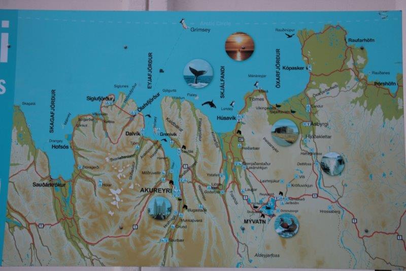
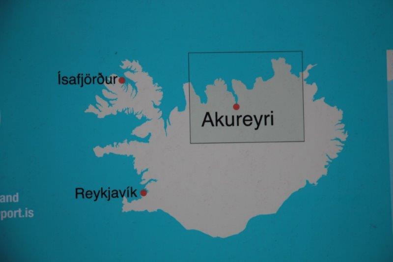
Yesterday we were in East Iceland and today we are in Northern Iceland. Reykjavik (Rake-ya-vik), the country’s capital, is in South Iceland and tomorrow’s port will be in West Iceland; so we will have covered all four of the ancient quadrants.
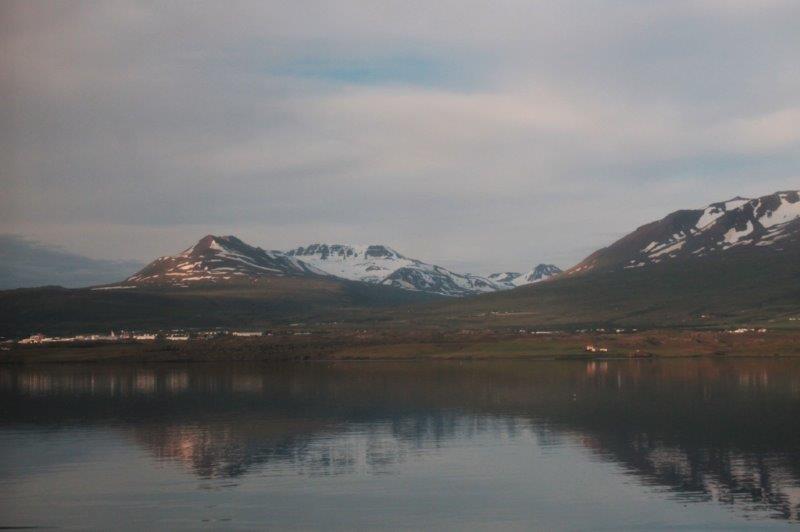
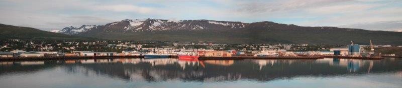
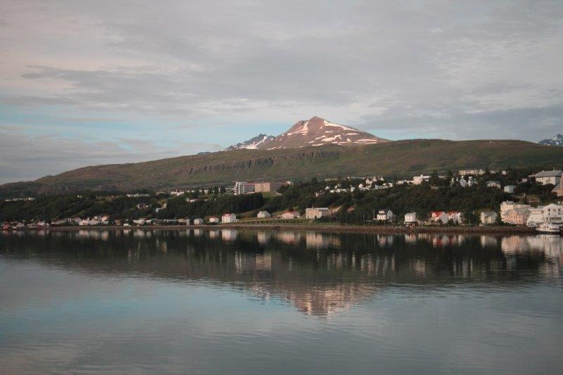
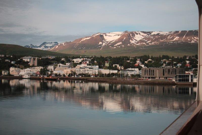
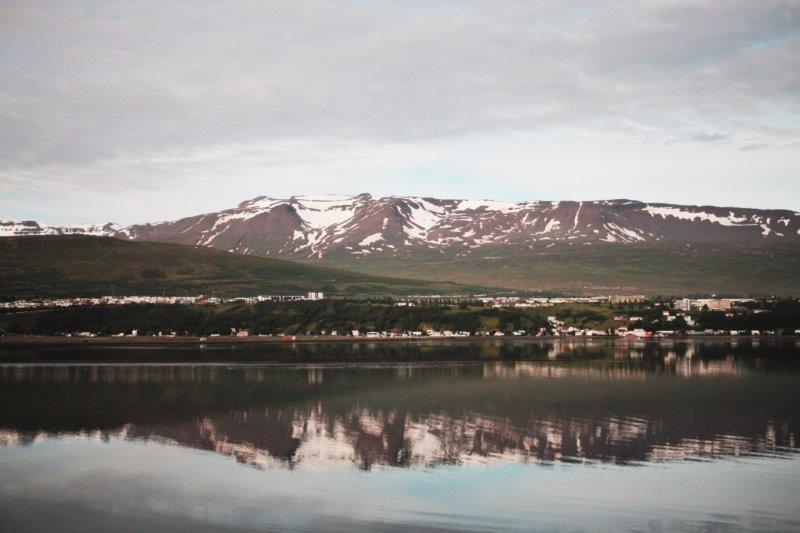
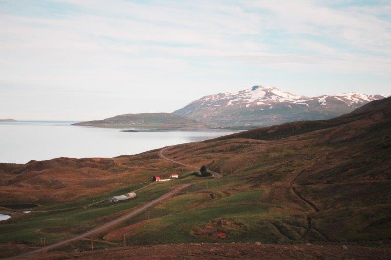
Akureyri (Ack-er-air-ee) is only 60 miles south of the Arctic Circle and is Northern Iceland’s second largest city. Believe it or not Akureyri has some of the warmest weather in Iceland and today was too warm for the locals and really nice for us southern-types.


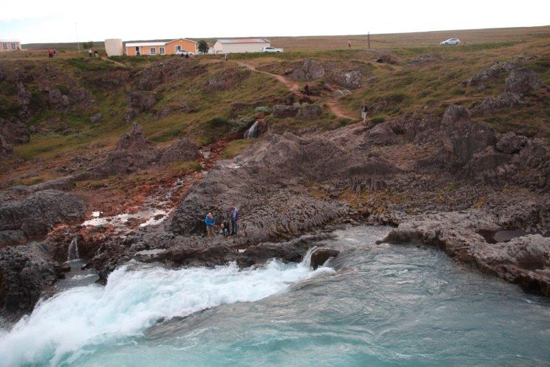
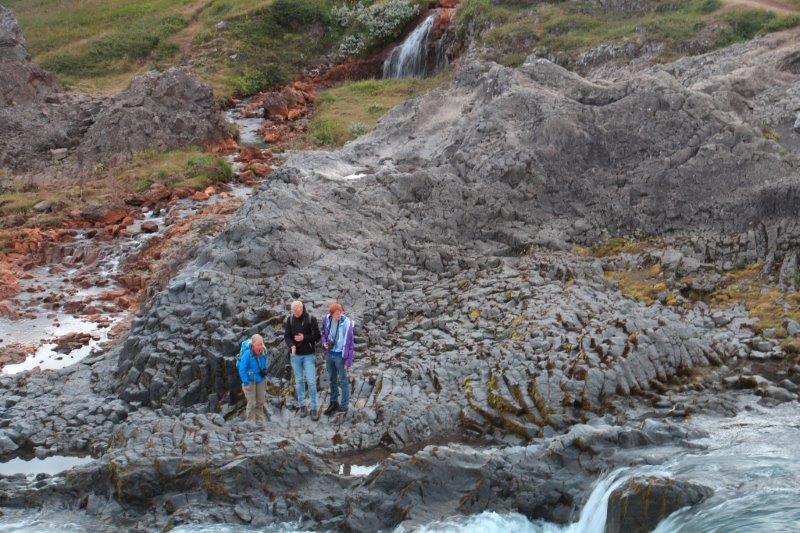
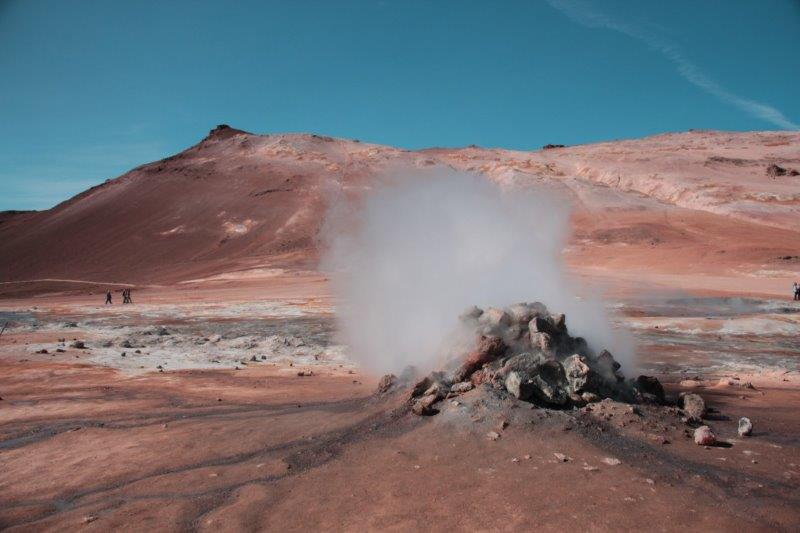
 The photo with the steaming waterfall is actually the construction site of a new road tunnel. However when they had only drilled a short distance into the mountainside they encounter a very hot water spring. Men could not even work in it for short periods because the air was so humid and hot. They started to drill from the other side and encountered a cold spring. The Akureyri side of the mountain really needs more cold water and the other side would love to have the hot water to heat their houses but they have not figured out how to move the water from one side to the other, nor how to work around it so they can’t complete the tunnel either. Stalemate. I guess nature wins.
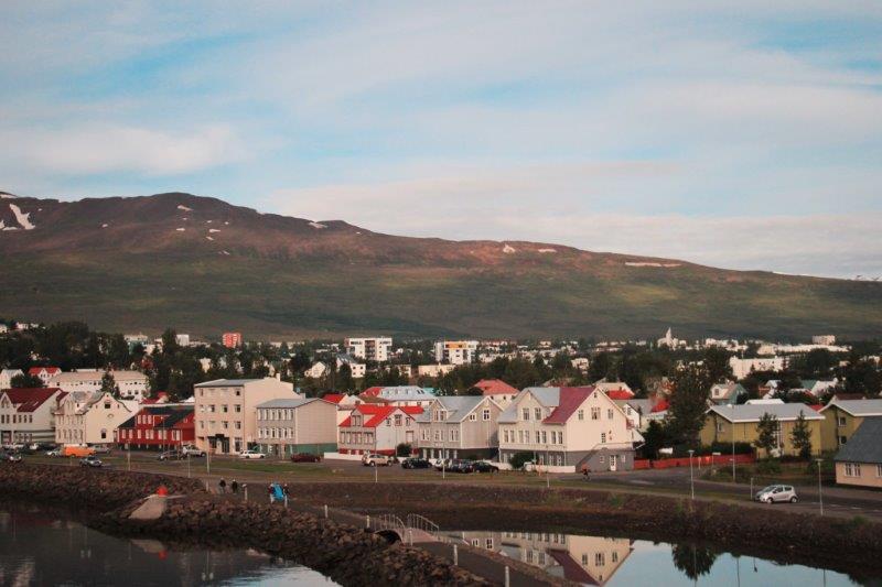
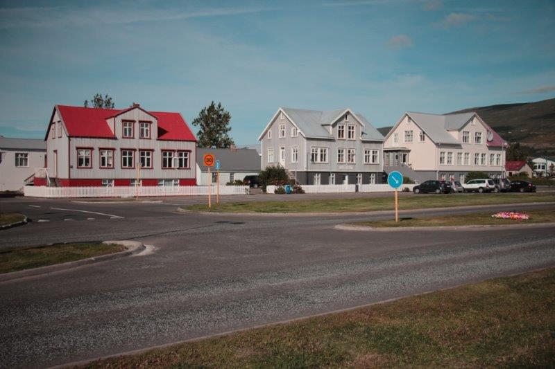
The settlement here was originally set up as a trading post in the 16th century and officially became a municipality in 1862. The oldest house remaining in the town was built in 1795. There is a large Lutheran Church on the hill that was built in 1940. Some of our friends walked up to see it but there was a funeral in progress so they were unable to go inside.
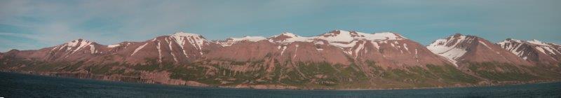
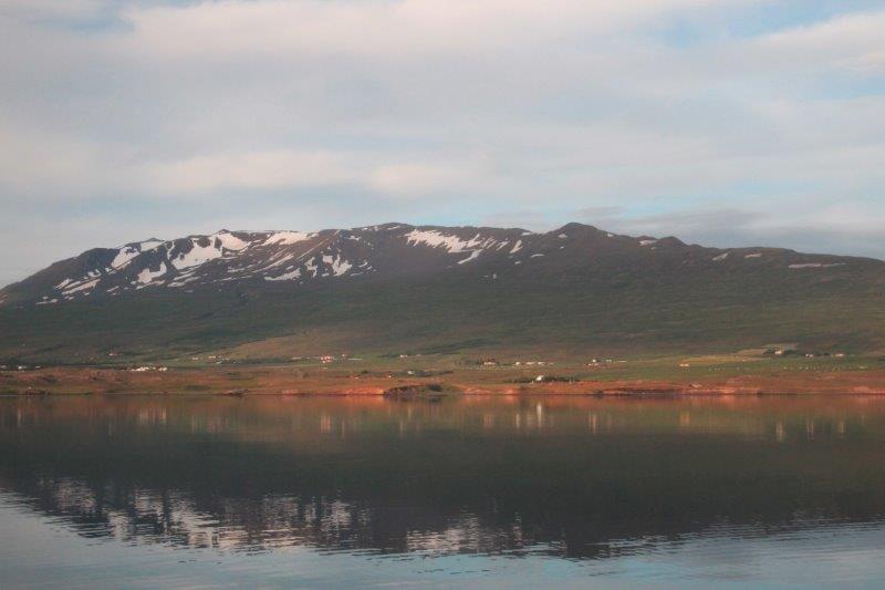
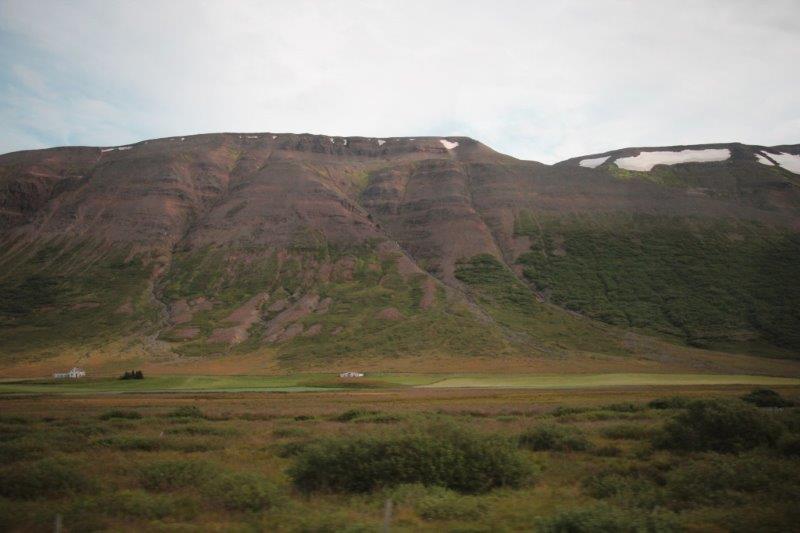
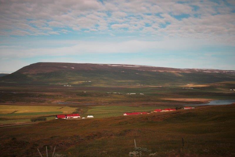
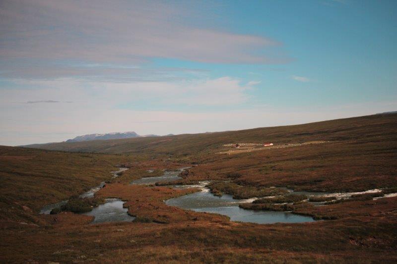
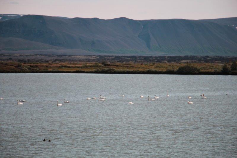
The area is very different from that around Reykjavik. Here there are large farms and green grass spreading down the valley bottoms, instead of all the lava rock we saw before. Everything is surrounded by high mountains and travelling from one town to another invariably means you must cross one, two or three mountain passes, which are often impassable in winter due to the high winds and snow. Several times each winter the road is closed and they don’t even try to clear it until the storm is over, no matter how many days that may be. They have learned that if you open it up it will just get closed again by more snow within an hour. There is only one road – Highway 1 – so if that happens no one is going anywhere.
 Our guide was originally from Germany but she came to Iceland 30 years ago to look for work, fell in love with the country and then with an Icelander and now has four children. The thing she found most difficult when she first came to Iceland was the laid-back attitude here. In Germany everything is planned to the minute and everyone wants to know the exact plan before they go anywhere. This drives Icelanders crazy when they have German tourists because in Iceland everything is “maybe.” You ask how long it will take to drive to such and such place. “Well,” the Icelander will say, “It might take us 45 minutes to drive there, but there may be sheep on the road, or someone may be late, or some other thing may occur so I can’t tell you when we will arrive.” A common expression sounds something like Aecta Resthas and means ‘we will wait and see, and the problem will likely resolve itself.’ They do not work on Plan A because it rarely comes to pass and they don’t fret unduly about a lot of things because they feel the problem or situation will eventually resolve itself. Mostly they don’t plan at all and just make decisions as the occasion arises. Not a good environment for CDO people! But they are very nice, calm, friendly people.
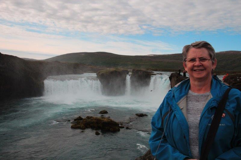
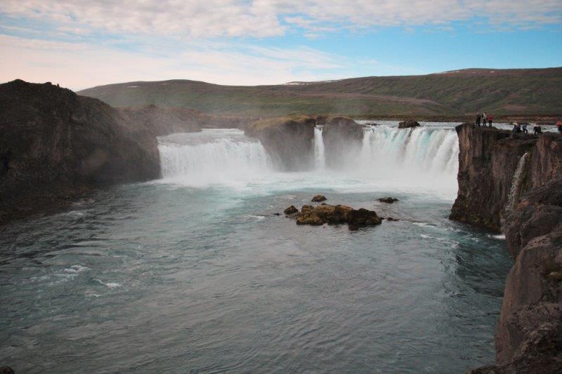
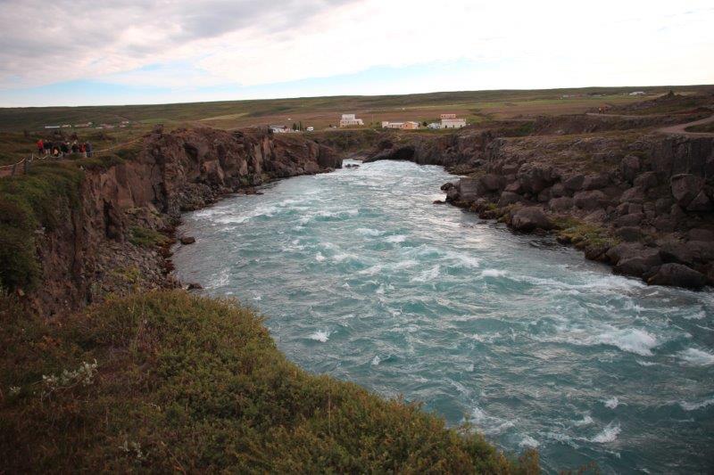
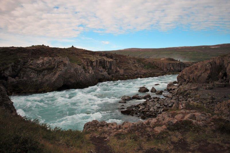
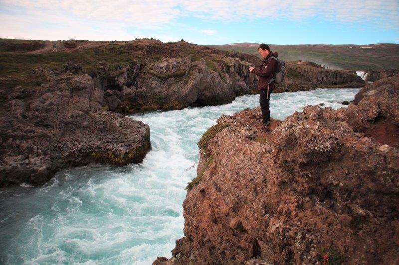
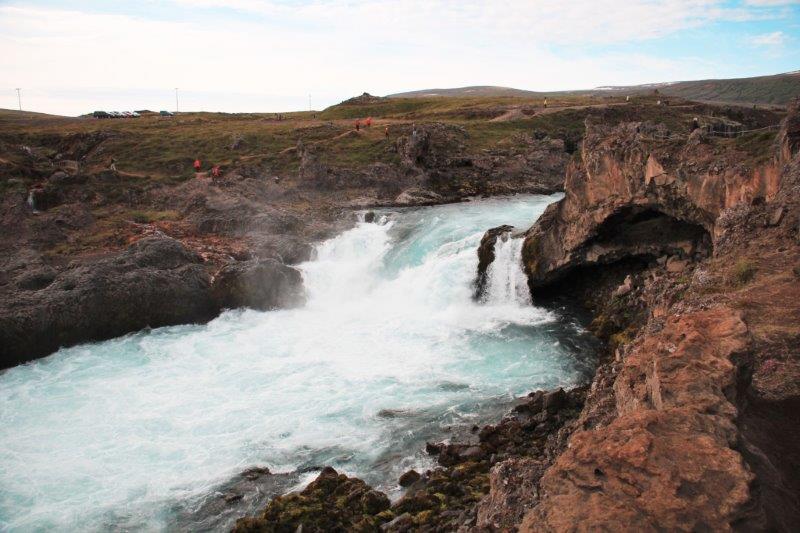
Our first stop of the day was Godafoss Waterfall (The waterfall of the gods), so named because when the parliament decided the nation should be Christian the local priest in the area had all the people bring their Norse idols and throw them into the waterfall. Godafoss is not the tallest waterfall by any means (there are thousands of them cascading down the ever-present steep mountainsides) but it is considered the most spectacular in Iceland. There is a tremendous amount of water flowing over the edge and through the gorge.


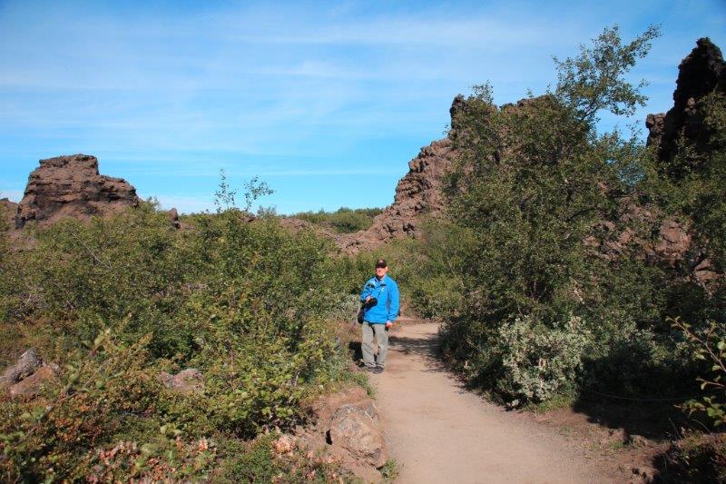
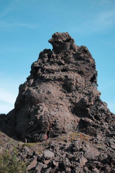
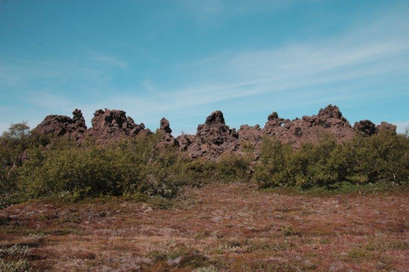
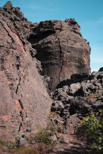
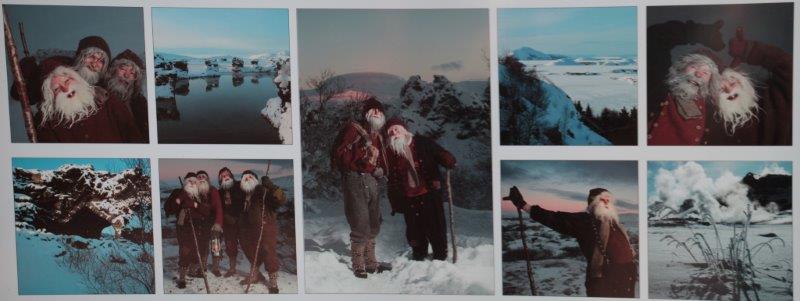
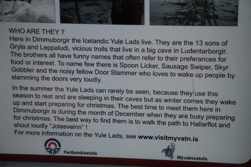
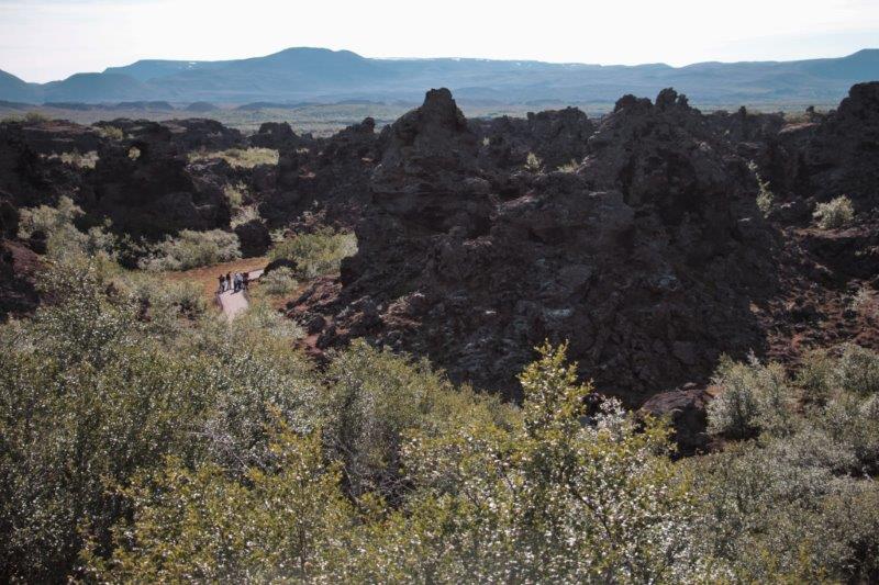
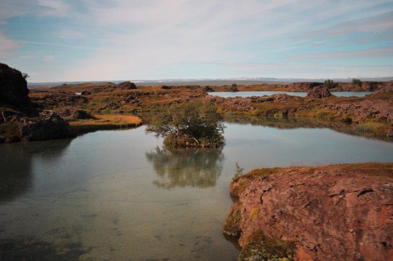 The second stop was the Dimmuborgir (Dim-mu-boar-gur) lava labyrinth. There was a massive volcanic explosion here several thousand years ago and the huge chunks of lava are strewn all around. We were advised to look for the many trolls that have been turned to stone and we definitely spotted quite a few of them. At Dimmubrgir, as at Thingvellir National Park that we visited our first day in Reykjavik, you can see the split of the tectonic plates. A little bridge takes you across a narrow, but very deep, chasm where the North American and Eurasian tectonic plates are gradually moving apart. Dimmuborgir is known as the home of the 13 Yule Lads that emerge at Christmas to wreak havoc on the household but leave gifts for the children each night.


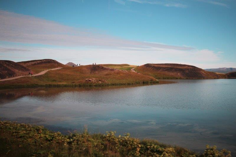
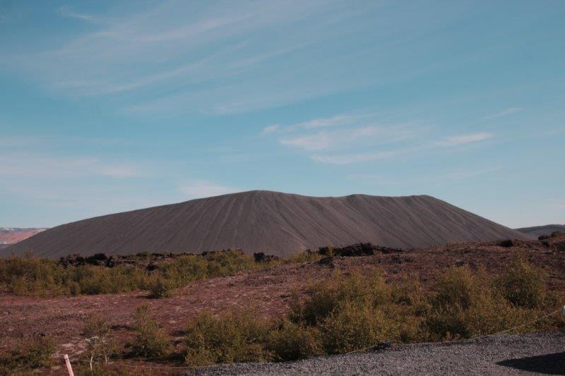
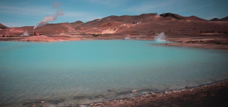
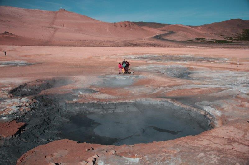
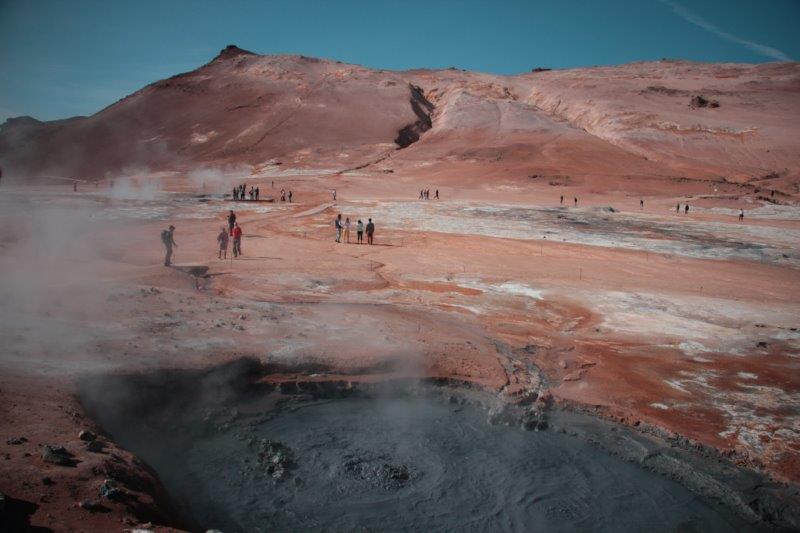
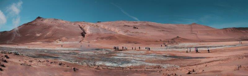
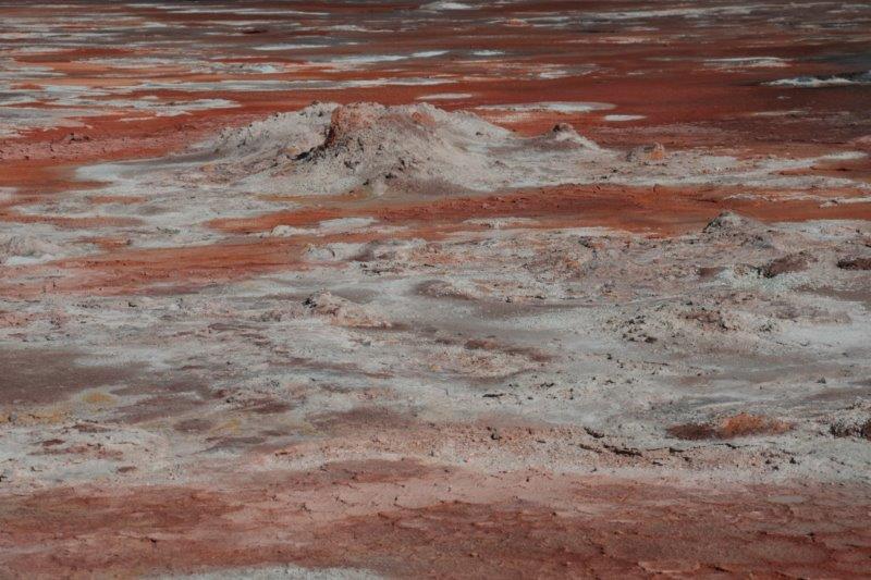
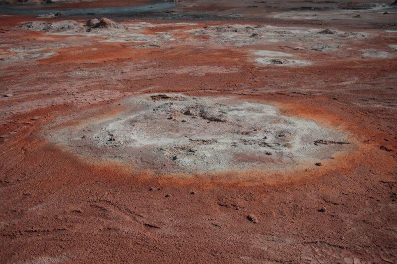
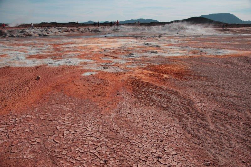
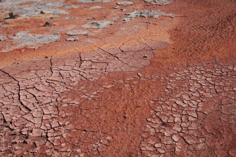
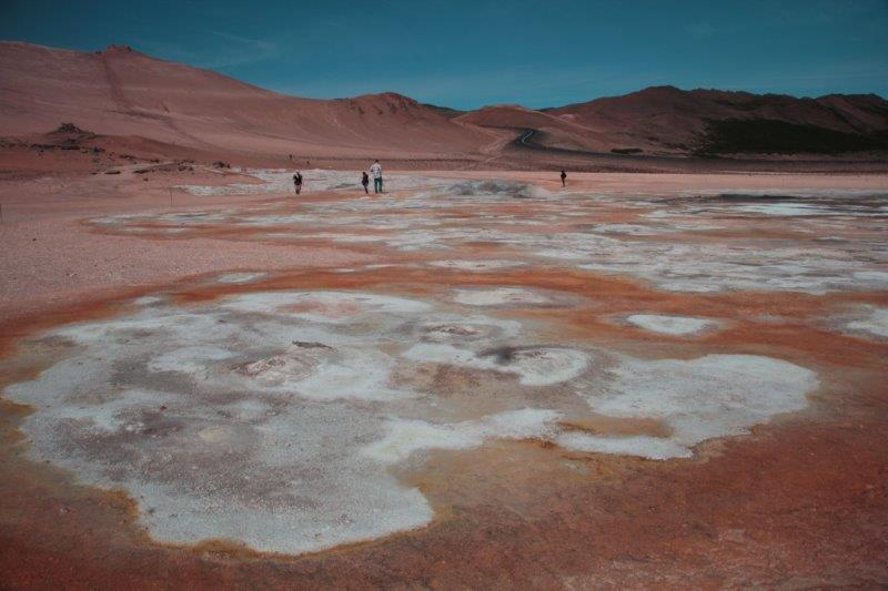
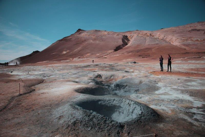
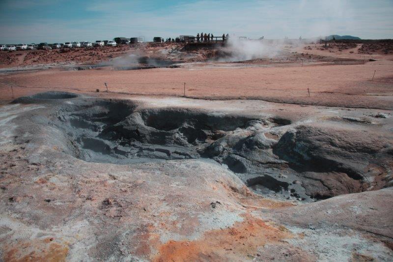
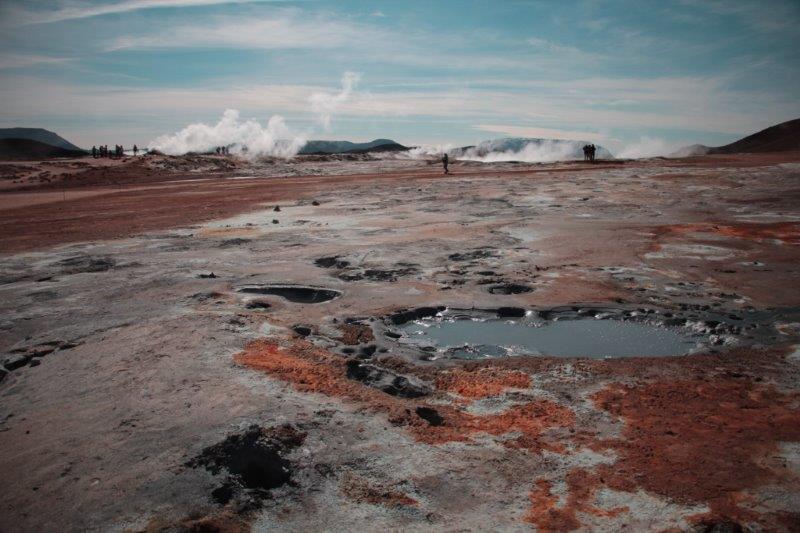
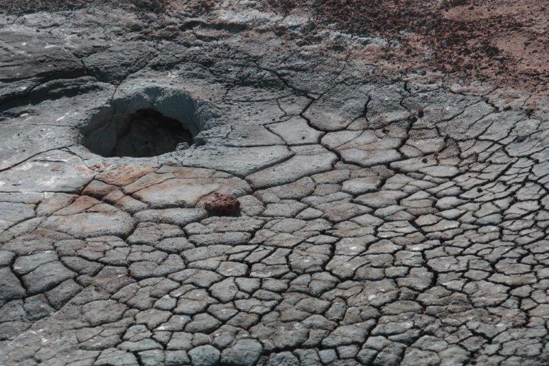
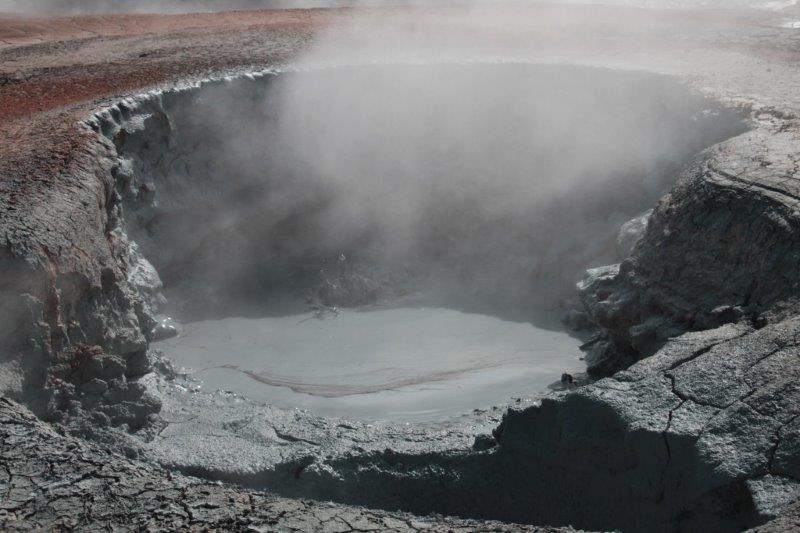
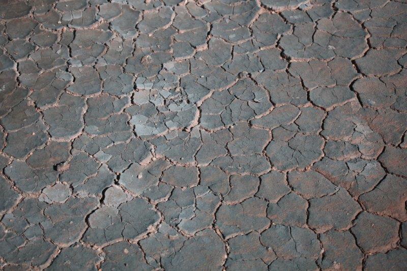
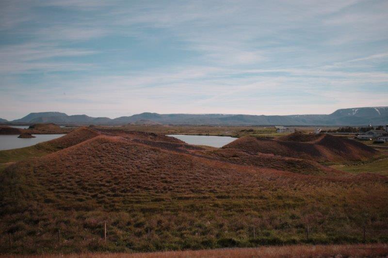
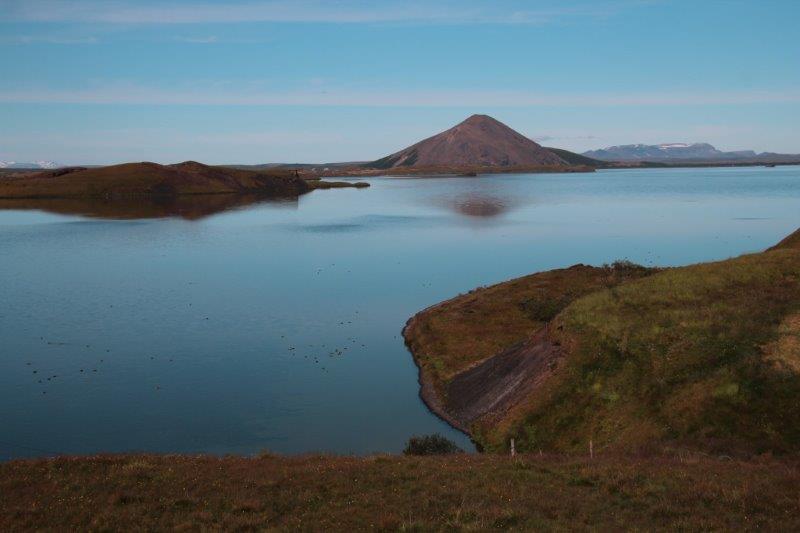
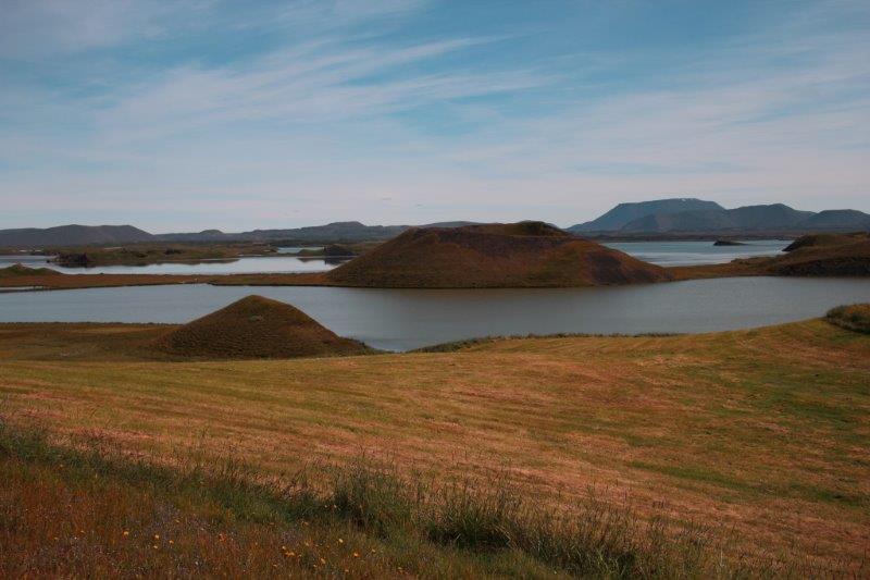
 We next drove to Lake Myvatn (Miv-eth), a thermal pool area where I happily wandered around taking photos of all the textures and colours. (An interesting fact our guide shared is that all of these ‘tourist’ places are on private land. All the land in Northern Iceland is privately owned and the owners charge no fees for us to go see the natural wonders on their land. I don’t know whether the property owner pays to make all the paths and signage or if it is subsidizer or paid for by the government. It is expected though that as Iceland welcomes more and more tourist the free fee will probably change.) From Lake Myvatn we could see a gigantic lava crater that we thought may have been created in an eruption. This was not so. The crater is the result of a large lava bubble exploding just as boiling soup forms bubbles that burst on the surface. There were miniscule people to be seen walking along the crest.


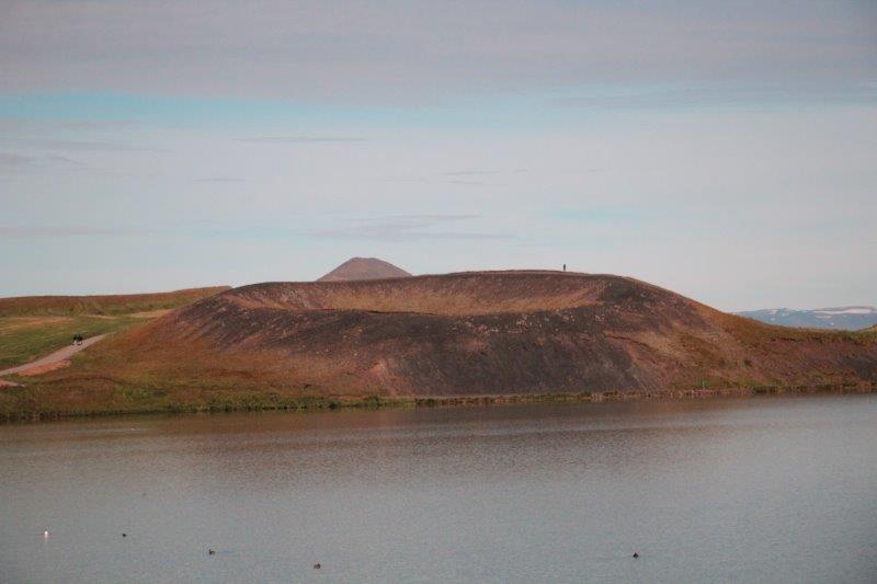
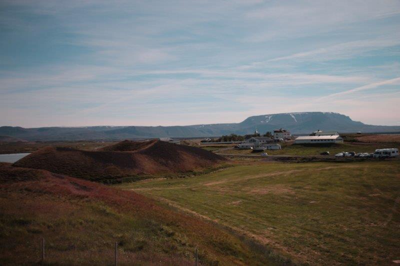
 Our final stop before the two hour drive back to Akureyri was for lunch at Skutustadagigar (Scoot-oo-sta-da-ur). There are a couple of hotels here and guest houses here and the land and the lake are dotted with large craters. These pseudo-craters were also created by lava bubbles exploding. After lunch we had 20 minutes or so to wander the paths around the craters before the drive back to Akureyri.
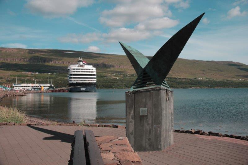
 Because we had a bit of extra time our bus driver and guide stopped on the far side of the fjord for five minutes so anyone who wanted could take a photo of the town and our ship. John had fired up the GPS to see if there were any geo-caches in town and it showed there was one at the viewpoint 150 meters from the bus. While folks took their pictures he rushed over to some rocks at the end of the parking area and soon located the cache. He didn’t have a pencil with him to sign the log and he didn’t have time anyway as everyone was back on the bus by the time he put it back in its hiding place but we can log it as found. Pretty funny!
When we got back to the ship we walked part-way into town and located another cache on the boardwalk. We had just finished signing the log when a fellow came down the steps and rounded the corner holding a GPS. He saw us and made an abrupt about-face. We knew immediately he and his wife were geo-caching. John re-hid the cache and as he walked past the fellow said, “You will be warmer on the other side.” The fellow laughed and as we walked away we could see them getting out the log book to sign.


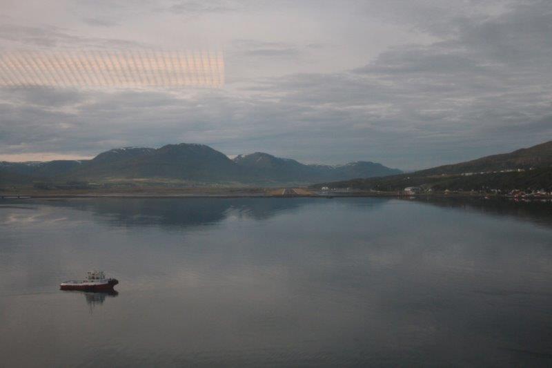
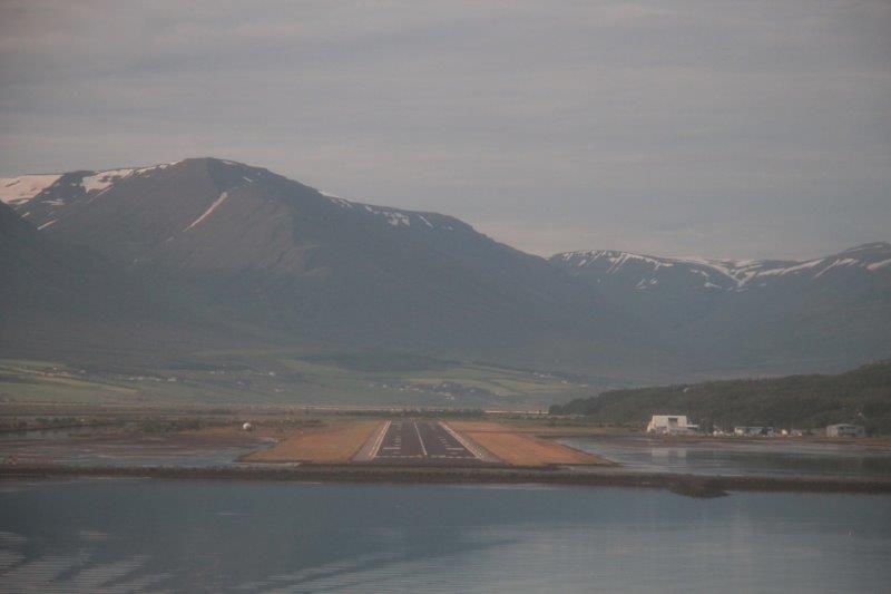
 The ship put-putted at a very slow speed out of Akureyri for scenic cruising of the Eyjafjordur so we could view the lovely mountains, and we then were on our way again.