My husband and I retired in 2007 and decided to spend the kid's inheritance by travelling as much as we could until either the money or our health runs out. So far so good.
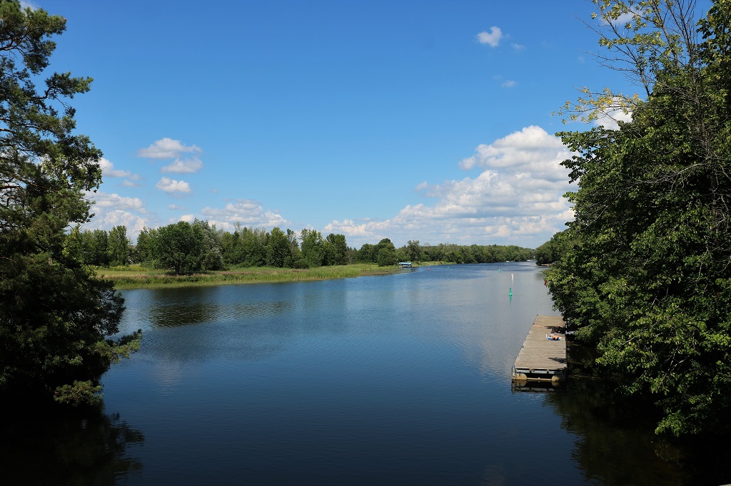
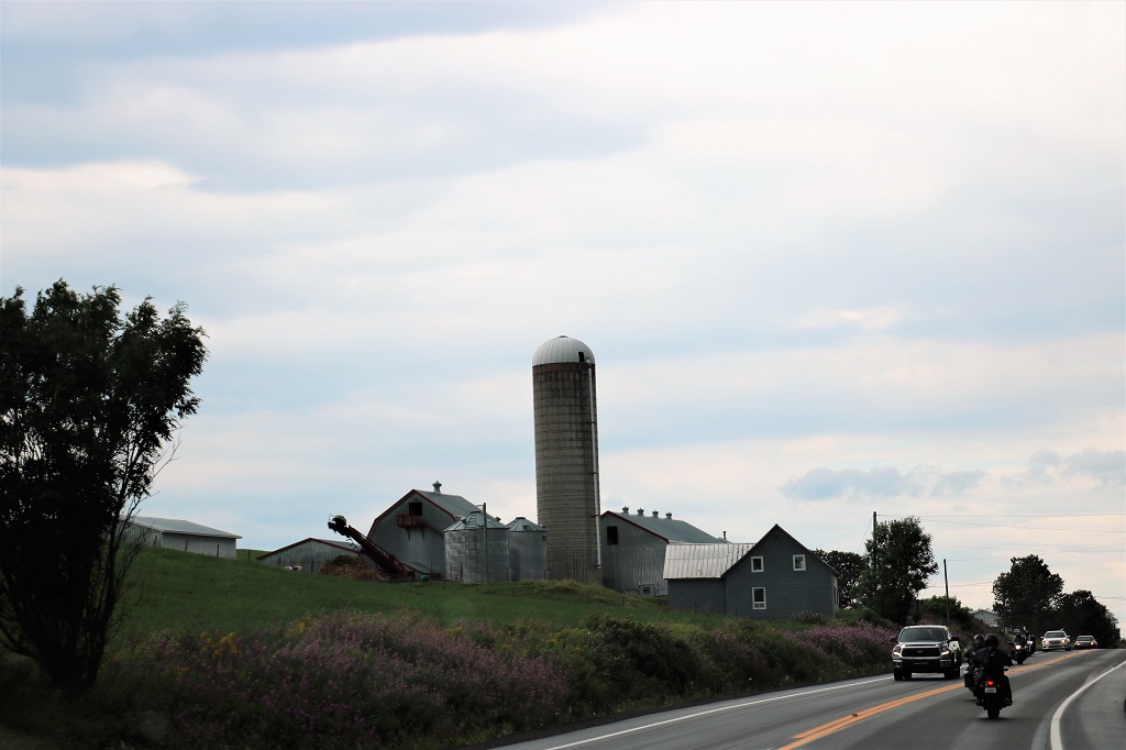
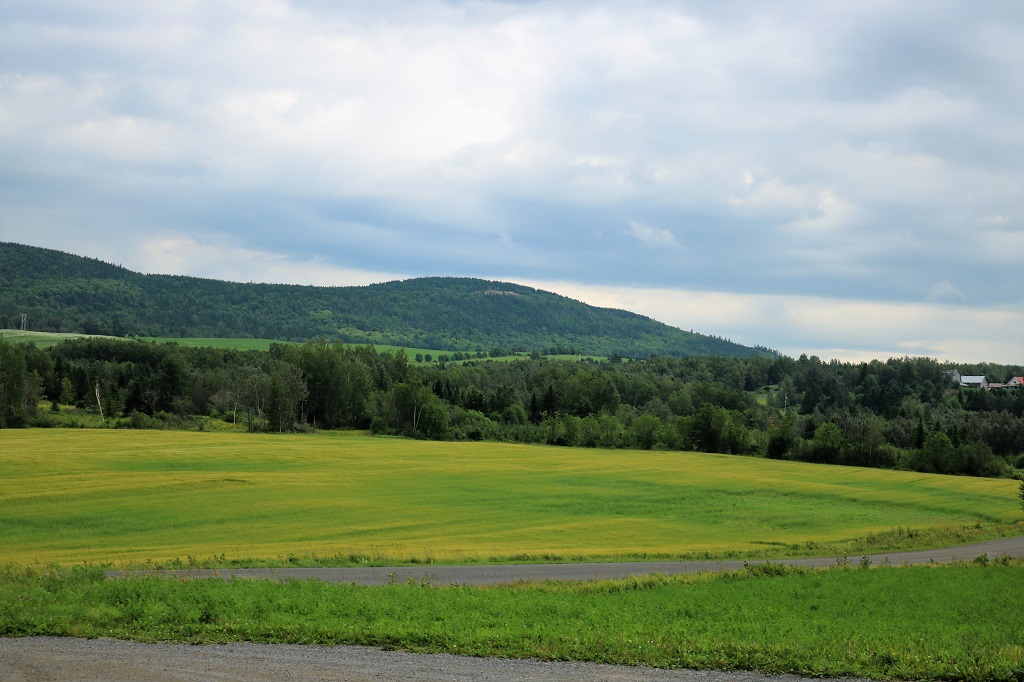
Today’s blog is really short. We only stopped twice during the five hour drive from Montreal. Thankfully the freeway section out of the city was late enough in the morning that traffic was light. After we left the freeway we drove through farming country and a few villages. That was it.
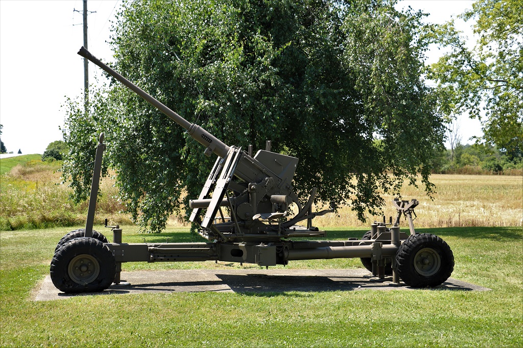
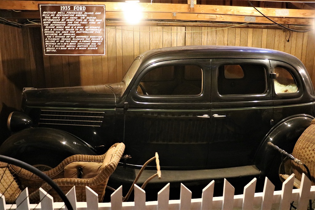
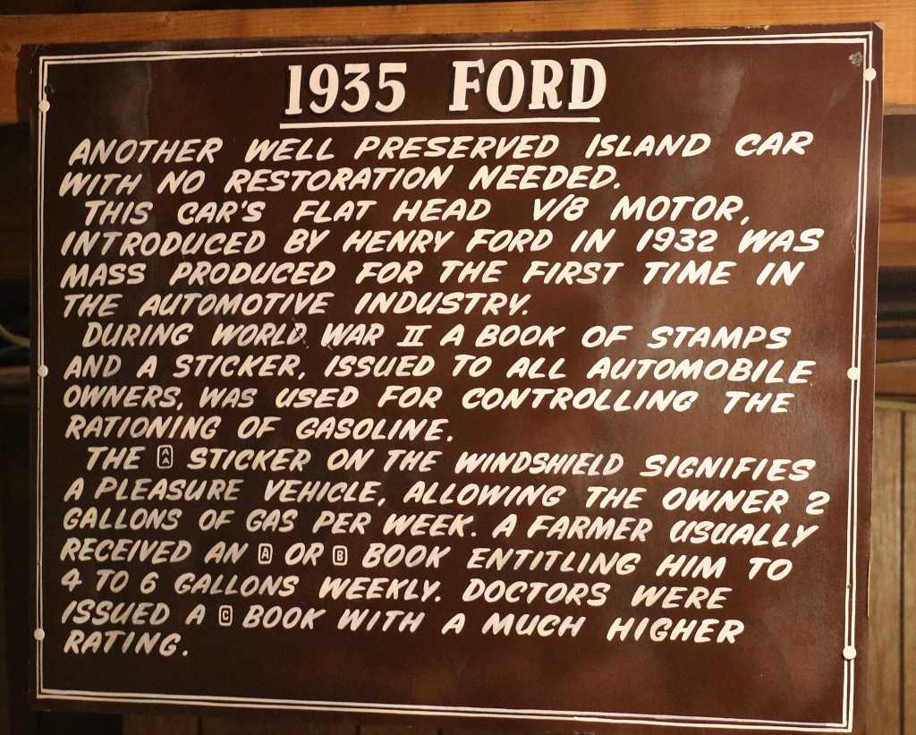
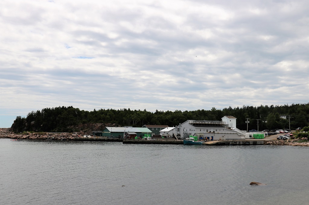
There is a nano geocache hidden somewhere on this Bofor 40 mm anti-aircraft autocannon that is stationed at a Royal Candian Legion near Finch, Ontario. A nano cache is about the size of my index fingernail. We were warned it was very difficult to find and it was very hot today so we only searched for a half hour before moving on.
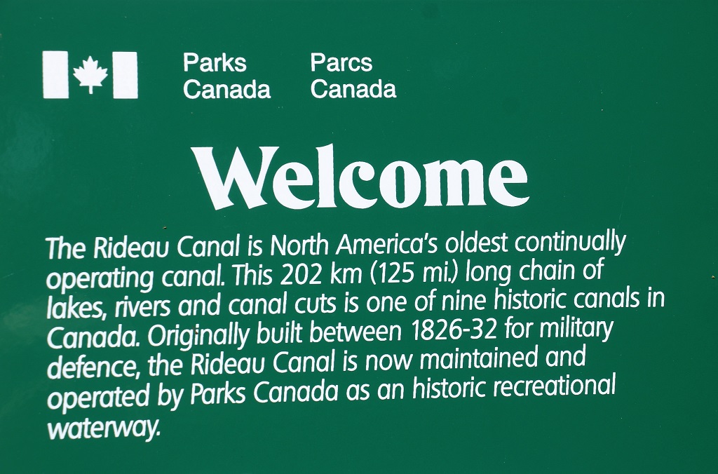
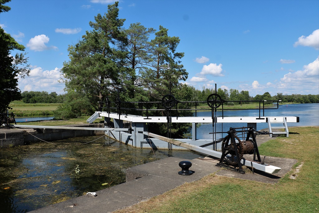
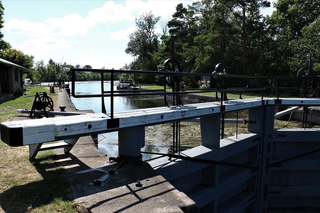
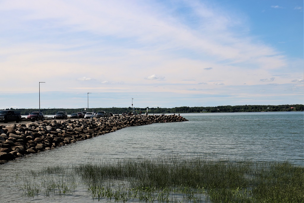
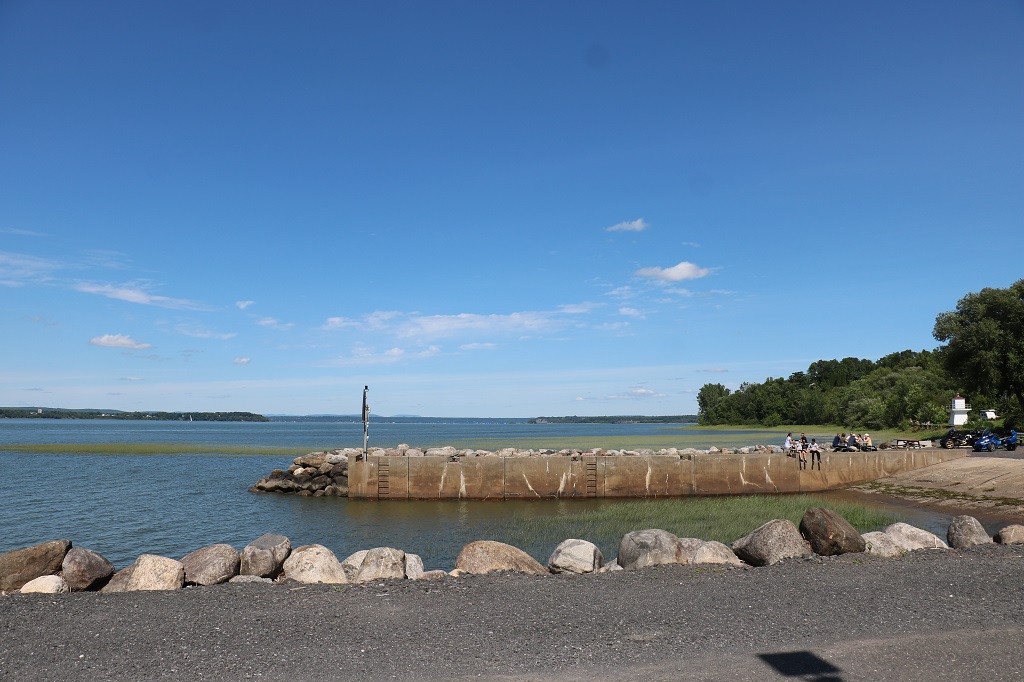
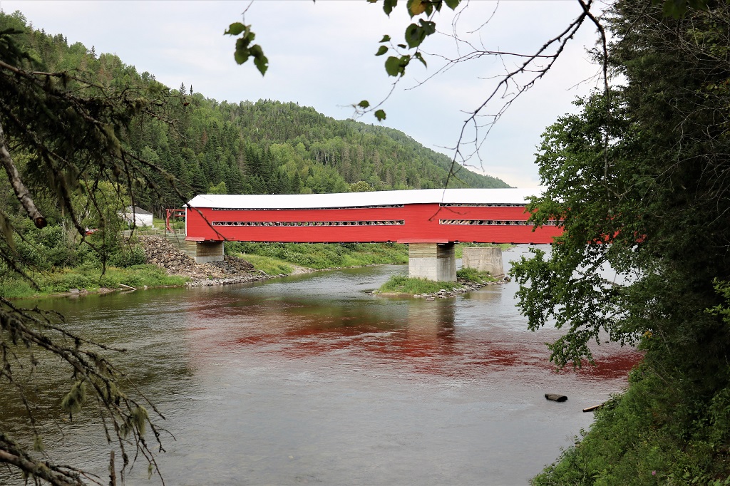
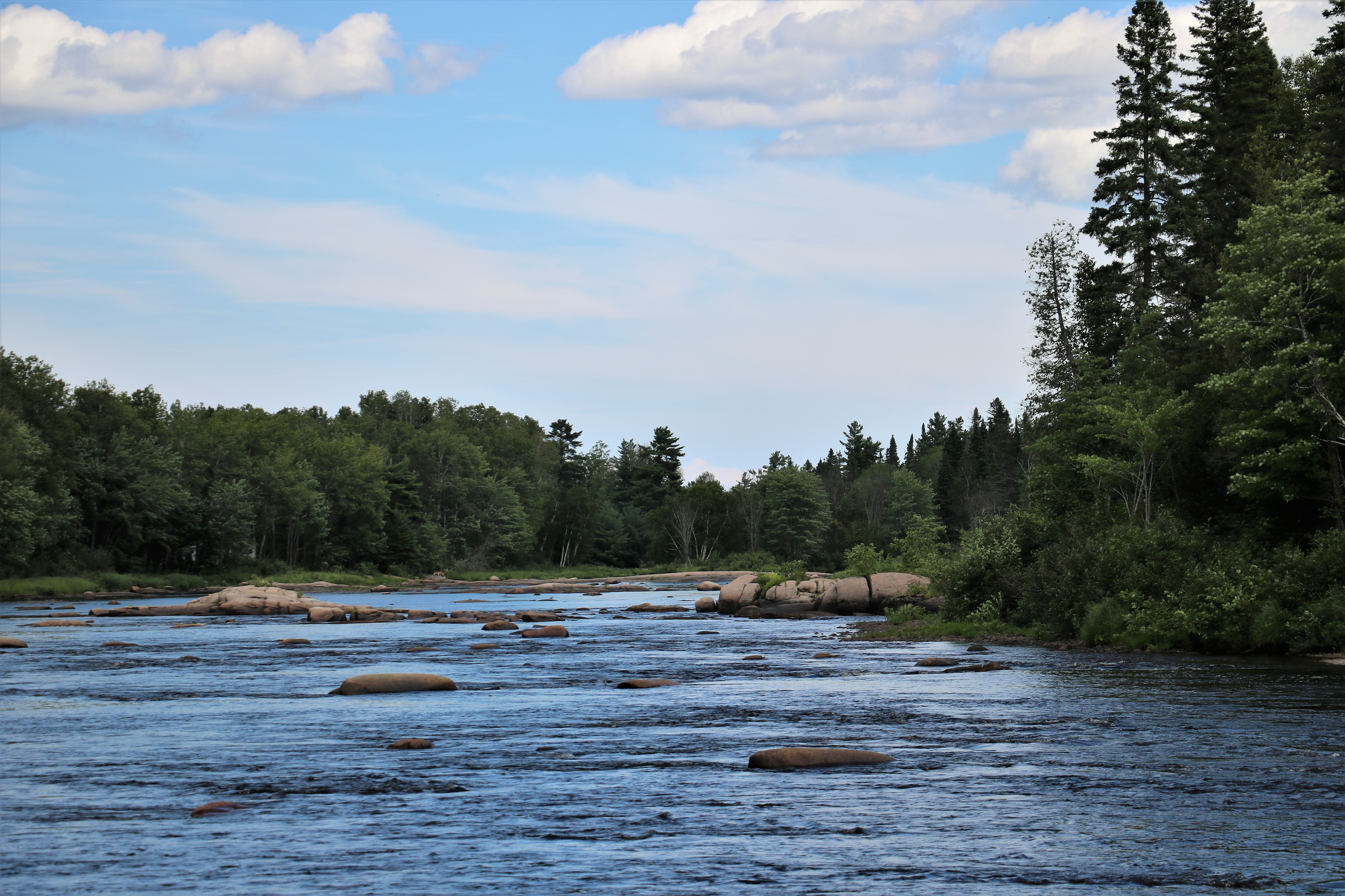
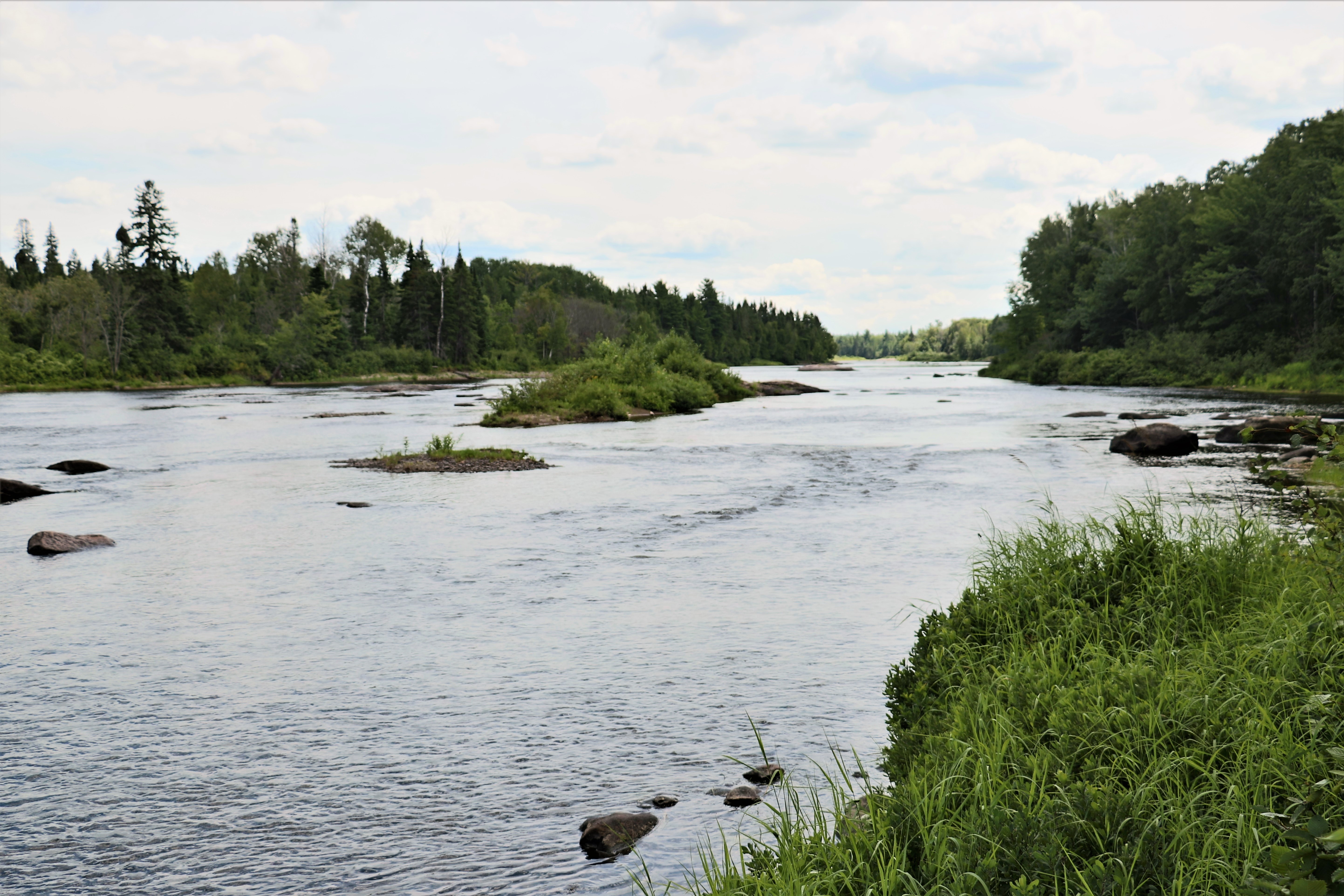
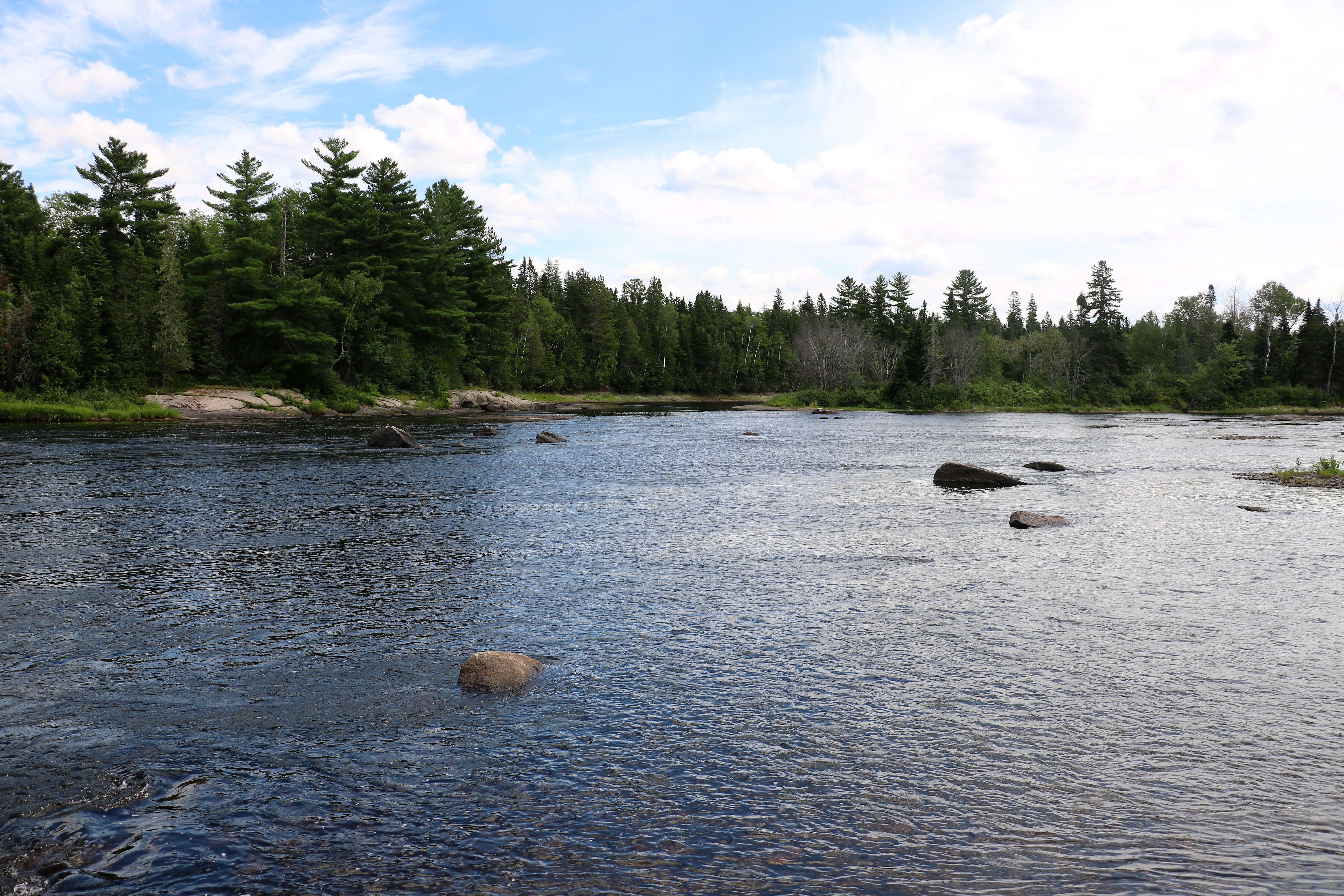
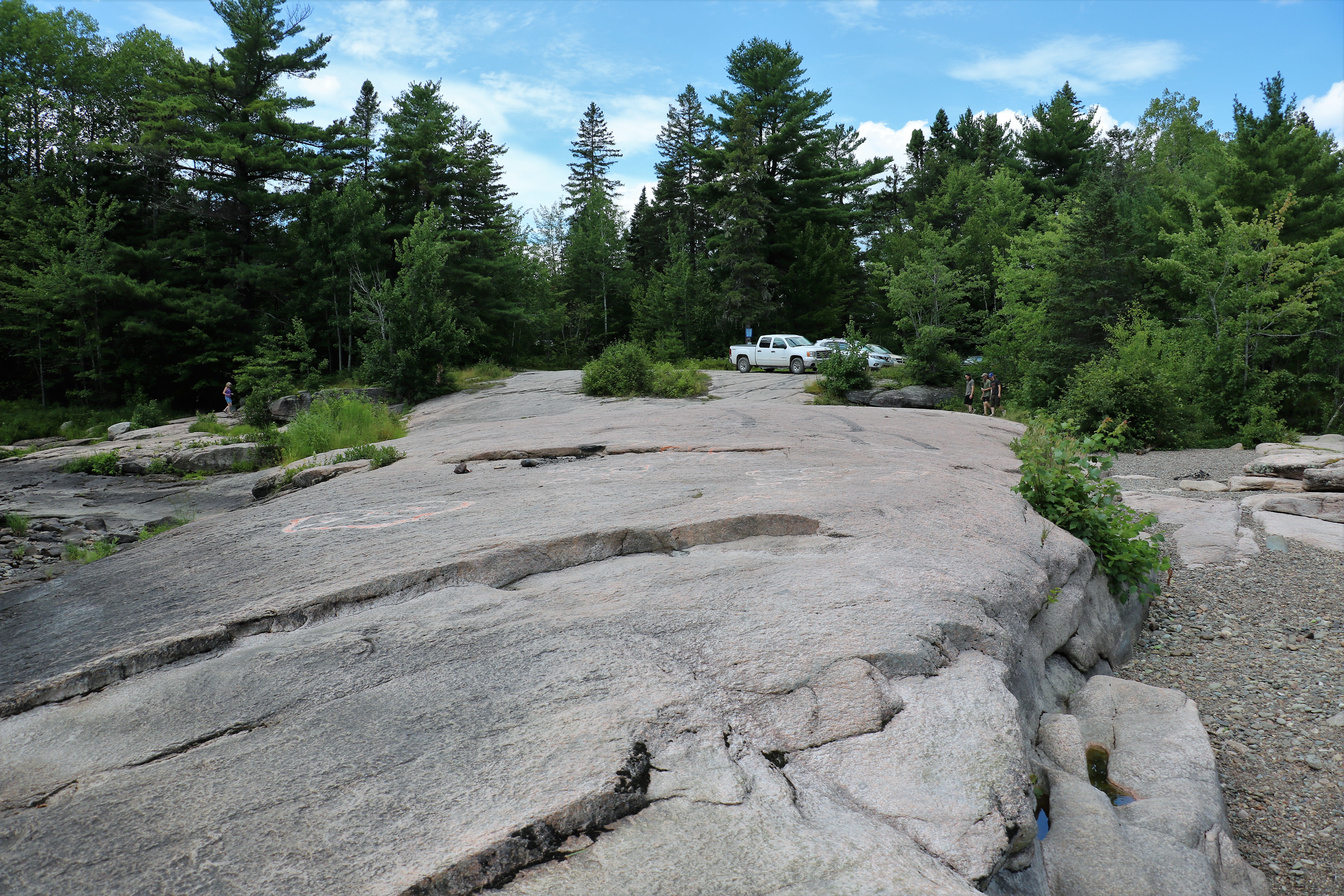
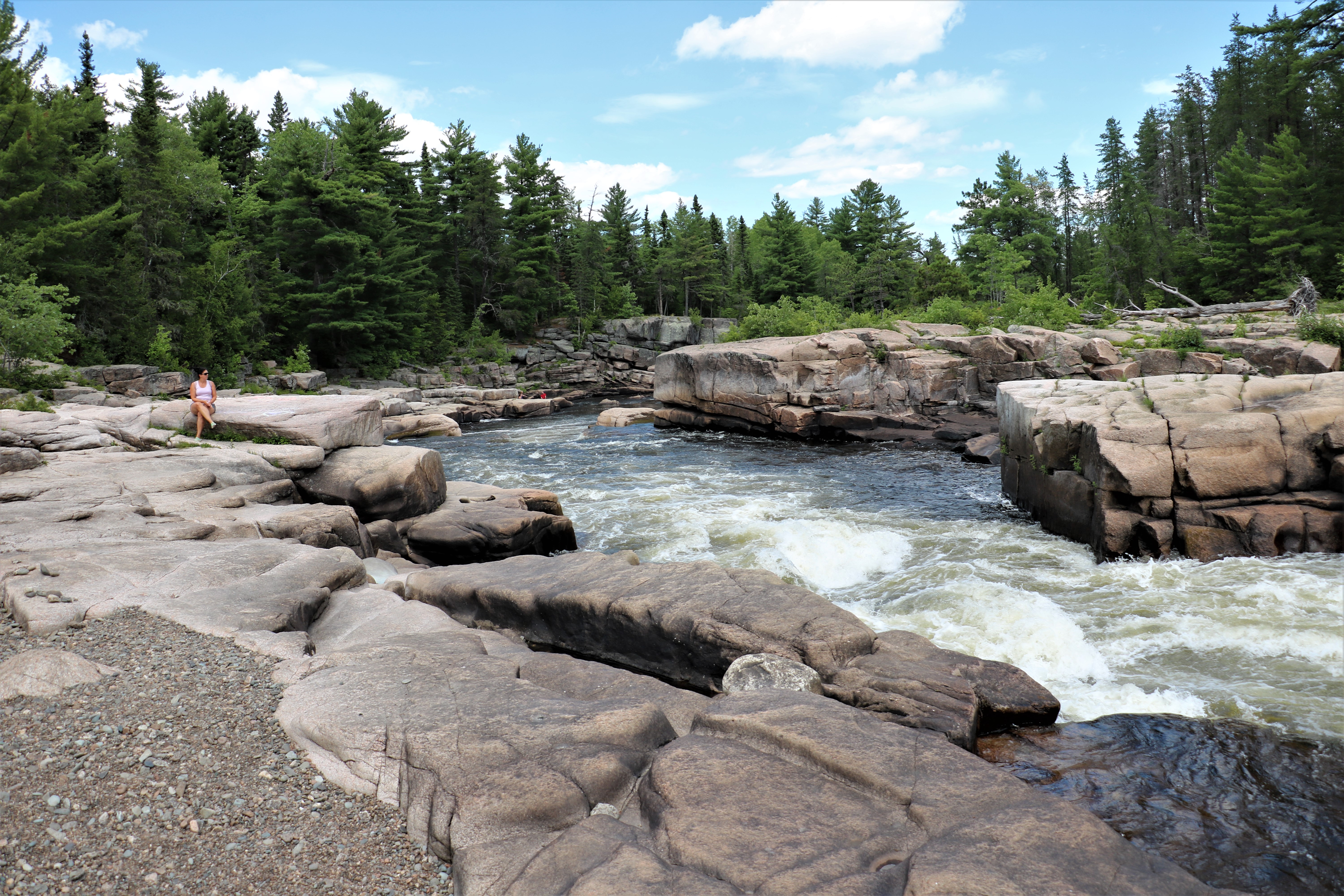
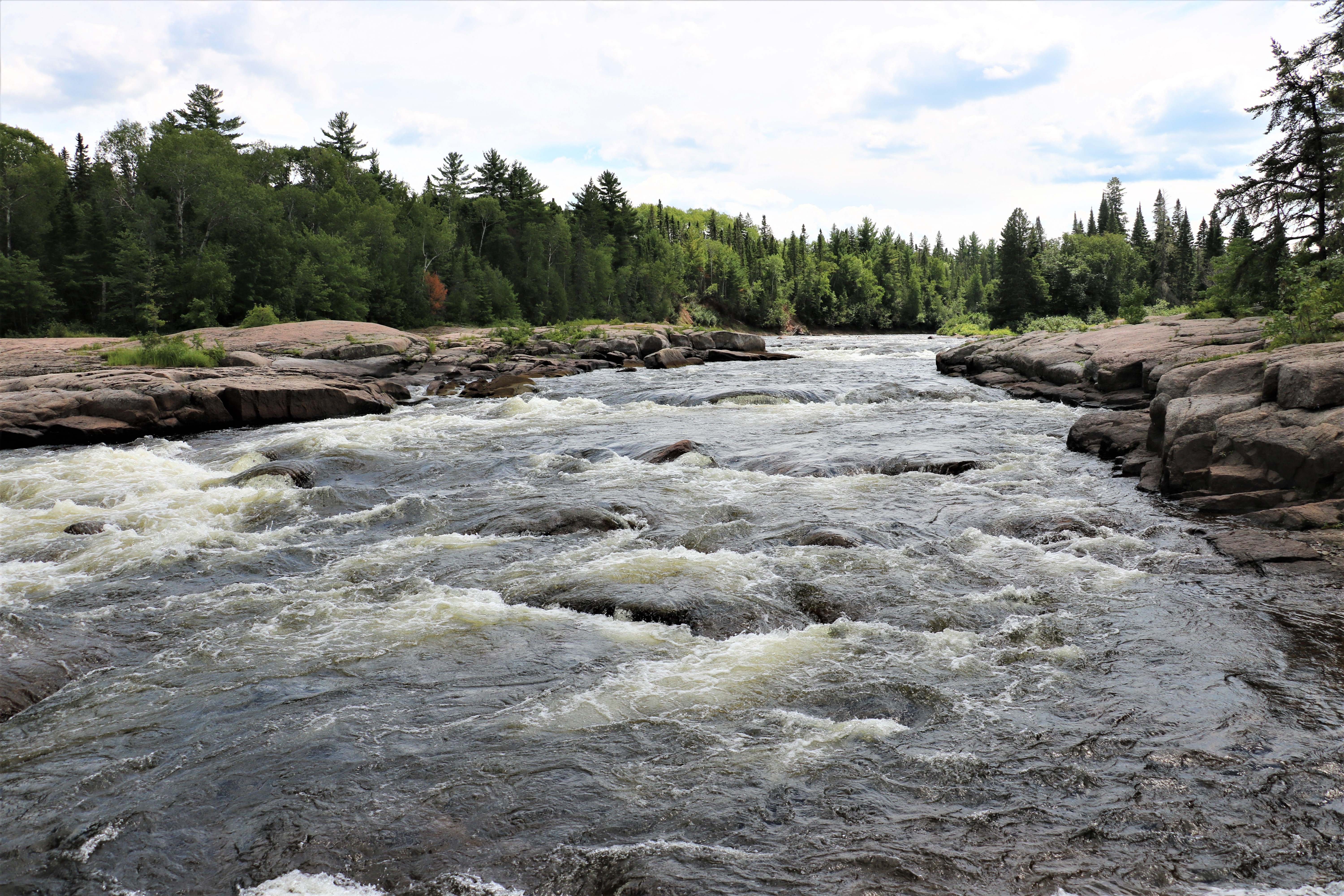
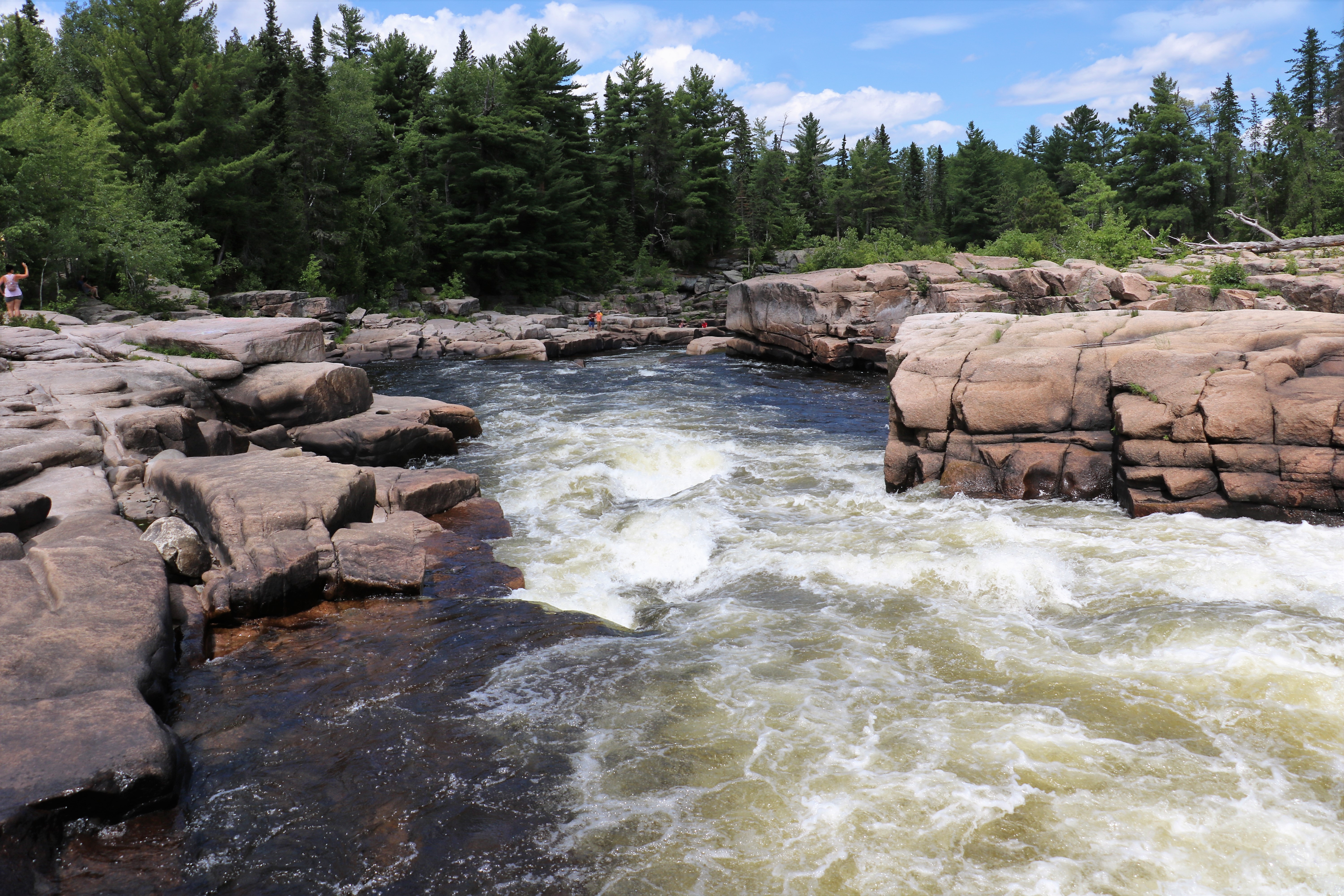
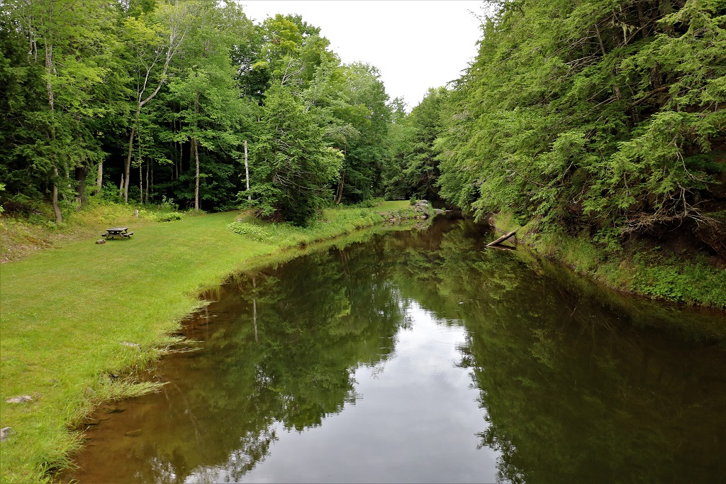
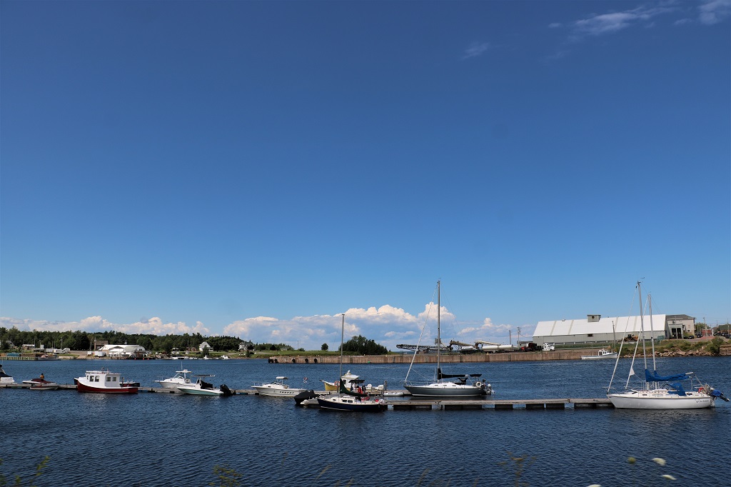
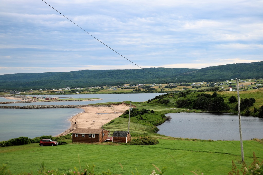
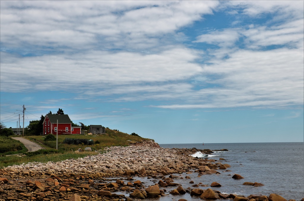
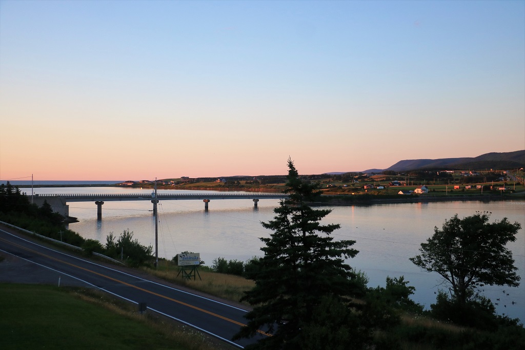
Our only other stop was not far from Smiths Falls at Burritt’s Rapids, one of the locks on the Rideau Canal water system. This lock is small and the gates are opened and closed by handcranks.
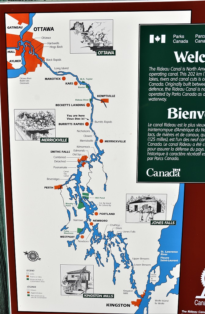
If you look closely at the map you can see 24 white V-shapes that denote all the locks between Ottawa and the St. Lawrence River.
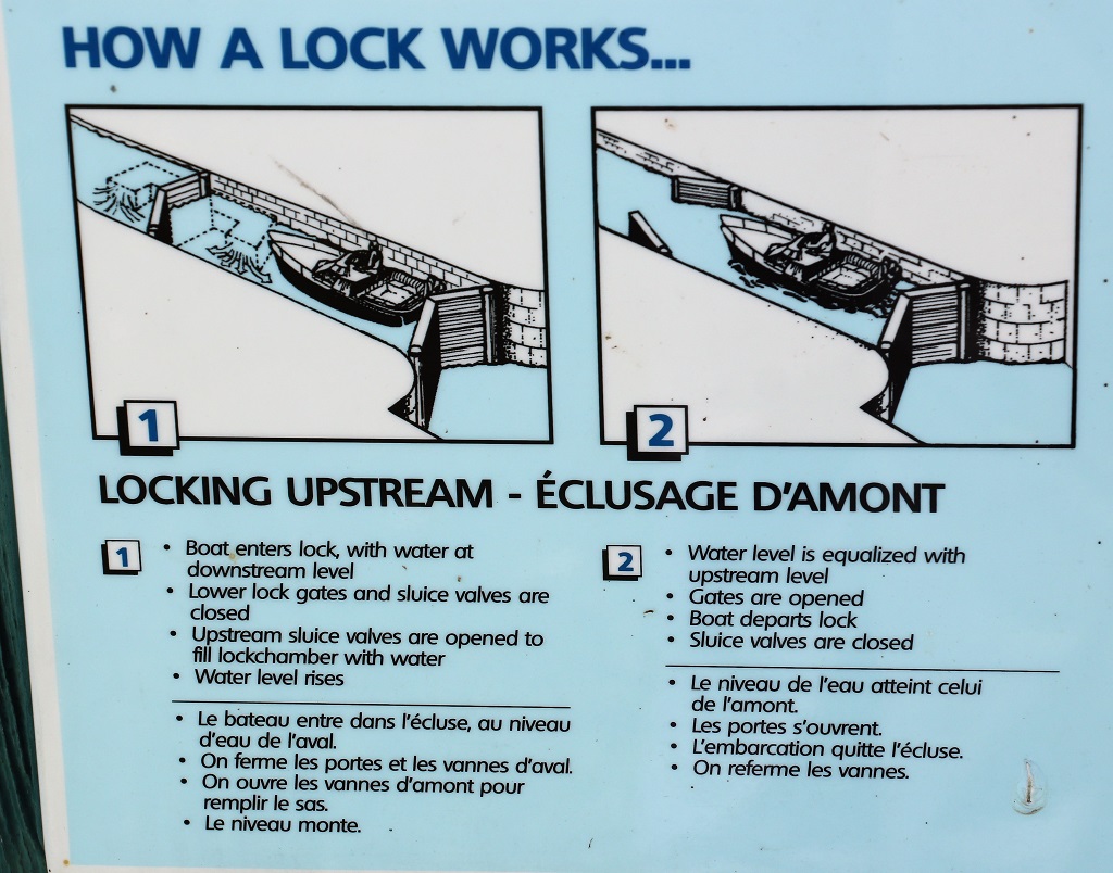
Just in case you don’t remember how a lock works here is a good explanatory drawing.
We arrived in Smiths Falls at four; just in time for our weekly video chat with our son and his family in Texas, then we went out for dinner before settling in for the night.
We are staying here two nights. John had a cousin that lived in Smiths Falls and he owned a cabin on Ottey Lake about 20 minutes away. His daughter has a cabin there as well and tomorrow we are going to spend the afternoon with her and have dinner. So, if there is a blog tomorrow, it too may be a short one.
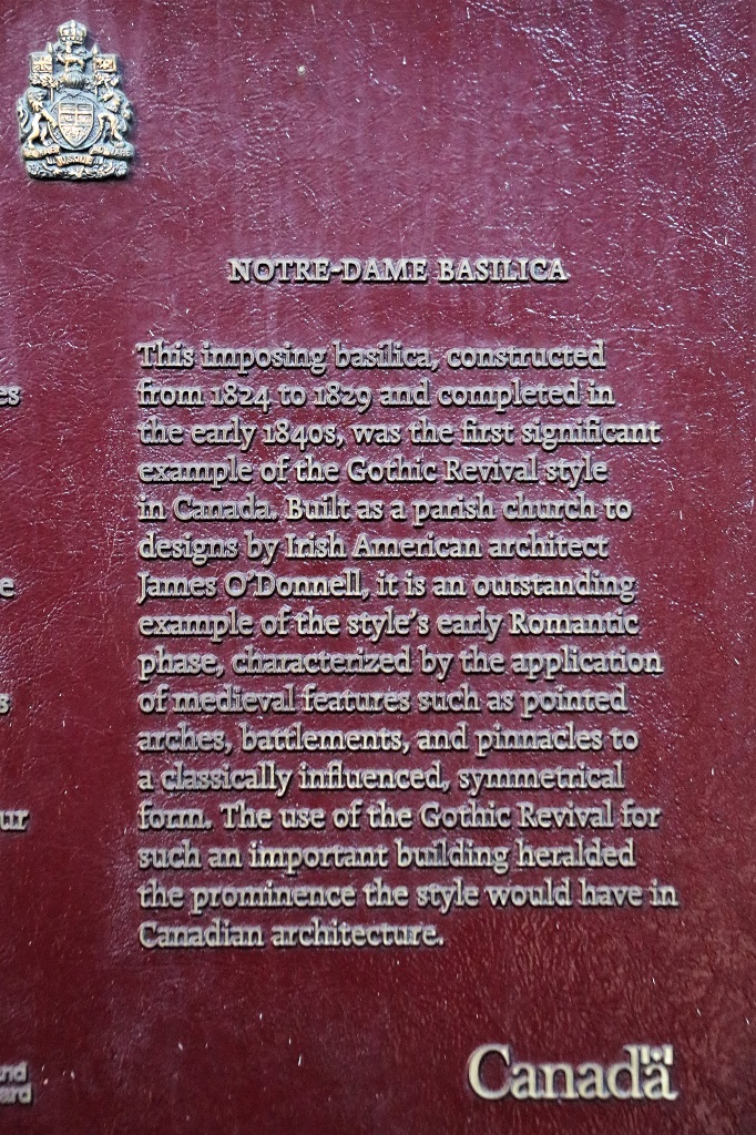
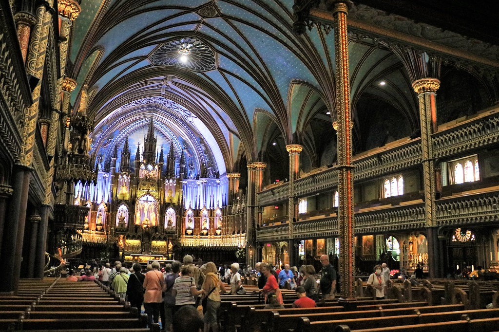
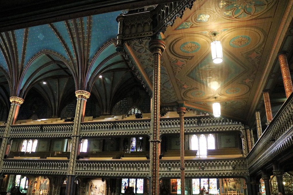
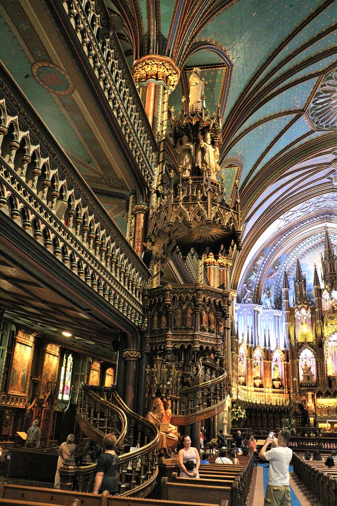
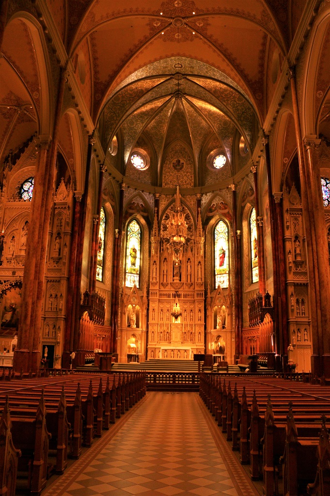
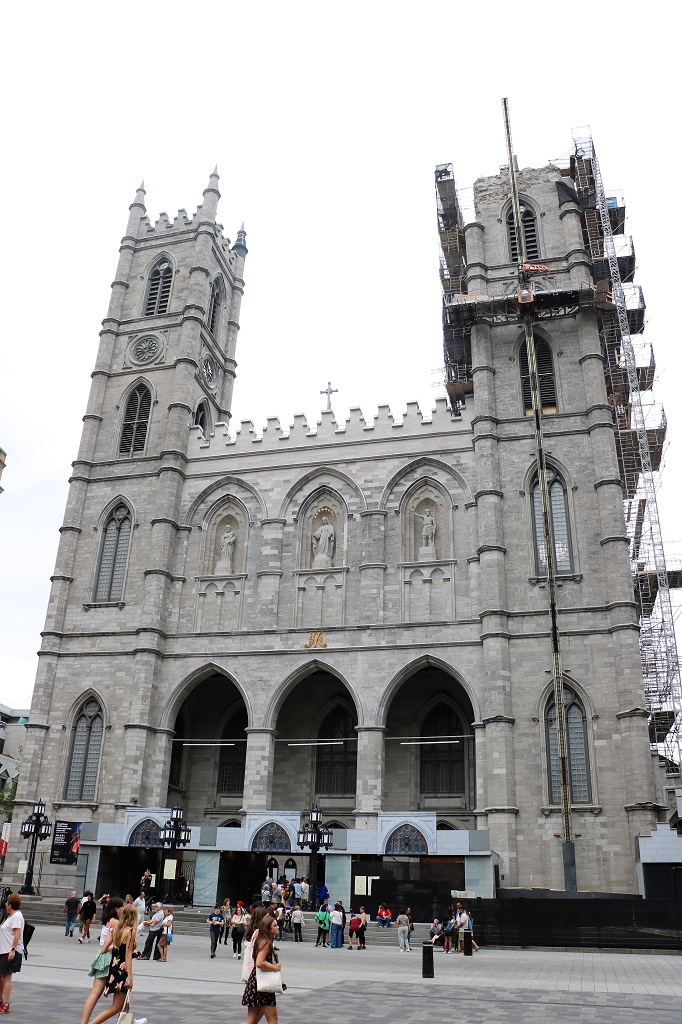
We had another great day wandering around Montreal. It was Basilica day. We toured Notre-Dame and St. Patrick’s.
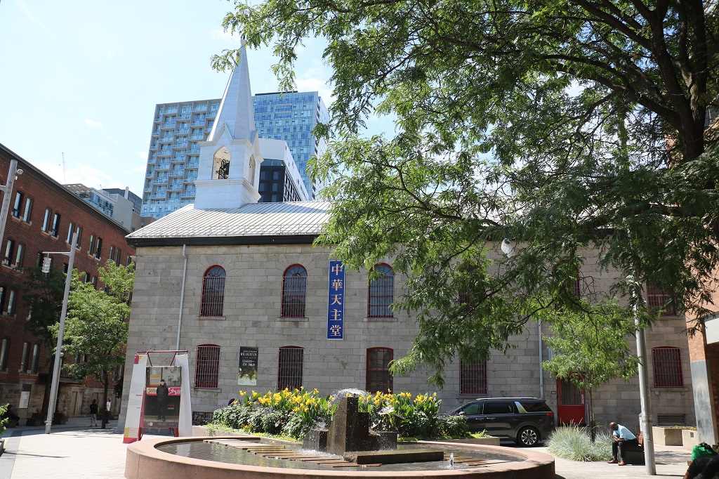
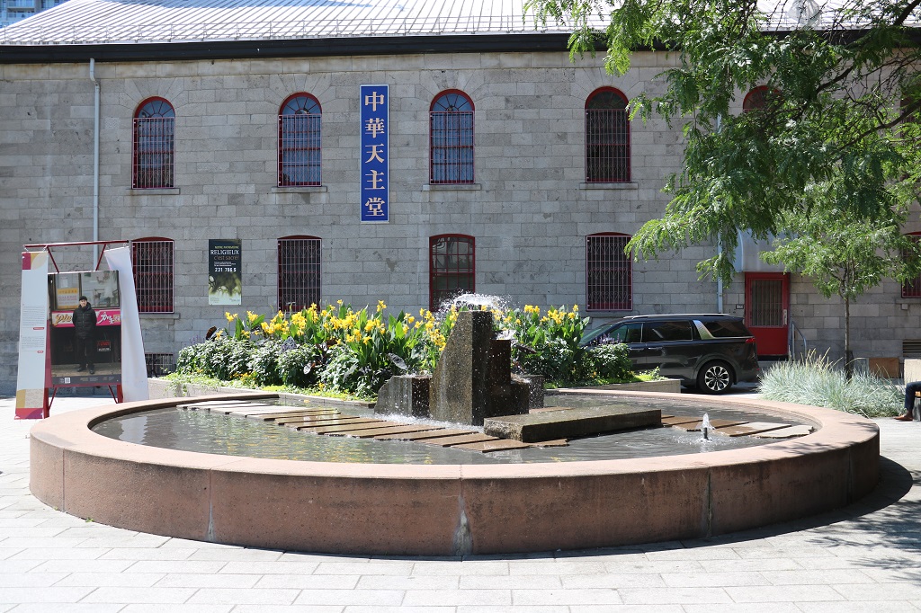
We walked on different streets to get to Notre-Dame Basilica and passed through the Chinese Quarter.
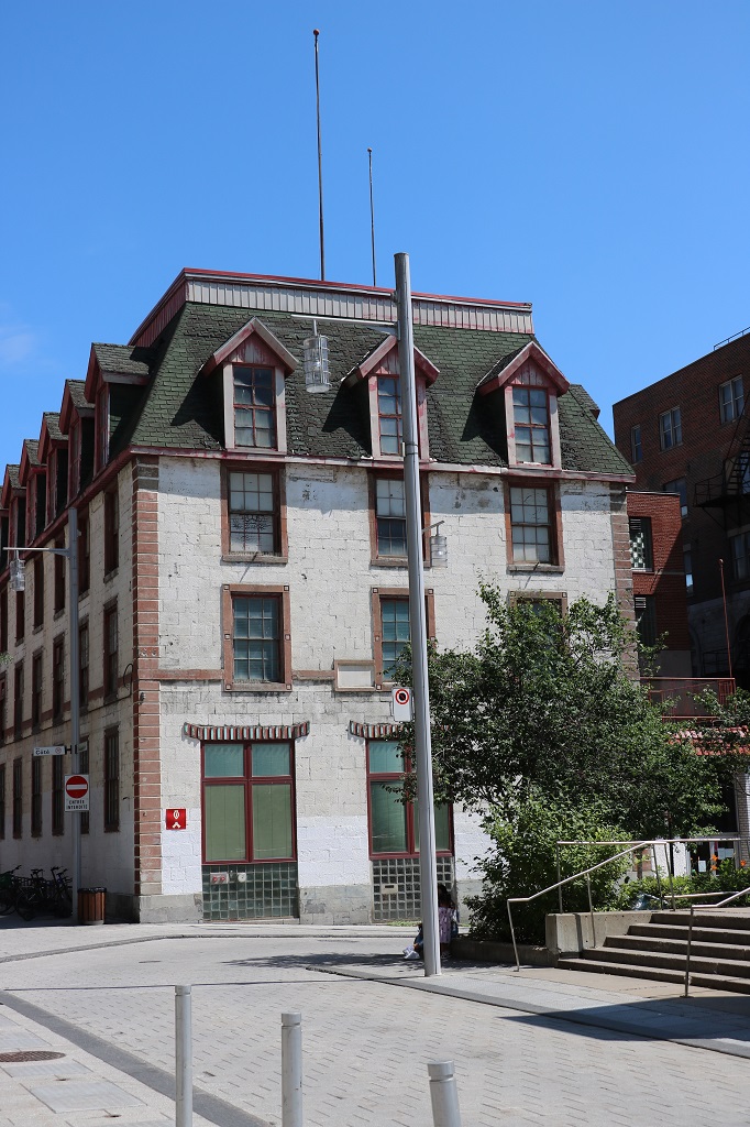
This area looked a bit like a campus but I could not see a name for it.
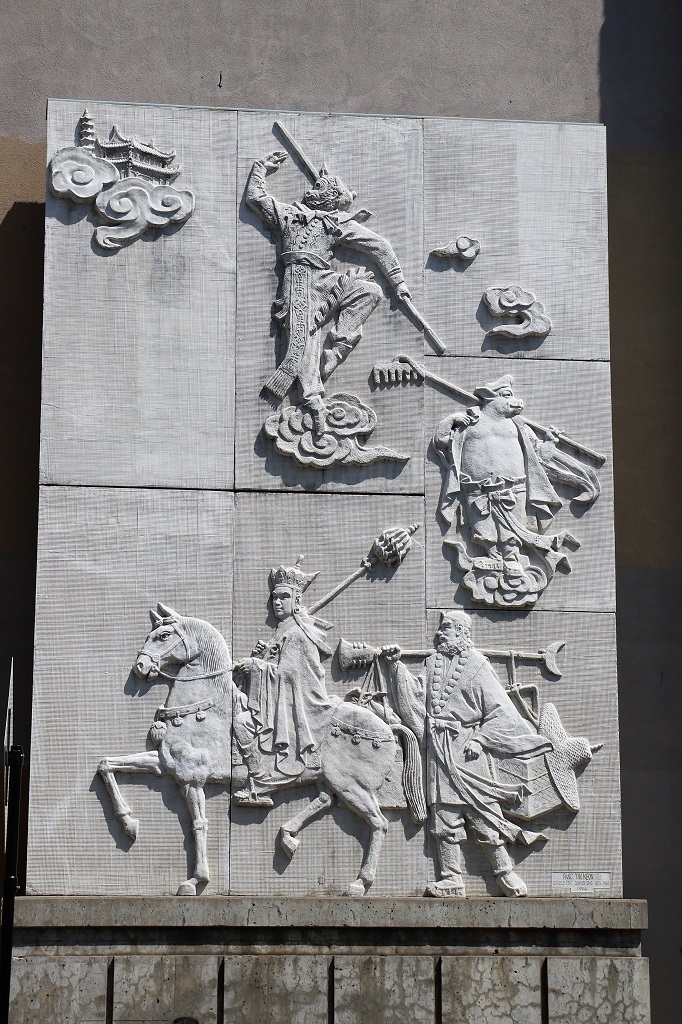
It would be interesting to know story behind all the figures on this bas relief.
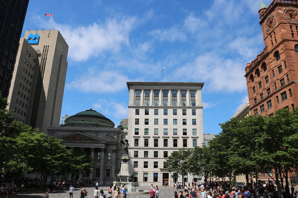
Place d’Armes square from the top of the steps at Notre Dame Basilica.
Before the days of sound systems, the priest would climb to the top of the stairs and deliver his sermon. He could be heard throughout the church.
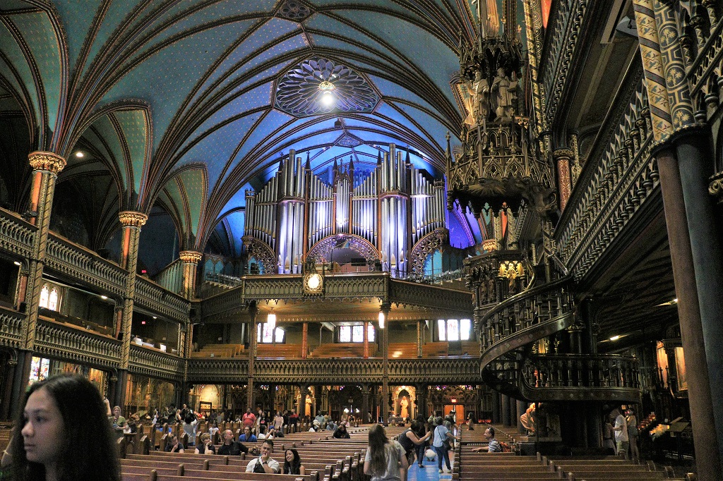
The organ was made by the Montreal firm of Casavant Frères. It was completed in 1891. Today it has 7,000 pipes. The longest is 9.75 meters (32 feet) and the shortest is 6.35 mm (one quarter inch).
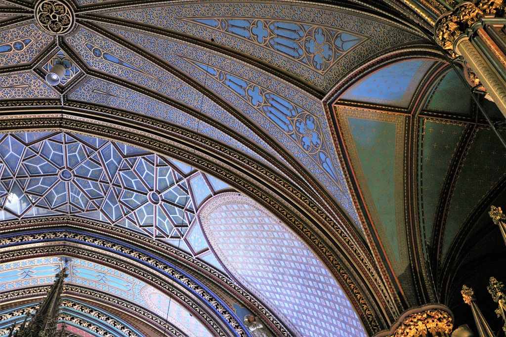
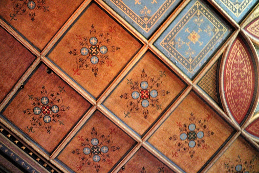
Gorgeous work on the ceilings.
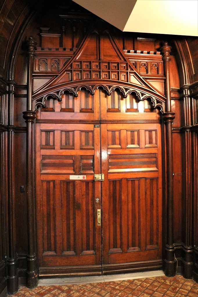
And beautiful doors.
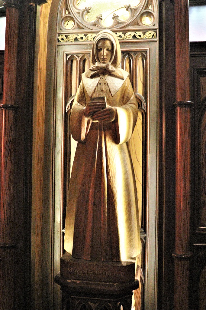
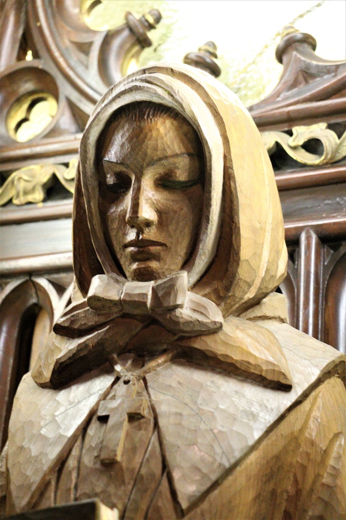
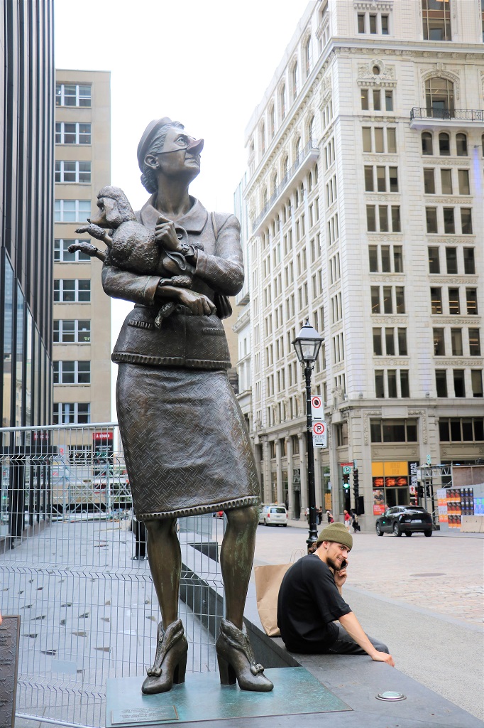
This sculpture of Marguerite Bourgeoys was made by Sylvia Daoust. It did not say in what year. She was the founder of the congretation of Notre-Dame. It is carved from wood.
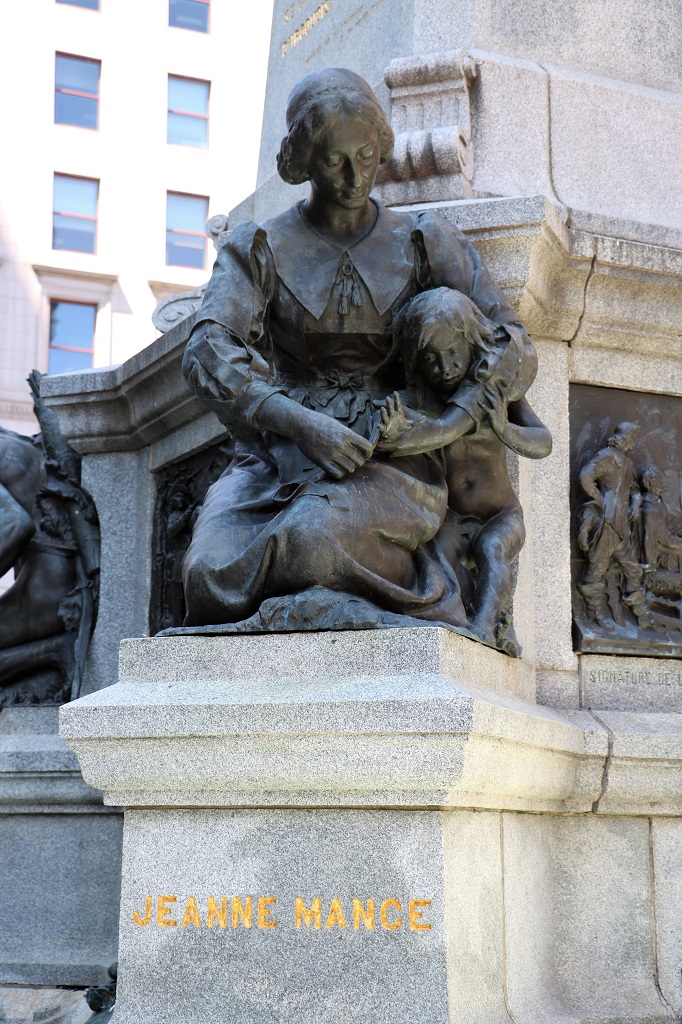
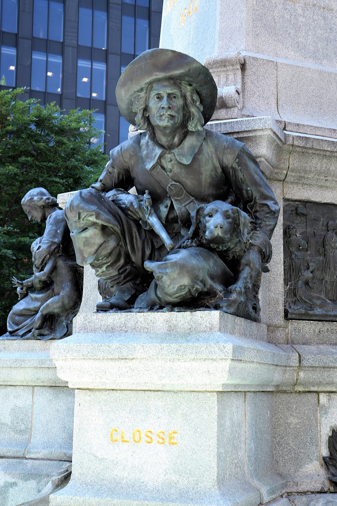
Around the base of the statue on Maisonneuve, the founder of Montreal that I posted a photo of yesterday, are sculptures of four other prominent persons/peoples in the history of the city.
Jeanne Mance was a pioneer of New France and one of the founders of Montreal. She established the first hospital in 1645 and was the first secular nurse in Canada.
Charles Le Moyne de Longueuil et de Châteauguay was a prominent figure in the early days of Montreal. He was a French officer and merchant and also served as interpreter for indigenous languages.
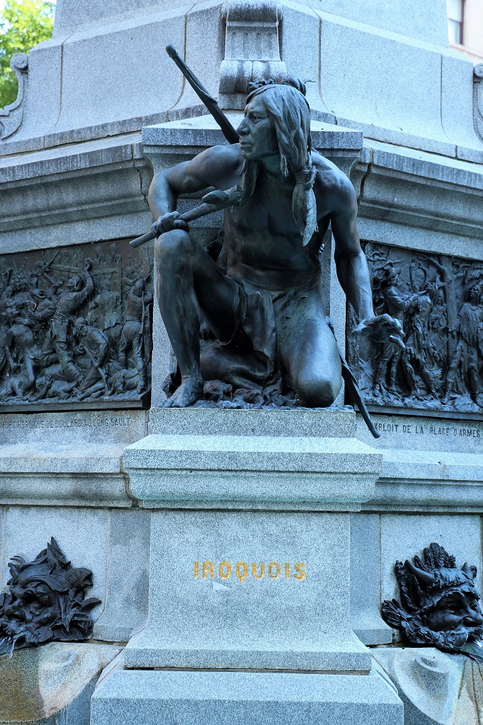
Lambert Closse became a public notary, as well as Sergeant Major of the garrison of Ville-Marie. He is most known for fighting the Iroquois and exhibiting combat tactics that allowed him to win many of his battles. He met his wife, Elisabeth Moyen, while rescuing her from the Iroquois in 1657. Lambert Closse died in combat in 1662.
The French defeated the Iroquois in 1644.
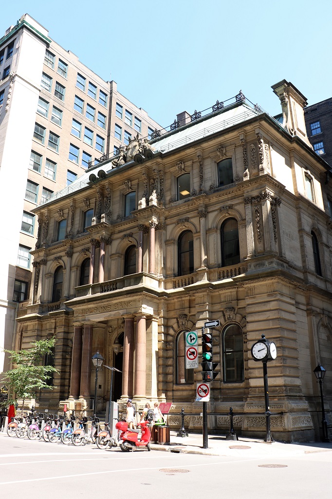
The 1866 headquarters of the Molson Bank, begun by William Molson, son of the founder of the Molson dynasty. It was the first building in Montreal to be built in the Second Empire style. The bank had 125 branches across the country by 1925, the year it was absorbed by the Bank of Montreal.
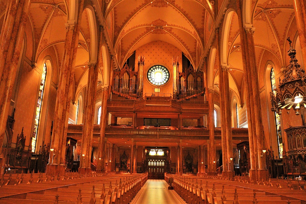
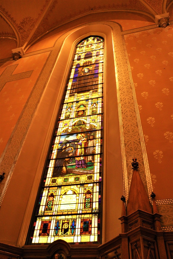
After a delicious cinnamon pastry for lunch we walked up a few blocks and visited St. Patrick’s Basilica which was built by the Irish Catholics. It was very dark inside, even with lights on. Everything was brown, or shades of brown. Even with a very high ISO setting on the camera the photos are dark. I had to do a bit of filtering and editing to make them somewhat clear.
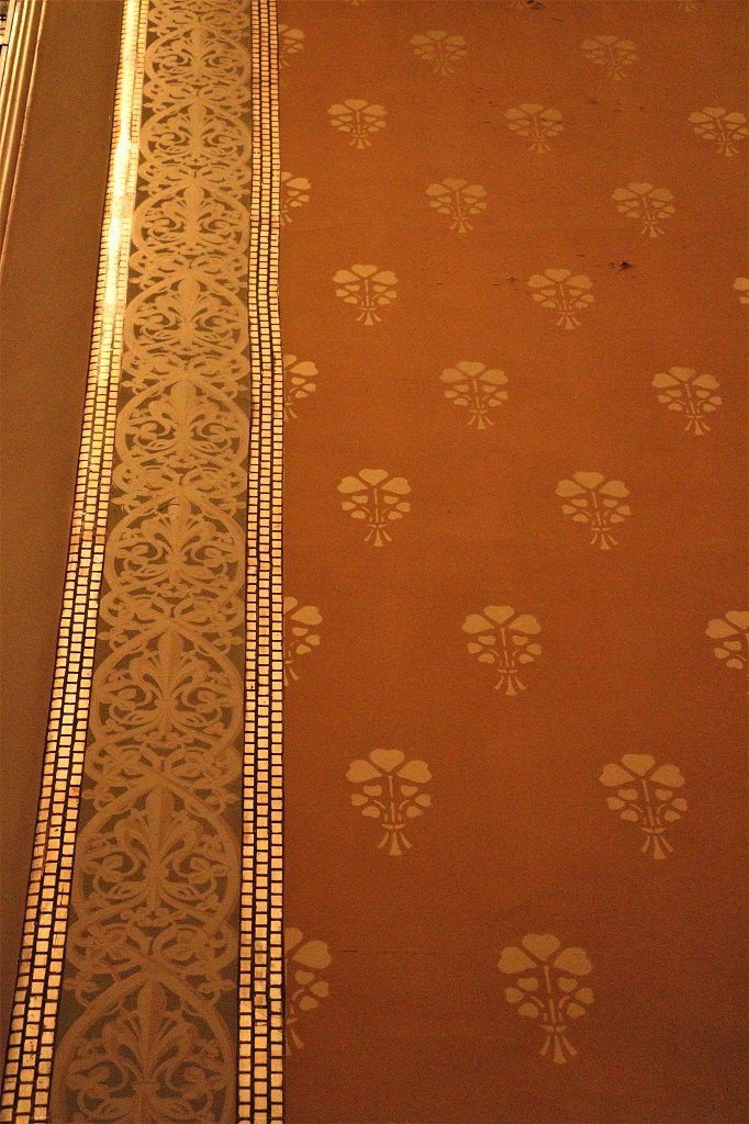
I think all the gilt squares in the stipes on the high, high walls were handpainted. Notice how the rows are uneven.
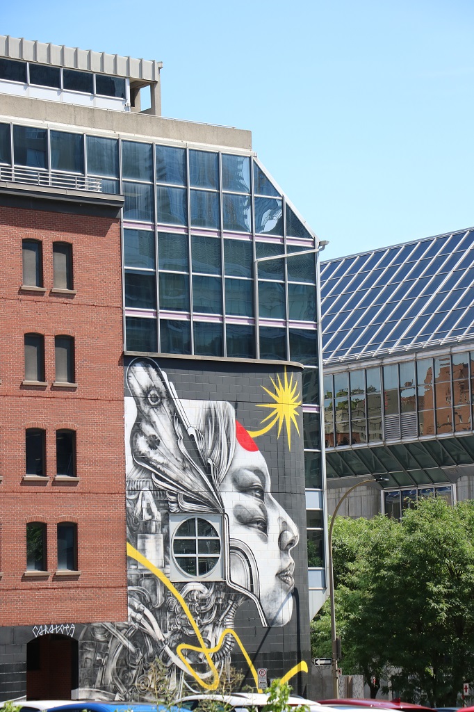
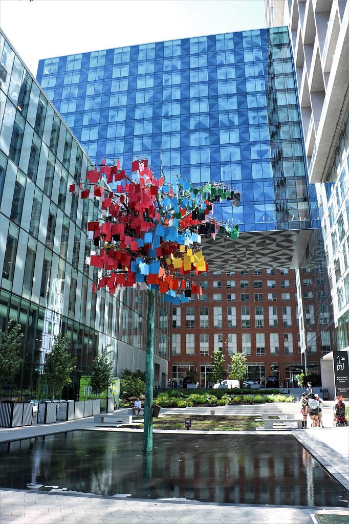
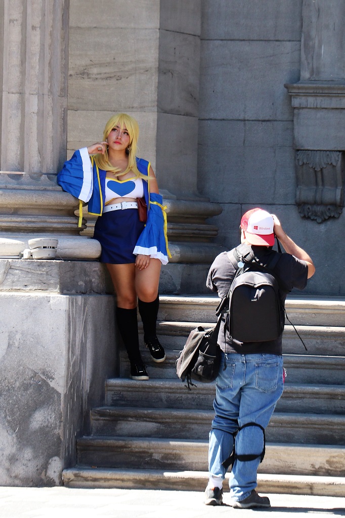
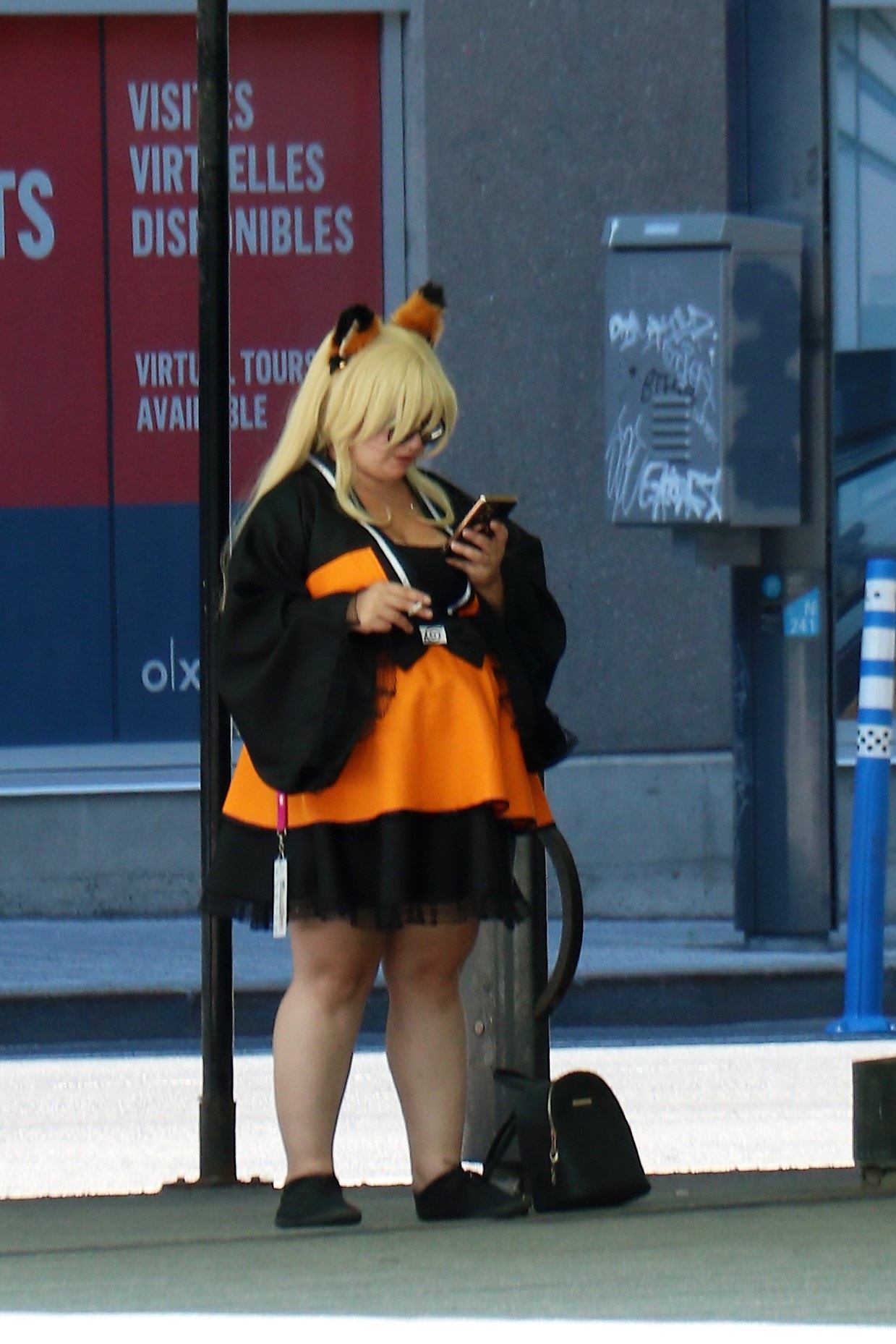
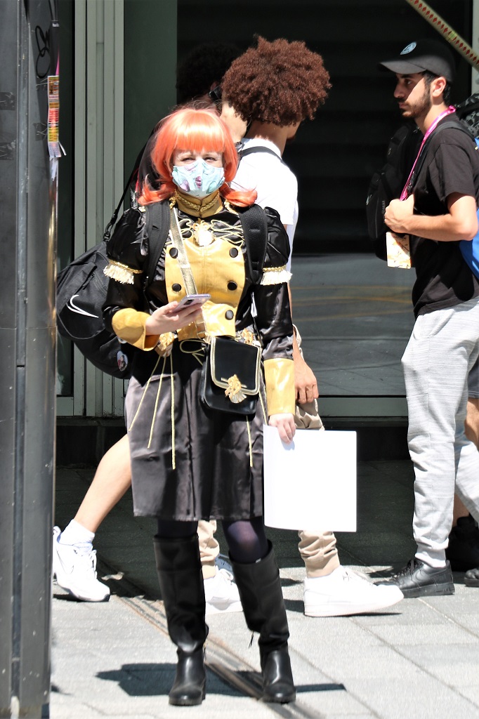
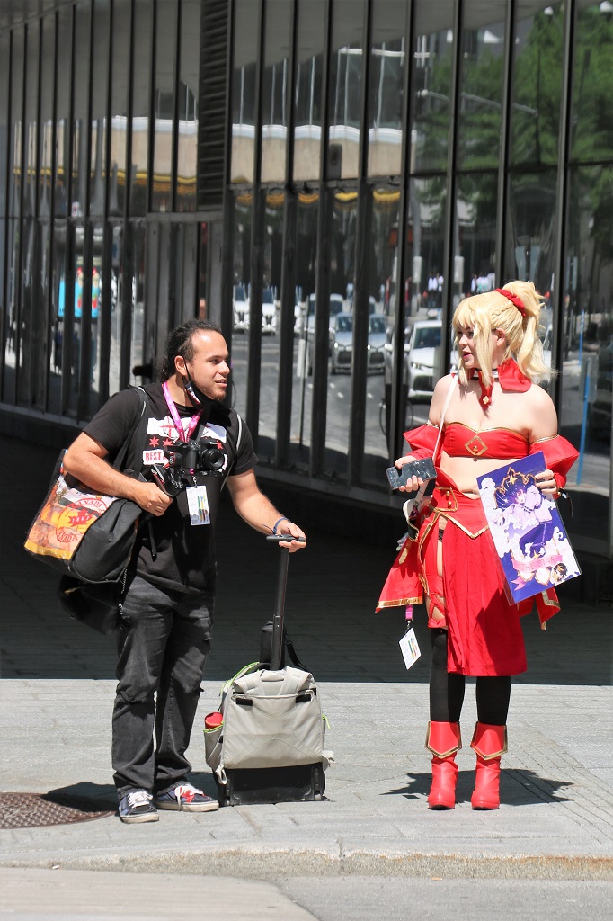
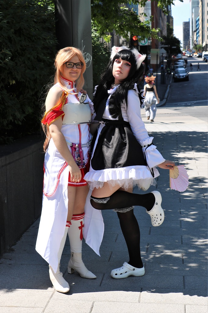
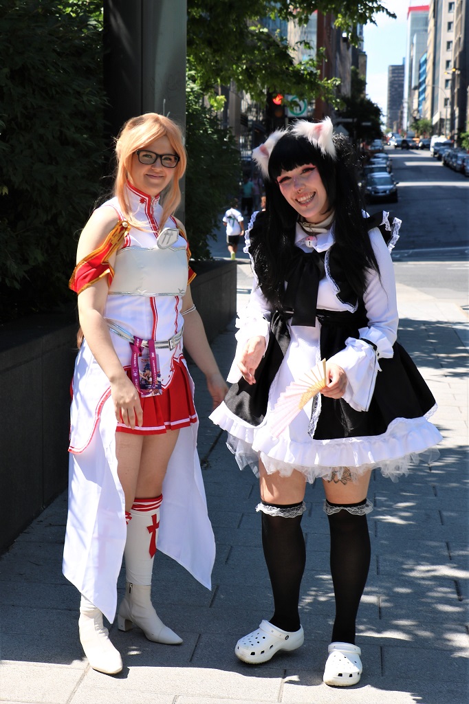
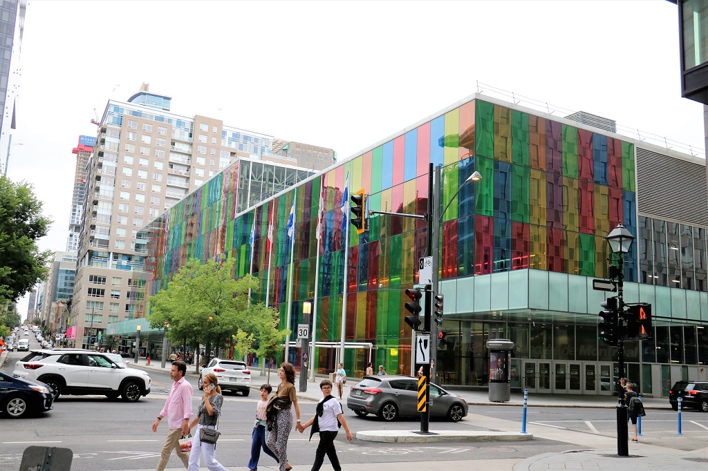
A large convention center (the one in yesterday’s blog with all the different coloured panels) is just down the street from our hotel. This weekend Otakuthon is going on. It is Comicron for Animé. With COVID they have not met for three years and there are probably 5,000-6,000 people in attendance. Many of them are dressed like their favourite animé character and we saw a lot of them as we walked around.
This gal was not the only one having professional photos taken. We saw several photographers getting shots in various places.
These two gals were leaving a park as we approached and John asked if he could take their photo. They were more than pleased to pose for us. They said they made parts of their outfits and bought other parts online.
Tomorrow we leave Montreal. John has done his best to find some quieter roads, but pretty much all the roads heading west out of Montreal are freeways to Ottawa/Hull and Toronto.
We managed to drive all the way to our hotel in Montreal without going on multi-lane fast freeways! We were only on a long three-lane section as we approached the center of the city, but it was block by block slow-moving traffic. Much better. John did a great job find a route that didn’t stress me out.
We left our hotel at 11 and pulled into a park in Repentigny about noon. We wandered around the park for a half hour and then sat in the truck and relaxed for another half hour. It was a short distance to drive to Montreal, with nothing I could find to see along the way, and we did not want to arrive too early. We were really hoping, if we could not check in on arrival, that we could at least park the truck.
Driving into the city to find our hotel.
We arrived at 2 and the hotel had our room ready so we were able to freshen up before heading out to walk to Old Town, which was about 15-20 minutes straight down toward the river from the hotel.
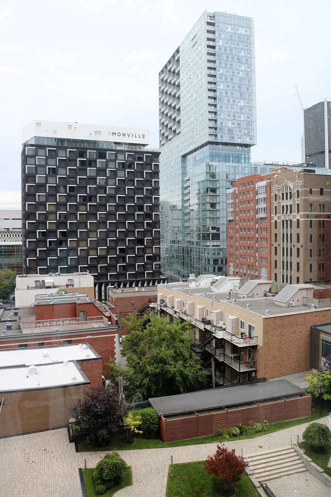
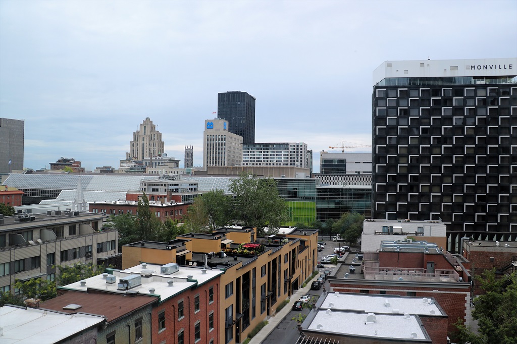
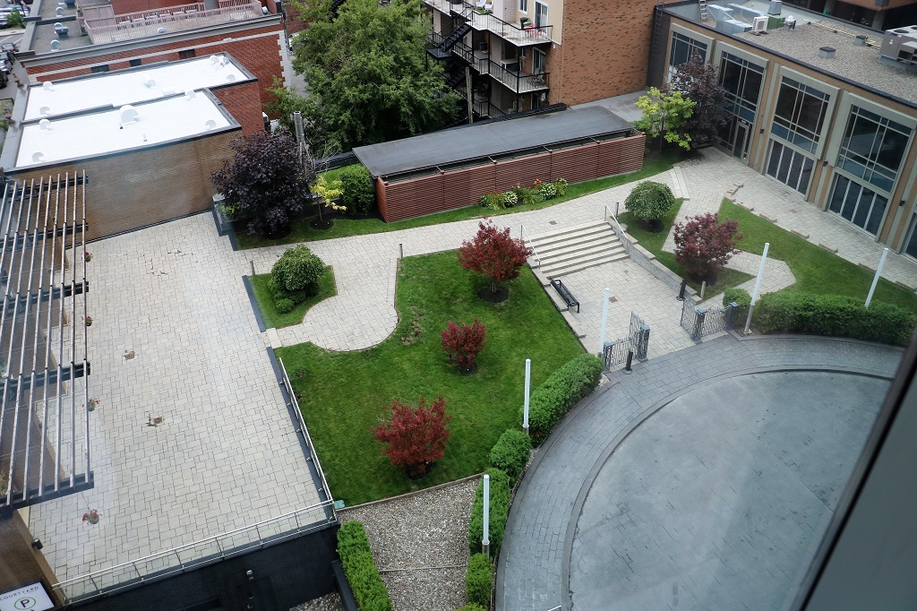
The views of the city and the courtyard from our room on the 6th floor of the Courtyard Marriott.
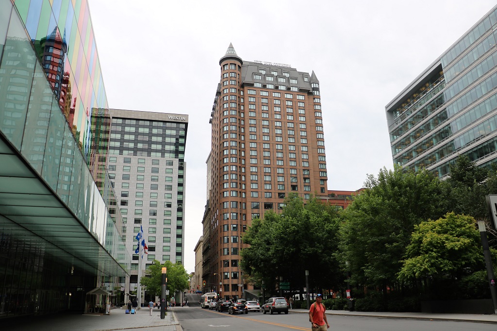
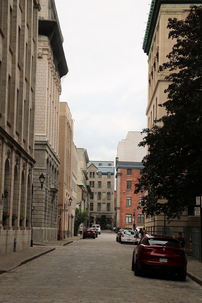
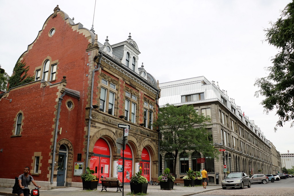
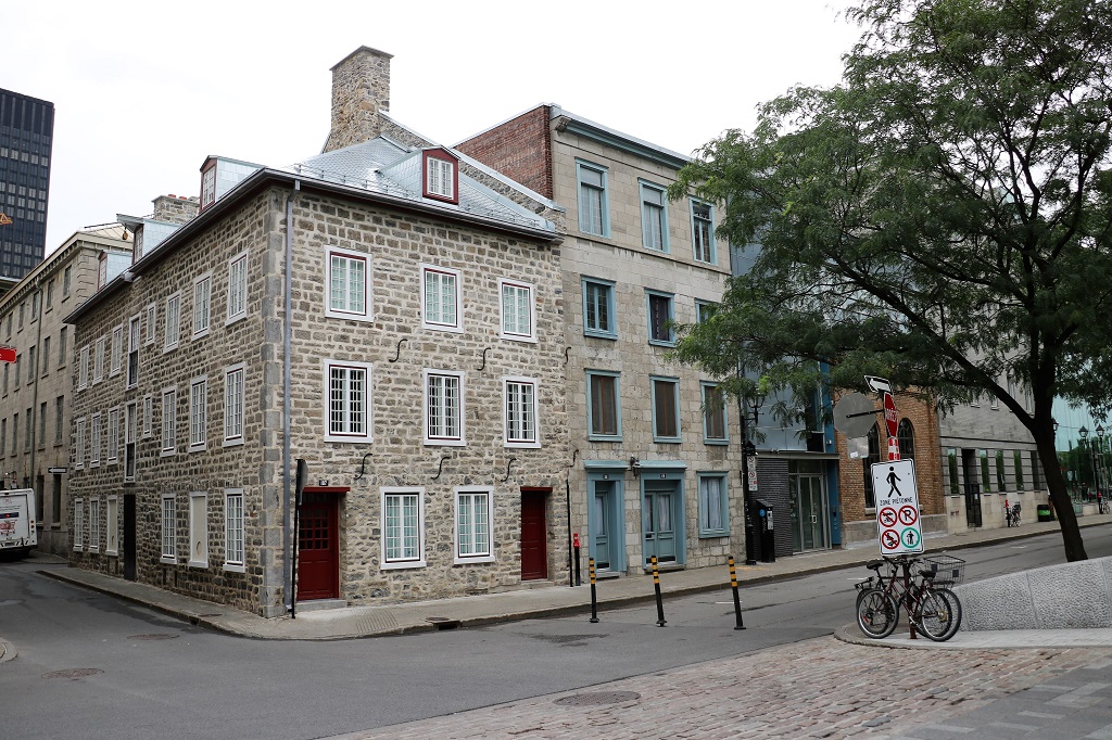
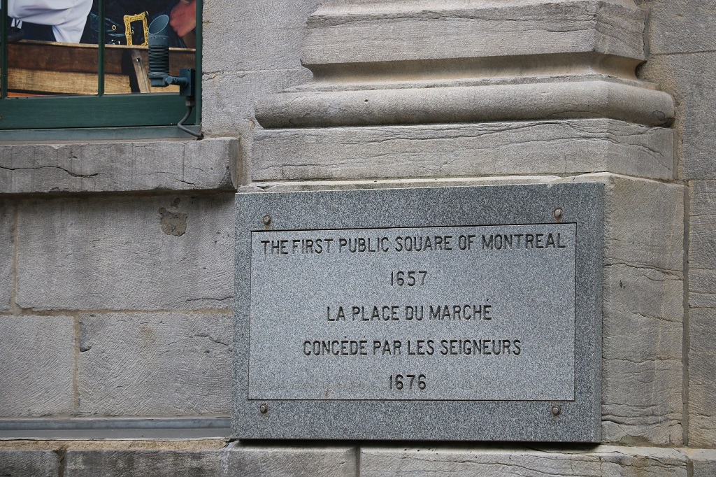
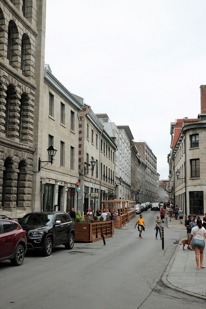
We had a good walk, looking at all the old buildings and wandering the cobblestone streets, but I must say I prefer Old Town Quebec City. There is more of interest to see there with the Plains of Abraham, the Citadel, Martello Towers and the promenade along the front of the Chateau Frontenac – and all that history to read about – as well as old buildings and cobblestone streets. And Quebec seems to have a more ‘preserved and contained’ old section. Montreal has more modern buildings – or modern-ish ones – intermingled with the old ones. Could be just me though, so don’t let it stop you from visiting if you get the chance.
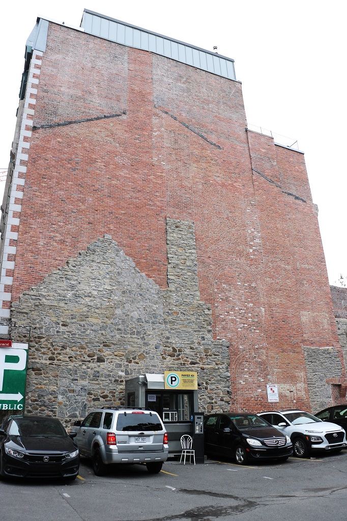
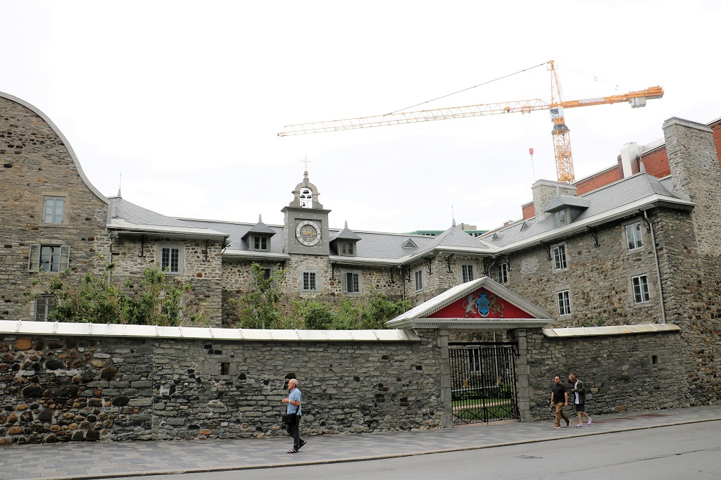
Consequently this blog is a lot of photos of old buildings, almost none of which I can identify.
I love how the stone from the house still shows the shape. Also there is a higher roofline, several windows and an archway in the brick.
Basilica of Notre Dame. We plan to go there tomorrow.
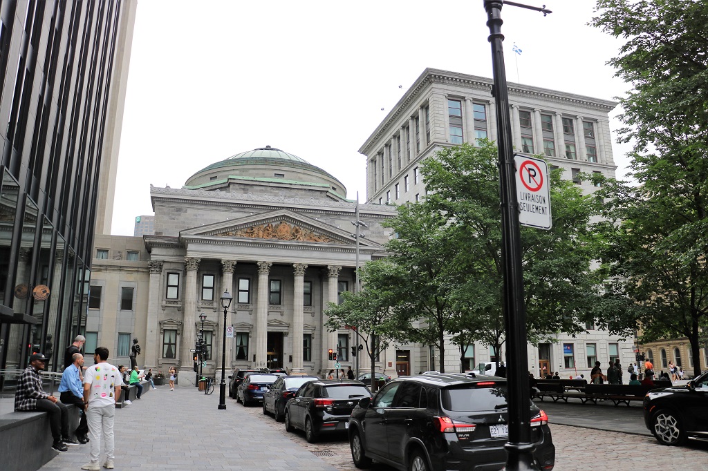
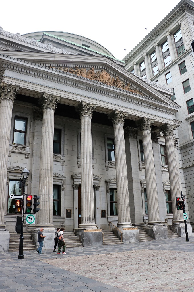
Head offices of the Bank of Monteal.
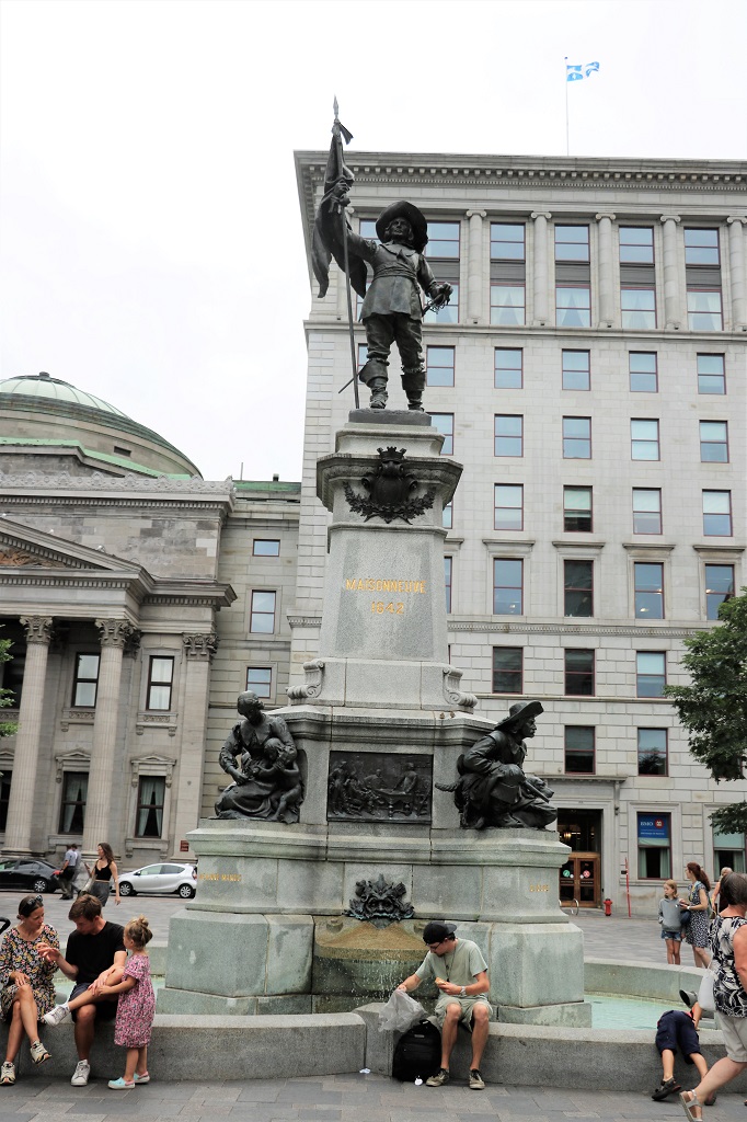
This monument in memory of Paul Chomedey de Maisnoneuve, founder of Montreal, was unveiled on July 1, 1895, as part of the celebrations for the 250th anniversary of the founding of the city on May 31, 1642. The project was announced in 1891 but not completed and unveiled until 1895. It sits in the middle of Place d’Armes, the square in front of the Notre Dame Basilica.
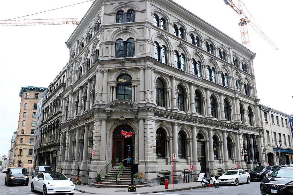
British Empire Building – now offices and shops.
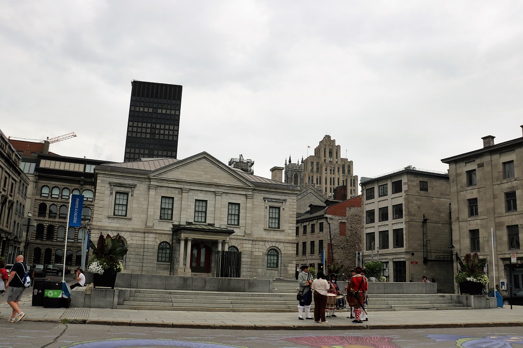
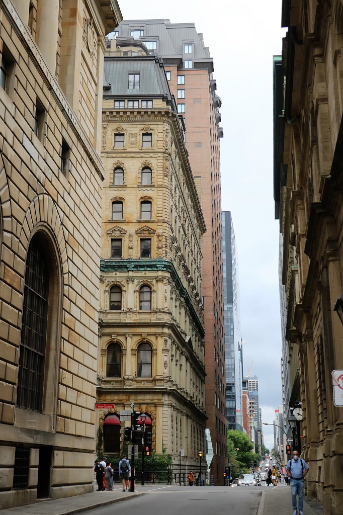
I like the change of eras looking down the street from old to new.
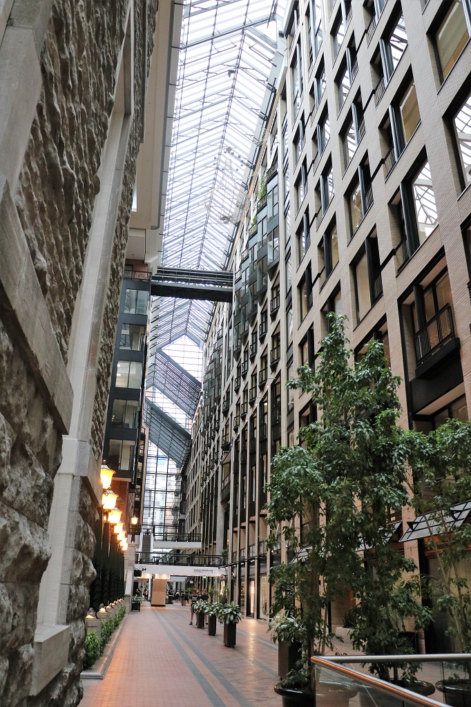
There is a huge three-level mall under the buildings. They connected the street-level ones with a glass roof and walkways and built underground. We only walked partway into the street level.
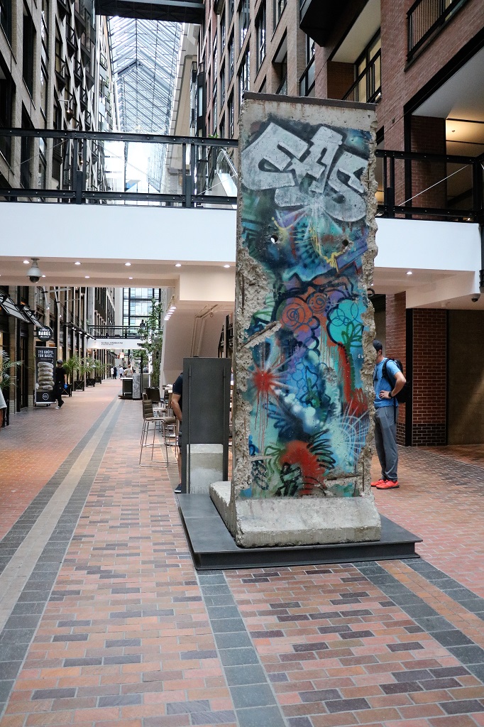
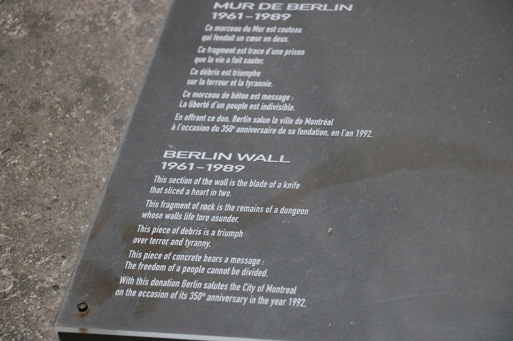
The graffiti on this section of the Berlin Wall that was sent to Montreal was done in Berlin. As the wall was broken down in sections people wrote on them or created specific art projects on them. It was an outpouring of joy and also a political statment. We saw lots of them when we were in Berlin at the location of the former wall.
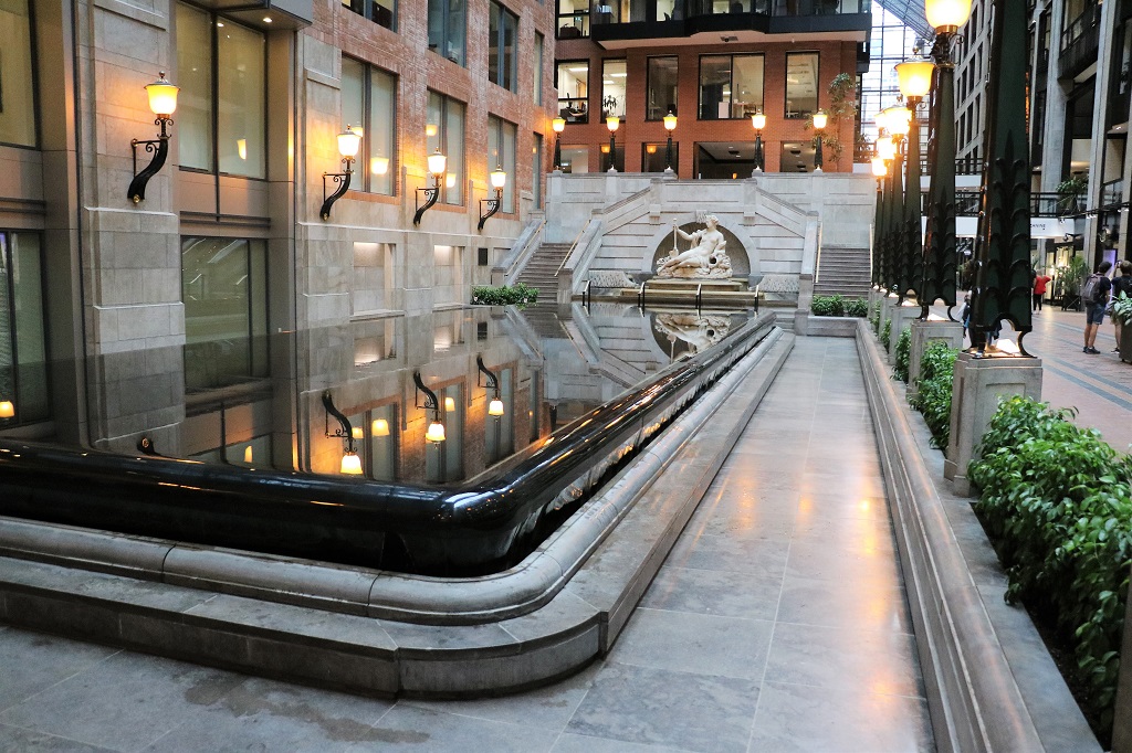
A courtyard in the mall had this gorgeous infinity pool in it.
Even though the water flows off the entire surface of the pool it was very quiet.
I needed to rest my feet and achy hips from all the concrete so we headed back to our room to rest up a bit before supper.
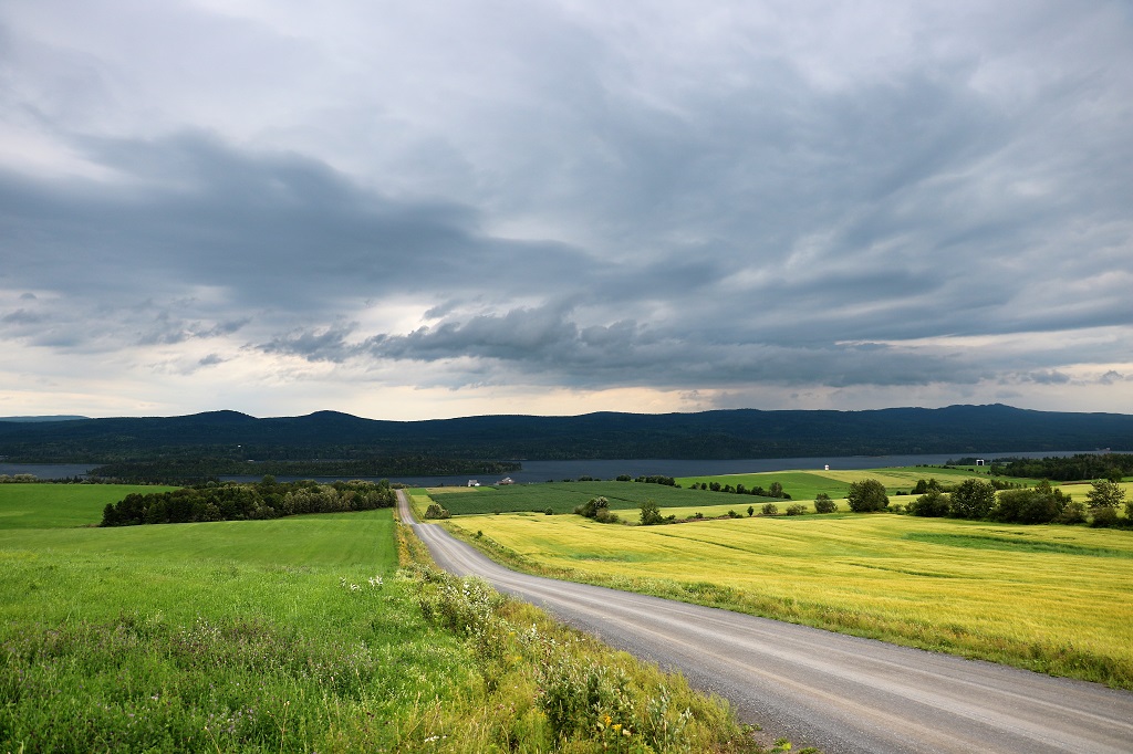
We have been nursing a slow leak in one of the truck tires and it seemed to be losing air quicker so before we left the hotel this morning John decided to change the tire. Thus we did not leave until 11:30. If you take Highway 40 and just drive the freeway it will take you about 2 1/2 hours to reach Berthierville from Montmagny. Since we avoid freeways if at all possible we meandered along the St. Lawrence coast road and arrived 6 hours later.
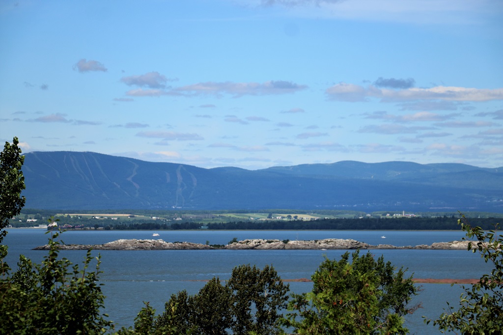
The ski hill on the far side of the river is the Mont Ste-Anne Ski area.
I had managed to find a few things to see along the route that we have not seen before, but it was mostly a bust. The first two were closed on Tuesdays and Wednesdays, the third we could not find, and we somehow missed the turn to find the fourth.
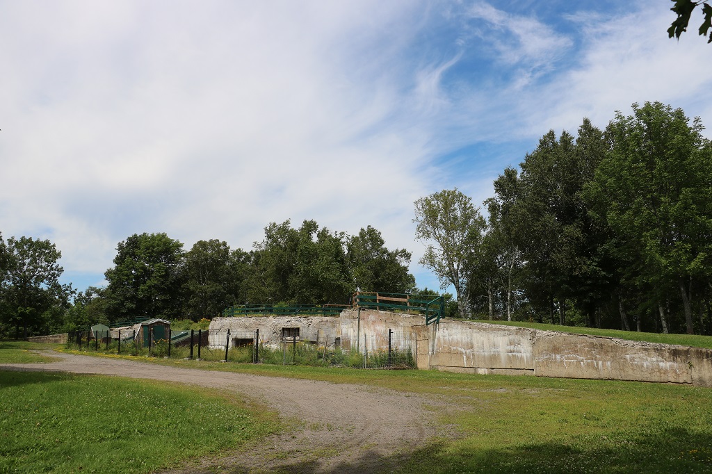
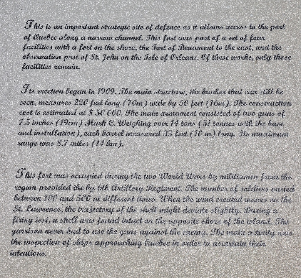
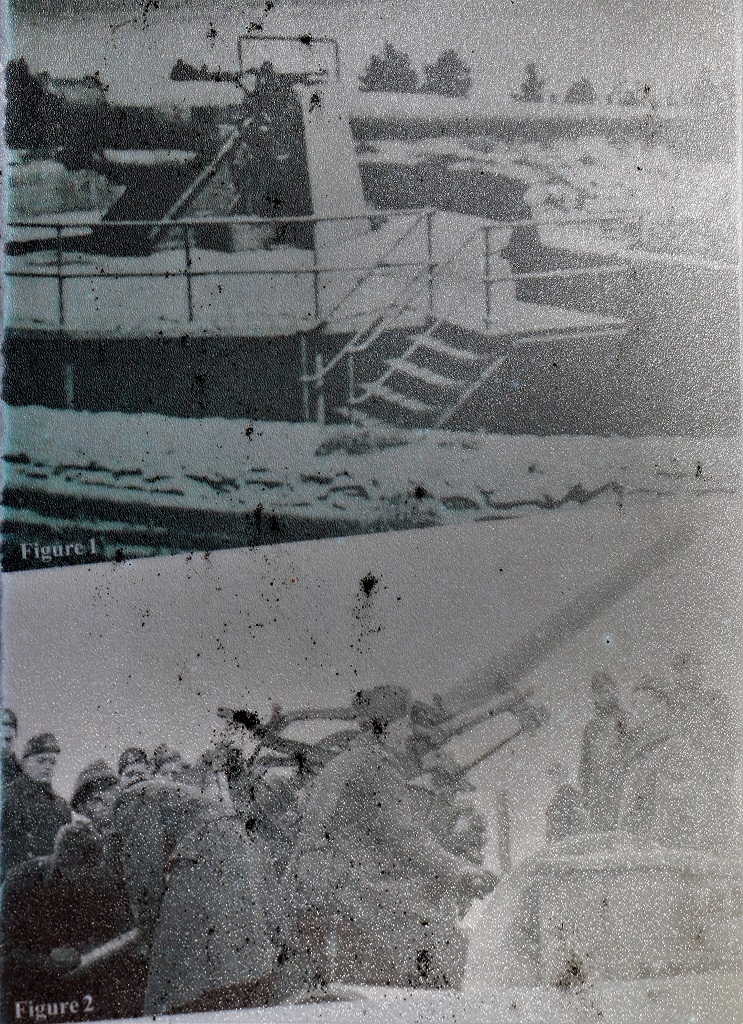
We did find the remains of the Fort la Martiniére, which was just the concrete remains WWI and WWII St. Lawrence protection system.
We drive by so many lovely stone or brick manor-style houses and many of this type that are most often painted in lovely bright colours.
Lunch was enjoyed on a small municipal park bench in a town whose name I don’t know. The towns just seem to run one into another along this drive.
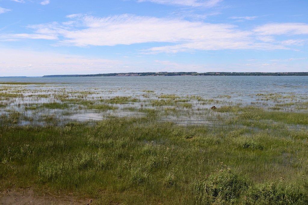
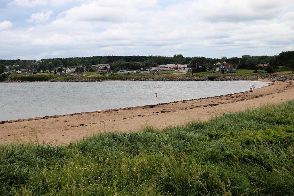
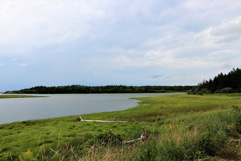
The river in front of the little park had a long stretch of marsh land and there were signs up about protecting it.
We saw a sign for a viewpoint but when we drove down the road we came to a boat jetty with a very popular restaurant.
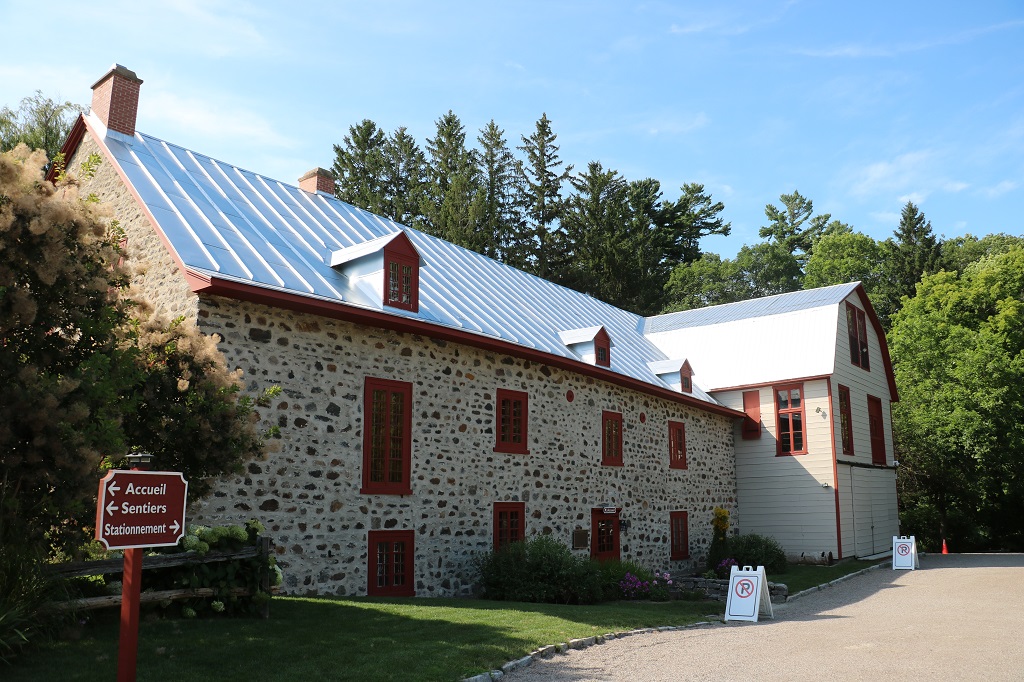
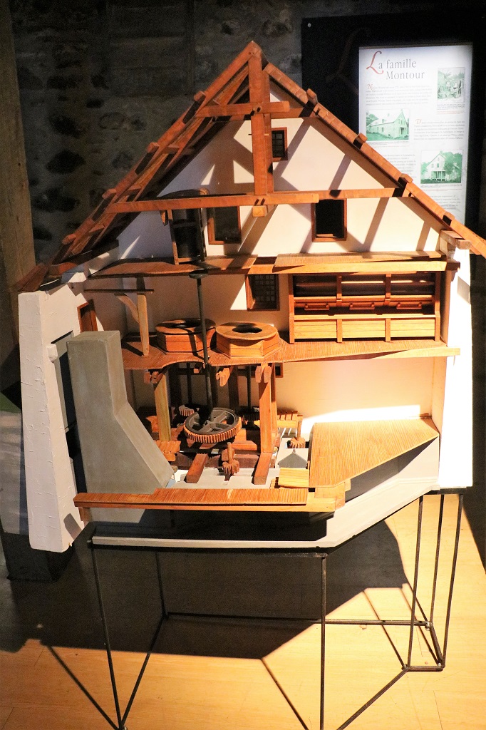
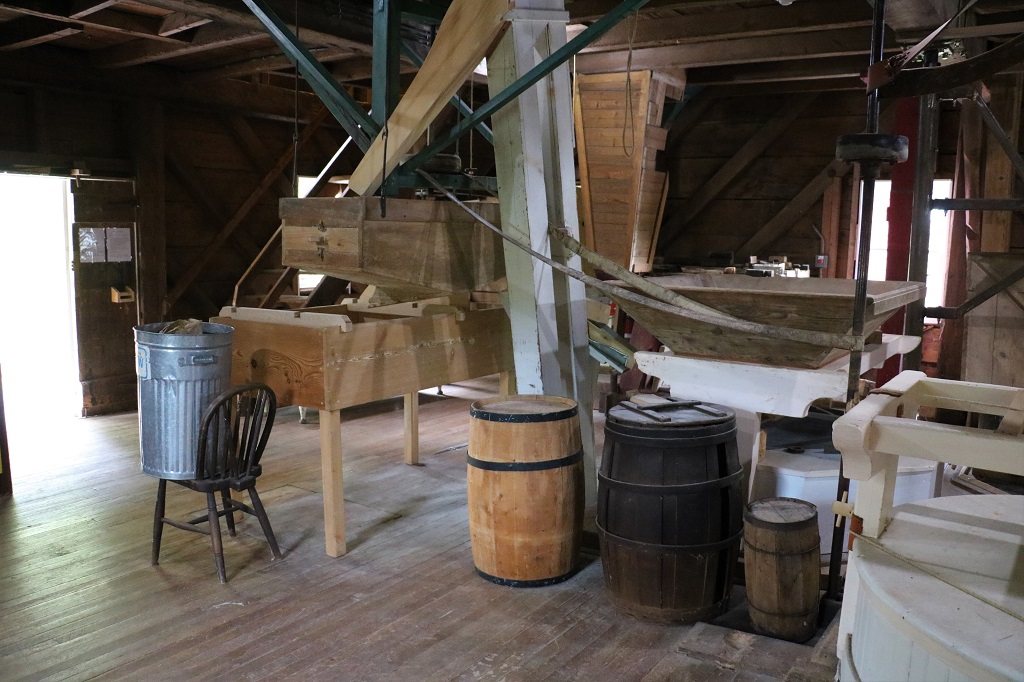
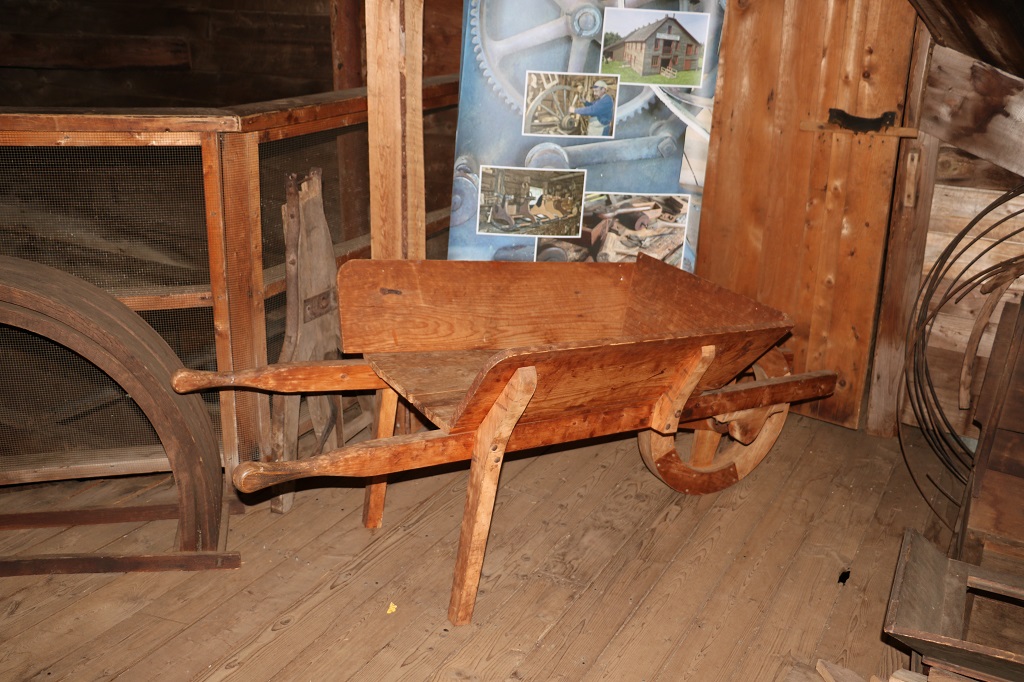
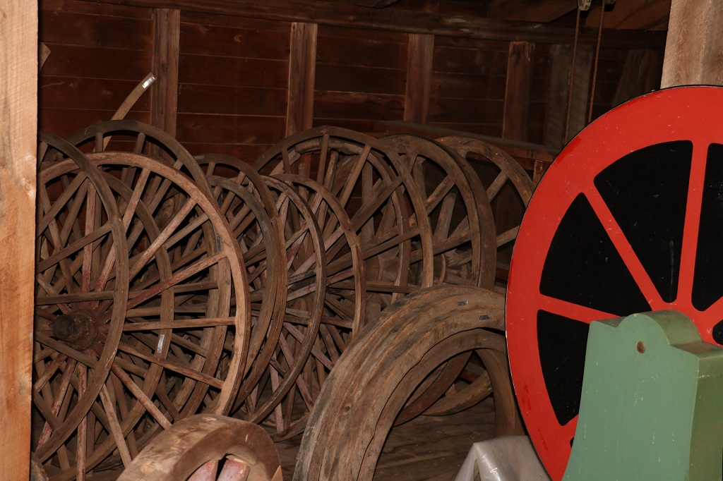
We crossed the St Lawrence River at Trois Rivières and continued down the north coast. Not far from Berthierville we saw a sign for the Moulin Seigneurial de Point-du-lac; another old flour and sawmill.
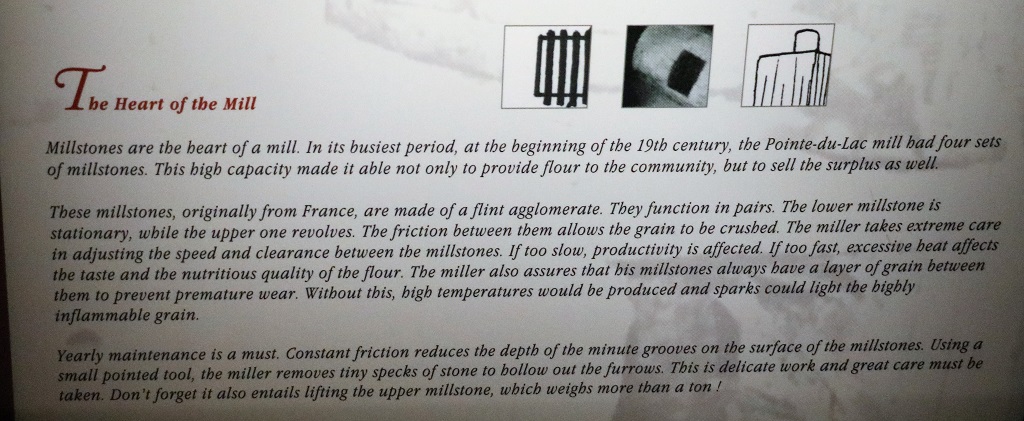
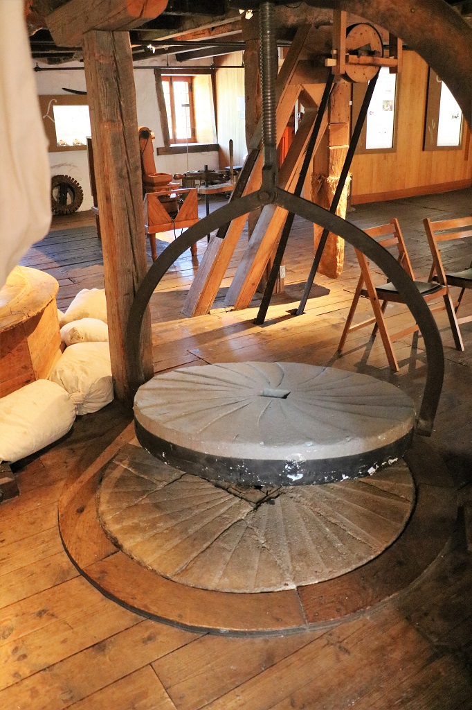
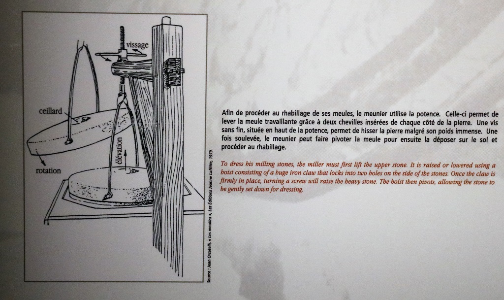
There was only one thing inside the mill that I photographed. We had been told about the miller having to lift the millstones and ‘dress’ them (make sure the grooves were clean so there would be no wear spots), but the Old Balmoral Grist Mill did not have the hoist pieces. This mill did. Each of the millstones weighs a ton so they use the hoist to lift the top one off and swivel it to the side so each stone can be cleaned and checked.
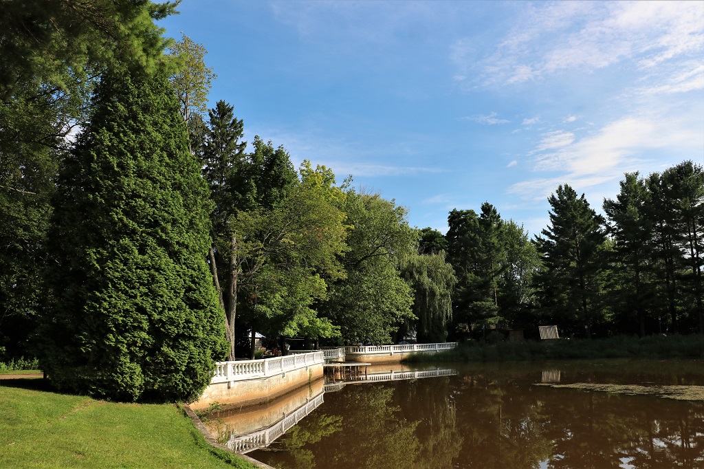
The grounds around the mill had several hiking trails and the lake – although very muddy – was quite a scenic spot.
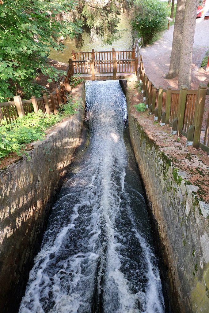
The old waterwheel flume looking down.
And looking up.
We decided to take the plunge and go to Montreal. We usually avoid big cities but we would both like to see Old Town Montreal and the road we have been driving goes right into the city so we will do the small villages and then stop lights at every block on the way to our hotel. We plan to park the car at the hotel, which is not far from the Old Town and walk everywhere. John has not quite figured out how to get out of Montreal and avoid their massive, busy freeways, but he is working on it. They do not bother him at all, but I hate multi-lane freeways with everyone going 100 kph and changing lanes here there and everywhere.
Between the long weekend, summertime in general, and people finally feeling comfortable to travel, finding accomodation the past week or so has been a challenge. John could find no rooms at all around the Gaspe so we had to scrap that plan and today we just drove across the bottom of the peninsula from Dalhousie to Rimouski and then headed west along the St. Lawrence to Montmagny again for the night. We left our hotel at 10 and arrived at 5:30 Atlantic Time, which was now 4:30 Eastern Time.
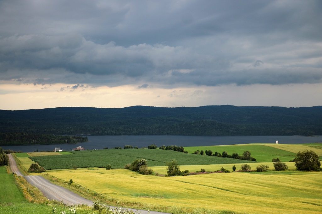
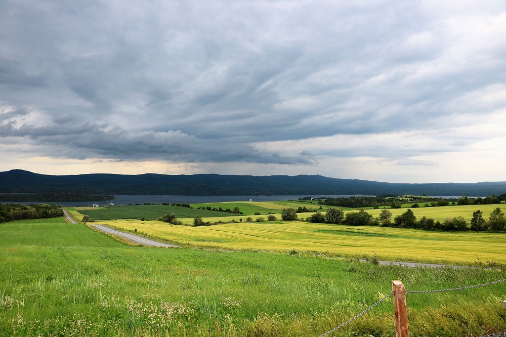
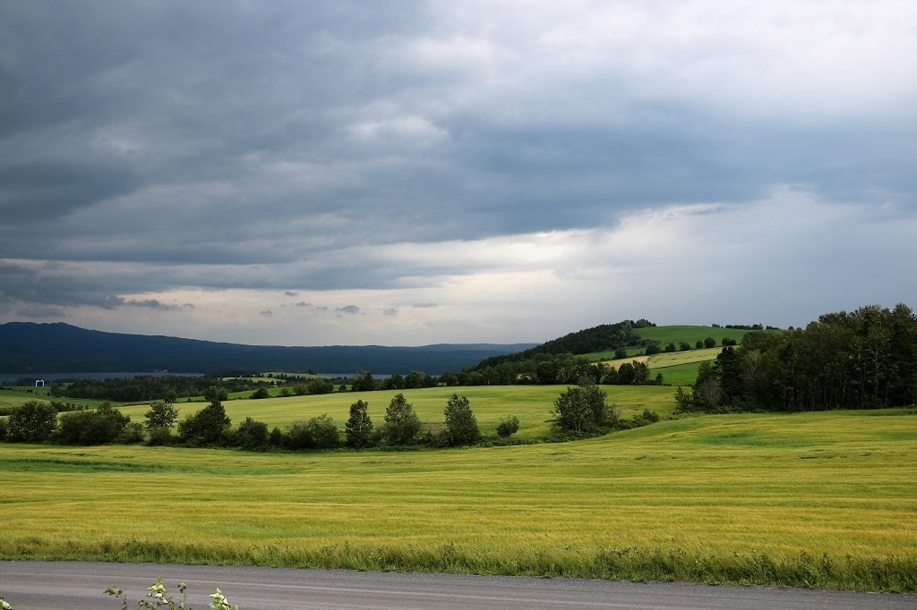
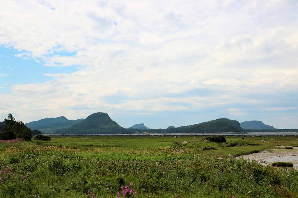
The drive was more scenic than we expected. We thought we would be going through forests until we got to the St. Lawrence River, but we spent a lot of time passing farms, Huge dairy farms and really large fields of silage corn or wheat.
There was a sign for a viewpoint off to the left so we made the turn, not expecting too much as we had trees on the right side of the road and farm land on the left. After going uphill about a half mile we arrived at the Val-Brilliant kiosk with an amazing view of the Lake Matapedia and the surrounding farmland.
It’s not your eyes, this photo is out of focus. The truck hit a bump just as I hit the shutter. The viewpoint is at the top of the hill.
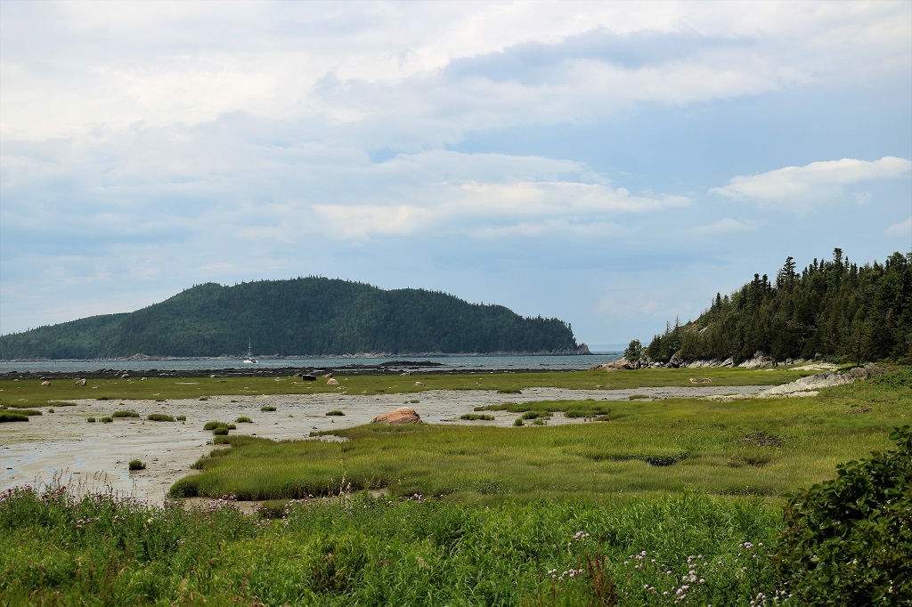
At lunch time we pulled into Bic National Park which is a favourite kayaking and windsurfing area. They actually regulate the number of people on the river on any given day, so you need to make a reservation. We just had our PB&J sandwich in the parking lot, took a couple of photos and headed on our way again.
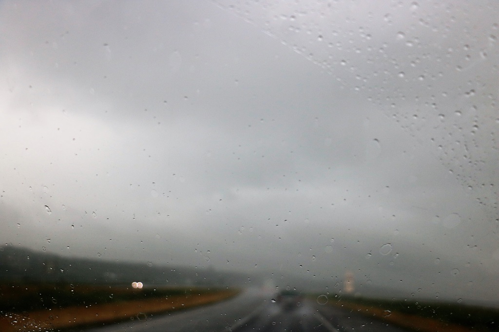
As we approached Rimouski on the St. Lawrence River we hit rain. And we drove through rain – and I mean RAIN – for the next three hours. At times we could barely see the vehicle in front of us.
The rain finally stopped when we were about 80 km from Montmagny and we had a nice drive through some small towns all the way to our hotel.
So, short blog today, which I expected since we had quite a lot of driving to do and not a lot of time for long stops; not that were were any heritage spots or museums to tour anyway. Tomorrow is a shorter day. We only have to go to Berthierville about 2 1/2 hours down the St. Lawrence. We have been on this section of road three times and have stopped at any places that are of interest, which may mean a very short blog tomorrow – or none at all.
We were off at a slightly earlier than normal time this morning. When we checked into our hotel yesterday they told us they had a hot water problem and we may have only warm, or possibly cold water for showers. They gave us the option of cancelling – although I am pretty sure no one did that since there was nowhere else to stay in Moncton – or we could get a 30% discount on the room. We took the discount and stayed. With no morning showers we were down to breakfast and out of the hotel a good 3/4 of an hour early and on our way north.
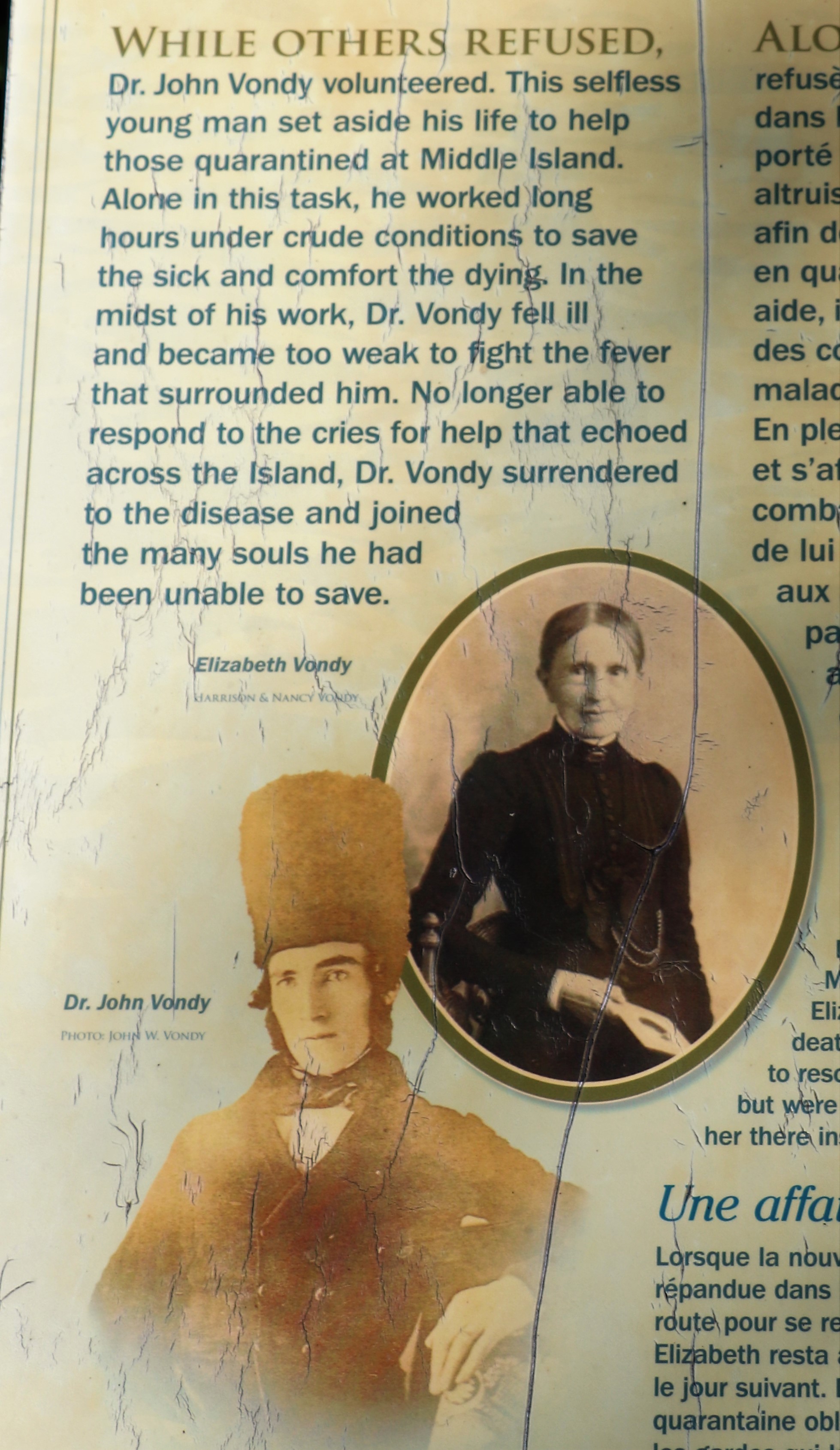
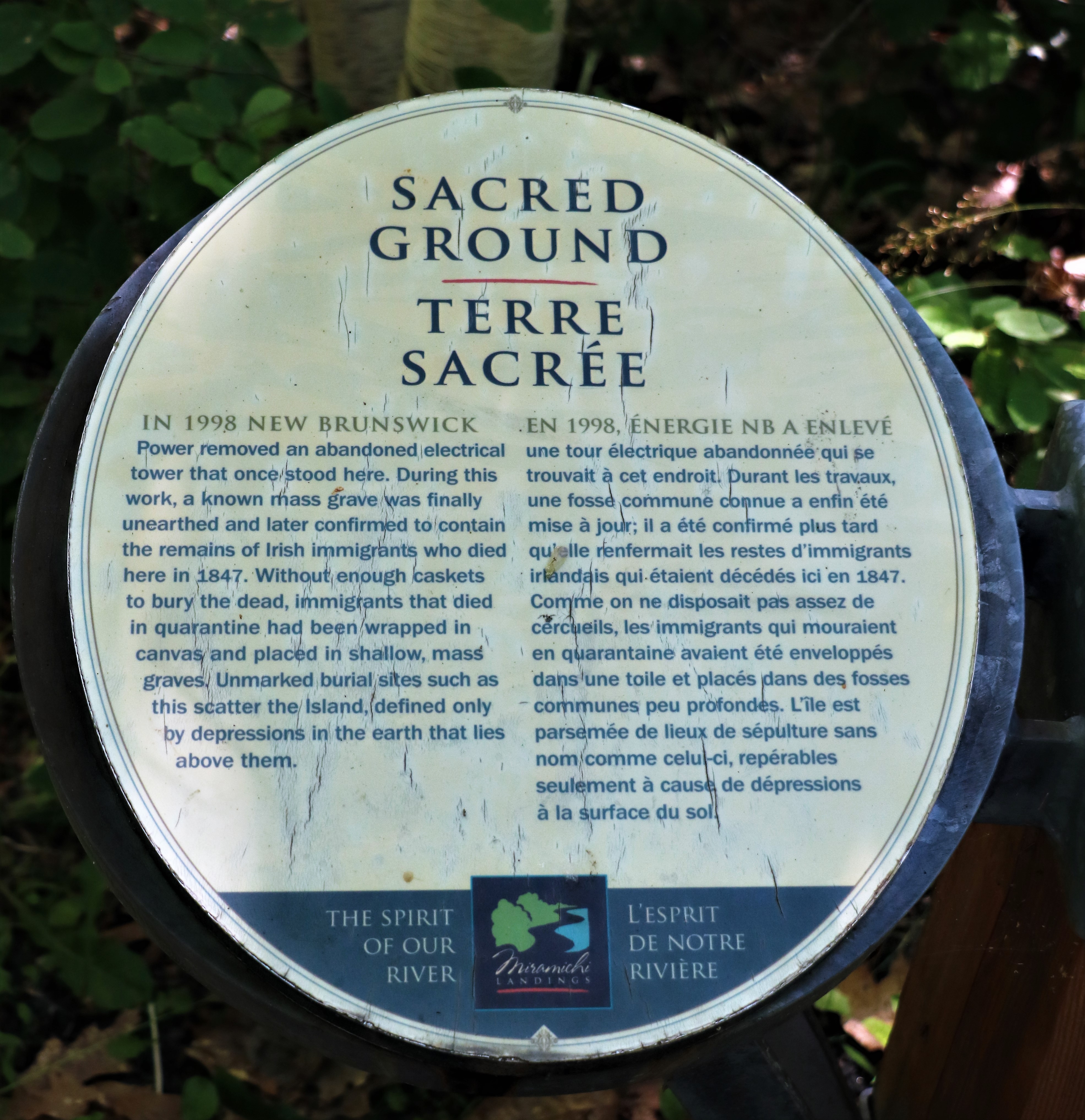
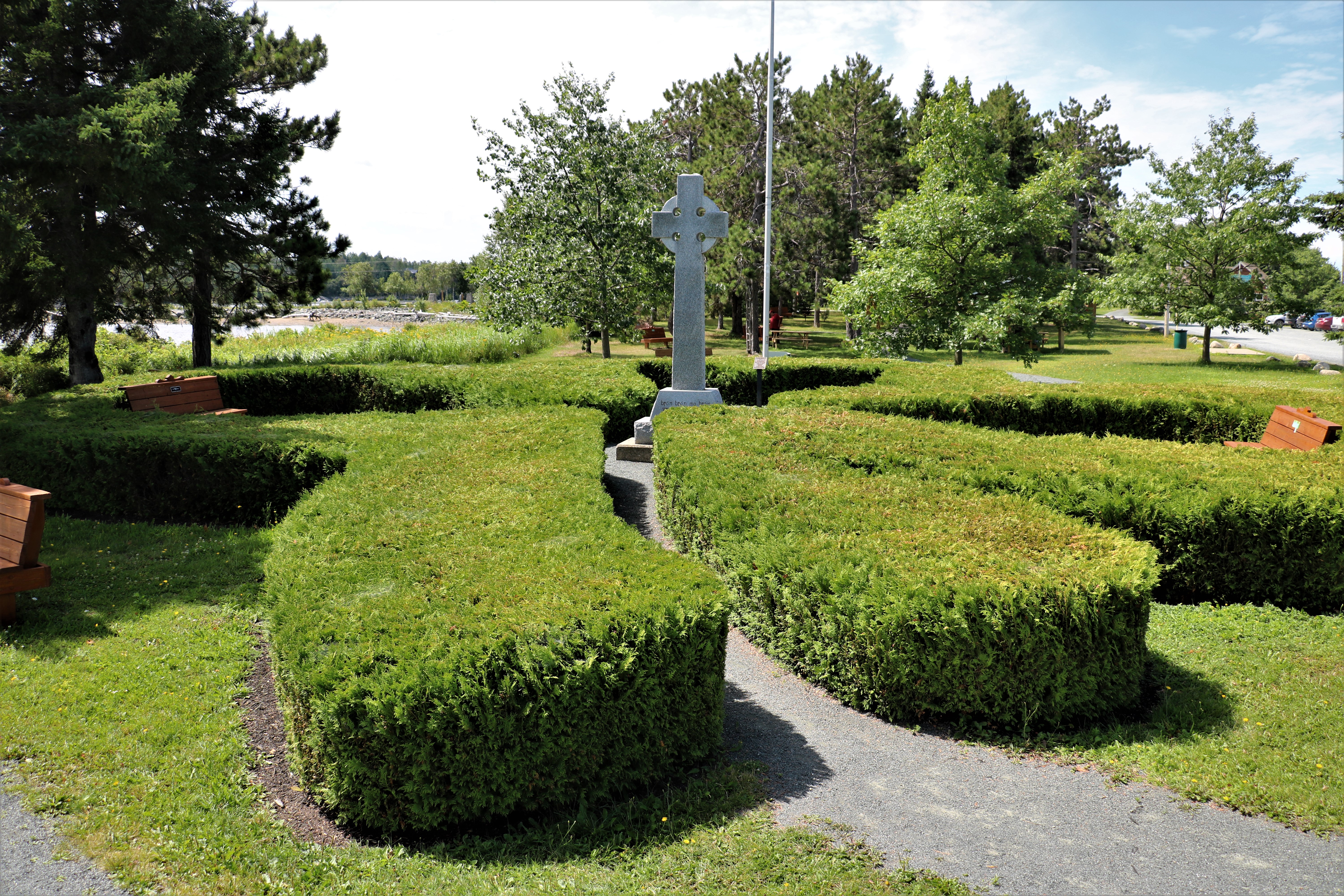
We drove up to Miramachi on an inland road we had not traveled before instead of the coast road and before crossing the bridge into Miramachi we drove over to Middle Island.
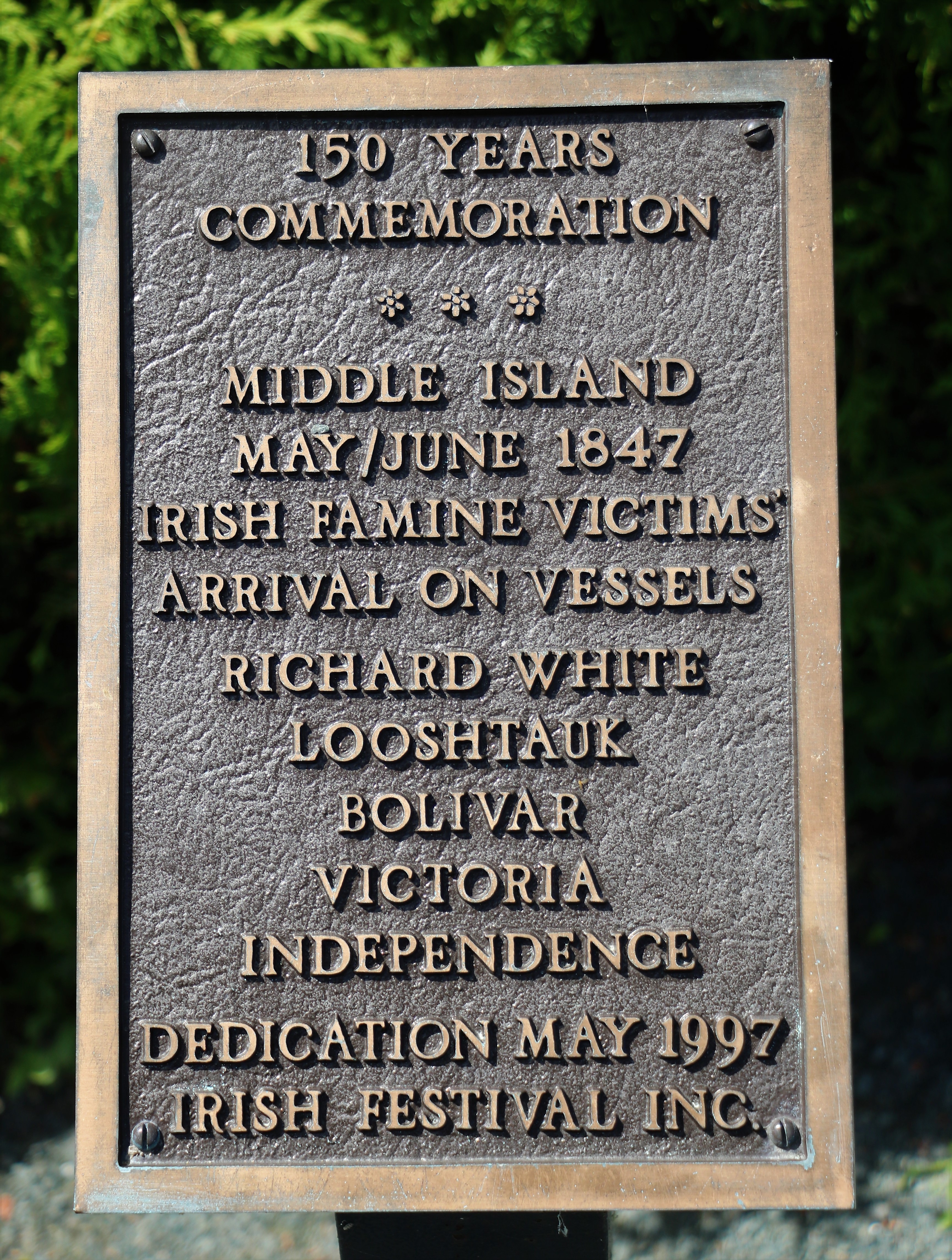
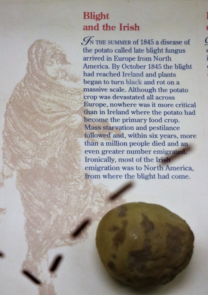
Middle Island became a quarantine center for several shiploads of Irish immigrants that came to Canada in 1845-46 after a mysterious fungi destroyed the potato crop. Three million peasant Irish survived on boiled potatos for every meal of the day. Without the potato they had nothing to eat. Even after selling any possessions they may have had, including their horse teams, they began to starve. Over one million died and thousands turned to Canada for a fresh start and free land.
Sadly it is a two month journey across the ocean and many of the weakened people who were jammed into the ship’s bottom hold (the cheapest fare) in appalling conditions contracted typus and scarlet fever. As the death toll rose the captains asked permission to land any isloated place they could so the people could get treatment and be kept separate. Middle Island was one such place.
The cedar shrubs surrounding the Celtic cross memorial are in the shape of a shamrock and atop the pole is the Irish flag.
Middle Island is very small. We walked all the way around it and read all the placards. It is also a popular park and there were lots of people enjoying the water and the picnic spots.
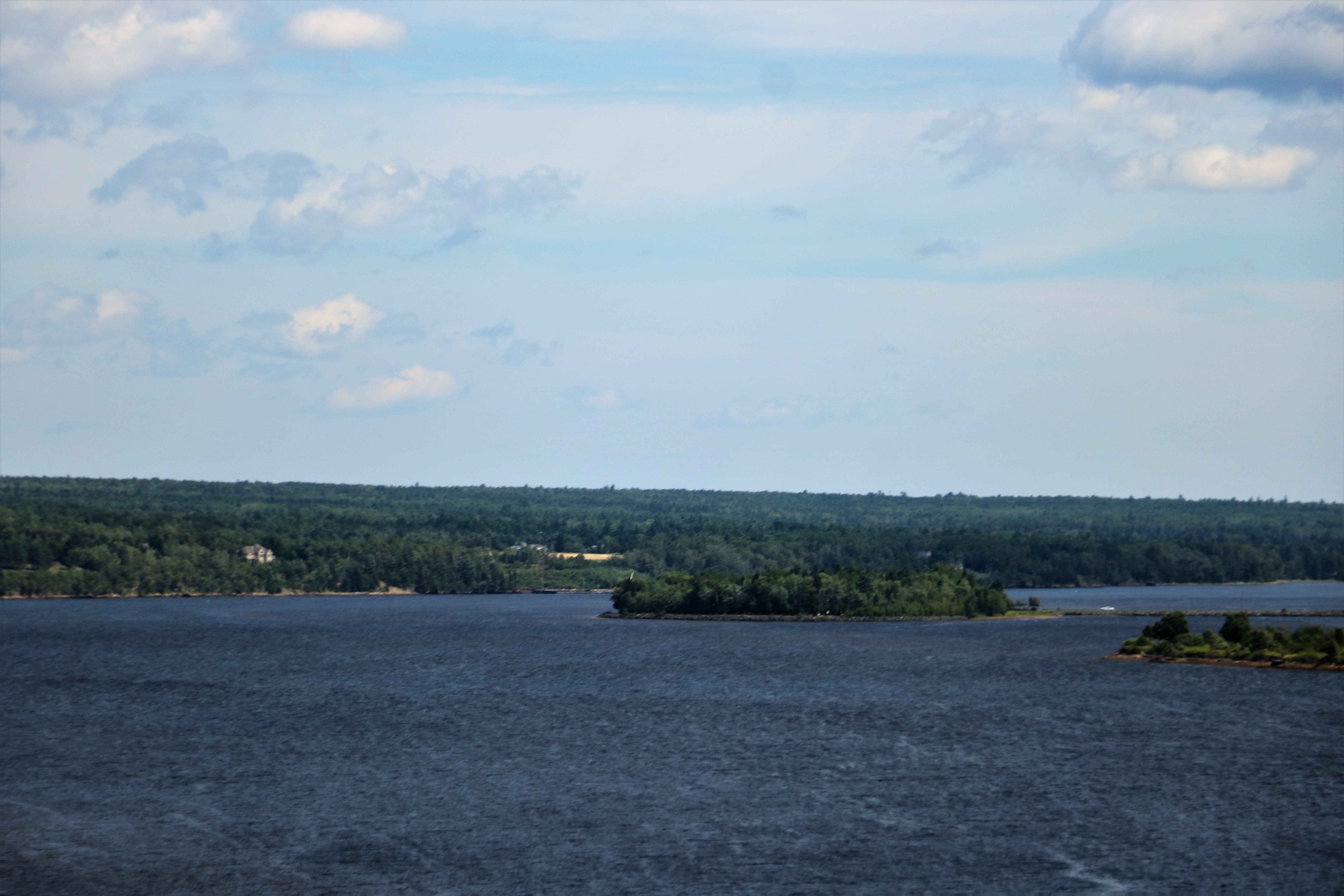
I was able to capture a photo of the island as we crossed the Miramachi bridge.
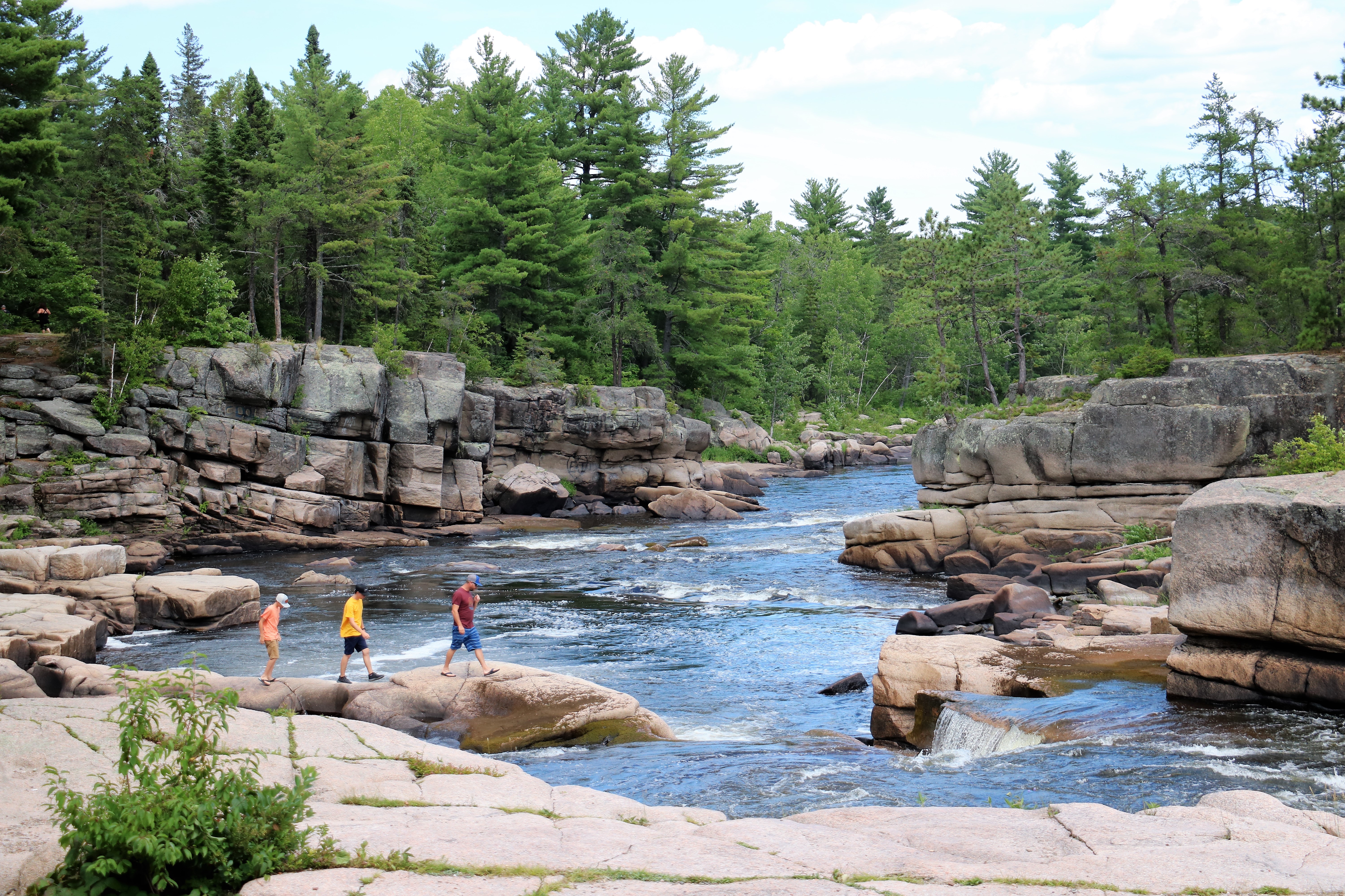
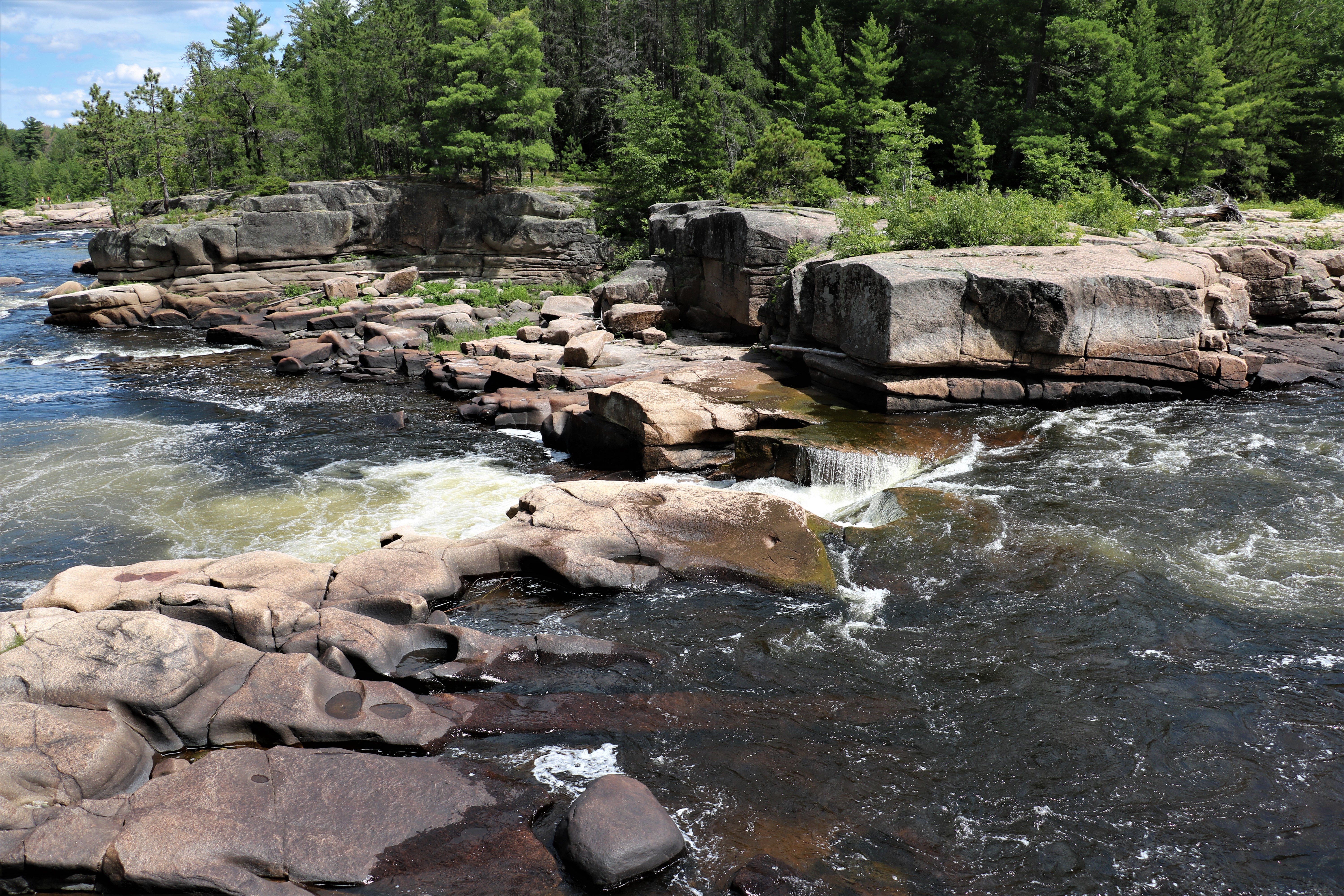
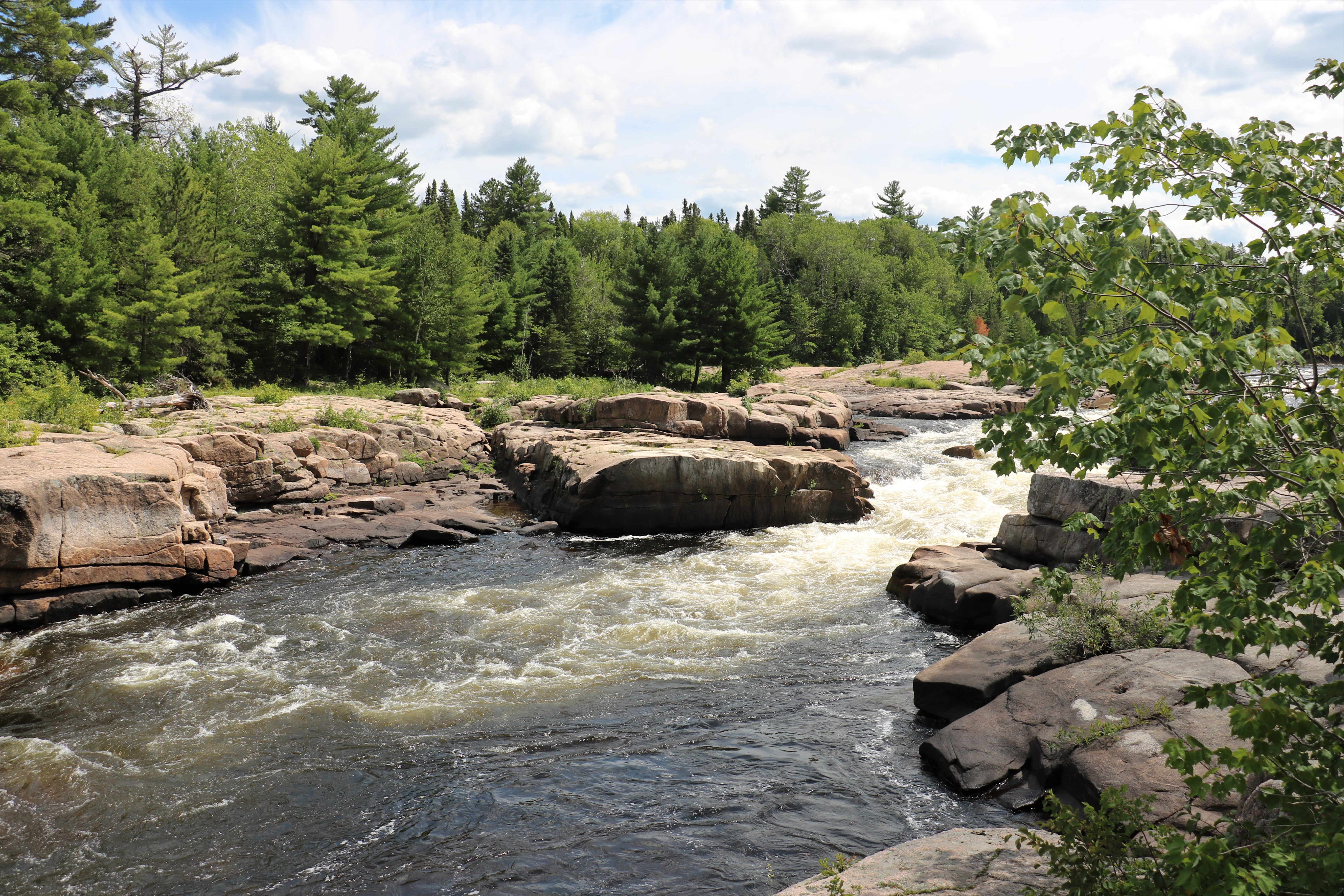
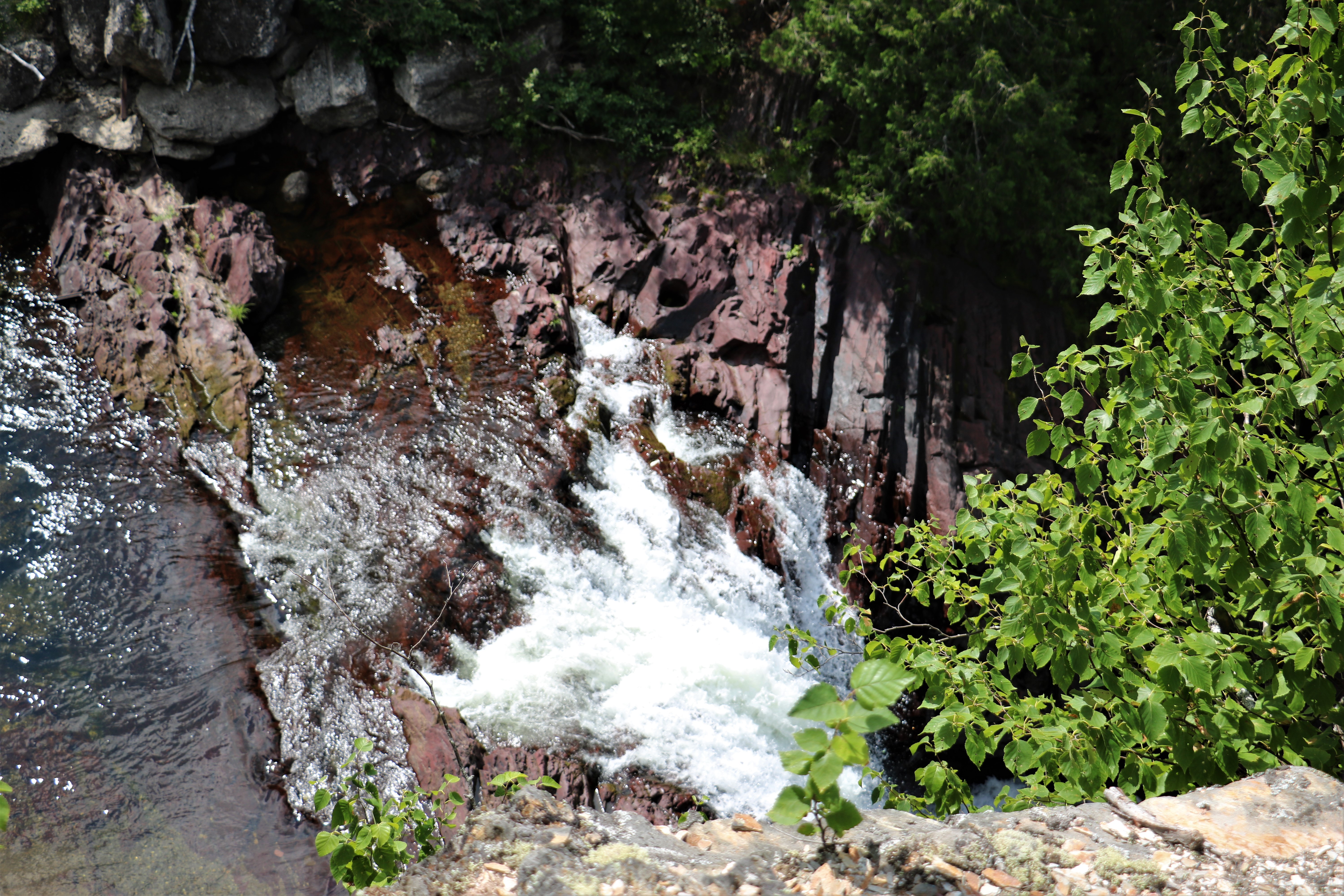
We drove toward Bathurst on a main road, then turned off on a smaller road to go see Pabineau Falls. There were lots of directional road signs at the turn-off to the falls and it was a nice gravel road.
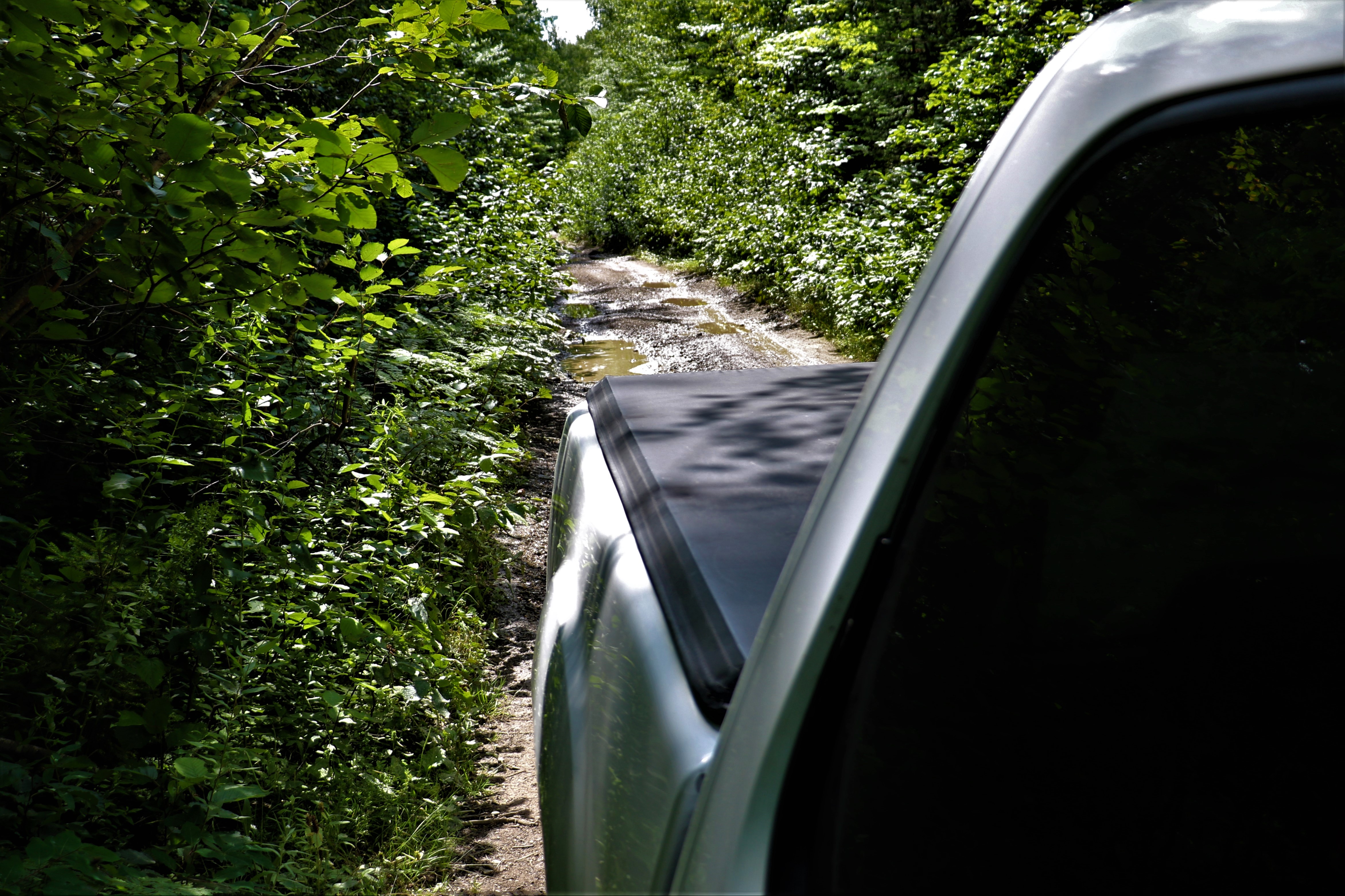
However, it very quickly became narrow and rutted and full of deep puddles. The directions said it was 11 km to the falls so we settled in for a bumpy ride. The road narrowed further and we had just decided it was really a quad trail when a dirt bike, a side-by-side and a quad appeared behind us. John pulled to the side at the first slightly wider place he could and asked the young man on the dirt bike if the road improved and if it lead to Pabineau Falls. He assured us it did and that we had navigated the worst of it and in about 2000′ it would wider again and take us right to the falls.
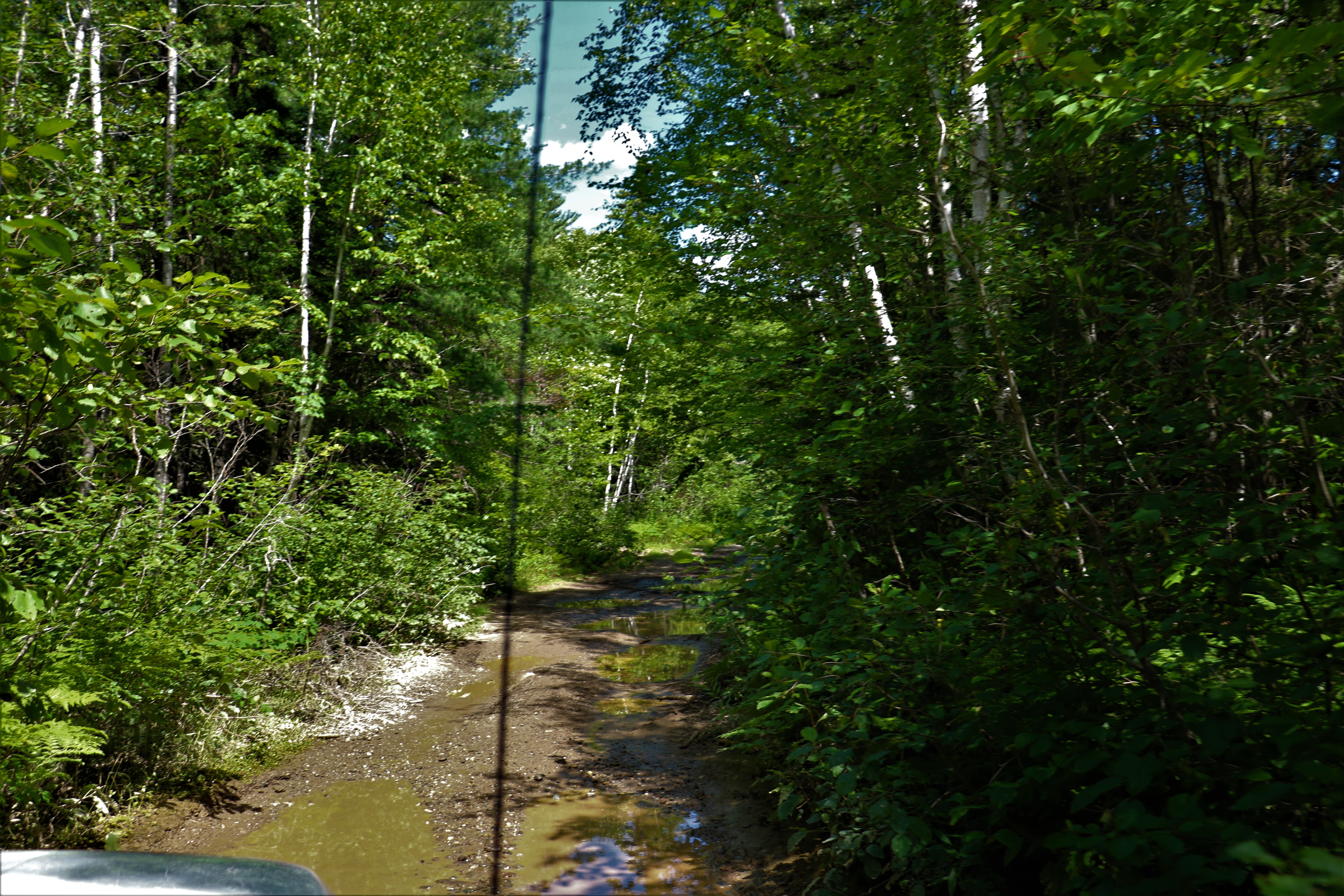
The road did widen out and we began to see houses and the river.
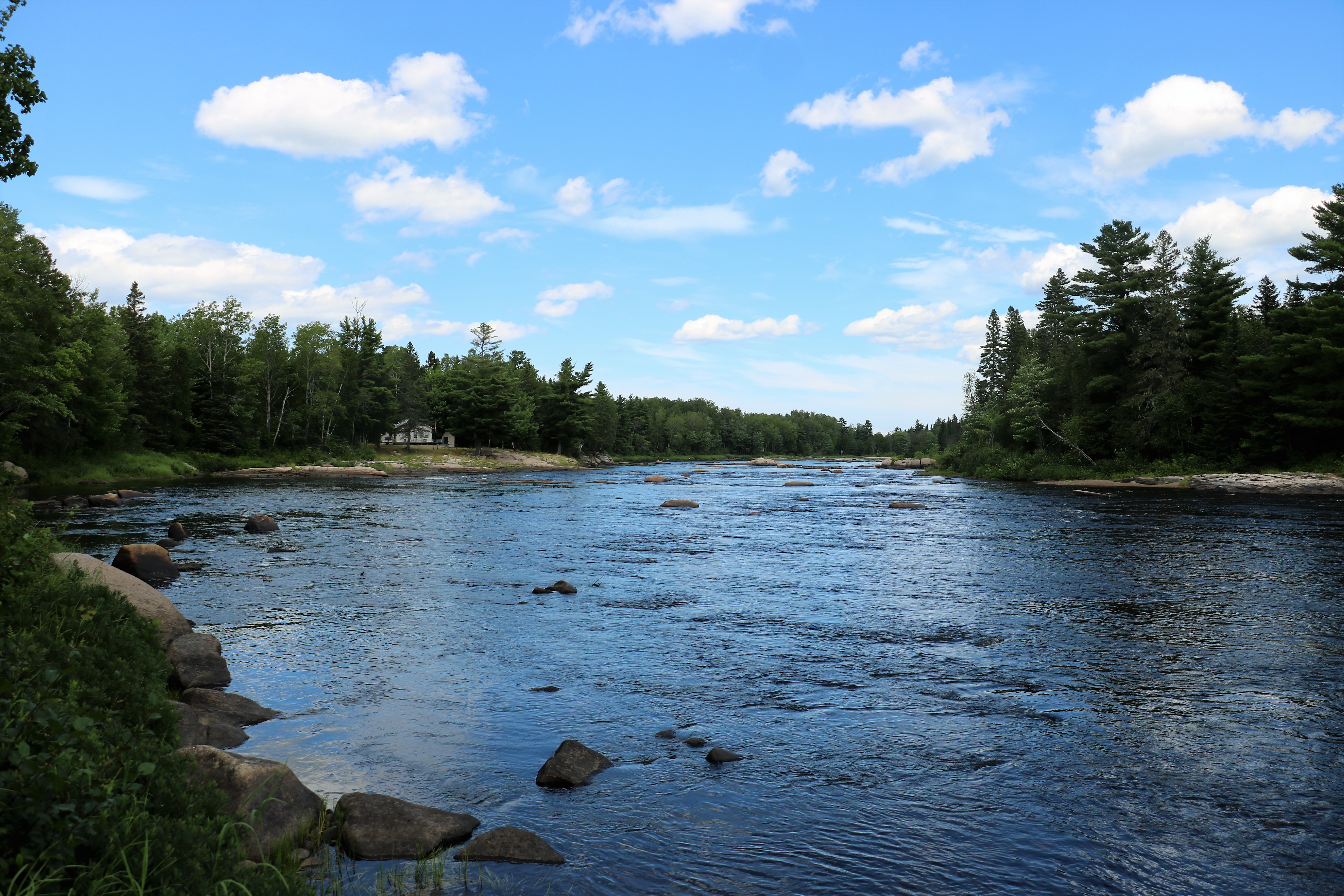
We arrived at Pabineau Falls and found a paved parking lot and paved road coming from the other direction.
All the rocks and white water created lots of different photo shot options.
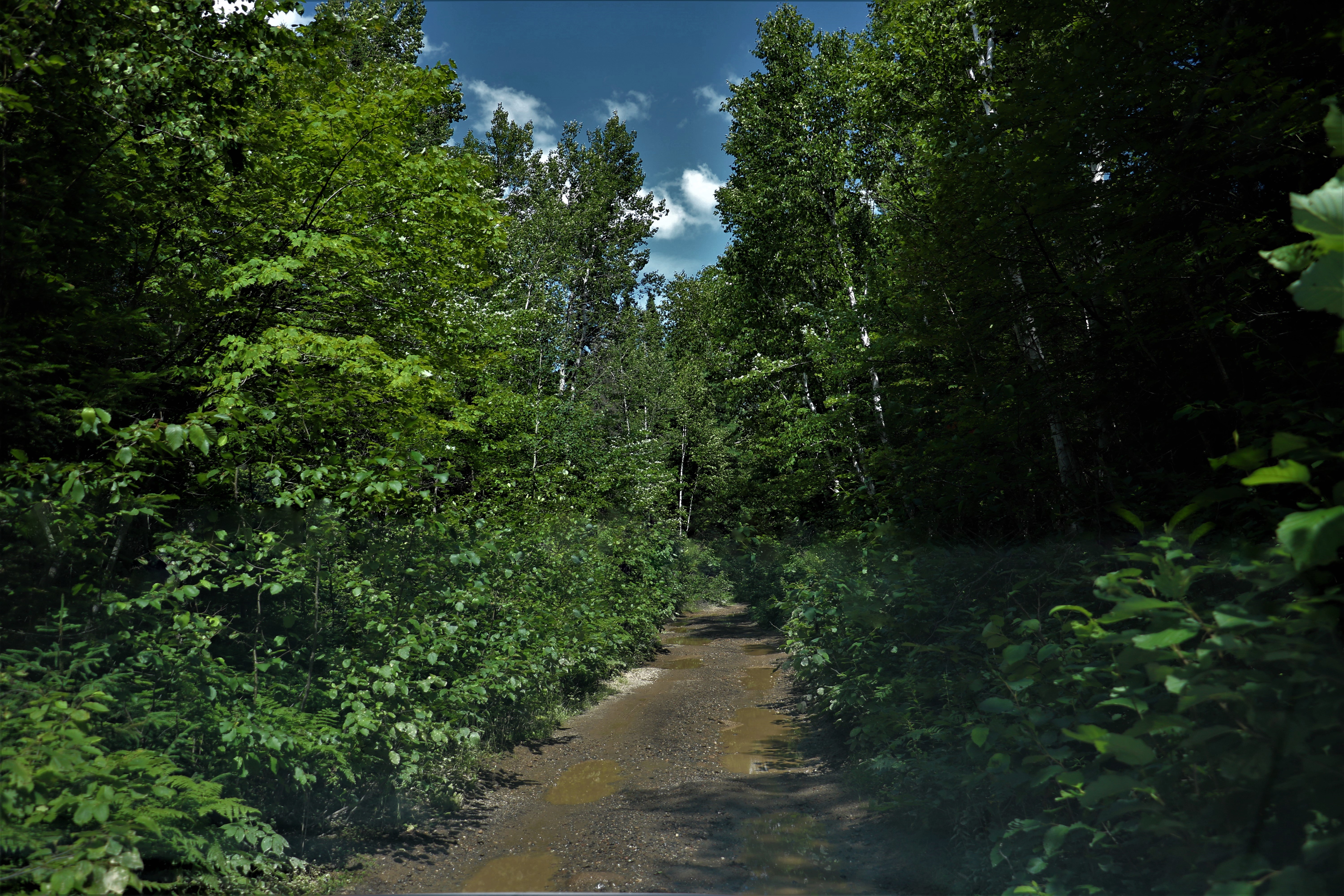
As we drove away I said to John that I bet we could have driven to falls from the other direction on about 5 km of paved road. And sure enough in 5 km we were at the intersection of a main road. We both thought we should turn left to continue on our way to Dalhousie but after quite awhile we felt we must be on the wrong road because we should have joined a main highway. We checked our geocache map and discovered that we had driven over 20 km in the wrong direction.
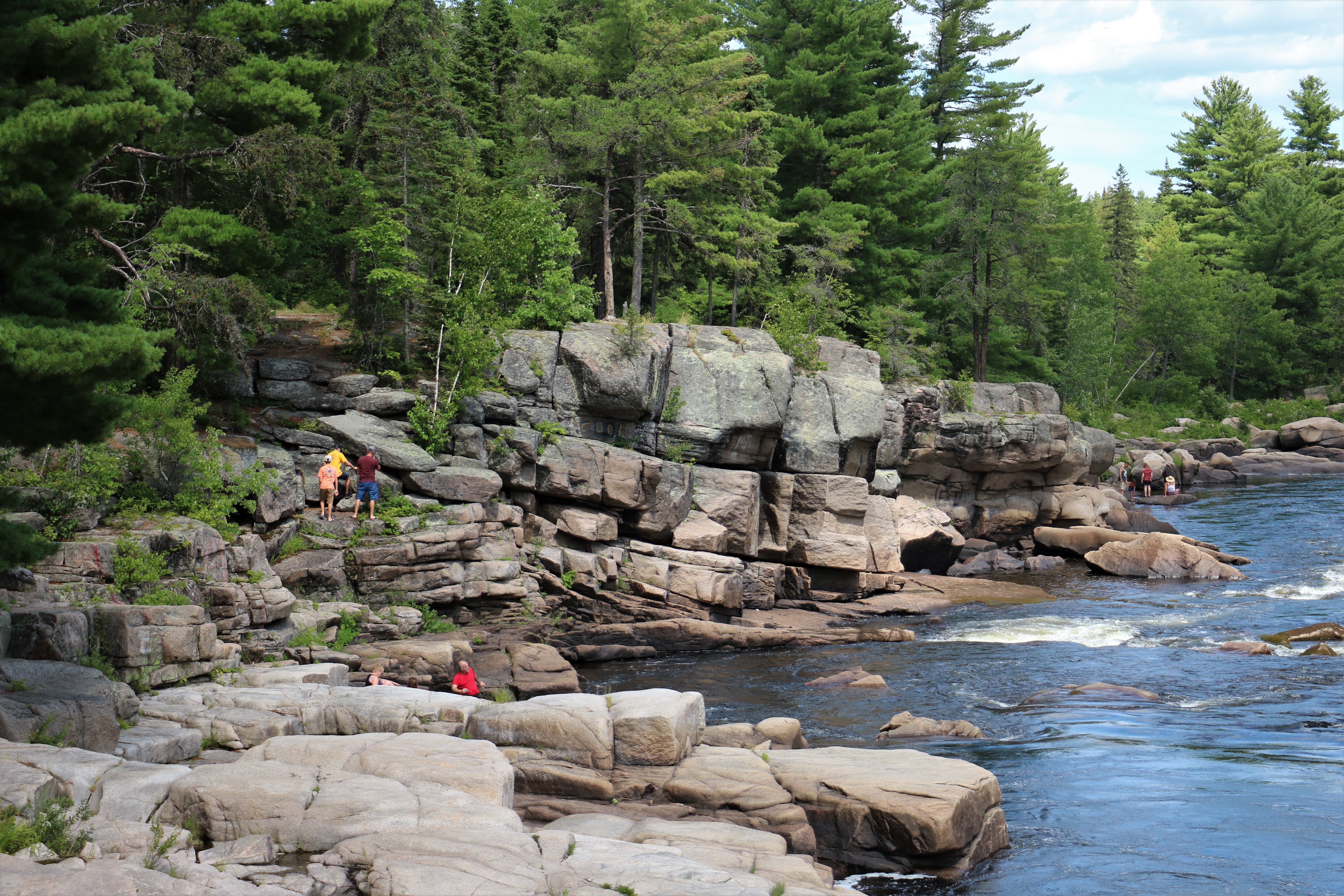
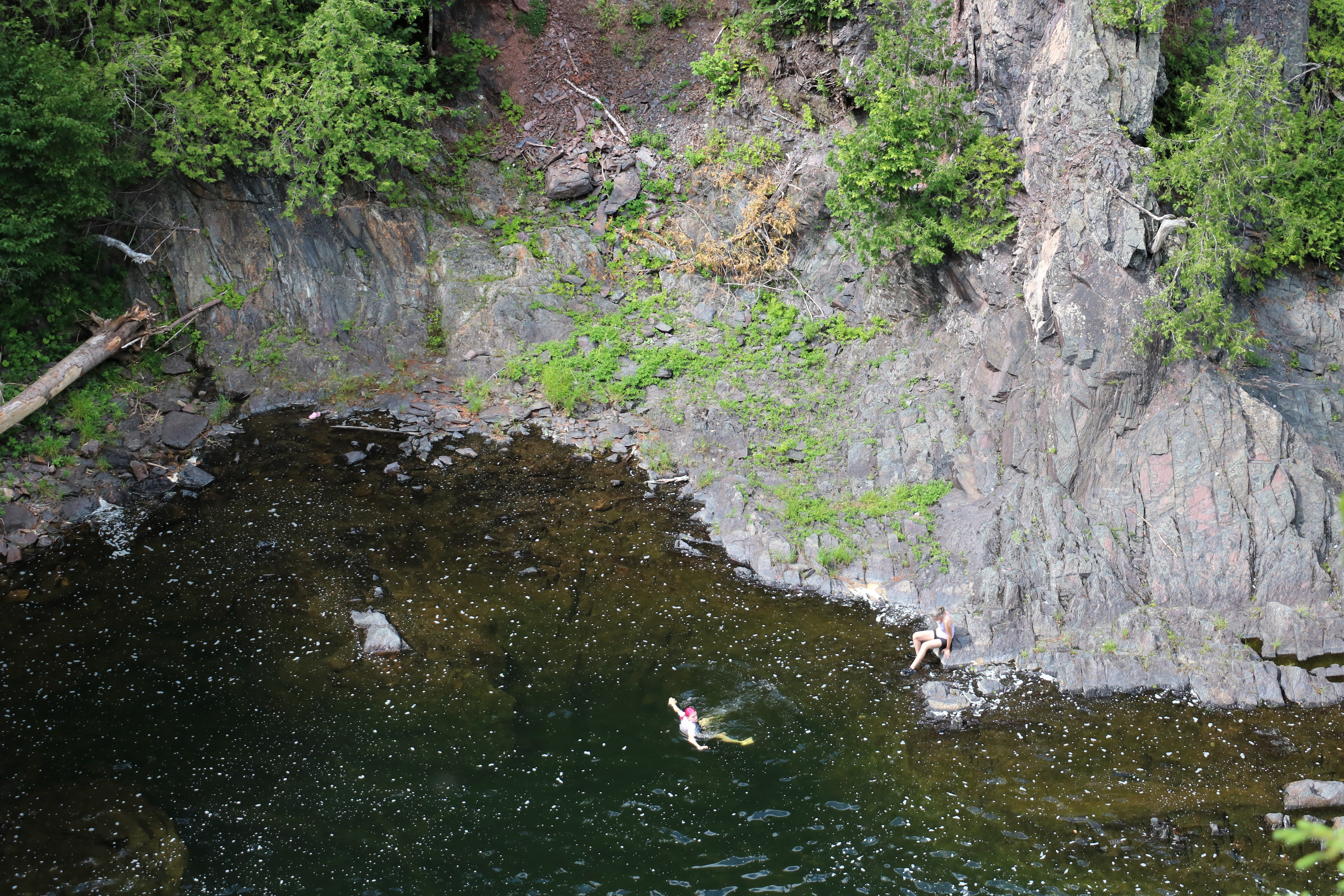
Once we had that figured out we backtracked and got on the main road and then found the turn-off to Tetagouche Falls 8 km down another road – good paved road this time.
There is a nice fenced lookout over the falls but trees have taken root in the rocks and almost completely block the view of the falls. I managed to get a couple of photos of the people playing in the water pools at the base of the falls and one sort of okay one of the falls, but with no real identifyable surroundings.
Once we took our pictures it was back to the main road and a straight shot up to Dalhousie and our hotel for the night.
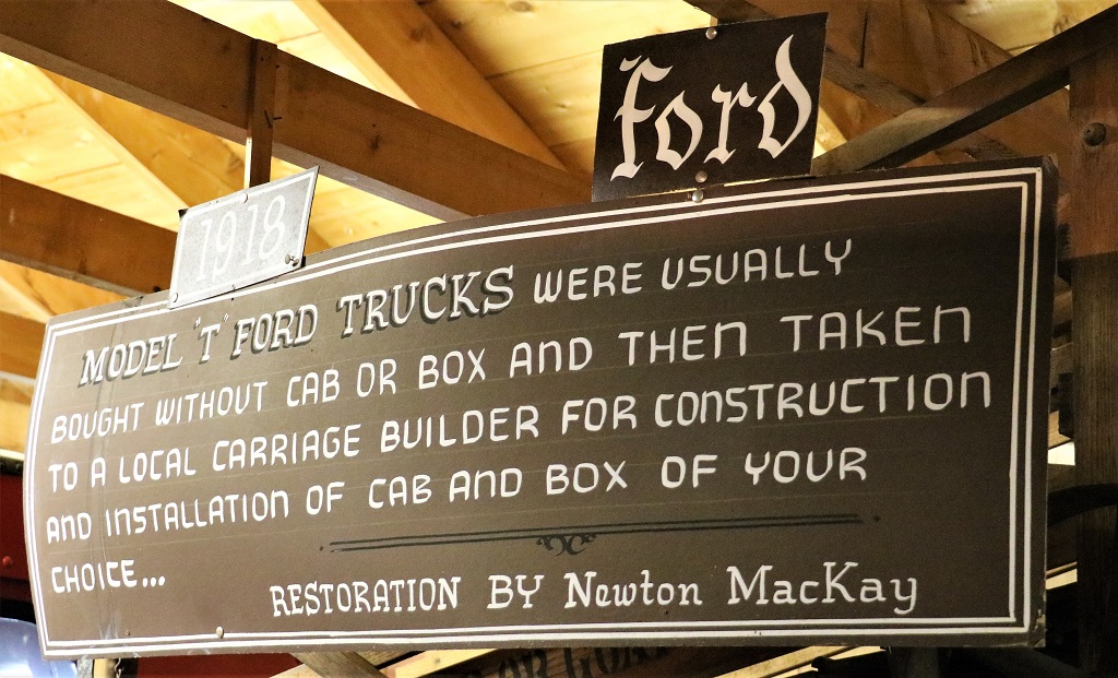
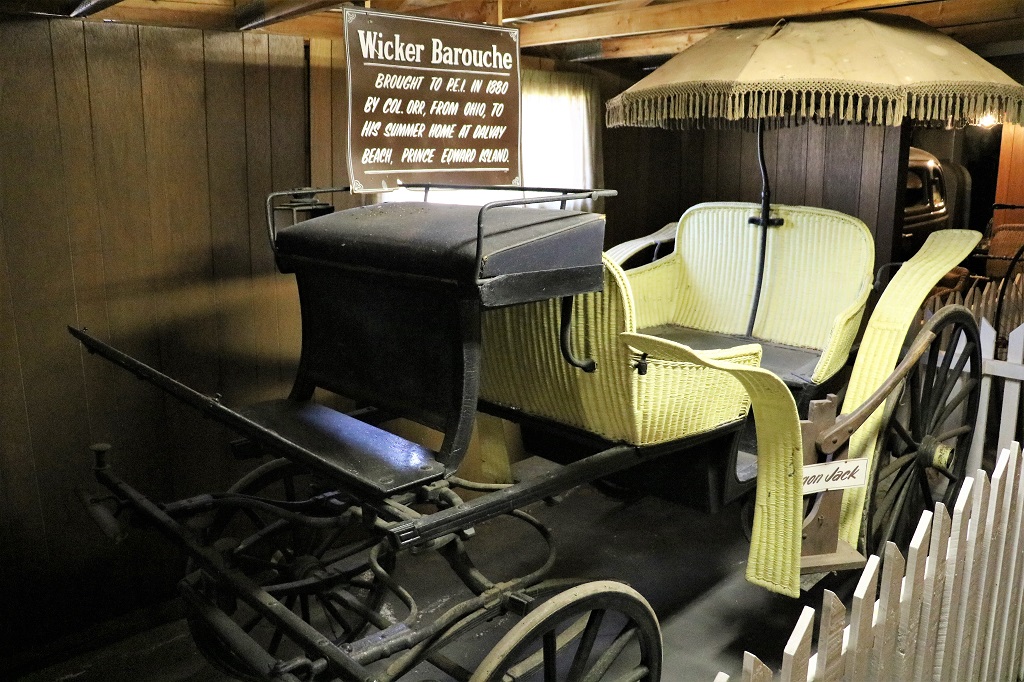
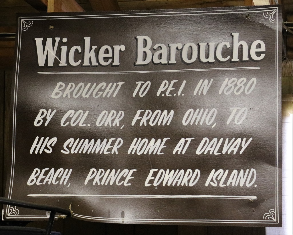
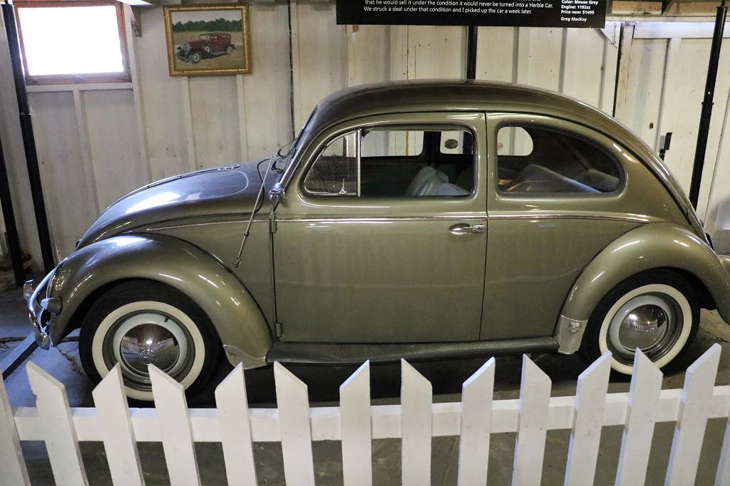
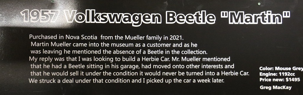
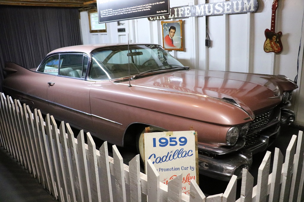
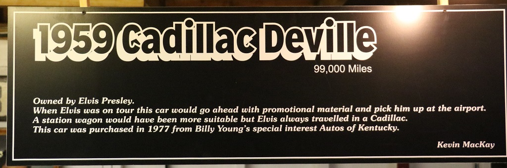
It was a somewhat lazy day. We left Summerside after breakfast and drove across the island to Bonshaw to visit the Car Life Museum. We were not very impressed by the outside of the building, nor by the piles of car manuals, LP records and other miscellaneous things stacked on open shelves inside the entrance, but we did not have anything better to do so decided, even if it was a bit tacky, that we would go see it anyway.
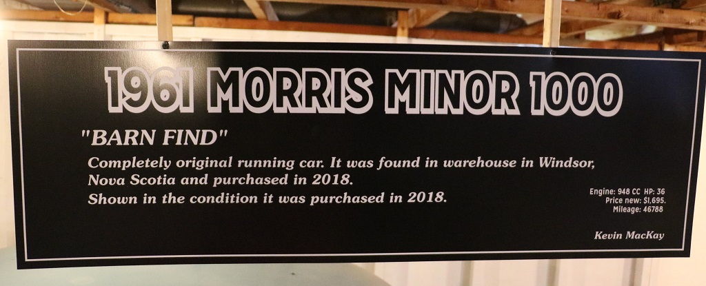
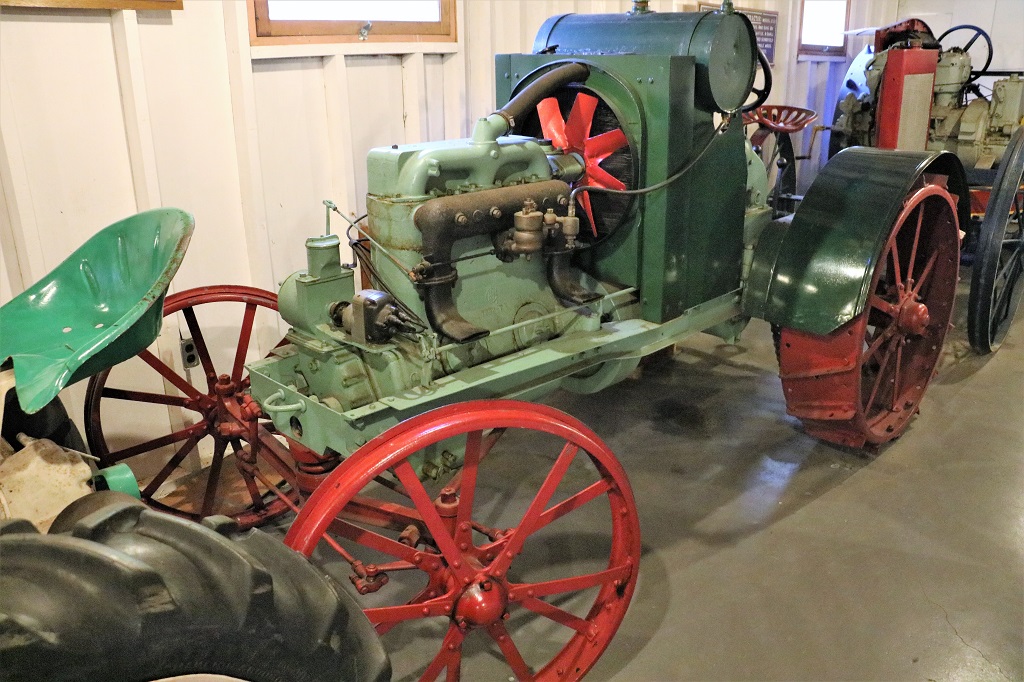
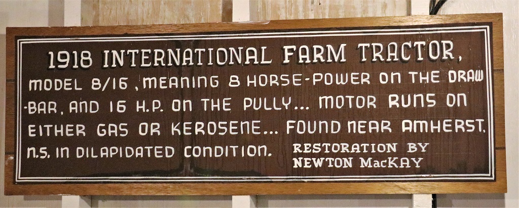
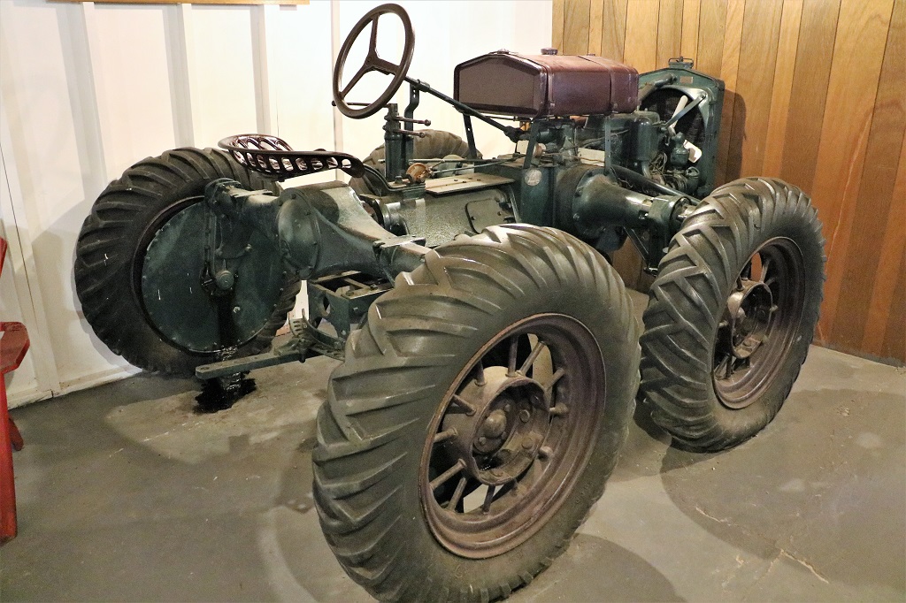
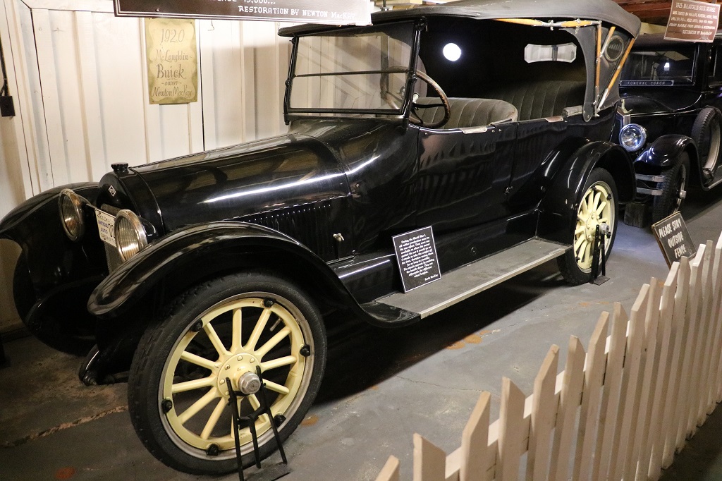
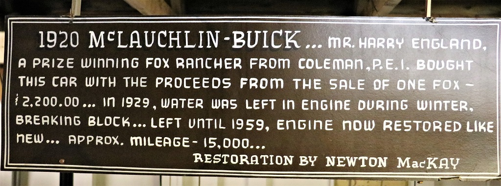
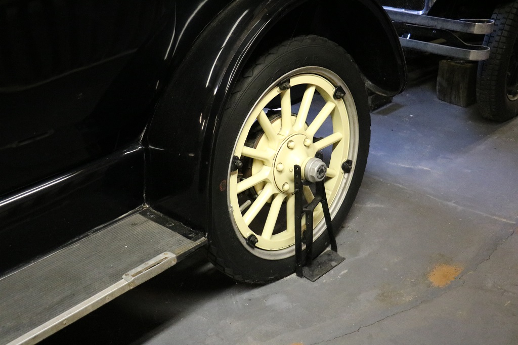
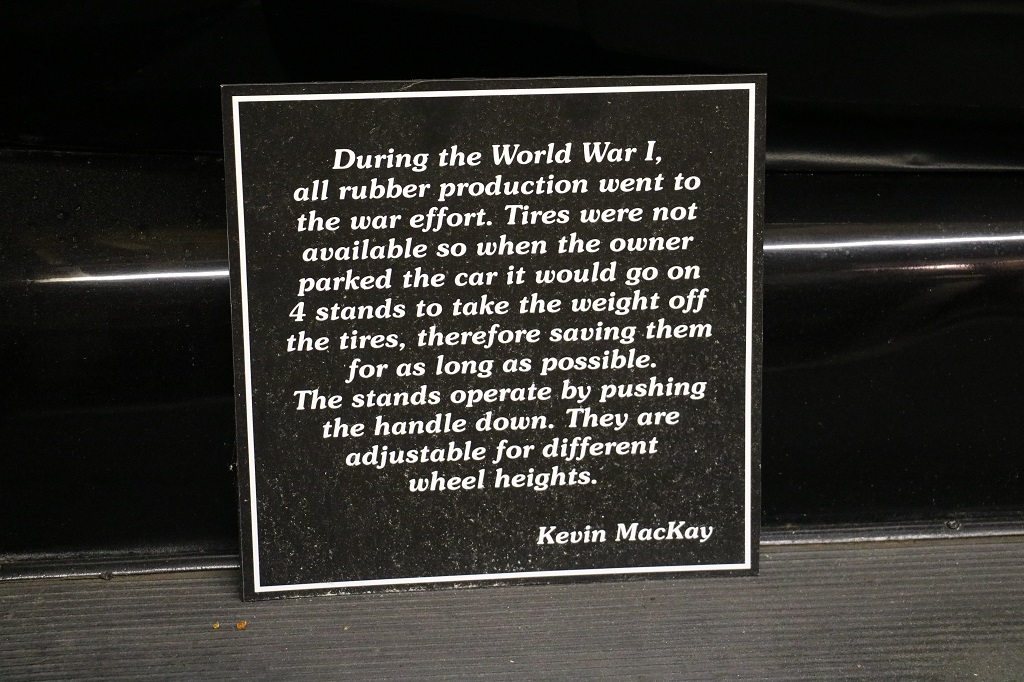
And they actually had some nice cars on display. It is a private family collection. I have only posted photos here of the cars and/or information that I found most interesting. The space was not really wide so it was hard to get some good shots, but we did enjoy the hour we spent there.
This car was just like one of the hotrods in the movie ‘Grease.’
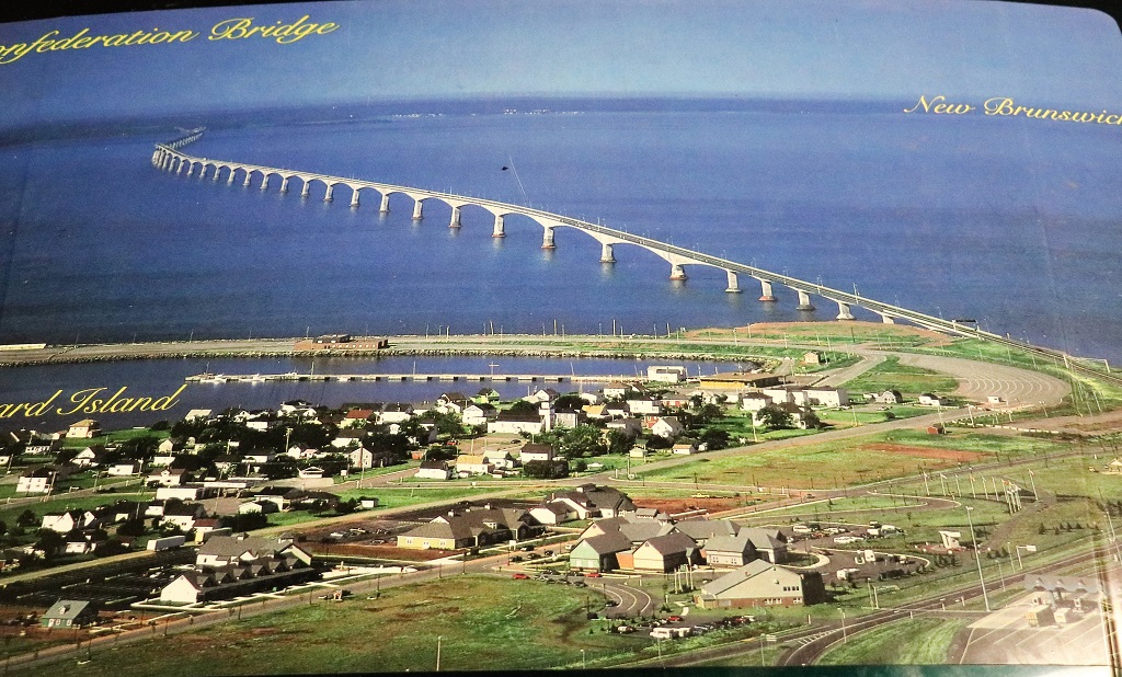
This large photograph of the Confederation Bridge between Prince Edward Island and New Brunswick was on the hood of the first car to be driven across the new bridge when it opened in 1997. I didn’t care about the car but I liked the photo that shows almost the entire bridge.
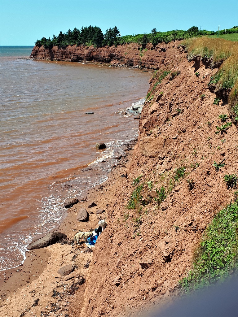
Prince Edward Island is very rural. There are no high hills and it has very rich soil. Wheat, barley, and lots of potato fields are on both sides of the road between every town. The population of the island is 167,680 as of the 2022 census. The city of Kelowna (within city limits only – it is much larger really) is 132,000. Vancouver Island is 5.5 times larger than PEI. It does still take several hours to go from one end to the other, so even though it is Canada’s smallest province, it is not tiny.
We drove a short distance from the car museum to Argyle Shores Provincial Park and had our lunch.
It was a beautiful, warm, sunny – but windy – Sunday afternoon and there were many people picnicing in the park and having a swim.
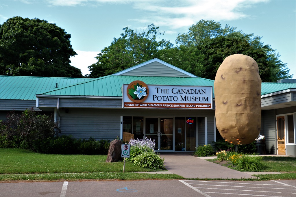
When we drove across Canada in 2014 we spent quite a bit of time in PEI and drove all over the island from one end to another and checked out all the sights. About the only things we had not seen were the Potato Museum and the Car Life Musuem which we saw yesterday and today.
We had made plans to have dinner with a friend in Moncton that we had not seen in over 40 years, but had been unable to find any accommodation anywhere around the city for last night. Our friend found an available room for Sunday and John found a hotel room in Summerside for Saturday so we came to PEI and changed our dinner in Moncton to tonight. So once we finished lunch we made our way back to the bridge and crossed over to New Brunswick again.
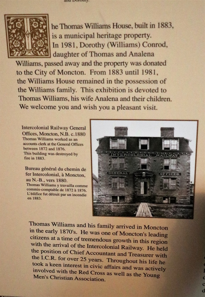
We arrived back in Moncton with enough time to tour the 1883 Thomas Williams house.
All but one of their 11 children survived to adulthood. Only three of the six girls ever married and all three of them eventually moved back to the family home, bringing their children with them.
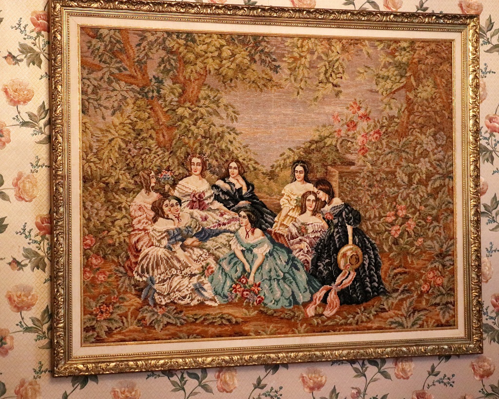
The only noteworthy item I saw in the house was a lovely framed tapestry in the ladies’ parlour.
It did not take long to tour the house so we had time to find our hotel, get settled and sit for a bit before heading over to Sandra’s for dinner and a visit.
We have now officially switched to Plan B. There are no available hotels or B & Bs along the road around the Gaspe. We thought then that we would just drive north to Rimouski on the south side of the St. Lawrence in Quebec and take the ferry to the north side, then drive along that side of the river, skirt Montreal and head westward toward Ontairo, but there are no rooms available in the towns on the north shore either. So….we will spend tomorrow in Dalhousie in New Brunswick and then drive straight to Montmagny where John was able to find a room. We also have a reservation in Berthierville the next night but need to figure out where we go from there. It seems everyone wants to go travelling again, the same as I did. Who knew? We were in the Maritimes at this time of year in 2014 and had no problem finding rooms. Not so in 2022. But I certainly can’t blame anyone for wanting to go travelling.
After two days of driving and scenery we made up for it by visiting three museums today. Two of them were close to the B & B we stayed in at Tatamagouche last night and the other was about 60 km down the road from our hotel in Summerside tonight.
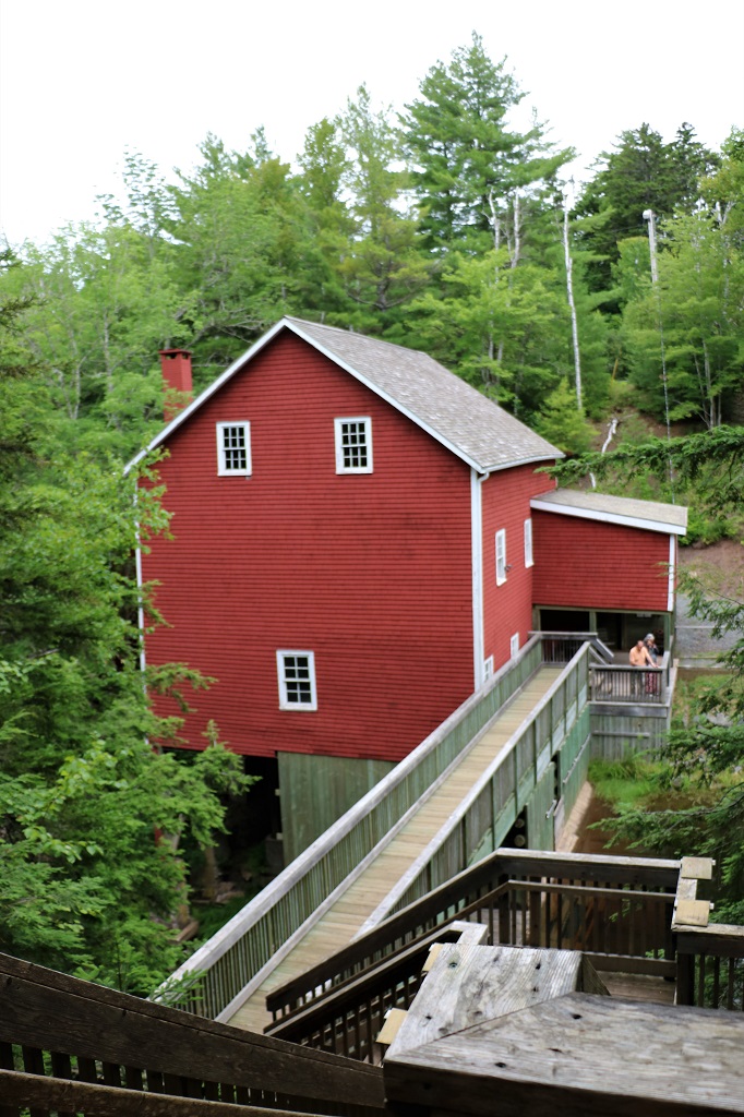
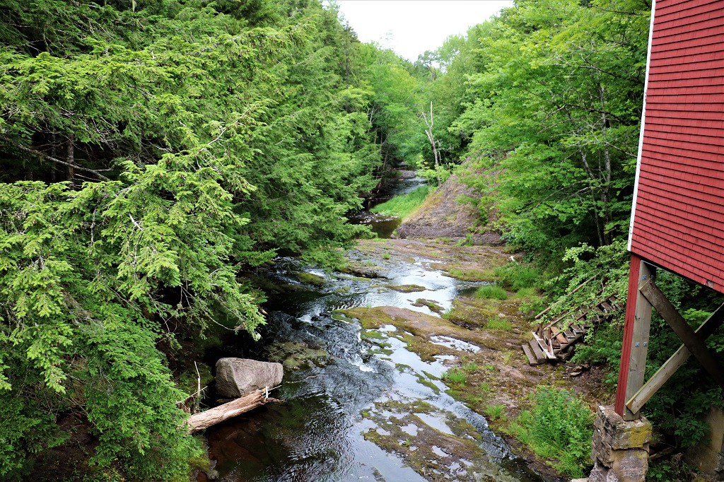
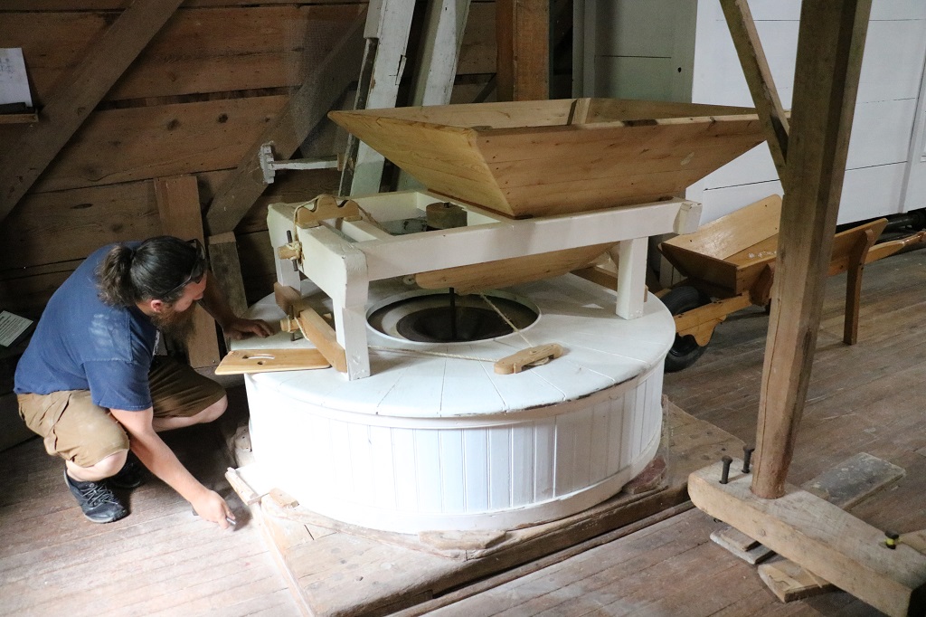
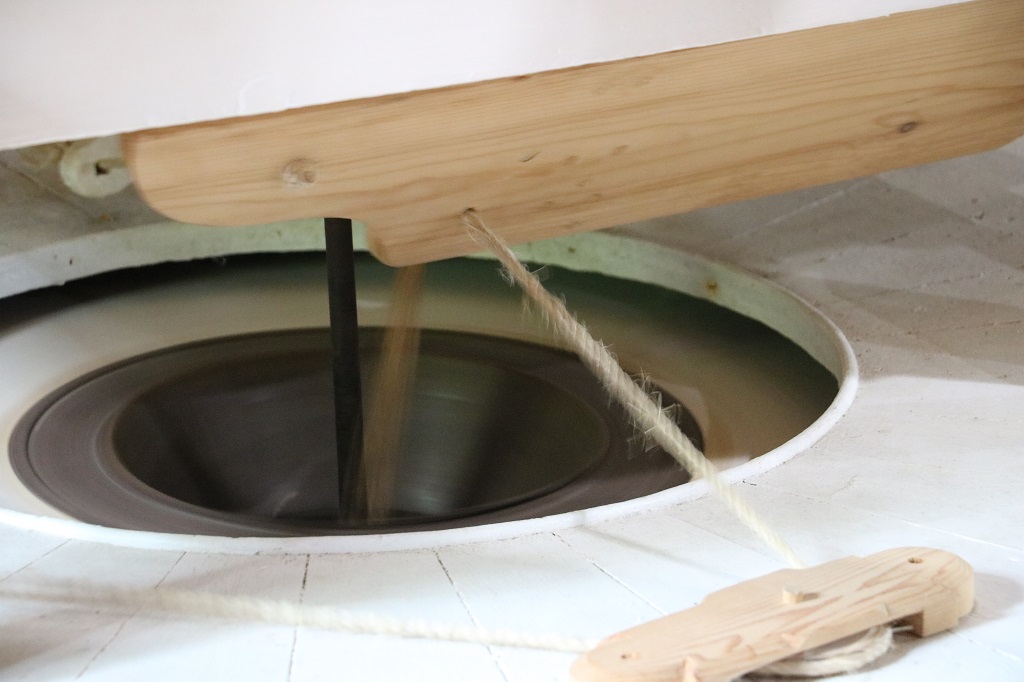
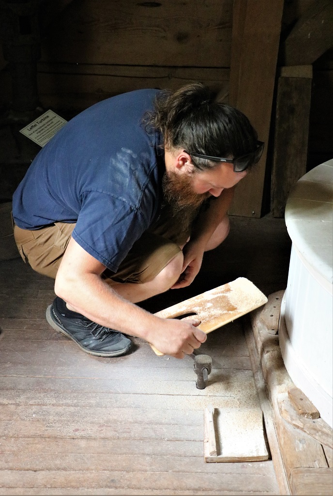
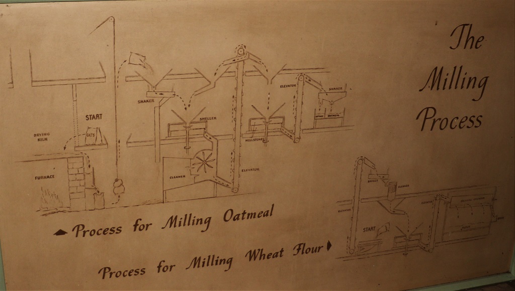
First was the Balmoral Grist Mill. It was begun in 1874 and still grinds grain today.
Back in the mill’s heyday it would have been run with a huge waterwheel, today it is done with an electric motor. The three levels of the mill were full of hoppers, grinding wheels, conveyors, chutes, gears and belts.
The mill could grind all the grains; corn, wheat, oats, buckwheat, etc. We were shown all the stages of the process and after looking around all three floors, Caleb, the miller, poured a bag of grain into a hopper and started it up to make flour.
He would stick the board in the little slot at the base of the grinding wheel and let some of the flour fall on it, pull it our and check the consistency to see if it had been ground the way he wanted it.
The flour made at the mill is bagged in 5-lb bags and available for purchase. It was very intersting to see.
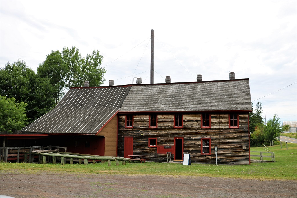
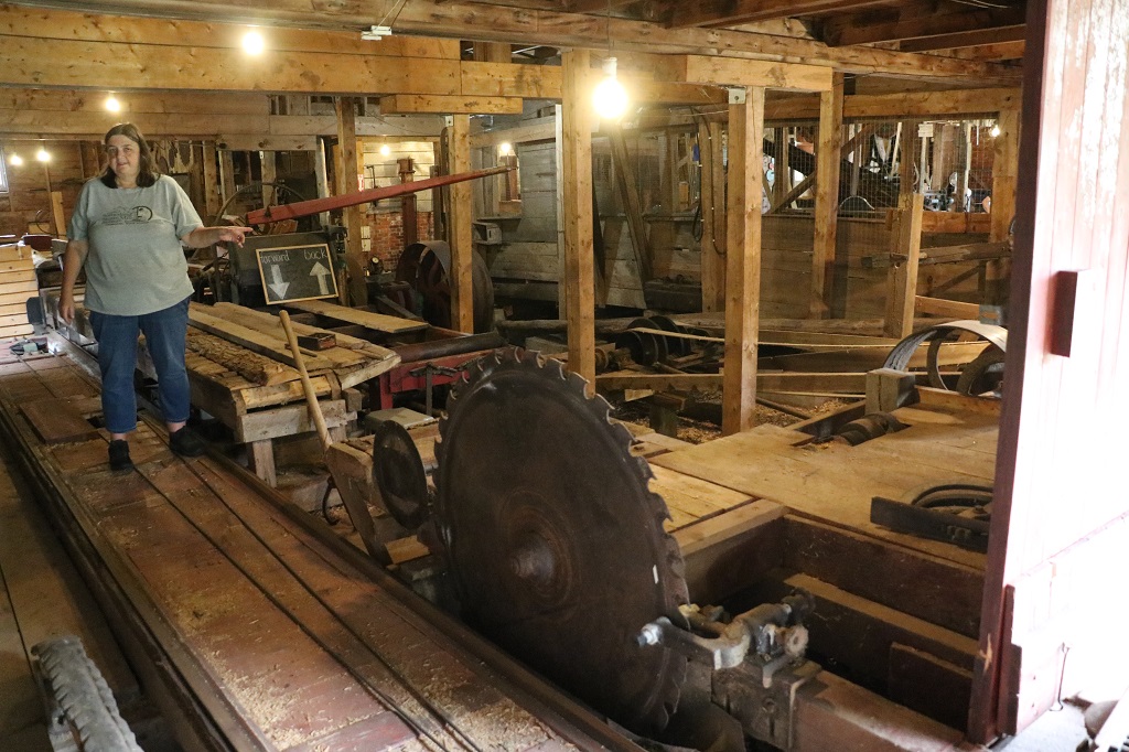
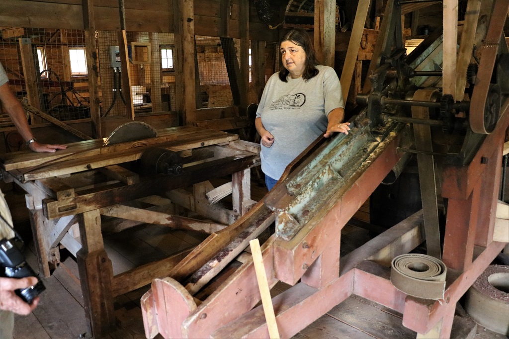
Not too far away was the Sutherland Steam Mill; begun in 1894 by Alexander Robert Sutherland. It was a lumber mill with a woodworking shop upstairs. Nine men worked in the sawmill. The local men would bring in their log loads and tell Mr. Sutherland what lengths and thickness of boards they wanted and he would cut all of each order in turn so the men always got back their own wood.
He had a portable mill first where the parking lot now is and it burned down, so when he build the new mill he had barrels installed on the roof with water pumped up to them and it would drip down over the roof and keep the wood moist so there would be no risk of a fire destroying the mill again.
The slat cutter. He installed it on a slant so that the big board would slide down again for a second cut to make the narrow slats like the one leaning on the machine in the center front. Slats like this are used in lobster traps, snow fences, holding insulation in place around the base of the house in winter, lathe and plaster walls,and many other things. They made bundles and bundles of them and were always in demand.
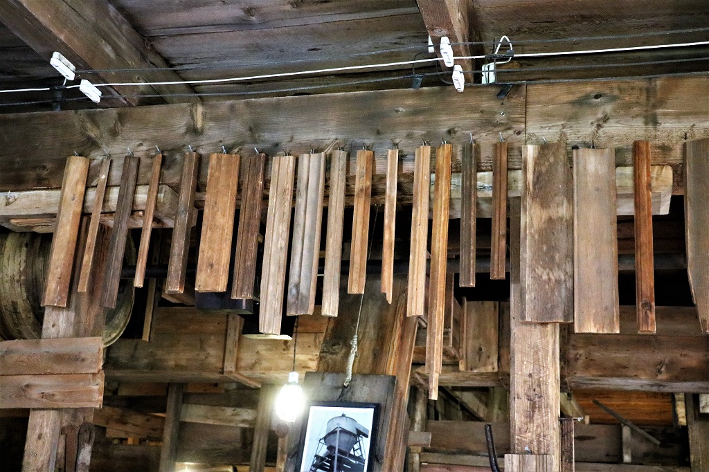
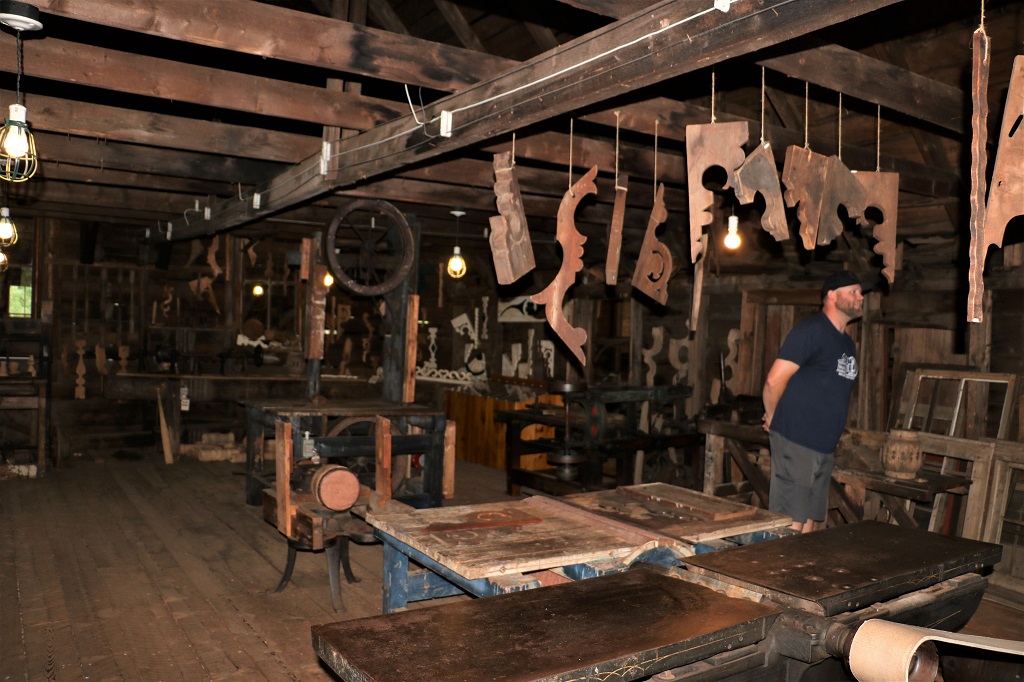
This was a three-side planer and molder that was used to make all kinds of trims and moldings like the many types shown in the photo below.
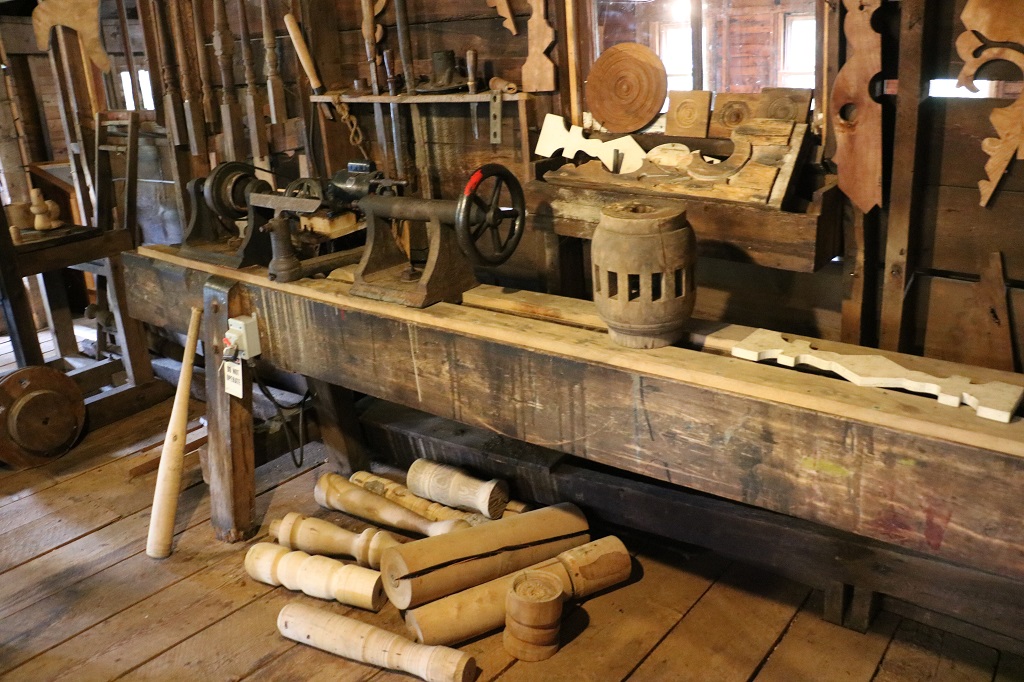
Upstains was the woodworking shop. If it could be made from wood it could be made here.
Gingerbread trim was very popular in the area and this shop made many variations of the intricate trim.
Mr. Sutherland was a genius at machinery innovation, recycling, and woodwork design, but he was not so good at collecting bills. This is the wagon his wife used to make the rounds and receive payments.
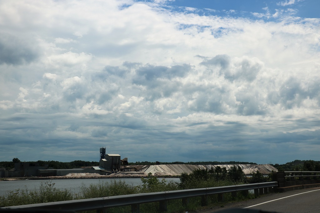
It took just over an hour to tour each of the mills so it was about 12;30 before we were officially on the road. As we drove through Pugwash an hour or so later, we saw the huge Windsor Salt mine.
Pugwash is the only salt mine, and currently, the only underground mine in Nova Scotia. Josh Allen accidentally discovered salt in 1953 when drilling for water at his lobster factory. The Canadian Salt Company Ltd. hoisted the first load in November, 1959. Shafts go down to one thousand feet to huge working corridors (30’ x 55’). The company employs approximately 210 people. The processing plant at the site produces industrial grades of salt. The refining process for this industrial salt is one of crushing, screening and sizing. The mine produces approximately 1,200,000 tonnes of salt per year. The mine’s lifespan is estimated in excess of 100 years, possibly longer with advanced technology.
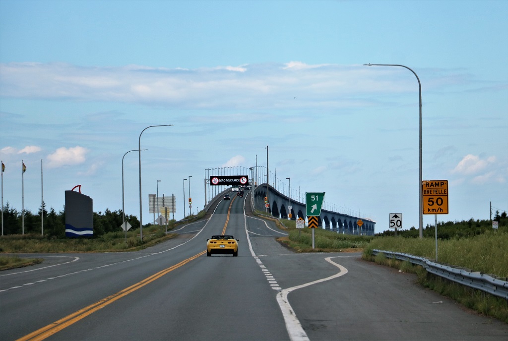
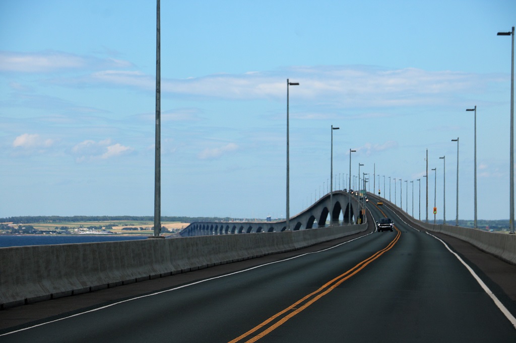
We crossed the border into New Brunswick and immediately headed east to go over the Confederation Bridge to Prince Edward Island.
Opened on May 31, 1997, the 12.9-kilometre (8.0 mi) bridge is Canada’s longest bridge and the world’s longest bridge over ice-covered water. Most of the curved bridge is 40 metres (131 ft) above water with a 60 m (197 ft) navigation span for ship traffic. The speed limit is 80 kmh and it takes just over 10 minutes to drive across. It cost $1.3 billion to build. It is a toll bridge but you pay the toll going westbound back to the mainland. As of January 2022 it is $50.25 per car or two-axle truck.
A photo of the rearview mirror gives you a bit of an idea of how long this bridge is.
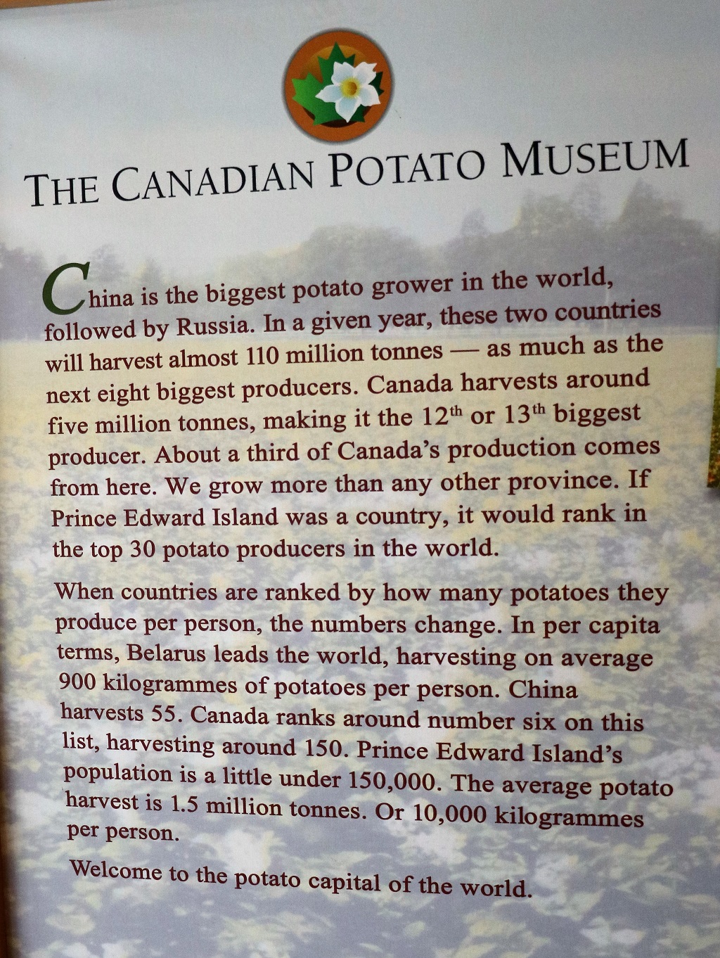
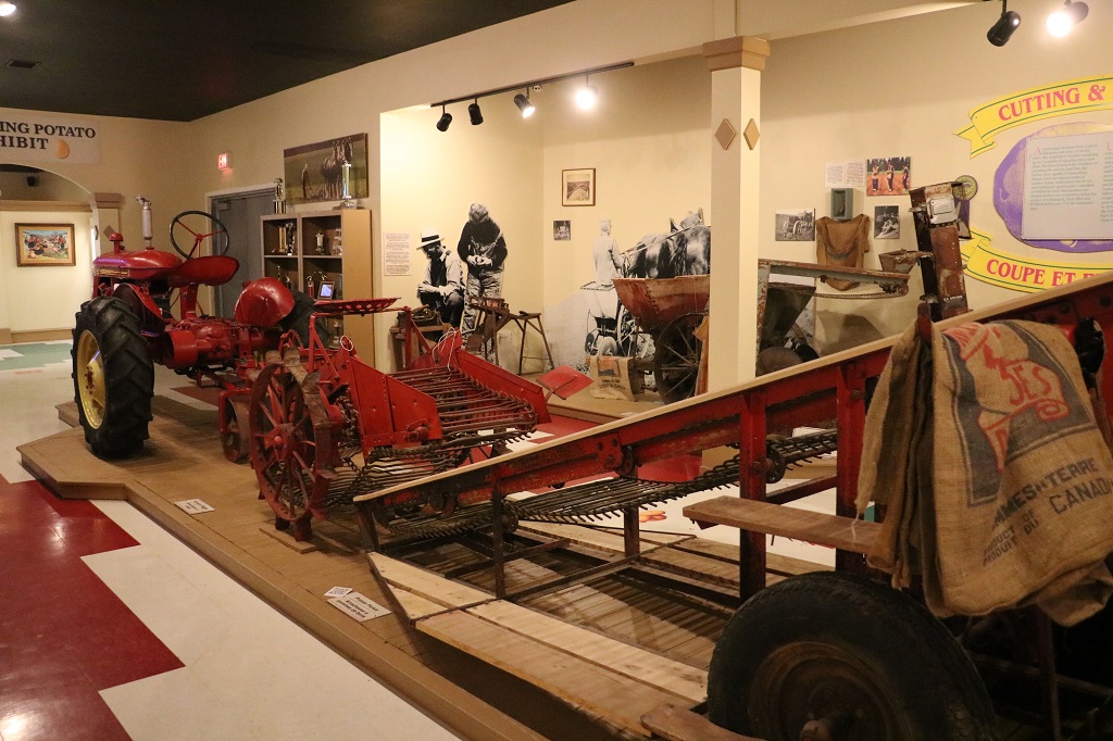
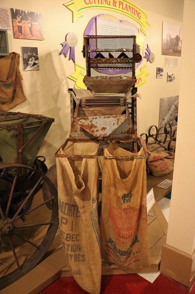
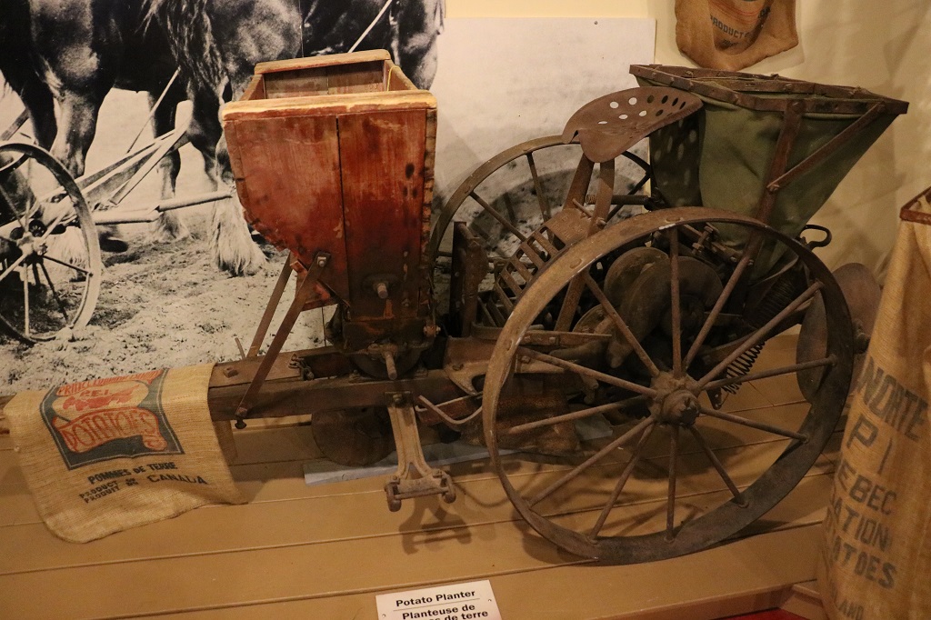
We headed north once we crossed the bridge and drove for an hour and a quarter to the town of O’Leary where the Canadian Potato Museum is located.
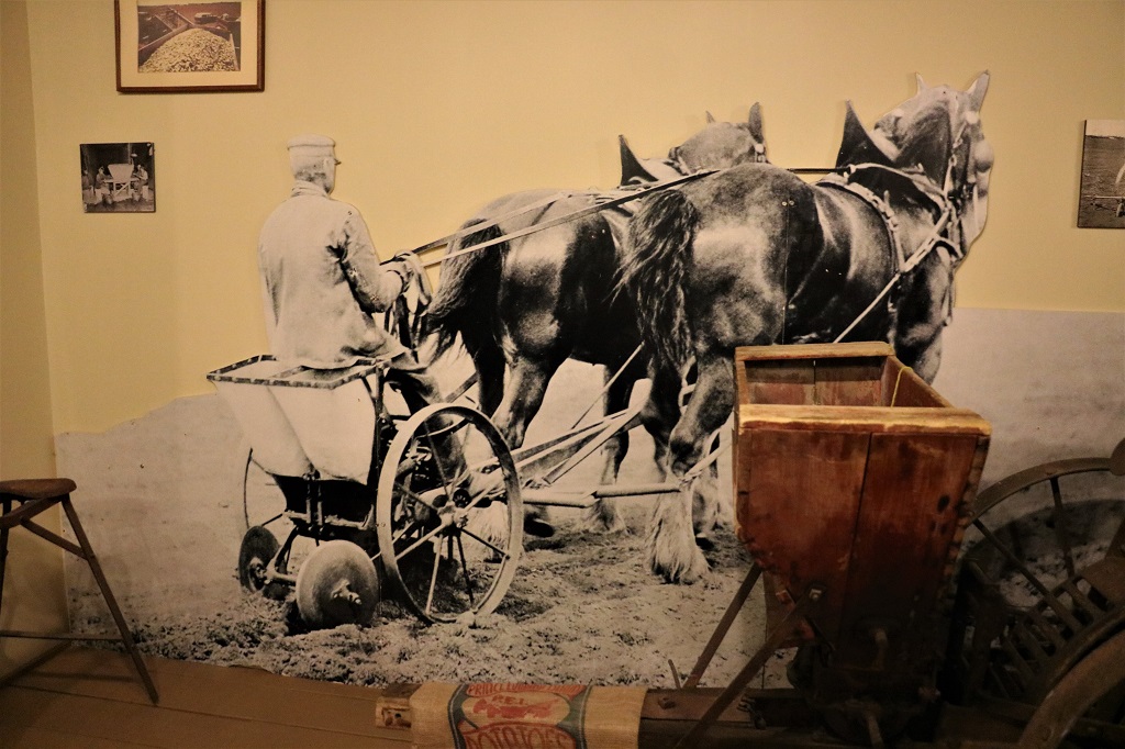
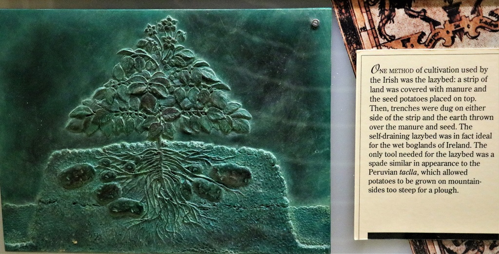
This was hard to get a photo of that made sense. It is a potato slicer. Potatoes are not grown from seed, rather a plant develops from a sprout that grows out of an eye on the tuber. Any small piece of potato contaning an eye is capable of sprouting into a new plant. The machine above was an early potato cutter, which was a lot less time consuming than having to cut them all by hand.
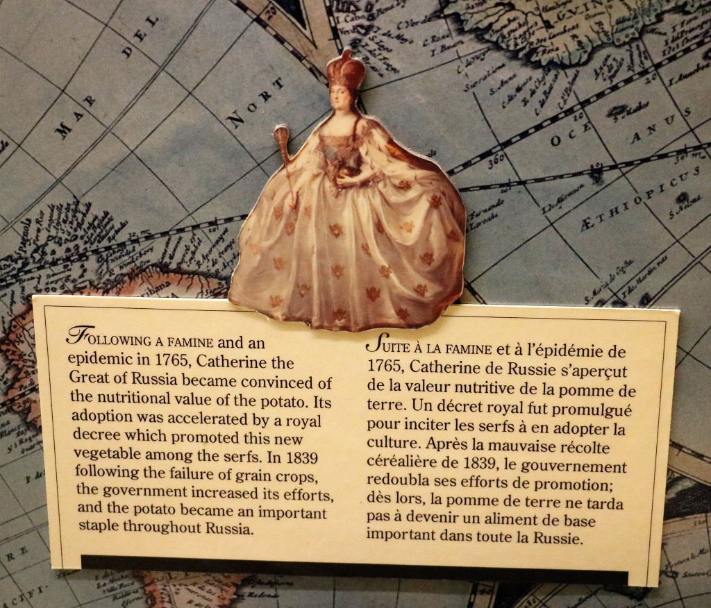
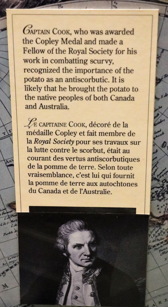
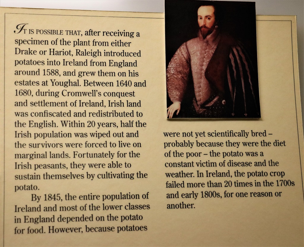
There were three walls of historical information about potatoes and how they spread around the world. They were originally from in South America.
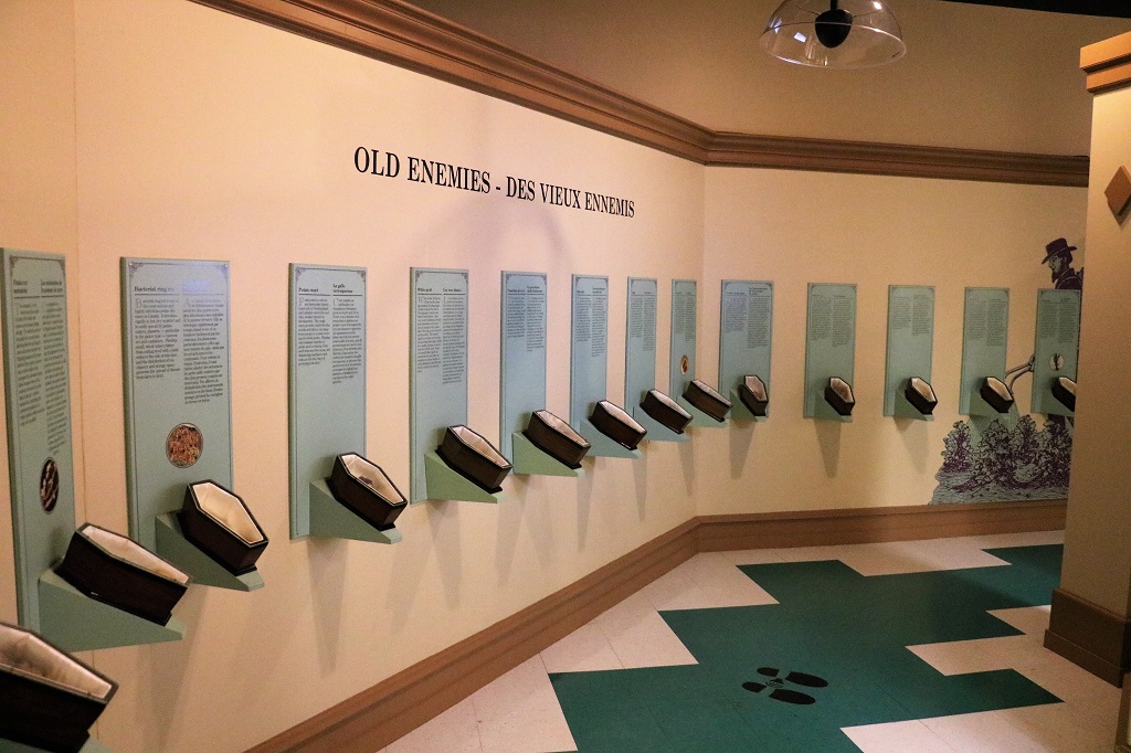
There are over 260 known virus, bacteria and fungi that affect potatoes, not to mention insects and pests. There was a wall of small coffins with potatoes inside showing several of the different effects of bugs and blights, etc.
We concluded our tour of the Potato Museum a few minutes before they closed at 5:30 and then drove 45 minutes back to Summerside and our hotel for the night. There is a huge motorcycle rally going on so there were closed roads and bikes everywhere.
John has been finding it quite difficult to find accommodation the last week or so. Everything is full or is $280-$350 per night. He saw an Air BnB listing for $124 per night to sleep in a tent that had two beds in it! We planned to drive around the Gaspe but we may have to nix that and head on a more direct route back to Quebec/Ontario. We shall see what pans out.
We had plans to see a few things on our drive today, but they did not pan out. We woke up late (yay sleep!) so it was almost 11 by the time we left Margaree and it took quite awhile to make our way the rest of the way down Cape Breton to the mainland.
We only made a couple of stops at marshes to find a few geocaches and walk about for a break. So today’s blog will be similar to yesterday’s; photos and a few comments.
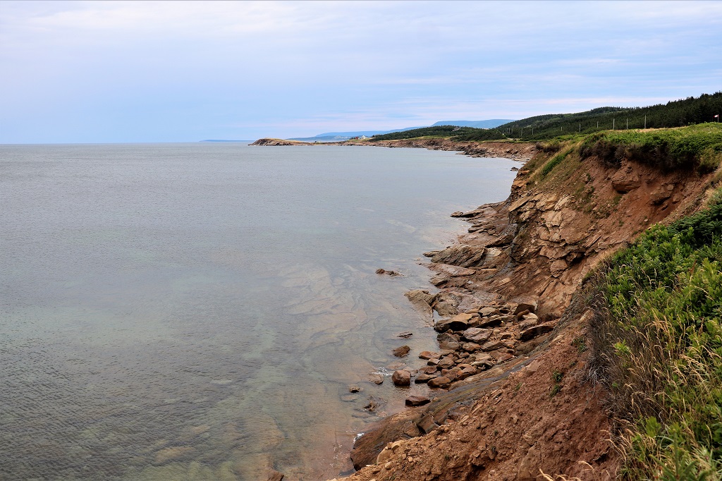
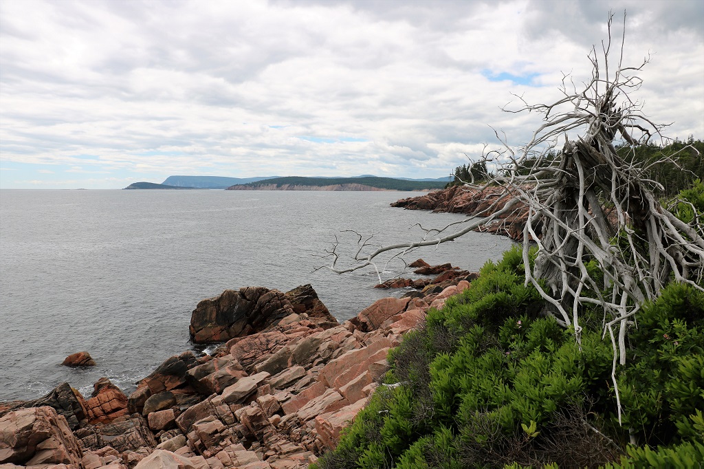
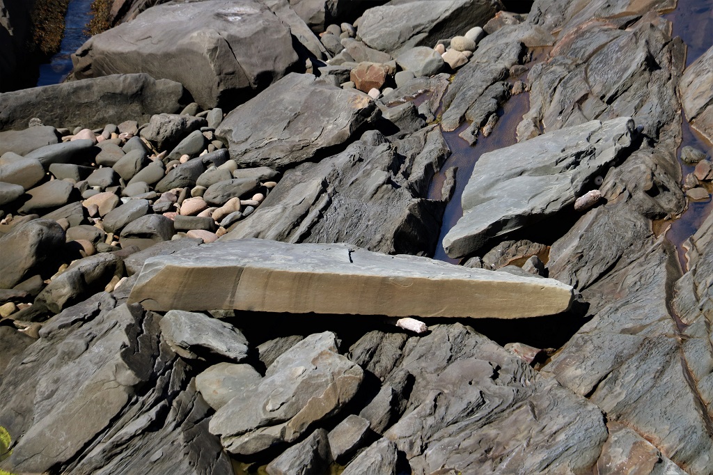
A closeup up photo of the rocks in the water. I thought they were very cool looking.
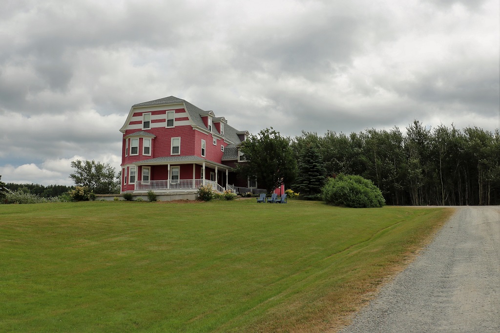
Hillcrest Hall Inn
Port Hood Provincial Park. This is a manmade marsh. The sandstone in this area was high quality, dense yet easy to shape, and therefore was quarried and shipped to the Fortress of Louisburg to be used for the window and door asings of the original fortress. That left the sandstone land bridge between Cape Breton and the mainland weakened, and mother nature did her thing.
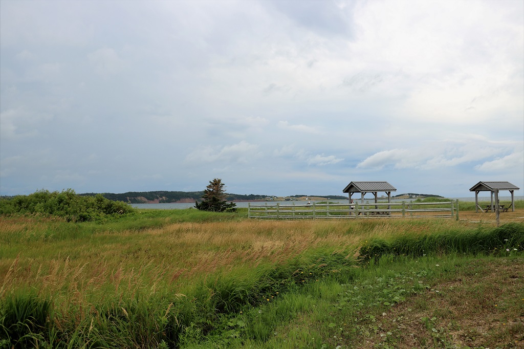
Another nice boardwalk through marsh at Celtic Shores.
The water was so beautifully still.
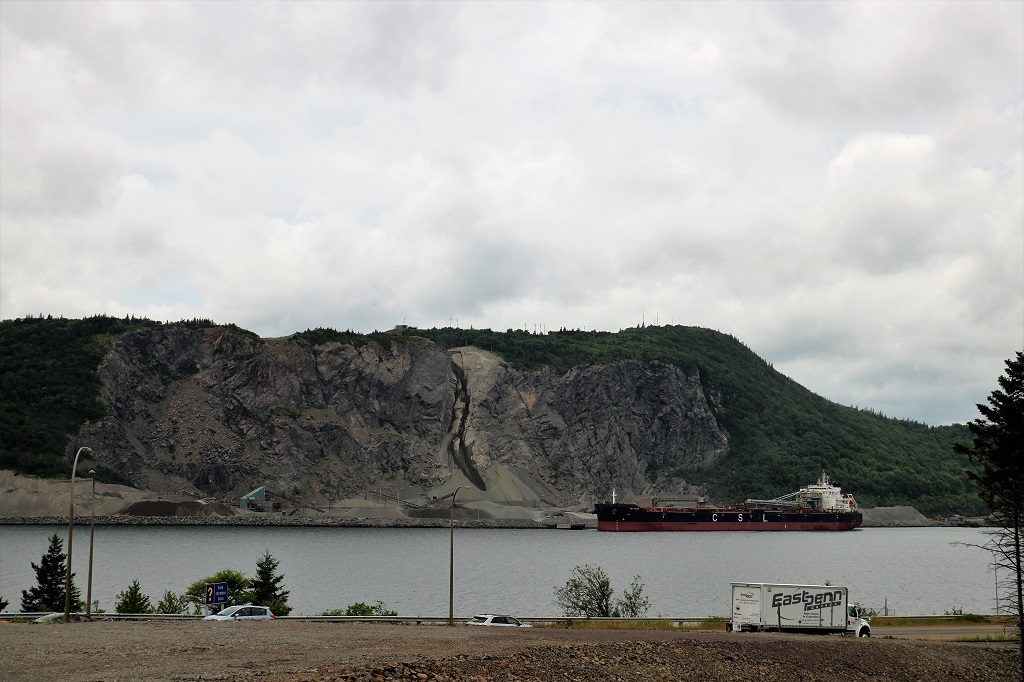
We arrived back at the Canso Causeway to the mainland and got a good view of the huge quarry operation on the hillside. If you look very closely and follow the dark stripe of earth to the top you can make out the conveyor that is dropping the sand/gravel to the bottom to be loaded onto the ship.
Our drive from the causeway to our bed and breakfast took another couple of hours and we drove through dairy farms and alfalfa fields and woodlands. Before we leave in the morning we are going to visit at least one, perhaps both, of the mills we planned to see today, but were too late arriving. One is a grist mill and the other is a steam mill.
The internet at our hotel in Margaree was almost non-existent. It was not an issue just at the hotel either, but one suffered by the entire town. Cape Breton Island is large, somewhat remote, populated by many small villages. So far no internet provider has considered it worth their cost to upgrade 20 year old wireless systems. It took forever, but I got my photos uploaded. and even wrote my blog, but the system could not publish it. I discovered this morning that, even though it said it was being saved as I wrote, it was not, so there was nothing there. Hence I have to do it all again today.
Thankfully yesterday was a 100% driving and scenery day so I do not need to remember much.
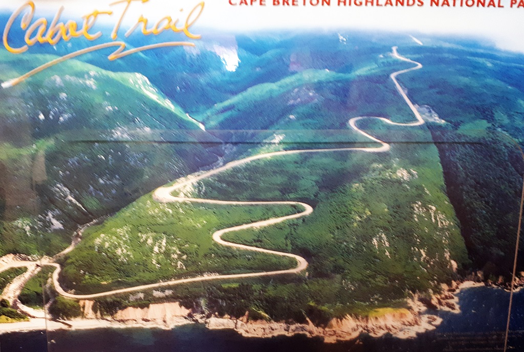
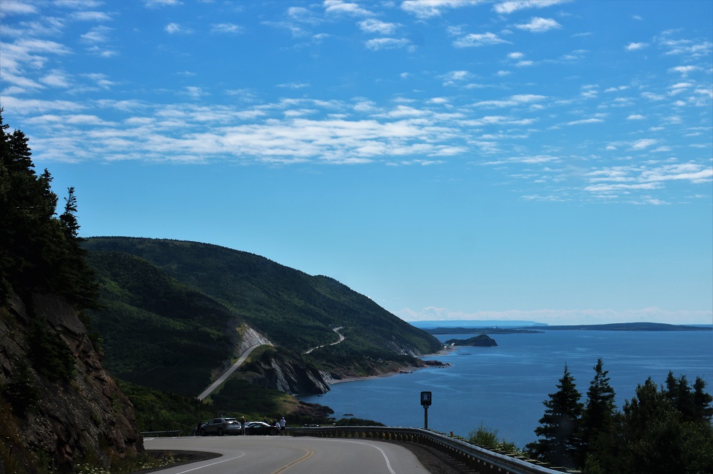
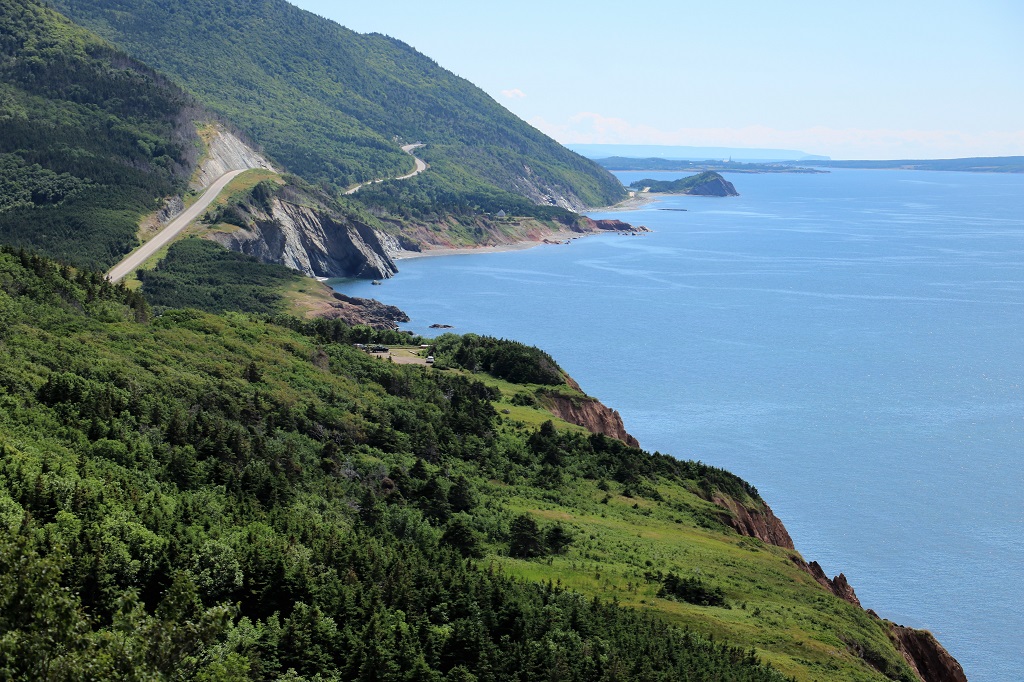
Cape Breton Island is connected to the Nova Scotia mainland by the Canso Causeway. The island is 10,311 km². 20% of the island, or 950 sq km², comprises the Cape Breton Highland National Park, which was established in 1936. The 298 km Cabot Trail encircles the island and takes about 5 hours to drive due to the two lane road with no passing lanes, many, many curves and lots and lots of going up and down VERY steep hills, not to mention all the ‘must see’ viewpoints.
It is best to travel the Trail counter-clockwise because all the lookouts are on the right. You will constantly be having to cross traffic if you go the other way. And there is lots of traffic in the summer time. The Cabot Trail is world famous as a spectacularly scenic drive. Going up the east side is not so pretty as it is mostly trees with a couple of viewpoints and occasional breaks to see water. But once you get to the top and start down the west side it is breathtaking, with places to stop one right after another.
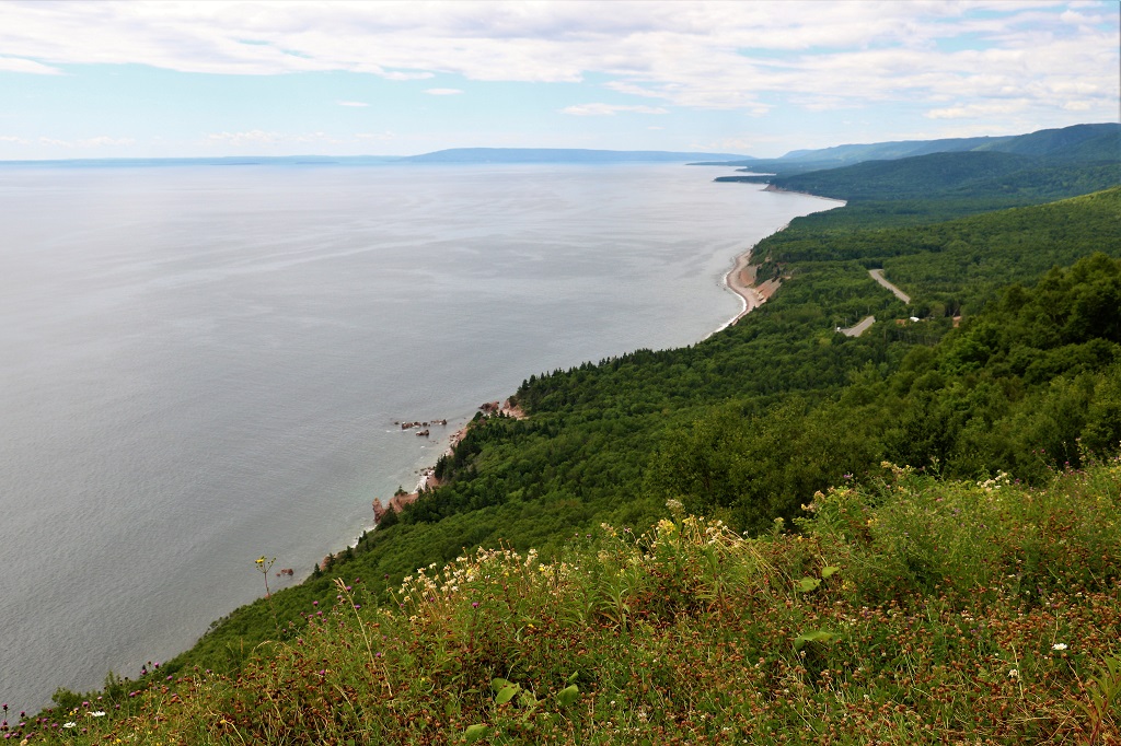
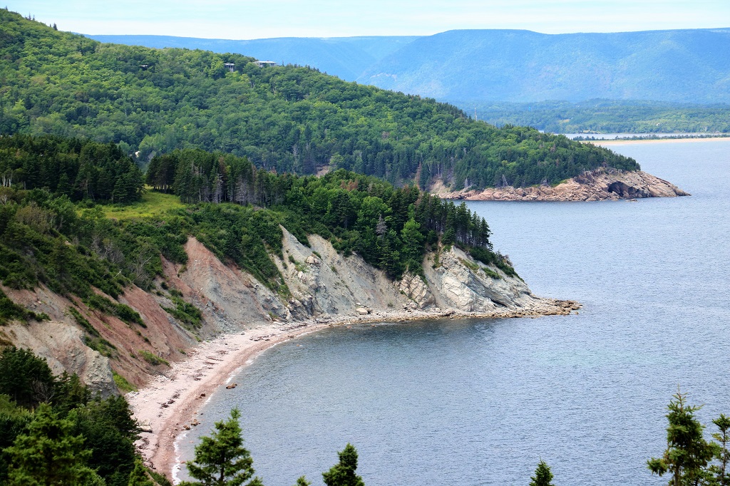
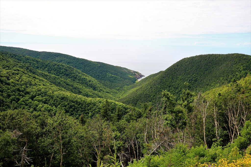
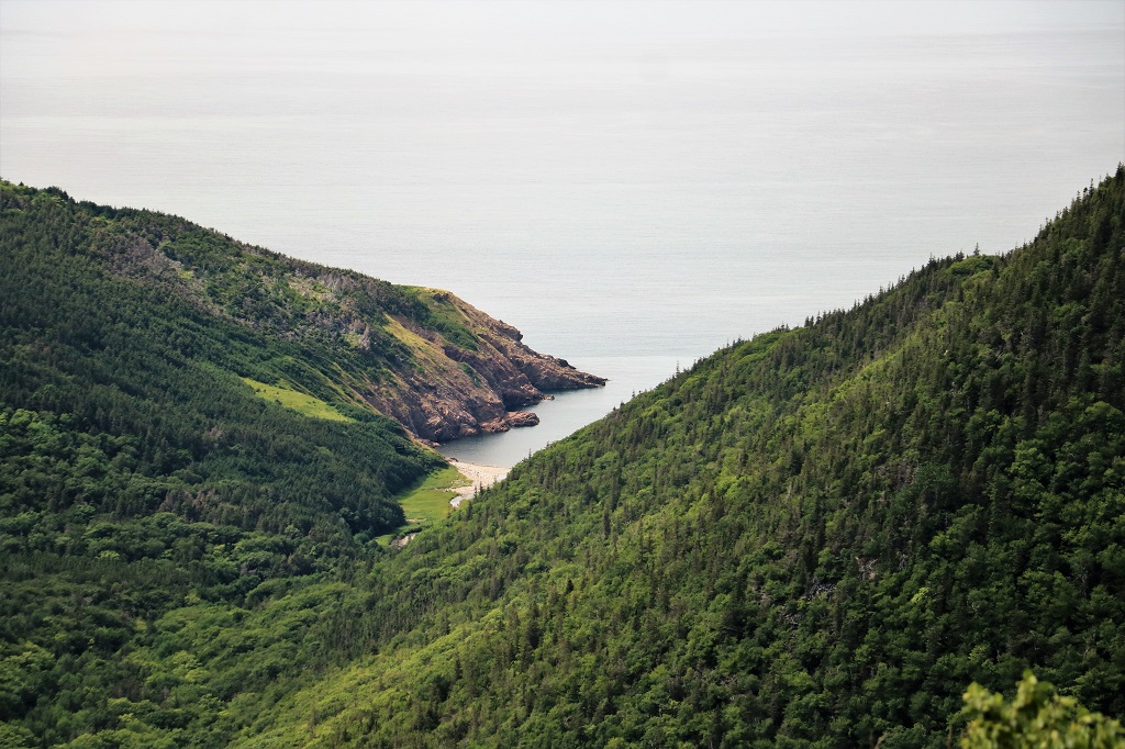
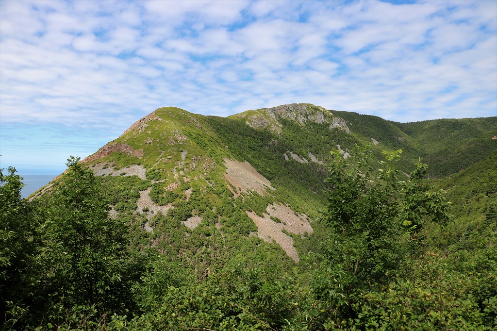
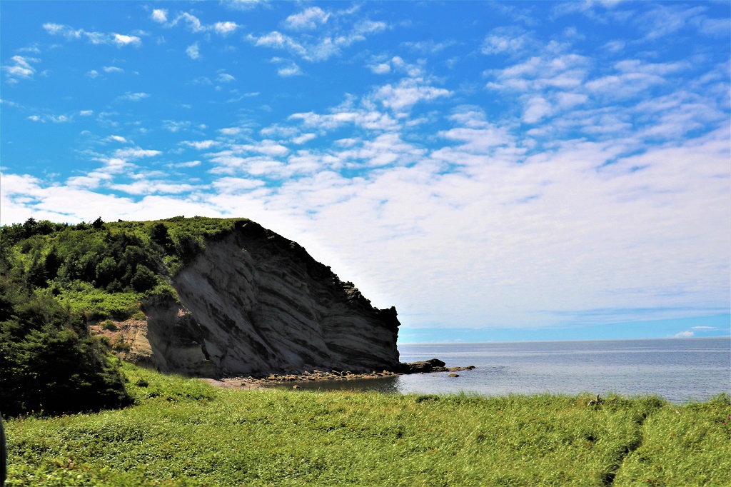
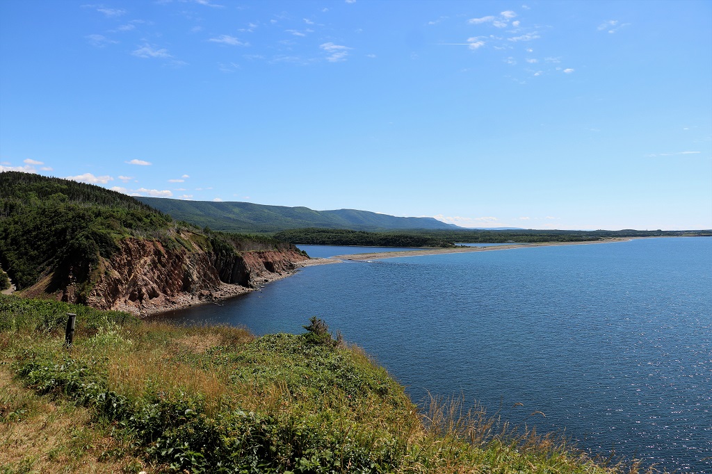
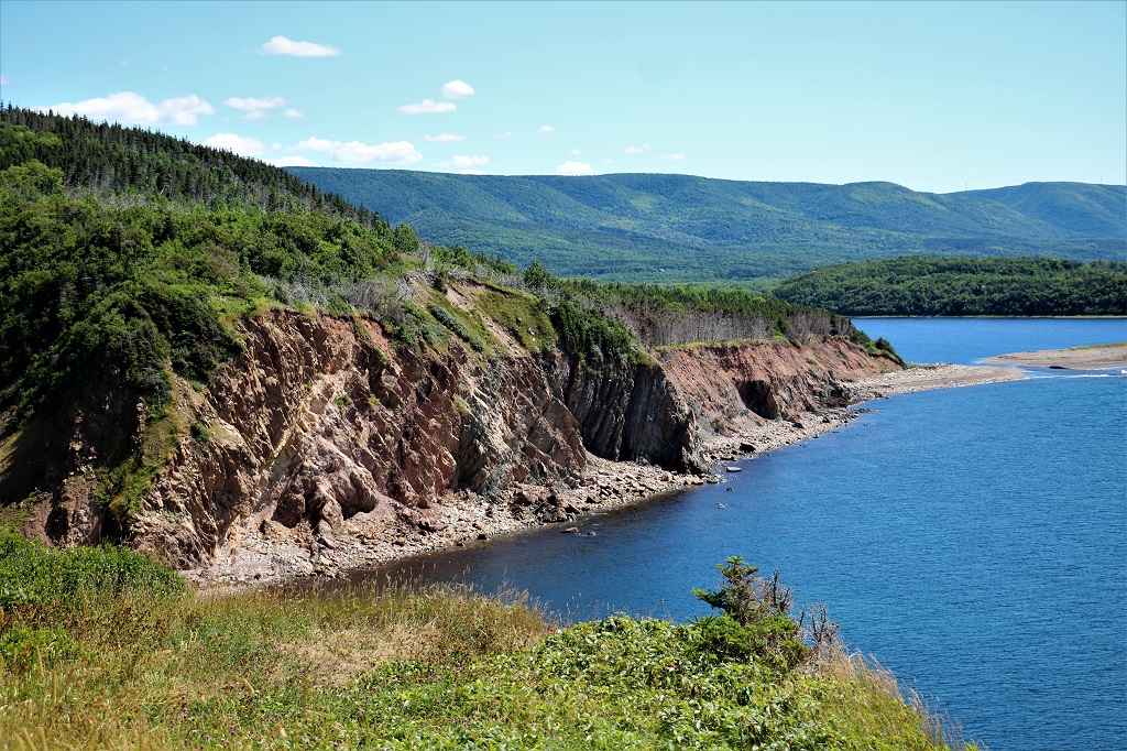
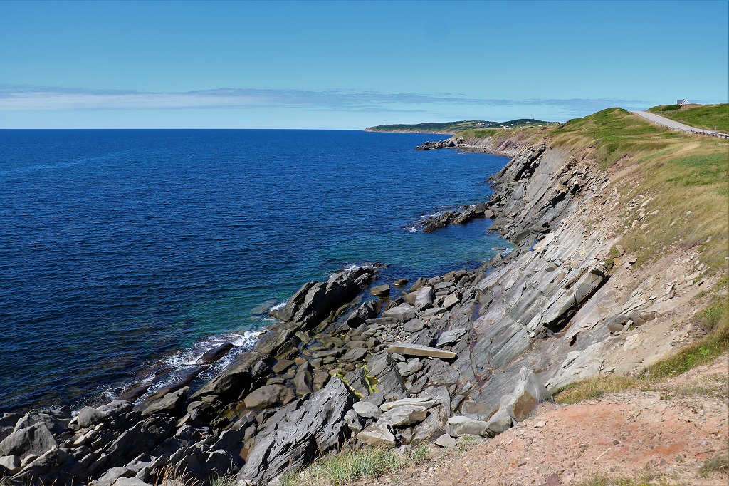
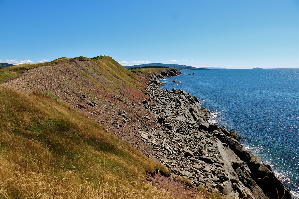
This post will be pretty much all photos with the occasional comment thrown in. There were no names on the viewpoints so no identifiers.
I love the different colours of blue in the water here.
Cape Breton is covered in forest. As you drive you go through deciduous forest (which would be gorgeous in the fall) to coniferous and back to deciduous within very short distances due to the rapid change in elevation going up and down the steep hills.
Cape Breton was settled by Scots and when you see rocky hillsides like this you can understand why it reminded them of the homeland they left behind. The place names and road names and other identifying signs are in English and Gaelic.
I did mention the road was winding and up and down.
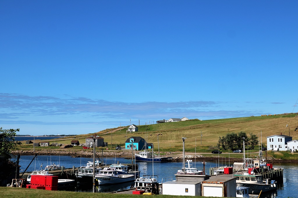
As soon as you return to the lowlands you travel through fishing villages.
We spent the night at Margaree which is just over halfway down the western side of Cape Breton.
We had a nice view from our hotel.
Today we completed the loop and returned to the mainland. We are spending our last night in Nova Scotia at Tatamagouche before heading into New Brunswick tomorrow.