My husband and I retired in 2007 and decided to spend the kid's inheritance by travelling as much as we could until either the money or our health runs out. So far so good.
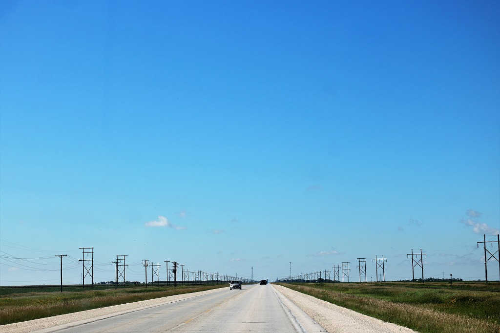
There was only one tourist thing to visit on the road between Brandon and Wyburn and, sadly, it was a bit of a disappoinment.
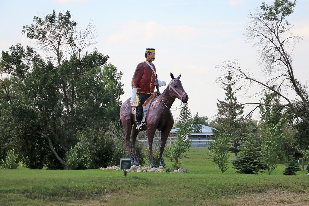
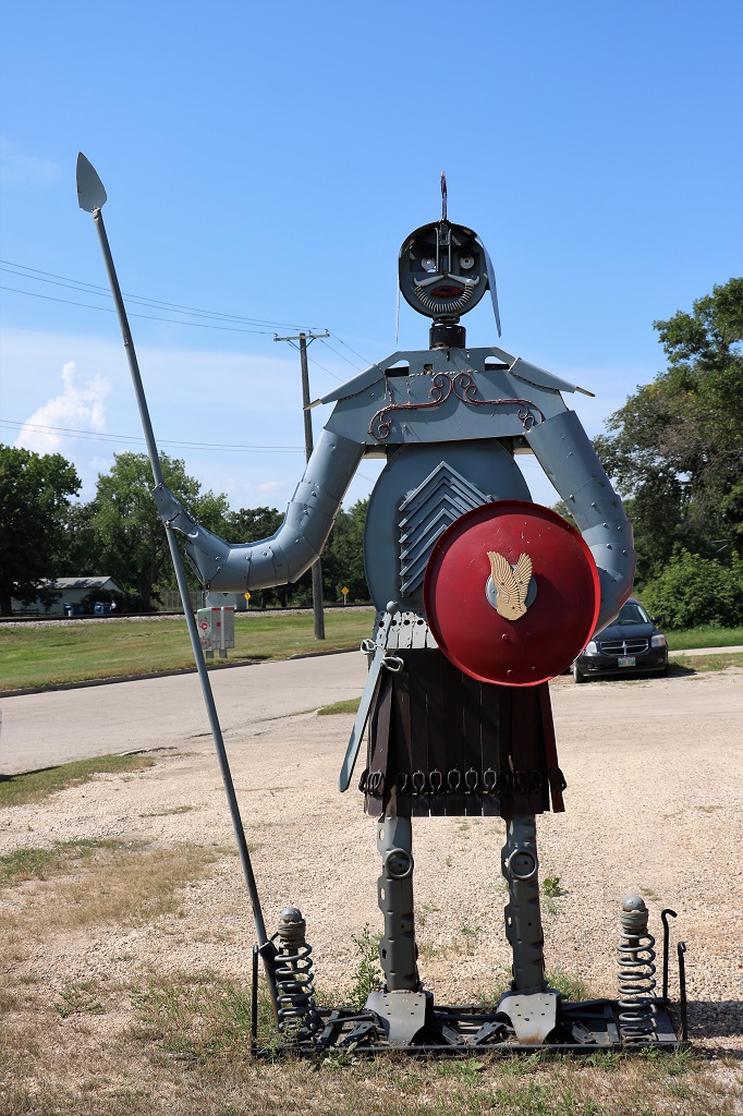
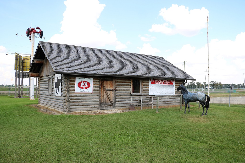
Highway2 (in Manitoba) and 13 (in Saskatchewan) is known as the Red Coat Trail to commemorate the Northwest Mounted Police journey to provide policing services to the rapidly opening west. At a campground beside the highway at Redvers there is a very large statue of a ‘Red Coat.’
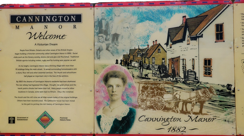
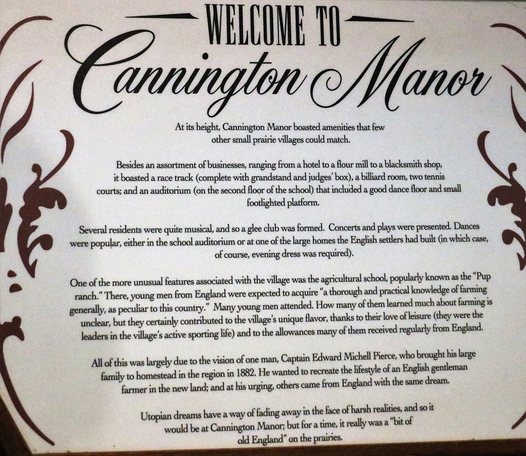
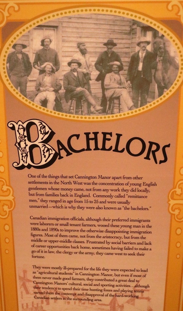
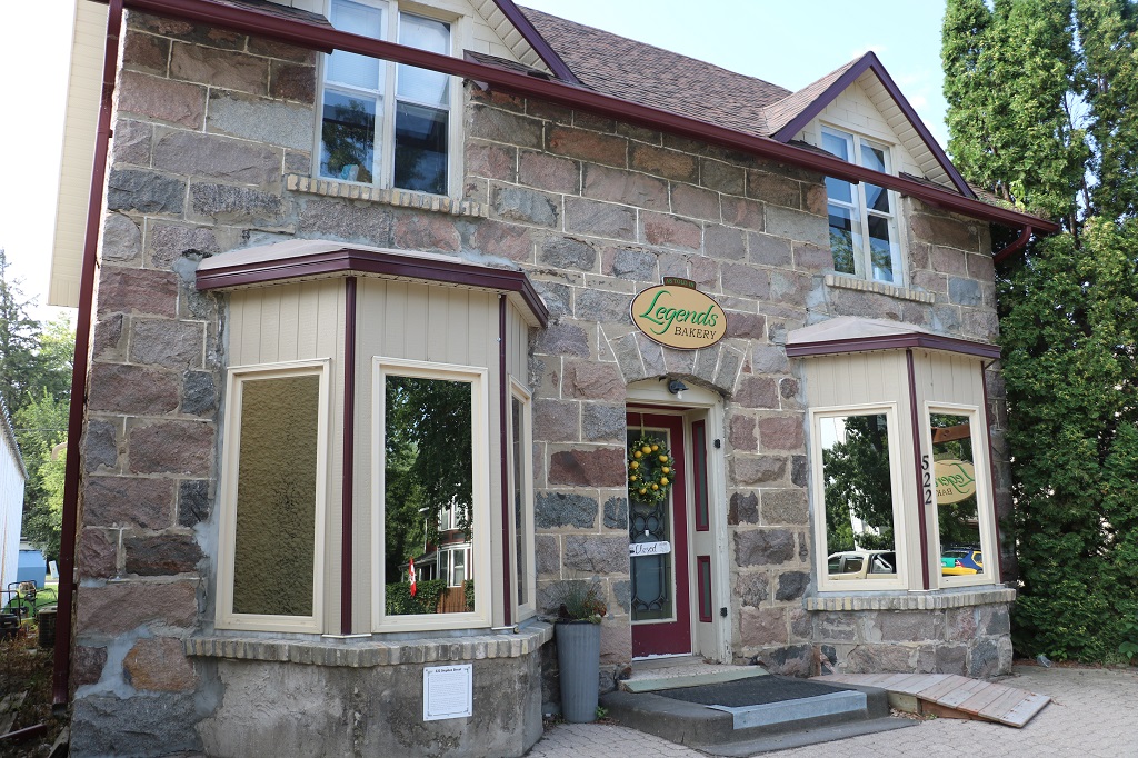
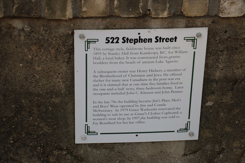
After we crossed the border into Saskatchewan we looked for the sign for Cannington Manor which was settlement built by English immigrants to be similar to an upper middle-class community similar to where the people had come from and hopefully to develop into the type of society they were used to.
There were many placards in the visitor’s center that told the full story of the settlement, its member, businesses, sports and entertainment, etc., and it’s eventual demise. I have only added a few here to give you an idea of the vision.
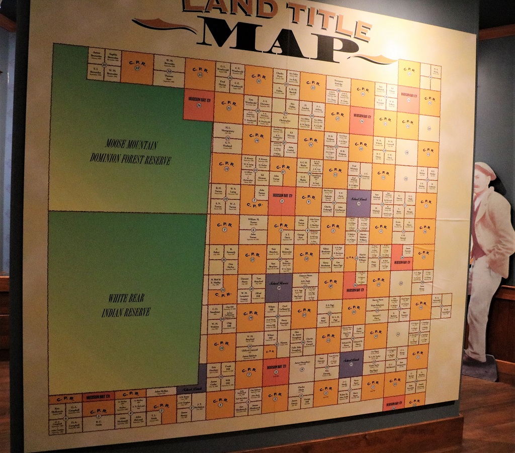
This huge map on the wall showed all the land parcels settled by the Cannington Manor pioneers. What really surprised me were the amount owned by the Canadain Pacific Railway and the Hudson’s Bay Company. Almost every second section belongs to the CPR!
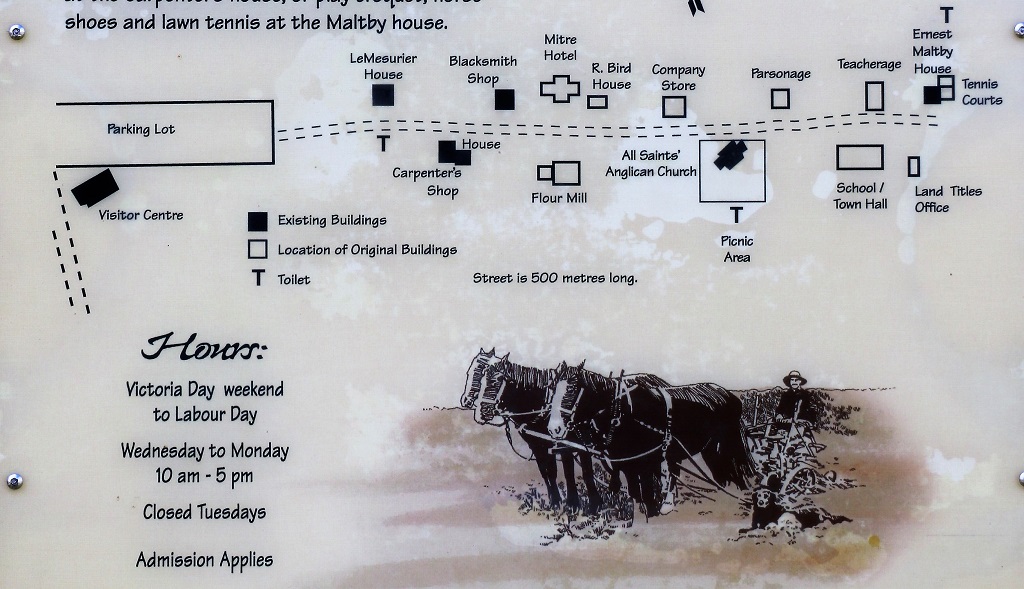
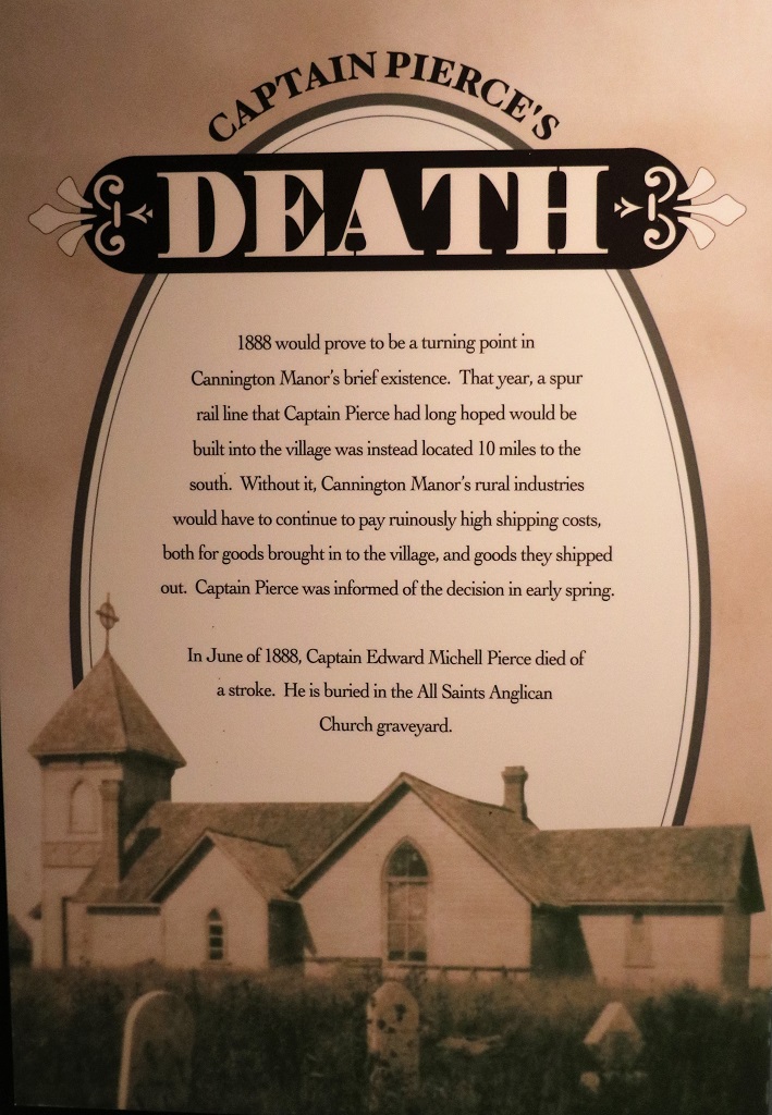
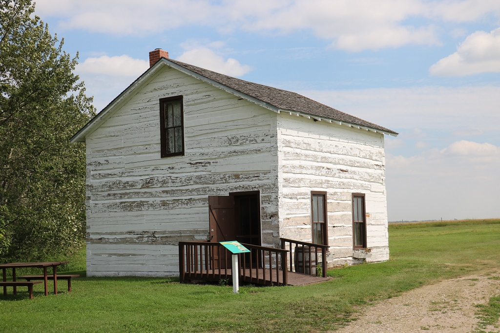
The story of the community was very intersting. What was disappointing was the ‘village’ itself. There were only a few buildings and most were reproductions There information plaques where all the houses or businesses along the single street had been located and the remnants of footings. None of the buildings were much more than sheds. All of the larger properties like the flour mill or general store were long gone.
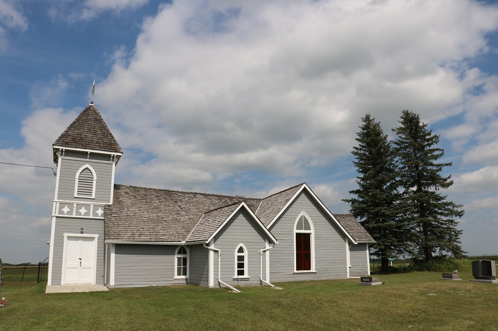
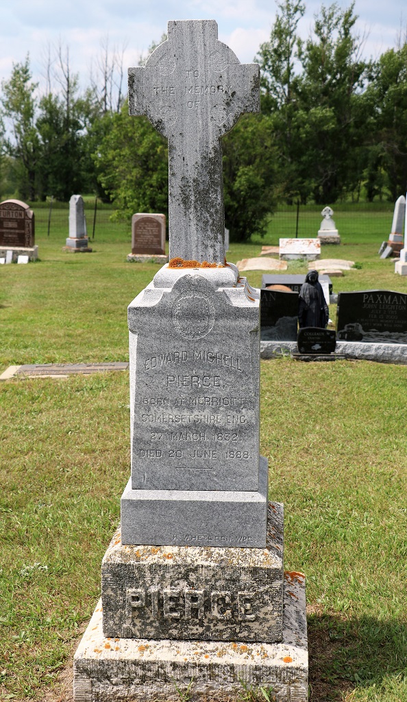
The Anglican Church belongs to the Diocese of Qu’Appelle and services are still held once a month. The cemetery contains the graves of many of the early family members of Cannington Manor and is still used.
There were three geocaches hidden in the park. One was AWOL, one we couldn’t find – but saw a garter snake warming in the broken foundation of the old flour mill – and one we found.
There was a large house built by three wealthy brothers that was part of the park as well. They raised racehorses and raced them at the race course at the end of the village. At one one time their 100 stable farm was the largest employer in the district.
After we read all the sign boards along the village street and checked out the buildings we drove down the road in the direction of the sign. We never saw another sign and ended up getting completely turned around and driving over 30 kilometers on various roads before finding the highway again. And, we discovered we had gone in the wrong direction as well, because after we had been driving westward again we came across the same sign pointing up the road to Cannington Manor. Opps.
We stopped at an historical cairn about the first Roman Catholic priest who came to the area and had our lunch before driving the rest of the way to Weyburn.
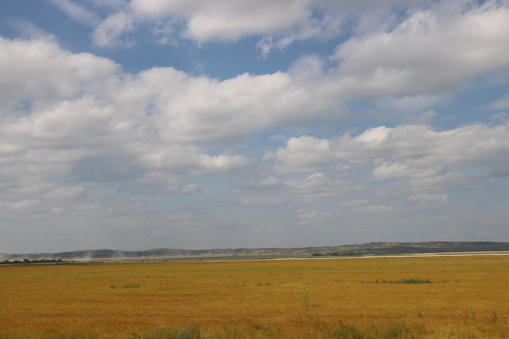
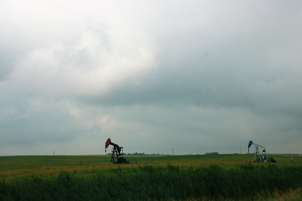
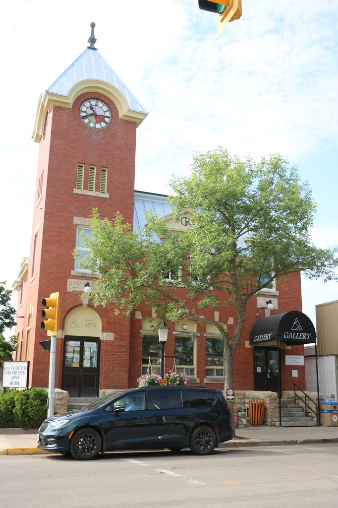
There were a lot of oil jacks on both sides of the road and further into the grain fields. When we drove into Weyburn their town sign displayed a stalk of wheat and a pump jack. Quite appropriate I think.
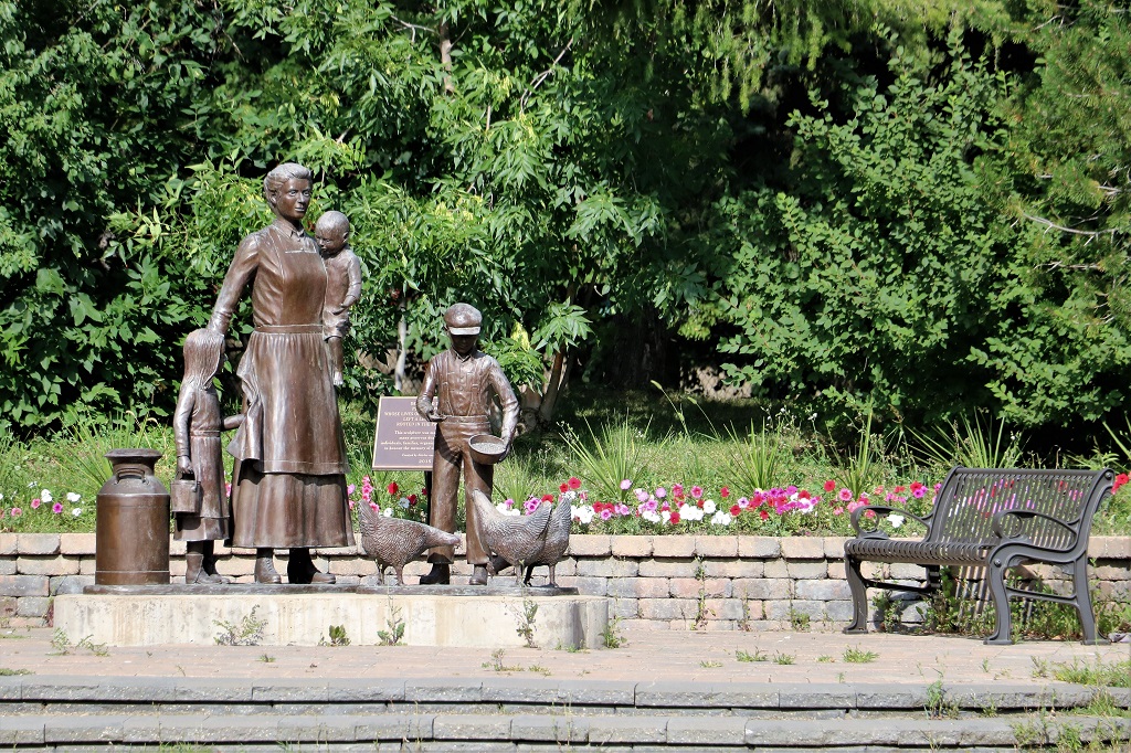
I snapped this photo of a sculpture in a little garden on the side of the street while we were stopped at a red light on the way to our hotel so I don’t know exactly what it was for but I will guess something to do with the hardiness of the early settlers.
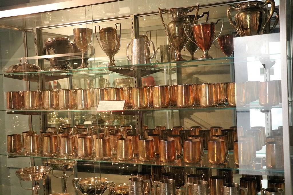
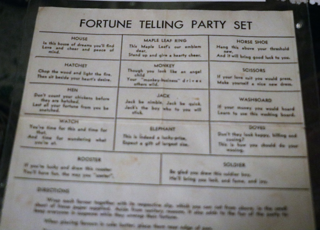
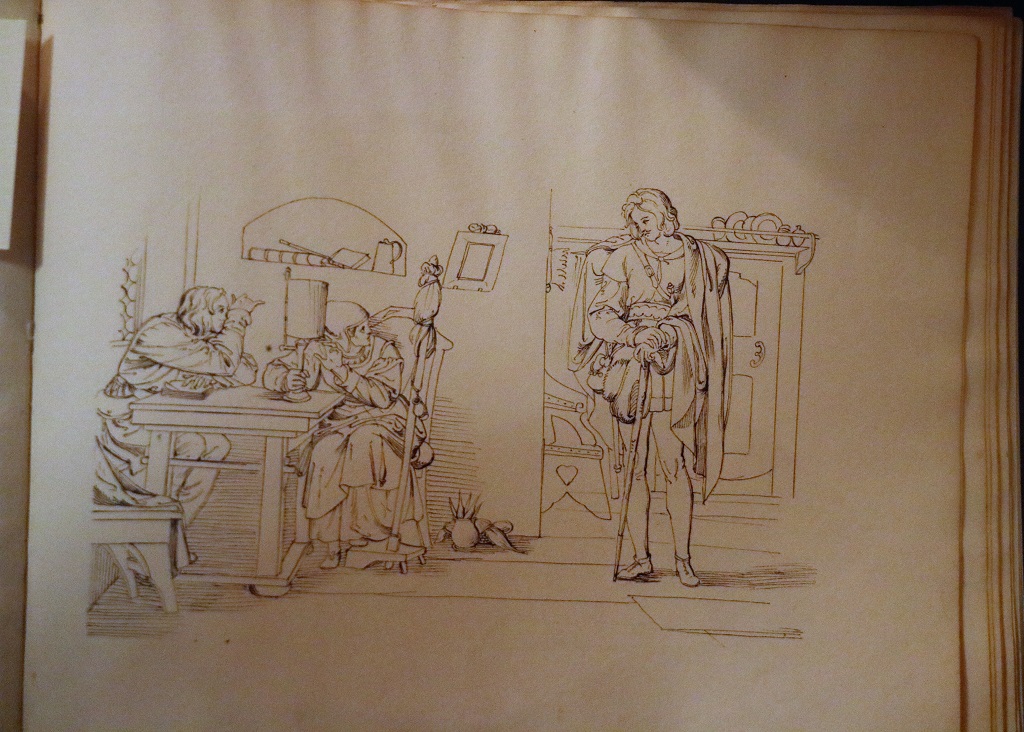
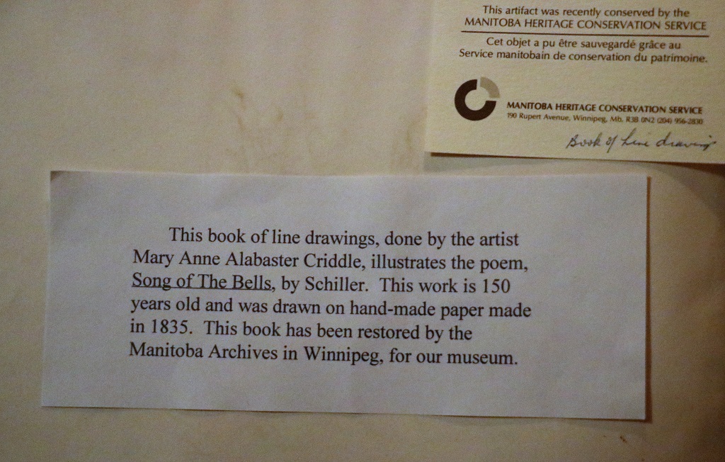
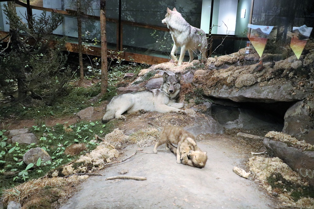
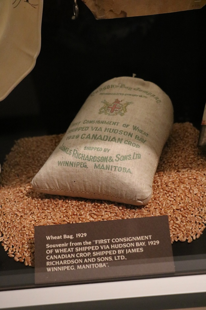
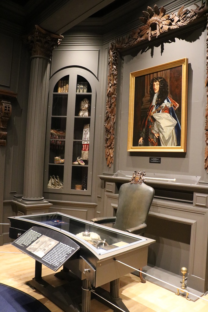
It has been quite some time since I filled a blog with images and placards from a museum, so today is the day.
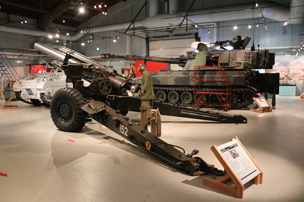
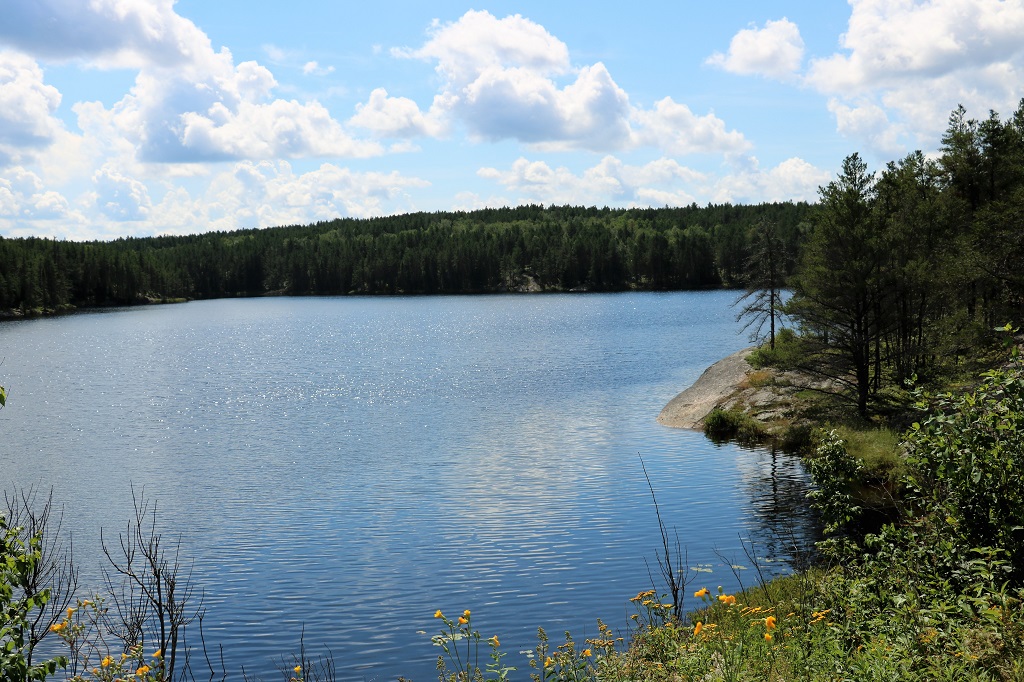
We headed north and then east to go to Spruce Woods Provincial Park which is a large protected area of sand dunes. Also on our list of things to do while in Brandon, time permitting, was a visit to the Royal Canadian Artillery Museum at CFB Shilo and the Plains Museum in Carberry; both of which were more or less on our way to Spruce Woods.
We had to turn south on a road between Brandon and the one to Carberry and Spruce Woods and drive about 13 km to CFB Shilo and decided to do it as we were going by rather than on the way back to Brandon.
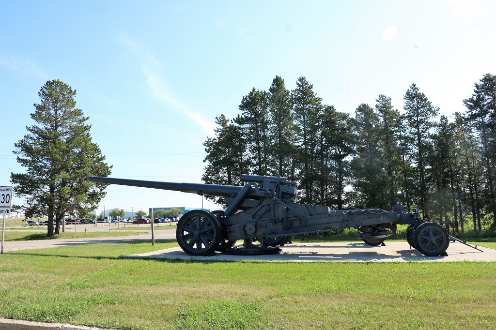
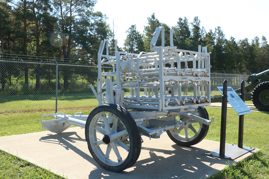
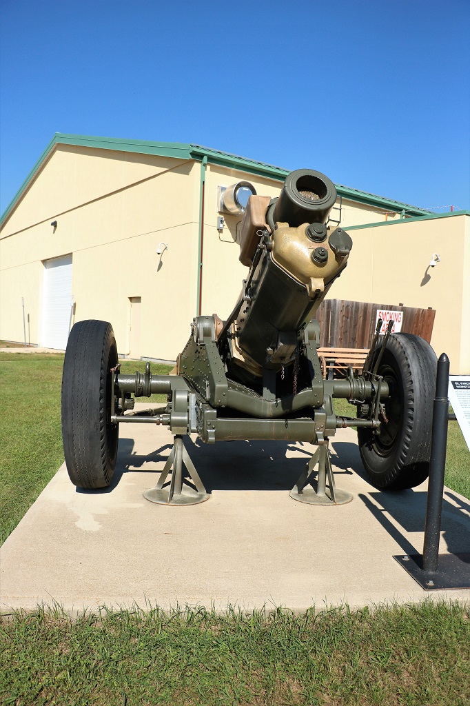
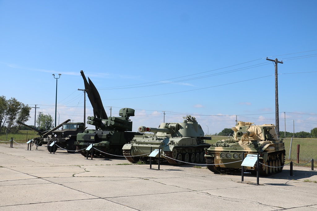
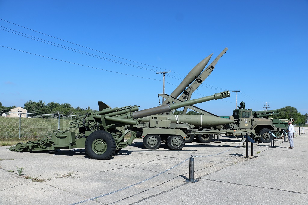
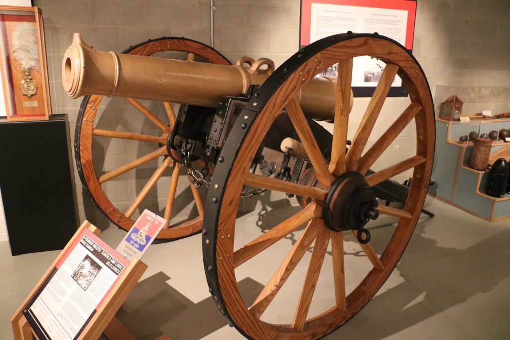
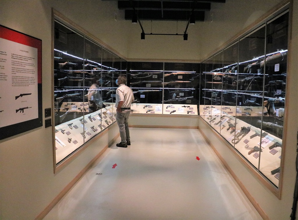
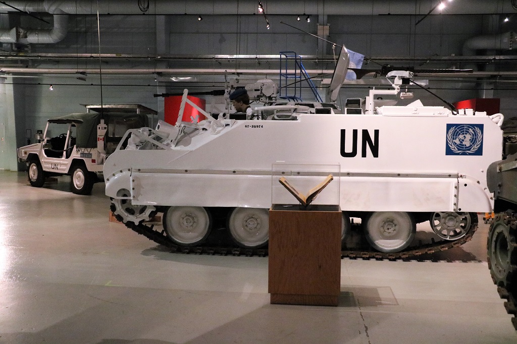
We spent quite awhile outside before entering the building. Both sides of a long driveway and a back parking lot had various artillery on display.
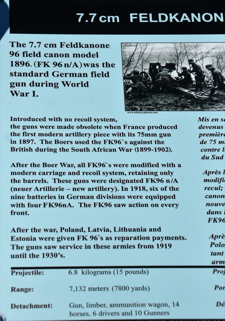
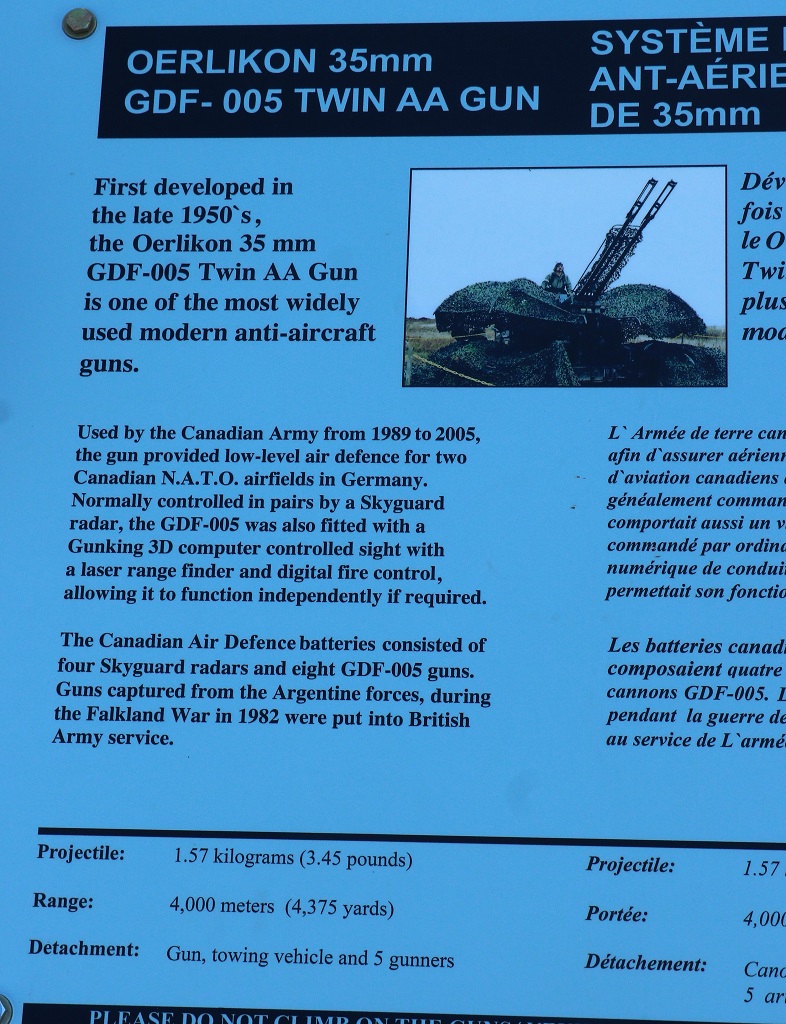
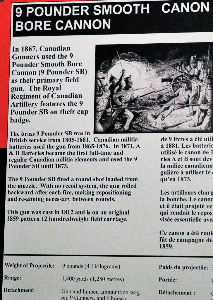
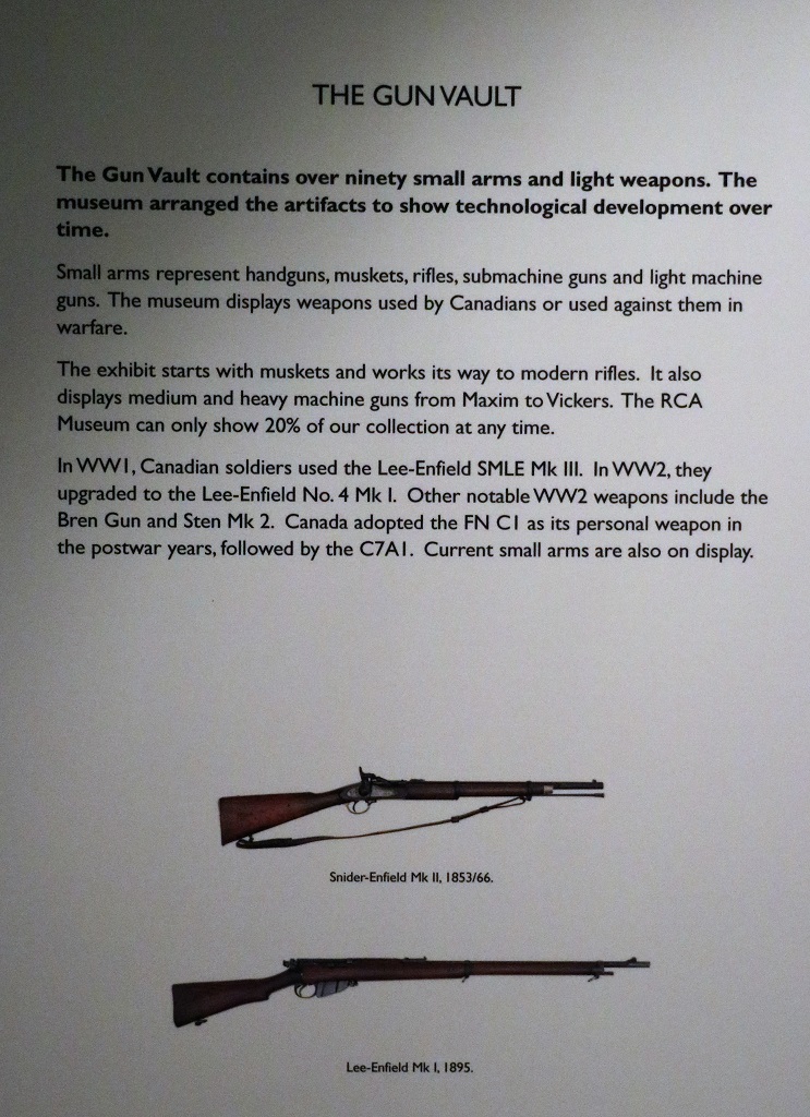
This huge gun was at the property entrance. They had really good rightups with statistics about every piece of artillery.
I took 109 photos at the museum and have tried really hard to pare them down, but there are still a lot of photos of guns.
Note the wooden wheels.
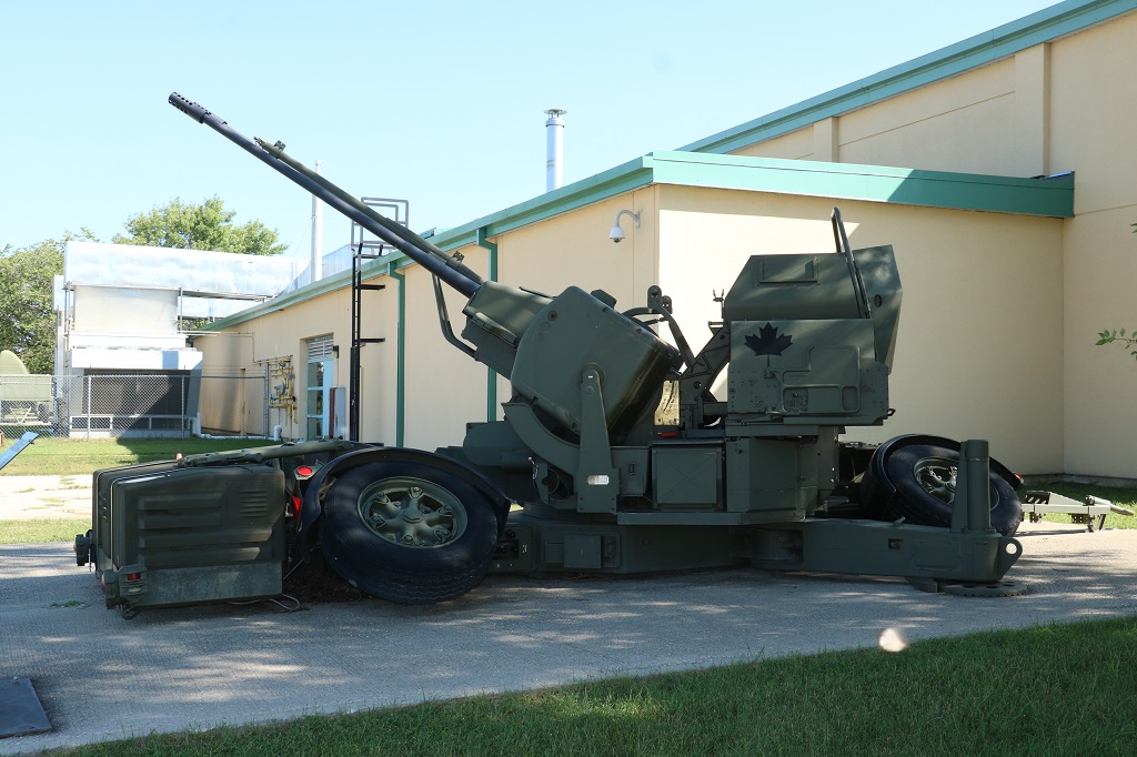
Loved the camo paint job on this one.
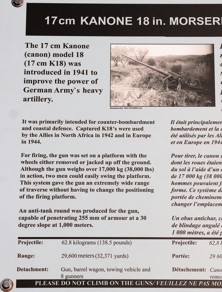
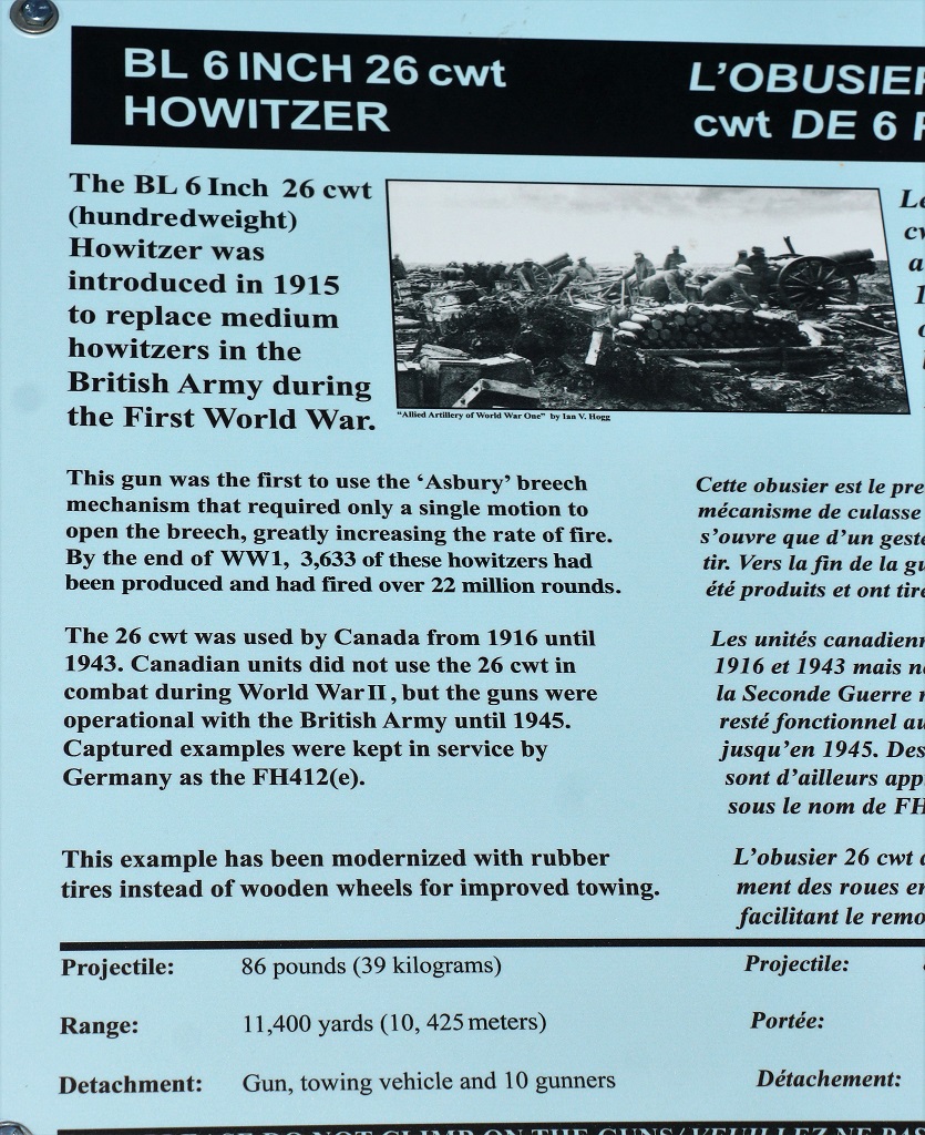
The Howitzer is such an oft mentioned gun in novels and WWI information. It is such a fearsome-looking weapon. I was surprised at how big the barrel was. Some of the guns we saw had a target range of 10 miles – this one’s range was 6.4 miles.
Look at the stockpile of shells awaiting firing.
The wheels on this gun folded in so it could sit flat on the ground when being fired.
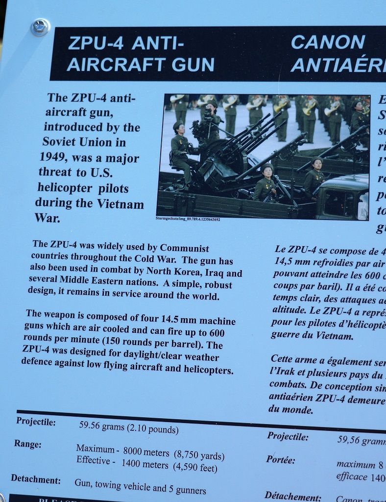
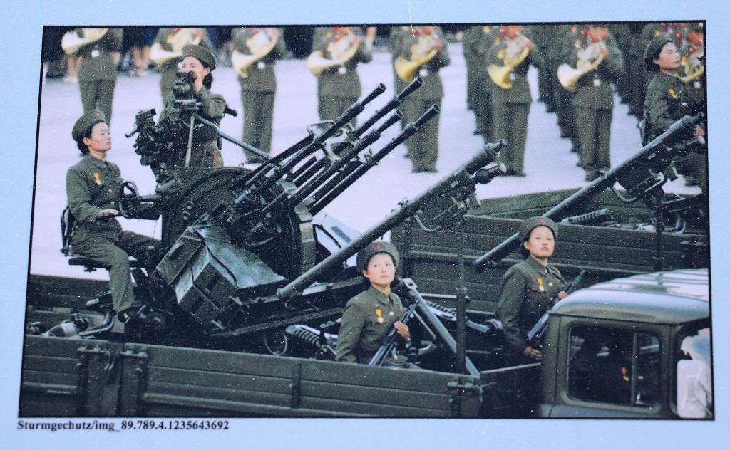
The rocket launcher pointing to the sky could send nuclear warheads.
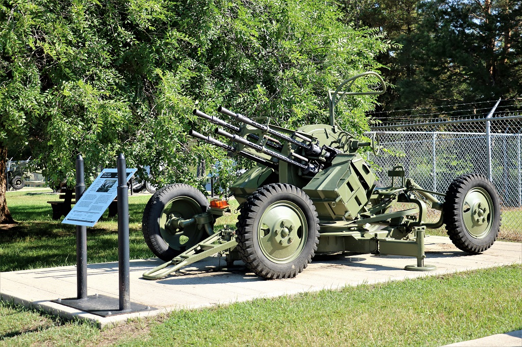
150 rounds per minute from each of the four barrels.
Women gunners in this North Korea photo.
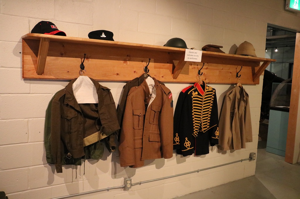
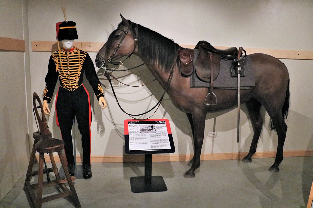
After we looked at all the guns outside we went into the huge building and spent another hour or so, and only walked past many of the items and displays. Way too much to read and look at thoroughly.
Colonial musket loaders to modern day handheld rocket launchers.
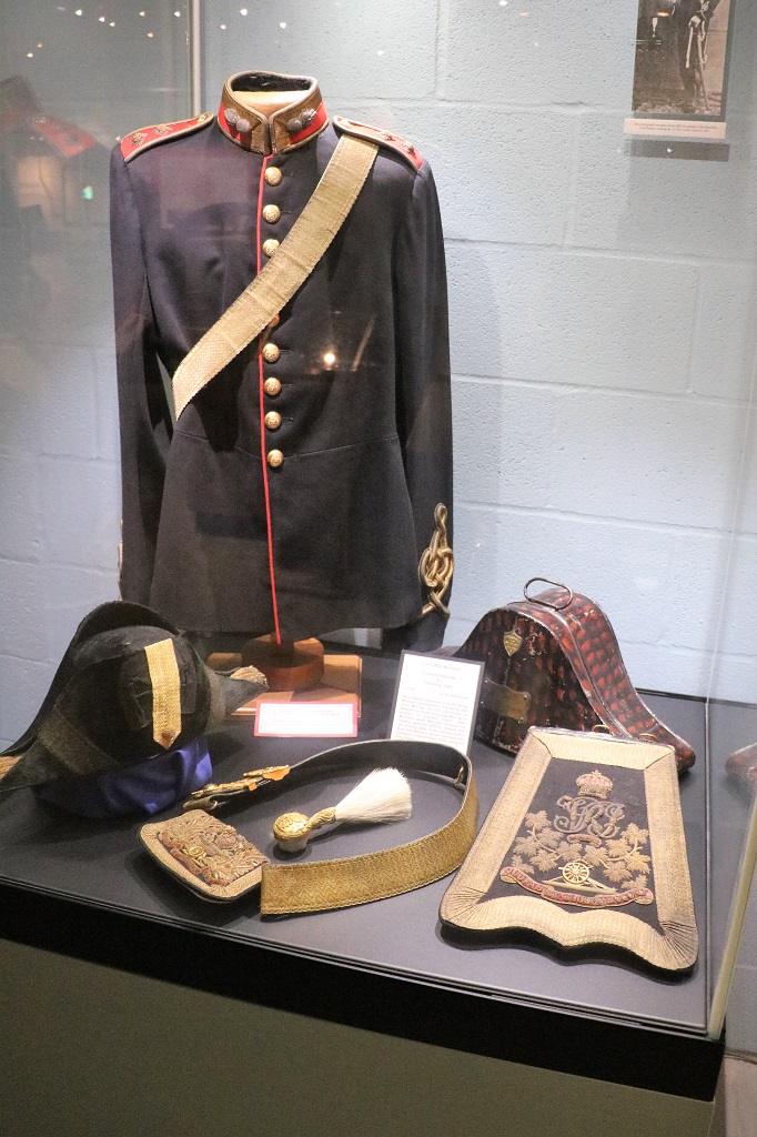
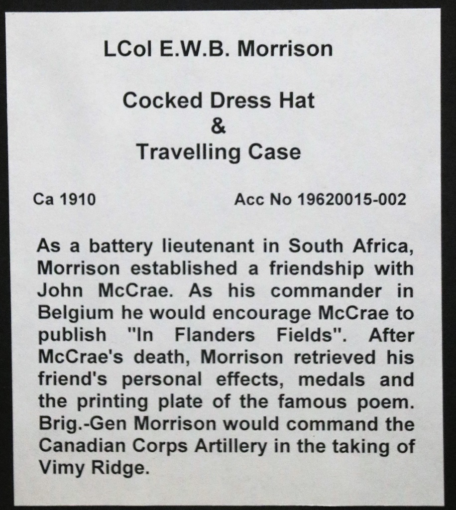
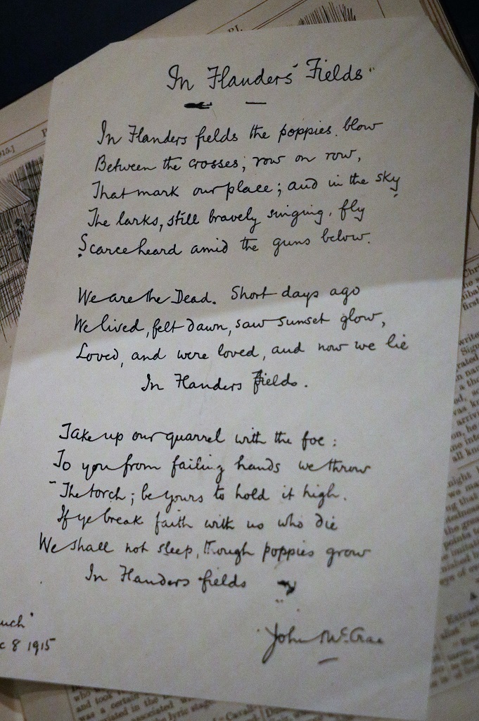
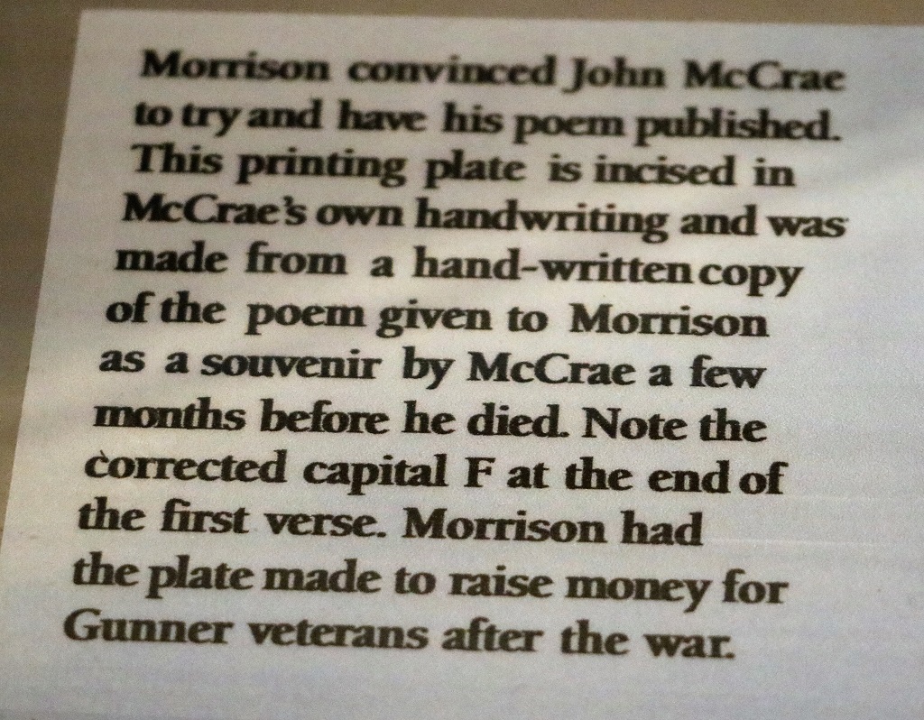
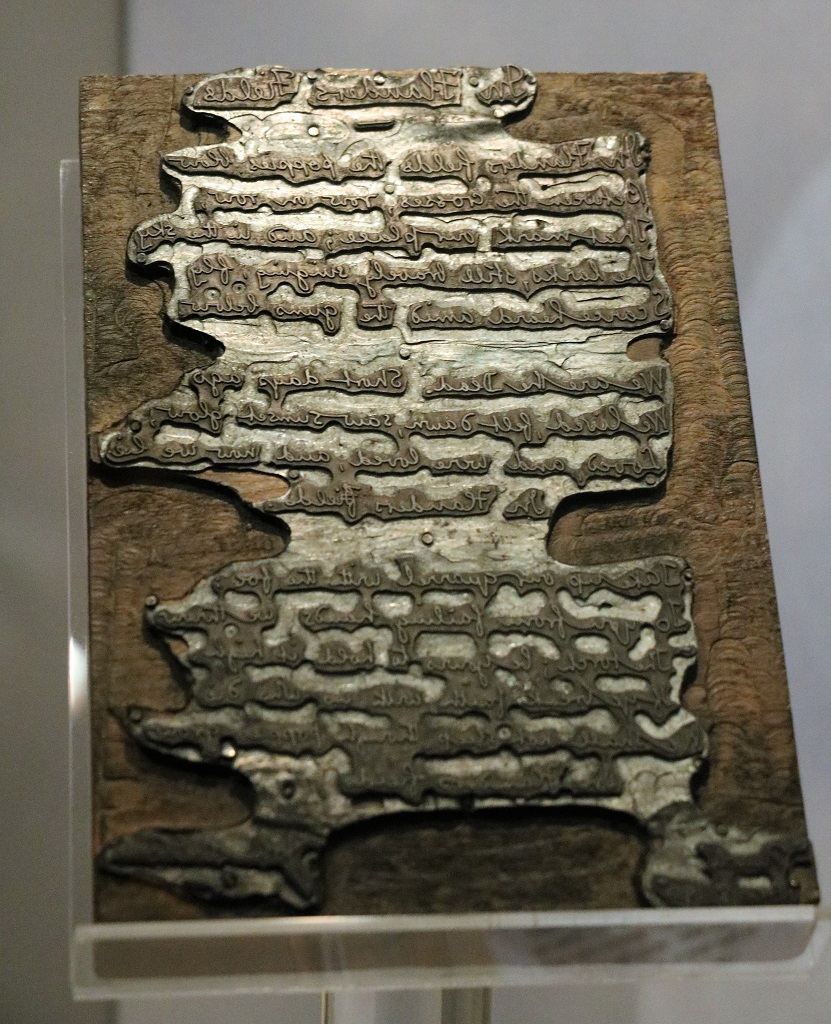
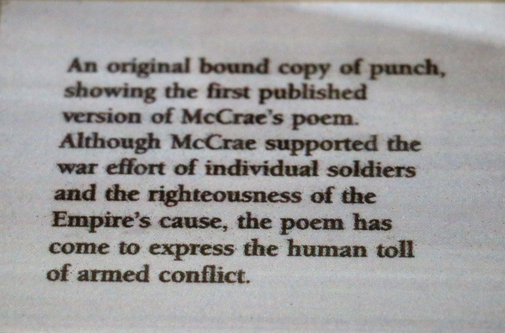
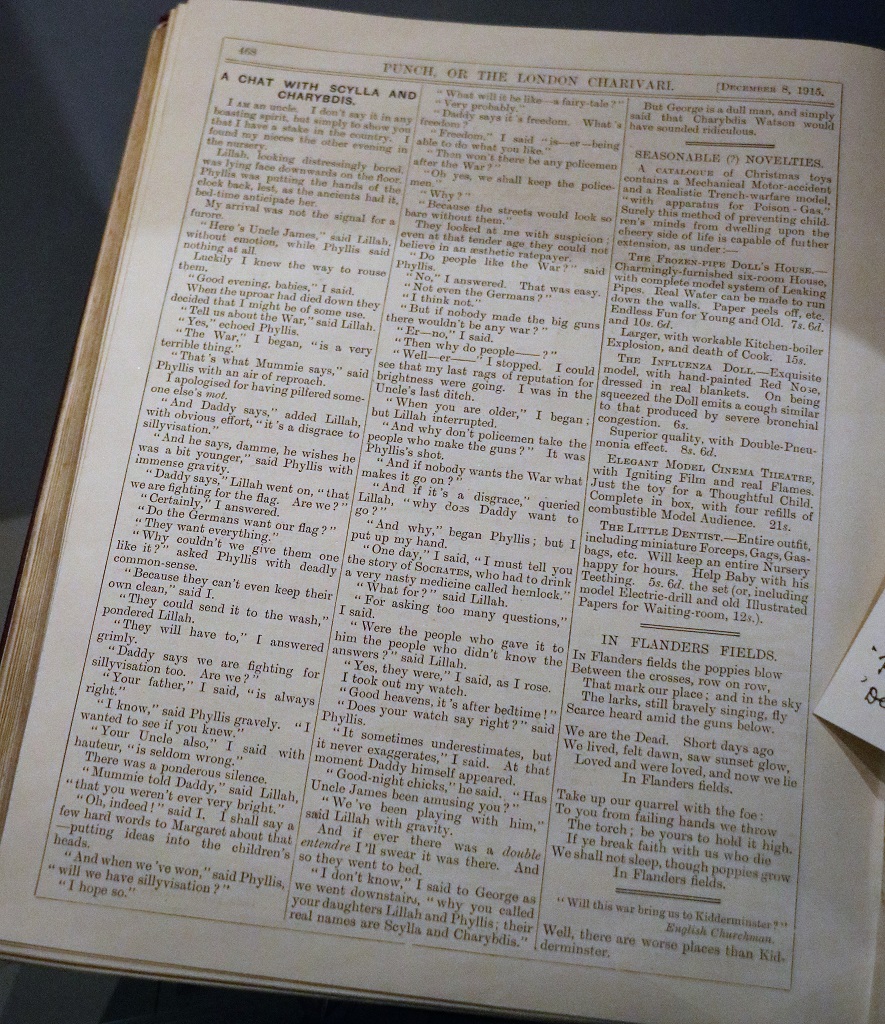
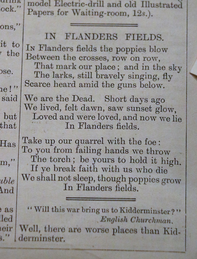
A display case with more information on Lt. Col. E.W.B. Morrison told more about his connection to Lt. Col. John McCrae and the famous poem “In Flanders Fields. John McCrae wrote the poem after the funeral service of his good friend that had joined up with him and then, we were told in Belgium where he wrote it, threw it away. Morrison picked it up and told McCrae he should publish it.
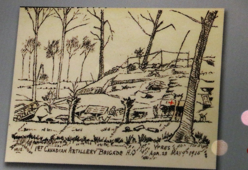
This is a copy of Morrison’s drawing where, according to most accounts McCrae wrote the poem.
One of Morrison’s illustrations of the poem.
Notice though that no credit was given for the author.
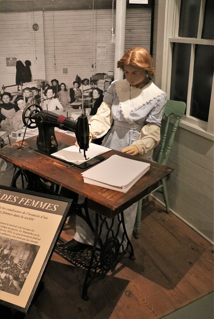
There was a book binding factory in Winnipeg in 1915. This ‘woman’ is stitching pages together.
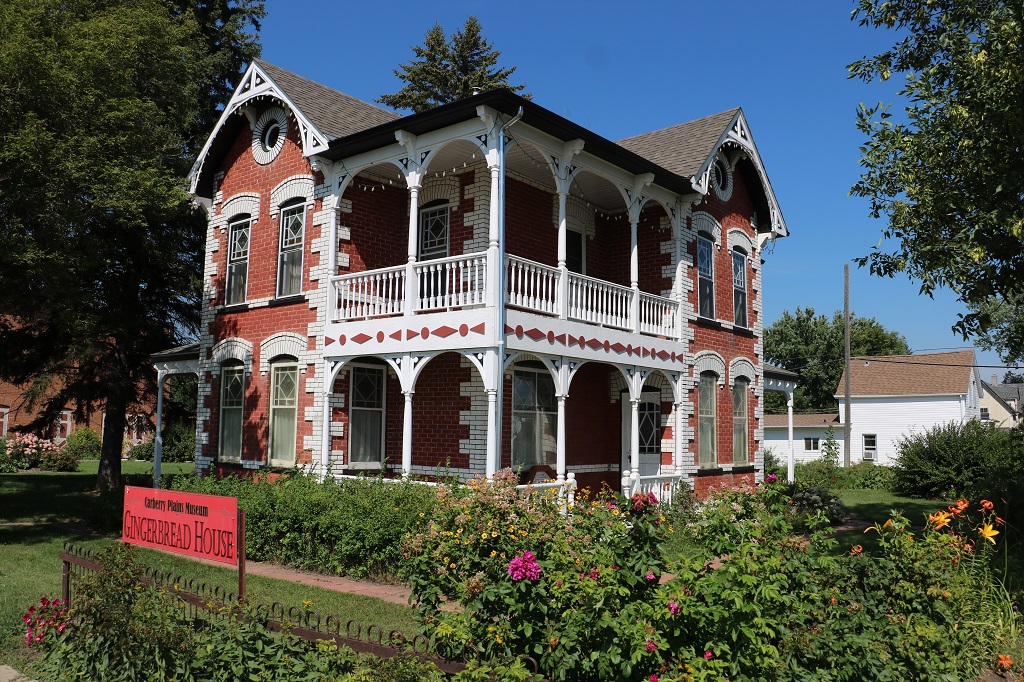
We drove back to the highway and headed east again before turning south to the community of Carberry. As we were driving around the town we saw the Plains Museum so decided to go take a look.
The museum building was originally a sash and door factory owned by a prominent Carberry citizen. He owned most of the city block and had a General Store and a few other business throughout town. His house was next door and is owned by the city and is part of the museum. We toured it later.
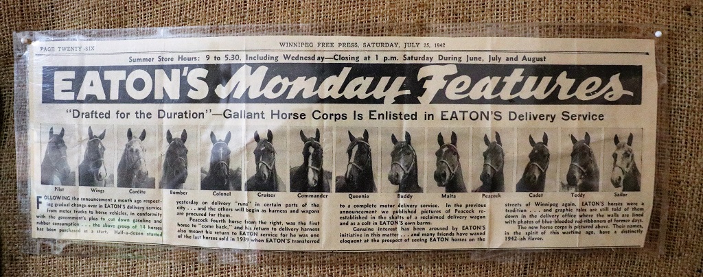
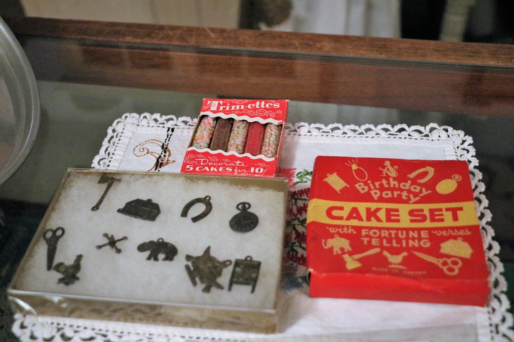
Items of interest to me in the Carberry Plains Museum.
My mom just wrapped a few pennies and a couple of nickels and dimes and one quarter in wax paper to put in our birthday cakes. I did not know there were actual sets of tokens for that.
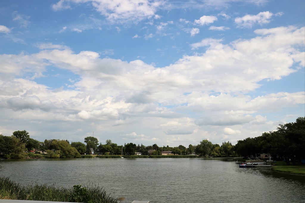
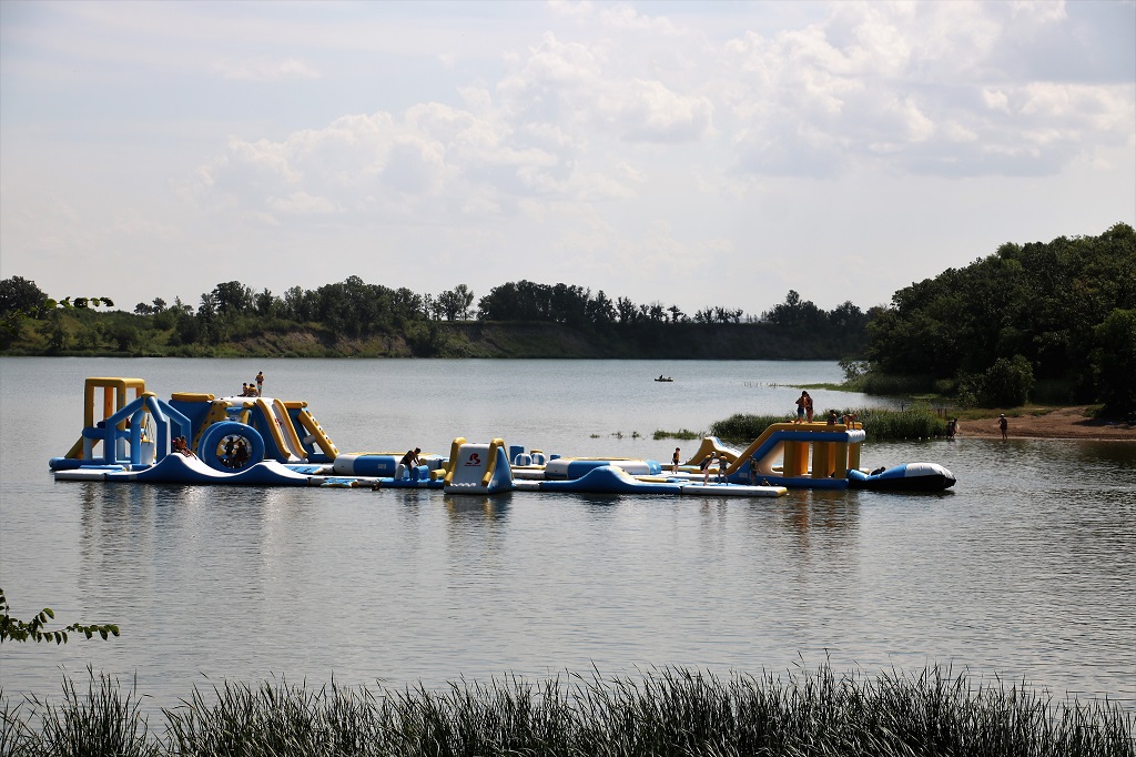
We had a double-scoop ice cream lunch between touring the museum and the Gingerbread House and then headed down the road to find Spruce Woods Park and go see the sand dunes. The park is very large and we could see the sandy soil under the vegetation on both sides of the road. We pulled into the place that had the trail to the dunes and the Park Policeman was there checking vehicles to be sure they displayed a permit. We asked where we could get one and he directed us to a campground a few kilometers down the road. After wandering around for awhile in search of the place to buy a permit John was told that it is a hour and a half hike round trip to see the dunes. And over 40 minutes of walking before you even see them in the distance. A day permit was $9.50. By this time it was 3 o’clock and the hottest part of the day so we decided we did not need to see sand dunes that bad so headed back to Brandon.
The Assiniboine River winds back and forth like a snake.
I spotted these colourful watercraft while we were trying to find where to buy a park permit.
There were patches of sand hills along the road so we did see dunes – sort of .
Tomorrow we leave Manibtoba and enter Saskatchewan. We will be spending the night in Weyburn about 3 hours drive from Brandon.
There was a thunderstorm with heavy rain last night in Boissevain. And a warning for potentially loonie-sized hail. We did not hear if that came true, but a lot of grain fields that are due to be harvested are now wet. We had overcast skies and cool temperatures all day today so nothing was drying very fast.
We drove through an area with quite a few jackpumps.
A few kilometers west of Boissevain John spotted an historical marker pointing to the left that said Newcomb’s Hollow. Neither of us had any idea what that was so we went to find out. We drove 2 miles south (well, we actually drove about 4 miles south and had to turn back because there had not been a sign at the two mile mark for when we had to turn east) and 1 mile east on another of Manitoba’s good gravel roads.
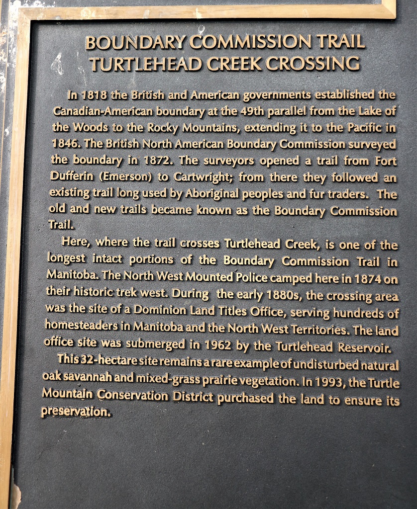
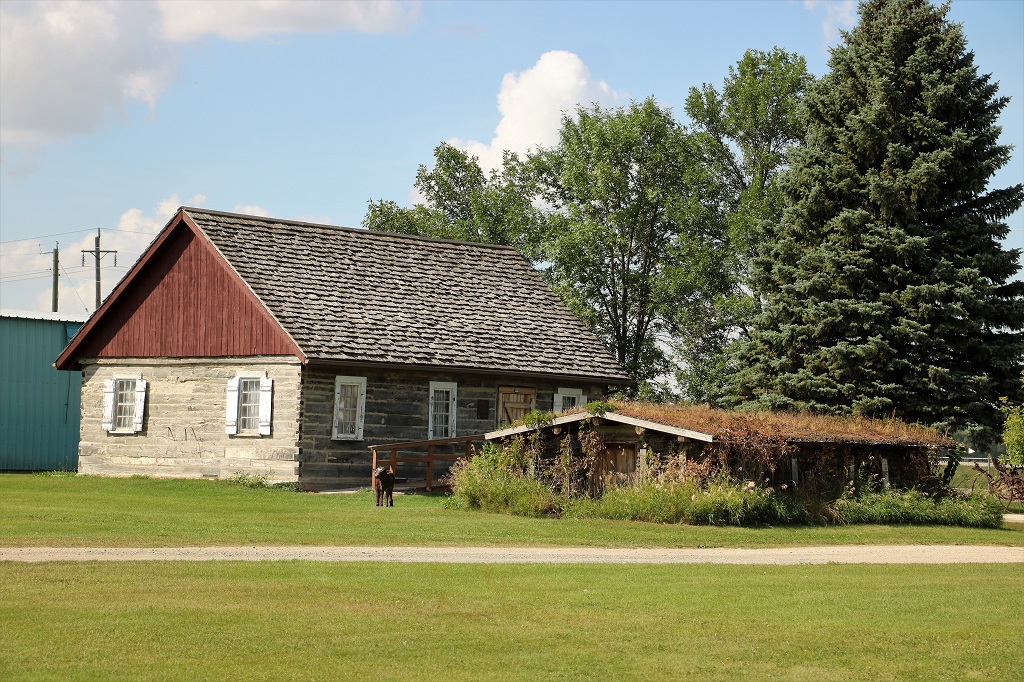
Newcomb’s Hollow turned out to be a very historically significant place in Manitoba (and Canadian) history.
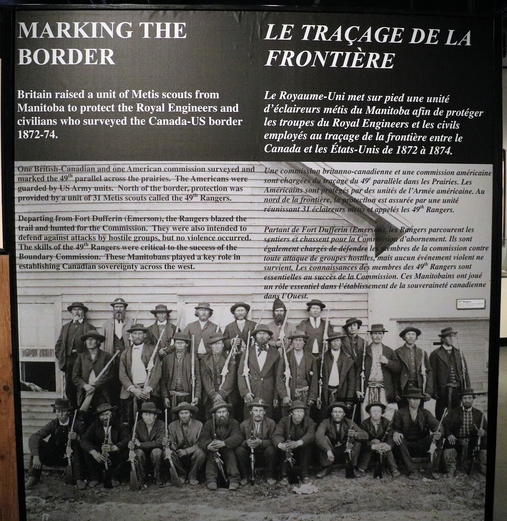
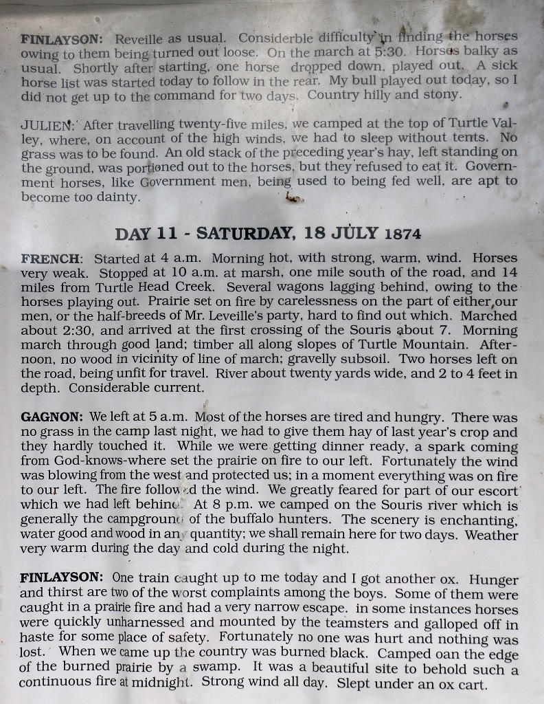
The need arose to mark the boundary between Canada and the United States. In 1873 a Boundary Commission was jointly formed by both countries, and guided by a Metis scouting party, the group travelled along the 49th parallel on the Canadian side using the old Native Trail. It took two years to mark the border. The Canadian crew consisted of 11 officers, 128 men, 114 horses, 55 ponies, 120 oxen and 179 wagons.
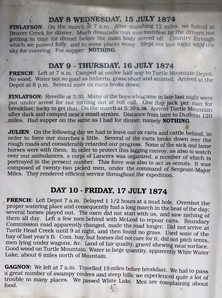
On the 10th day of this grand march from Fort Dufferin, the newly formed Northwest Mounted Police reached Newcomb’s Hollow. Accounts from several diaries were posted on the information boards.
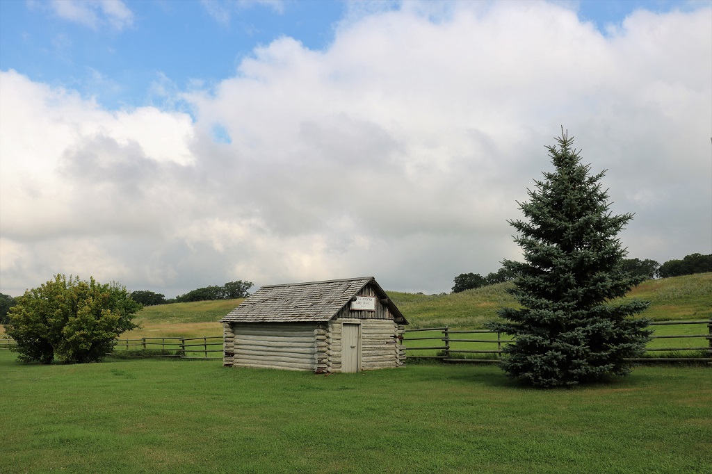
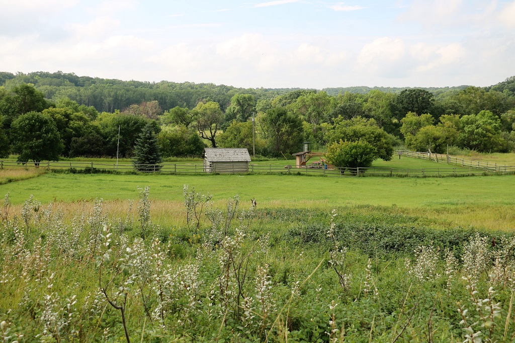
With pioneers coming westward on the Boundary Commission Trail there was need to register land and distribute it in an orderly and fair fashion. In April 1880 John A. MacDonald established the Land Titles Office at the junction of the Boundary Commission Trail and the trail from the Souris and Assiniboine Rivers leading to North Dakota. George Newcomb was appointed administrator over 2700 square miles covering a large part of present-day Southwest Manitoba and Southeast Saskatchewan. Newcomb’s two story house and land office was the social centre, often used for church services and also hosted the ‘First Agricultural Exposition’ in December 1881. By 1893 over 4,000 homesteads and 2100 pre-emptions were filed to cover an area of 1,200,000 acres of virgin prairie. This spot was once the busiest site in southwestern Manitoba.
There was a geocache hidden up on the hill near the old Land Title Office so, of course, we had to go find it.
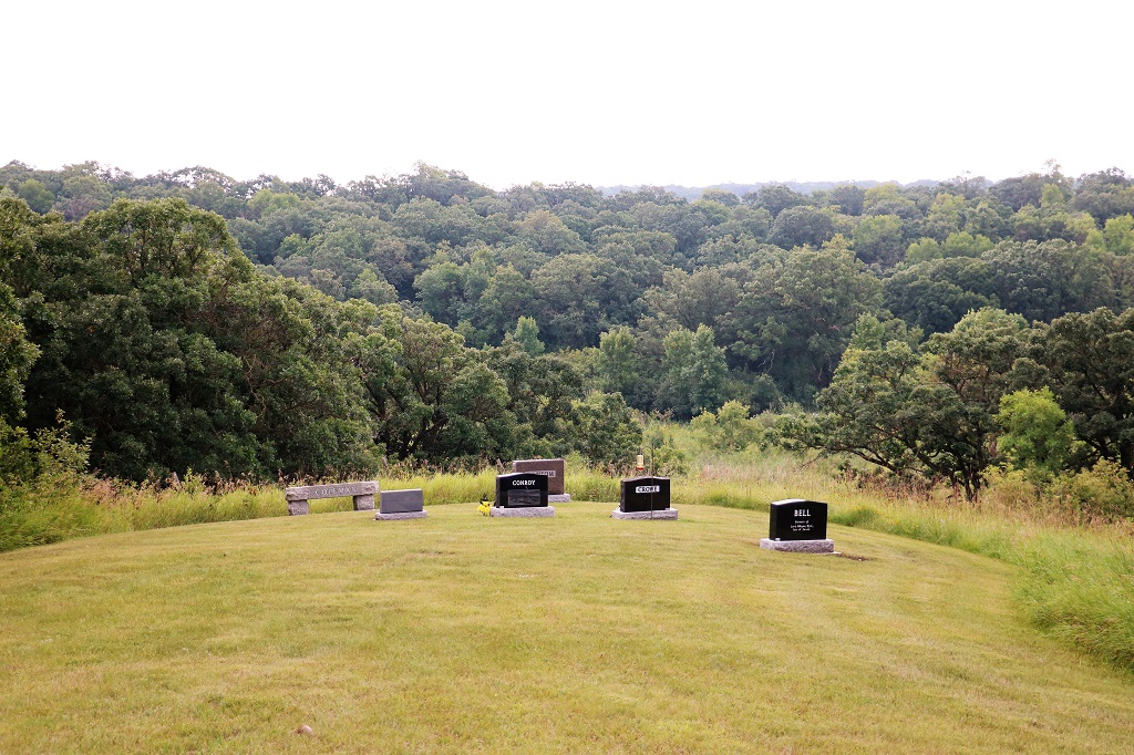
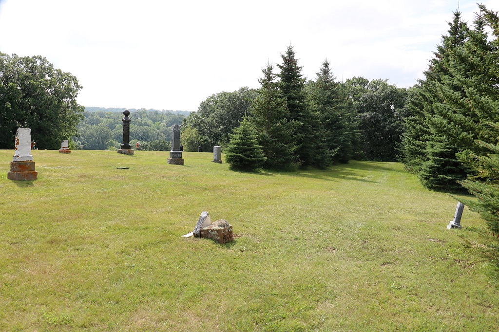
On the way to Newcomb’s Hollow we passed the Deloraine Pioneer Cemetery and there was a geocache hidden there as well.
The cemetery is still used. They planted a lot of fir and spruce trees and the cache was hidden under one of the lovely prickly ones. I found a nice bird’s nest while on the cache hunt.
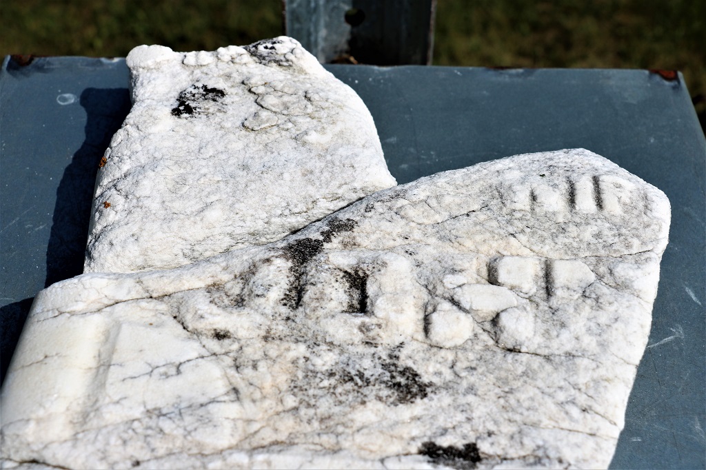
There was a guest book in a box with the lid weighted down with a couple of stones. After I signed the book I put the stones back and realized they were granite and had belonged to grave marker – and the big piece belonged to someone named John.
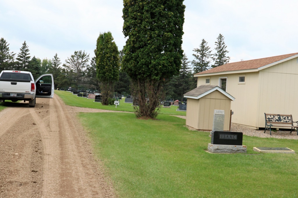
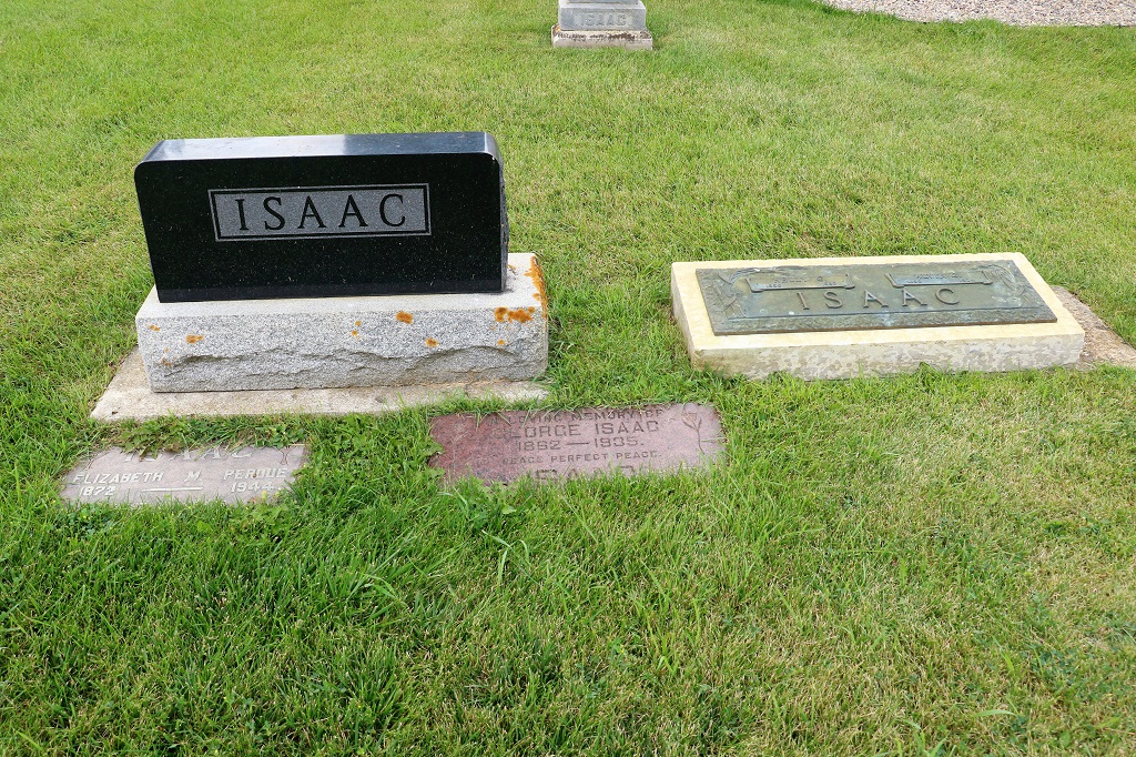
I had recently discovered that my mother’s foster parents, whom we knew as Grandma and Grandpa Isaac, were buried in Souris where Grandpa had been born. When I was growing up they lived in Victoria so I assumed they were buried there and had checked every cemetery to find them. When I was looking at his military records they said he was buried in Souris so I wanted to find the graves on this trip.
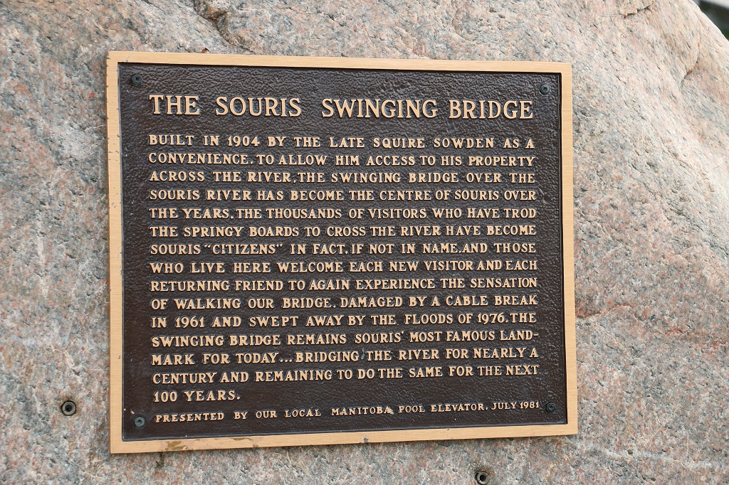
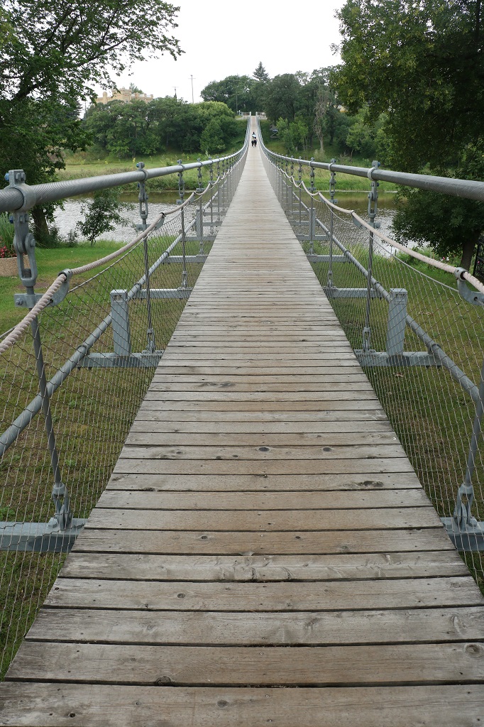
Souris is well known for its swinging bridge. The story of the Souris Swinging Bridge is one of resilience. Since 1904, the swinging bridge was reinforced in 1907, 1961 and yet again in 1974. The bridge was completely rebuilt after the floods of 1976 and 2011. The new design measures 184 metres (604 feet) tip to tip and regains the title of the longest swinging pedestrian bridge in Canada!
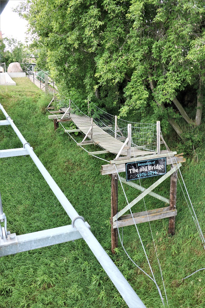
After the bridge was destroyed in 2011 the new bridge was built to survive floodwaters so it barely moves and certainly does not swing without a lot of effort.
The old bridge would certainly have moved a lot!
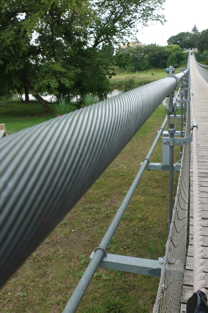
The cable is so thick my hand would only wrap halfway around it.
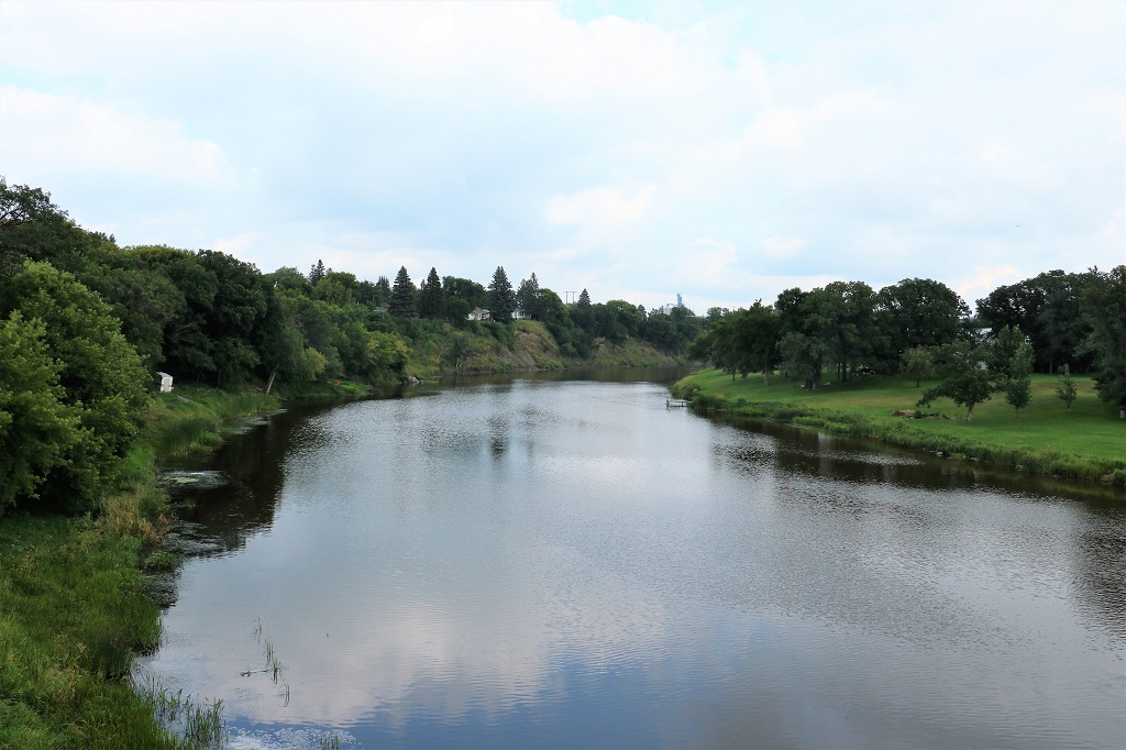
The Souris River.
The Souris-Glenwood cemetery has 3,000 graves in it. I had no plot number so we asked a fellow mowing the grass if there was a directory. There was one in a box at the front gate that we had not noticed, but he had another in his equipment shed and looked it up for me. Turned out we drove right past them! Grandma and Grandpa were buried right behind the shed. So funny. We were so busy looking at all the graves wondering how we would ever search them all that we didn’t even notice what was right beside the truck as we drove in.
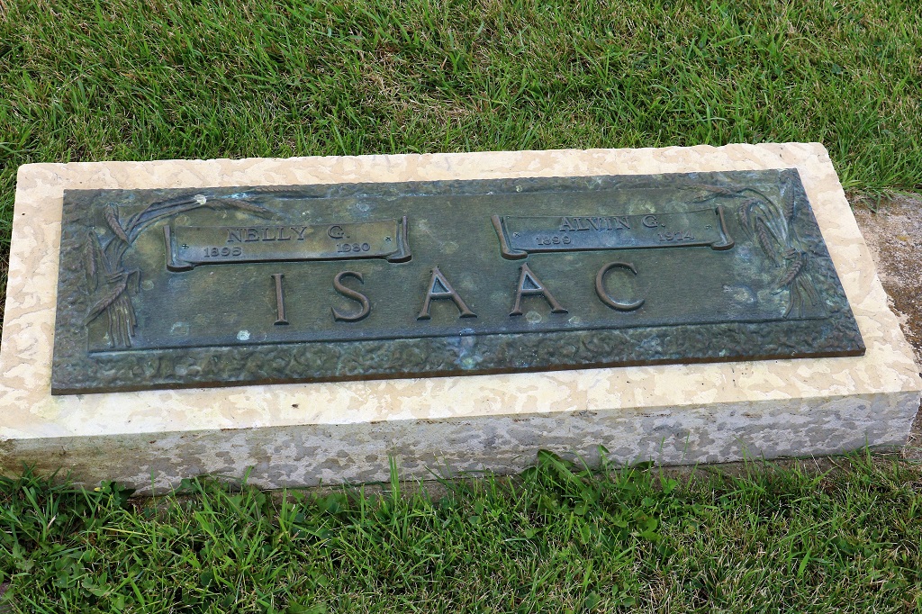
Beside my Grandma and Grandpa’s marker were markers for his parents and there was another Isaac behind and three more markers on the other side of the road – obviously a family section.
My grandpa’s parents.
Grandpa and Grandma Isaac. They raised my mom from age 9 to 17 after she and her sisters were orphaned when mom was 6.
We drove around Brandon looking at some of the big old houses and went past Display Building Number II built for the Dominion Fair. Brandon had established an agricultural exhibition in 1882 and it had become one of the foremost exhibitions in Western Canada. Since the 1913 construction, the building has been used continuously for exhibition purposes for the Provincial Exhibition of Manitoba.
The Daly House Museum had a nice little garden.
We are spending two nights in Brandon. Tomorrow we will drive eastward a short distance to Spruce Woods Provincial Park to see the sand dunes.
It is 188 km (118 miles) via Highway 3 from Winkler to Boissevain so we knew we had time to do an Adventure Lab in Morden before we left. Adventure Labs are a new element of geogcaching that take you to several places in a community or countryside where you find the answer to a question about what you have come to see. The Lab in Morden took us to see five of their old brick or stone buildings.
The old post office. Built between 1913 and 1915.
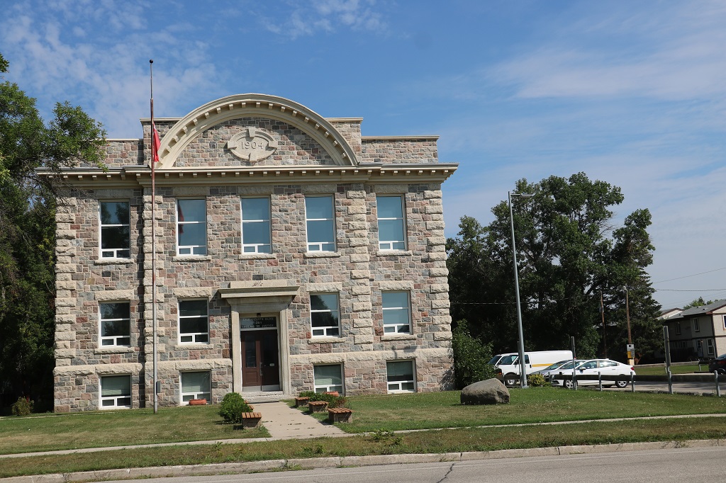
The Morden Court House was built 1905 on nine acres that the Manitoba government purchased for a court house and gaol. It opened in 1906 and Morden became the seat for the Southern Judicial District. There were cells in the basement as well as an apartment for the resident caretaker.
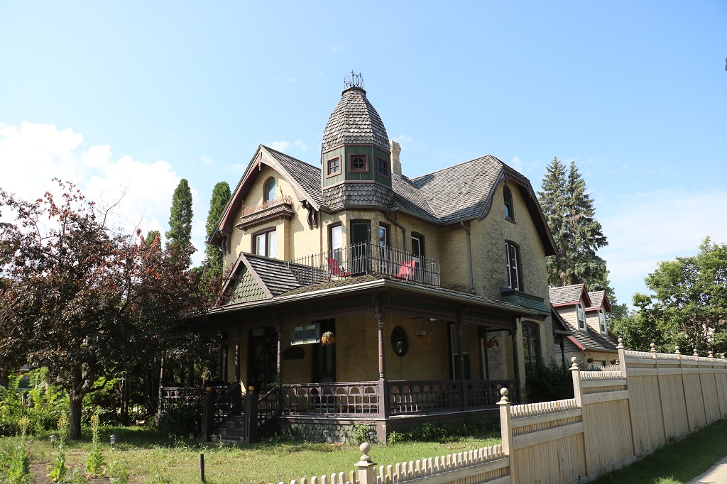
This is a Queen Anne style of architecture. The house was built in 1894 for a pioneer grain merchant. The brick was manufactured locally. It was designated a municipal historic site in 1995 and has been carefully restored.
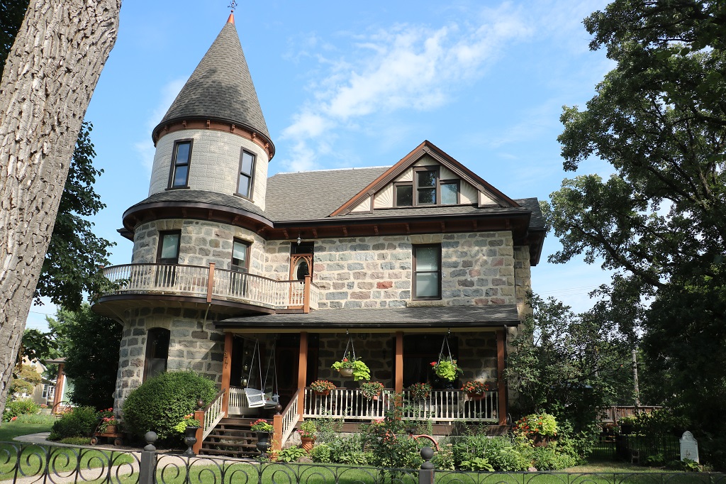
This was my favourite. Another Queen Anne style. Built in 1899 for Morden’s first medical practitioner who arrived in 1884.
I couldn’t get a photo of the last house. It was too close to the road with too many trees. The one below is also quite hidden by trees. It was across the street from the house above and equally as nice. It may be a B & B.
So, it was after 11 before we left Morden and embarked on our tour through several little communities on the way to Boissevain.
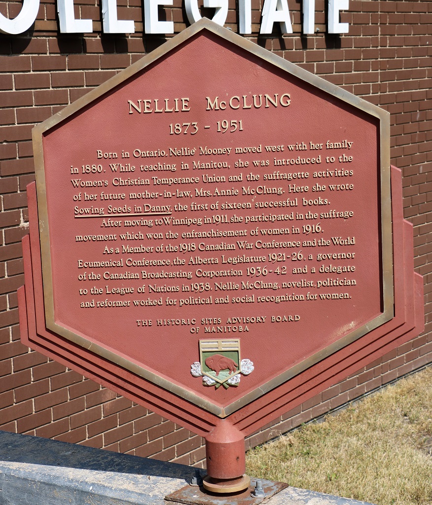
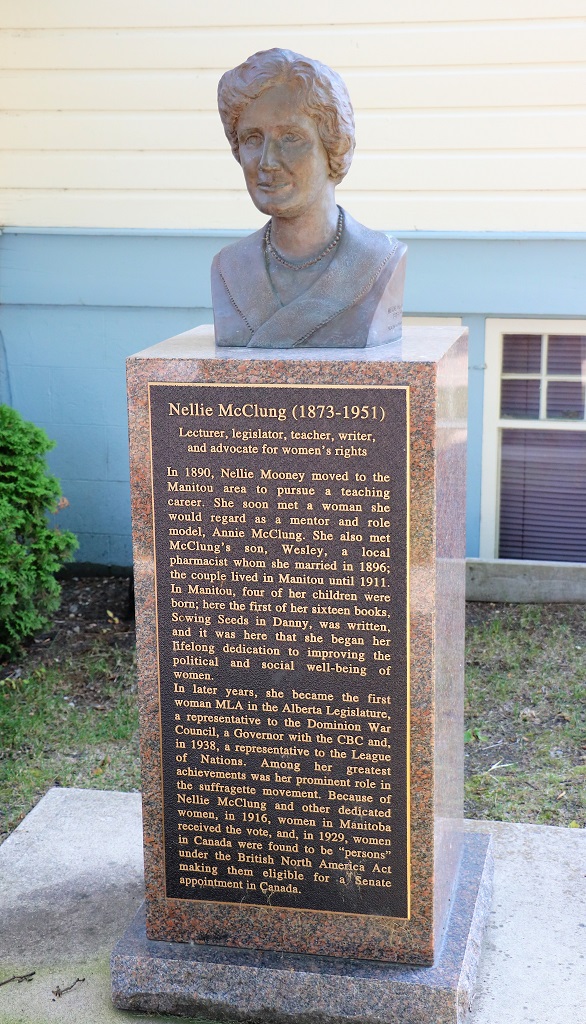
We stopped in Manitou to see the information about Canadian women’s rights activist and author Nellie McClung. We had hoped to see the houses she lived in to learn more about her, but they were all closed.
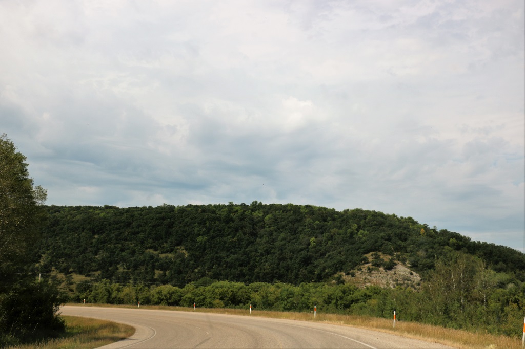
Coming from BC as we do, this is not an exciting image. But in Manitoba where so much of the land is flat this forested, winding downhill stretch of road into La Riviére and Oak Valley is quite novel. Actually this part of southern Manitoba is dotted with gullies, and gulches, and small hills and lakes.
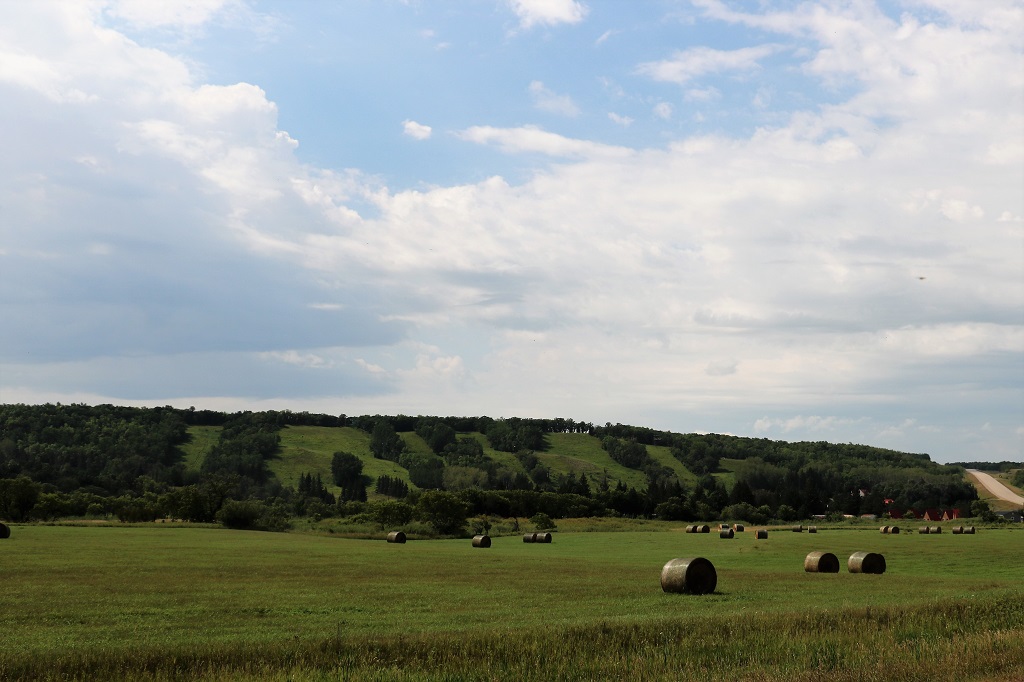
La Riviére is home to Holiday Mountain Ski Resort. These are the runs. They even have a chair lift.
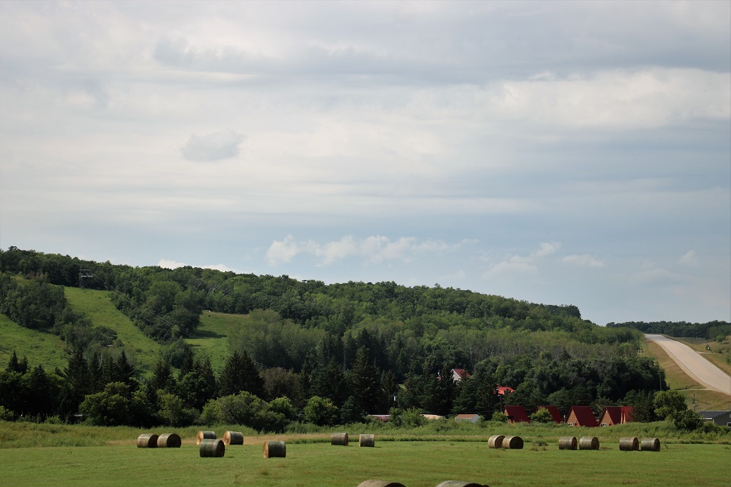
The Resort complex is the red-roofed A-frame cottages.
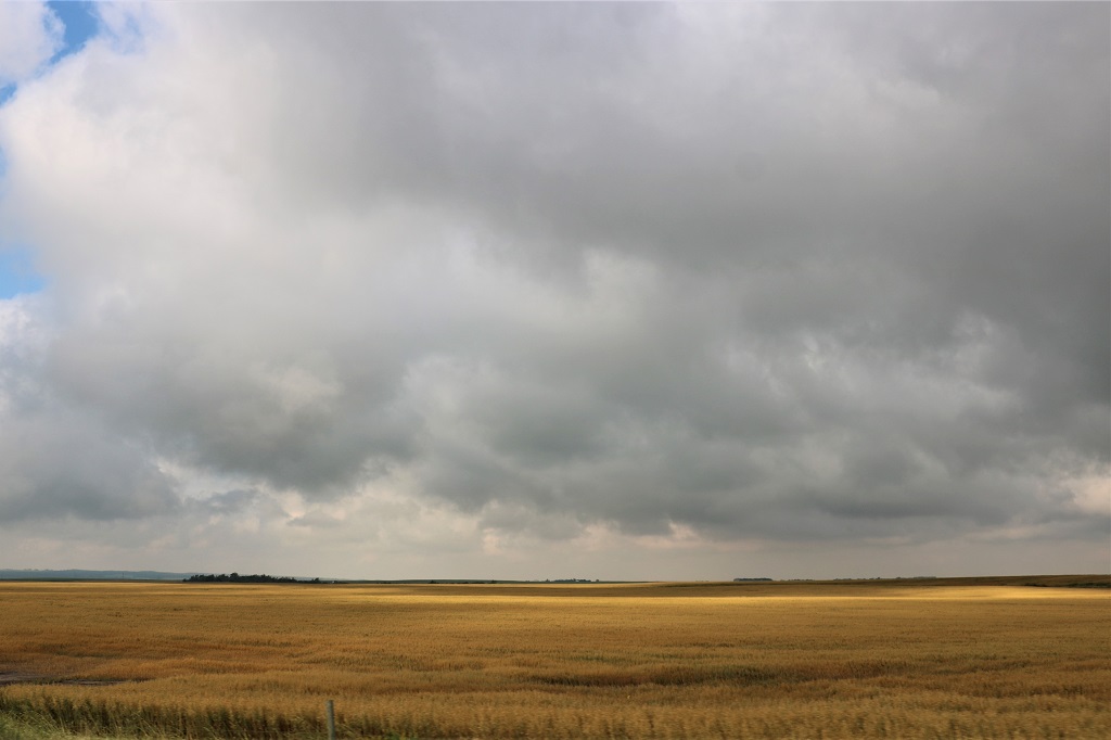
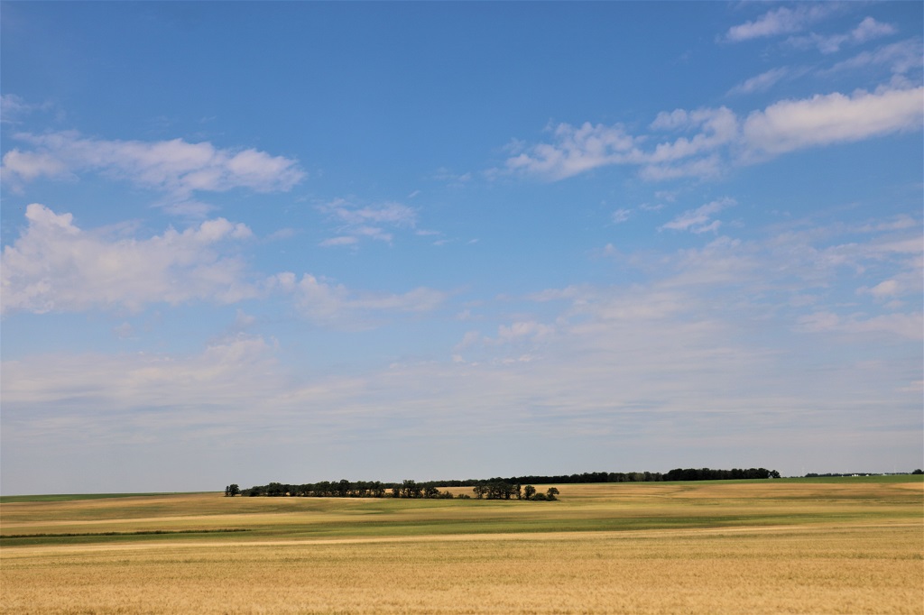
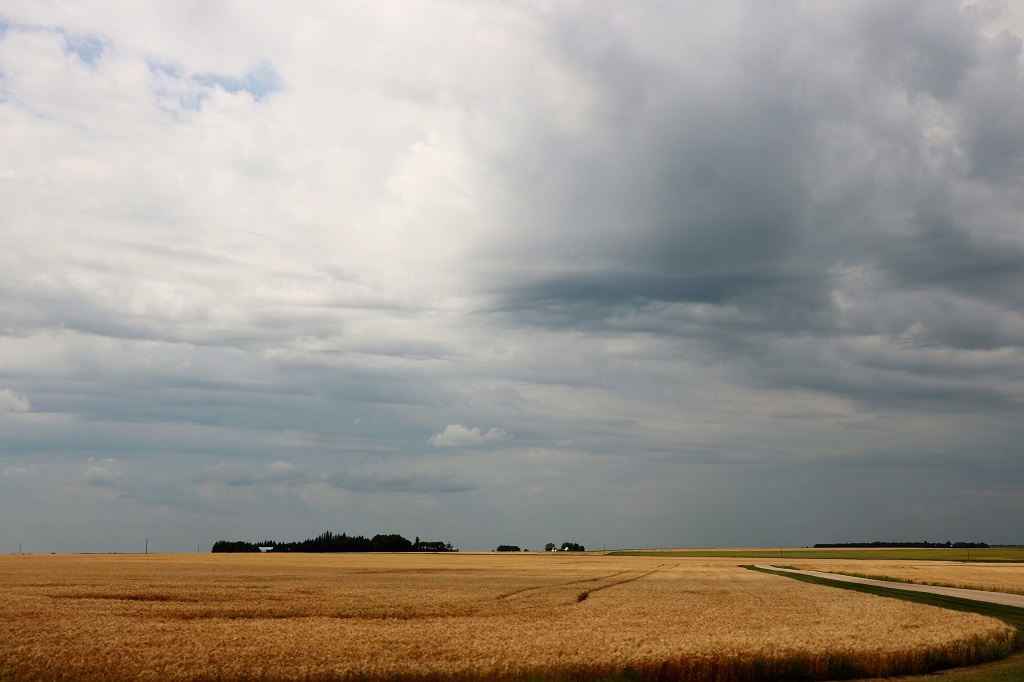
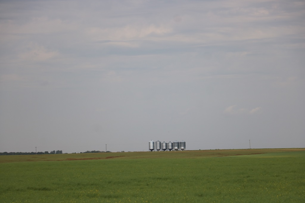
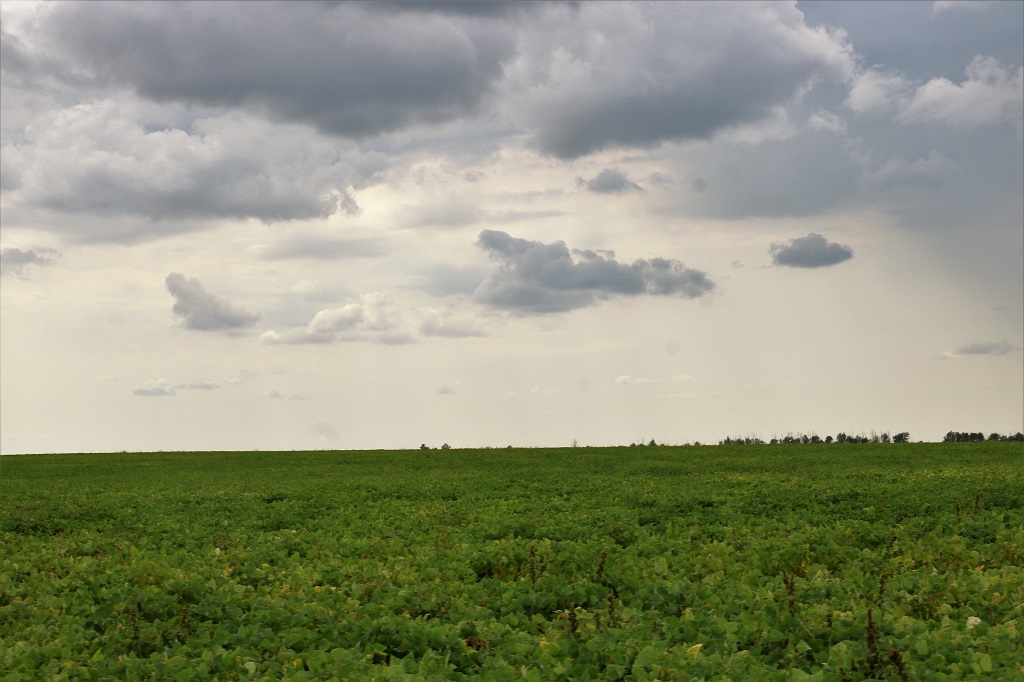
As long as we are on the prairies there are going to be pictures of fields and big sky. I love the wide open spaces.
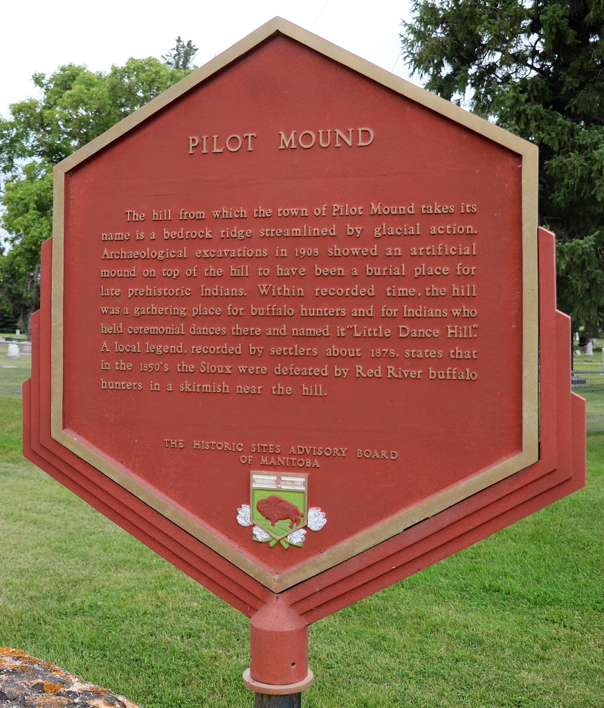
The mound was also a directional marker for early fur traders, explorers, and settlers.
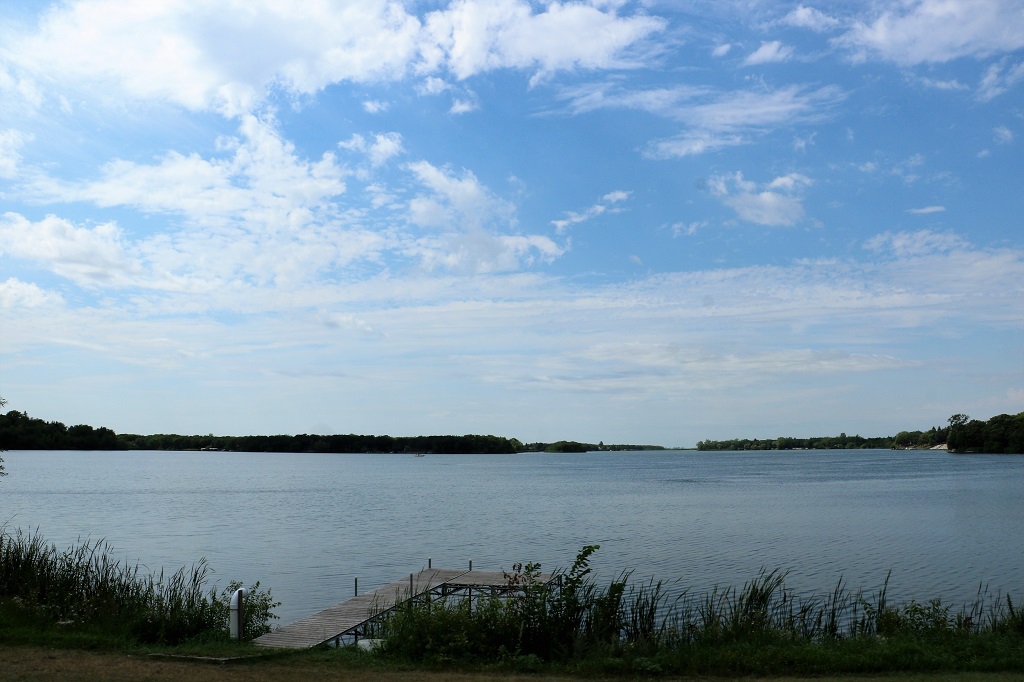
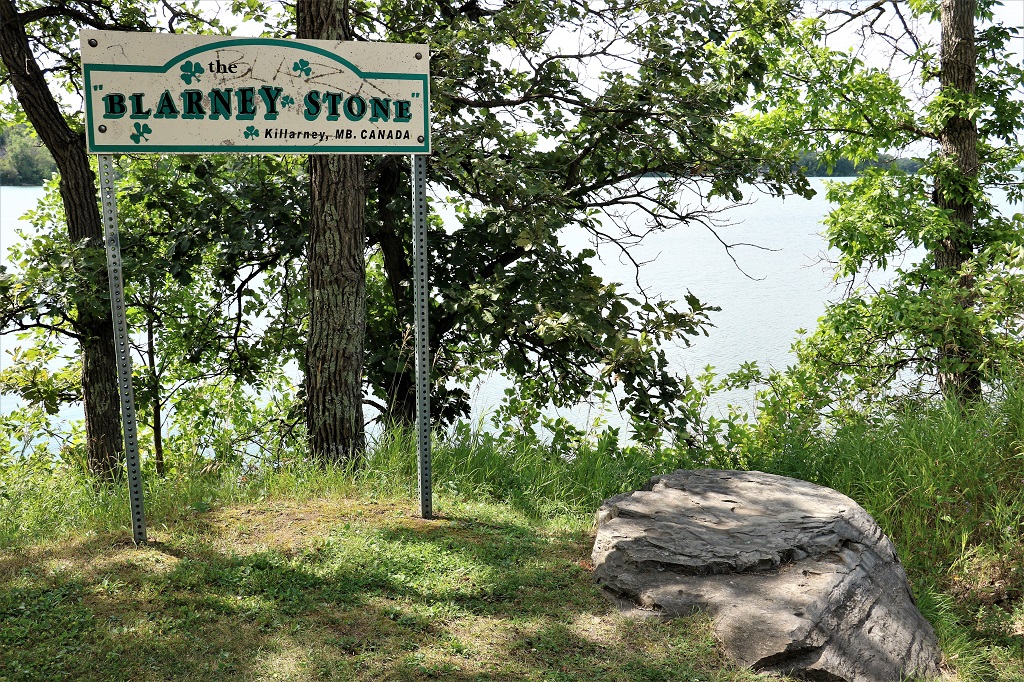
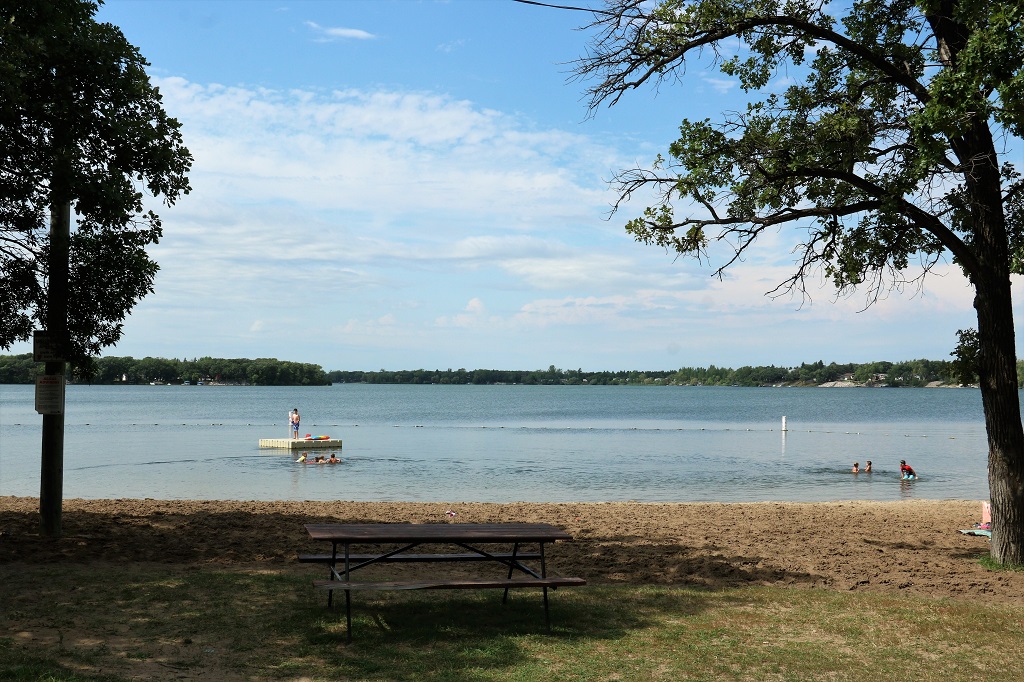
Killarney is so named because the lake here reminded one of the early settlers of the Kerry Lake district back in Ireland. And the town has embraced it’s Irish link wholeheartedly. Even the fire trucks are green! Many street names and businesses have Irish Names. And in Erin Park on the shores of Killarney Lake you will even find a “Blarney Stone.”
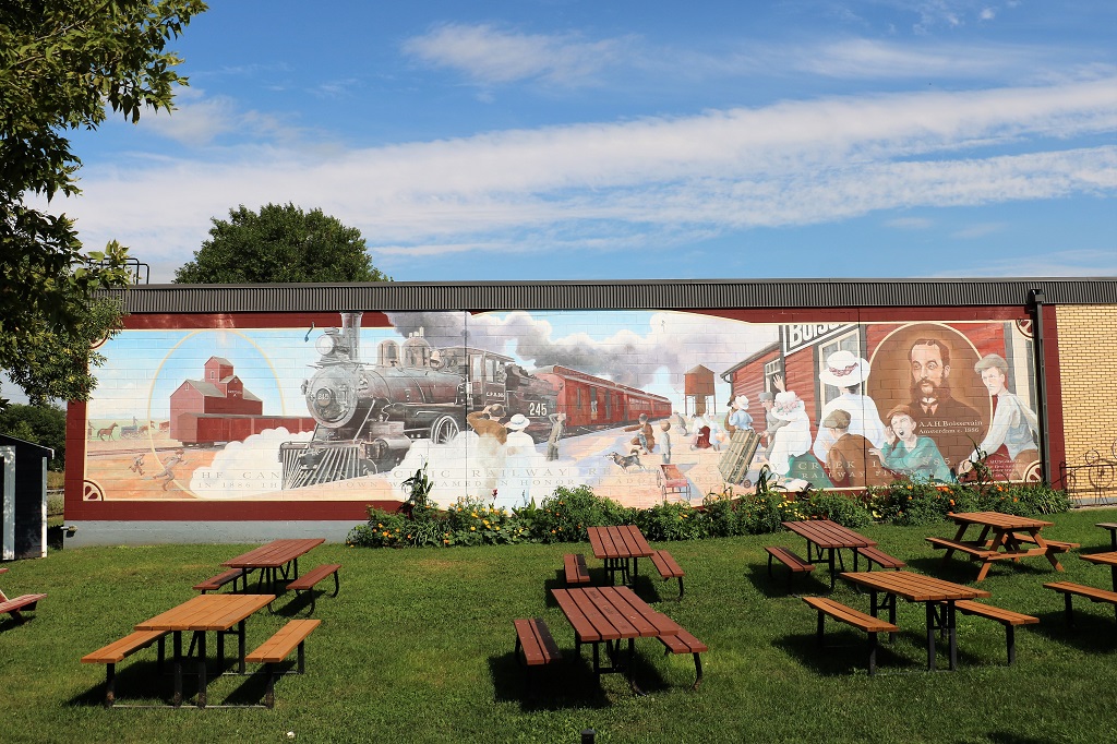
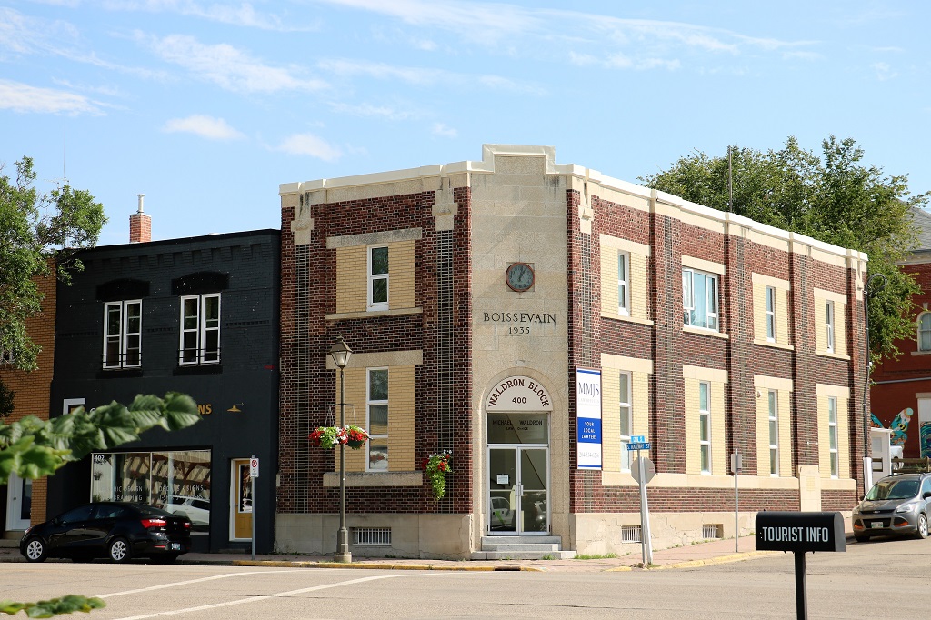
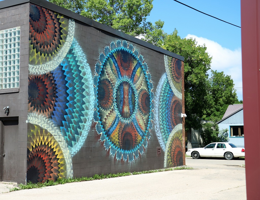
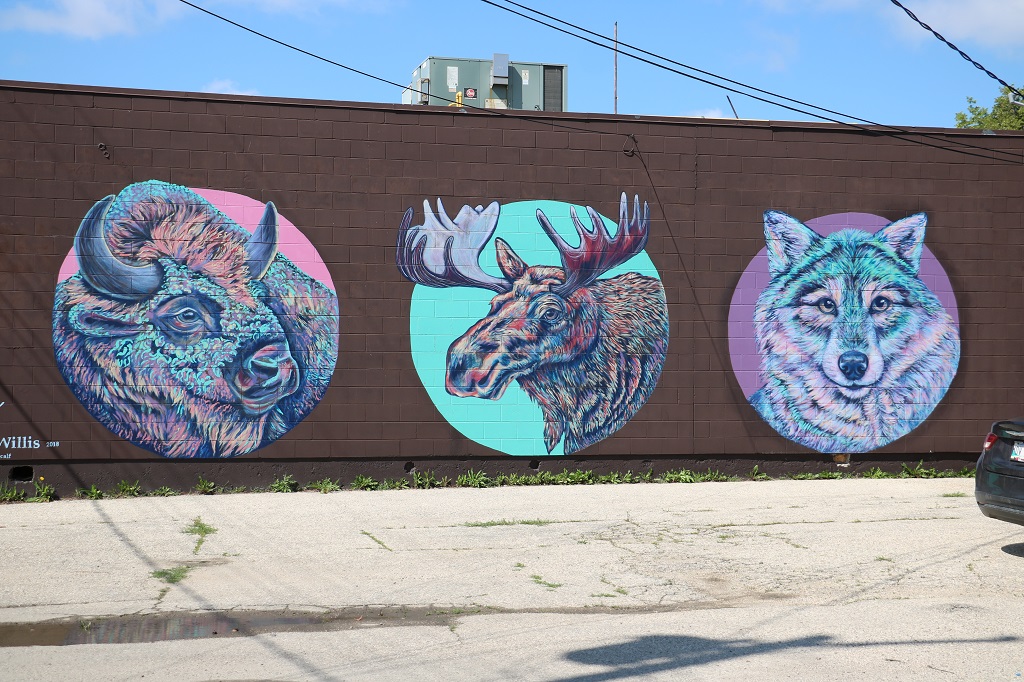
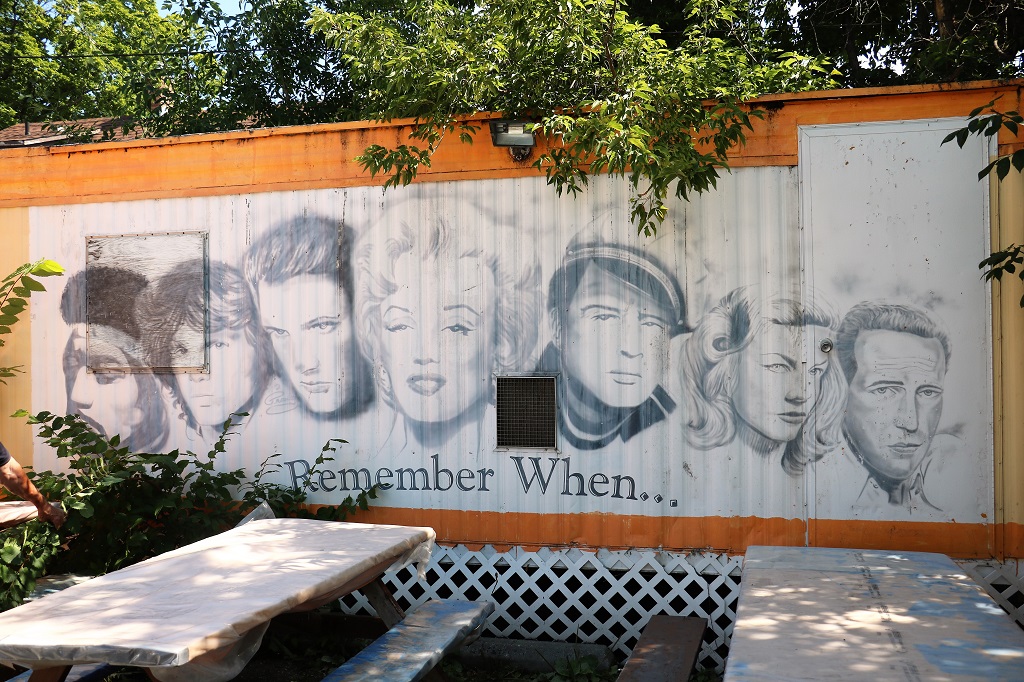
We arrived in Boissevain at 4 and spent a half hour doing another Adventure Lab that took us to some of the 15 murals around town. Murals seem to be a recurring theme in a lot of places, but they are usually very well done.
Boissevain was on the Northwest Mounted Police Boundary Commission route. This mural shows Commissioner George Arthur French leading the first troop across Western Canada in 1874. The Northwest Mounted later became the Royal Canadian Mounted Police. The little boy on the left is listening to the stories about his great-grandfather Commissioner French and is so fascinated he becomes an RCMP office when he grows up – as depicted by the Mountie on the right.
This mural depicts the first locomotive to arrive in Cherry Creek around 1886 as a result of Adolphe Boissevain (portrait on the right) selling shares in Europe to raise the funds. The town was later renamed in his honor.
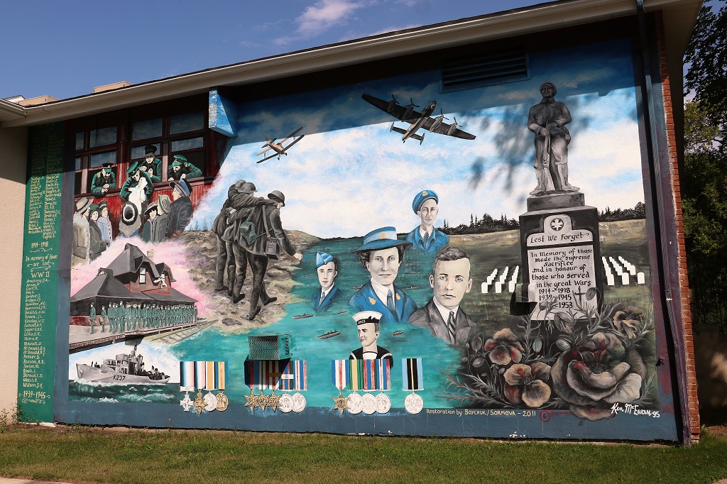
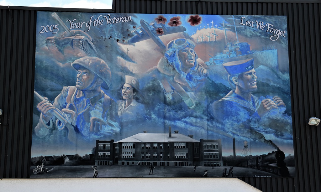
Any murals on the walls of Canadian Legions rightly commemorate the huge sacrifices made for our freedom by so many men and women. And rightly so. They should never be forgotten.
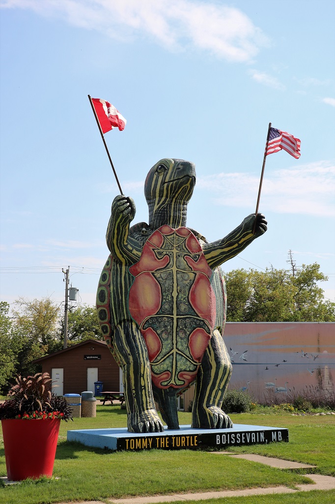
Our hotel is across the street from Tommy the turtle. He waves both a Canadian and a US flag because the American border is only 25 km south of here. The Boissenvain, Manitoba – Dunheith, North Dakota border crossing is adjacent to the International Peace Garden that spans the border into both countries. It was established in 1932 not long after the border crossing was opened. We toured the Peace Garden when we did our 17 States road trip in 2017.Tomorrow we drive north about 73 km to Brandon. Along the way we will stop in Souris to find my mother’s foster parent’s graves. We spend two nights in Brandon and then drive west again into Saskatchewan to do some touring about the southern small towns of that province.
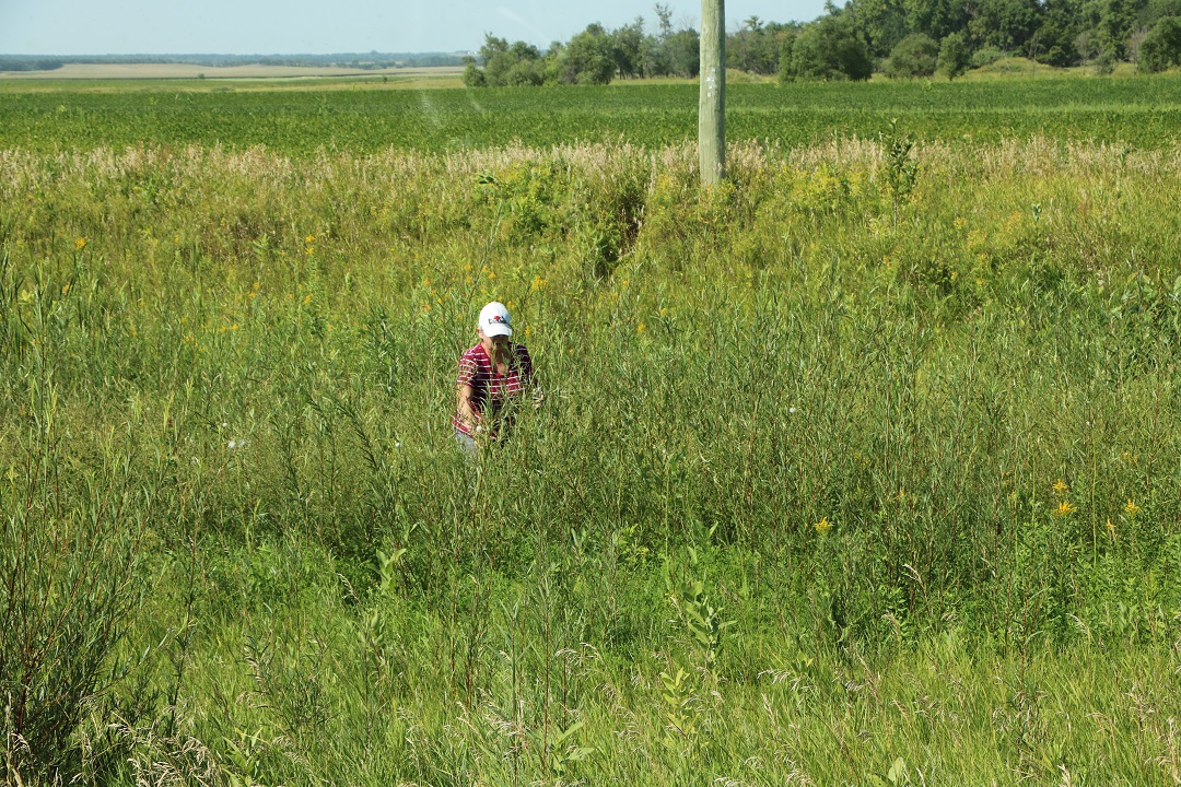
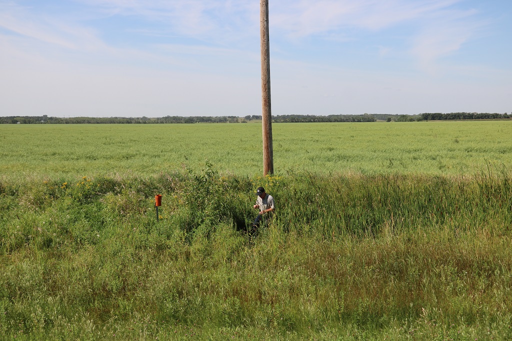
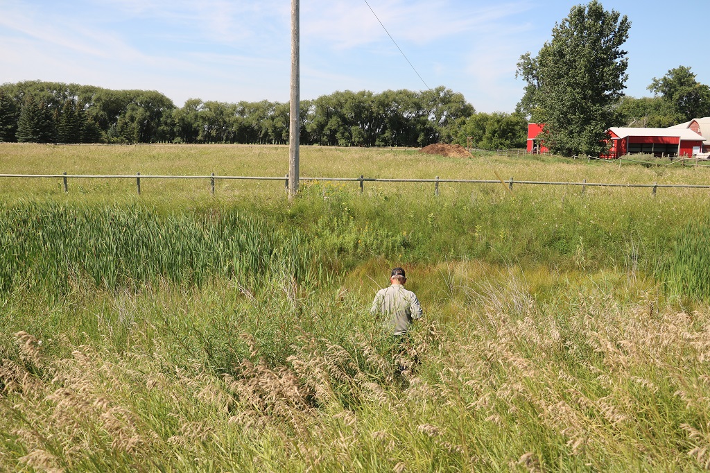
We spent most of the day in Morden, which is only 14 km west of Winkler. There was another geocache trail on power poles just west of Morden that we decided to find. There were 25 caches in total and we found them all except one.
At home we often have to do some bushwhacking to get to a cache, but here it was grasswhacking. We really appreciated the roadside sections that were mowed. They had so much rain here this spring that everything has had a good growth year. I almost stepped on a frog at one cache location.
After we completed our trail we went to find a cache hidden in a metal sculpture made by a retired farmer that he called the Covid Warrior.
One more of the things we put under the category of “We would never have seen this except for geocaching.” It is 11 feet tall. Very nicely done.
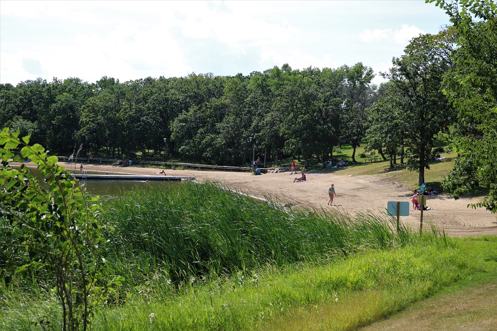
There was a geocache and a virtual cache overlooking the dam on Lake Minnewasta. And this sign.
Across the lake is a lovely sandy public beach and campground managed by the City of Morden.
This is an awesome, and obviously very popular, water playground. The kids were having a blast.
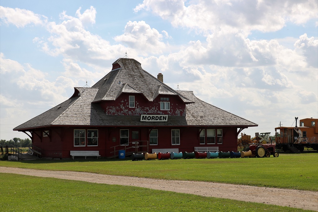
We had lunch on a shaded picnic table and watched the kids play for awhile then drove back into Morden and headed for the Thresherman’s Museum, which is located halfway between Morden and Winkler.
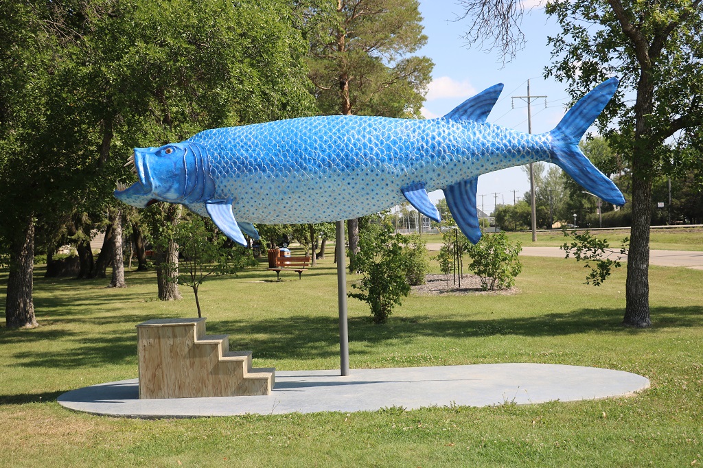
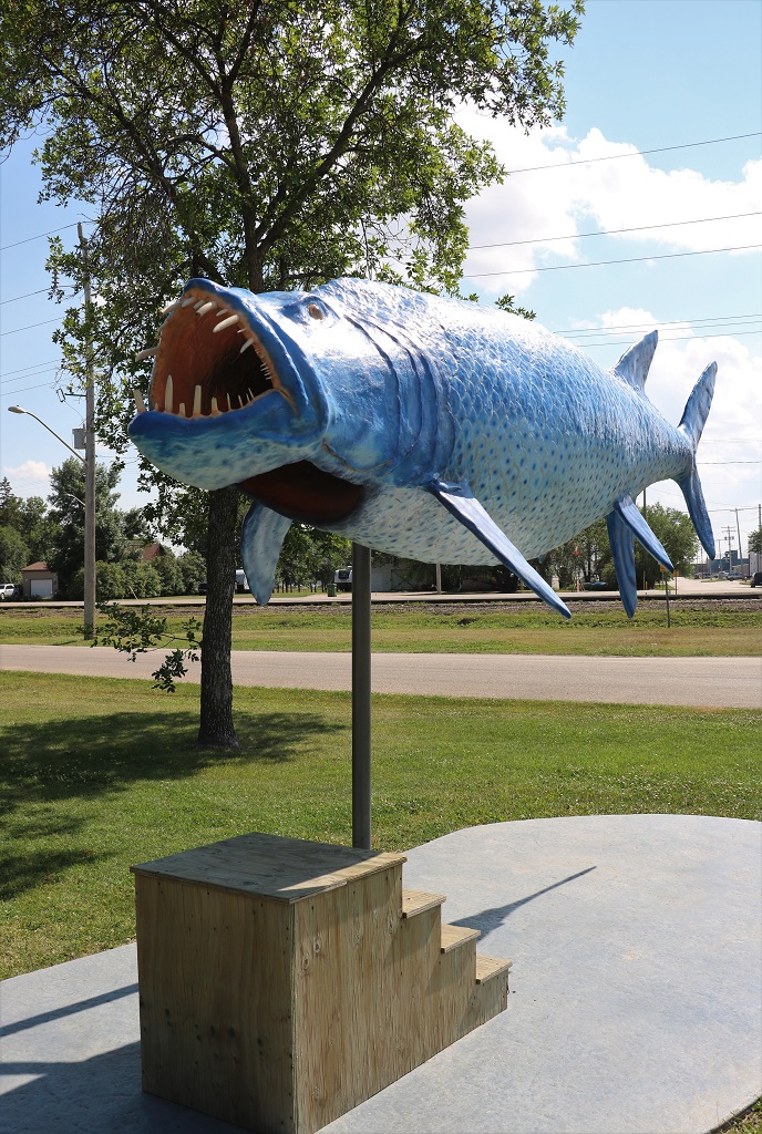
This is a lifesize model of a Xiphactinus; a ferocious marine predator. Fossil remains of several of them have been found in the Morden area. They have a Fossil Discovery Center that displays them and many other fossils. Most of Manitoba was once covered by gigantic Lake Agassiz that was created by the melting prehistoric Laurentian Ice Flow.
I like the steps that you can climb and stick your head inside the creatures mouth.
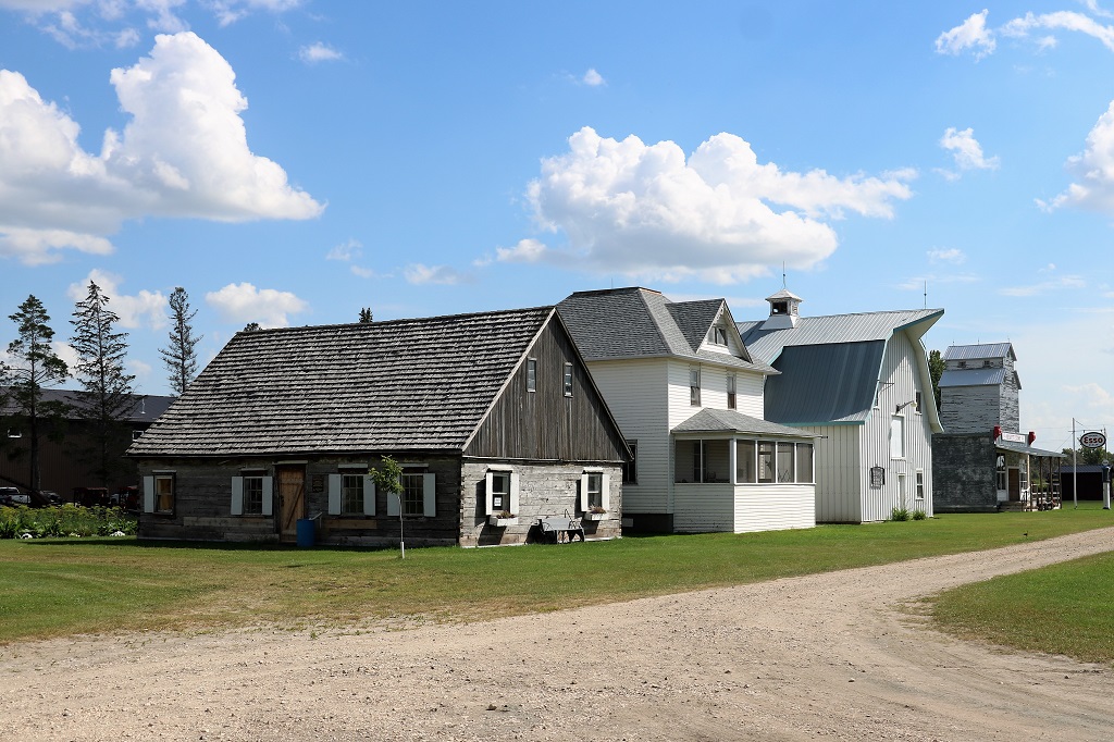
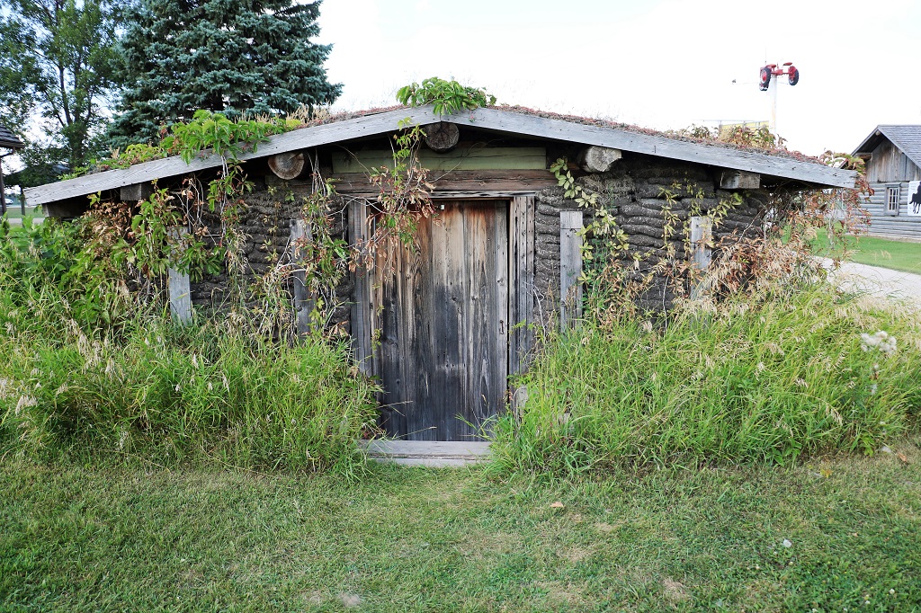
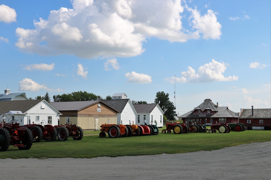
The Thresherman’s Museum was a collection of buildings, some replicas, some heritage. All were open to walk around in and furnished or equipped with early settler to mid-1950s items.
The sod house was half buried. You went down four or five steps to enter. This would have greatly helped retain heat during the cold winter storms.
There were five or six big sheds with farm equipment and other items in them.
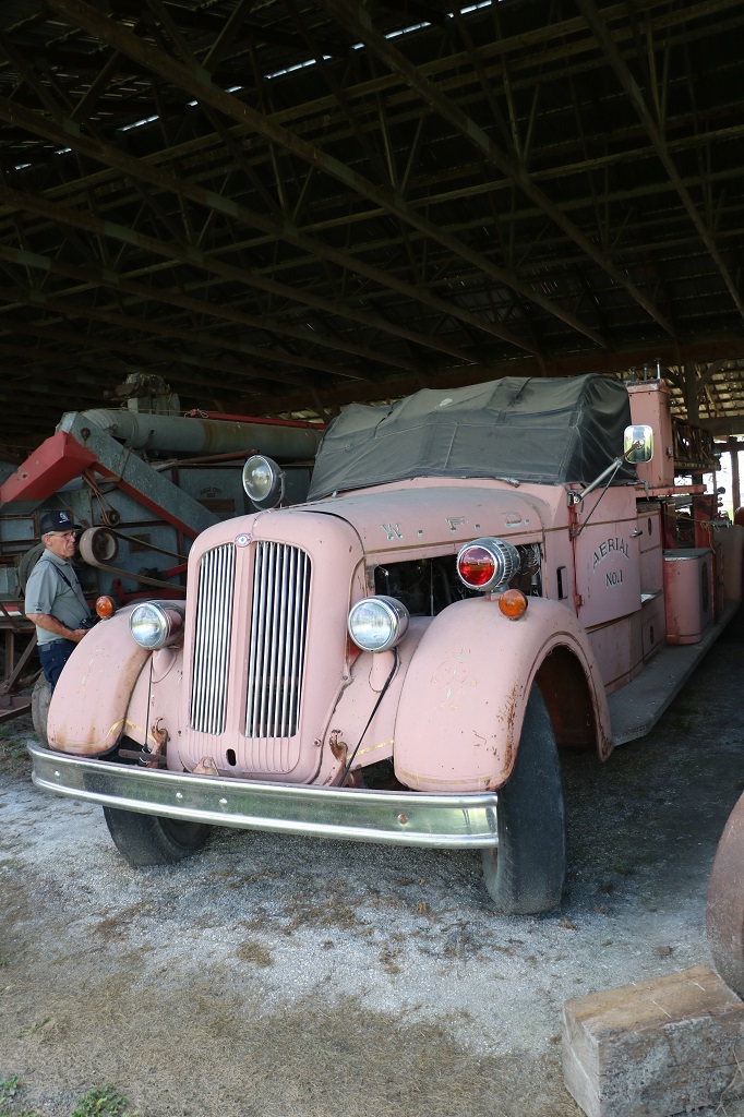
The sun did a real number on the red paint of this old aerial fire truck.
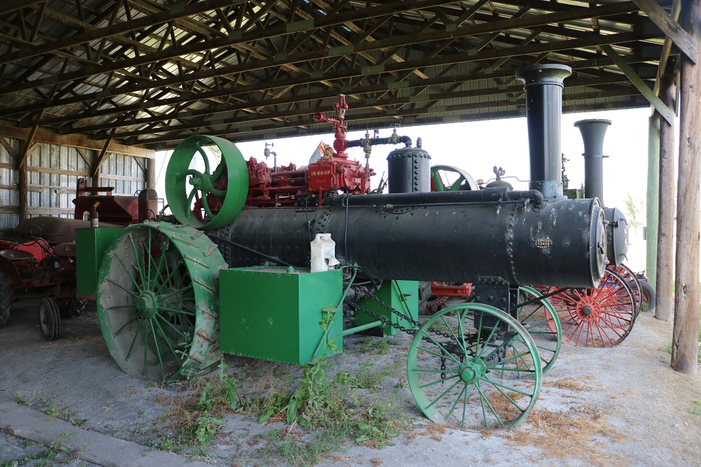
This steam tractor looks a lot like Thomas the Train.
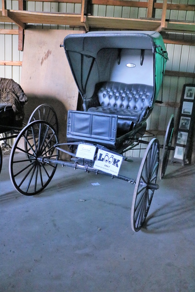
A doctor’s buggy from the 1920s and 1930s.
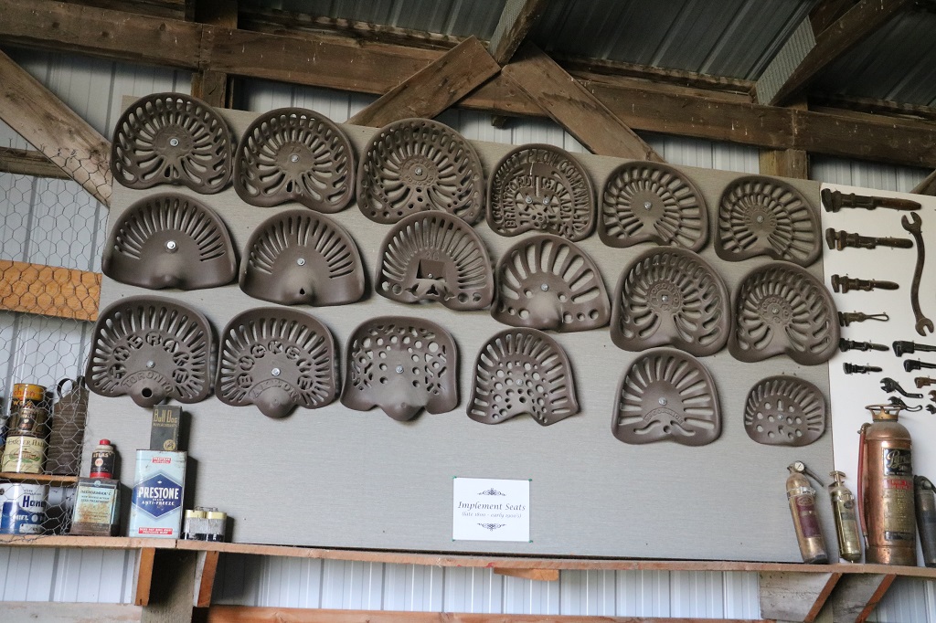
John and I both liked the collection of farm equipment seats.
We had two fun days of geocaching. We found 38 caches yesterday and 28 today. We leave Winkler tomorrow and head west on Highway 3 as far as Boissevain. It isn’t very far away, only a couple of hours, but I am sure we can manage to take all day to get there.
Today and tomorrow are geocaching days. We planned to find caches on this backroads cross-Canada road trip, and we have found quite a few, but we expected to have been caching more than we have. Between driving time and stopping to see things time we have only picked up a cache here and there. So we came to Winkler to spend two days finding geocaches.
Last night while I wrote my blog John made up a list of caches to find and we headed out an hour or so after breakfast. There were 30 caches hidden on hydro power poles along a gravel road so they were our first goal. The electric company is changing out the poles for taller ones so three of the hides were gone with the old poles. We found all the rest though.
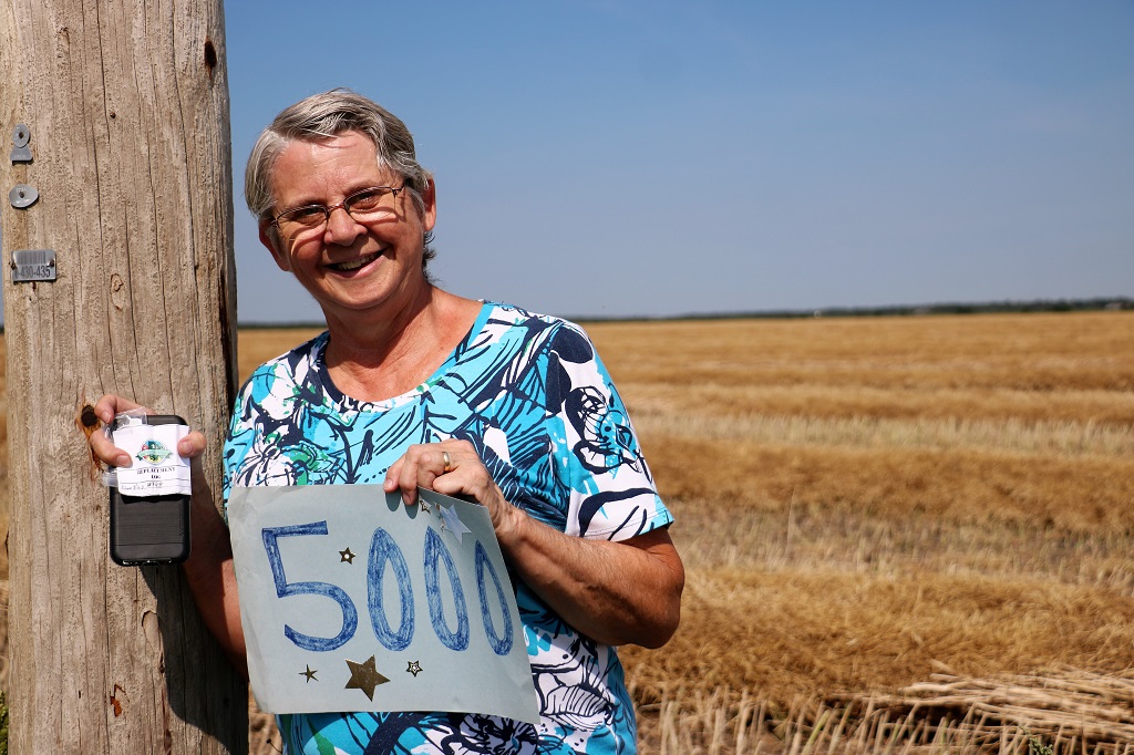
The fifth cache we found today marked my 5,000th find since we began caching in May 2015.
To date, I had found 10 more caches than John, so a little further down the road he got his 5,000th as well.
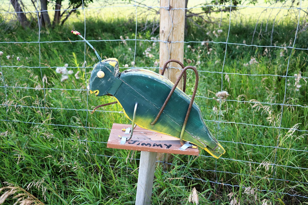
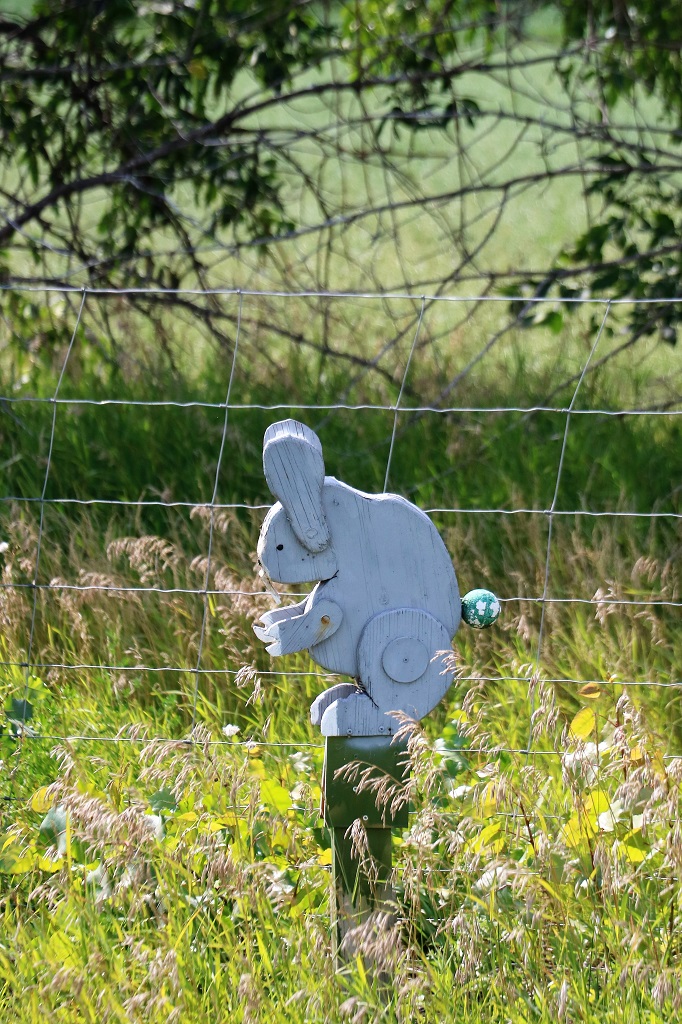
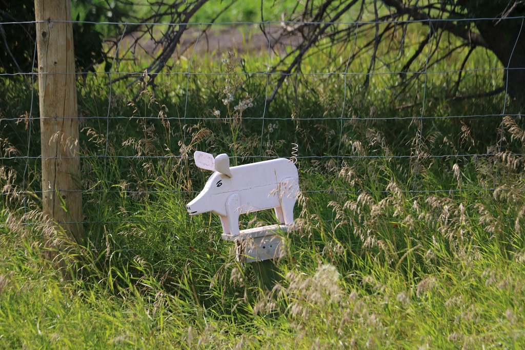
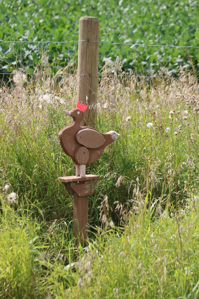
After we completed the 30-cache trail we drove to neighbouring Morden and had lunch at a park before heading south to Woodhenge. Along the way we found six cute hides. Someone likes to make things.
Called Jimmy, but should probably be Jiminy for Jiminy Cricket from Pinoccohio
This cache was called Bouncy Bunny. The ears and front legs move and the entire bunny moves back and forth on the back legs.
Next we had Arnold the pig from the old TV sitcom “Green Acres.”
The chicken cache was Pat. The wings move and the chicken rocks forward and back on the legs.
Followed by Chrissy the cow.
And finally Rambling Rose, the skunk. The tail lifted up and down. Very cute and very clever.
The Winkler area is old lake bottom and Morden is on higher ground so we actually went up a hill!
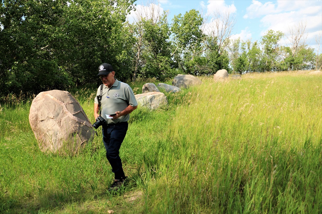
When John was looking at the geogcache map to select some caches to find, he saw an earthcache called Woodhenge. Earthcaches have no container with a log paper to sign. They are places of geological or geographical interest. When you go to the co-ordinates you will be asked to submit answers to questions about what you learn in the write-up or information boards or personal observation. Only after you have sent the required answers in a separate email to the cache owner do you log the cache as found. We like Earthcaches because we always learn something as well as stop at places we otherwise may just drive past. As soon as John showed me what Woodhenge was I said we had to go find it.
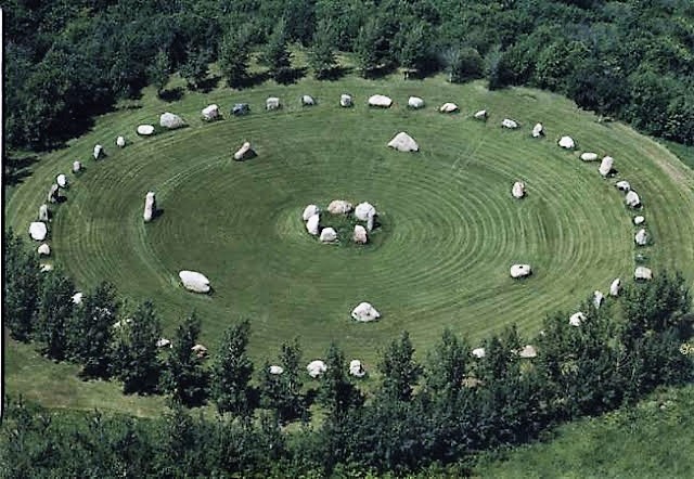
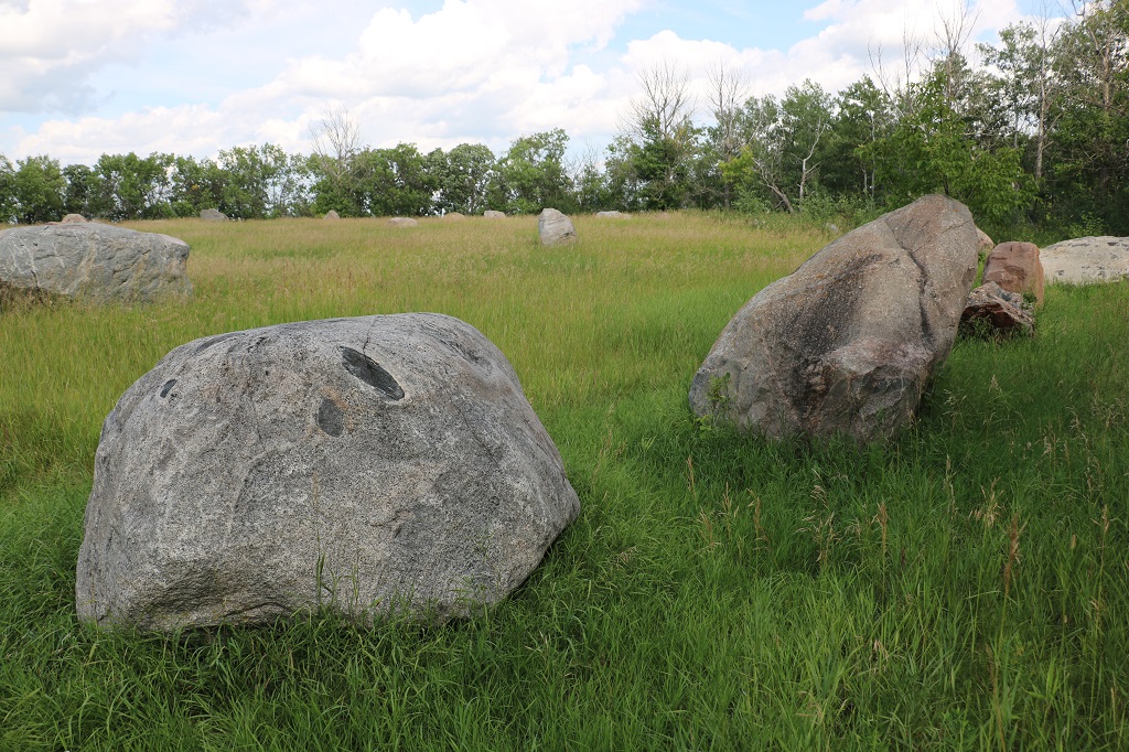
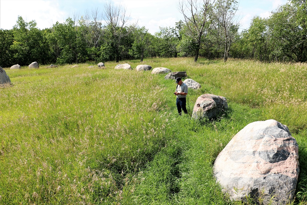
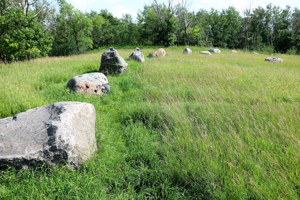
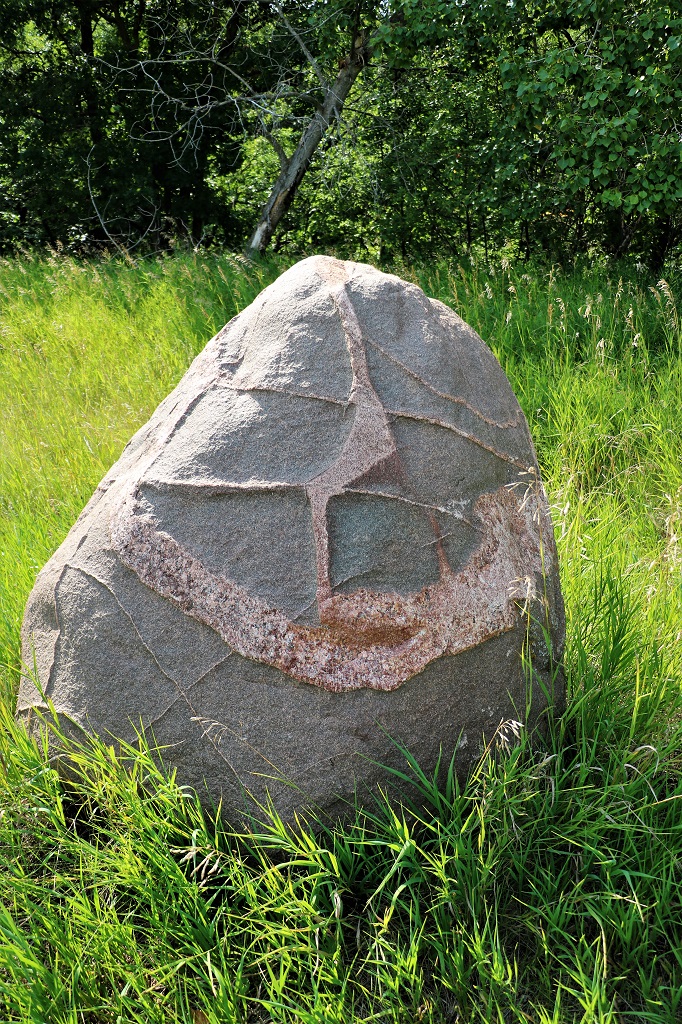
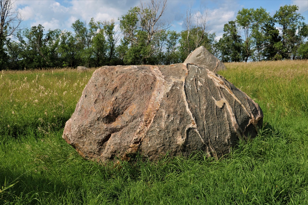
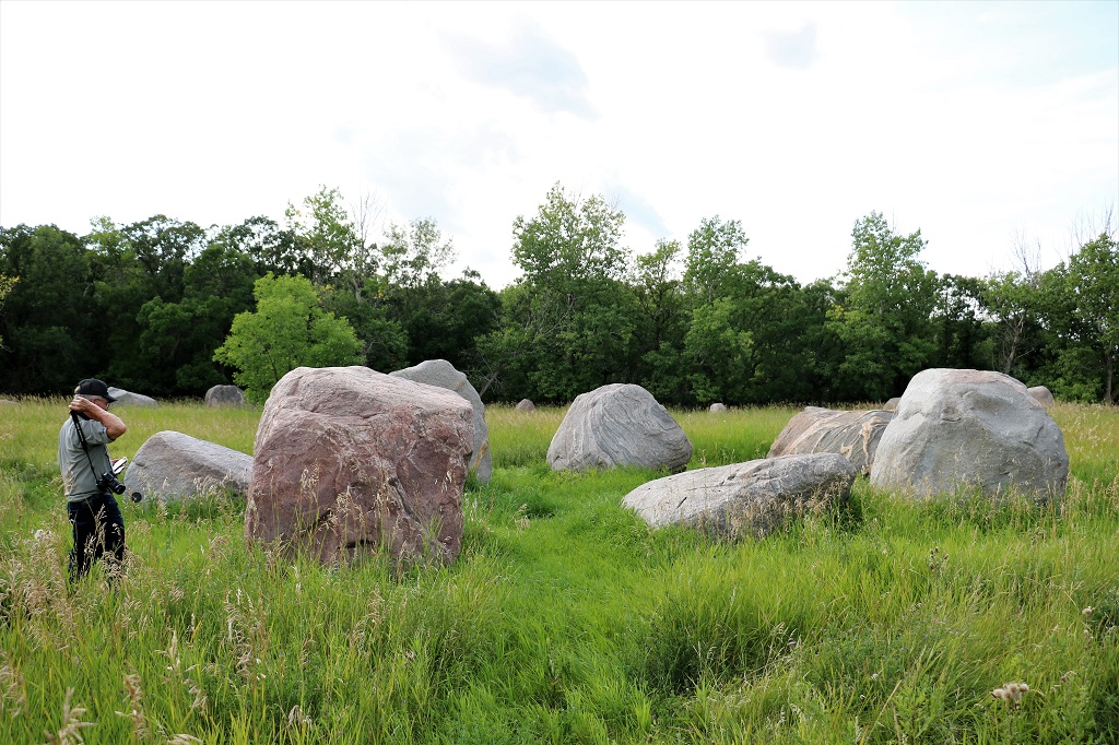
Woodhenge was created over several years by an art teacher from Morden named Marcel Debreuil. He had been to Stonehenge in England a couple of times and decided to make his own stone circle in Manitoba. He searched for large boulders (erratics left behind by long ago glaciers) in the Manitoba prairies and built a massive Stonehenge-like circle on his property which he called Woodhenge. This overhead image shows what it was like when Marcel owned the property and kept the field mowed.
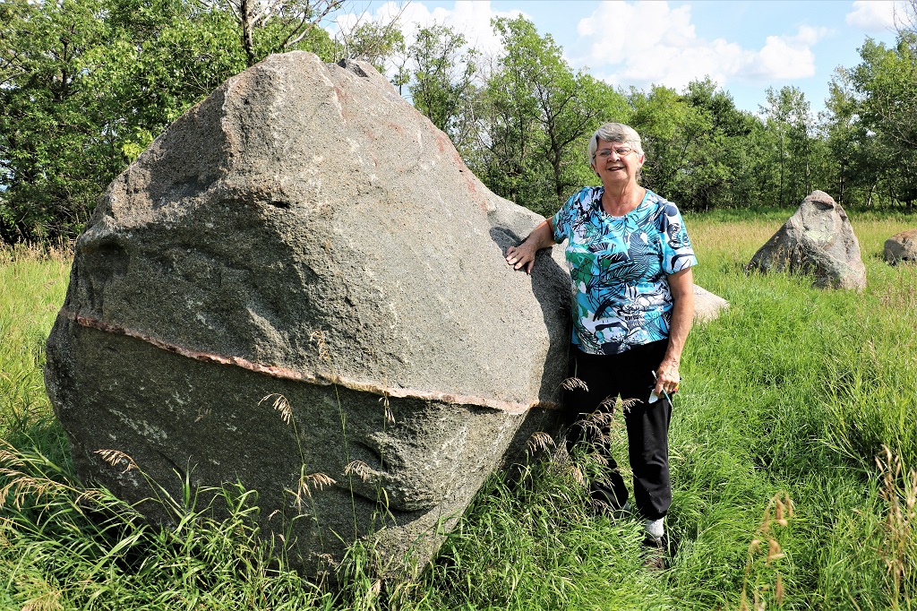
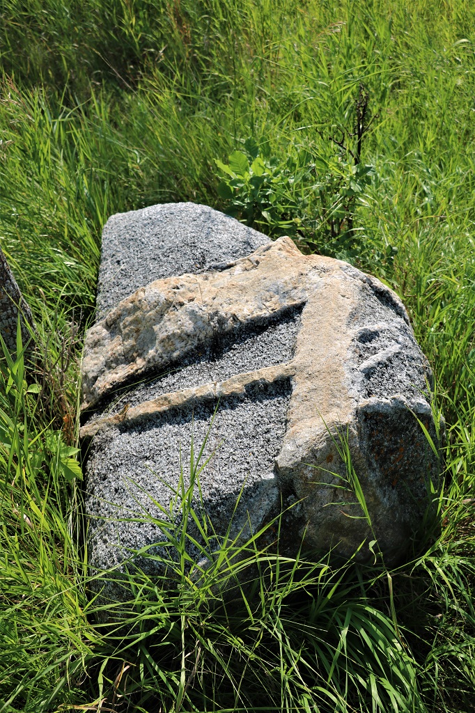
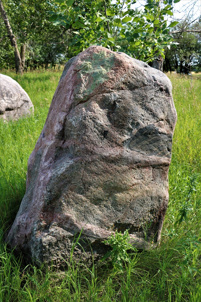
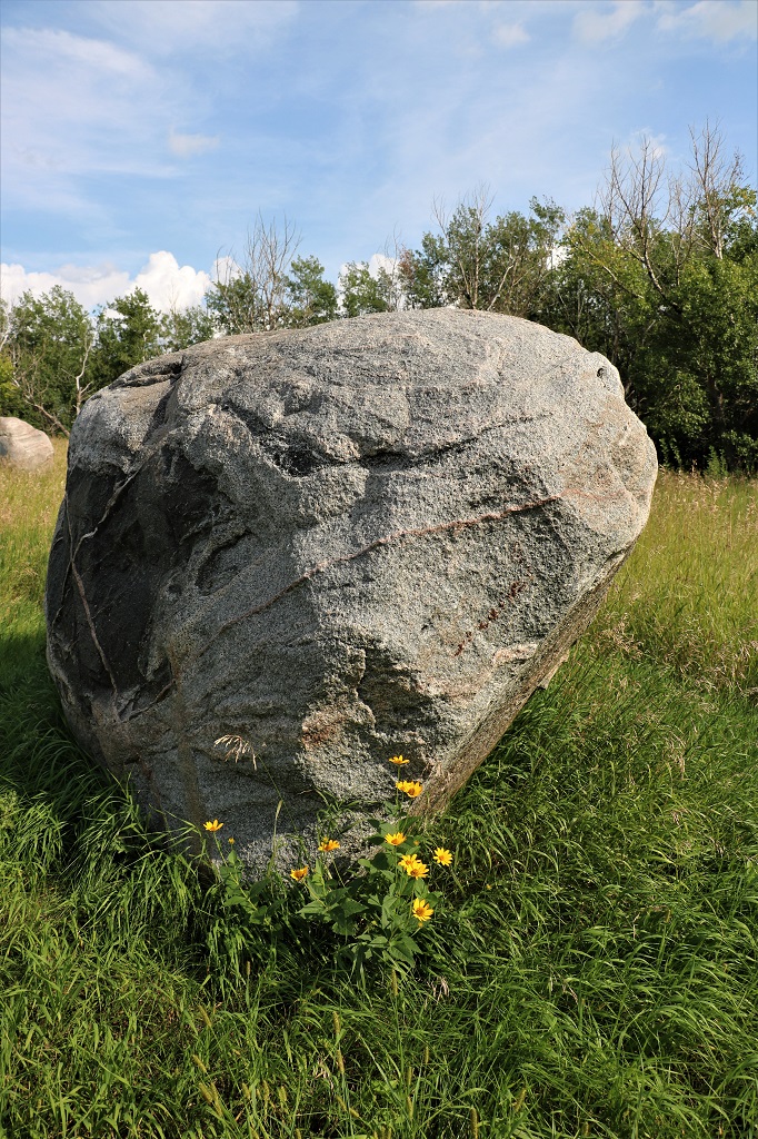
None of the rocks were located too far away. Most he just found and moved, some he actually paid for. The stones are set in circles divisible by 7. The outer ring is 49 stones and the two inner rings are 7 stones each for a total of 63. He selected each stone for its unique features. There are specific stones dedicated to each of Mr. Debueil’s family members, but he passed away in 2011 so no one knows which they are any more. The new owners have the property posted with No Trespassing signs, but the person that made up the Earthcache obtained permission for geocachers to go and see it. Trees and grass have grown tall so it is not readily visible from the road which helps a lot to keep it undisturbed and preserved.
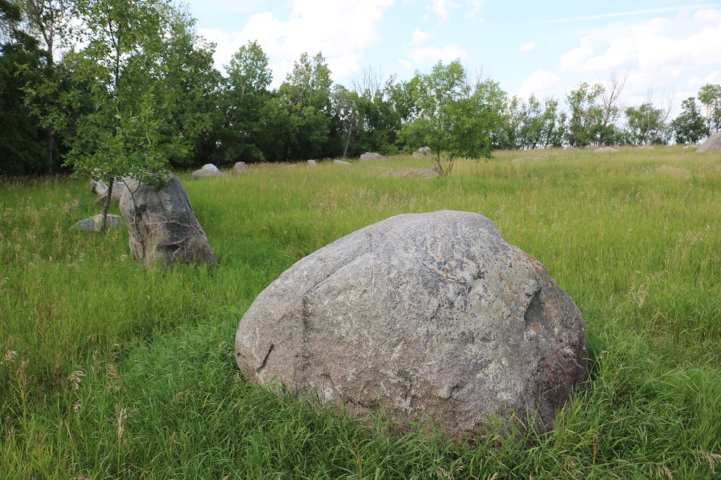
They are not exactly little! I liked this one because it had a pink quartz vein all the way around it.
I climbed up on one of the shorter, flatter ones and tried to get a couple of photos that show the size of the outer circle.
This one has so many different colours.
This is the only stone that had flowers growing near it. All the rest just had tall grass.
The inner seven. The low one in the center has fallen over. If you look at the overhead photo that I took off the internet you can see that it was originally standing.
I thought it was awesome. The man made himself a huge project and I am glad John saw the cache on the map so we could visit the place.
It was about 30° all day and we had been in and out of the truck finding caches for about five hours so we headed back to the hotel and a cool shower before dinner. More geocaches to find tomorrow. Today was fun!
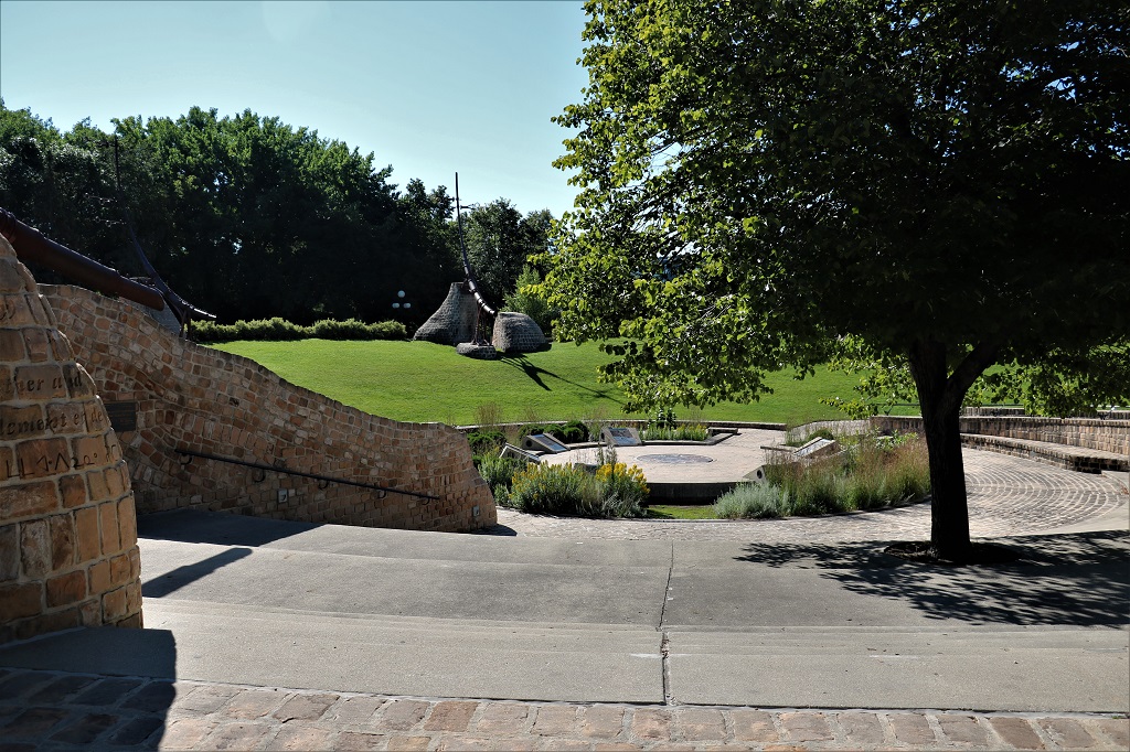
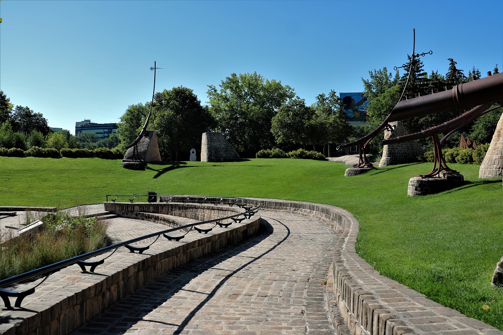
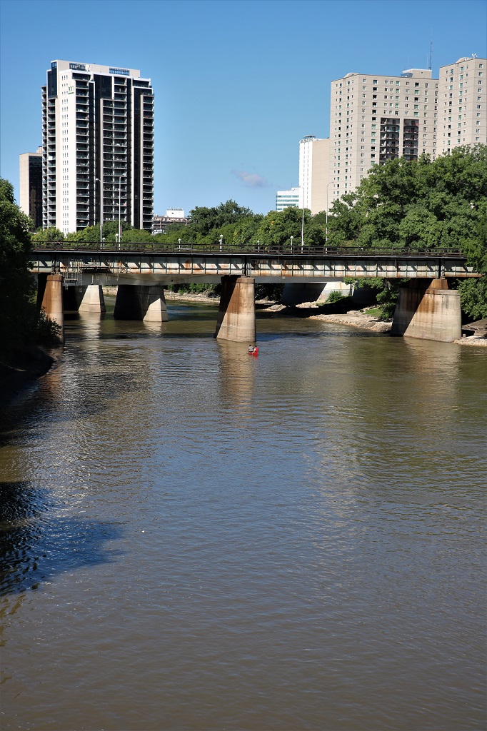
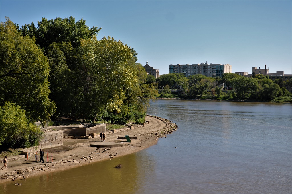
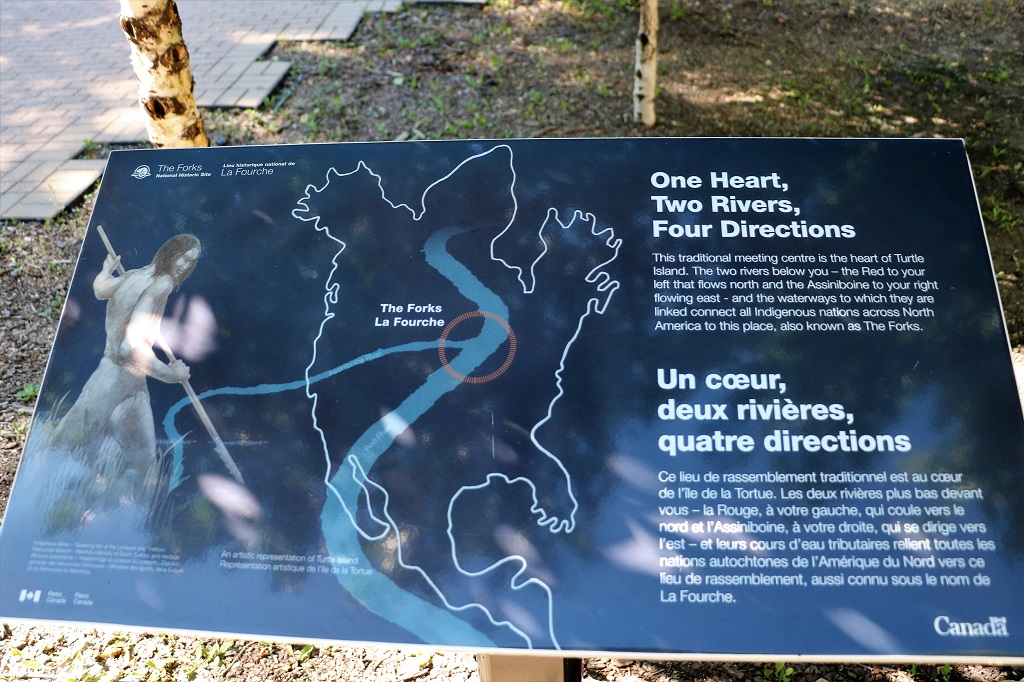
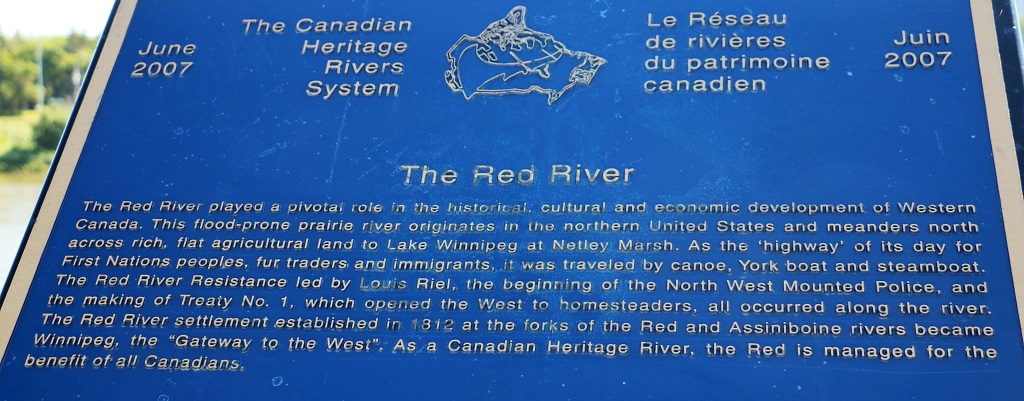
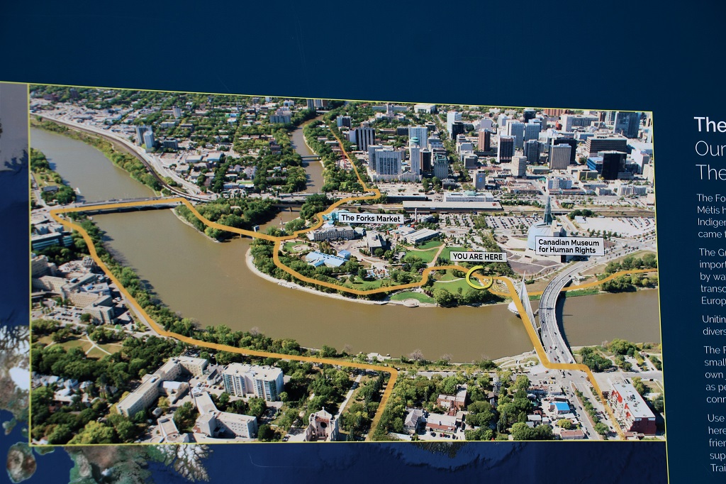
We checked out of our hotel about 10 and drove to the Forks to have a walk around before we left Winnipeg. The Forks is the historical name for the area of the confluence of the Assiniboine River and the Red River. The Red River was proclaimed a Canadian Heritage River in 2007 because of its significant role in the development of Canada.
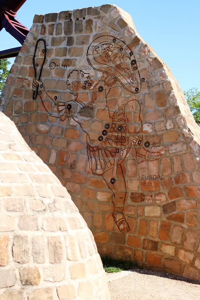
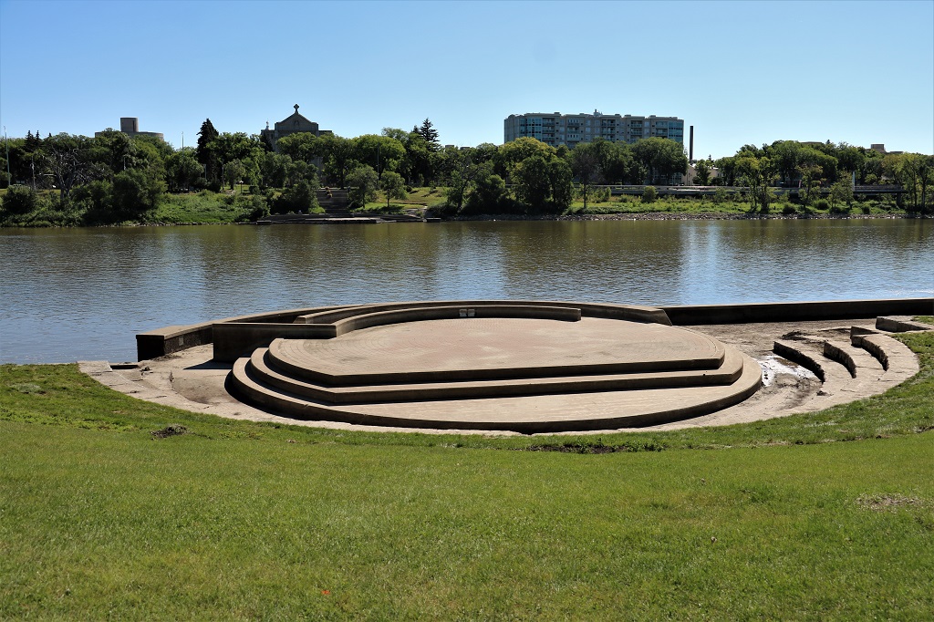
There is a large ‘gathering place’ with lovely stonework and carvings around a central celestial marker.
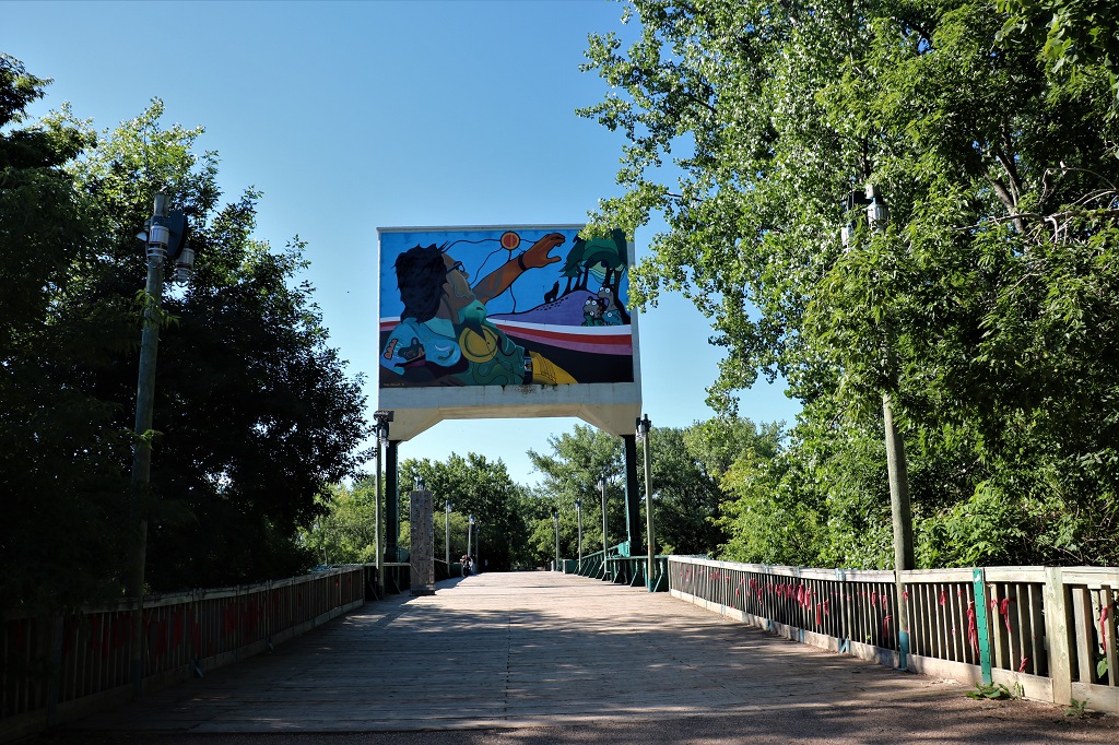
The footbridge across the Assiniboine River where it joins the Red River has a mural painted on the counterweight used to open the bridge.
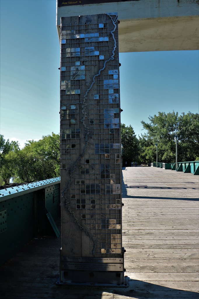
This metal sculpture on a post on the bridge shows the winding path of the Red River as it makes its way north.
The Assiniboine River.
The name Winnipeg is derived from two aboriginal words that mean ‘Where the river is muddy, or dirty.’ These two rivers are never clear and they can flood during every season of the year – and have done so – more than once. I have a photo of my grandfather using his neighbour’s rowboat to go down the street during one of the big flood years. This spring was a bad one too.
Often at the confluence of two rivers there is a difference in water colour so you can see them merge, here, however it is just muddy water flowing into muddy water.
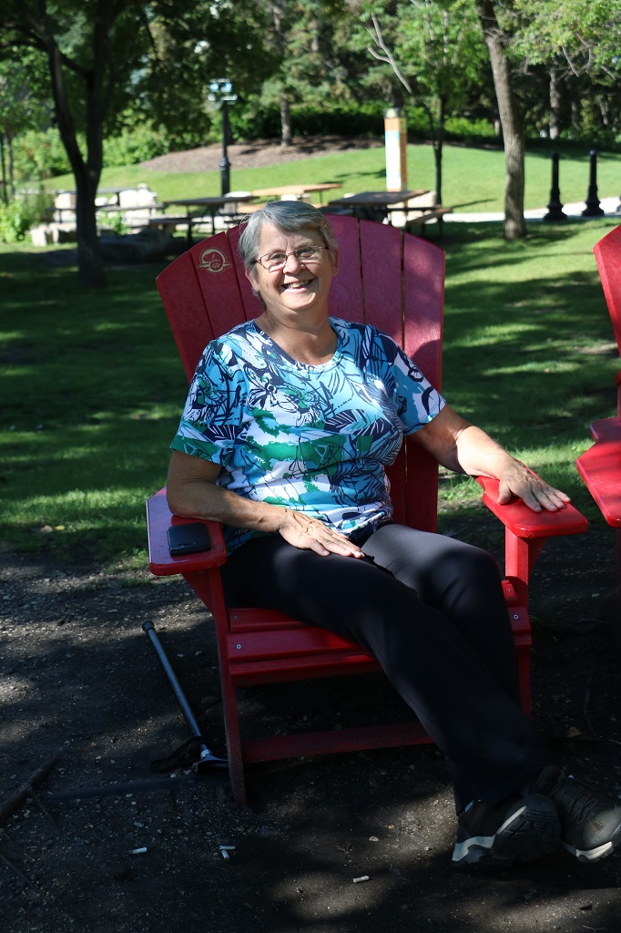
Since Parks Canada manages The Forks they have set out their red chairs. That means a photo op.
The Canadian Museum of Human Rights opened in Winnipeg in September of 2014 and has quickly become an iconic symbol of the city.
This photo was on a sign board for the Manitoba Trails system, but it is a good image to show the meeting of the rivers.
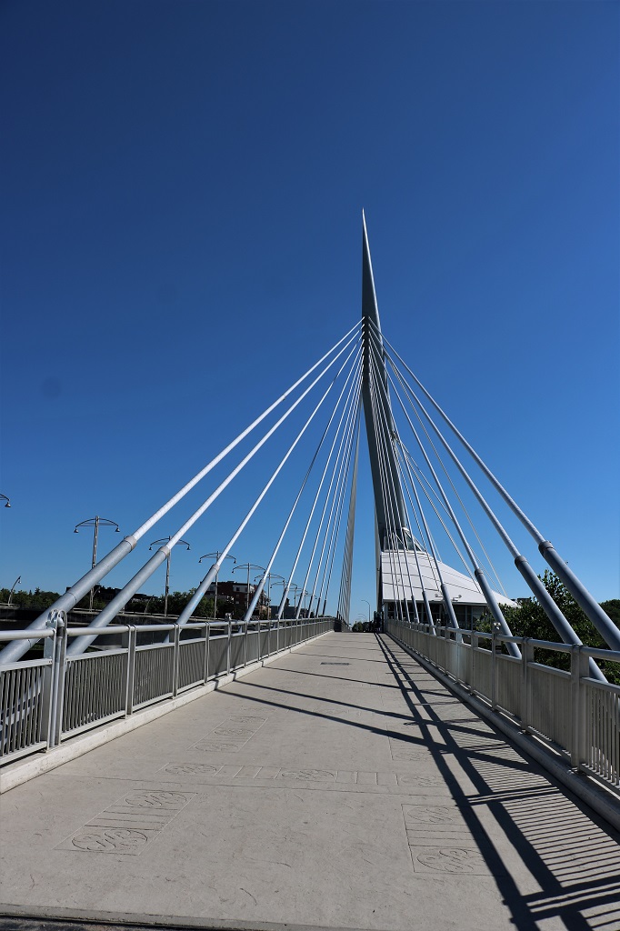
The Esplanade Riel Footbridge crosses the Red River and The Forks restaurant juts out about halfway across. The footbridge parallels the vehicular Provencher Bridge.
I don’t know if the builders of the Provencher Bridge knew the footbridge was going to be built alongside or if they were just inclined to be artistic since much of it is visible from the lawn at the boundary of The Forks area.
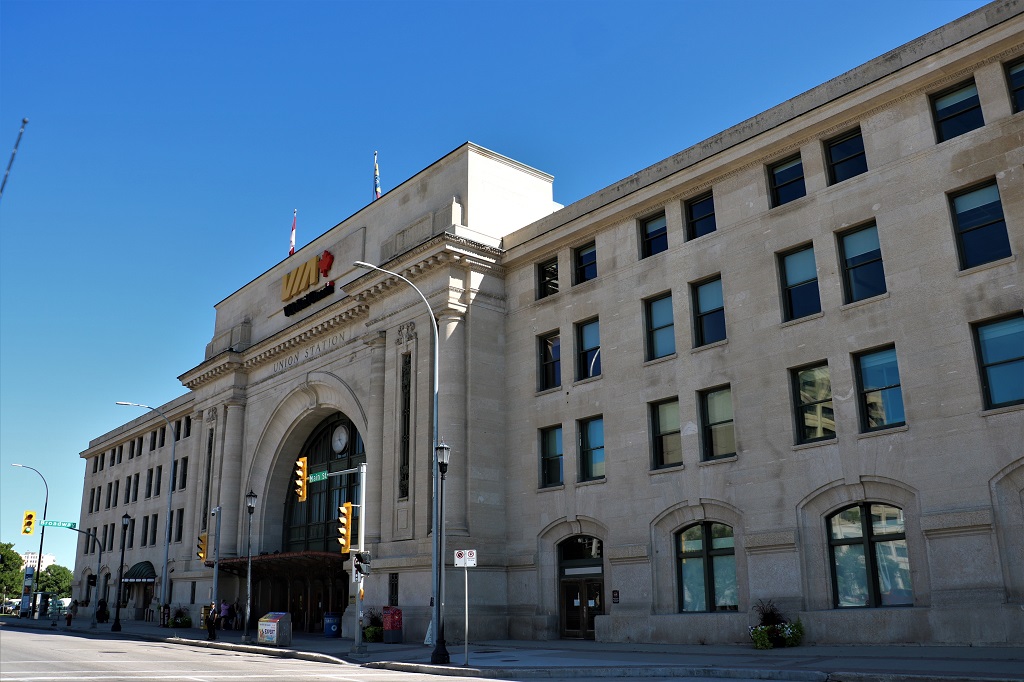
Winnipeg is very much a railway town. My grandfather worked for the Canadain National Railway in Winnipeg before taking early retirement after a heart attack and moving to Victoria and my mother was raised here. The Union Station is a famous city landmark. We drove past it on our way out of town.
Winkler is an hour and a half drive southwest of Winnipeg. As usual we took our time and took a couple of ‘roads-less-traveled’ to get there.
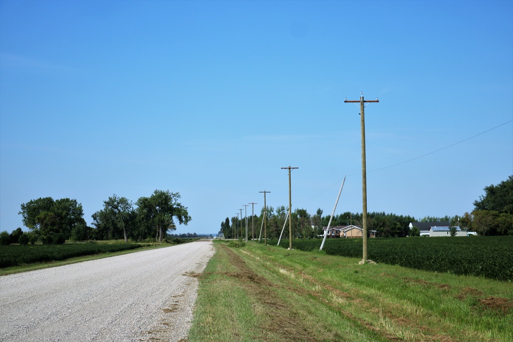
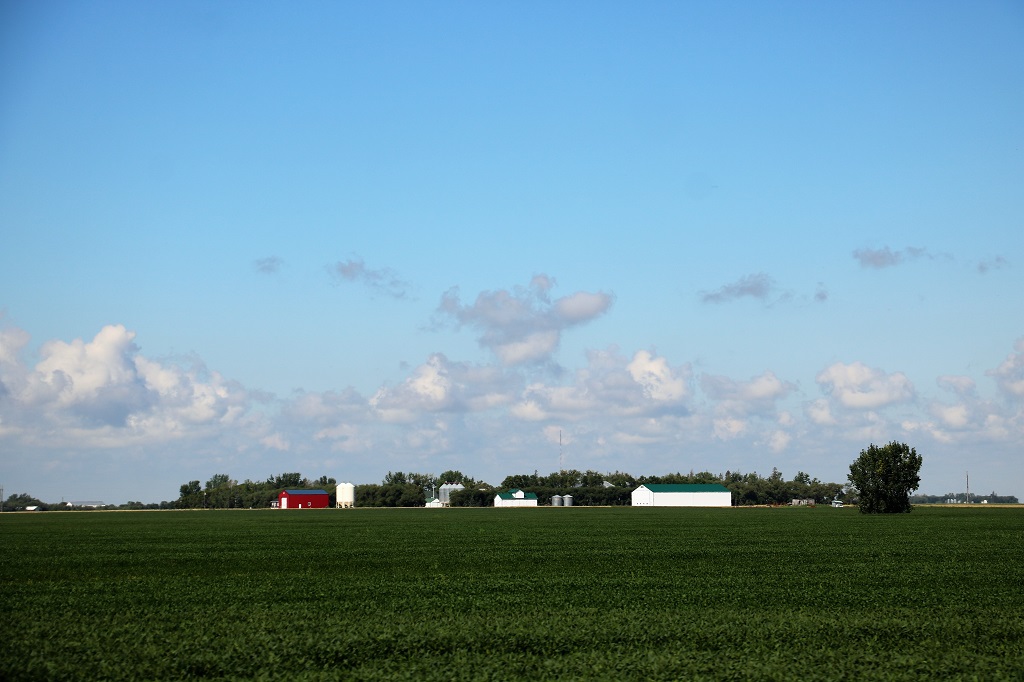
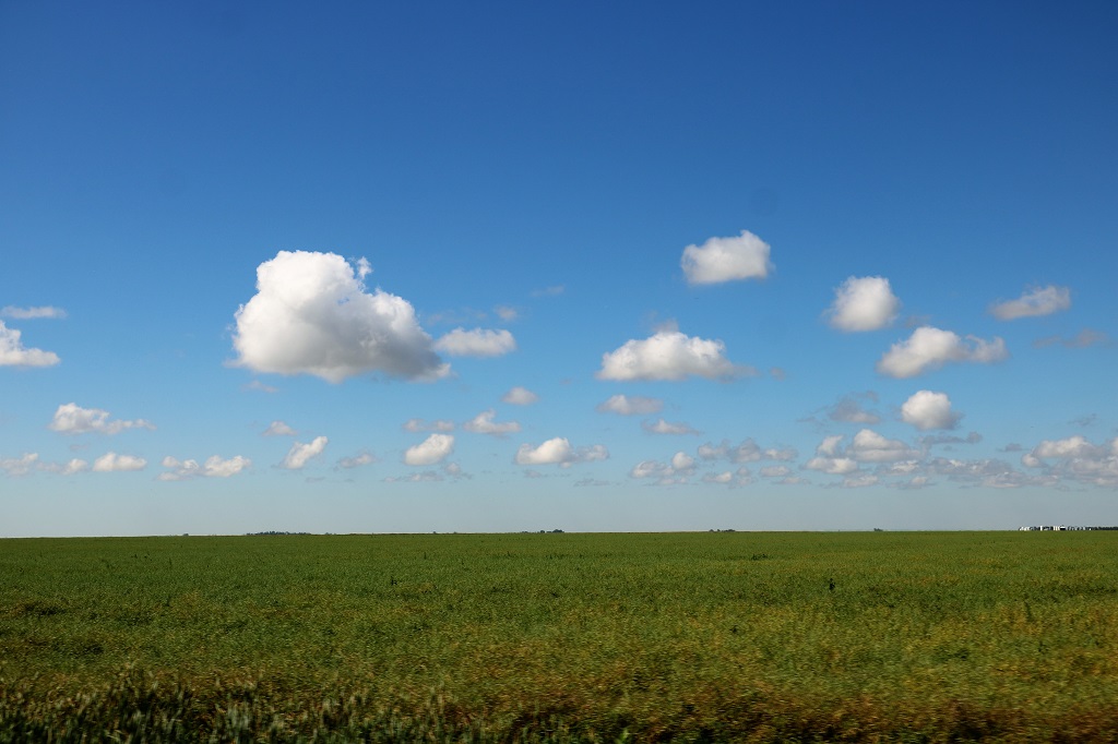
This is indeed the prairies. Flat as far as you can see.
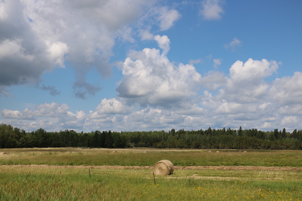
We drove past huge fields of many different crops. This is all dryland farming. No irrigation.
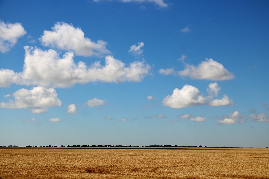
Harvest time is going to begin very soon.
One of the gravel roads we drove on. I thought it was interesting that they bale the hay along the roadside.
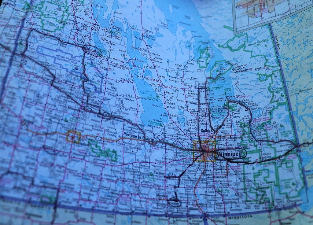
I have a large Canada/USA mapbook and in it I draw the routes of our various North American road trips. As I was filling in today’s route (the jigjag line going southwest) it struck me how all roads in Manitoba take you to Winnipeg.
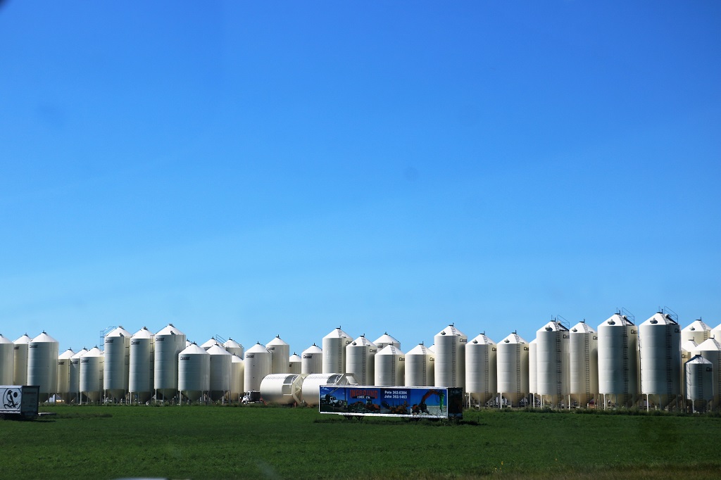
Does anyone need to buy a grain silo? This business seems to have a good number in stock.
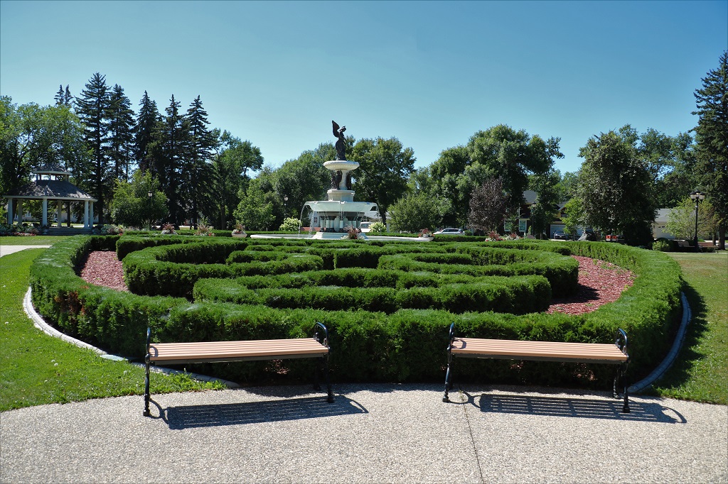
We arrived in Winkler and spent a few hours finding some geocaches and doing a couple of Adventure Labs in two of their small parks. The Bethel Heritage Park sat beside the Library and was beautifully maintained. There were plaques throughout the park that told the story of the faith of the people that settled here. There is a very large Mennonite population, but people of many faiths make up the community.
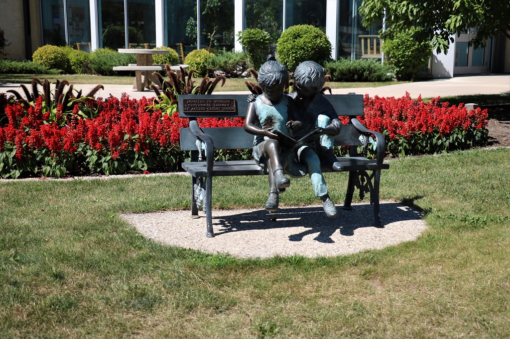
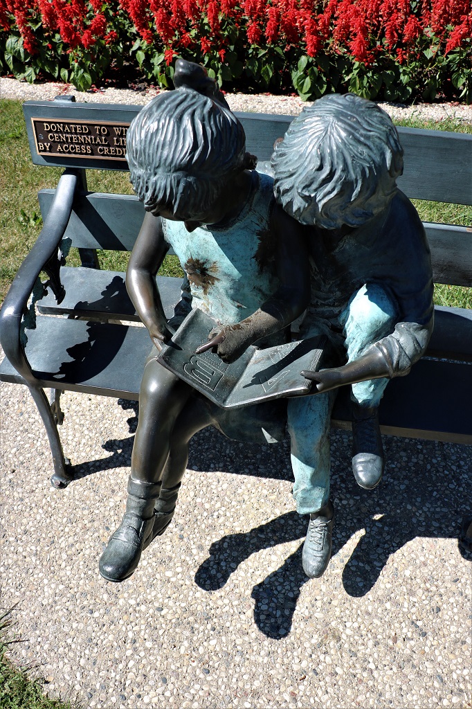
This adorable statue of a boy and girl reading a book sits on the lawn in front of the library and was donated by the artist.
The first hospital in Winkler (Bethel Mennonite Hospital) was on this site. It had 15 beds, a maternity ward and an operating room. It was built in 3 months for a cost of $8,000 in 1938.
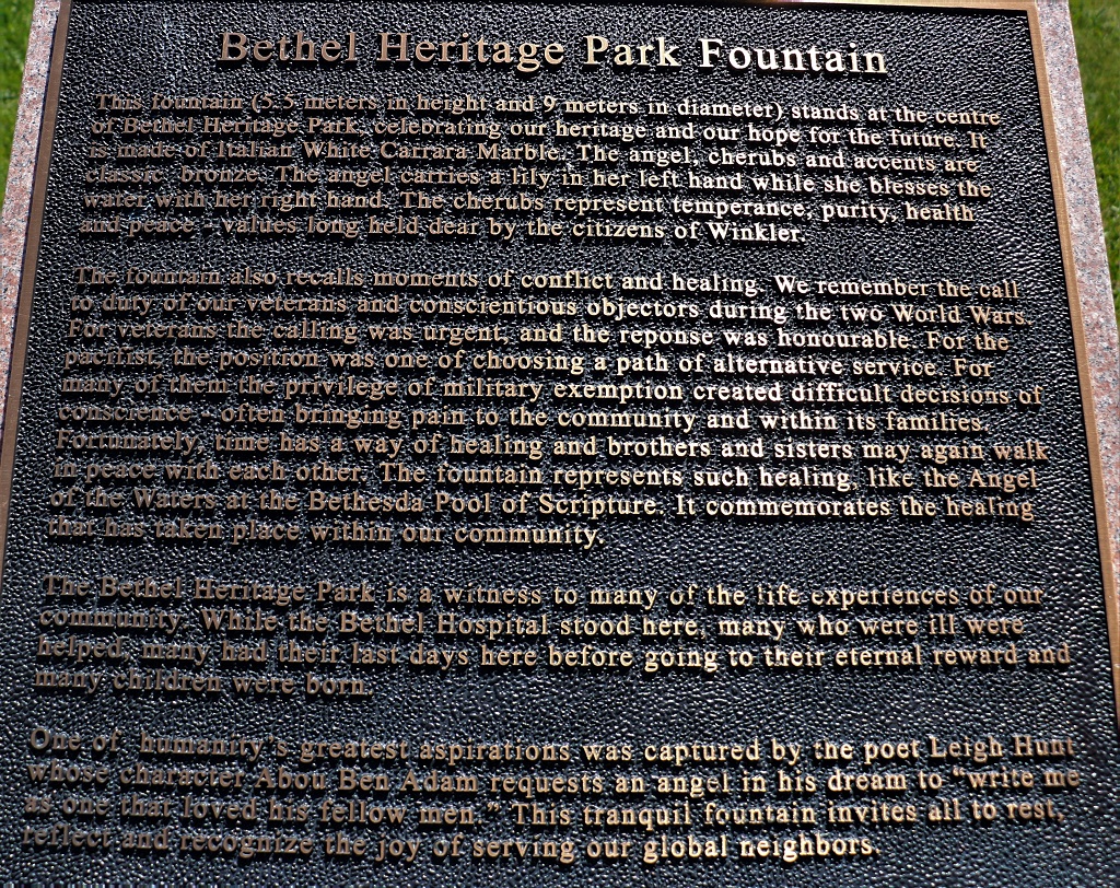
The plaque below was on a large curved brick wall to the right of the fountain. I thought it was very interesting information.
We settled into our hotel room, found a restaurant for dinner and worked on making a list of geocaches to go find tomorrow. It is supposed to be 31°, so we will be warm out on the prairie.
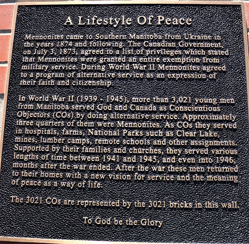
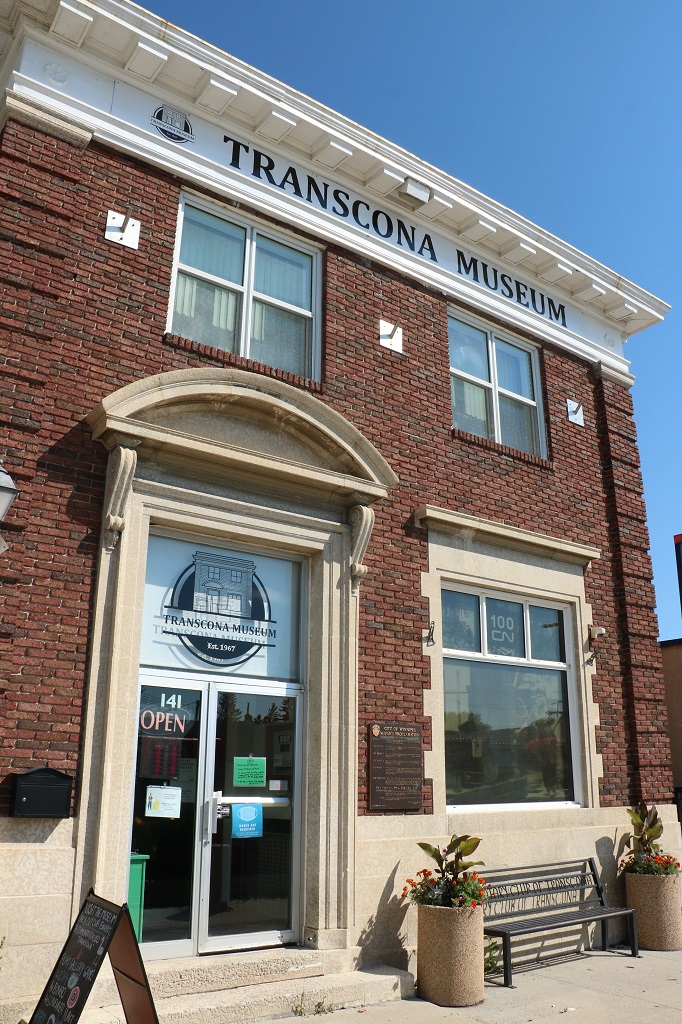
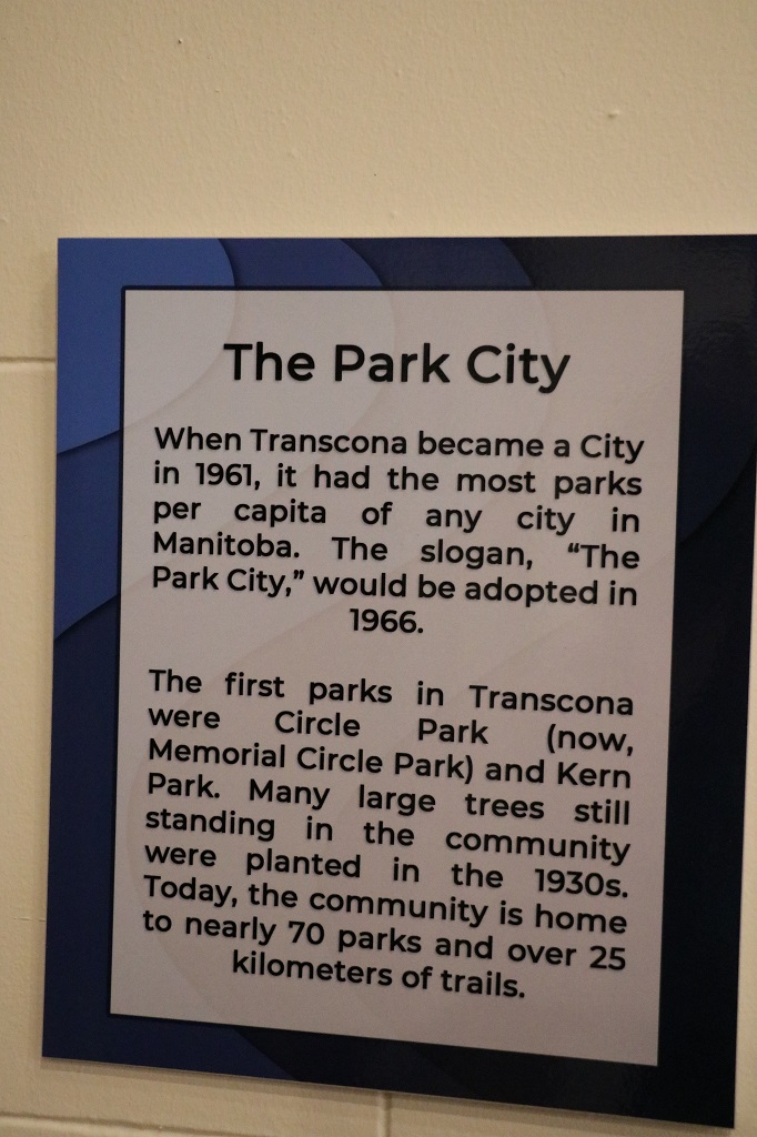
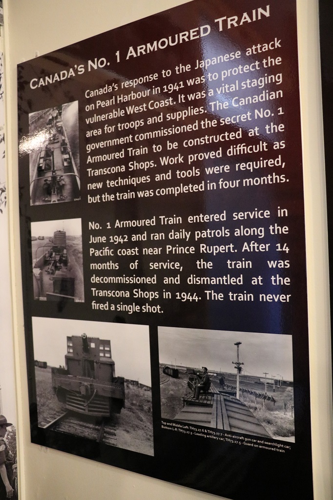
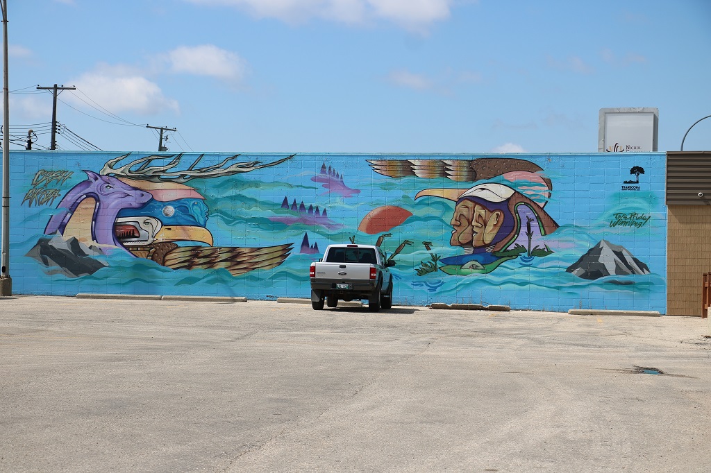
We drove about 10 kilometers east to the community of Transcona to vist their museum. We thought it would have a lot of information about the railyards, but it was quite small. As always, though, with museums, there were some interesting things.
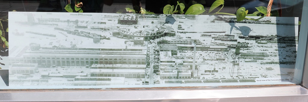
The community of Transcona came about in 1908 when the Grand Trunk Pacific (GTP) and National Transcontinental Railway (NTR), looking to build a second railway line across Canada, settled on a large area of unoccupied, flat land east of Winnipeg. This land functioned as the centrally-located site for repair and maintenance of the GTP and NTR railways. The town’s name is a combination of Transcontinental (Railway) and (Lord) Strathcona, Donald Smith who was a former Manitoban who was instrumental in building the Canadian Pacific Railway not too long before.
The Transcona Shops fully built built 33 engines as well as all the maintenance and repairs they did. The first one they built is on display in the Rotary Park. In 1972 Transcona amalgamated with the city of Winnipeg, along with 11 other communities.
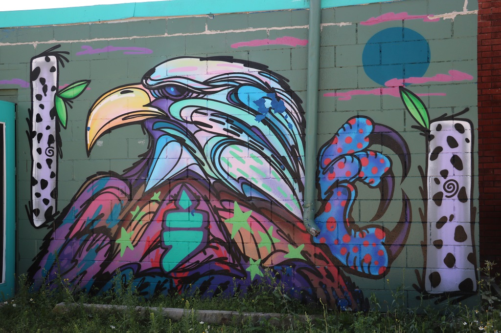
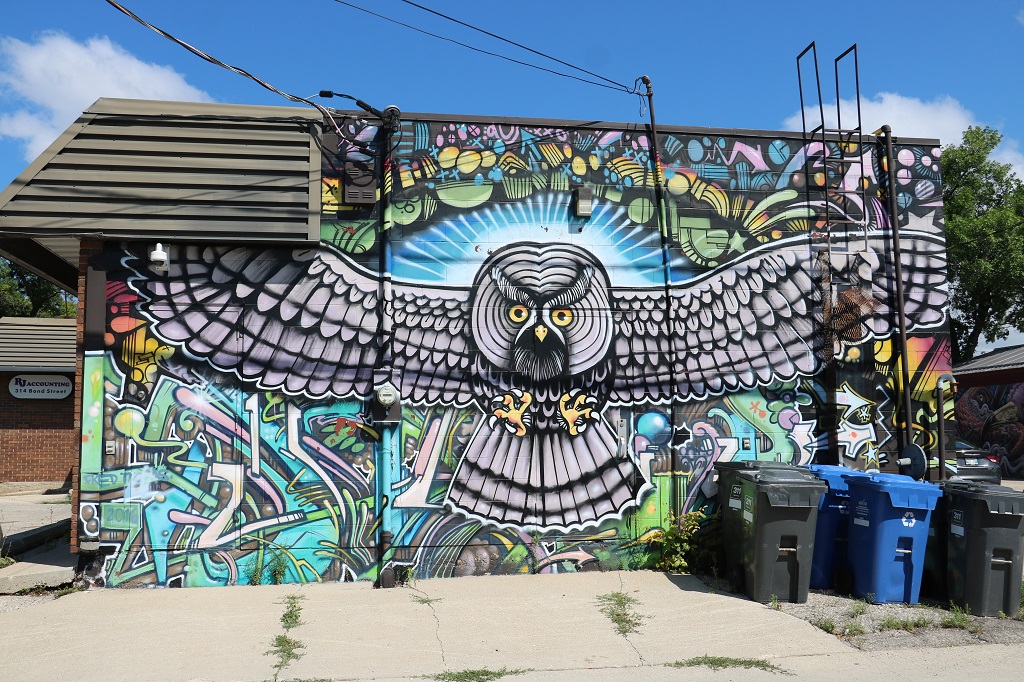
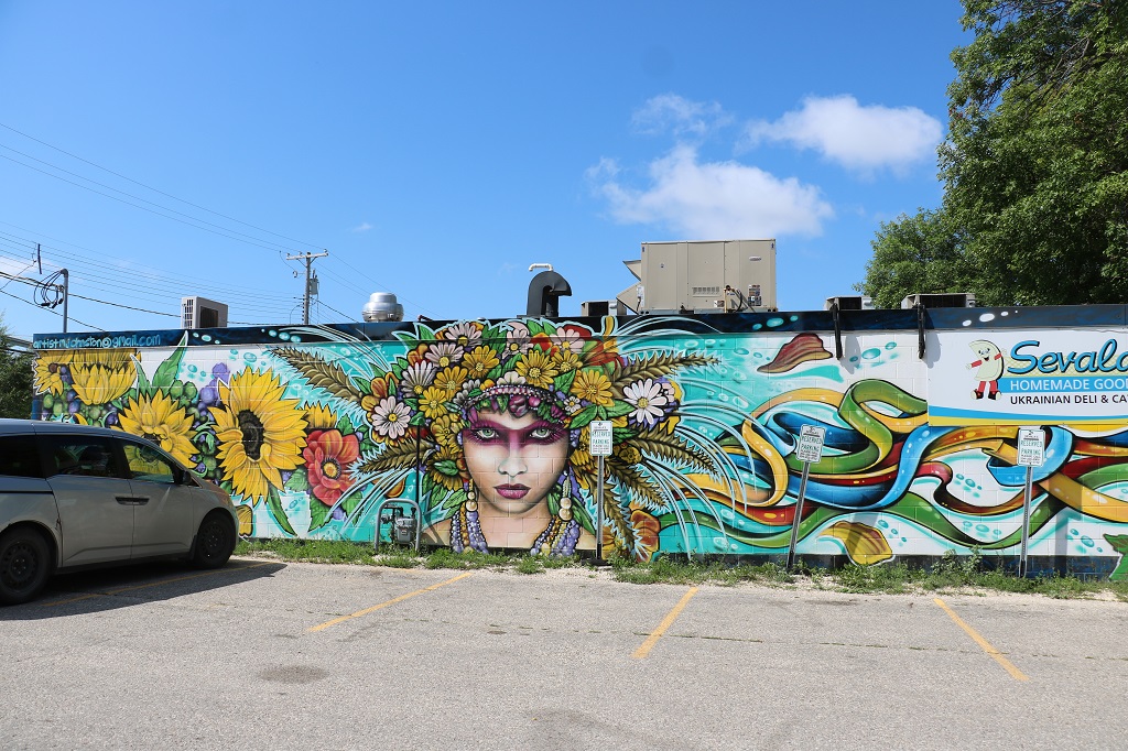
After we toured the museum we did an Adventure Lab that took us to five of the nice murals there are around town. As we searched for the specific five we needed we saw many others.
We drove back to Winnipeg to go to the Costume Museum of Canada which I had wanted to visit last time we were here but it was closed. It was closed again today. Rats! So we just drove the short distance to the Museum of Manitoba.
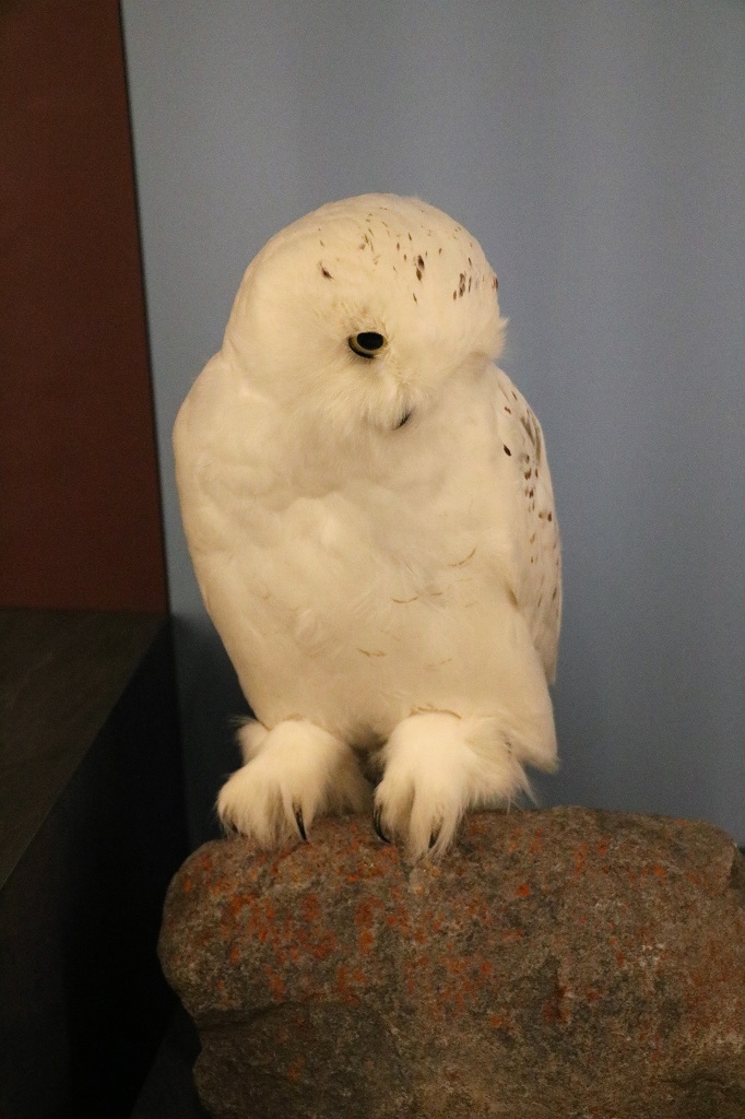
It was a large museum with 9 galleries, some of which we just did a quick walk through. I took lots a photos as usual, but have only posted a few – well, relatively few – here.
Snowy Owl.
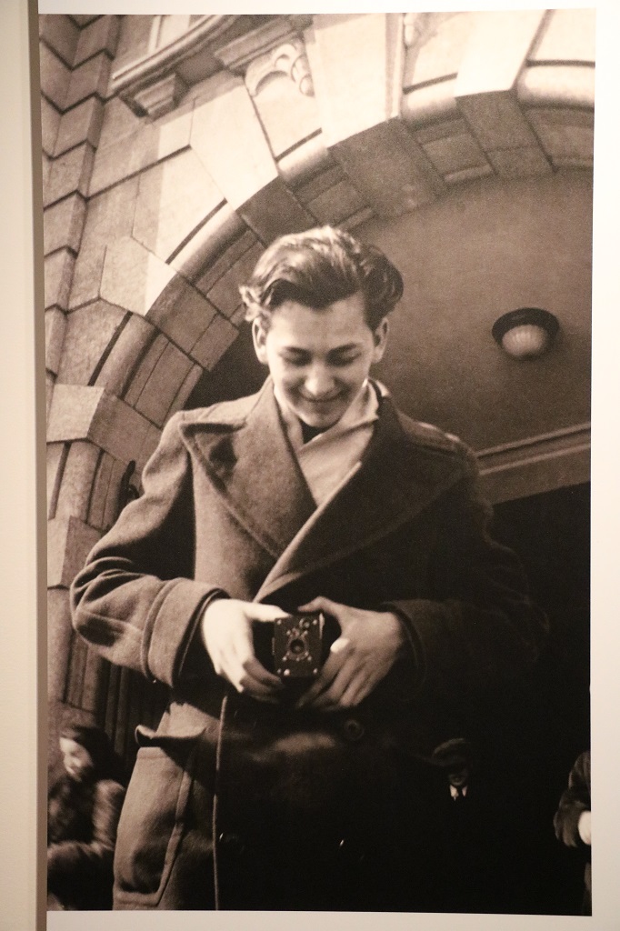
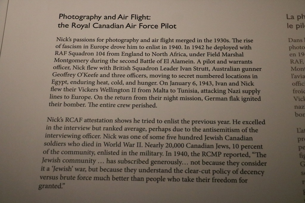
There was a small gallery showcasing the photographs of a young Jewish man who lived in Morden, about 125 km southwest of Winnipeg. He was an avid photographer from the age of 12 and did a lot of experimenting with light and angles, and took many self-portraits. His box of negatives was discovered after he died in North Africa during WWII.
Nick Yudell in 1931 on the steps of St. John’s Technical Collegiate.
Taken in 1940 not long before he left for Britian to fight in WWII.
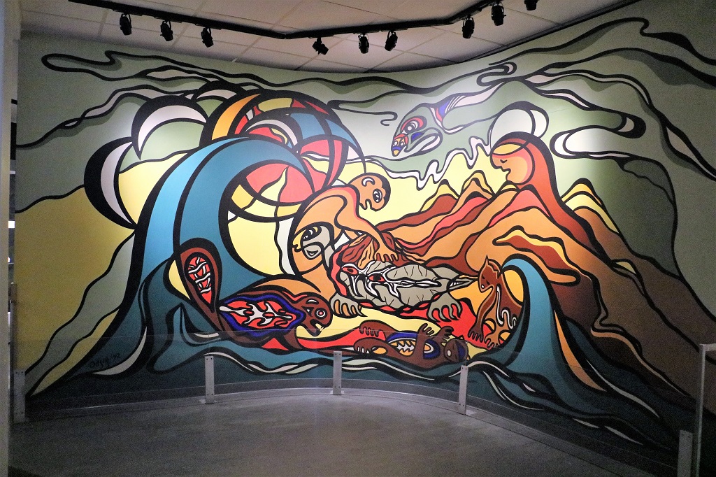
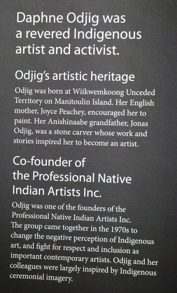
This large wall painting was done by Daphne Odjig. We have a limited print of one of her paintings from the 1980s when she lived in our area. She died in 2016.
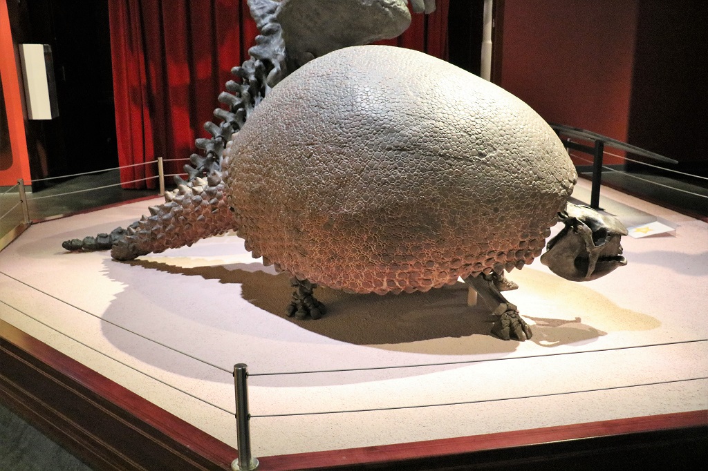
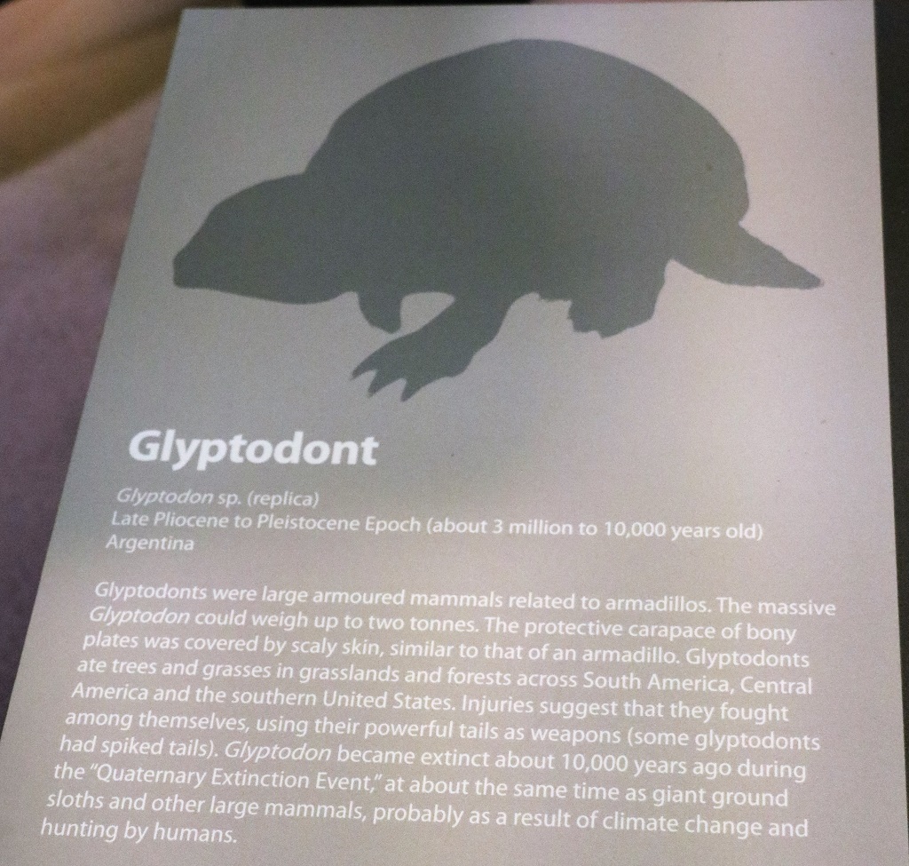
As is the norm in most prairie museums there was a section about dinosaurs and also a special gallery and film (accessed by a separate ticket which we did not buy). I had never seen this turtle-type one before. I think he is cute. He is not classed as a dinosaur, but is a mammal.
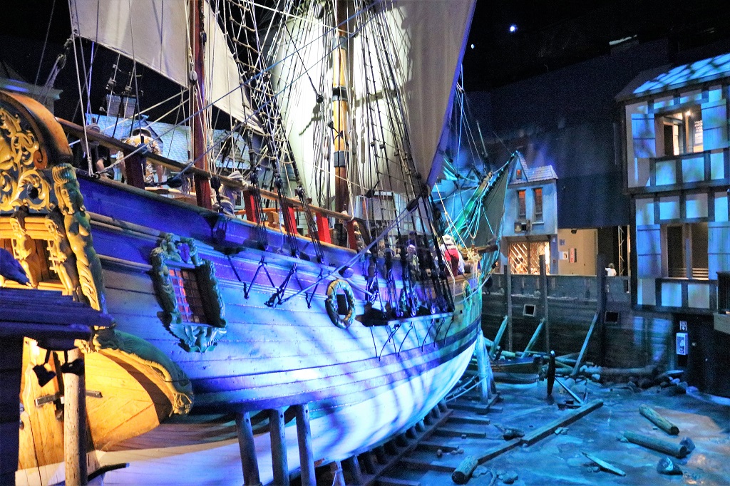
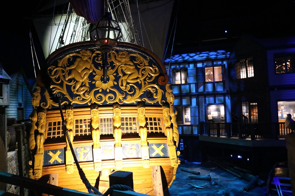
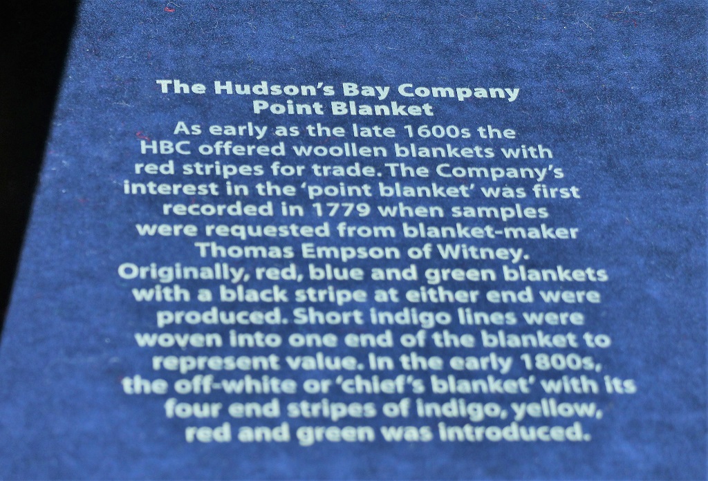
We spent the most time in two galleries: The Nonsuch and the HBC Collection.
The Hudson’s Bay Company, to commemorate its 300th anniversary in 1970, commissioned a shipbuilding firm in Devon, England to build a replica of the Nonsuch. At the same time the Museum of Manitoba approached the HBC for a contribution to its proposed cultural complex – the new museum. HBC gifted them the Nonsuch.
The shipyard knew they were making a replica for a museum but they also wanted it to be seaworthy and sail. They used historic tools and techniques from the 17th century, including the same types of wood. It took 10 months and $125,000 to build her. The Nonsuch was launched on Aug. 26, 1968 and shipped to Canada. Before coming to it’s permanent berth in the museum it sailed 14,000 km in salt and fresh water – in the Great Lakes of Ontario and Erie and through the Welland Canal. It was also shipped to Seattle and sailed up the west coast of British Columbia, making several ports of call.
The HBC Heritage webs site says:
“At 43 tons, Nonsuch had a deck of about 16.2 metres (53 feet) in length, and 11.3 metres (37 feet) along the keel. Her beam (breadth) was 4.6 metres (15 feet), she had a draft of 2 metres (6½ feet), and was designed to take a complement of six to eight naval cannons. Built in Wivenhoe, Essex in 1650, she began life as a merchant ship before she was bought by the British Navy, subsequently captured by the Dutch, and then recaptured by the British before being sold to private interests. She is generally believed to have been named in honour of Barbara Villiers, Lady Castlemaine, one of King Charles II’s favourite mistresses. The name, meaning “none such” or “without equal,” was a nickname of hers.”
The Nonsuch replica sits as though just returned from her voyage to Rupert’s Land (pre-Canada name) in port at Deptford, England in 1669. The walls that make up the town around the ketch were built after the ship was in place, so Nonsuch is never sailing again.
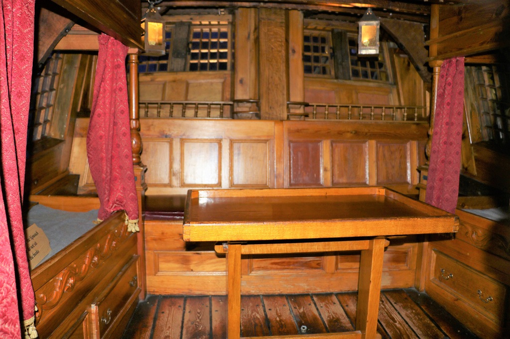
Even with the upper level viewing area you could not get a shot that showed how high the masts and sails were. Seven people at a time were allowed aboard. There are 4 kilometers of ropes of various sizes on the ship. Rope coils were everywhere. When Nonsuch origianally sailed she had 12 crew. Four slept in the Captain’s cabin at the stern (there are only two bunks but two would be on duty while two were off). The other eight crew slept (usually four at a time unless All Hands were needed due to a storm or something) in the hull below deck.
Captain’s quarters. A bunk on either side with a couple of drawers and a sided desk in the middle.
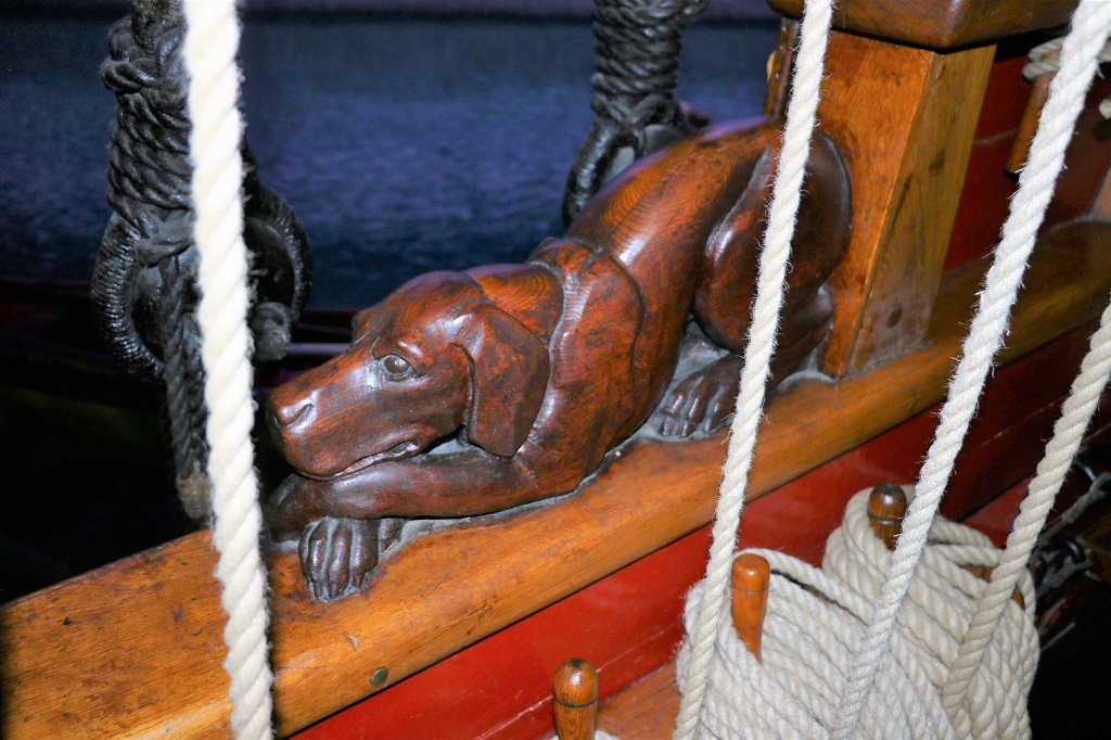
On either side of the ship there are carvings of a dog. The staff call one of them Wellington and the other Boots. I assume after the seafaring footware.
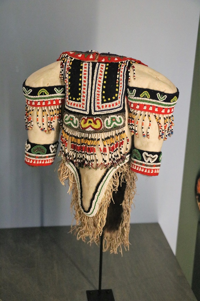
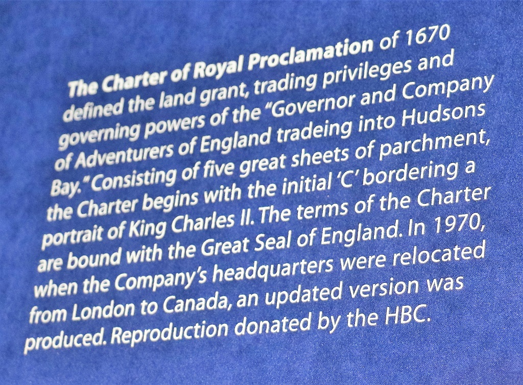
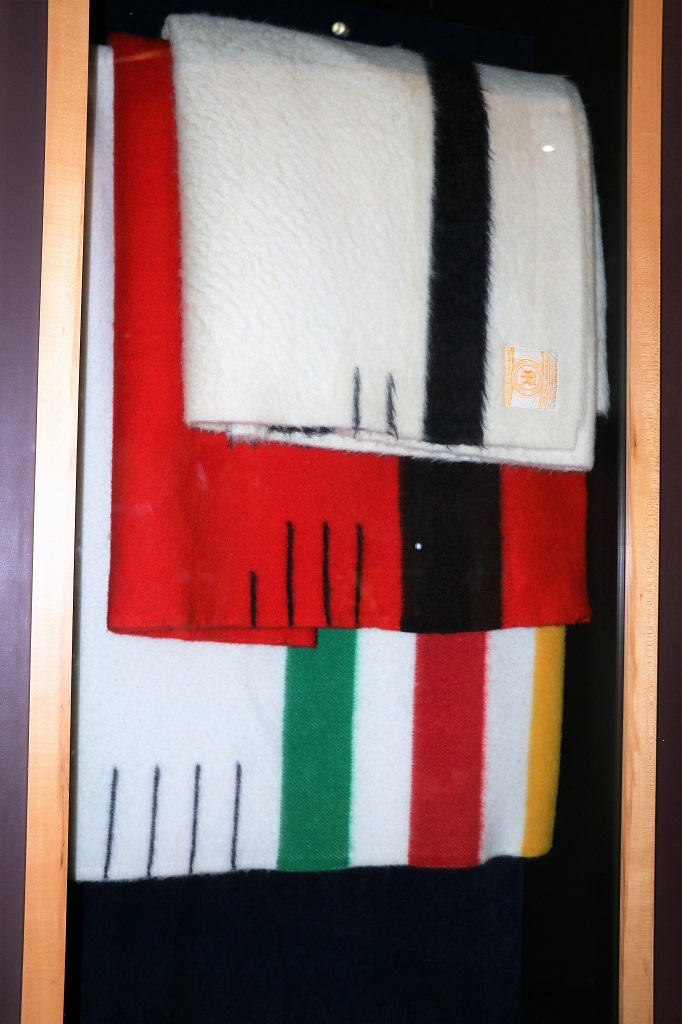
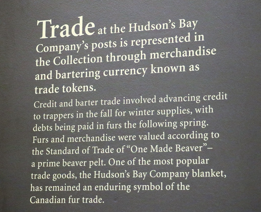
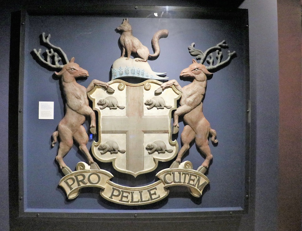
In 1920, for Hudson’s Bay Company’s 250th anniversary they began to actively pursue putting together an historical collection. Men were dispatched to former posts and the call was issued for items. By 1960 over 10,000 objects reflecting the story of the company and the remarkable people who worked for the fur trade had been acquired. Items are still being gifted to the collection. In 1994 Hudson’s Bay Company gifted the collection to the people of Canada and the Manitoba Museum became its home. There were many, many interesting things in the pieces of the collection on display.
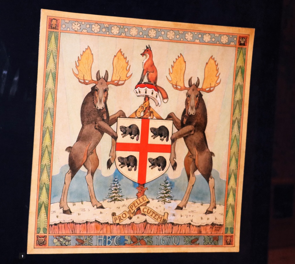
The motto Pro Pelle Cutem translates to For skin, skin – or A pelt for a skin. The motto is often taken to mean “[animal] skins obtained at the cost of [human] skin.”
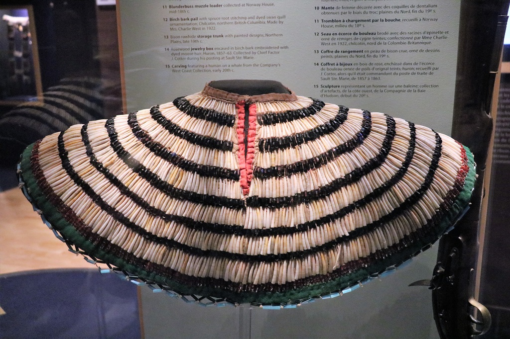
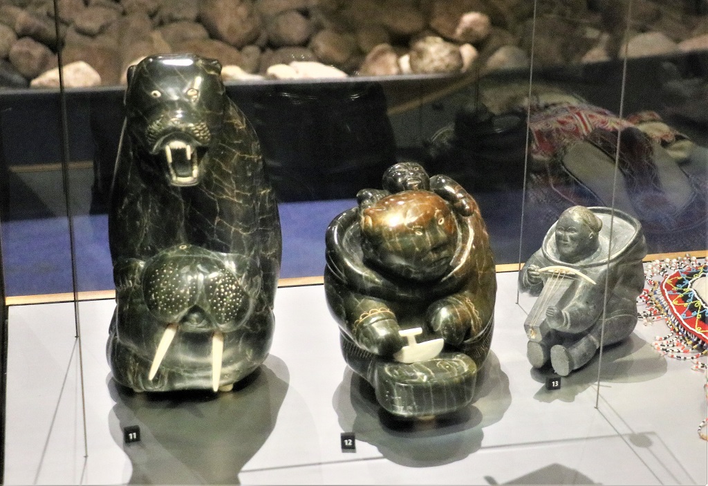
John and I thought this mantle was made from porcupine quills, but the description list says it is dentalium shells that would have been acquired through trade. It is from the late 1800s and the Northern Plains. Dentalium shells are a type of seashell.
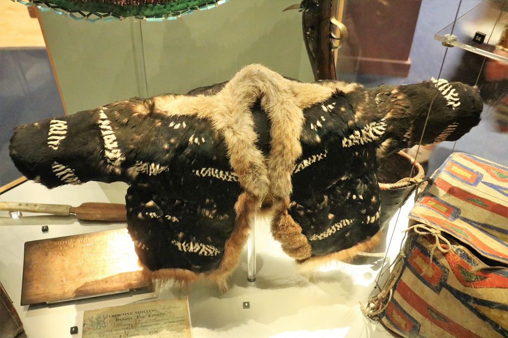
This child’s jacket is made from loon feathers with fur trim. It is Inuit from the early 20th century.
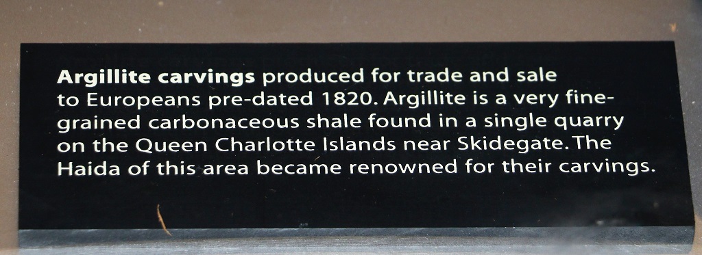
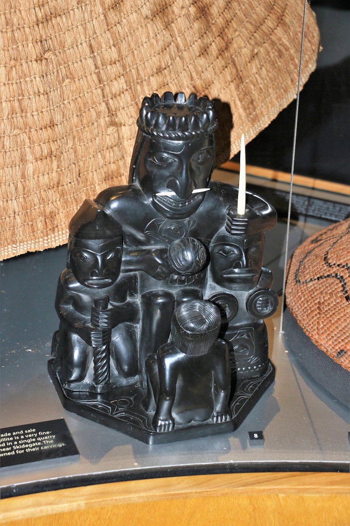
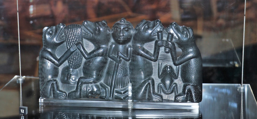
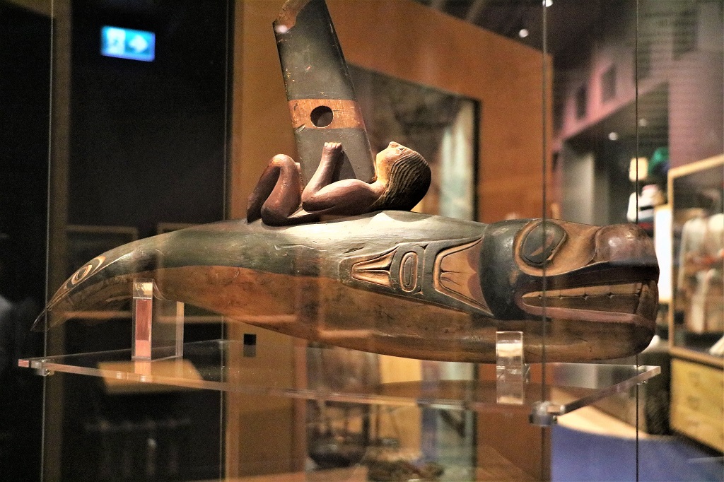
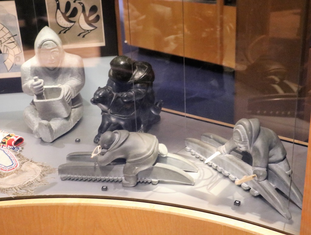
The carvings in the photos above and below are from the Inuit Collection. All are from the early 20th century.
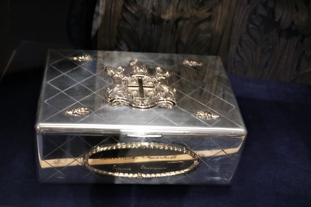
This silver cigar box with the HBC Coat of Arms on the lid was given to Sir Winston Churchill in 1956 to commemorate his honorary postion of Grand Seigneur in the Hudson’s Bay Company. (I wonder how they got it back?)
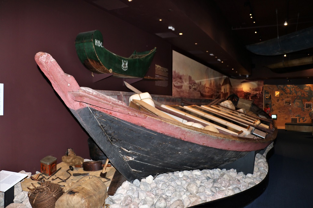
A replica of one of the large trading canoes.
This HBC coat of arms was on the exterior of the Hudson’s Bay store in Kamloops, BC (an hour from our home) from 1957-1982 when the store was relocated from downtown to the new Aberdeen Mall up on the hill. Our family did some shopping in that store from time to time.
The end of the HBC collection had a display of the Chairman’s office in London, England until the headquarters of the company was moved to Canada in 1980.
Despite it not being the destination of choice for our touristing today, we did enjoy the Museum of Manitoba.
Tomorrow we check out of the hotel and drive to Winkler, which is only 1 1/2 hours away. Winkler is Manitoba’s 4th largest city with a population of almost 14,000. We are spending three nights there as well. But we do not have a list of heritage houses, or historical villages, or musems to see. We plan to do some geocaching!
I had no plans to do a blog today. We were taking a day off. John had a church meeting via zoom to attend this morning and also had to write something in his role as Fire Department Chaplain for a funeral service he won’t be home to attend. I had laundry to do and a good book to read. We do not go at a fast pace on our road trips, but they do tend to be steady, so we figured a down day was in order.
But I snapped a few photos on our walk home from The Forks after dinner, so thought I would post those.
The Canadian Human Rights Museum.
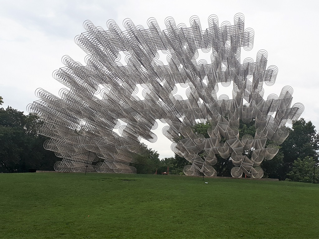
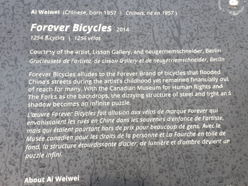
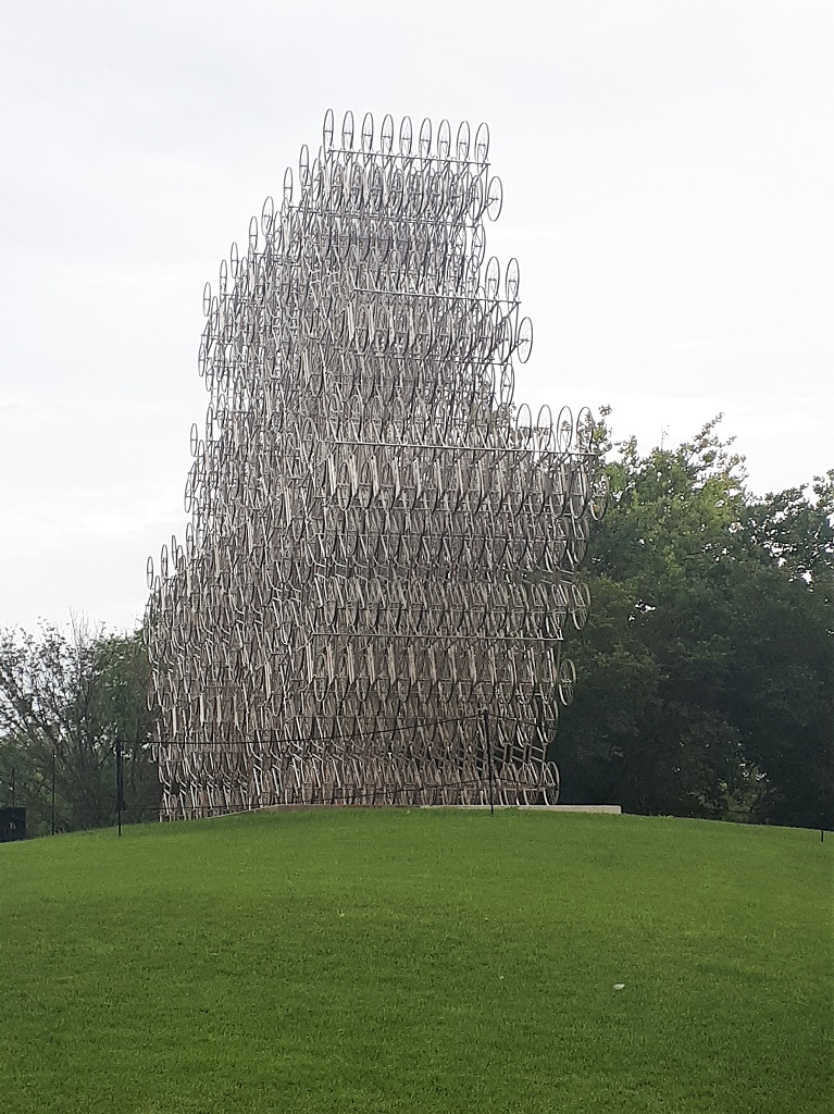
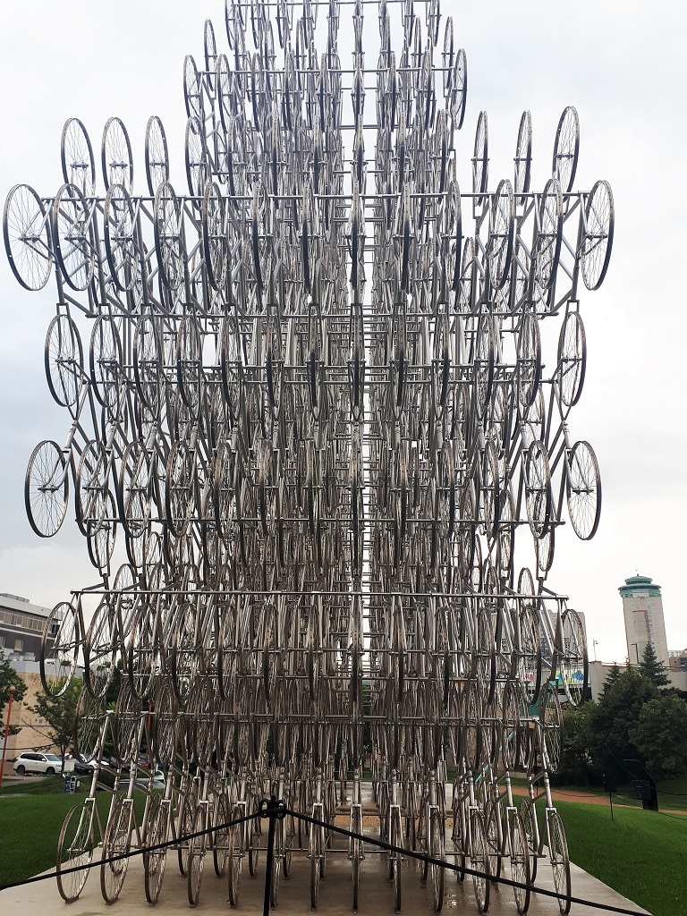
When we were in Winnipeg on our way east earlier this summer we could see this amazing sculpture from our hotel room. It is set up at The Forks on a two year loan from the artist and we walked right past it on our way back to the hotel tonight.
The sculpture is composed of 1254 bicycles and is dismantled and set up by a special team in each location it visits. The artwork bio says: “Titled Forever Bicycles, the sculpture alludes to the bikes that flooded the streets of China, Ai’s home country, during his childhood. Despite their seeming omnipresence, bicycles remained financially out of reach for many, including Ai’s family.”
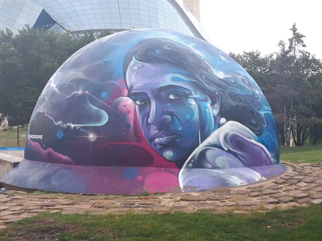
There is a large skateboard park at The Forks and on a hill beside the deep trough part is this lovely piece of art.
And that, folks is as exciting as my day went. It was actually nice to just veg. Tomorrow we are out and about again. We have plans to go to the Transcona Museum in the morning and the Costume Museum of Canada in the afternoon.
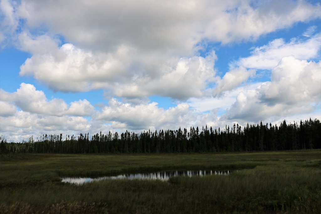
Today was a driving day. We made two quick stops at heritage info signs and other than that it was rest stops and lunch. We left Thunder Bay at 9:30 AM. Along the way we gained an hour, moving from Eastern to Central Time so 12:30 became 11:30 and we had to wait longer before a lunch stop. Haha.
Once we got near Kenora the land flattened out and we started to see more crops.
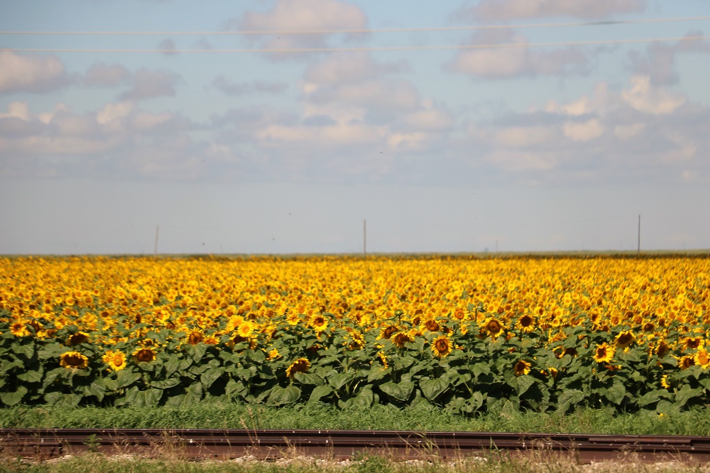
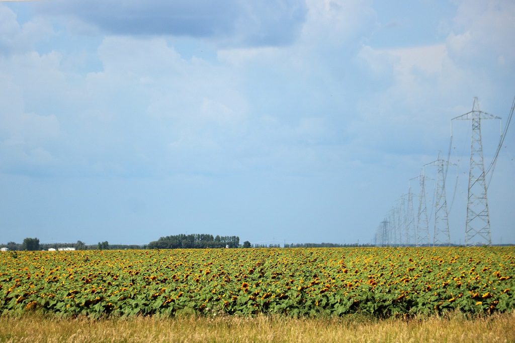
As we approached Winnipeg we passed acres and acres of sunflowers.
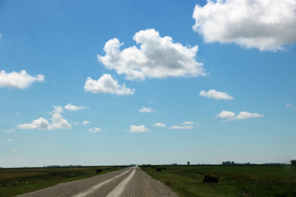
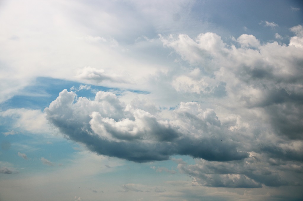
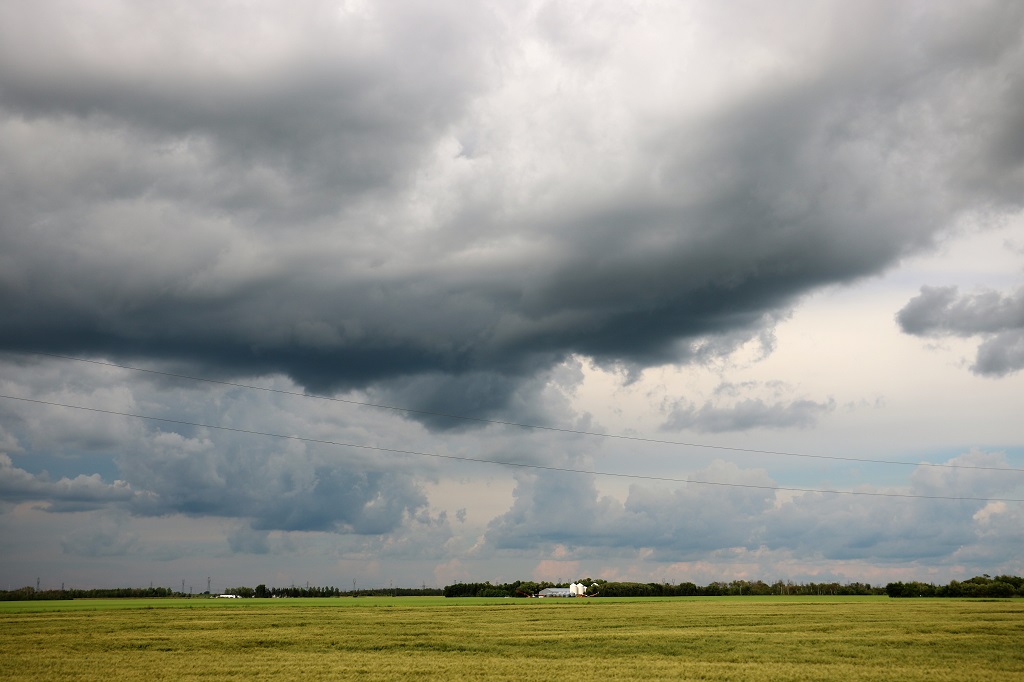
This cloud looks so much like an outstretched hand, there is even a ‘fingernail’ on the ‘thumb’.
We arrived in Winnipeg at 5:15 (6:15 Thunder Bay time) and checked back into the Humphry Hotel where we stayed on our way east. We are here three nights. There are a few things we plan to go see, but we also intend to do a bit of nothing much.