All posts by jj1951

My husband and I retired in 2007 and decided to spend the kid's inheritance by travelling as much as we could until either the money or our health runs out. So far so good.

2009 Sep 6 & 7 – Days 12-13 – Astoria, OR

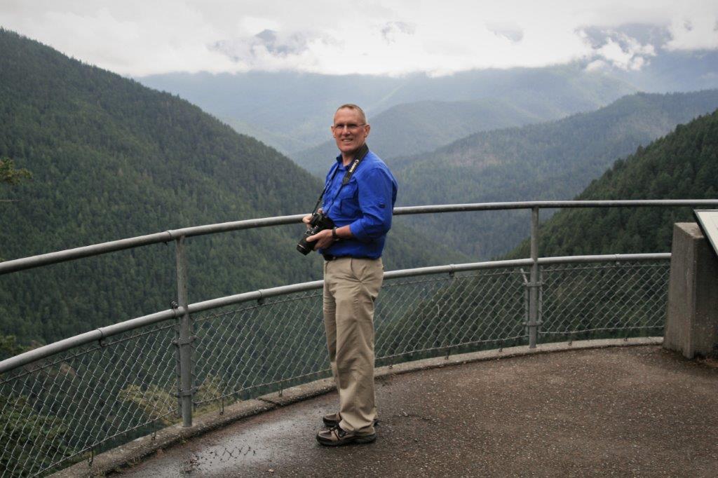
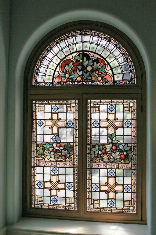
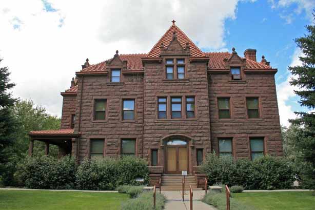
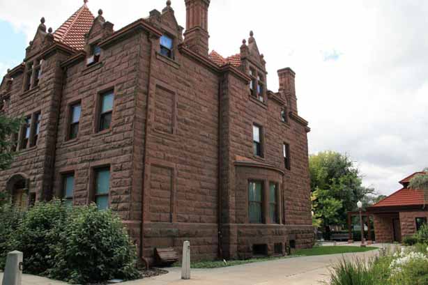
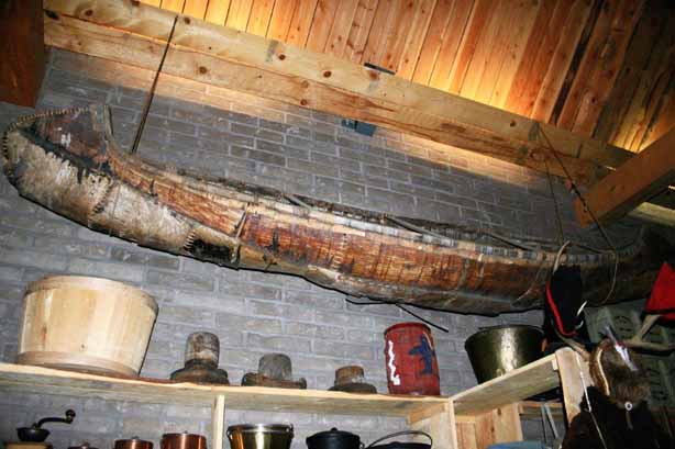
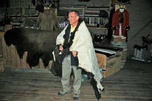
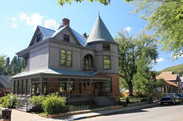
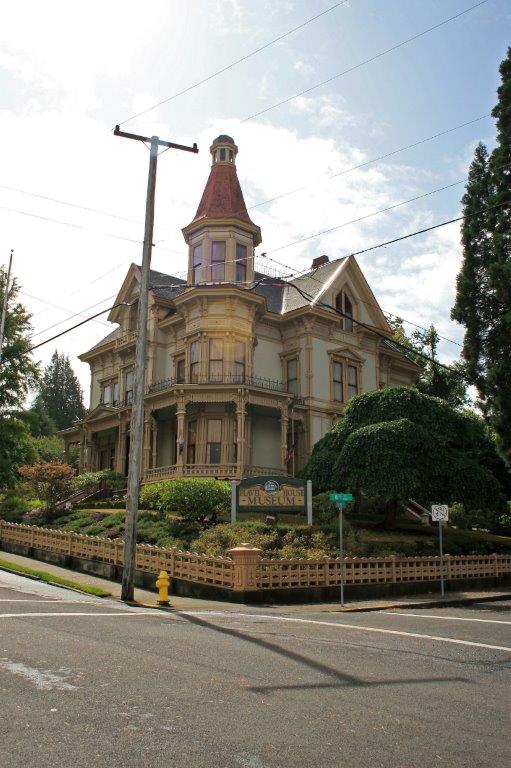
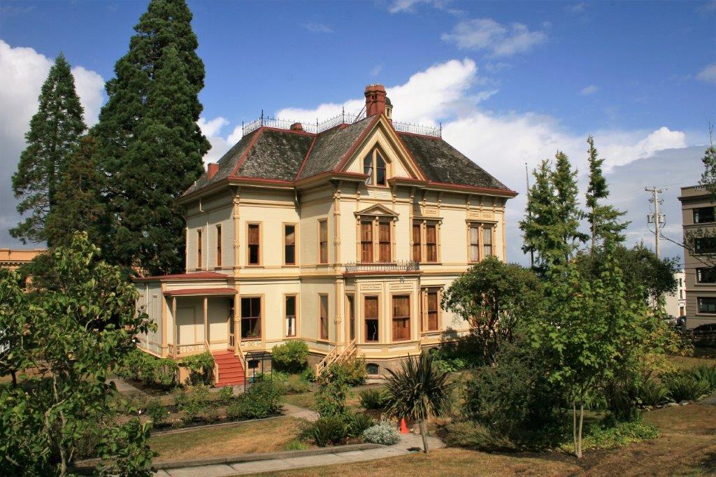
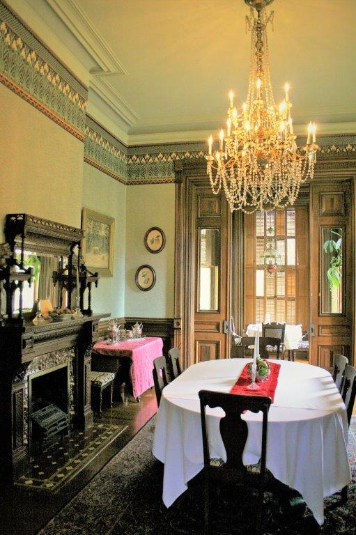
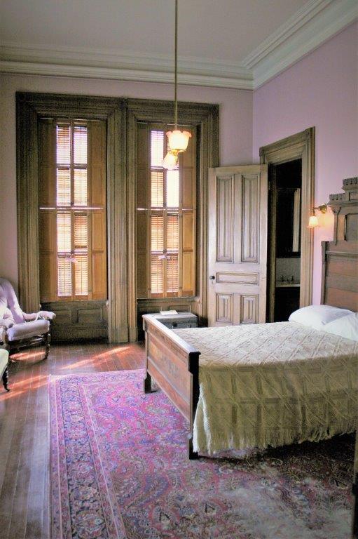
We spent the night in Astoria and after breakfast we set out to do a bit of sightseeing.  Our first stop was the Flavel House Museum.  We were actually allowed to take photos (without flash) in this house, which is quite unusual for historic buildings.   
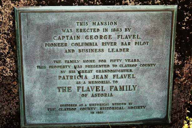
Very few facts are known about George Flavel before he came to Astoria, there is even dispute over where and when he was born.  And few details are known about the man’s personsonality and businesses either.  In Astoria he was known as a fearless seaman and ran a very successful river boat pilot service.  He had other businesses and also invested in real estate.  At the time of his death in 1893 it is said that his estate was worth $1.25 million (about $50 million in today’s value).  In 1854, when he was 30, he married his wife Mary Christina who was 14.   They had three children.  After his death his widow lived in the house with her two daughters Nellie and Katie, until her death in 1922.  Nellie and Katie also lived in the house the rest of their lives (Katie died in 1910 and Nellie in 1933).  George Flavel’s funeral procession was one of the longest ever held in Astoria.

The Queen Anne style house was built in 1883 and covers an entire city block.  It is 11,600 sq. ft and cost a reputed $36,000 to build.  The wood work in the place was absolutely beautiful.  It was gifted to Clatsop County by Flavel’s  great grand-daughter who had inherited it from her Great Aunt Nellie and soon after turned it over to the county for public use and enjoyment. 
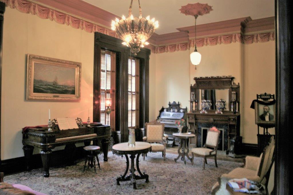
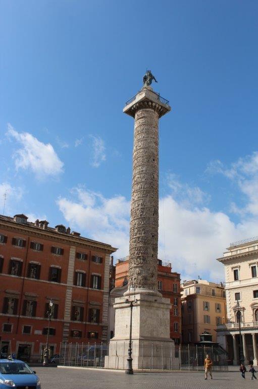
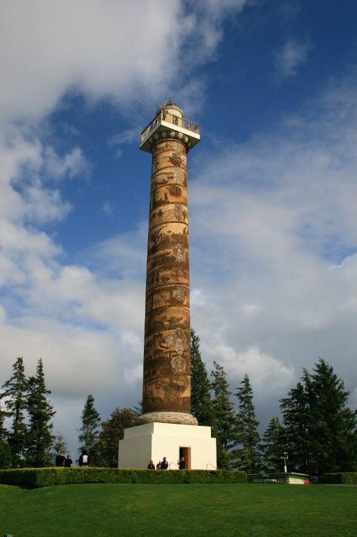
After we left the Flavel house we drove out to the Astoria Column, erected in 1925 as the last of 12 historic markers placed between St. Paul-Minneapolis and Astoria.  The markers were the pet project of Ralph Budd, President of the Great Northern Railroad.

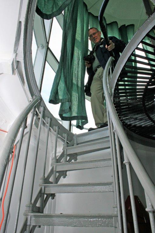
The column is 600′ above sea level and sits atop Coxcomb Hill.  It was modeled after the Trajan Column in Rome which we saw in 2012 when we took the Grand Mediterranean Cruise.

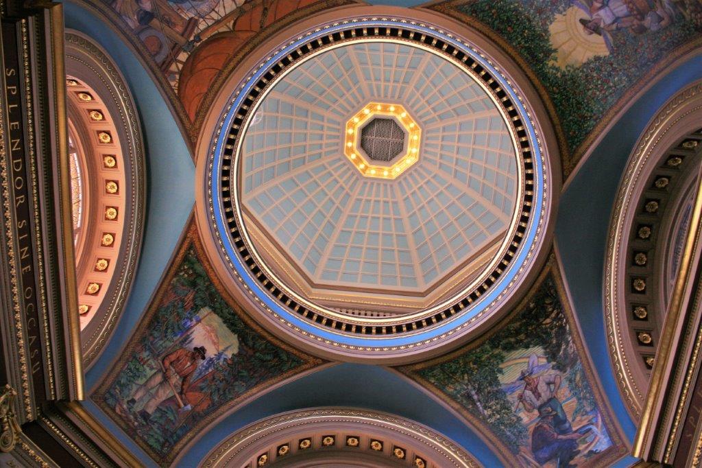
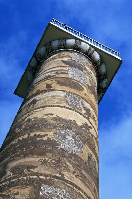
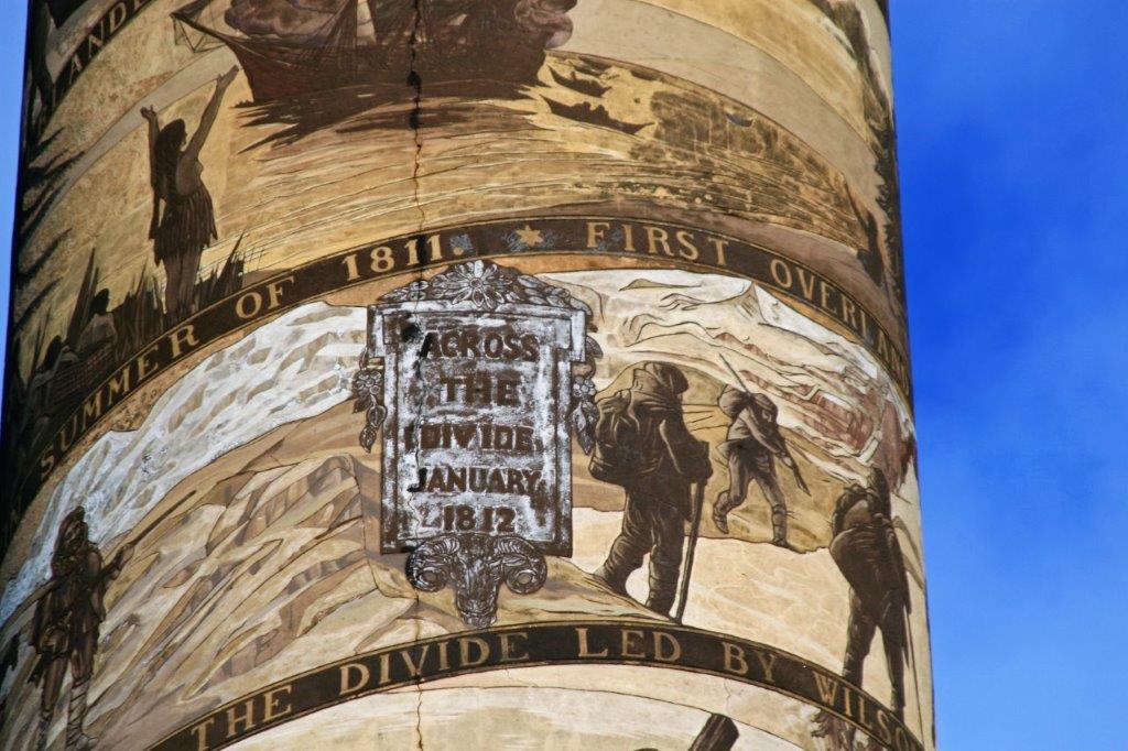
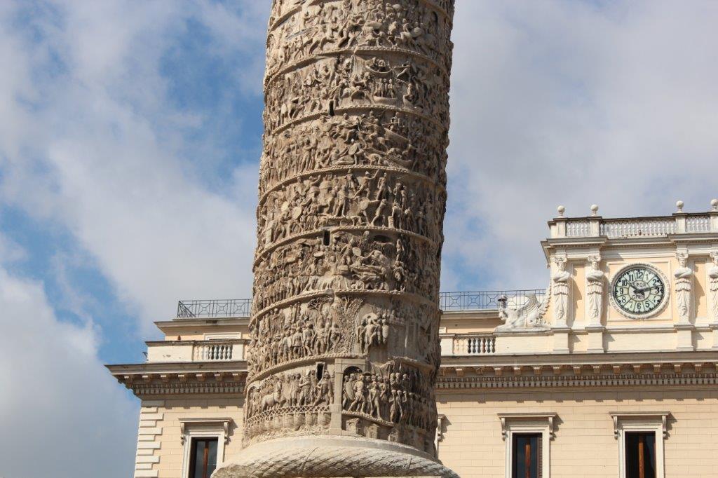
The hand-painted spiral frieze on the Astoria Column would stretch 500′ if unwound.  It is a graffito painting technique by artist Attilio Pusterla and took almost a year to complete.  The paintings commemorate historic events that transpired at the mouth of the Columbia River – beginning with its discovery and ending with the arrival of the railroad.

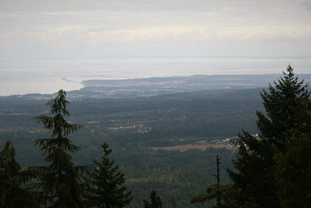
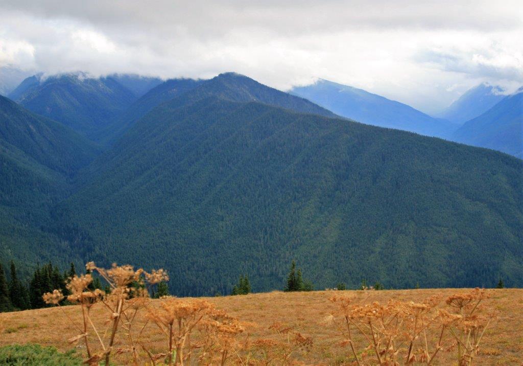
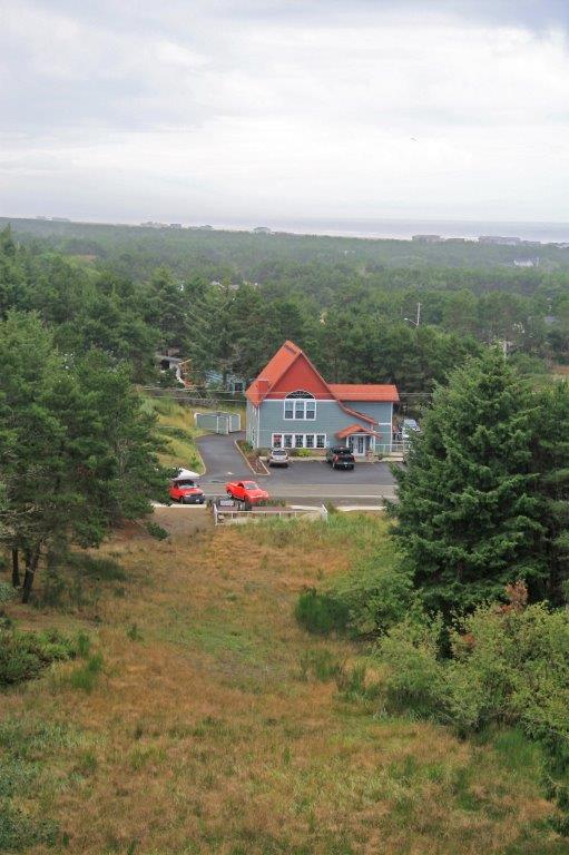
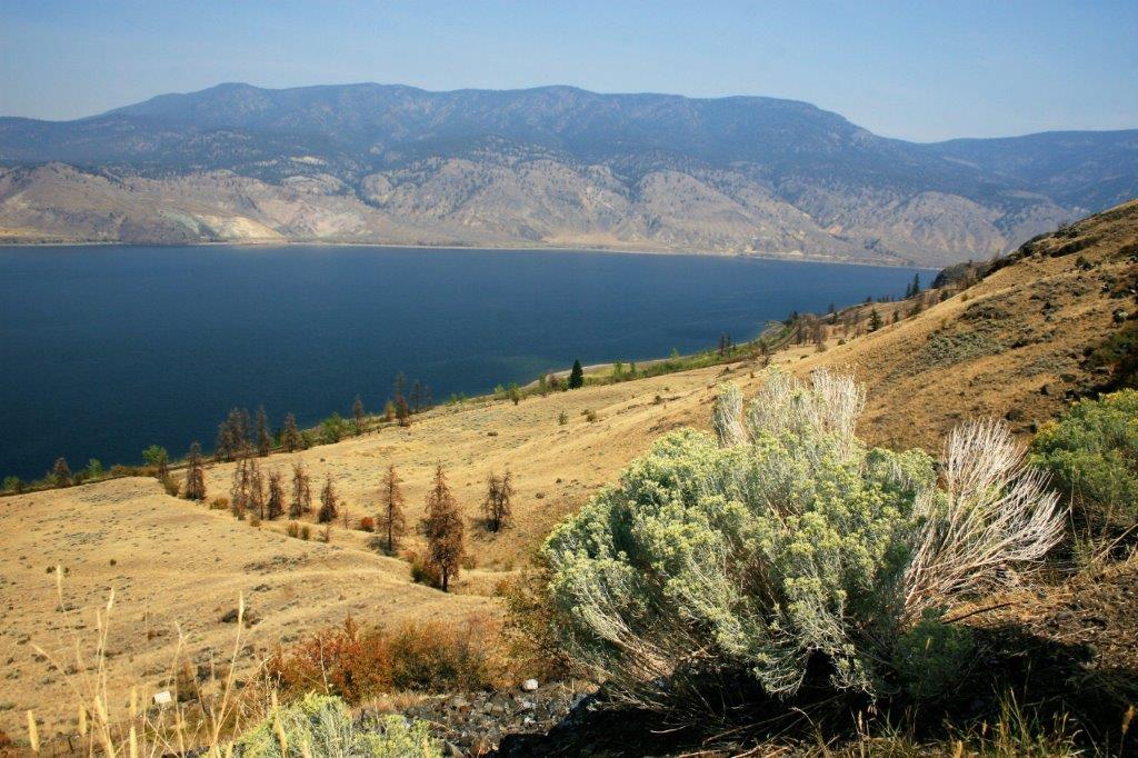
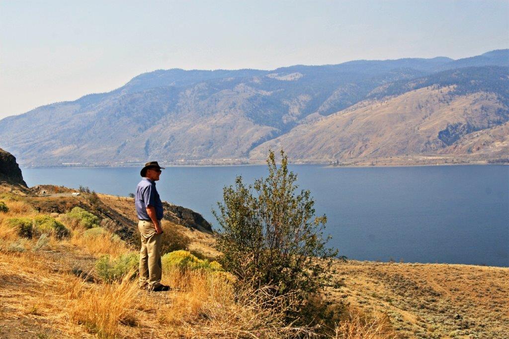
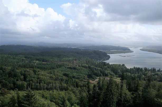
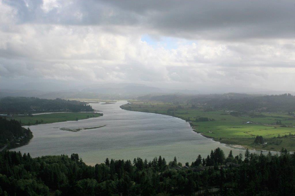
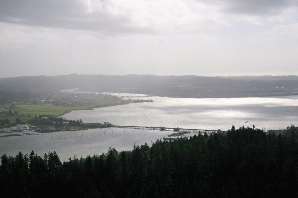
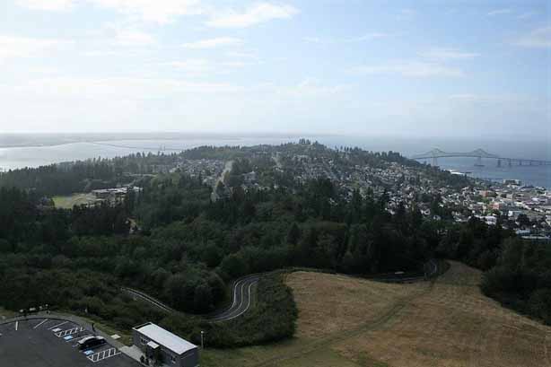
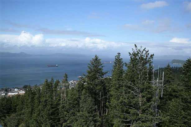
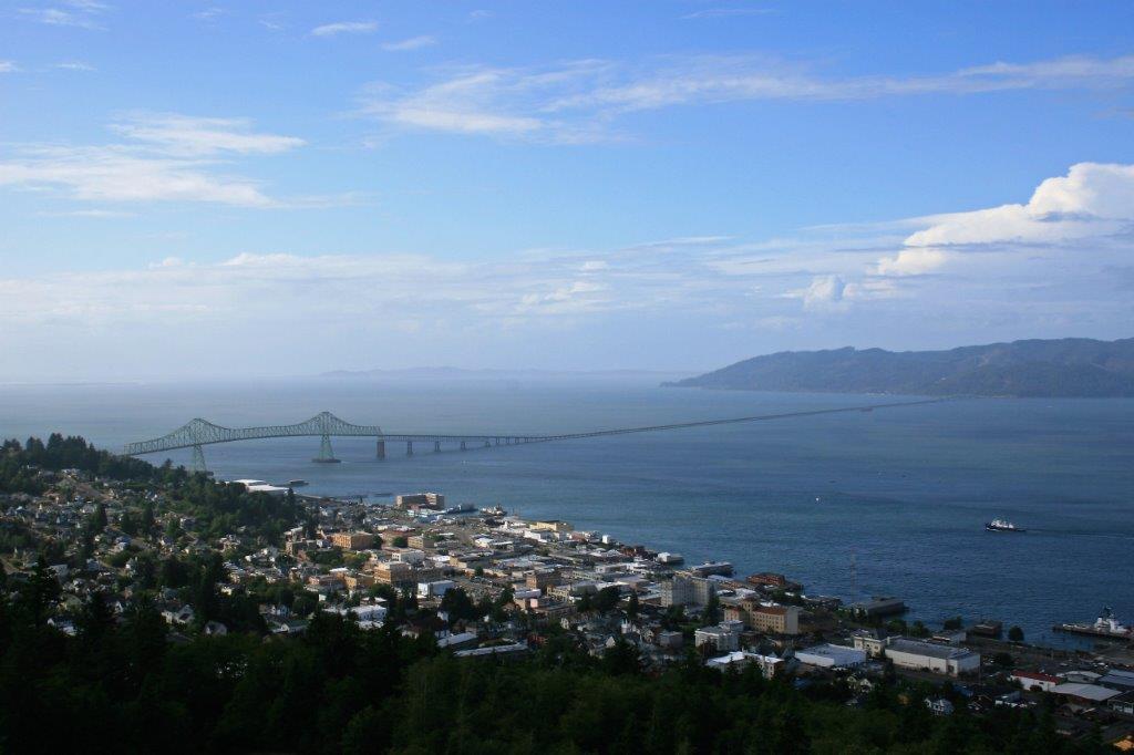
  The view from the top was spectaular.  You can see Young’s Bay, the Coast mountain range, the Columbia River and a significant distance of inland forest.

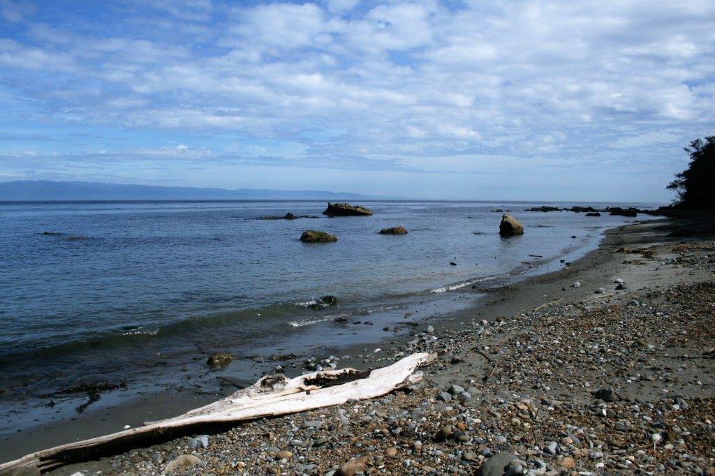
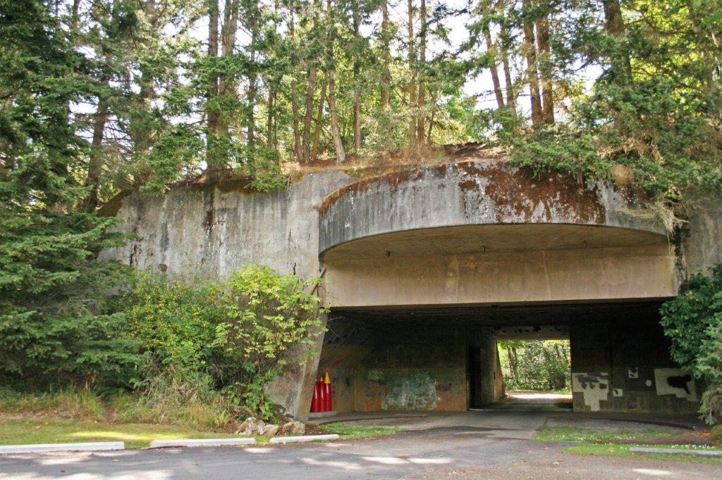
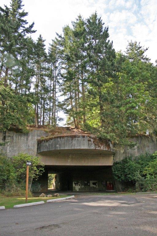
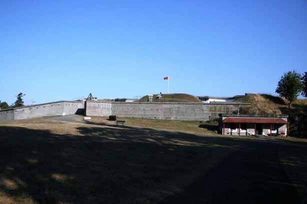
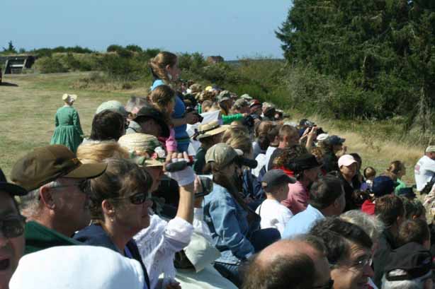
As we were looking for our hotel the night before we had seen an advertisement for a Civil War Re-Enactment at Fort Stevens that is held annually on Labour Day Weekend.  Fort Stevens is a five minute drive across the inlet from Astoria.  It was Sunday, the last day of the event but we decided to go have a look-see.  I had always wanted to see a Civil War Re-Enactment.

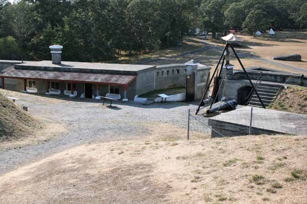
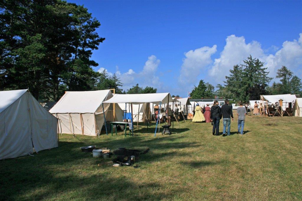
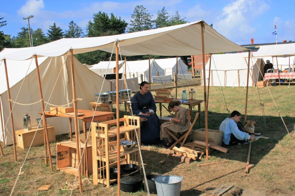
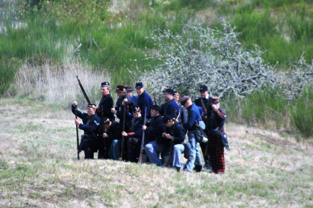
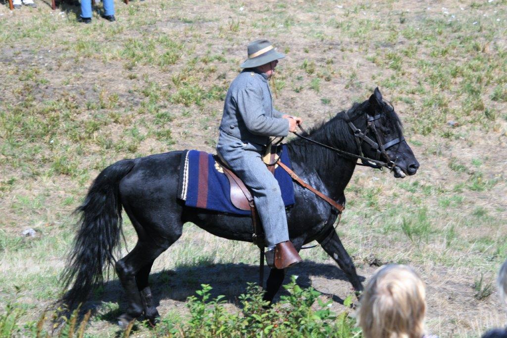
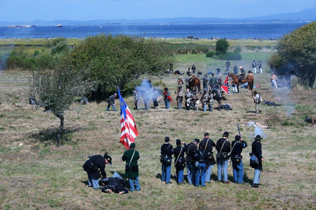
We spent much of the afternoon at Ft. Stevens.  It was great.  The event is big enough to have a Cavalry division attached to the Union forces.  The two camps were arranged just as had been done during the war: Union forces did not allow family members and support businesses to camp with the troops and the Confederacy had family tents within the troop compound.
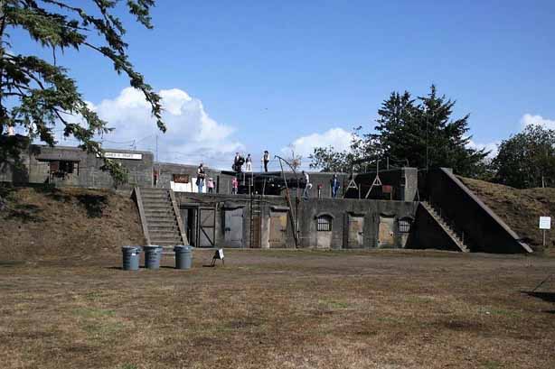
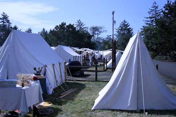
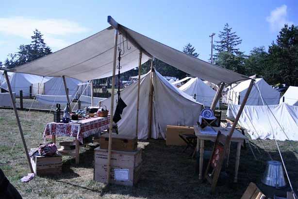
The Union Camp was quite structured (above photos)

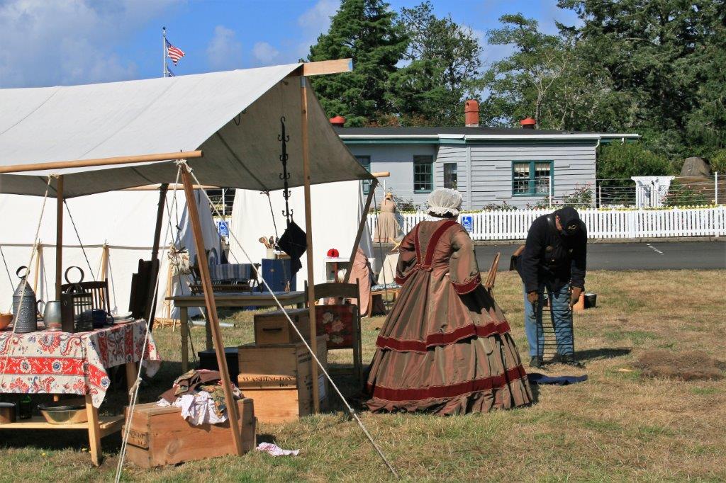
And the Confederacy was a little bit more mishmash.  Apparently this was typical.

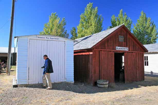
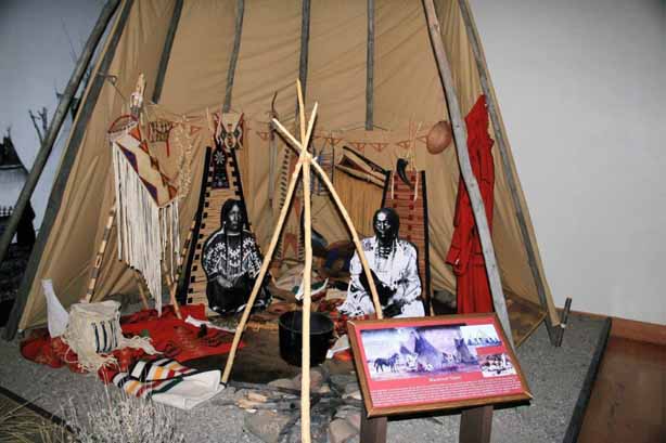
All the supporting entities required for a transient army had tents on site; blacksmith, baker, farrier, leatherworks, even a Christian center.  From the moment a person sets up their tent on the grounds they are ‘in character’ until the end of the weekend.  Even children play with simple toys and are dressed in period clothing.  All the cooking is simple outdoor camp fare.  
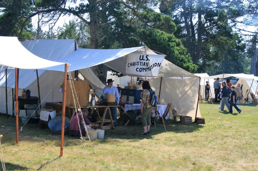
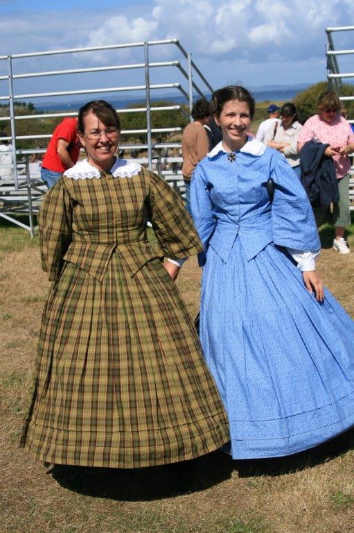
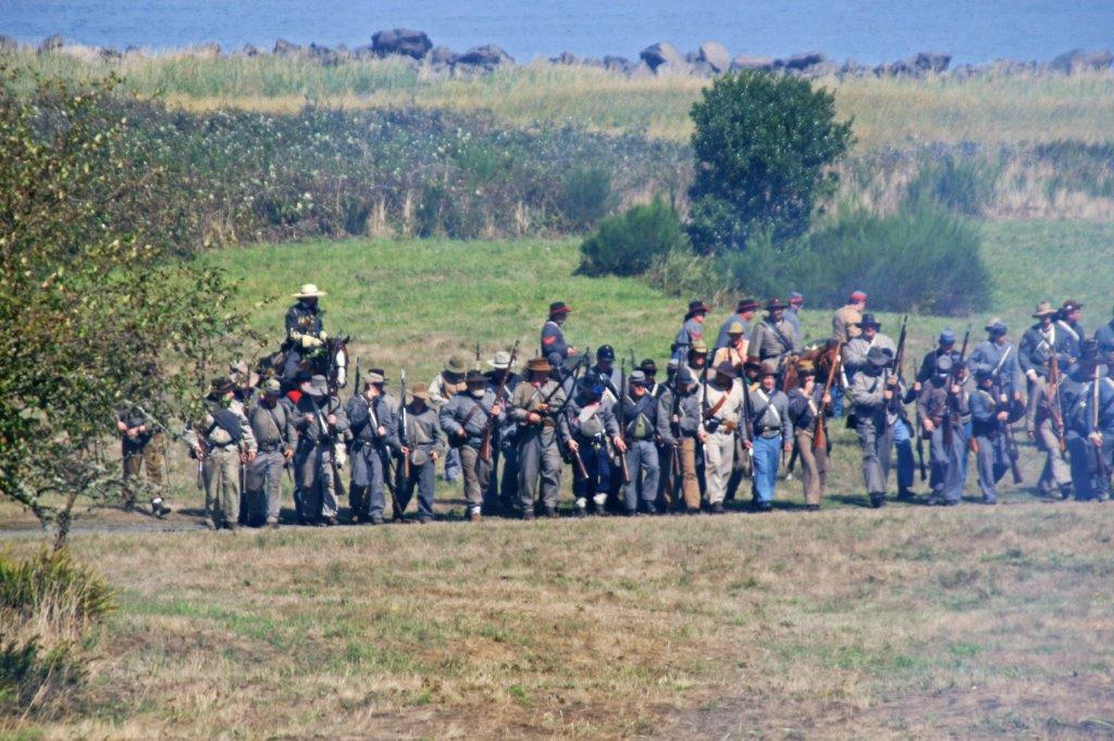
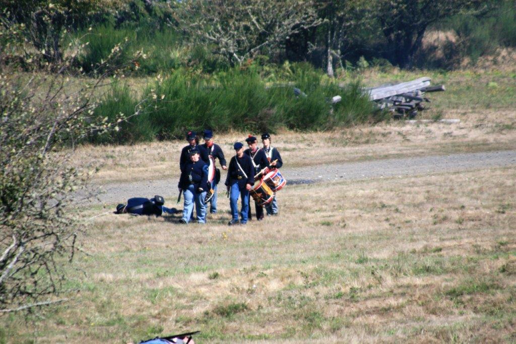
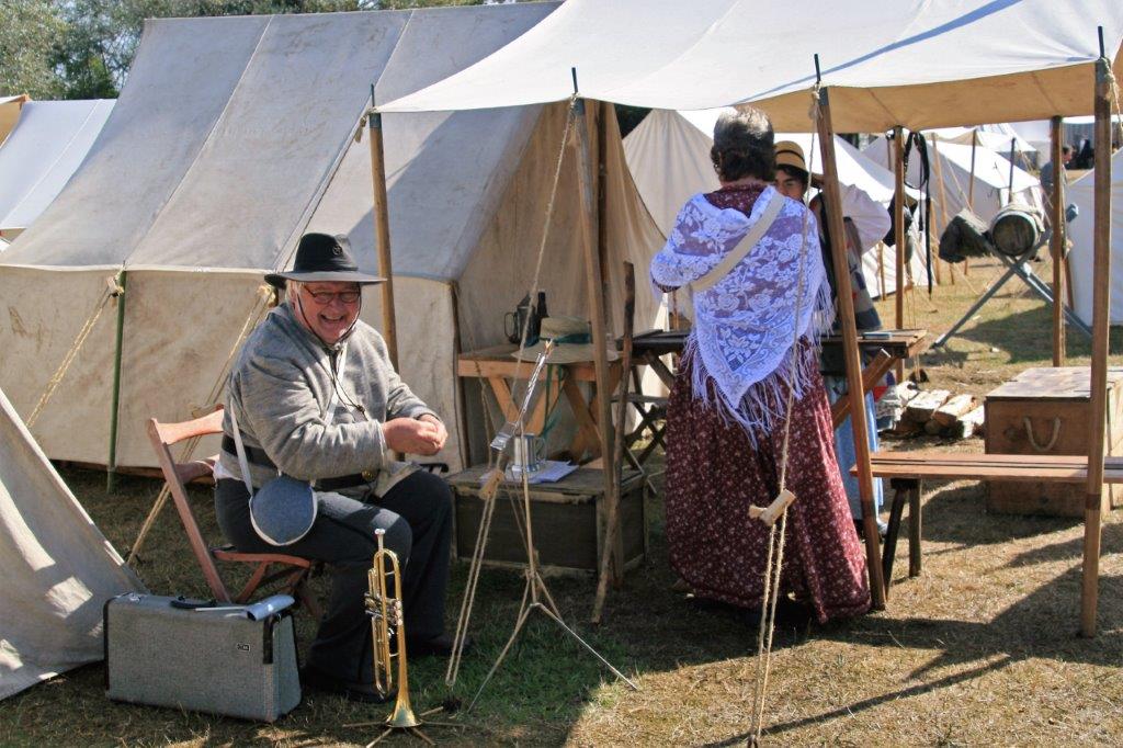
Many  different Union and Confederate Militia and Infantry were represented.  People choose which group and troop they wish to represent and puchase the gear and uniforms required.

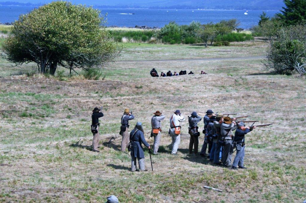
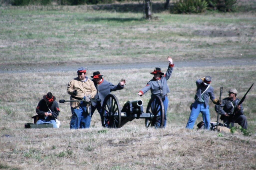
There was a schedule of battles posted for the weekend.  We were in time to see the final one.  Sometimes they re-enact an actual battle that took place during the American Civil War, sometimes, like the one we saw, the organizers create a scenario.   The ‘battle’ we saw was a rescue attempt by the Confederates to free some of their soldiers that had been taken prisoner by the Union army.

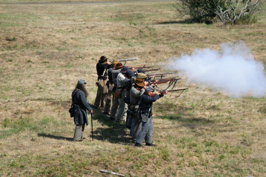
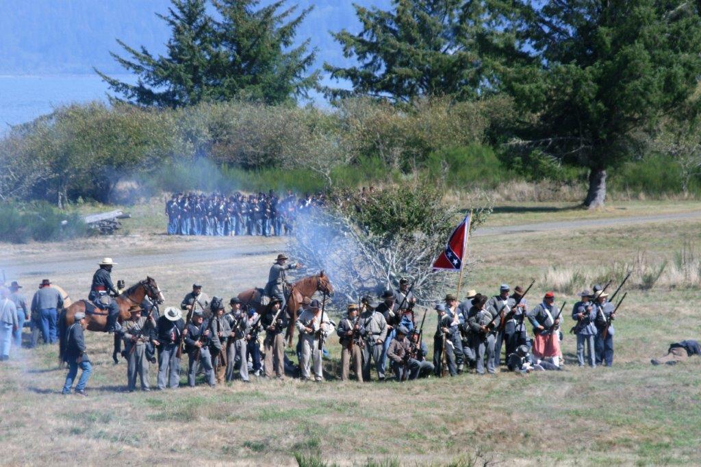
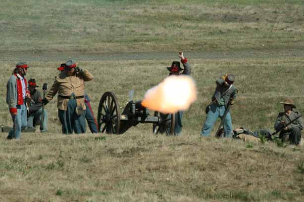
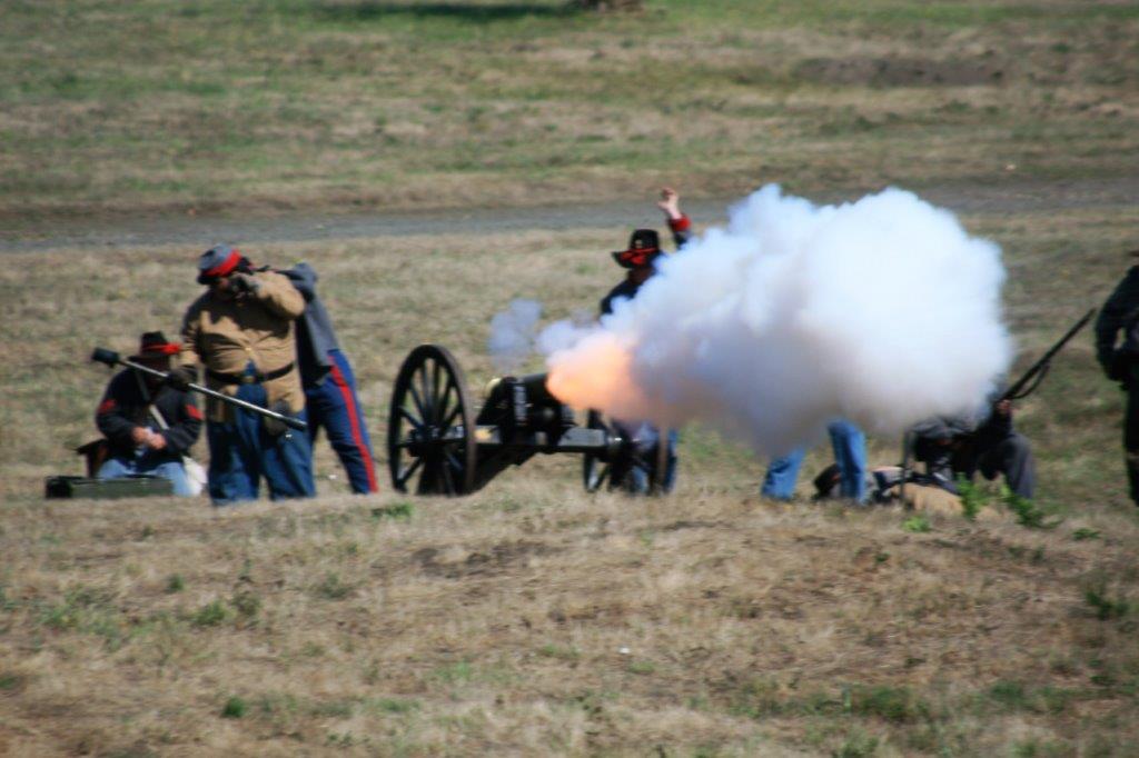
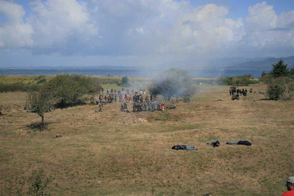
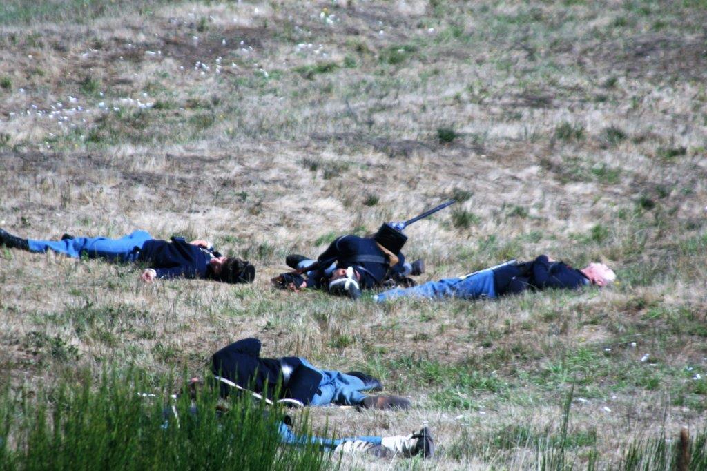
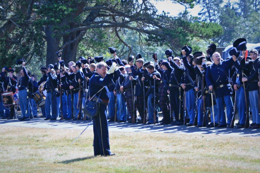
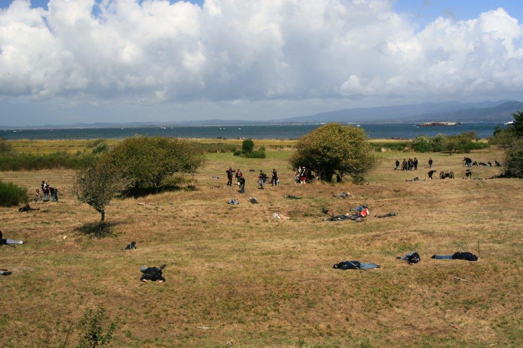
The battlefield was soon littered with ‘the dead.’  At the conclusion of the battle (the Union army won) all soldiers doffed their hats in a moment of silence for their ‘fallen’ comrades while the bugler played “The Last Post.” 
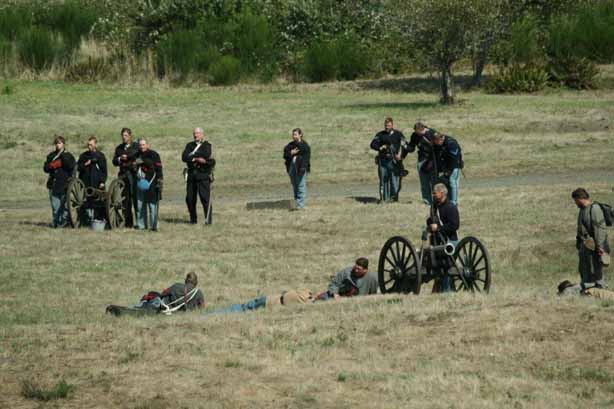
To finish of the performance the two armies formed a line and took turns firing their muskets and rifles.  
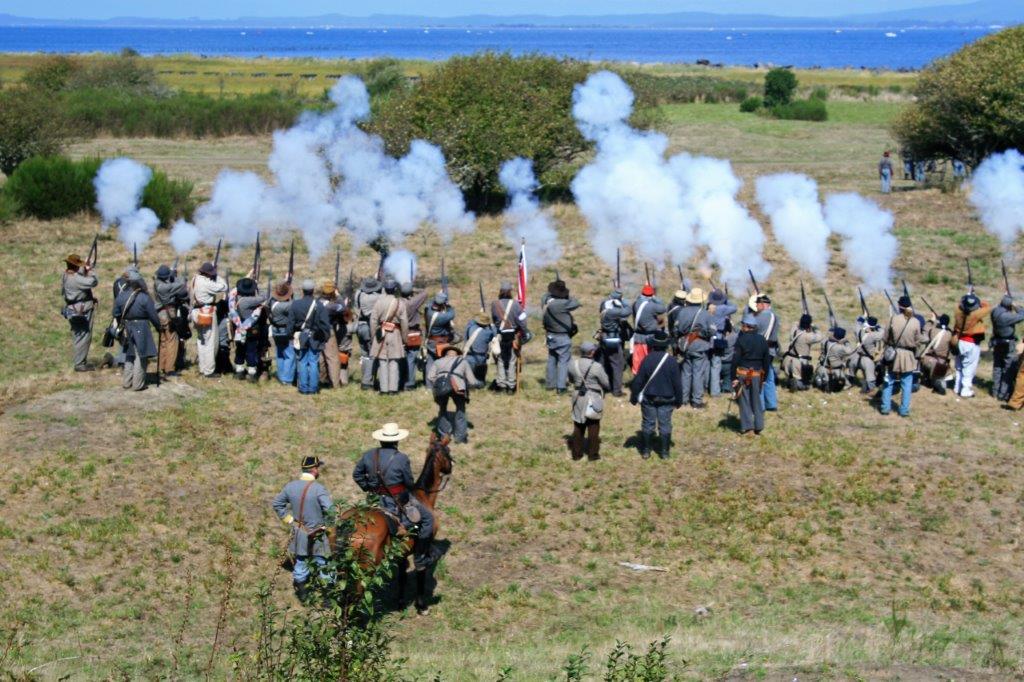
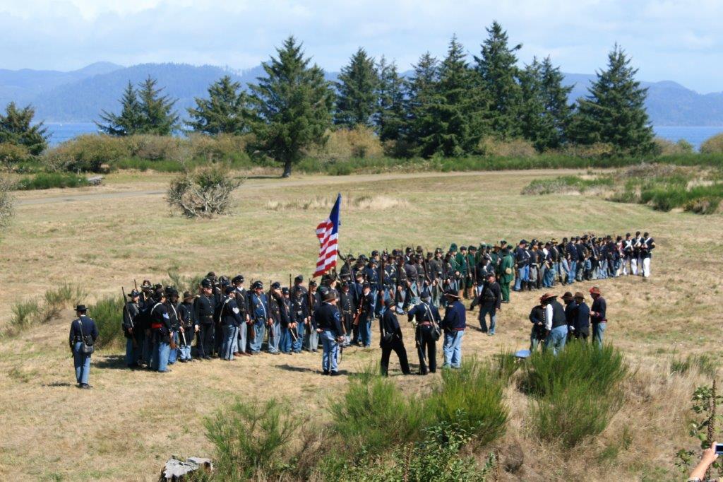
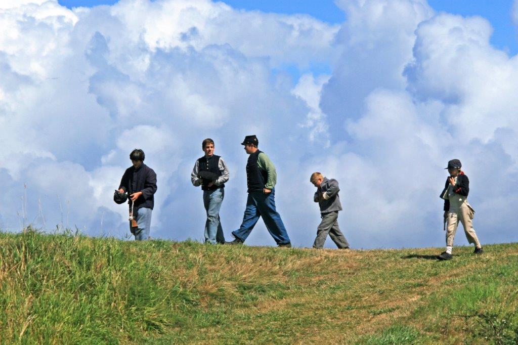
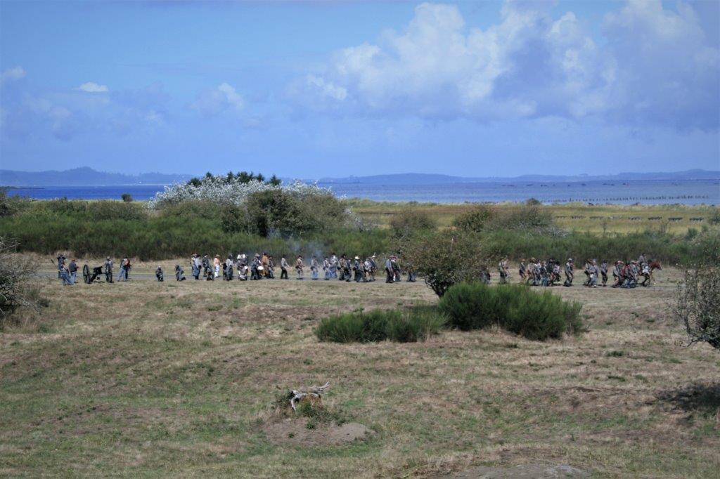
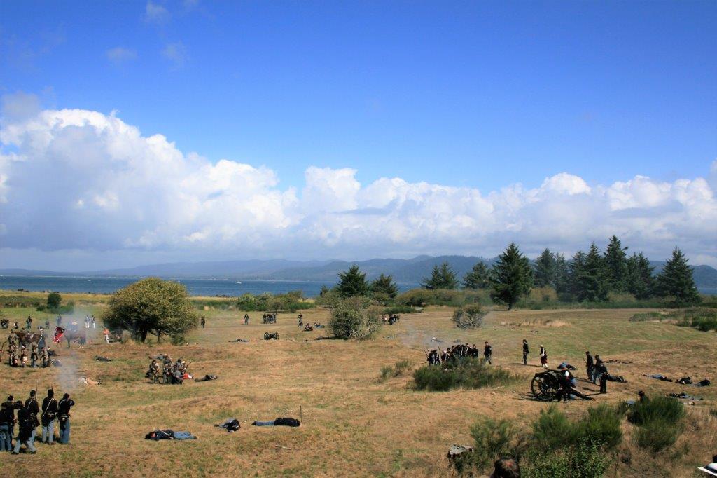
All of the soldiers joined in a march from the battlefield to the campsite and gave a cheer for a job well-done. 
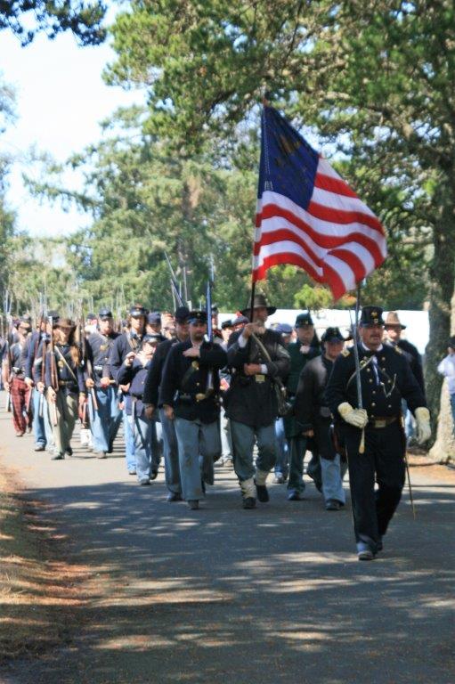
It was really neat to see.  I am glad we chanced upon the advertising sign.  If you are ever going down the Oregon coast near Labour Day I recommend you make some time to go to Fort Stevens.

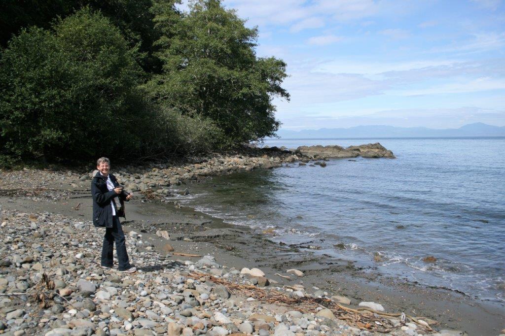
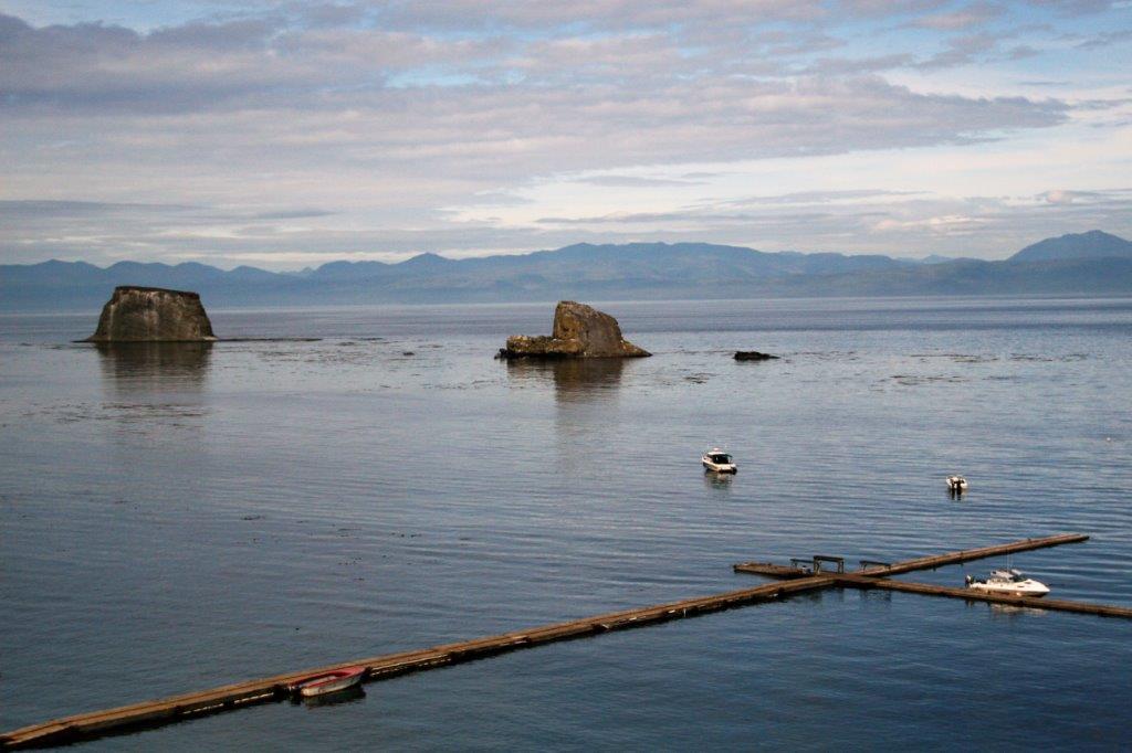
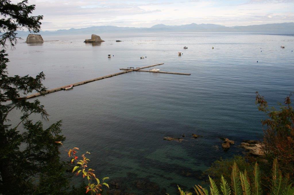
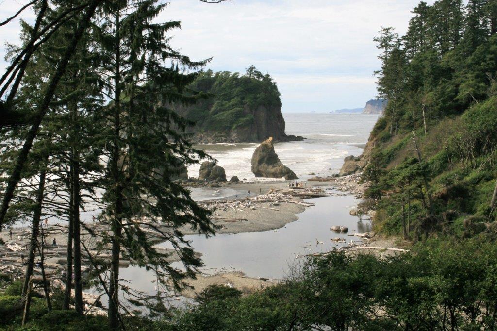
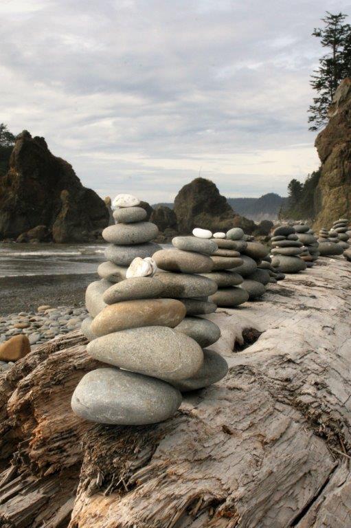
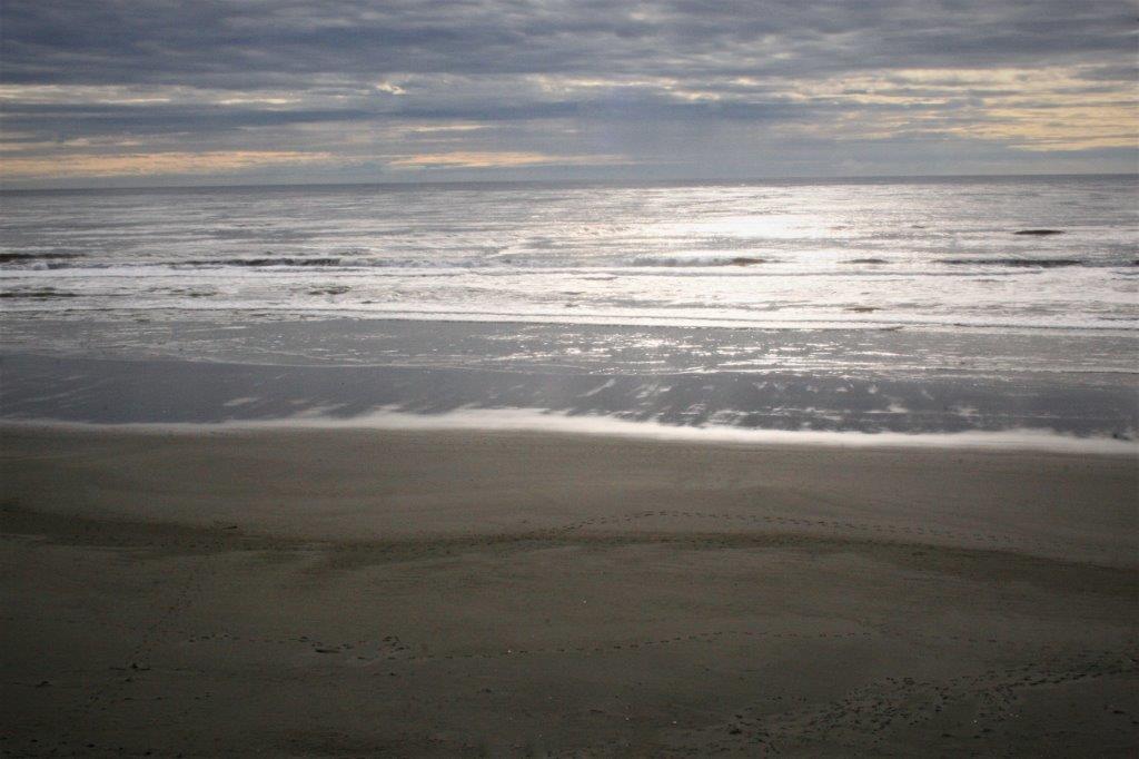
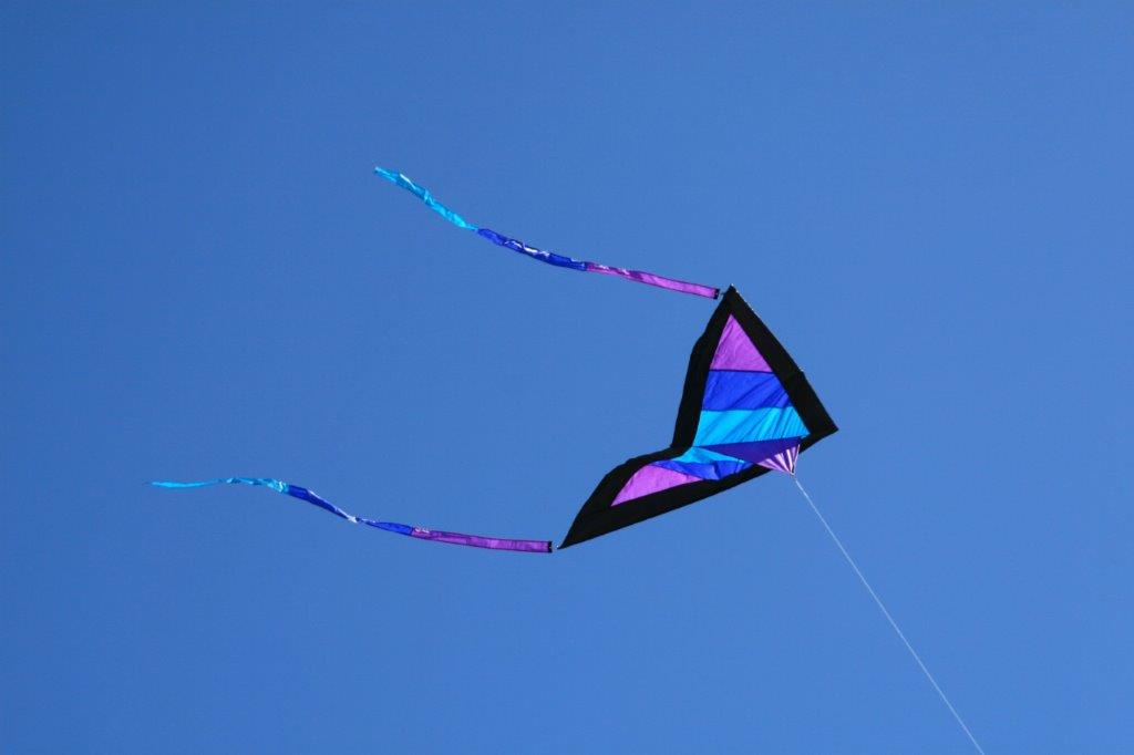
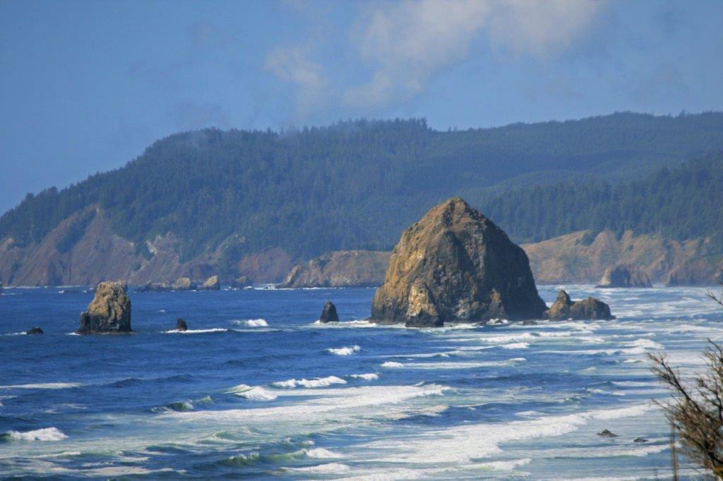
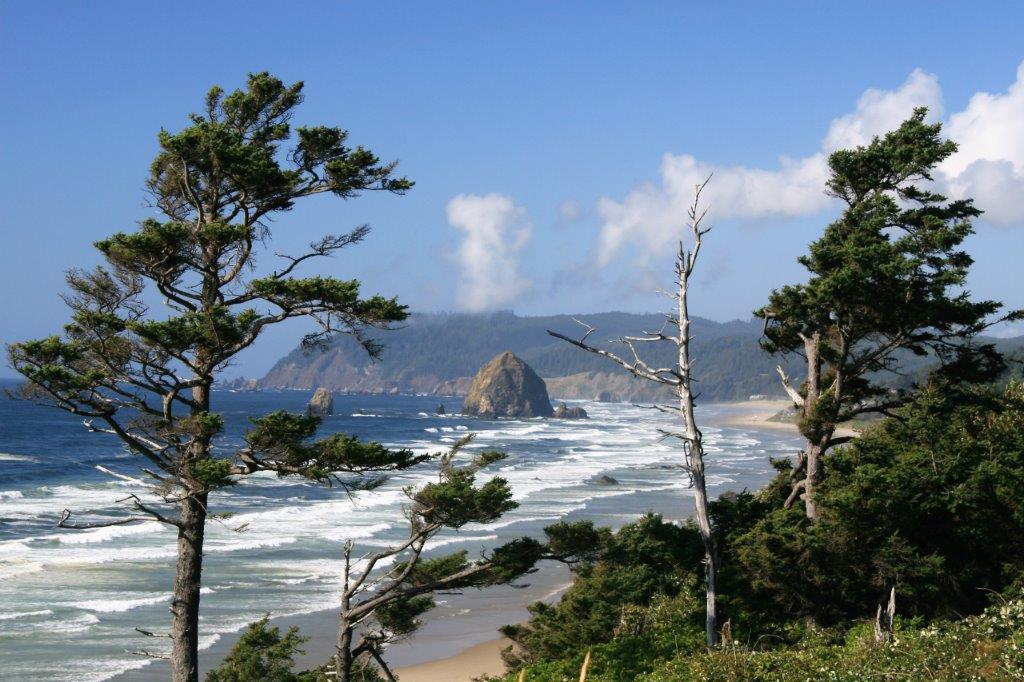
We had a reservation in Tillamook for the night and the War Re-Enactment was coming to an end so we headed southward.  We stopped at Cannon Beach and got some good photos of Haystack Rock.  This is a popular kite-flying beach and there were many people out enjoying the activitiy that day.  
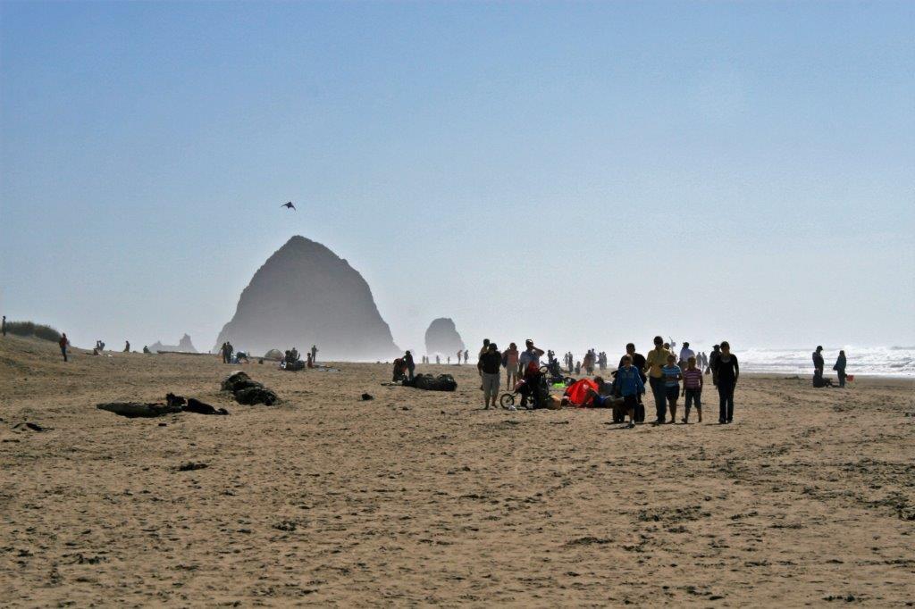
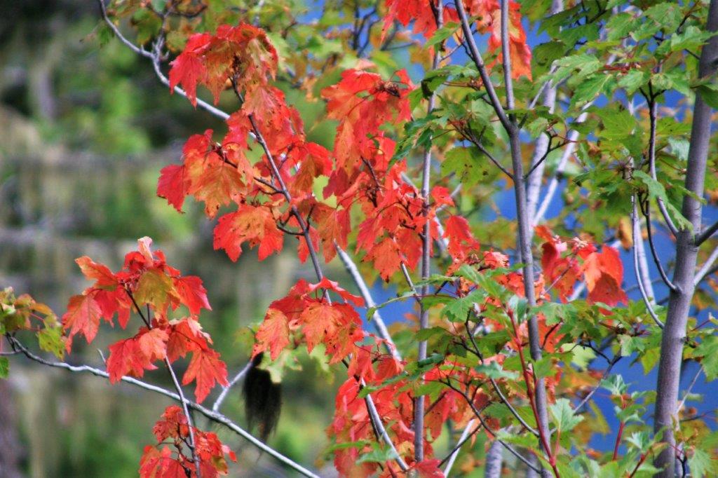
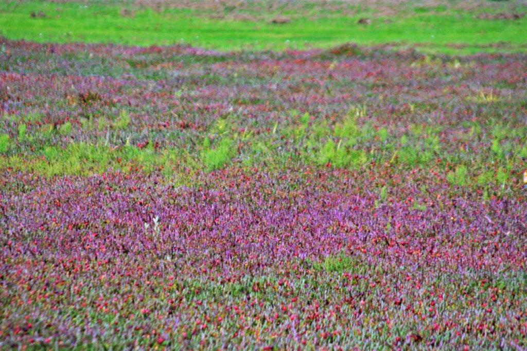
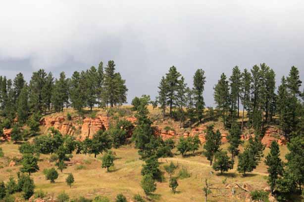
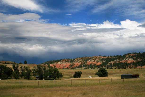
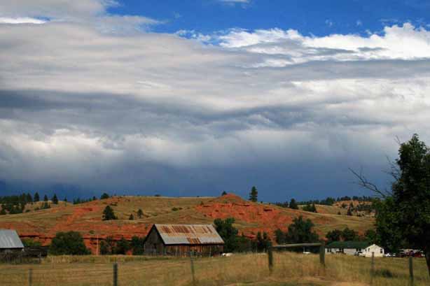
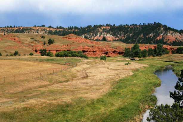
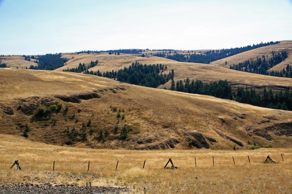
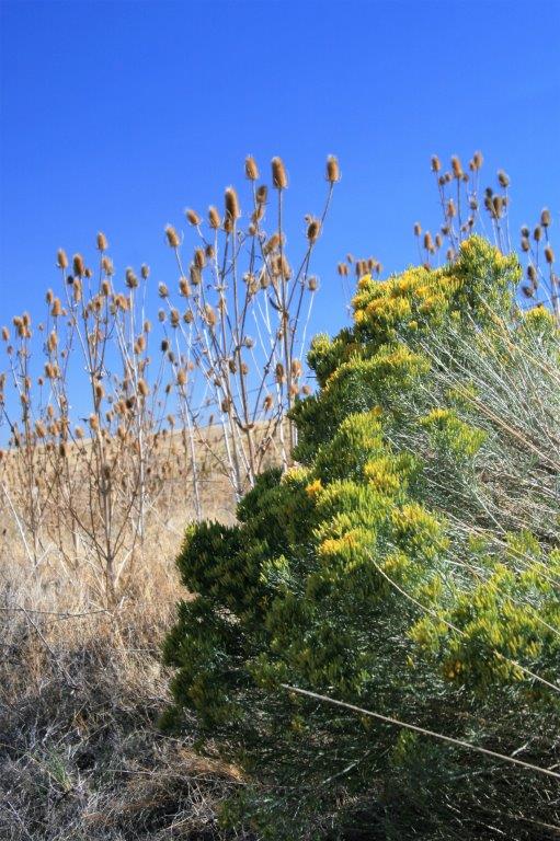
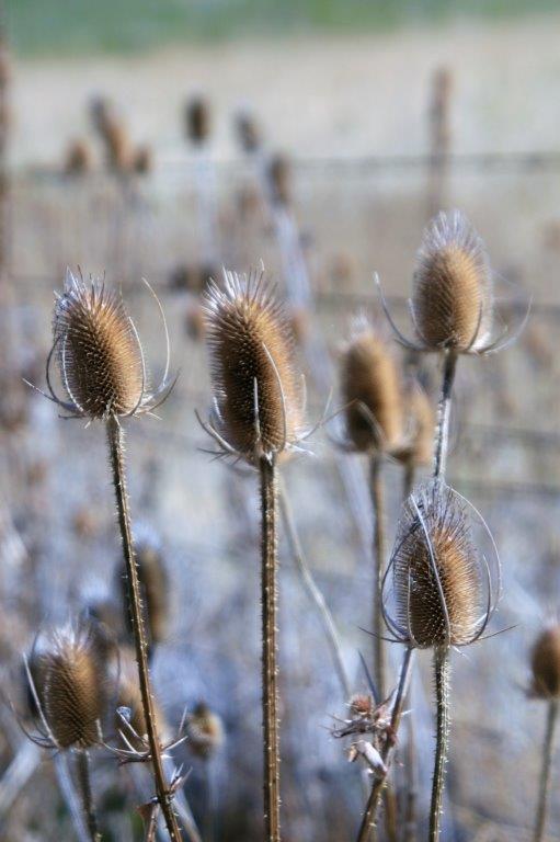
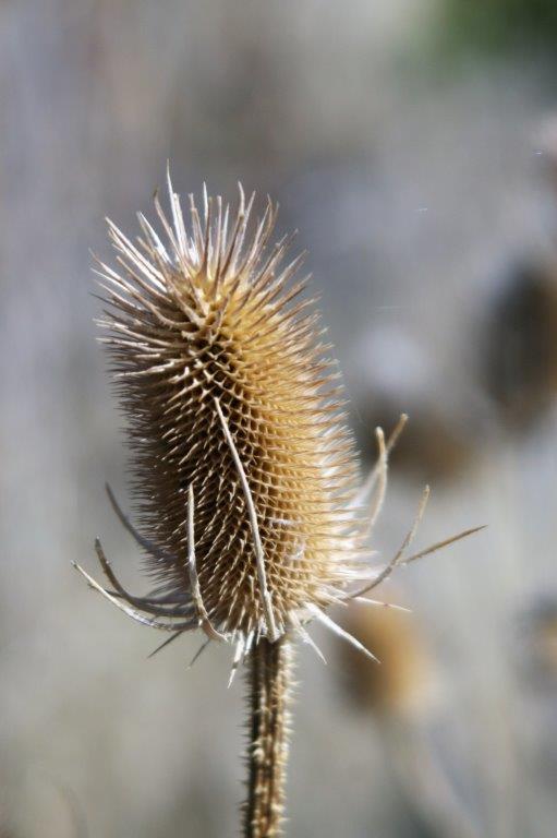
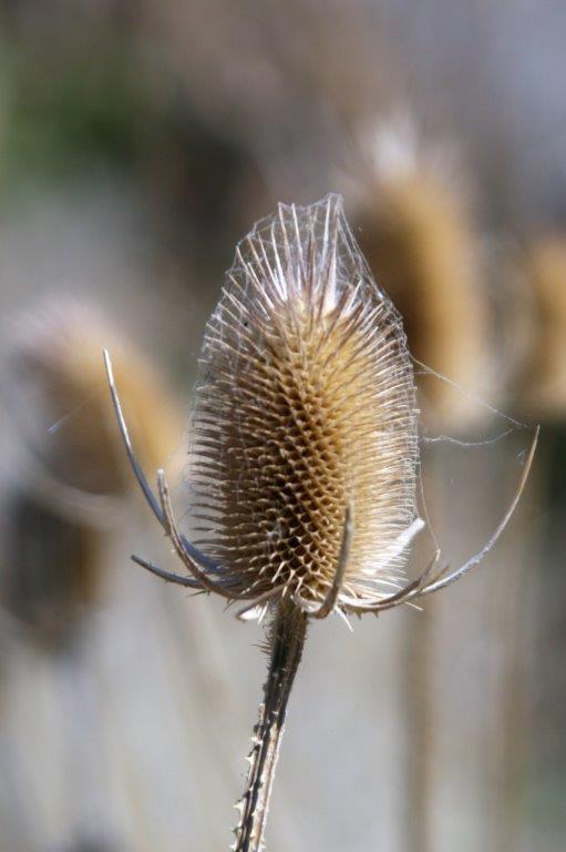
We stopped again not far out of Tillamook and took some photos of the tall dried thistle-like plant growing beside the road. 
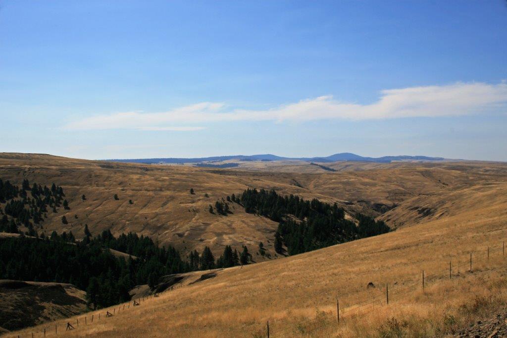
It turned out to be a very full, very interesting day.

2009 Sep 3-5 – Days 9-11 – Washington Coast

We left Victoria the morning of September 3 and took the ferry across Juan de Fuca Strait to Port Angeles, WA.  The Strait separates the southern end of Vancouver Island, British Columbia from the Washington Olympic Penninsula, much of which is protected in Olympic National Park.The 18-mile drive from Port Angeles up Hurricane Ridge takes you ever-deeper into dense forests of Douglas fir, hemlock, western red cedar and alders.

About half-way up is Lookout Rock where there are views – on a clear day – of the strait and Mount Baker.At Crescent Lake there are a few cabins and a couple of resorts.  The area is very popular for hiking holidays in the summer.  There is a road that encircles the park but most of the natural beauty spots have to be reached on foot.
Marymere Falls are at the end of a three-quarter mile trail.  The falls drop 90 feet down the rock face in a pretty cascade. Unless you are camping (and I don’t camp), there are not many places to stay along the coast of the penninusula so we drove back to Port Angeles for the night.

The next day we began to follow the coast road south.  There are many nice beaches and coves along the route and we would often pull over and take a walk along the shore. Our drive took us through one of the many WWII defensive bunkers that were built along the western coast of the United States in case of further attacks by the Japanese.

We really liked Ruby Beach and we spent quite a bit of time wandering over the rocky beach.  The shore is littered with driftwood and completely covered with round rocks, smoothed by the ocean tides. That night we stayed in the community of Aberdeen which sits at the end of Grays Harbour, an almost-completely enclosed natural harbour.

A short drive down a spit at the end of Grays Harbour takes you to Westport Light; which, naturally, has to be climbed.


At Westport there is an excellent Maritime Museum. Westport also has a very active fishing fleet and there were many boats tied up at the marina. The Westport area is home to huge cranberry bogs.  Cranberries are big business here and there is a nearby processing plant. We crossed the bridge to Astoria, Oregon and had a lovely dinner at a restaurant with a beautiful view of the water and the bridge.  After dinner it was time to check-in to our hotel for the night.

2009 Aug 31-Sep 2 – Days 6-8 – Sooke and Duncan, BC

During our one-week stay in Victoria we took a drive west to the town of Sooke.  This community is where my grandparents lived when I was young and I remember with fondness the one time we visited them.  My grandpa teased my younger sister and me and constantly referred to us as “The Terrible Two.”  Grandma and Grandpa took us out for dinner at White Spot in Victoria.  This was a great treat!  We almost never ate in restaurants.  While we visited I read the book “One Hundred and One Dalmations” by Dodie Smith and years later when John and I took our infant son down to meet my grandparents in Victoria, where they were now living, Grandma remembered how much I loved the book and gave it to me.  I still have it.  It is a wonderful story.  I highly recommend it as a ‘chapter-a-night’ bedtime story for kids. Quite different from the Disney movie version.

On the way to Sooke we stopped at Fort Rodd Hill National Historic site and toured the old bunkers from WWII.  (All the photos at Fort Rodd Hill are John’s.  Mine were no good and I deleted them.) Fisgard Lighthouse is situated nearby along the southern end of Vancouver Island.  It was a lovely day and the light looked very picturesque on its rocky point. This young deer was very curious about the two strange two-legged animals it saw.  It stood watching us for quite awhile before moving off.

We went to Sooke to go ziplining at AdrenaLINE Zip Lines, which takes you from treetop to treetop.  We had gone ziplining when we were in Princeville on the northern tip of Kua’i a couple of years before and it was a blast so we thought we would do it again.  I video taped John coming in on one of the lines and all you see is a forest of trees and hear a fast whirring sound.  Then suddenly John bursts out of the trees and speeds past me.  Unfortunately the blog site is not set up for video. You will have to settled for these photos that John took of me. As you can tell by my happy expression we had a great day!

The next day we drove north to Duncan, about an hour away.  The Pacific Northwest Raptor Center is located there and we spent a pleasant few hours checking out the birds and watching the handlers give a demonstration of the raptor’s skills.  I have a short video clip of a hawk flying through the spread legs of about 12 guests.  It flies so fast you can’t even see it until it is lifting up and away. Really awesome stuff!  And so much fun to see.  Cooper’s Hawk                                              Bond, a Ferruginous Hawk.   Lucy is a Harris Hawk and (below) is Chinook, a Redtailed Hawk

 This is a Saker Falcon                               Anakin, the Harris Hawk                                                A Barn Owl.                         Even the Black  Vulture is part of the show.   This little Gryfalcon was quite the star.  These are an Australian Kookaburra and a Spectacled Owl.

September 2, back in Victoria, we took a tour of the BC Parliament Buildings.  We toured this building when we were on our honeymoon many moons ago and it was nice to see it all again. These four murals, depicting the resources of British Columbia are painted around the central dome.The room where all the silliness takes place. And, occasionally some work that benefits or hinders the province and/or it’s citizens. The coat of arms of British Columbia.  I love stained glass windows!View of the front lawn from one of the windows.  The Inner Harbour is straight ahead and the Empress Hotel is on the right. A short walk down the side of the Inner Harbour from the Parliament Buildings takes you to the world-famous Empress Hotel, where you can partake of High Tea every afternoon.  The Empress has an absolutely stunning rose garden and I had a great time photographing many of them. This was our final day in Victoria and in the morning we drove to the ferry terminal and crossed Juan de Fuca Strait to Port Angeles, Washington, where began our coast drive.


2009 Aug 26-30 – Days 1-5 – Home to Victoria, BC

The first ‘long’ road trip we took after we retired was a trip down the Washington – Oregon coast.  We had known for years it was a lovely drive and a must-see.  We began our trip with a one week time-share stay in one of our very favourite cities; Victoria, BC.  John and I used to say, many years ago, that if we ever had to leave our home in south central British Columbia we would move to Victoria.  The climate is mild, the scenery is beautiful, and the city still has the old-English charm from back in the day.  We have been to Victoria many times but always love to go back.

We drove down to the Vancouver area and spent the night before taking the 1 1/2 hour ferry ride from Tsawwassen (pronounced Twasen – you combine the T and W as in twirl) to Schwartz Bay, which is about a half-hour drive from Victoria.
 During the ferry crossing we saw a couple of Killer Whales in one of the coastal inlets.  They didn’t seem bothered by the other ferry. Most of our days in Victoria were leisurely and we took quite a few walks along the beautiful Inner Harbour with the Empress Hotel. This “Copper Cowgirl” live statue was excellent.  She held each of her poses for many minutes and was very engaging to watch.

We were staying in Rose Cottage, a few blocks behind the BC Parliament Buildings and an easy walk to Beacon Hill Park.  We had been here years ago when we visited my grandparents in Victoria but had never spent much time wandering around.  I was happy to see all the cute animals in the kid’s petting zoo. The flower gardens were gorgeous. We walked most places during our stay and passed the Parliament Buildings on several occasions.  It is a great place to people watch. Since this trip was taken almost 8 years ago I don’t promise to be able to remember the names of all the lighthouses or coves along the coast, but I will do my best to relate the trip as accurately as I can.  We were gone three weeks so even if I lump a few days together as I did with this blog there will be a few for you to read.  Hope you enjoy the trip.  We had great weather and a great time.  But, then, John and I always have a great time when we travel.

2010 Sep 1-6 – Days 21-26 – Hardin, MT to home (Fort Benton)

This is the final entry on my 2010 Road Trip blog.

We had spent the night in Hardin, MT, a few miles east of Billings.   The next day, as we drove through Billings we stopped to tour the beautiful Moss Mansion.  No photos allowed inside unfortuantely but even the outside and garden were pretty nice. Our drive that day took us to Great Falls.  Once we make the decision to head for home John tends to get in destination mode and we don’t spend a lot of time finding stops of interest; so we pretty much have driving days.

From Great Falls we went back to Fort Benton. Since we were not able to tour the fort and museum on our way down to Yellowstone we stopped in again on the way back to BC.

At Fort Benton there is also the Museum of the Northern Great Plains which had interesting exhibits and a ‘typical’ town heritage street. In the museum is a taxidermy group of six buffalo.  These animals were collected by a man named Hornaday in 1886 on behalf of the National Museum in Washington, DC, when the species was on the brink of extinction, in order to preserve an example of these great creatures.  The animals were on display in the Smithsonian for 70 years and the big bull’s image was the model for several national symbols and issues. Coins, paper currency, postage stamps, the Great Seal for the Department of the Interior, and the National Park Service badge all bear his likeness.  The group was returned to Ft. Benton in 1955 but was put in storage until the it was completely restored in 1996 in the original positions and put on display. After we toured the museum and town we entered the fort.  Fort Benton was established in 1846, a full generation before the Civil War, and was the last fur trading post on the Missouri River before a 642-mile overland trek on the Mullan Road that would get you to Walla Walla, Washington. Inside the replicated trading post we were greeted by the ‘trader’ who gave us the lowdown on the items that were the common goods kept in stock. John ‘wore’ a hide as a demonstration. The one constant as we drove around Montana and Wyoming that summer (and I would think every summer) is the massive number of mosquitos that meet their end on the truck and windshield.  It was a daily chore to clean them off. We spent the night in Havre, then Spearfish, ID, then Nelson, BC and finally, after three weeks, we were home again.  This endeth the blog.  Thanks for tagging along.

2010 Aug 31 – Day 20 – Gillette, WY to Hardin, MT (Little Bighorn)

My Daddy’s “Drive North America” books says, “Montana’s Crow Indian Reservation is the site of perhaps the most famous event in Plains Indian history.  Here, in 1876, along the cottonwood-shaded banks of the Little Bighorn River, Lt. Col. George Armstrong Custer made his legendary last stand – a rout of some 260 soldiers of the 7th Cavalry by almost 3,000 Sioux andCheyenne warriors.”

Another of Dad’s travel books, “Handpicked Tours of North America,” describes the situation like this: “The Cheyenne, a few Arapahos and Sioux  under the Sioux warrior Sitting Bull trespassed on Crow land in the biggest congregation of Indians ever assembled on the plains. The brochure I picked up at Monument gives some background: “The Lakota and Cheyenne left their reservation in the Black Hills in frustration over the invasion of their given lands by thousands of gold seekers who swarmed into the area in violation of the Ft. Laramie Treaty.  The government tried to keep the prospectors out to no avail and also tried to buy the land from the Indians to circumvent hostilities; also without success. Thus the indians resumed raids on settlements and travelers along the fringes of Indian domain.  They were ordered to return before Jan 31, 1876 or be treated as hostiles “by the military force.”  When the Indians did not comply, the army was called in to enforce the order.  Some Crow scouts accompanied the U.S. Cavalry units as they set out to force the trespassers back onto their own reservations.” “The Bureau of Indian Affairs, misjudging the situation, told the army that only 800 warriors were involved. The fact was that 10,000 to 12,000 Indians had joined Sitting Bull’s forces, including some 4,000 warriors who were among the best cavalrymen on earth, many of them armed with the latest repeating rifles, which they had obtained from reservation traders.”

“Unknown to Custer, another army unit had encounterd the natives on Rosebud Creek, east of Little Bighorn.  The army had been fought to a standstill and forced to withdraw.  This success further encouraged Sitting Bull to continue into Little Bighorn Valley and set up camp.”

“Custer was leading one arm of a pincer movement, and had rushed his cavalry unit into a position where he could block an expected Indian retreat as another army unit advanced.  He located the Indian camp at dawn on June 25 and divided his regiment into three battalions to surround and attack a superb, eager-to-fight army, which he was unaware outnumbered him five or six to one.”

The Little Bighorn Battlefield National Monument encompasses the land where the battles took place.  There are paved pathways on a self-guided interpretive trail that winds through the tall grass and past the grave markers.  The Rangers in the visitor’s center willingly answer questions and explain the events of the battle. “After the battle the bodies of Custer and his command were hastily buried in shallow graves at or near where they fell.  In 1877 the remains of 11 officers and two civilians were transferred to eastern cemeteries. Custer’s remains were reinterred at West Point.  In 1881 the remains of the rest of the command were buried in a mass grave around the base of the memorial shaft bearing the names of the soldiers, scouts and civilians killed in the battle.  In 1890 the Army erected 249 headstone markers across the battlefield to show where Custer’s men had fallen.  In 1999 the National Park Service began erecting red granite markers at known Cheyenne and Lakota warrior casualty sites throughout the battlefield to provide a balanced perspective of the fierce fighting that occured here in 1876.”There is now a memorial area commemorating the Indian’s that fought and a marker to honor the Cavalry horses that were intentionally shot to provide some amount of cover from the arrows and bullets. Little Bighorn Nationa Monument is also the site of Custer National Cemetery which is a military burial place still in use today. Once again, I was awed and moved to be walking the ground of an historical event I had learned about in grade school and seen immortalized on screen.


2010 Aug 30 – Day 19 – Lead, SD to Gillette, WY (Devils Tower)

A few miles west of Lead, SD is Roughlock Falls, created by Little Spearfish Creek.  The water flows down a spectacular chasm then tumbles off a 50 foot limestone ledge in a series of cascades.  It is very pretty and one of the most-photograph spots in South Dakota’s Black Hills.

We turned north after visiting the falls and drove up to the old cattle drive staging town of Belle Fourche (beautiful fork); named by French explorers from New France (much of Quebec and the Acadian pennisula – New Brunswick, Nova Scotia, Prince Edward Island – and Newfoundland), where the Belle Fourche and Redwater Rivers join the Hay Creek.  The area was a major fur trading center in the early days and later it was a way-station on the stagecoach line from Medora, ND to Deadwood, SD.

For 14 years (1876-1890) an enterprising fellow named  Seth Bullock bought up properties as homesteaders ‘proved up’ and sold out.  When the railroad refused to pay the high prices demanded by the near-by community of Minnesela to ship the ranchers cattle to the packing plants, Seth offered them free right-of-way through his property if they would build a terminal on his land, near where the present Belle Fourche Livestock Exchange is located.  The first shipment of cattle left Belle Fourche for the east in 1890 and by 1895 2,500 carloads of cattle per month, in the peak season,  were sent eastward, making it the world’s largest livestock-shipping point.  Even today Belle Fourche serves as a large trading area for local farmers and ranchers.

I wrote this historical tidbit because just before we left home to begin this road trip we had watched an old John Wayne western movie, “The Cowboys,” in which a rancher had all of his hands desert him to go to the gold fields and he had to, reluctantly, hire young boys to drive his cattle herd to Belle Fourche.  I was quite tickled to be in the same place.  So many of the beloved cowboy movie sets from my youth became real on this trip.

Another historical side note: In 1959 the  U.S. Coast and Geodetic Survey designated a point 20 miles north of Belle Fourche as the geographic center of the United States.  Until then the center of the US was Smith Center, Kansas but with the inclusion of Hawai’i and Alaska the middle point had to be re-configured. (Aren’t you glad I read all this stuff?)

At Belle Fourche we turned west and re-entered Wyoming.  The sky was very grey near Hulett. About 45 miles from the border is Devils Tower National Monument, America’s first; designated by Teddy Roosevelt in 1906. The tower is actually the core of a volcano exposed after millions of years of erosion.The base of the tower is cluttered with huge bolders that are pieces of the columns that have fallen off the sides. We walked the mile and a quarter trail all the way around.  The tower is 865 feet high and is featured in many Native American legends. It is a popular climbing spot and we watched several different pairs of climbers navigate the columns.  You have to look very closely to see the climbers just above the trees in the wider shots.  Brave fellows.

By the time we left the sun was lower and cast a lovely golden glow on to the tower.  It was a fascinating place to visit.  The curves at the bottom of the columns were amazing, especially when you consider how large the rocks are.

We spent that night in Gillette, Wyoming and the next day we drove north through Sheridan into Montana and the site of the Battle of the Little Big Horn.

2010 Aug 29 – Day 18 – Keystone, SD to Lead, SD (Mt. Rushmore and Deadwood)

About six miles west of Keystone is the ‘oh-so-famous’ Mount Rushmore National Memorial.  The story goes that a New York lawyer, Charles E. Rushmore, visited the Black Hills on business in 1885 and asked a local prospector the name of the 6,000-foot peak.  The peak had no name and the prospector facetiously answered “Mount Rushmore,.  The name stuck and was never changed.

Gutzon Borglum, the sculptor, arrived in 1927 on a commission from the federal government to carve the likenesses of four U.S. presidents – Washington, Jefferson, Lincoln and Theodore Roosevelt – on the granite face of the mountain.  Each face is about 60′ high.  It took 14 years and 400 workers to finish the memorial.  Completion day was Oct 31, 1941.  (Korczak Ziolkowski who designed and began the Crazy Horse Memorial also worked with Borglum on Rushmore.)

The faces are visible from a fair distance as you drive toward them.There is a nice plaza and entrance gate behind which all of the flags of the U.S. states are flying.

Once we had taken a dozen or so photos we headed north to Deadwood. Deadwood is a famous (perhaps infamous is a better word) gold rush town.  The entire city is a National Historic Monument.  The famous Wild Bill Hickok and Calamity Jane are buried at Mt. Moriah Cemetery on the hilltop above the town.   Mt. Moriah Cemetery has special permission from the federal government that allows them to never lower the flag. Deadwood was decimated with a smallpox epidemic in 1878 and the graves of many children bear witness to the tragedy.During the gold rush era about 250 Chinese immigrants arrived in the area.  Most worked in the service industries rather than the mines themselves and there is a section in the cemetery that was the final resting place of many.

The city of Deadwood is not very big.  I think the populations is about 1300.  Over 300 buildings were destroyed by fire in 1879 so much of the town rose again from the ashes. Being such a cowboy fan in my youth it was really great to be in a place featured in so many stories and movies.

After leaving Deadwood we continued west to Lead, site of the Homestake Mine.  Homestake for many years was the longest continuously operating gold mine in the United States.  It opened in 1877 and ceased running in 2002.  There is now a visitor’s information center with mining history and equipment displays. The Open Cut was the name of the absolutely massive pit mine that was the bread and butter of Homestake for generations. We spent that night in Lead and the next day moved north to Belle Fourche, SD and turned west again back into Wyoming to see the Devil’s Tower before going to Gillette for the night.

2010 Aug 28 – Day 17 – Custer, SD to Keystone, SD (Crazy Horse and Needles Highway)

A short distance from Custer is the Crazy Horse Memorial.  This gigantic figure is the singlehanded creation of sculptor Korczak Ziolkowski.  By the time it is completed it is estimated that 10 million tons of granite will have been blasted from Thunderhead Mountain. Korczak was completely self-taught.  He never took a formal lesson in art, sculpture, architecture or engineering.  One of his pieces “Paderewski – Study of an Immortal,” won first prize by popular vote at the 1939 New York World’s Fair.   Lakota Chief Henry Standing Bear saw the sculpture and wrote to Korczak saying, “My fellow chiefs and I would like the white man to know the red man has great heroes also,” and invited Korczak to come to South Dakota to carve Crazy Horse.

The artist was 40 years old and had only $174 when he arrived in the Black Hills on May 3, 1947 to accept the invitation.  The first blast took place June 3, 1948 and removed 10 tons of rock from the mountaintop.  Korczak was a firm believer in the free enterprise system and felt Crazy Horse should be built by the interested public and not the taxpaper.  Twice he turned down offers of federal funding.

There is now a huge complex at the site with a clear view of the ongoing construction.  The Indian Museum of North America, the Indian University of North America, and an Education & Conference Center, plus a visitor’s complex with a restaurant and art gallery give tourists plenty to see.  The project is completely funded by visitor’s fees and donations.

Korczak died in 1982.  He understood that the project was larger than the lifetime of one person and left detailed plans to be used with his scale models to continue his work.  His wife Ruth, who previously had worked mainly on raising their ten children, funding, bookkeeping and public relations, continued to direct the project until her death in 2014.  The CEO of the Crazy Horse Memorial Foundation Board of Directors, plus two of Korczak and Ruth’s children (Jadwiga and Monique) have directed the work since.  His daughter Monique Ziolkowski is also a renowned sculptor and her works as well as several of her father’s are on display in the gallery.                                    “Brothers” by Korczak – 1935 (on loan)

      “Wild Bill Hickok” by Monique Ziolkowski and James Borglum

Korczak had begun working on the head of the horse first but after his death Ruth changed the schedule to complete Crazy Horse’s head first hoping the 87.5′ face would encourage tourists to come and see the project and bring in funding.  After the chief’s head was finished in 1998 the Crazy Horse Memorial became one of the top ten tourist attractions in South Dakota. The workers are now blocking out the 22-story high horse’s head and it is expected to take decades to complete.  The painted outline (which is 6 feet wide) on the mountain shows the 45-foot ear and the 16-foot wide eye which will be about 260 feet below the head of Crazy Horse. The 1/34 scale model on the viewing terrace gives the visitor a close-up look at what the finished memorial will look like.  The poem will also be carved in the side of the mountain. This custom-painted motorcycle and 1860’s stagecoach from the Deadwood-Cheyenne route were on display in the Visitor’s Center. After we left Crazy Horse we drove the Needles Highway on our way Keystone. This 20 mile section of road has hairpin turns, narrow tunnels and granite spires along the roadside.   The small parking area at the base of the ‘Needle’s Eye’ was packed with cars.  Clambering around on the rocks is a favourite pass time while people wait for vehicles to navigate the tunnel.  The most fun was watching the bus come through.  The mirrors were tucked in and that driver inched his way through with virtually no room to spare.

 We met a herd of Bison that had no issues with holding up traffic.        I loved this directional sign.  Where are we going exactly?This big fellow was right at home walking down the middle of the road. It wasn’t anywhere near Christmas yet this Pronghorn its horns decorated for the holiday.

And a very friendly group of free range donkeys stopped traffic in order to have a visit (and hopefully, some snacks I would suspect).
There was plenty of wildlife to see that day.  We encountered some deer and more pronghorns before finally reaching Keystone, SD for the night.

2010 Aug 27 – Day 16 – Torrington, WY to Custer, WY (Wind Cave)

Wind Cave National Park in South Dakota was established January 9, 1903.  The park isn’t huge, only 28,000 acres and most people  that come here spend their time underground, even though there is plenty of wildlife to see roaming the grasslands.There are 53 miles of explored passages in Wind Cave, making it the third longest cave in the United States and the seventh longest in the world.  The cave is a ‘dry’ cave, meaning there is no moisture creeping through the limestone rocks that create stalagtites and stalagmites.  It does, however, have many unusual mineral formations, including the world’s best collection of boxwork; a calcite formation resembling irregular honeycombs. A distinctive feature of Wind Cave is a strong wind that rushes in and out of the mouth of the cave equalizing air pressure between the inside passageways and the atmosphere outside.  Because it is a cave system the park is open all year round and the temperature underground stays ‘relatively’ constant.

Most caves are thought to have little to no change in temperature but the noticeable wind movement at the entrance to this cave system prompted a study in 1984-85.  A concluding summary was:  “The real weather (i.e. daily changes in the cave’s atmospheric conditions) of Wind Cave is driven by the wind. Few caves experience the volume of airflow which Wind Cave exhibits. On average, almost 1,000,000 cubic feet of air enter or leave the cave per hour when the Walk-In Entrance is open! That’s enough air to completely fill a cave 10 feet wide, 10 feet tall, and almost 2 miles long! Since it takes a long time for a volume of air this large to warm or cool to cave temperature, temperature changes can occur surprisingly deep into the cave on days when the cave is inhaling. The Wind Cave Climate Study of 1984-85 showed that with the Walk-In Entrance open in the winter, temperatures could fluctuate by over 12°F as far into the cave as the Post Office (over 500 feet from the entrance). The entire Half-Mile Tour route is almost always cooler than the 55°F deep cave temperature, mostly due to cold air brought into the cave during the winter. So much for constant temperatures at Wind Cave!”

Tours are led by Park Rangers and if you are claustrophobic you had best stay topside.  Many of the passages are narrow and you need to duck or dodge to avoid formations.  Even the shorter tours include as many as 450 steps up and down.  You descend 200′ below the surface on the tour we took.

I love caves and Wind Cave was quite different from many others we have toured.
                 Wind Cave’s famous calcite boxwork formations.
  Since I like take photographs I lingered at the back of the group to avoid too many bodies in my shots.  This however, did create lots of pictures of John’s back in his Disney “Grumpy” hoodie.