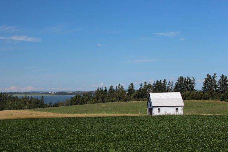
Prince Edward Island is shaped like a crescent and the two ends are connected to the middle by narrow strips of land. It is divided (for the tourists) into four regions: Points East Coastal Drive, the top half of the middle called Green Gables Shore, the bottom half of the middle called The Red Sands Coast, and the west, called the North Cape. We used Charlottetown as a starting point for the Points East Drive which we divided into two days doing the south on Wednesday and the north on Thursday.
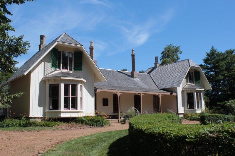
On the way out of town we stopped to tour Ardgowan, the home of W.H. Pope, one of the Fathers of Confederation but discovered it was no longer open to the public and was being used by Parks Canada for their offices. Bummer. It is a pretty neat looking house.

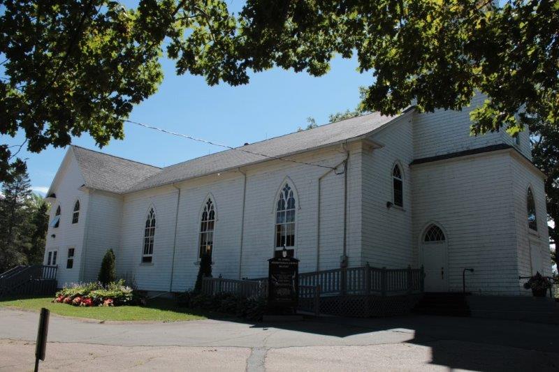
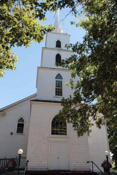
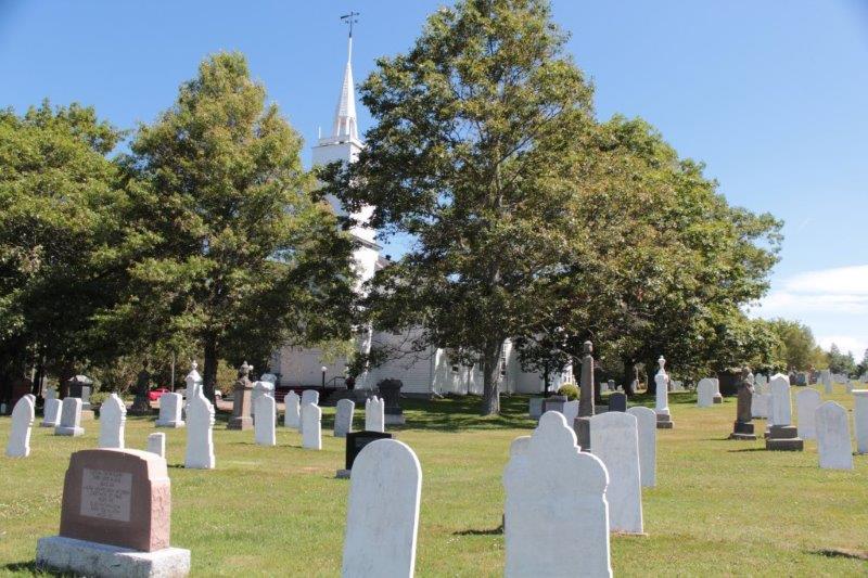
We drove through an area called Belfast that was the original settlement of 800 Scottish immigrants brought to PEI by Thomas Douglas, 5th Earl of Selkirk on three of his ships in 1803. He had purchased land for them and he financially supported them until they got settled. In the town of Belfast was St. John’s Presbyterian Church, built in 1824.
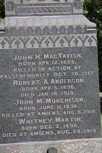
Under a big shady tree there was a WWI Memorial with the names of church members who had died. There were 13 names engraved on the marker. All of the major Canadian offensives of the war had taken at least one of the men. 2 died at Amiens, 1 at Somme, 1 at Vimy Ridge and 3 at Passchendale.

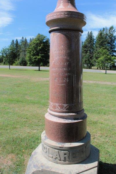
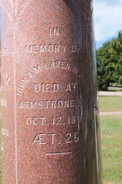
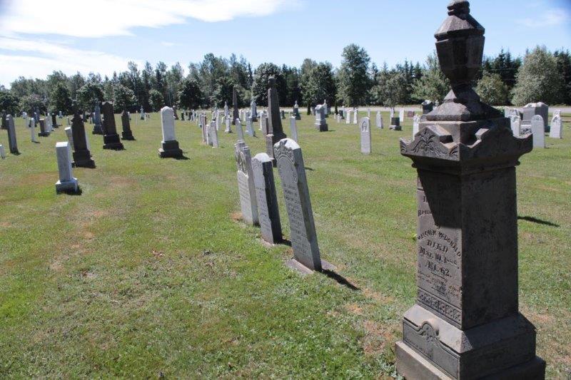
Two sides of the church yard was taken up by cemetery. We decided to wander a bit. The markers were in beautiful condition even though many of them were from the early 1800’s. John chanced upon a family marker for the MacLaren’s and discovered that John T. McLaren died in 1890 at the age of 26 in Armstrong, BC!

When we got back to the truck to leave I noticed that the white pickup parked beside Poppy also had BC plates. There was another couple wandering the graveyard while we were out there so I went to find one of them. I asked the lady if the truck was hers and if so where in BC was she from. She and her husband lived in Langely, but had lived many years in Kelowna. They retired last year, sold their house, bought a 35′ fifth-wheel trailer and spent 6 months at a time travelling around. We had a great chat!
Our next stop was Prim Point on a spit jutting out near the bottom of the coast. We were making a turn to the lighthouse at the Chowder House restaurant and a lady came rushing across the parking lot waving her arms. We stopped to see what the problem was and she said, “I have an SSR too. I stop everyone I see that has one. Mine is purple, it is parked right over there. I am from Newfoundland.” Time spent extolling the wonders of SSRs followed.
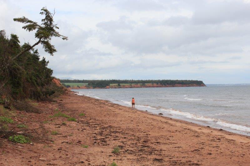
We also stopped at Cape Bear Lighthouse, not because we wanted to see another lighthouse, but because there was a Marconi Museum there and we wanted to check it out. Turns out it was a small museum mostly dedicated to the SS Titanic. The Marconi Telegraph Station at Cape Bear was the first to receive the distress signal. A nice young man gave us the tour and took us to the top of the light, which was moved 500′ back from the shore by horse and capstan in 1949 and will be moved again this fall because the cliff has eroded right up to the lighthouse again. PEI loses 200 feet of coastline very year to the waves. John told him they will have to make the bridge longer soon.
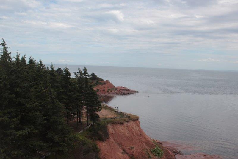

That’s the coast of Nova Scotia on the horizon.
Today we did the north coast. We drove right across from Charlottetown to Caridgan where we had ended up yesterday. We started around the spit at Cardigan and I kept checking my map thinking we should be coming to a town soon. We followed the Points East Coastal Route Starfish markers, went through a wooded area and came out at Caridgan again! Neither of know how that happened.
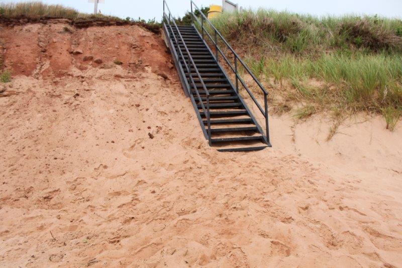
We got sorted however and made a couple of beach stops on our way up. First was at Sally’s beach which had a long stretch of red sand. I had read in one of my books that between Souris and Bothwell there were white sand beaches so we pulled in at Red Point to see if it might have white sand. And it did. Gorgeous fine white sand. At the stairs up the bank you can see the two layers, white on bottom, red on top.
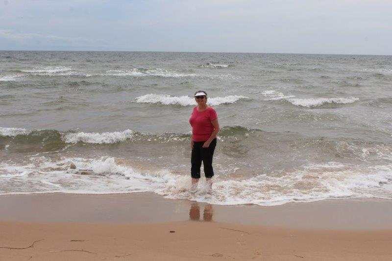
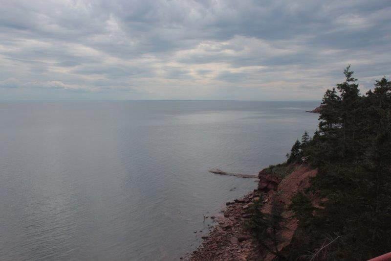
Standing in Northumberland Strait between PEI and Nova Scotia.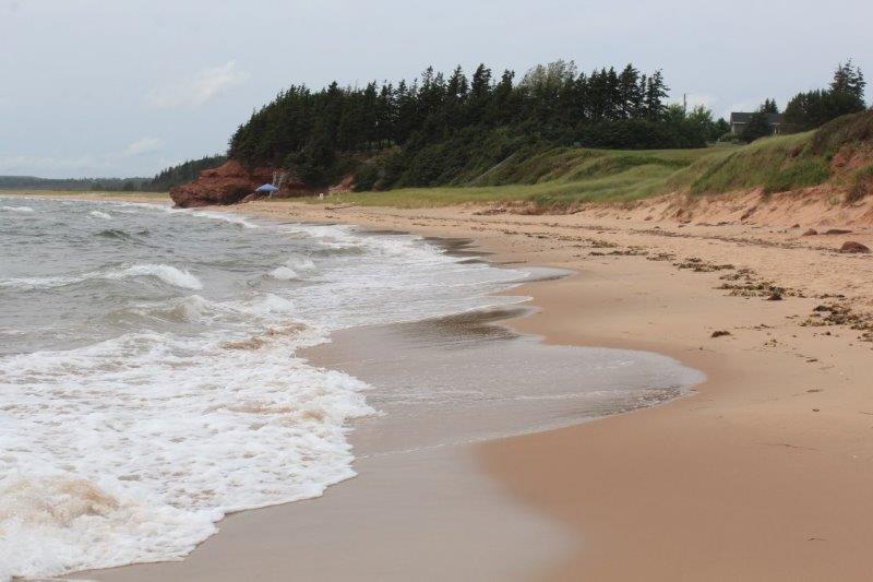
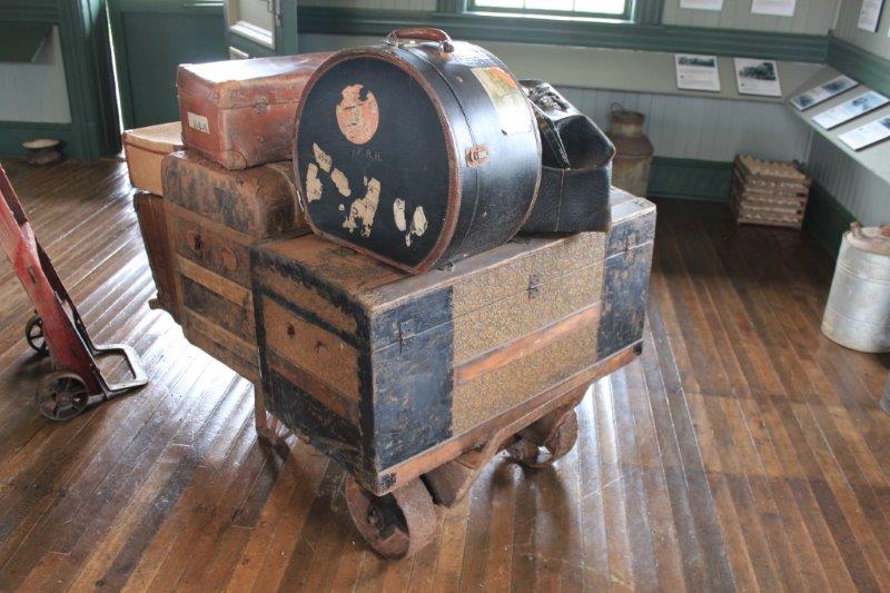
The little town of Elmira has a railway musuem. Elmira was once the end of the line on the Canadian National Railway’s system on PEI which connected almost every town on the island. It ceased operation in Dec. 1, 1989.
CNR had 25,000 miles of rail/steamship system when it was all done. They even had ferries that went between Nova Scotia and PEI that had rail lines in them and the trains just drove on the ferry.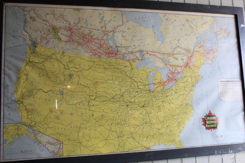
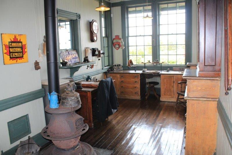
When the four provinces of Ontario, Quebec, New Brunswick and Nova Scotia created the Confederation of Canada in 1867, PEI had opted out. It was a wealthy area with lots of agriculture and had established markets in Europe for its fish, lobster, mussels and oysters. In 1871 PEI decided to build a railway system linking four of the major centers of the island for a cost of $4,000,000. By 1872 they had added several other stops on the line, costs were over budget and they couldn’t get refinancing of their loan. So….they asked Ottawa if the offer to join Canada was still available. If so PEI would enter Confederation but first they needed money to finish their railway. They received a grant of $3,250,000 and joined Canada in 1874.
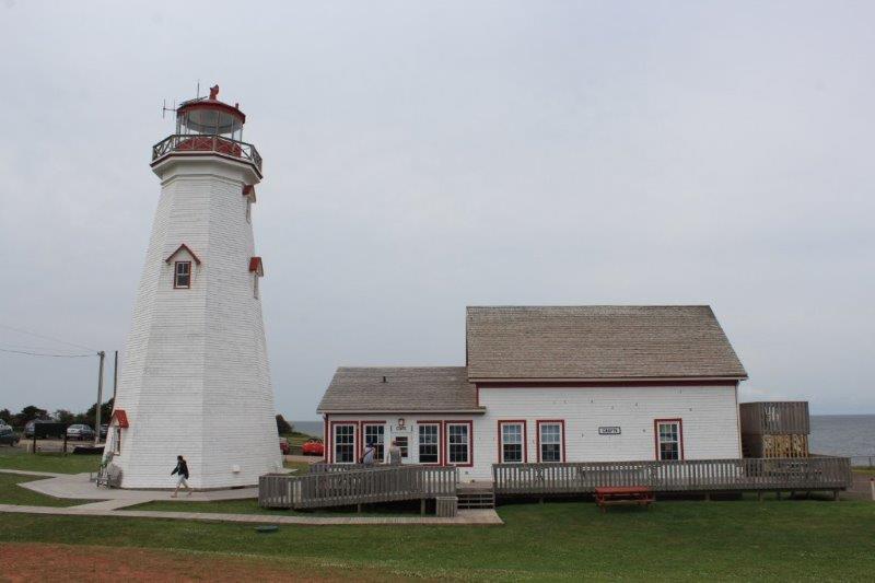
The East Point Lighthouse is, naturally, at the easternmost point of PEI so it was necessary to take the extra 3 km or so and go down there.
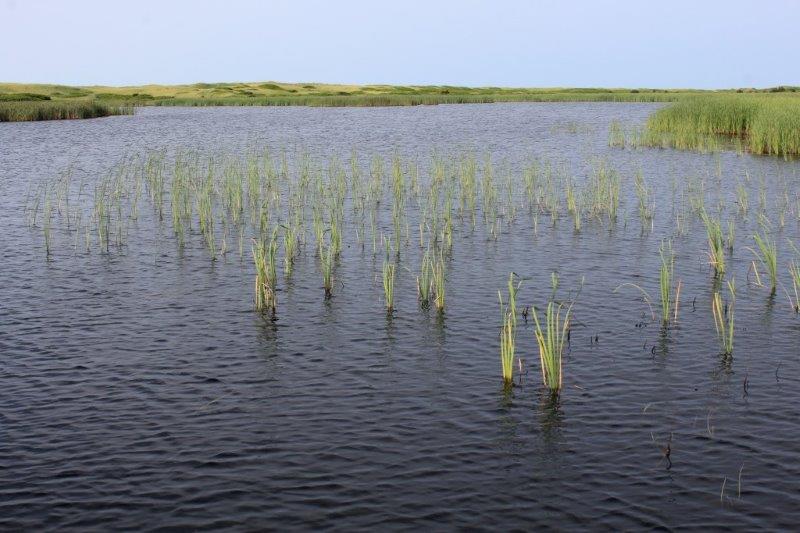
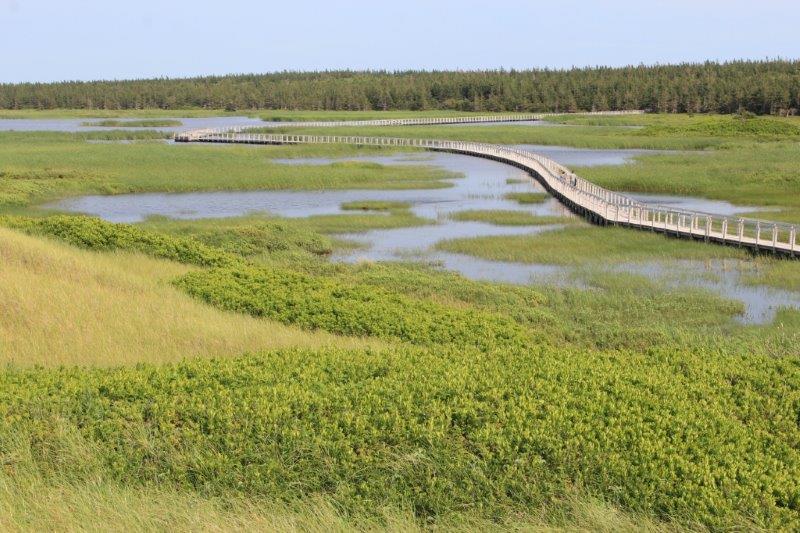
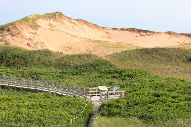
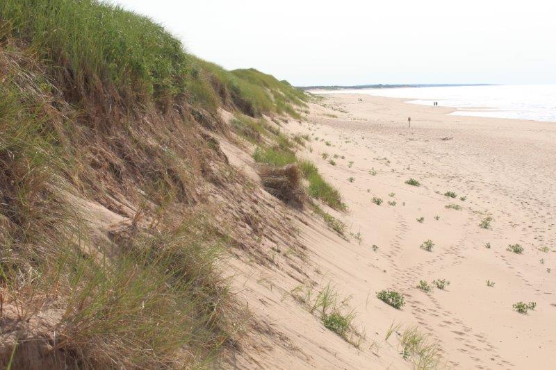
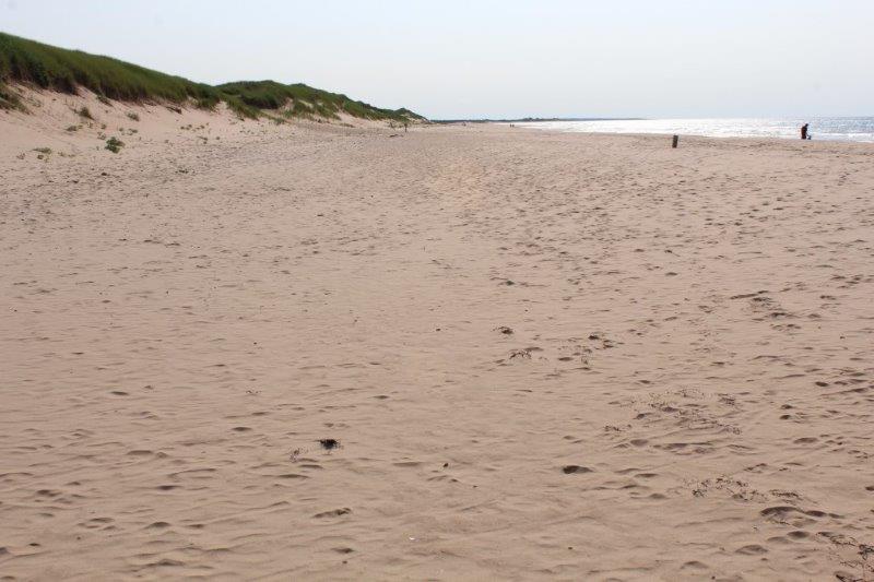
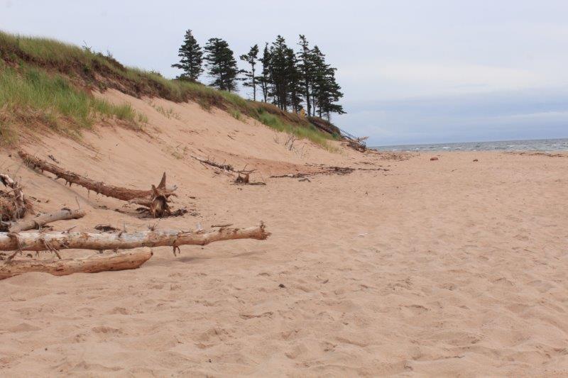
We were on our way back to Charlottetown and I asked John to make a detour to the eastern part of Prince Edward Island National Park at Greenwich to see the rare parabolic sand dunes. A parabolic dune is one that travels and leaves a path of little hills as it moves inland. The dune at Greenwich is one of very few in North America. We ended up on a 1.5 km walk that culminated at the very long floating boardwalk across a freshwater marsh, up a steep sand dune and down the other side to an absolutely gorgeous beach. And, of course, 1.5 km back again. But the clouds that had covered the sky all day, drifted off as we walked and by the time we got to the marsh we had beautiful blue sky. It was after 5 o’clock and the light was lovely. This semi-unplanned detour was the highlight of our two days on the Points East Coastal Drive.
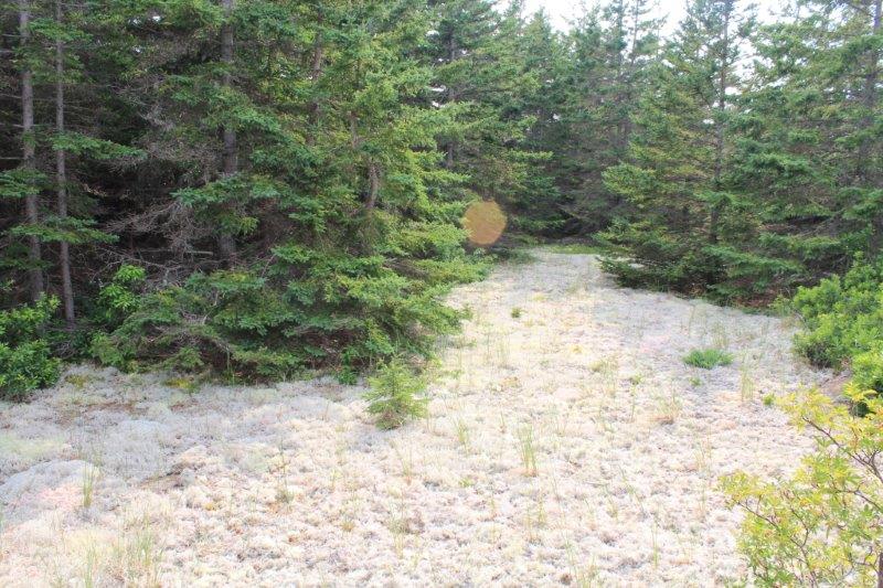
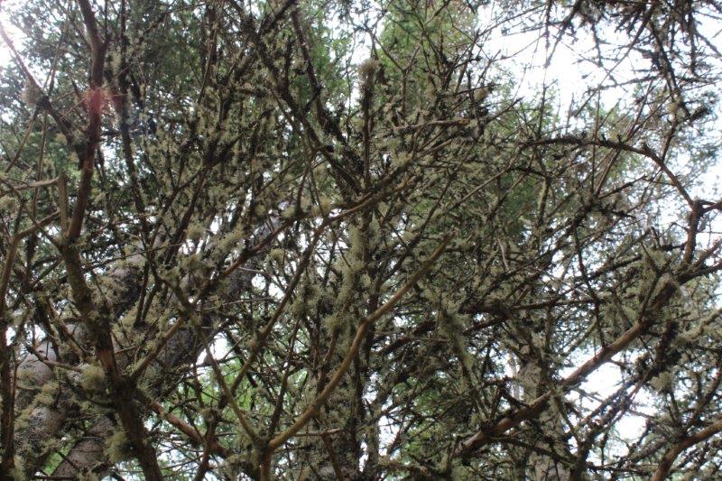
Lichen growing on the sand.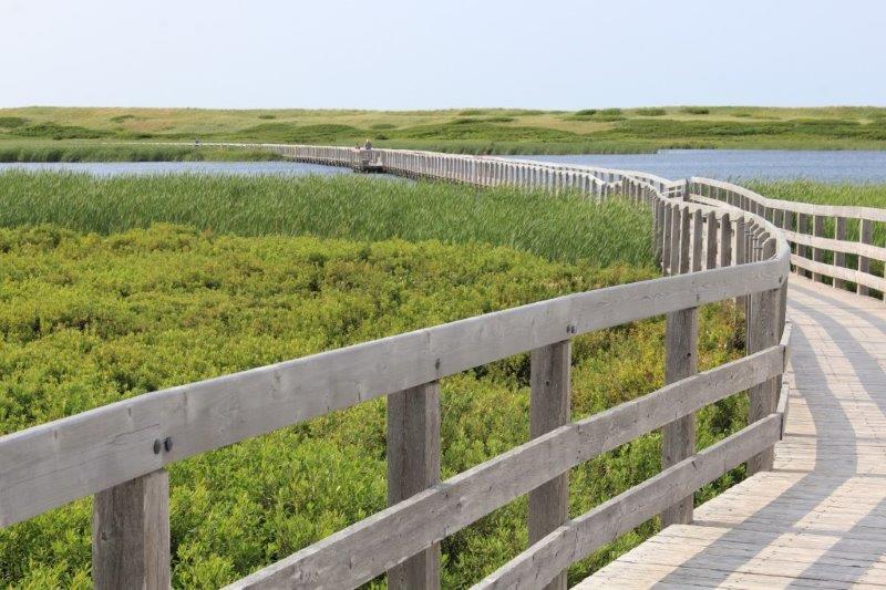
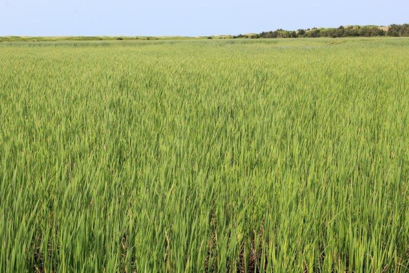
Marram Grass that anchors the dune