We entered our seventh province today (for those of you who think I am counting wrong; I am not counting BC since we started there – we will only be visiting 9 provinces on our trip).
Since we will be returning to Moncton to do the south and west before we begin our journey homeward, we did not do any of the things on the to-do list in Moncton. Instead we took the quiet coastal road to Cape Jourimain and drove the beautiful Confederation Bridge to Prince Edward Island.
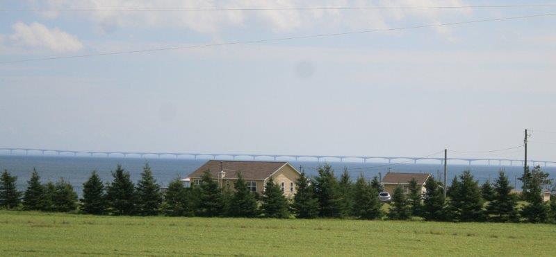 Look closely and you can see the bridge along the horizon.
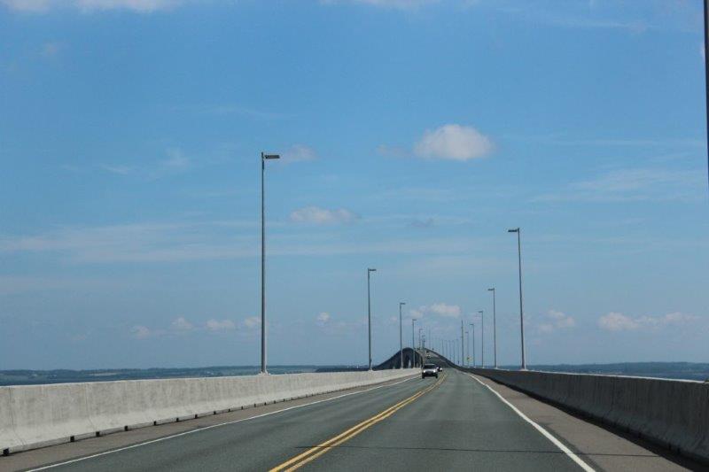
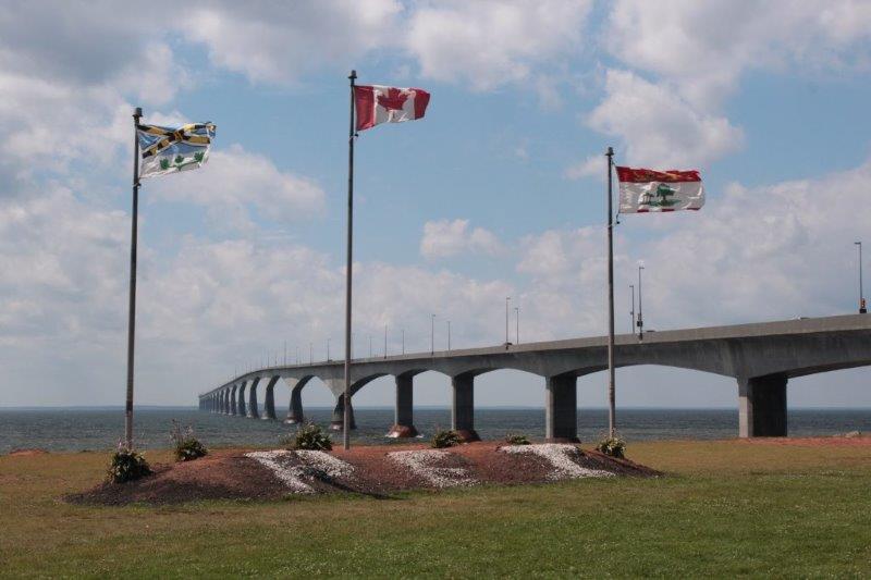
 The bridge was built by private contractors between 1994-1997. It is a toll bridge, but you only pay one way – as you leave the island – $45 per passenger car. I would be very interested to know how long it will take them to pay off the $1 billion cost. This was a mammoth project: 12.9 km (8 3/4 miles) long with a steep hill in it to allow ships to pass underneath and an intentional curve to keep drivers alert. It is the longest bridge over ice-covered water in the world.

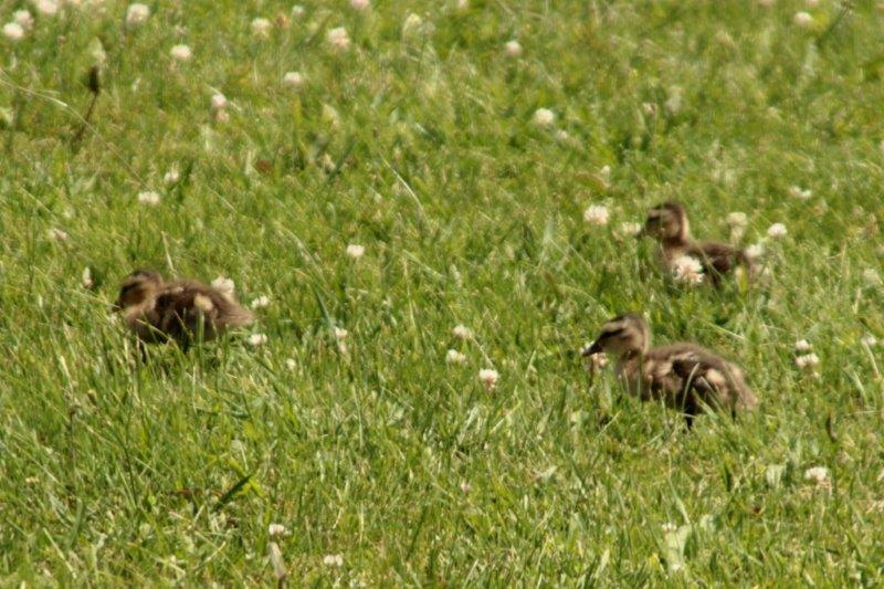
Some lost ducklings
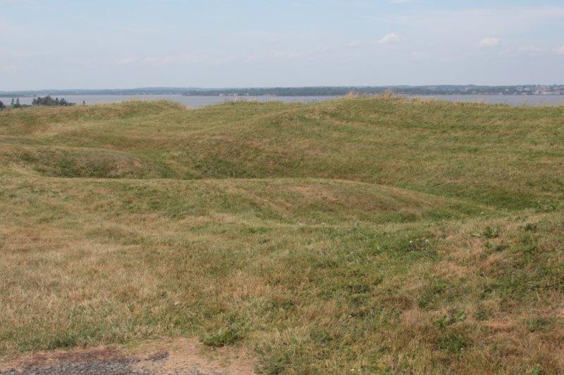
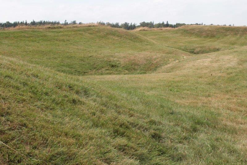
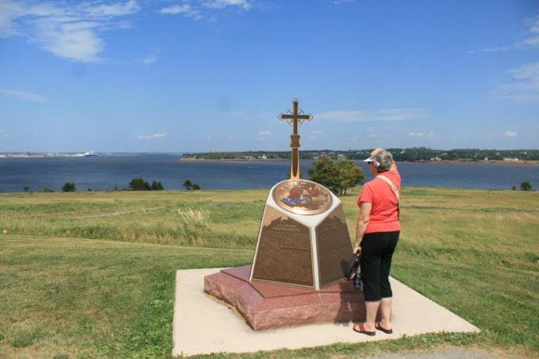
We kept to the southern coast road along a thin peninsula to Rocky Point to see the Port-la-Joye – Fort Amherst National Historic Site. Unfortunately the Interpretive Center was closed but the placards told the story of the French, then English forts that had been built on the site. There was only the land moat and hillocks left to indicate where the British Fort Amherst was built after the French Port-la-Joye was destroyed.

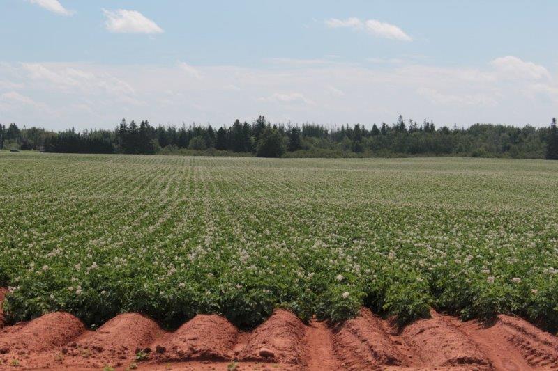
We loved the small bit of PEI we have seen so far. It really does have very red dirt, which is obviously very fertile as the crops we saw looked very lush. PEI is known for potatoes and we saw many acres of them, but we also saw wheat, barley, beans, alfalfa and other crops. The highest point on the island is 152 meters (499′) above sea level so it is very flat.
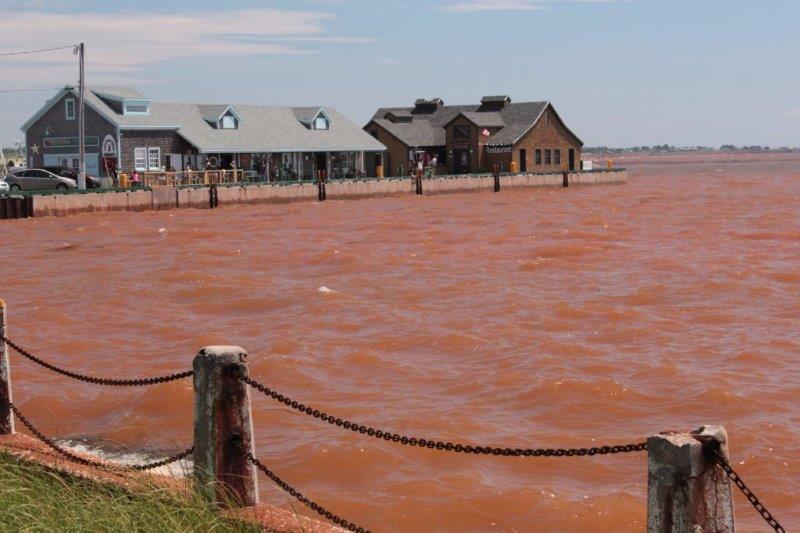
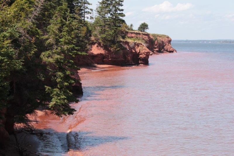
The coast water is red from the soil.
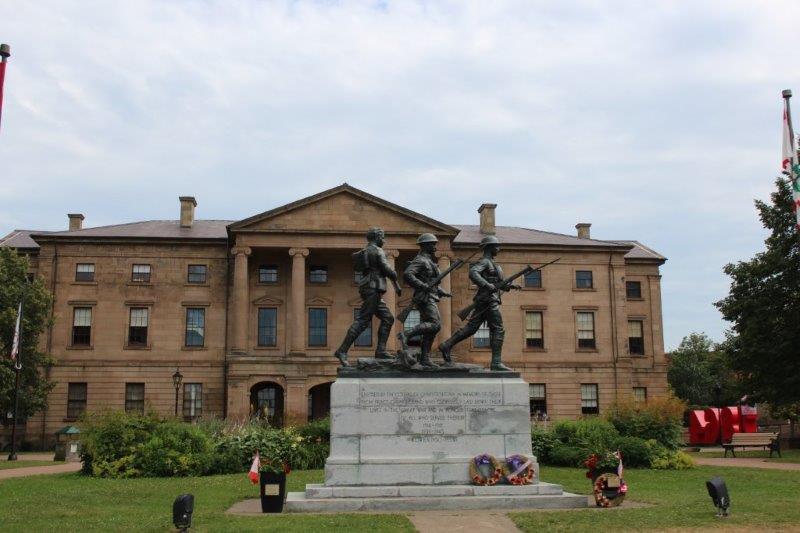
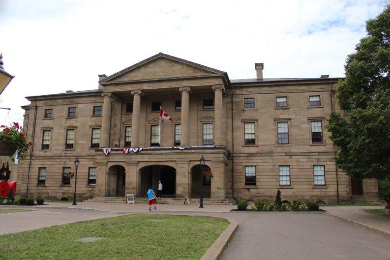
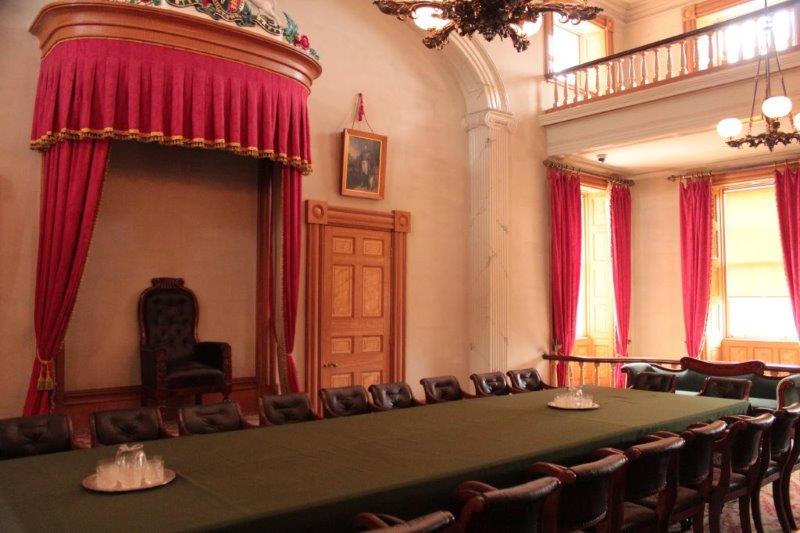
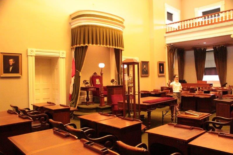
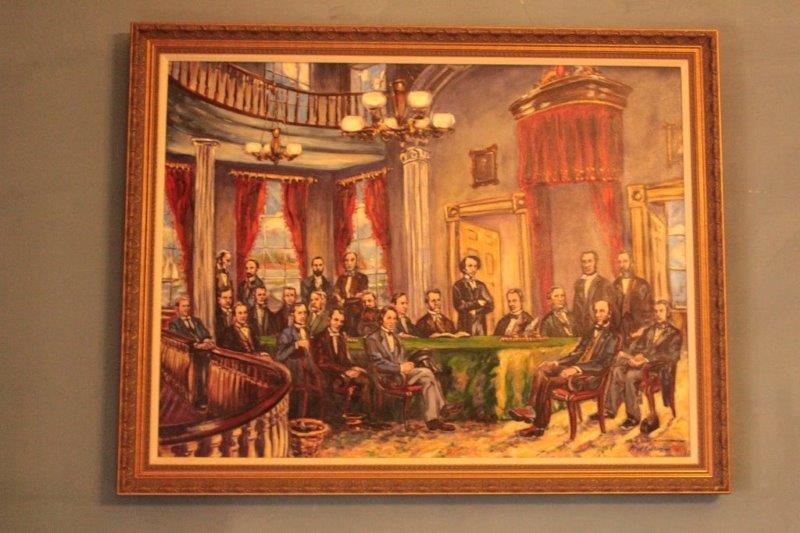
 We rounded the peninsula and made our way to Charlottetown and found Province House where the first steps to Canada’s Confederation were made at the Charlottetown Conference held in this very building Sept 1, 1864 – 150 years ago this year. Pretty cool! The 27 Members of Parliament in PEI still sit in the same chamber on the same chairs!
They had a really good short film about the Charlottetown Conference, which was actually to be a meeting of the Maritime Provinces to discuss a Maritime Union. When the leaders in Upper and Lower (British and French) Canada learned of the Conference they invited themselves and brought up the idea of a Confederation of them all in order to protect the lifestyle, customs and laws of our country from annexation by the rapidly expanding USA. Three years later four Provinces signed the British North American Act to create the Confederation of Canada. Other provinces joined over the years and “We became a nation from sea to sea to sea.”