Day 31 – July 7 – Pembroke, ON to Ottawa, ON

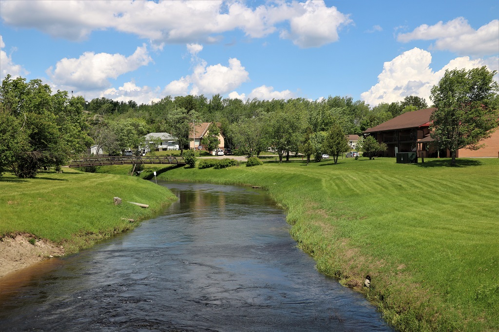
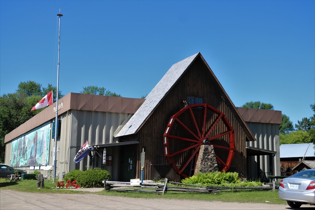
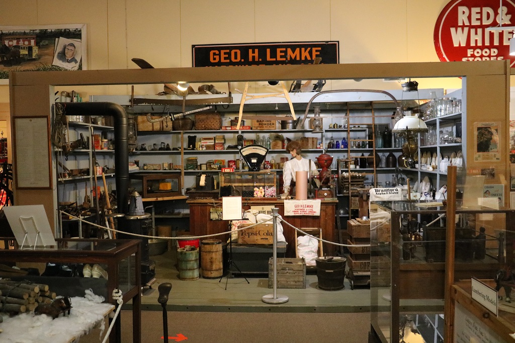
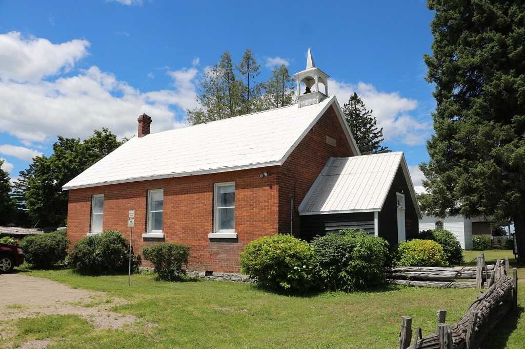
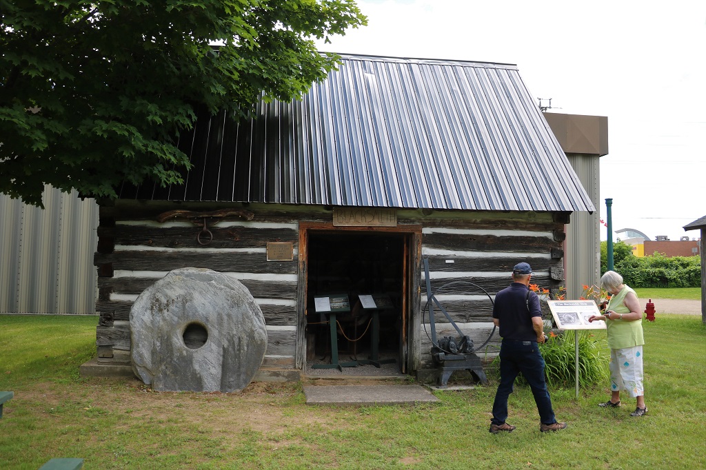
Before we left Pembroke this morning we went over to the Champlain Trail Museum and Heritage Village. They had nice displays inside the musem and then we a lady took us on a tour of the buildings on the site.

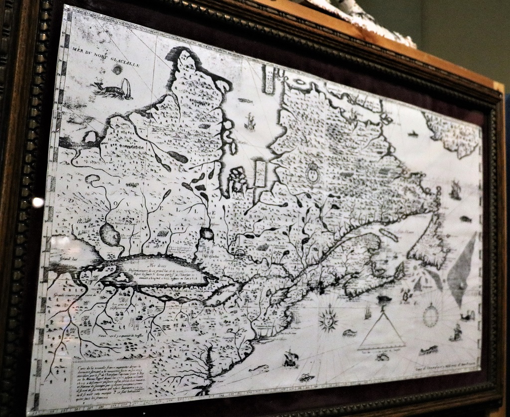
French explorer Samuel de Champlain discovered and mapped the St. Lawrence River and most of Quebec and Ontairo when he ‘got lost’ looking for China. Below is a copy of his 1632 map which is incredibly accurate. A replica of the astrolobe he used for his measurements was in the museum.

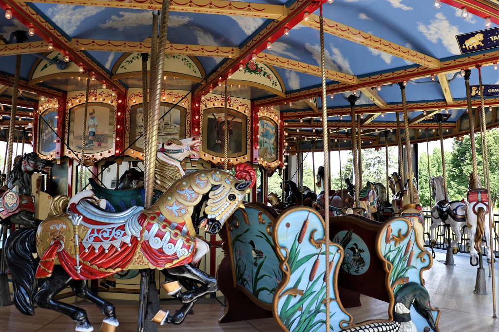
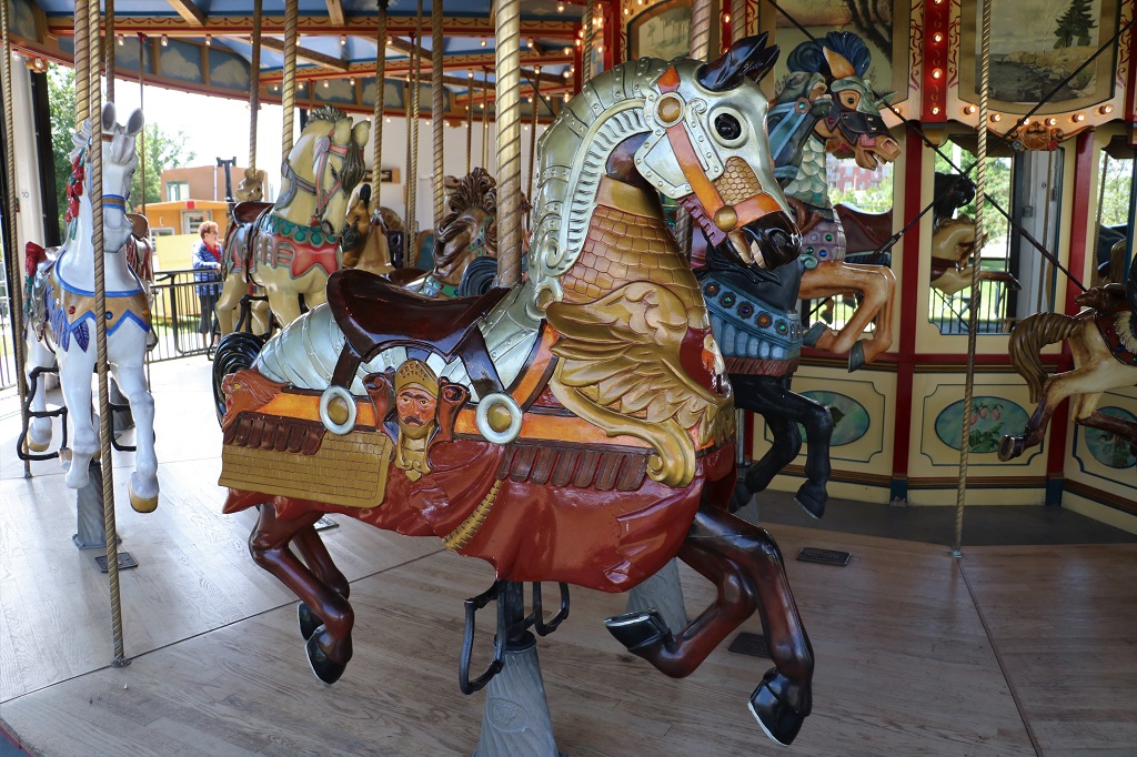
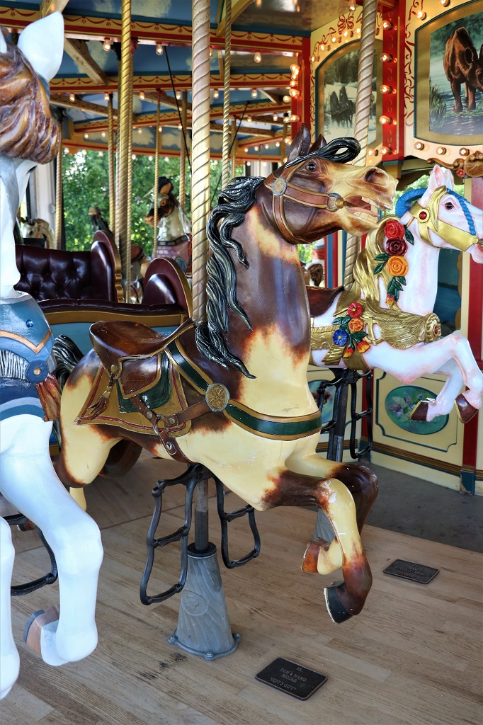
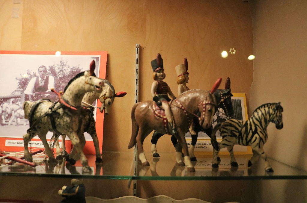
There was no information placard by this display of handcarved circus wagons and horses.

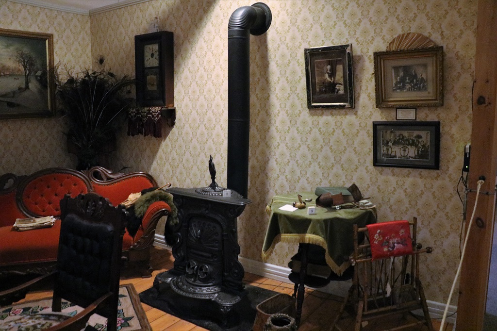
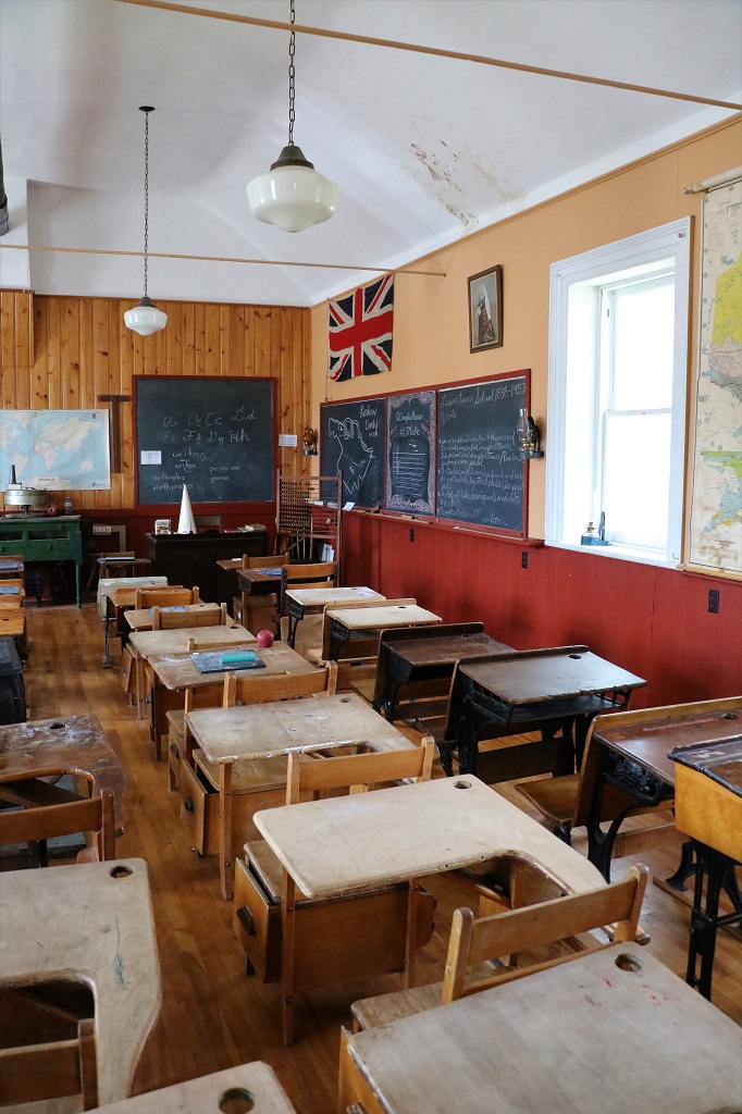
There were rooms of a typical Victorian era house to walk past.

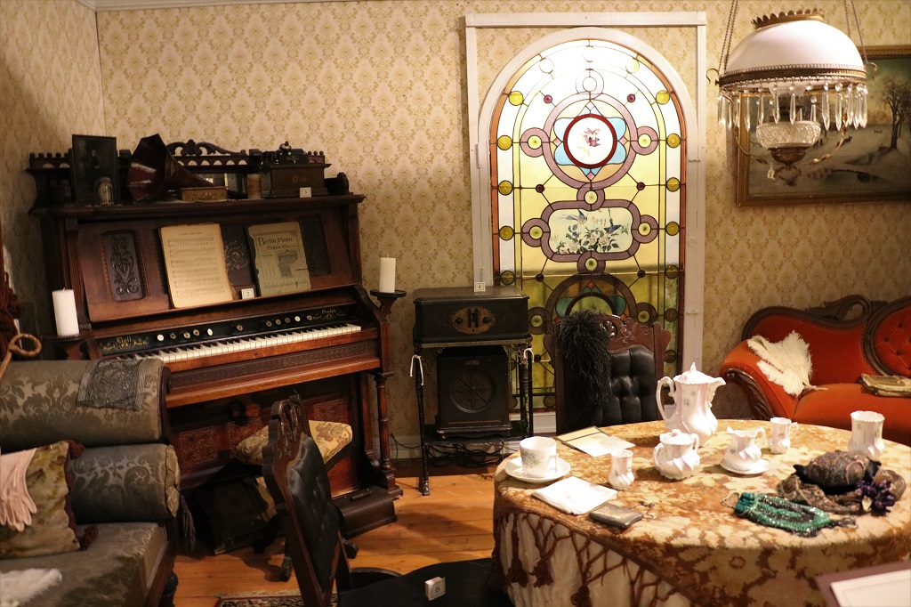
The parlour, which would never have been used except for weddings, funerals or if the minister/priest or a politician came calling. The stained glass window is original from a local pioneer family’s house.
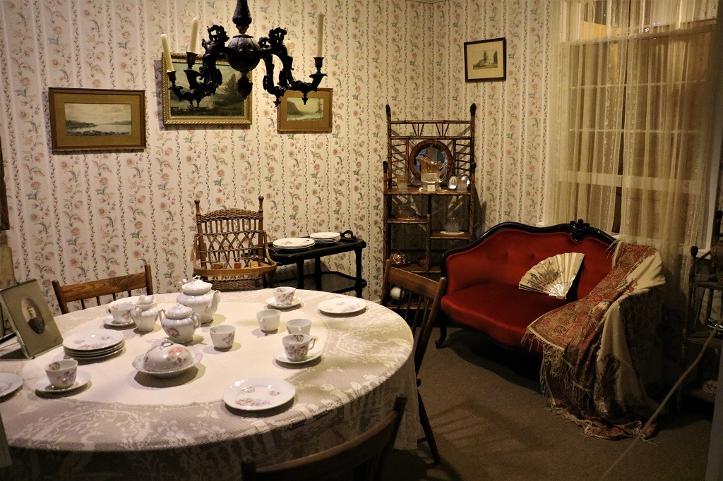
The dining room.

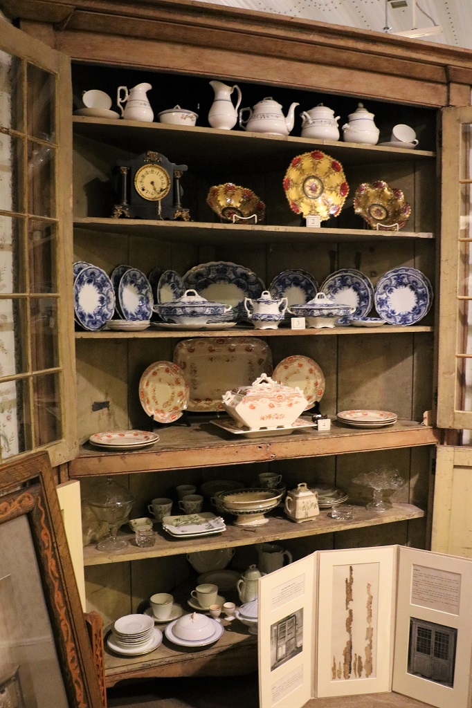
This corner cupboard was the first item placed in the museum ‘house.’ It came from a local hotel.

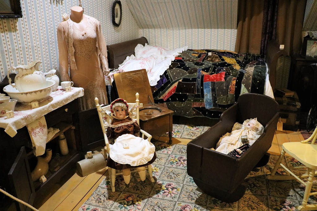
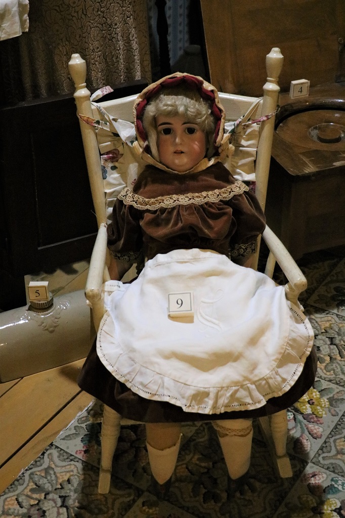
This porcelian-head doll came from England. It has an uncanny resemblance to my stepmother.

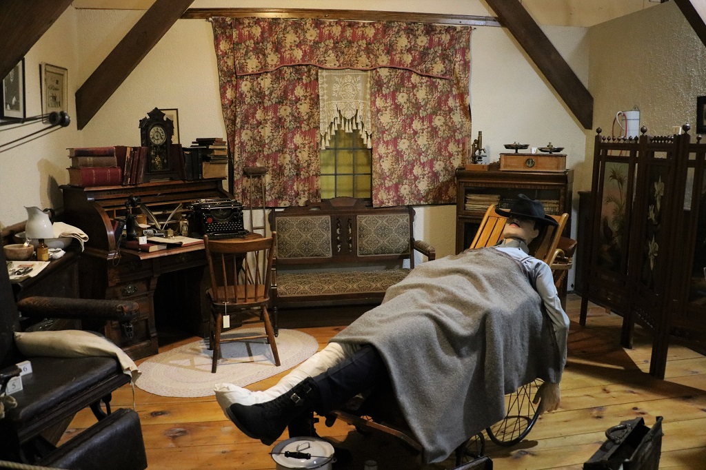
The doctor’s office.

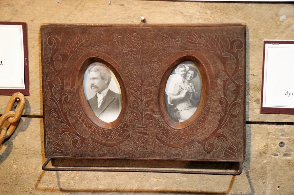
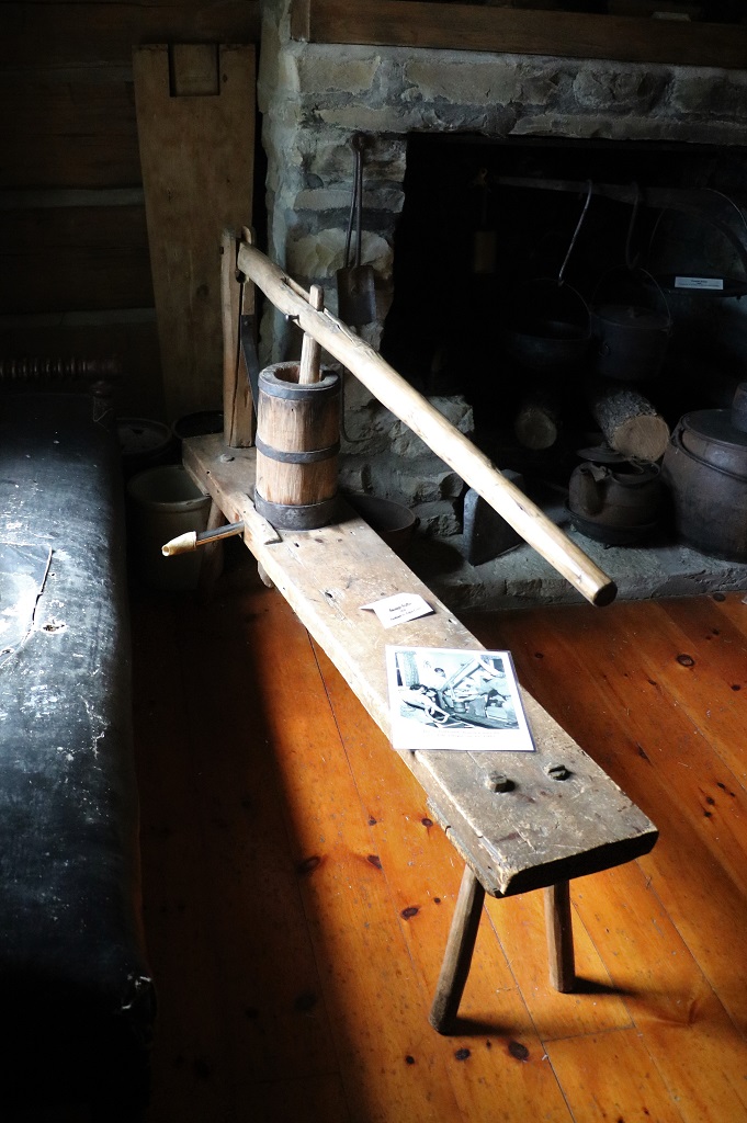
This tie rack from the late 1800, early 1900’s was carved from the back of a dynamite crate with a nail by a lumberman in Mattawa. It took him an entire winter to do.

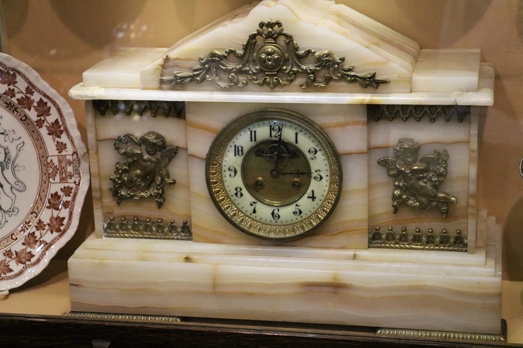
I loved this gorgeous clock.

The building for the electric company is still standing in Pembroke.

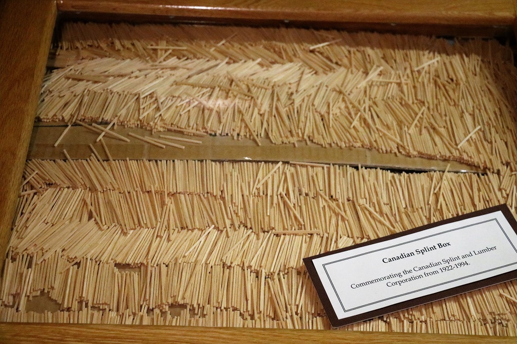
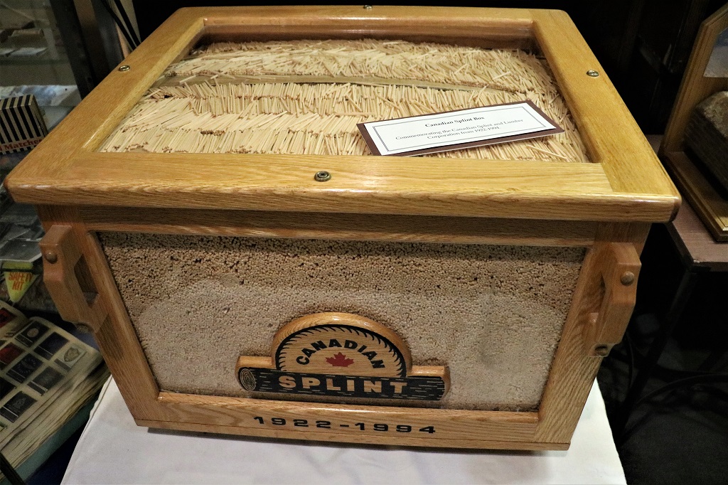
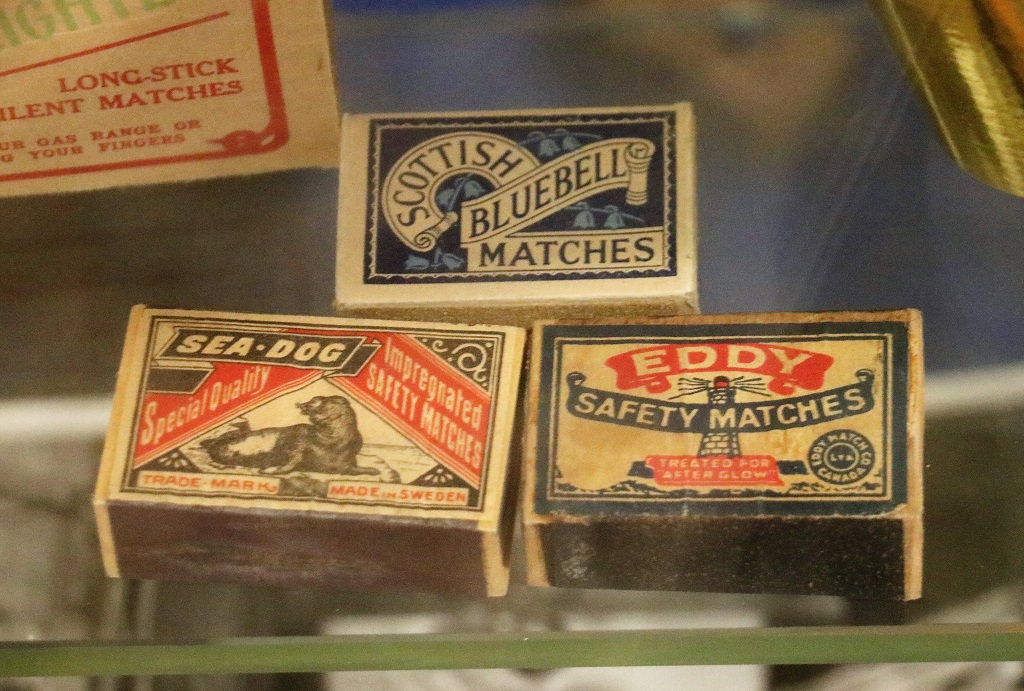
The Canadian Splint and Lumber Company made the sticks for matches. They were treated with a special substance then sent to the Eddy company to have the match heads put on. One 16′ log produced 500,000 match sticks. The short video said how many the company produced in a year out of the number of trees they used but I did not have a pen and paper to write it down. Lets just say it was LOTS!

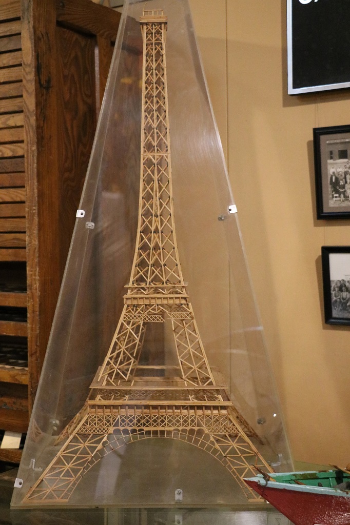
The EiffelTower made from match splints.

This beautiful 1880 log house was lived in by three generations of the family. It was dismantled and moved to the museum property in 1965.

They were a German famiy (many immigrants from Germany settled in the Ottawa Valley). This is a homemade sausage maker. Sausage making involved the entire family.

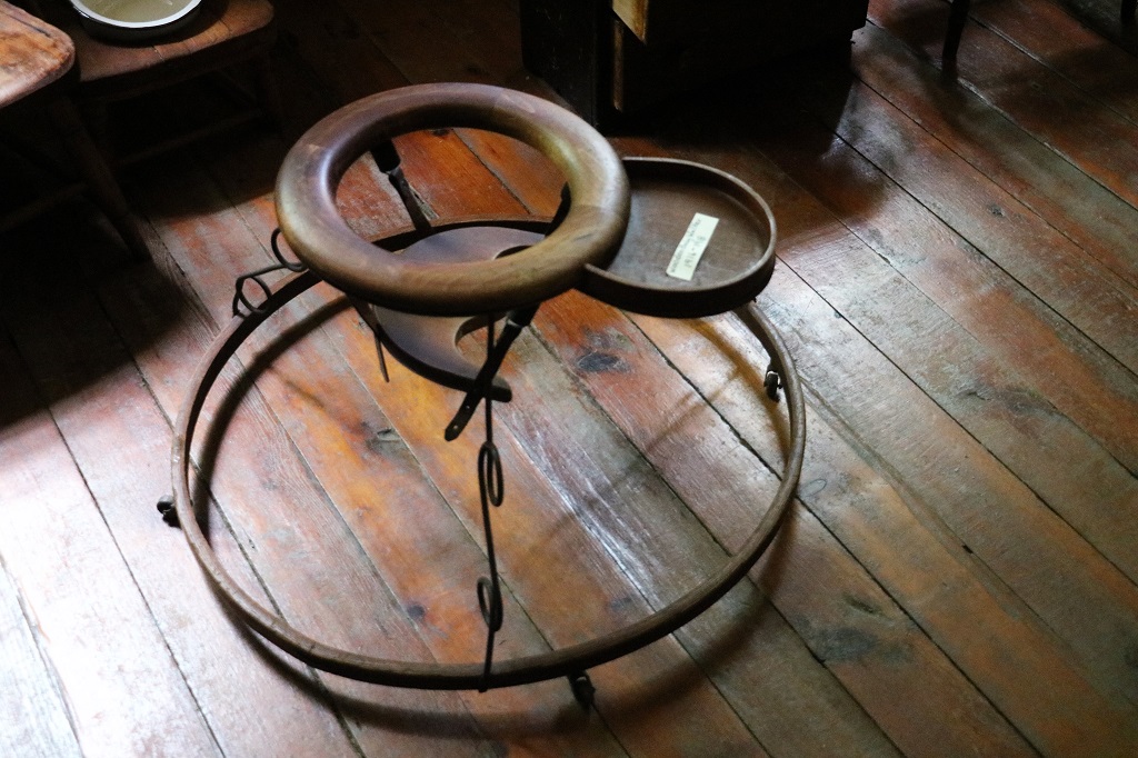
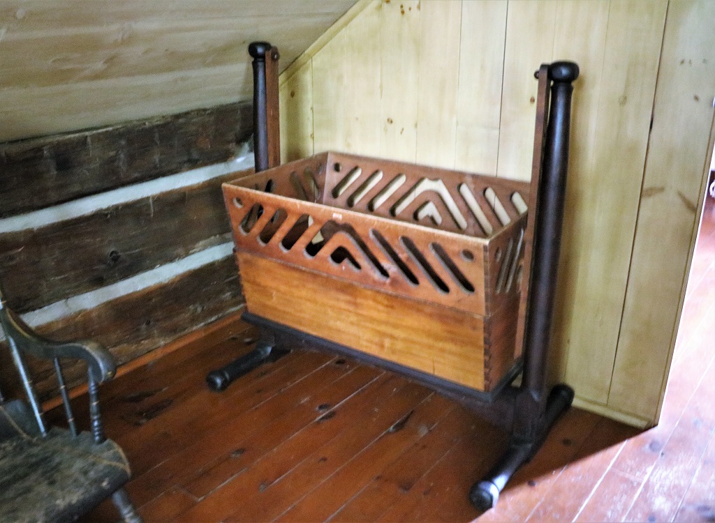
This 1916-1918 handmade wooden baby walker was just gorgeous. As was the cradle below.

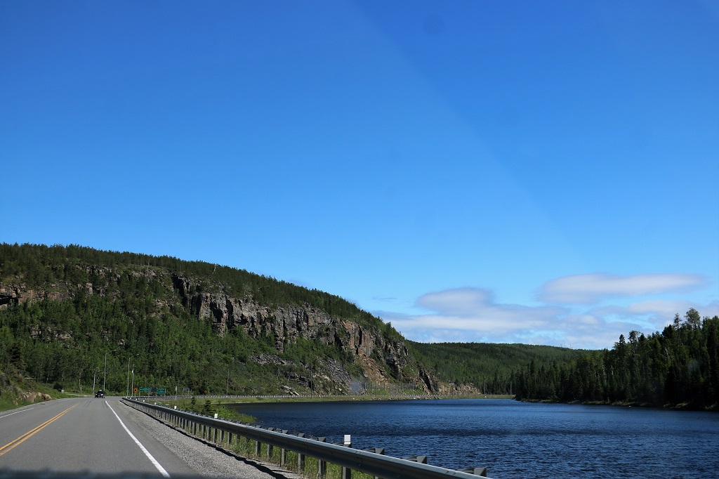
We left Pembroke at 1 o’clock and headed to Ottawa.

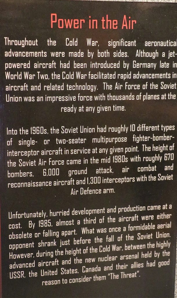
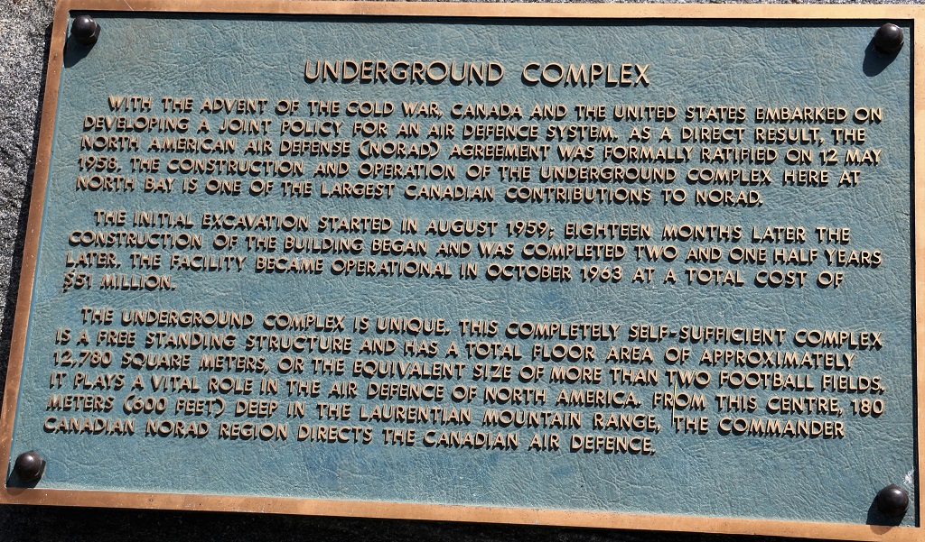
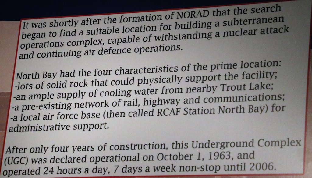
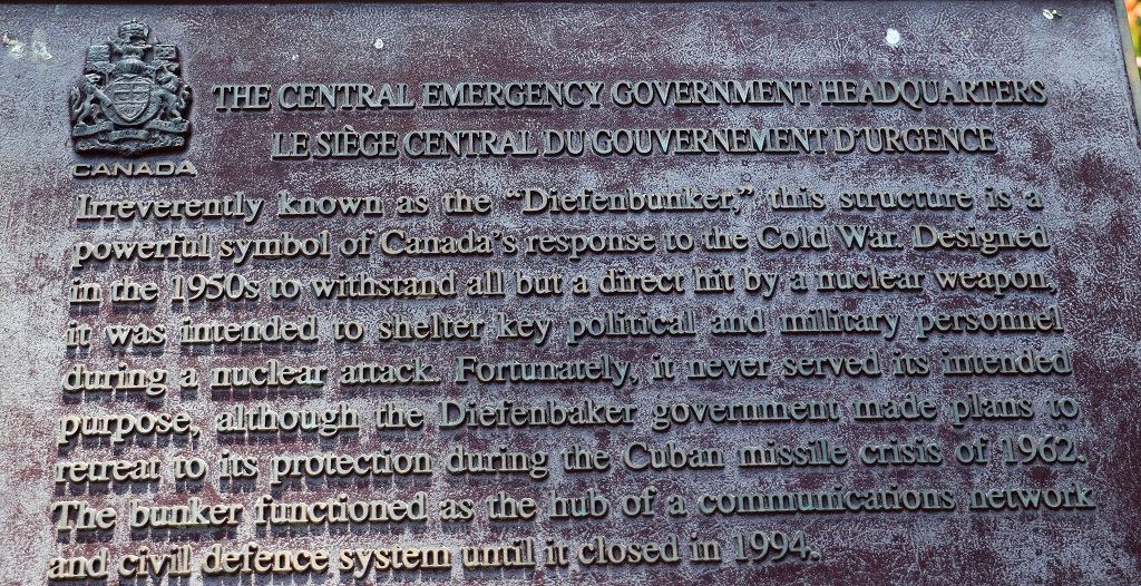
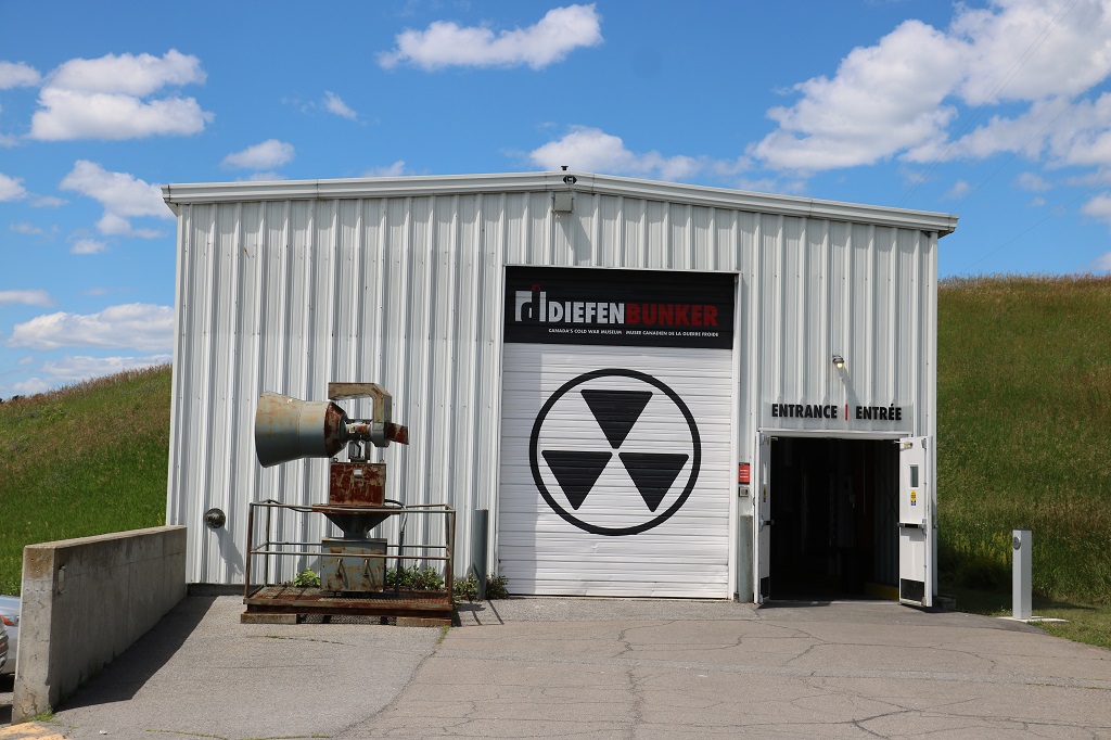
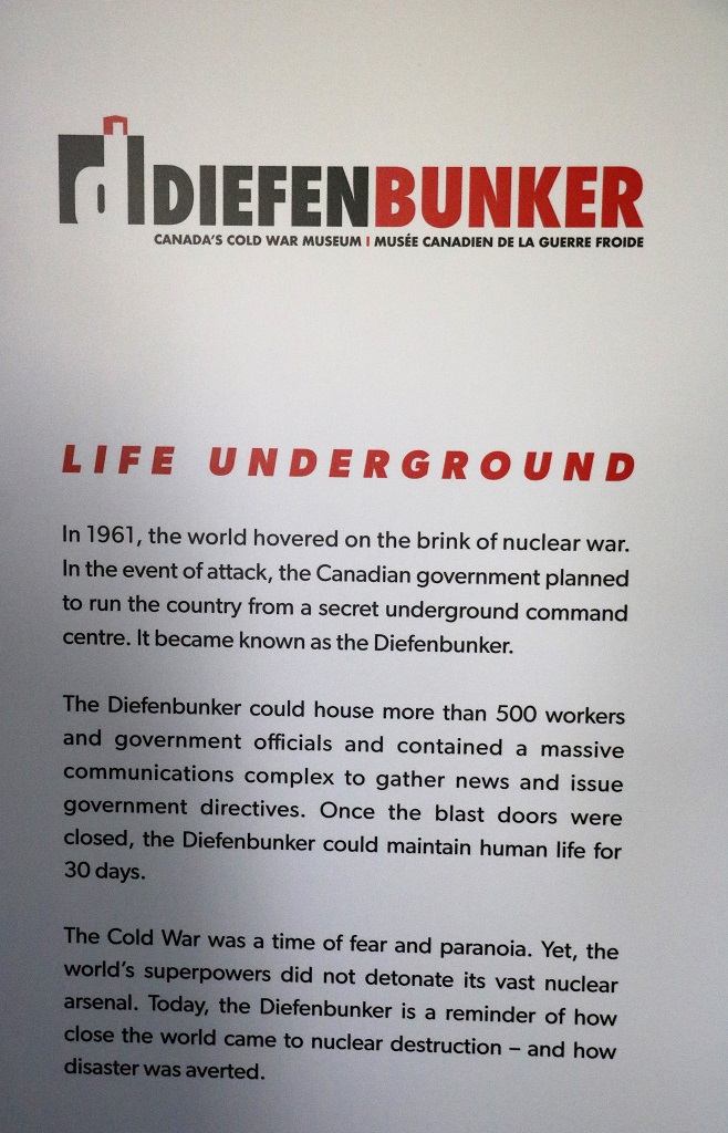
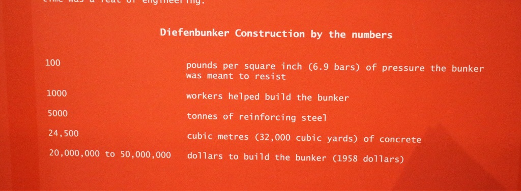
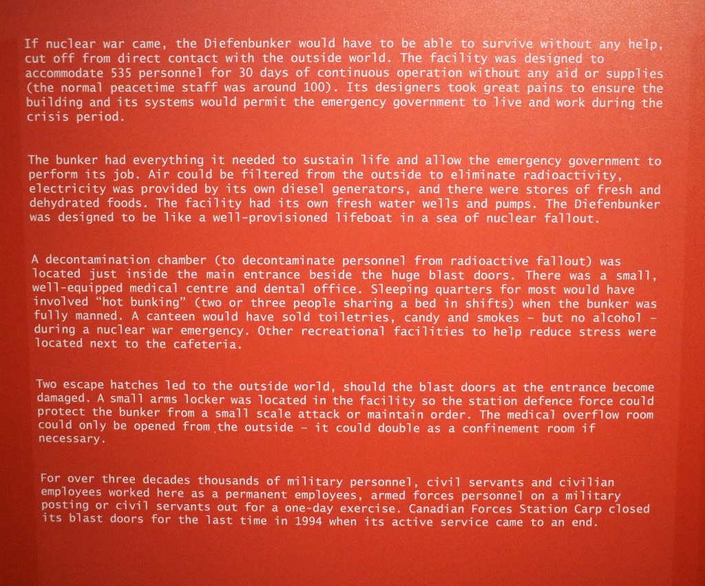
Once we arrived in Ottawa we planned to go to the Ornamental Garden at the Experimental Farm, but about 25 or so kilometers outside the city were signs to the Diefenbunker – the Canadian Government bomb shelter in the event of a nuclear attack during the Cold War of the 60’s to 80’s. We had planned on visiting it not realizing it was so far out of the city so we decided to go since we were so close and save a trip back out another day.

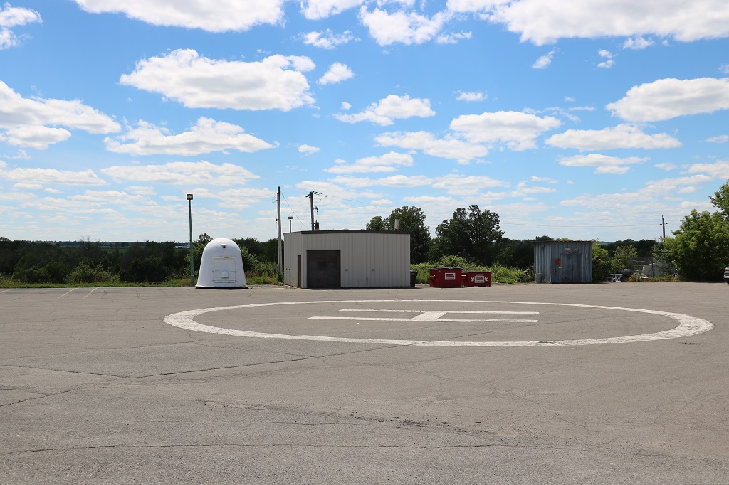
The heli-pad that would have brought the Prime Minister and high-ranking government officials to the site was only 50′ from the entrance to the bunker.

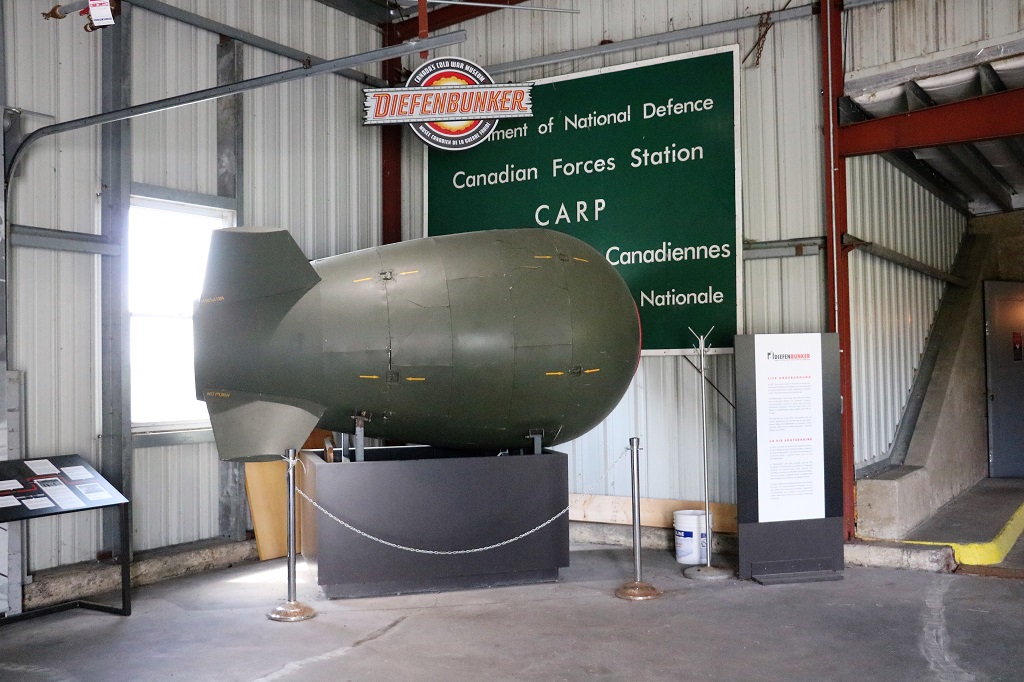
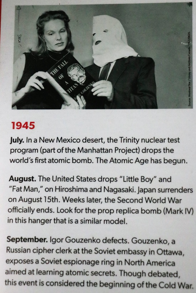
A replica bomb of a similar model as the ones the USA dropped on Hiroshima and Nagasaki to end WWII.

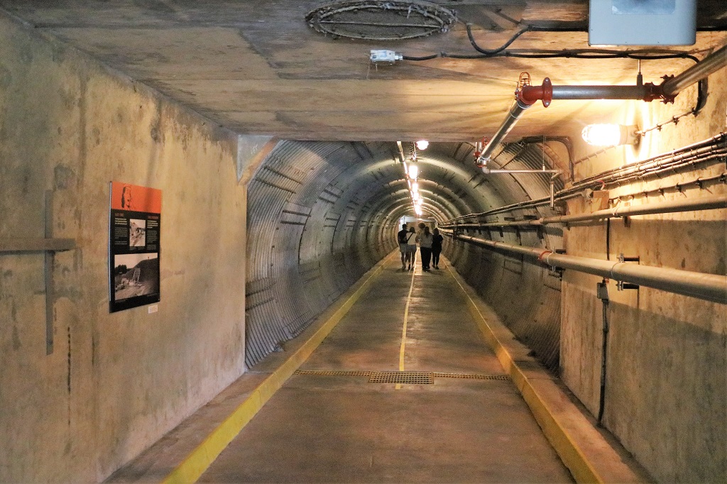
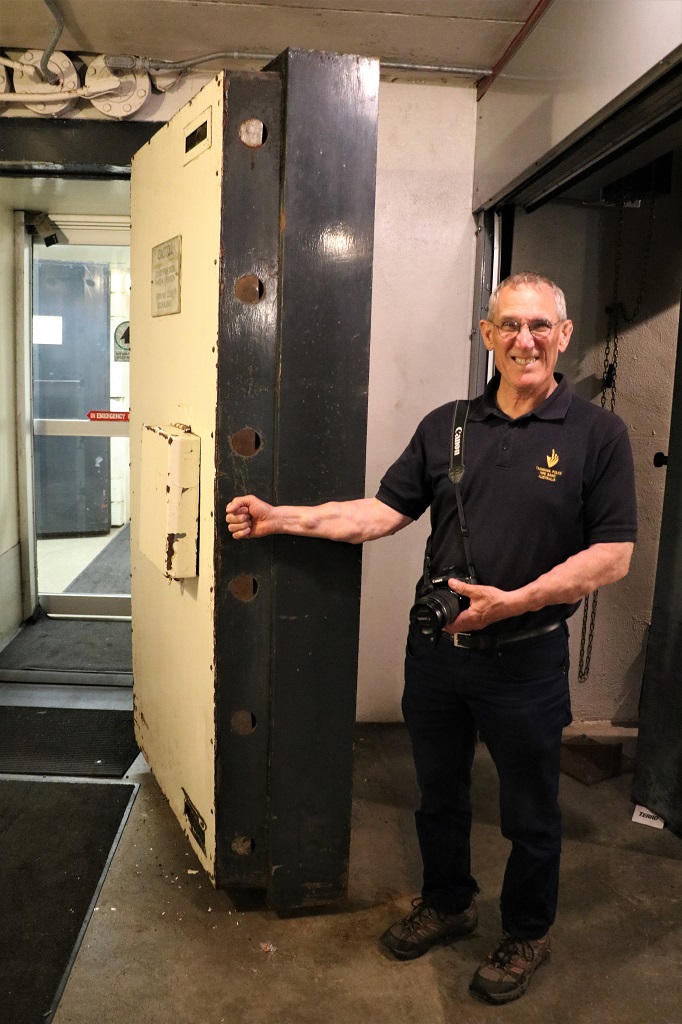
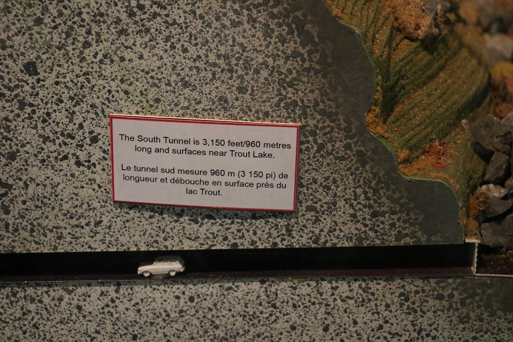
At the end of the tunnel we passed through two sets of these solid steel doors. The Diefenbunker had four levels underground. We were given a map outlining all the levels and the things we could see on each one. We only got through the first two levels which had the most rooms to see before we had to make our way topside again because they closed at 4.

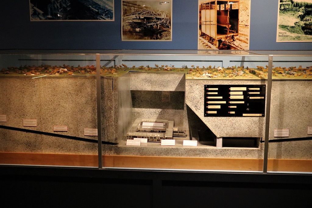
A model of the four levels of the Bunker.

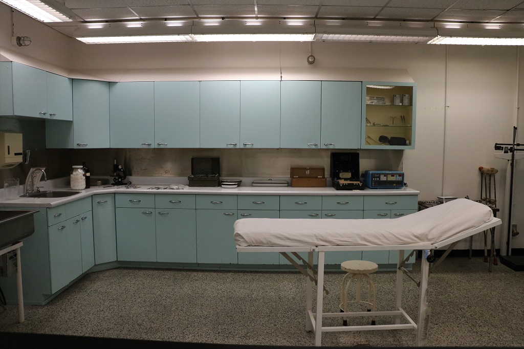
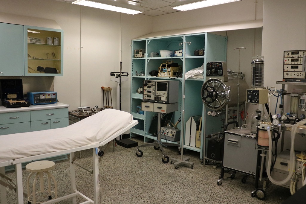
In the case of a nuclear event, this compact medical centre had to keep all personnel inside the Bunker healthy and functioning – without outside help or additional supplies. It only served as an ordinary medical clinic during the operation years of CFS Carp, but it was outfitted for a nuclear attak.

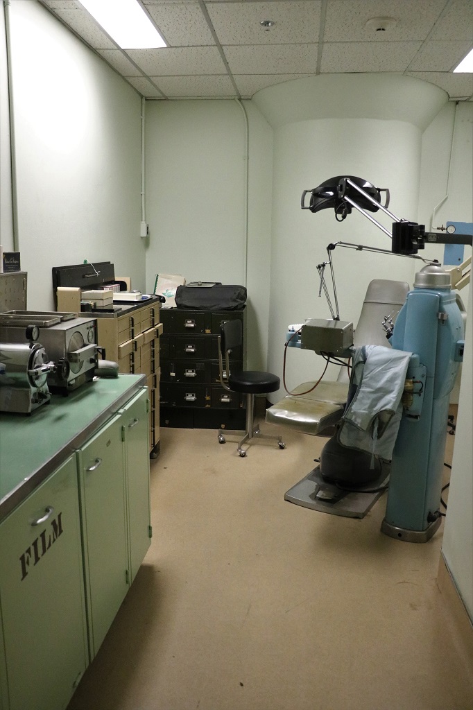
There was also a fully equipped dental office.

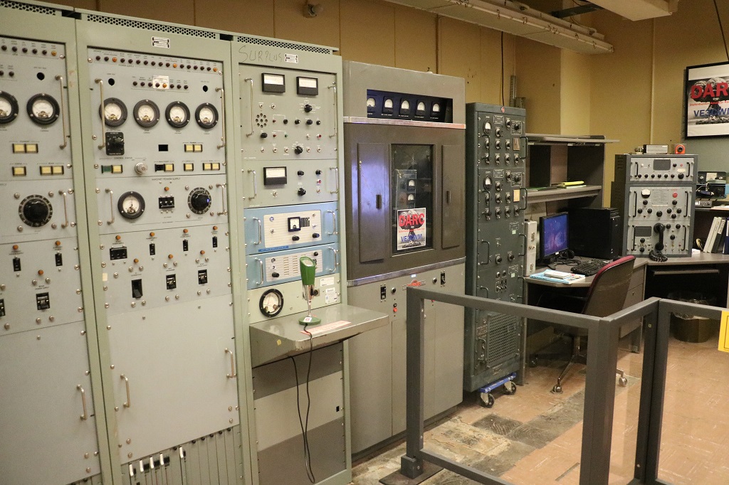
The radio room. All the equipment had been removed by the military when they closed the facility but local ham/short wave radio club members donated all the different years radios from the 50’s to 2000. Club members are in the Bunker regularly to talk about the radio room and maintain the equipment.

Today’s cell phones have more transmitting power than these radios. But it is impossible to get a cell signal inside the Bunker.

The War Cabinet Room.
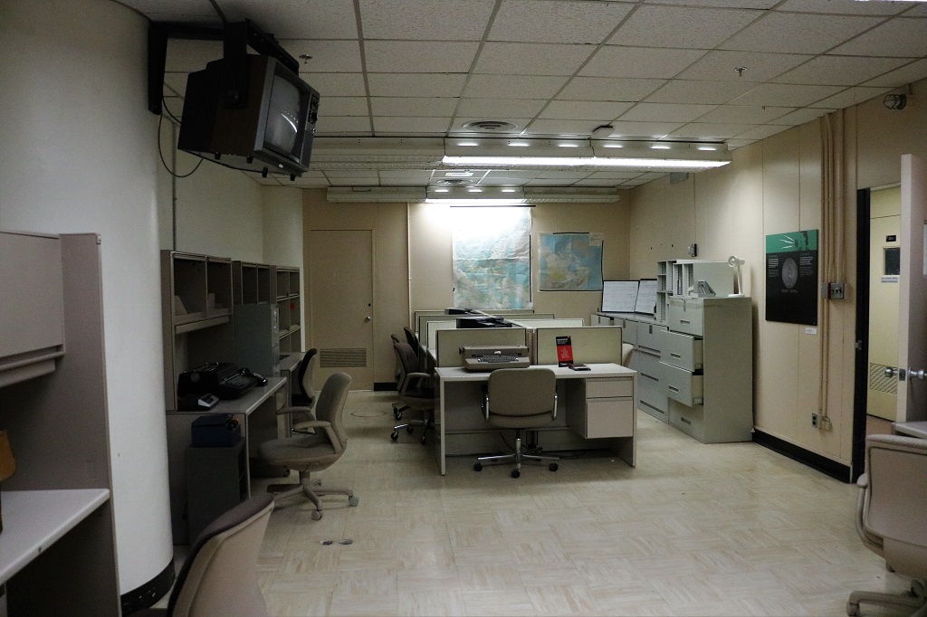
The Secretariat.

We drove the remaining distance to Ottawa and found our lodging for the next four nights at a University of Ottawa campus dormitory. Tomorrow will be flowers. I promise. Unless it rains. And tomorrow night we have a BBQ with John’s cousin and his daughters, their spouses and children.

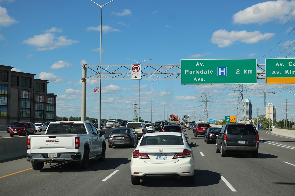
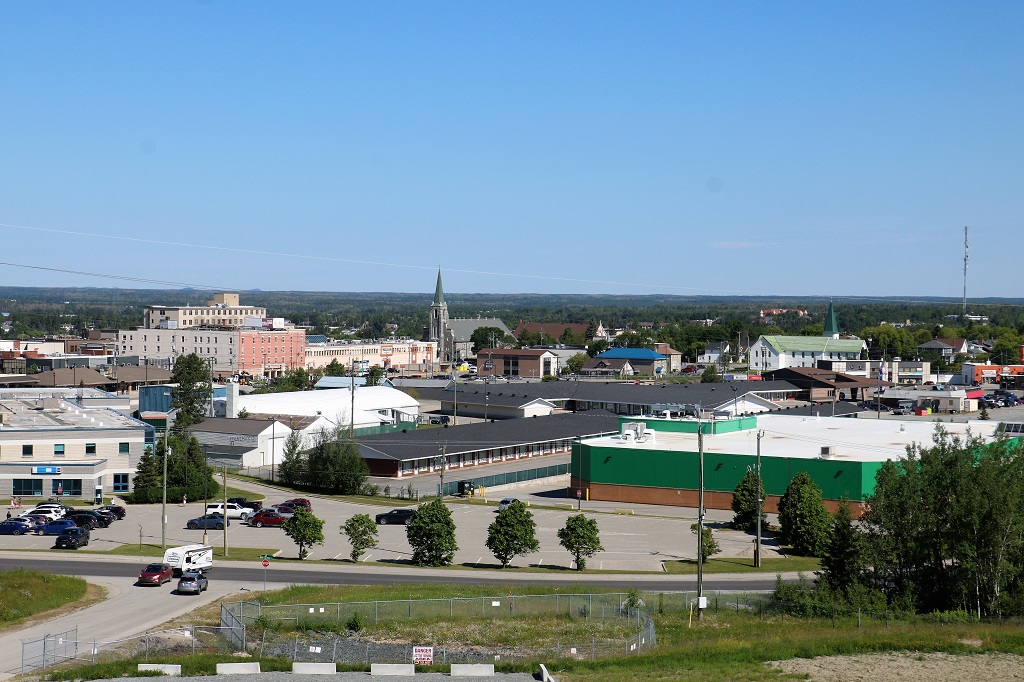
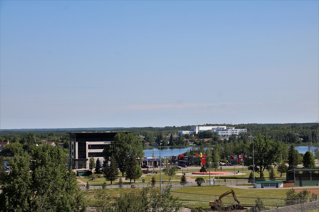
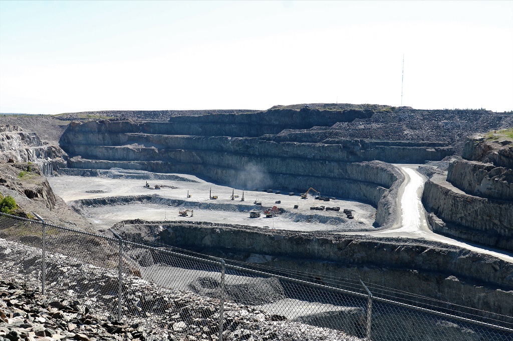
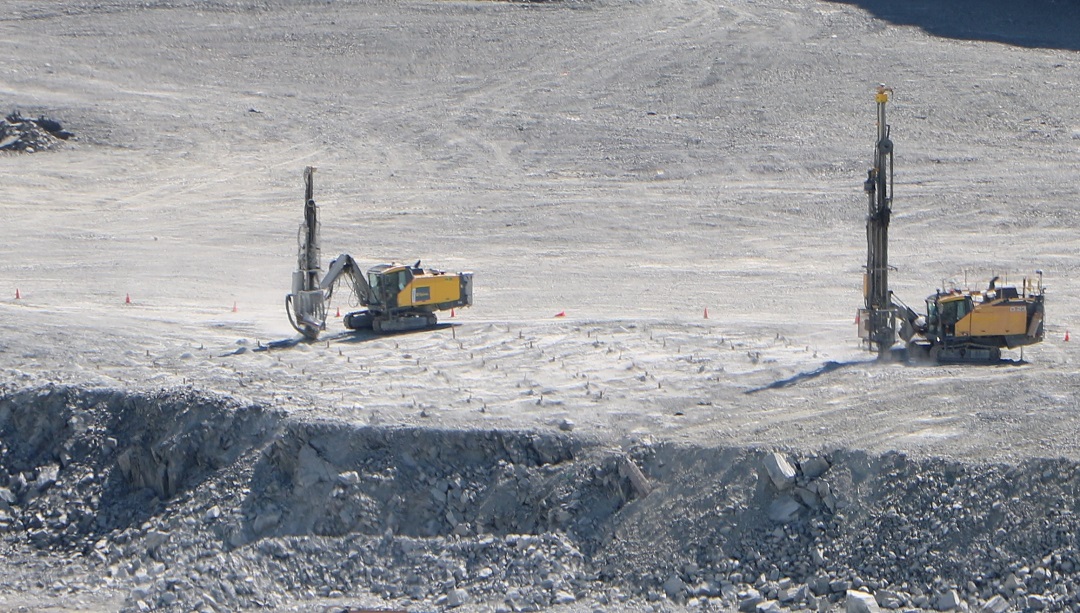
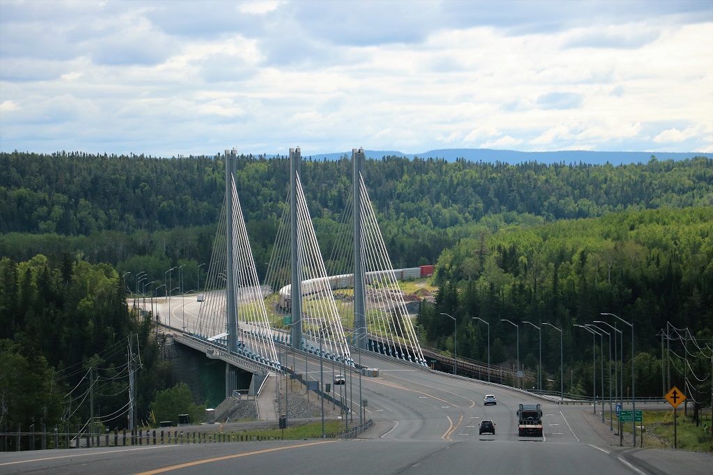
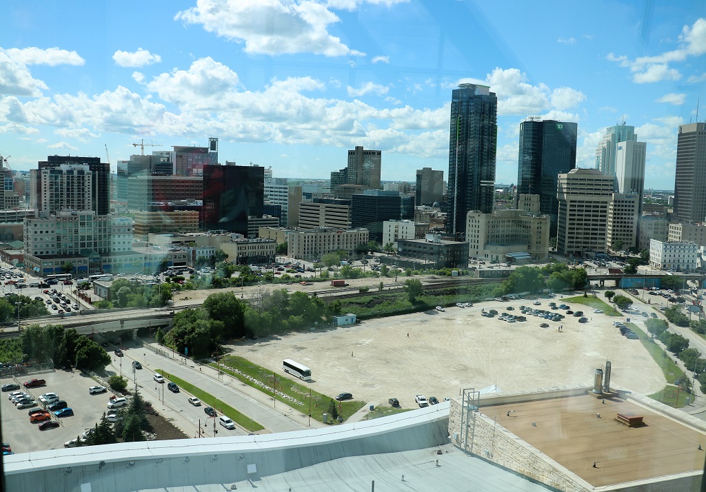
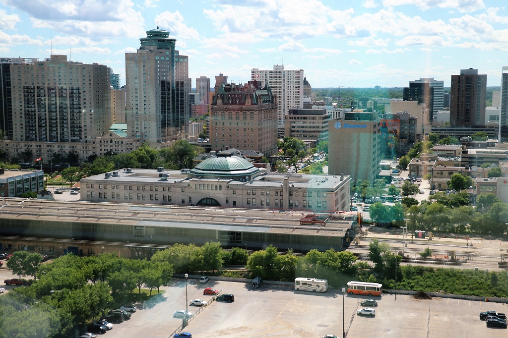
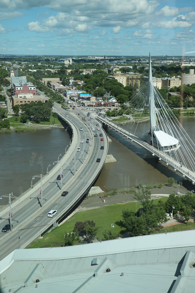
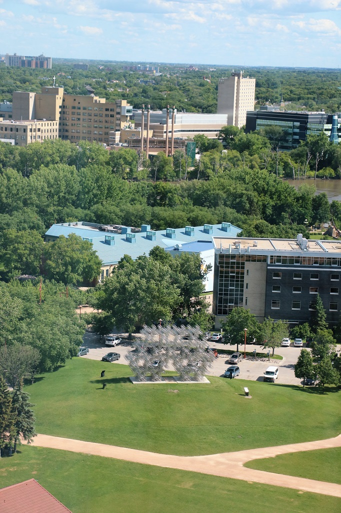
Why we tend to avoid large cities!

Day 30 – July 6 – North Bay, ON to Pembroke, ON

We started our day in North Bay doing a couple of fun things. We went to the Heritage Railway and Carousel and had a ride on each.

They use a diesel engine to pull the train. Replacement cost would be $450,000. They also have in this shed an eletric engine and a gas engine. The train and the carousel are operated and maintained completely by volunteers.

Local carvers made, and local artists painted, all the horses on the carousel. When they had finished this one they started on a smaller one that is made of northern Canada animals. It was not open and operating but there were pictures of all the animals they had made. Moose, fox, lynx, deer, elk, raccoon, etc. They were adorable.

This was my lovely steed.

John rode the buckskin beside me.

When we had finished our rides we crossed the street and walked along the waterfront marina.

There was a beautiful sandy beach and a large playground beside the marina.

Then we drove over to Wing 22 CFB North Bay where the Canadian Aerospace Defense Museum was located. I did not know there was a Canadian Forces base in North Bay. They are a unique airbase because they have no airplanes. They used to, but now they just do airspace reconnaissance, checking on all flights over Canada – domestic, foreign, and military.

They had a much smaller museum than Cold Lake but since North Bay was part of the same radar control system there was some overlap. They had displays on the wartime battles of WWI and WWII since both of those engagements led up to the airspace control measures now in place all around the world.

As usual I took tons of pictures of all the information signs and things that interested me. I have tried to not bore you by posting too many.

I have heard so much about the WWII Battle of Britain with the German bombing night after night that I forgot that the Germans also sent huge zepplins across the English Channel to bomb Britain in WWI. The British did not even have an air force at the time. But in a very few months after declaring war on Germany they did. Many pilots were from Canada, and half of the takedowns of 12 of Germany’s big Zepplins were done by Canadians; some with British crew.

The number one ace of WWI was Canadian Billy Bishop who logged an astonishing 72 confirmed kills. He did not fly against the zepplins though. There were write-ups on all the Canadian flyboys who did destroy them. One of them got two. He was the only pilot to do so.

The image below goes alongside the one above.

Although the pilots attacked the huge zepplin airships, their bullets did not penetrate all the layers to do much damage. It wasn’t until they created incendiary bullets that went through to the gas that the zepplins could be destroyed. Up until then all they did really was harrass them.

The WWII section also included a good short film about the bombing of Britain.

The most surprising thing to me was the model of the underground complex at North Bay. It is no longer in use. They moved everything above ground in 2006 but the installation is still there and maintained. The military has not yet figured out how to decommission it and until that is done it is a military base and must be maintained even though it is empty of all equipment and furnishings, etc.

The little car looks like it is on a gradual slope but in reality that road is on a 10% grade. The North Tunnel entrance is on the base.

It was three o’clock by the time we drove out of the base. After that it was just a drive past trees, rocks, water and some farm land to Petawawa where we had dinner and then drove to Pembroke for the night. The two communities are spread out along the shore of the Ottawa River and just run from one town right into the other.

Tomorrow we reach Ottawa. John has cousins there and we will be visiting them and touring around the city. I have a whole list of things to see even though we have been there several times. We are staying four nights at rooms on the Universtity campus. $100 per night as opposed to all the hotels that are between $180 and $250.

Day 29 – July 5 – Haileybury, ON to North Bay, ON

We did manage to turn our two hour drive into a six hour day, but we were worried for awhile that it may actually be about two. Three of the four things we planned to do today we were unable to do. Two because both of the museums we wanted to see in Cobalt were only open Wed-Sat and it was raining all day so a climb up a 400′ fire tower in Temagami was not appealing since the spectacular view would have been grey clouds.

Before we left the Tesikaming Shores area we drove back up the road to New Liskeard and found Ms. Claybelt, the huge Holstein cow that is at the Visitor’s Center. Despite so much mining activity in the area, agriculture is still a major contributor to jobs and the economy so Ms. Claybelt is a reminder of that.

She is named Ms. Claybelt because this area is a vast tract of fertile soil stretching between the Cochrane District in Ontario and Abitibi County in Quebec covering around 29,000,000 acres (120,000 km2).

I don’t ask to have my picture taken very often, but who could resist a photo with such a lovely cow?

We drove south again to Cobalt, a small town transformed by the discovery of silver in the early 1900’s. The town is now a National Historic Site. We had hoped to tour their Cobalt Mining Museum where you could also arrange to get a tour down one of the mines, and their Military Bunker Museum but both were closed today. We walked around the small display of mining equipment at the headframe across the street and then headed toward North Bay.

Note the number of X’s and *’s that denote mine sites or open vein sites.

We were a few kilometers out of Cobalt and we spotted a Heritage Mining Trail #3 sign with an arrow pointing to a side road to the left. Off we went. You could pick up maps for the 15 or so points on the tour at the mining museum but since it was closed we could not do that and figured we were out of luck. I was able to pull up the map on my phone so we set out to locate several of the sites around where we were. We did not go back into town to see the ones there.

This is all that is left of the massive mill. It was closed in August of 1927 and burned to the ground the following April.

This pile of core samples was beside the foundation remains of the Cobalt Lake and Hellens Mill. None of the buildings of the various mills or head frames, except the one ln downtown Cobalt have survived.

This was the entrance to the Little Silver mine. They just followed the silver vein down narrow channels of rock. I would not want to be a miner in one of those!

The sign is true. As we came out of the forest into the small glade before the mine entrance the air temperature dropped several degrees and we were instantly cold. It was raining steadily but it was not cold except in that spot.

Can you imagine being able to just fill a lake with mine tailings today? But read the bottom line above.

The final stop we did of the Heritage Mine Tour was the Nipissing Hill Lookout which was the site of another mill and a tramway. The view looking over Cobalt would have been awesome on a nice day!

As we headed back down we located a few geocaches hidden along the road and there was one at this vein cut. It was hard to get a photo of it between the high fence and the rain but it would have been a nightmare to work in there or the other even narrower vein just a few feet away.

The Visitor’s Center at Latchford had this huge boulder out front. We stopped here to find the location of the world’s shortest covered bridge – as verified by the Guiness Book of World Records.

The bridge spans a small creek and is 11′ 3″ long. We have now driven through the world’s shortest covered bridge and walked through the world’s longest covered bridge. In 2019 we went to the 1282′ bridge in Hartland, New Brunswick.

We stopped at a small park with a covered shelter in Latchford and had lunch. This bridge is named for a local man who was the recipient of the Victoria Cross.

Everything was so grey and dark and wet today this is the only scenic picture I took.

Day 28 – July 4 – Timmins, ON to Haileybury, ON

The sun was very bright as it set last night in Timmins. I hate all the wires in the photos, but I am doing my best to ignore them.

John and I have become quite adept at making a two hour drive take all day.

We actually did not leave Timmins at our normal 10ish. Instead we took a drive to the new viewpoint that opened last week. It was built by the mining company that has a 15-year deal to work the open pit gold mine that has been closed for a number of years. They built a lovely three-level, wheelchair accessible viewing area with nice metal fencing, benches and picnic tables. Since it is brand new lots of local people were up there last night to watch the sunset and this morning to see the view over Timmins and watch the work in the mine. There are security guards that come up whenever they are going to do blasting (usually at 11 AM and 3 PM) and clear the area so there is no risk of anyone getting injured by flying rocks.

When the mining contract is up in 15 years the company will fill the pit with water to create a lake and restore the area as a park for the community to use.

This truck is hauling 100 tons of material. The tires are over 8′ tall. We spoke to a fellow who works for the same company but was an electrician at another one of their mines (working 1900 meters underground) and he said that truckload will yield about 120-150 grams of gold (between 4 1/4-5 ounces). Formerly about 60% of the gold could be extracted from the ore; with today’s equipment and technology that percentage has risen to 99% so many of the old mines are now worth further work.

This truck is about half way out of the pit they are currently working so this picture gives an idea of how deep they are. We could just see the edge of a deeper one right below the viewing area.

This is a photo John took and cropped in close. There are four of these machines drilling holes along this section for dynamite charges. They are all the little sticks you can see in the neat rows. When they get all the charges in place they will blow it all at once.

Due to our visit to the gold mine pit we did not leave Timmins until 11 AM. We headed south and picked up another geocache Trans Canada Highway Adventure Lab that once again showed us some things we would have otherwise missed. So today is a combination of things I had read about and noted to stop for, and things the Lab took us to.

This first stop in Matheson was due to an historical sign on the highway directing us to this marker down by the Black River where there was a nice picnic area and park.

Second stop was on the Adventure Lab to the small town of Swastika. During WW II the govenment wanted to the town to change their name to Winston but they refused saying the town and the name had been around long before the Nazis took the symbol for their emblem.

The river at the park at Swastika.

This is the head frame for the Kirkland Lake Gold mine. It is basically a massive elevator shaft. All the ore is brought to the surface with it, miners, equipment and water and anything else needed can go down in it. There are about five wires we can see on this one and each wire is a different lift.

This hockey player sculpture was at Kirkland Lake, but I did not see a sign explaining who it represented.

The Miners Memorial at Kirkland Lake. The earliest deaths recorded are in 1917 and the latest was 2005.

Beside the memorial was a life-size statue of miners at work. The equipment being ‘used’,the mucker machine, even the battery packs on the miners are original and were donated by local miners. The sculpture weighs 40 metric tonne and is made of 10 meter high black granite and bronze. It was completed in 1994 for Kirkland Lake’s 75th anniversary.

The town of Kirkland Lake was dominated for many years by these seven different mine head frames.

Of the seven mines, this head frame is the only one still standing. It was from the Toburn Mine which operated from 1913 to 1953. During that period, the mine produced 1.2 million tonnes of ore, averaging half an ounce of gold per tonne. The mine workings, at 750 m deep, were the shallowest of the big 7 mines in Kirkland Lake. The ores went progressively deeper to the west.

Gold, and other mines, do not only yield the one mineral they are mining for. Many other minerals are found along with the gold. Note how many of these have asterisks beside them. Those are in sufficient quantities to be commercially produced

There were a lot of mines operating in this area over the last 100+ years. The smallest yield was 10 ounces. The largest was the Kerr (Addison) which produced 10,457,441 ounces in its 85-year history. At one time this area produced more gold than South Africa. The total production of all these mines was a staggering 42,583,205 ounces of gold!

This big fish was at the tourist center at Larder Lake, which was closed. Larder Lake was the site of the first gold rush in northeastern Ontario in 1906. The area is also well known for its fishing opportunties!

We had a nice chat and visit with the two young women at the Virginiatown Visitor’s Center. Gold from the nearby Dr. Reddick Larder Lake Mine was bought by the newly formed Royal Canadian Mint in 1907 and used to mint the first $5.00 gold coin in Canada. The front of the coin features St. George and the Dragon and the back has the portrait of King Edward the VII.

Our final stop with the Adventure Lab was a short distance down a gravel road to a spot with good visibility of Mount Cheminis (Mt. Chaudron in French). The mountain is a popular hiking spot as well as a location of spiritual significance to the local indigenous poeple.

The formation is known as a ‘monadnock.’ a hill that rises abruptly from the surrounding landscape. It was created during the last ice age when glaciers scraped away the surrounding softer rock, leaving the harder and more resistant rock of the mountain.

We exited the mining district and drove into farm country about 30-40 km from New Liskeard and our accomodation for the night in Haileyberry.

The canola is in bloom.

Tomorrow is another two hour drive to North Bay. I think we should do it in about 6 or so hours.

Day 27 – July 3 – Hearst, ON to Timmins, ON

We left Hearst at our normal 10ish and made several quick photo stops before we got to Cochrane. We were doing an Adventure Lab geocache that is part of a series being set up along the full length of the Trans-Canada Highway. Adventure Labs are a new add-on to the regular geocache hunt, but they do no have a log paper to sign; instead, as you approach each part of the Adventure Lab, your phone will display a question, the answer to which is on signs or plaques at your location. Most Adventure Labs take you around towns to point out the points of interest. The Trans-Canada Highway project has select points of interest along sections of the highway that eventually will all be connected into one long hunt. Most of the TCH labs are about 10 stops. We enjoyed being directed to memorials, or town mascots or advertising displays. The Labs are quick and fun and you see many things you would never otherwise notice as you drive along.

The first stop was at a memorial for a young man from Hearst who was killed on a NATO mission in Afghanistan. He was only 20. The memorial also has photos and names of men from the town who died overseas in WW II.

The Voyaguer statue at Mattice.

A fellow built this big T-Rex to advertise his hotel. The hotel is gone but the T-Rex still stands.

This tall memorial stands to commemorate the death of three pulp mill workers who were on strike here in 1963. Independent contractors crossed the picket lines and provided logs to the pulp mills. Over 400 pulp mill workers heard about a secret shipment of logs going to the mill and went to prevent it. The contractors shot at them. Three died and 8 were wounded. 20 of the contractors were charged with murder. It was the most violent labour strike in Canadian history.

I have no idea who built this big bear or why. It was just up on a small hill by itself.

The community of Moonbeam has it’s own alien space ship.

Cochrane, Ontario has a polar bear habitat and there are bears and bear signs all around town. There are three bears at the habitat. They have three large enclosures, each with a pool, plus an air conditioned shelter where they spend the night and the entire lake beside the habitat is fenced and the bears have access to swim in it. Two of the bears are related. Inukshuk is the father of Ganuk and are both on loan from the Toronto Zoo. Inukshuk goes back and forth to sire more bears, Ganuk has been in Cochrane for quite a few years. Henry was born at Sea World on the Gold Coast of Australia and when his mother was beginning to distance herself, as they do when their cubs are about 2 years of age, Henry was brought to Cochrane.

Inukshuk was getting his pre-dinner dry food mixture that is specifically made for polar bears. He took every mouthful of the spoon so very gently. They get fed moose meat, seal meat, this kibble mix and fruits and vegetables. They get the fruit and veg mainly in the summer to give them food that does not contribute a lot to their weight so they can manage the heat better. They love watermelon.

After he had a few spoonfulls sitting up, he sprawled on his belly with both back legs extended and just lay there waiting for the next serving.

This is Ganuk. He just came out of the pool in his enclosure and is soaking wet. He walked into the grass and had a good long roll to help dry off.

Inukshuk finished his snack and wandered along the back of the enclosure. Henry stayed in the house in the air conditioning.

After we left the polar bear habitat we drove over to the Tim Horton Area and toured museum.

John and I both grew up in the golden age of the Toronto Maple Leafs and Montreal Canadiens and John’s brother was a big Leafs fan and really liked Tim Horton. Tim was called the steadiest defenceman in hockey and when he died in a car crash at age 42 the hockey world was stunned. He is a household name in Canada due to the donut shop franchise that he started and are located in almost every town across the country – and internationally. There is even a Timmies in Dubai.

We arrived in Timmins at supper time and settled into our hotel for the night. Tomorrow we continue on our way toward Ottawa but are only going as far as Temiskaming Shores. There are several things we plan to see along the way.

Day 26 – July 2 – Nipigon, ON to Hearst, ON

As expected today was a driving day. There are only a few small communites between Nipigon and Hearst, which are 401.5 km (249 1/2 miles) apart. But we were pleasantly surprised during our first couple of hours of travel to have some very pretty scenery. Even a waterfall! The area was very reminiscent of areas in BC. But there were no stops, except a brief one for lunch; no tours, no museums – just driving.

The Nipigon River Bridge. It took 3 years to build and cost $106 million. 42 days after the bridge opened in January 2016 bolts attaching the main deck failed during a winter storm causing the deck to rise two feet. The incident caused up to 1,300 trucks – carrying an estimated $100 million worth of goods – to detour each day for several weeks. The bridge partially opened to alternating one-way traffic 17 hours after it closed. The government estimates the repair work at between $8 million and $12 million. Three factors were determined to have caused the failure: First was the design of the shoe plate and its flexibility. Second was a lack of rotation in the bearing that was constructed. And third was improperly tightened bolts attaching the girder to the shoe plate. The Discovery TV’s show “Engineering Disasters” is currently filming an episode about it.

A glimpse of a waterfall caused a quick turn into an open area. There was a barely visible trail heading into the bush but it soon came to a creek that needed to be crossed on wet rocks and almost no discernable trail on the other side. This is a Provincial Historic Site but there was no information why it had that designation.

Reflection Lake
I guess Frosty goes fishing at Beardmore.

Both sides of the road for miles were covered in this little yellow flower, with some white daisies and a red weed that we have at home thrown in the mix.

Sturgeon River

We are now driving in northeastern Ontario. North of here there are only a few hunting lodges you can drive to – on gravel roads – and some small villages accessible only by air; and lots and lots and lots of rocks, trees and water.

When I look at the map this area does not appear very far ‘north’ so I checked the latitude. Hearst, ON sits at 49.6880 and Kelowna, BC is 49.8880. Salmon Arm, BC is 50.700. Ontario’s ‘north’ is not even a quarter of the way up British Columbia and nowhere near what we consider ‘north.’ They can get snow from late September to late May but do not get lots and lots at a time – usually about an inch. November is the worst with an average of 8 1/2 inches. Temperatures get to -24 C in January.

Tomorrow will be another driving day, not quite so long – only about 3 hours – to Timmins, which was a gold mining town. You used to be able to have a mine tour but a mining company purchased the land and the tours have been closed for almost 10 years now. Rats. I wanted to do that. Maybe we can do a silver mine tour at Cobalt the next day. Here’s hoping.

Day 25 – July 1 – Thunder Bay, ON to Nipigon, ON

Happy Canada Day! Our wonderful country is 155 years old today. And John and I were at the very same place today as were were on our first drive across Canada 8 years ago.

The Terry Fox Memorial, just east of Thunder Bay. Last time we were here we had our picture taken wearing the new Canada T-shirts we had purchased from Fort William. No pic this year though.

From the Terry Fox Memorial you can look across the water of Lake Superior to the Sibley Peninsula and Sleeping Giant Provincial Park. This was our destination after visiting the Terrry Fox Memorial.

There is an Ojibwas legend about the Sleeping Giant:
A great tribe of Ojibwas lived outside Thunder Bay on Isle Royale. Because of loyalty to their gods and their industrious and peaceful mode of living, Nanna Bijou, the spirit of the Deep Sea Water, decided to reward the tribe.
The Great Spirit told the chief about the tunnel that led to the center of a rich silver mine. He warned that if the Ojibwa tribe were ever to tell the White Man of this mine he, Nanna Bijou, would be turned to stone. The Ojibwas soon became famous for their beautiful silver ornaments. The Sioux warriors, upon seeing the silver on their wounded enemies, strove to wrest the secret from the Ojibwas.
Torture and death failed to make the gallant Ojibwa tribesmen divulge their secret. Sioux chieftains summoned their most cunning scout and ordered him to enter the Ojibwa camp disguised as one of them. The scout soon learned the whereabouts of the mine.
One night he made his way to it and took several large pieces of the precious metal. During his return to the Sioux camp the scout stopped at a White Trader’s post for food. There, without furs to trade, he used a piece of the stolen silver. Two White Men, intent upon finding the source of the silver, filled the scout with firewater and persuaded him to lead them to the mine. Just as they were in sight of “Silver Islet”, a terrific storm broke over the cape. The White Men were drowned and the Sioux scout was found drifting in his canoe in a crazed condition.
A most extraordinary thing happened during the storm. Where once was a wide opening to the bay, now lay what appeared to be a great sleeping figure of a man. The Great Spirit’s warning had come true and he had been turned to stone.
Today, a partly submerged shaft to what was once the richest silver mine in the northwest, can still be seen. White Men have repeatedly attempted to pump out the water that floods in from Lake Superior, but their efforts have been in vain. Is it still under the curse of Nanna Bijou, Spirit of the Deep Waters? Perhaps…who can tell?

A few kilometers up the road from the memorial is a marker to commemorate where Terry had to stop his Marathon of Hope due to the pain from his recurred cancer. His plan was to run the 5300 km across Canada – from Atlantic to Pacific – but he had to stop at mile 3339.

As we drove down the Sibley Peninsula we stopped to try find a geocache hidden at one of the bases of this massive railway viaduct. It was officially the Blende River Viaduct, but is locally called the Pass Lake Trestle. It was built in 1916 by the Canadian National Railway as part of the southern rail line around Lake Superior. The tallest part is 140′ above the ground and it is 2280′ long. It has not been used for quite a few years and there is now a movment to have it turned into a trail and added to the Trans-Canada Trail network.

Sadly Sleeping Giant Park is just full of very long hikes. The only short ones that my poor legs would be able to do only went to bogs or marshes. All we saw along the road were trees, trees, and more trees. We turned around and headed for nearby Nipigon where we were spending the night thinking we would be seeing things in Sleeping Giant.

Before we got to Nipigon we took a side road and did another thing we had done in 2014. We drove the narrrow, winding road to Ouimet Canyon.

Nipigon is only 111 km from Thunder Bay and, even after the drive down the Sibley Pennisula and the road and short hike to the canyon, it was only about 2:30 when we arrived. We worked on an Adventure Lab geocache and had a nice drive around the town, which is small but very spread out. As were touring around we could hear a local country band playing on an outdoor stage at the Legion; doing a Canada Day concert.

Nipigon has lovely signage at all their parks and heritage information on all their old buildings. It was a very nice town to drive around. We loved the Paddle to the Sea Park. They had an awesome splash park for kids and several other mini-play areas as well.

At the Nipigon Marina.

Tomorrow we enter northeastern Ontario and will be driving about 4 hours to Hearst.

Day 24 – June 30 – Fort Frances, ON to Thunder Bay, ON

As expected, again, we drove past more rocks, trees, and water. The area surrounding Fort Frances is dotted with little islands and inlets and the Rainy Lake extends for miles. The lake covers 360 square miles and straddles the border between the USA and Canada. There are numerous bridges that connect islands to make the highway. This was the longest one.

Not quite half-way to Thunder Bay we stopped in the Visitor’s Center parking lot for the town of Atikokan which was an iron ore mining town until the two mines closed in 1979 and 1980. There was a geocache there so we found it before heading into the town to look around.

Atikokan now bills itself as The Canoe Capital of Canada and we saw a couple of different canoe company shops on our way into town.

There was a geocache hidden in the canoe too.

We parked by the musuem and library and walked across the footbridge over the creek to the Legion Point Historical Park that had information boards about the ire ore mines.

Iron ore was confirmed to be at the bottom of Steep Rock Lake in 1938. It wasn’t until near the end of WW II when there was a tremendous need for iron for the US and Canadian war effort that a plan was made to access it.

Pneumatic drill
Water pressure monitor with shield to protect operator

First opened in 1943, the mines would supply raw materials for everything from World War Two Hawker Hurricanes (made in Thunder Bay) to toasters and nails in the late 1970s.

David K. Joyce was a 14-year old enthusiastic mineral collector in 1969. He went on a trip to Atikokan and wrote a blog about his experience. He noted these statistics:

  • billions in wages and taxes resulted from the operation
  • double the amount of earth and rock was excavated to build Steep Rock compared to the Panama Canal
  • 215 million cubic metres of overburden and lake bottom were removed.
  • 570 billion litres of water were pumped.
  • the amount of ore taken from the mines was enough to supply ALL of the cars and parts ever used in Canada up until 1978.
  • enabled 48,000 person-years of employment during its time.”

This is a stamp mill from a gold mine. In the late 19th century there was a short-lived gold rush in the area. Several mines operated and used stamp mills like this to process the ore. This one belonged to the Golden Winner mine which operated from December 1899 to October 1900 during which time 15 tons of ore were milled for a total value of $70. That is correct. $70! Most of the other mines were as shortlived and unproductive.

There was also early logging operations in the area. On display was an old railway engine that had been used to haul the logs to water where they could be floated to mills or transportation sites. It was discovered in 1962 and restored by members of the community.

We found a store that sold ice cream and enjoyed a cone before heading back to the highway and east toward Thunder Bay. About 60 or so kilometers from Thunder Bay we crosssed the Laurentian Divide, also called the Northern Divide. From this point all water either flows to the Arctic Ocean or to the Atlantic Ocean.

The base of the Atlantic side of the sign had a lot of rocks with purple in them.

Amethyst – our daughter’s birthstone and favourite jewel.

For the last couple of days we have enjoyed the large patches of lupins blooming on the roadside.

We spend the night in Thunder Bay and tomorrow we are going to Sleeping Giant Provincial Park on the Sibley peninsula just east of Thunder Bay. There are a lot of really long hiking trails there so we are not sure how much of the ‘sights’ we will be able to see, but it is worth exploring. Hopefully the day will be as beautiful as today was.

Day 23 – June 29 – Winnipeg, MB to Fort Frances, ON

Before we left Winnipeg we drove to 95 Figaro Street to see the house that my grandparents Catherine and William Young lived in before they died in 1935 and 1936. It has obviously been recently updated but looked very similar to the house my mother lived in later with her foster parents (the couple I knew as Grandma and Grandpa) George & Nellie Isaac on Martin Avenue. We had found that house on our 2014 trip.

Today was pretty much as expected; mostly driving past trees, rocks and water.

We left Winnipeg and headed east toward Kenora, Ontario. 20 minutes east of Winnipeg we passed the longitudinal center of Canada.

There was a short stop at Falcon Lake for lunch which we ate in the truck as a cold wind was blowing all day and the sky was overcast.

Falcon Lake is near the boundary of Whiteshell Provincial Park.

Not long after we were on the road again John said the trip odometer turned over to 5,000 km. We entered Ontario at 12:40.

Gasoline at Kenora was $2.24 per liter. We stopped at the Visitor’s Center for a bathroom break and to check out the area brochures.

This lovely glass ceramic canoe was on the lawn at the Kenora Visitor’s Center. The plaque says, “The canoe reflects the Path of the Paddle Waterway Trail from Wabigoon Lake (Dryden), through Eagle Lake (Vermillian Bay), Winnage & Teggau Lake systems to Dogtooth Lake (Rushing River Provincial Park), Lake of the Woods (Kenora), and Winnipeg River to the trail end at Whiteshell Provincial Park.

At the Kenora Visitor’s Center

Inside the Visitor’s Center was this wall showing the different species of fish that can be caught in the area’s lakes.

Did I mention there was a cold wind blowing all day? These are pics I took driving through Kenora.

We drove over a bridge and thought the river looked pretty so John turned the truck around and parked in the Rushing River Provincial Park Campground driveway and we walked over to take some photos.

These are the sorts of rocks we drove past between ponds and lakes and forests of thin trees.

We made another short photo stop at Nestor Falls.

Manitou Rapids Ojibway First Nations had this lovely memorial to all of the veterans who served.

There were a few more names on the back as well.

A short distance past the memorial we turned off Highway 17/Trans-Canada #1 onto Highway 71 and went south to Fort Frances. We arrived at 5, settled into our hotel and walked to the nearby restaurant for dinner.

We saw this pretty rainbow as we were eating. This is Rainy Lake and on the opposite shore is International Falls, Minnesota. Apparently there are boats and drones that patrol the waterway between the countries. Our server had never heard of any problems with people sneaking across. She thought you could get a pass that will allow you to go have dinner or shop at specific places across the border.

Tomorrow will be another driving day. We have a four hour drive to Thunder Bay on the northern shore of Lake Superior. Lake Superior is the largest of the Great Lakes of North America, and among freshwater lakes, it is the world’s largest by surface area and the third-largest by volume. It holds 10% of the world’s surface fresh water.

More rocks, trees and water, but the road south to Fort Frances and tomorrow’s route to Thunder Bay are new to us, so I guess it will be different rocks, trees and water.

Day 22 – June 28 – Winnipeg, MB

When we travelled across Canada in 2014 I went to the cemetery where my mother’s parents were buried. Her mother died in Nov. 1935 and her father in June 1936 so my mom and her three older sisters were orphaned about five years after they arrived in Canada from Scotland. My mother was 6 when her dad died. I think the eldest sister (there were four girls, just like my family) was 16.

We did find both of the graves, although they were buried in different sections of the cemetery; but not too far apart. Since my grandfather William Young had served in the Canadian Expeditionary Force in WW I he was buried in the miiitary section. Brookside Cemetery was primarily created as a verteran’s cemetery. There are 10,400 military graves there. It took us quite awhile (with help from the administration office) to find my grandmother, Catherine Young’s grave. We discovered that she had no marker, just a round disk with the grave number – 249. They were likely too poor to buy one and grandpa may have been sick (he died of TB from being gassed in the war) and perhaps not working since he died only 7 months after she did. Grandma Young died of peritonitis from a ruptured appendix.

John and I both felt strongly that she should have a marker. It did not matter that we never knew her, nor that our mother had no memories of her, she was important to people during her lifetime. We drove across the road to the memorial company and ordered a marker. I had to phone one of my sisters to get the dates for it and she phoned our other sister to say what we were planning and they both said they would help pay for it. We also had the date of Grandfather Young’s birth put on his stone. The memorial company sent photos of the finished stones in 2014 but since we were back in Winnipeg again I wanted to pay my respects and we went back to Brookside.

The marker we had chosen for Grandmother Young was the same as my mother has at Mt. Ida Cemetery at home. I was sad to see that all of the white inlay on the letters and the Scottish heather in the corners has worn off. They have had a lot of rain in Winnipeg this spring and there is water sitting in low spots all over the place. Grandma’s grave was not in water but the ground was quite soft and her marker was dirty. We washed it all off before we left.

I had spent time in our hotel room this morning catching up on some banking so by the time we went to the cemetery and found the graves and got to the Human Rights Museum it was after 12. The museum opened in September 2014 only three months after we were in Winnipeg the first time. It is a huge building with 8 floors if you count the scenic view level at the top. By the time it opened construction and contents cost $351 million dollars. It is a beautiful building and the galleries are really nicely done telling about all the different types of inequality and prejudice and racism that people have experienced in Canada over the centuries, plus a really good exhibit on the Holocaust and what led up to it. But it was also the biggest waste of space I have ever seen! There were huge areas of emptiness on all levels. I think the architect must have expected to have several thousand people on every floor at the same time. I bet if they did not build everything on such a massive scale the cost could have been halved.

The museum is located not far from The Forks, the hub of downtown Winnipeg at the confluence of the Red River and the Assiniboine River. The location was selected specifically due to the historical importance of the area.

There were three huge pieces of art by indigenous artists.

This bead and embroidery panel on felt is at least 30 feet tall.

About 1/3 of the Garden of Contemplation on Level 3.

The internally-lit alabastar-lined ramps zig-zagged back and forth from levels 2 to 6. There are one kilometer of ramps to get from the first floor to Level 7. An elevator takes you to the top of the tower on Level 8.

It was a beautifull day today so the views of Winnipeg were really nice from the Tower of Hope.

Your eyes are not playing tricks and the photo is in focus. This an artwork by Chinese-born Ai Weiwei, artist and dissident. It has travelled the world and came to Winnipeg from Austin, Texas where it had been for two years. It is entitled “Forever Bicycles” and is made up of 1,254 stainless steel bicycles from Shanghai Forever Co. It is 9 meters (30′) tall and arrived in pieces aboard four semi-trailers. It took about a week to set up. The sculpture is site specific and is modified to accommodate and enhance the area in which it is displayed. A company from London dismantles and sets it up in each location. It will be in Winnipeg for two years – with a possible one year extension.

The sculpture alludes to the bikes that flooded the streets of China, Ai’s home country, during his childhood. Despite their seeming omnipresence, bicycles remained financially out of reach for many, including Ai’s family.

The view from Forever Bicycles to the human rights museum is intentional. Ai is known for his human rights-related activism; he is openly critical of the Chinese government’s stance on that topic and democracy.

It was almost five o’clock and the museum was getting ready to close as we left. We headed back to the hotel to rest our weary feet once again before walking down the street for dinner. Tomorrow we leave Winnipeg, and Manitoba and head into Ontario. There are very few roads above the Trans-Canada Highway in northern Ontario but we have found a few and will be toodling along driving through forests with rocks and water for the next few days. The four-day drive from Kenora to Sault St. Marie in 2014 was some of the most boring days of any road trip we have done; so I do not expect a lot of exciting scenery. Maybe, since we are not just following the northside of Lake Superior this time, we may see a bit of difference, but we are just going to be a little higher in the Canadain Shield so I doubt it.