Category Archives: Hanna Travels

Day 8 – June 14 – Dawson Creek, BC

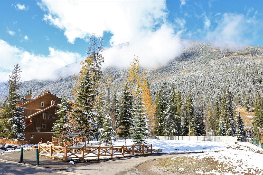
After a lovely breakfast at Brian & Marilyn’s we left for a day of sightseeing around Dawson Creek.

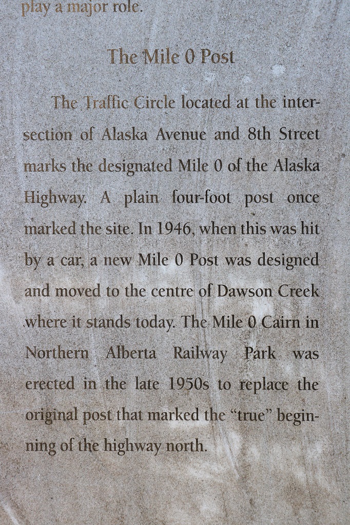
First stop had to be the Mile 0 Marker in the middle of the street commemorating the beginning to the Alaska Highway.

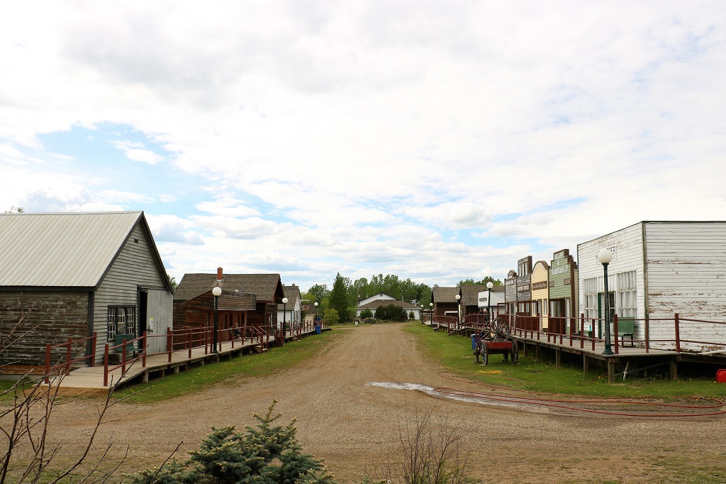
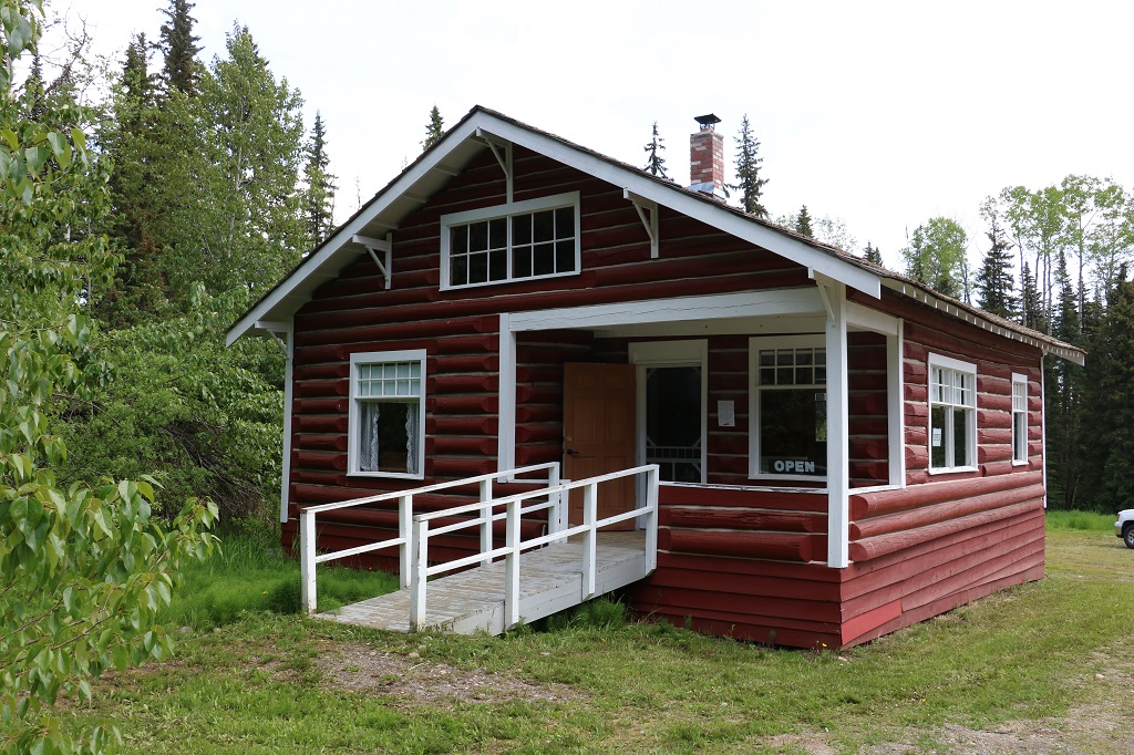
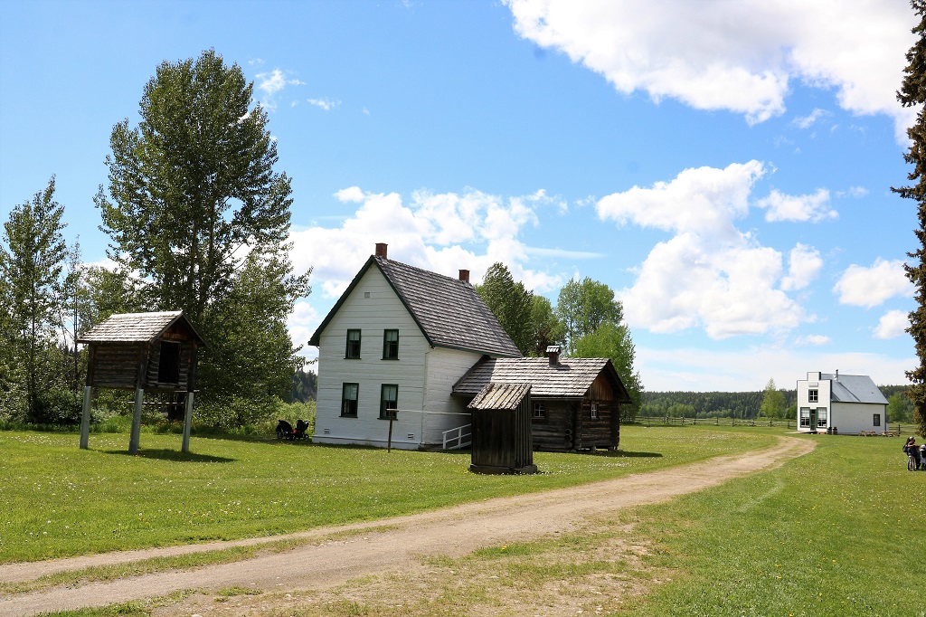
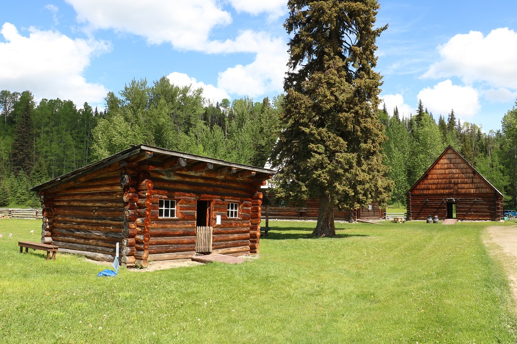
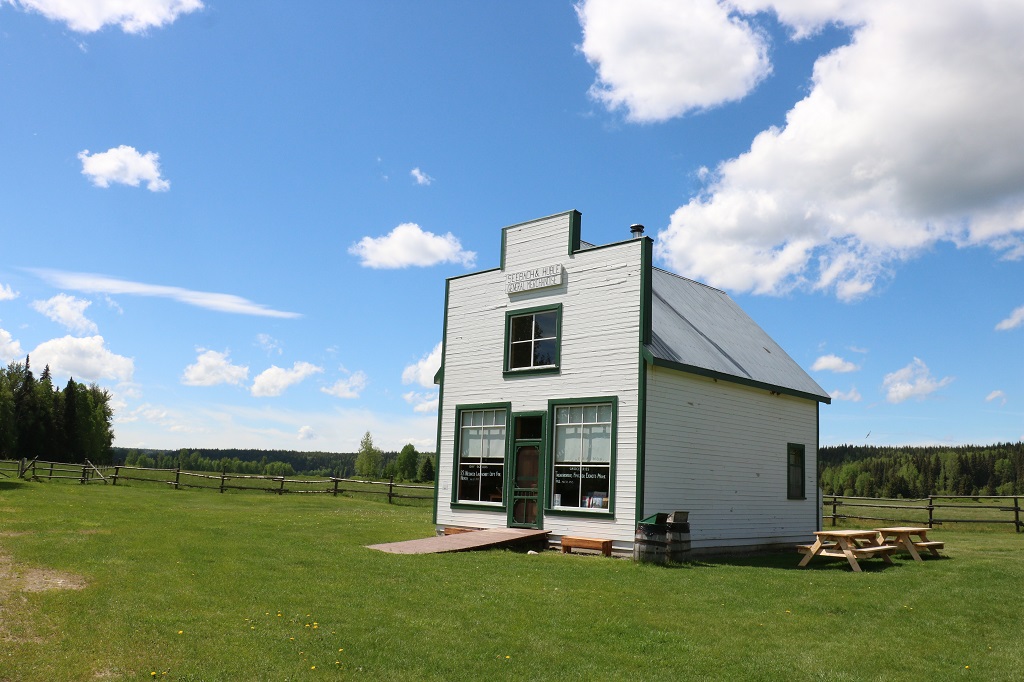
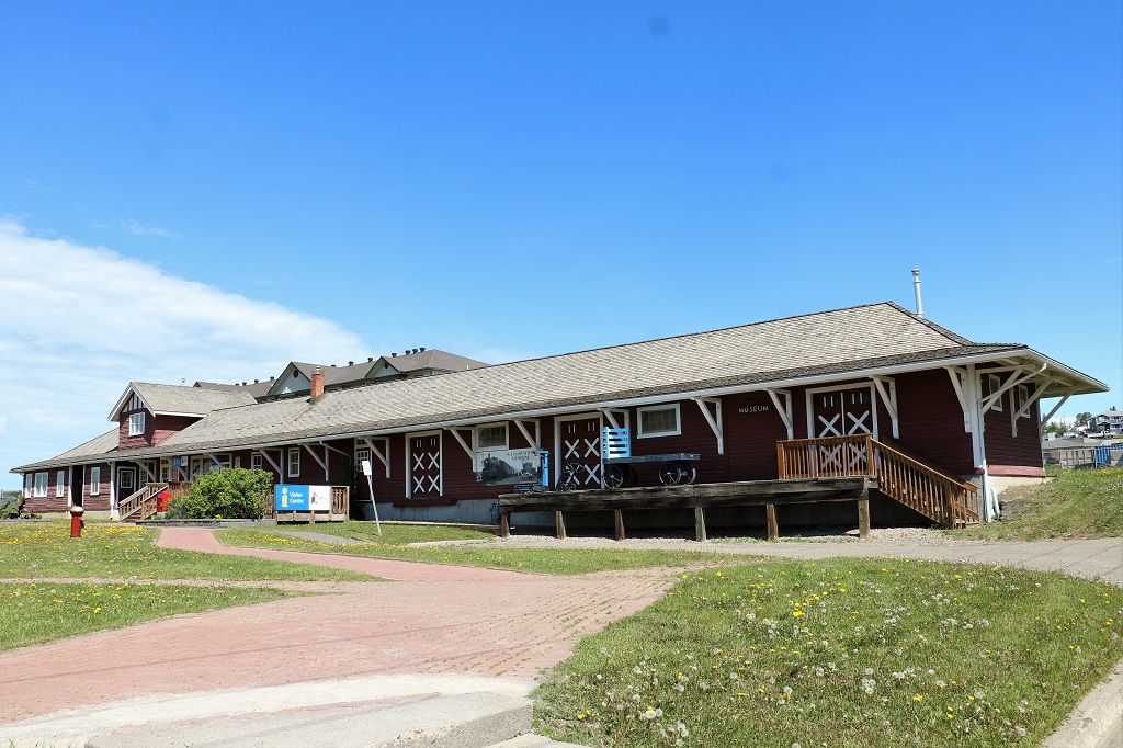
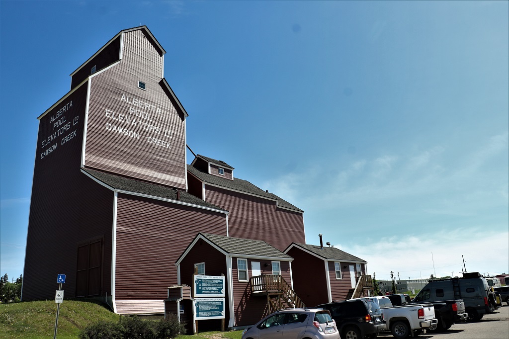
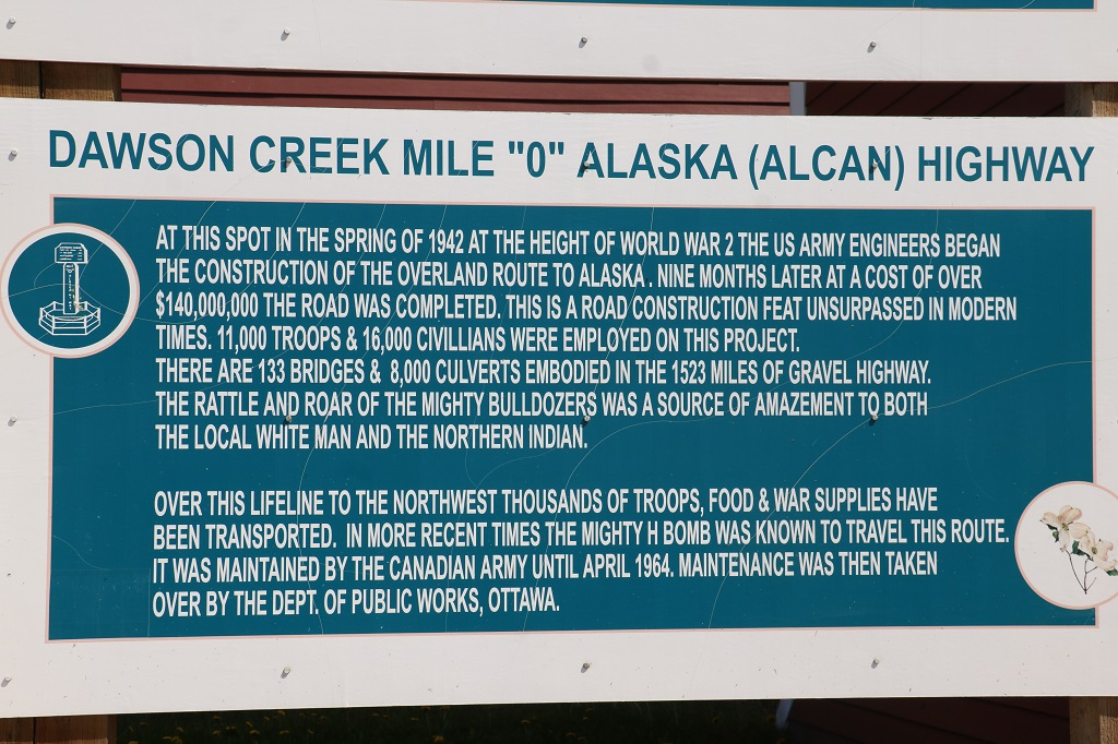
Next we went to the Visitor’s Center and the Station Master’s House which are located on Highway 97 near the beginning of the Alaska Highway on the north side of Dawson. The Station Master’s house and the Natural History Museum are located in the same building and the Art Gallery is next door in the only remaining old-style Grain Elevator.

The entire street used to be lined with the huge grain elevators. Now they have boring round ones.

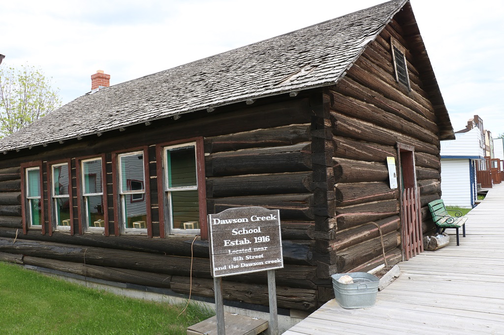
The Station Master lived in quarters attached to the railway depot. He was in charge of organizing all the goods and people who came and went on the trains. His job became exceedingly busy between March and May 1942 when 10,000 American troops and 600 carloads of tractors, bulldozers, fuel and supplies arrived from Edmonton to be distributed along the route for the planned highway to Fairbanks, Alaska.

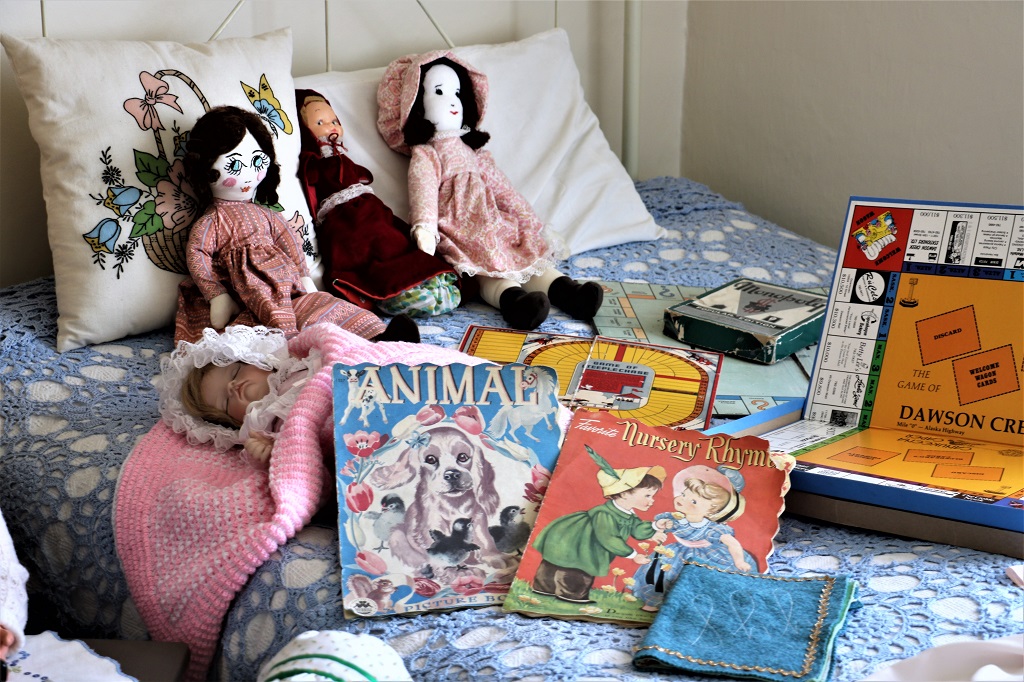
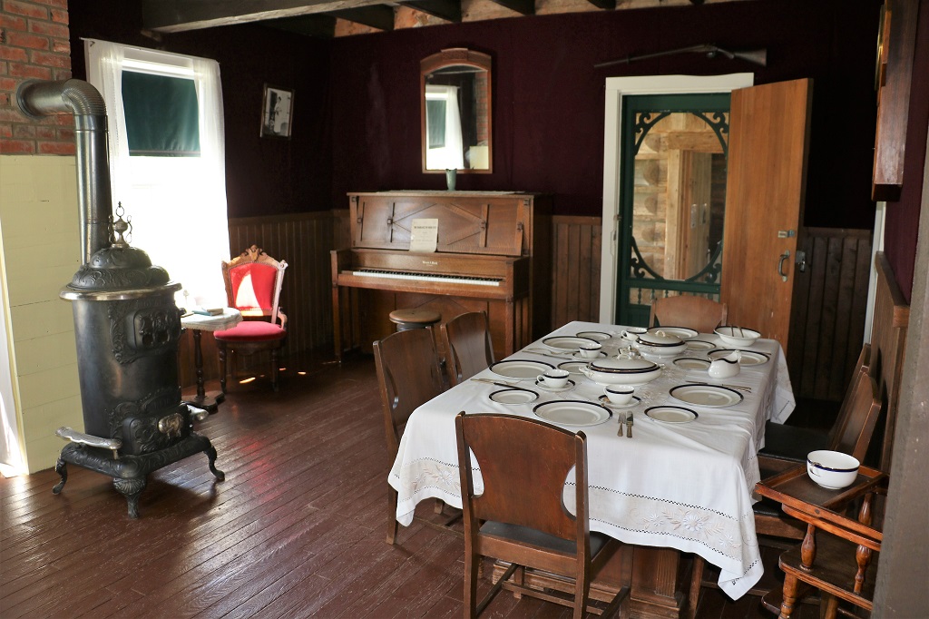
The rooms in the Station Master’s house were small and it was hard to get photos that looked like anything. The only one I kept was this one from one of the upstairs bedrooms. My cousin Denis gave me the same book as the blue one with the cocker spaniel on it for my third birthday!

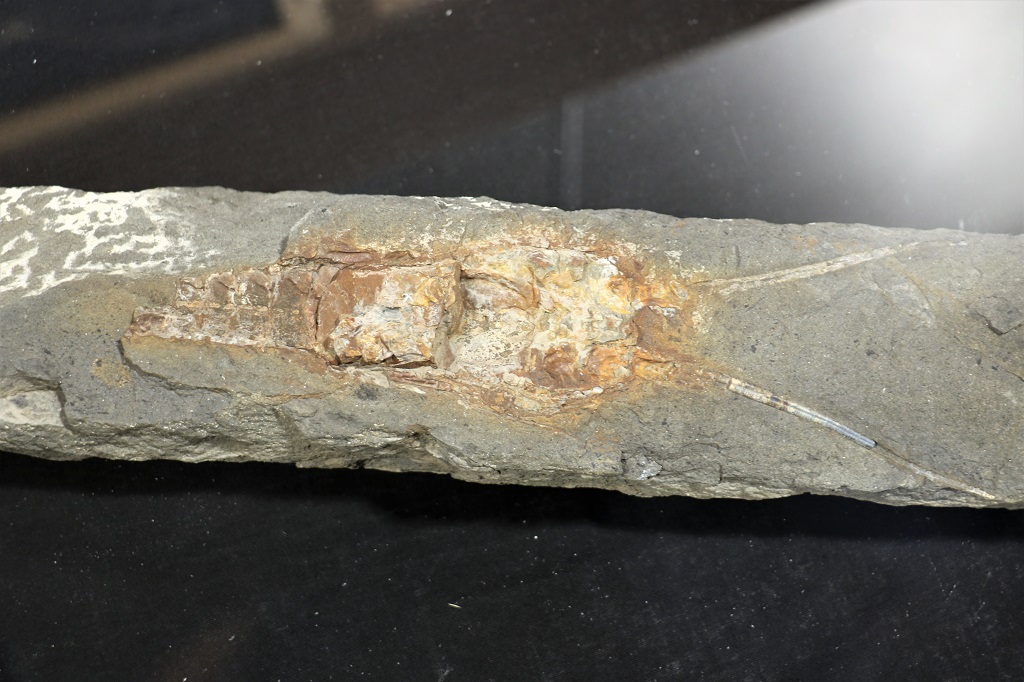
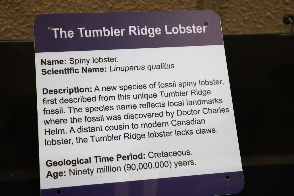
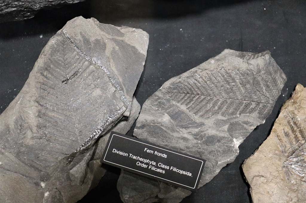
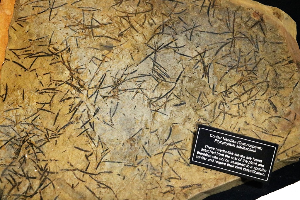
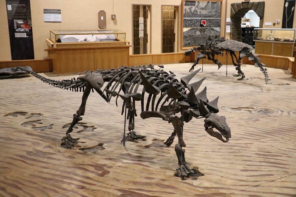
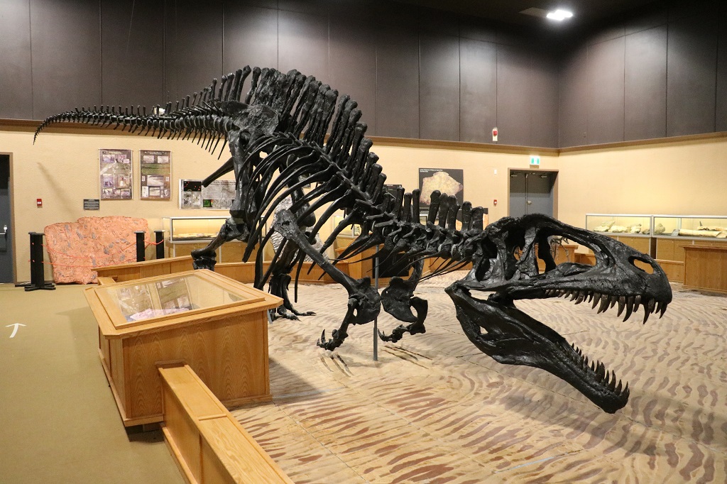
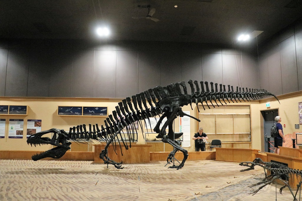
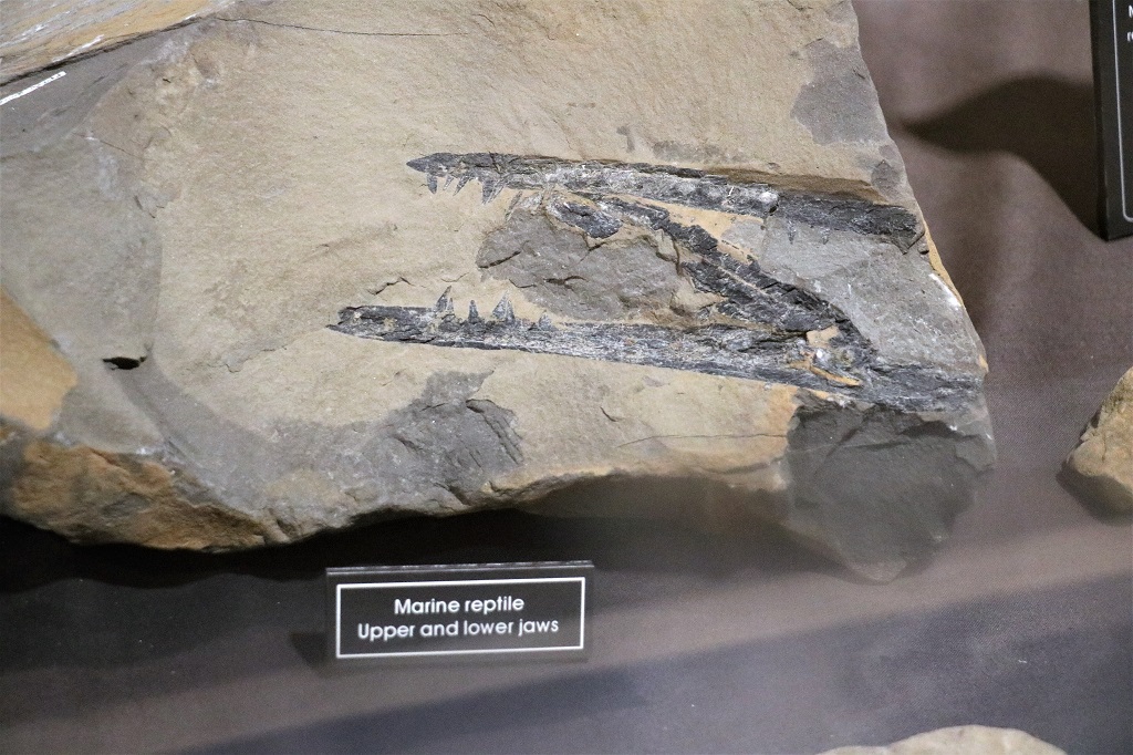
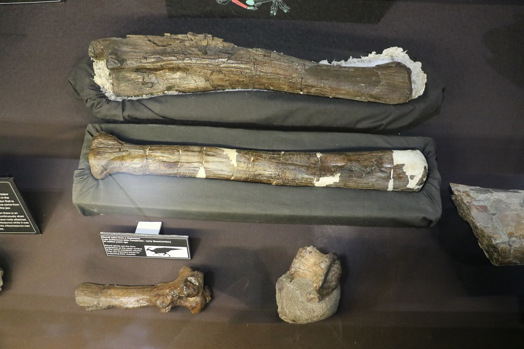
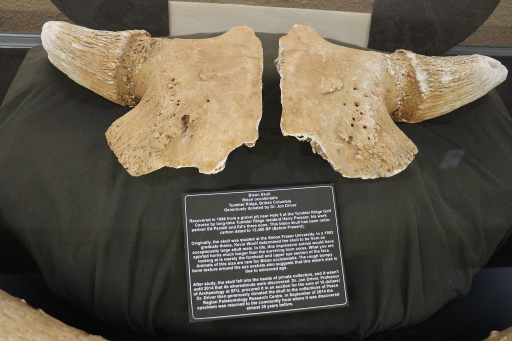
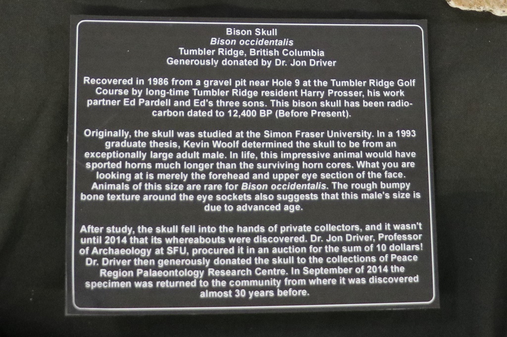
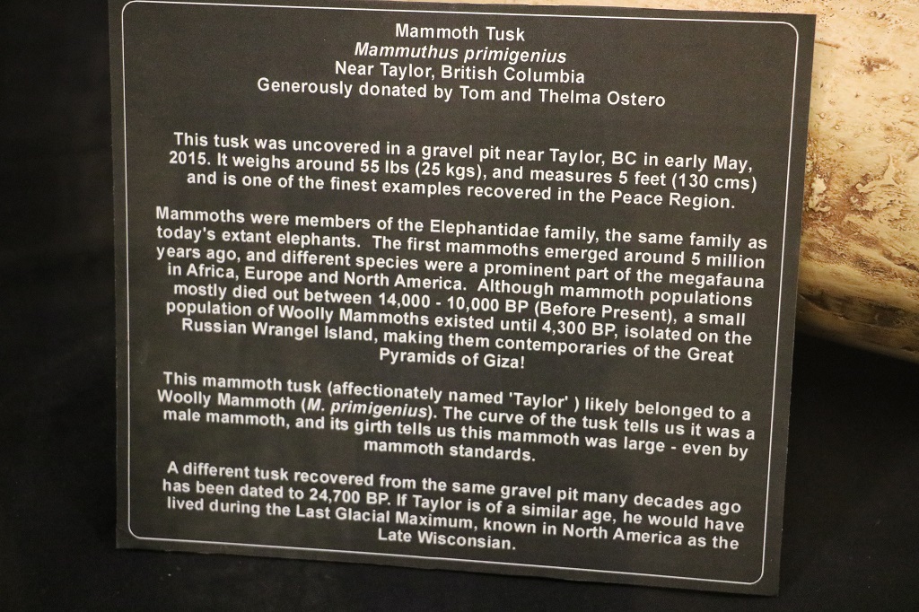
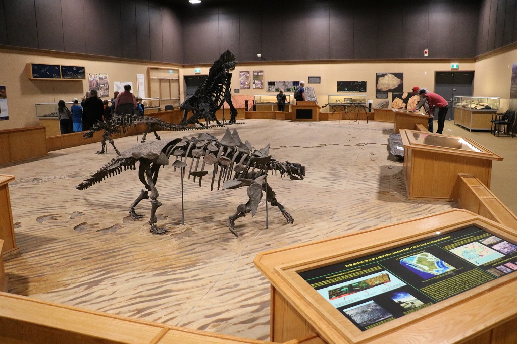
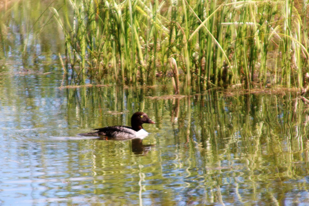
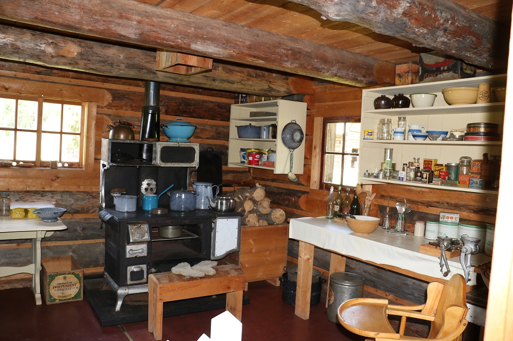
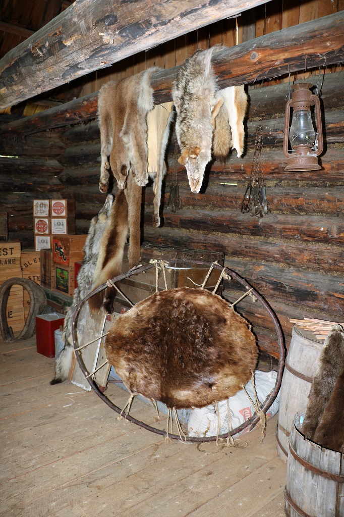
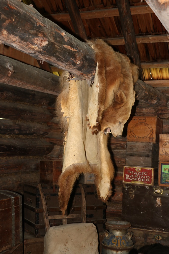
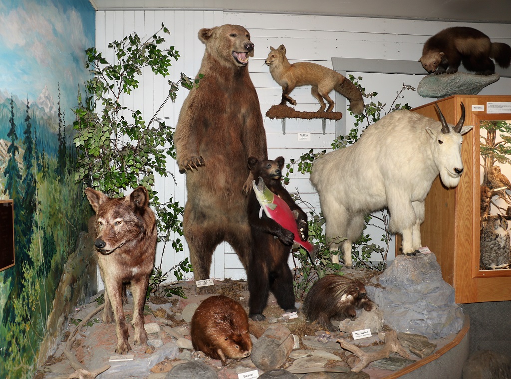
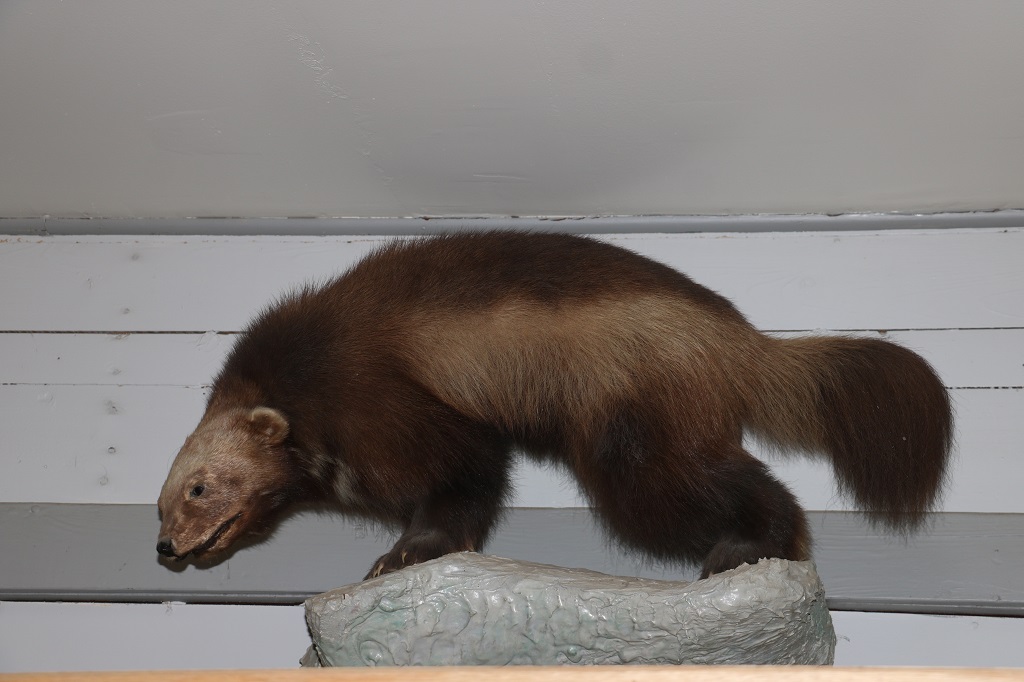
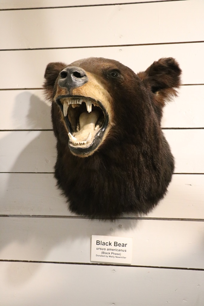
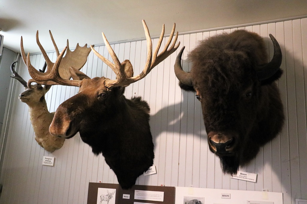
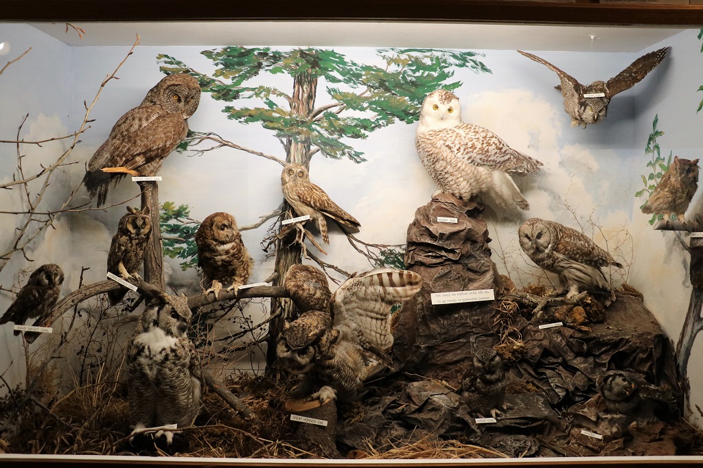
There was a natural history musuem on the other side of the Visitor’s Center. It primarily showcased taxidermy examples of birds and animals from the area. There were a few First Nation buckskin jackets and some dishes and other household things.

Wolf, Grizzly bear, small black bear with a salmon, beaver, Mountain Goat and porcupine.

Wolverine

Moose and Bison
A large collection of different owl species

I liked this display of all the different grains that are, or were, grown here. They had been entered in a fall fair. They are – front left to right – Brome, Oats, Fesgue, Alfalfa, Wheat. Flax. Back left to right – Barley, Canola, Timothy, Rye.

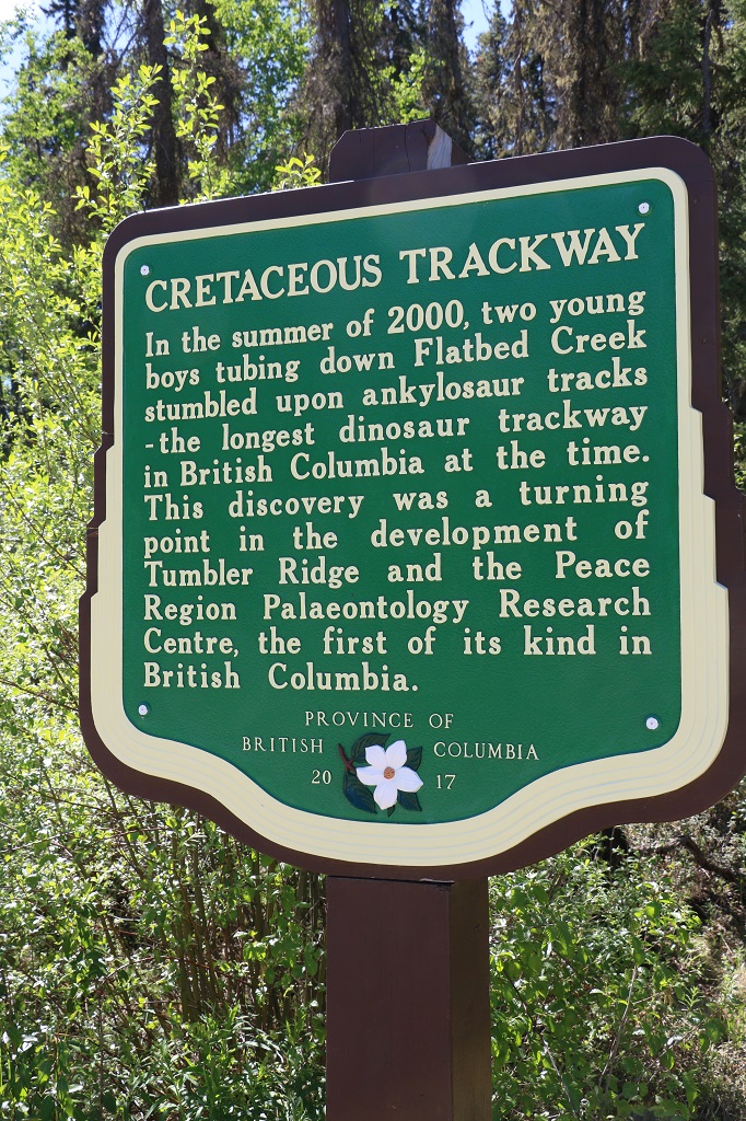
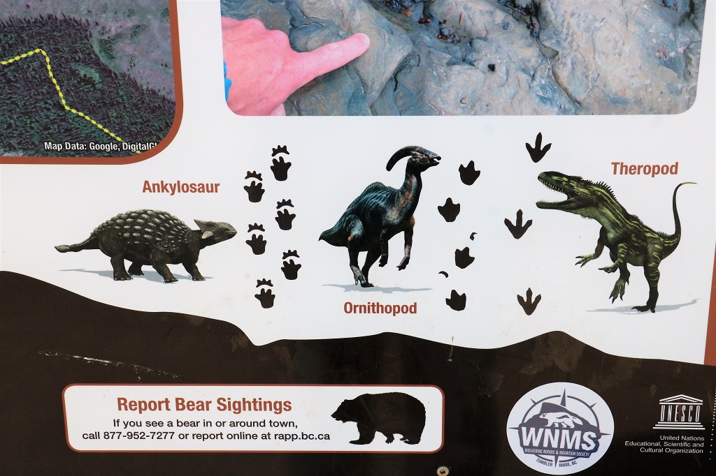
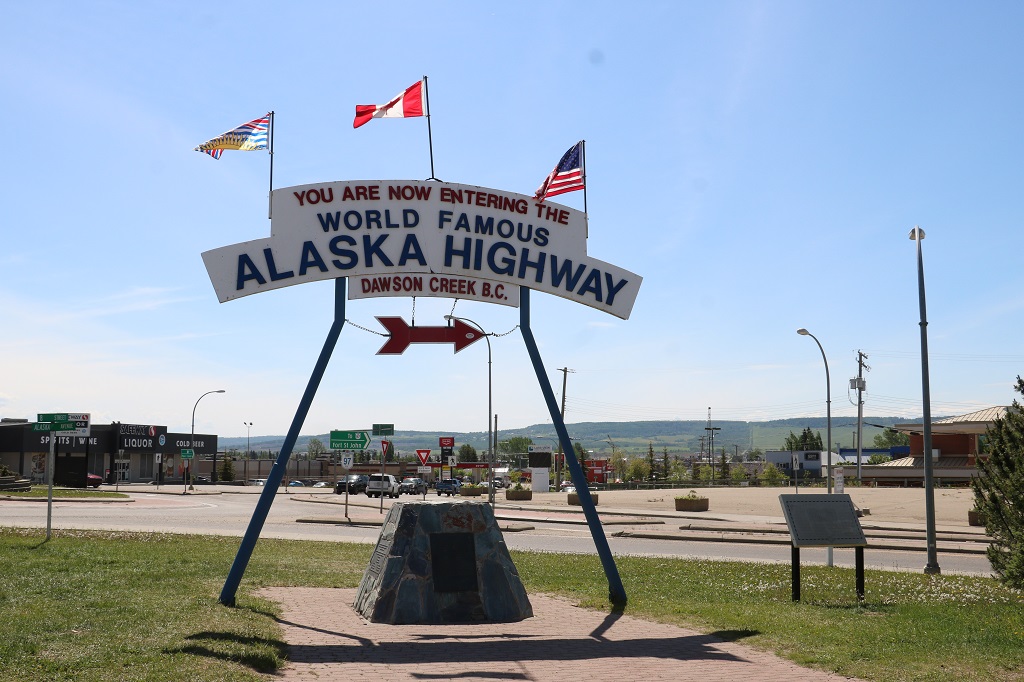
When we concluded our tours of the museums, we walked past the big grain elevator, through the parking lot to the big Alaska Highway sign. There were motorhomes parked from Quebec, Iowa, New York and Illonsis. I guess after two years of going nowhere people are eager to go places a long way from home.

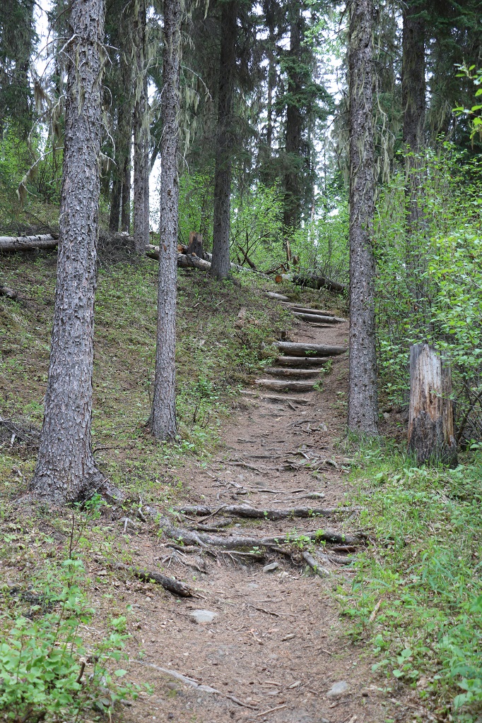
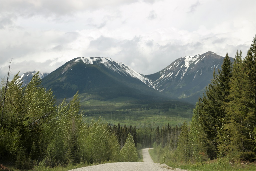
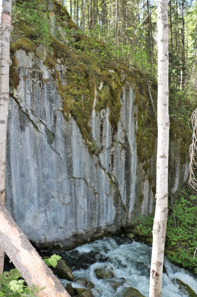
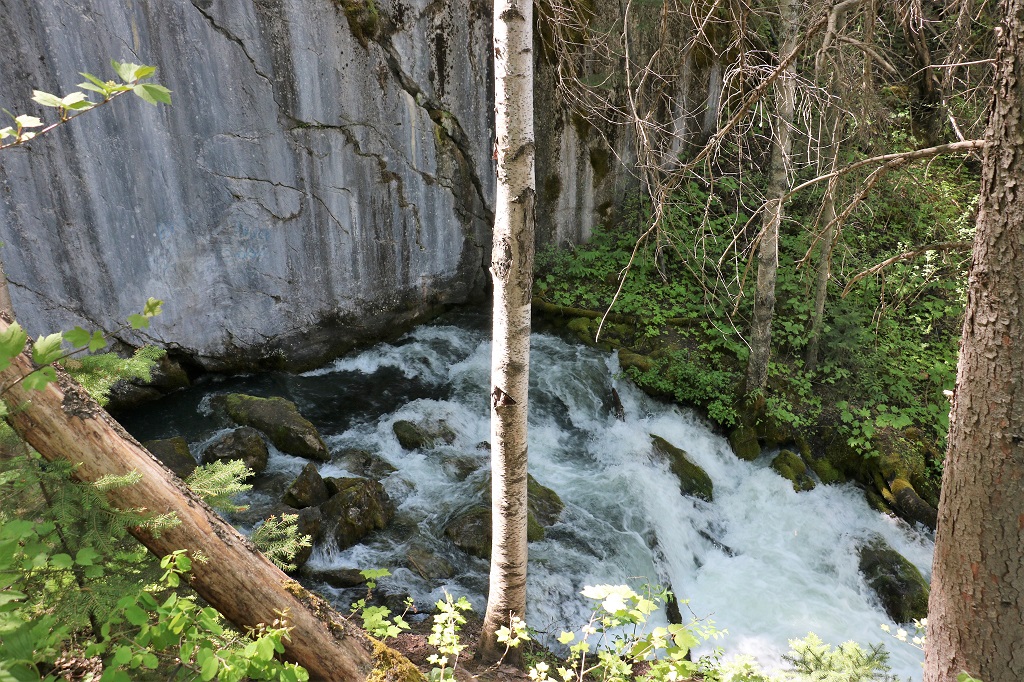
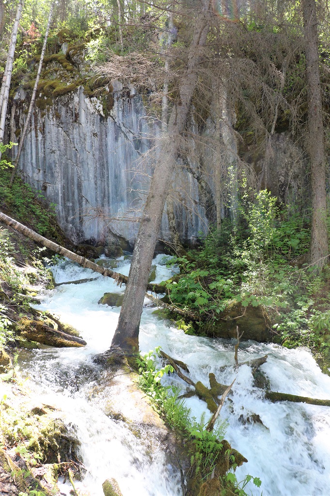
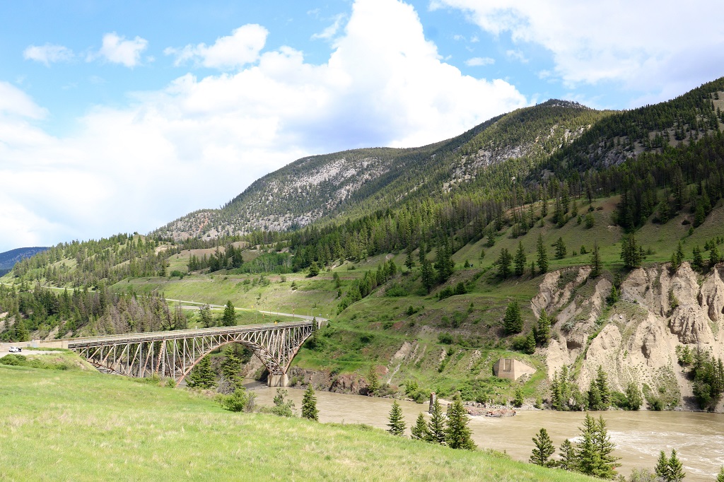
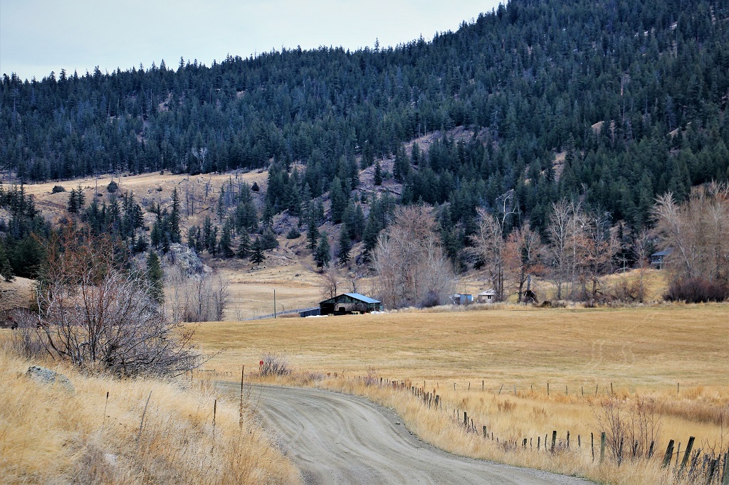
The Kiskatinaw Bridge is along an old section of the Alaska Highway. The original road was very rough and built very quickly using the most expediate route. In the mid-1950’s parts of it were moved or curves were straightened to make a road more navigable by public traffic. It took quite a few years before it was all paved.

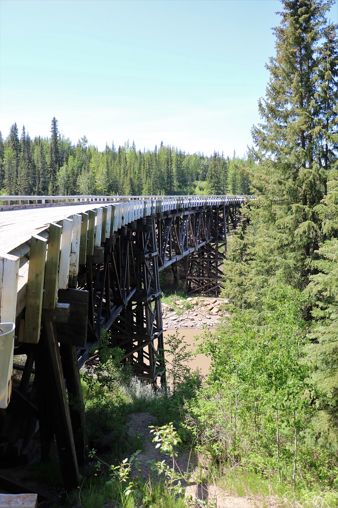
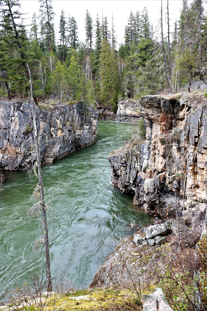
Though there were many timber bridges built by these civilian workers, the Kiskatinaw Bridge was the only one still in use until the last year or so when it was closed to traffic. It is also one of the most unusual, curving nine degrees along its 162.5 metre (534 foot) length.

The bridge, the first of its kind in Canada, was built in 1942-43 by Dow Construction of Toronto. The bridge is a three span, timber truss structure built 30 metres (100 feet) above the stream. Approximately 500,000 board feet of creosoted British Columbia fir were used in its construction. The fir was shipped from coastal B.C. to the railhead at Dawson Creek.

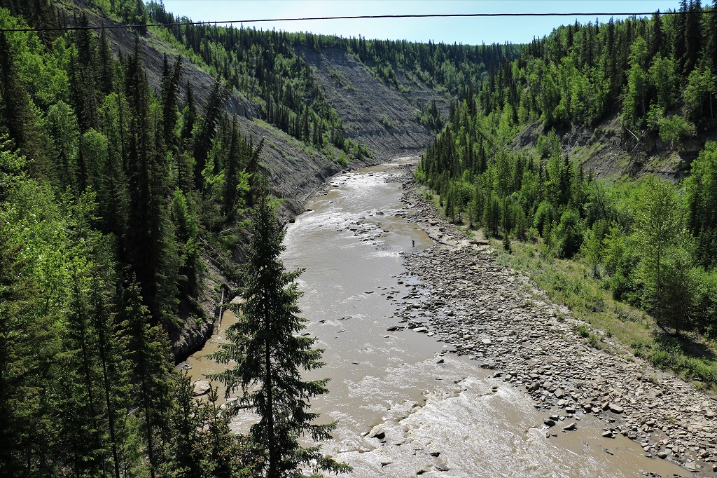
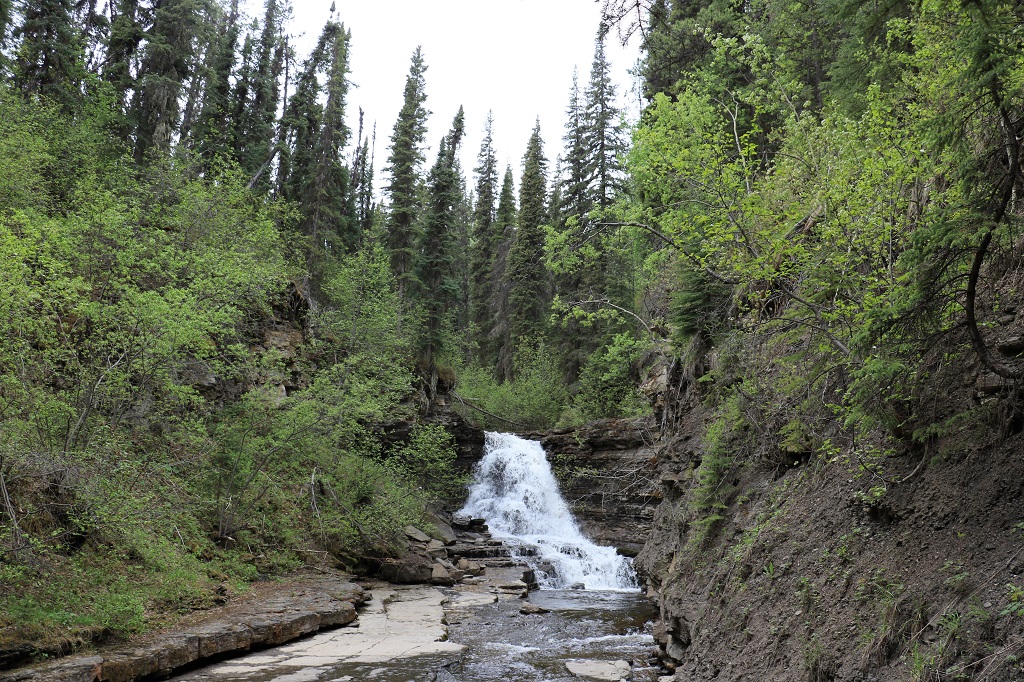
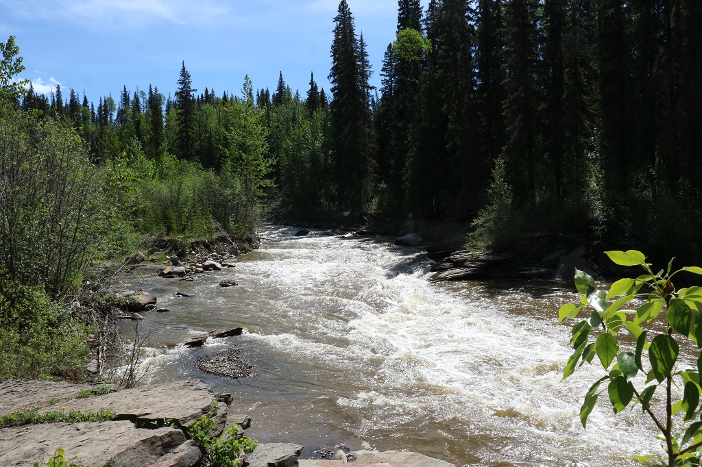
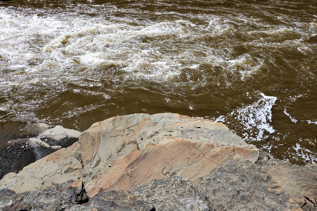
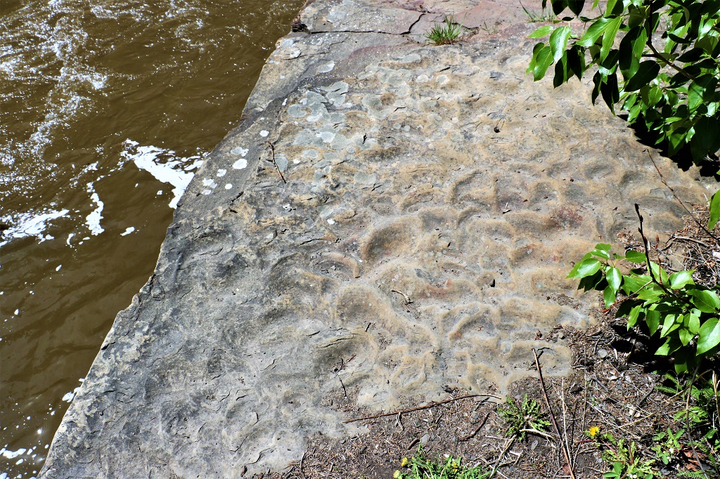
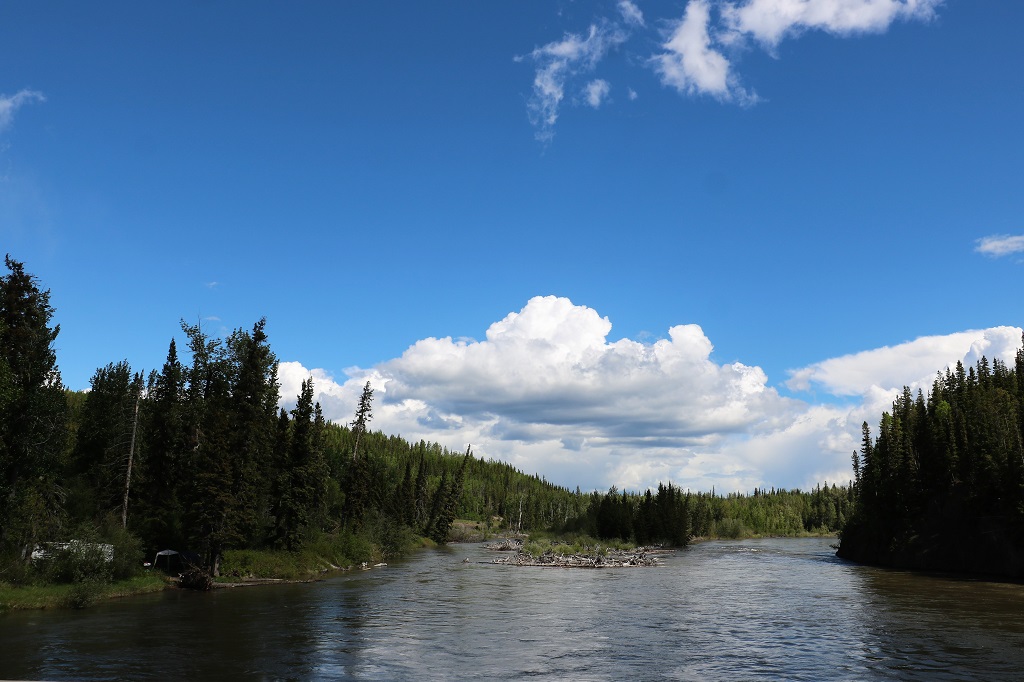
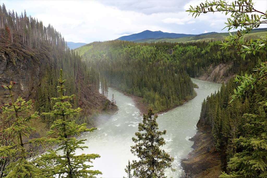
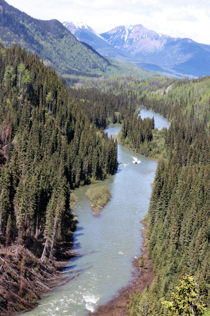
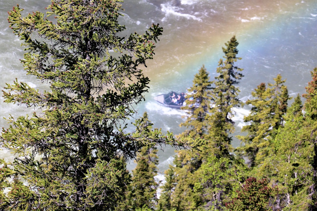
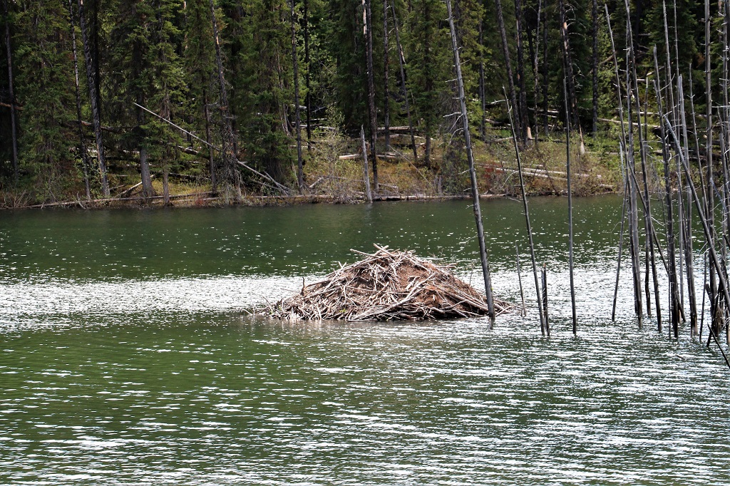
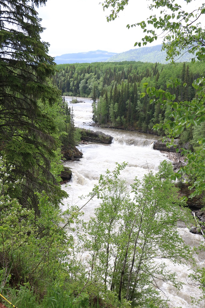
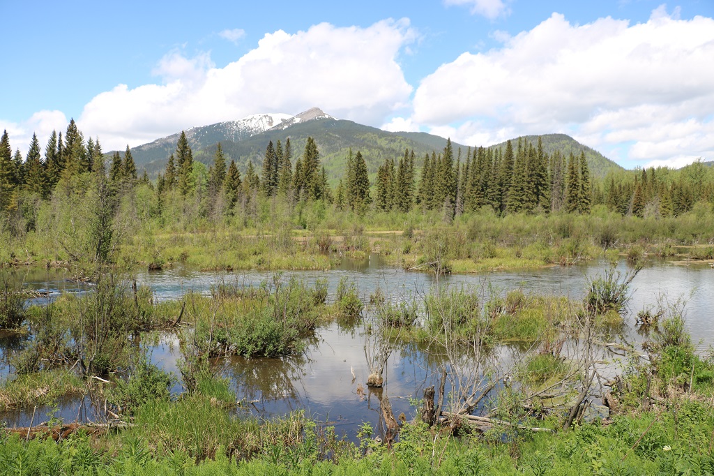
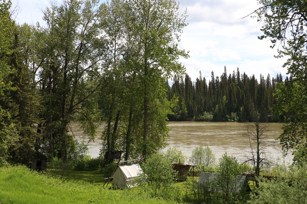
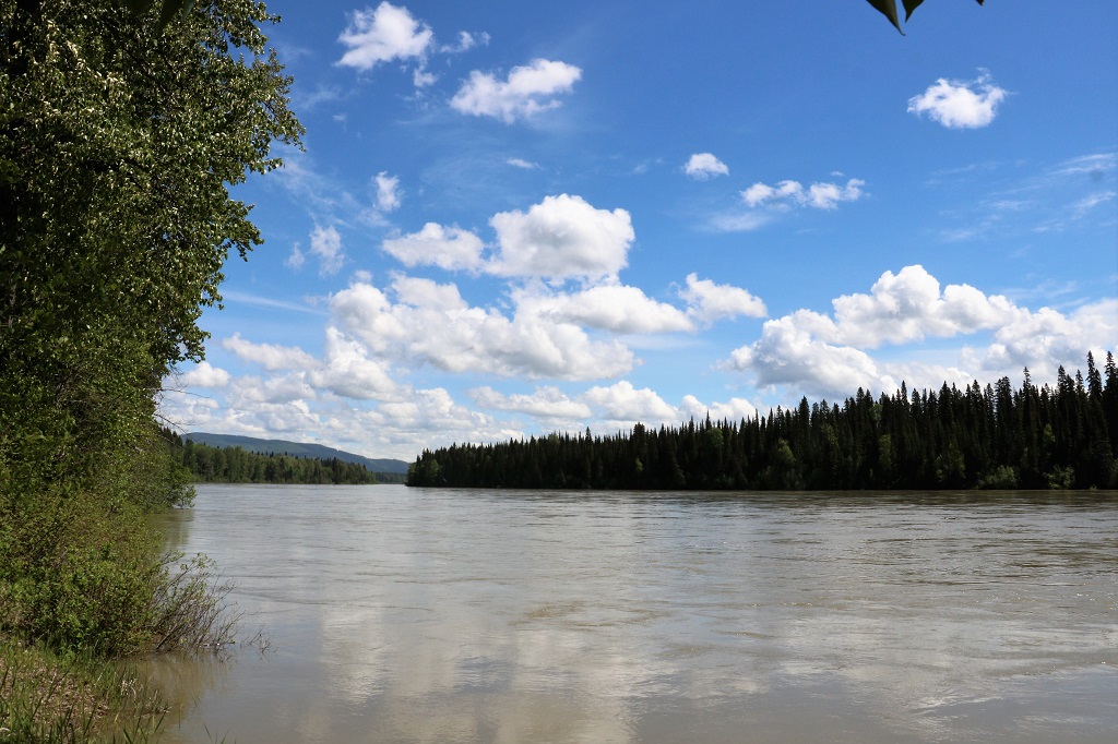
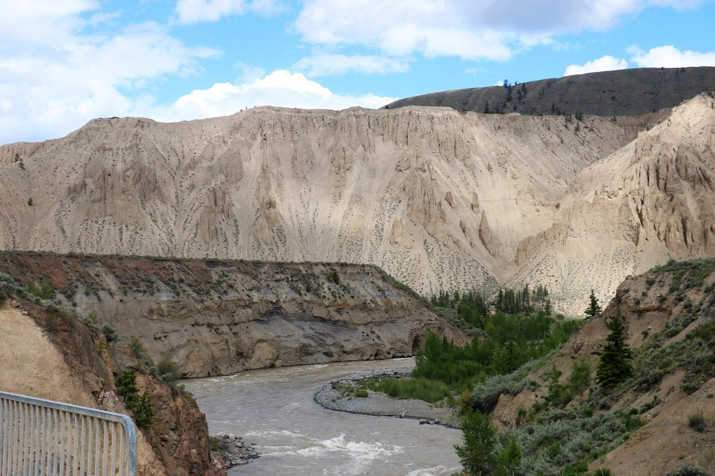
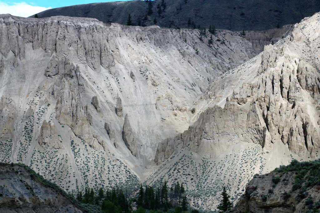
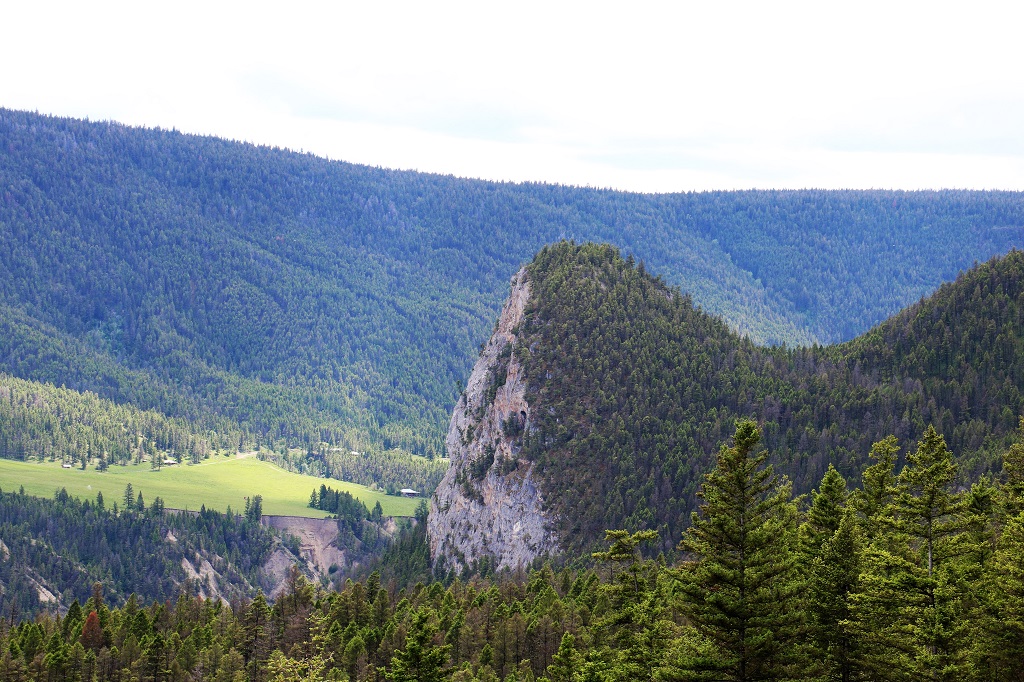
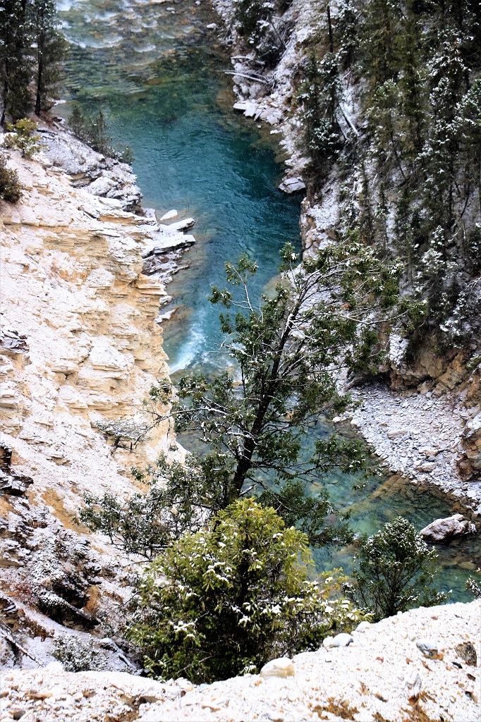
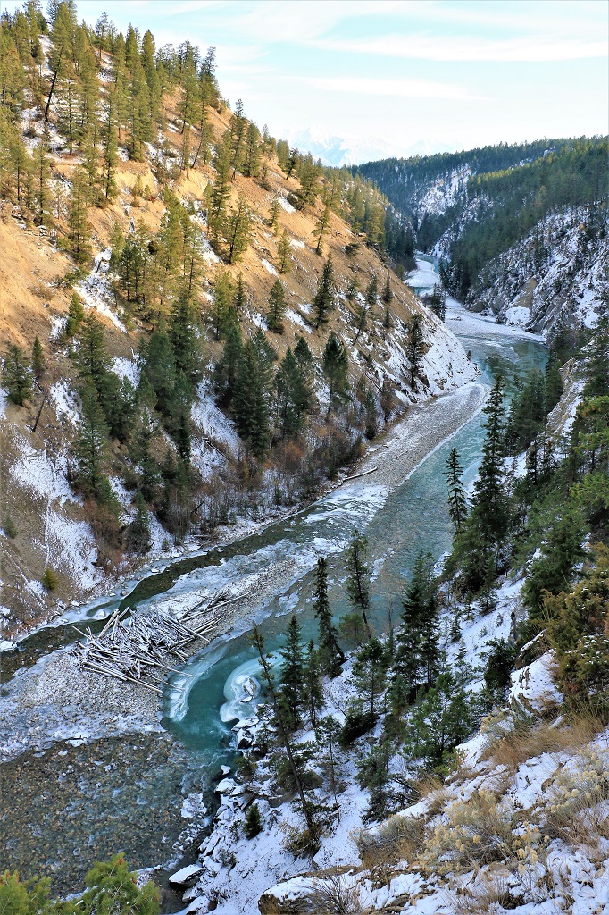
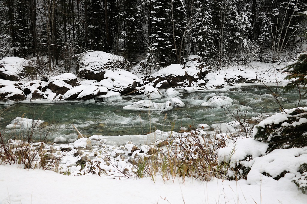
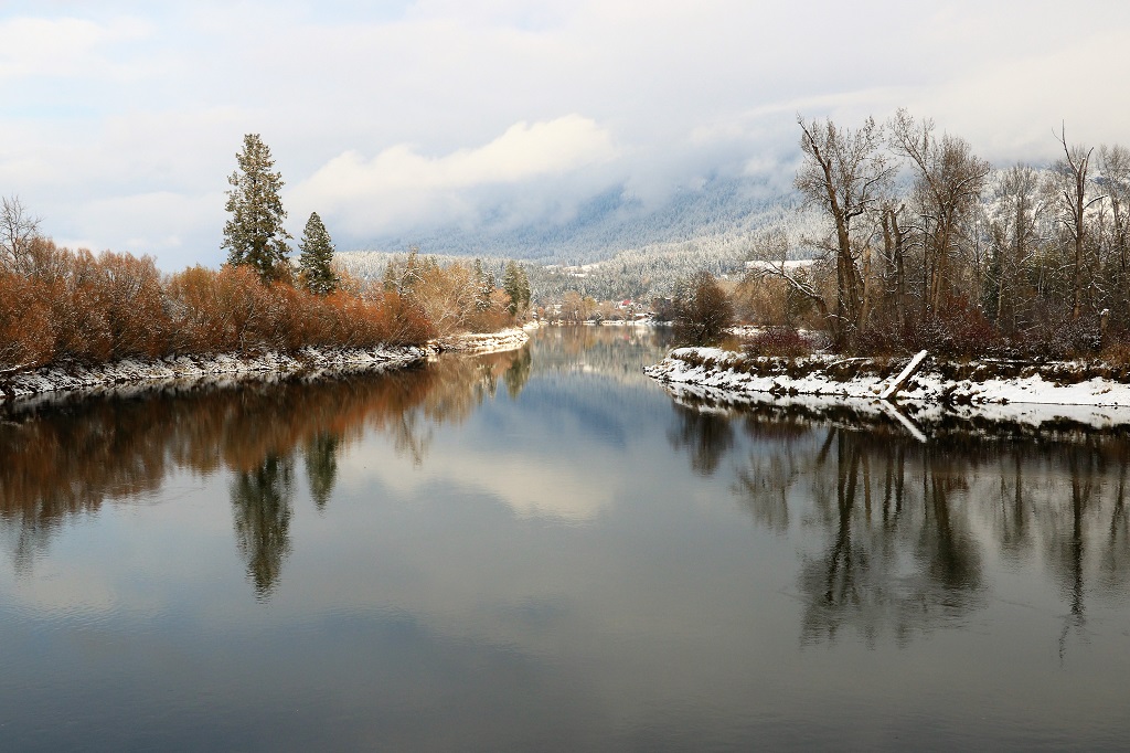
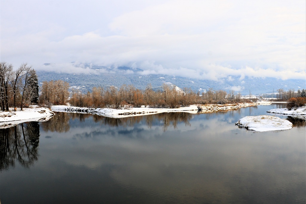
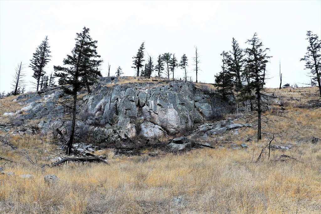
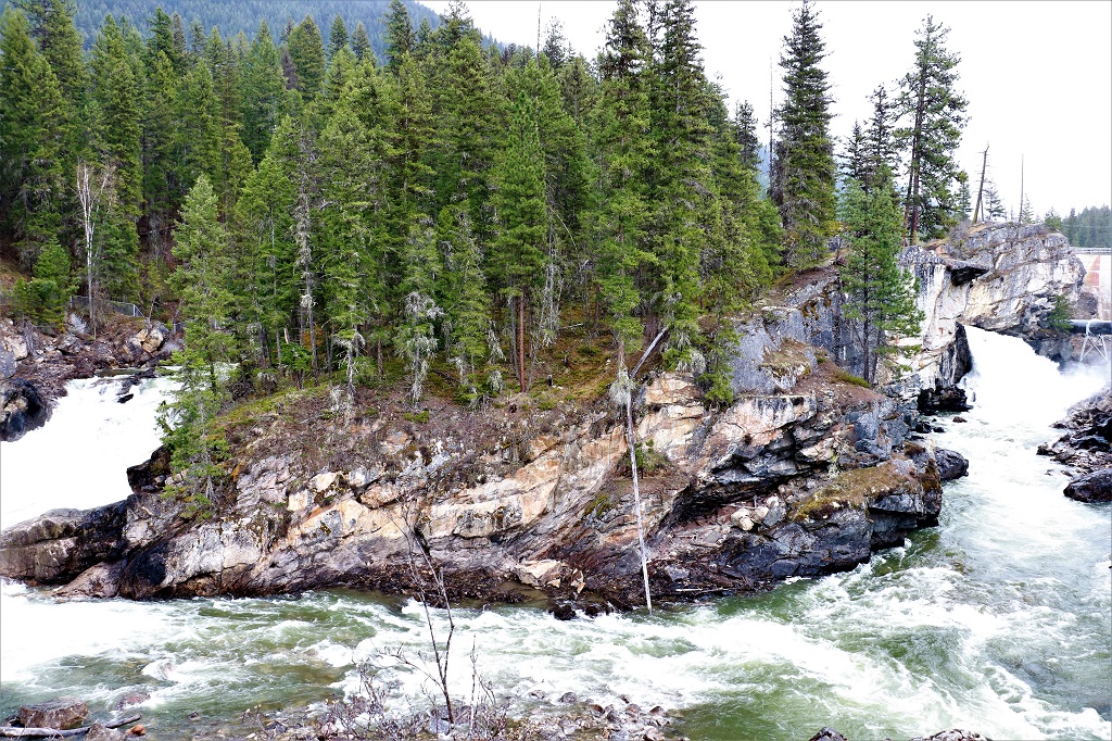
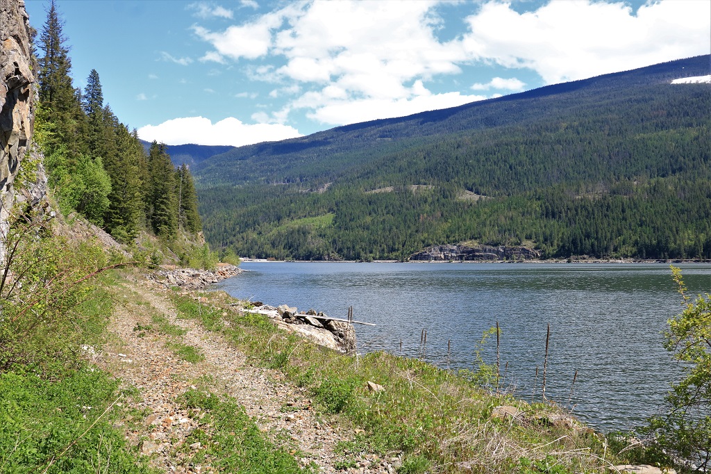
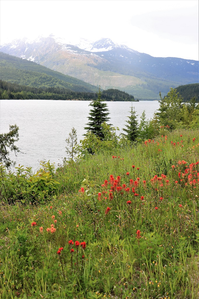
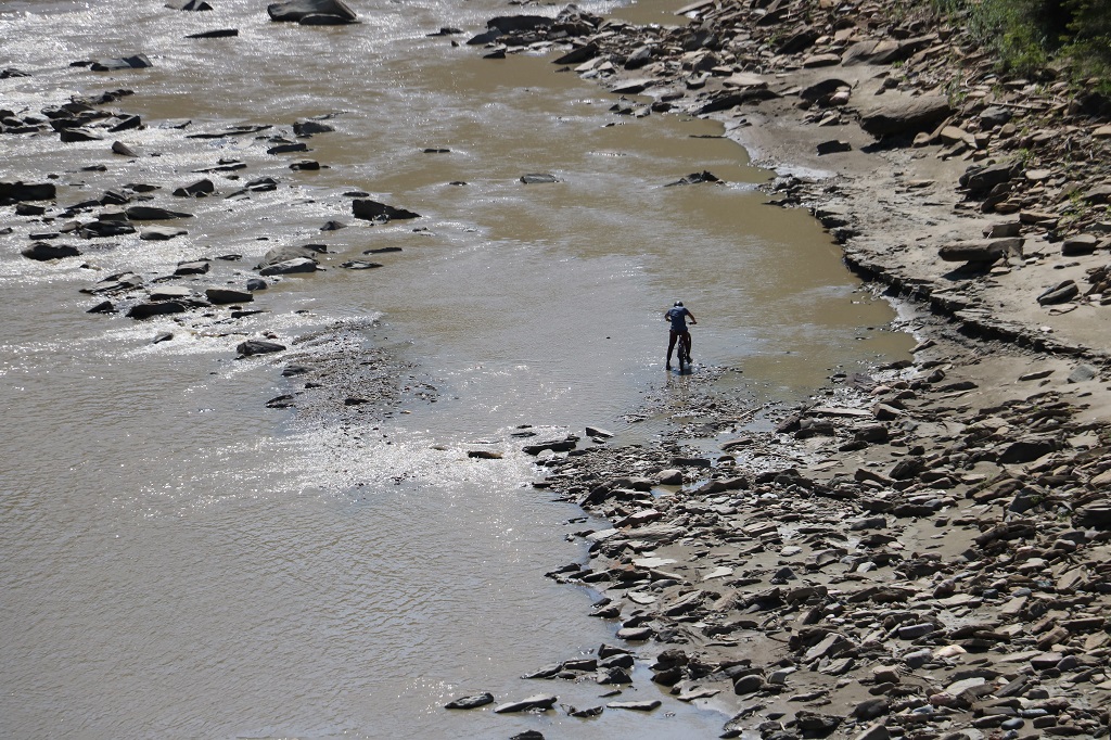
A little to the right of center in the image above is a dark upright speck. This is a mountain biker who was riding along the riverside. Where he came from and how he got down there I have no idea.

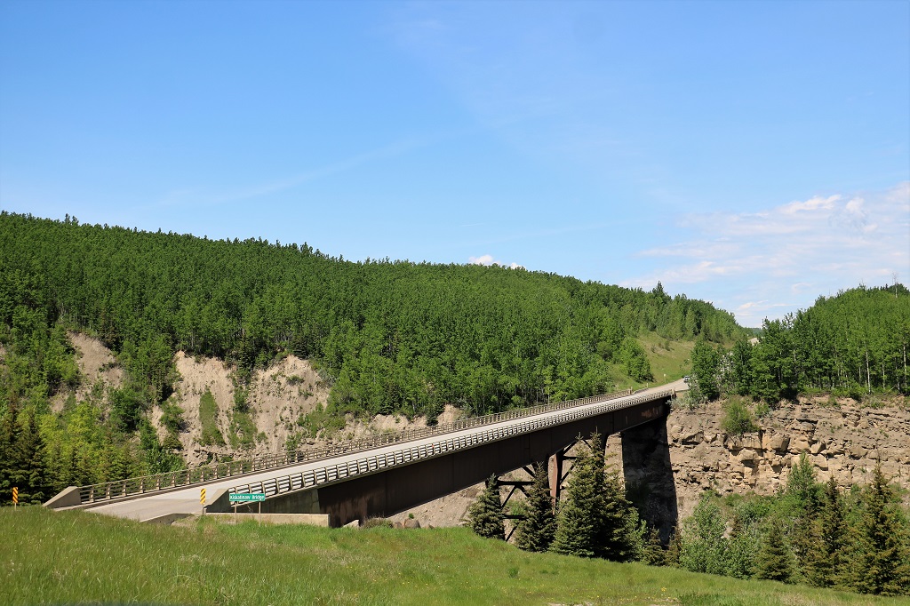
A new Kiskatinaw Bridge was built on a new section of highway in 1978. The old one could no longer deal with all the weight from the oil and gas and forestry trucks that go back and forth from Dawson Creek to Fort St. John.

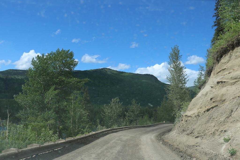
The bridge was about 10 or so kilometers up the Alaska Highway out of Dawson Creek and when I was looking at the map I noted that it was only another 40 or so kilometers to Fort St. John. I am pretty good at geography but I always thought it was much further away. Since it was so close and we had lots of time we decided to go up.

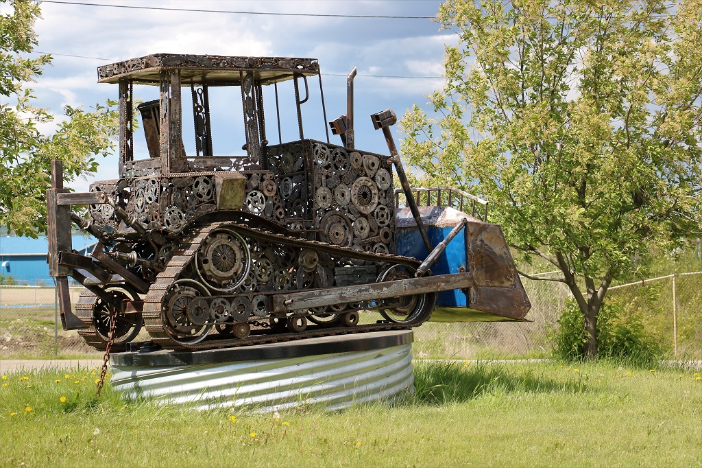
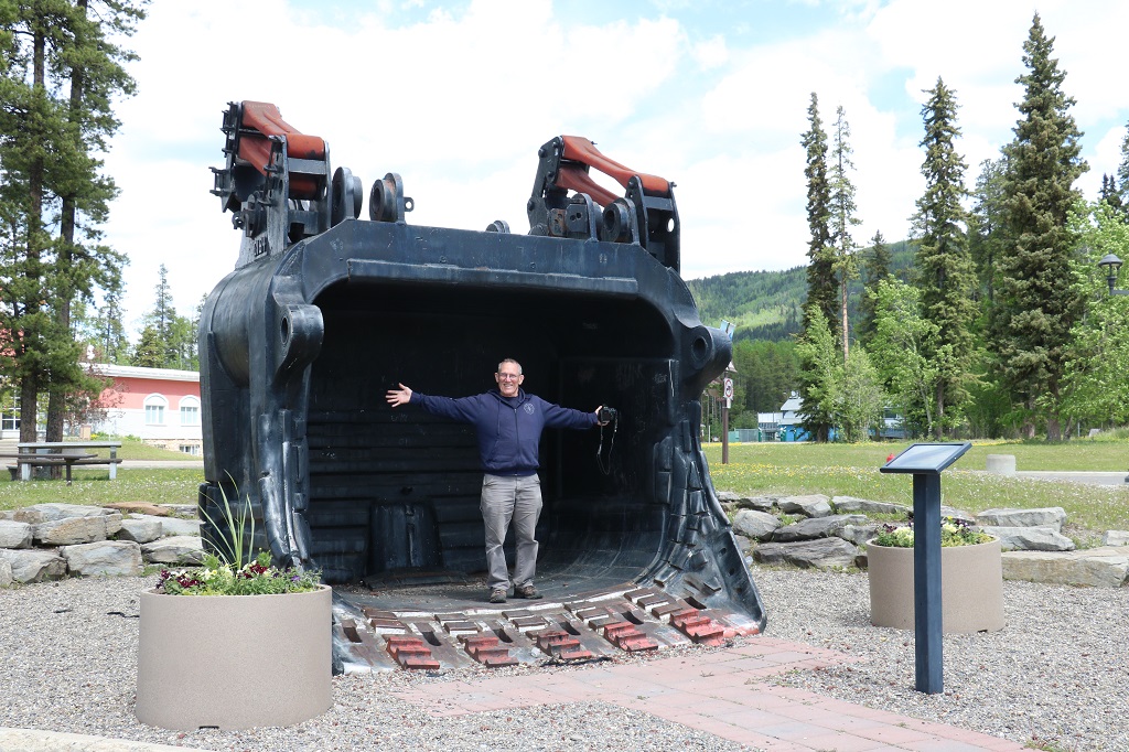
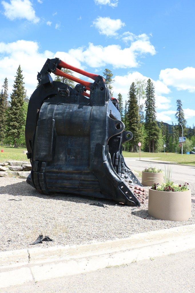
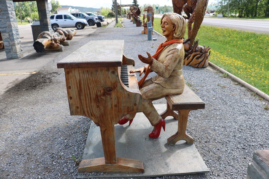
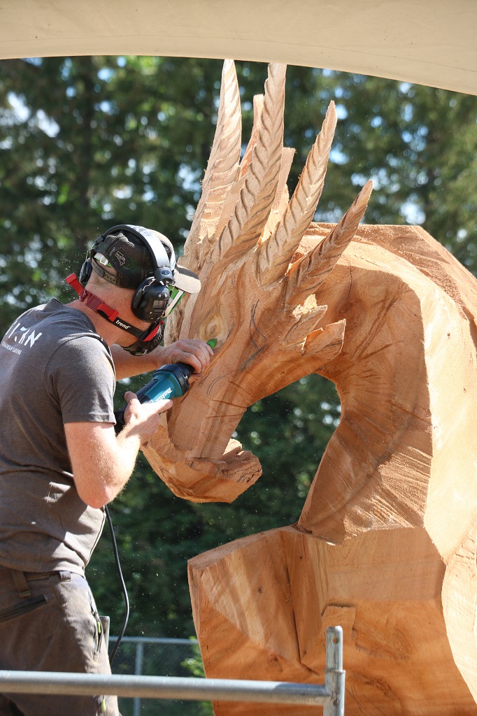
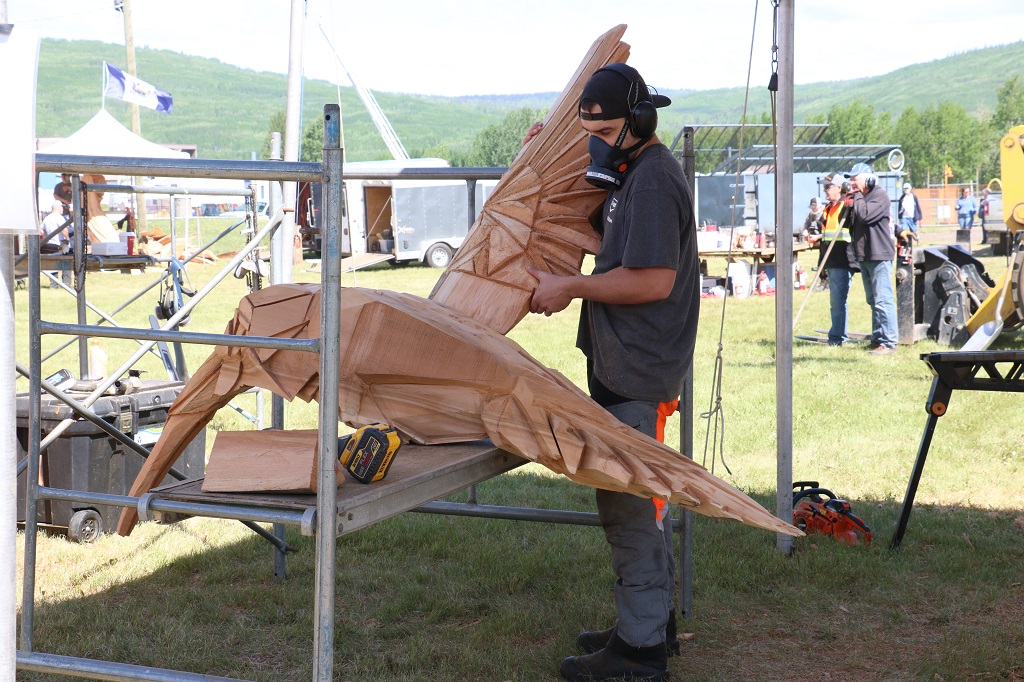
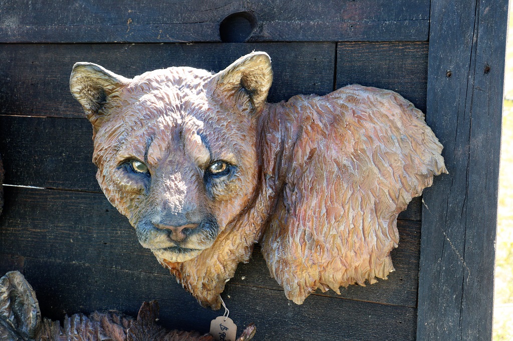
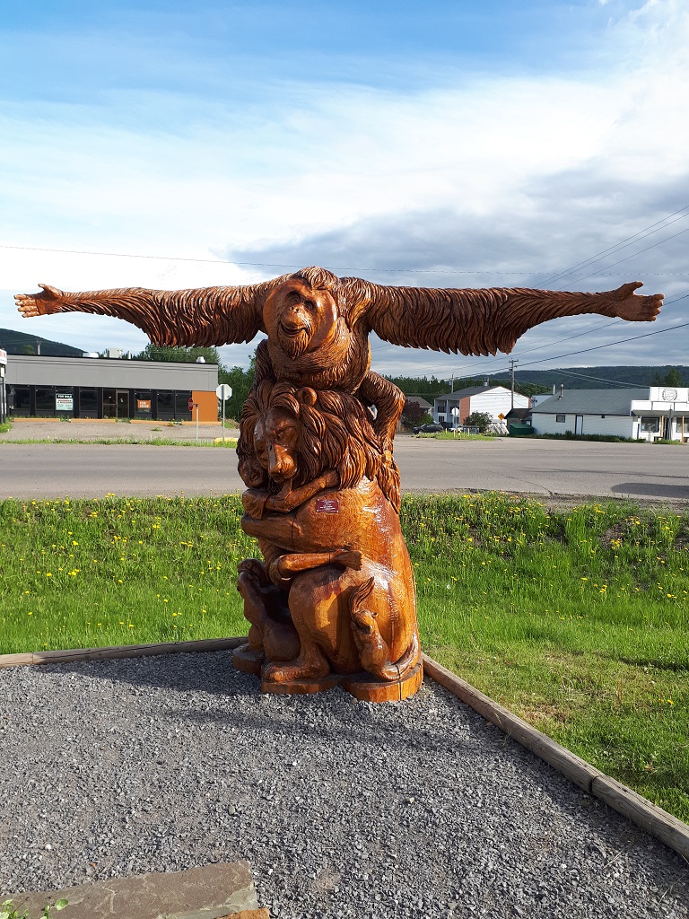
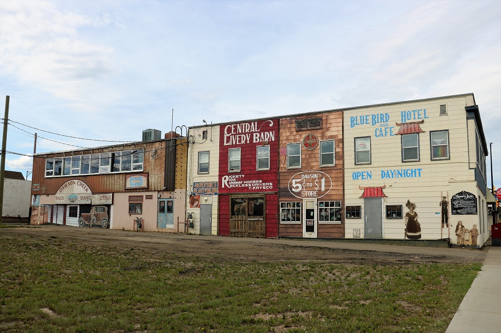
We drove around town for awhile just to check out the place and also tried to find several geocaches. But were constantly thwarted by vehicles in the way, people nearby, missing caches or some, like the small one that was recently hidden if this awesome sculpture located at the recycling depot that we just could not find. We searched for awhile, sticking our fingers in all the holes we could and running them under all the ledges, but no luck.

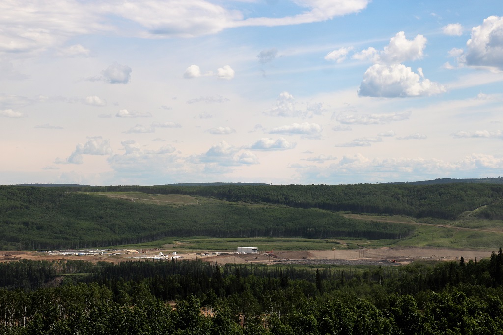
Our daughter’s fiance works at the big Site C Hydoelectric dam being constructed on the Peace River. We had been told it was only a couple of miles out of Fort St. John and there was a viewpoint so you could see it. We never did find the viewpoint despite John driving around on quite a few roads.

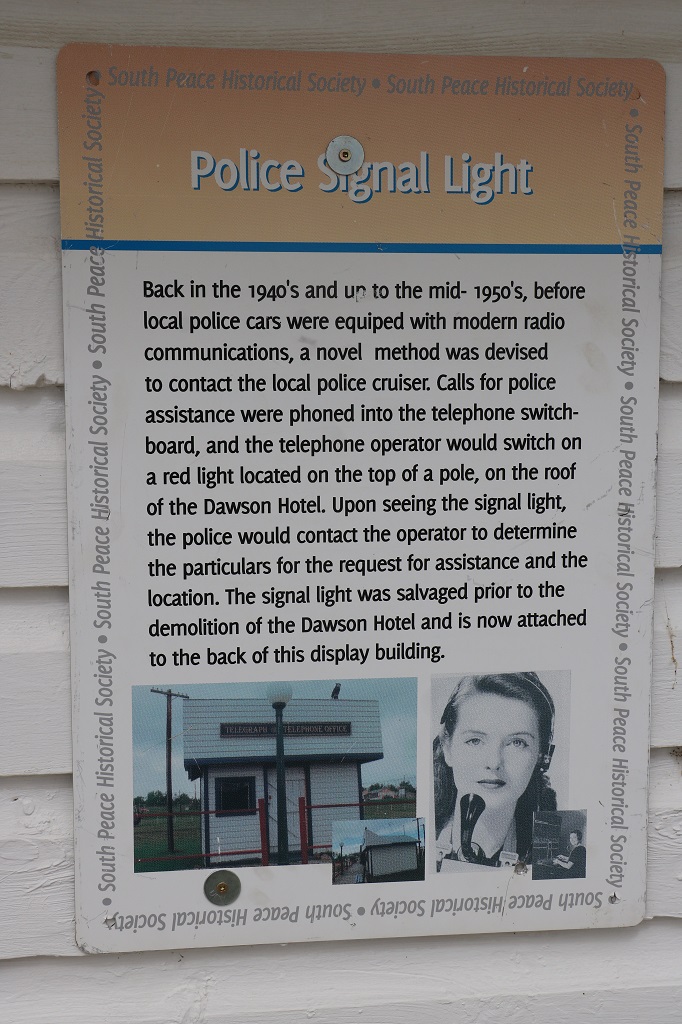
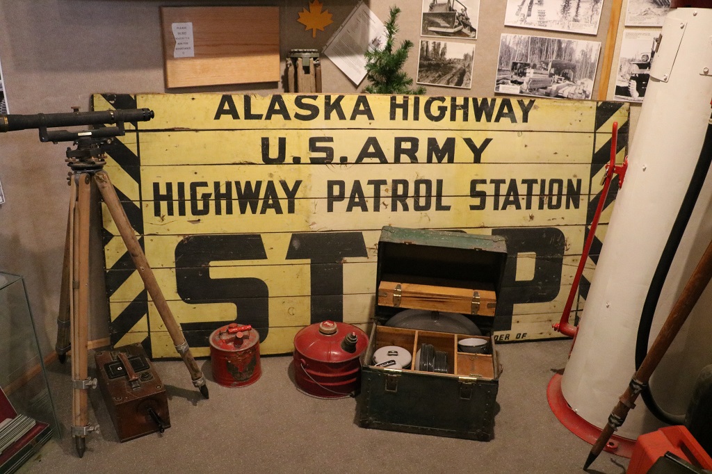
We headed back to Dawson to tour the Alaska Highway House that had lots of artifcats and information on the building of the Alaska Highway. Somewhere between 2020 and today the building was demolished. I don’t know where all the items went. Rats. They may have been moved to the Community Hall at the Hertigage Village we saw yesterday because there was quite a good display there.

It was time for dinner so we found a local restaurant to eat and then returned to Brian and Marilyn’s for the night. Tomorrow we head east across the BC border into Alberta and the city of Grande Prairie where we will be meeting another long time friend for dinner.

Day 7 – June 13 – Tumbler Ridge, BC to Dawson Creek, BC

There was a Closed sign on the hotel restaurant but we could see people sitting at tables so we went in to ask if they were open thinking they may have forgotton to turn the sign.

They were only open to hotel guests and any outside orders would have be take out as half of the power was off in the building. We had breakfast and checked-out. The receptionist had just pulled our receipt from the printer when the all power went off again.

We got a bit worried that the Dinosaur Discovery Gallery that we could not visit yesterday due to the town-wide power outage would be closed again, but they must be on a diffferent grid and were still open.

I do not have a deep interest in dinosaurs and cannot tell one millenia from another, nor recognize any of the different ‘aurs’ or ‘opods’, but I do find it interesting to see the things that have been unearthed. And, since the discovery of the dinosaur tracks by the two boys in 2000 coincided with the closure of the largest coal mine and the departure of half the population; thus in a large part saving Tumbler Ridge from becoming a ghost town I was keen to see what they had collected.

Many of the items are replicas or molds for a couple of reasons. Some of them are huge and weigh several tons and some of them are still out in the mountains embedded in the rock.

The Dinosaur Discovery Gallery is housed in a former Elementary School . When the mine closed and so many people left there were not enough children for two elementary schools so they were amalgamated into one and the other was used for the Dinosaur Gallery. Not being a purpose-built museum to display so many heavy or large artifacts they keep most of them in a large shed on the property and make casts of others.

As usual with me in any musuem I take a ton of photos of the items that interest me and the information about them. I have trimmed my selections down a lot here but there are still quite a few fossils and bones and such. Feel free to scroll down and bypass it all. I won’t mind.

There was a brand new case with several fossils of 350 to 500 million-year old fossilized coral. These were just discovered recently and they have not had time to make up the labels. Discoveries are literally being made every day in this area and one of the most exciting things for the paleontologist is that the Tumbler Ridge area has fossils and bones, etc. from at least three different prehistoric eras. The world-famous museum at Drumheller, Alberta has bones, and tracks from one era only.

Ankylosaur

They have replicas of each of the three species of dinosaurs whose tracks were found along Flatbed Creek.

Ornithopod
Theropod

I was quite impressed to see such detailed fossil impressions of fish. This whole area was once a massive inland sea stretching the full length of North and South America.

Large adult Therapod track.
Hadrosaur footprints. 73 million years ago. The first complete skeleton of a hadrosaur has been found here.
Bones from the skeleton of the Hadrosaur

After we left the Dinosaur Discovery Gallery we headed out of Tumbler Ridge on the road to Dawson Creek. We have friends there that we have not seen in 32 years and are going to stay with them for a couple of nights while we see the local sights.

We made one stop on the way and hiked into Quality Falls which was a little waterfall that drops in a narrow canyon. The trail was 2.5 km round trip and there was quite a few steep downward sections but overall it was a pretty good and I huffed and puffed and limped my way there and back.

The Tumbler Ridge is home to a large windfarm owned by the Meikle Corp.

The Dawson Creek area is farming country. Many, many tons of grain are grown up here every year. Dawson is also the official Mile 0 of the Alaska Highway built by over 11,000 American soldiers and 16,000 Canadian and American civilians in 1942 when it was believed there could be an invasion by the Japanese into North America through Alaska. We will be learning more about that as we tour around Dawson.

When we arrived in Dawson Creek we found the Walter Wright Pioneer Village and spent an couple of hours wandering through all the old buildings and looking at the artifacts and displays.

Several of the buildings are original and have been moved to the site. Most are replicas and quite a few of them were construction projects for the local highs school woodwork classes.

St. Paul’s Anglican Church. Built and financed by community volunteers. the building is still sturdy after being moved three times.

We finished touring the Heritage building at 4:30 and drove over to our friend Marilyn’s house where we met her husband Brian, had dinner and then visited with three of Marilyn’s (now-adult) kids and spouses and a granddaughter. It was a really nice evening catching up on each other.s doings over that past three decades.

Day 6 – June 12 – Tumbler Ridge, BC

We woke up to sunshine again and decided to do the hike to the dinosaur tracks before visiting the Dinosaur Gallery in case it decided to rain. The hike was 1.5 km each way through pine and spruce forest. We kept up a steady conversation or John whistled as we walked to alert possible bears to our presence. The trail was pretty good and we went up a few banks before going steadily downward to latbed Creek.

The foot prints in the rocks at Cabin Basin belong to these three dinosaur species and we saw footprints of each of them.

Ankylosaur footprint. The toes are the easiest to make out, the deeper round part is the main foot.
Ornithopod footprint
The meat eating Theropod. The elongated thin cracks are the creature’s claws.

We saw two men digging dirt off the rock that contained many dinosaur footprints. They were clearing the bottom edge of the rock shelf of buit-up dirt to reveal more footprints. One of the men came over to us right away and pointed out several tracks for us.

We took the short trail to see where the two boys (age 8 and 11) discovered the first dinosaur tracks in 2000.

The boys filled the dinosaur tracks with baby powder to make them more visible.

We could not get to the original site as it was across the creek which was flowing full and fast with spring runoff.

Flatbed Creek

The large flat rock shelf on the opposite side of the river is where the boys spotted the tracks after one of them fell off their inner tube as they went over the rapids and clambered ashore. Floating down the creek is popular in summer. These kayakers were doing the more adventurous version today.

We went back to the Cabin Basin area and saw that the men had revealed quite a few new tracks.

The fellow told us that in this area the rule of thumb is that if you flood a space with water and it pools in places, those are dinosaur tracks. Since the boys first discovery thousands of tracks in several different locations have bee discovered, as well as bones.

Every depression in the rock, we were told is a dinosaur track.

We hiked back to the truck and drove to the Dinosaur Gallery which is located in a old school in a residential area of Tumbler Ridge only to find it closed due to a power outage.

We decided to go find the four geocaches that are hidden in the township, but could only find three of them because the fourth is hidden inside the library and it was closed because it is Sunday. It would have been closed anyway since there was no power anywhere in the town and everything that was supoosed to be open was locked up until it came on again.

One of the caches was a nano (which is about the size of my little finger nail) hidden in this huge mining bucket. It could hold 15 cubic yards of material in each shovelful.

We decided to go back to our hotel room and have some lunch and wait for the power to come on again. Apparently a transformer blew at 11 AM and the estimated time to have power on again was 7 PM. It did not get back until 9 so no Dinosaur Gallery today. We have a short drive to Dawson Creek tomorrow so we will go before we leave town.

Thankfully we were able to have dinner at the hotel restaurant, which was the only place in town that was open for food, and consequently was busy all day. They offered a limited menu of pizza or salads, sandwiches or things like burgers which can be cooked on the gas grill or chicken nuggets which go in the deep fryer. We had pizza and bought large enough ones to have leftovers for our lunch tomorrow.

So our day’s activities were a little shorter than planned, but John had a good nap and I did some research on things to see and do along our planned route across Canada. It was actually quite nice to have a lazy afternoon.

Day 5 – June 11 – Tumbler Ridge, BC

The weather is slated to be sun and cloud today and tomorrow and four days of rain thereafter. We know how often the weatherman is wrong so we decided to take the drive to Kinuseo Falls today and go to the dinosaur gallery and trails tomorrow. That way if the rain came a day sooner than forecast we would be indoors for some of it.

Kinuseo Falls are located on the Murray River at the northern tip of the 63,000 hectare Monkman Provincial Park. The falls are 68 kilometers south and west of Tumbler Ridge on a gravel road.

The first documented reference of the waterfall was made by surveyor R. W. Jones in 1906 when he was looking for navigable passes for the Grand Trunk Railway. The first photograph was taken in 1914.

We left Tumbler under sunny skies and the further we went toward Monkman Park the darker the clouds became and the more rain that came down.

We drove past the abandoned Quality Coal Co. facility. There is only one of the original three mines still operating in the Tumbler Ridge area. After the two mines closed the city lost half it’s population, but the discovery in 2000 of dinosaur footprints and the subsequent finding of thousands more prints, plus a bone bed and other bones, and even skin fossils has helped tourism become a big draw. Tumbler Ridge holds the richest dinosaur deposits anywhere in BC.

The coal silos at the abandoned Quality Coal Co. facility.

We were thinking our viewing of the falls may be a wet one, but by the time we got to the parking lot the rain had moved on and we had nice sun and cloud again.

It was only a short walk to the lower viewing platform at the top of the waterfall. You could really see the power and volume of water flowing down the Murray River and over the edge. Kinuseo Falls falls measure 197 feet (60 metres), slightly taller than Niagara Falls, though it obviously doesn’t move the same volume of water. 

The best view of the falls is from the upper viewpoint which was a 650 meter hike along the mountainside.

You can take jetboat tours to the base of the falls and when we were at the upper viewpoint we saw three jet boats approach. Two of them branched off to the right fork of the river,but one came down the visible left fork.

The pilot had to really push the power on the jetboat to get it this close to the base of the falls and then the strength of the water prevented him going further. I am pretty sure everyone on the boat got wet though.

We headed back toward Tumbler Ridge with the intention to hike up to Barbour Falls along the way. Again it clouded over and began to rain. And again the sky cleared.

The beaver who made this big lodge probably did not have to work too hard to find his building supplies. There are branches littered all along the shore of the little lake.

Barbour Falls Trail is located at the end of 11.3 km of narrow, boney gravel road. When we pulled into the parking lot there was only one vehicle and the fellow was trying to get the spare tire down from under the truck to replace a flat. John had quite a time doing the same thing when we had to change our first flat on the Dempster Highway in the Yukon Territory in 2018, so he went over to lend a hand.

The couple was from the coast and Miranda was finishing her 6th of 7 weeks practicum in speech therapy in Tumbler Ridge. Shandor had come from Vancouver to spend the week with her. They had just found out they were going to have a baby in January. After the tire was changed we decided to do the 800 meter trail together so we could talk along the way to alert any neighbourhood bears. They were very nice and we had a great chat as we walked along. There was a geocache hidden at the waterfall viewing area and Shandor actually spotted it before we had begun to look for it.

On the drive back to Tumbler Ridge we saw a White-Tail deer ahead on the roadside. She did not want to have her photo taken I guess, because she wandered into the bush quickly so we were unable to get any good photos.

We arrived back in Tumbler Ridge at 4:30 and took a little drive around town before heading to the hotel so John could work on uploading Sunday’s worship service on the church website.

Tomorrow is dinosaur day.

Day 4 – June 10 – Chetwynd, BC to Tumbler Ridge, BC

After breakast we walked along the roadway and looked at the chainsaw carvings on display. There are over 200 of them all around the town of Chetwynd. On a bulletin board there was a copy of a pamphlet that shows each of the sculptures on one side and the location of them on the other.

I restrained myself from taking photos of everyone we saw.

We had been told the Chainsaw Carving Competition was taking place at the Rec Center so we headed there next. I was very surprised to see no signage advertising the event along the streets or in front of the rec center. There was something posted on the bank by the construction area but it just said, “60th anniverary, let the chips fly,” which, to me, was a bit ambiguous if you did not know what was going on. For such a major event for the town and one that has not been held for the last couple of years, I would have thought the tourism board would have much better advertising.

Something else that surprised me when we got to the carving area was that most of the carvers were teams of two or three, even though the signage at each tent highlighted the one carver. There were only about three of the 12 that were on their own. It struck me as a bit odd to have a timed competition for a sculpture when some people had help carving and others did not. Just me being picky I guess.

The carver doing these beautiful horses was from Wales.

Several of the carvers brought smaller pieces of their work for sale. I really liked this cougar. It was only $900.00.

We left Chetwynd at 12 o’clock and headed down Highway 29 toward Tumbler Ridge. A distance of 88 kilometers. Half an hour later we turned off onto the Sukunka Resource Road to go see the Hole-in-the-wall.

Sukunka is a radio controlled road with lots of traffic from the gas plants and road maintenance workers. There is a campground down the road somewhere and the industrial drivers are aware that there is often public vehicles on the road without radios. Even if you have a radio, which we do, the rules on this road are that you only call the kilometers when going down, not when going up. All upward traffic must yield to downward vehicles.

It was 51 kilometers to our destination and we drove mostly through forest on both sides. Every once in awhile though the trees opened up and the scenery was lovely.

Sukunka Falls

We followed a truck with a huge piece of equipment on it and it’s pilot vehicle for several kilometers. Needless to say were were happy when it turned off into one of the camps.

Hole-in-the-wall is a 137 hectare Provincial Park that preserves a rather unique geographical feature. A solid rock face of about 30′ that has water pouring from the base.

It was now, we thought, 2:30 yet our phones said it was only 1:30. Turns out that the Tumbler Ridge area does not change their time in the spring and fall, so the hour ahead that we were in Chetwynd went back again. We had some lunch and then headed back to the highway, faithfully calling our descending kilometers on the radio. We were a bit surprised on our trip up to meet quite a few big trucks that did not call their mileage markers on the way down as they were supposed to do.

There are three or four narrow sections where upcoming traffic must stop before entering to wait for any vehicles coming down. If you didn’t have a radio to know when one was coming I would not feel too comfortable about possibly rounding one of these corners to meet a big rig.

We had not gone too far down the highway towards Tumbler Ridge when we spotted this Grizzly enjoying a dandelion feast. We saw him/her far enough in advance so I could have my window down and my zoom lens on the camera.

Someone needs to find a good rubbing tree to get rid of a bunch of winter hair.

We pulled into Gwillim Lake Provincial Park and enjoyed the view of the lake and distant mountains.

Mt. Meikle is a mountain of sandstone left behind when softer shales were eroded away by wind, ice and water after the formation of the Rocky Mountain foothills. The basin scoured out below Mt. Meikle filled with water, forming Gwillim Lake.

John saw a sign for Bullmoose Marsh and made a quick turn into the parking lot. There were two trails to see the marsh. We took the shorter 500 meter (return) Sorba Trail first.

The longer Bittern Trail (1.3 km return) took us through the forest to a more distant part of the large marsh. It was a nice walk and we remembered to whistle and talk to let the bears know we were in their space.

93 different bird species have been spotted at Bullmoose Marsh and the best viewing times to see birds is May and June. The fowl must not have gotten the memo because we saw 4 mallards and this bird who was not on any of the sign boards.

I thought it might be a Common Goldeneye but they have a pointy green head and a white cheek spot. Google Lens couldn’t tell me what it was either.

We made one more stop before we got to Tumbler and that was to find the only geocache for the day. It was hidden up and over a hill off the highway on Sanctuary Road. The view was amazing.

This huge silo held the coal from the mines and then filled the train cars for transport.

We arrived in Tumbler Ridge at 5:30 and checked into our hotel before having dinner. We are here for three nights and then heading up to Dawson Creek where we are staying two nights with friends.

Day 3 – June 9 – Prince George, BC to Chetwynd, BC

We left Prince George at 10:20 and headed north on Highway 97. We were heading to Chetwynd, about 302 km (3 1/4 hours drive). This is new road for us now.

40 km up the road we stopped at a roadside pullout to find a geocache. There were signs there about the Giscome Portage Route and the Huble Homestead. The homestead was 6 km down a gravel road so we decided to go and see it.

We saw our first bear of the day as we drove to the homestead. A sow and her two cubs were sunbathing beside the road. Even though John stopped quite a distance from her she immediately wandered off into the bush. My photo isn’t very good as it was taken through a bug-covered windshield. The second cub was behind the momma bear.

The Giscome Portage was a 9-mile stretch of land that crossed the Continental Divide from the upper Salmon River (a tributary of the Fraser) to Summit Lake. Prior to 1862 only the local indigineous people used it. John Giscome and Henry McDame were the first to be guided through the trail. The trail was used my almost 400 miners during the Omieca Gold Rush in 1871. It is now administered by BC Parks and you can hike it if you like.

The Huble Homestead is a large section of land that was developed by partners Al Huble and Edward Seebach who had established traplines along two creeks in 1903. In 1904 they established a partnership and set up a trading post at the end of the Giscome Portage along the Fraser River.

The 1908 Salmon Valley Post Office was reconstructed at the parking lot of the Huble Homestead.
The Huble Homestead.

The reconstructed cabin on the left belonged to Edward Seebach. He was a lifelong bachelor. The building on the right was the blacksmith shop and is a working forge.

A typical fishing camp.

The two-story Huble house is the only original building on the site. Al and Annie Huble and their children lived here until the general store closed in 1919. Annie and her six-year old daughter Ada from a previous marriage arrived in 1911.

The parlour walls were covered with purple cloth that was taken down, cleaned and carefully re-hung every spring. There was a master bedroom and Al Huble’s office on the main floor and four bedrooms upstairs, one of which was used as a guest room or rented out to a trapper passing through.

The information board at the big barn told of an orphaned moose calf that Al Huble brought home and bottle fed. It became a family pet and would pull the children in a sleigh. The story was told as well that it would open the door and walk through the parlour.

The ‘summer kitchen’ was used all year round and was located in the cabin that Al Huble built when his wife and her daughter arrived. When the new house was finished they dragged the cabin up to the back, built a covered walkway between the buildings and the cabin became the house kitchen.

This little flat-roofed cabin was the first building erected by the two men when they settled in the area. After they each moved into cabins on their own parts of the property the flat-roof cabin beame a workshop.

The General Store carried everything that was needed by the community of 27 homesteads that were soon in the area. WWI and the age of the automobile put an end to the river traffic and the store closed in the summer of 1919.

There were two warehouses down by the river that held stock that arrived for area residents or to other settlements along the river and the Hudson’s Bay Company and also stored the furs being shipped out until the riverboat arrived.

The Fraser River at the end of the Giscome Portage and Huble Homestead.

After we left the Huble Homestead we drove up the road and took a detour to see Summit Lake.

Summit Lake

We pulled into the entrance to Bear Lake Provincial Park to find a geocache that a previous finder had said needed a new log sheet as the old one was soaking wet. We carry supplies for cache maintenance so we decided to fix it up while were were in the area. It was now 2:30 and we were 74 kilometers from Prince George! We had lunch before heading off again and decided we better do some driving for awhile.

Pine Pass takes you through the northern end of the Rocky Mountains with Chetwynd, Dawson, Creek, and Fort St. John on the other side.

We stopped at Bijoux (French for jewel) Falls which was only 400 meters off the road and was the home of the Stellar’s Jay, British Columbia’s provincial bird.

You could tell it was spring runoff. Even behind the fence at the viewing area you got wet with the spray from the falls hitting the rocks.

There were two Stellar’s Jays flitting among the trees at the parking lot and this one was in no hurry to fly away from people wanting to take its picture. It was probably hoping for a snack.

There was a roadside pullout with an incredible view of the mountain range.

I took a video of the whole view but it would not insert into the blog post. Rats.

We saw two more bears not long after. The dandelions are profuse along the roadside so great eating for the hungry bears.

I spotted this one just off the road on the driver’s side and John was kind enough to turn the truck around so we could get a couple of photos of it.

We made one more quick stop at a viewpoint to find a well hidden nano cache before driving into Chetwynd.

We arrived in Chetwynd at 6:30 mountain time. We entered a new time zone when we exited the Pine Pass. Chetwynd is famous for its Annual International Chainsaw carving competion, which just so happens to be on this weekend. Unfortunately we only booked one night here so we will not be able to see the finished products that these amazing craftspeople do. There are over 200 chainsaw carvings around the town of Chetwynd and tomorrow we will check out a bunch of them before going over to the competition grounds to see some of the carving. 12 carvers are invited to compete each year. 4 Canadians, 4 from the USA and 4 International. There is no specified theme so the carvers can make whatever they want. They have 35 hours to carve a 40-50 inch wide, 8-foot long log into a sculpture.

This carving at the town entrance sign was made by a fellow from Japan.

There are over a dozen carvings along the roadside as you enter town. I photographed these two where we parked to go for dinner.

Day 2 – June 8 – Williams Lake, BC to Prince George, BC

We were having breakfast at the hotel this morning and a fellow was checking out at the desk. The lady at the desk knew the man and they chatted for a few minutes and she said, “Have you been out to the sand dunes? It is the largest dune in BC.”

I had not heard about sand dunes in this area of ranchland and bluffs so when we were checking out we asked where the dunes were. There was different lady at the desk and she said she was lousy at directions so we said we will just drive down to the Tourist Information Center and ask them. Which we did and the helpful woman gave us a brochure and a map to find our way.

Since we were only going as far as Prince George today; a distance of 239 km or about 2 1/2 hours, we decided to go have a look-see.

We had to drive for about 35 minutes on the Bella Coola Highway west of Williams Lake, turn left at Riske Creek and drive a further 23 km on the Farwell Canyon Road, which is an active logging road. We were told to look for a red and black sign and a monument rock and from there you could hike to the dunes.

It was an awesome unexpected side trip. Thankfully we have a forestry radio compliments of our daughter’s fiance so we were able to let the logging trucks know the mile markers we were passing as we made our way along so they were aware of where we were.

This road winds around canyons, down steep slopes and up again and across the Fraser River. I don’t know how far away the logging operation is but we saw the dust from oncoming trucks on the far hills.

We were sure this was the sand dunes but we were told to go to mile marker 23 and we were not there yet. We had stopped on a wide spot to take photos and could see it clearly. But…we kept going.

We passed marker 23 with no sign of a black and red sign, or a monument rock. At marker 25 we pulled over to allow a logging truck plenty of room to go by and John got on the radio and said we were looking for the sand dunes. He said the hike started at marker 19!

We turned the truck around and headed back. We pulled into the little circular pull out that we had passed on the way up and took some more photos of the bluffs and the river.

Someone at some time had a homestead down by the river. We could not quite figure out how they got in there as there are steep-sided bluffs all around.

The Fraser River

And sure enough when we returned to maker 19 there was a red and black sign telling us we were on private land belonging to the Douglas Lake Ranch and to please stay on the roads and trails and respect the wildlife and the plants. There was also a plaque on a rock at the litte grassy turnaround at the trail head to commemorate the death in a flash flood of a local cowhand.

Sadly, what we were not told at the Visitor’s Center was that the hike to the dunes was VERY long and went down into a canyon and up the other side and across a meadow.

The area is the habitat of a large number of California Bighorn Sheep and there was a herd of them grazing on the meadow. With our zoom lens we were able to spot 7 young ones among the adults. I didn’t get a clear photo of them unfortunately.

It was now past the noon hour so we had some lunch before heading back to Williams Lake.

Obviously a pine cone took root in the crevice between these two huge rocks.
Back across the Fraser River

We arrived in Williams Lake at 1:25 and headed north toward Prince George. We stopped in Quesnel and toured the museum which had a very diverse collection of artifacts including logging tools, ranching items, homestead and business displays, a small collection of lovely dolls from various places in the world, lots of wonderful old photos taken in the early 1900s of local people, plus quite a number of items from the early Chinese residents.

We found a few geocaches along the way and drove the last few kilometers into Prince George in a driving rainstorm with lightning flashing in the sky. It was a short cloudburst and the evening is nice again.

We loved our unplanned side trip. The scenery was so ruggedly beautiful and we went somewhere we had never heard of and saw one of the largest sand dunes in Canada, even though from a distance. Wonderful, wonderful day.

2020 At Home – Part 2

John had been searching all year for somewhere we could retreat during the pandemic and still follow all the health protocols. Nothing was available in the province until late October when he found a week at Panorama Ski Resort in the Kootenays in SE BC. We own a time share unit there that we received from my step-mother many years ago when she no longer planned to use it. Our daughter was recovering from a third surgery on an ankle she broke in Mexico in early February and so was equally as in need of ‘a time away’ as we. We packed up the truck and headed out on Oct. 19.

It was early in the season and the ski lifts were not yet open so there were very few people around the resort. We brought all of the food we needed for the week and cards to play, a puzzle to make, and a few board games for entertainment in the evenings. We planned to find geocaches during the days and had a wonderful week exploring the Invermere/Panorama area.

There is a multi-trail hiking/biking system called Lake Lillian Recreation Area just up the road from the lake. Over the course of a few days we found every geocache hidden in the recreation area. And every one of the hides took us to a place with a wonderful view or a unique geographical feature.

The community of Invermere sits at the base of the Purcell Mountains, a subrange of the Columbia Mountains which are located on the west side of the Canadian Rockies.

We had a view of another hillside of hoodoo cliffs on another hike along the trails.

As we walked the various paths and trails in search of geocaches it was not uncommon to come across one or more deer munching the fall grass.

There are lots of larch trees among the conifers on the hillsides around Panorama and when the sunlight hit just right the contrast in the deep green and bright yellow as stunning.

On another day we walked down the very long, very steep road of an undeveloped subdivision to find a geocache hidden at the canyon viewing platform.

As were were leaving Panorama at the end of the week we really noticed how much ice had built up along the sides and among the rocks of Toby Creek.

We had a wonderful time on our week away at Panorama. It gave us enough of a lift to “stay at home” to the end of the year.

Once we were home again we drove up the one of logging roads in Hunter’s Range every day for several days to check off a missing day on the calendar. There is a challenge to find a cache on every day of the year (not all in the same year) and we had quite a few needed days in October and November. The Hunter’s Range series checked off nine different days in early November.

When you are driving into the hills in the late fall the scenery can change dramatically from one day to the next. We had fog and fall colours and, then, aburptly, winter white.

The community of Enderby is the closest to our home in Salmon Arm. It stretches along the banks of the Shuswap River and one of our days up Hunter’s Range was a beautiful day and the reflections in the river as we crossed the bridge were so pretty I had John pull over on the other side so I could walk back and take some photos.

As I stepped out of the truck in the parking lot I noticed all the leaves of a maple tree had dropped and created a lovely colourful carpet on a fresh snowfall.

Lower elevations and a few days of milder weather and we were free of snow again. We drove around to the North Shore of the main Shuswap Lake and found a couple of geocaches at Magna Bay. Clear blue water and fall colours make for pretty pictures.

There were a series of caches along a road back in the foothills east of Kamloops. We had never been on the Campbell Creek Road before and really enjoyed the drive through the semi-arid ranchland.

The final day of geocache-finding for the year 2020 was a drive in mid-December into the hills west of town to Skimikin Lake. There was a cache hidden on the far side of the lake at the top of hill. We found an unplowed road to walk most the way around the lake and then we branched off on a horse trail before doing a little bushwhacking to get to the site of the cache. Thankfully there was not much snow yet at the spot, because we would not have been able to find the cache if there had been.

We are so very blessed to live in an area of such geographical and botanical diversity. When we add in the changes of seasons we can experience a vast array of colours, textures, and scenes from one day to the next. If one must “stay at home” during a global pandemic this is a pretty good place to do it.

2020 At Home – Part 1

2020 was a very strange year for everyone. The largest adjustment I had to make was staying home. Since we retired in 2007 we have travelled a lot, and I love to travel. We had a road trip planned for the spring to drive to Houston, Texas after the birth of our first grandchild in early March. But then, COVID-19 hit the world with a bang and the borders were closed and travel was restricted and we had to stay home.

This prevented us from not only travelling, but meeting our granddaughter. Thank goodness for today’s technology where we can watch her grow via the internet. Certainly not the same thing by any means, but definitely better than the days of old when it would take weeks if not months for a letter to arrive and photographs were very expensive and limited.

No travelling meant no travel blog either so I decided to do a couple of blogs about the ‘at home’ travels we enjoyed while pursuing our geocache hobby. Caches are hidden everywhere (There are 3 million of them around the world; including several in Antarctica.) and going to find them takes us to little out-of-the way places or to very familiar places.

Geocaching is a hobby perfect for times of social distancing because you can take off for the day and drive some back country roads and not see another person while out enjoying yourself.

We had a long snow-filled winter so our first local trip was in mid-April when we drove to Shuswap Falls. There are actually two water falls, one either side of a small island. There is an old power plant to harness the electricity. I am not sure if it is still operational.

In early May we went over to the small community of Chase and up the hill to the Nisconlith Meadows which are awash with wildflowers every spring.

A week or so later we drove east to Sicamous and walked along the shore of Mara Lake along the old decommissioned railway to find a series of geocaches hidden along the trail.

There is a wonderful nature trail along the foreshore of town and another series of geocaches are hidden along the route. We have been working on finding them off and on for a year or so and found the final one this year.

The Larch Hills are east of town and there are quite a few logging roads interspersed through the forest, many of which have geocaches. The views can be lovely if you get to an open patch.

A few years ago we drove all the way up to Mica Dam above Revelstoke to find the 100+ geocaches hidden along the road. We were unable to find three of them so in June we decided to drive the route again to find them. Can’t leave unfound geocaches. We hate DNFs (Did Not Find).

The north shore of the Shuswap Lake has some lovely waterfalls and beaches. We spent a lovely day in August in the area.

The final first-half of the year day trip was along the far side of Okanagan Lake from Vernon in the Fintry area where we climbed a couple of hundred stairs to find a geocache above the waterfall.

And that was as exciting as over half of 2020 was. I will do another post of pics from our October week at Panorama in the Kootenays in southeastern BC plus the few other day trips to find geocaches that we did before the end of the year.

2012 March 22-24 – Days 11-13 – At Sea to Cadiz, Spain

We were woken in the morning by a ship-wide announcement that the Captain had diverted the ship’s course and was now involved in a rescue operation.  Apparently a Madeiran fishing boat with eight men aboard had a leak in the engine room so they had gathered their possessions and abandoned ship in the lifeboat.  Four ships responded to their distress call.  A freighter arrived first which, by the ‘rules of the sea’ makes them the rescue ship.  However, the Prinsendam is a cruise ship and has lower deck access.  We were asked to bring them aboard until they could be airlifted via a helicopter from Madeira. Now times have changed drastically in the past few years. At one time the captain would have moved close to the lifeboat, cut the engines and had the fishermen paddle over to the ship where they would be assisted aboard.

This does not happen in our world today.  The captain cut the engines, yes, but the lifeboat was not allowed near the ship and no crew members from our ship went to their boat.  When the army helicopter from Madeira was directly over the ship, the lifeboat was brought alongside and the fishermen were assisted aboard by security crew.  All of the upper decks were evacuated of crew and passengers.  The fishermen were to be hauled up on a winch line from the open pool deck into the helicopter.  The ship’s firemen were standing by with charged hoses in case of any accidents that may happen.  John, of course, had to check out the preparations by the fire crew and was able to do an adjustment to this fellow’s twisted air hose line.   The fishermen were take directly to the lower deck elevator, brought up to the pool deck without stopping and assisted one by one into the harness for the dangling ride up to the helicopter.  When all the men were aboard their belongings were sent up after them.  As we sailed from the area the fishing boat was still afloat, but much lower in the water and listing to one side.  The captain announced later that the men had arrived home and all were safe and sound.  A boat would be sent from Madeira to collect the lifeboat and check on the fishing boat.  Never a dull moment at sea!

We were scheduled to dock in Portimao, on the Algarve coast of Portugal the next day.  However the Captain warned us that predicted high winds may prevent our going up the dredged river channel to the village.  His concern was realized when the port pilot came on board the next morning and advised against trying to navigate the narrow channel due to gale-force winds.  Portimao is considered a ‘fair weather’ port and the Prinsendam would have been the largest ship to anchor there.  Since the passengers would be tendered to shore the strong winds would also have made getting into and out of the boats dangerous.  So…our second port-of-call was cancelled and we continued along the Iberian south coast to our next port, Cadiz, Spain.

We had been scheduled to arrive in Cadiz (pronounced Kaa deez) at 8 am on March 24 but docked instead at 5 pm March 23.  The port is right ‘downtown’ in Old Cadiz so you just had to walk across the street and look around.  By the time we finished dinner though it was too dark to be wandering unfamiliar streets in a foreign country.  One of the crew told us the next morning that he had gone out, walked a few streets and gotten totally lost.  Took him several hours to find his way back to the ship.

                                       One of the creative flower arrangements on the ship.Our towel creation on the bed that night was a peacock, complete with colourful feathers.  Very cute.

The early arrival meant the ship spent three nights  instead of the scheduled two docked at Cadiz.  Cadiz is the gateway port to Seville which is about an hour and a half’s drive inland. We had tours booked each of the next two days, the first was a four hour tour in the countryside where we visited Los Alburejos Farm. They raise Andalusian horses and bulls for the fights.  The day after that we did an all-day tour into Seville to see “The Palaces of Seville.”