We left Prince George at 10:20 and headed north on Highway 97. We were heading to Chetwynd, about 302 km (3 1/4 hours drive). This is new road for us now.
40 km up the road we stopped at a roadside pullout to find a geocache. There were signs there about the Giscome Portage Route and the Huble Homestead. The homestead was 6 km down a gravel road so we decided to go and see it.
We saw our first bear of the day as we drove to the homestead. A sow and her two cubs were sunbathing beside the road. Even though John stopped quite a distance from her she immediately wandered off into the bush. My photo isn’t very good as it was taken through a bug-covered windshield. The second cub was behind the momma bear.
The Giscome Portage was a 9-mile stretch of land that crossed the Continental Divide from the upper Salmon River (a tributary of the Fraser) to Summit Lake. Prior to 1862 only the local indigineous people used it. John Giscome and Henry McDame were the first to be guided through the trail. The trail was used my almost 400 miners during the Omieca Gold Rush in 1871. It is now administered by BC Parks and you can hike it if you like.
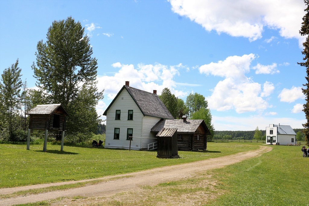
The Huble Homestead is a large section of land that was developed by partners Al Huble and Edward Seebach who had established traplines along two creeks in 1903. In 1904 they established a partnership and set up a trading post at the end of the Giscome Portage along the Fraser River.

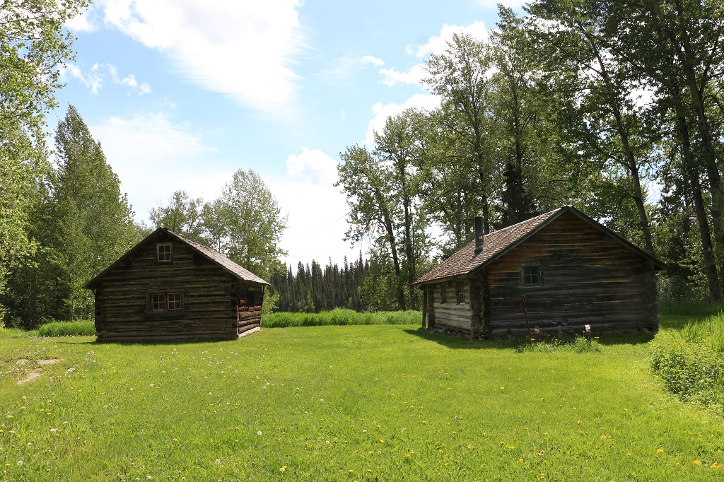
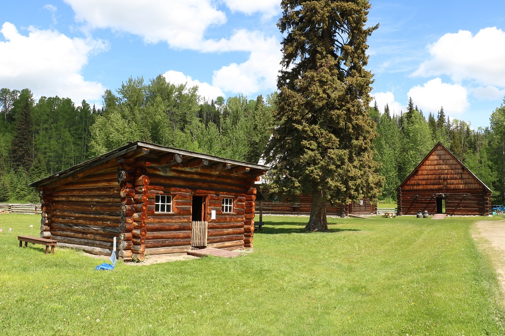
The reconstructed cabin on the left belonged to Edward Seebach. He was a lifelong bachelor. The building on the right was the blacksmith shop and is a working forge.
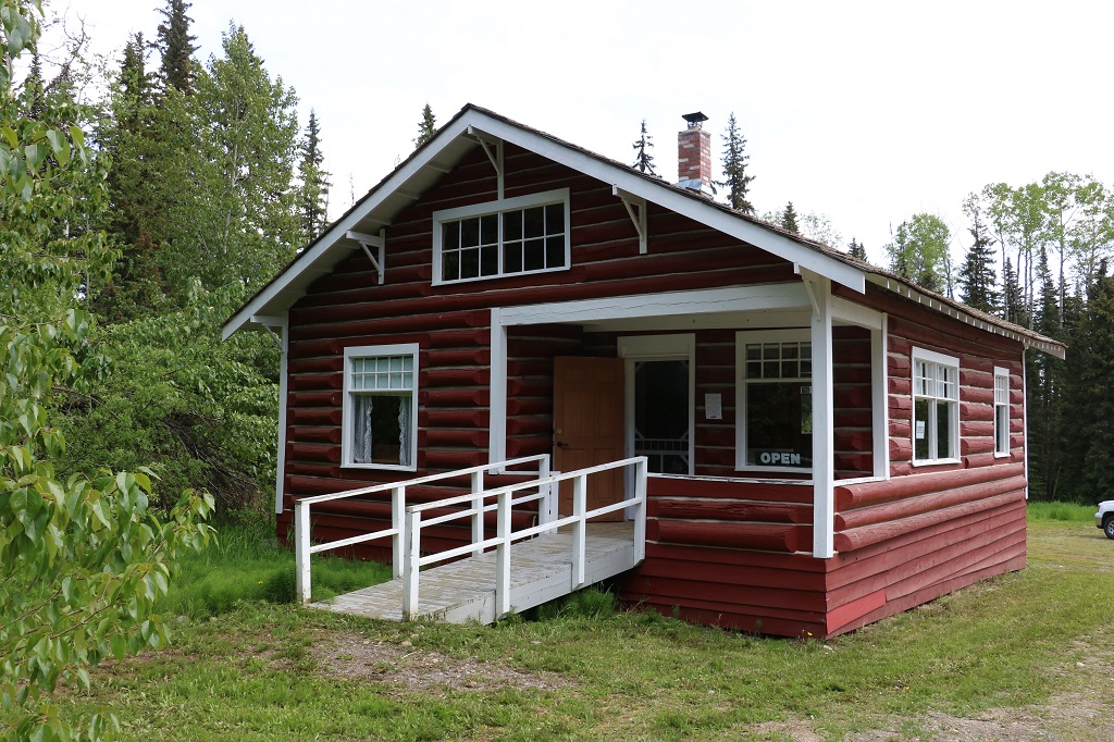
The two-story Huble house is the only original building on the site. Al and Annie Huble and their children lived here until the general store closed in 1919. Annie and her six-year old daughter Ada from a previous marriage arrived in 1911.
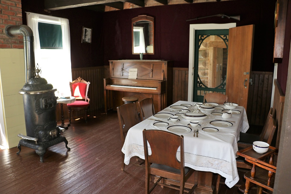
The parlour walls were covered with purple cloth that was taken down, cleaned and carefully re-hung every spring. There was a master bedroom and Al Huble’s office on the main floor and four bedrooms upstairs, one of which was used as a guest room or rented out to a trapper passing through.
The information board at the big barn told of an orphaned moose calf that Al Huble brought home and bottle fed. It became a family pet and would pull the children in a sleigh. The story was told as well that it would open the door and walk through the parlour.
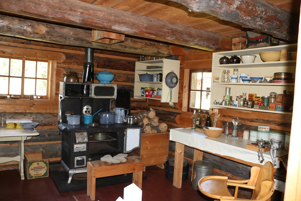
The ‘summer kitchen’ was used all year round and was located in the cabin that Al Huble built when his wife and her daughter arrived. When the new house was finished they dragged the cabin up to the back, built a covered walkway between the buildings and the cabin became the house kitchen.
This little flat-roofed cabin was the first building erected by the two men when they settled in the area. After they each moved into cabins on their own parts of the property the flat-roof cabin beame a workshop.
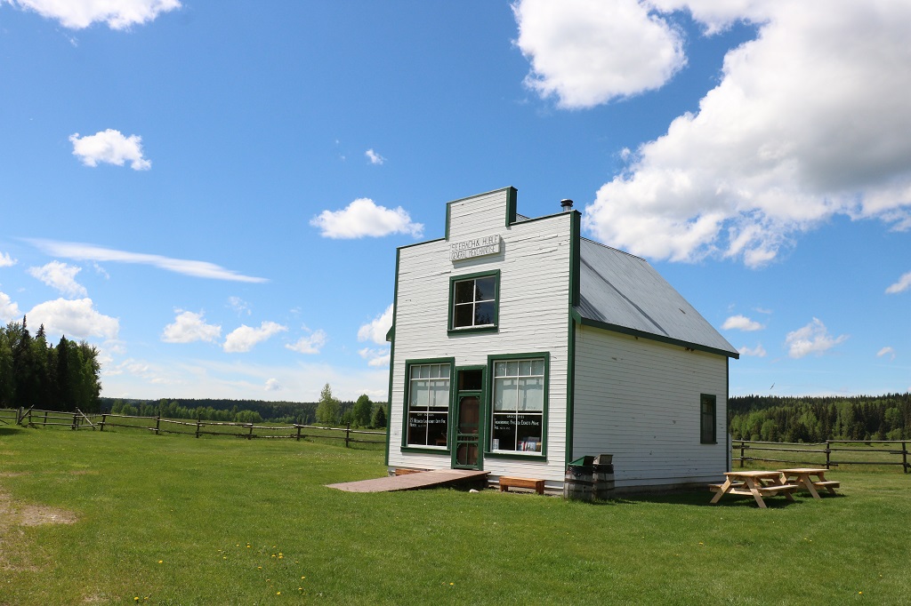
The General Store carried everything that was needed by the community of 27 homesteads that were soon in the area. WWI and the age of the automobile put an end to the river traffic and the store closed in the summer of 1919.
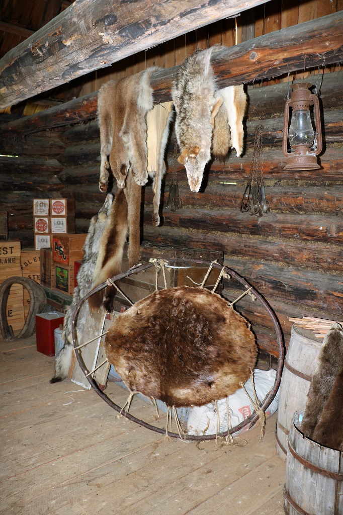
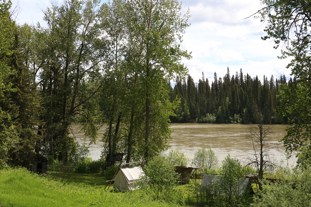
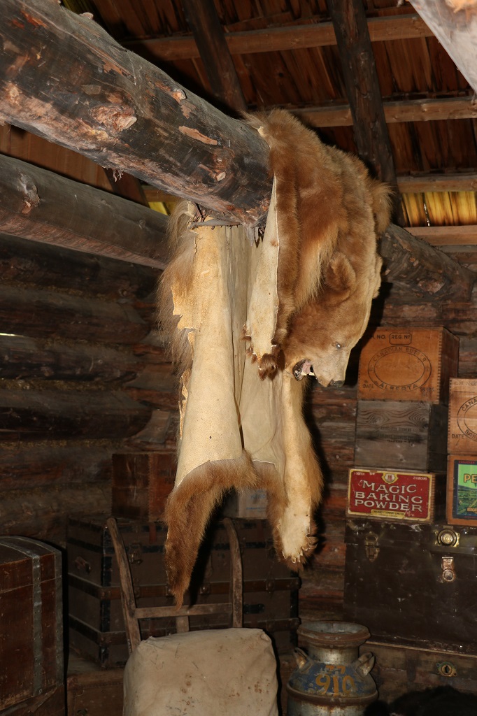
There were two warehouses down by the river that held stock that arrived for area residents or to other settlements along the river and the Hudson’s Bay Company and also stored the furs being shipped out until the riverboat arrived.
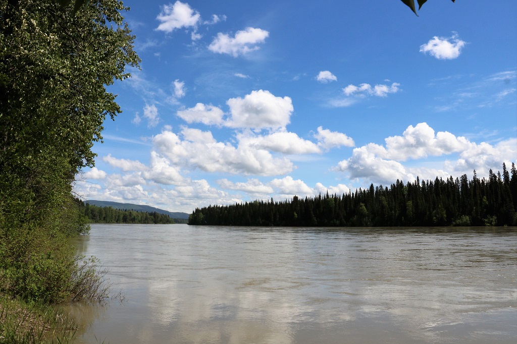
The Fraser River at the end of the Giscome Portage and Huble Homestead.
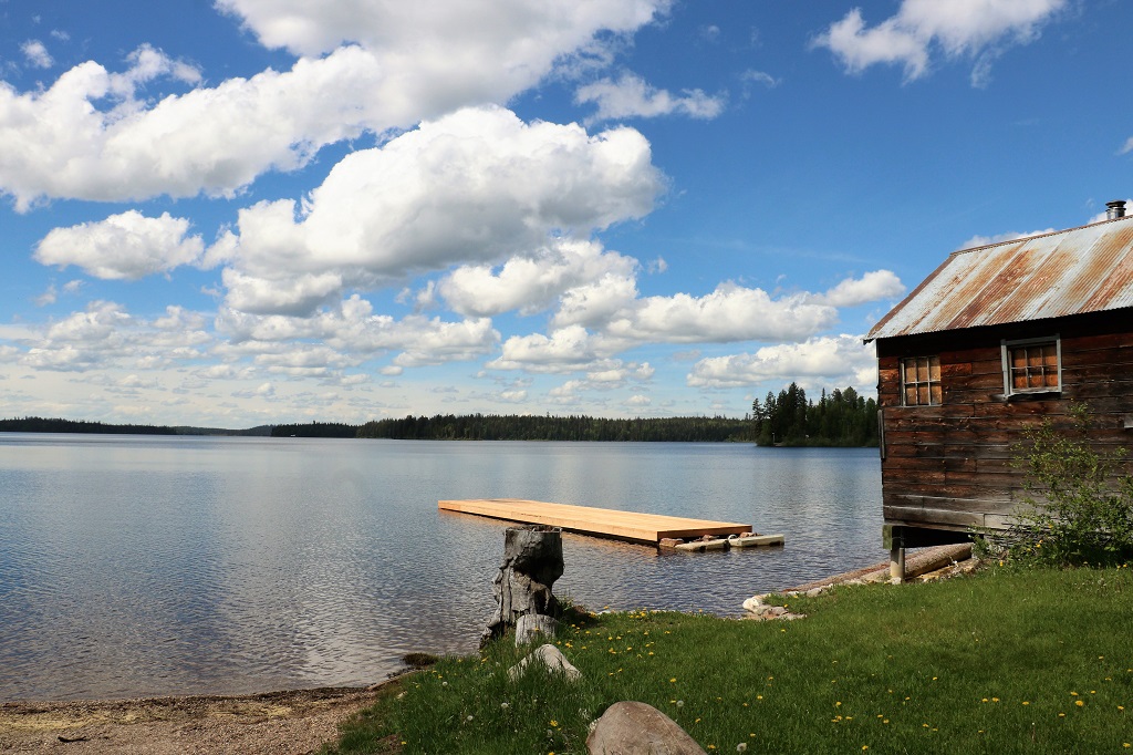
After we left the Huble Homestead we drove up the road and took a detour to see Summit Lake.
We pulled into the entrance to Bear Lake Provincial Park to find a geocache that a previous finder had said needed a new log sheet as the old one was soaking wet. We carry supplies for cache maintenance so we decided to fix it up while were were in the area. It was now 2:30 and we were 74 kilometers from Prince George! We had lunch before heading off again and decided we better do some driving for awhile.
Pine Pass takes you through the northern end of the Rocky Mountains with Chetwynd, Dawson, Creek, and Fort St. John on the other side.
We stopped at Bijoux (French for jewel) Falls which was only 400 meters off the road and was the home of the Stellar’s Jay, British Columbia’s provincial bird.
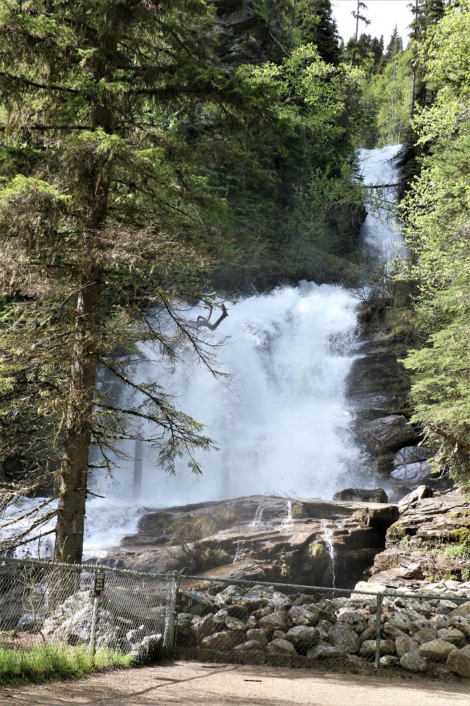
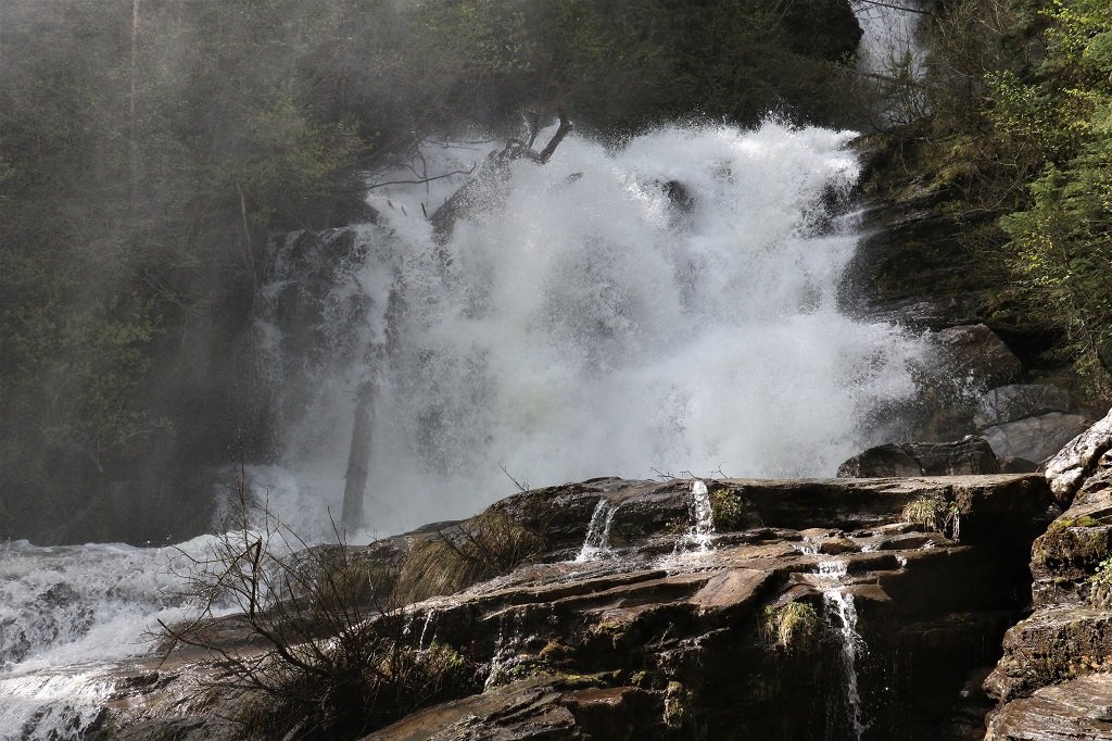
You could tell it was spring runoff. Even behind the fence at the viewing area you got wet with the spray from the falls hitting the rocks.
There were two Stellar’s Jays flitting among the trees at the parking lot and this one was in no hurry to fly away from people wanting to take its picture. It was probably hoping for a snack.

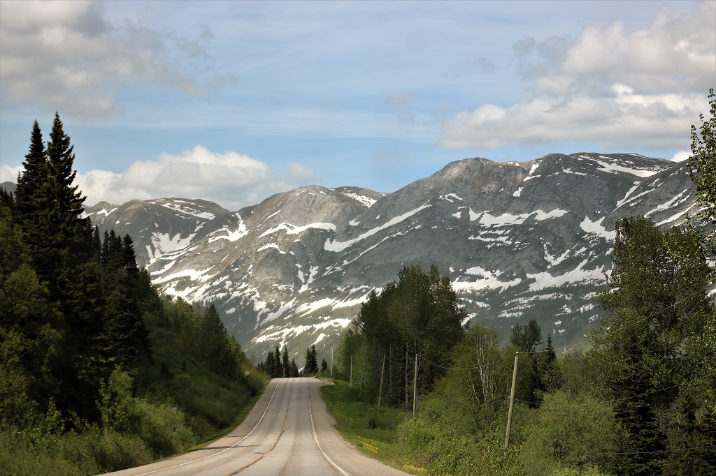
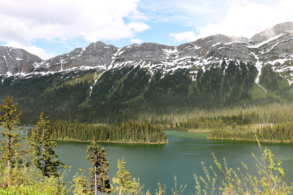
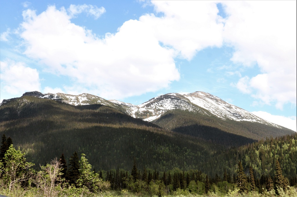
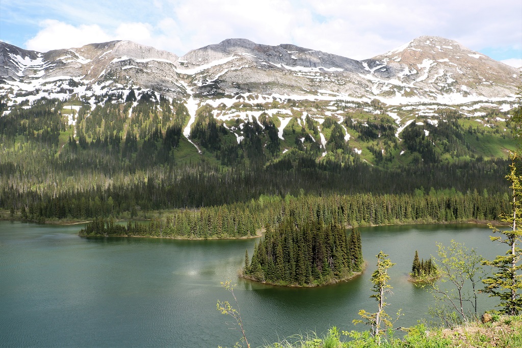
There was a roadside pullout with an incredible view of the mountain range.
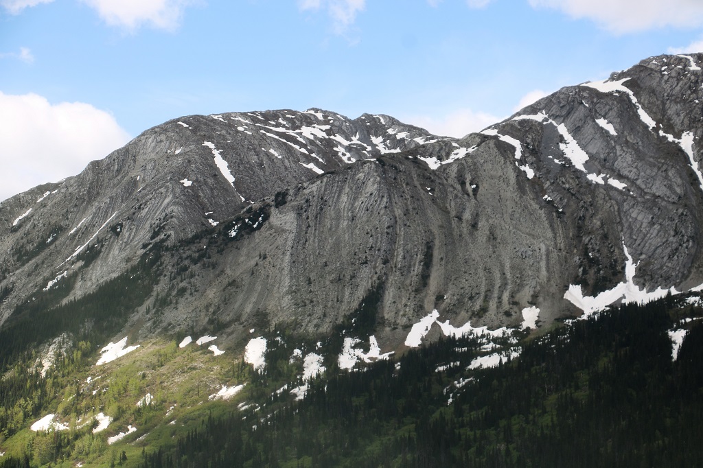
I took a video of the whole view but it would not insert into the blog post. Rats.
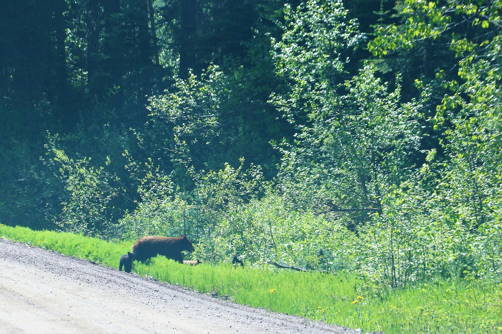
We saw two more bears not long after. The dandelions are profuse along the roadside so great eating for the hungry bears.
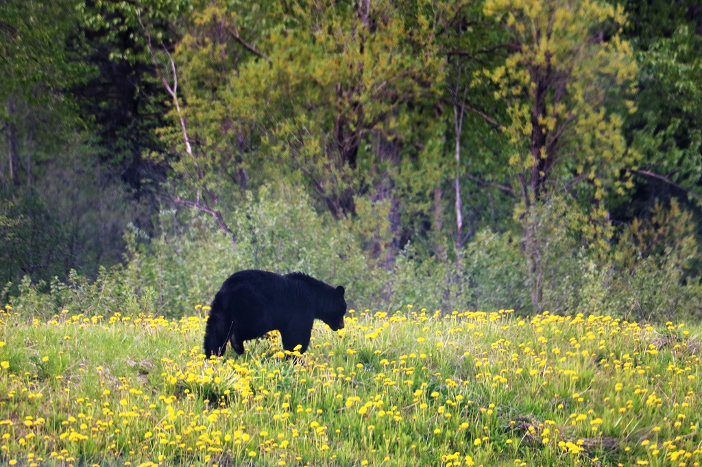

I spotted this one just off the road on the driver’s side and John was kind enough to turn the truck around so we could get a couple of photos of it.
We made one more quick stop at a viewpoint to find a well hidden nano cache before driving into Chetwynd.

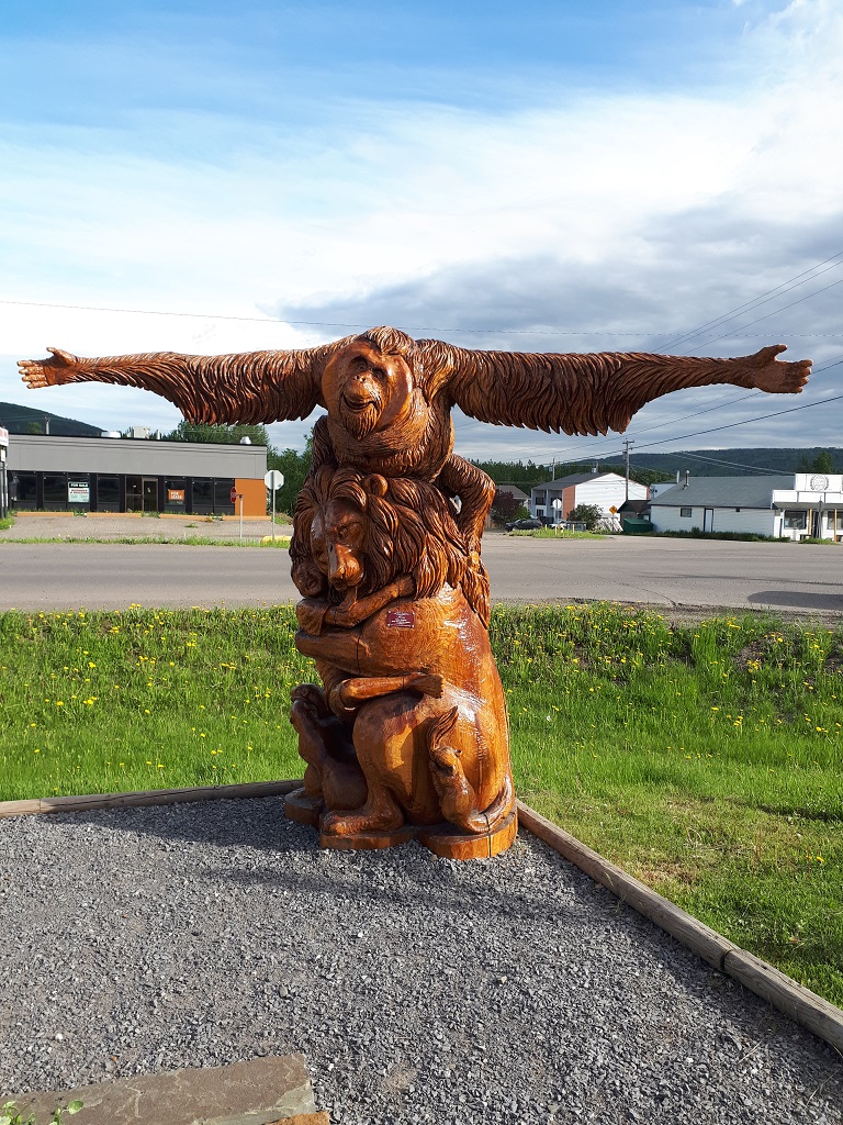
We arrived in Chetwynd at 6:30 mountain time. We entered a new time zone when we exited the Pine Pass. Chetwynd is famous for its Annual International Chainsaw carving competion, which just so happens to be on this weekend. Unfortunately we only booked one night here so we will not be able to see the finished products that these amazing craftspeople do. There are over 200 chainsaw carvings around the town of Chetwynd and tomorrow we will check out a bunch of them before going over to the competition grounds to see some of the carving. 12 carvers are invited to compete each year. 4 Canadians, 4 from the USA and 4 International. There is no specified theme so the carvers can make whatever they want. They have 35 hours to carve a 40-50 inch wide, 8-foot long log into a sculpture.
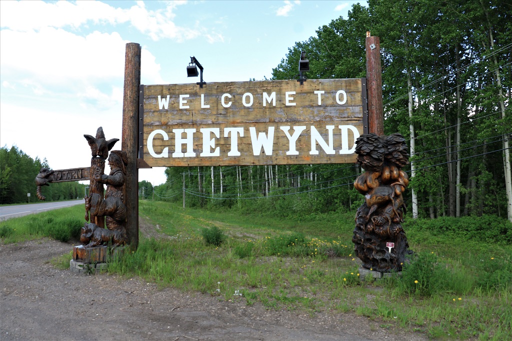
This carving at the town entrance sign was made by a fellow from Japan.
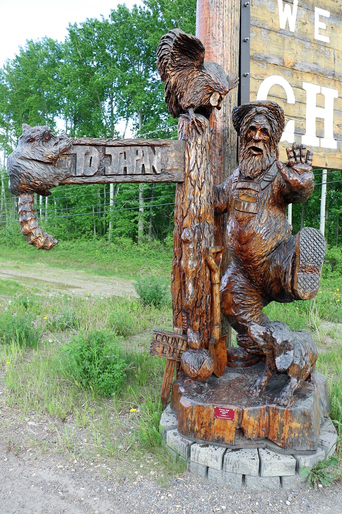
There are over a dozen carvings along the roadside as you enter town. I photographed these two where we parked to go for dinner.