Category Archives: Hanna Travels

Day 18 – June 24 – Humboldt, SK to Yorkton, SK

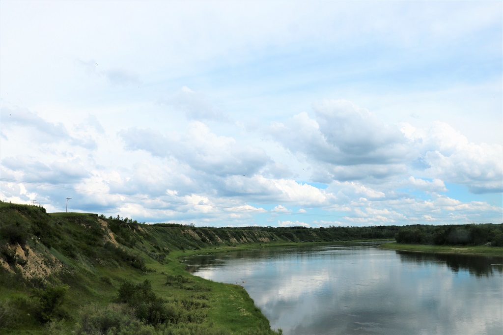
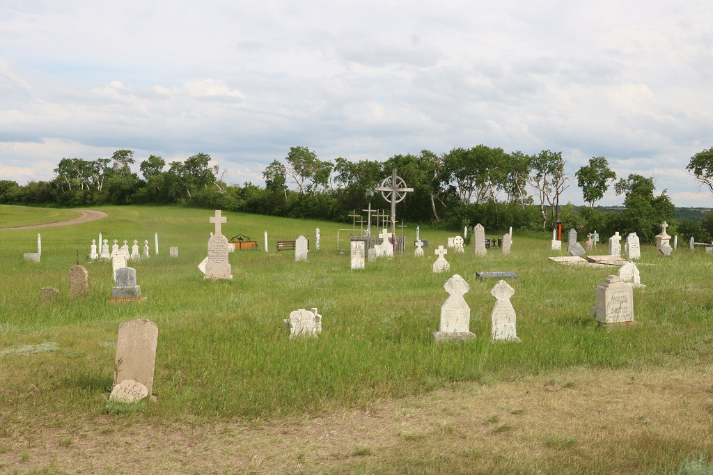
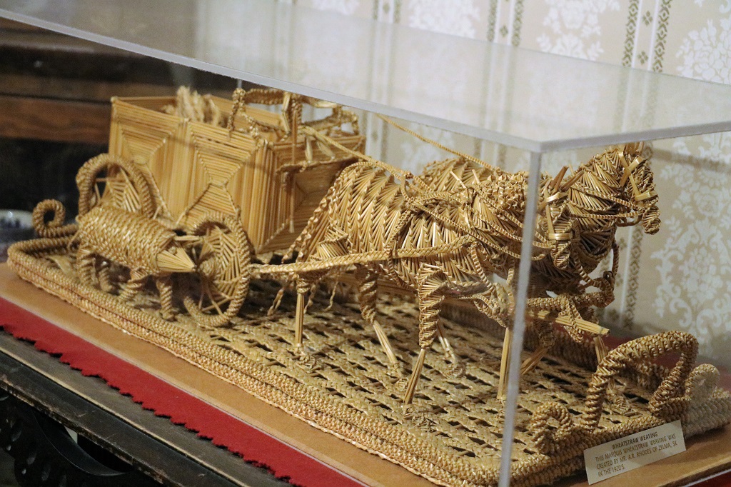
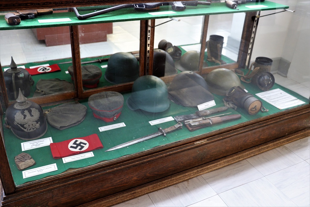
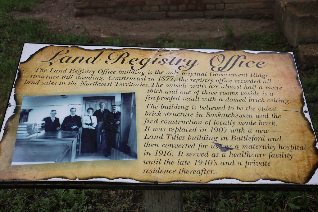
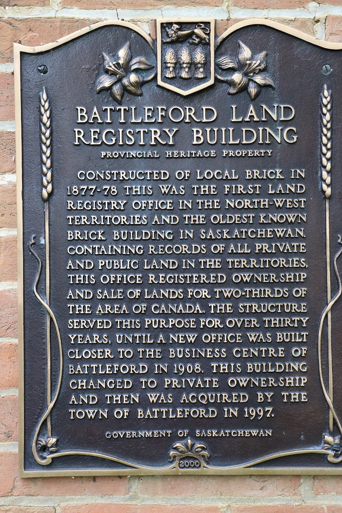
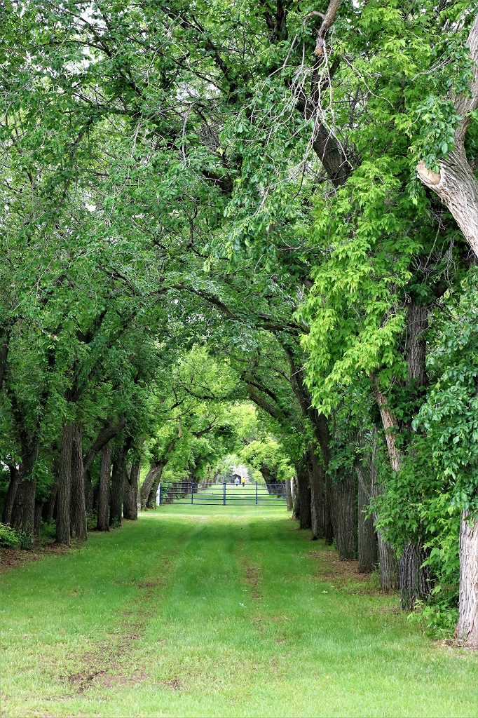
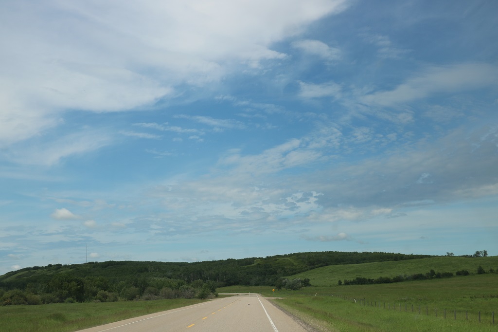
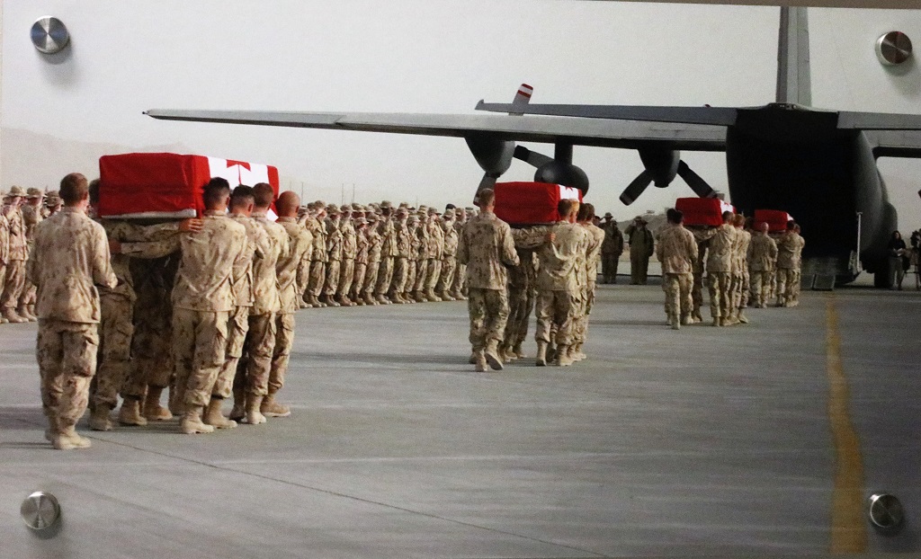
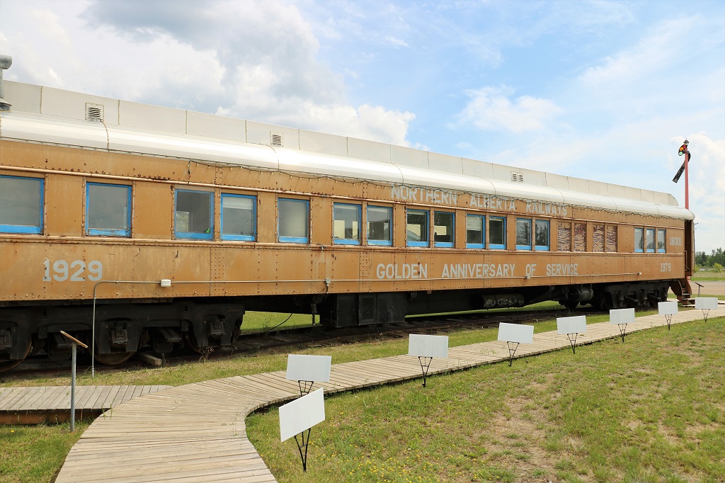
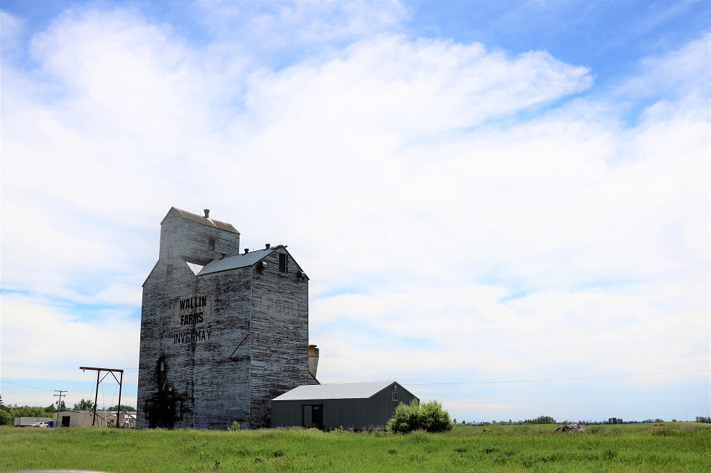
We only made one sightseeing stop today.

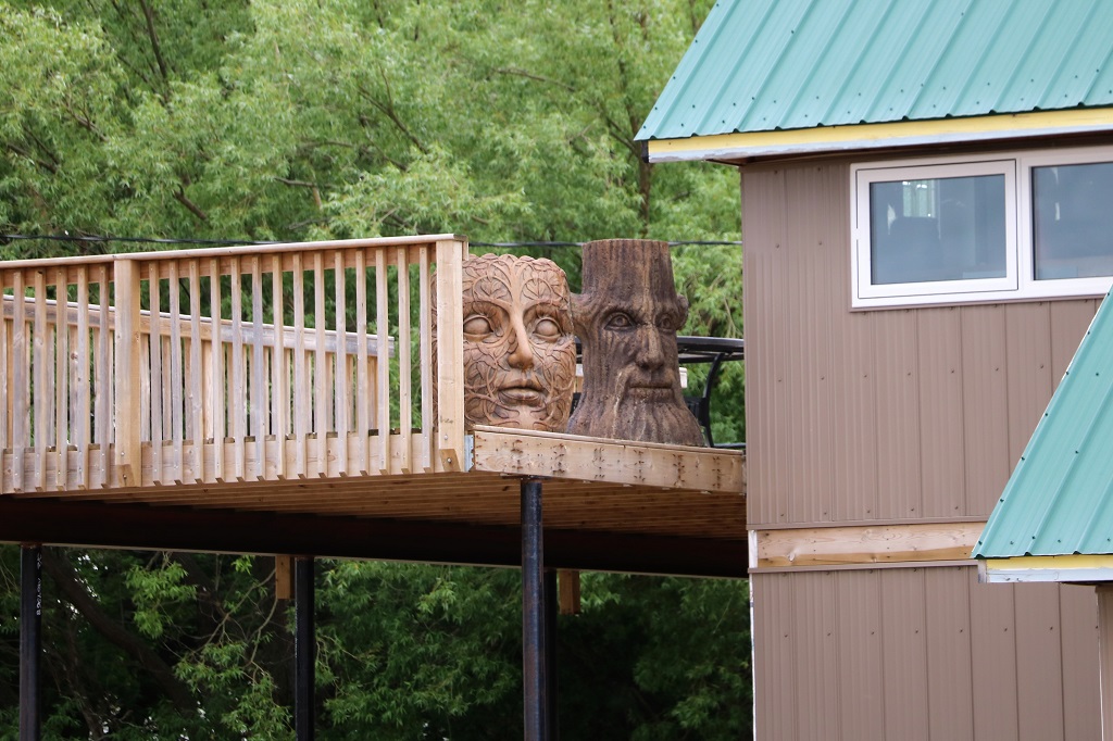
I can’t remember what town we were driving through when we spotted these two beautifully carved heads on the deck of a large building.

We did stop briefly a few other places, most notably at the welcome signs to the town of Englefeld where they host a hog-fest every year. The large pig was made by a local company owner to celebrate the 25th Englefeld Hog-fest and was atop his building until it was moved to the entrance to town. He chose a Yorkshire pig for his sculpture because they are long and sleek, without the typical potbelly. After the pig was moved community members decided to beautify the area and planted a garden, then they needed somewhere to store their tools and water buckets. An internet search provided an image of a small building that looked like it could be from the “Three Little Pigs” story so more volunteers drew up plans and built it to futher enhance the site. The fat pig in the coat on the right is the Hog-fest mascot.

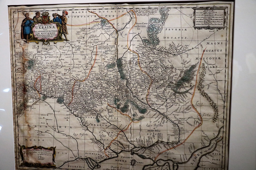
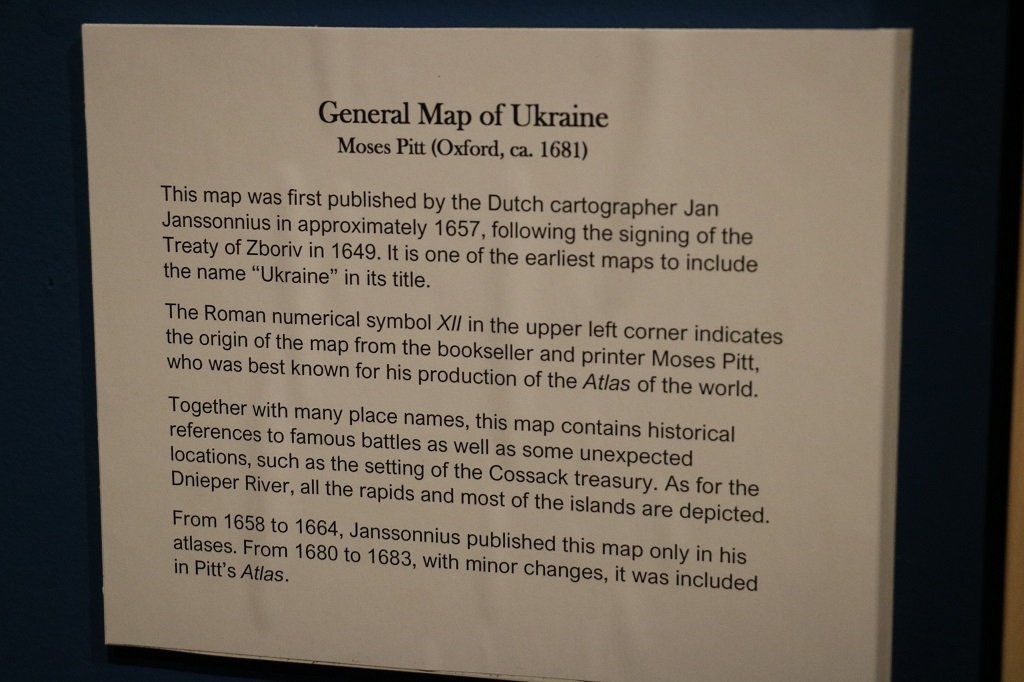
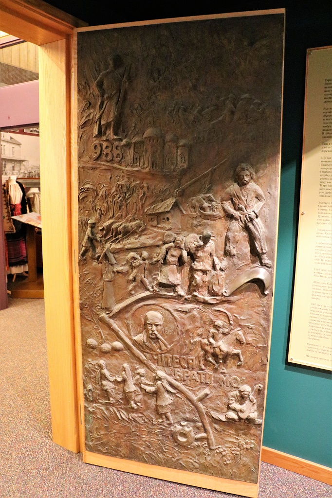
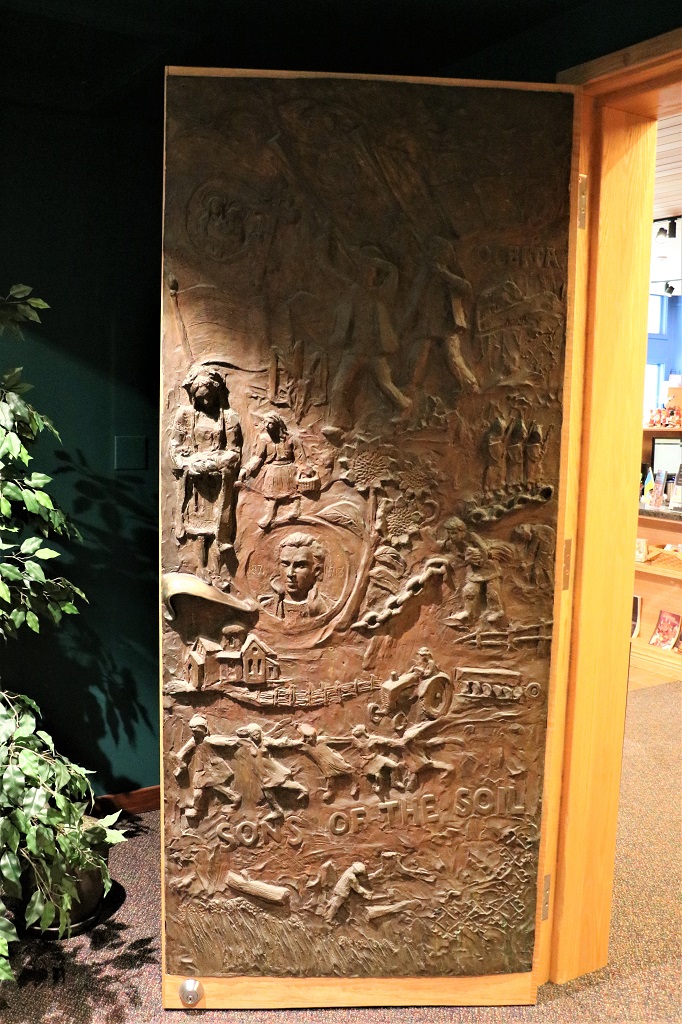
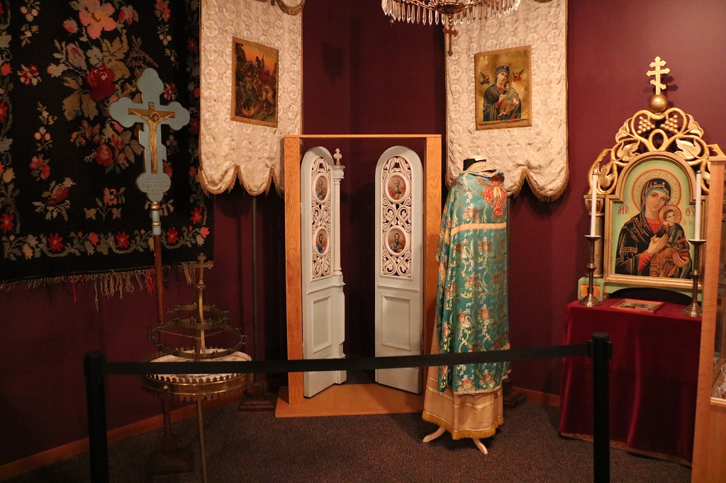
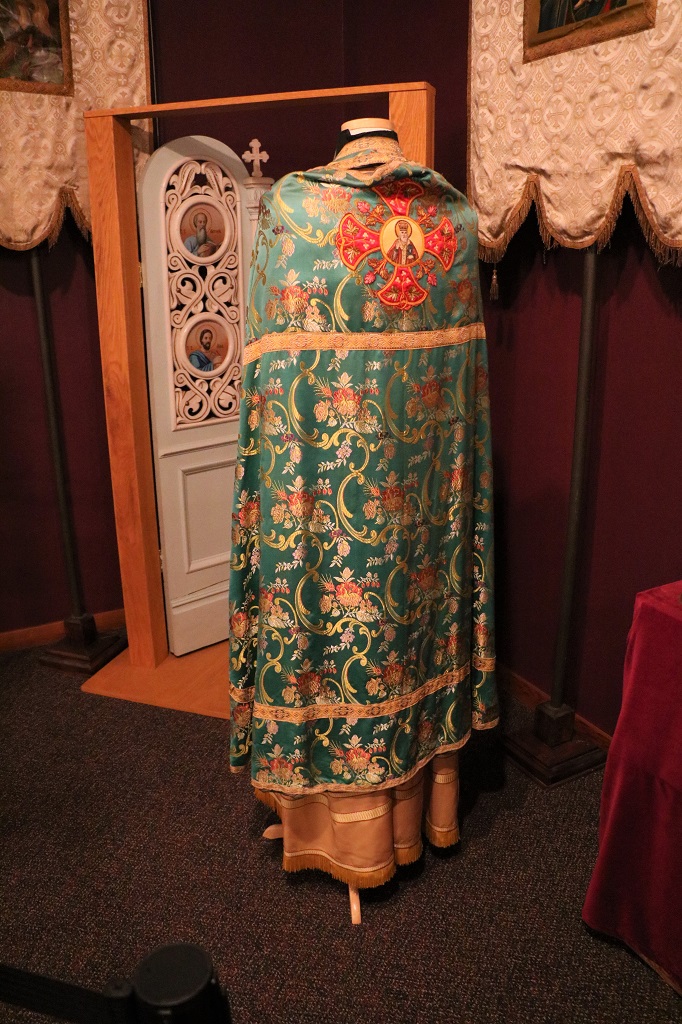
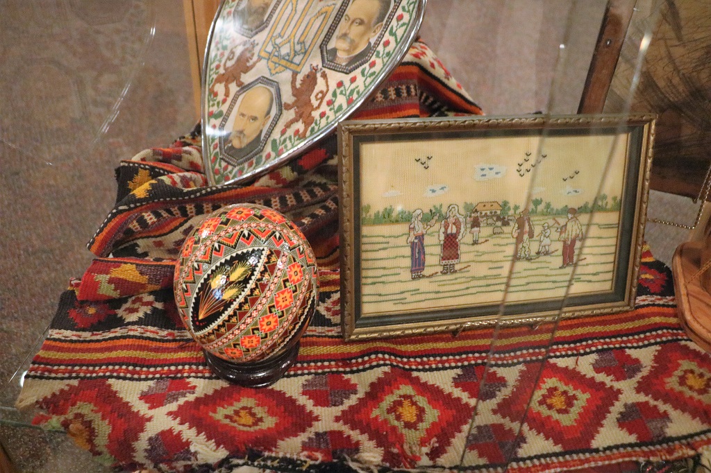
We stopped in Canora to see the Ukrainian Heritage Museum, but it was closed and we carried on driving to Verigin to the National Doukhobour Heritage Village.

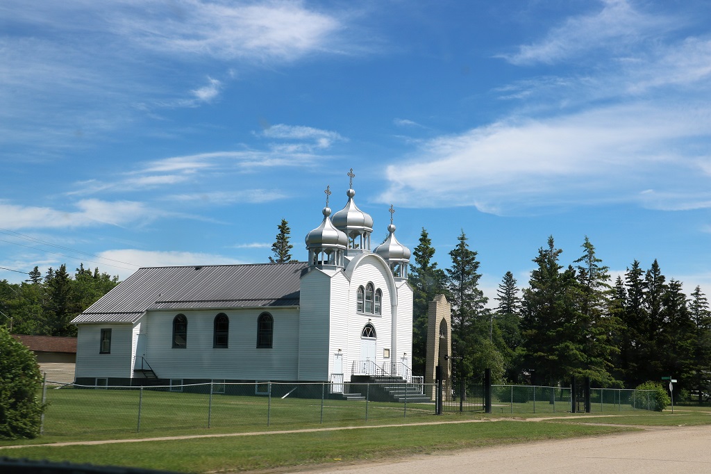
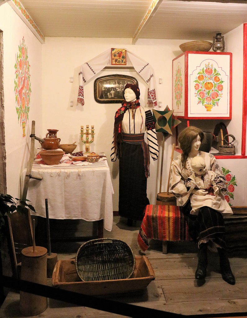
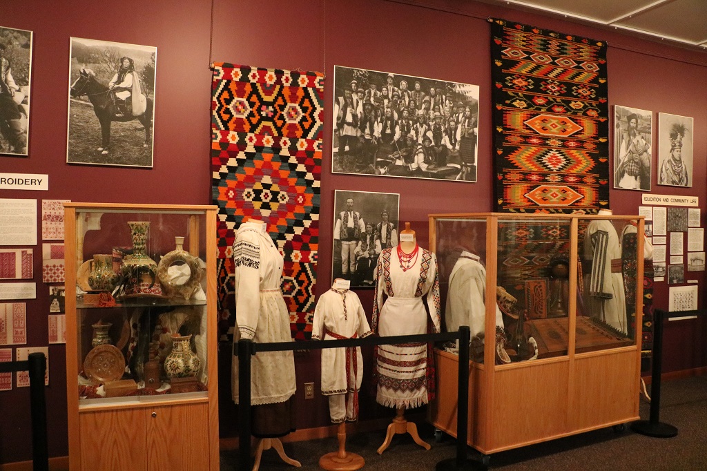
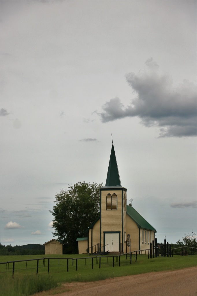
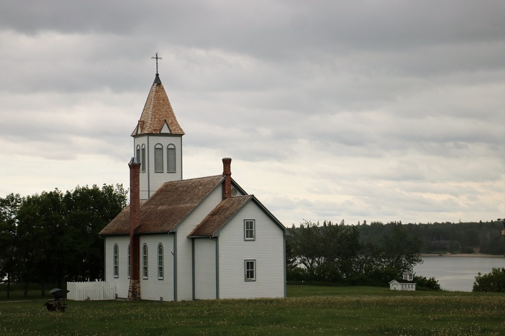
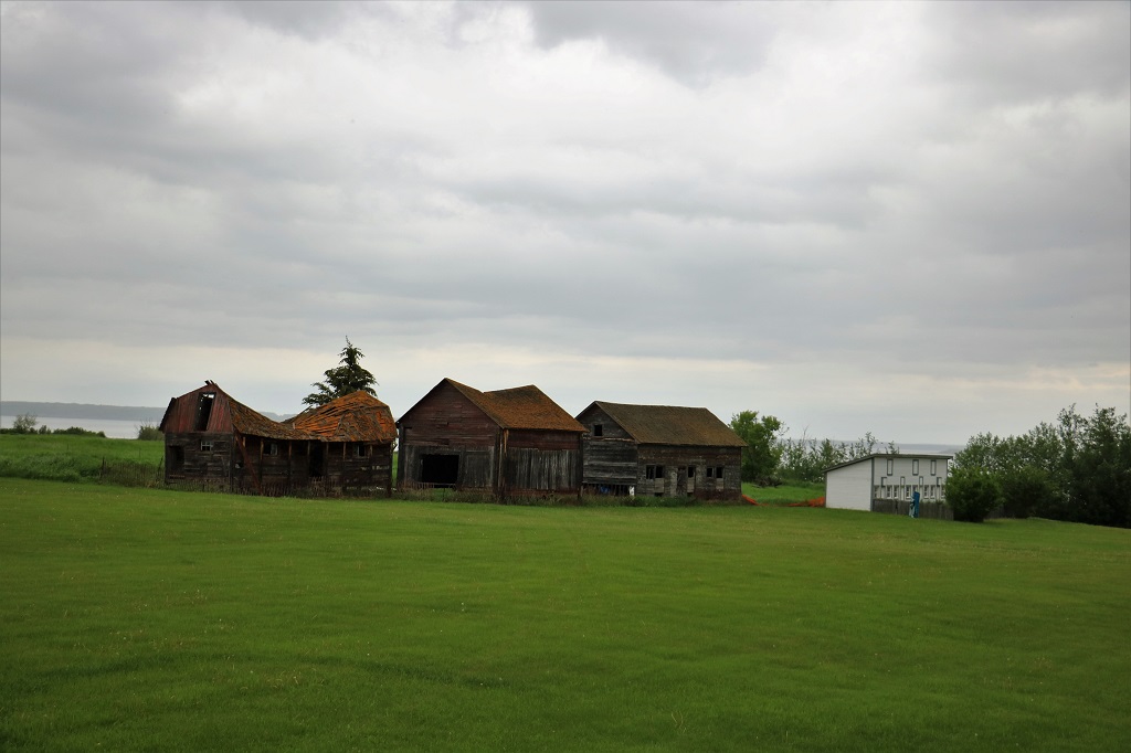
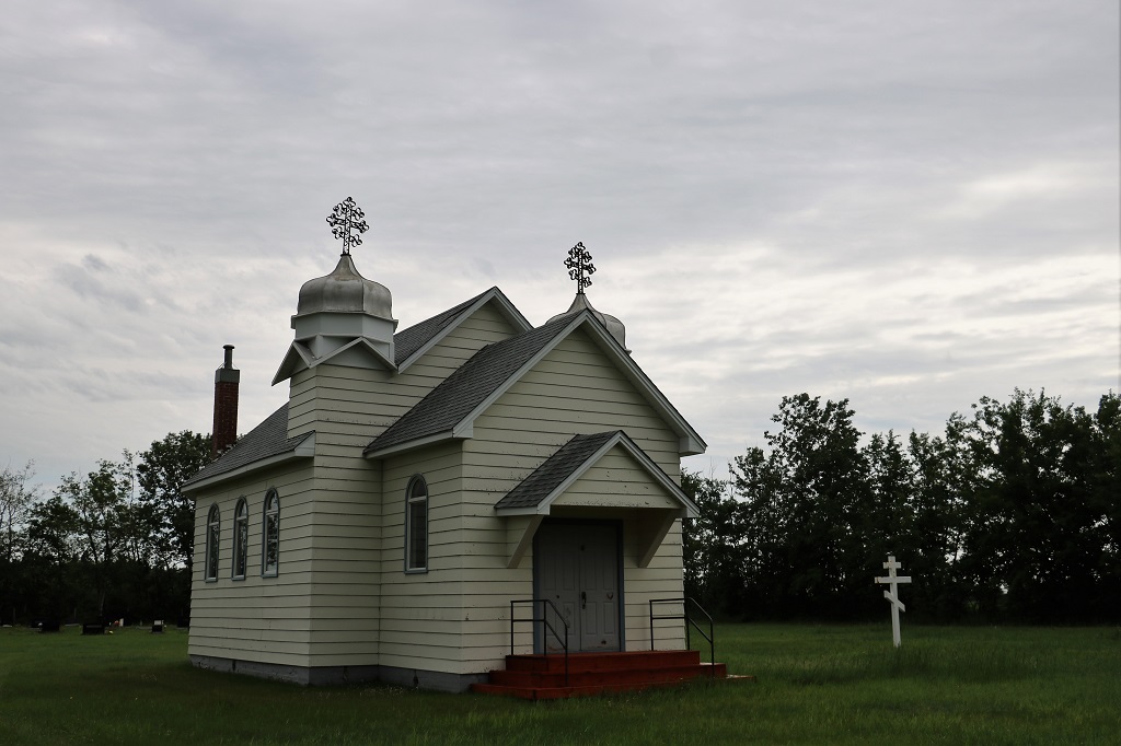
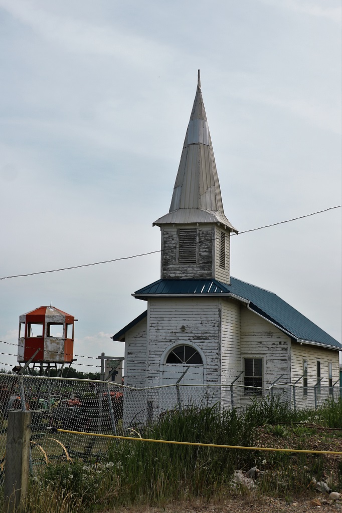
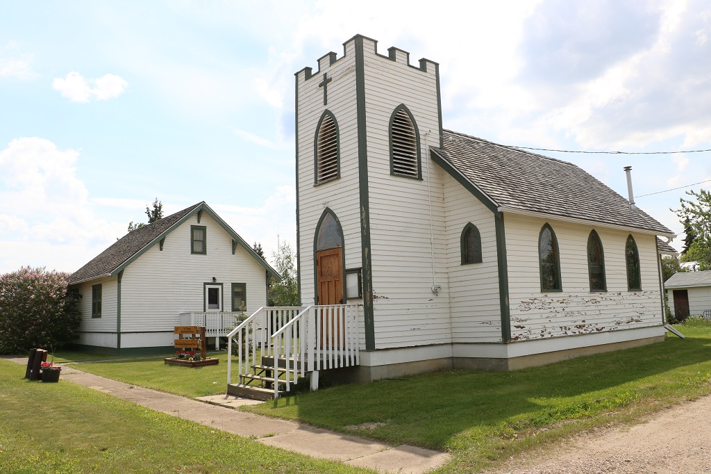
We drove past several of the distinctive Ukrainian churches in communities we passed through today.

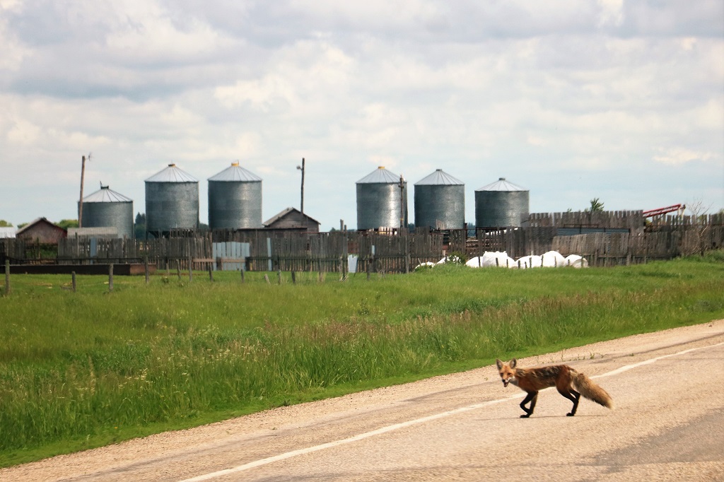
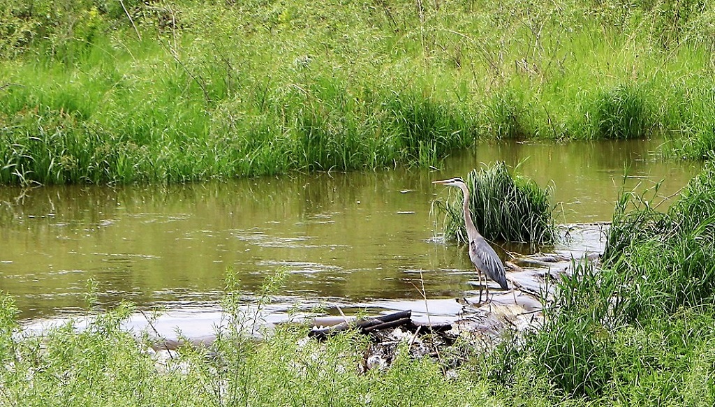
When we noticed this animal crossing the road ahead of us John and I both thought at first it was a coyote, but we soon realized it was a fox. You don’t see them out in the open very often.

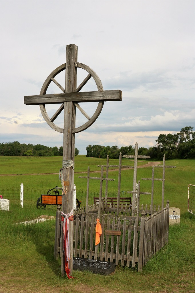
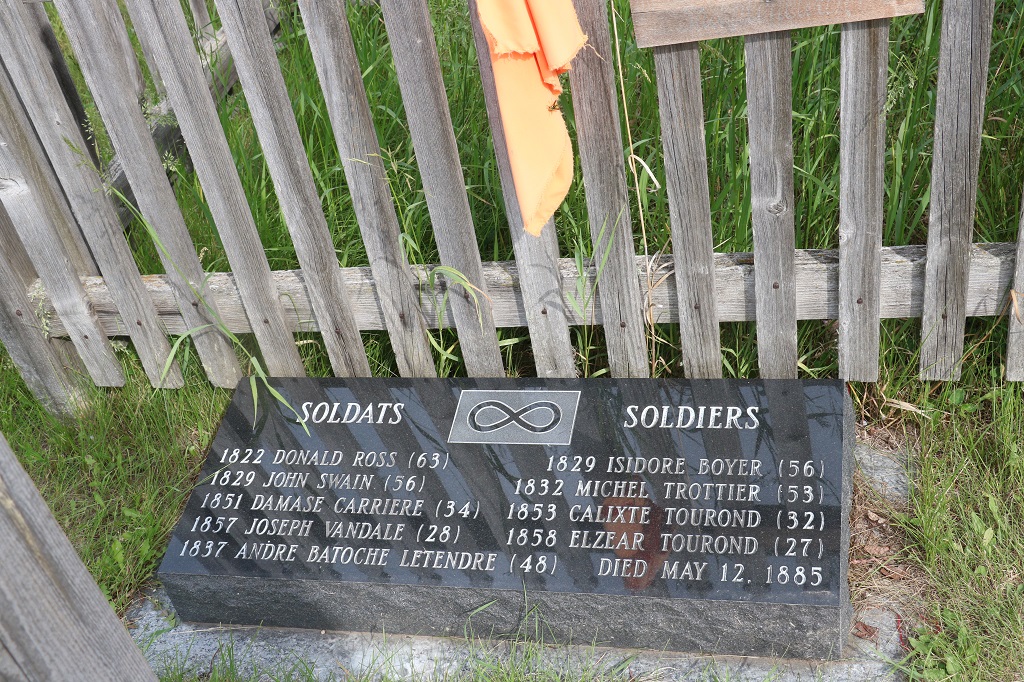
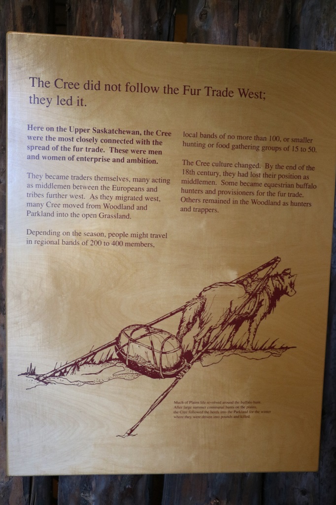
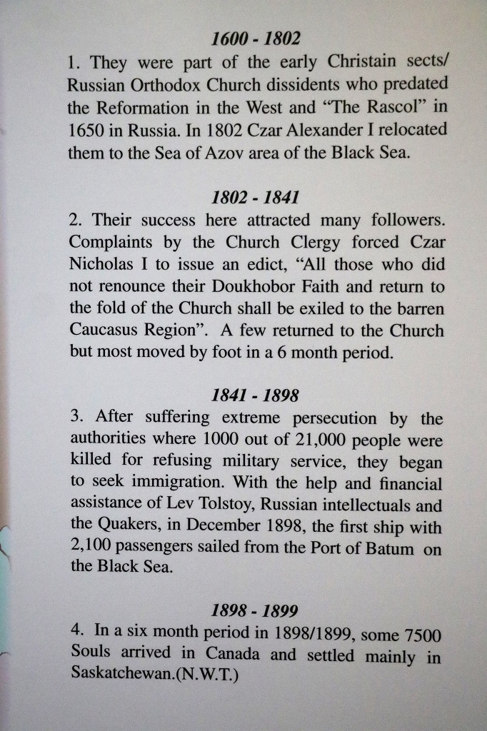
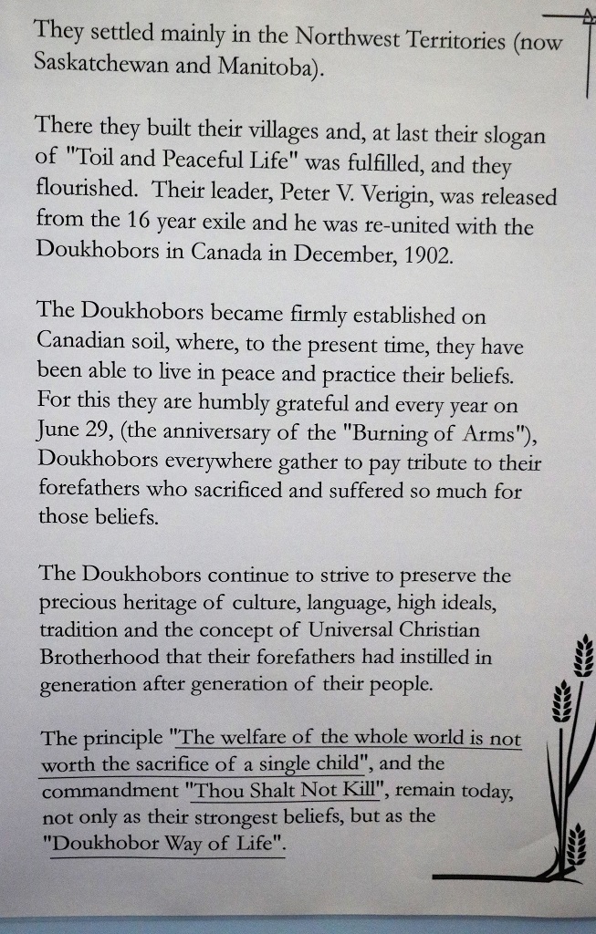
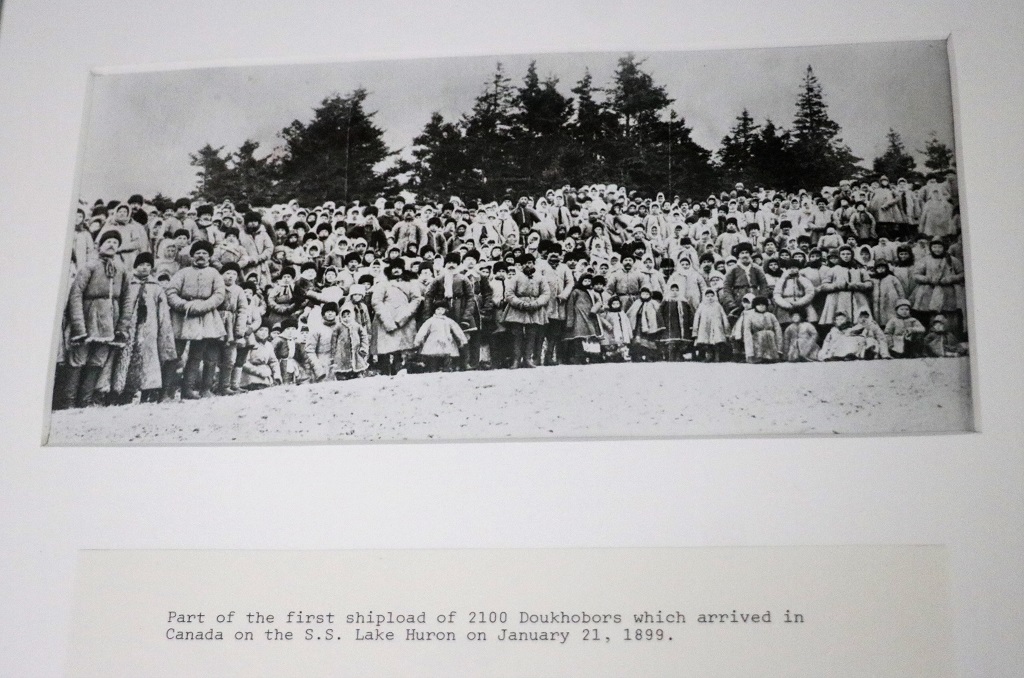
Another group of people persecuted in their own land were the Doukhobours from southern Russia. They are pacifists and refused to take up arms and were no longer willing to do military service; to the point that they had a Day of Burning in 1895 where they gathered all their weapons and burned them. Their pacifist stand met with harsh oppression and great persecution followed, including torture and exile to Siberia. They realized they must leave their homeland and seek a place where they could live without sacrificing their principles. Through their own efforts and those of author Leo Tolstoy, as well as the Society of Friends (Quakers) sufficient funds were raised for the move. Arrangments were negotiated with the British and Canadian governments. They were offered land and about 7500 people migrated to the North West Territory which later became the provinces of Manitoba and Saskatchewan in 1899.

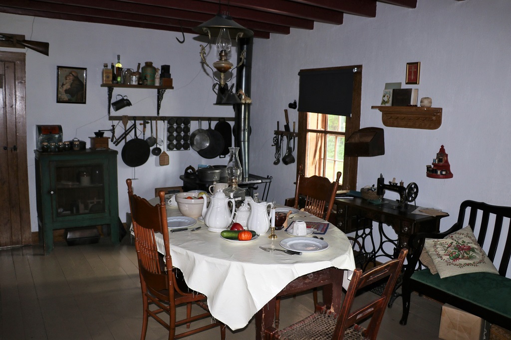
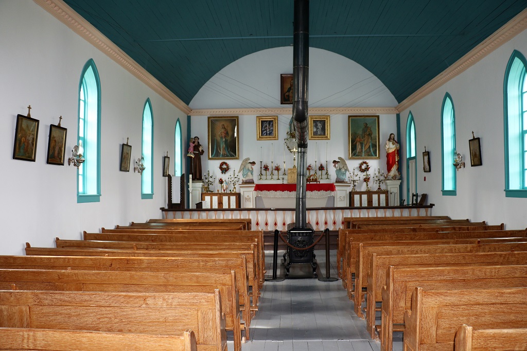
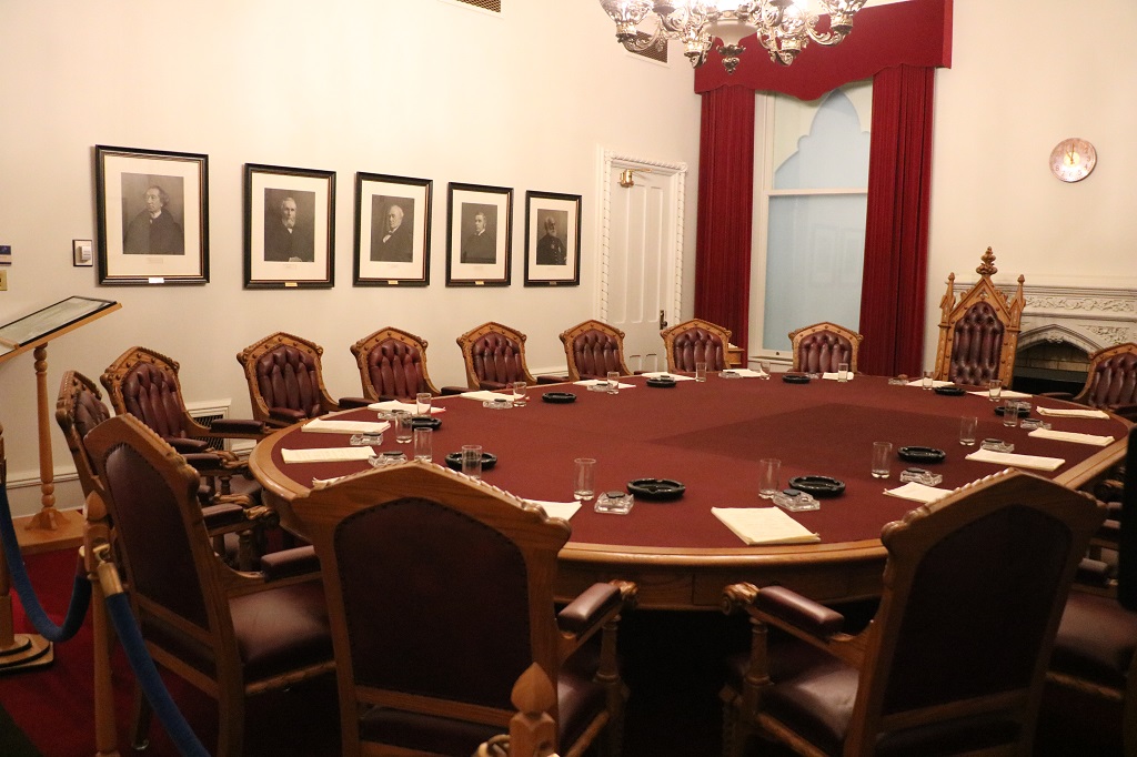
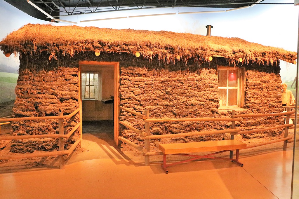
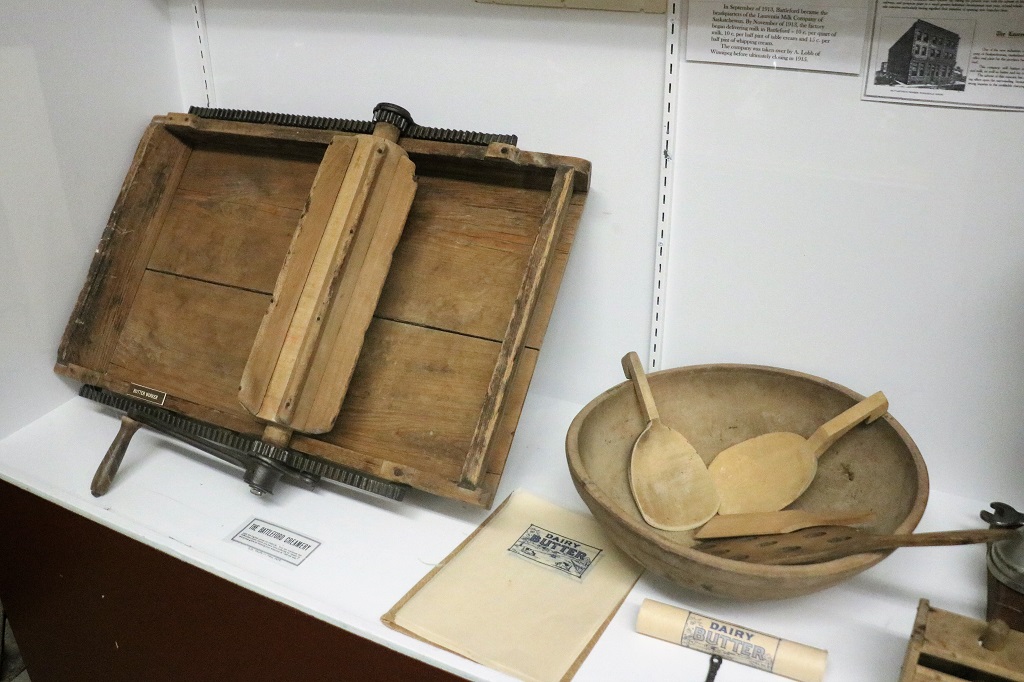
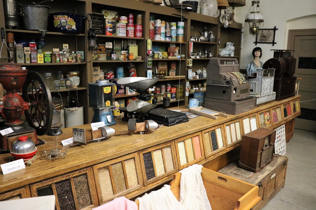
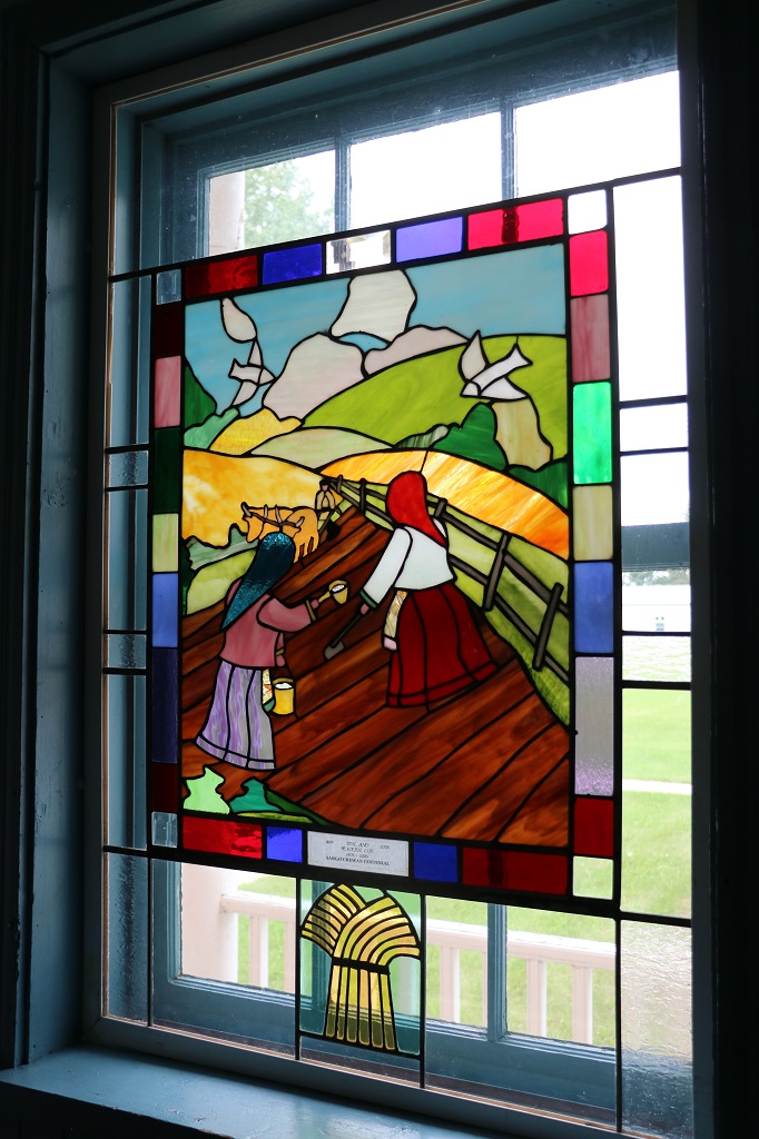
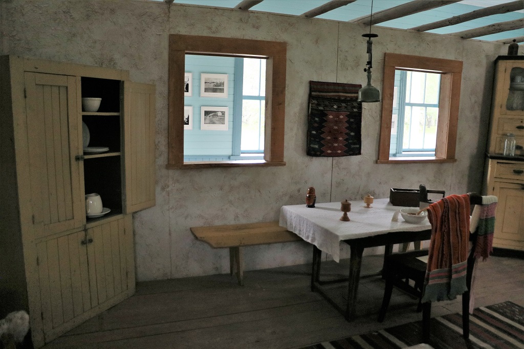
There was a large number of photographs and items in the main center and 9 buildings on the grounds that we could wander through at will. All of the buildings but the large one had been brought to the park from other Saskatchewan Doukhobour villages.

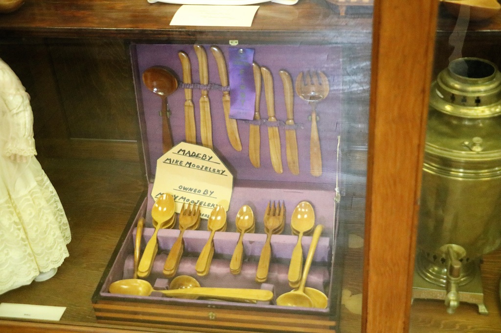
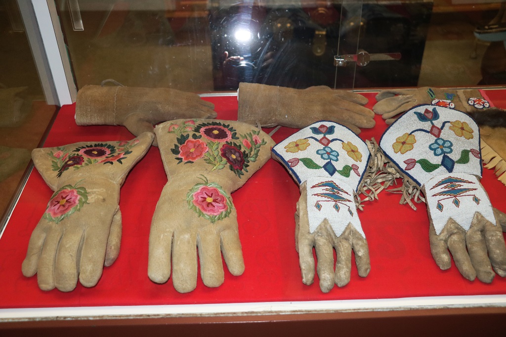
A complete set of hand-carved wooden cutlery.

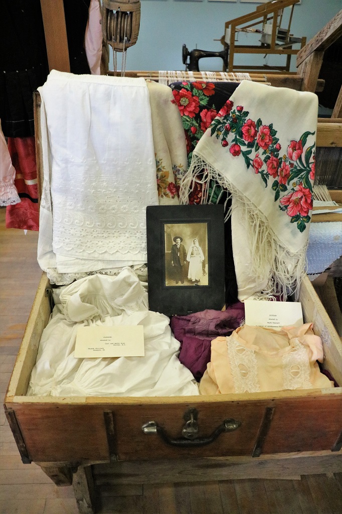
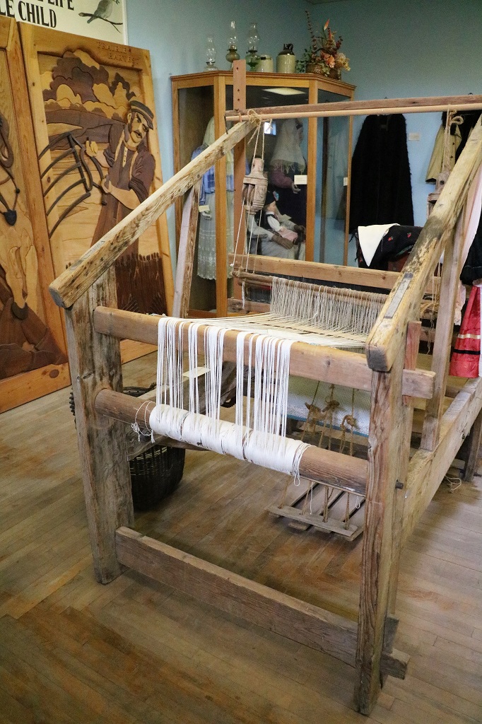
The man’s suit is handmade from linen made from flax.

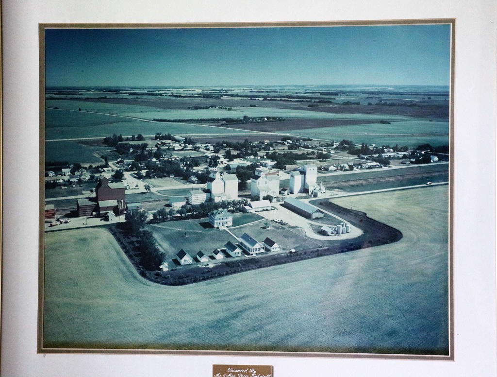
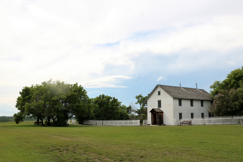
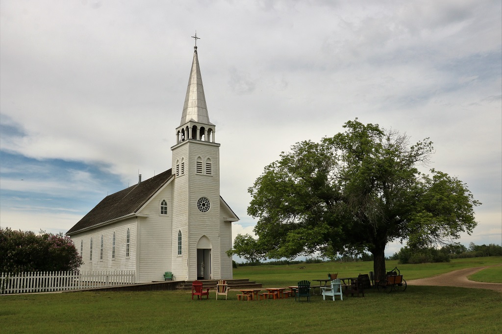
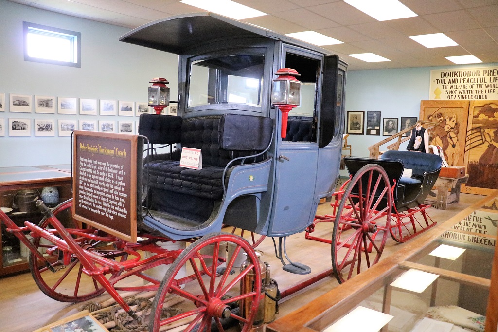
An aerial view of the heritage park with the large Prayer Hall and leader’s residence in the center.

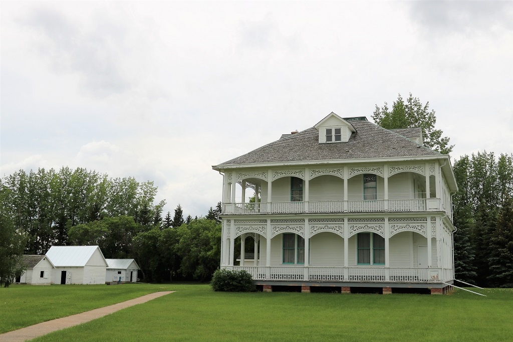
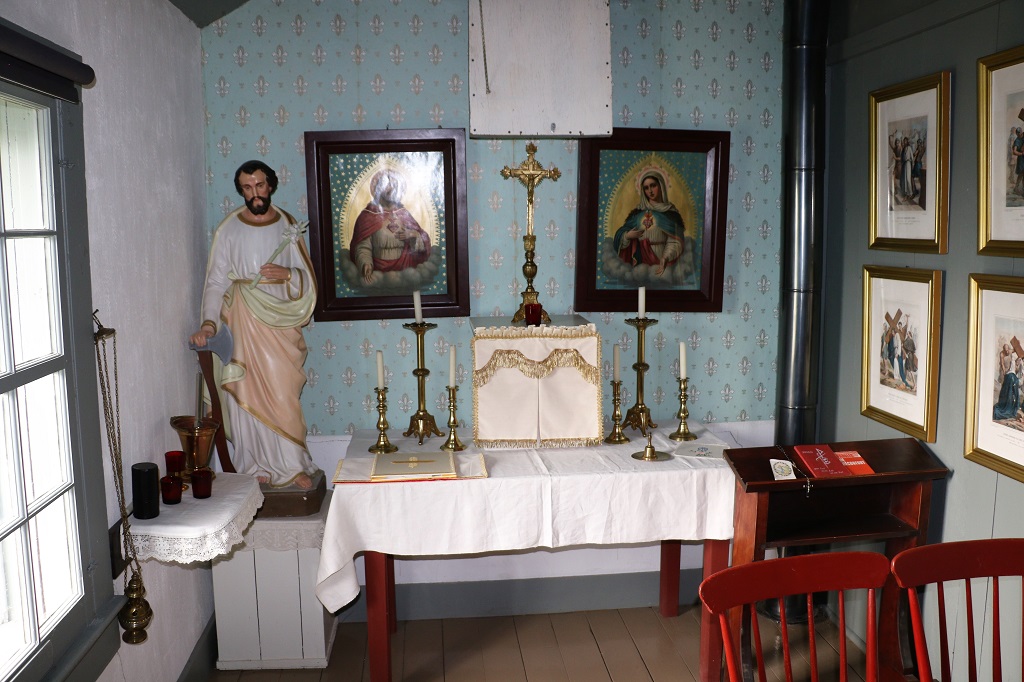
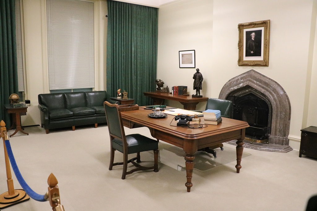
This building is fashioned on the style of the Doukhobour leader’s house from Russia. It was built on site in 1917 and served as a place for communal gatherings, weddings, funerals and spiritual meetings. The upstairs was the private living quarters of the sect’s leader, Peter V. Verigin, and later his son, Peter P. Verigin. Peter V. was released from a 16-year exile in Siberia and reunited with the Doukhobours in Canada in 1902.

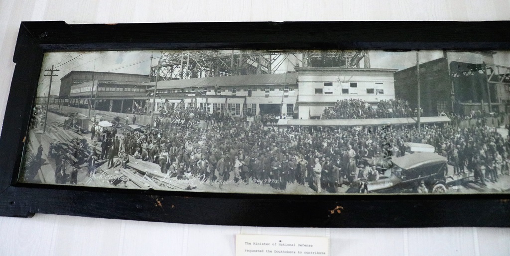
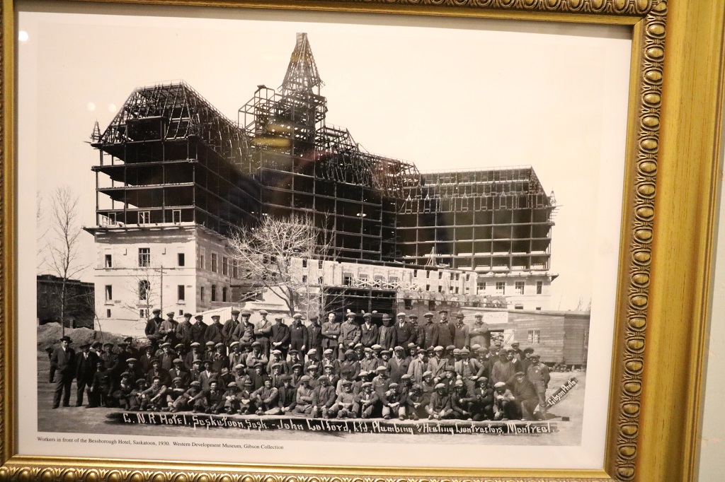
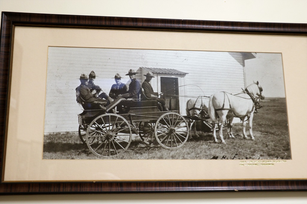
During WWI the Canadian government asked the Doukhobours to contribute to the war effort with their labour since they would not contirbute with arms. A group traveled to Toronto in 1915 to build a bridge. The above photo is of Doukhobour men at the J. Couglan & Son’s shipyard in Vancouver May 9, 1918.

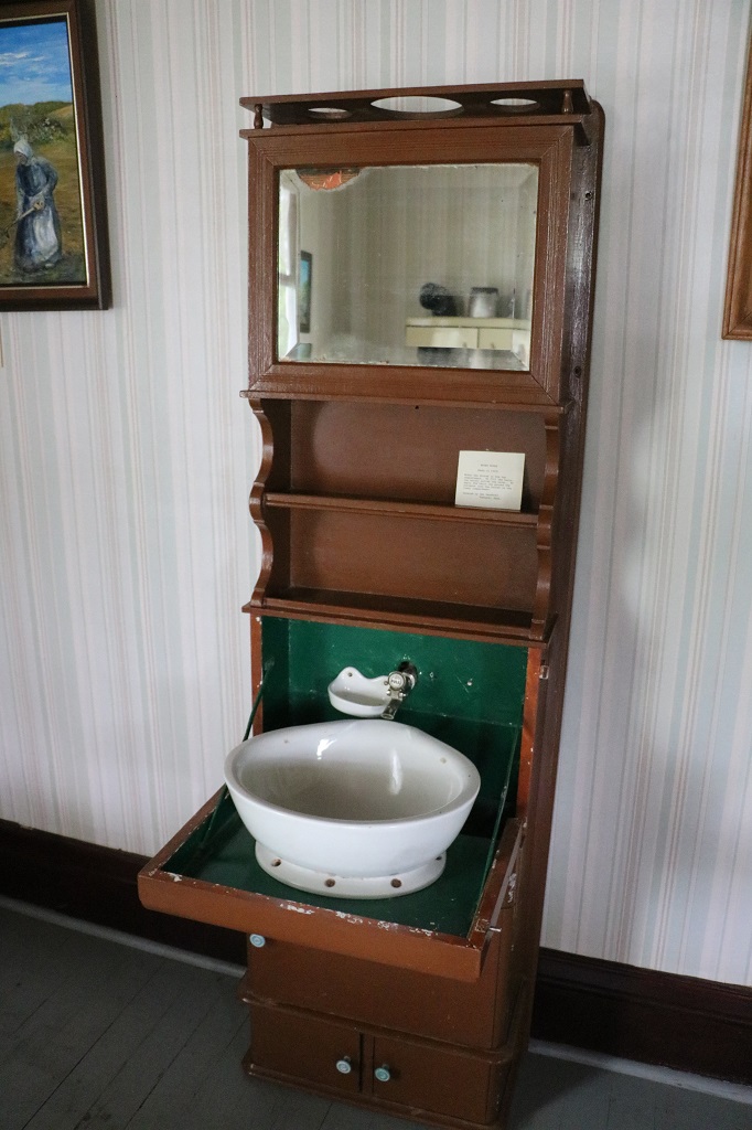
This ingenious water basin was in the Verigin House. Water was kept in the cabinet at the top. To fill the basin you pulled the knob and when you were finished you raised the shelf base and the water was sent to a container in the bottom.

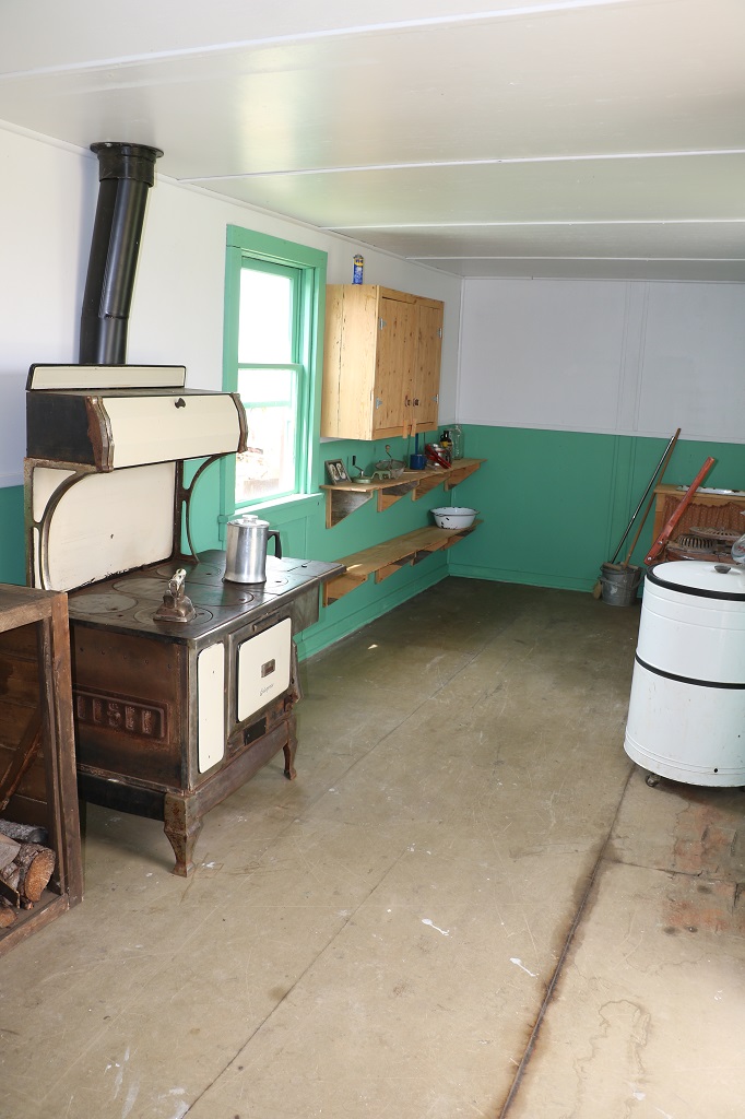
We looked at the blacksmith shop, which was empty because they were renovating, a communal barn that housed all the village horses, a granary that all the grain was stored in from every farm, a communal bath house where the muscles from a hard day’s work were soothed in heat and steam, the bakery, and the a brick house that also contained the Tolstoy museum.

The brick oven in the bakery is still used for special occasions. You can bake 35 loaves of bread at a time inside it.

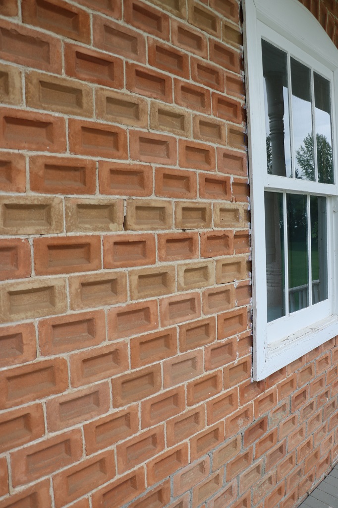
They had their own general store and their own flourmill, three grain elevators and a brickyard. The bricks on the this prayer house from the village of Gromova were placed on edge instead of flat to provide a different look. The bricks on the corners were placed in the traditional manner.

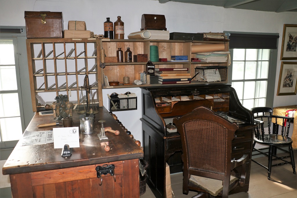
The library of Russian books.

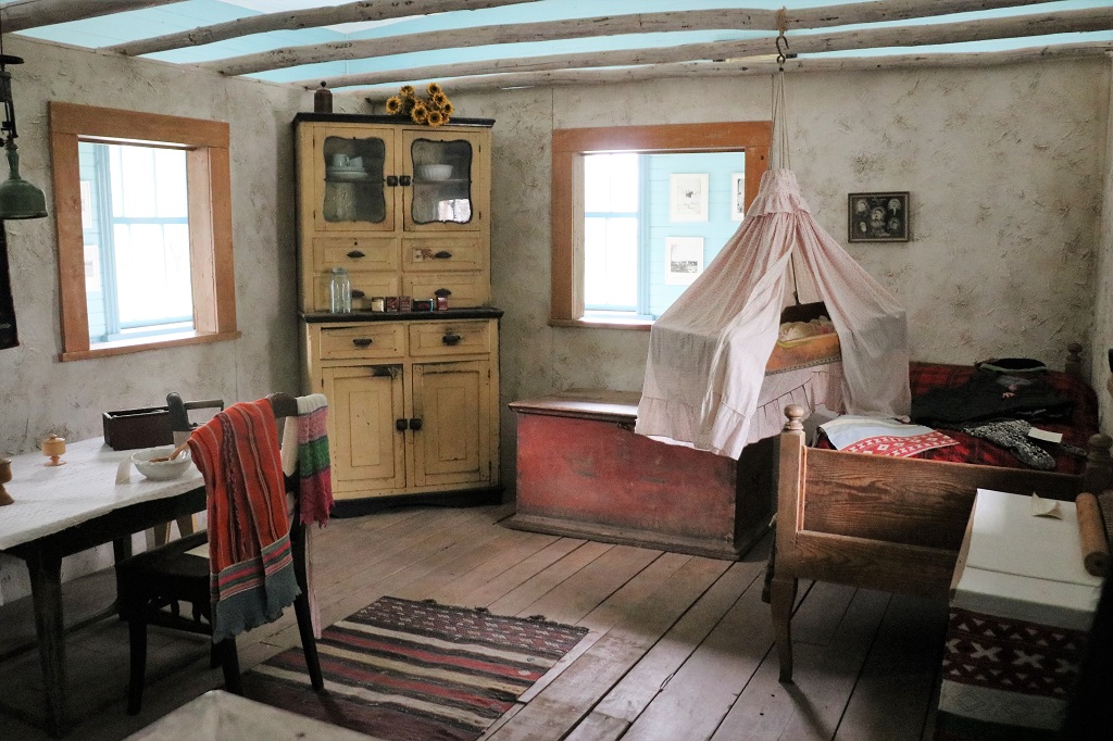
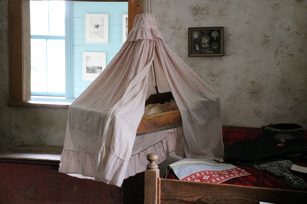
The cradle was suspended from the ceiling beside the bed. Very clever idea when the baby is very young.

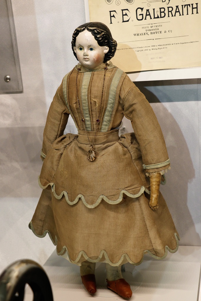
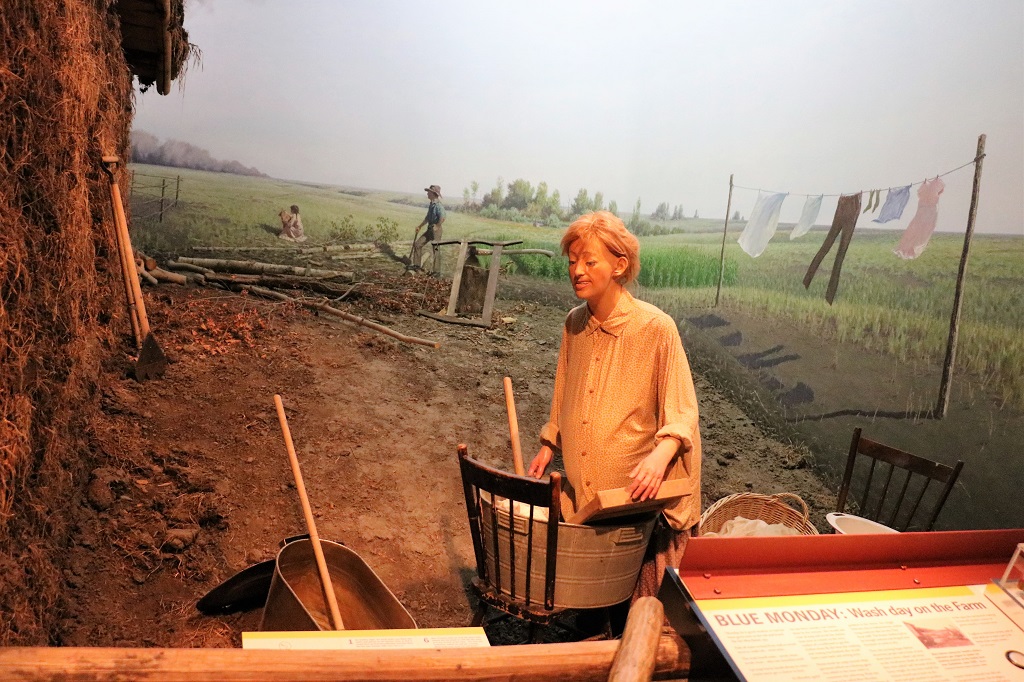
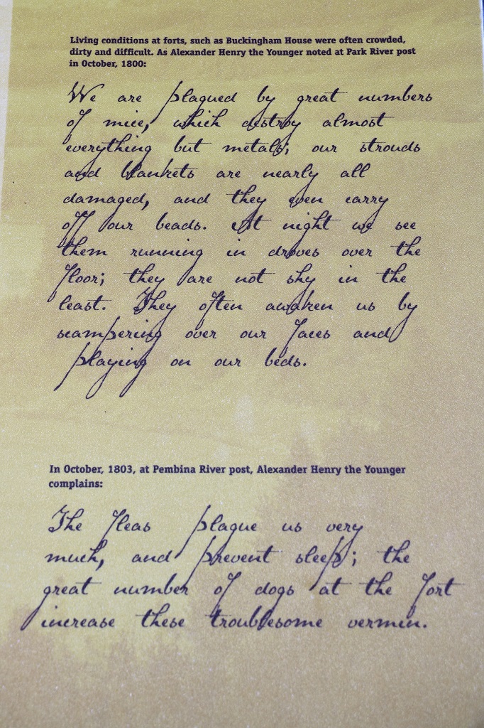
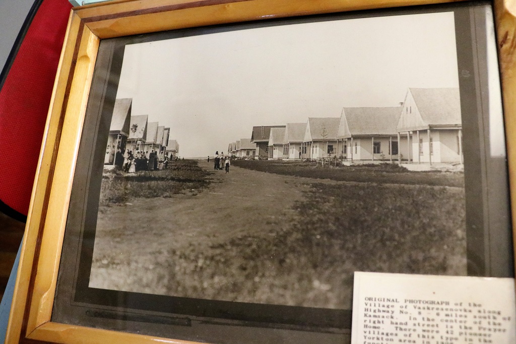
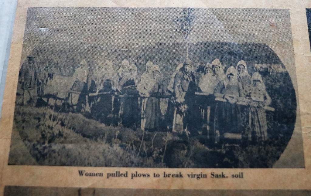
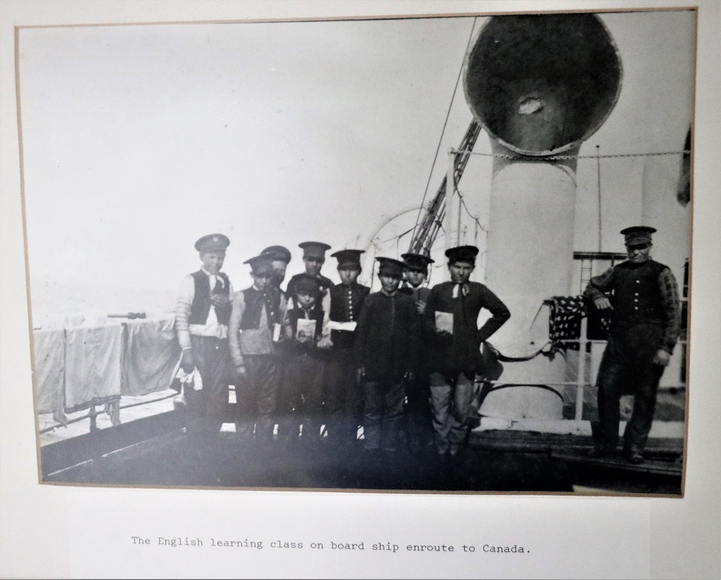
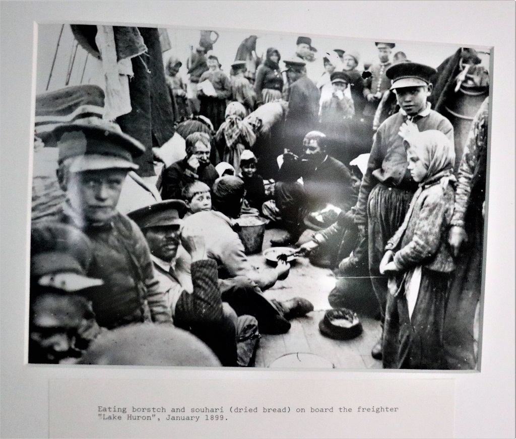
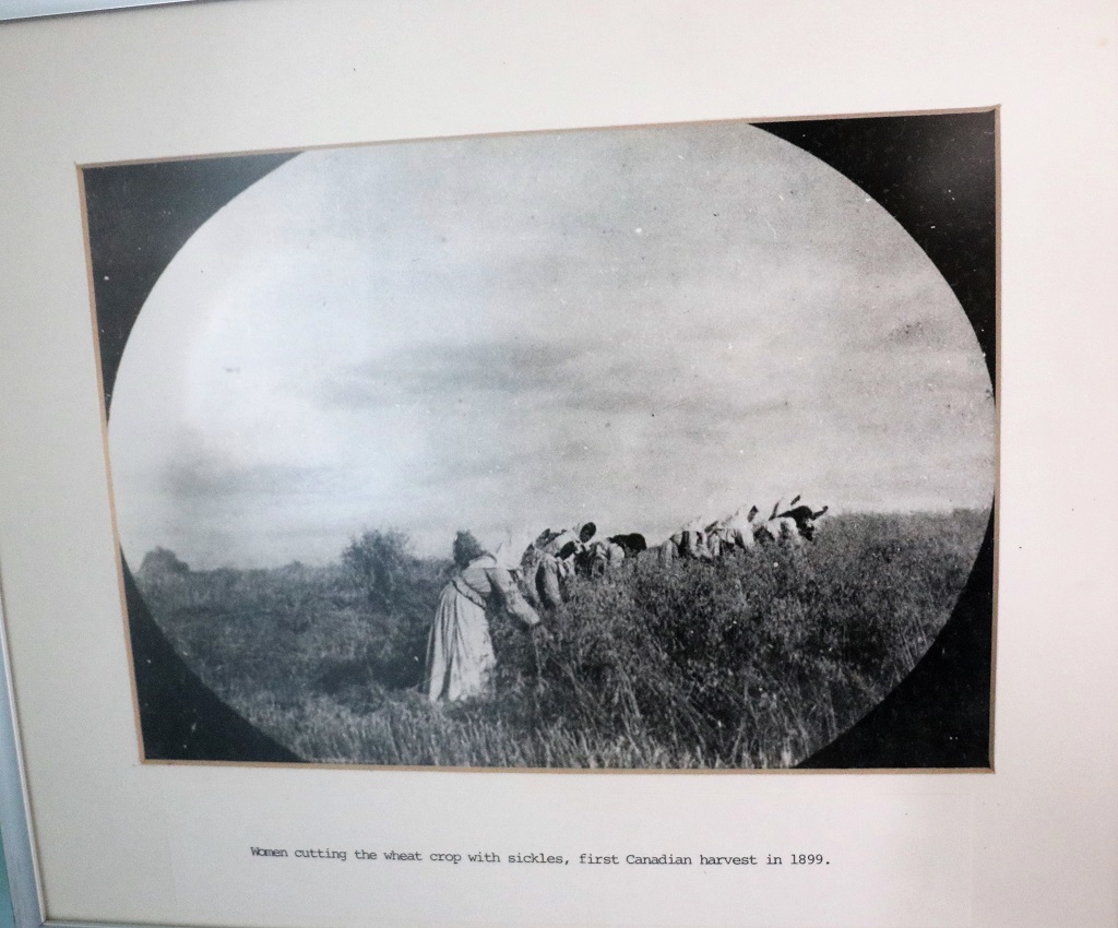
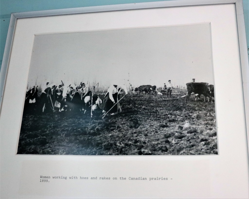
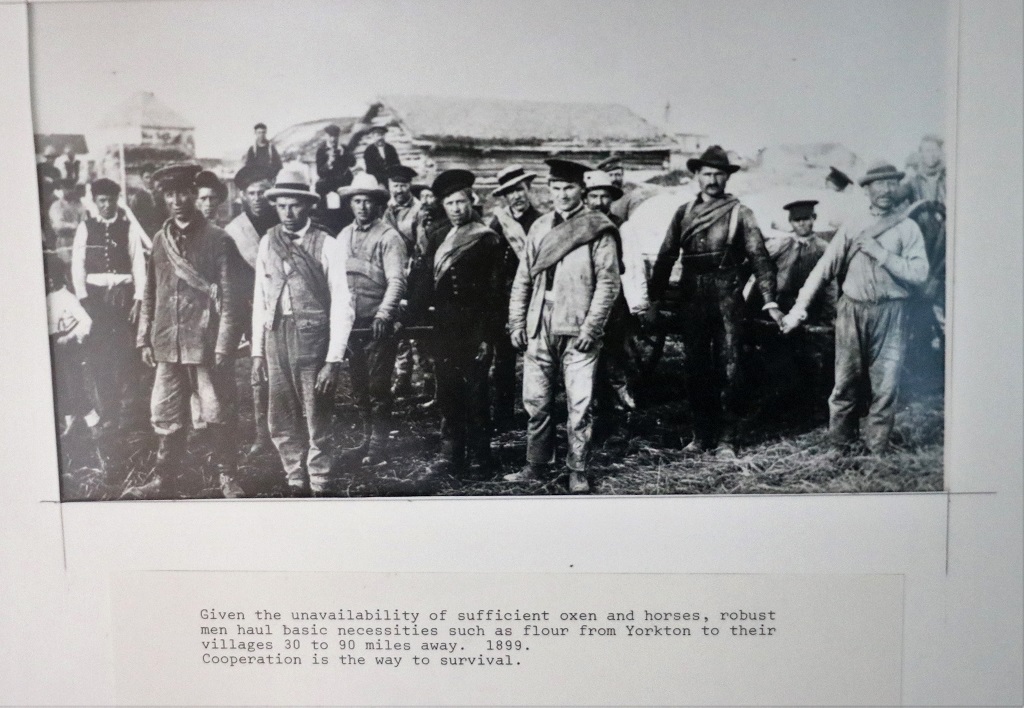
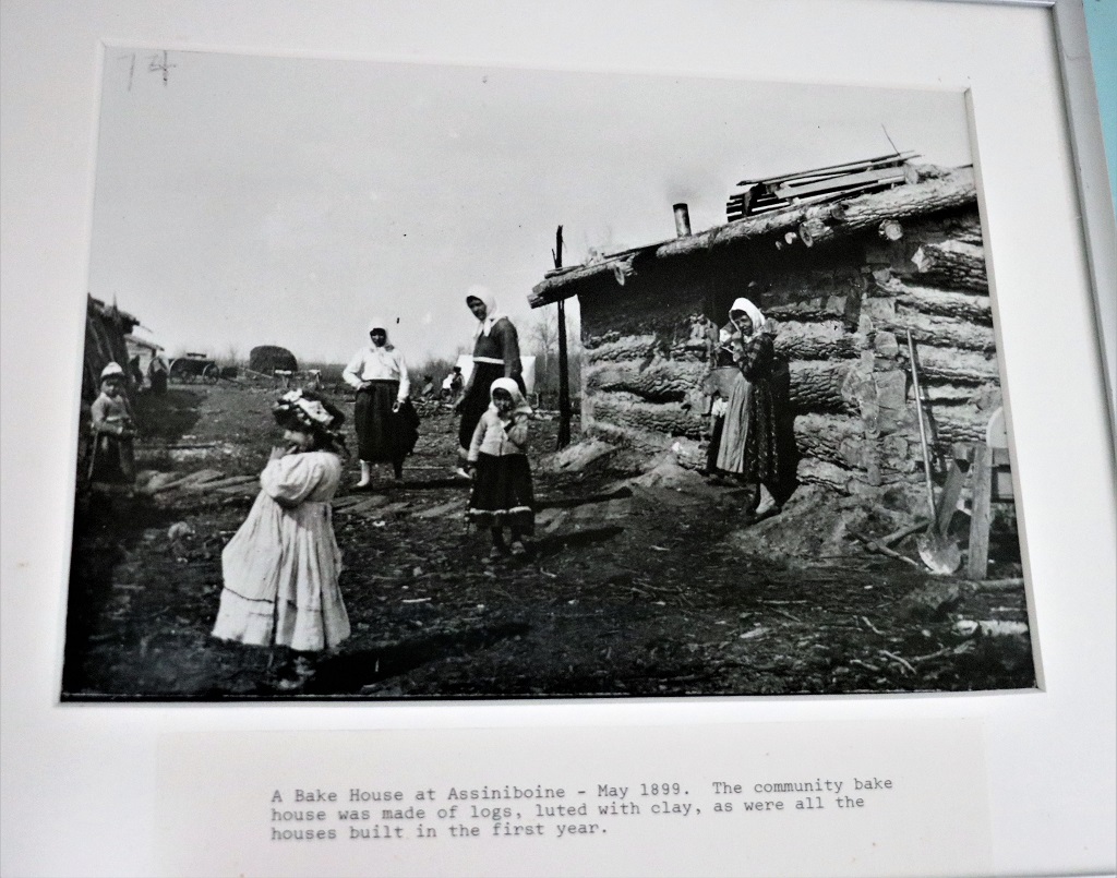
There were old photographs in almost every building and they were an excellent journal of the experience of these early settlers. I do not know who’s idea it was to have a photographer document their journey to and in a new land but there were pictures right from the emarkations point in Russia, on board the ship, and working the new land. I have added quite a few of them below. The titles are on each and I think are clear enough to read. Just like the Ukrainian immigrants these people worked very hard to make a new life in a new land.

Without horses or oxen the men (and sometimes women also) pulled the wagons. Note: they were hauling a TON of flour for miles.

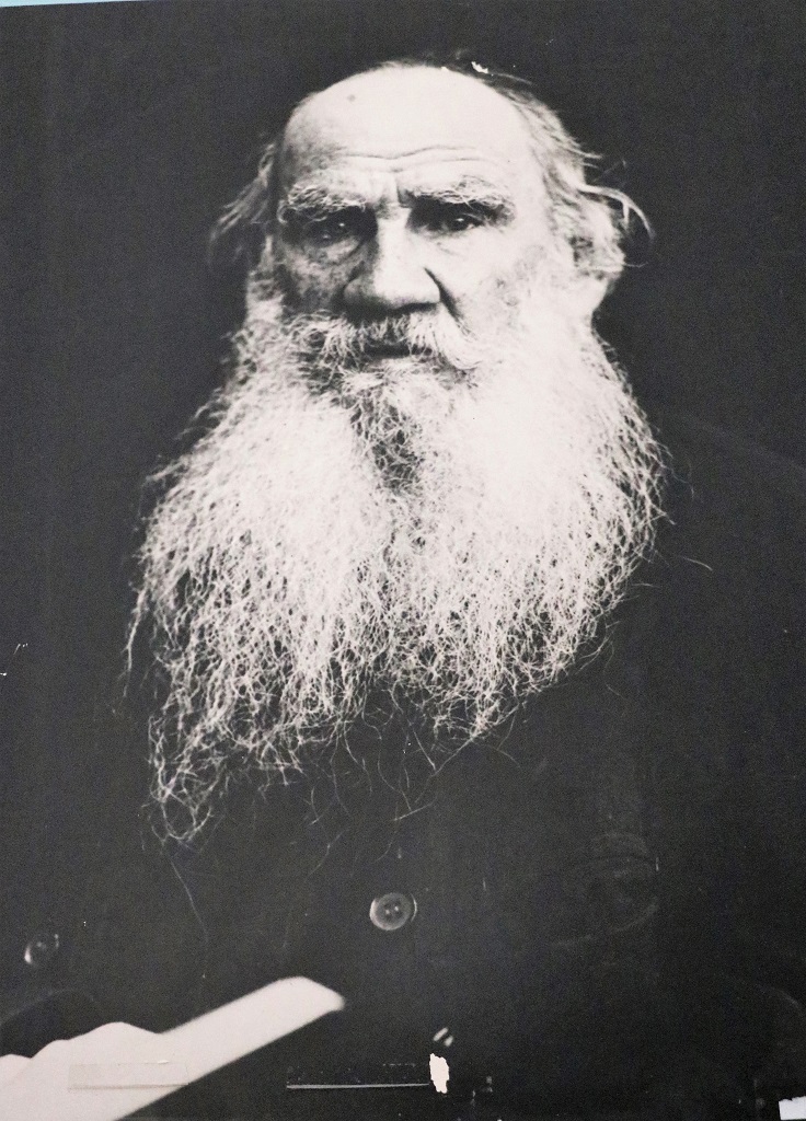
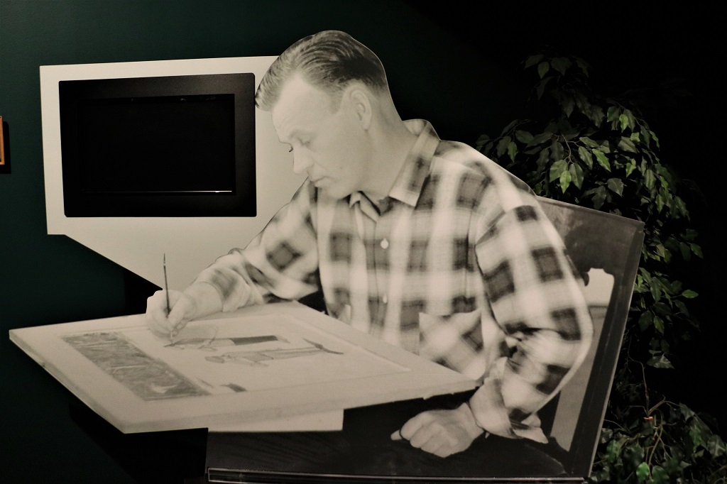
Leo Tolstoy – author of War and Peace and Anna Karina which are often regarded as among the best novels ever written.

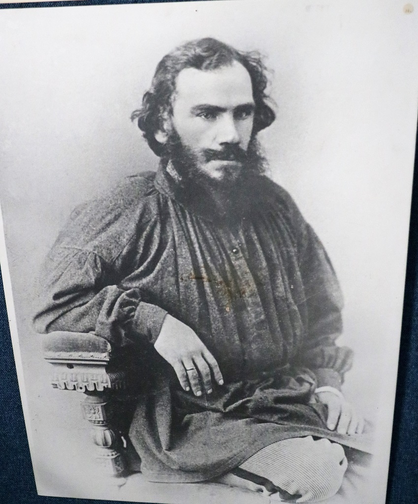
Even as a young man Tolstoy had his distinctive beard. And very fiery eyes.

We left Verigin at 4:15 and arrived in Yorkton at 5. Tomorrow we will tour their branch of the Western Develoment Museum before crossing to Manitoba.

Day 17 – June 23 – Prince Albert, SK to Humboldt, SK.

Today was a Plan C day. We were going to leave Prince Albert and drive to Flin Flon, Manitoba but when John looked at the available hotels he discovered there were only two. The one with the better rating had comments like, old, tired, not very clean and cost $85 per night. The one with the poorer rating cost $220 a night and all the comments complained about how overpriced it was. Flin Flon is not a big place and there is not really anything to see there, we were only going because it is about the most northerly place of any size in Manitoba you can drive to and why not go when you can? However we decided we did not need to spend $220 per night plus, I am sure, inflated food and gas prices so we decided not to go. This changed two days of our itinerary as we were going to go to Swan Lake tomorrow after staying in Flin Flon. John could not find any hotels in Swan Lake which would have necessitated a VERY long driving day from Flin Flon to Dauphin. So now we had two days with no plan, therefore we created Plan B.

Plan B was to putter around Saskatchewan east of Prince Albert and basically spend a day driving around the area going to Nipawin, Tisdale, Melfort, and then spend the night in Humboldt (which is only about an hour and a half east of Saskatoon). The next day we would do a bit more touring around and spend the night in Yorkton.

Our friend Nolan that we had visited in Saskatoon, and the lady at our hotel said we should go to Lake Wasekesiu which is in Prince Albert National Park about 90 km north of town. She said, “It’s like Banff, only without the mountains and the people.” Since we were just having a driving around day anyway we decided we may as well drive up there. Then I was looking at one of my map books again realized that on our way up to Prince Albert we had passed the Batouche Historic Site that I wanted to see. We were too late yesterday to stop anyway but today we would have time so we decided to backtrack after visiting Wasekesiu. Thus we instituted Plan C.

Prince Albert is the last major town in northern Saskatchewan and it is really located about half-way up the province. Once you drive past Waskesiu the road soon turns to gravel and there are only a few small, isolated communites before you are in tundra. Northern Alberta and Manitoba are the same; techniqually not really north but as far as you can navigate. “Northern” Ontario and Quebec are even further south because the majority of those two provinces are covered with the rocky Canadaian Shield.

I wasn’t sure what the lady at the hotel meant when she said the Lake Waskesiu was “like Banff without the mountains and people.” We figured that referred to a lake surrounded by trees, which it was but with a gorgeous sandy beach added. However as we drove around we realized she was probably referring to the popularity of the park as a vacation spot. There were cabins, and condos, and a golf course (which was hosting a Canada PGA tournament this weekend), tennis courts, a huge play ground and all the amenities of a holiday place.

I checked my geocache map and saw that Parks Canada had hidden six new caches, four of which came up for finding yesterday. We went looking for them and found three of the four so got First to Find, which is always cool.

The second cache we looked for was up on this little hill. By the time we located it and hiked back down it was lunch time so we settled on the truck tailgate to eat. Within a ten or fifteen minute period nine RCMP trucks, 8 of them towing boats, drove past. I have no idea what would necessitate such a large presence of patrol boats. The lake is large and connected to two others but that seemed very excessive to us.

Prince Albert National Park is the only fully protected nesting grounds of the white pelican. Due to a steady current at The Narrows the ice remains thin all winter and there is often open water early in the year which is utilized by many migratory birds. Over 200 species have been documented.

Canada Anemone

We headed back to Prince Albert via the old road. We had been told there was a good chance of seeing wildlife on this road and we had a coyote and a deer cross in front of us. Too quickly for me to get a photo though unfortunately.

We arrived at the Batoche Historic Site at four. The Interpretive Center closed at 5, but you were still allowed to walk the grounds. The place was much larger than we had thought so we did not walk the long trails to see the rifle pits, or the Caron House (which would have been locked by the time we got there anyway), or some of the other battlefield areas.

Batoche was a Metis trading and farming community and was also the sight of the final battle of the 1885 Rebellion. The Metis and First Nations people, under the leadership of Louis Riel, had been petitioning Ottawa for more equality from the Government in matters of land and other discriminatory laws. Sadly the issues came to armed conflict and remained unresolved for many, many years. Louis Riel was tried for treason and, although the jury recommended mercy, was executed by hanging.

We went through one of the art galleries and the historical room before the center closed and still had time to see the inside of the church and rectory before they were locked for the night.

The art gallery showcased some lovely ‘rug’ art. My mother used to make little round floor mats like this but these were pieces of art. Someone must do a demonstration of the technique because there was a partially completed one on a table.

The Metis settlers were mostly devout Roman Catholics with added elements of First Nation spiritualism. The Rectory was built first and was home to the priest and his assistant. There was also a room set aside soley for the use of the Bishop when he visited once or twice a year.

The Rectory was also the community post office and the priest was the postmaster. The post office was on the second floor. The first floor entry was a large area with chairs and a divan. It was used as a waiting room, both for people wanting to see the priest about some matter, but also for people who needed their mail read by the priest as very few people were literate.

This is the priest’s original library. These books would have taken a long time and cost a lot to acquire and transport into the wilds of the west. They are not all religious texts as he had interests in astronomy and other things as well.

Also on the second floor, along with the priest’s bedroom and office library, and the post office, was a small chapel that the priest could use for his private devotions. Before the church was completed this tny room was also used for mass.

In 1996 Parks Canada located and purchased the original Harmonium that was in the choir loft and had it returned to the church. It had been purchased years ago at a cost of $50. A harmonium is a reed organ with sound produced by foot bellows. There are no pipes; pitch is determined by the size of the reed. The young Parks Canada fellow were were chatting with took John up and struck a few notes on it. He cannot play the piano but he was tickled to play the harmonium. John took a turn as well. The instrument is played regularly to keep the reeds from drying out and shrinking.

At the cemetery there was a little shed with information on a few of the families whose names you see often on graves. The cemetery is still used by local people or people with historic family ties to Batoche.

The children were born in 1952, 1953, 1954, 1955, 1957, and 1958. So unbelievable tragic.

We left Batoche at 5:30 and had almost an hour and a half drive to Humboldt.

Therre are so many ponds and small lakes up here that we drove numerous sections of road right through the middle of them.

You know you are in farming country when….

We arrived in Humboldt a little after 7 and had a delicious dinner at the Bistro in the Pioneer Hotel on 9th Street. It was recommended to us by the lady at our hotel and did not disappoint.

Day 16 – June 22 – Saskatoon, SK to Prince Albert, SK

Today ended up being somewhat different than we had planned. We were going to check out of our hotel, go to the Ukrainian Museum of Canada, which was just down the street, then go to the University of Saskatchewan Saskatoon Campus to tour the Diefenbaker Canada Center which we had been told housed plans and drawings of the Canadian Avro Arrow airplane project, and then head an hour and a half north to Prince Albert and perhaps do some geocaching for the rest of the day.

But, we did not leave Saskatoon until after 4 PM, so arrived in Prince Albert at 6 which was time to check in and find dinner. Two things changed our plans and gave us instead an awesome visiting day. First was a message first thing this morning from a dear friend of ours saying that their son, who is going to the university here to become a vet, was still in Saskatoon working on a project with bison and we could probably arrange to see him after work at 2 PM. We have known Nolan his entire life so were quite happy to arrange to see him. We were sure we could amuse ourselves until he finished work today.

We continued with our original plan after breakfast and went to the Ukrainian Museum. There were three rooms. The first was full of historical maps of the Ukraine dating back to the mid-1600’s.

The second room featured twelve paintings of the life of early Ukrainian settlers to Canada that were commission from the artist William Kurelek by the Ukrainian Women’s League of Canada. I did not photograph any of them as they are original artwork and I am sure would be under copyright.

The third, and largest room, displayed gorgeous clothing, woodwork, carpets, Easter eggs (Pysanka) and other items made by some of the local or pioneer Ukrainian people. There were also a series of cards that told the immigrant story. I am only inserting the seven that tell the basics of the story for all the new immigants that came to Canada between 1892 and 1914.

A close up of the tiny embroidery stitches. Girls were taught to embroider from a young age.

Incredibly detailed embroidery on this priest’s robe.

And on this headpiece.

The second thing that changed our plans was John saying he wanted to stop at the Presbyterian Church and see if the minister was in today. Roberto had been a summer student for us one year while going through seminary and then had accepted the call to St. Andrew’s in Saskatoon. And, yes he was in. He had a short meeting to finish so we went across the street and sat in the park until he was done.

The Vimy Memorial to commemorate the Canadian servicemen who fought at Vimy Ridge in WWI.

When Roberto finished his meeting we went for a long lunch and caught up on each other’s news. By the time we were done it was almost 2 o’clock and we were expecting a message from Nolan about when and where to meet him. We went over to the campus and found the Diefenbaker Center which had good information on his political career and accomplishments as Canada’s 13th Prime Minister but nothing on the Avro Arrow that we had been told was there.

John Diefenbaker and his second wife Edna who are both buried not far from the Center on the University grounds. Diefenbaker was born in Saskatchewan and received his law degree from U of SK

He set up the Diefenbaker Canada Center himself and bequeathed all of his souvenirs, letters, and journals to the University. This is a replica (or could be the original furnishings) from his office as Canada’s Prime Minister.

His Cabinet Room.

Just as we were leaving the center we recieved a text to meet Nolan at the Veterinary Medical building at 3. Perfect timing. That gave us 10 minutes to find it.

We had a nice chat as he took us on a walking tour of the area of the campus he frequented. Beautiful white stone and blond brick buildings.

Tje Veterinary Medical Building.

The Administration Building. The cornerstone was laid by Sir Wilfred Laurier, Canada’s Prime Minister from 1896-1911.

So all the unexpected, and wonderful visiting made for a lovely Plan B. We left Nolan at 4 and headed to Prince Albert for the night.

Day 15 – June 21 – Saskatoon, SK

We drove past the Bessborough on our way to the Western Development Museum so I was able to get a bit better shot of it today. And in the museum there was a photo of it during construction.

Saskatoon also has some pretty modern buildings as well.

My apologies to the Western Development Museum in North Battleford. If it is half as good as the one in Saskatoon we may need to go back and visit. The four branches of the Western Development Museum are in North Battleford, Saskatoon, Yorkton and Regina. There are over 75,000 artifacts that explore Saskatchewan’s story from settlement to the present day.

This Blairmore Ring was on display outside the museum. We had learned about the huge potash deposits in Saskatchewan on our cross-Canada trip in 2014 when we stopped in Esterhazy.

We spent well over two hours in the WDM this morning and loved every minute of it. As soon as you step through the entrance doors you are in ‘Boomtown’. Saskatchewan boomed with economic activity from the turn of the century to 1914. Landseekers flooded the west and towns grew almost overnight. 1910 Boomtown is an indoor representation of a typical Saskatchewan town, and recaptures the atmosphere and style of this bustling period through 30 typical town buildings with accompaning ‘vehicles’ on the street.

All of the buildings were full of the appropriate items beautifully displayed and the various wagons, buggies and early automobiles added an authentic touch to the street. It was awesome!

This Marquis wheatstraw weaving was created by Mr. A.R. Rhodes of Zelma, SK in the 1920’s.

A Penny Farthing bicycle. So called because the sizes of the wheels were reminiscent of the difference in size of the two British coins.

If there is a fire engine, John will check it out thoroughly.

The walls of the watch and clock shop were covered in tick-tocking time pieces.

And there was no shortage of pocket watches either.

Just to keep us wandering there were off-shoot galleries. The first we went through was old cars. Just like the Boomtown street I took a ton of photos but I have narrowed my blog selections down a lot.

I do not like brown at all but I loved this bronzy-shade 1959 Cadillace Coupe de Ville. Factory price was $5,250. 21,924 2-door hard tops Coupe de Villes were built. Two doctors won this car in 1959.

A Minneapolis-Moline UDLX Comfortractor. A 1938 tractor with closed-car comfort. Suitable for field work during the day and a trip to town in the evening. The headlights permitted round-the-clock use.

A 1908 McLaughling Surrey.

At the end of the street was a large section with a lot of old tractors, threshers, etc. I sat on a bench and rested my feet while John took a look.

The last gallery was the Saskatchewan story and covered everything from the beginning of settlement to the electric era. Lots and lots of interesting things and stories. It was amazing how many hardships those early people suffered through.

Every homesteader’s first house – the one-room soddy.

As well as the Spanish flu there was the dustbowl of the 30’s, the Great Depression, a break-out of foot and mouth disease that caused the slaughter of thousands of cattle, and equine encephalitis. Not to mention the long distances from neighbours, lack of education and medical help, flies, dust, mosquitos, etc., etc., etc. I am so happy I was born much later. My hat is off to these people.

We had lunch in the parking lot and then headed off to see the zoo at the former Forestry Farm. The park was originally established as the Dominion Forest Nursery Station and later Sutherland Forest Nursery Station. Between 1913-1966 it was responsible for growing and shipping 147 million trees across the northern prairie provinces. The first shipment of trees were sent to farmers in 1916. The nursery grew caragana, ash, maple, elm and willow. After the nursery closed in 1966 a portion was re-opened as a city park. It is now a National Historic Site.

In 1964 the Golden Gate Animal Farm ran into financial difficulties and the city agreed to acquire the animals and equipment. The zoo was then relocated to the Forestry Farm Park.

We knew we were going to the zoo at the wrong time; mid-day on a sunny day. We feared the animals would be in their shelters taking naps and this proved to be the case. Also all of the birds have been removed to protect them from the current outbreak of Avian Influenza. We saw glimpses of the bobcat and lynx in their ‘caves’ but almost all the four-footed critters were at the back of their large compounds in the shade lying down. It was quite expensive for a zoo with only 80 species and we had to do a lot of walking to see not very much. Still it was a pleasant afternoon stroll which we would have enjoyed a bit more if we were not so foot-sore from the museum.

They have a fund-raising campaign to build a bigger enclosure for the two grizzlies and they need it.

There was no shortage of Canada Geese around the park.

The only primates were four or five Goeldi monkeys.

There were two normal brown Plains Bison and this ‘White’ one.

The only other animals we could sort of see were these two Mouflon Sheep and their half-grown kids.

We headed back to the hotel and rested before dinner. Tomorrow we plan to visit the Ukrainian Museum of Canada, which is just down the street from our hotel and then go to the University campus to the John Diefenbaker Center to see the plans and model of the Avro Arrow plane. After that we will drive north to Prince Albert for the night.

Day 14 – June 20 – North Battleford, SK to Saskatoon, SK

We planned to visit the North Battleford Historic Site. That is why we came to North Battleford. Unfortunately it is only open from Wednesday to Sunday. The only other thing I thought we may go visit was the Western Development Museum. There are four of them in Saskatchewan, each one with a different theme. The North Battleford one was farm equipment. Since John and I both grew up on farms and we have toured quite a few museums with farm equipment we were pretty sure there would be no surprises there, so we went to the Visitor Center to see if there was something else. Turns out the Visitor Center is located in the Fred Light Museum which I had written down to check out but could not really find a lot of info on when I was looking at things to see and do in North Battlford.

The museum is housed in the former St. Vital Public Catholic School. The first building was erected in 1887 but by 1911 a larger buidling was needed. Fred Light was the son of a pioneer Mounted Police family of old Battleford. He was always very involved in the preservation and restoration of western historic artifacts and amassed one of the most comprehensive collections of firearms in Western Canada.

Because the buiding was once a school, the collections are displayed by themes in each room. There was the Battleford Room, an Old General Store room, a School Room, a Veterans Room, Gasoline Alley and the Gun Room,

Notice the painting of the young girl on the base of the lamp in the middle.

It is a lot easier to buy your butter from the store than to have to make it with these things.

Look, some of these are BC Okanagan apple boxes.

A painting of the Battle of Batouche which took place north of Saskatoon during the 1885 Rebellion.

Northwest Mounted Police patrol wagon.

The Veterans Room had one of the most impressive displays of uniforms I have ever seen. All branches of the military from WWI and WWII and the 1885 Rebellion were beautifully displayed. There was a wall-length cabinet of military badges that a fellow had collected and donated! Hundreds of them. It was really impressive

The most impressive room, though, was the Gun Room. Display case after display case of rifles, ammunition, revolvers; even one of swords, sabers and knives.

The cannon is a working model.

I think these may have been the oldest firearms in the collection. They are, from top to bottom: Portuguese Matchlock. Circa 1600’s. Belgian Flintlock, 64 caliber, 1762. London Cap and Ball, 64 caliber, 1762. Arabian Snaphaunce, 50 caliber, 1700. Virginian Squirrel, 38 caliber, circa 1830. And a Japanese Matchlock, 50 caliber, 1645.

After we left the museum we did a geocache Adventure Lab that took us to some of Battleford’s historic buildings.

The Town Hall and Opera House was completed in 1912 for a final cost of $40,000.

The Post Office is the second longest continuously run post office in Canada and the oldest post office in Saskatchewan. It was constructed in 1911. The town clock was installed in 1914. In 1987 Canada Post issued a 72 cent stamp to commemorate the heritage value of Battleford Post Office.

The Court House was built in 1907. It is still used by the community in its orginal role. The Court House is connected to the former Land Titles Building, also constructed in 1907, which is now a Municipal Heritage Building.

The final building was on a hill out of town. It was the Land Registery Office constructed in 1877.

As we were driving back down the hill to rejoin the highway and head to Saskatoon, John saw a sign for The Ridge and thought it was maybe a housing area so he turned off and went to see what was there. Turns out it was the original site of another historical building – Government House.

Government House. Between 1877 and 1883 the North West Territory, an area then comprising over two-thirds of Canada, was administered from this location. The building contained offices and chambers of the territorial council as well as the eight-room residence of the Lieutenant-Governor. It was damaged and looted during the 1885 Rebellion when it was the base of militia operations. After the territorial government was moved to Regina the building became one of Canada’s first Industrial Schools. The school was closed in 1914 due to increasing operating costs and the growing doubts over the wisdom of having off-reservation education. The Seventh Day Adventist Church rented it for $5 per year but had to do all the maintenance and renovations. They did extensive additions including a third story. The academy taught Grades 1-12 and closed in 1931. The remaining years were spent in the care of Oblate priests who bought it in 1931 and turned it into a seminary and St. Thomas College for Grades 9-12. By 1972 it was reaching the end of its useful lifetime and the order built a new seminary building on the property. The Old Government House burned to the ground in a vandal-caused fire June 7, 2003.

It rained off and on all the way to Saskatoon. We only stopped to have our lunch, find a couple of geocaches, and do a short tour around the town of Biggar. Love their town motto.

We did not drive this road today. We found a geocache at the turnoff and in the description for the cache it said to drive a little further and you would have a nice view of the road going south. And we did.

We arrived in Saskatoon at four, checked into our hotel, sorted a few photos and went for dinner at the hotel’s Irish Pub. (Sadly for John, they did not have Guiness on tap and he had to settle for a bottle. He was a bit disgusted that it wasn’t served in a Guiness glass though – it was a Kokanee glass.) After we had finished eating the sun came out. Our hotel is right across the road from the lovely, long Kiwanis Memorial Park that stretches along the South Saskatchewan River.

The Delta by Marriott Bessborough Hotel. The 10-story Bessborough opened in 1931. It was built for Canadian National Hotels, a division of Canadian National Railway and is considered one of Canada’s grand railway hotels.

University Bridge across the South Saskatchewan River.

Tomorrow we see some sights in Saskatoon.

Day 13 – June 19 – Cold Lake, AB to North Battleford, SK

We left Cold Lake under sunny skies at 10:20 this morning and arrived at our hotel in North Battleford at 6:20. It is normally about a 3 hour drive from one place to the other and we really did not intend to take as long as we did to reach our destination. We just ended up wandering around some back roads trying to find the road to the historic Fort George & Buckinghmam House fur trading forts.

I had a route planned to follow today, but I looked closer at one of my map books and saw two historical sites that were not a large distance out of our way and since we had lots of time we decided to go with Plan B and check them out. So instead of heading due east out of Cold Lake we headed SW to Bonnyville. From there we were to take one of the numerous Range Roads that criss-cross the prairies and get to the location of the forts. Sadly our maps were not detailed enough and the Alberta Government seems to think everyone knows where all the roads lead so has not posted very good, if any, directional signs at intersections.

But we were not terribly put out as this was to be a backroads type of trip anyway, we just did not plan to see quite as many of them today as we did.

There are sizable lakes and ponds all over the place in these parts of northern Alberta and Saskatchewan.

John saw this patch of white fluff and turned the truck around so we could get a photo of it. I don’t know what the plant is, but it certainly had a lot of seeds to blow in the wind.

We finally found our way to the forts and walked through the interpretive center before following the path to the former sites of the forts run by the North West Company (French) and the Hudson’s Bay Company (British).

There was lots of interesting information on the placards in the interpretive center but I have chosen only the ones that talk about the fur trading and left off all the descriptions of the forts, etc. Not nearly so many information pics today. (Thank goodness you all say.)

In 1792 North West Company and Hudson’s Bay Company pushed the fur trade west along the North Saskatchewan River and built competing forts at this site.

Beaver pelts were used as currency during the fur trade years. Goods were traded by value according to the number of beaver pelts it took to purchase them. If you have ever seen one of the famous Hudson’s Bay blankets you may have noticed some lines extending in from the edge of the upper corner. Whatever number of lines are stitched into it tells the number of beaver pelts you would need to trade to buy that blanket.

It was a nice walk through the woods to the site of Fort George. It was quite a bit larger than the Hudson’s Bay’s Buckingham House fort. The forts were major trading centers for about 8 years. Fort George was abandoned in 1802 and burned to the ground sometime before 1809. There have been extensive archaeological digs at both sites.

The two forts were only about 500 meters from one another and in between they built what they called “The Plantation”, where they erected tepees to provide lodging for the aboriginal traders to stay in while conducting business at the forts.

The Buckingham House site had a large patch of wild strawberries and there were quite a few ripe ones so we enjoyed a nice treat.

The Alberta Provincial flower – the wild rose.

Bunchberry

Canada Mayflower. This may be a delicate, small blossom but the perfume in the air was lovely as you walked past the patch on the trail.

We made a short stop to find an Earthcache at the Windsor Salt Works near Lindbergh. The informatin on the Earthcache said: “Most of the Windsor-brand table salt that we use to season our food is actually not mined in Windsor, ON, but in Lindbergh, Alberta. This mine produces about 400 tonnes of rock salt per day.

In 1946 companies drilling for oil and gas accidently discovered a thick bed of rock salt. The deposit is located 1100 meters below the plant. They draw nine million liters of water per day from the North Saskatchewan River and then pump it down wells to the salt beds. The water warms as it descends, dissolves the salt and is then pumped up another well. Each 10 liters of water carries over 2.75 kilograms of salt, which is pumped into large pans and steam-heated in evaporators until 99.8 per cent pure salt is left. The Windsor company believes there is enough salt beneath Lindbergh to last another 2000 years.”

There was a pretty little creek that ran on both sides of the road where we stopped to find the Earthcache.

There were two lovely herons at the creek. I didn’t get a picture of either of them, but John got this nice shot of one.

This fake eagle was atop a very high pole beside the road. No idea why there would be a need to do this, but there must be one. It would not have been cheap or easy to erect this.

All our wandering around today even had us back on gravel roads for awhile.

All Saints Anglican Church that was not near any town.

Our last stop of the day was at a National Park’s Historic Site that marked the last battle of the 1885 Rebellion.

It was a longer day than we had planned and we spent much longer on the road than we expected but none-the-less we enjoyed ourselves. Tomorrow we will tour the North Battleford Historic Site and then head south to Saskatoon. We had planned to visit Saskatoon on our drive across Canada in 2014 but there was a big music festival going on and there were no hotel rooms available. We decided to venture a bit southward on this trip to see some of the things we wanted to see in 2014, and then will head north again to Prince Albert in a couple of days.

Day 12 – June 18 – Cold Lake, AB

WARNING! WARNING! We spent almost three hours in the Cold Lake Museums. This is a very long blog, you may to want break it up into smaller reading bits. What can I say, I love museums.

The museums are located in the old radar station and are comprised mostly of CFB Cold Lake history, with an Oil & Gas section, a Heritage section and an Aboriginal section. There will be LOTS of photos of placards as I am too lazy to write down all the stuff I find interesting. The good – or bad – thing about taking the photos in a place like this is I get to choose the things that I like or find interesting. I bet if you looked at John’s photos there would be all-together different images. And, unusually, he took more photos today than I did.

We woke to steady rain but by the time we left the building at 2:30 it was sun and cloud. There had been a thunderstorm alert posted, but it never materialized.

Outside the building is one of three former big white globes. These covered the radar dishes. The one inside the this globe, which has been moved to side of the parking lot, still has the dish that collected data on width. The height one is inside the museum and the third one we saw yesterday at CFB Cold Lake.

It was not possible to get a photo of the dish as it pretty much filled the whole globe.

This is what the station looked like during its heyday. Note the long ‘corridor’ between the main building and past the radar dishes to the end. The rooms for Oil & Gas, Heritage, and Aboriginal Museums offshoot from this corridor. It is 724′ or 221 meters long and you walked the length of it to see the three display rooms and back again to exit the building.

The first room we entered was the old radar room. There was lots of different equipment lining the walls and information on how the radar system works.

The ‘height’ radar dish.

Radar scanners.

Every black dot and every ‘globe’ is a radar site. You can see they extend the full length of Canada’s northern coastline, even into Alaska.

How could you ‘forget’ to build the control tower at an airbase???

4 Wing CFB Cold Lake from the air circa 2019.

My favorite thing in this room was the ‘lavatory roll’ survey. Apparently some brilliant supply officer decided the Department of Defence was using too much toilet paper and issued a directive that the use be monitored so it could be determined if ‘they were getting their money’s worth.’

I have included the most pertinent correspondence written over the 9 months of this important survey. They are worth a read if you want to take the time. I still chuckle over the absolute absurdity of this and can only imagine some of the ‘reports’ that were submitted.

They had four former soapboxes on display. My two favourites are below.

The museum had displays about pretty much everything that happens and every service branch and squadron at the base. It was really well done.

The Dutch word for this French designed, Unmanned Aerial Vehicle translates to Sparrohawk. It was primarily designed to carry a Forward Looking Infrared payload. It saw active use in Canadian Forces missions in Afghanistan.

This large CFB Cold Lake crest is carved from wood.

The page below had fallen off the wall and was partially hidden behind an artifact. I was able to photograph this section which tells the beginning of the story that led to Charles Sweanor’s capture and subsequent roll in “The Great Escape.”

The photos of the 50 men who were executed were taken from German identification photos. The painting was done by Flight Lieutenant Ley Kenyon. His story is below the Great Escape stats.

A Sidewinder Wing Pylon & SUU-20 Bomb Dispenser.

John and I were both surprised at how small the bombs were in this thing considering how much damage they can do.

There was an entire wall of paintings by a Cold Lake artist and former member of 410 Cougar Squadron of CFB Cold Lake. Jim Belliveau, from 1993 to the present has been responsible for the design (and in most cases the actual painting) of over 50 aircraft paint schemes on over 10 different aircraft. We could not tell whether these were design paintings or images of the aircraft flying in their finery. The Canada 150 airplane design is on a T-shirt in the gift shop.

What happens when a large bird impacts a CF-18 Hornet windscreen at 600 km/hr and less than 100 m above ground?

One section of the very long corridor that led to the other three museums located here. We came first to the Oil and Gas Museum which was a room filled with large information boards telling about the geology of the area that makes it rich in oil and gas and details the extraction process, etc. I sat on a bench and rested my feet while John looked it over.

There were displays all along the corridor and this machine was sitting in one of them. I had never heard of a Graphotype so I looked it up on Google.

Graphotype was a brand name used by the Addressograph-Multigraph Company for its range of metal plate embossing machines. The machines were originally used to create address plates for the Addressograph system and mark military style identity tags and other industrial nameplates.”

Next was the Heritage Museum which had lots of ‘old’ stuff in it, some of which were things my mother or grandmother used.

A local amatuer historian named Denis Gardner was instrumental in getting the Cold Lake Museums started. He is also a very talented model maker. When he brought his farm, logging and other historical models to the museum he included his pirate ships. I only photographed the one.

There were hundreds, if not thousands, of other items I could have taken pictures of today, but I tried really hard to not photograph everything. I still ended up with 86 pictures and I think there are about 60 of them in today’s blog. John took 116, so I didn’t do too bad.

This Red River cart is carrying a birch bark canoe. I love models and miniatures. People that can make them amaze me, especially when they are so detailed.

When I was a child there was a Black Beauty horse somewhere that we would beg mom to put a nickel in so we could ride it. If you pulled on the reins it went faster. It didn’t have red eyes though. I don’t know why they painted them red.

Pick your shoe size for the cobbler to make your next pair of boots.

I tagged my daughter on Facebook and asked her if she wanted me to get this sign for her. She declined. Weird, I wonder why?

The final museum was about the Aboriginal Dene people.

Of course there were airplanes in the yard, but there we no id plaques to say what they were.

We rested our feet and had a PB & J sandwich and an orange for lunch then headed toward Cold Lake Provincial Park which is a very popular fishing spot.

The Cold Lake area is home to more than 200 bird species and the shores of the lake are important nesting grounds. The lake is one of the largest in Alberta.

We returned to the hotel to go through photos before dinner. Tomorrow we head into Saskatchewan and go to North Battleford.

Day 11 – June 17 – Slave Lake, AB to Cold Lake, AB

We woke to rain and it contined to rain heavily almost all day. Every once in awhile we would drive into a section where it wasn’t raining, but it didn’t take long to get under the clouds again. Consequently we did not get out of the truck very often.

Just before we reached Lac la Biche we turned off Highway 2 and drove 4 km to the Lac La Biche Mission Heritage Site. Even though the signs said they were open and that we should ring the bell to have someone come downstairs no one arrived. We took a couple of photos and as we were heading to the truck to continue our journey we saw a large group of children going from one building to another. All the staff must have been escorting the class on a tour.

The Notre Dame des Victoires Mission began in 1853 in a log cabin beside the Hudson Bay Company post, 6 miles east of the current location. In 1855 they moved to this site to set the property up as a depot for supplying their missions in the Peace, Athabasca & Mackenzie Districts. Within a few years the complex grew to include a convent, church, flourmill and granaries, a sawmill and various storehouses & sheds.

We stopped during a rain lull to find a geocache hidden at the All Saints Ukranian Orthodox Church of Sandy Rapids.

We arrived at our destination for the next two nights about 2:30 and drove out to the Canadian Forces Base.

Construction of what would become known as RCAF Station Cold Lake began in 1952 at the height of the Cold War after a nearby site in Alberta’s “Lakeland District” was chosen by the RCAF for the country’s premier air weapons training base. The chosen location for the base was west of the former Town of Grand Center (now part of the City of Cold Lake), and was based on factors such as low population density, accessibility, weather, suitable terrain, and nearby available land for air weapons training. The facility is operated as an air force base by the Royal Canadian Air Force (RCAF) and is approximately 35 km (22 mi) south of the Cold Lake Air Weapons Range (CLAWR), which is used as practicing grounds by CFB Cold Lake’s fighter pilots. The weapons range spans land in both Alberta and Saskatchewan and covers 11,700 square kilometers.

Candaian Forces Cold Lake Base is an independent town with all of the usual amenities – grocery stores, gas station, sports center, splash park, swimming pool, baseball field, golf course, school, several churches, a family resource center and a large health care facility with ambulance service. We even saw a Tim Horton’s. There are several differnt residential sections plus barracks for the annual cadet camps held from June through August.

Timber wolves, indigenous to the Canadian north where this unit is situated, are well known as skilled hunters and fearless fighters. The three heads illustrate all round watchfulness and readiness, symbolic of the unit’s role. The Motto translates as “Northern Sentinel”.

CFB Cold Lake’s primary lodger unit is called 4 Wing and we saw many places and things like benches with the 4 Wing moniker.

Our drive around the base consisted of stops at a lot of different displayed aircraft. I know as much about airplanes as I do dinosaurs, but at an air force base I guess it would be considered a requisite to photograph a bunch of them.

C-18 Hornet. The air frame for this aircraft was also used by the Royal Australian Air Force, and the Swiss, Malaysian, Finnish and Spanish air forces.

CT-133 Silver Dart, often called the T-Bird, it is easily identifiable by its wingtip fuel tanks.

The CFSA Freedom Fighter was also used by the Royal Netherlands Air Force and the Venezuelan Air Force.

Since this is an Air Force base and not an army base there was not very many military ordinance around. This QF 3.7 inch MK-3 Anti-aircraft gun was the only one we saw. It was built by the General Electric Company starting in 1941. Production capacity eventually reached 300 guns per month. This gun was also built for the UK, Australian, New Zealnd and India Air Forces. In it’s history it has been used by 14 nations and remains in service today by the Nepalese Air Force.

Another Silver Star. These planes were first flown in 1952.

This was my favourite. It just looks so sleek. It is a CF-104 Starfighter. It was used by the Canadian Air Force from 1963-1984. Canadair produced 200 of these planes for use by the RCAF and 140 for Lockheed. The Lockheed version was also purchased and used by Japan, Germany, Turkey and the United States Air Forces.

The CC-129 Dakota was built by Douglas Aircraft Corp in the USA as the C-47. Over 10,000 C-47 Dakotas were built, starting in 1933. During its peak this aircraft was used by over 40 militaries worldwide. Today it is still in use by some, but mostly as a cargo aircraft with small private carriers.

In Canada its primary roll was a transport aircraft, but post WW 2 it was used in a variety of other roles including Search & Rescue, target towing, and as a navigation trainer for CF-104 Starfighter pilots.

This particular airplane entered service in 1944 and after modification in 1962 served in France. In 1967 the plane became part of Base Flight at CFB Cold Lake where it was used as a CF-108 Starfighter navigational trainer, which is why it has a large conical nose which earned it the nickname Pinocchio.

Throughout its service life this aircraft accumulated an astonishing 1,246,666 flight hours. It spent its last 3 years in Winnipeg before being retired in 1989 and moved back to Cold Lake for preservation. The plaque below may be a little hard to read, but I thought it was quite a fondly worded history of this plane.

Before we left the base a couple of hours later we stopped at the viewing area near the airstrip and watched a few of the planes that we had seen take off as we toured around come in for landings. A couple of them did a ‘touch and go’ where they landed and then immediately went airborne again.

This one is rising off the tarmack after setting down briefly for its ‘touch and go’.

Earlier in the afternoon we had seen these two planes rise into the air together and as we were at the viewing area they came in to land together. They set down, one slightly behind the other, at the same time. Awesome flying to watch.

We left the base and headed to Cold Lake to find our hotel but made one more stop to see the two planes outside the Cold Lake Museum; which we plan to visit tomorrow. Both of these planes display a large red X on the tail which indicates that they were training aircraft.

Day 10 – June 16 – Grande Prairie, AB to Slave Lake, AB

We had nothing planned that we were going to stop and see today, but, as usual we found things. I am enjoying this small town, less traveled route so far.

Northern Alberta is oil and gas country as well was farming country and as we left Grande Prairie this morning we saw quite a few jack pumps in the farm fields. I counted 11 in one field.

The growing season is just starting up here.

We went into the bush to find a geocache and I discovered a bonebed. Well not a dinosaur bonebed but the remains of some large animal, perhaps an elk or moose.

A good friend of ours at home was the former minister at the Presbyterian Church in Wahnam, Alberta. This is the old one in a small heritage park that was locked up. I think the one she served in years ago is now a senior’s center.

Another geocache we found today. This was a clever ‘hide’ because it was not hidden at all. The cache owner had made a cute little mailbox and put the cache container into it. All the cars that drove past here every day would never even notice it.

There were many small lakes and ponds beside the road and in the fields, several of them with beaver lodges.

We pulled into an unserviced camping area beside the Smoky River and had some lunch.

When you cultivate and seed farms measured in sections (one mile square) you need a big tractor.

There is a small railway museum in McLennan from the days of the Northern Alberta Railway, so we stopped to check it out – and had an ice cream cone and some mini-donuts.

Well, there was another incentive. Somewhere on this caboose is a nano (size of my little fingernail) magnetic geocache. It has not been found very many times and we did not find it either.

McLennan bills itself as the Bird Capital of Canada because of the large flocks of migratory shorebirds and waterfowl birds that concentrate on the shores of Kimiwan Lake.

We wanted to see St. Paul’s Anglican Church and Rectory but they were both locked. These two buildings have been a part of McLennan for over 80 years. After the rectory basement flooded in 1997 it was deemed unsafe and slated for demolition. A group was formed to save it in 1998 and in 2006 the project was given Municipal Heritage Site recognition.

There were three of these huge lilac bushes at the Rectory. As you can see one of them completely covers the sidewalk. The blossoms were just coming out and the perfume was lovely. The bees were happy too. I do not know which variation of lilac they are. They are more delicate and a much softer colour than at home.

About 25 or so kilometers from Slave Lake a big storm cloud settled overhead and washed the truck for us. The rain only lasted a few minutes and then the cloud moved on.

We arrived in Slave Lake about 5:30, checked into our hotel, went for dinner, then drove out to Devonshire Beach to find an Earthcache. Devonshire Beach is found at the south end of Lesser Slave Lake Provincial Park and is recognized as one of the 10 top beaches in Canada. It is a 1.5 kilometre stretch of natural and groomed sandy beach which is part of a 1500-year-old sand dune complex. Devonshire Beach is a unique environment in Alberta and the beach is an important habitat for rare plants such as the sitka willow, which is adapted specifically for this sandy lakeshore environment.

Owners of Earthcaches like to see photos of you to prove you were there as there is no log paper to sign with this type of geocahe. The coordinates of an Earthcache will take you to a place of geological or natural interest. The description of the cache explains the features of the place where you are standing or that you can see. To claim the ‘find’ you need to answer questions that are related to what you see and what the information describes. We have stopped at a lot of very interesting places to log Earthcache finds. John took this photo of me at Devonshire Beach to post with my ‘found’ entry about the dunes.

Tomorrow we head to Cold Lake very near the Alberta/Saskatchewan border. Cold Lake is home to a large Canadain Air Force base and we will tour it either tomorrow afternoon or Saturday. We are staying two nights in Cold Lake before motoring into Saskatchewan.

Day 9 – June 15 – Dawson Creek, BC to Grande Prairie, AB

We didn’t leave our friend’s place until after 11. It is only a one and a half hour drive from Dawson to Grande Prairie but there were quite a few geocaches along the roadside that we planned to try find.

We are in the northern prairie now with the long straight roads.

After a week and a day we finally entered the next province. Lots of people would do the same distance in a day or a day and a half.

The landscape is now all farmland and flatland.

We pulled into a small park and campground to find a geocache. There was a motorcyclist who had stopped to eat his lunch and he asked if we had seen the big plaque on the rock. The park name was the Sudeten and that was where his grandmother was from.

The Sudetenland is the historical German name for the northern, southern, and western areas of former Chzechoslovakia which were inhabited primarily by Sudeten Germans. The plaque told the story of how the park came to be and why it had that name. It is a little hard to read, but if you zoom in to see smaller sections better you should be able to read it. It is a pretty amazing story.

The community of Hythe needed a new fire hall. The projected budget was $1.2 million. Neither the town or the fire department had access to that amount of money so they drew up their own plans and began to build it themselves with volunteer supplies and firefighters, as well as many community members doing the work. It took a year to complete and came in at 1/3 the cost. There was a geocache hidden in one of the old fire hydrants they had lining the driveway. Apropos for a long-time volunteer firefighter to find.

The community of Beaver Lodge has a large beaver at the entrance to town. John had pulled over to the side of the road to look back and take a picture of it. He also captured the one below, which surprisingly is all in focus with two moving vehicles.

Large grain elevators of different types are near every town and many large farms.

The description of a geocache up ahead along the highway said it was near a new dinosaur museum. I had seen nothing about a museum in my guide books so we decided to go see some more fossils.

First discovered in 1974 by a local high school teacher along the Pipestone Creek, the finding of this horned dinosaur, Pachyrhinosaurus Lakustai, was so significant it led to the creation of the musuem, which opened in 2015 near the community of Wembley. The Pipestone Creek bonebed is one of the densest mass fossil sites in the world. The size of a football field, hundreds of dinosaurs were frozen in time here. With the sheer size and scale of fossils the creek was nicknamed the River of Death.

The Philip J. Currie Museum is named for a renowned Canadian paleontologist.

A model showing what a section of the bonebed looks like.

It is a good thing some of these animals had big bodies because their heads were huge!

This skull shows all the parts the scientists have glued together to make it complete.

There were two sand pits like this where kids (or adults) could use the brushes to expose the fossils. In reality the paleontologists use jackhammers, rock picks, and hammers and chisels to remove the bones.

We had not intended to see more dinosaurs but it was interesting. I don’t think I will go to another museum for awhile. As I said, I am not a huge dinosaur person, but we had the time today, so why not?

We got to Grande Prairie at 5 and moved into Mountain Time again so our clocks are an hour ahead. We called our friend Ryan and arranged to meet him for dinner at a nearby restaurant where we had a great visit until 9. Tomorrow we continue east to Slave Lake, about 3 1/2 hours away.