Category Archives: 2015 Summer – Voyage of the Vikings Cruise

2015 Aug 13 – Day 20 – Zeebrugge, Belgium

I am going to restrain myself.  I promise.  I hope.

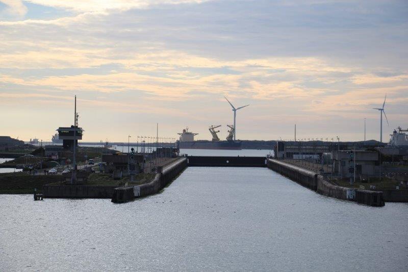
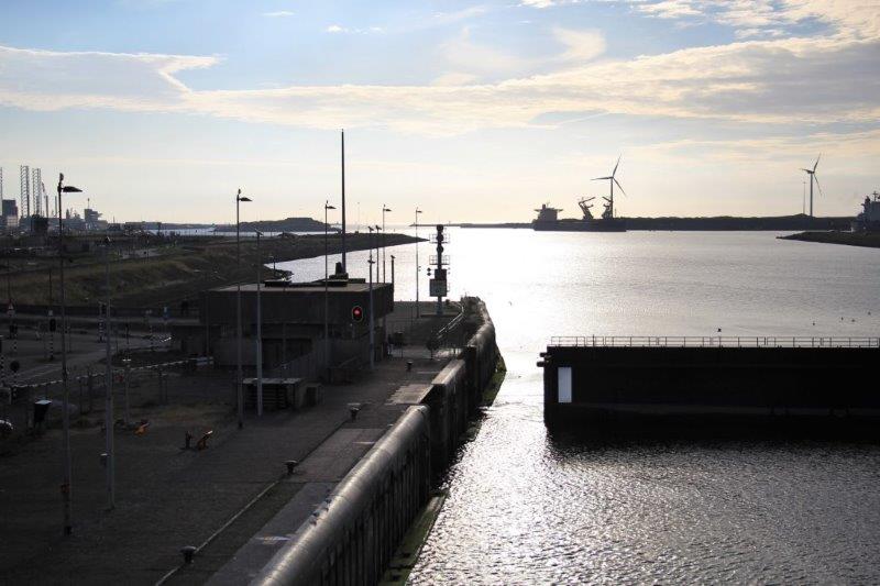
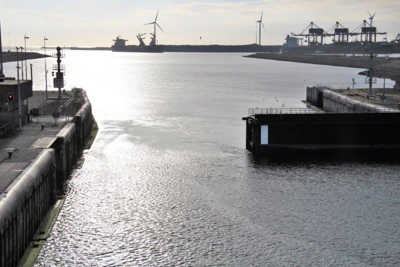
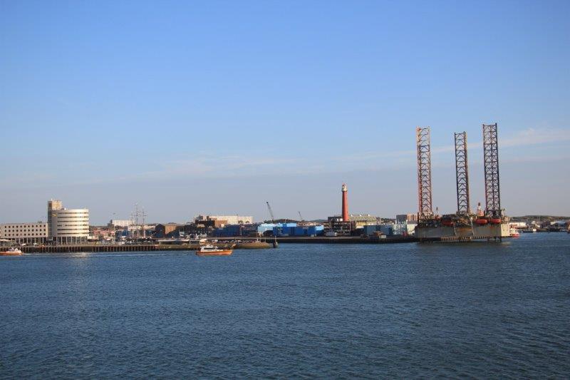
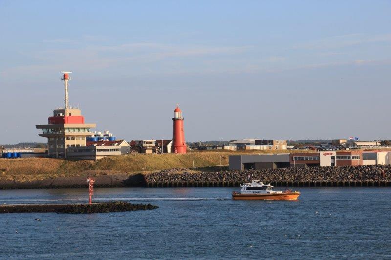
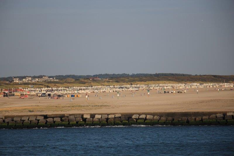
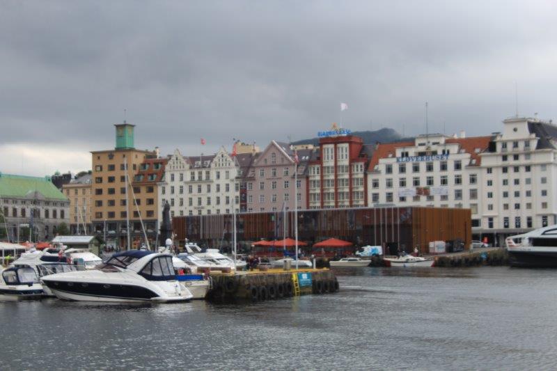
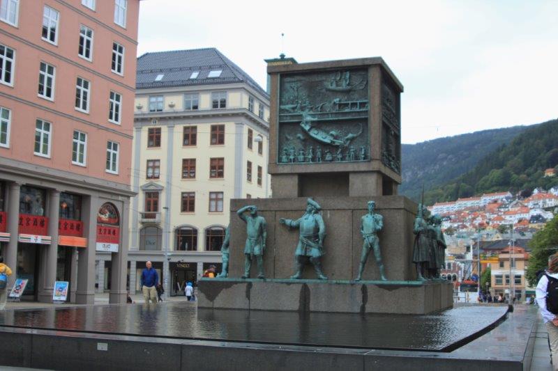
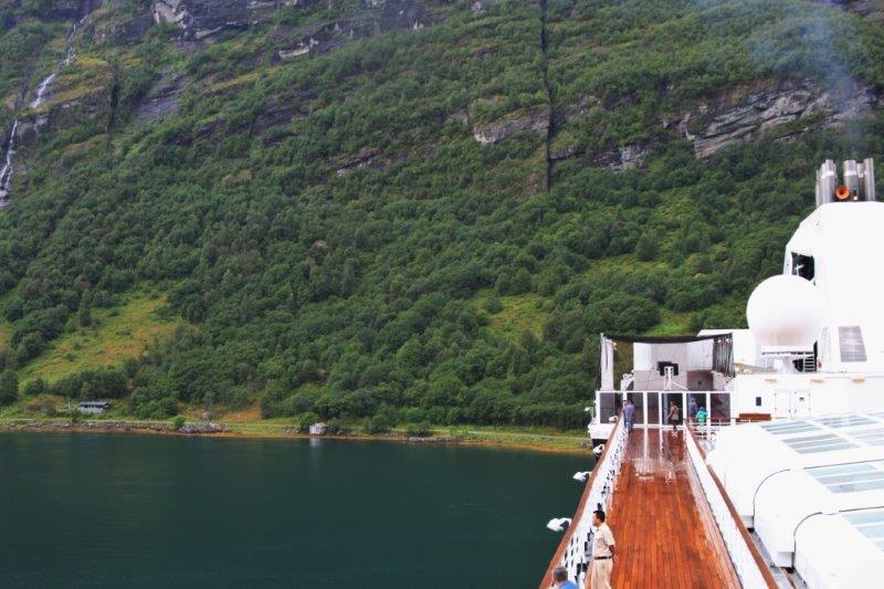
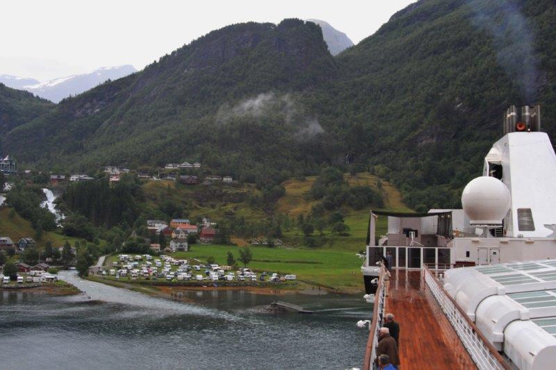
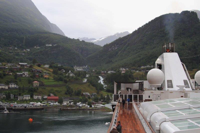
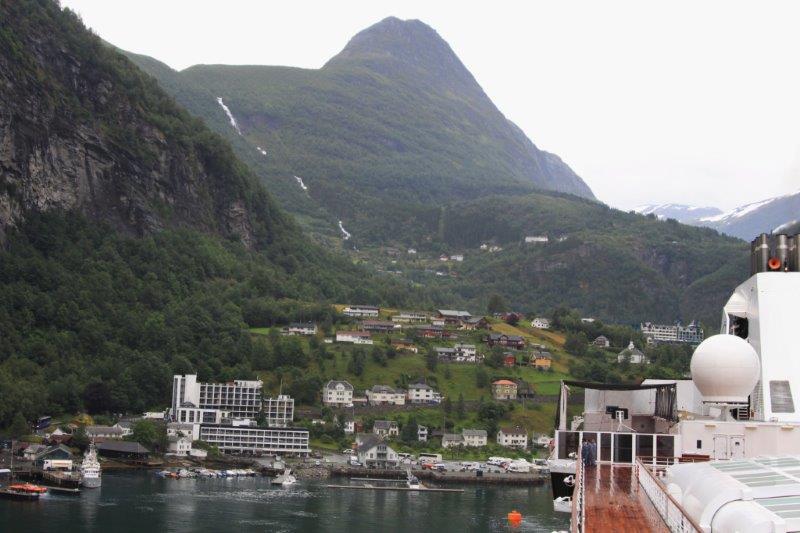
Zeebrugge port is second only to Antwerp in the country and is the largest car shipping port in the world moving 2 million cars annually.

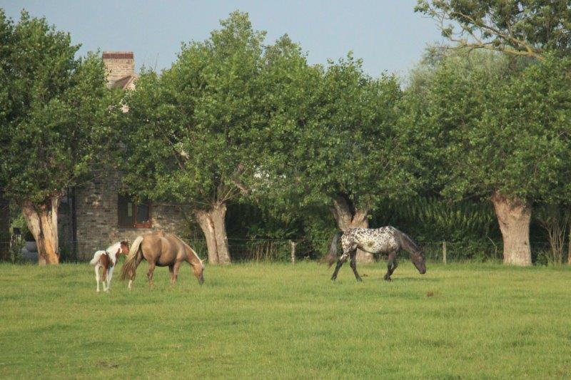
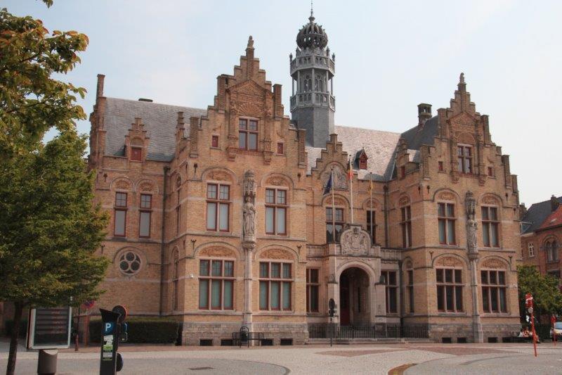
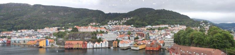
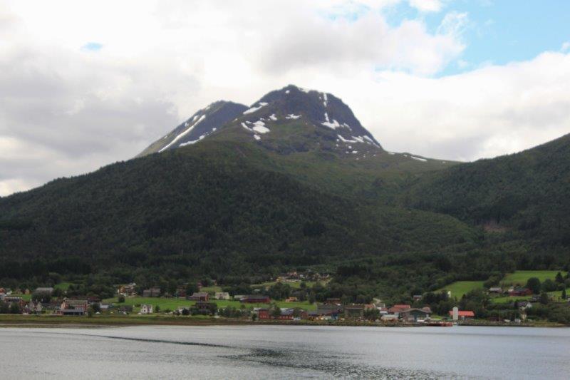
Belgium is a very small country, 30,000 sq. km (65 km of coastline) but is one of the most densely populated countries in the world with 11.2 million inhabitants. It has more castles per square inch than anywhere else, with about 470 in the country – unfortunately we were not going to see any of them today.

We were on our way to Ypres – correctly spelled and pronouced Eiper (Eeeper) by the Flemish.  The French spelling, Ypres, came about because Belgium is a dual-language country: the north which borders Holland uses Dutch, the south which borders France uses French.  French was the dominate international business language pre-WW1 and used on all the maps, thus Ypres.  They are working hard to get the correct Flemish name and spelling recognized.

IMG_9477 IMG_9482 IMG_9483This was a WWI memorial tour and my head is brim full of information about the Eiper (Ypres) Salient and the Flanders Fields area. (A salient is a curved ‘front line’ that projects into enemy territory and therefore needs to be defended on three sides.)  Oh no, you say.  But, I promised to be good so I will do my best to keep the majority of it to myself, else this will become a book.  If you want to know more there are hundreds of books written and tons of info on the internet – knock yourself out.

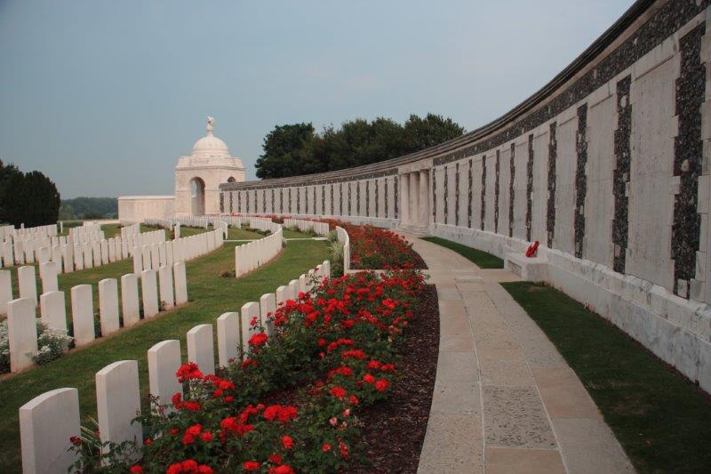
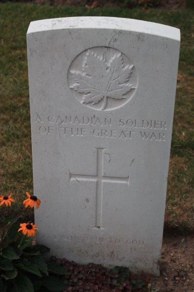
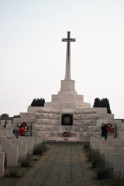
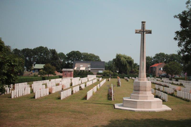
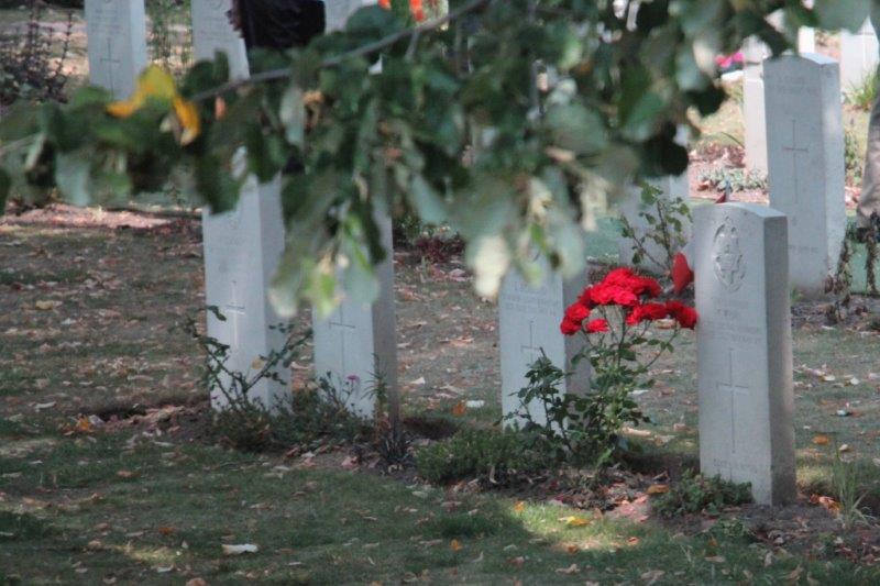
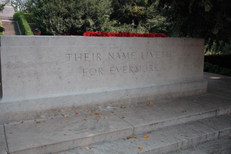
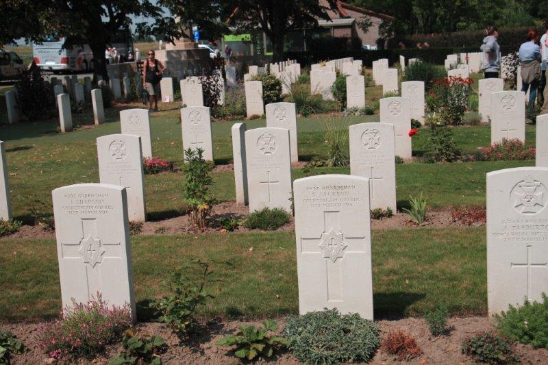
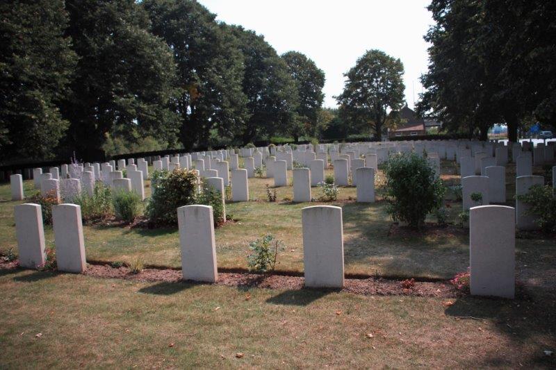
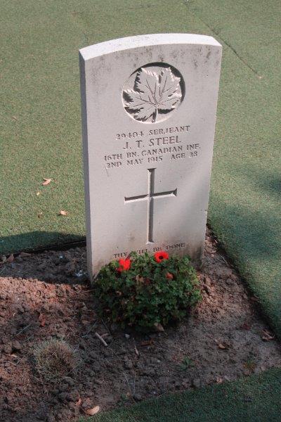
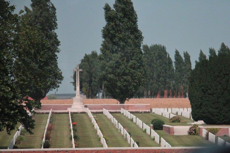
Our first stop was at Tyn Cot Cemetery (so named because a farm in the area reminded the British soldiers of a similar area in Tyn County at home and the name stuck when the cemetery was created.  There are many British names in the area’s cemeteries, towns and streets for this same reason).  Tyn Cot is the largest Commonwealth war cemetery in the world and contains 11,956 graves (8,961 British, 997 Canadians, 1,368 Australians, 520 New Zealanders, 90 from Newfoundland (which at the time was not part of Canada), 2 British West Indians and four German soldiers).  Of these almost 12,000 graves 8300 are unidentified and are inscribed with the regiment of the soldier, if known, and the inscription “A (nationality if known) soldier of The Great War.”  Along the bottom of each marker is the phrase, composed by Kipling, “Known Unto God.”

IMG_9485 IMG_9487 IMG_9527 IMG_9526 IMG_9498 IMG_9515 IMG_9536
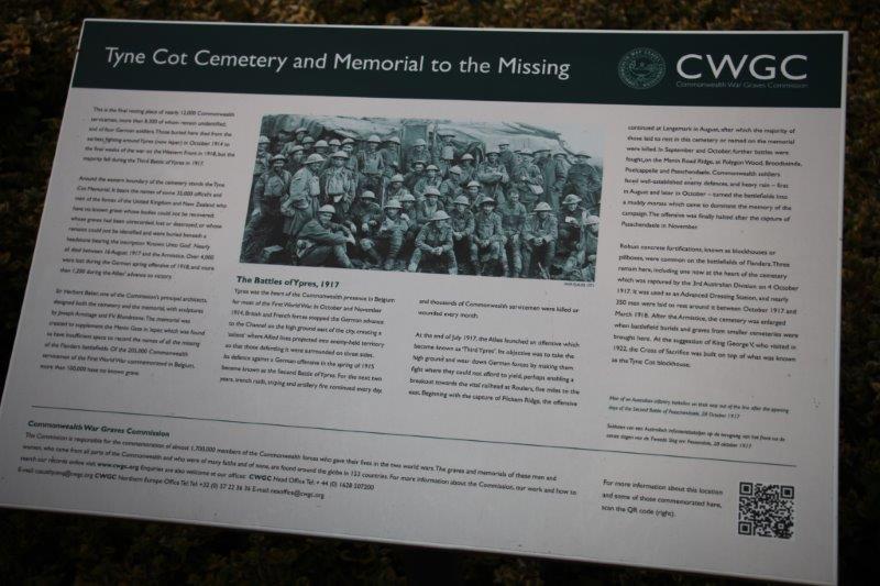
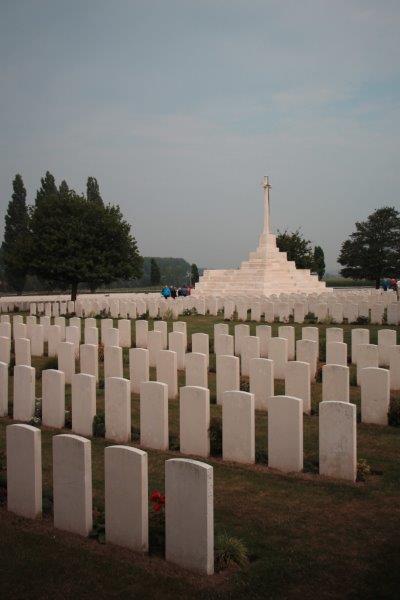
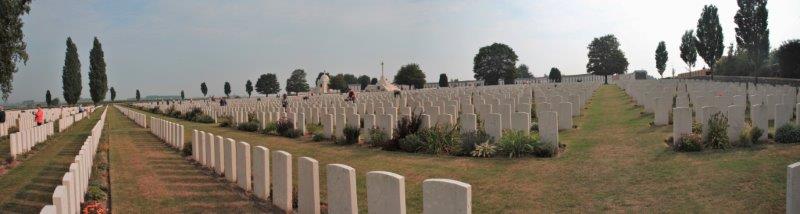
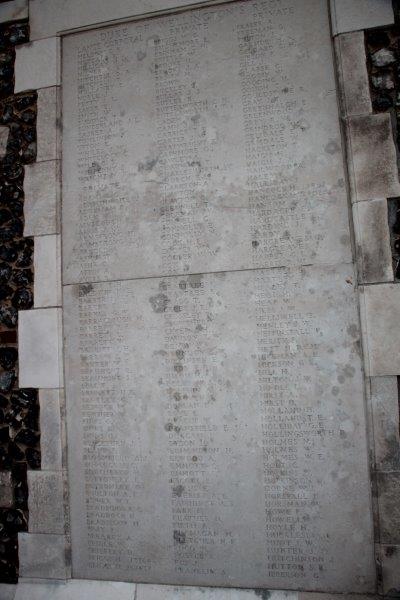
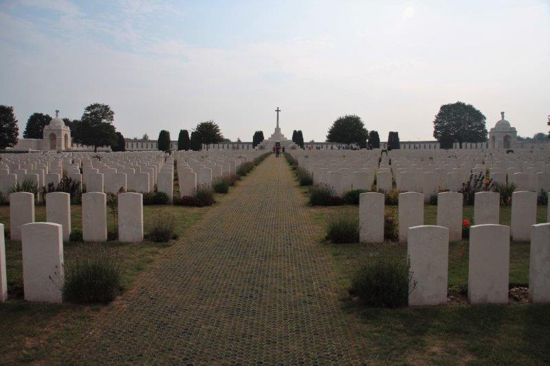
The wall around the cemetery bears the names of 34,857 unknown dead.  The descriptive plaque at the entrance says, “Oct 1914 – Nov 1918.  35,000 officers and men of the forces of the United Kingdom and New Zealand who have no known grave, whose bodies could not be recovered, whose graves had been unrecorded, lost or destroyed, or whose remains could not be identified.”  Nearly all died between Aug 16, 1917 and Nov 11, 1918.  There are 250,000 Commonwealth servicemen of WWI commemorated in Belgium, 100,000 of whom have no known grave. (750,000 soldiers, sailors and airmen died on the Western Front during WWI, 200,000 in Belgium and over 500,000 in France – 60 million mobilized worldwide with 50% casualties; wounded or dead.) They are commemorated upon headstones marking graves in over 1000 war cemeteries and 2,000 civil cemeteries or on one of the six memorials in Belgium and 20 in France which carry the names of more than 300,000 who have no known grave.)

IMG_9541 IMG_9542 IMG_9544Belgium was the only completely occupied nation in both World Wars.  Located as it is between The Netherlands and France, even though it was a neutral country, it was invaded by Germany and occupied for four years during each war.

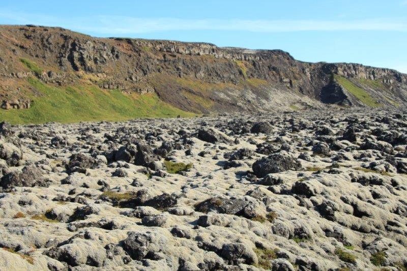
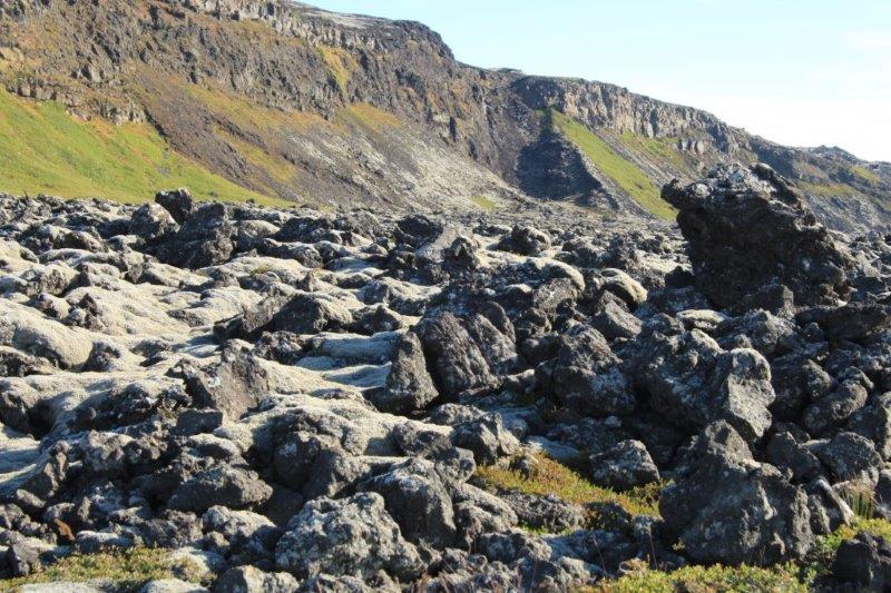
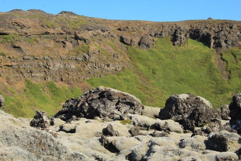
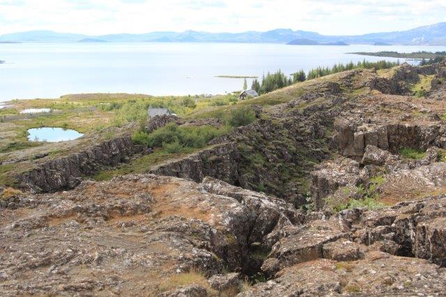
The area of Flanders was completely destroyed.  There were virtually no recognizable buildings, no trees, no roads, no canals and ditches, no landmarks remaining by the end of the war.  Everything had been shelled or trenched.  Many of the major battles of WWI occurred within the area of Flanders Fields in northern Belgium; Ypres, Passchendale, Hill 60, Sanctuary Wood, Polygon Wood.  The front line moved back and forth several times over the years and every 50-100 meters cost thousands of lives on each side.

IMG_9762 IMG_9500 IMG_9509 IMG_9510 IMG_9511We had 45 minutes to wander the cemetery.  Our guide explained about the creation of the Commonwealth Graves Commission after the war to deal in a consistent manner with all the dead regardless of rank.  Most of the Commonwealth dead remained in Belgium, very few were re-interred back home.

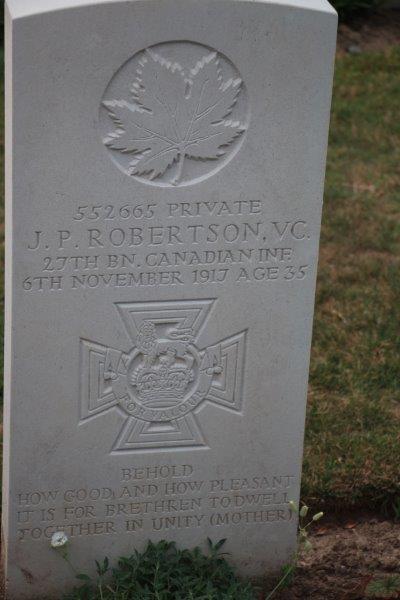
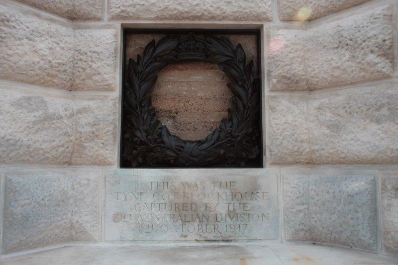
There are smaller cemeteries all over this area where battles took place and the dead were buried on the spot. Tyn Cot was one such but other bodies as they were found were brought here for a proper military burial and it became a major cemetery. There are also separate cemeteries for Scotland, Australia, the US (some of whom fought here during the last year of the war), etc.  We were shown the grave of a Canadian private who was awarded the Victoria Cross and told about the two bunkers remaining on the site; one bare concrete near the original entrance gate and the other that was incorporated into the Cross of Remembrance located in the center of the cemetery.

IMG_9502 IMG_9537 IMG_9539 IMG_9538

IMG_9545
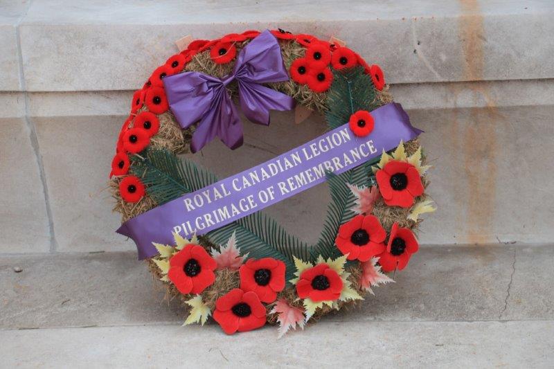
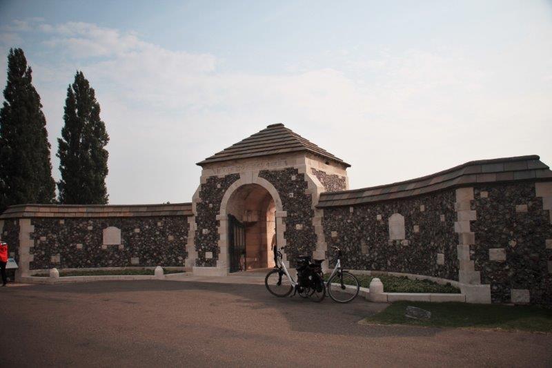
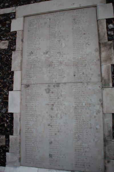
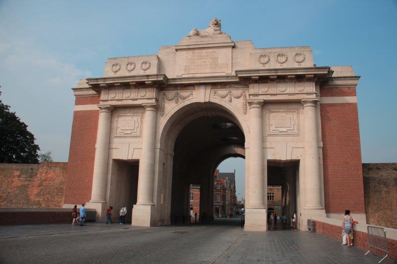
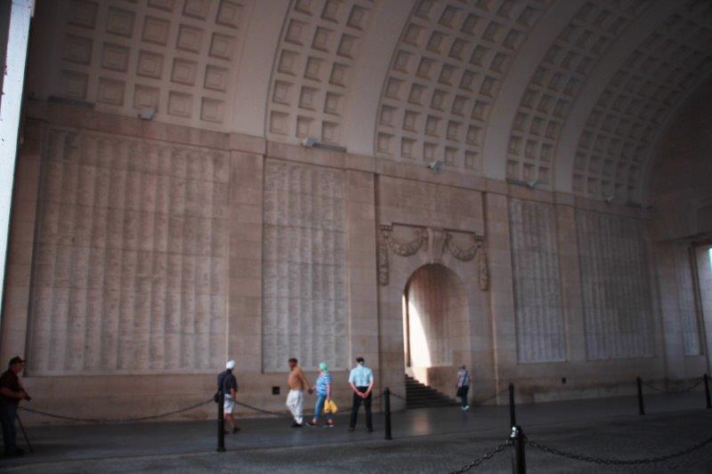
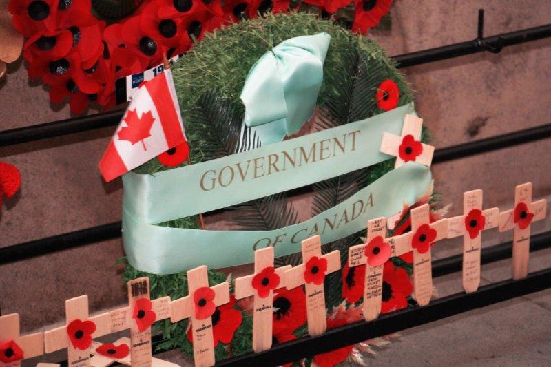
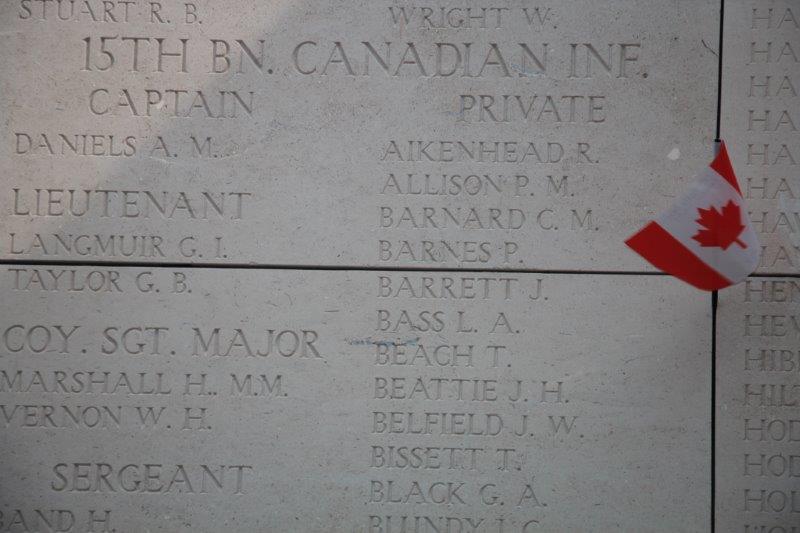
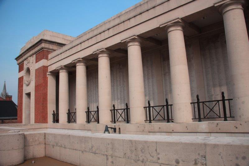
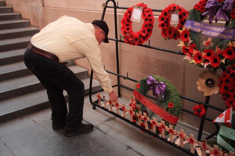
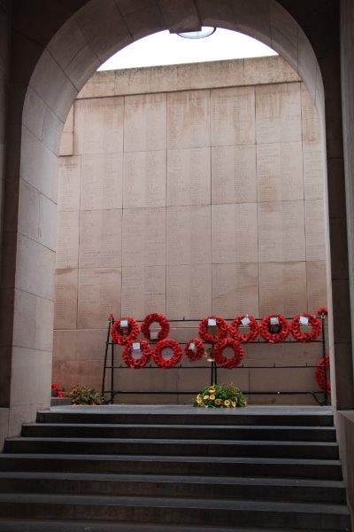
Scottish CemeteryWe next drove to the town of Eiper and the Menin Gate, whose walls are inscribed with the names of 54,896 soldiers who fought in the Ypres Salient from 1914-1918 and who have no known grave.  I had gone to the Royal Canadian Legion in Salmon Arm before we left for Boston and got some poppies and red maple leaves.  I laid a couple on graves of unknown Canadians at Tyn Cot and John and I each laid one at the Menin Gate. When the memorial was officially opened by George V part of the service included the playing of The Last Post.  People requested that it be played again, and again and again.  The street on both sides of the Menin Gate are closed off every evening at 8 pm and a Short service of Remembrance including The Last Post takes place.  A year ago they commemorated the 30,000 playing of The Last Post at the Menin Gate.

IMG_9551 IMG_9560 IMG_9558 IMG_9567 IMG_9570 IMG_9571 IMG_9565 IMG_9661 IMG_9555You may be wondering about all the German dead.  Understandably there was not much sympathy for them during or after the war. Over 600,000 people of Belgium were displaced, forced out, suffered injury and death, and had everything they owned confiscated or destroyed.  Most of the German dead were just buried in mass graves. Very few, if any, have ever been re-patriated home.

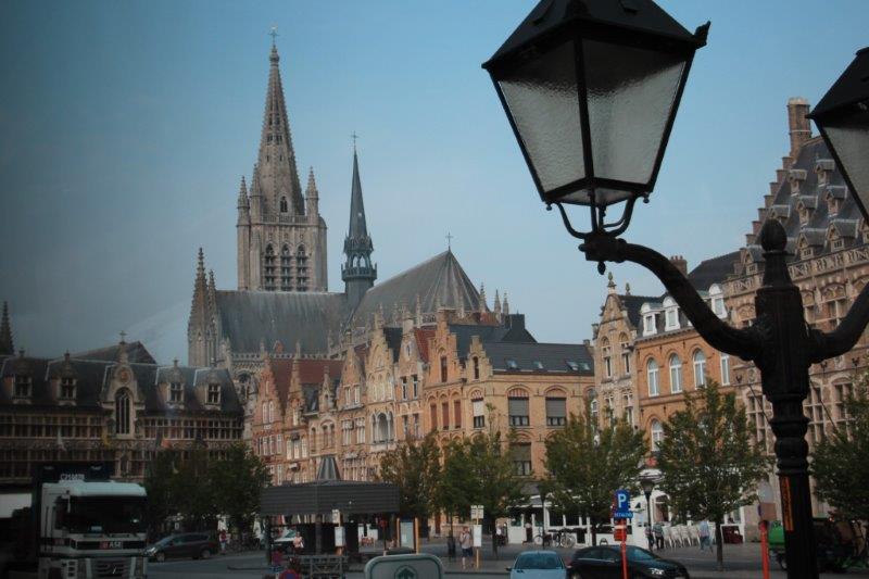
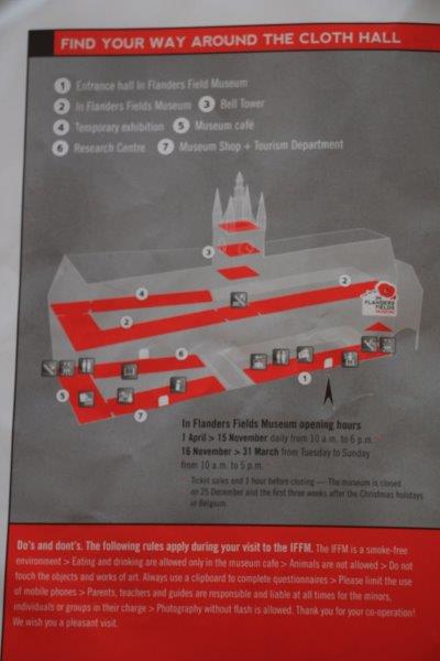
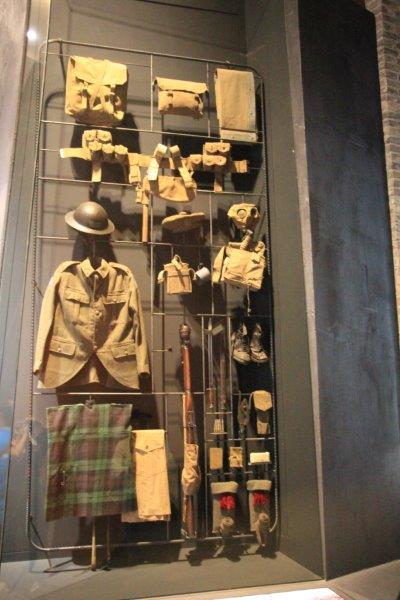
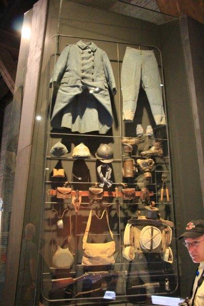
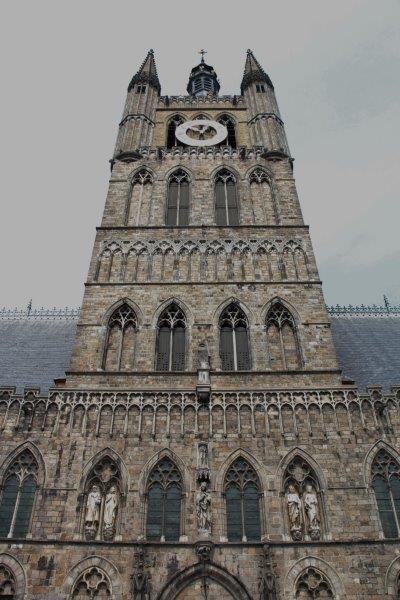
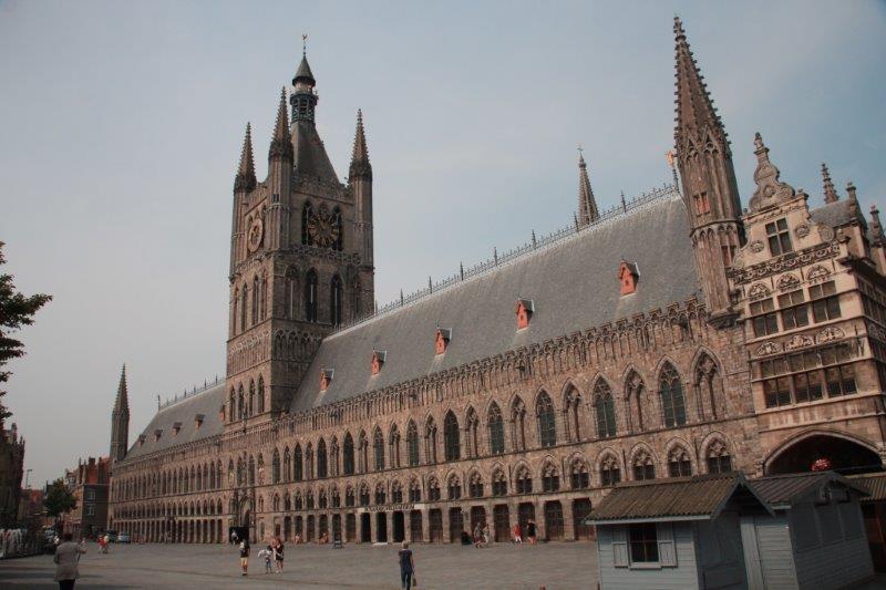
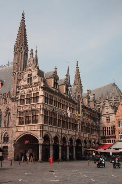
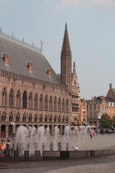
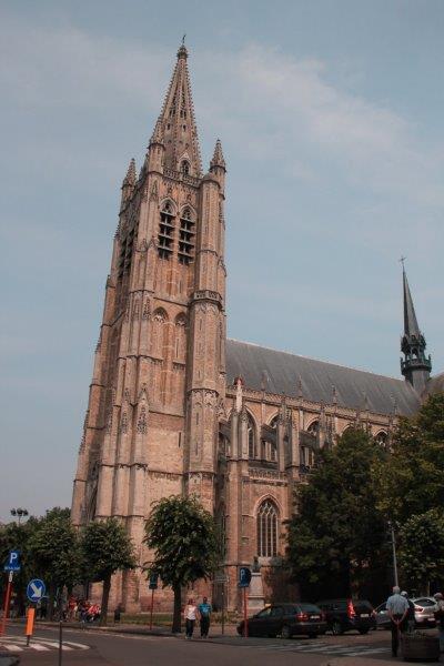
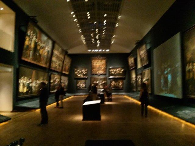
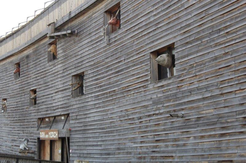
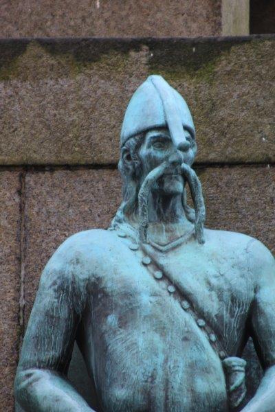
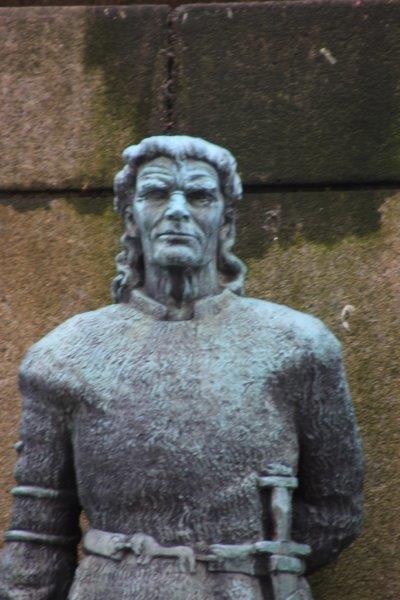
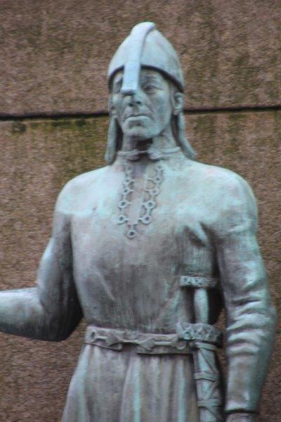
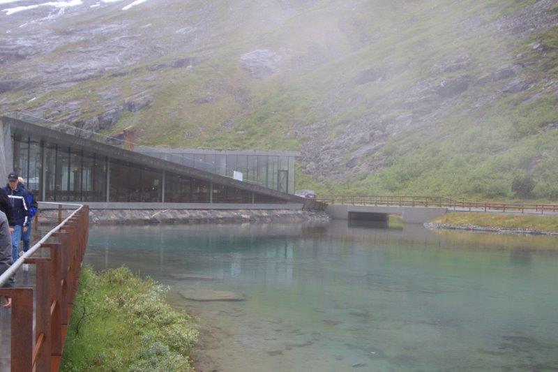
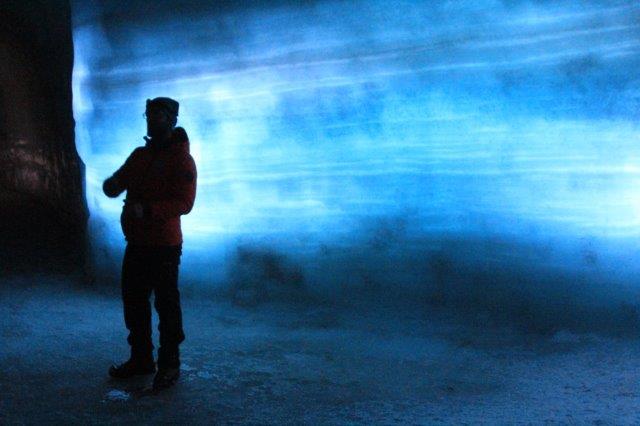
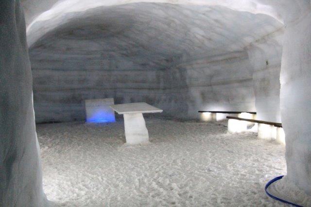
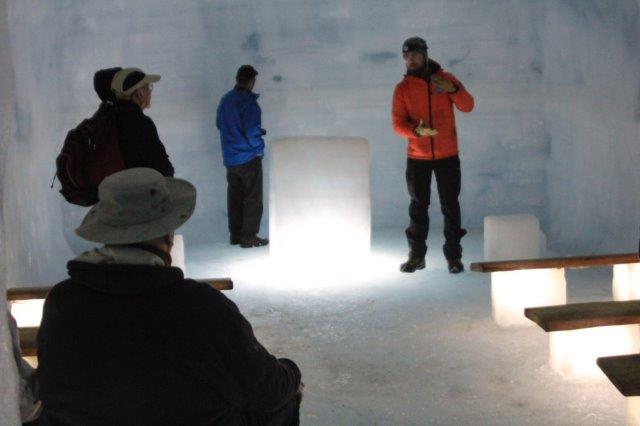
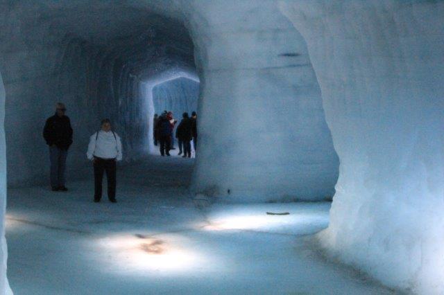
Our next stop was a couple of blocks away in the town of Eiper; the Flanders Fields museum; considered to be one of the best museums in the world.  Oh no!  Thankfully we had three hours before the bus would return to pick us up.  Our guide said most people go through the museum in about an hour so that gave people lots of time to find some lunch and explore or shop.  Our friends Bill and Lyn and Bob and Barbara were on the tour and we had gathered together on the ship so we were all on the same bus.  Barb said we would meet at the exit at 12 and go for lunch.  I said I would tell John but told her I was a museum junkie and if I was done by then I would join them.  Guess…. Did we meet them for lunch?  Not.

IMG_9550

IMG_9572 IMG_9573 IMG_9577 IMG_9590 IMG_9592 IMG_9591 IMG_9761
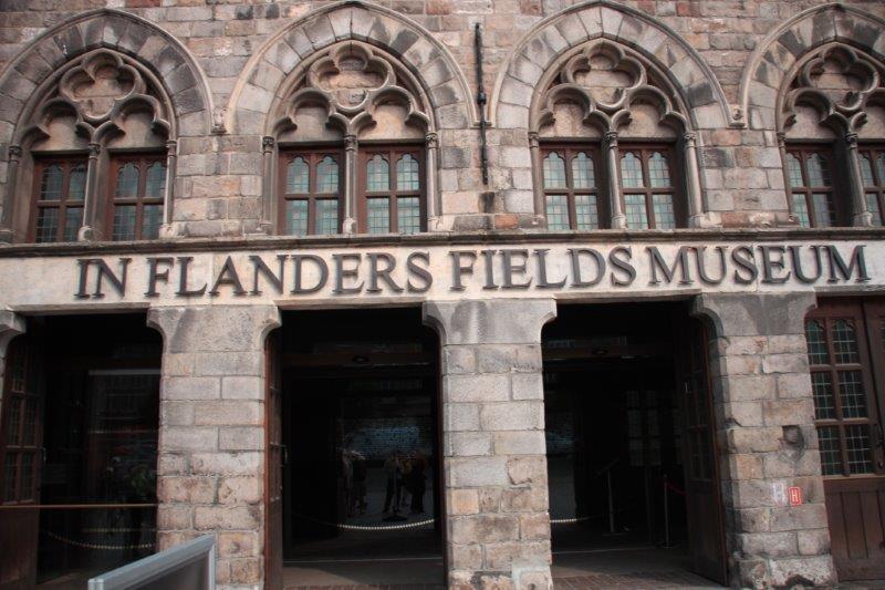
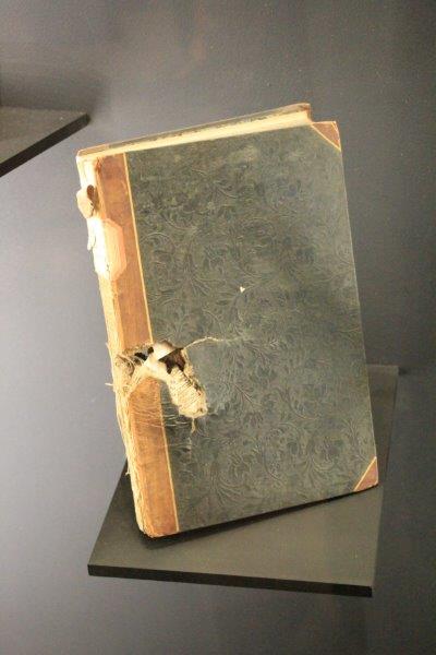
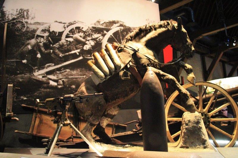
We spent over two hours in the museum which was loaded with images, paintings, uniforms, videos, before and after shots of the countryside, models, videos of actors and actresses narrating ‘personal’ experiences of the war.  It was really good.

IMG_9602 IMG_9621 IMG_9638 IMG_9639 IMG_9640 IMG_9643In Belgium it is still common 100 years later to come across unexploded shells, pieces of shrapnel, weapons, equipment and bodies during construction or farm work.  The Commonwealth War Graves Commission maintains an office in Eiper and they come to the site and care for the remains.  With DNA and other modern equipment it is possible sometimes to identify the victim.  If it is a soldier of the Commonwealth he is given a full military funeral and interred in Tyn Cot or one of the other cemeteries.  If a German, I think the Commission gets in touch with Germany to care for the body.

In the museum there was a display case crammed full of items that were all collected during an industrial construction built between 1990-2010.

IMG_9613 IMG_9614 IMG_9615 IMG_9616 IMG_9620

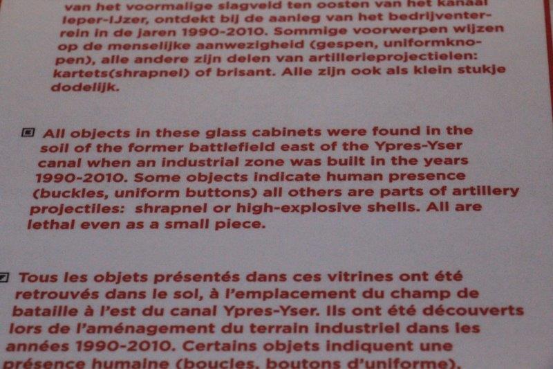
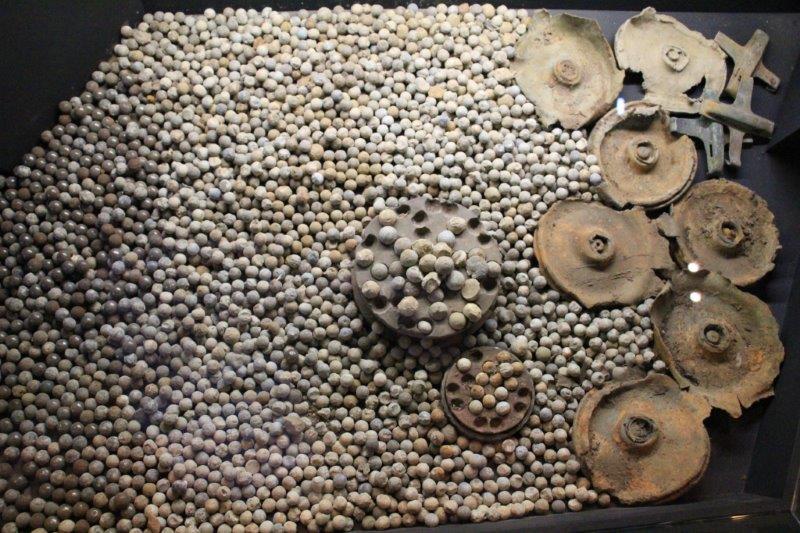
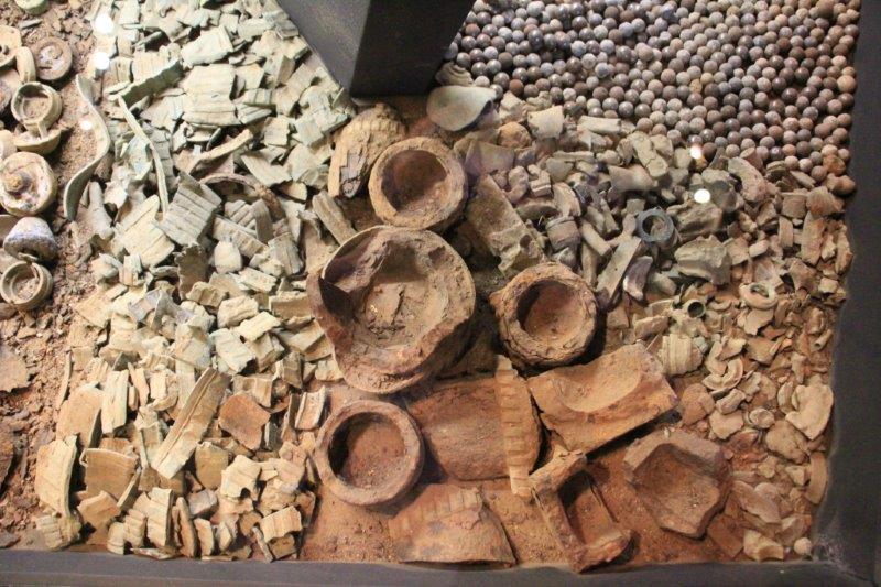
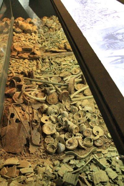
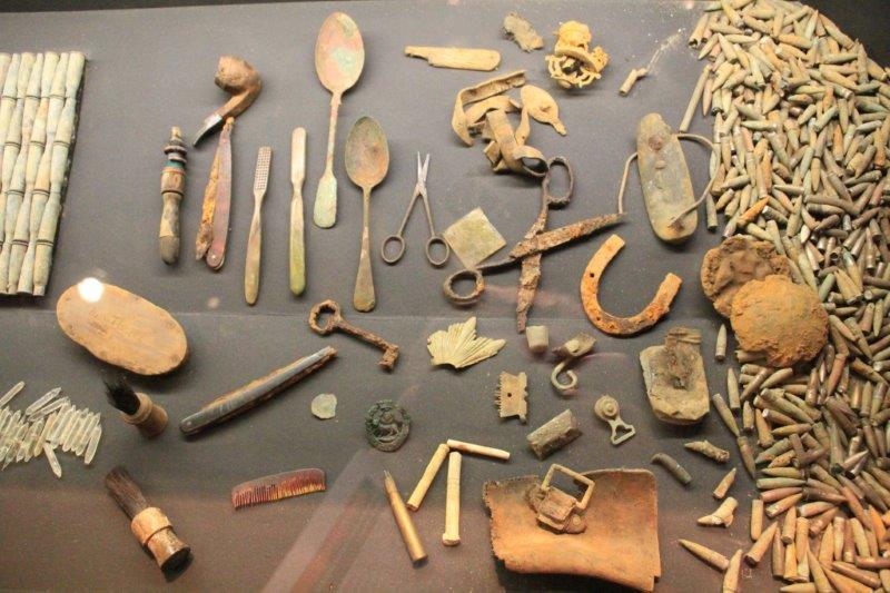
There are still unexploded shells and mortars buried in the ground.  Sometimes they are detonated by the discovery – hit by equipment or farm machinery – with deadly results.  Sometimes they explode underground and do no damage.  A few weeks ago a farmer was working his field and suddenly the tractor lifted right off the ground.  A mortar had exploded underground and the force lifted the tractor.  On one 25 acre parcel a farmer found 120 bodies, 4 air planes, 1 English tank and over 2000 shell holes.

Also hidden around the country are old trench works and fortified bunkers.  These too are regularly discovered during construction projects.  A year or so ago a farmer was returning home for lunch and half of his farm sunk into the ground in front of him.  There had been a wood-beam trench room under his land.  Over time water had seeped into it, rotted the timbers and the whole thing caved in.

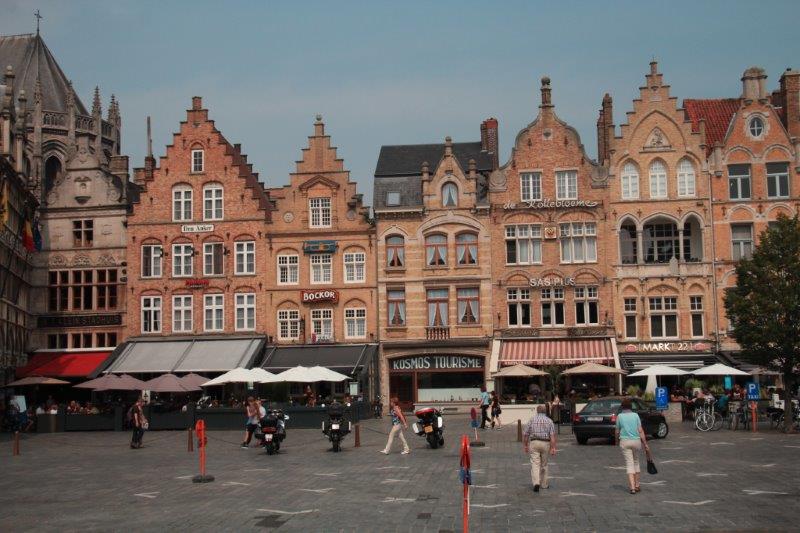
After we came out of the museum we ate the bran muffins we had brought from the ship, bought some ice cream and then wandered around Eiper for an hour or so until the bus returned to pick us up.

IMG_9649 IMG_9651 IMG_9652 IMG_9653 IMG_9655 IMG_9671 IMG_9684 IMG_9686
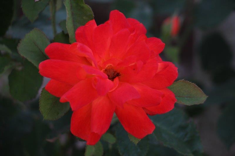
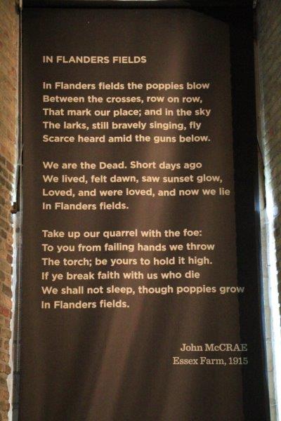
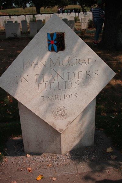
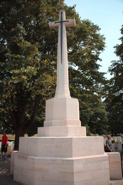
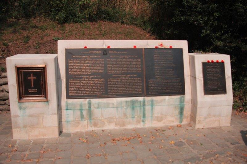
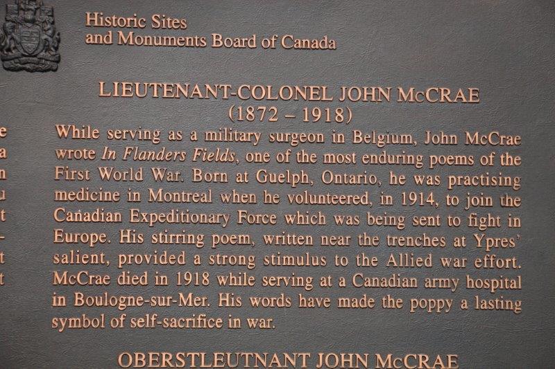
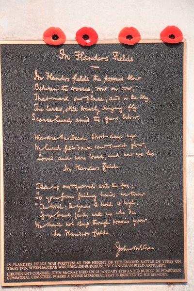
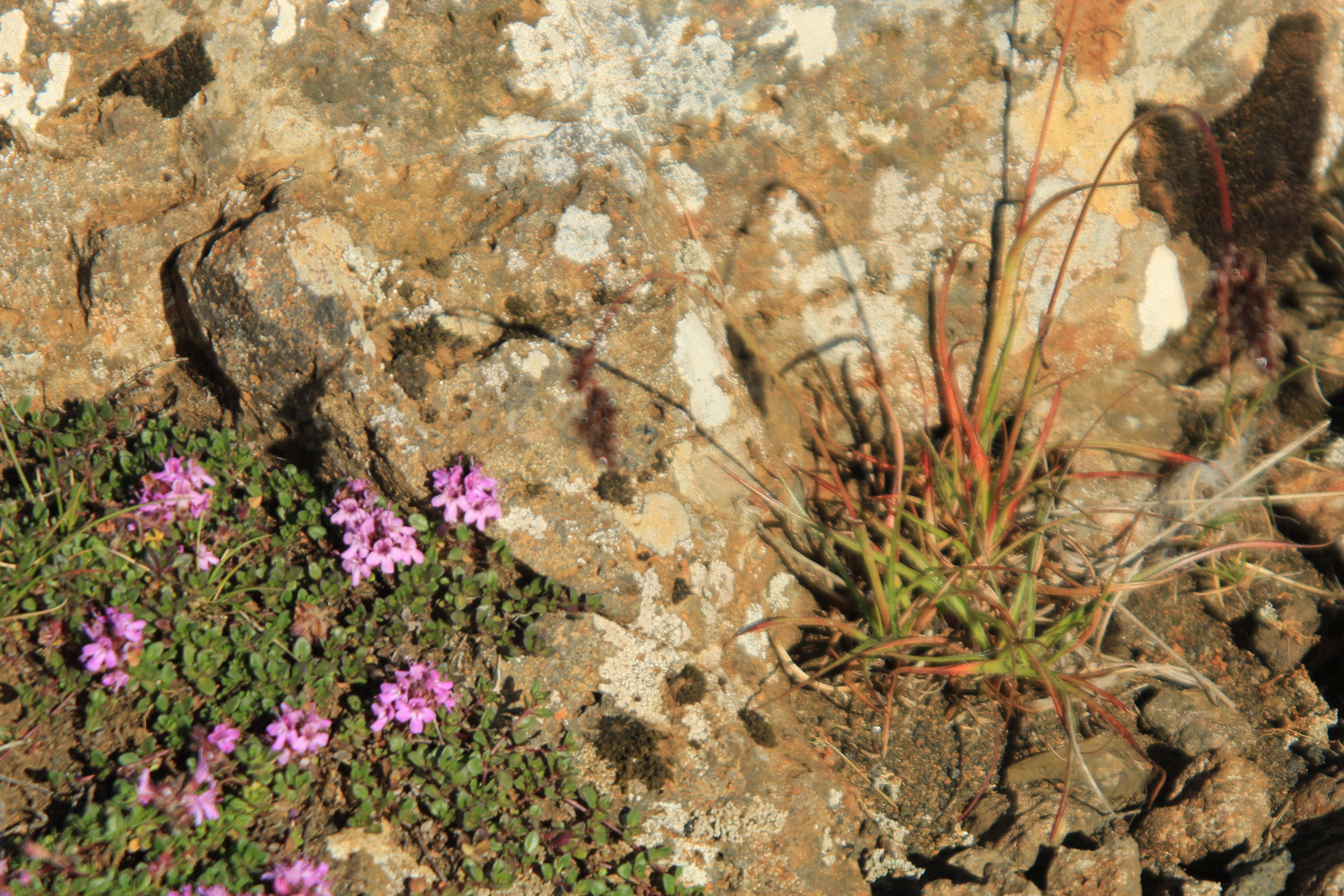
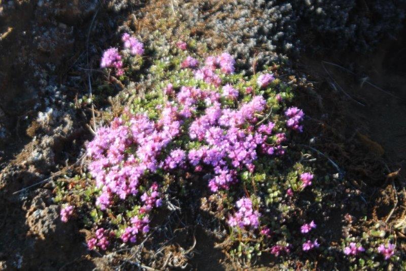
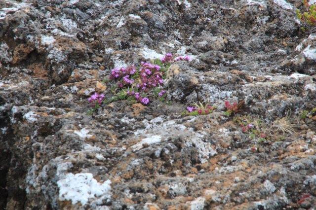
Our last stop – finally, you say – was Essex Farm Cemetery.  In the near vicinity of the cemetery was the medical aid tents where Canadian doctor Major John McCrae (later Lieutenant-Colonel) was working as Brigade-Surgeon of the 1st Canadian Artillery Brigade who were lined up along the nearby Canal Bank.  His good friend was brought in, gravely wounded, and died not long thereafter.  Major McCrae penned the poem “In Flanders Fields” on May 3, 1915 at the height of the 2nd Battle of Ypres.  He read the poem at his friend’s funeral and then tossed it away.  It was picked up by another soldier who sent it to Britain where it was published in “Punch” magazine.  Immediately it resonated with the public and the military as a poignant reminder of the self-sacrifice and futility of war.  It is still recited at most every year at Remembrance Day (Nov. 11) ceremonies in Canada.  (We had to memorize it in elementary school and I can still recite most of it.  Funny how some things stick in your brain.)  Coincidentally there were still a few poppies in bloom at Essex Farm. (The soil in Belgium is clay. They say every Belgian is born with a brick in their stomach because all of the ingredients to make bricks are just below the surface. When the clay-mixed soil is churned up and the top soil destroyed the first plant to grow again is the poppy, which makes it a fitting symbol for survival during and after war. We laid the rest of our poppies from home at Essex Farm Cemetery.
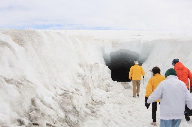
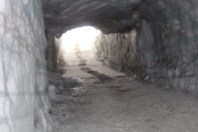
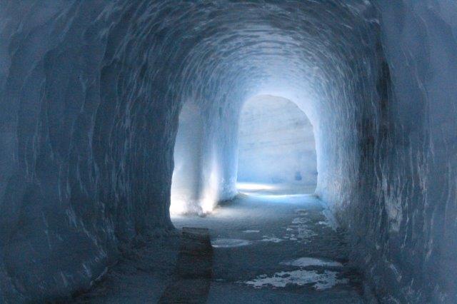
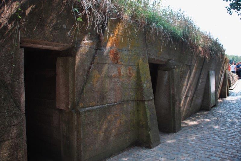
IMG_9692 IMG_9694 IMG_9696 IMG_9698 IMG_9707  One of the bunkers

IMG_9705


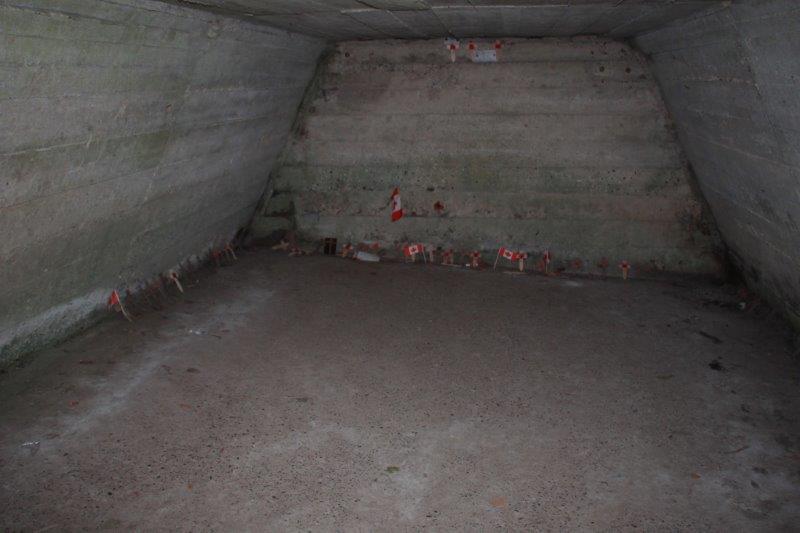
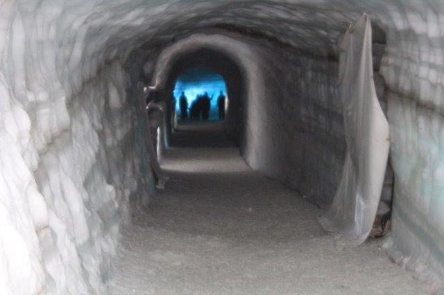
Memorial flags and wreaths placed inside the bunkers.IMG_9708IMG_9714  IMG_9713 IMG_9715 IMG_9719 IMG_9730 IMG_9732 IMG_9733 IMG_9736 IMG_9737

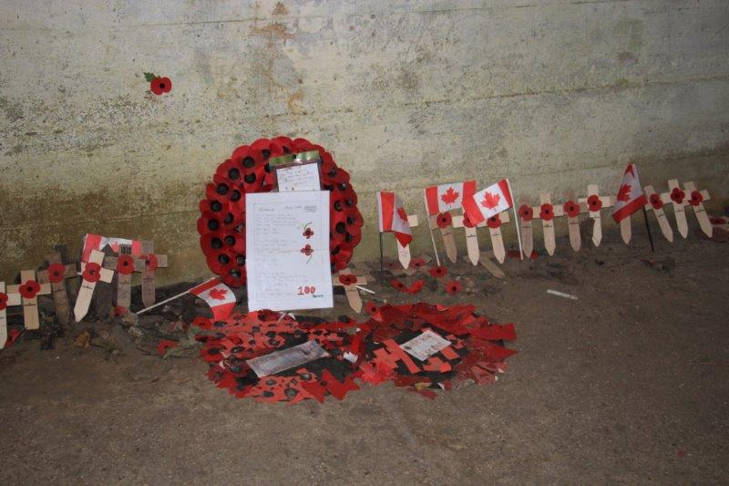
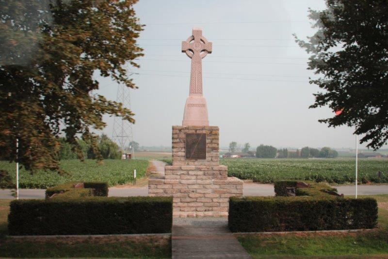
On the way back to Zeebrugge we passed the Australian Cemetery and a few other small ones.  We got back at 3:30, the ship sailed at 5, we ate dinner, turned our clocks back another hour and were in our jammies with our sore feet up by 7:30.  A day at sea tomorrow. We need it.

IMG_9740


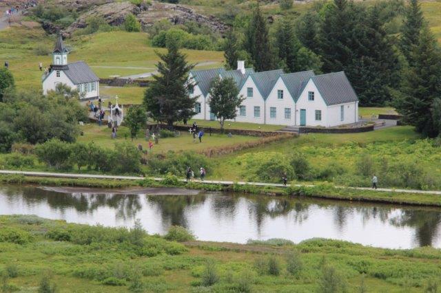
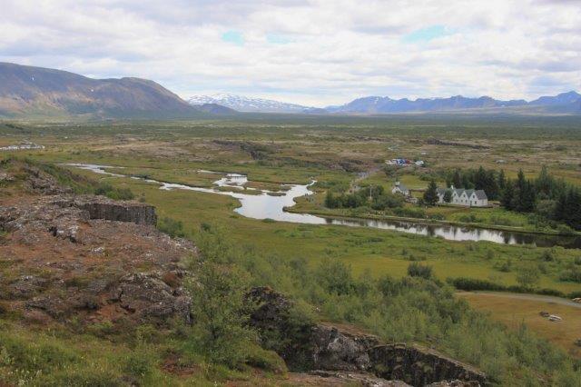
The Australian Cemetery


It was a very poignant day, but I am so very glad we went.  We owe everything we have today in our wonderful country to the sacrifices of these young men. May they rest in peace and never be forgotten.

2015 Aug 12 – Day 19 – Amsterdam and At Sea

I tried to talk John into taking the train to the windmill museum located 22 miles out of Amsterdam, but he knows how I am in museums so he was hesitant to go out of the city when we needed to be onboard by 3:30.  Our original plan for the day was to walk to the Hermitage and see this summer’s exhibit, so that is what we did – the windmill museum can wait until next time we are here.  Probably a good thing because it takes half an hour to walk to the museum, then the time to view the exhibit (with a museum junkie in tow) and half an hour to walk back.

The Hermitage in Amsterdam is linked to the famous Hermitage in St. Petersburg and every year Russia sends a new collection for display in Amsterdam for the summer.  We chanced upon the museum when we were in Amsterdam several years ago – the collection that year was Tsar Nicholas’ Court.  Two years ago we saw The Dutch Masters (St. Petersburg Hermitage has a large collection of art work by Rembrandt, Reubens, Van Dyke, etc. as the Tsarina’s daughter lived in Amsterdam and sent paintings to her mother in St. Petersburg).  This year’s collection was called “Napoleon, Josephine and Alexander.”

Tsar Alexander I and Napoleon became good friends and signed a treaty to support each other in war and for Russia to join the French trade embargo against Britain.  This treaty was very costly to Russia – especially the trade embargo and eventually collapsed. Napoleon’s Grand Armee invaded Russia with disastrous results.  He entered the country with 600,000 troops and 175,000 horses. The Russians drew the French deeper and deeper into the country, sacrificing thousands in the process.  As the French moved forward the Russians burned all the crops, all the buildings and destroyed anything the French army could possibly use.  Eventually winter set in and the French needed supplies to camp until spring.  There was no place to shelter and no food for man nor animal.  Thousands died of cold, of drowning in the frigid waters and of starvation.  By the time Napoleon crossed the border back into French territory there were 30,000 men and several thousand horses remaining.  The beginning of the end for “The Little Emperor.”

There are no photos allowed inside so we left our cameras at the coat check.  The Hermitage does an exceptional job displaying and describing their exhibits and I love to go there.  The displays included paintings, sculptures, lances and swords, some furniture, jewelry and trinkets like snuff boxes, uniforms and other items of clothing, etc. etc.  Really great stuff!!

We actually saw two different exhibits this year, the Napoleon one from Russia and a portrait exhibit of leaders of the Dutch Guilds who took care of all trade and the security in the city during The Golden Age of the late 17th century.  These paintings are unique in the world and are rarely seen due to their enormous size. It was permissible to take photos without flash in the portrait gallery but we didn’t have our cameras.  I took one quick photo with my phone; which isn’t very good but will give an idea of how big these paintings are.  Only the wealthy could afford to have their portraits taken so these works clearly show the leaders of commerce and trade.

CAM00342We emerged from the Hermitage after 1:30 and walked a different route back to the ship.

IMG_9357 IMG_9359 IMG_9364 IMG_9365 IMG_9370 IMG_9372 IMG_9373 IMG_9374 IMG_9375


NEMO is the Science CenterIMG_9380


This is the Maritime MuseumIMG_9384 IMG_9385 IMG_9388 IMG_9393 IMG_9397 IMG_9400 IMG_9401  This is a private houseIMG_9402


Two of our favorite crew: Dharma and Aurora


While we were eating dinner we sailed the long channel out of Amsterdam.  We went to the cabin, got our cameras and went onto the bow deck to watch the sail through the lock taking us out to sea again.  The captain had announced that he expected to be in the lock at 7 pm and at 6:59 were tied inside waiting for the gate to open to lower the water level back to the sea.  (Amsterdam sits 18’ below sea level.)  Tomorrow we are in Belgium, the port city of Zeebrugge (Zee-rouge with a B sound at the beginning) and are taking my most-wanted tour of this trip – “Ypres, In Flanders Fields.”

IMG_9404 IMG_9408 IMG_9411


Former ventilation shafts – now de-commissionedIMG_9416 IMG_9421 IMG_9422 IMG_9424 IMG_9425 IMG_9427


Not a lot of spare room in the lockIMG_9431 IMG_9434 IMG_9435 IMG_9439 IMG_9452 IMG_9458 IMG_9460


Seaside holiday cabinsIMG_9462 IMG_9463 IMG_9467 IMG_9472


2015 Aug 10 & 11 – Days 17 & 18 – At Sea and Amsterdam

We had a day at sea between Bergen, Norway and Amsterdam.  We spent a quiet day as we usually do on sea days.  We didn’t see anything interesting until after dinner. We had heard that we had been passing oil drilling platforms during the day and when we went out onto the Promenade Deck after dinner, as we often do, there were six platforms visible.  The sun looked like it might give us some nice colour as it set so we went to the cabin and got our cameras and went back on deck to see the show.  Nothing as spectacular as in Iceland, but it was a nice sunset and the lights on the platforms lit up as night approached.

IMG_9111 IMG_9112 IMG_9155 IMG_9158 IMG_9174 IMG_9177The ship sailed from the North Sea through the lock and down the long channel to Amsterdam while we were sound asleep.  By the time we woke at 8 the ship was docked, all the paperwork and processing had been completed, and we were free to go ashore.  The cruise terminal is located about a kilometer from Amsterdam downtown and Central (Train) Station.

We had breakfast, gathered up our coats and cameras and headed to Central Station to find which train would take us south to Dordrecht.  The Netherlands has a very effective and efficient network of trains which move thousands of people every day between cities and to and from work.  We purchased a Class 2 Intercity ticket to Dordrecht and got to the correct platform less than ten minutes before the train arrived (if we had missed it we would only have had to wait half an hour for another one).

The train took us out of Amsterdam, through farm and flower countryside and made 5-10 minutes stops at about 8 towns and cities, the largest of which was Rotterdam.  It took about an hour and 40 minutes to get to Dordrecht.

IMG_9180 Central StationIMG_9187 IMG_9193 IMG_9196 IMG_9197 IMG_9198Once we got to Dordrecht we asked directions to Maasstraat where Noah’s Ark was docked.  Our information said it was about 1.4 km so we thought we would just walk, but the information folks said it was too far and we should go round the corner and catch the No. 4 bus.  We had no Euros (we needed $2 coins for the bus tickets) and had meant to exchange some money at the front desk before leaving the ship but we had forgotten.  Fortunately there was an ATM at the train station and a currency exchange office that gave us some coins for our Euro notes.

The number 4 bus arrived just as we got to the bus stop (again, not a worry if we had missed it as another one would be along in 15 minutes).  It took about 10 minutes to get to Maasstraat and we just got off the bus, crossed the street and walked up the road to the Ark.

A Dutch man, a construction contractor, received a vision to build Noah’s Ark in 2004 to show people that the Bible stories were real and God did care for them.  I haven’t read the book of the whole story (we bought it) but I think it took him about 2-3 years.  The ark is ‘life size,’ made of pine wood and at anchor in the canal.  It is 150 meters long (495 feet), 35 meters wide (115 feet) and 25 meters tall – four stories above the water level (82 ½ feet).  It is HUGE.

IMG_9203 IMG_9204 IMG_9205 IMG_9211 IMG_9212 IMG_9214Once inside you follow the ‘elephant’ footprints through the Ark, hear about how they built it, and what tools and equipment Noah may have used when he built his ark.  Pertinent Bible passages about Noah and other important Bible characters, and about Jesus are related with mannequins and murals.  There are life-size models of animals from Elephants to DoDo birds, a section on the seven days of creation, the time of the dinosaurs, the mysteries of the cosmos, a restaurant, a conference room, two open air courtyards – one at each end – a walking deck around the top story, live birds, ponies, goats, rabbits, a wallaby, and a donkey.  Everything on the ark is made of wood.  It was very interesting, well presented and truly an amazing feat of construction.

IMG_9246 IMG_9221 IMG_9256 IMG_9283 IMG_9300 IMG_9301 IMG_9223 IMG_9235 IMG_9244 IMG_9252 IMG_9268 IMG_9269 IMG_9275 IMG_9302 IMG_9304 IMG_9312We spent over two hours touring around, then walked back to the bus stop, caught a bus back to Dordrecht train station and the Intercity back to Amsterdam; arriving at 4 pm.

IMG_9277 IMG_9279 IMG_9278 IMG_9325My wide angle lens broke/locked up and the focus ring will not move so I have been having to use my zoom lens since leaving Boston.  John kindly loans me his wide angle every now and then when I just can’t get the shot I want with my zoom, but it has been driving me crazy not to have my 18mm.  Amsterdam is a shopping mecca so we were sure we would be able to find an electronics/camera shop if not on the ‘main street,’ at least not too far away.  We walked almost as far as Dam Square (about 500m from Central Station) before spying a large department-type store.  They did not carry camera equipment but the information guide told us there was a large electronics store on the other side of Central Station which sells everything.  So-o-o, we walked all the way back to the train station, through to the other side, up one side of the building and down the other and no Media Mart. We asked someone else, “It is about a 12 minute walk down by the Hilton Hotel – which is on a street across the canal from the cruise terminal! Sheesh.  Finally we located the store only to be told they don’t sell 18-55mm lens separately (this is the normal size that comes with a camera body).  He had an 18-135 in stock though so 339 Euros later (about $500) I walked out with a new lens.  Heaven!

IMG_9330 IMG_9331 IMG_9335 IMG_9336 IMG_9337 IMG_9340 IMG_9342 IMG_9348 IMG_9351 IMG_9352 IMG_9353My poor feet were aching by this time and it was after 5 o’clock so we went back to the ship, changed clothes quickly and went to dinner.  We are in Amsterdam until 5pm tomorrow, which is the half-way point of the cruise.  200 people just booked the Boston to Amsterdam segment and are getting off and an equivalent number of people are getting on to sail from Amsterdam to Boston.  Sure beats being stuck in an airplane for hours.  Sail the Seven Seas from continent to continent.

2015 Aug 10 – Day 16 – Bergen, Norway

Our third and final stop in Norway was in Bergen. We had no tour planned for our day here.  When I read through the shore excursion options there were 3 or 4 tours and all of them seemed to drive around town and then take you to the funicular car to go up to the top of the overlooking hill for a panoramic view of the city.  We thought we could probably just do that on our own.

A few days ago I was looking over the shore excursions for the spelling of some place or other and noted a 7 ½ hour tour out of Bergen taking you to “The Queen of Fjords” – Hardanger.  I was tempted to book the tour as Hardanger is the most famous fjord in Norway, but we had just completed two long tours at our other stops, both finished off by blanketing fog.  I overcame the impulse and was glad I had not succumbed when we woke up in Bergen to overcast skies and a light rain. (Bergen, we learned, is like Vancouver.  It gets lots of rain.  They have about 320 days of precipitation – rain or snow – per year.)

We lingered over breakfast, then climbed up to the open deck at the top of the ship and took some photos of the city.  The ship was docked within an easy walking distance of the downtown.  As we were walking along the deck I caught a flash of white out the corner of my eye.  When I turned to see what it was there was a seagull sitting on the railing a couple of feet away and totally unconcerned about our presence.

IMG_8847 IMG_8850 IMG_8855 IMG_8858 IMG_8861 IMG_8869 IMG_8879About 10:30 we walked down the gangway, picked up a street map at the gate and went on our merry way.  John turned on the GPS because we knew there were a few caches quite nearby.  As usual it had us going back and forth from one side of the street to the other and never settling on where we were supposed to go.  John looked for the next cache which was just down the street in The Ramparts.  We looked all along the stone wall with no success and it was posted as magnetic and there was nothing metal it could be stuck to.  Perhaps it was inside?

We turned the corner and walked into the courtyard.  This area is called Bergenhus Festning (or Fortress).  It dates back to medieval times.  You can take a guided tour of the two towers but we decided not to.  The GPS led us through the courtyard to the back of the church and lo and behold, we found it.  It turned out to be the only one we found although we did try some others.  Between the bouncing GPS and the muggles all around we gave up and concentrated on our site seeing.

IMG_8884 IMG_8886 IMG_8891 IMG_8892 IMG_8893 IMG_8894 IMG_8895 IMG_8898 IMG_8901 IMG_8902 IMG_8906 IMG_8909The main tourist shopping area was just a little ways down the street.  I was thinking that it being Sunday many of the shops would be closed and the church bells were ringing for services as we were in the Fortress. However, the mighty dollar has won out, at least on the dockside street (shops a block back were closed) and people were happily hopping from store to store looking for the perfect souvenir or T-shirt.

The quayside area dates from the 11th century is built upon detritus from past fires when any fire debris, burned timbers, household refuse, etc. was mixed with earth to reclaim land.  Thus, the quayfront was pushed by stages into the harbour layer upon layer and level upon level which, in turn, provided a deeper draft for larger ships to enter and dock.  There is all kinds of archaeological treasures in the ground under the buildings – pieces of china, inscribed pieces of wood or bone, shoes, sheaths, pottery shards, jewelry, etc.  Archaeologists call it Cultural Deposits and all the ground under the tenement houses is protected.  The buildings along the street were edge to edge with each other and several of them had distinct leans.  One house has sunk about 8-10” and will have to be lifted and shored up soon.  How I have no idea.

IMG_8923 IMG_8924 IMG_8927 IMG_8928 IMG_8932 IMG_8934 IMG_8935 IMG_8936 IMG_8937 IMG_8940 IMG_8942 IMG_8944By this time the clouds had lifted quite a bit and everything looked considerably brighter.  We decided we would walk up the side street to take the funicular up the mountain.  There were only a few people in line and the funicular goes up and down every 15 minutes.  The car came to a stop just as we approached the ticket readers.  Once our ticket was scanned the little gate opened and we walked on.  It only takes about 5 minutes to get to the top but the view was outstanding.  There was access to 320 degrees of views of Bergen stretching toward the sea and up the hillsides.

IMG_8951 IMG_8962 IMG_8973 IMG_8975 IMG_8977 IMG_8985 IMG_8986 IMG_8987 IMG_8988 IMG_8991 IMG_8993We snapped a bunch of photos, wandered around for a while and then went into the café restaurant for a light lunch.  When we came out again there were people everywhere!  Obviously several of the tour buses had disgorged their passengers at the bottom.  Bergen runs a Hop On, Hop Off bus that stops at the funicular ticket shack too.  We were glad we had taken our photos earlier and made our way through the hordes to a waiting car going back down.

When we were up top we spotted a nice looking park with a fountain in the center and decided we would walk over to it and take a look.  We walked through a huge pedestrian square and past a lovely flower bedecked gazebo before crossing the street to the large plaza beside the small lake.  There were supposed to be two geocaches in the area, but again one was magnetic and we could find nothing in the vicinity of the co-ordinates that a magnet could stick to and after much wandering around and searching in bushes we discovered that the second had been disabled.  So much for that.  The park was lovely though.

IMG_9003 IMG_9011 IMG_9012 IMG_9013 IMG_9014 IMG_9017 IMG_9015 IMG_9019 IMG_9021 IMG_9022 IMG_9026 IMG_9034 IMG_9037 IMG_9038 IMG_9041

IMG_9046 IMG_9042 IMG_9049 IMG_9052 IMG_9054 IMG_9057 IMG_9063 IMG_9065Our path back to the ship took us through the fish market which has been held at the end of the quay since 1796.  There were dozens of tented booths with ice-filled display cases full of whole and fillets of various types of fish, crab legs, mussels, and clams, and tanks with live crabs and lobsters.  Each booth not only sold the food from the sea they also had huge gas-fired grills and they would cook your dinner on the spot.  Tucked among the seafood vendors there were also some sellers of jams or reindeer sausage and a few other types of food.  Across the street were the sellers of T-shirts, sweaters, caps, jackets, jewelry etc.  Needless to say it was a very crowded length of street.

IMG_9079 IMG_9080 IMG_9082 IMG_9084We wandered up a couple of blocks off the main street and walked past closed art galleries and antique shops and the backs of a collection of the tenement houses that are along the quayside street until we came to the gardens by the fortress which was a straight path back to the ship. We were onboard by 4 o’clock, half an hour before all aboard.  It was a great day and I am so glad we didn’t take a tour so we could just wander.

IMG_9094 IMG_9095 IMG_9101 IMG_9102 IMG_9104 IMG_9106Tomorrow is a day at sea before we spend two days in Amsterdam.

2015 Aug 9 – Day 15 – Alesund, Norway

Alesund (pronounced just like Allison, but ending with a D sound) is a port town established in the early 19th century and incorporated as a town in 1848.  It is still the most important fishing harbour in Norway due to its central location along the west coast and the discovery of off-shore oil in the North Sea in the 70’s (which has made Norway one of the richest countries per capital in the world, but along with that it is a very expensive place to live). Alesund has a population of 46,000 and is built on seven islands. There is archaeological evidence of community activity 6,000-10,000 years ago and the area was a major trading center for 500 years around 1000 AD.  A Viking cargo ship that was built in this area (verified by the wood used) about 850 AD was discovered elsewhere and a replica is docked outside the Maritime Museum.

Jan 23, 1904 when the city had a population of about 14,000, at 2:15 am, a fire started in a cannery.  There were gale force winds blowing and the fire department consisted of 15 men, 2 horses and various pumps and tools.  Arriving on the scene the firemen quickly realized they had no hope of combating the blaze and concentrated their efforts on evacuating the area.  Fourteen hours later the fire halted on the far edge of town.  850 homes were destroyed (out of 1000) and 10,000 people lost everything.

One fellow told his wife as she was taking things out of the house that he had been visited by an angel and told that his house would be unharmed.  She didn’t believe him and continued to remove items from the building.  The fire passed right over the house, burning everything in the vicinity, including all of the things his wife had removed.  The house is still standing today.

Alesund was a favorite summer holiday spot of the Dutch Queen and German Emperor Wilhelm II, who came every year for the salmon fishing.  Four days after the fire four ships arrived from Germany filled with building materials and labourers, food and clothing.  The German Kaiser fed 3000 people three meals a day for weeks.

Most of the architects of the day had been schooled in the Art Nouveau style so when the town was re-built all the buildings were Art Nouveau even though several different designers and planners worked on the designs.  It only took 3 ½ years to re-build 500-600 homes and businesses.  Since all the businesses had been destroyed all the trades people were available to work on construction. Alesund became a city unique not only in Norway and Europe, but in the world as one town/one architecture.

However in the 1950’s people wanted to modernize and many of the buildings were torn down and new ones built.  It wasn’t until the mid-60’s before a new city planner realized the unique quality that was being destroyed.  Today legislation is in place to protect all the Art Nouveau buildings.

Once again our tour took us out of town.  We would like to see some of the towns but so often a city is a city is a city and the things that interest us are more often than not out in the countryside.  Alesund was no exception.  We left town at 8 am and had a two hour drive along the shoreline of Storfjord to the turn-off into the mountains to get to the Troll Path.  We passed many small farms (often the farm became summer work and the men would fish in the winter months to earn enough money to support the family.  This is now considered to be an actual profession, called a fisherman-farmer.)

We also drove through a micro-climate area where they grow 60% of all the strawberries in Norway.  There were many people in the various fields picking the berries.  Usually the strawberries are ready in July but they were late due to the cool summer.  Beginning in 1946 Polish migrant workers of all professions have come to pick the berries every year. Some are even doctors or accountants but in a few weeks picking strawberries they can earn the equivalent of an annual salary at home.  The workers are housed and fed by the farmers while they are in Norway.

Being a country of fjords and mountains the Norwegians have constructed many bridges and many tunnels.  We drove through over a dozen tunnels on our way to the Troll’s Path turnoff.  Most were 1-2 km long and the longest was 6.6km (4 miles).  The road used to go along the edge of the mountain but it was destroyed so many times by avalanches and was constantly needing to be re-built so the government just had a tunnel drilled through the mountain instead.

IMG_8432 IMG_8437 IMG_8449 IMG_8454 IMG_8463 IMG_8471 IMG_8472 IMG_8480Here too there was a very remote farm on the cliff face only accessible by track up from the boat launch in the fjord. This farm was quite large and if they needed more space they just cut down some of the surrounding trees.  The land was farmed by the family for over 50 years and whenever they purchased new equipment or brought in household goods or foodstuffs it had to be carried by hand up the cliff to the farm – no pack animals.  It was also abandoned when education became compulsory for children – even though they only HAD to go to school every second day it was almost impossible for them to make it.

IMG_8475


Here is the farmIMG_8477


Here is the boathouse on the shore of the fjordIMG_8478


Now look near the middle of the photo to find the farm and then look to the lower left to see a small white spot that is the boathouse.  There was a path up the cliff side from one to the other.

Our first stop along the way was at the Gudbrandsjuvet Gorge.  There is a zigzag metal walking path that takes you over the gorge and past the waterfall.  It is an easy 10 minute walk. The bus drive lets you off by the visitor’s center and picks you up at the end of the walkway.IMG_8507 IMG_8509 IMG_8515 IMG_8516 IMG_8519 IMG_8517 IMG_9113 IMG_9117The Troll’s Path is now a road but originally it was a handmade path over the mountain and down the other side that the farmers built so they could move their goods back and forth without going all the way around.  The idea was first thought of in the mid-1700’s and begun in the late 1800’s by volunteers on both sides working only in the summer months.  It took 14 years to build and you can still climb it today. We actually saw one intrepid fellow making the climb as we were driving down the far side.  The highest point of the Troll’s Path is 2800’ above sea level and the road is narrow (two buses passing almost touch mirrors and are at the very, very edges to do so), winding and with many hairpin turns on the way down. The cliff on the far side is almost a vertical climb and the other side isn’t much better. It would have been an absolutely exhausting way to move merchandise and goods, but quicker.

(Trolls, by the way, were created by the Norse God Odin when he decided he wanted to make some things like the two creators who made the gods and the people.  But Odin wasn’t very good at it and he just used spare parts and odds and ends so all trolls are very ugly. Some are huge, some are small.  Some have one head, some have two or three.  They all have tails. All of them tolerate children but don’t like adults.  Odin asked his son Thor what he thought of his creation and Thor told him they were really ugly and would scare the people and that Odin should destroy them.  Odin did not want to do that because he had made them but he made the Trolls nocturnal so they wouldn’t be around people during the day.  If a troll gets caught outside of its cave and gets hit by sunlight it turns into a rock.  Many of the rocks strewn about the hillsides and mountains of Norway were once trolls. There are many, many stories, sagas, and tales about trolls in Norway and every gift shop is full of books and T-shirts and small and large troll knick-knacks.)

We passed some lovely scenery on our way up the mountain and, just like the day before, just as we arrived at the parking lot the fog rolled in and everything turned white! We had 35 minutes at the summit and I hotfooted it to the very end of the path to the lookout where there is a spectacular view down the mountain and out through the valley. (We had seen a poster of it at the gorge – see photo)  Everything was totally white.  You couldn’t distinguish anything.

IMG_8533 IMG_8544 IMG_8550 IMG_8561 IMG_8562 IMG_8564 IMG_8570 IMG_8575 IMG_8576 IMG_8577 IMG_8580The family from Louisiana that sit next to us in the dining room were on our tour and when they arrived at the lookout I said that I wasn’t moving until 5 minutes before we had to be back on the bus because I knew how fast fog can lift if it decides to.  Sure enough after about 10 minutes or so we could see a different shade of white where the waterfall began at the cliff edge and a few minutes after that we could see the hairpin turns winding down the mountain. It never did clear enough for us to see the view out the valley but we could see it as we drove down so it worked out well.

IMG_8591 IMG_8594 IMG_8601 IMG_8604 IMG_8605

                                    This is what we were supposed to see at the top.

We navigated all the very tight turns with a bit of backing up and shifting about now and again and drove through the valley to the Troll’s Shop and Restaurant for lunch – a nice buffet with wonderful Norwegian salmon.
IMG_8609
IMG_8611 IMG_8624 IMG_8627 IMG_8630


A very narrow winding road.IMG_8631


In this pic you can see road on the lower left and upper right. There is a haripin turn between them.IMG_8639 IMG_8644 IMG_8669 IMG_8672 IMG_8677 IMG_8678 IMG_8695 (2) IMG_8697 IMG_8700 IMG_8713The road was completed in 1921.  All the walls and the bridge were built by hand with no mortar or cement between the rocks.  The weight of the rocks and on the rocks creates the strength.  The road was to be officially opened by the King and he would be driven down the mountain. The engineer was so afraid that the bridge or one of the supporting walls would collapse and kill the monarch he committed suicide the day before so he would not have to bear the blame.  The bridge has been untouched and unaltered since the day it was built and big buses, campers and cars and trucks go up and down it all summer long.IMG_8646 IMG_8629Our last stop of the day was at the Troll Wall which is a row of black cliffs that create an almost impregnable wall.  One face is the tallest vertical drop in Europe at about 600 meters and was first successfully climbed over two days (albiet along the outer edge) by a Norwegian team in 1940-something.  An English/Norwegian team climbed the vertical face in the early 1950s.  It took two weeks. They spent 13 nights anchored by pitons and ropes to the rock.  It became a very popular place for parachutists to basejump.  About 300-400 jump were attempted and so many deaths and expensive rescue operations have occurred that the government has now outlawed jumping from the top.  You can still climb it and several different teams have done so by several different routes.  If you find and succeed along a new route it is named for you.  There is a memorial near the gift shop listing the names and nationalities of all the climbers (10) and jumpers (9) who have died on the mountain.

IMG_8737 IMG_8740

IMG_8756 IMG_8757

After leaving the Troll Wall we were driven back to Alesund.  Not too far out of town our guide told us there is a new bridge ahead crossing the fjord.  It is due to open in a few weeks.  The only thing needed to be finished is the connecting road.  In the meantime, we have to drive around. Well, we drove at least 30 km going down one side of the fjord, around the end and back up the other side.  The bridge is about 1 km long. I’ll bet folks are pretty anxious for it to be open.

IMG_8787

IMG_8759IMG_8763 IMG_8775


If this photo was reversed it would look almost like Bastion Mountain at home.IMG_8782


So very reminicent of home.  IMG_8797 IMG_8806We had to be on board by 4:30 and our tour was to end at 4.  John and I were hoping it would be on time because the ship was literally docked at the edge of town and we were hoping to have a bit of time to walk a few of the nearby streets.  However, since everyone had been so prompt getting back on the bus at each stop we were running ahead of schedule.  Our tour guide had the bus driver come back into town on the old highway and show us where the 1904 fire stopped and told us all about it and then drove us through many of the streets to show us the Art Nouveau buildings.  It was great!  So we didn’t have to hurry to go see some buildings when we got back we could just go onboard and get ready for dinner.  Despite the fog at the summit it was a good day.  Long, but good.  Tomorrow is Bergen and we have no tour planned.IMG_8811 IMG_8815 IMG_8817 IMG_8819 IMG_8821 IMG_8825 IMG_8827 IMG_8829 IMG_8830 IMG_8831 IMG_8840

2015 Aug 5 & 6 – Days 12 & 13 – Djupivogur, Iceland and At Sea

We left Reykjavik at 1 pm on Tuesday Aug 4 under cloudy skies.  The itinerary said we would have scenic cruising in Berufjordur as we sailed away, but the fog rolled in and we saw white sky and grey water on both sides of the ship. The further we sailed from Reykjavik the worse the weather got and we were pitching and rolling during dinner.

In the morning we woke to high waves and thick cloud.  The captain came on the intercom to tell us that the high winds and rough seas may affect our stop in Djupivogur, which is a small village on the southeast coast of Iceland.  Djupivogur is a tender port with limited good anchorage offshore so the captain was unsure if they would be able to safely secure the ship or use the tenders to take passengers to shore. He said he would sail in and assess the situation.

We have cruised enough that we knew our stop was going to be cancelled.  There is no way the tenders would be able to ferry people back and forth even without the issue of having a secure anchorage for the ship.  And, sure enough, a couple of hours later the captain came on again and informed us the port call was cancelled.

Aug 5 was our 43rd wedding anniversary so on Tuesday night John ordered two bottles of wine to be brought to our table at dinner.  The eight of us have a great time making jokes and telling stories.  And I guess we got too rowdy for a nearby guy because he complained that we were too loud and it was hard for him to enjoy a nice dinner.  Oops.  Some of the people at other tables looked quite surprised so I guess we don’t bother them.  Of course, several of the people at our table made comments about it apparently being a bad thing to have fun, but I think that fellow will request a table on the other side of the dining room from now on.

We tried to keep it quiet that it was our anniversary but our waiter must have overheard the well wishes or the table toast and after dessert we were presented with a large slab of cake with Happy Anniversary on it.  The Indonesian waiters sing a local celebration song for people’s birthdays and anniversaries and all the nearby fellows came over and sang for us.

IMG_8082 IMG_8083

The icing on the cake, so to speak, was free champagne: not because it was our anniversary but because we had our port of call cancelled.  Everyone in the dining room received a glass of champagne compliments of the captain – well HAL really, but the gesture was appreciated because I like champagne.

Aug 6 was to be a day at sea on our way to Geiranger, Norway so with the cancellation of Djupivogur, Iceland the captain has lots of time to get there.  The sky was still cloudy and the water was dark rolling waves but they were not as high as yesterday.  After breakfast we were able to walk 2 miles on the promenade deck and not get cold.  Internet was down in the morning, but in the afternoon I finally managed to publish my blog for our second day in Reykjavik.

We are now 8 hours ahead of Pacific time back in BC and we will be setting our clocks ahead another hour tonight so as to be on Norway time in the morning. Being this far north really shortens the length of time between zones.  The ship usually changes the time at noon so we just skip from 12 to 1.  This only creates a problem if you forget and go up for a late lunch to find that the Lido is closed because it is now after 2 pm when you thought it was 1. BUT – you needn’t fret too much because the pizza stand is open all afternoon and the taco bar is loaded with goodies to choose from and the hamburger and hot dogs can be ordered anytime – not to mention room service, which is available all the time.  As you see we don’t suffer much onboard.

Hopefully the weather will improve tomorrow.  The sail-in to Geiranger is supposed to be gorgeous with soaring mountains right to the water’s edge.  The captain said we will be sailing into the fjord about 4:30 am and by 7 the scenery should be lovely.  He expects to dock at 9 so we can go ashore by 10.  Not too sure if I will get up that early but you never know.  Usually if my brain registers information like that my internal alarm clock will wake me up even if I don’t plan to get up and then, since I am awake, I get up anyway.  Tomorrow will tell.

2015 Aug 7 – Day 14 – Geiranger, Norway

We have completed three consecutive stops in Norway.  We sailed along the Geirangerfjord in the early morning hours.  John and I got up a little after 7 and went out onto the bow.  The sky was overcast so the steep mountains on either side of the ship were grey and misty.  Still, it was nice with dozens of waterfalls dropping hundreds of feet into the fjord.

IMG_8086 IMG_8087 IMG_8093 IMG_8106 IMG_8109

The Seven Sisters WaterfallIMG_8111  IMG_8113We putted slowly past a small ‘community’ – called Grande after the family that orignally had a farm on the site – with a hotel and lots of trailers and campers and further on to the end of the bay to the main town of Geiranger (pronounced like HAIR but with a hard G like in GUARD and a syllable break before the ANGER which is pronounced just like ANGER – so, GAIR-ANGER).

IMG_8122


 Notice the switchback road above Grande.  This is the Eagle Road.

IMG_8116IMG_8114There are only 200 year-round residents but the population swells to 1000 in the summer months and accommodates 600,000 visitors annually (including 149 cruise ships)!  There were campgrounds and cabins to rent tucked all over.  We even saw tents set up right beside the road and campers stopped for the night on the roadside.  Geirangerfjord is the second most visited fjord in Norway, after Hardanger Fjord in Bergen.

The day before we were in port there were four cruise ships anchored in the bay and the day after we left there would be four more arriving.  The Deutchsland ship left mid-day and after that we were the only one here.  The community is so small, the roads are so narrow I can’t imagine how crowded it would be with 10,000 people from four ships in town at once. On those days there are upwards of 100 busses plying the only two roads.

Geiranger sits at the end of the only S-sharped fjord in the world.  We sailed 167 nautical miles from the coast to Geiranger at the very end.  The town is accessible via two roads and the fjord in the summer.  In winter the fjord freezes over and one of the roads is closed as it goes up the mountain behind the town and is blocked by snow and frequent avalanches; so the only way in or out is via the Eagle road with its 11 switchbacks.

There is no hospital nor medical center.  There is a doctor but he is only ‘open-for-business’ on Wednesdays for 2 hours.  The community is serviced by helicopter in the event of a medical emergency.  The nearest bank is over 2 hours drive away and also only open on Wednesdays.  There is one grocery store.

IMG_8120 IMG_8123 IMG_8125 IMG_8142

Note the two orange buoys.IMG_8148 IMG_8149 IMG_8150 IMG_8162As we sailed in we passed a small German cruise ship anchored in the bay and headed straight for shore; at least it seemed that way.  There were two large orange buoys anchored parallel to the pier and ferry dock. When the bow of the ship reached the buoy nearest the shore we halted and the captain turned the ship 180 degrees in that small space so we were now positioned stern-to-shore between the buoys!  It was really a cool maneuver!

IMG_8155Watch  the campers beside the road as we turn.IMG_8157 IMG_8158 IMG_8159 IMG_8161 IMG_8165 IMG_8166 IMG_8167


The ship’s stern is now tied to the orange buoy closest to the shore.


Geiranger was a tender port but we were so near the pier it only took a few minutes.  Our tour was called Mt. Dalsnibba (DOLLS-NIB-BAA) and the Eagle Road.  It was VERY popular choice and there were six busloads of passengers taking the tour.  We were the last bus to leave.  The Eagle Road is on the right of Geiranger and to get to Mt. Dalsnibba you take the road that goes up behind town.  (There is a third road that curves around the bay along the fjord shoreline but it dead-ends not too far out of Geiranger.) The six buses were divided – even numbered buses went up to Mt. Dalsnibba first and then up the Eagle Road and odd numbered buses did the opposite.

The day continued to be cloudy and misty but visibility was still good.  Norway has been experiencing a very cool and wet summer this year.  Our bus driver very capably negotiated the switchbacks up the Eagle Road to the view point.  All the passengers got off the bus and it continued to the top where it could turn around and pick us up for the drive down.  From the viewpoint you could see the entire end of the fjord and look back the other way to view the Seven Sisters waterfall – of which only Four Sisters were flowing as it is late in the summer and most of the spring melt has finished so Three of the Sisters have stopped.

IMG_8181 IMG_8183 IMG_8207 IMG_8219


The viewpoint hanging out over the cliff edge.


There are several abandoned farms scattered around the area.  Mostly, they raised sheep and goats. Only 2.7% of Norway is arable land and only .7% is in permanent crops.  Sheep and goats are the only domestic animals that can navigate the steep slopes.  One such of these farms was located on a relatively flat parcel of land near the Seven Sisters.  But it was so high up the cliff face that it took hours to carry any supplies up or down to the fjord and was completely inaccessible in winter. The mother of the family used to tie a rope around each of her children’s waists when they went outside to play so they would be safe from falling off the cliff into the fjord. When education became compulsory for children in the 1950’s the farm was abandoned.  With my zoom lens I was able to get a shot of it – not a very clear one but it gives you an idea of where they lived.

IMG_8185 IMG_8187After we navigated the hairpins back down we drove through Geiranger and up the steep road on the way to the top of Mt. Dalnibba, which is above the treeline at 5000’ above sea level.  We reached Big Lake and turned off the road onto a private toll road to reach the mountain top.  We were literally two corners from the top and the fog rolled in. By the time we got parked and out of the bus you could see nothing. Even the little lake behind the visitor’s center that I glimpsed as we drove in was obscured.  Very disappointing – but there is nothing you can do about the weather.  Barb and Bob took the same tour at the same time but they were on an even numbered bus that went to Mt. Dalnibba first and she got some lovely photos.  She sent me a couple that even had a rainbow from edge to edge.  This is what we didn’t see.

IMG_8234 IMG_8252 IMG_8262 IMG_8265


The long and winding road.IMG_8270


Appropriately called the Big Lake.IMG_8271 IMG_8281 IMG_8286 IMG_8287 IMG_8293 IMG_8294  Trolls are everywhere.IMG_8298


The viewpoint when we got there.


What we should have seen.rainbow2We arrived back in Geiranger at one o’clock.  We tried to find a geo-cache that was located in town but the GPS bounced all over and we gave up. (This happens ALL the time with that thing.  It is totally useless and unreliable.  $160 wasted.  We have tried at several ports to locate caches only to be directed over here and then back there and then back here again.  You never know where it acutally is!  Very frustrating.  That GPS is getting junked as soon as we get home).

Two years ago a staircase was built alongside the furious waterfall that splits the town in two. There are 327 steps to the top.  We climbed to the top, trying to find a cached that was located on one of the many landings but there were way too many ‘muggles’ (non-geocaching folks) to do a search. The GPS had us going up and down the stairs several times not settling anywhere so we gave up and continued the climb.  The view of town and the ship were pretty nice.

IMG_8326 IMG_8327 IMG_8336 IMG_8345 IMG_8376 IMG_8381 IMG_8386 IMG_8354 IMG_8372 IMG_8389 IMG_8401At the top is the Fjordcenter.  Geirangre is a UNESCO World Heritage Site and the center has displays all about the landscape and the effects of glaciers.  We tried for awhile to find the cache that is hidden at the center but again the GPS didn’t know what it was doing.

We continued up the hill to the Geo-Nature Park and after a considerable time searching we finally located a cache!  On the way down again John suggested we go around the back of the Fjordcenter in case the cache was there.  It was a magnetic cache (meaning it is held in its hiding place with a magnet and there were no metal places around the front of the building where we were looking before.)  Success again!  We located the cache tucked in a corner at the far end of the back of the building.  We became so optimistic after this that we decided to go back down the stairs to town and see if we could find that cache instead of walking back via the road as first planned.IMG_8408 IMG_8409There were still many people going up and coming down but during a break when all the people were walking away from us John got down on his knees and felt under the edge of the metal landing and while down there he spotted the cache hidden under the hand rail.  Three for three!  Yea.

The ship sailed out of Geirangerfjord at 11 pm.  We stayed so long because our next port of call is Alesund which is located at the entrance to the Geirangerfjord and the ship only has to travel 167 nautical miles at slow speed to be docked by 7 am the next day.

2015 Aug 4 – Day 11 – Reykjavik, Iceland

We were blessed with good weather again today.  We had a 5 ½ hour tour called Picture Perfect Iceland which departed the ship at 7:30 am and returned at 12:30 – the all aboard time before the ship departs for our next port of call.  We got up at 6, had room service deliver breakfast and were in the Showroom at Sea by 7:10 to await the call to board our bus.

The title of the tour says it all.  We were driven around the Reykjanes Peninsula with photo stops at various scenic or interesting places.  Our guide was a professional photographer and would answer any questions we wanted to ask.  Most people, like me, just wanted to see the sights and take pics.  I am not sure the fellow answered more than two ‘photography’ questions all day.

So….again, I have a blog loaded with photos.  I am burning up my internet time very quickly and will probably have to buy more before the cruise is over.  I will live with that though as we don’t gamble, don’t drink, and don’t shop so we don’t spend very much money once we get aboard.

John and I found the first stop of the tour very interesting because we remember the teams on The Amazing Race having a challenge here.  It was not at all a pretty place, and it stunk to high heaven but it was neat to go there after seeing it on TV.  With all the traveling we have been doing lately usually it is us saying we have been there to someplace we see on TV or in a movie.  A bit different to experience the opposite.

We stopped at fish drying racks.  Lots of them – with thousands of fish carcasses hanging out in the sun to dry.  After the fillets are removed the rest of the fish – head and skeleton – are hung on pole racks and left to dry in the sun.  Iceland exports 22 tons of dried fish skeletons each year.  They are sent to Africa where people boil them into a soup and to Italy where people make them into a type of starch.  It was wise of the tour company to take us to the smelly, somewhat disgusting stop first because then all the rest of the nice and interesting places we saw blotted out the memory and the smell of this first one.

IMG_7800 IMG_7801 IMG_7811

IMG_7817 IMG_7822We stopped briefly at a viewpoint overlooking the coast and backed by colourful hills.  Very pretty place.

IMG_7826 IMG_7827 IMG_7828 IMG_7834 IMG_7835 IMG_7836 IMG_7837 IMG_7844 IMG_7848 IMG_7850 IMG_7865IMG_7852 Our next stop was at some thermal pools – just like a mini-Yellowstone.  The guide warned us to stay on the boardwalk and stay on the paths because the ground may look solid around the open pools but it is likely not and the temperature of the water and mud is 100 degrees Celsius (212 degrees Fahrenheit).  “We don’t want to take you back to the ship medium rare or well done,” he said.  (And, as usual, with a rule, the EFM – Except For Me – contingent couldn’t resist and there were footprints in the mud near one of the mud pools). Just as I experienced in Yellowstone it was very hard to leave because there are so many colours, textures, patterns and shapes at thermal pools.  I was good though and I got back on the bus at the correct time.

IMG_7877 IMG_7881 IMG_7884 IMG_7885 IMG_7887 IMG_7889 IMG_7890 IMG_7895 IMG_7896 IMG_7900 IMG_7905 IMG_7910 IMG_7913 IMG_7914 IMG_7917 IMG_7924 IMG_7925 IMG_7929The fourth stop was at a lava field.  Now we had driven through lava fields most of the day yesterday and again this morning – The island of Iceland is, after all is said and done, a lava field – but what made this one different was the moss.  All the lava rocks were covered with a thick, soft, grey moss.  It stays grey until it gets rained on and then it turns green in minutes.  The moss just grows over the irregular heaps of lava rock and gives them a bumpy sort of cushion appearance.

IMG_7937 IMG_7942 IMG_7946 IMG_7948 IMG_7953 IMG_7957 IMG_7961 IMG_7967 IMG_7971We drove through a commercial fishing community and past one of Iceland’s few remaining little fishing villages (the large commercial vessels are ending the old ways).  We didn’t stop but were able to get some shots from the bus.

IMG_7973 IMG_7974 IMG_7977 IMG_7979 IMG_7983

One of many geo-thermal plants to harness the steam for electricty.


(I apologize for the quality of a lot of my photos lately. The focus ring on my wide-angle lens has jammed and will not move, therefore will not focus.  I am having to take all my photos with my zoom lens and it does not focus well from a moving bus.)

Next we took a gravel road down to Reykjanesviti Lighthouse (I sincerely hope you are pronouncing all these places correctly while you read this – I wouldn’t even attempt it.) The lighthouse was originally built on the coast but the coast kept falling into the sea so they moved it inland and built a tall mound to put it on.  Nearby is a cliff-face with lots of large rocks that the sea birds roost on.  There was a huge, high cliff that I really wanted to climb but there was not enough time.

IMG_7989 IMG_7992 IMG_7996 IMG_8004 IMG_8005

IMG_8021

I wish there had been time to climb up this hill.

The Great Auk, now extinct, lived and nested in the North Atlantic. They were a large, flightless bird – basically the original ‘penguin’ – that was hunted for their meat but the biggest destruction was done when it was discovered that Auk feathers made great mattress stuffing.  The mass killing almost wiped them out but for a few hundred that nested on one of the gigantic rocks off shore at this site.  However during one of the many fissure eruptions the rock collapsed into the water leaving about 3-4 pairs.  In 1844 some Danish taxidermists bribed a local farmer with huge money to row out to the islet and kill the last ones so they could stuff them for posterity.  Thus ended the existence of the Great Auk. There is a larger-than-life-size sculpture of a Great Auk at the cliff edge.

IMG_8015 IMG_8008And last but not least we went to the famous Blue Lagoon.  The ship offered many different tours to the Lagoon so you could bathe in the warm healing waters.  The Blue Lagoon has become the iconic Iceland tourist trap. Locals used to go there often but very few of them do anymore.  The pools are not natural; they are the waste bi-product of a nearby geo-thermal plant.  All of Iceland’s electricity is produced from geo-thermal energy.  All of their homes are heated with hot water piped throughout the city and towns from thermal bore holes.  There are over 360 heated swimming pools in the country as well.  They have 80% clean energy. The only ‘dirty’ energy is from the aluminum smelting plants and the automobiles and buses.

The Blue Lagoon was just a popular relaxation area but it was discovered that the warm volcanic mud had healing properties for skin conditions like psoriasis and eczema.  Now thousands of people come from all over the world to slather on the mud and soak in the warm water.  There is a medical center nearby that treats skin ailments.  Both of our tour guides poo-pooed the place now. We didn’t go inside to see the people bathing but we did walk all around the outdoor pools. The blue color comes from the silica in the water that is left after geo-thermal electricity production.

IMG_8027 IMG_8032 IMG_8033 IMG_8043 IMG_8044 IMG_8047 IMG_8049 IMG_8053 IMG_8056 IMG_8058 IMG_8066 IMG_8077 IMG_8080Unfortunately, since both of our tours took us outside the city we did not have an opportunity to go into town and see the sights of Reykjavik.  This is a common problem we face on cruises – too many things to see and limited time and opportunities to see them all.  We have learned to choose the things we want to see the most and not fret over the things we can’t do, but it does make us want to return and check out all the things we missed.

2015 Aug 2 & 3 – Days 9 & 10 – At Sea and Reykjavik, Iceland

What a difference a day makes!

During the night (Saturday to Sunday) we entered the Denmark Strait which is notorious for bad weather and rough water.  By the time we woke the ship was sailing through high waves and winds of 46 knots.  All accesses to the promenade deck were roped off.

John and I, fortunately, are not bothered by rough weather but navigating around the ship became a bit hazardous with all the wave action so we spent most of the day in our cabin – emerging for lunch, long enough to do a load of laundry, and dinner; our third formal night

We have met quite a few new friends on the cruise.  Our table in the dining room is open seating – meaning no fixed table at no fixed time.  Before we boarded the dining room manager had made a reservation for us for the first three nights at 5 pm at Table 134 – a round table for 8, not beside a window but next to the tables beside the window so we still had a good view.  Meghan told us that if we liked the table at the end of the three days to let him know and he would book it for us for the duration of the voyage; which pretty much gave us fixed seating.  We had a few different couples join us the next few nights, but over the course of the week we have become a regular eight; John and I, Bob and Barbara from Florida, Jim and Lynn from Victoria, and Lois and Sheila from Seattle.  Sheila and Lois had made no dinner reservations but were seated at our table the second and third nights and then tried for the next three nights to get back.  Last night they were brought to the table and happily announced that they were joining us from now on.  We have a blast every evening.

Due to the strong winds and high seas all day the Captain had to go slower than was required if we were to make it to Reykjavik by our scheduled 8am Monday morning.  Unless things calm down a lot overnight so he can speed up considerably we will be late arriving – possibly as late as noon.  This may put paid to our 8:15 am, 8-hour tour in a 4X4 on the glacier and into the ice cave.  I hope not.  I am looking forward to that one.  We may still be able to do it by switching the lunch stop for a dinner stop since the sun doesn’t set until 10:20 pm.

We saw a note in our mail slot when we left for the dining room at 5 o’clock.  Our tour is on for tomorrow with the full itinerary. Whatever time we dock is when we head off on tour.  Yay!  And the weather is supposed to be not too bad – partly cloudy and 12C (54F).

We woke Monday morning as we sailed into Reykjavik under blue sky.  And it was 8 am.  Once we had cleared the storm last night the captain poured the coal to it and made up a lot of our lost time.  We were told to go out to the parking lot at 9:30 and wait for our bus.  It arrived at 10:30 (many of the buses were late and there were a lot of very unhappy people. Turns out – rumour has it anyway – the shore excursions desk did not inform the tour company until we were docked that we would be arriving almost on schedule so many of the drivers had to go get their buses and guides and hotfoot it to the cruise terminal. There will be several letters of complaint sent to HAL in Seattle I am sure).

We boarded our bus and headed out of the city.  Iceland has a population of 300,000 – 2/3 of whom live in the greater Reykjavik area (the actual city boundary population is 100,000 but the same amount again live in the suburban sprawl.)  Iceland is 80% uninhabitable – all under ice or volcanic rock – and everyone lives along the coastline.  And since they have lots of coast they just spread out at will.  Tourism has recently become the number one money earner, followed by fishing and aluminum smelting; which is quite controversial because it does not employ many people, all the bauxite is shipped from Australia and Jamaica to be melted down and turned into aluminum in Iceland because the energy is so inexpensive here.  Then the ingots are shipped out to USA, Japan and Europe.  Icelanders are VERY proud of their clean environment and many are not pleased that foreign companies are benefiting from the country’s natural thermal power to produce a product that employs few people and puts pollution into the air.

IMG_7140 IMG_7141 IMG_7143 IMG_7145 IMG_7146 IMG_7153 IMG_7154 IMG_7155 IMG_7160 IMG_7178 IMG_7196 IMG_7205 IMG_7217

Icelandic Horses – the only 5 gaited horse in the world.IMG_7219Our first stop was at Thingvellir National Park.  Here the North American tectonic plate and the Eurasian tectonic plate are slowly separating – which will split Iceland in half in about 15 million years. The plates are spreading apart and separating by 2cm per year.  It was very easy to see where the earth is splitting.

IMG_7237 IMG_7238 IMG_7242 IMG_7244 IMG_7245 IMG_7249 IMG_7252 IMG_7254 IMG_7269 IMG_7270It took almost three hours to drive into the Highlands and through the lava rock desert to arrive at the base of Uxahryggir Glacier.  We only had to wait 15 minutes or so for our pre-arranged entrance time into the ice cave.  The cave is man-made; actually carved out of the glacier by two farm tractors with sandstone tunneling drills attached.  It took 14 months to make and the company expects (hopes) it will last 10-15 years.  The cave is about 150 meters beneath surface of the glacier so you don’t have to worry about the roof caving in.  With all the bodies moving about the big open spaces though there are lots of places where water drips and puddles have formed. It has become a huge tourist attraction.

IMG_7317 IMG_7320 IMG_7335 IMG_7338 IMG_7348 IMG_7356 IMG_7361 IMG_7362 IMG_7365 IMG_7368 IMG_7384 IMG_7385


You can just spot the big 8-wheel trucks near the top of the glacier.IMG_7387 IMG_7388 IMG_7429 IMG_7498 IMG_7433We walked into the glacier and descended slightly to a bench-lined room where we added Crampons to our shoes for grip on the ice as we walked.  The loop takes almost an hour to do.  There are several ‘rooms;’ one was rented out recently to 60 people who had a summer solstice party and they also have a chapel where people can and do get married.

Our guide around the ice cave asked me if we were from British Columbia because we were both wearing the Painted Lodge jackets we bought at the Hanna Reunion in Campbell River.  I said yes, but not from the Island, that we were from Salmon Arm.  He laughed.  “I spent 8 months in Kamloops taking adventure guide training and went to Salmon Arm a couple of times. Lovely area.”  Small world.

IMG_7437


Looking back at the entrance.IMG_7440  Crampons – great grip

IMG_7442IMG_7444

Pointing out the ash-line from the 2010 volcanic eruption.IMG_7443IMG_7448 IMG_7455 IMG_7457 IMG_7469 IMG_7474 IMG_7481After our tour of the ice cave we drove about 20 minutes to the hotel for our lunch.  By this time it was almost 4 pm and we had had nothing to eat since 8:30.

IMG_7500 IMG_7502

IMG_7531 IMG_7532 IMG_7541An hour later we were back on the bus heading for Hraufossar and Barnafoss; two waterfalls, neither of which are very tall.  Hraufossar is an actual waterfall from glacier run-off water and flows down a river. We could only see the channel as we didn’t have time to walk up the pathway all the way to the waterfall itself.  Barnafoss is a wall of running water that just comes out through the lava and flows down the walls.  It is strictly melting glacier ice that soaks through the lava rock underground.

IMG_7551 IMG_7561 IMG_7565 IMG_7567 IMG_7571 IMG_7579 IMG_7581 IMG_7582 IMG_7583 IMG_7584 IMG_7585We boarded the bus for the final time and started our long drive back to Reykjavik. Aug 3 was a Bank Holiday long weekend in Iceland and is a huge family holiday time.  Our drivers (there were 3 trucks of guests) felt we would get caught up in returning holiday traffic if we went the normal highway route so we took a detour which became two detours and added over ½ hour to our trip but gave us a lovely scenic drive back to the MS Veendam.

IMG_7632 IMG_7657 IMG_7663 IMG_7669 IMG_7706 IMG_7711 IMG_7720 IMG_7725 IMG_7727 IMG_7730 IMG_7738 IMG_7741 IMG_7743 IMG_7768Iceland reminded John and me of New Zealand just the way the mountains were so close-up and of Hawai’i because we were constantly driving through lava beds from one scenic spot to another.  It is called The Land of Fire and Ice yet has quite mild winters with a normal snow fall of one and half to two meters and normal winter temperatures of 1C.  The sun rises for 3-4 hours in the winter and sets for only 3-4 hours in the summer. Tourist come all year round.  There were over a million visitors here last year and even more are expected this year.  I can understand – why there is a lot of beauty here; even in the deslolation of the lava rocks.  Tomorrow we are here until 1 pm and have another tour scheduled at the horrible departure time of 7:30 am.

2015 Aug 1 – Day 8 – Cruising Prins Christian Sund

WARNING:  This blog contains MANY photos of scenery, ice flows and ice bergs (plus a few seals – but only at the very end).

Today was strictly a scenic day.  We entered Prins Christian Sund at about 4:30 am (we missed it).  We woke up at quarter to 7, looked out the window and saw sheer cliffs rising up out of the water.  We dressed quickly and went to the bow deck, which the Captain had opened to passengers for the day.  The access to the bow deck is behind the stage in the showroom and only crew is usually permitted.

Due to the chilly temperature there was coffee and hot chocolate available.  We spent the next two hours watching the absolutely incredible scenery go by.  We were travelling VERY slowly and navigating past small, medium and very large icebergs.

CAM00325 CAM00327 CAM00329 CAM00340 CAM00341 IMG_6759 IMG_6766 IMG_6770IMG_6769 IMG_6773 IMG_6777 IMG_6780 IMG_6796IMG_6800IMG_6791   IMG_6811 IMG_6813 IMG_6815 IMG_6817 IMG_6820 IMG_6821 IMG_6826 IMG_6827 IMG_6837 IMG_6839The Captain cruised into the Sund as far as a dead-end channel where a very remote village of 50-130 people live and provide guided fishing tours.  You could just see the tops of the roofs behind the rocks. At the end of the channel we did a slow turn around and sailed back to a fork in the Sund and headed out to sea.IMG_6845IMG_6847


If you look closely you can just make out the roofs behind the rock outcropping near the water.

IMG_6861 IMG_6865 IMG_6866 IMG_6868 IMG_6870 IMG_6872We went to the Lido for breakfast and returned to the bow deck for the rest of the morning.  Mid-morning the crew brought hot Dutch Pea Soup out to warm everyone up again.  The day was glorious; beautiful sunshine with a few scattered clouds and not too cold, considering we were on the bow heading into the wind and sailing over frigid water
IMG_6874 IMG_6885 IMG_6886 IMG_6887 IMG_6888 IMG_6896 IMG_6897 IMG_6900 IMG_6901 IMG_6909 IMG_6910 IMG_6912 IMG_6913 We were in the middle of know where when in the space of 15 minutes or so three different motor boats went speeding by. They must have come from or had gone to the little village I guess.IMG_6918 IMG_6942 IMG_6926

I love the blue-green sheen of the underwater ice.IMG_6931 IMG_6939
I finally forced myself to leave the deck and go to the cabin.  I could have stayed all day without a break but I had taken so many photos I decided enough was enough.  In the cabin I worked on my blog from the last couple of days and uploaded the 205 photos I had taken today.

IMG_6967 IMG_7021 IMG_6975

I think this butterfly must have come on board in Boston.  It was nestled on a window ledge near the Lido pool.  I don’t think it would want to go outside.

Just before lunch we entered the ice floe that drifts out to sea every summer with the melt and calving of the icebergs.  After we ate and visited for a while with our cruise friends Bill and Lynn we went back to the bow deck and watched the ship inch its way amongst the thousands and thousands of pieces of ice.  The tallest piece was estimated to be 275’ high.  The variety of shapes and wind-carved detailing on the ice kept us on the deck until time for dinner.

IMG_7011

IMG_7025 IMG_7036 IMG_7040 IMG_7041 IMG_7042 IMG_7049 IMG_7050 IMG_7052

This ice berg had a cavern that the water would blow out of even though the seas were calm.IMG_7053 IMG_7054 IMG_7081