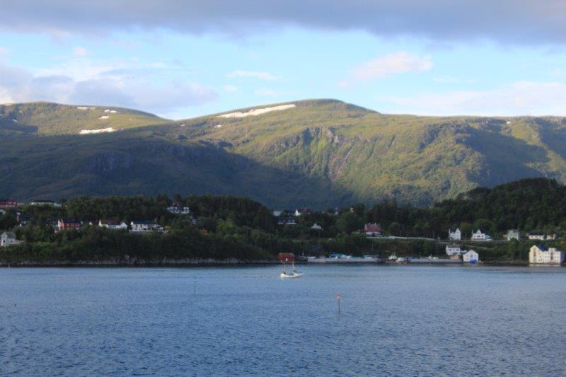
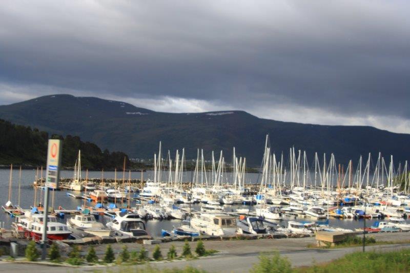
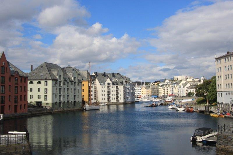
Alesund (pronounced just like Allison, but ending with a D sound) is a port town established in the early 19th century and incorporated as a town in 1848. It is still the most important fishing harbour in Norway due to its central location along the west coast and the discovery of off-shore oil in the North Sea in the 70’s (which has made Norway one of the richest countries per capital in the world, but along with that it is a very expensive place to live). Alesund has a population of 46,000 and is built on seven islands. There is archaeological evidence of community activity 6,000-10,000 years ago and the area was a major trading center for 500 years around 1000 AD. A Viking cargo ship that was built in this area (verified by the wood used) about 850 AD was discovered elsewhere and a replica is docked outside the Maritime Museum.
Jan 23, 1904 when the city had a population of about 14,000, at 2:15 am, a fire started in a cannery. There were gale force winds blowing and the fire department consisted of 15 men, 2 horses and various pumps and tools. Arriving on the scene the firemen quickly realized they had no hope of combating the blaze and concentrated their efforts on evacuating the area. Fourteen hours later the fire halted on the far edge of town. 850 homes were destroyed (out of 1000) and 10,000 people lost everything.
One fellow told his wife as she was taking things out of the house that he had been visited by an angel and told that his house would be unharmed. She didn’t believe him and continued to remove items from the building. The fire passed right over the house, burning everything in the vicinity, including all of the things his wife had removed. The house is still standing today.
Alesund was a favorite summer holiday spot of the Dutch Queen and German Emperor Wilhelm II, who came every year for the salmon fishing. Four days after the fire four ships arrived from Germany filled with building materials and labourers, food and clothing. The German Kaiser fed 3000 people three meals a day for weeks.
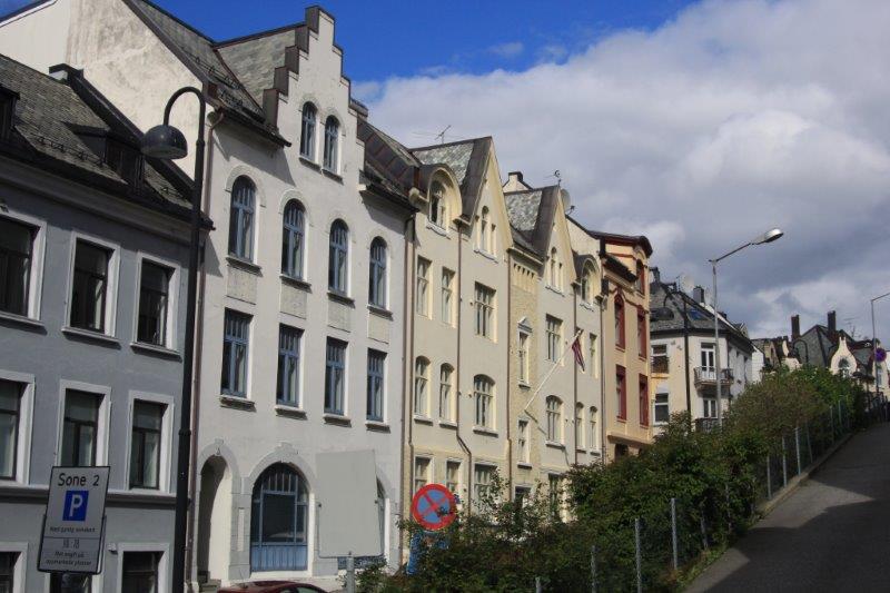
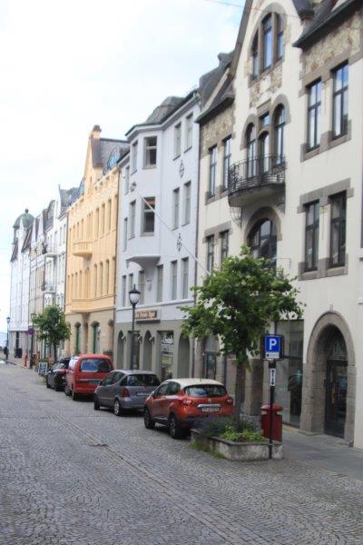
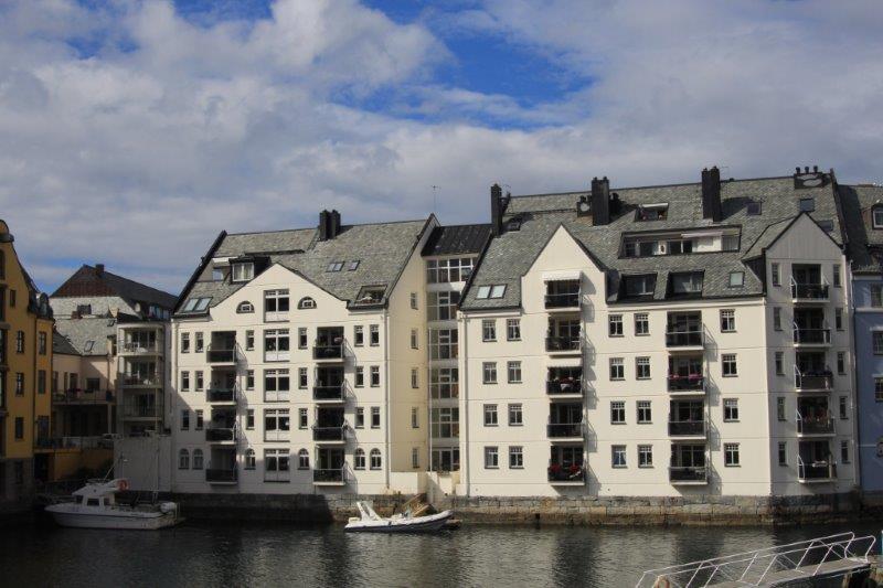
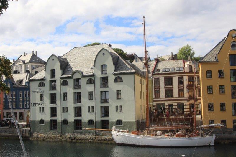
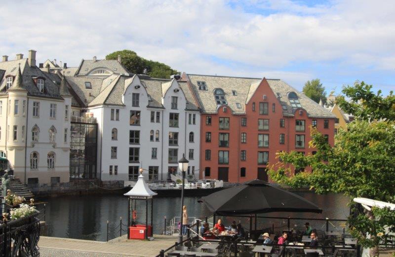
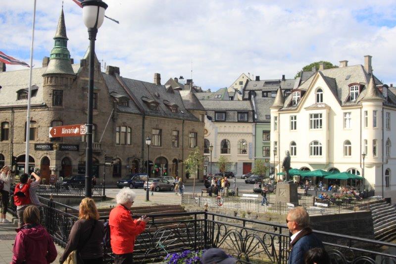
Most of the architects of the day had been schooled in the Art Nouveau style so when the town was re-built all the buildings were Art Nouveau even though several different designers and planners worked on the designs. It only took 3 ½ years to re-build 500-600 homes and businesses. Since all the businesses had been destroyed all the trades people were available to work on construction. Alesund became a city unique not only in Norway and Europe, but in the world as one town/one architecture.
However in the 1950’s people wanted to modernize and many of the buildings were torn down and new ones built. It wasn’t until the mid-60’s before a new city planner realized the unique quality that was being destroyed. Today legislation is in place to protect all the Art Nouveau buildings.
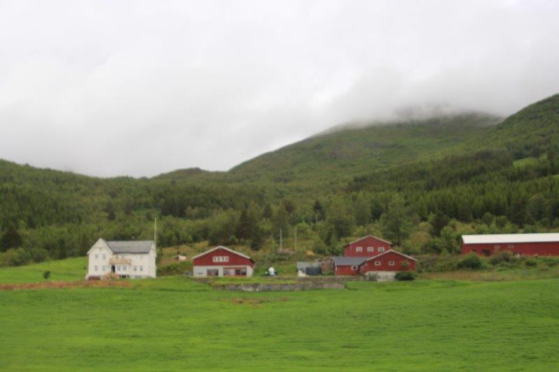
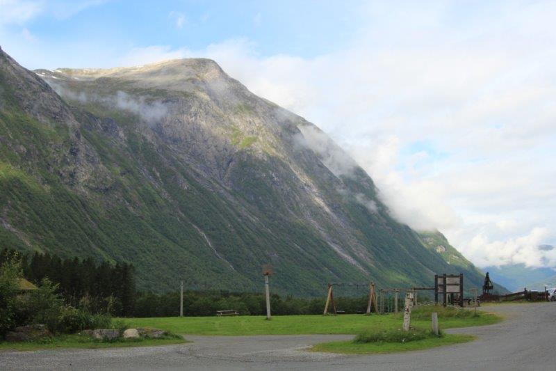
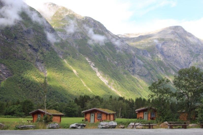
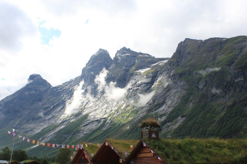
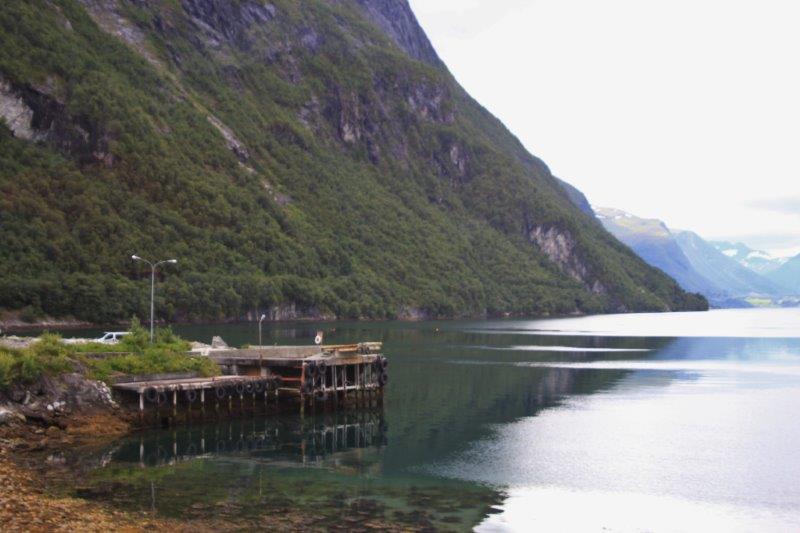
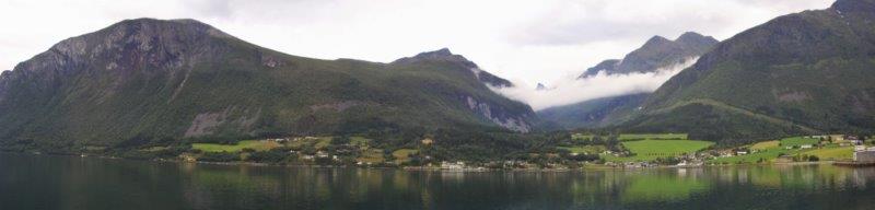
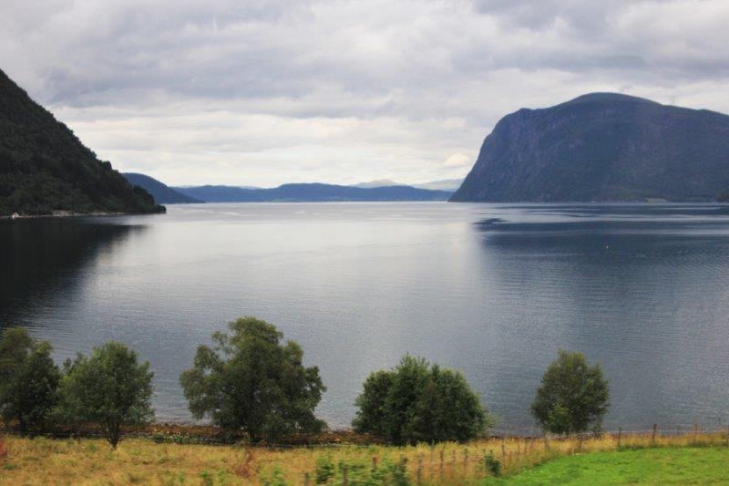
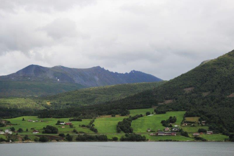
Once again our tour took us out of town. We would like to see some of the towns but so often a city is a city is a city and the things that interest us are more often than not out in the countryside. Alesund was no exception. We left town at 8 am and had a two hour drive along the shoreline of Storfjord to the turn-off into the mountains to get to the Troll Path. We passed many small farms (often the farm became summer work and the men would fish in the winter months to earn enough money to support the family. This is now considered to be an actual profession, called a fisherman-farmer.)
We also drove through a micro-climate area where they grow 60% of all the strawberries in Norway. There were many people in the various fields picking the berries. Usually the strawberries are ready in July but they were late due to the cool summer. Beginning in 1946 Polish migrant workers of all professions have come to pick the berries every year. Some are even doctors or accountants but in a few weeks picking strawberries they can earn the equivalent of an annual salary at home. The workers are housed and fed by the farmers while they are in Norway.
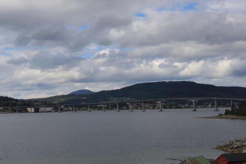
Being a country of fjords and mountains the Norwegians have constructed many bridges and many tunnels. We drove through over a dozen tunnels on our way to the Troll’s Path turnoff. Most were 1-2 km long and the longest was 6.6km (4 miles). The road used to go along the edge of the mountain but it was destroyed so many times by avalanches and was constantly needing to be re-built so the government just had a tunnel drilled through the mountain instead.
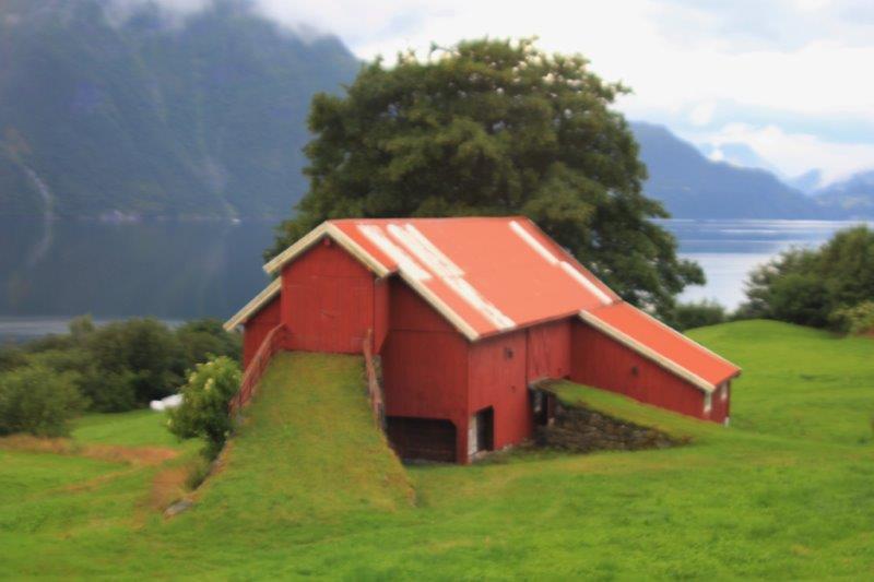

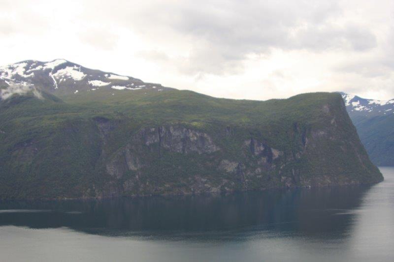
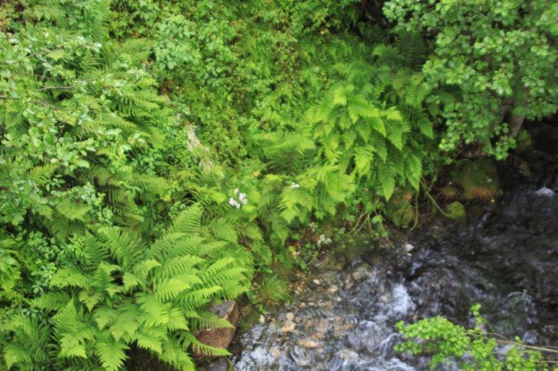
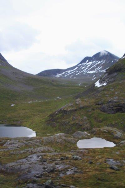
 Here too there was a very remote farm on the cliff face only accessible by track up from the boat launch in the fjord. This farm was quite large and if they needed more space they just cut down some of the surrounding trees. The land was farmed by the family for over 50 years and whenever they purchased new equipment or brought in household goods or foodstuffs it had to be carried by hand up the cliff to the farm – no pack animals. It was also abandoned when education became compulsory for children – even though they only HAD to go to school every second day it was almost impossible for them to make it.
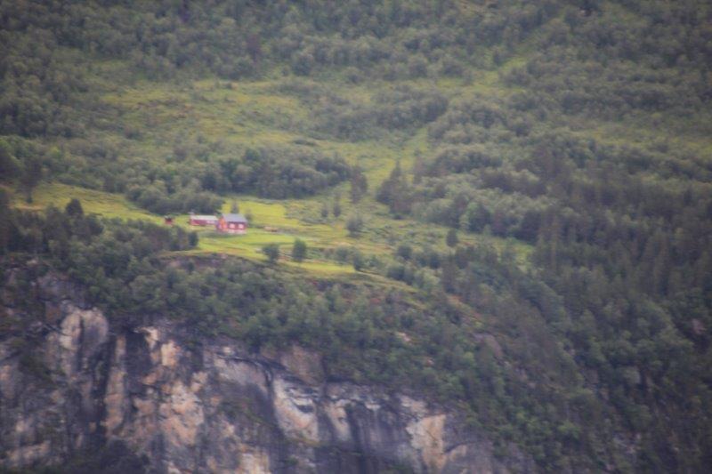
Here is the farm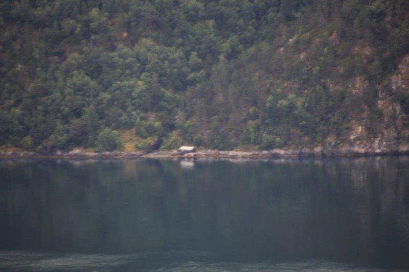
Here is the boathouse on the shore of the fjord
Now look near the middle of the photo to find the farm and then look to the lower left to see a small white spot that is the boathouse. There was a path up the cliff side from one to the other.
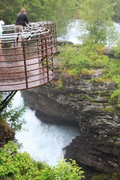
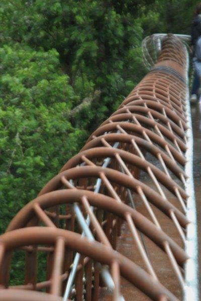
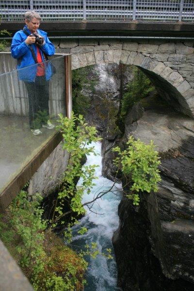
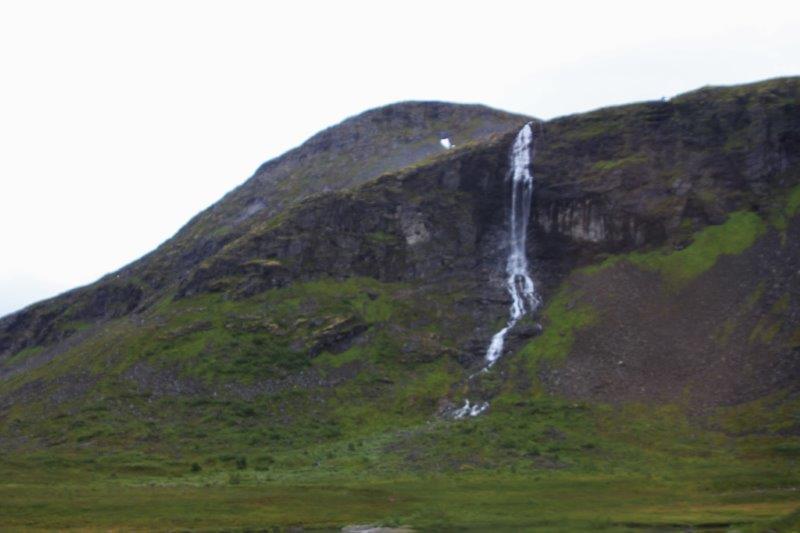
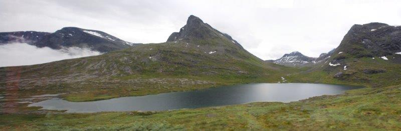
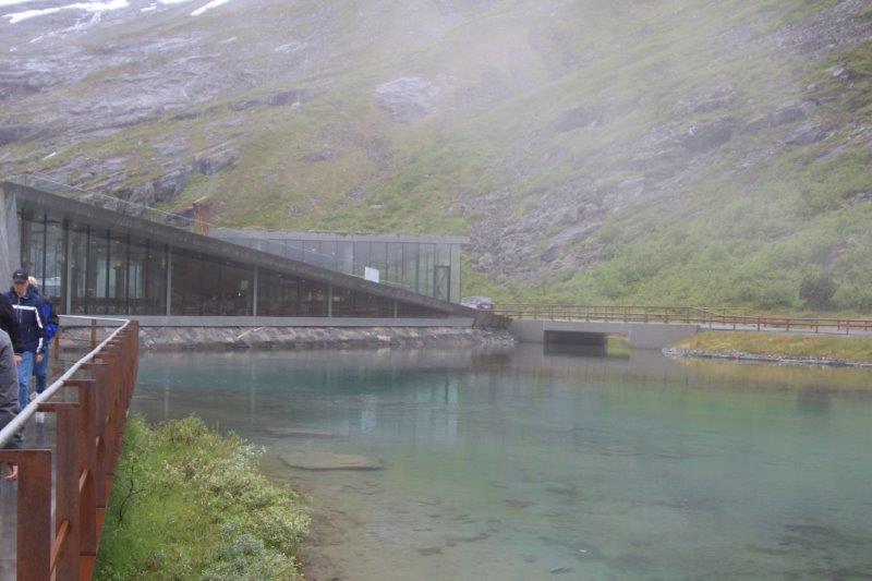
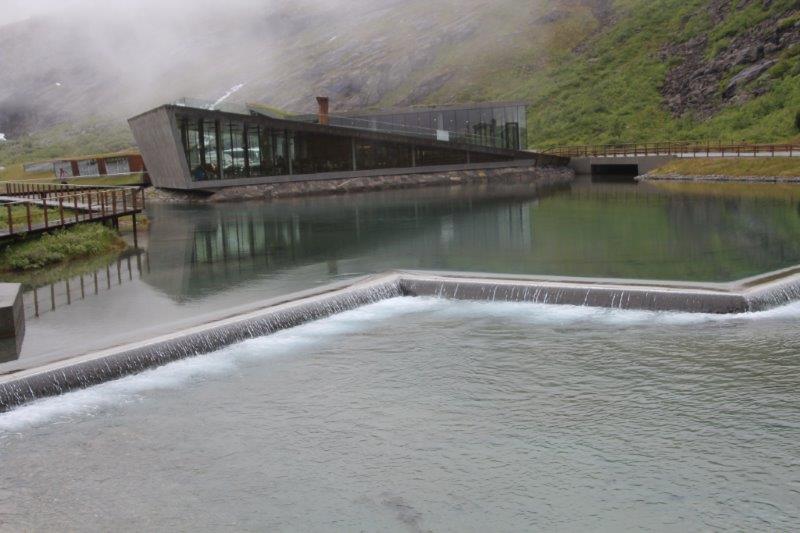
Our first stop along the way was at the Gudbrandsjuvet Gorge. There is a zigzag metal walking path that takes you over the gorge and past the waterfall. It is an easy 10 minute walk. The bus drive lets you off by the visitor’s center and picks you up at the end of the walkway.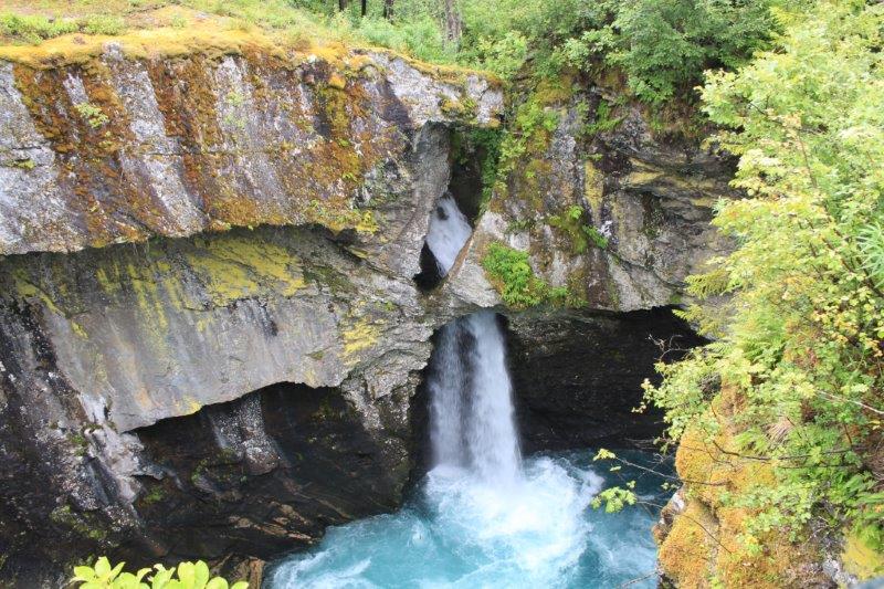

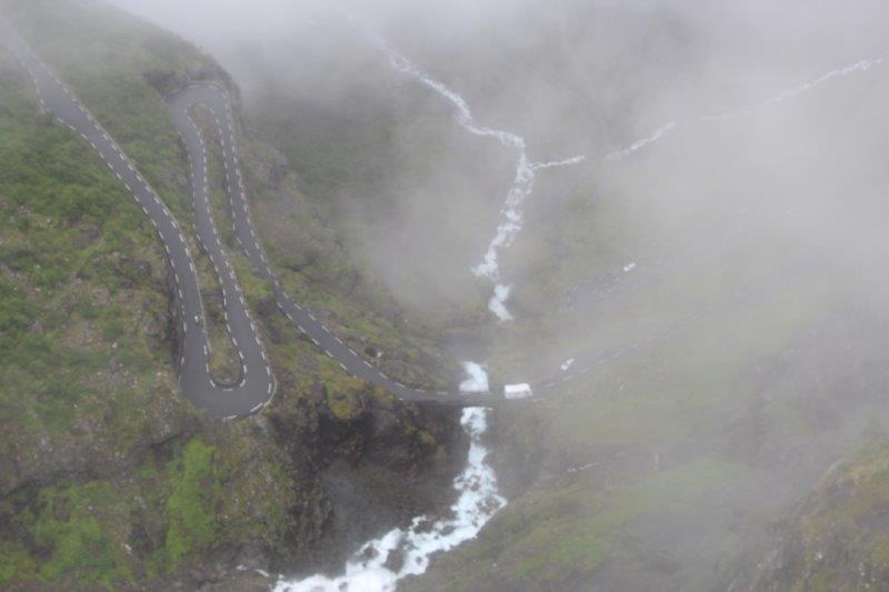
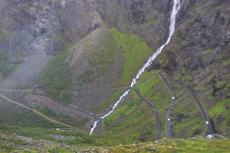
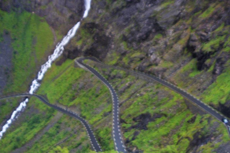
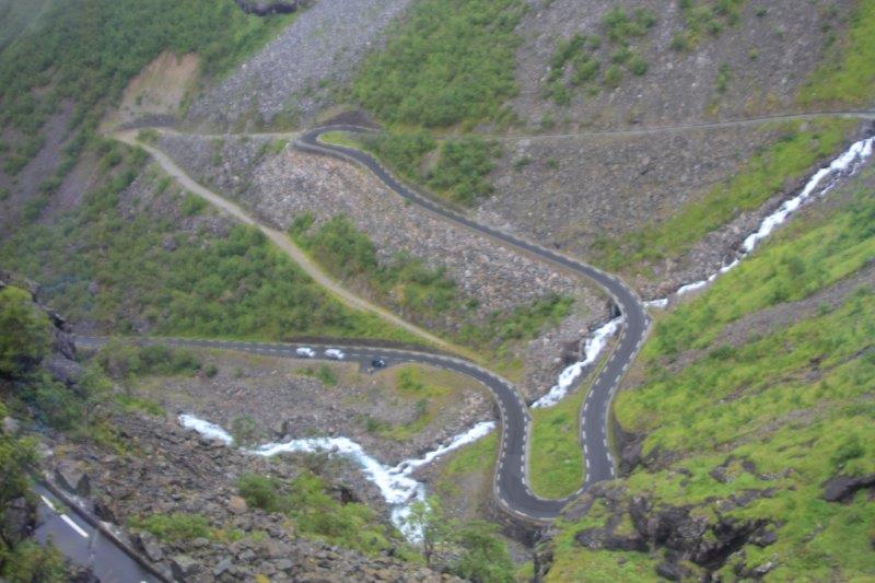
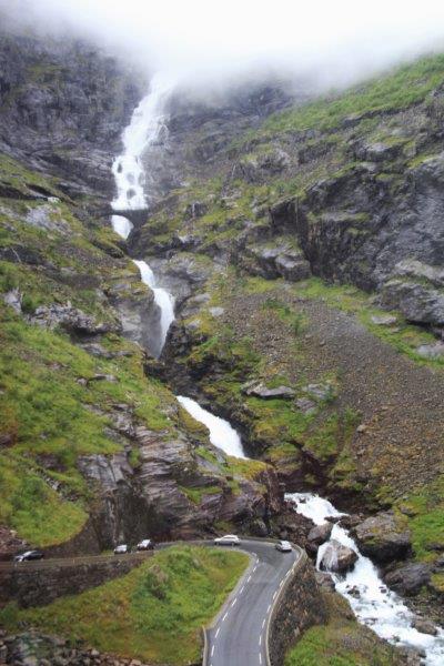
 The Troll’s Path is now a road but originally it was a handmade path over the mountain and down the other side that the farmers built so they could move their goods back and forth without going all the way around. The idea was first thought of in the mid-1700’s and begun in the late 1800’s by volunteers on both sides working only in the summer months. It took 14 years to build and you can still climb it today. We actually saw one intrepid fellow making the climb as we were driving down the far side. The highest point of the Troll’s Path is 2800’ above sea level and the road is narrow (two buses passing almost touch mirrors and are at the very, very edges to do so), winding and with many hairpin turns on the way down. The cliff on the far side is almost a vertical climb and the other side isn’t much better. It would have been an absolutely exhausting way to move merchandise and goods, but quicker.
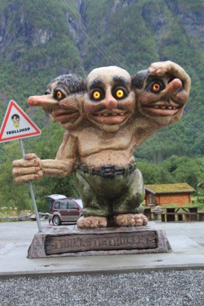
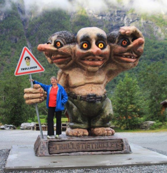
(Trolls, by the way, were created by the Norse God Odin when he decided he wanted to make some things like the two creators who made the gods and the people. But Odin wasn’t very good at it and he just used spare parts and odds and ends so all trolls are very ugly. Some are huge, some are small. Some have one head, some have two or three. They all have tails. All of them tolerate children but don’t like adults. Odin asked his son Thor what he thought of his creation and Thor told him they were really ugly and would scare the people and that Odin should destroy them. Odin did not want to do that because he had made them but he made the Trolls nocturnal so they wouldn’t be around people during the day. If a troll gets caught outside of its cave and gets hit by sunlight it turns into a rock. Many of the rocks strewn about the hillsides and mountains of Norway were once trolls. There are many, many stories, sagas, and tales about trolls in Norway and every gift shop is full of books and T-shirts and small and large troll knick-knacks.)
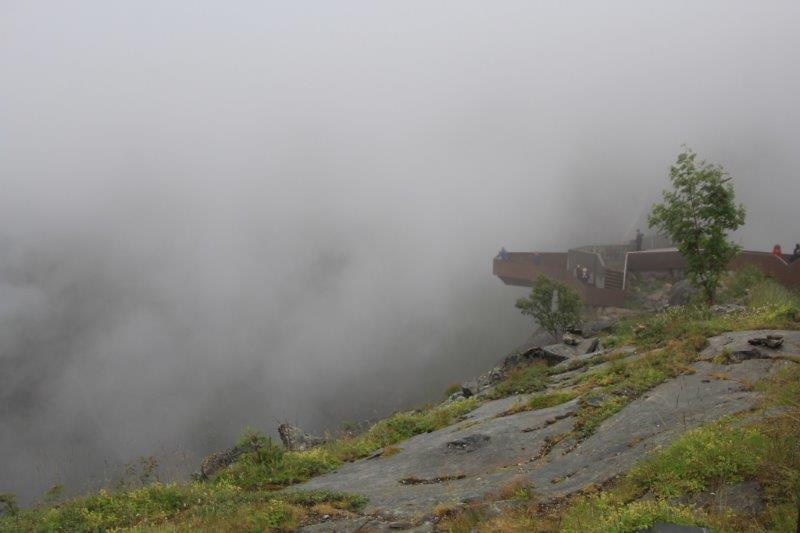
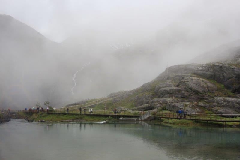
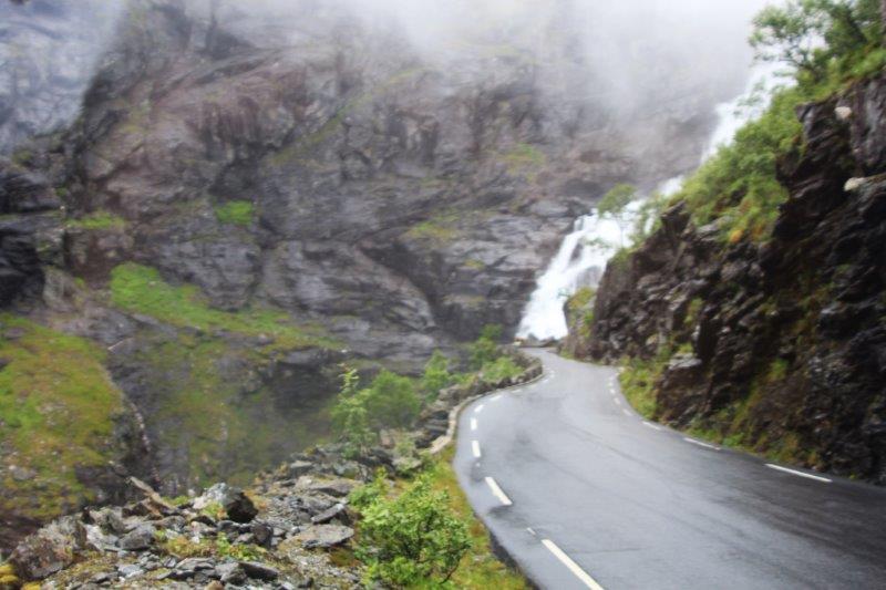
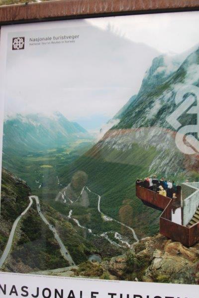
We passed some lovely scenery on our way up the mountain and, just like the day before, just as we arrived at the parking lot the fog rolled in and everything turned white! We had 35 minutes at the summit and I hotfooted it to the very end of the path to the lookout where there is a spectacular view down the mountain and out through the valley. (We had seen a poster of it at the gorge – see photo) Everything was totally white. You couldn’t distinguish anything.
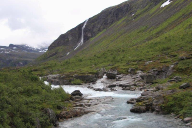
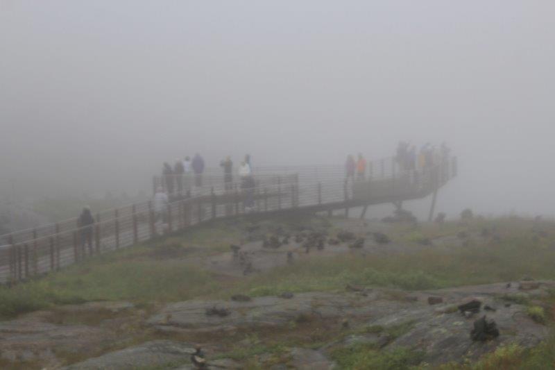
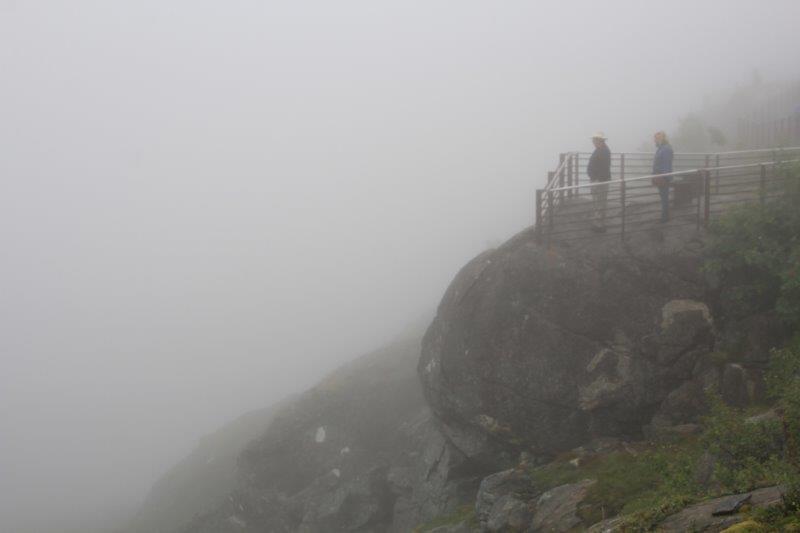
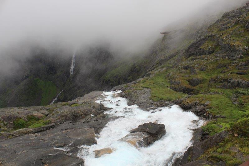
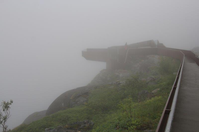 The family from Louisiana that sit next to us in the dining room were on our tour and when they arrived at the lookout I said that I wasn’t moving until 5 minutes before we had to be back on the bus because I knew how fast fog can lift if it decides to. Sure enough after about 10 minutes or so we could see a different shade of white where the waterfall began at the cliff edge and a few minutes after that we could see the hairpin turns winding down the mountain. It never did clear enough for us to see the view out the valley but we could see it as we drove down so it worked out well.
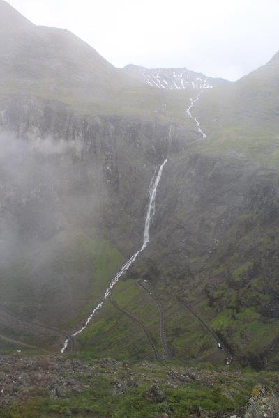
 This is what we were supposed to see at the top.
We navigated all the very tight turns with a bit of backing up and shifting about now and again and drove through the valley to the Troll’s Shop and Restaurant for lunch – a nice buffet with wonderful Norwegian salmon.
A very narrow winding road.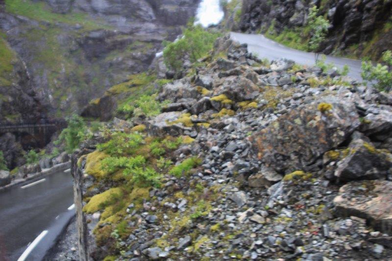
In this pic you can see road on the lower left and upper right. There is a haripin turn between them.


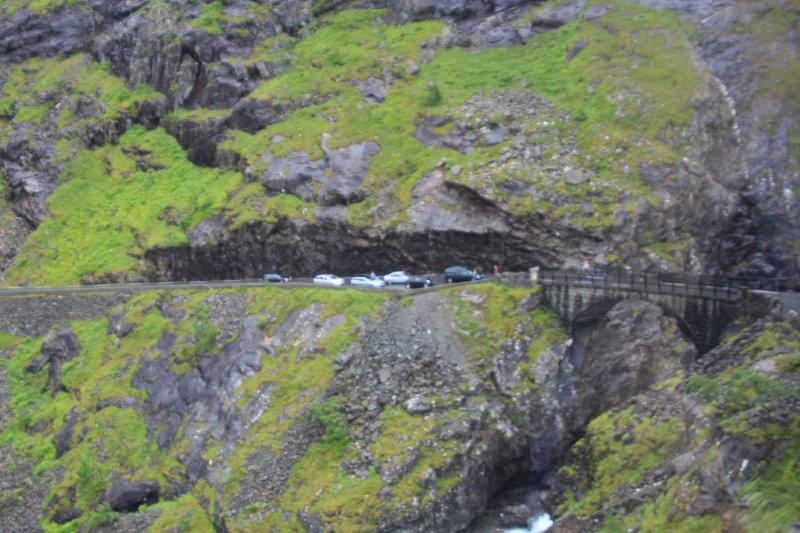
 The road was completed in 1921. All the walls and the bridge were built by hand with no mortar or cement between the rocks. The weight of the rocks and on the rocks creates the strength. The road was to be officially opened by the King and he would be driven down the mountain. The engineer was so afraid that the bridge or one of the supporting walls would collapse and kill the monarch he committed suicide the day before so he would not have to bear the blame. The bridge has been untouched and unaltered since the day it was built and big buses, campers and cars and trucks go up and down it all summer long.
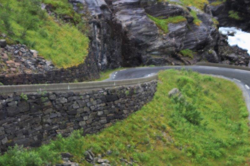
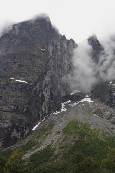
 Our last stop of the day was at the Troll Wall which is a row of black cliffs that create an almost impregnable wall. One face is the tallest vertical drop in Europe at about 600 meters and was first successfully climbed over two days (albiet along the outer edge) by a Norwegian team in 1940-something. An English/Norwegian team climbed the vertical face in the early 1950s. It took two weeks. They spent 13 nights anchored by pitons and ropes to the rock. It became a very popular place for parachutists to basejump. About 300-400 jump were attempted and so many deaths and expensive rescue operations have occurred that the government has now outlawed jumping from the top. You can still climb it and several different teams have done so by several different routes. If you find and succeed along a new route it is named for you. There is a memorial near the gift shop listing the names and nationalities of all the climbers (10) and jumpers (9) who have died on the mountain.
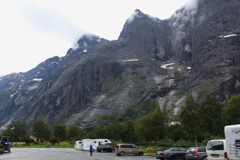
If this photo was reversed it would look almost like Bastion Mountain at home.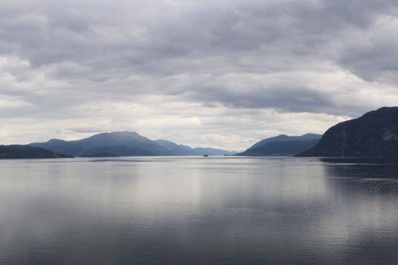
So very reminicent of home. 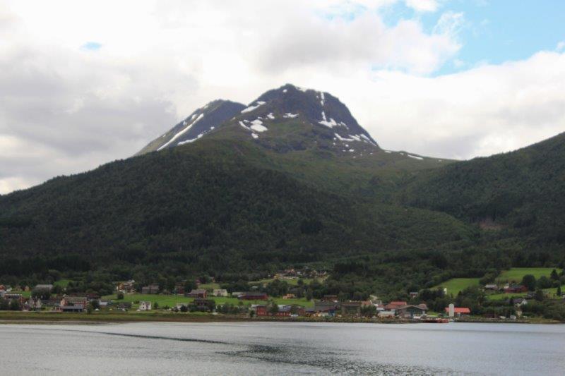
 We had to be on board by 4:30 and our tour was to end at 4. John and I were hoping it would be on time because the ship was literally docked at the edge of town and we were hoping to have a bit of time to walk a few of the nearby streets. However, since everyone had been so prompt getting back on the bus at each stop we were running ahead of schedule. Our tour guide had the bus driver come back into town on the old highway and show us where the 1904 fire stopped and told us all about it and then drove us through many of the streets to show us the Art Nouveau buildings. It was great! So we didn’t have to hurry to go see some buildings when we got back we could just go onboard and get ready for dinner. Despite the fog at the summit it was a good day. Long, but good. Tomorrow is Bergen and we have no tour planned.

