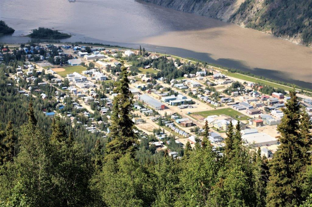
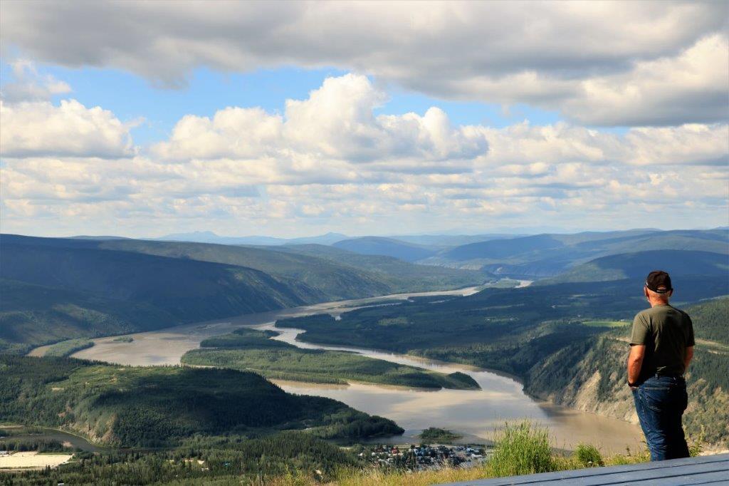
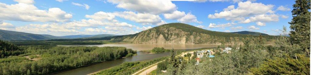
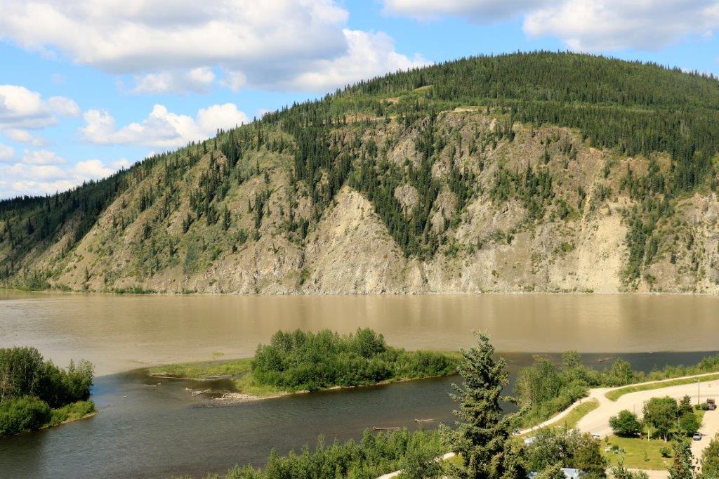
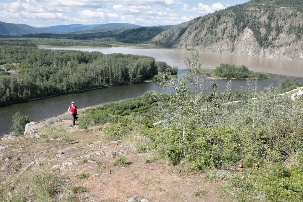
Today was a viewpoint and goldfields day. After breakfast we drove up to the Midnight Dome which is a high hill overlooking the Klondike and Yukon Rivers and the town of Dawson City. The vastness of the view was seriously impressive.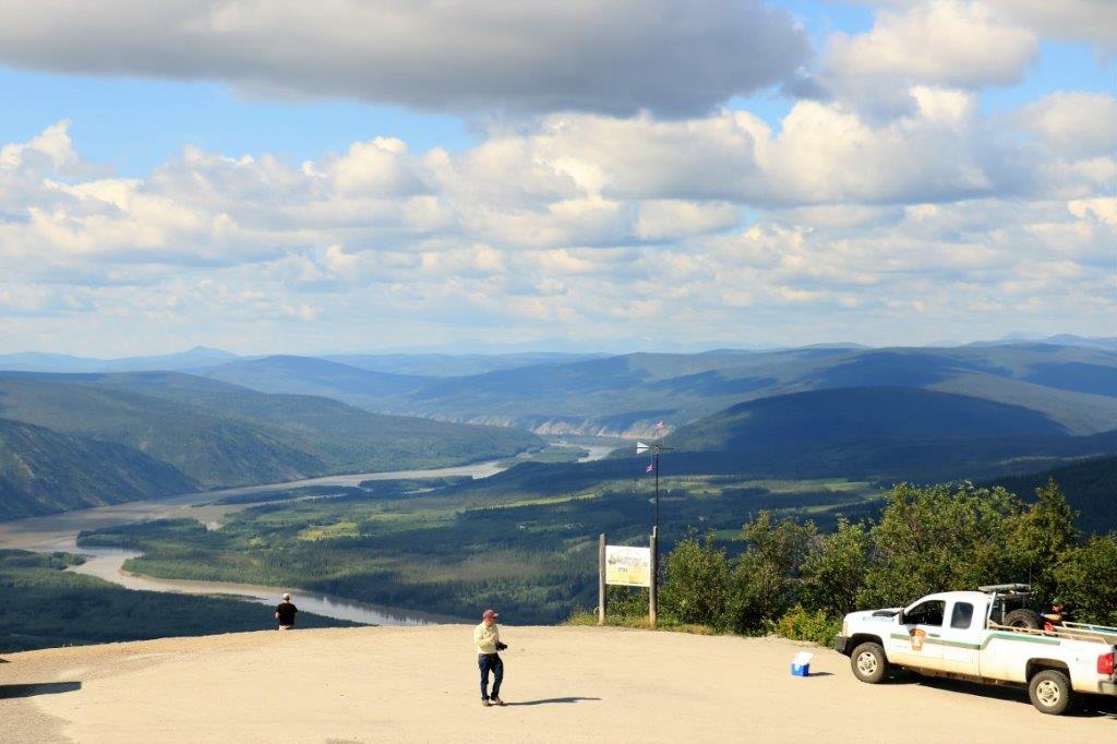

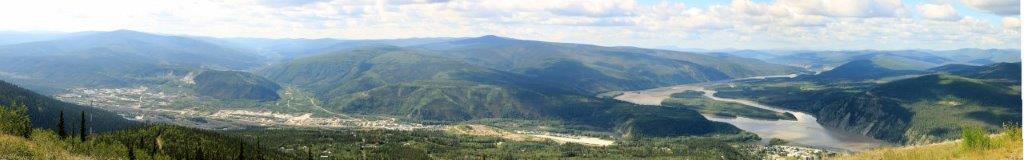
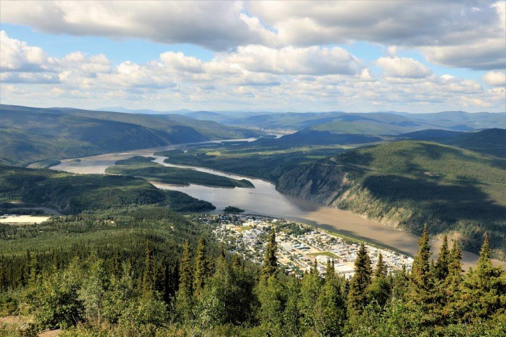
 Notice the two colours of water in the river. At the upper left of the photo is the Klondike River merging with the muddy Yukon River. It takes a fair distance downstream for the waters to fully merge.
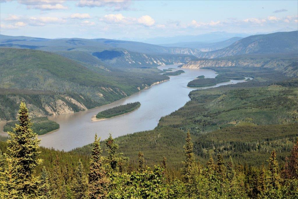
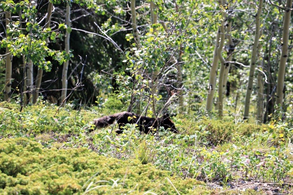
 As we were driving back down Dome Road we spotted a silver fox at the side of the road. It turned around and disappeared into the bush. They look like a black fox, but the tips of their hair is silver, hence the name.
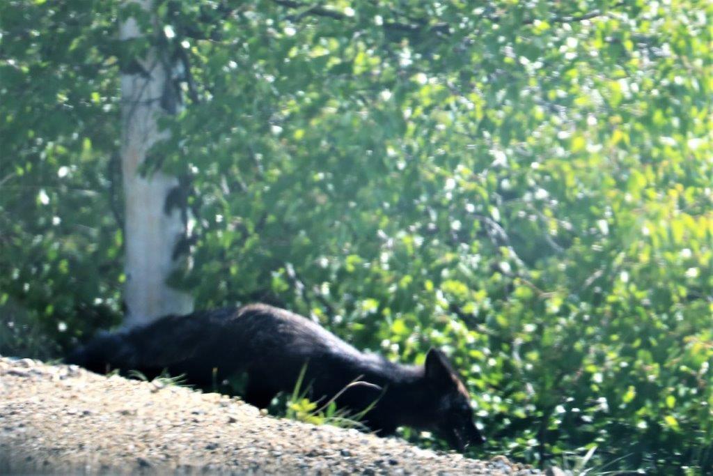
 There was a geocache hidden at Crocus Bluff Viewpoint and the road to the bluff joins the Dome Road so we went over to find it.
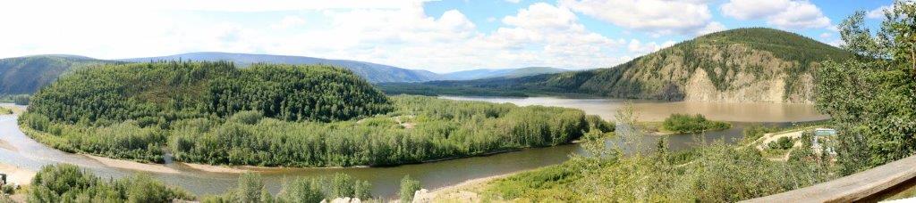
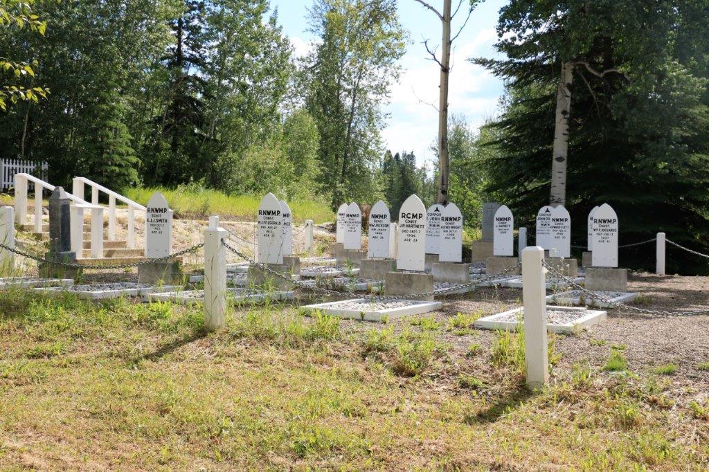
 The Mary McLeod Road, where Crocus Bluff Viewpoint was located, also was the site of the Hillside Cemetery; begun in 1898.
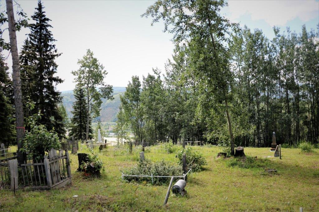

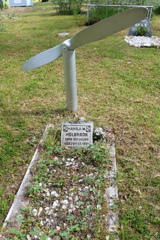
 My brother-in-law would like this grave marker.
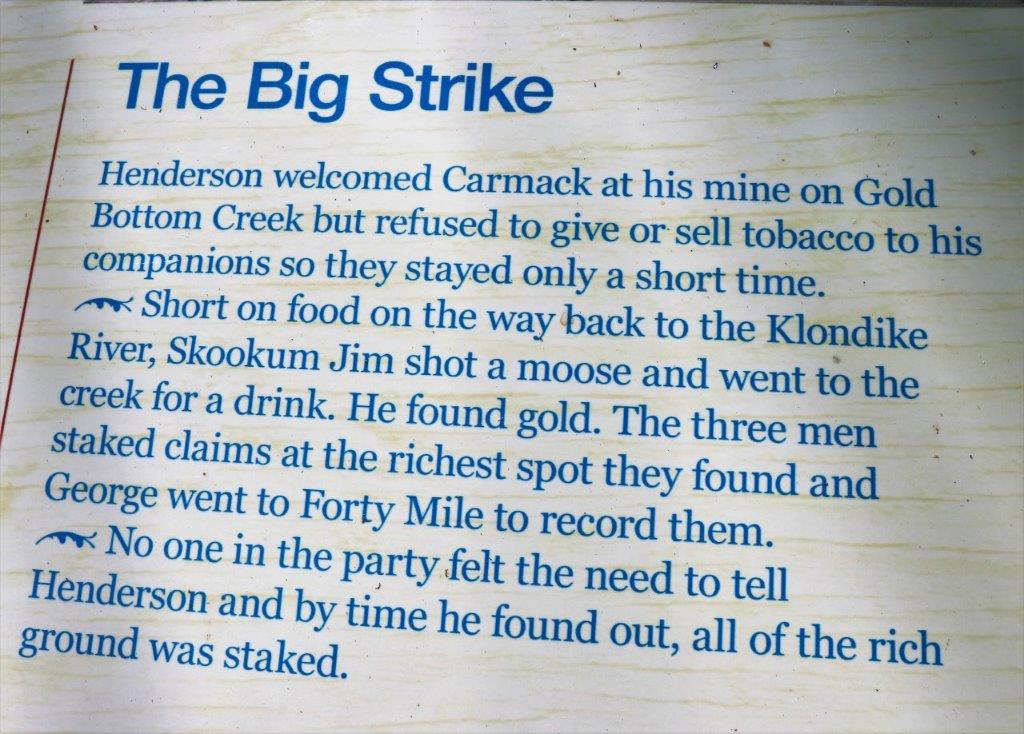
At the bottom of Dome Road we took the highway out of town a couple of kilometers and then turned off onto Bonanza Road. Bonanza Road extends far down the valley and is home to the Klondike Goldrush Discovery claim and all the subsquent claims made by most of the local miners even before word of the discovery was leaked to the world.
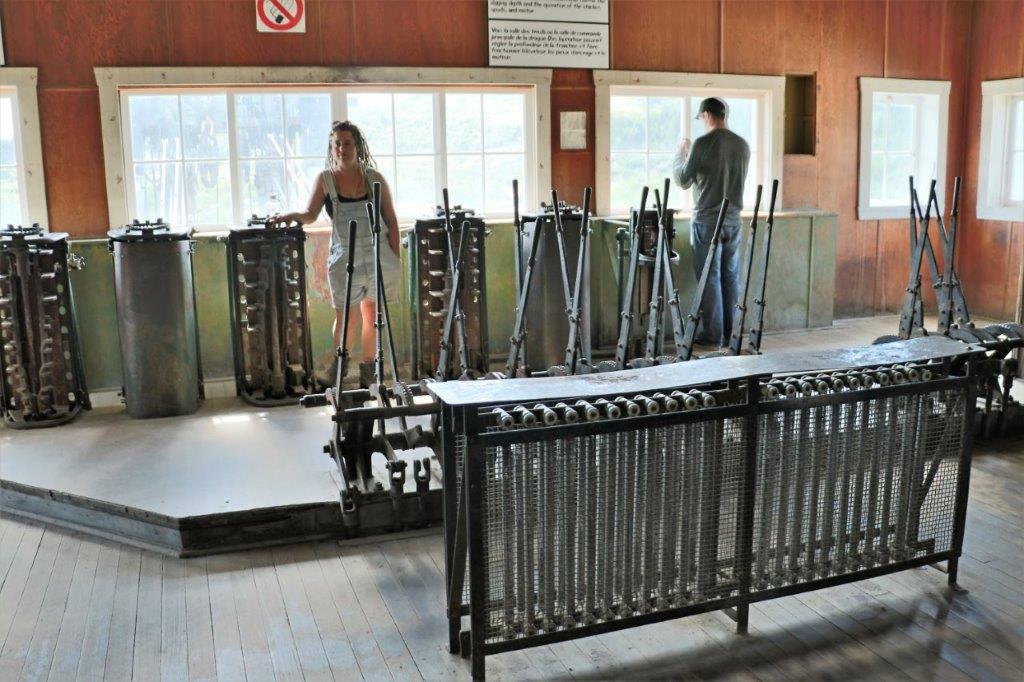
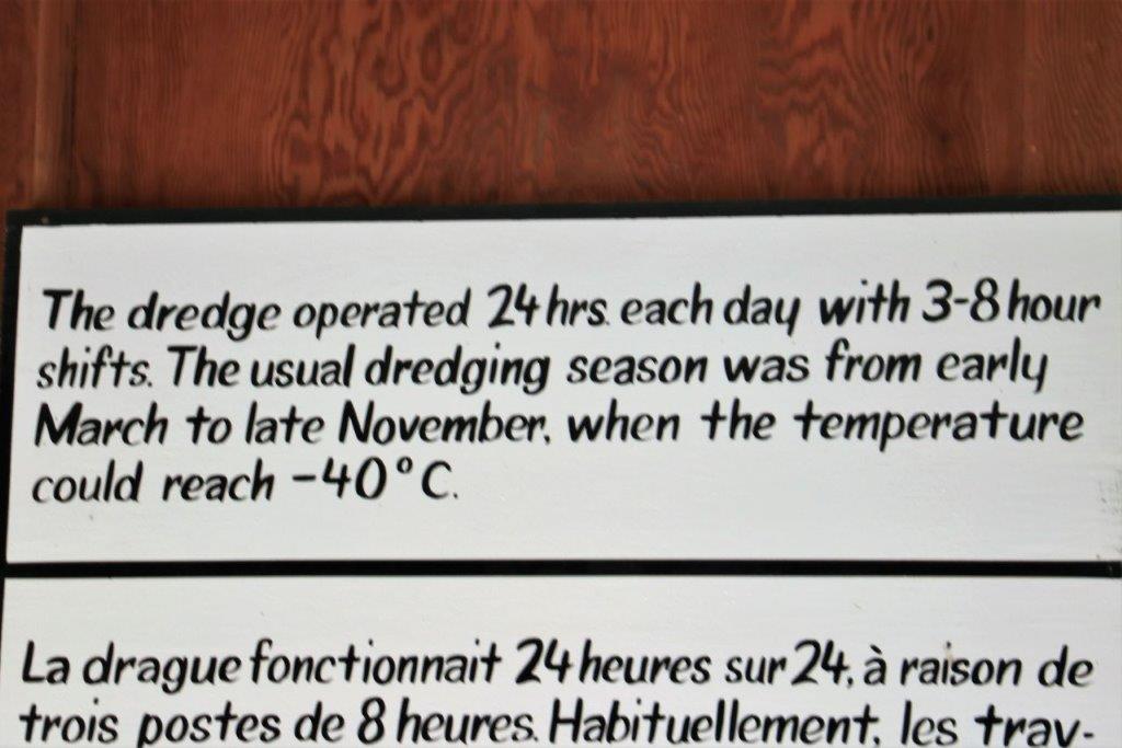
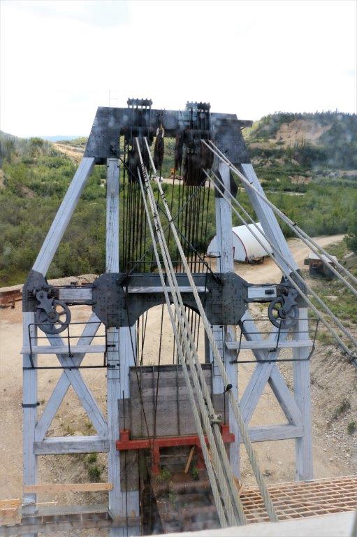
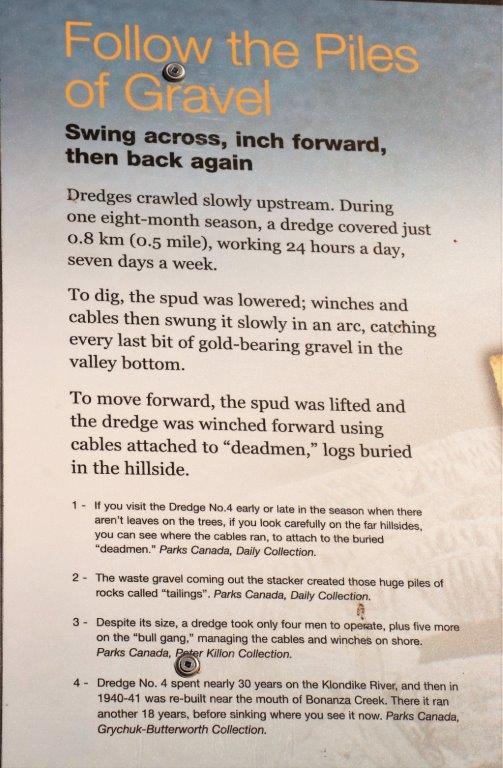
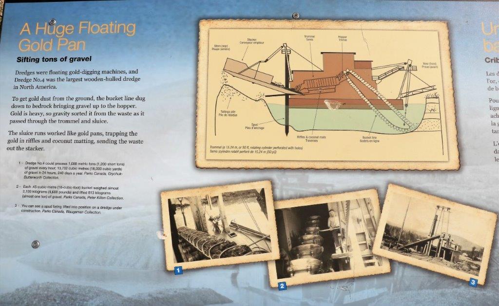
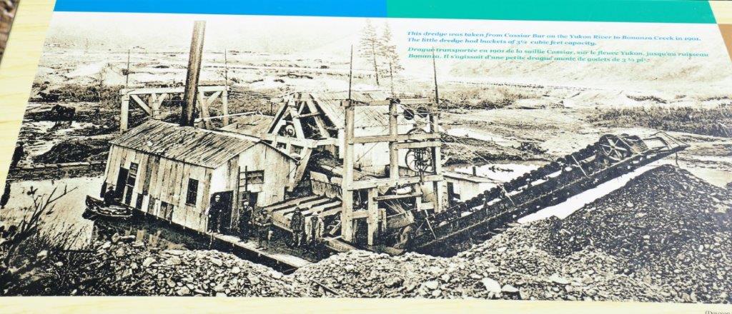
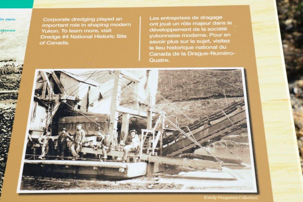
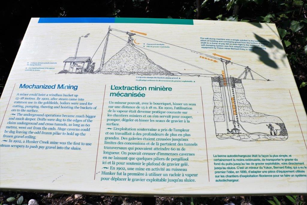
Our first stop was Dredge #4, the largest dredge to work the gold fields. After the first rush was over (1-2 years), many of the hopefuls who had no luck headed off to Alaska for the new discoveries there. Dawson City was headed to be a boom/bust town. However, the town and the gold mining was saved by bringing in dredges that could remove the rock and soil from the bedrock layer. The hardest part of finding gold in the Klondike was the permafrost. Once you remove the top layer of soil you hit permafrost, which is frozen soil from the Ice Age and is many many meters thick. Even an iron dredge shovel cannot break through it.
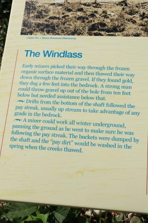
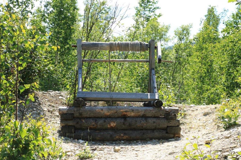
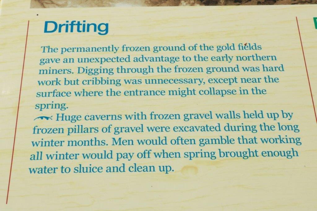
The miners working their claims by hand had to build a fire on the permafrost layer of a space they had cleared, let it smolder overnight, clear away the foot or so of thawed dirt, light another fire, let smolder to melt the permafrost, clear it off, repeat, repeat, repeat until they reached bedrock. Gold is 19 times heavier than water so it will work its way through crevices and cracks in dirt/rock until it rests on the bedrock. Then they could extract the gold they find before moving to begin a new hole.
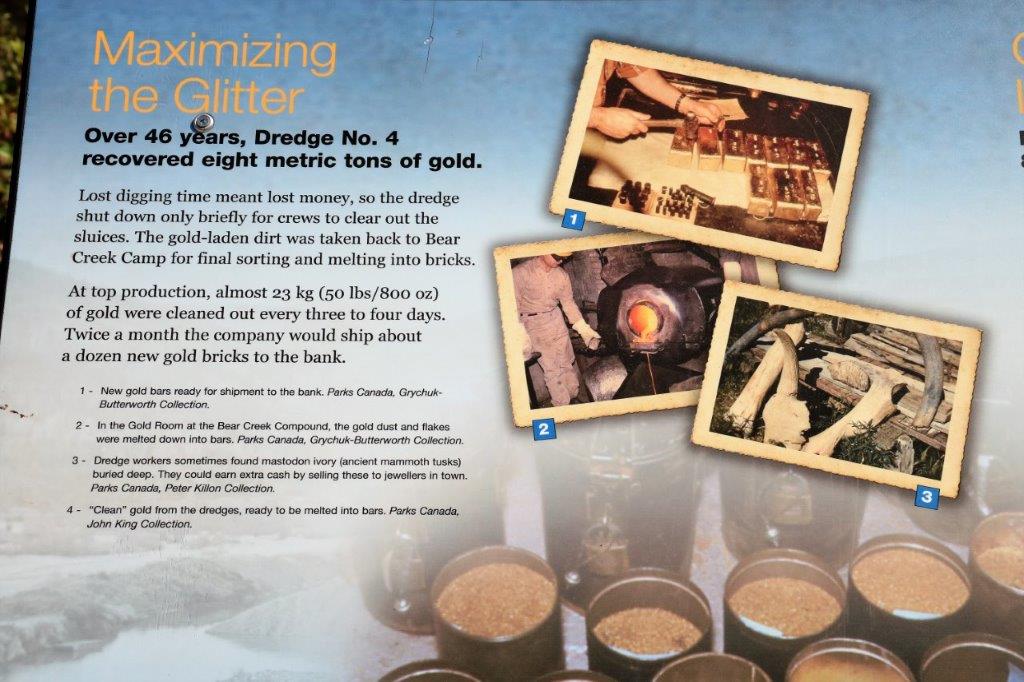
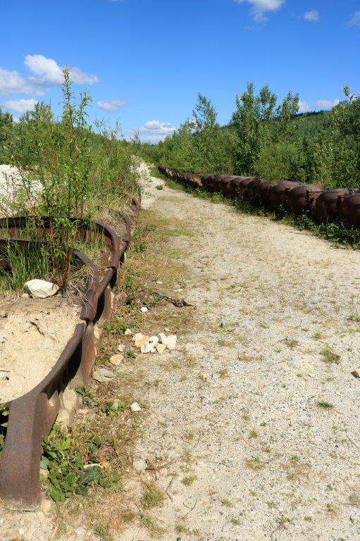
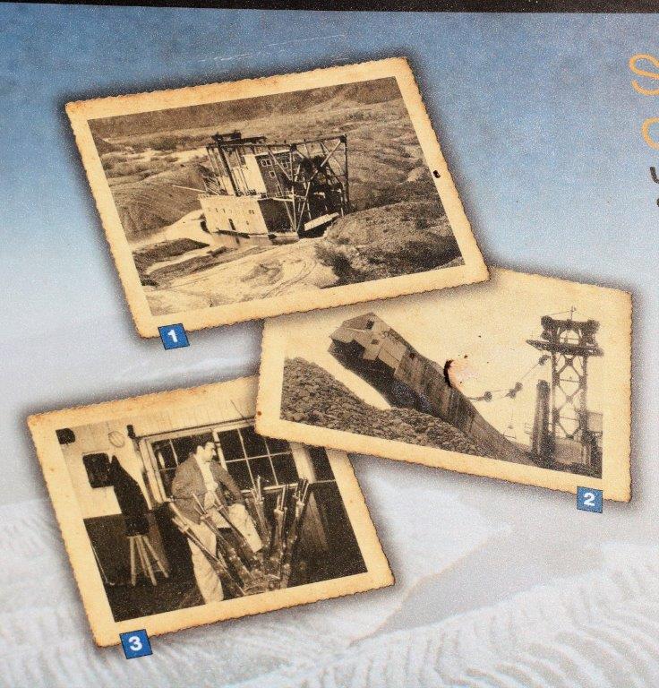
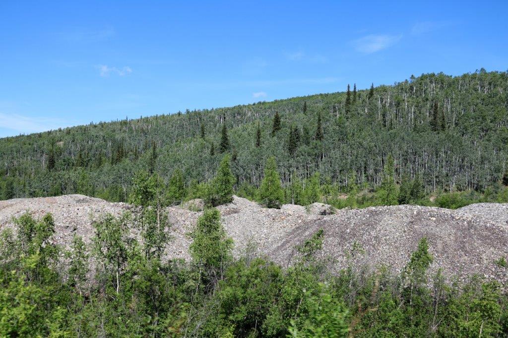
The dredges were floating dirt movers. There is a 12 man crew that works ahead of the dredge melting the permafrost. #4 dredge worked the Bonanza Creek for 46 years before it was flooded when a hydro-electric dam burst and flooded the creek. The dredge was buried in sludge and water for thirty years before Parks Canada had it lifted out of the pond, cleaned, and restored for an historic monument. (Note of trivia: Due to the demand for water for the dredges there were dams put on the Yukon River and Dawson City was the third city in all of North America to receive electricity.)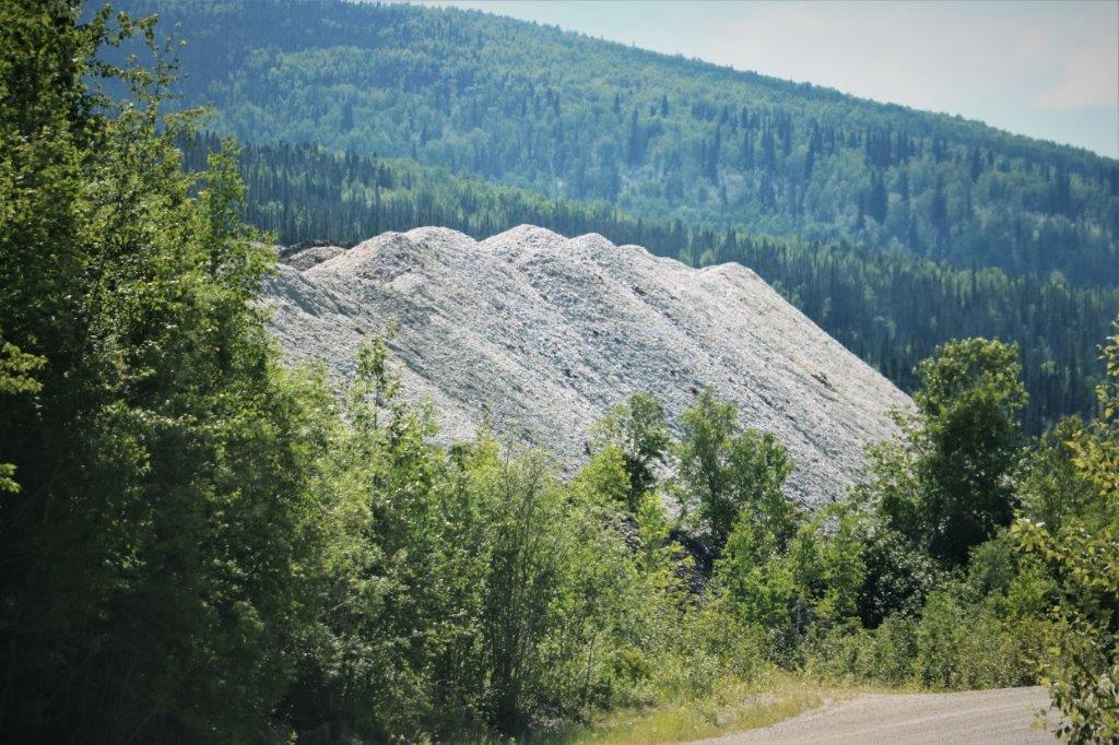 These tailing piles extend the full length of the creek into the valley.
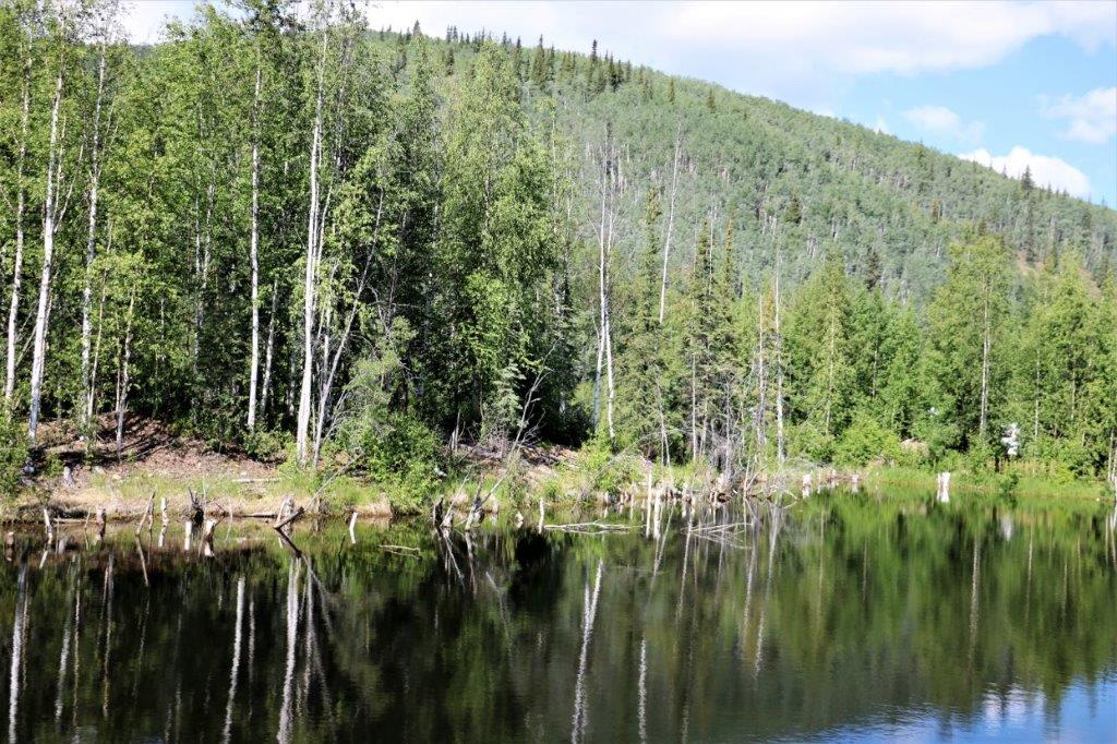
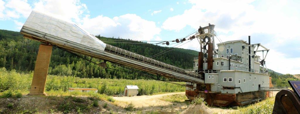

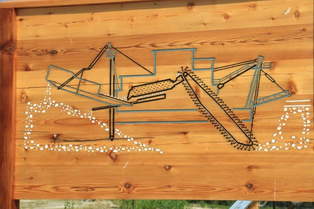

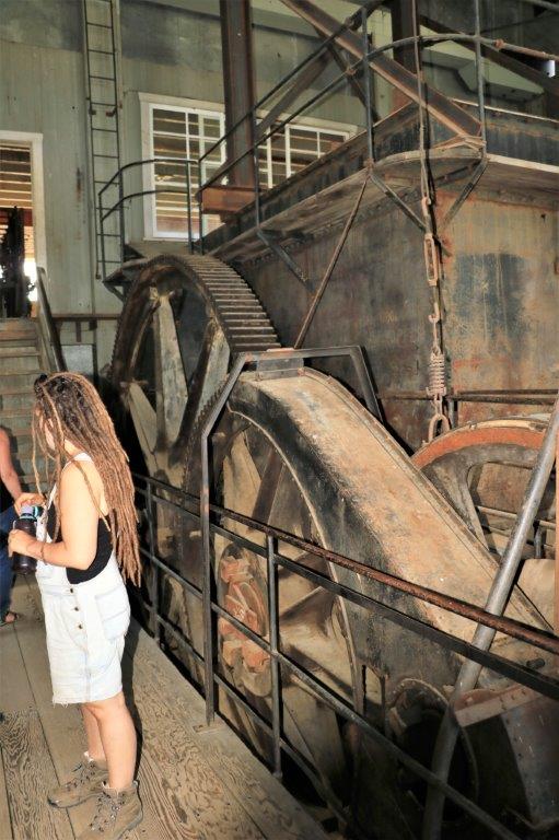
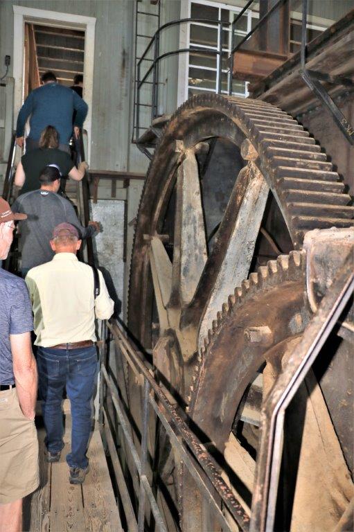
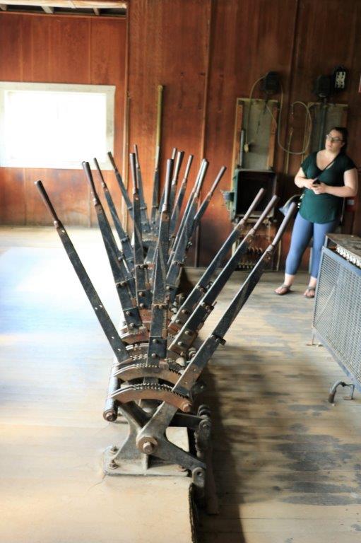
 The long arm at the front of the dredge had 66 of these big steel buckets attached and it took 3 minutes to make one rotation digging up the dirt.
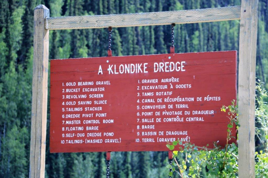
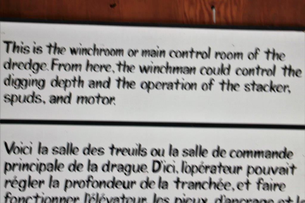
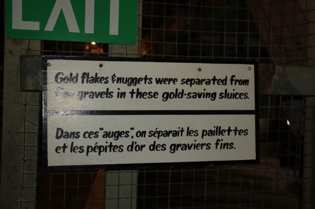
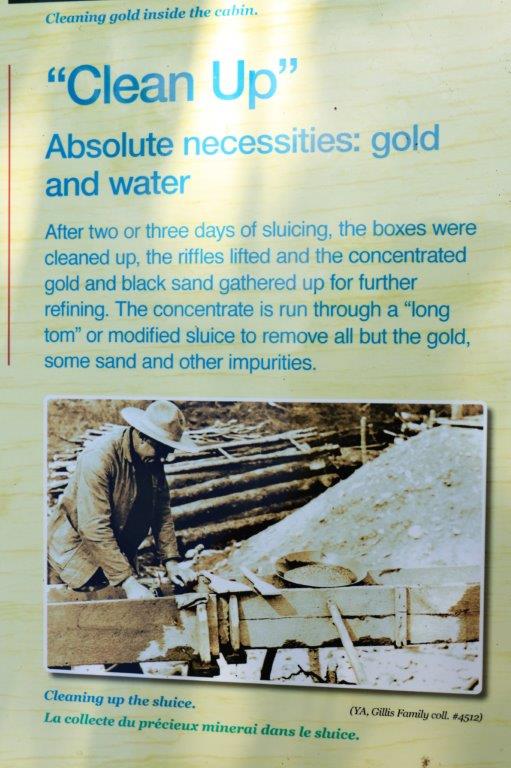
I took quite a few photos of the massive equipment in the dredge, but I am not about to try explain what they all did. There were only 4 men required to run the dredge the majority of the time. A fifth man would come on board to do the “Clean Up,” which is collect the gold.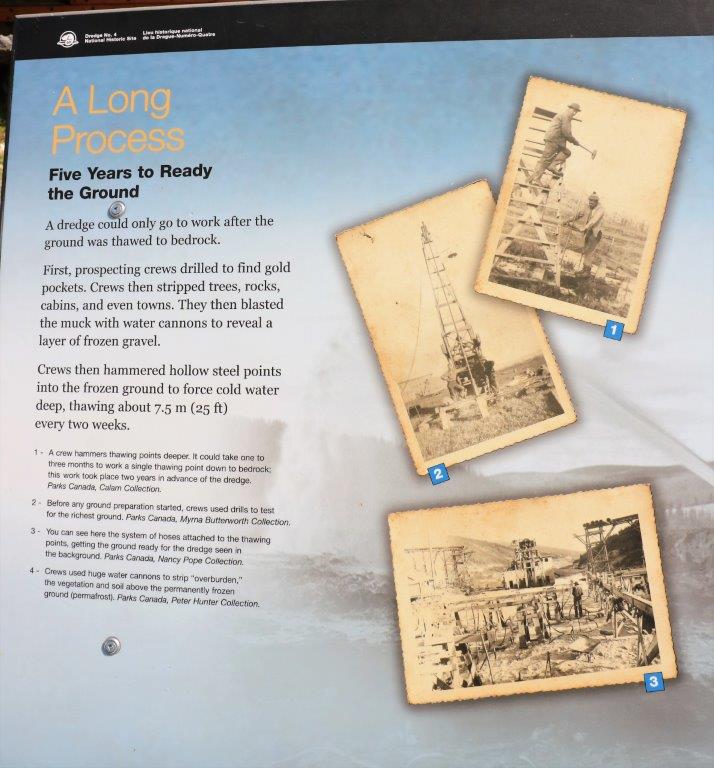

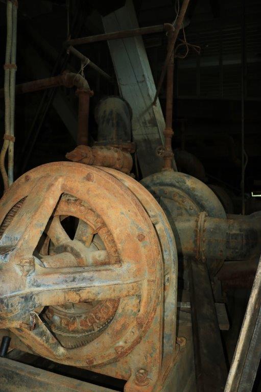

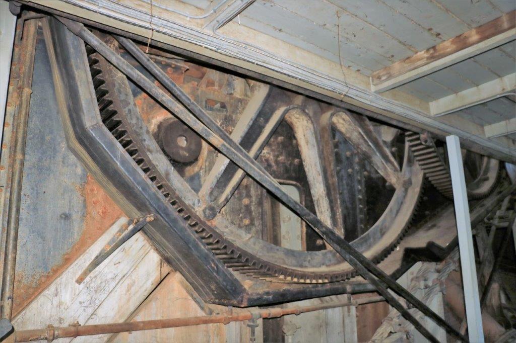 The dredge was built in Ohio in 1912, disassembled and sent by train to the coast, then by ship to Skagway, Alaska, and then the pieces were put on the narrow-guage White Pass and Yukon Railway to go up to the Klondike. The large gear above is 14′ in diameter. The tunnels on the rail line are not that wide. They realized there was no way to get the two gears up on the railway, so they were sent back down, put on another ship and sent around to the mouth of the Yukon River in the Bering sea and brought down by river barge. The dredge cost $500,000 and the cost was recouped in the first year.


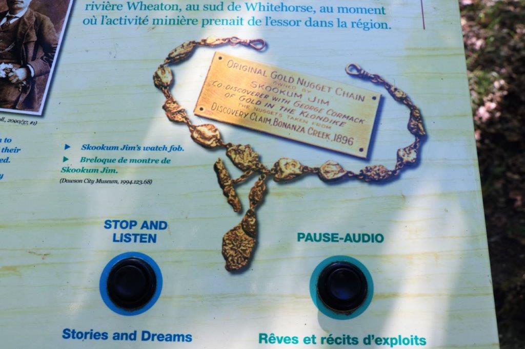
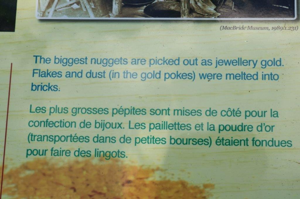
 Our tour guide was a French-Canadian gal and she showed us a 1/2 ounce nugget her boyfriend had found at Hunker Creek. The chain is one ounce of gold. There is still lots of active claims being worked around here.
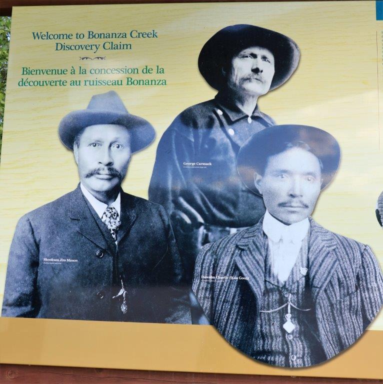
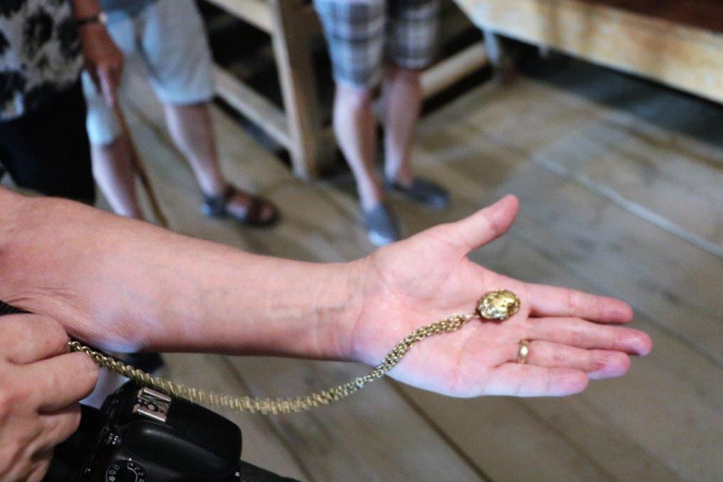 After we toured the dredge we continued down the road to the sight of the Discovery Claim, the first one staked. The first claim staked and registered on a gold field is called Discovery Claim. All others are numbered upstream or downstream from Discovery.
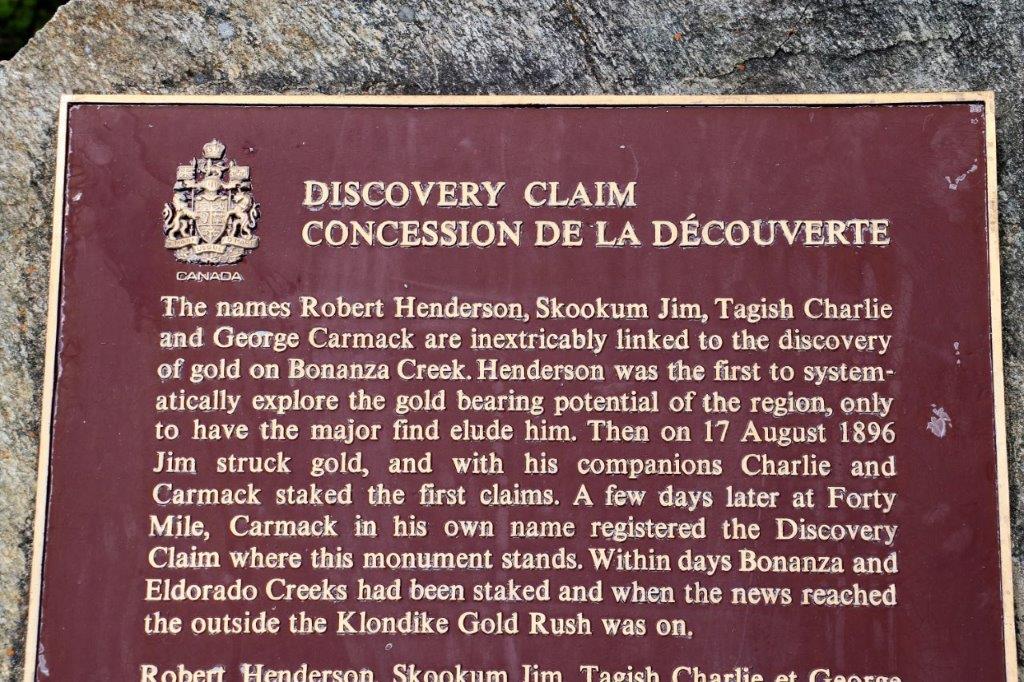

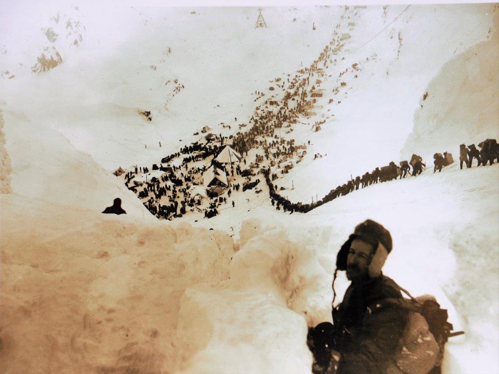 Hopeful goldseekers climbing the steepest part of the Chilkoot Trail from Skagway, Alaska into the Yukon.
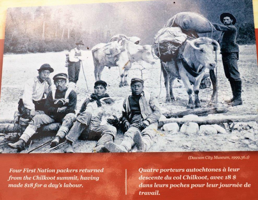
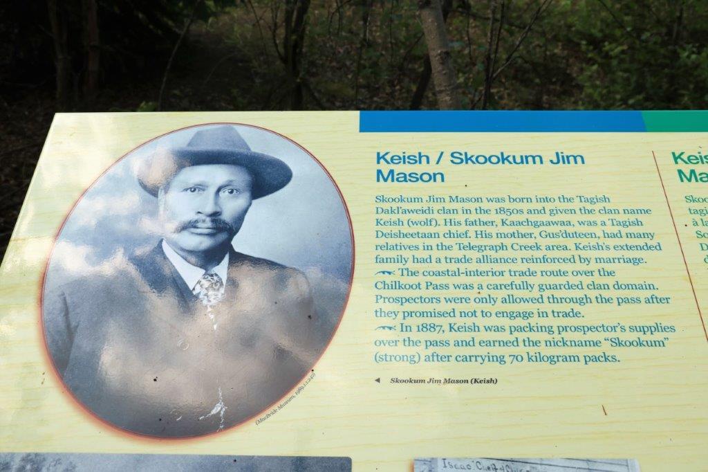
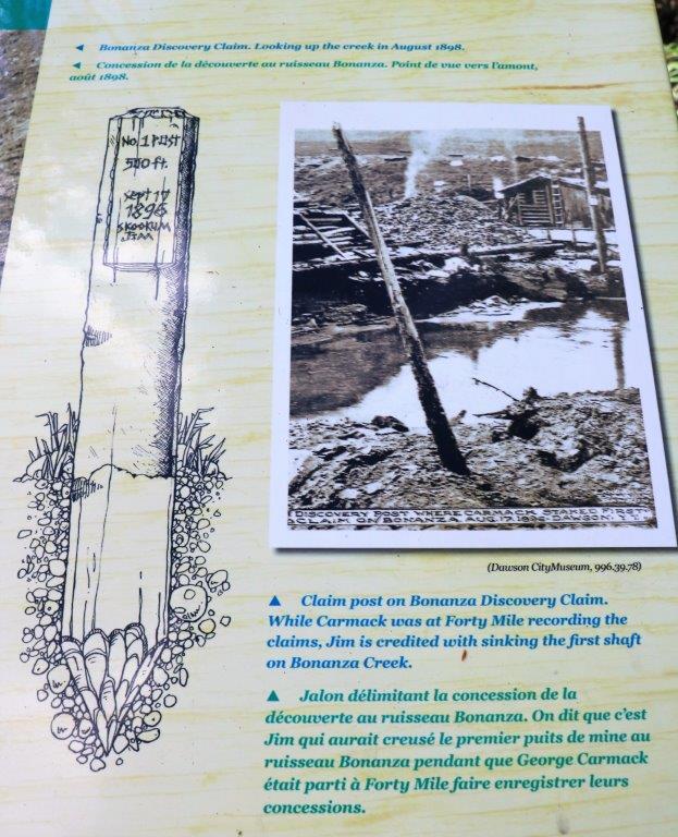
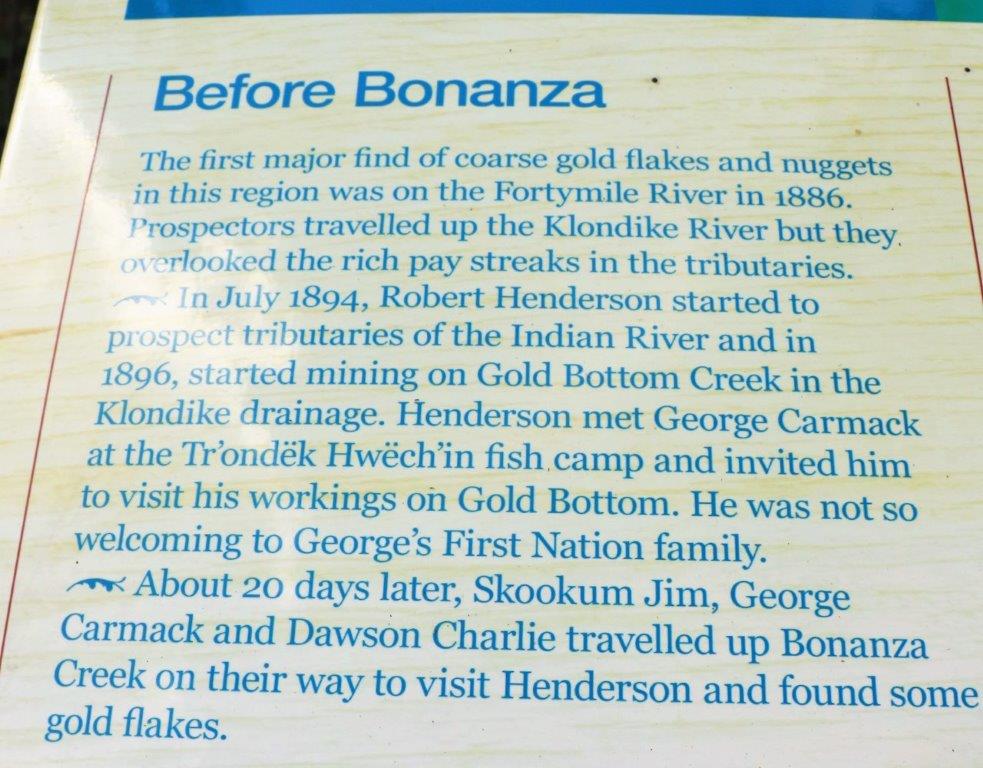
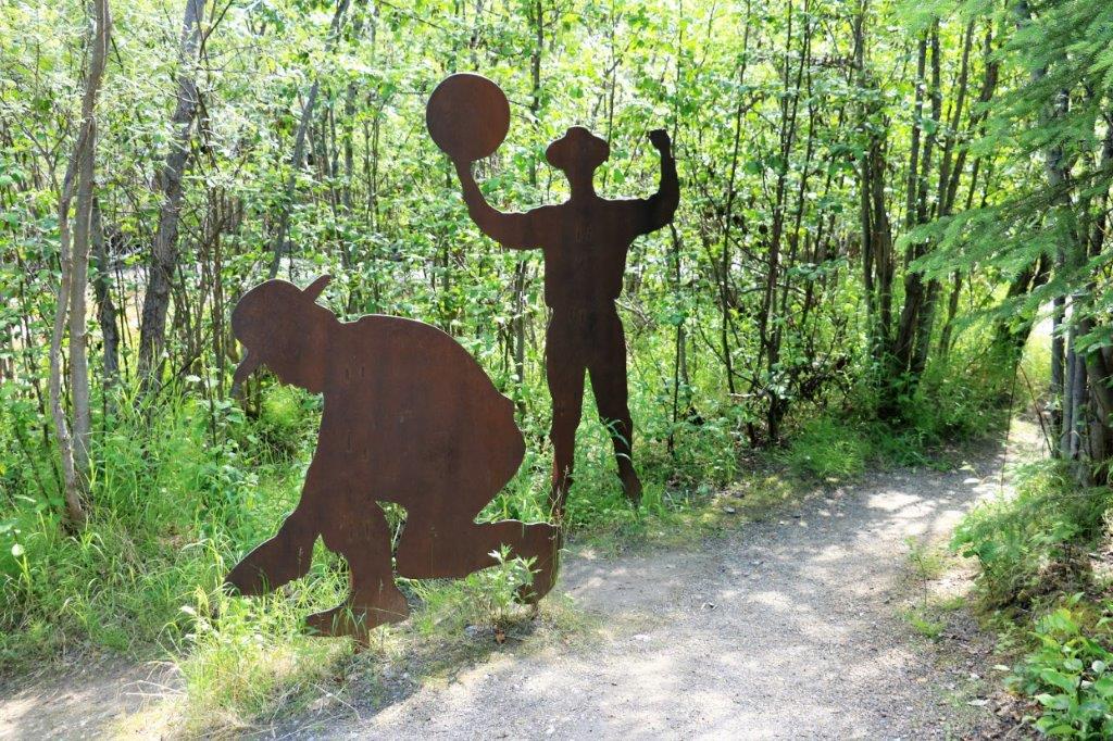
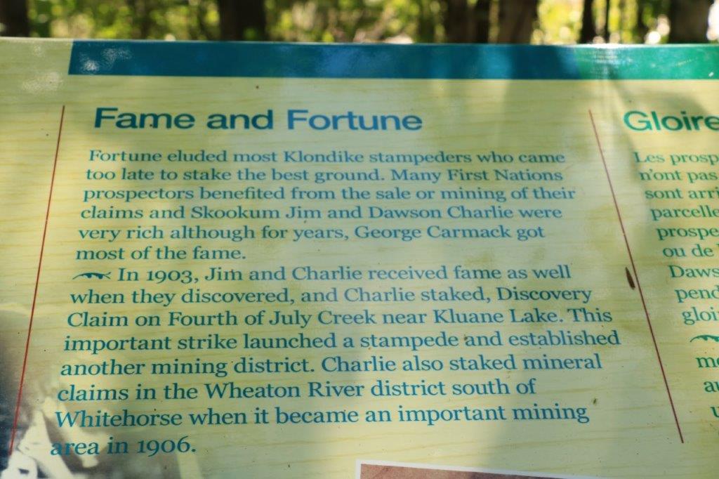

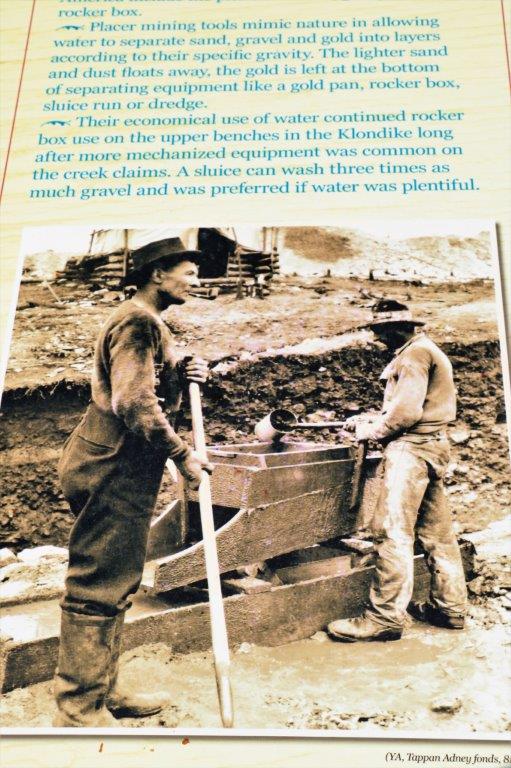
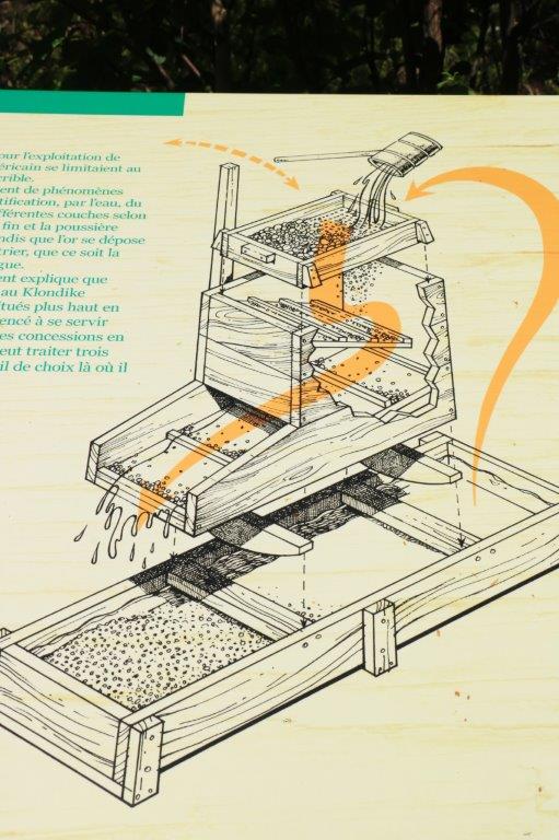
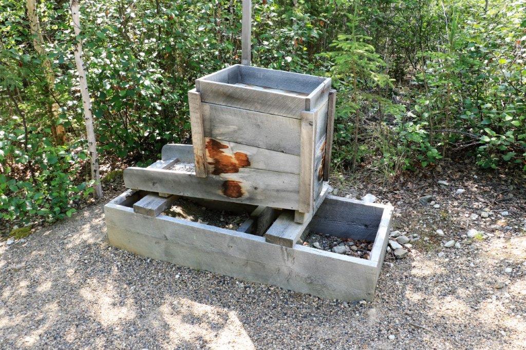
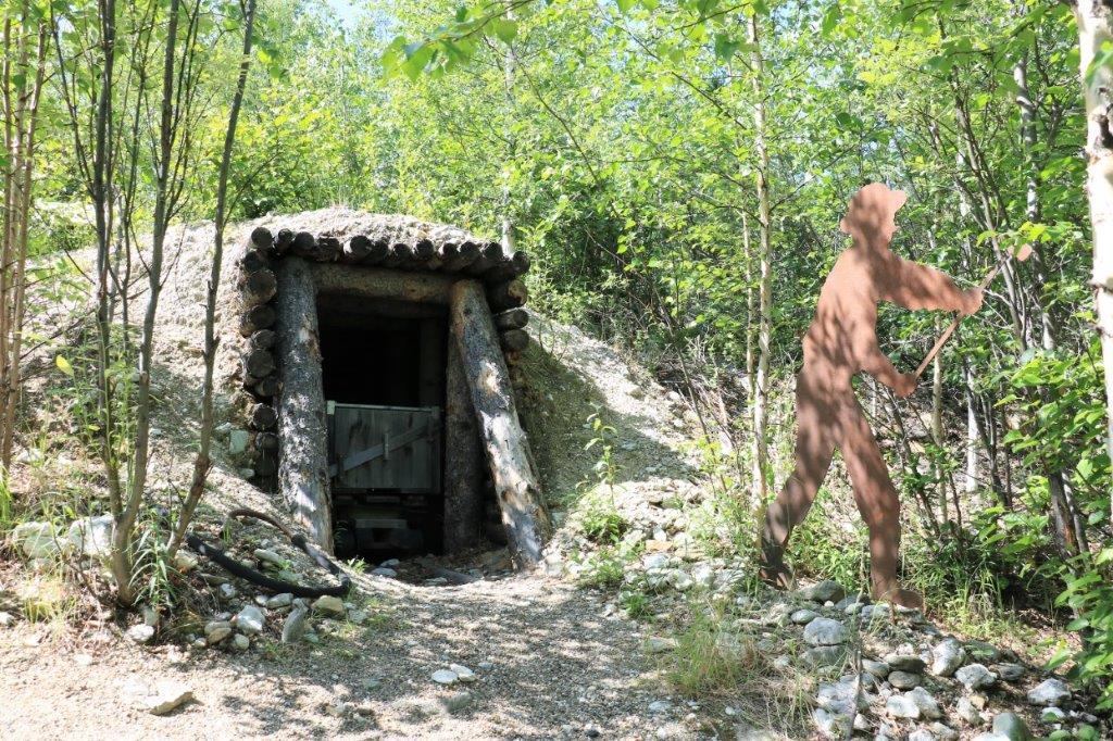
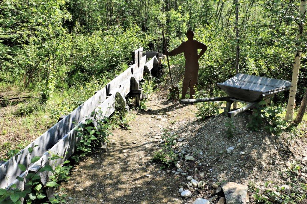
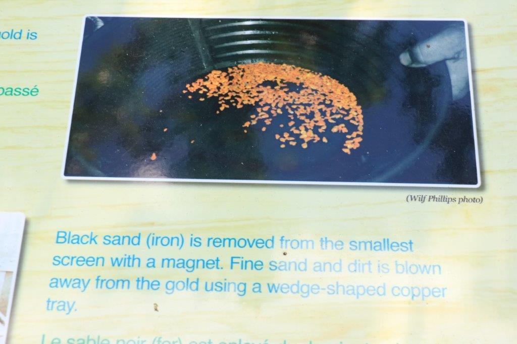
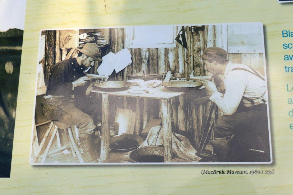
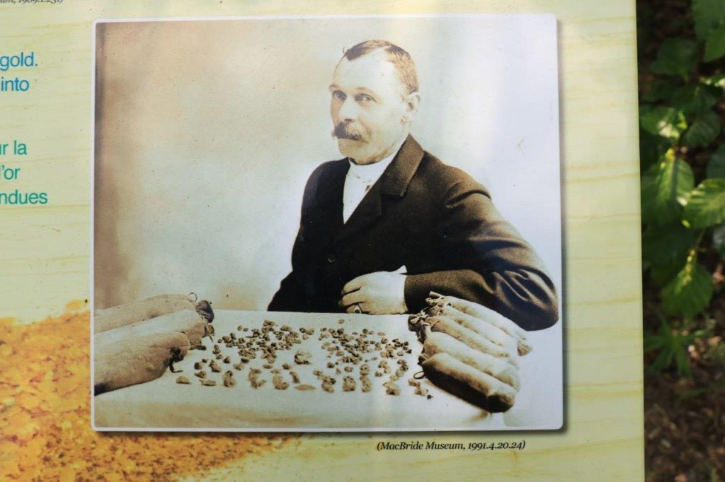
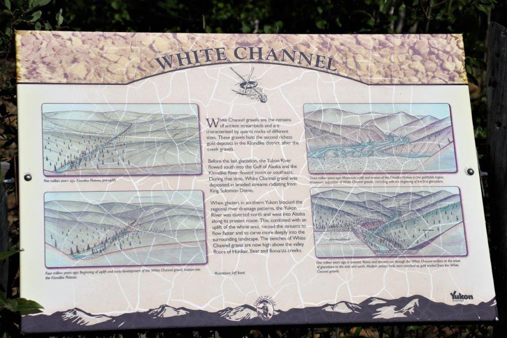
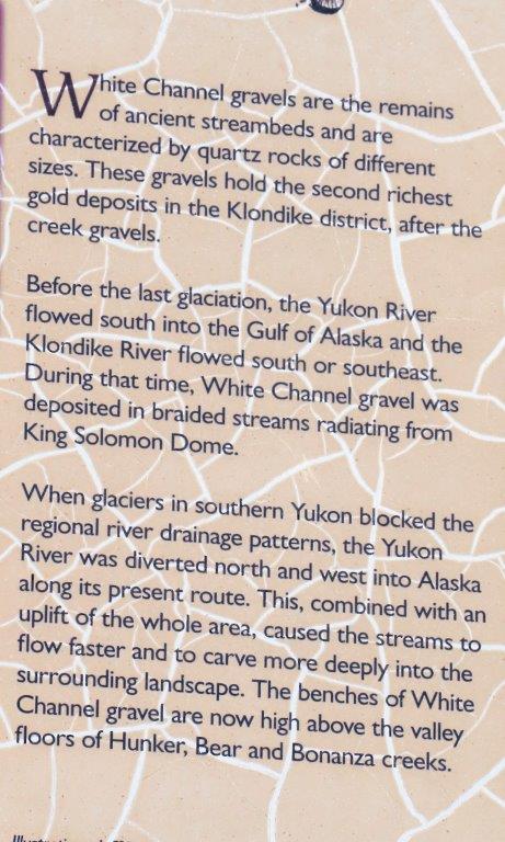
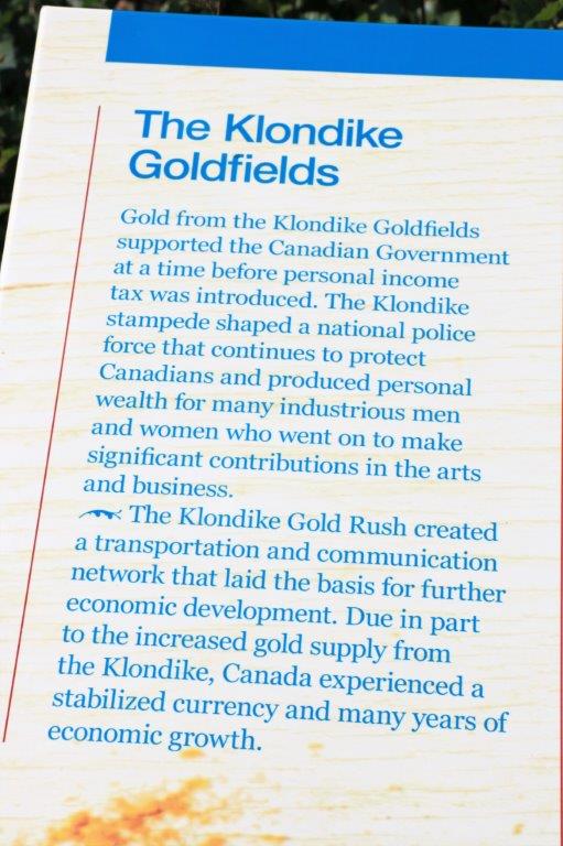 There was a loop trail that had tons of placards about the early days of the goldrush and the life and work of the miners. I took tons of photos of them all but am only putting a few of the most interesting ones in here.
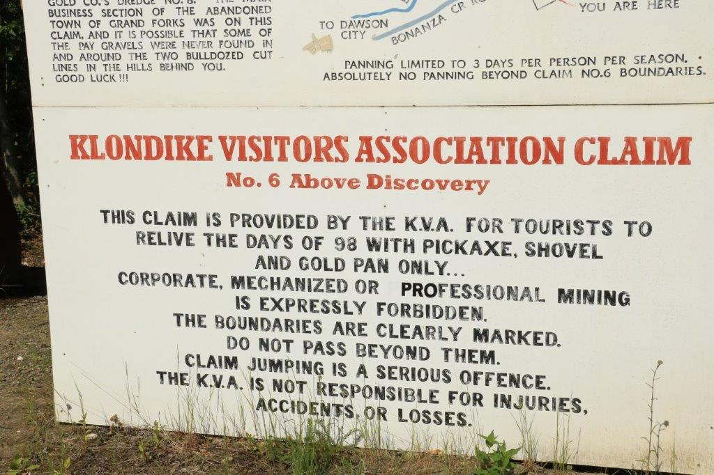
 Further down the road from Discovery Claim is Claim #6. This is a Free Claim and people can bring their own gold pans and spend some time looking for gold.
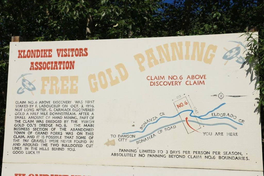
 From Claim #6 we turned around and drove back to Dawson, passing the huge Dredge #4 on the way.
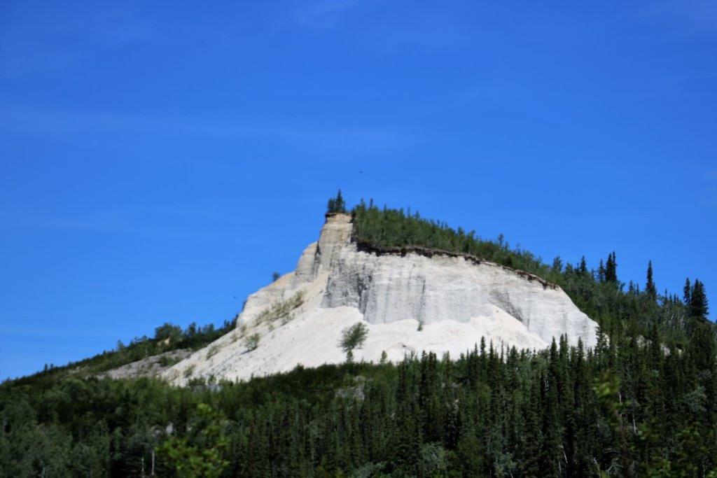

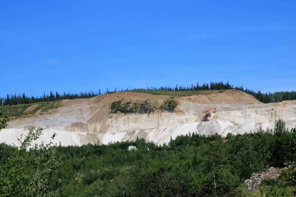 This White Channel operation was carving the whole side off a mountain.
Back in Dawson we found a few more geocaches (we only have three of the twenty left to find. We will get them when we are back here on Sunday after we return from Tuktayuktuk.) One was hidden under a huge rock at the ferry landing. This is one of the free on-demand ferries that run on the rivers up in the north during the summer months. We will be taking this ferry later as we cross the river to get to the Top of the World Highway into Alaska.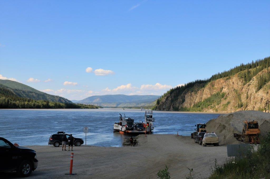 Now you know more about placer gold mining than you ever cared to learn. It was a most interesting day. We have an early rise tomorrow to drive half of the distance to Inuvik, which is 766 km north (475 miles) on gravel road. Hopefully it will not rain as the road becomes very muddy and slippery when it is wet which will turn the seven hour drive to Eagle Plains (the half way point) into a much longer one.
