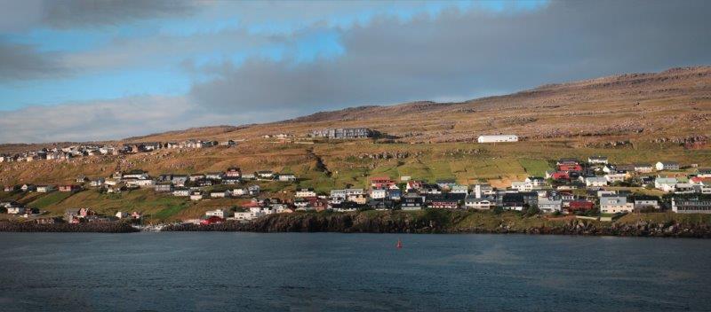
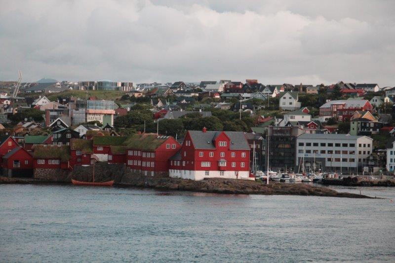
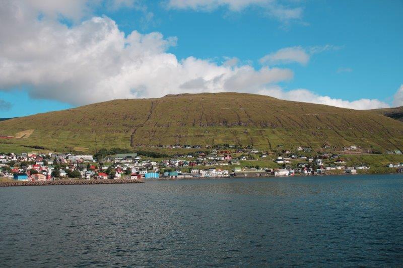
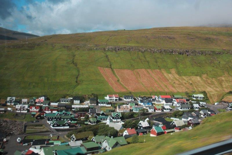
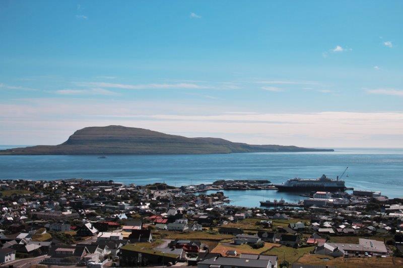
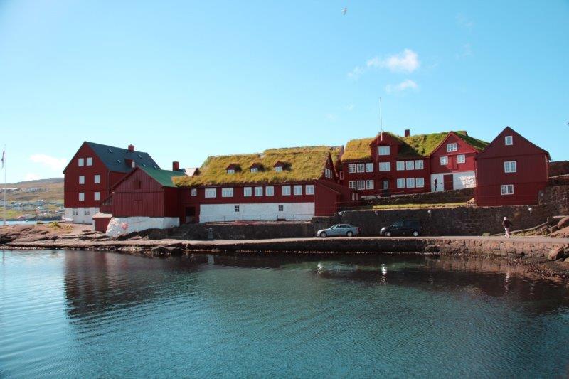
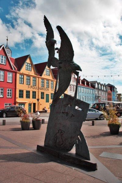
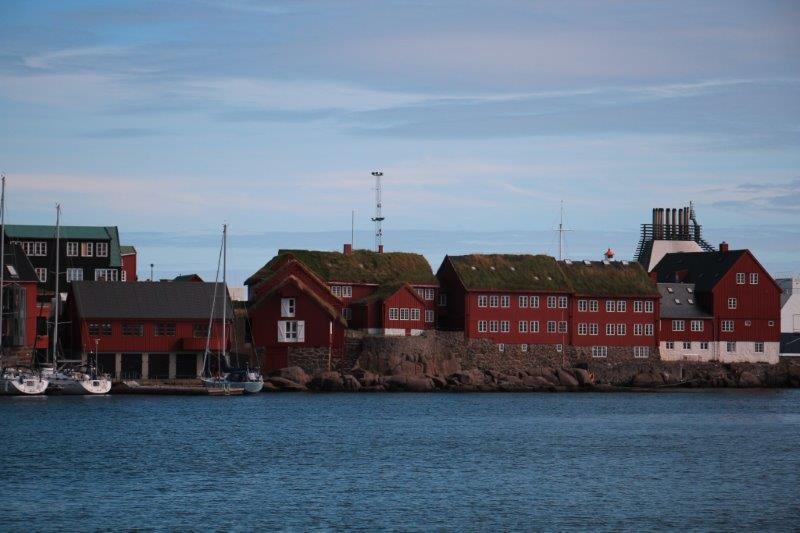
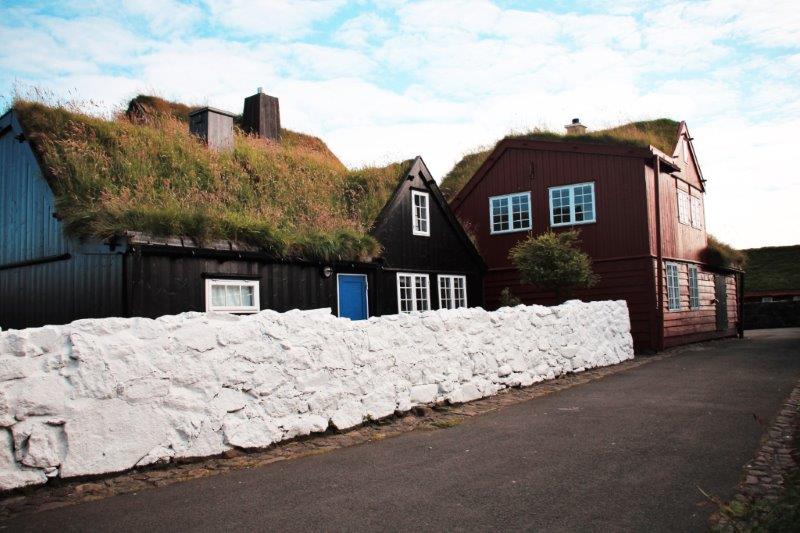
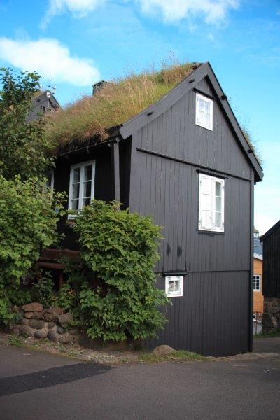
After a day at sea out of Dublin we arrived this morning at one of the world’s smallest capital cities, Torshavn (Tors haa ven), meaning Thor’s Harbour, the capital of the Faroe Islands and home to 35% of the population. The Islands are affiliated with Denmark and use the Danish Krone for their currency. They have two national languages, Faroese and Danish and most also speak English extremely well. The population of the Faroes is 50,000 people and 80,000 sheep. The first parliament was held in 1000 AD and the islands became a part of the Kingdom of Norway in 1035. When the switch to Denmark took place I do not know.
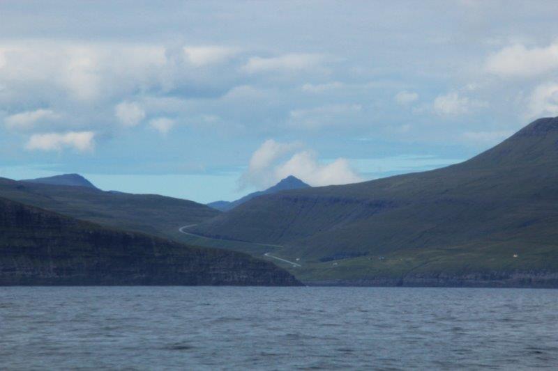
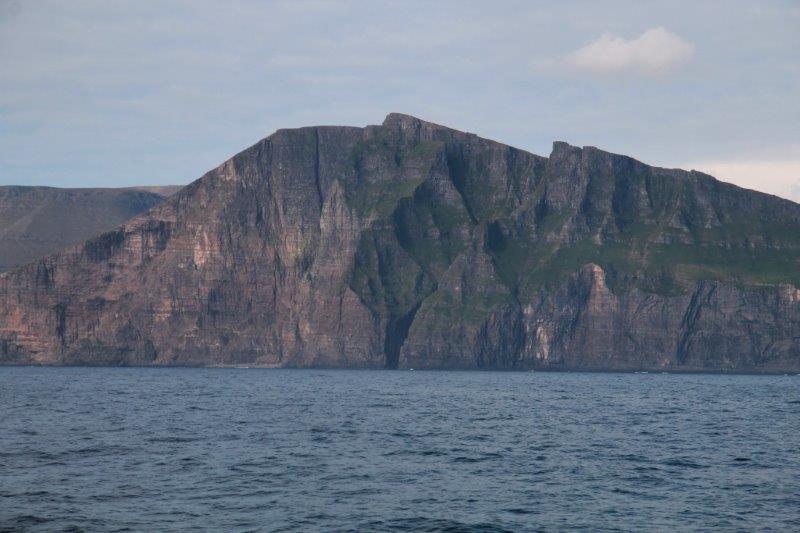
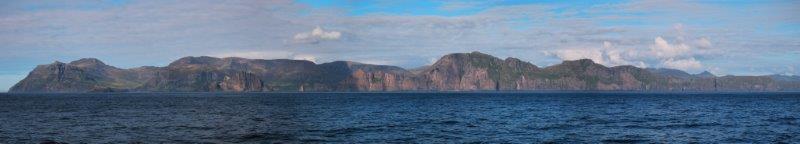
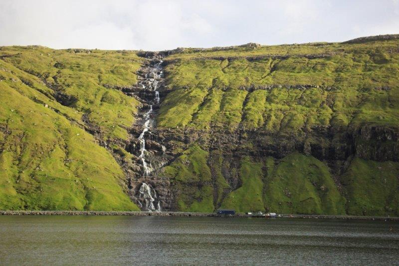
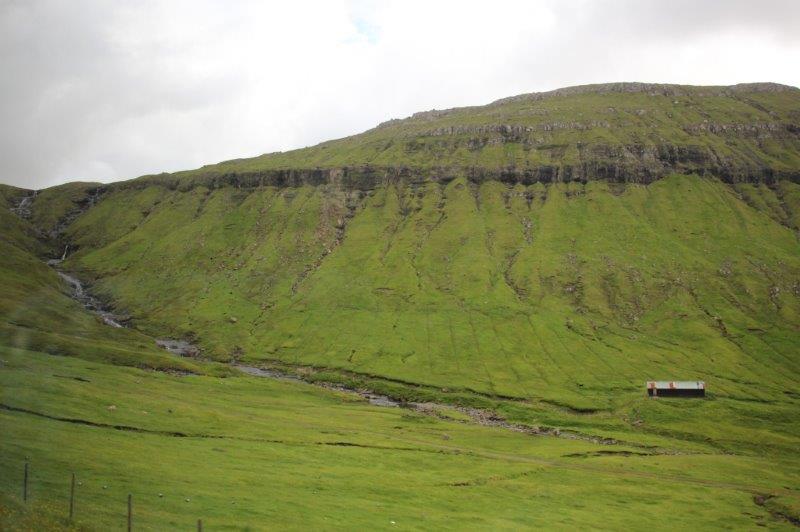
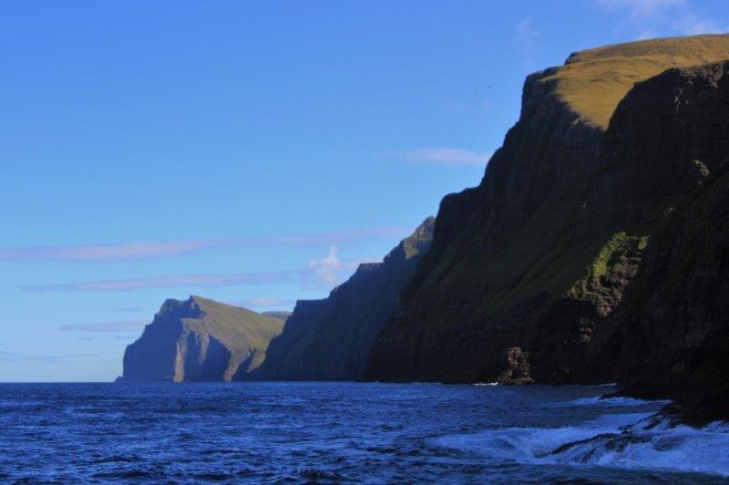
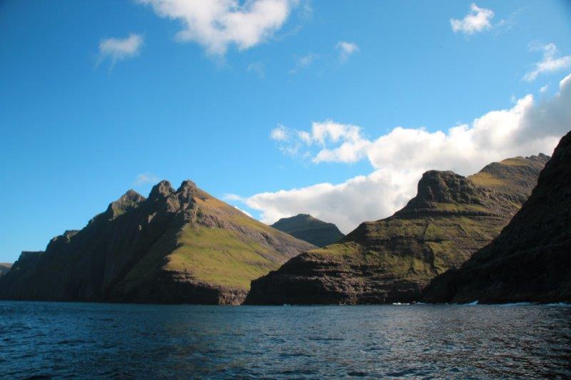
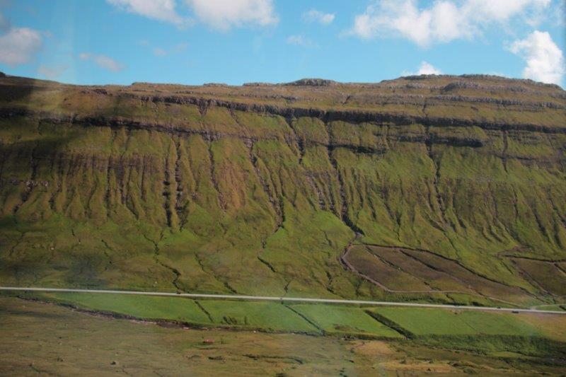
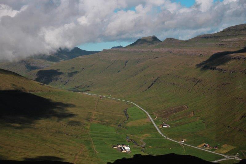
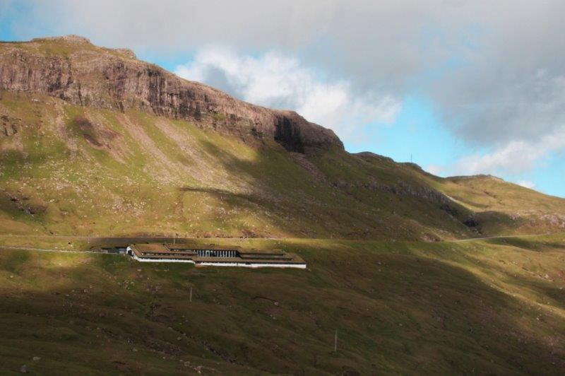
The archipelago is comprised of 18 islands and is geographically north of Scotland and halfway between Iceland and Norway and wherever you are on whichever island you choose you are never more than 5 km from the ocean. The highest mountain is 882 meters (2882 feet) above sea level and the average height of the Faroes above sea level is 300 meters (982 feet). There are massive sheer vertical cliffs on these islands and 18 long tunnels, two of them under the ocean floor connecting islands.

 Fishing and fish products are the most important ‘crops’ and account for 97% of all exports. The cliffs are nesting places for 200 species of birds; only 40 of which remain all year round. For a place so far north you would think it would have very harsh winters but that is not true. The Mexican Gulf Stream flows by and keeps the temperatures quite moderate. Winter temperatures rarely go below freezing with snow that comes and goes. Summers are also cool though with an average of 15C (60F).
We took a tour to see the Vestmanna Seacliffs where thousands of birds nest in the spring and early summer, including puffins. Most of the birds have raised their young and flown south already. We did see a few puffins but they were too far away on the cliffs or diving in the water for food so I wasn’t able to get any photos. We were also on a boat so focusing was an issue.
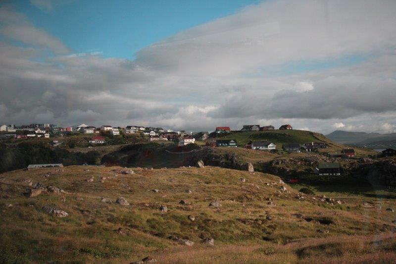
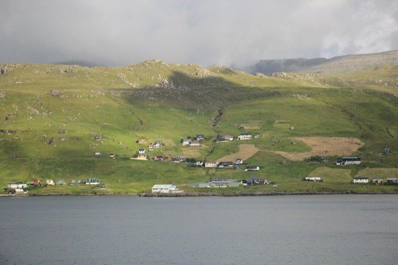
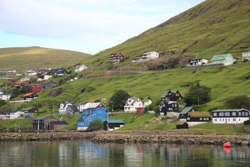
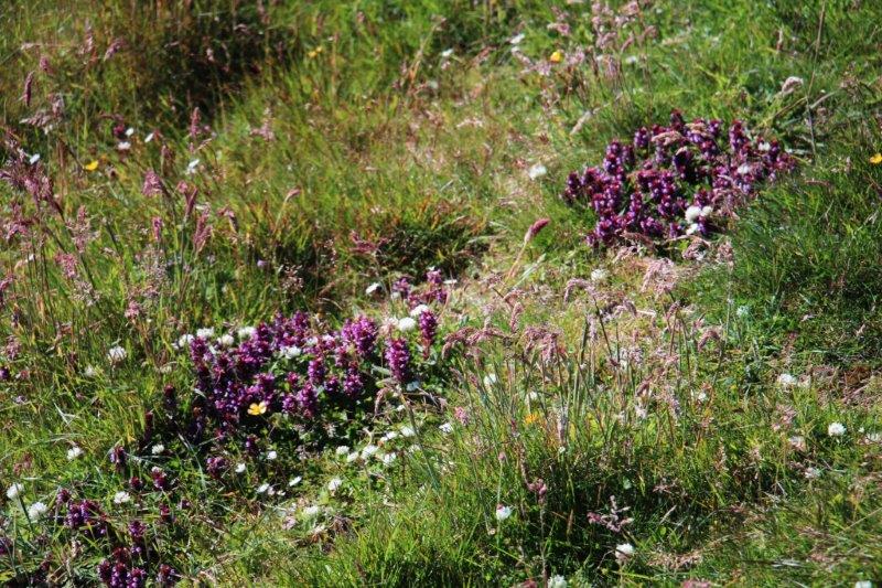
We were driven by bus to the western side of the Streymoy, the largest island and location of Torshavn. The day was lovely, sunshine and fluffy white clouds. Like most of the northern countries we have visited the Faroes have been having a cool cloudy summer. They have had four days of sunshine so far, yesterday and today being two of them and today was the best to date.
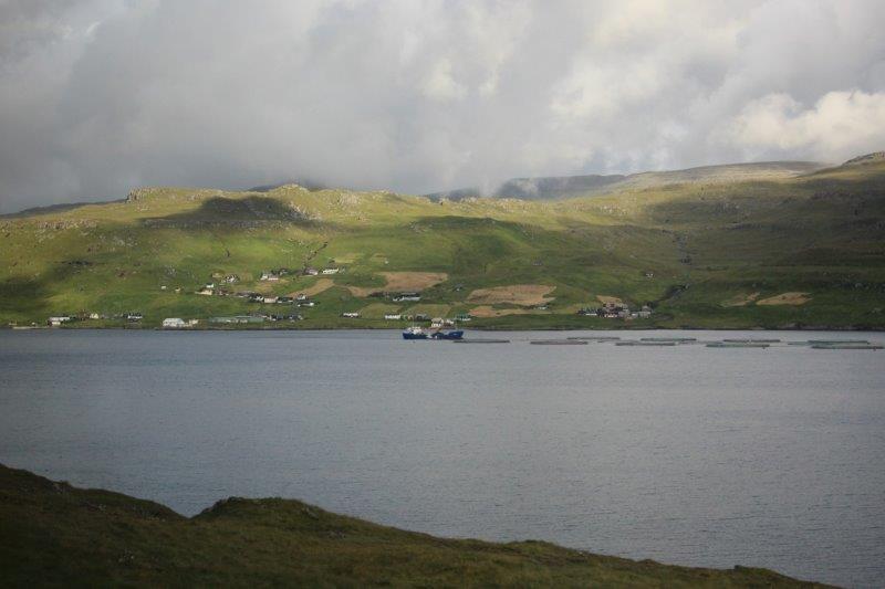

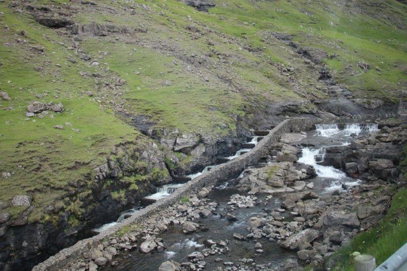
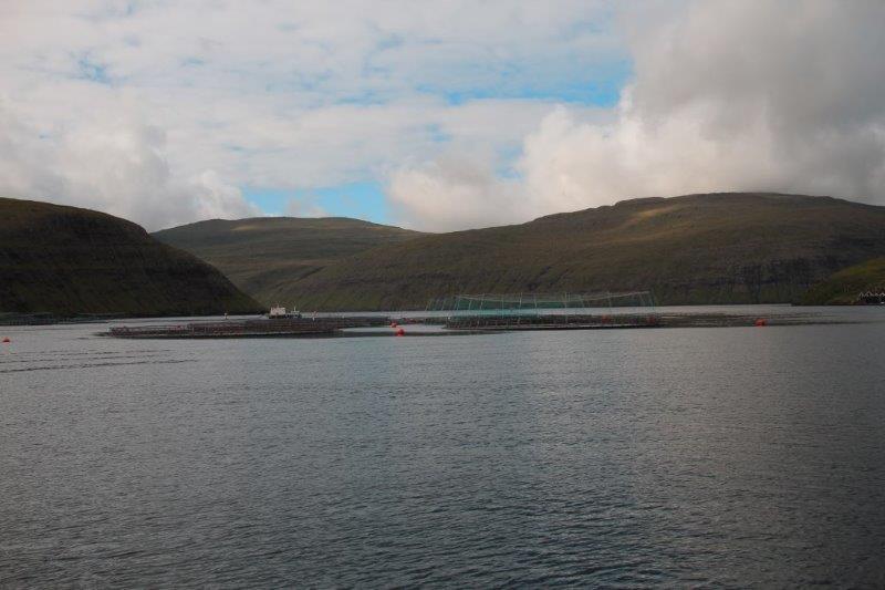
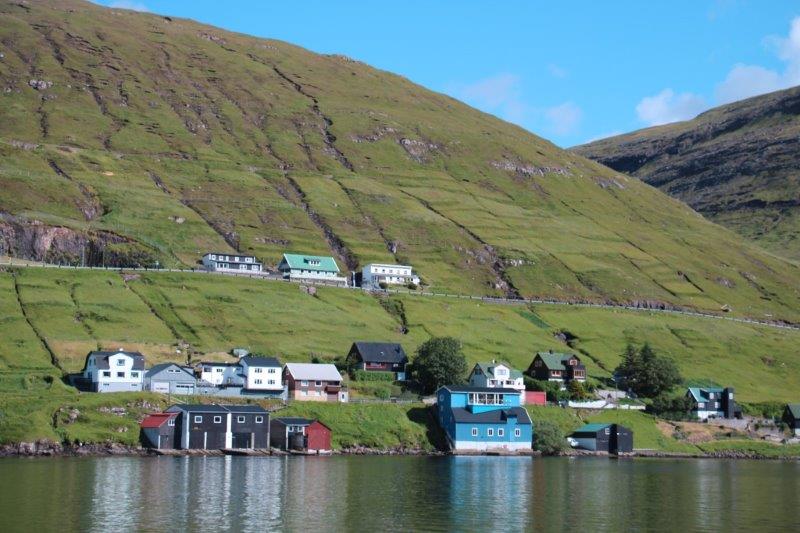
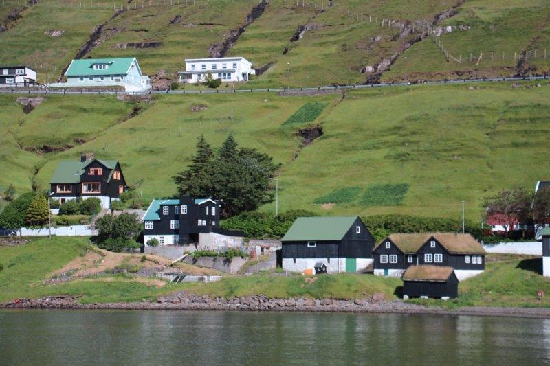
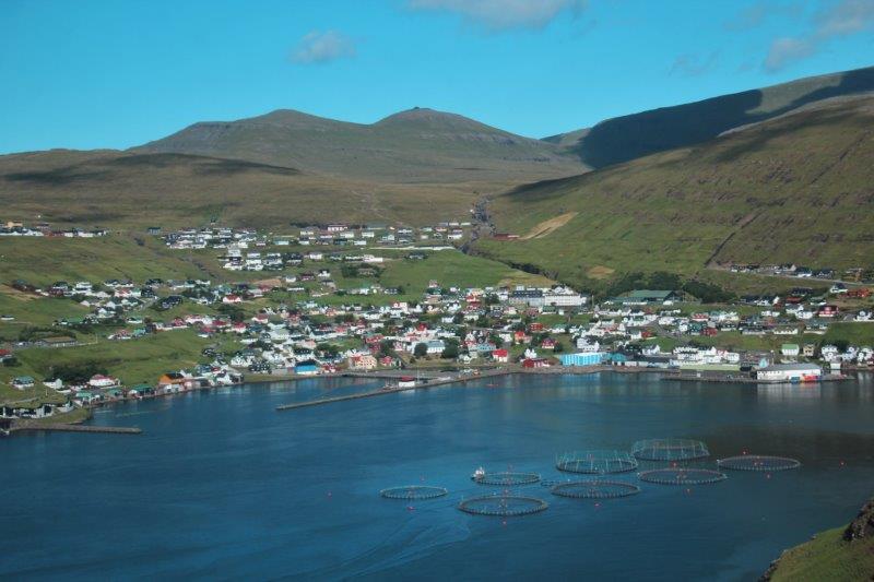
 Much of the fish are now farmed and you will see the huge rings in the water of most fjords. There are 85,000 salmon in each ring and they stay in them, getting fed daily, for 16 months at which time they weigh about 10-12 kg (22-26 lbs). The salmon is also fished in the rivers and fish ladders were made years ago to aid them in going inland to spawn. We passed a section of a river that had ropes festooned with blue plastic ribbons criss-crossing from one side of the river to the other. The fishermen put them up to discourage birds from catching the fish.
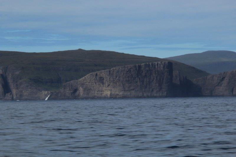
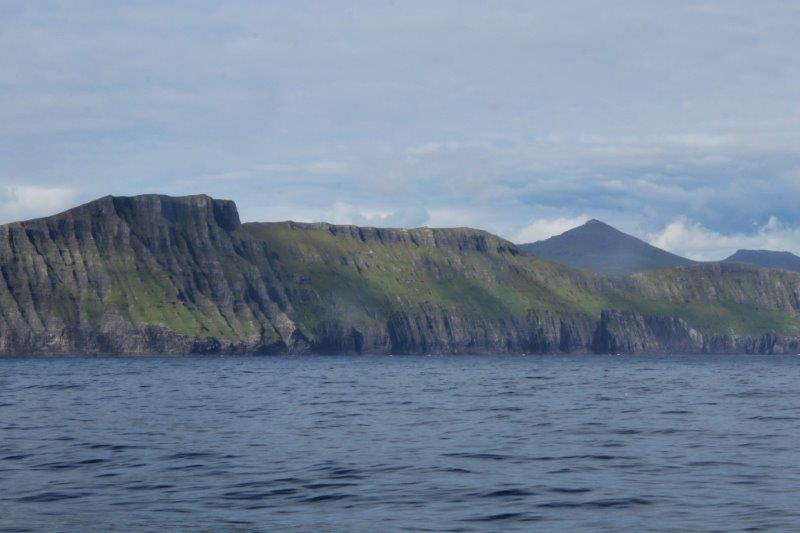
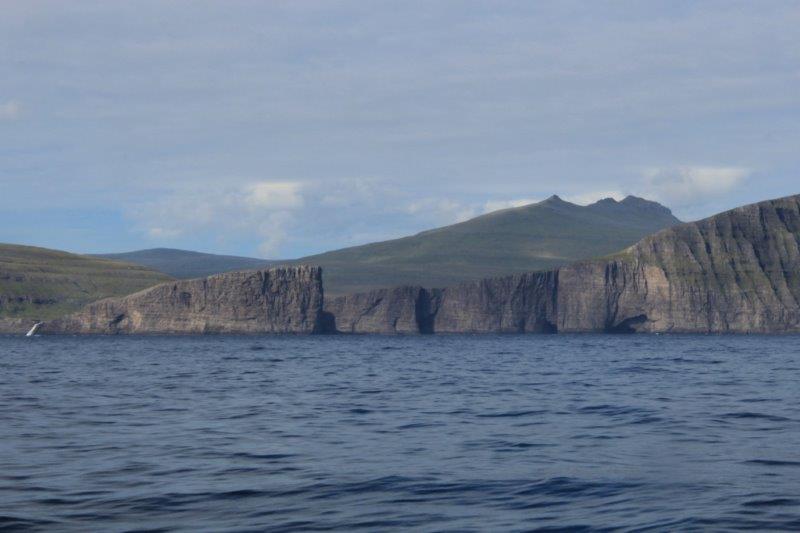
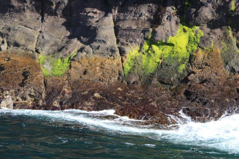
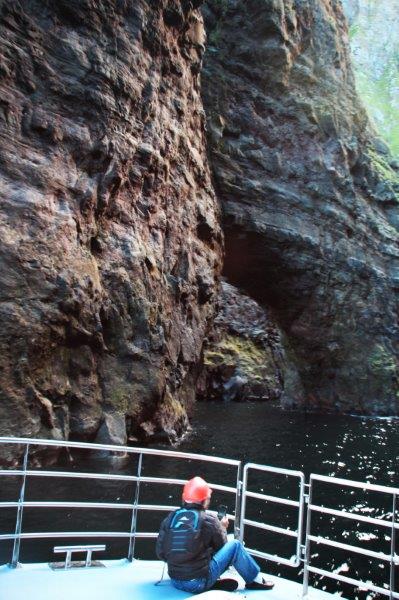
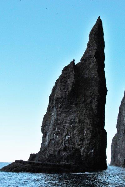
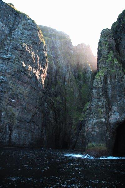
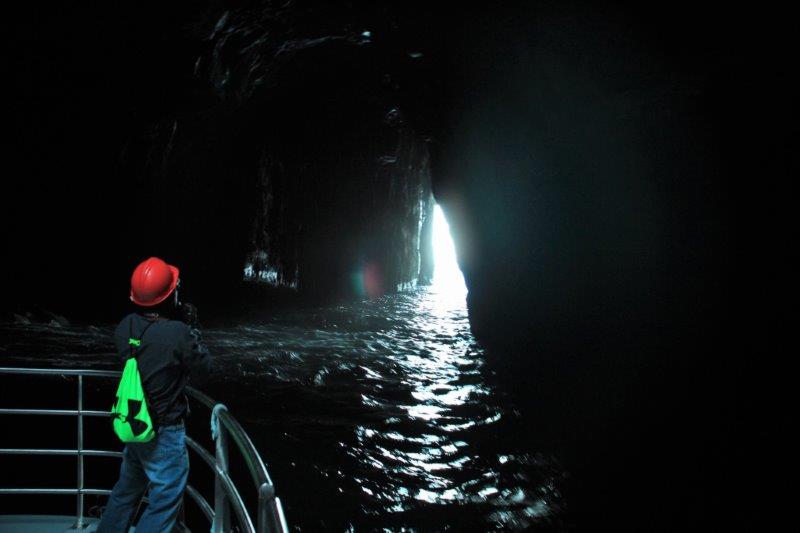
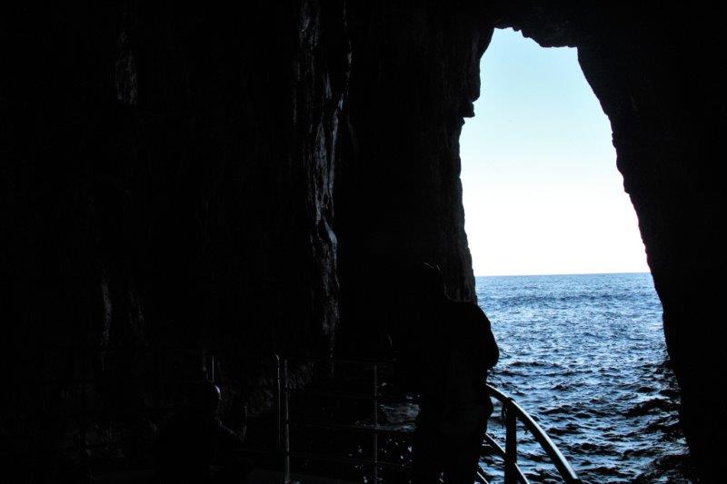
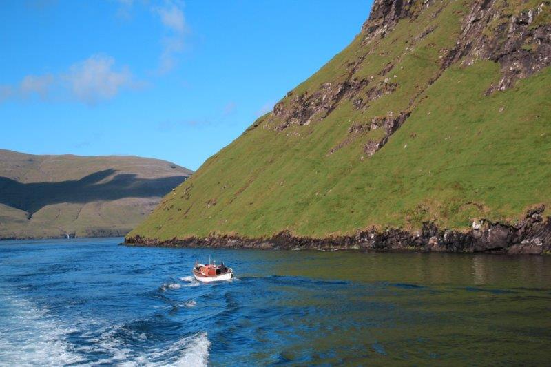
 We arrived at a largish community whose name I don’t remember and boarded our boat for the ride to the sea cliffs. There were 46 of us on the tour and we all got on the one boat with room for everyone. The skipper put-putted out of the harbour and around the point to hug the cliff-side for over an hour. There are lots of huge caves and cuts into the cliff face and we were taken into several of them and back out or through a natural rock arch or around a gigantic rock pillar; the last one we went through took us into a grotto and out the other side. Really cool!

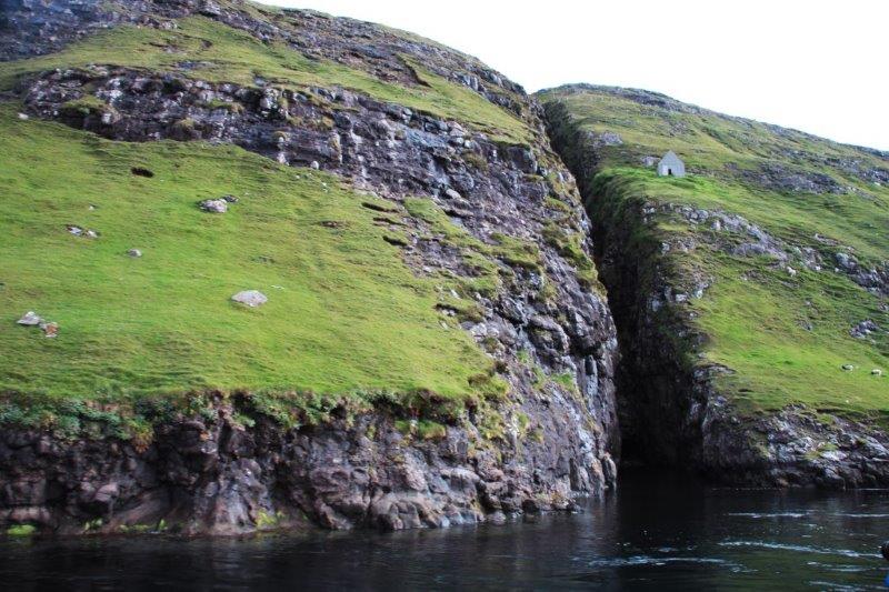
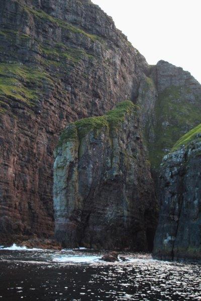
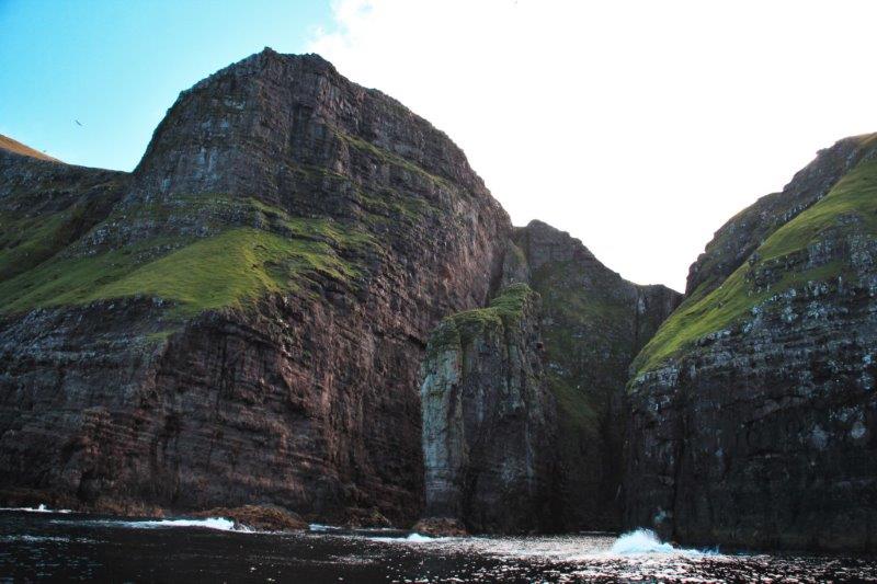

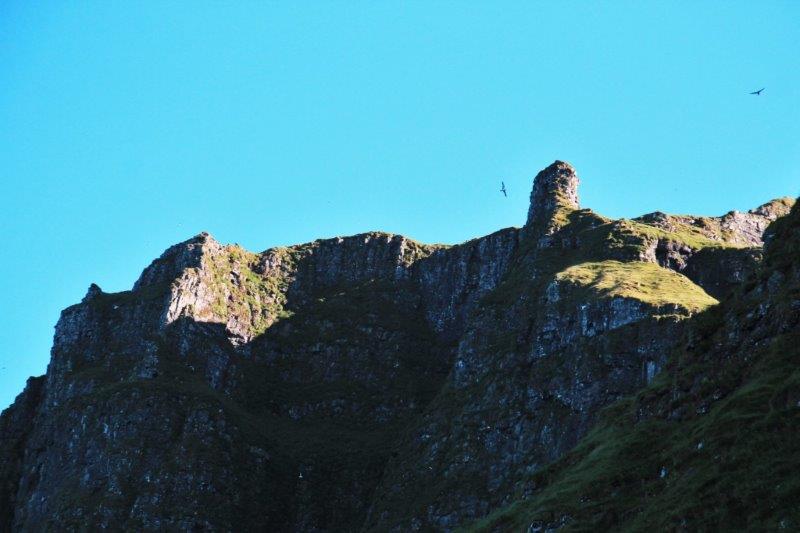
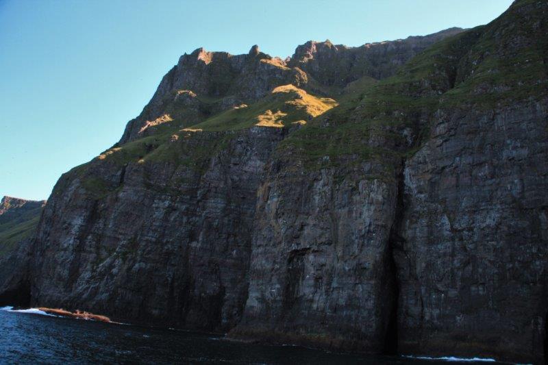
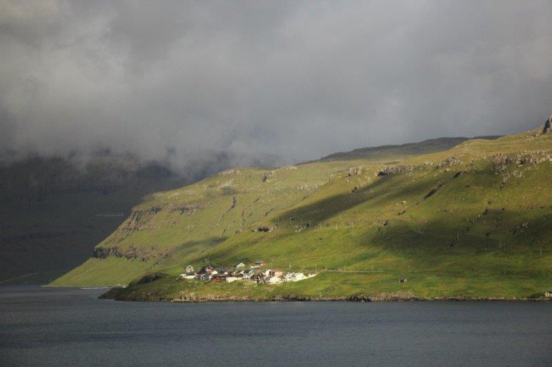
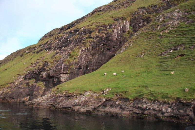
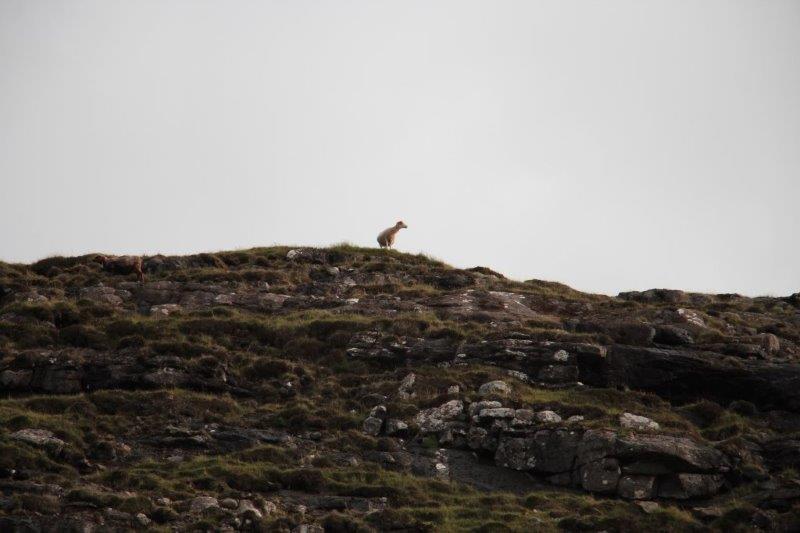
 As we went along the base of the cliffs we could almost always see some sheep grazing on the grassy slopes far above. Farmers leave the sheep out on the cliffs to forage from spring until fall when they are brought in for shearing and butchering. How do they get the sheep to the pastures, you ask, since these cliffs rise between 300 (700’) and 600 (1500’) meters right out of the sea? Well, some of them are driven over the hilltop from the valley side. Others, the ones on the more remote cliff tops are brought out by boat and hauled up the cliff face by rope, set free to graze all summer, then caught one at a time by some very energetic and brave fellows, and tied around the middle with a rope and lowered over the side and into a boat again. Absolutely crazy! It is a sort of fall sport to go to the cliff tops to try catch the sheep. You would not want to miscalculate your step and fall off! If you survived the fall (which is unlikely) the current flows at 8 knots and will just take you away southward. This happens sometimes to sheep that stray too close to an edge and fall into the water.
 The bus driver took us back via a different route and let off those who wanted to stay in town before driving the rest to the ship.

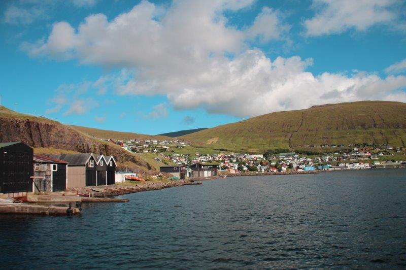

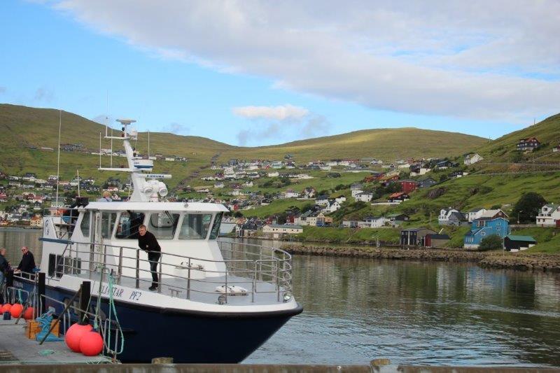
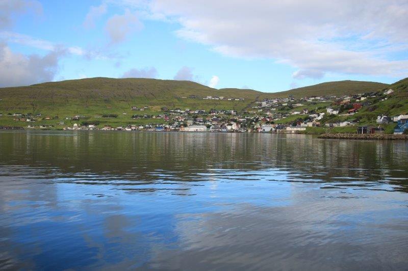
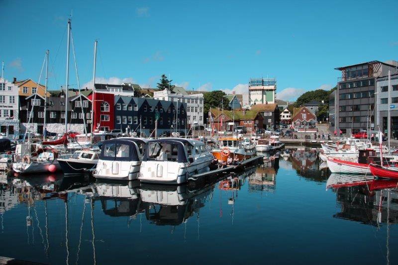
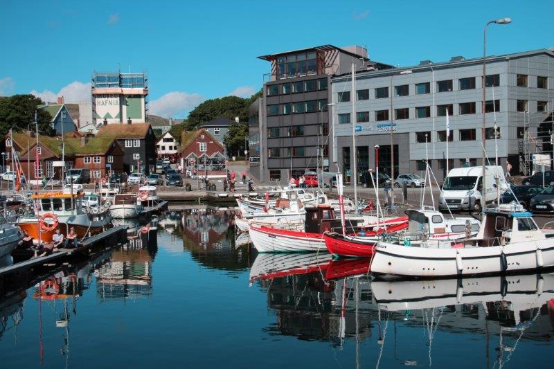
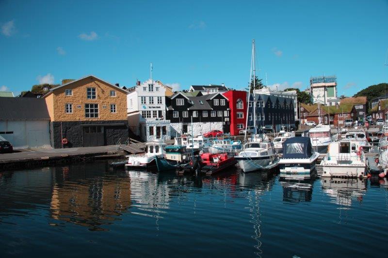
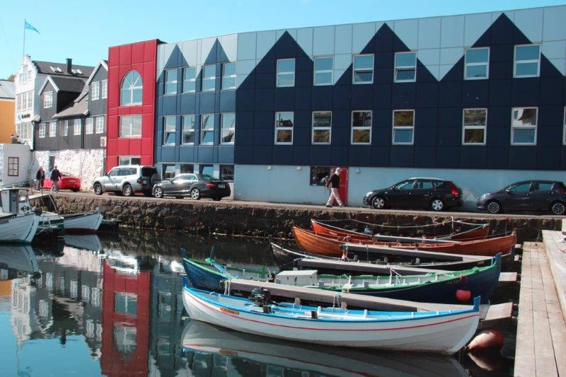
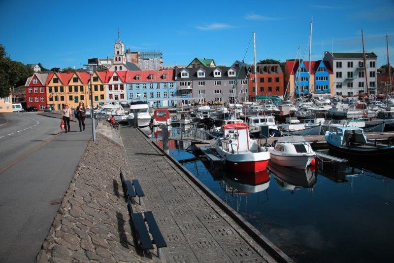
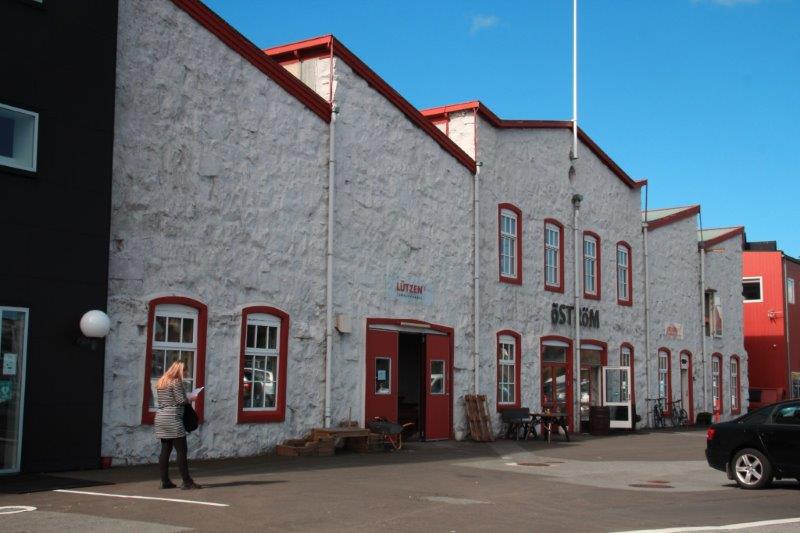
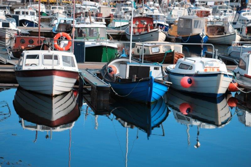
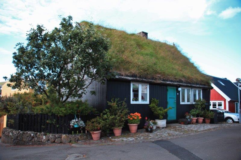
 We were docked at a working port so there was no walking from ship to shore. A shuttle bus would take you to the edge of town and bring you to the ship if you were not on a tour bus. We had two hours before all-aboard so we found a place to buy some lunch and afterward wandered around town. We tried to locate a geo-cache or two but all the caches seemed to be multi-caches that were strung out too far for us to find in the time we had. The reflections in the water of the boat harbour were stunning!


 We set sail again at 3 pm and the captain took us past some more of the island’s amazing cliffs. John and I just lay on our bed and took photos out the window. It was a great day! One of the best, along with Qaqortoq, Greenland, so far on our trip. Three more ports in Iceland over the next three days.