Haida Gwaii (formerly called the Queen Charlotte Islands) is an archipelago of about 400 islands located 45-60 km (30-40 miles) off the west coast of British Columbia. The two largest islands are Moresby and Graham. There is only one community on Moresby, Sandspit (which hosts the airport) and 20 km of paved road. The majority of the population of 4,500 live on the northern Graham Island which boasts 120 km of highway. It will take about 90 minutes to cover it all. But there are numerous gravel logging roads snaking into the wilderness as well – just watch out for trucks.
The Haida First Nation have called these islands home for thousands of years. Recent archaeological activity in the south has uncovered some of the earliest known evidence of human activity in North America. Spear points, butchering tools and animal bones carbon dated to be about 12,500 years old have surfaced. At one dig archaeologists found 4,000 worked-wood materials such as splitting wedges and braided cord, dated at 10,700 years old, the oldest ever found in the Pacific Northwest.
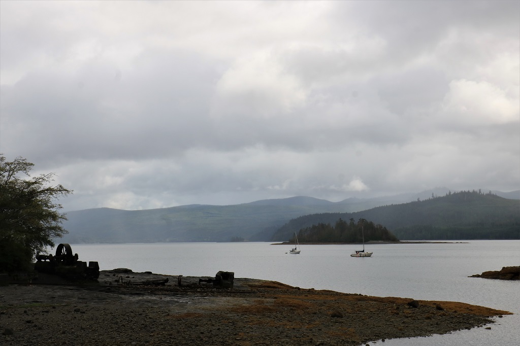
Almost the entire lower half of southern Moresby Island is protected as a National Park Reserve. The coast of Gwaii Hanaas is an area rich in sea life and it is in the works to create a protected Marine Park that would extend 25 miles out from the land. The park is only accessible by boat or float plane on guided tours. There are many unique plants, animals, and sea life here. The area is temperate rainforest so plant growth is fast and thick. Haida Gwaii receives the same amount of annual rainfall as Vancouver (48″) and has a mild winter; although it can be battered by some nasty storms.
We took our time getting up and out the door this morning. The Misty Arms isn’t really a hotel at all, but five nicely renovated rooms and a communal kitchen located above a pizza and grill, which is above a pub, which is above a liquor store. We walked up the road and across the street to a restaurant for breakfast. We have learned that there are very few places to dine in Queen Charlotte and you have your choice of Chinese or Koreasn cuisine or burgers and fish and chips pub fare. That’s it. I think by the end of our stay the communal kitchen will get used.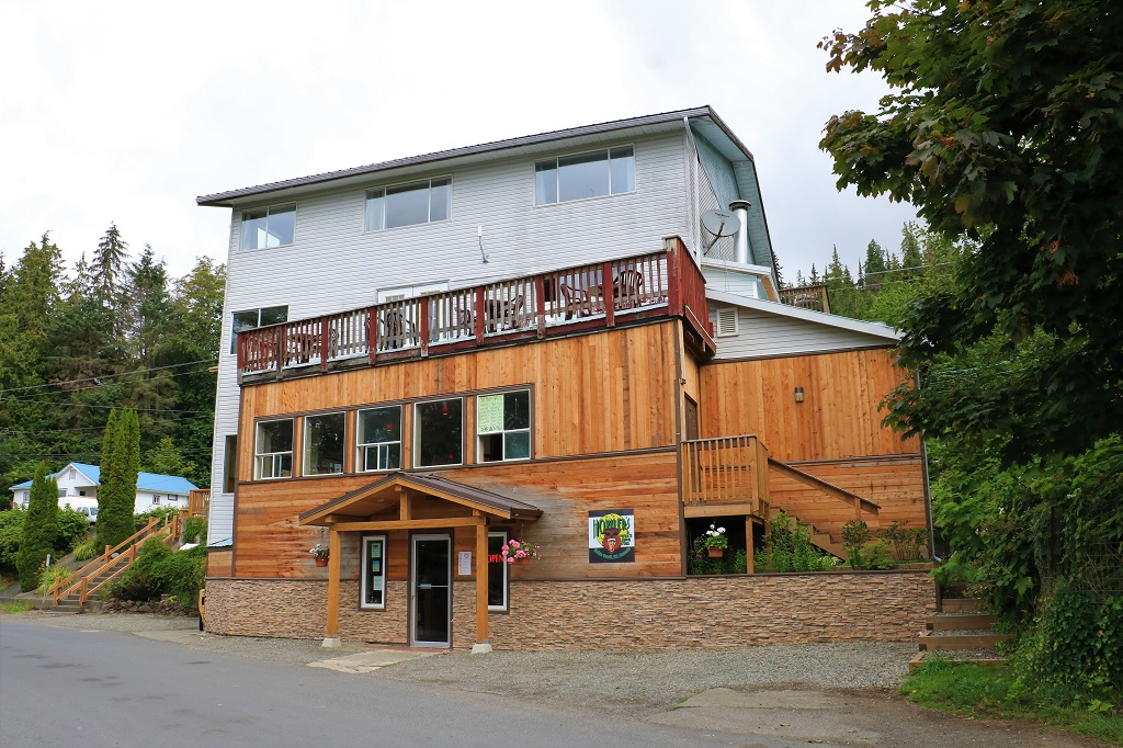 Our room is behind the two windows on the upper left.
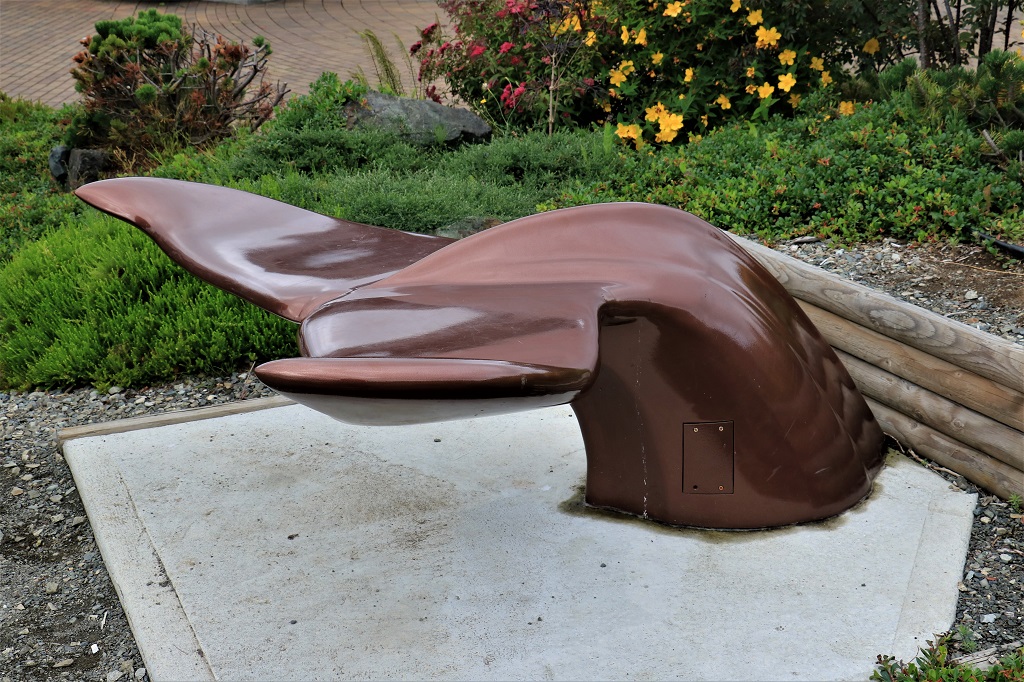
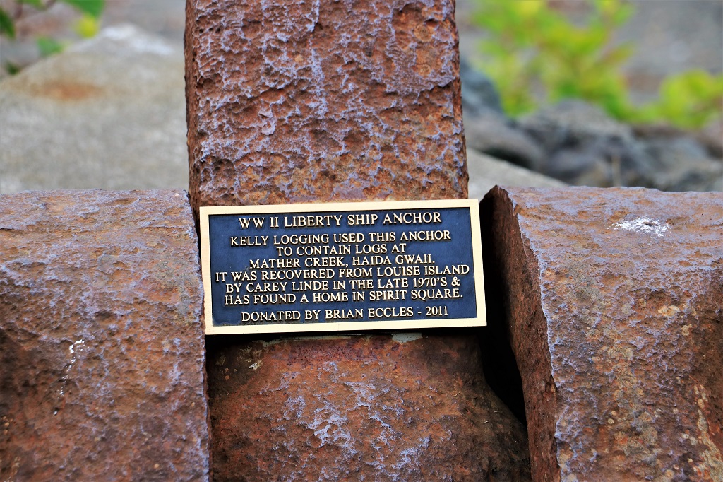
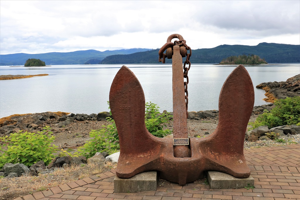
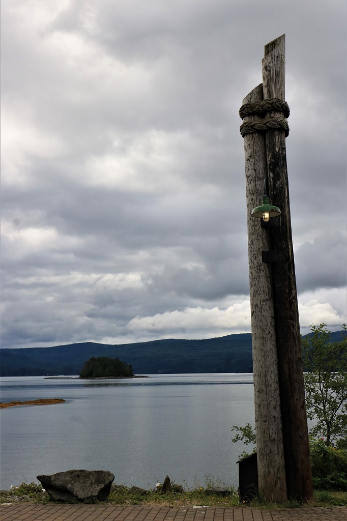
After breakfast we crossed the street and walked down a block to the Visitor’s Center. There is a geocache located inside, which would be our first cache find on Haida Gwaii. Outside the museum is a garden and Spirit Square.

 We walked past the nice mural on the Queen B Cafe building and a house we overlook from our room that we both like.
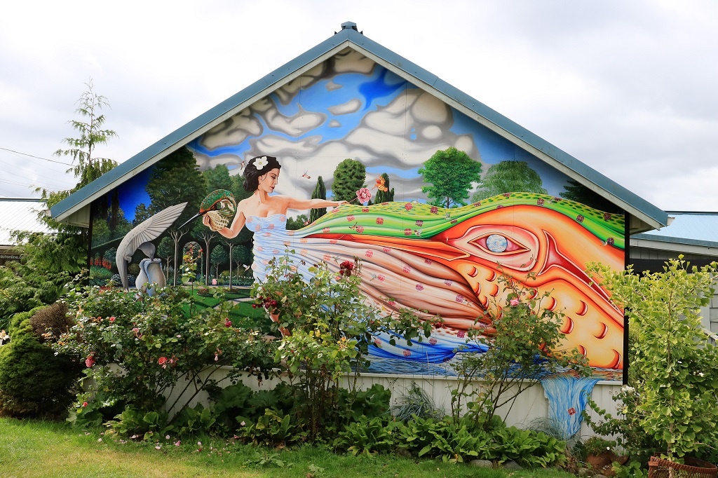
 Then we got in the truck and headed further down Oceanview Drive, the main road and into the other ‘downtown’ section of Queen Charlotte. There is no retail core here, the town is strung out along 2 or so km of the highway with many businesses located in former houses. The only clusters of business are those located near the new hospital and the Visitor’s Center, where we are accomodated, and those located near the post office and liquor store a short distance away. That is the area I remember from my visit here 50 years ago. I was able to locate the building that my eldest sister and her husband rented when I was here, but could not find the little house my other sister lived in. I found one that was tiny enough but it was situated in a hollow and I remember being able to see right across the road to the shore.
The paved road ends about a kilometer past the post office area. After that you are on gravel road. It is a pretty good gravel road and travels through residential areas until you reach the forest.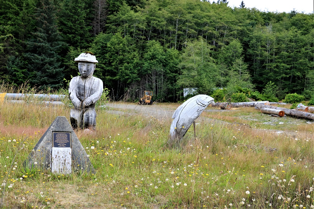

 About 6 kilometers on the gravel road takes you to Kagan Bay, a recreation camping and picnic site. There was a geocache hidden here but we could not find it. It was hidden for Canada’s 150th birthday in 2017 and has only been found once. We were hoping to be number two, but no luck. You can camp at Kagan Bay for up to 14 days.
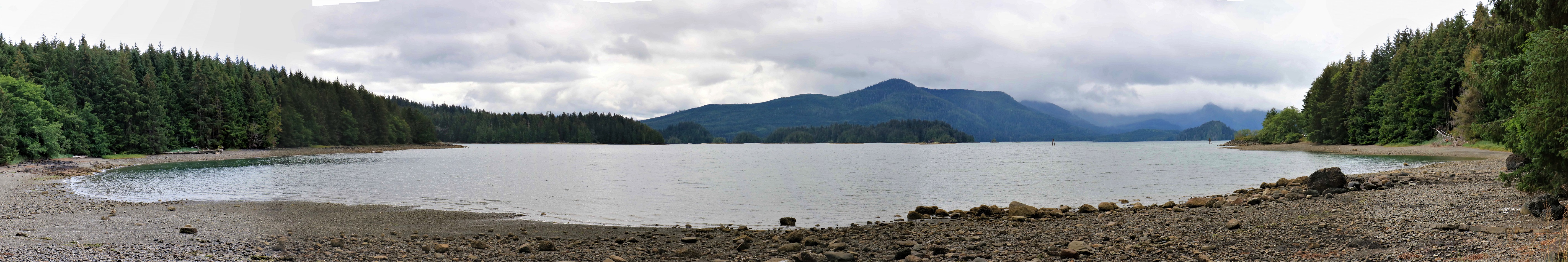 Another 1.5 kilometers past Kagan Bay is the Dry Land Sort area where you can camp as long as you like. This is where the road ends.
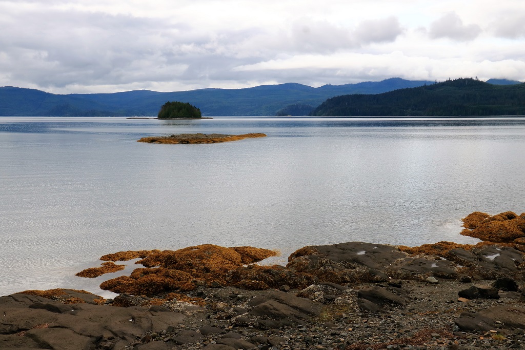
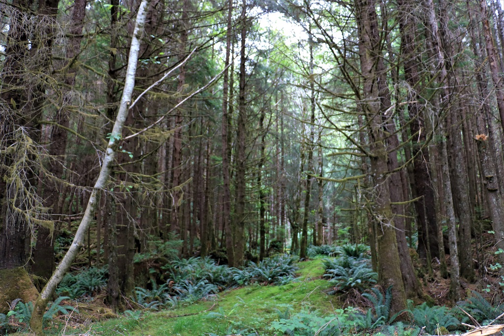
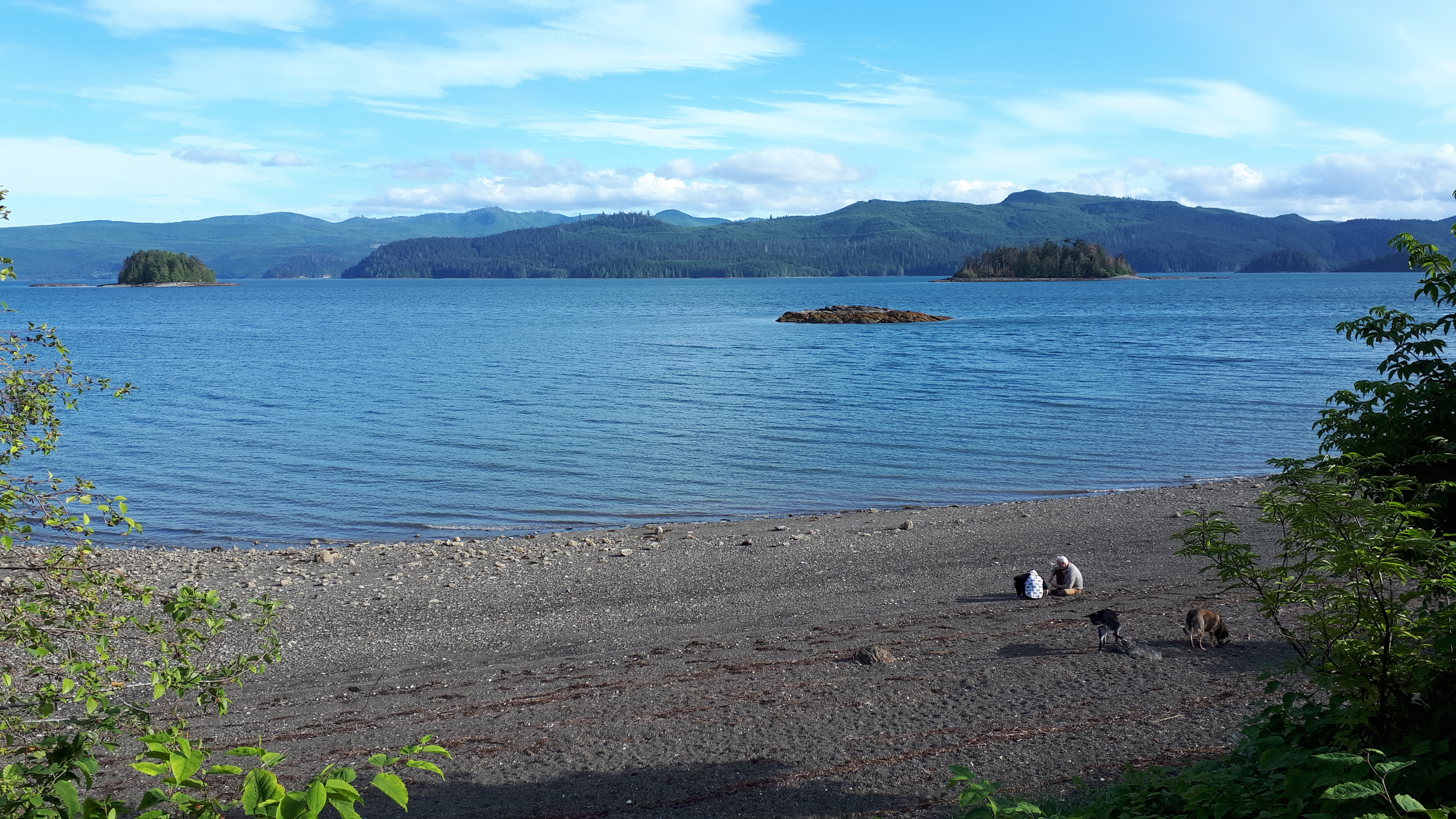
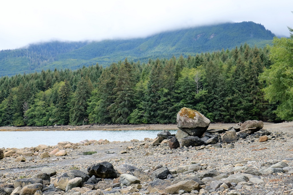 We turned around and took one of the logging road forks that lead to Sleeping Beauty trail. Sleeping Beauty is the mountain cleary visible from Queen Charlotte and is a popular, but very strenous 4.5 hour continuous uphill climb. The views are reputed to be glorious. We did not attempt to see it for ourselves. We went up the road to get a geocache at an opening in the forest that has a nice view overlooking Skidegate Inlet.
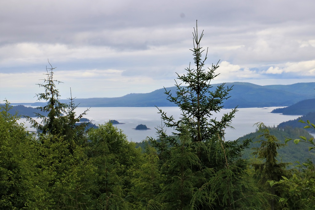 On the way back down after successfully finding the cache we passed a bald eagle sitting in a tree right beside the road. He just swiveled his head to keep an eye on us as we drove past. We also saw two of the tiny deer; one as we were heading out of town and another one dashed across the road a little while after we saw the eagle. They are only about the size of a Great Dane dog. I hope to see another one that is not in so much of a hurry so I can get a photo.
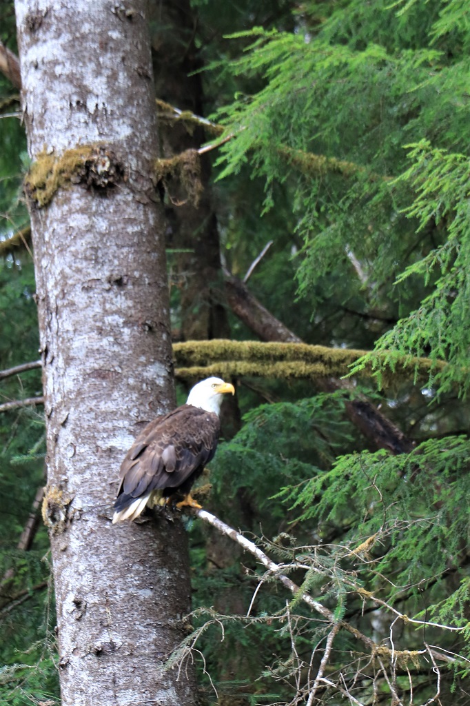
 We returned to our room for a late lunch and some down time just as it began to rain. Twenty minutes later the rains stopped and the sky slowly cleared and the clouds lifted until by the time we had finished our dinner it was a lovely evening. That is what the weather does here – changes every half hour or couple of hours.
 Tomorrow we are heading the opposite direction and making stops in Skidegate, Tlell, and Port Clements.
