We didn’t depart the cottage until 11:30. It was nice to have a slower morning; especially since I had an almost sleepless night. I hate those, but, what is a girl to do? Anyway we decided to drive to Port Renfrew, a small fishing commuity on the coast. From Port Renfrew you can only go northeast to Lake Cowichan, or south back to Sooke and then east to Victoria. Neither of us had ever been to Port Renfrew, so now was our chance. There is a long geocache trail that goes from Sooke to Port Renfrew and up to Lake Cowichan. There are over a hundred caches hidden beside the road. We had no intention of driving that far, nor of trying to find all 50+ on the way to Port Renfrew. We did , however, find 25 of them as we drove there and back, which always adds some fun to the day. We leapfrogged with another geocaching couple for an hour or so and searched together to find some of the caches.
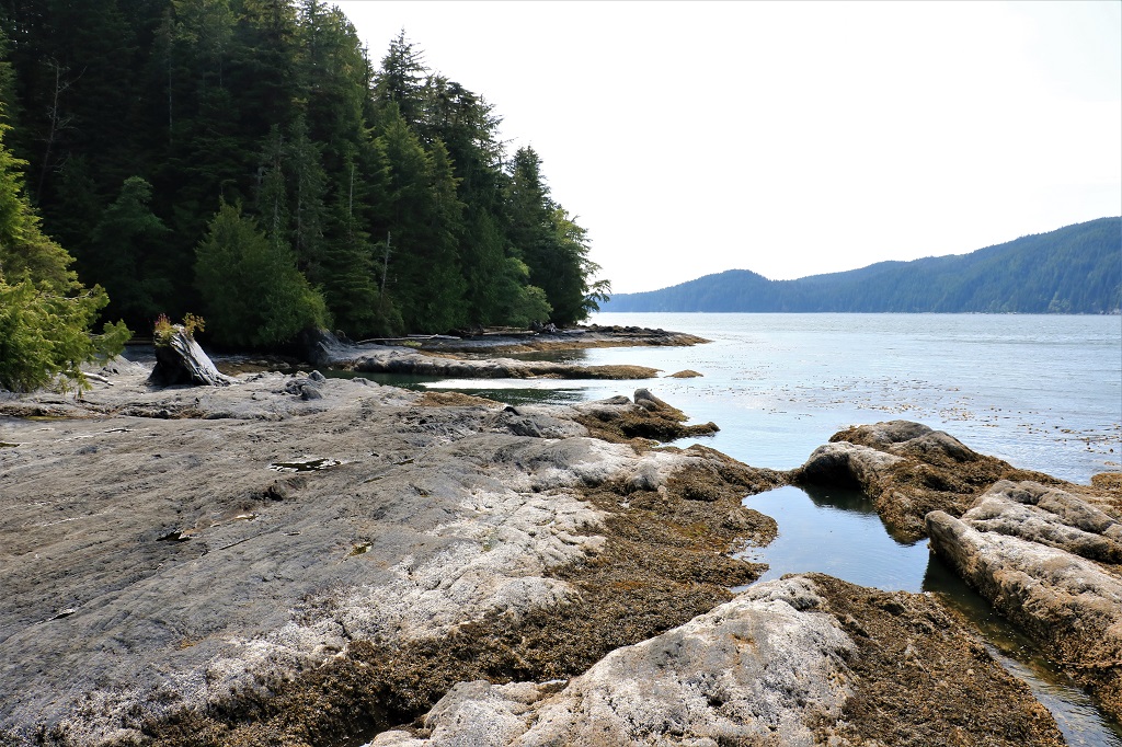
The road to Port Renfrew is quite narrow and winding and rises through the end of the Vancouver Island Range and down to the coast. The fertile area was settled in the mid 1880s by the promise of a road, which took 75 years to appear so none of the original settlers lived to see it. The life lines of the small community in those days were two CPR steam ships that would arrive about every ten days – weather and ocean currents permitting. There are still some of the descendents of the early settlers living in the area. Port Renfrew is a fishing community with a large sport fishing clientele. You can also go whale watching. Botany Bay Provincial Park is 2.5 km away and there are lots of hiking opportunities in the park. As a matter of fact there are hiking trails ALL OVER the place around here! Who knew?
The majority of the 82 km route is flanked on both sides by very dense forest. This rainy coastal climate is wonderful for growing stuff, especially huge, lethal wild blackberry bushes that dig holes in your arms and legs as you are looking for geocaches. There are many short, often one lane, bridges that span numerous rivers and creeks – many of which are at the bottom of deep gorges that show tops of trees and none of the water you can hear running below.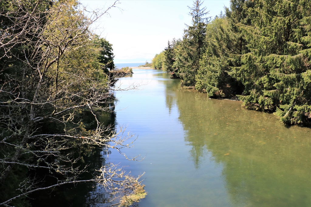 Muir is the name of one of the early settlers and this is Muir Creek.
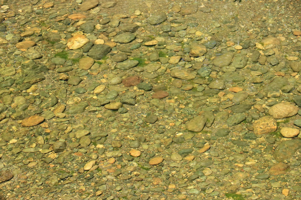
At Kirby Creek the water was crystal clear and slow moving.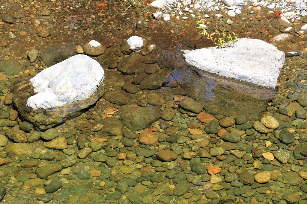
 We pulled into a large parking area that was close to the shore to take a look-see and learned that this section of the west coast of Vancouver Island is a prized surfing area. It is called Jordan Beach and the Jordan River enters the ocean a short distance away. There were no surfing waves on display today. We had met a fellow at one of the first stops we made for a geocache and he was suiting up to walk through the forest on a trail that accesses the ocean to go windsurfing. There are some strong winds here that make the area popular with windsurfers as well.
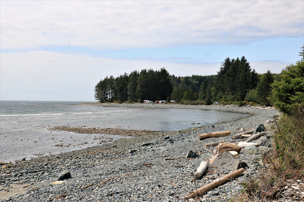
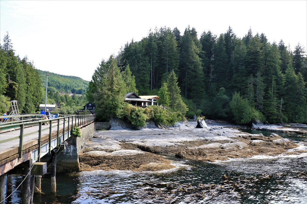
 When we reached Port Renfrew we continued driving down the narrow road to Botany Bay to see some of the tide pools and coastline, but found that you only arrived at a parking area and the ocean was almost a kilometer down a semi-steep trail. After all the walking we had been doing the last few days, the arthritis in my feet said that was not going to happen so we drove back to Port Renfrew and took a walk along the wharf.
.
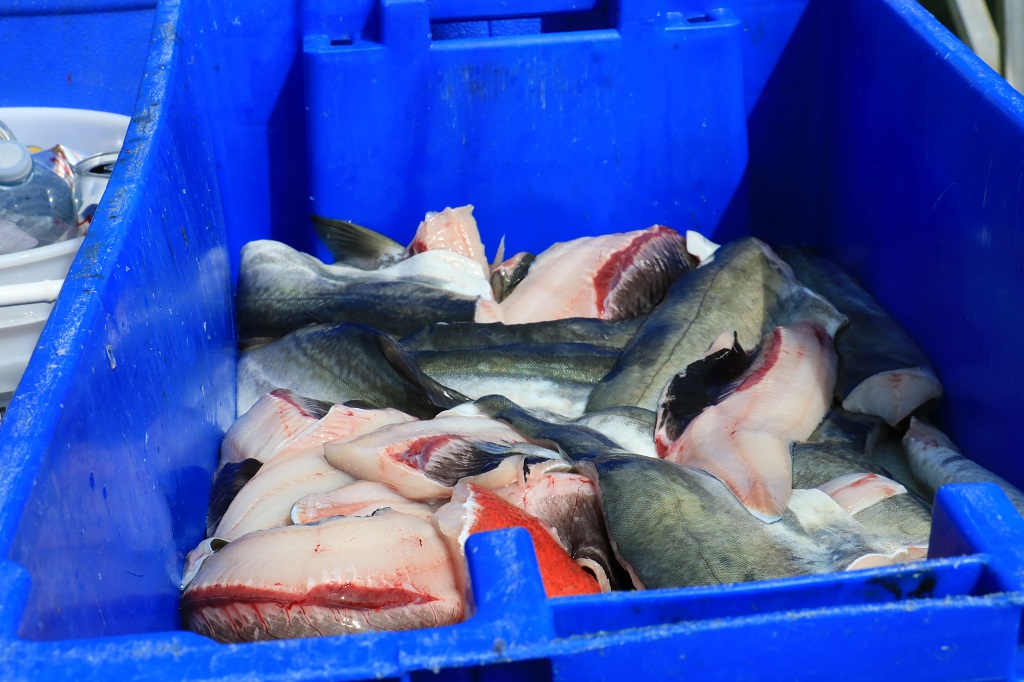
 There were quite a few fishing boats and charter boats docked along the wharf and the fishing must have been quite good today because we passed 6-8 large bins of filleted fish sitting on the wharf waiting to be picked up and taken up the hill to the processing plant. A fellow was busy filleting the catch of a couple of fishermen so it could be freeze-packed at the plant for them to take home.
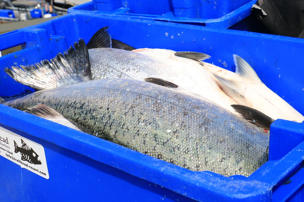
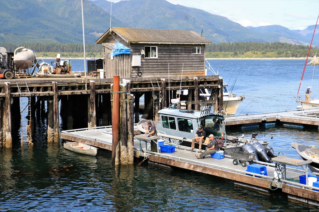
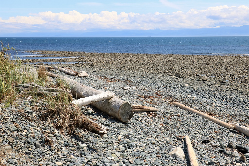
 The view from the end of the wharf was pretty nice.
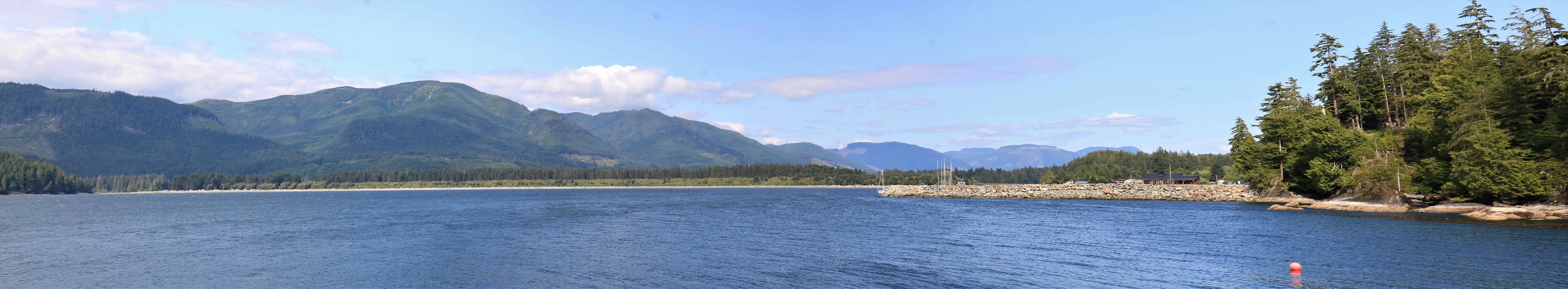 After our little stroll we got back in the truck and headed back to Sooke, stopping to pick up a few more geocaches. We got back to Wisteria Cottage at 6:30 and had dinner. Another lovely day on Canada’s west coast.
