Now that we are home from our 2017 summer road trip I will continue writing about our trip to, within, and home from Australia in 2011. We sailed to Sydney, Australia via the first leg (45 days) of the Holland America Line World Cruise. Before we left home for our road trip I wrote about our two days in Callao (Lima), Peru.
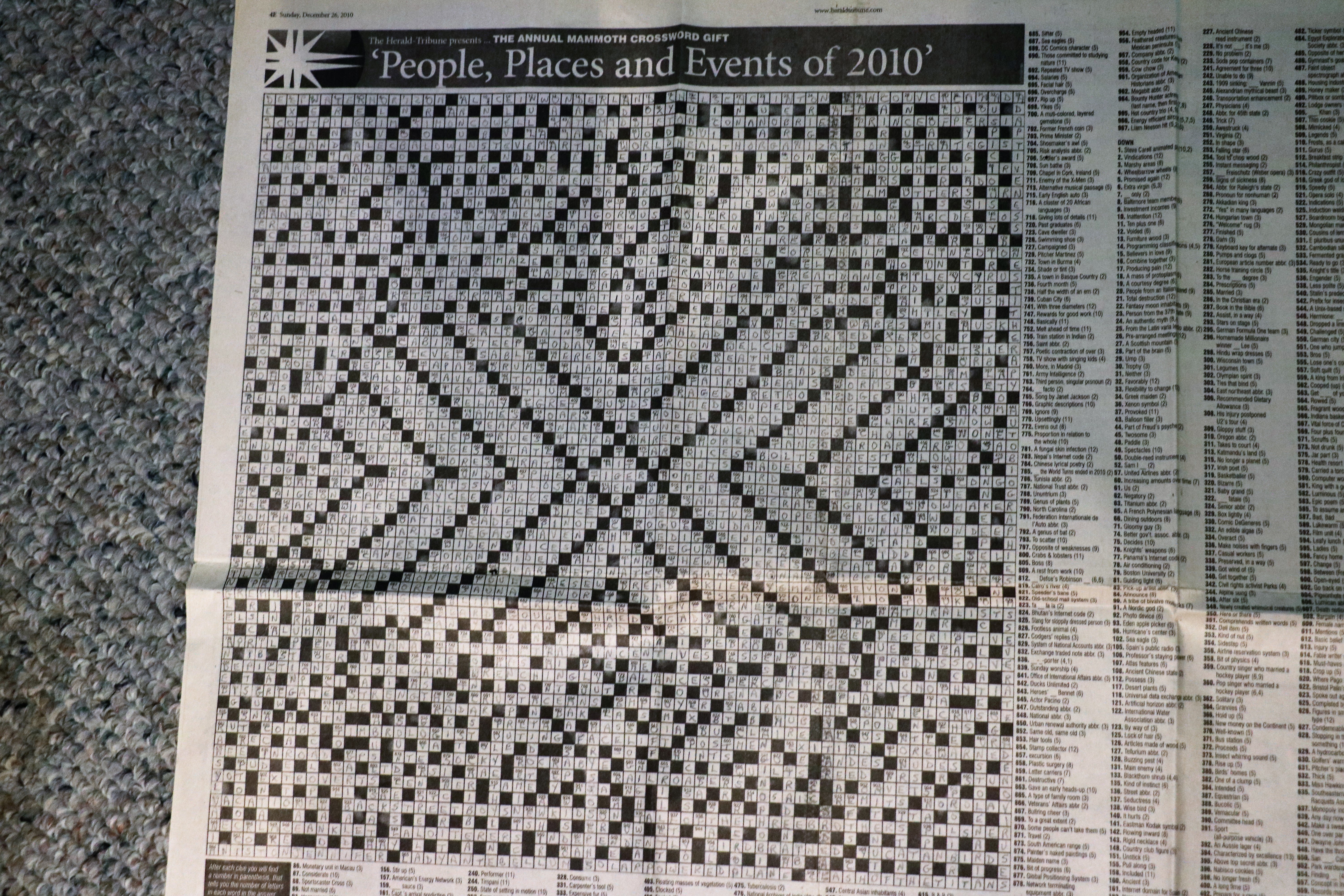
We had four days at sea between Callao, Peru and Easter Island in the middle of the Pacific Ocean. As I have mentioned before, John and I love sea days. We do lazy well and enjoy reading on deck or walking laps. On one of the first few days of the cruise I was sitting in the Lido working on one of the puzzles in my book and a lady stopped by and offered me a gigantic crossword puzzle that someone had given her. It took me several weeks to get it all done. Thankfully she also provided the answer page so I could look up a few things I couldn’t answer.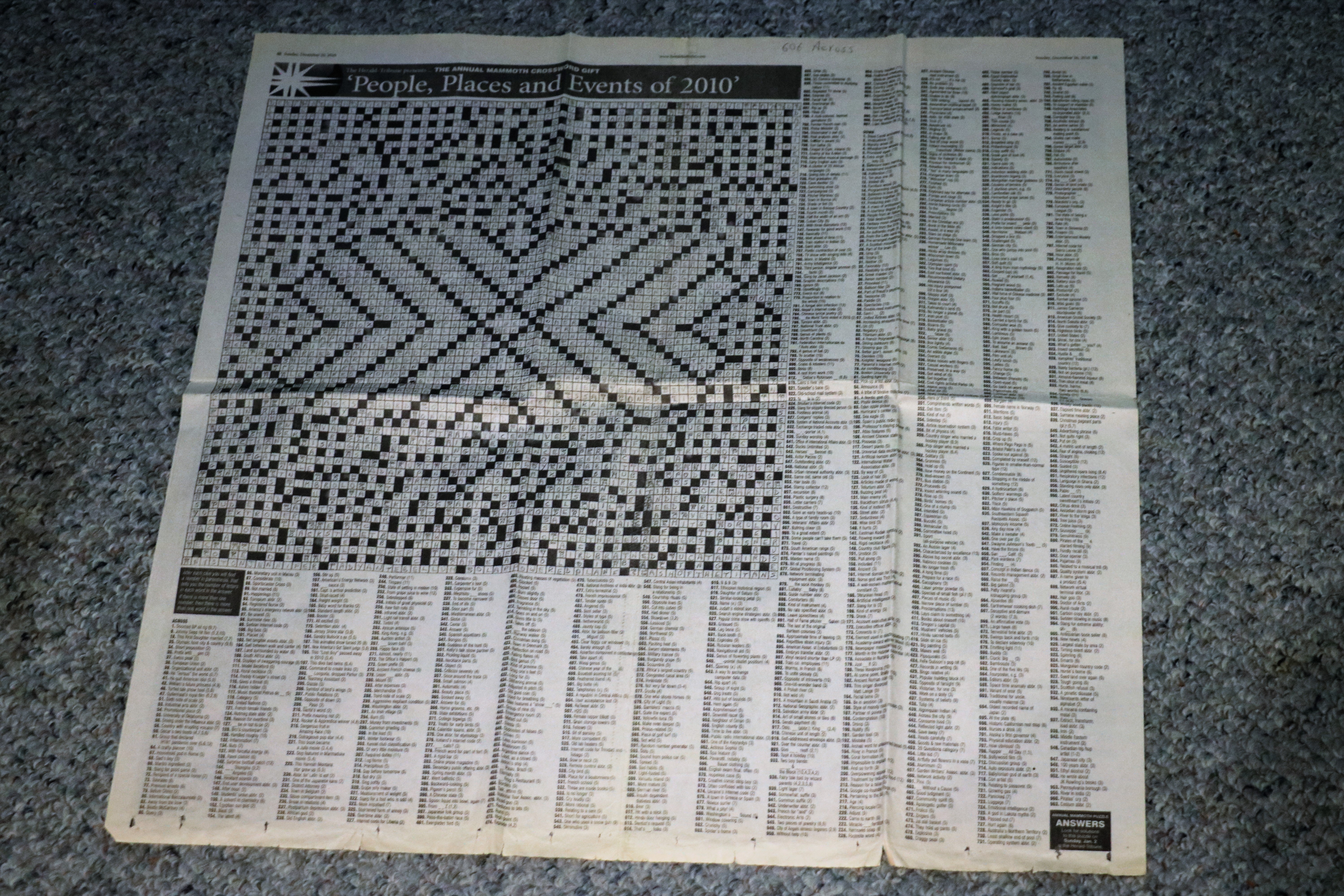
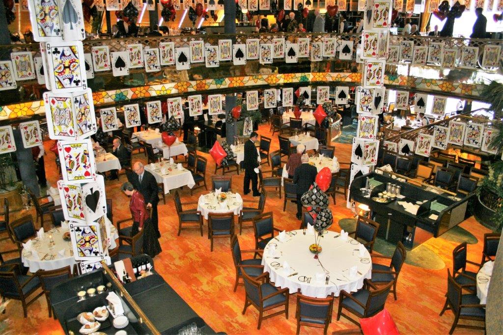
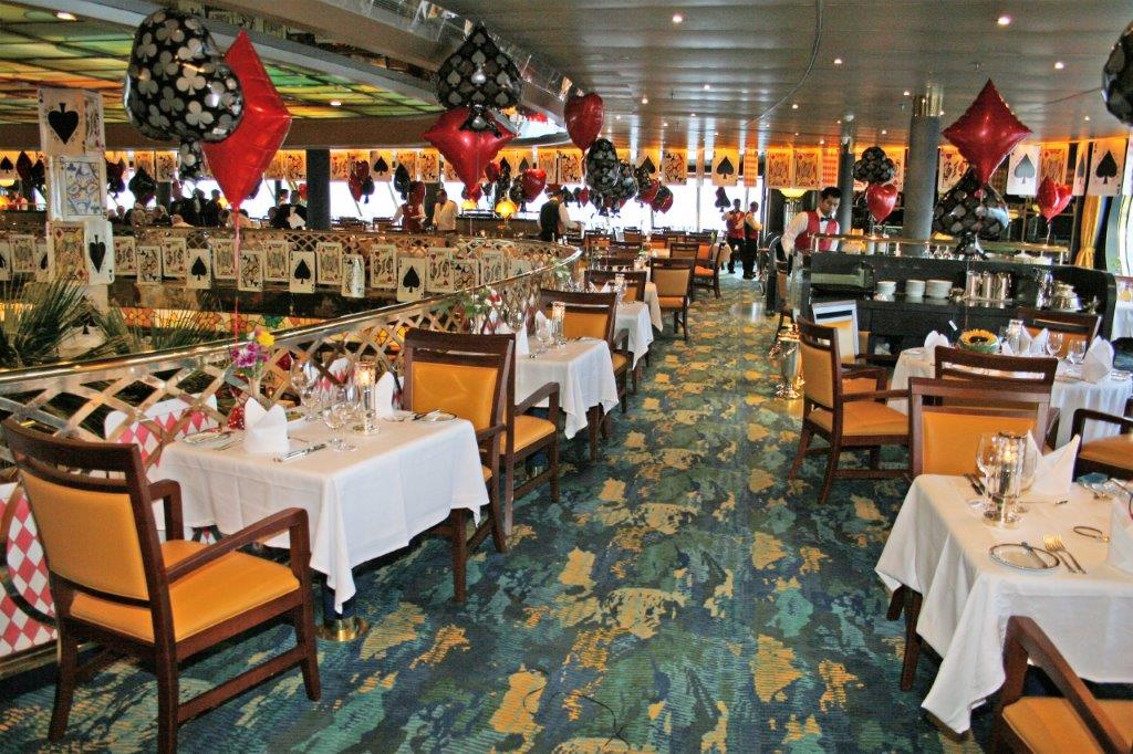
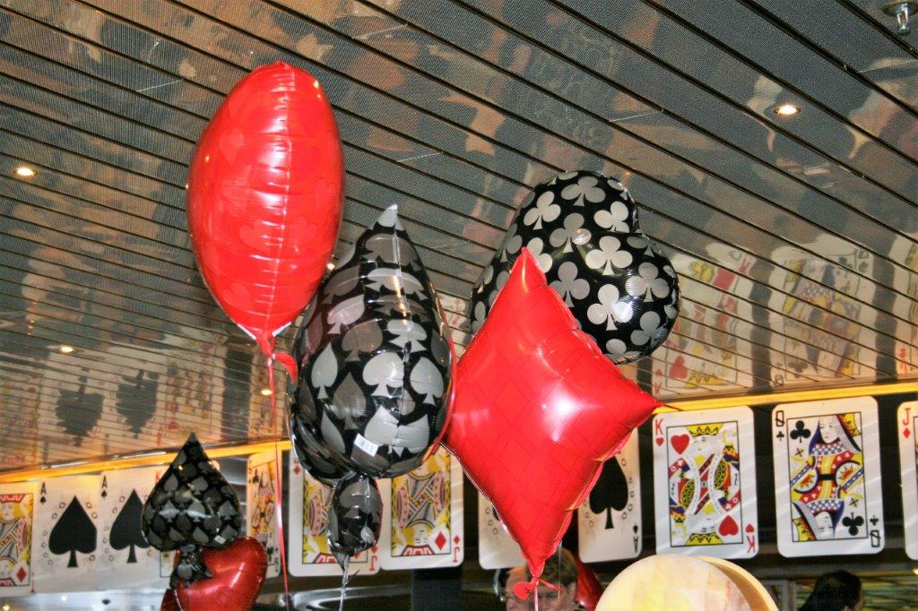
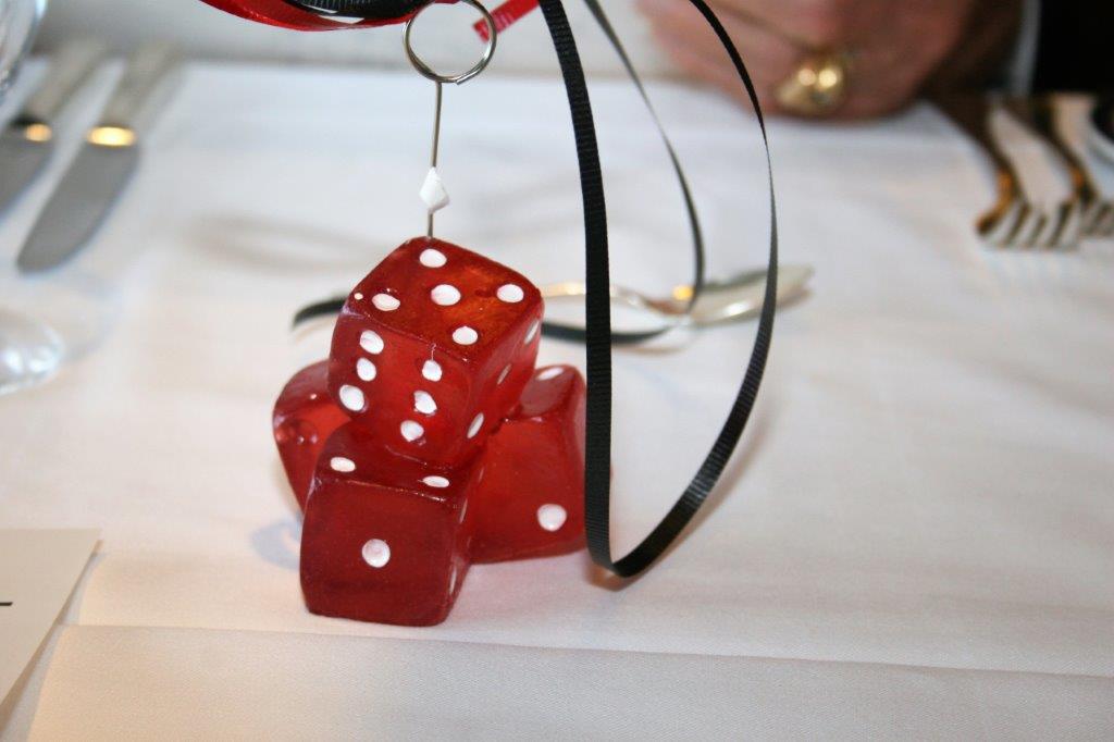
 We had a formal night the first day out from the South American coast. The theme was Casino Royale and large playing cards and sets of dice adorned the dining room, the Crow’s nest lounge and the hallways.
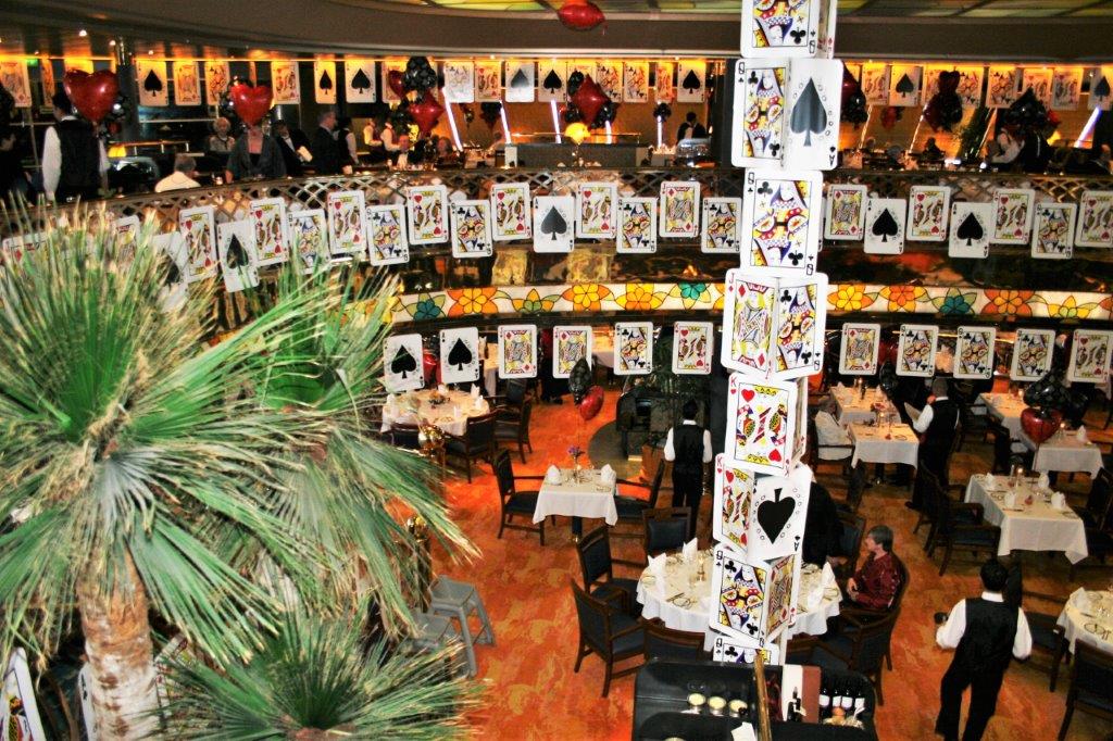

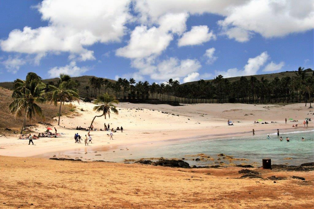
 Easter Island is a Polynesian island in the southeastern Pacific Ocean. It is a special territory of Chile and maintains the same time zone. (Time zone ‘lines’ jog in and around places all over the world. They are not straight like the lines of latitude and longitude.) Much of the island is protected within the Rapa Nui National Park and is a UNESCO World Heritage Site.
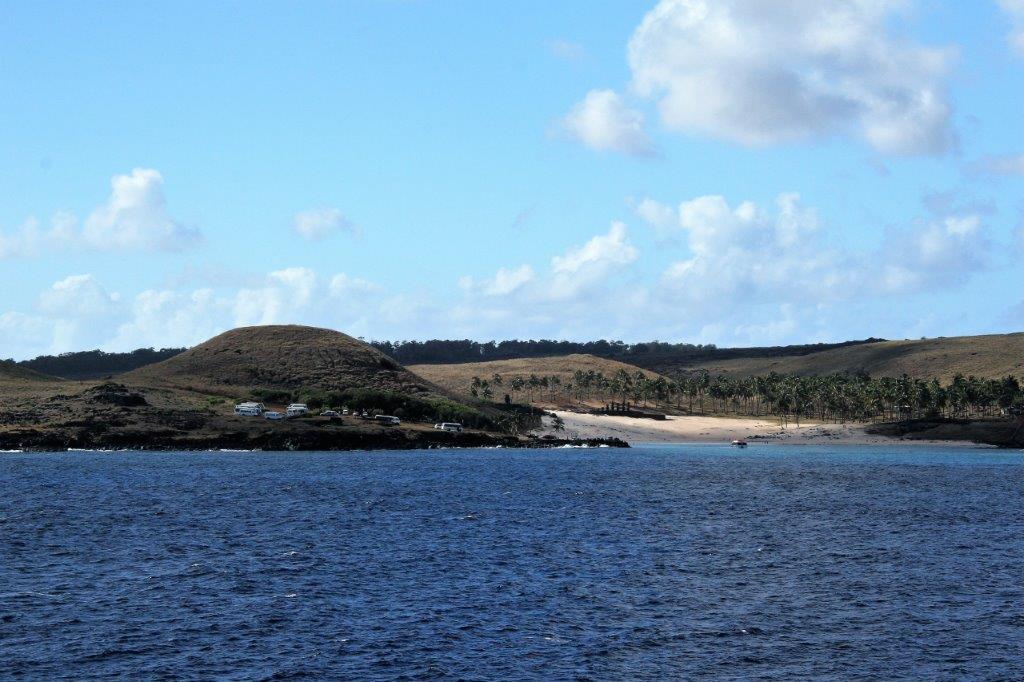
 The captain had been watching the weather for several days as we approached Easter Island and had hinted that we may not even be able to stop if the waves were too high. As it turned out the 6-10′ swells made it unsafe to take the tenders in to the normal western townsite of Hanga Roa so the captain arranged for all the tour buses and vans to make a dash to the north coast where seas were calmer and a portable docking facility made up of tenders lashed together tied to the small pier was created so we could disembark. This delayed all tours and visits to the island by over three hours, but thanks to the captains tireless efforts we were able to go ashore. Our tour was scheduled to depart at 8:30 but we did not get on land until noon.
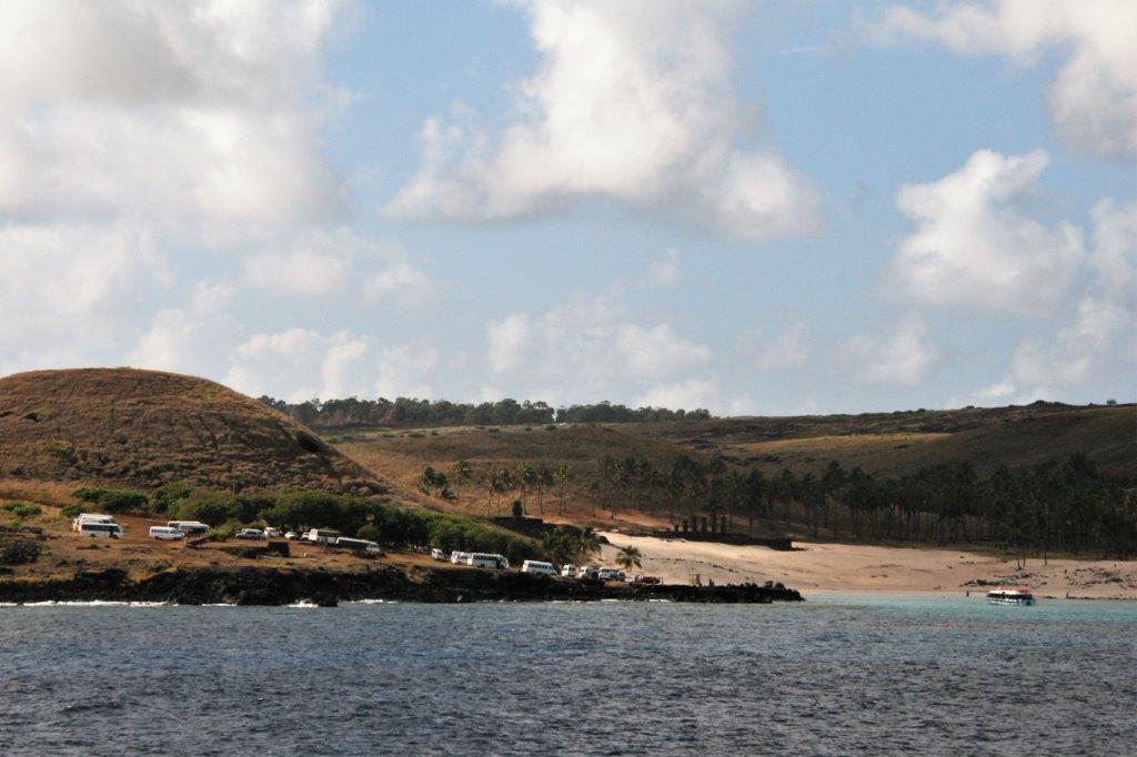

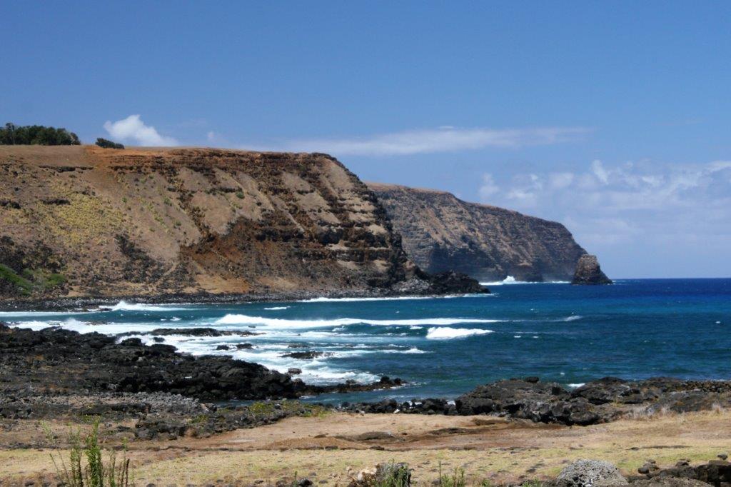
 Easter Island is one of the world’s most isolated inhabited islands. Its closest inhabited neighbour is Pitcairn Island (population about 50) 2075 km (1289.35 miles) to the west. The Chilean coast is 3,510 km (2,180 miles) away. The island is somewhat triangular in shape and covers about 63 square miles. It is approximately 24.6 km (15.3 miles) long and 12.3 km (7.6 miles) wide so you are never far from anywhere.
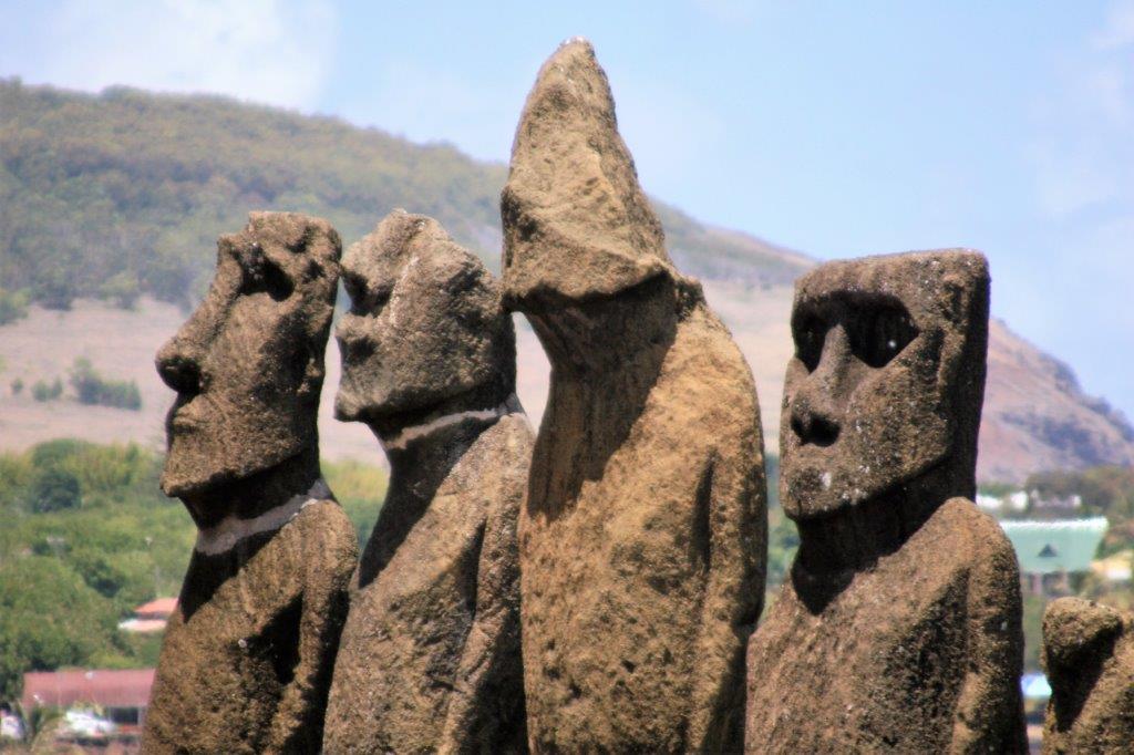
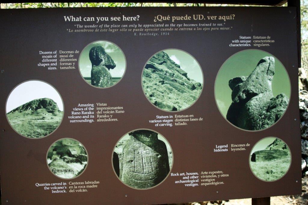
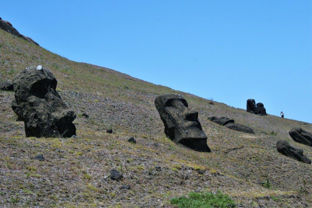
The large stone statues, or Moai, for which Easter Island is world-famous, were carved from 1100-1680 CE. So far a total of 887 monolithic stone statues have been inventoried on the island and in museum collections. Although often identified as “Easter Island heads” the statues are actually complete torsos, with figures kneeling on bent knees with their hands over their stomachs. Many of the upright Moai have become buried up to their necks by shifting soils.
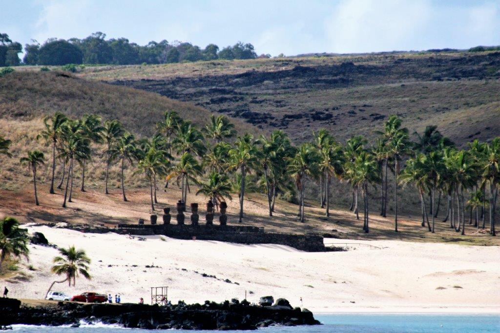
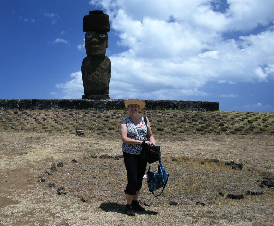
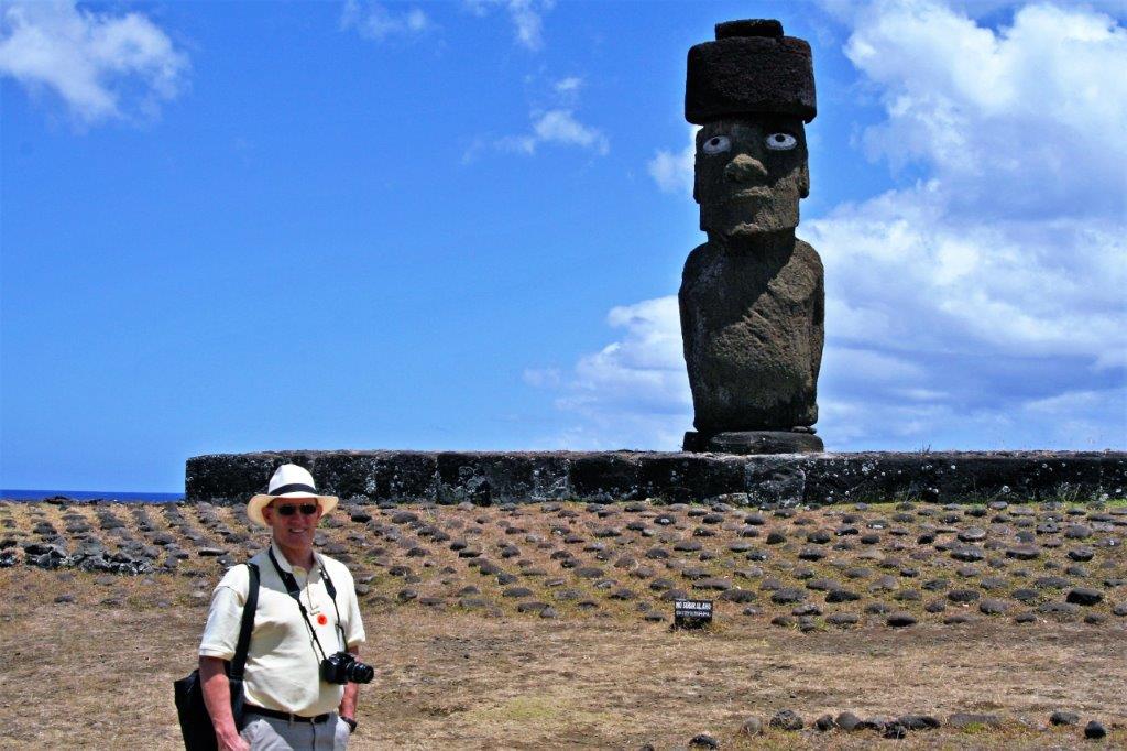
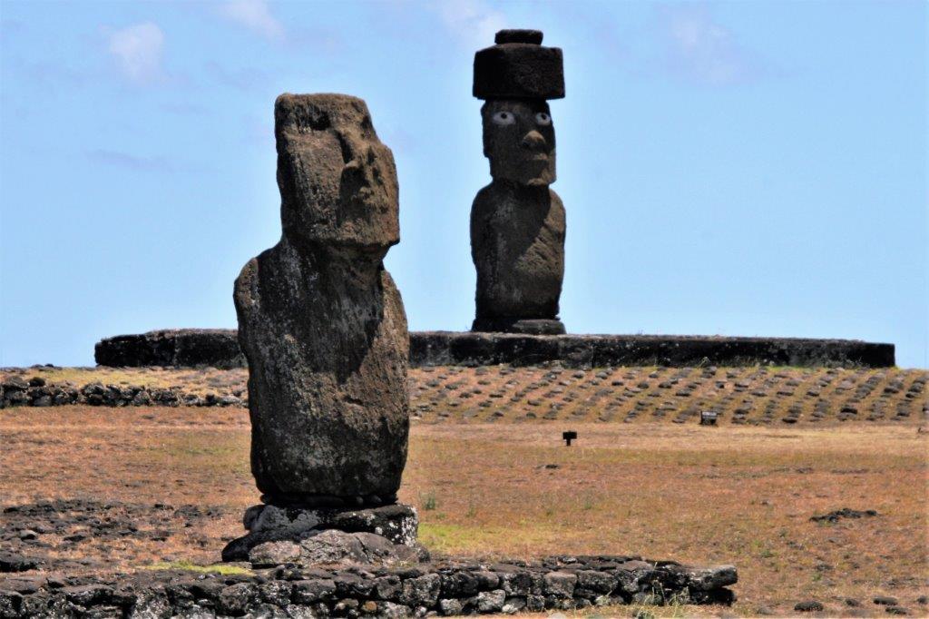
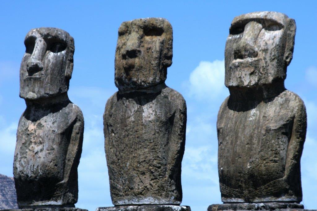
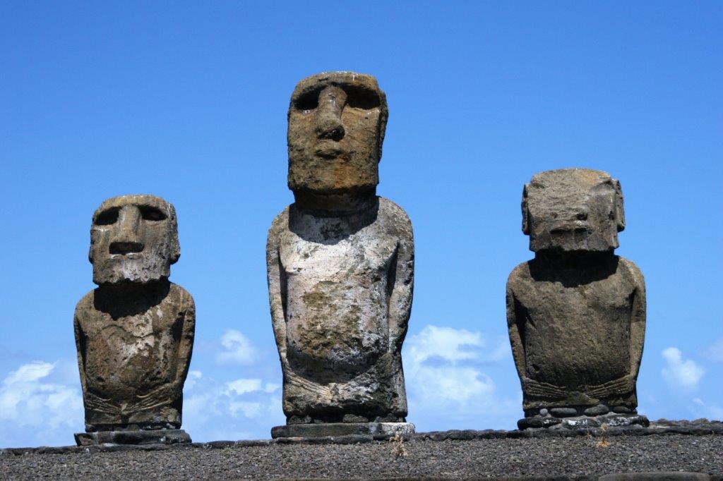
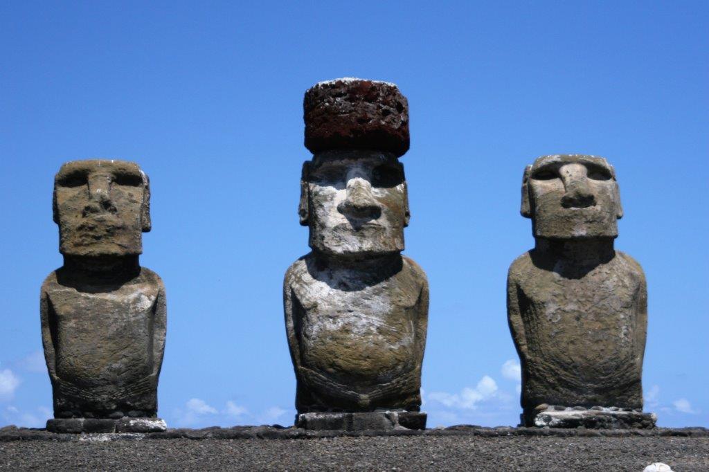
Our tour covered the entire island with three different stops. The first was to Hanga Roa where the tenders were supposed to have berthed, through the town (population about 5300 on the island) to the Tahai site with five standing statues.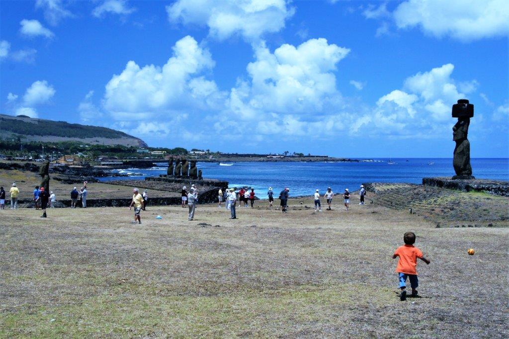
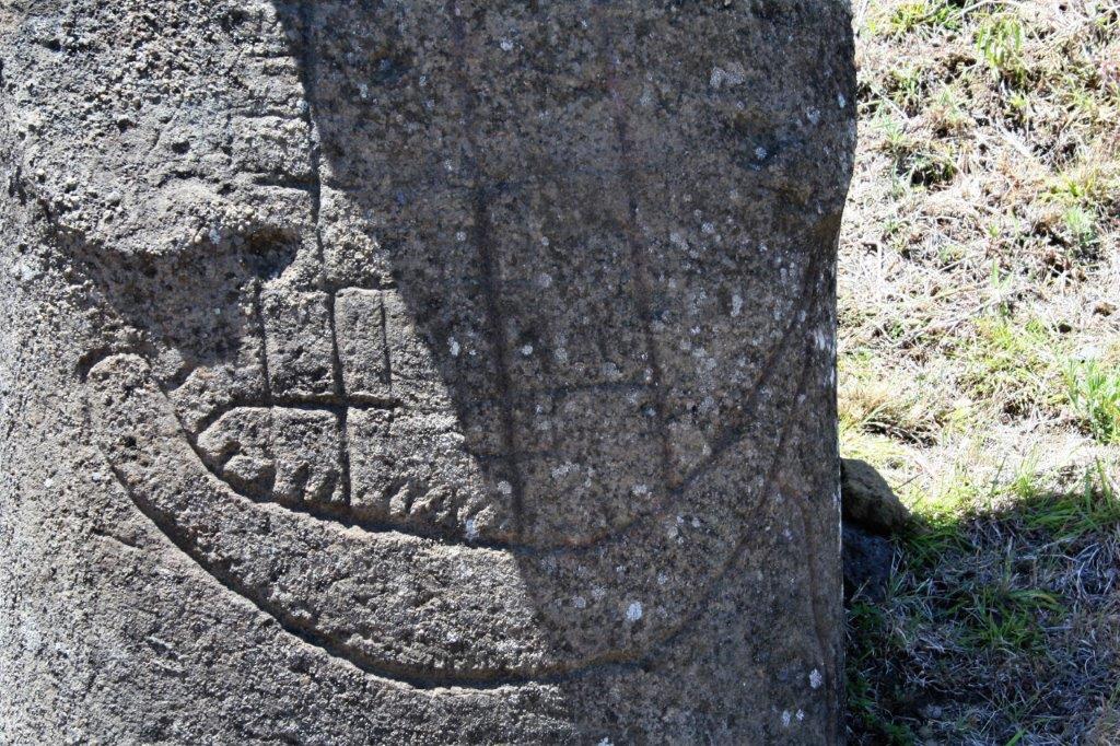
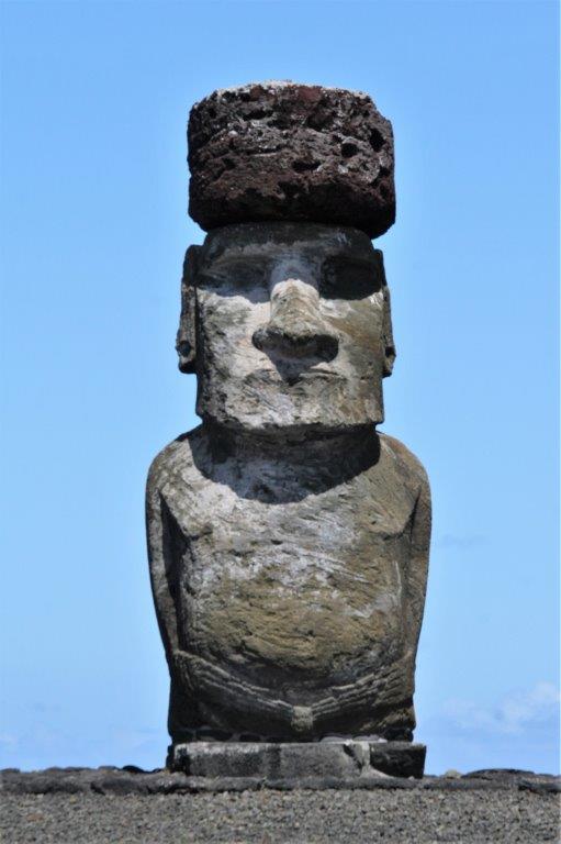
 The statues all had, not hats, but hair (top-knots) quarried from a different part of the island. Very few of the existing carvings sport them today.

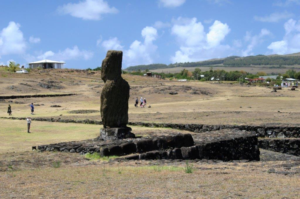
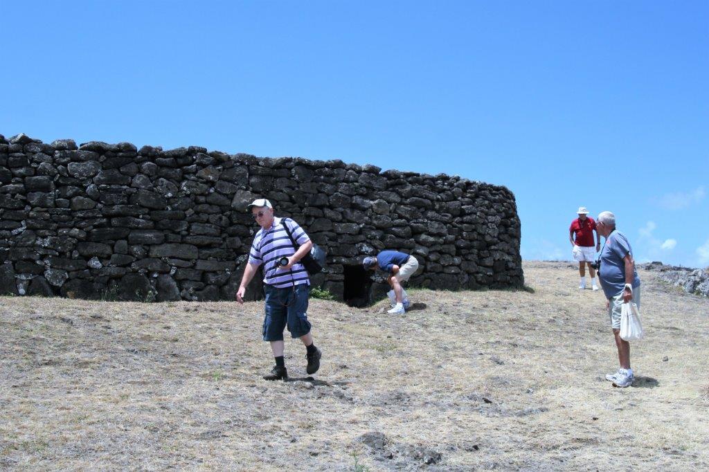
 Near the village was an example of the houses the people lived in. Very strange; elliptical shaped, narrow, and with very small doorways you need to crawl through.

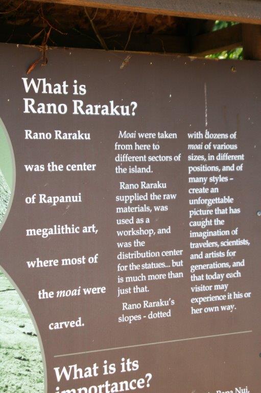
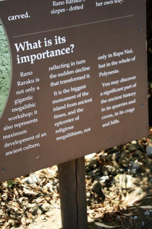
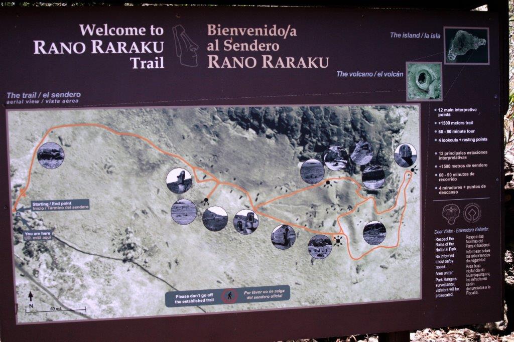
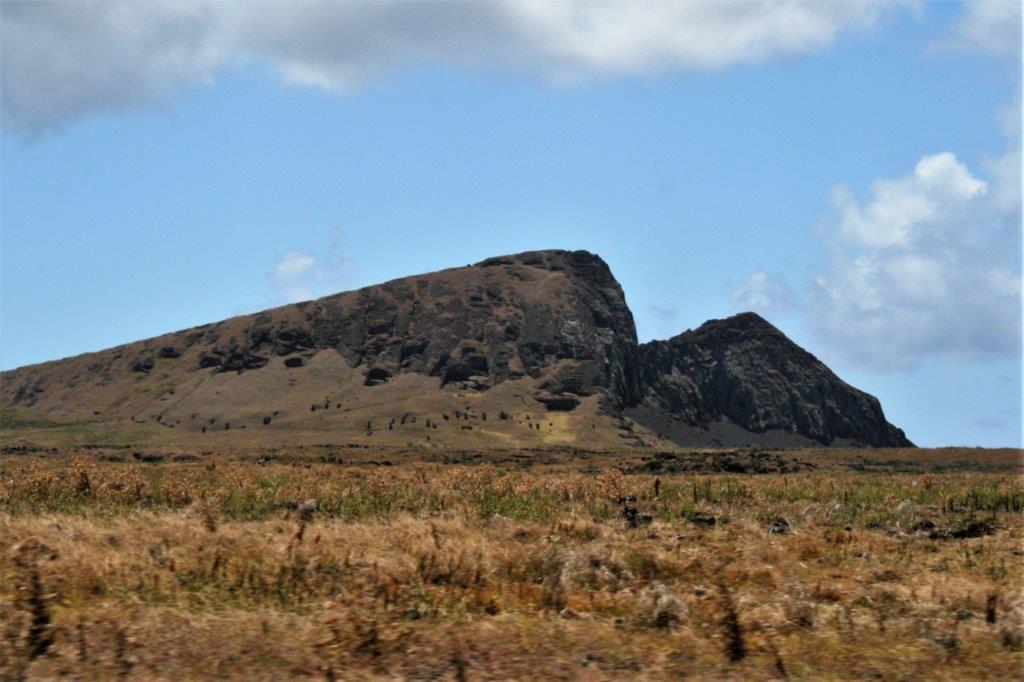
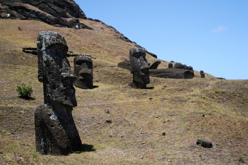
 The second stop was Rano Raraku, a sacred site and the quarry from which all of the statues were cut and carved.
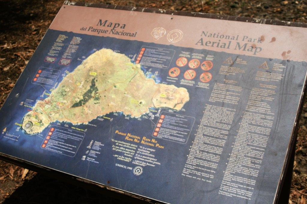

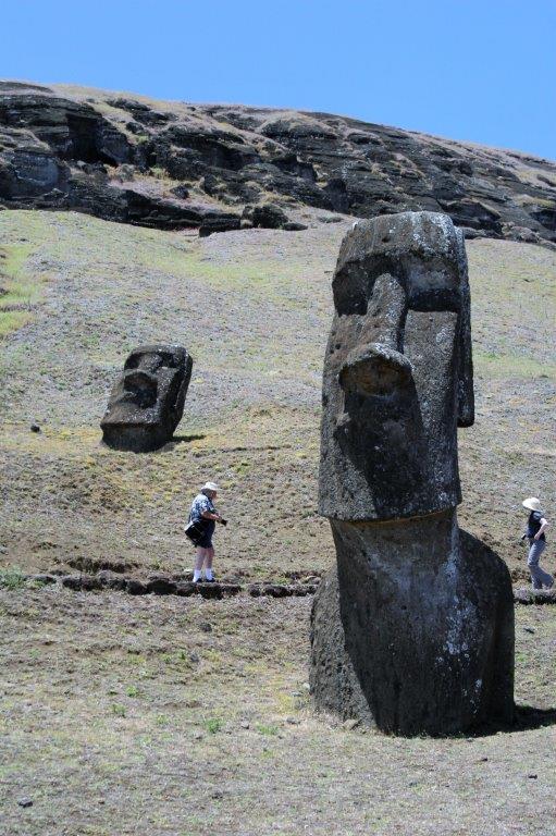 When you see the size of the people walking by you get an idea of how large these statues are; and remember most of the body is buried underground.
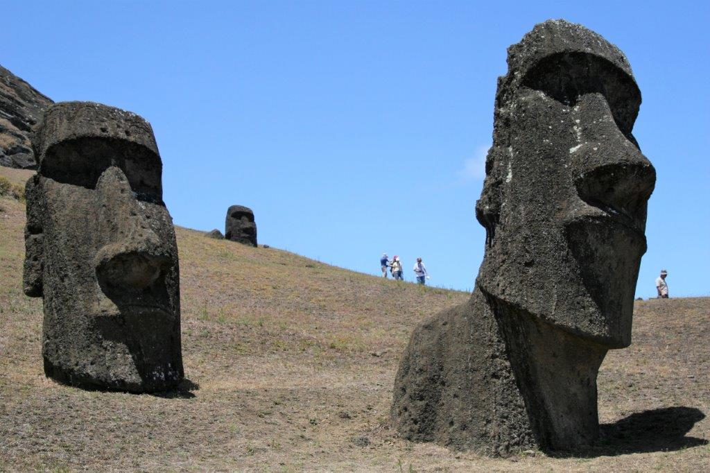
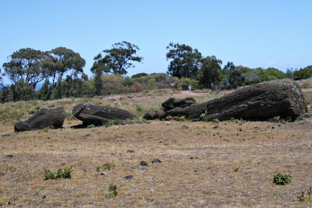
 How they were able to move these massive figures to all sides of the island is a mystery. One theory is that they used logs until all of the trees were gone which also made the island virtually uninhabitable so the peopled died out or moved away.
This statue is absolutely massive. I have no idea how they thought they could cut it out of the rock and move it away.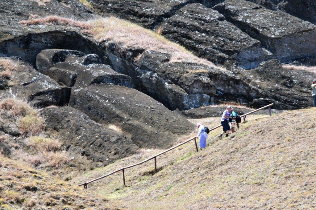

 There are still 397 statues of various sizes and/or incomplete at the quarry on the slopes of the extinct volcano.
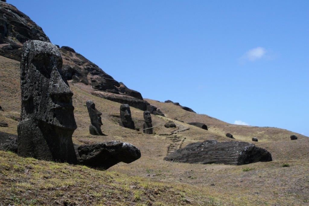
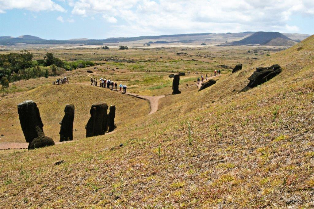
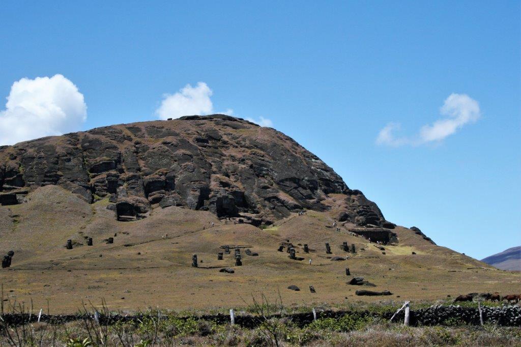
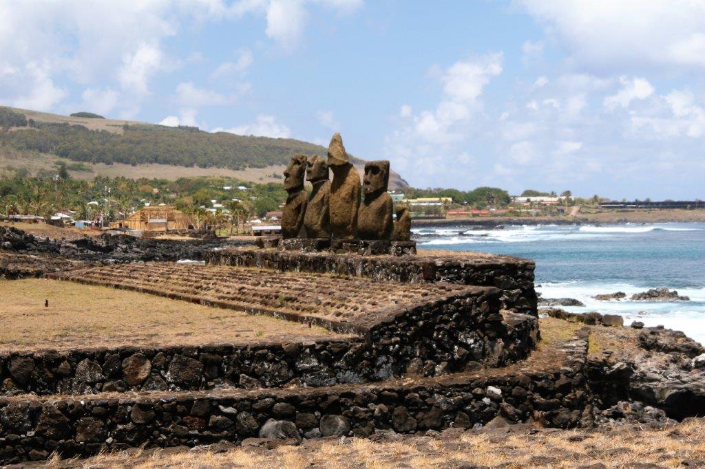
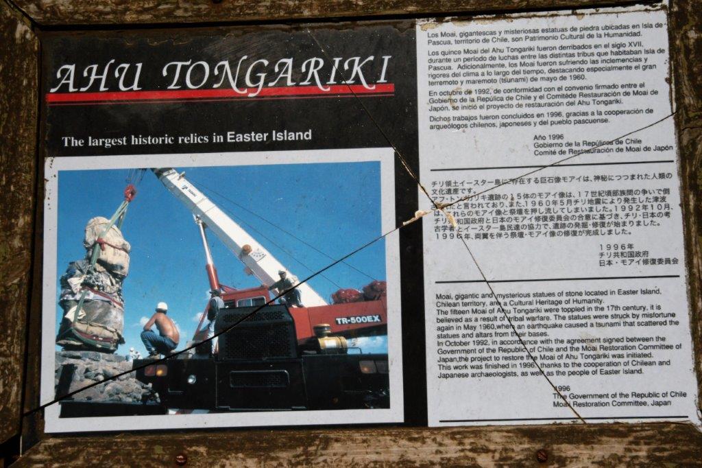
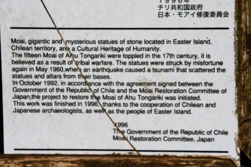
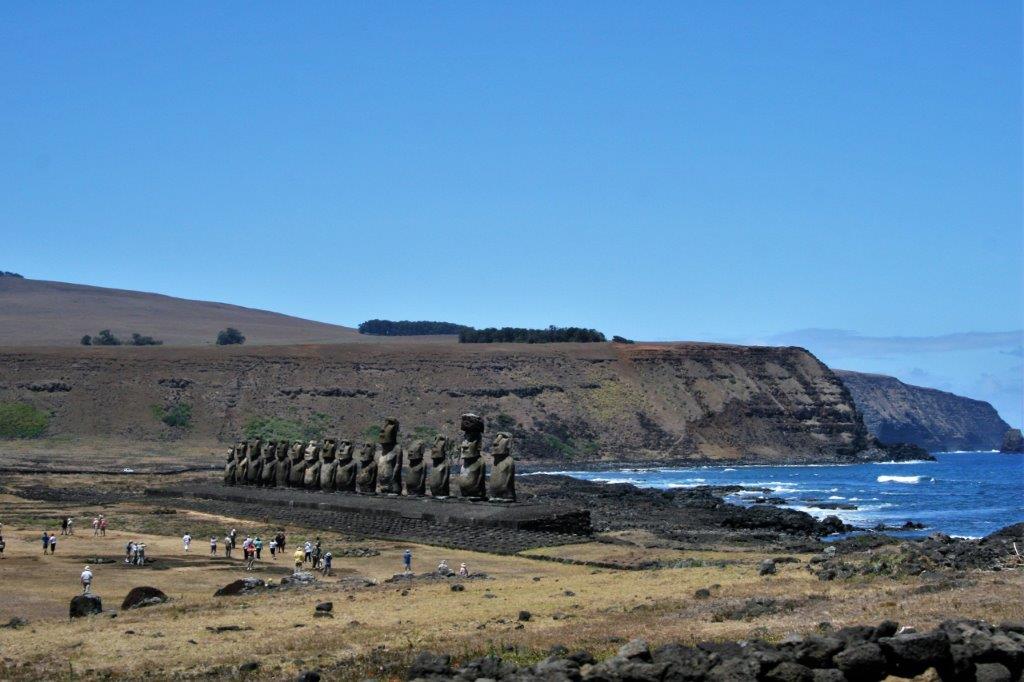
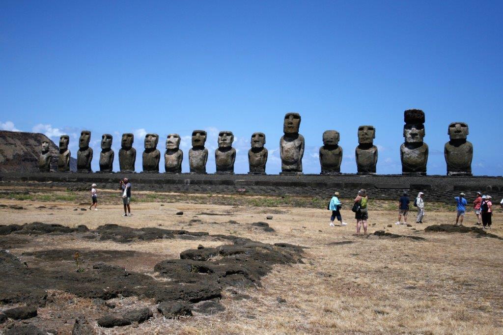
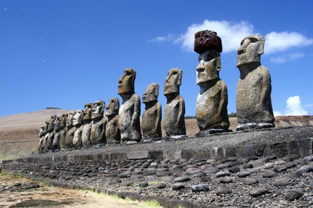
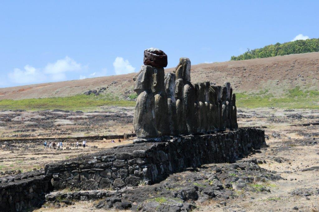
 Further along the southern coast on the back side of the quarry is Tongariki where 15 Maoi statues have been re-erected after being toppled by a tsunami in the 1960s. The platform beneath the statues is 656 feet long. Important personages and kings were buried under the platforms upon which the statues rest so all of the carvings and the bases are sacred sites.
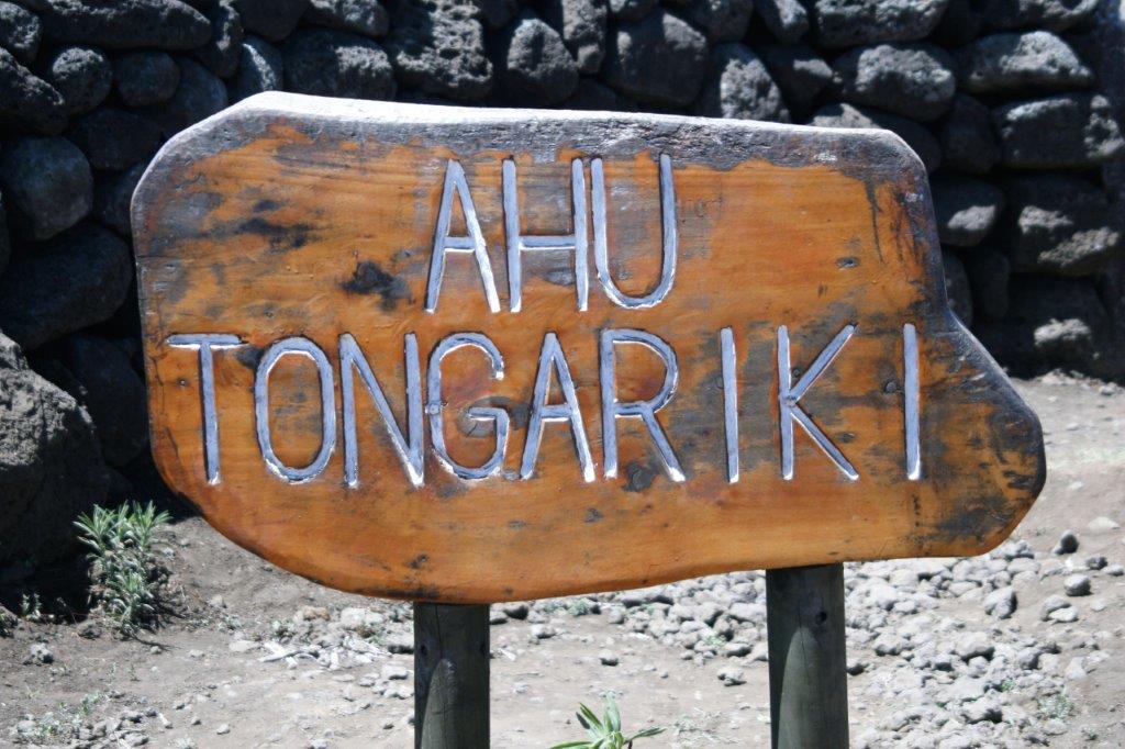


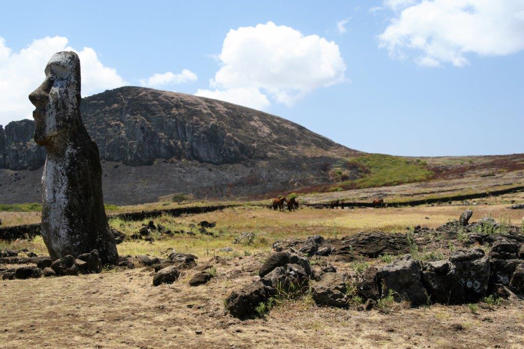
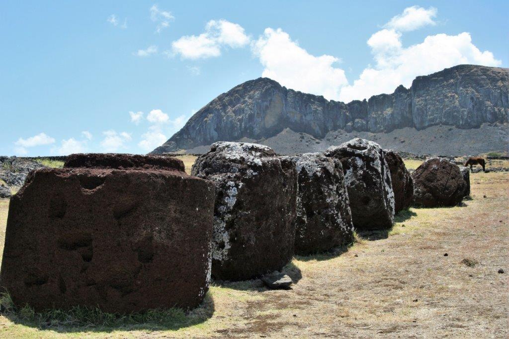
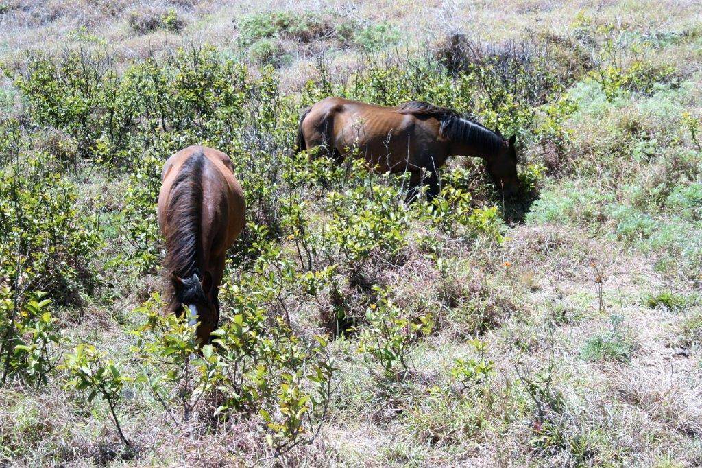
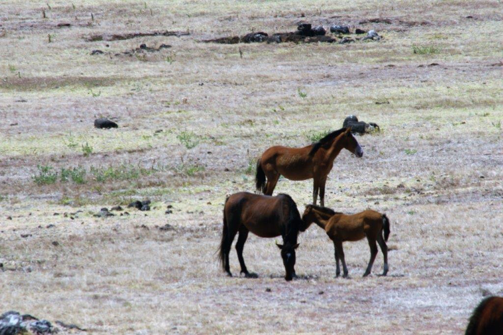
 There were some lovely horses grazing nearby.
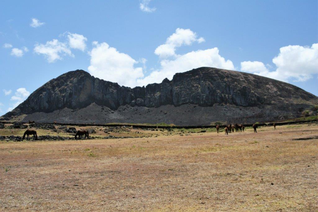
 We were driven back to our make-shift dock and tendered to the ship at five o’clock; in time for dinner which is always a good thing since the food is so good onboard.
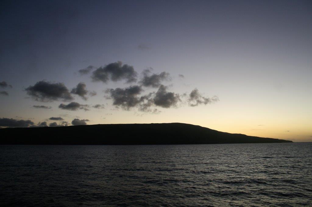
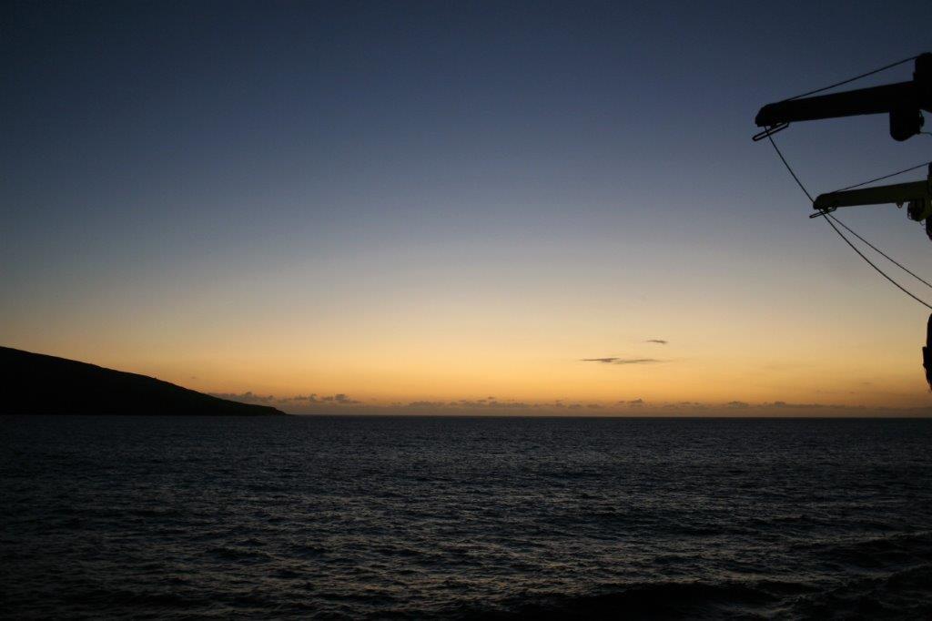
The ship was supposed to set sail for Pitcairn Island at five but due to the lengthy delay getting people safely ashore departure was put back until 8 pm. With the extra time needed to get people onto the tenders at shoreside and off the tenders at shipside, navigating the swells, we did not actually lift anchor and sail away until 9. No one complained about the delay, though. Everyone was very pleased with the effort and arrangements the captain and crew went to in order that we could make the scheduled stop here. It is not at all unusual for high seas to cancel an Easter Island port-of-of call. This was one of those surreal places we could not believe we were actually visiting. It was a wonderful day.
 We had two days at sea before we reached Pitcairn Island where 45 of the 50 residents will come aboard the ship to sell their sought-after stamps, homemade crafts, T-shirts and trinkets. The many shoppers on board are twitching with anticpation.
