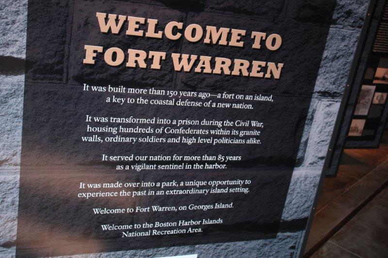
We took it a bit easy today. We didn’t leave the apartment until 12:30 in order to take the T out to Aquarium station and Long Wharf. We purchased round trip tickets to Georges Island so we could explore Fort Warren; which was built as a defensive fort for the Boston Harbor but was used during the Civil War for Union prisoners (deserters and dissidents), political prisoners and Confederate POWs..
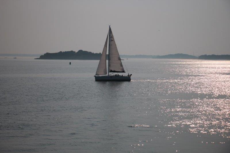
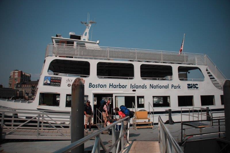
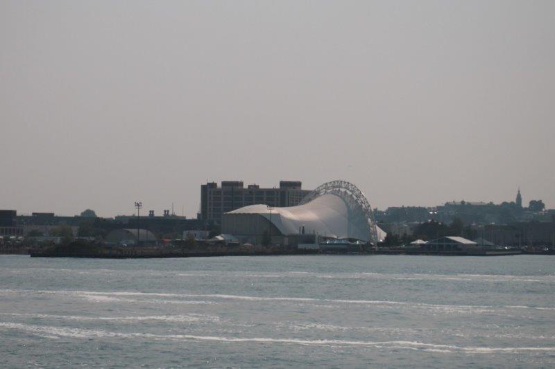
All 34 of the Harbor Islands are part of a joint Commonwealth of Massachuesetts and National Parks initiative. Six of the islands are not open to the public, but the rest are (access only by boat or ferry) and Boston Harbor Cruises makes regular daily runs from three terminal to the many of the islands – they have 51 boats of various sizes. You can even travel inter-island between two or three islands on each route. We just bought direct to Georges and back to Boston tickets. The ferry left Long Wharf at 2 and arrived at Georges at quarter to 3. The boat only goes 10 knots top speed so it was a pleasant, leisurely ride; another lovely day, although the air was distinctly more hazy today.

 On board was a Park ranger who gave us a commentary on all of the islands we were passing. Along the way she gave a lot of interesting Boston information some of which I am going to relate first.
When the Puritans arrived the area of Boston was a small penninsula. In order to make room for the many immigrants expected to arrive to settle the new land they carved the tops of Boston’s three hills-Copps, Breed and Beacon. The dirt was used as fill at the shoreline between long wharfs to make more land; thus creating the term wharving. This eventually quadrupled the size of Boston and today 75% if the city is on man-made land.
Boston’s number one export is scrap metal.
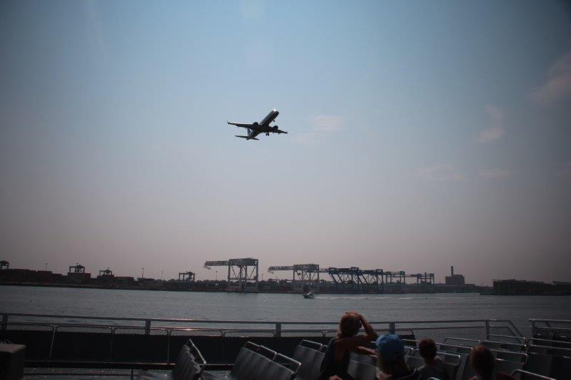
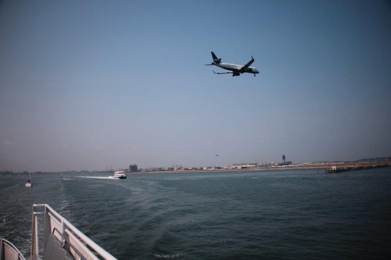
Logan Airport is located on 2400 acres of man-made land incorporating three small islands that used to be out in the bay: Governor, Bird, and Apple (Johnny Appleseed was from Boston),
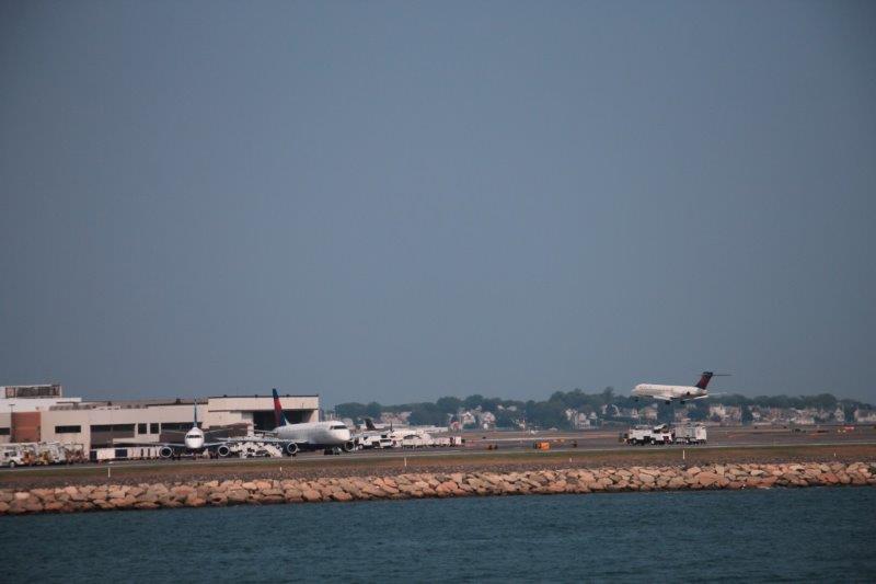 The harbor is on the direct landing flight path at Logan and about 10 planes landed – descending directly over the ferry – in the time it took to putt-putt past the airport area.
 Boston was divided by Interstate 93 and in 1982 plans were drawn up to move the highway underground and make a tunnel under the shallow Inner Harbor directly out to Logan Airport – the Central Artery/Tunnel Project known as The Big Dig – 5.6 km or 3.5 miles long. It is the most expensive highway project in US history and was (according to Wikipedia) “plagued by escalating costs, scheduling overruns, leaks, design flaws, charges of poor execution and use of substandard materials, criminal arrests and one death.” The project was begun in 1982 and scheduled to be completed in 1991 at a cost of $2.8 billion dollars. However, with all of the above, it was not finished until 2007 and cost $14,6 billion a 190% overrun which with interest added will top out at $22 billion by the time it is paid off in 2038.
Plus an observation of my own. Boston has a traffic/pedestrian crossing system different than that of everywhere else we have been. Both directions of traffic at a intersection alternately get green lights to go while pedestrians are stopped on all four sides. Then the cars are all stopped and all four pedestrian crossings have walk signals. I guess too many people were getting hit by right turning cars or something. It works well though. And off course you can always cross when the oncoming lane has a red if there is no one coming or you can at least get to the middle divide and then wait for the walk. That works too.
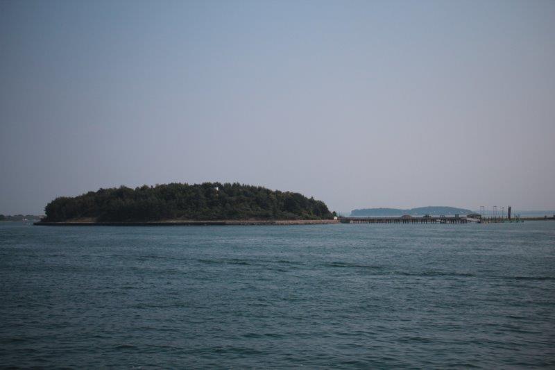
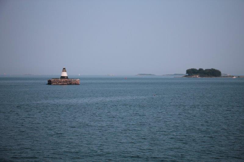
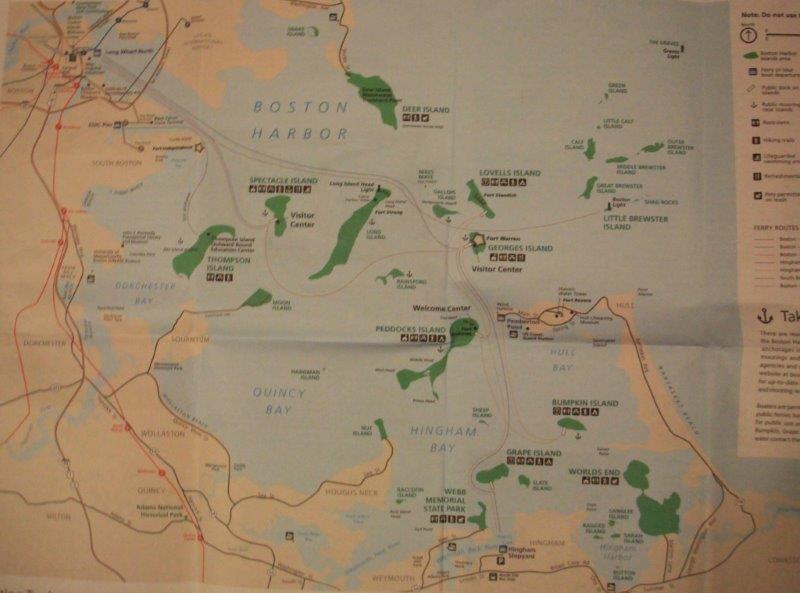 Harbor Islands: The first we passed was Spectacle Island. It was a smallpox quarantine island. Also had three illegal hotels on it at one point. Later it had a soap rendering business using the carcasses of 45,000 horses annually (they offered a pick-up service if your horse died). In the 1920’s it became the city garbage dump and continued as such for 50 years. There were firefighters stationed on the island to deal with the frequent fires from the methane gas produced by all the trash. They used the dirt from the Big Dig to cover the trash, extinquish the fires and build up the island so it has hills on it today. It is a favorite for camping and has a lovely beach.
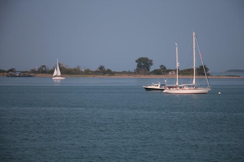
Long Island was next. Most recently the brick buildings were homeless shelters and a rehab center but the bridge connecting the island to the mainland was so unsafe it was dismantled this past winter – making 300+ homeless people find somewhere else to shelter. Quite a controversial decision.
 As we passed we could just make out the pilings on the right where the bridge used to be but it was too hazy and far away for a photo.
She told us things about some of the other islands as well but I didn’t make notes of it all so you are spared.


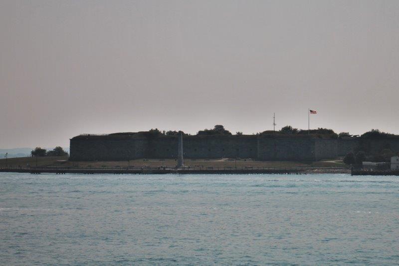
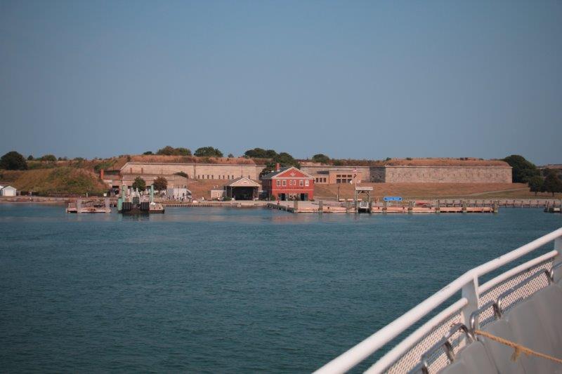
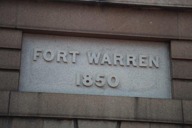
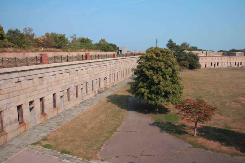
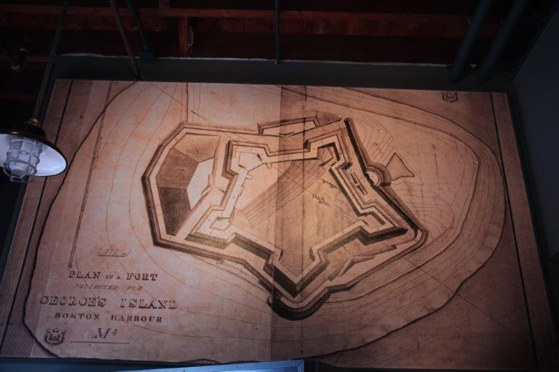
 When we arrived at Georges we were just in time for a Park guide to give a 45 minute tour of the fort. It was built after the war of 1812 when the British invaded and got as far as burning down the White House. Clearly some stonger shoreline defenses were needed.
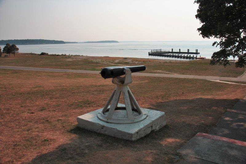
The fort was started in 1832 and the keystone was laid in 1850. However the fort was not actually completed for another 10 years. It’s weaponry was periodically updated as new innovations in firepower were available and the fort was used as a training ground during the Spanish-American War, WWI and WWII. It was de-commissioned in 1950 and purchased by the Commonwealth of Massachusetts for $5,400 in 1958. It is listed on the US Heritage Properties list and is now run and maintained by a joint Massachusetts and National Parks co-operative.
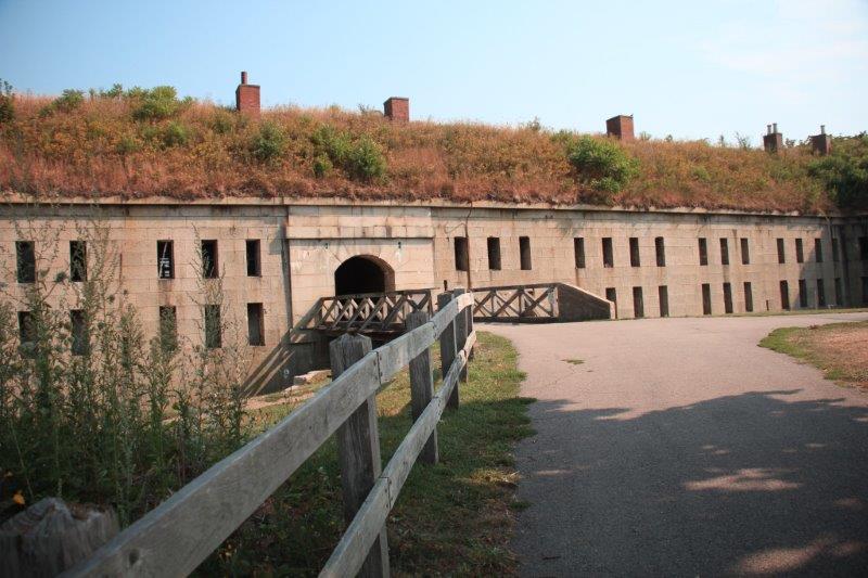
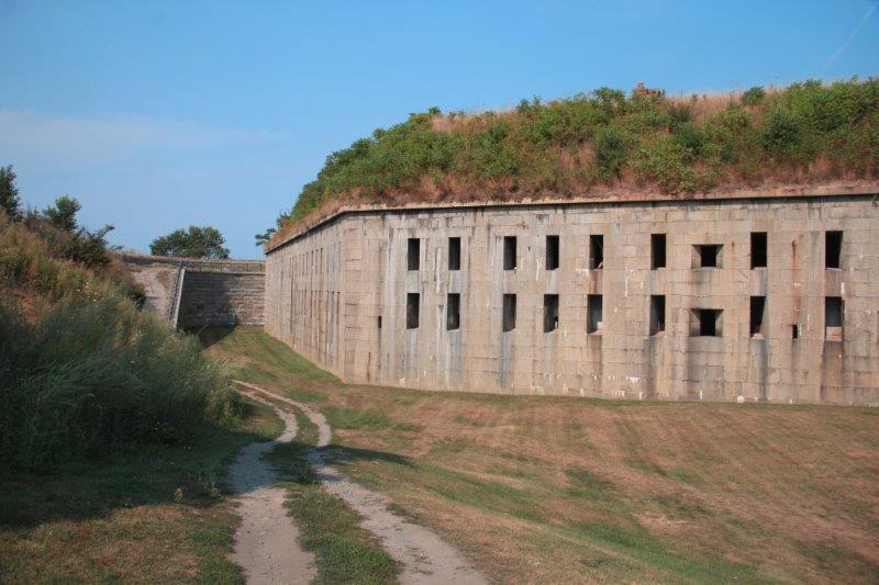
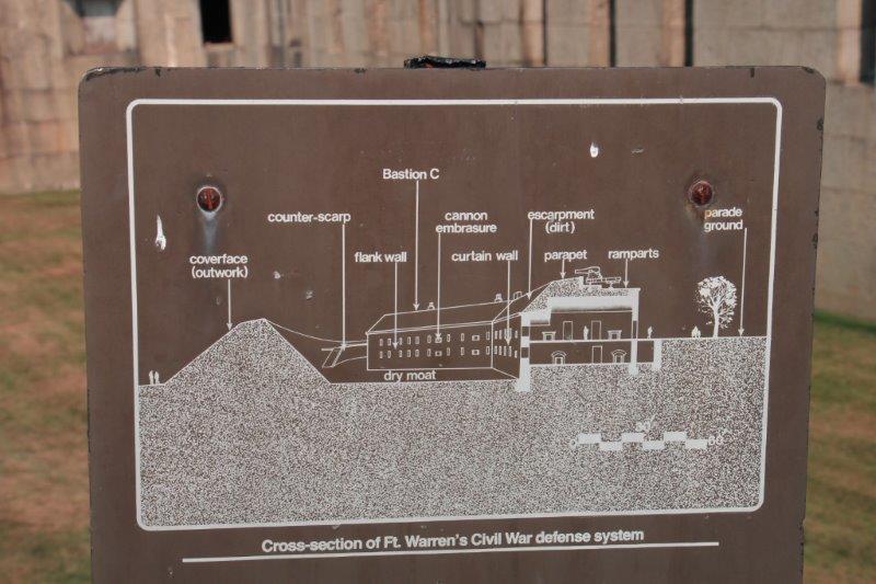
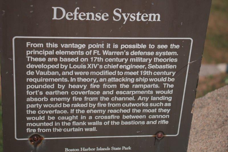
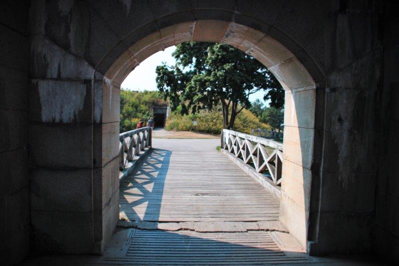
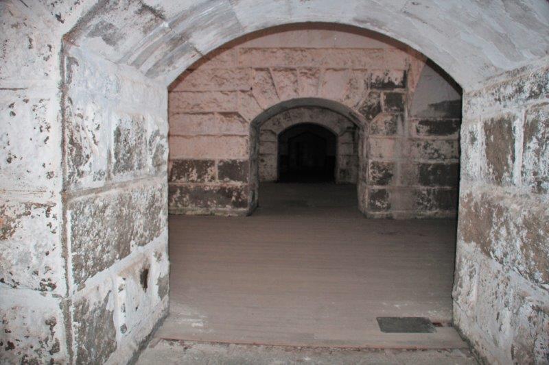
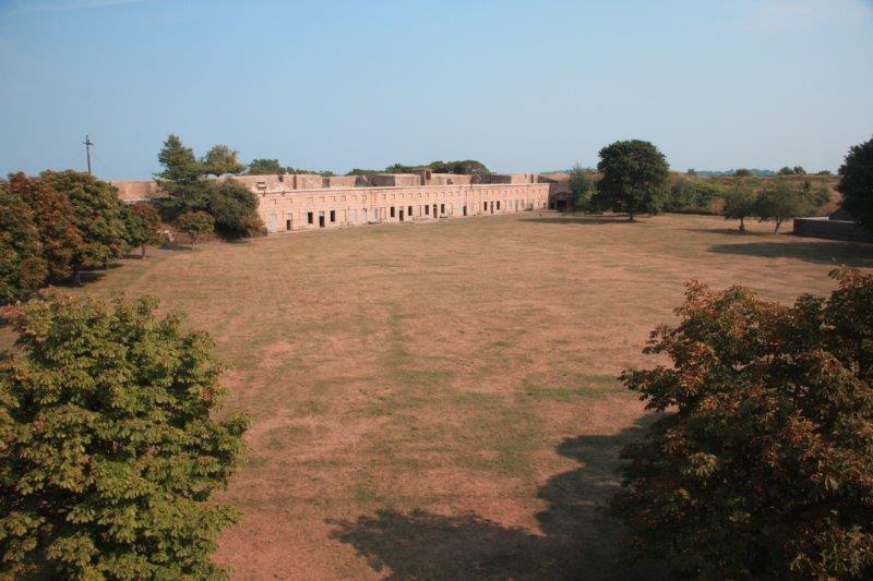
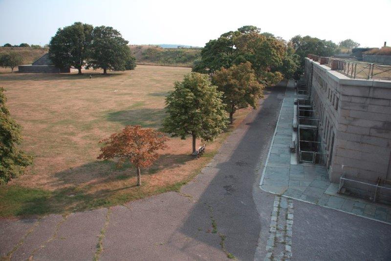
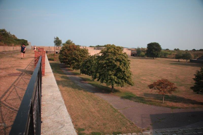
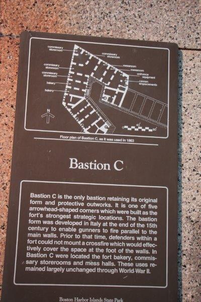
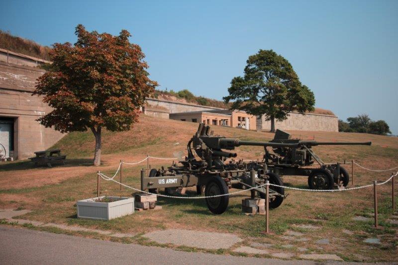 Back in the day, before the harbor was dredged the only access to Boston was through a narrow 1500′ wide channel between Georges Island and Lovells Island. This made Georges an important defensive property and it is big enough to have a fort. All the granite, stone and other materials were brought by barge from nearby quarries and factories. All the ancient defense mechanism developed over the centuries for this type of structure were employed; drawbridge, porticullus, earthworks hiding the structure and covering the roof to absorb cannon fire, arrow slits (muskets), etc. The fort never saw action in defense or offense and eventually the armaments outpaced the fort’s ability to adapt and it was de-commissioned.
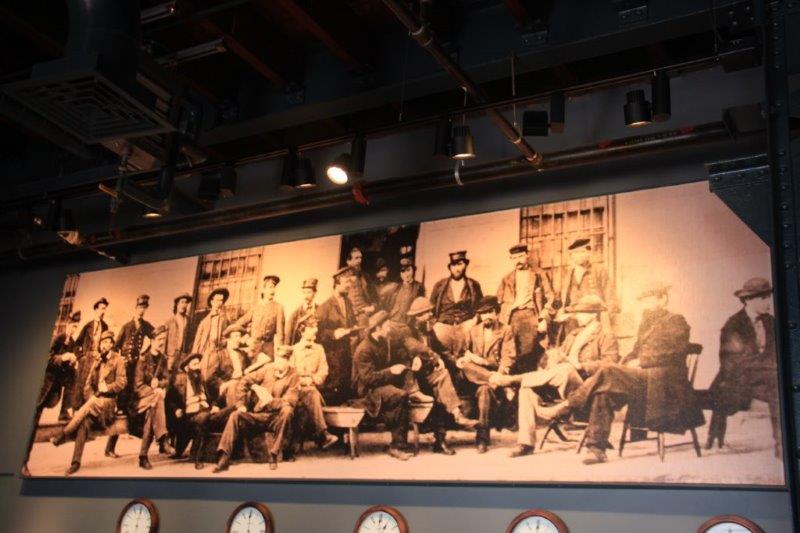
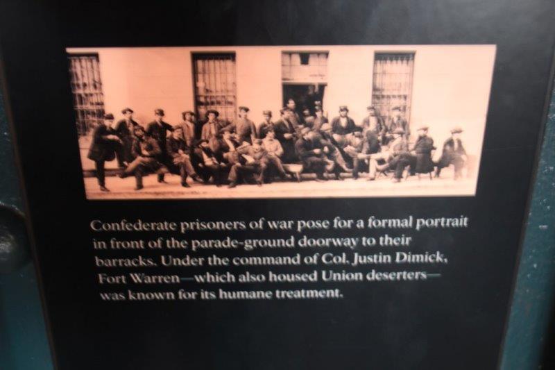
 When the fort became a POW camp during the Civil War the prisoners were treated very well by the camp officer. He had gone to West Point so many of the captured Confederate officers were former friends of his. He treated them well with good food, medical care and recreation. And since the fort had not been built as a prison and had to be adapted to be one many of the ‘cells’ were quite spacious and comfortable. He also hoped that if any Union men were caught by the Confderates they would likewise be treated well.


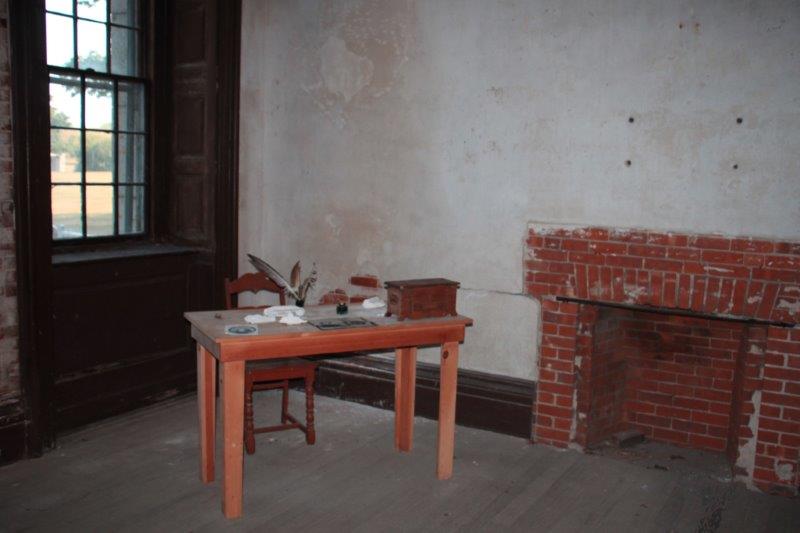 Former officers quarters used to house two Confederate prisoners. They had another room that was divided to get each a private sleeping area.
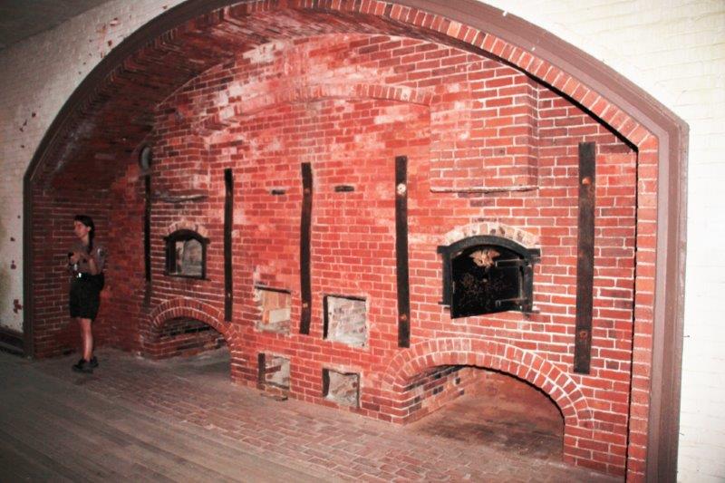
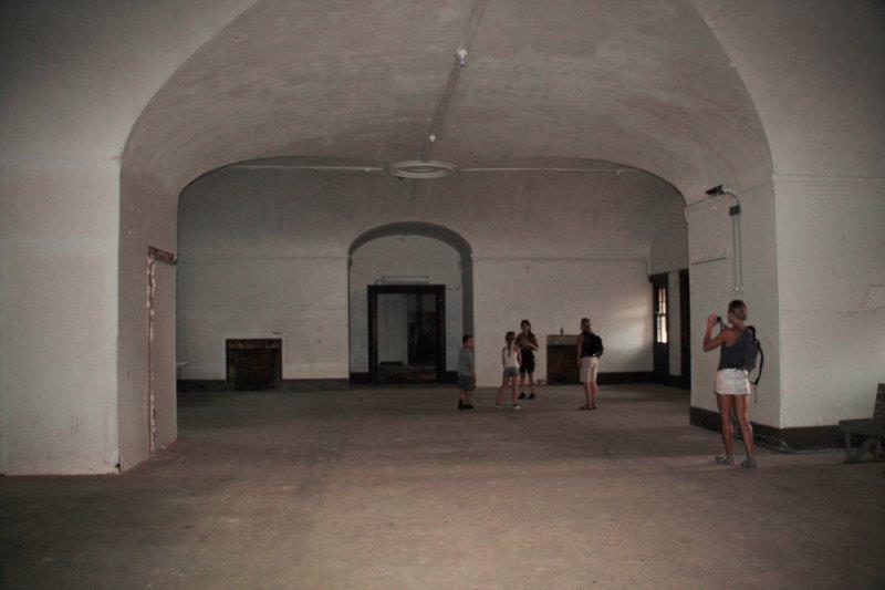
The bakery. They baked 1300 loaves of bread each day while it was a prison.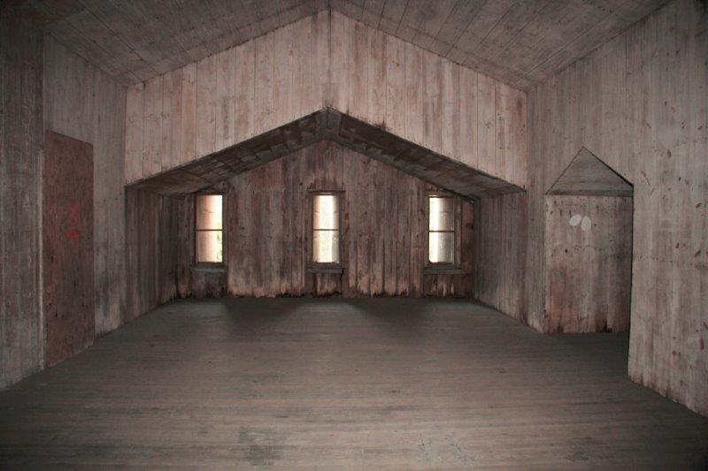


 The hospital wing. They had beds for 30 patients and two doctors who were prisoners (one Union, one Confderate) helped care for the sick or injured.
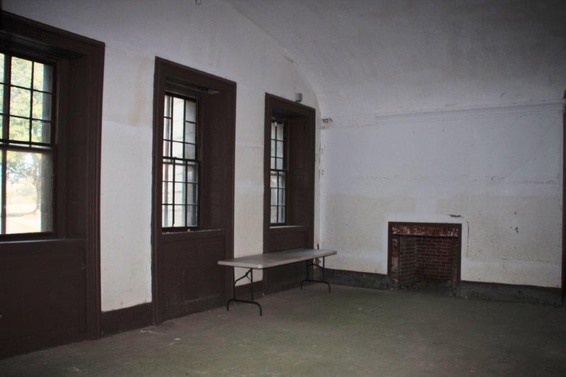
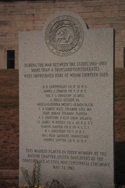
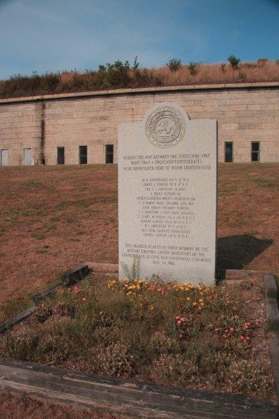 There were only 13 deaths during the years Fort Warren was a prison and all of the men had arrived sick and succumbed to their illnesses after being sent to the fort.
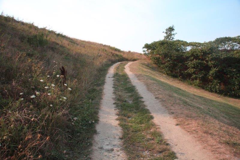
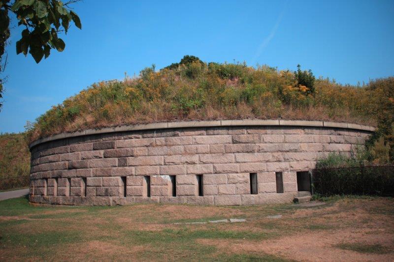
You would never know there is a fort and parade ground on the other side of the bank.
The last ferry left the island at 5 and we were back at Beacon Hill by 6:30. We had dinner at a restaurant down the street and then returned to the apartment. Tomorrow is our last day and I have only one thing left on my To Do list.