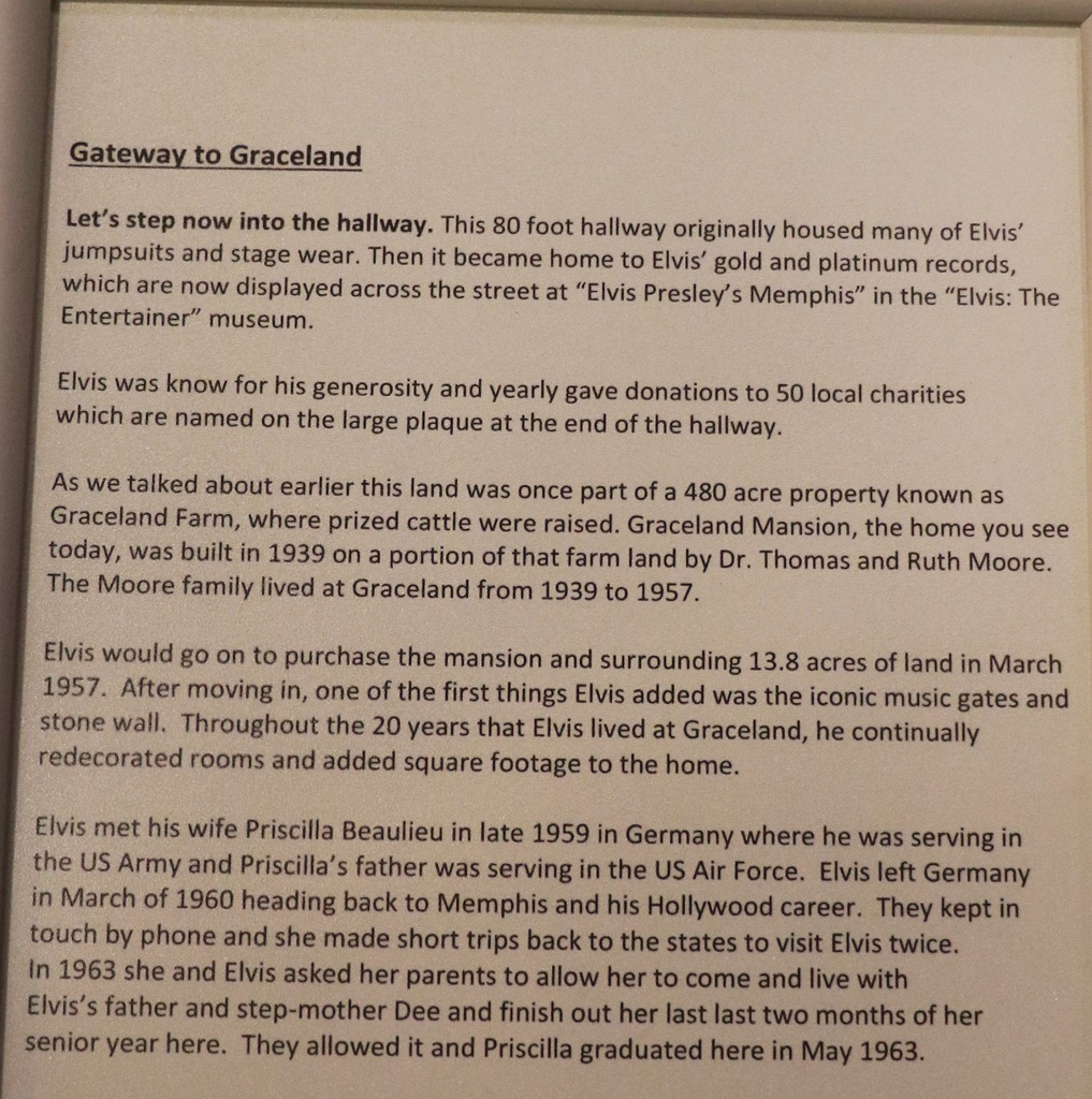
Today is not a very exciting blog, but we had a great day. We left Parkersburg at 9:30 and headed east across the NW corner of West Virginia before heading north into Pennsylvania – State number 13.
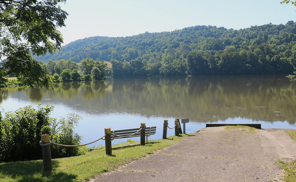
We stopped to find a few geocaches. The first was at the French Creek Boat Ramp. While John signed the log I wandered down the ramp and took a couple of photos.
The road we drove in WV was very, very winding with steep grades and sharp curves. I am sure John was wishing he was on his motorcycle for the majority of the morning. There were not very many caches along the route probably because there would be no safe place to pull off the road.
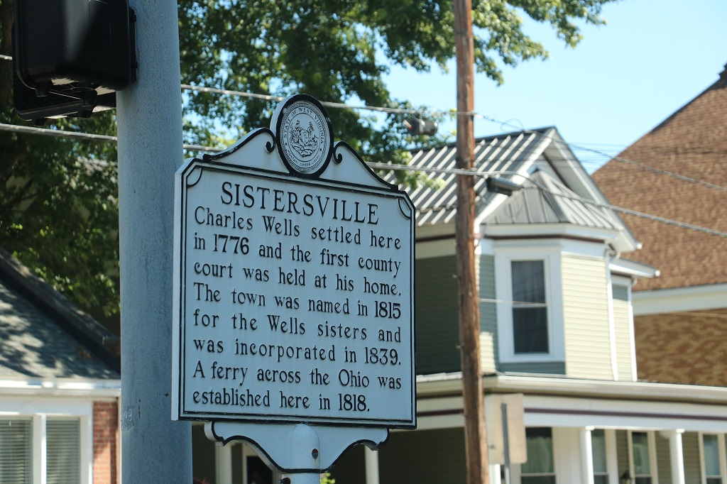
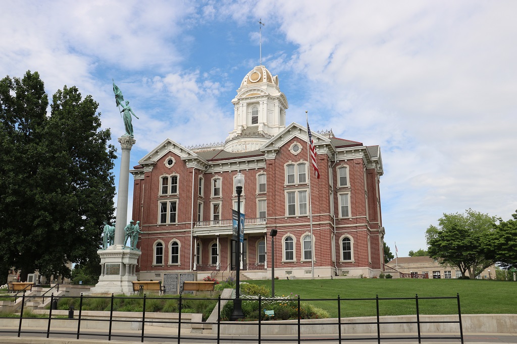
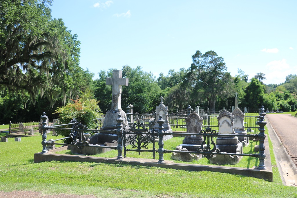
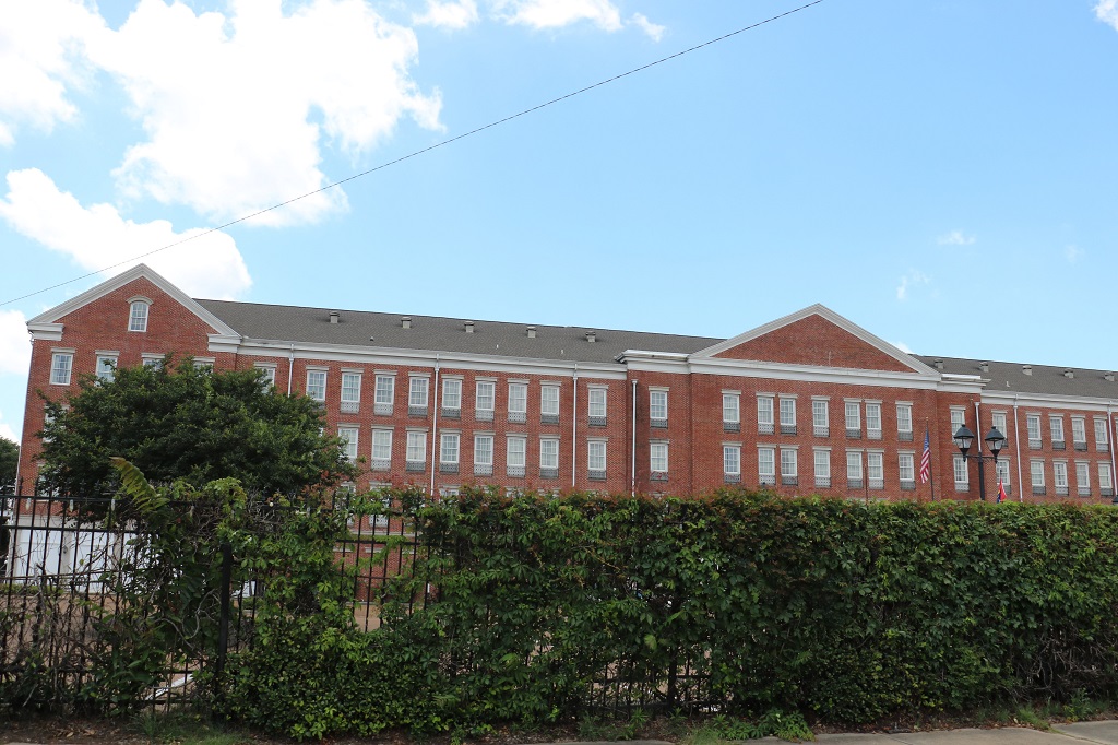
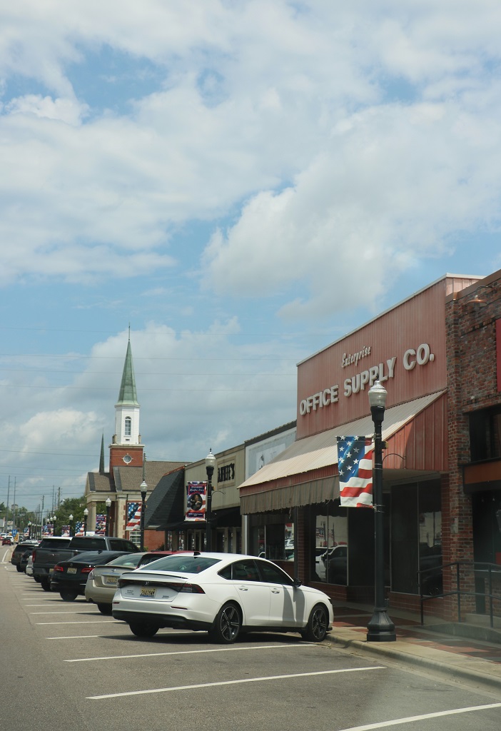
There was a cache hidden near the First Presbyterian Church in Sisterville.
This old building was across the street from the church. I liked the slate-roofed turret. The rest of the roof looks like it could use some work though.
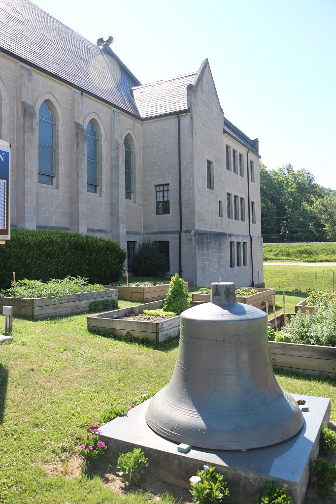
The church had several raised beds that had tomatoes and peppers growing in them. There was another that had sage, cilantro, basil, and a few other herbs. And further back on the lot they had this garden plot. We have some folks at our church at home that tend a vegetables garden for one of the local food banks. It is a really good community service and a better used of ground than a lot of mown grass. I liked seeing this quite extensive and varied garden.
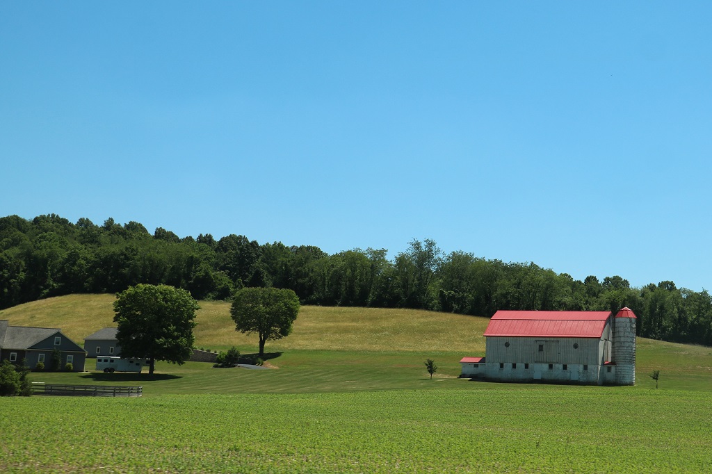
Since we were driving back roads there was no “Welcome to Pennslvania” sign. We did drive through some nice farm country.
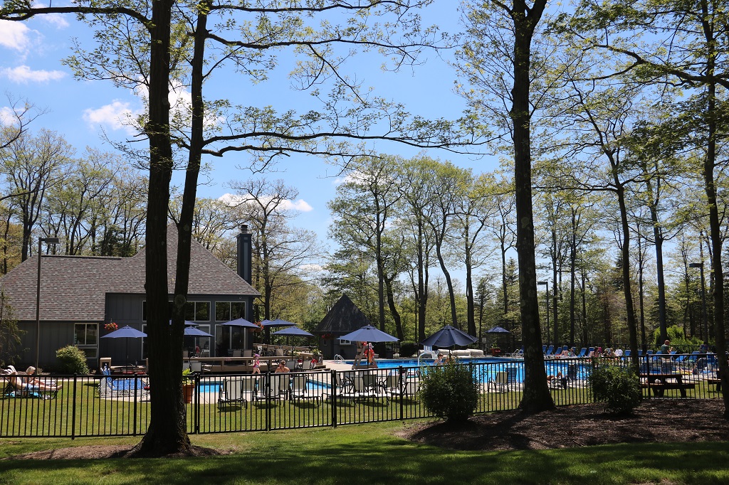
I had realized the other day that we were going to be driving far enough north in Pennsylvania that we might be close to where my cousin Karen lives in the Pittsburg area. Every time she had come home to BC to visit famiy in the last many years, we have been away so I have not seen her in ages and ages. Probably 20 years or more.
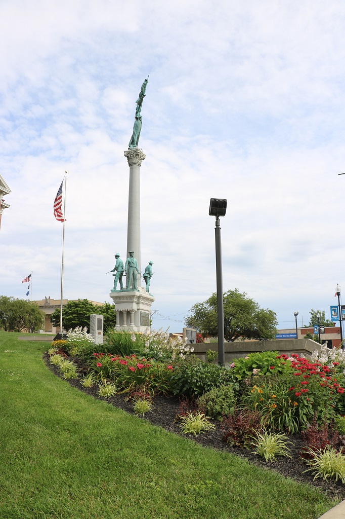
She and Tim have a get-away condo at Hidden Valley ski resort that is only about a 45-minute further drive than we had planned to go today. They live about an hour away from the condo but said we were welcome to spend the night there. They gave us the address and drove over, arriving about 15 minutes after we did. We used the short wait to go over to the pool area and find a geocache.
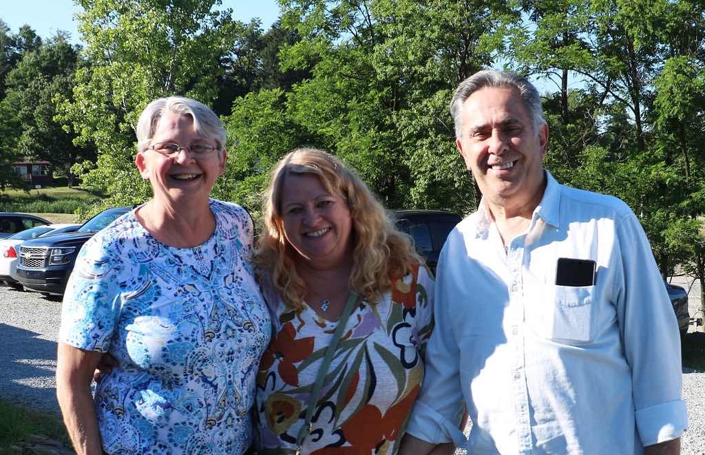
After a couple of hours visit we drove back down the mountain to a restaurant a few miles away and had dinner. Then Karen and Tim headed home and we went back to their condo for the night. It was wonderful to see her and meet Tim.
They not only graciously gave us accomodation for the night, Karen brought cookies and breakfast fixings. And she gave me presents! She does lovely craft work.
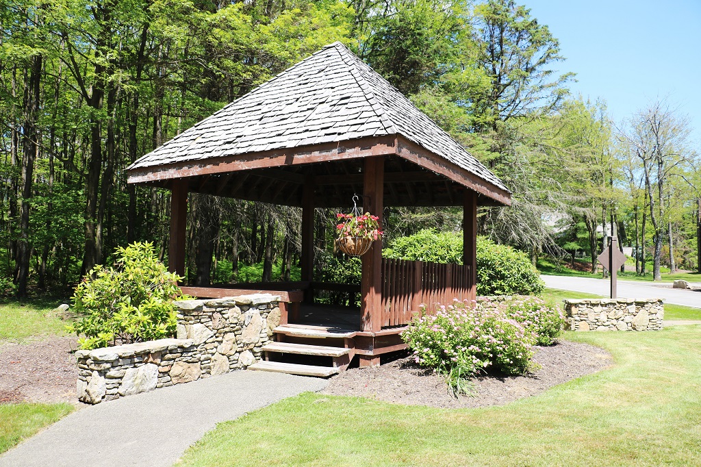
The evening view out the back door is pretty nice as well.
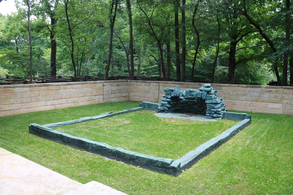
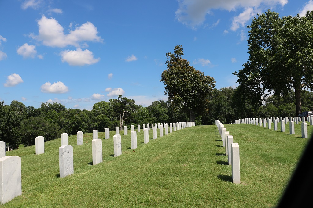
Tomorrow we head to Gettysburg where we will spend two nights.
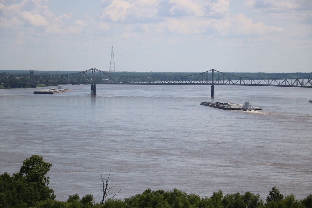
It was totally a drivng day. We made a couple of quick stops for photos or a geocache and other than that we drove through farmland – lots of acres of tomatoes – and forested rolling hills. Once again we were on the quiet back roads. We drove the Ohio River Scenic route all day and followed the snake-like winds of the river. It, as usual, made for a longer day than would the 2 1/2 hours to take the Interstate – but they are no fun.
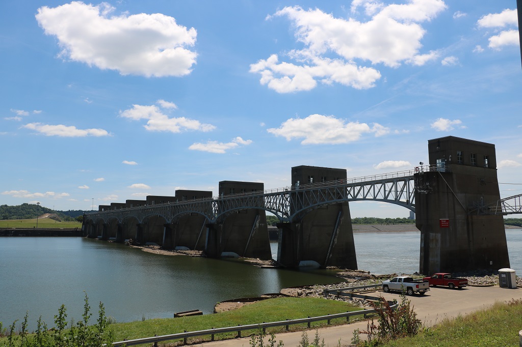
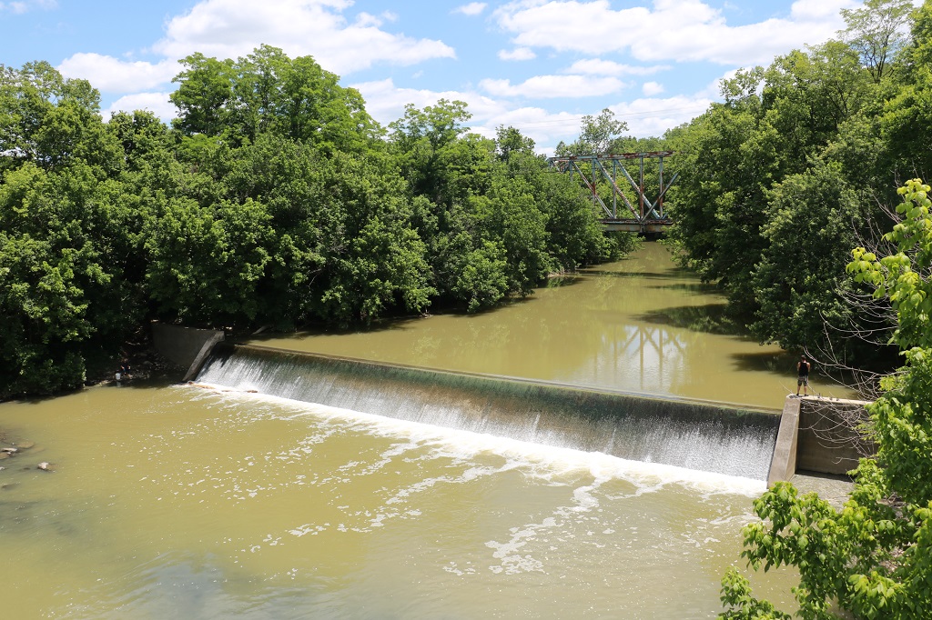
We enjoyed a lovely sunny day with a slight breeze. Just past Eureka we stopped at the Robert C. Byrd Locks & Dam to take some pics. We passed two more such dams further along our route.
There are locks on the other side of the river that will allow the big tug barges to get past the dam. It is interesting that even in the middle of a work week there were still a half dozen men fishing. They don’t look retirement age. Maybe Wednesday is their day off.
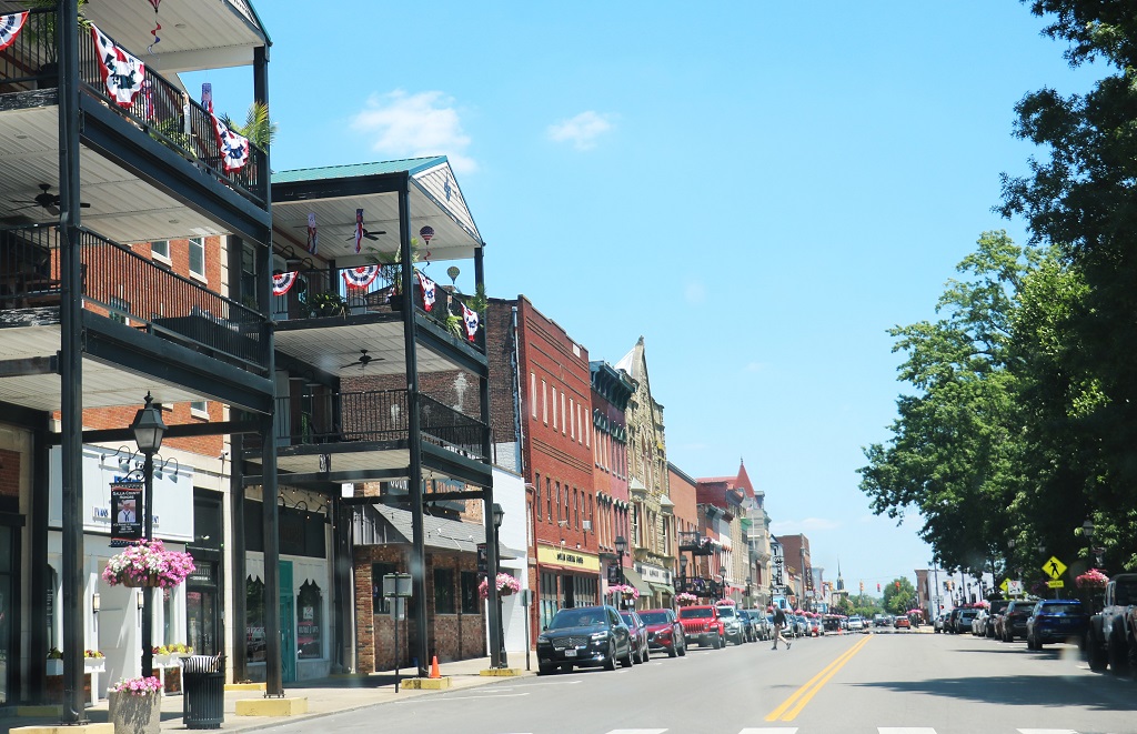
We drove through many small town and they all have similar brick buildings. Coming from a forestry area where everything is made of wood or concrete I have always liked brick buildings. This is Gallipoli, Ohio.
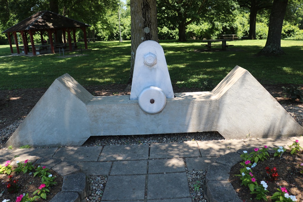
There was a simple puzzle based on information at the rest stop historical marker that gave us the coordinates to a cache hidden at the far side of the building.
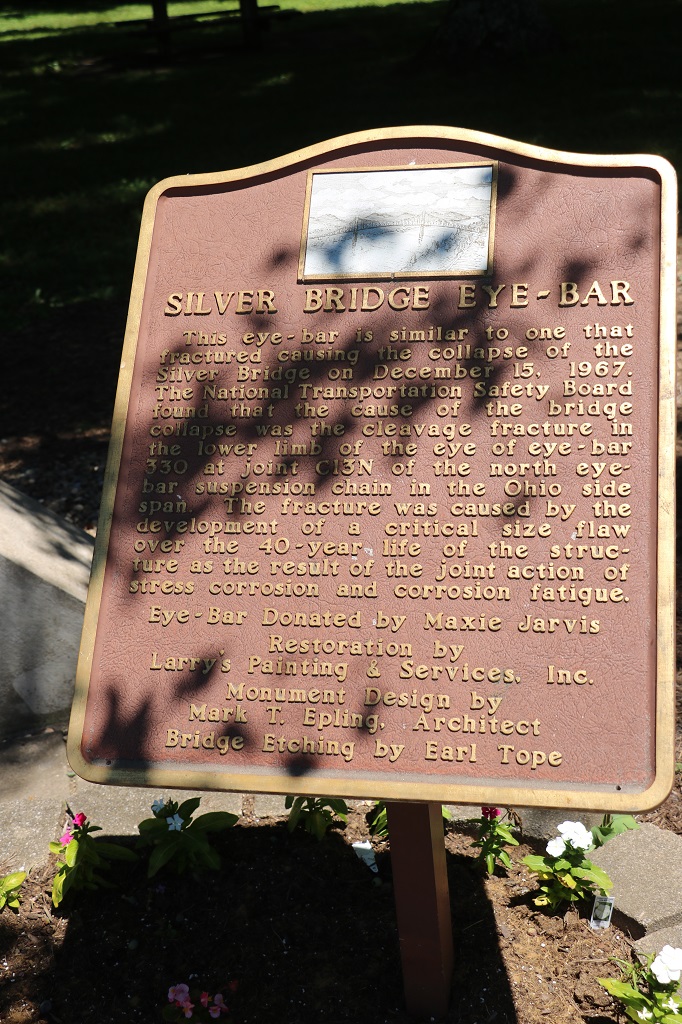
The bridge’s collapse was caused by a single hairline crack in the steel eye-bar similar to this one. In response to this catastrophe Congress established National Bridge Inspection Standards which caused a rigorous nation-wide bridge safety inspection program to detect unsafe structural conditions.
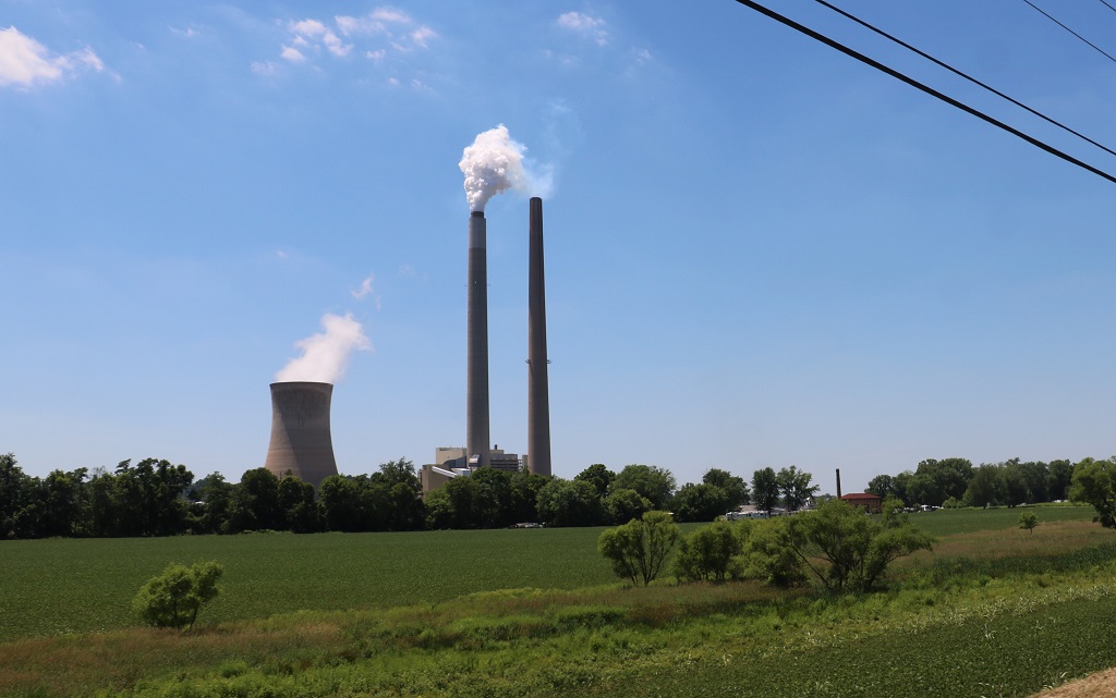
There are nuclear power plants on both the Ohio and West Virginia sides of the Ohio River.
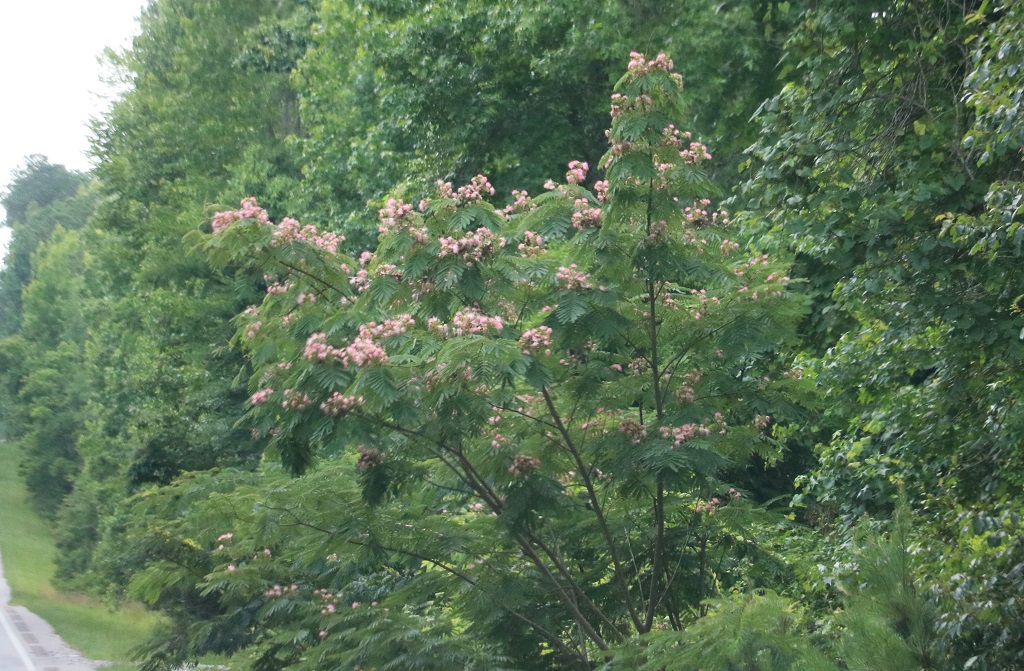
Periodically along the road for most of the day we would encounter patches of blooming day lilies. I don’t know if they have been planted or if they grow wild.
We crossed the bridge into West Virginia about 3:30 and checked into our hotel. I was able to get yesterday’s blog finished before we went out for dinner and then found a West Virginia geocache.
State number 12. Tomorrow we will get number 13 when we head into Pennsylvania and have a visit with my cousin. It was a pretty quiet day but we drove through some nice countryside on some quiet roads which makes for a good day.
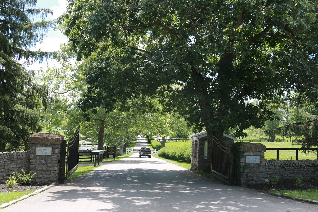
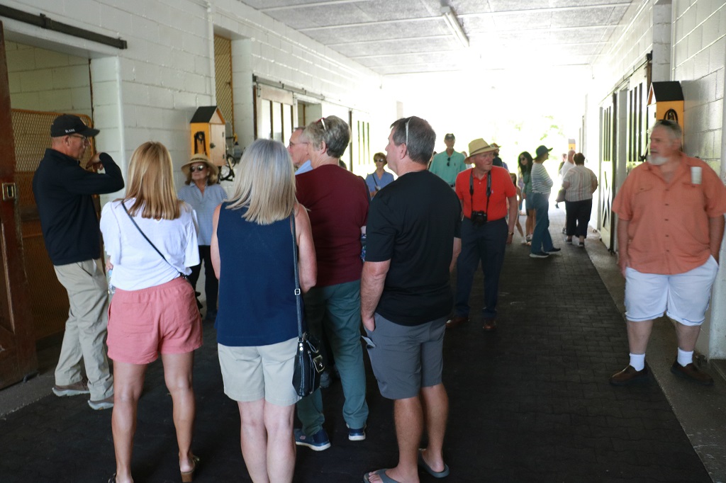
Our hotel was an 8 minute drive from Clariborne Farms and we had an 11 am tour booked. They offer two tours: a Stallion barn 1 hour walking tour at 10 and 11 am each day or a Brood Mare and Foals trolley tour around the farm at 1 PM. I first looked at the trolley tour as it would be easier for me with my bad joints but it was booked right up to July 13. Apparently it is alway booked 12-16 weeks in advance. So, stallion barn tour it was.
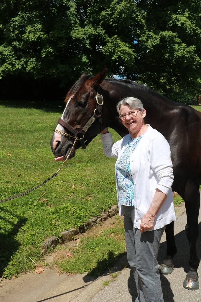
They had wheelchairs available so I used one instead of walking from the visitor’s center to the barns, paddock and cemetery. Our guide was the stallion handler. He is third generation born and raised on Claiborne. His grandfather was the stallion handler in his day and his dad worked on fencing. Tim was a very nice and accommodating man that could rattle of all the years that their horses had won such and such race and how much they earned racing and how much there stud fees were,and who sired who out of which mare, etc. Really interesting. Way too much for me to remember.
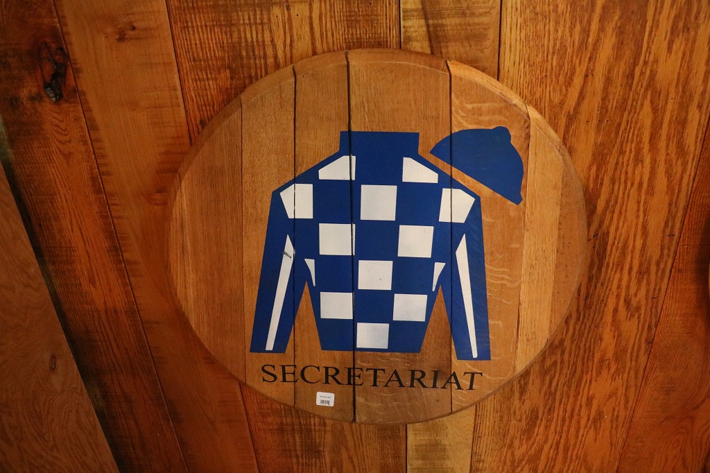
Secretariat was bred at Claiborne but he was not owned by Claibornel He was owned and raced in Meadow Stable’s blue and white colours. After his racing career ended Seth Hancock of Claiborne farms made a record making syndication deal for his stud rights at over $6 million. Claiborne’s colors were originally all orange but over time as the jockeys wore the silks in the sun and they were washed, the orange faded to a deep golden yellow. Everyone liked the colour so they left it and their silks are gold and black today though they are still officially posted as orange.
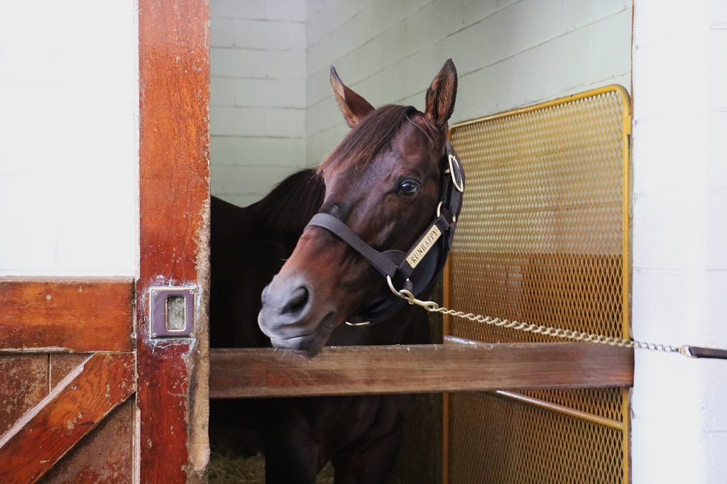
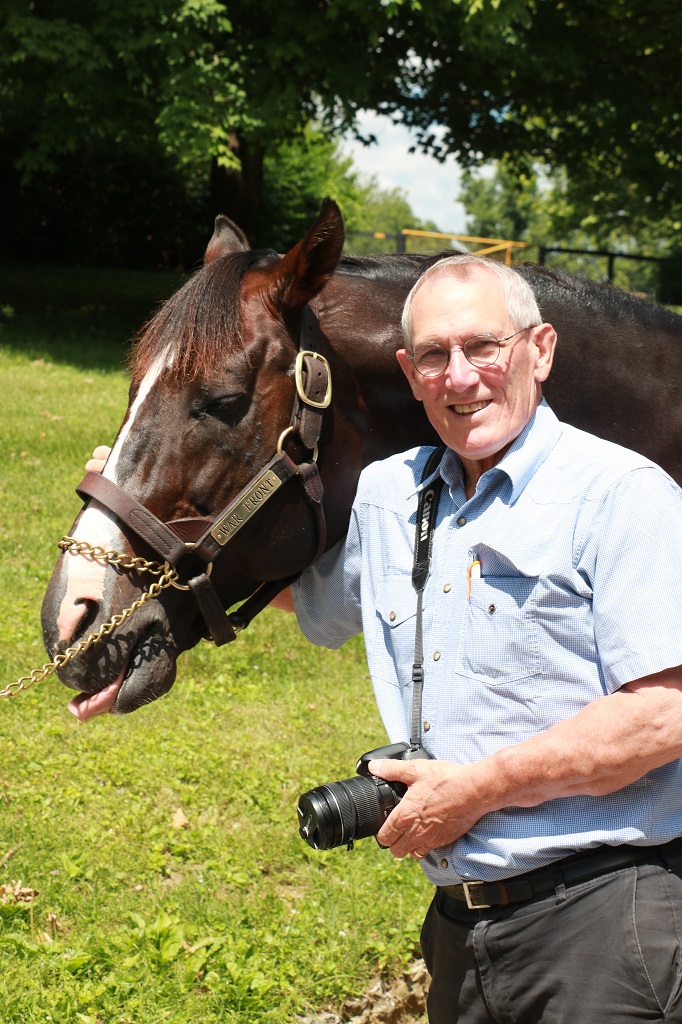
We went over to the breed barn where the stallions service the mares. After a horse’s racing career is over (usually in 2-3 years) they will syndicate his breeding rights to 40 shareholders which are sold at a value based on the horse’s racing track record. If the foals do well at the track the stud fee for the sire will rise. They have a young stallion named Runhappy whose stud fee is $10,000. His first crop of foals were born this year so in the next coupld of years they will know how well his racing genes are passed on. It literally takes him 15 minutes to cover the mare. If she does not get pregnant they will bring her back again. The stud fee is not paid until she delivers a live foal.
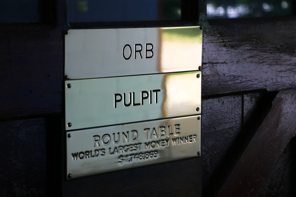
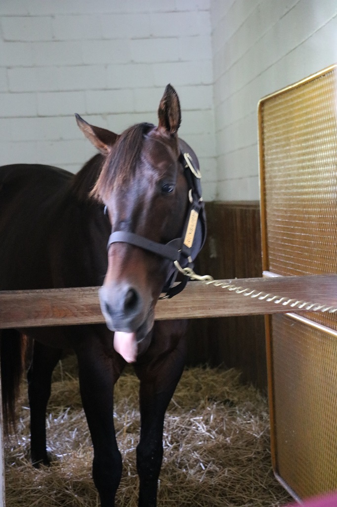
Next we went to the Stallion barn that holds 10 studs. The stallion that is the current race earnings leader has stall number 1. Every horse that was housed in each stall has his name plaque on the door. Runhappy earned over $1 million and won the Breeders’ Cup, and his progeny have already earned $19 million and produced 16 stakes winners – so he is Numero Uno. His stud fee is currently $10,000. Claiborne is the only stable that has sired a Triple Crown winner that also sired a Triple Crown winner.
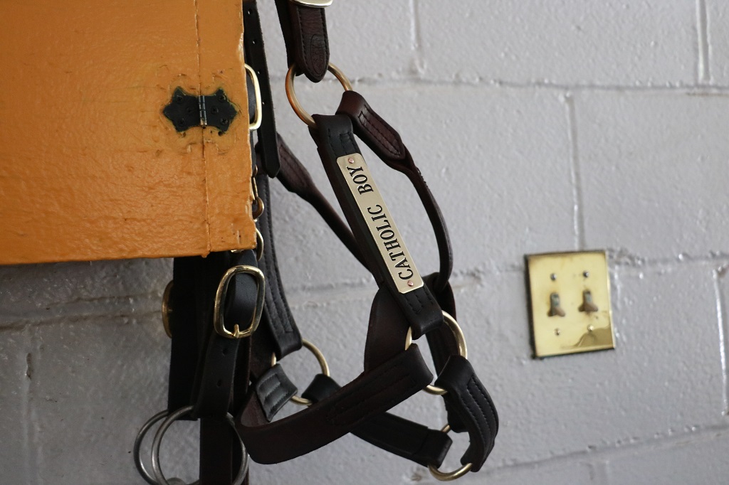
The harnesses and each of the stallion’s paddocks have their names on them.
Catholic Boy is the son of More Than Ready who won the Travers Stakes in 2018, He commands a fee of $25,000
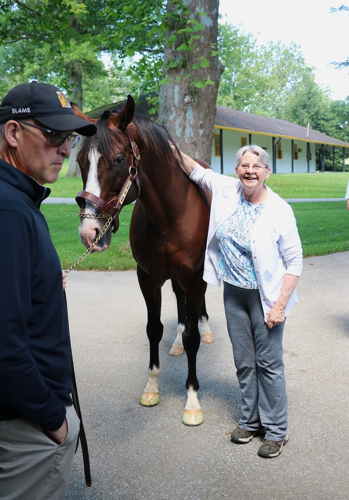
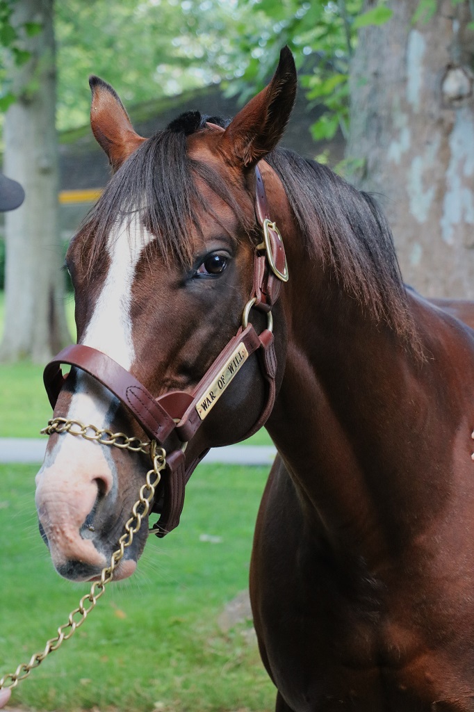
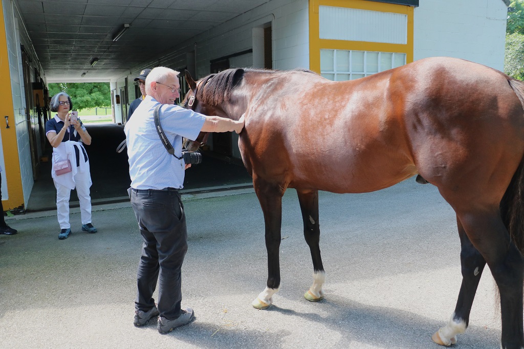
Tim went into the barn and brought out War of Will who is the son of War Front; their top producing stallion. Anyone who wanted to pet him and take a photo with him was welcome. And you could give him a peppermint. Tim regularly will give the horses peppermints; he keeps his pockets full of them. They love them. The gal at the Visitor’s Center said between the staff and the horses they go through about 8 lbs of peppermints a day. Peppermints wrapped in cellophane are much easier to keep in your pocket than sugar cubes.
War of Will
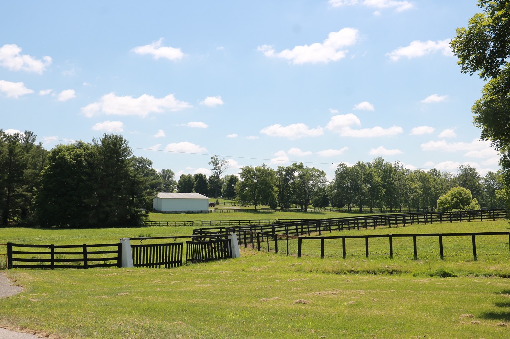
Claiborn Farm is 3,000 acres in size. There are 50 barns on the property and 30 houses and 100 miles of fencing. (I asked about the double fencing. It is used along roadsides as protection for the horses. It keeps people from being able to approach them and feed them or get bitten and it is two layers of fencing to go through if they, for some reason, want to break out. The double fencing is also a good insurance measure for the farms because if any of the animals get out and cause damage the stable is liable.)
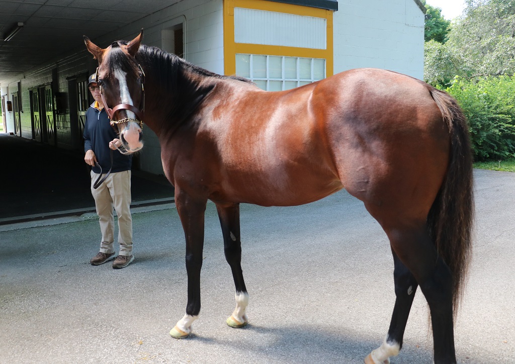
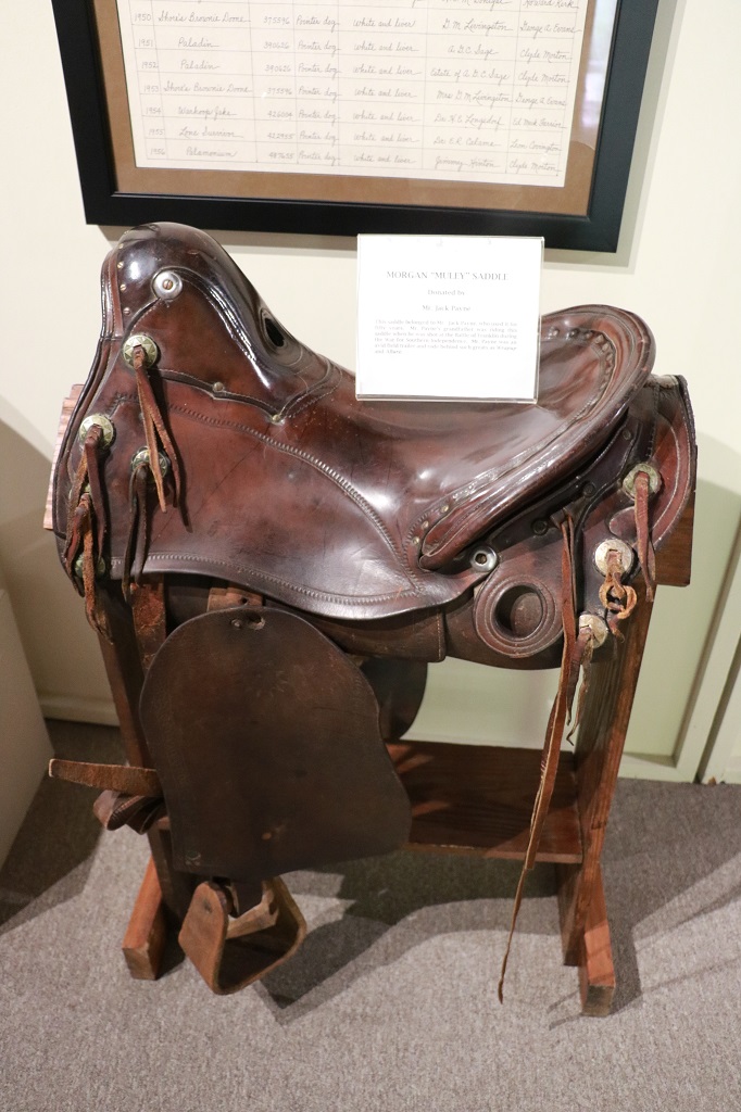
This is Runhappy. The next photo shows him enjoying his peppermint.
We walked over to a paddock to meet Hulio. He is about 19-21 years old – the person they bought him from was not sure of his age – and he has been at Claiborne for 15 years. He is the Teaser. When a mare is brought in to be bred Hulio is put in the paddock beside her. He will ‘talk’ to her and tell her how lovely she is, etc. and get her all excited before she is taken to the breeding barn to be covered by whichever stallion the owners have chosen. The 10 stallions can cover about 127 mares a day. Hulio gets to have fun about 4 times, but he is always happy to see a mare in the hope she will be his. Many stallions will ‘tease-up’ a mare two or three times and then when they realize they don’t get to do the deed they won’t talk to them anymore. Hulio has been doing it for 15 years and always makes the mares happy for the stallions.
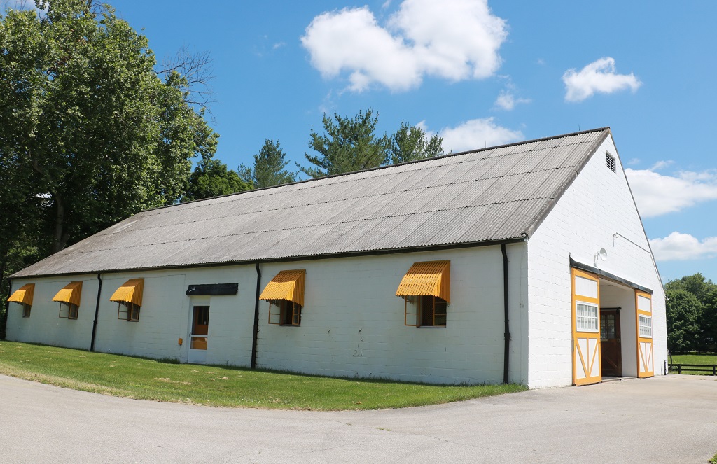
The 10-stallion barn. Built in 1930. Our next stop was the second stallion barn to meet War Front. Claiborne syndicates their stallions at only 40 shares. Some farms do up to 60. War Front’s shares were sold for $250,00 when he quit racing and became a breeding stud. His progeny has done so well on the track his shares are now worth over $2 million each. The horse is currently valued at $85,000,000 and his stud fee is $100,000. Tim gave people the opportunity to pet him or hug him as well. He said, “How often can you wrap your arms around $85 million?”
Love those peppermints!
Mr. Prospector (1970-1999) was a stallion back in the day before they instituted the “live foal” guarantee before the mare’s ownes have to pay the stud fee. His stud fee rose as high as $250,000 and you paid it whether the mare became pregnant right away or even if she lost her foal. At the peak of his ‘career’ he earned Claiborne Farm $3,000,000 per day. Internet quote: “His remarkable achievements as a sire, broodmare sire and sire of sires are unparalleled. Noted for passing on speed, precocity and classic ability, Mr. Prospector sired 181 stakes winners from 986 starters (19%), 113 graded stakes winners, 46 Grade 1 stakes winners, and 22 Champions in his stud career of which the last 19 years were spent at Claiborne. One noteworthy feat was siring winners of the Kentucky Derby, Preakness and Belmont — the next sire to do so was his grandson, and also a Claiborne stallion, Unbridled.
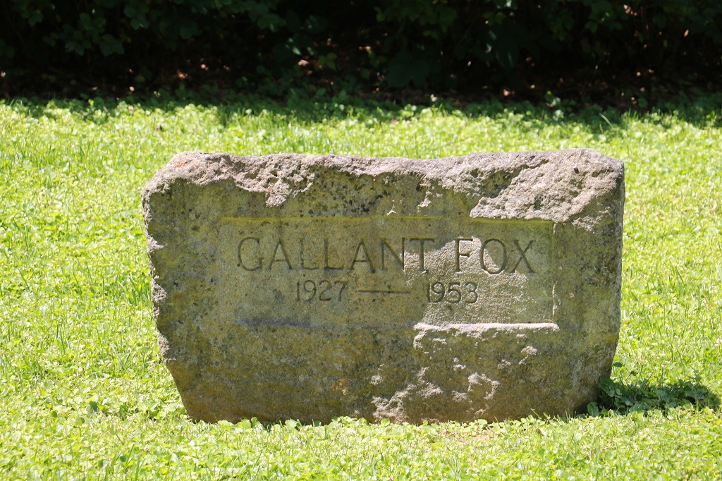
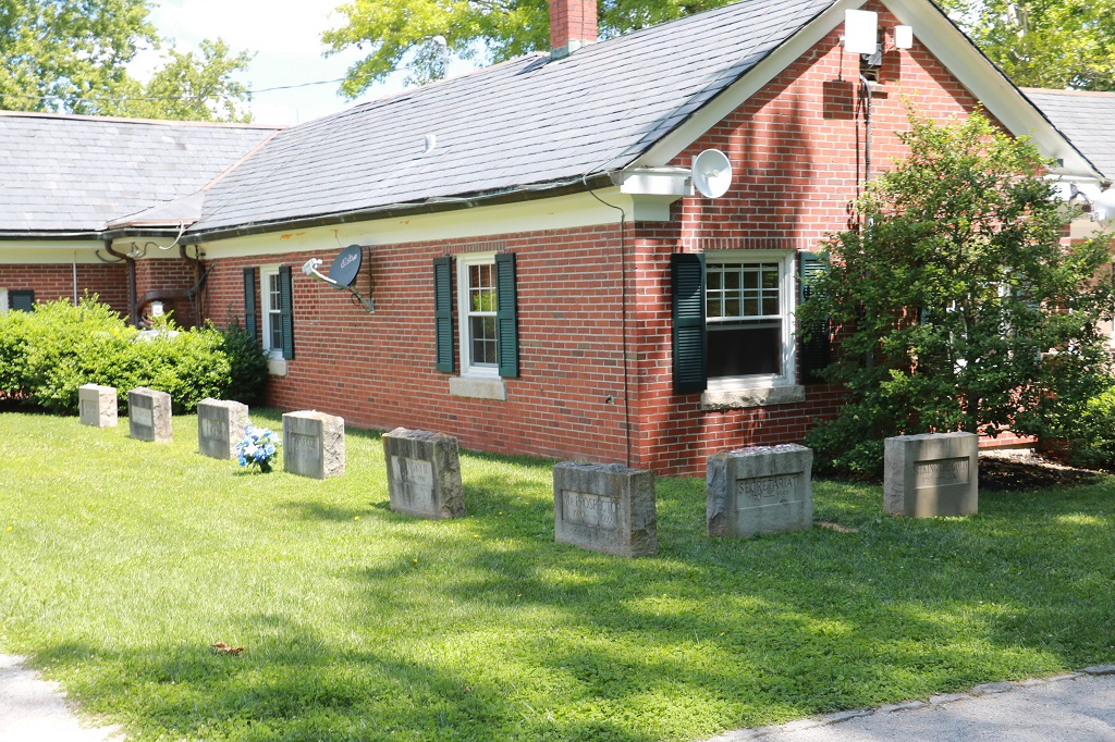
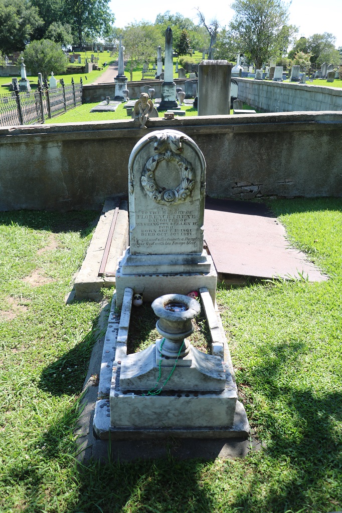
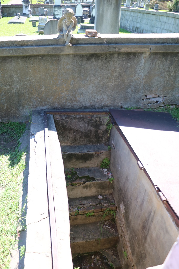
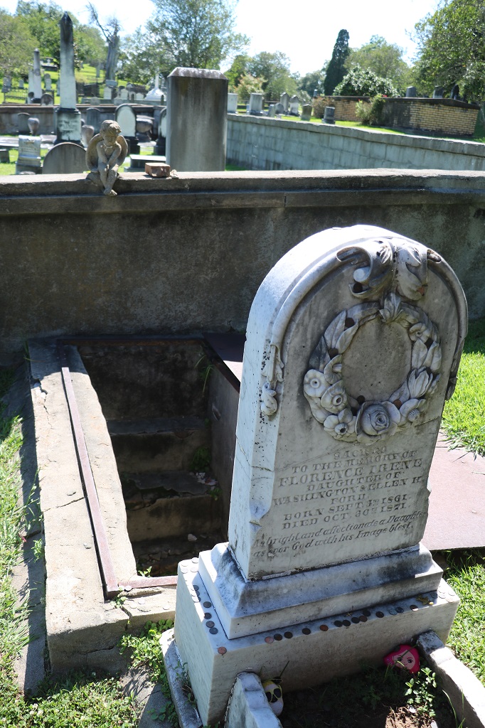
The last stop was to one of the three equine cemeteries on the property. Back in the day only the head, heart and hoofs were buried representing the heart, soul and body of the horse and the rest of the horse was cremated. Then it changed to full body cremation, but since 1984 the Hancock’s that own Claiborne have interred the whole horse. There are 23 horses buried in this cemetery. There is room for one more horse and the owners have reserved the spot for Blame, a winner of nine races in 13 starts including the prestigious Breeders’ Cup .
I spotted a small dam like this as we left Paris but could not get a photo. This one was up the road at Millersburg. They are called Weir dams and are built to raise the level of a river or creek (this is Hickston Creek) or to control water flow levels. There were a couple of fellows fishing at the dam. You can just make out the one at the edge of dam shaded by the trees on the left. The fellow standing on the wall on the right had gotten his hook stuck in the branch of the big tree and was trying really hard to get it loose. I don’t think he succeeded though and probably had to cut off a long length of line. Hope it wasn’t his favourite lure.
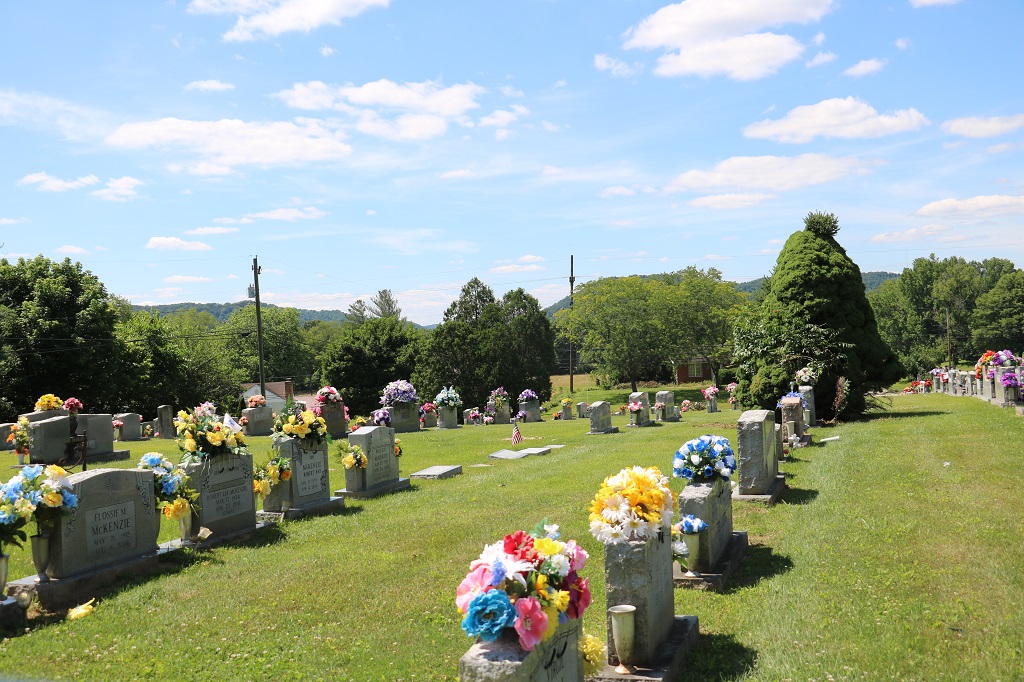
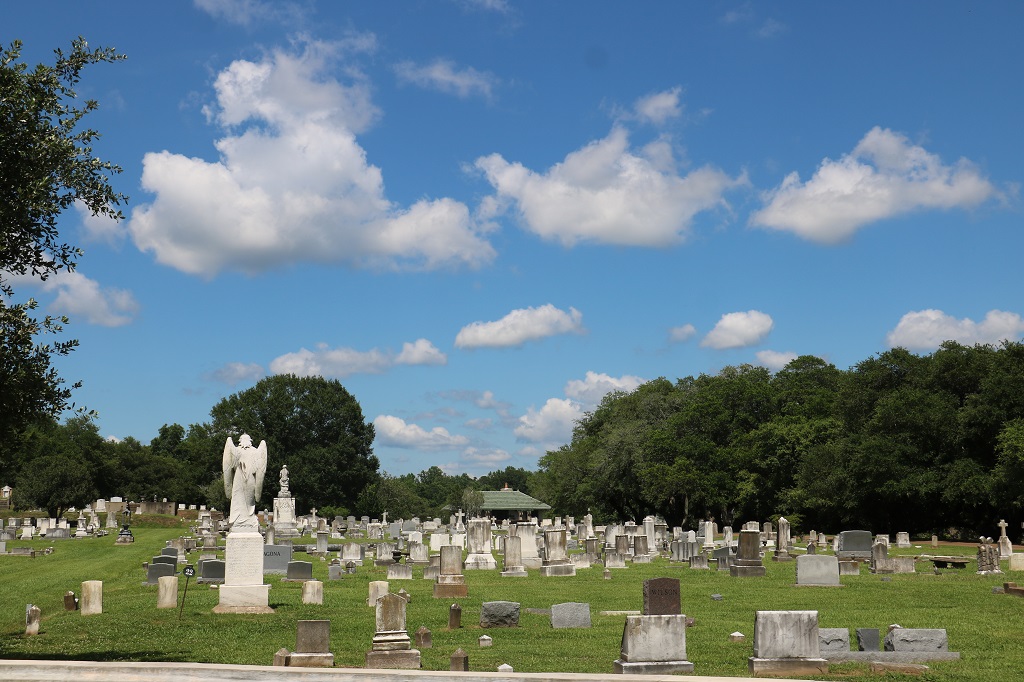
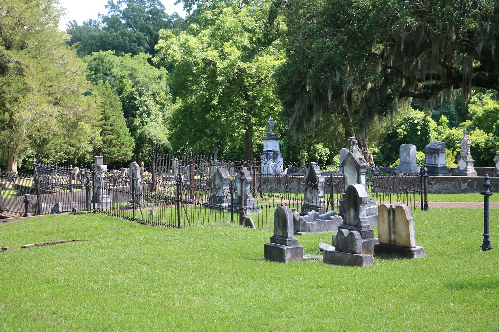
We drove past several cemeteries in our drive through Kentucky, Every one had most of the markers covered in beautiful flower arrangements.
State Number 11 today.
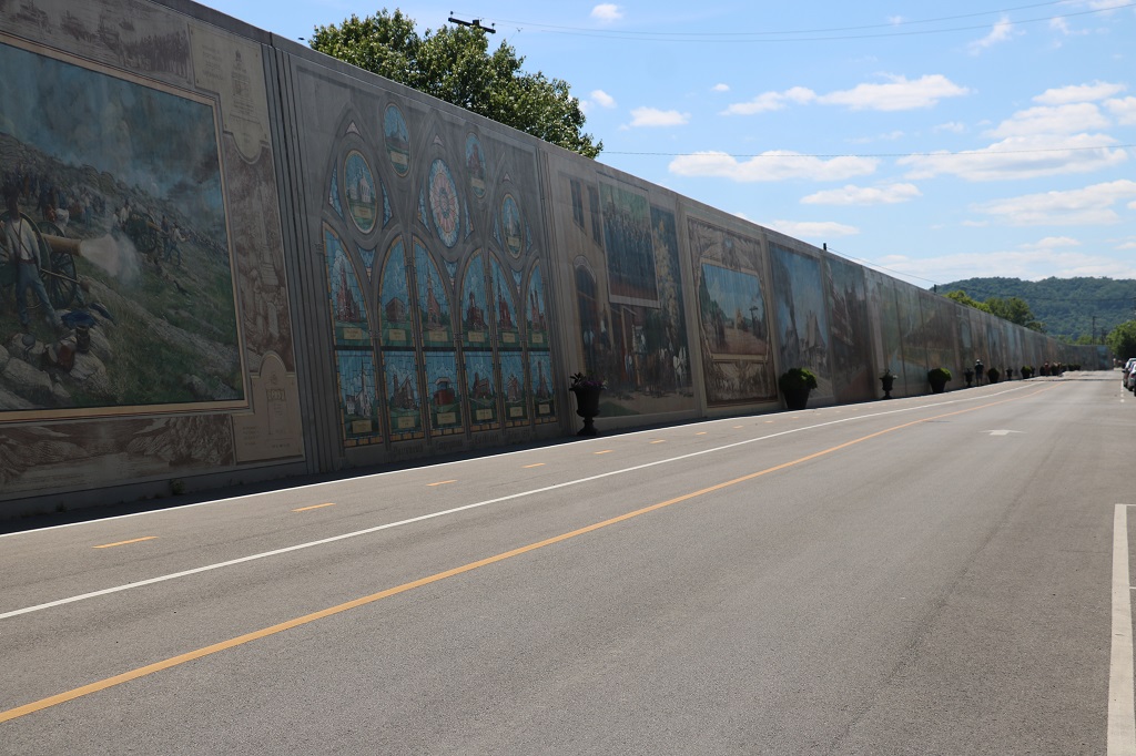
There was a devastating flood in Portsmouth in 1937. The water rose to the top of the windows of most of the downtown business district. In 1943 they built a 20′ (6 meter) high, 2000′ (185.5 meter) long flood wall between the rivershore and the town. In the 1990s, due to deindustrialization and other factors several of the factories in the area closed so they were trying to revitalize the town. They hired artist Robert Dafford to paint murals on the wall that depicted Ohio’s, and particularly Portsmouth’s history. They are gorgeous and there are placards along the sidewalk on the opposite side of the street that explain what each one is about or who is portrayed.
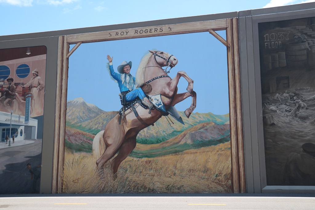
This was my favourite! I did not know Roy Rogers was from Ohio. I loved watching his TV show as a kid. My elementary school lunch kit had a picture on it almost the same as this one.
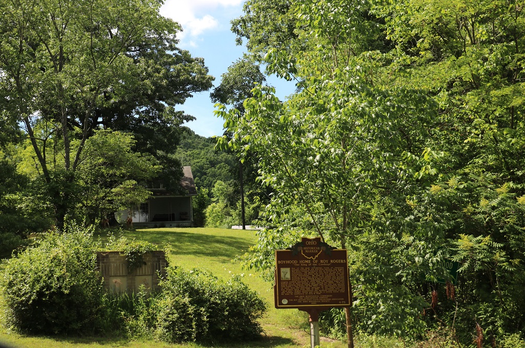
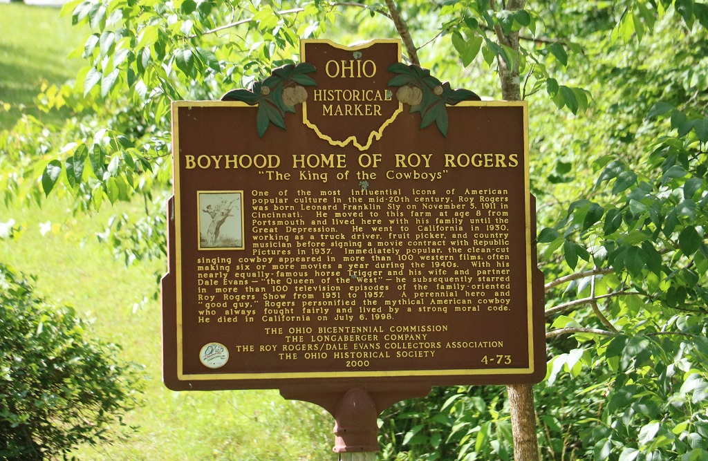
Note the information box that gives directions to his boyhood home. Where did we go next do you think?
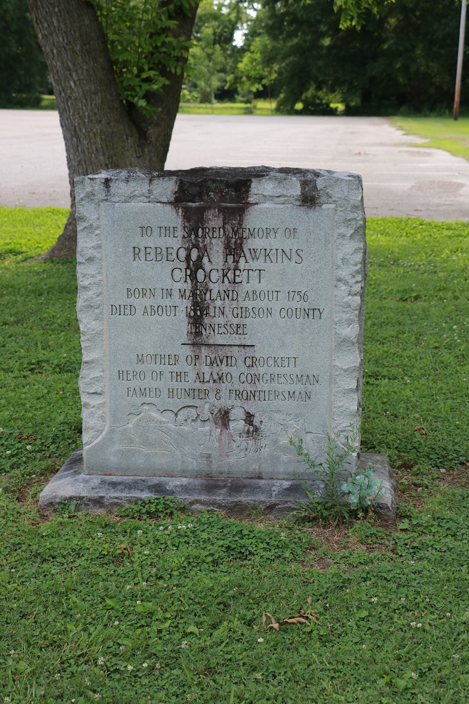
This road trip is becoming a trip down memory lane for me – Hank Williams, Sr., Superman, Davy Crockett, Secretariat, and now Roy Rogers. So fun.
We had spent some time the night before looking at maps and doing some route planning for John’s continued quest to go into 17 different states and find a geocache and I realized we were going to go quite a bit further north than I had thought and therefore we may be able to meet up with my cousin who lives near Pittsburgh, PA. Turns out she lives only about 45 minutes further east than the place in Pennsylvania we were thinking of stopping. So, on top of the great memories and adventures we will see a cousin we have not visited in quite a few years. Yay!
I played with sketchy wi-fi at the hotel for an hour trying to get yesterday’s blog to post. Finally had to do it on John’s laptop. I think mine is getting too old to hold the links or something, because I spend a lot of time reconnecting wi-fi in our hotels. Either that or the hotels just don’t have a good enough system to cope with all the devices that are online in all the rooms (which I suspect may be the problem because the wi-fi in our Paris hotel tonight is working fine.) Either way it is very frustrating. And time consuming. I did get done and we were on the road by 10.
We only had one stop planned because it was over 5 hours drive to Paris. Paris is 8 minutes drive from Claiborne Farm where we will go see the Thoroughbred racing stable tomorrow.
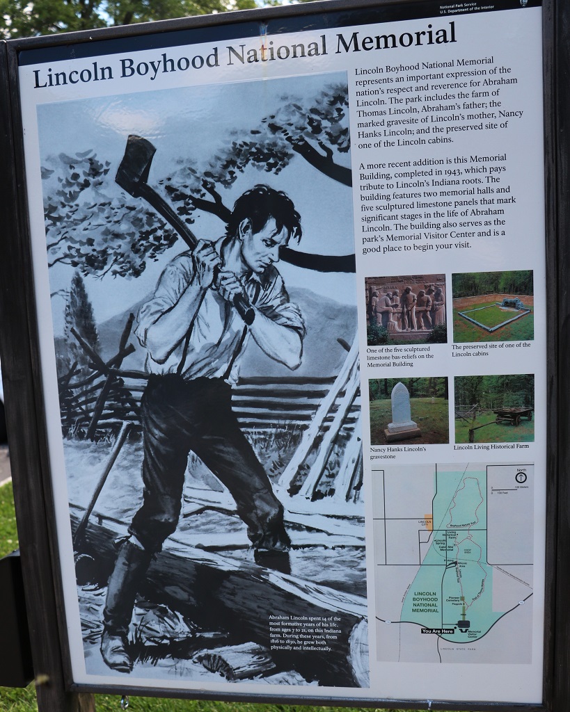
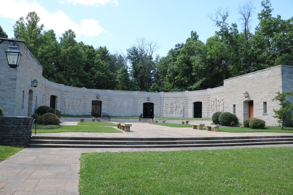
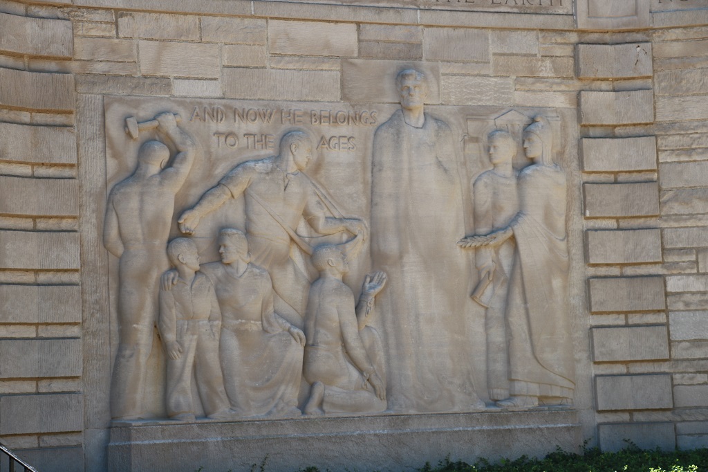
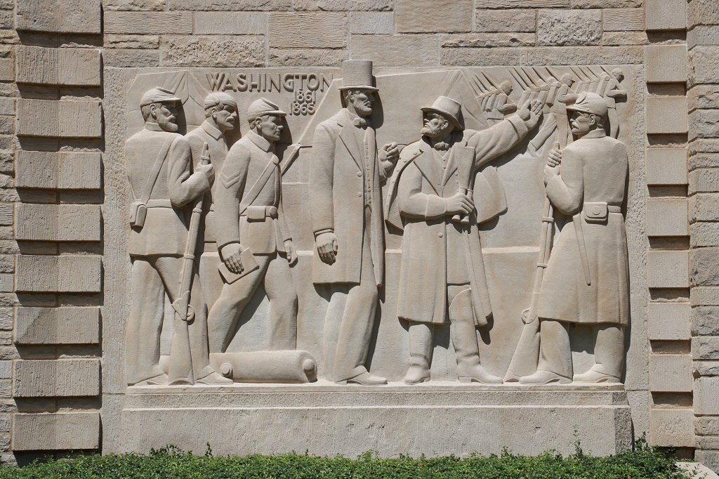
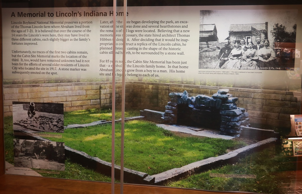
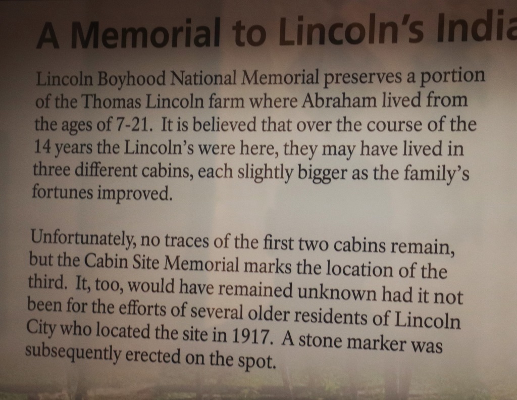
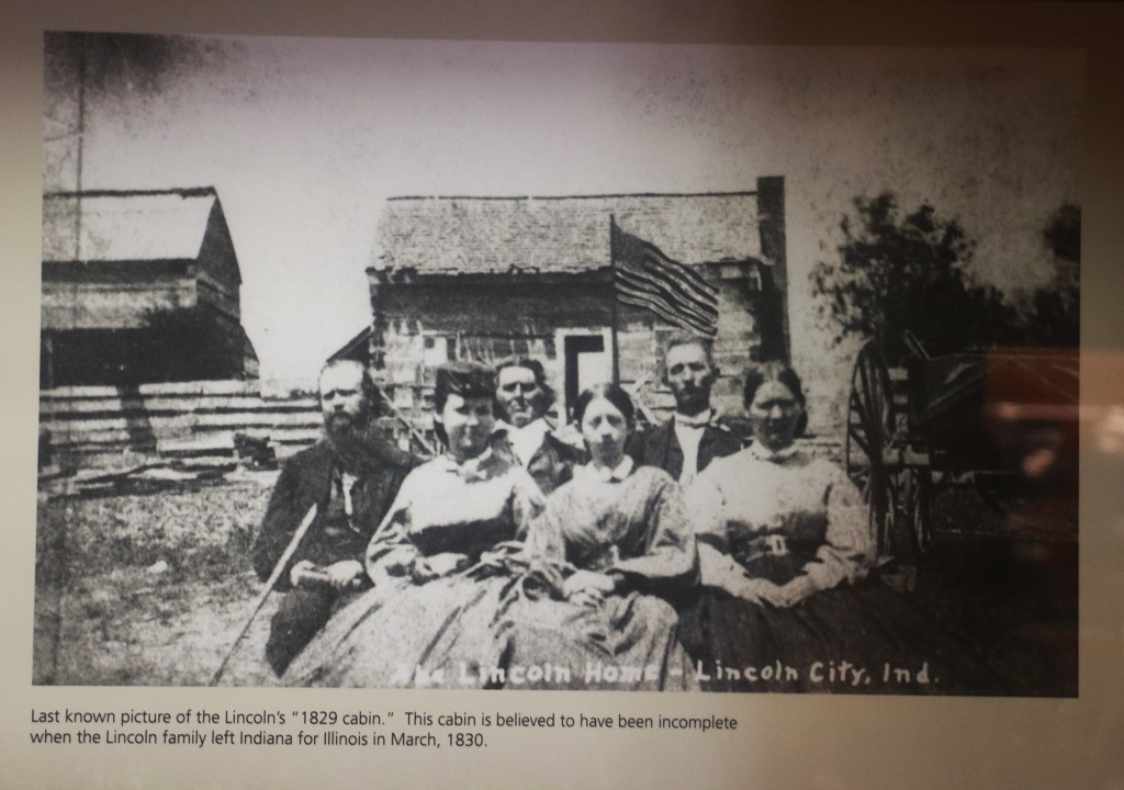
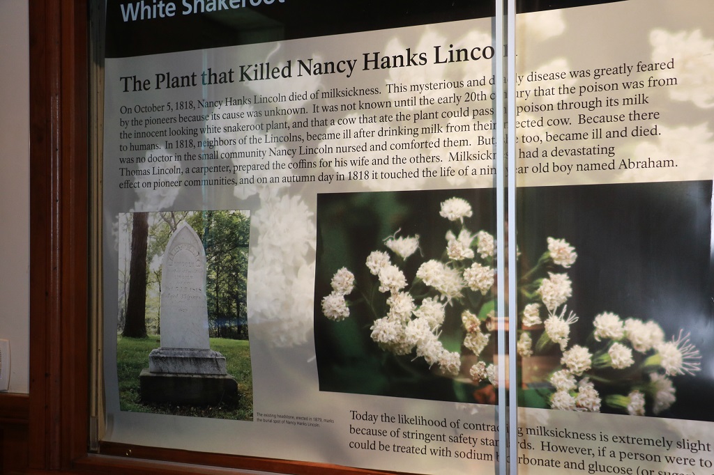
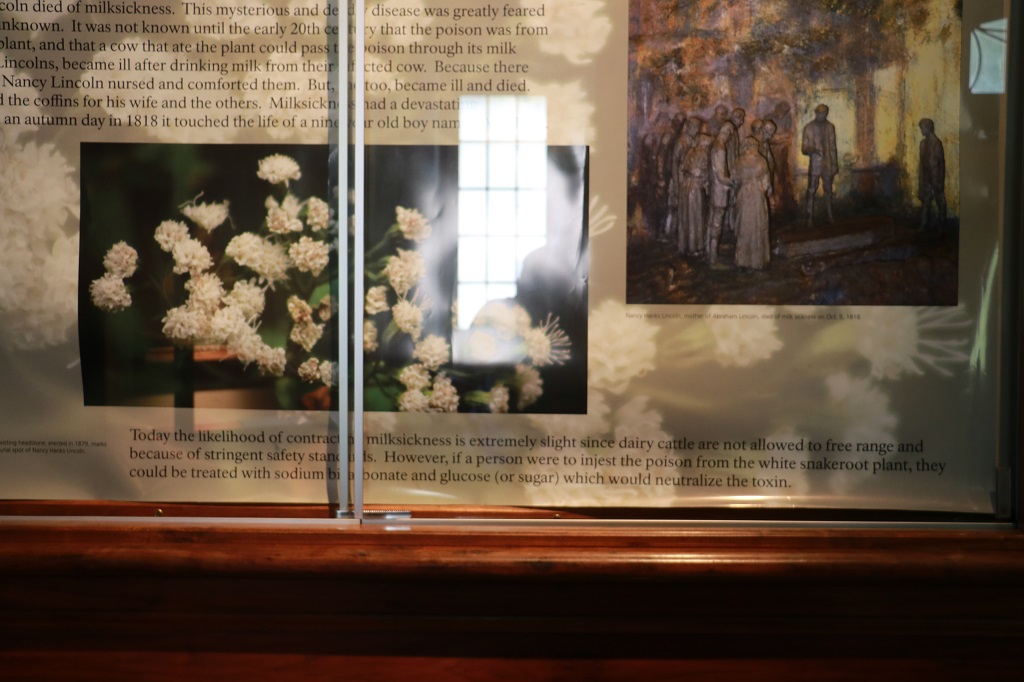
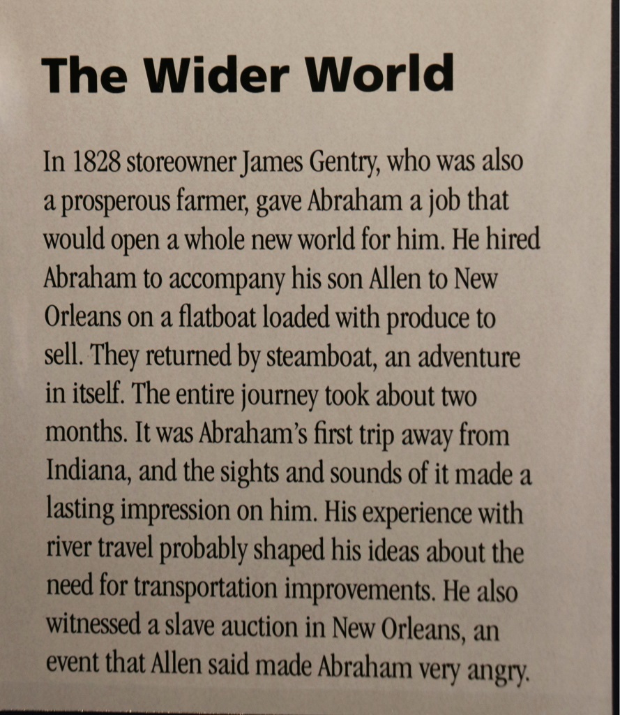
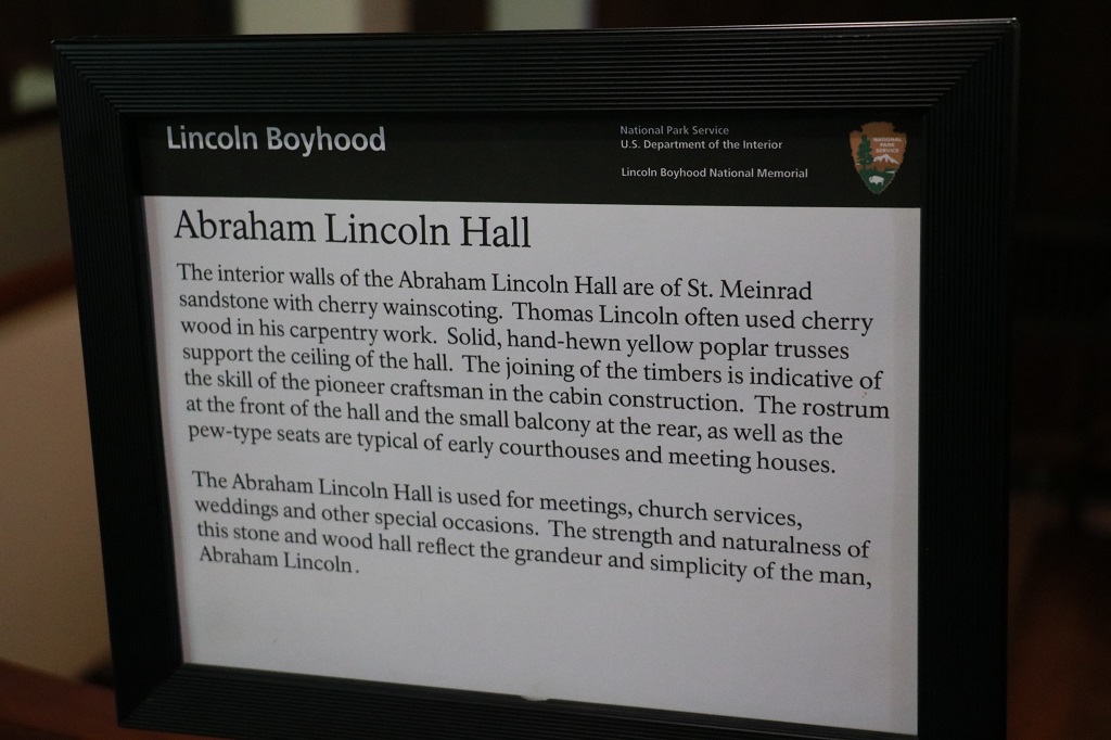
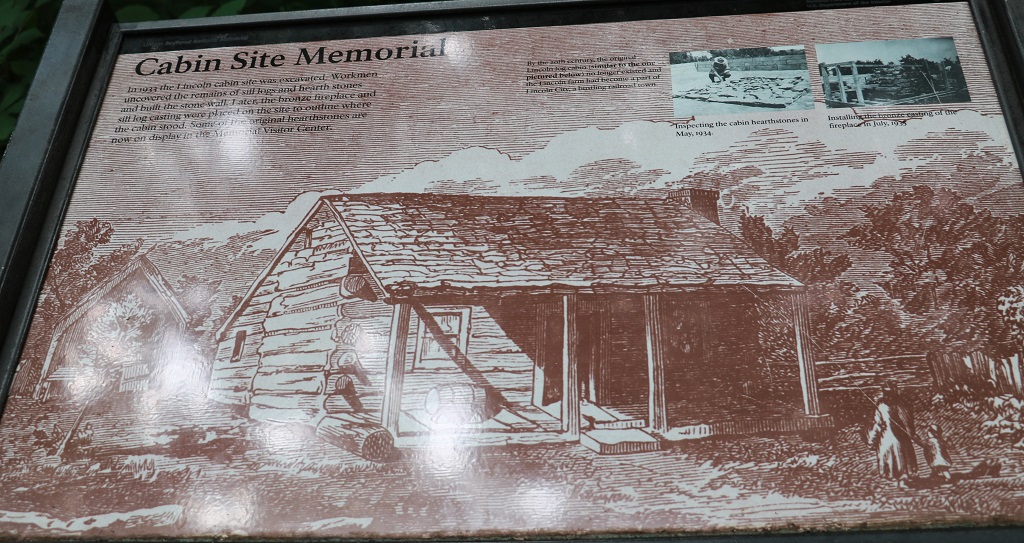
Our stop was still in Indiana; at the Lincoln Boyhood National Memorial. Lincoln spent his formative years here – from 7 to 21 – in three different cabins, none of which survive today. His mother is buried in the Pioneer Cemetery that is within the Park.
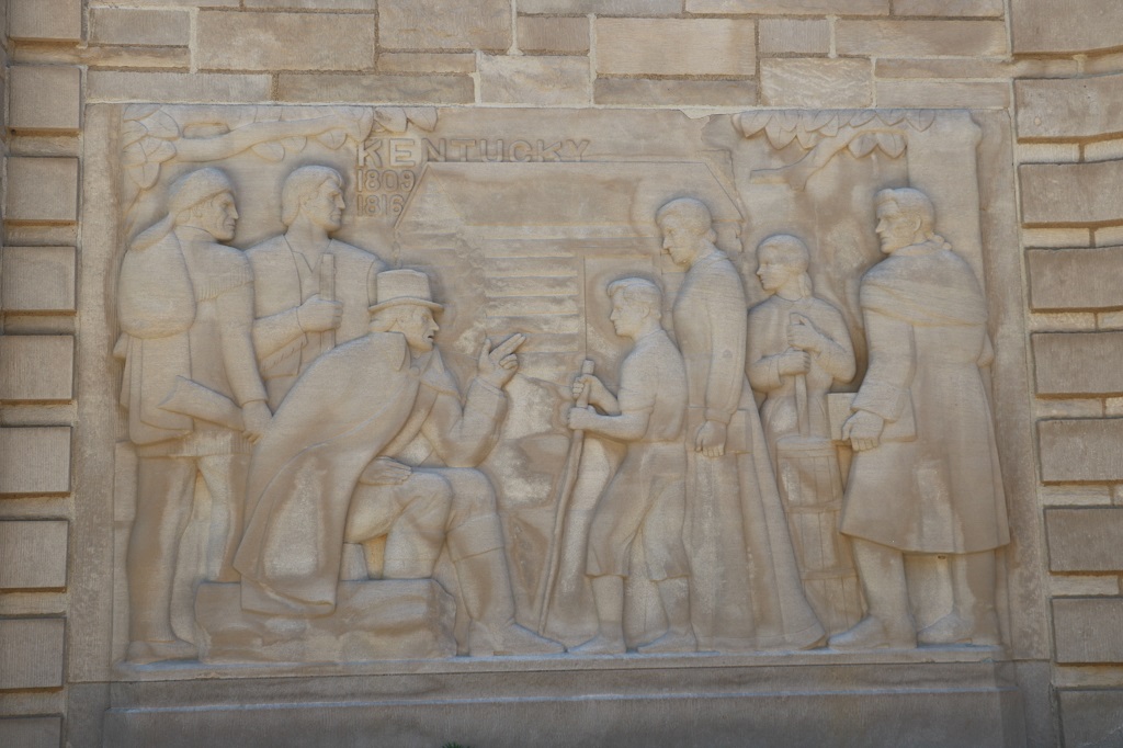
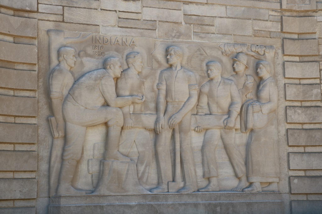
The stone panels portray important periods of Lincoln’s life. The Visitor’s Center is through the door on the right and extends around the back of the curve.
There was a nice large exhibit inside the Visitor’s Center so we wandered past the displays before heading to the cabin memorial. There is also a replica of a frontier farm with costumed staff going about the various chores. We did not take the time to go there as we had a long drive today. We did not even take time to find a geocache or two.
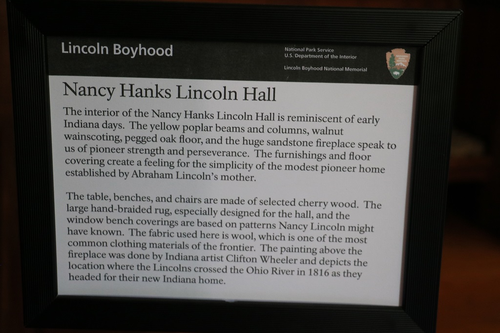
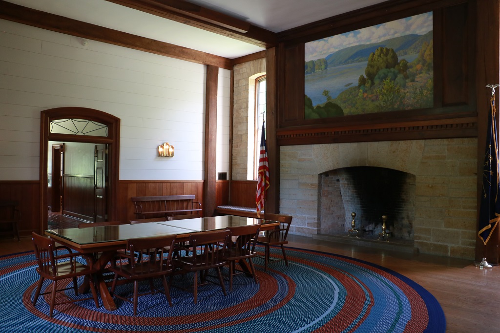
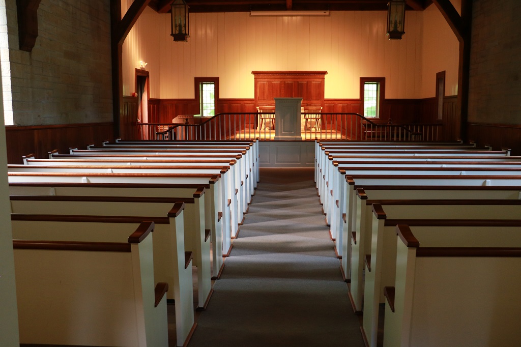
There were two large halls at either end of the Visitor’s Center. The west one was named for Lincoln’s mother and was used as a meeting room.
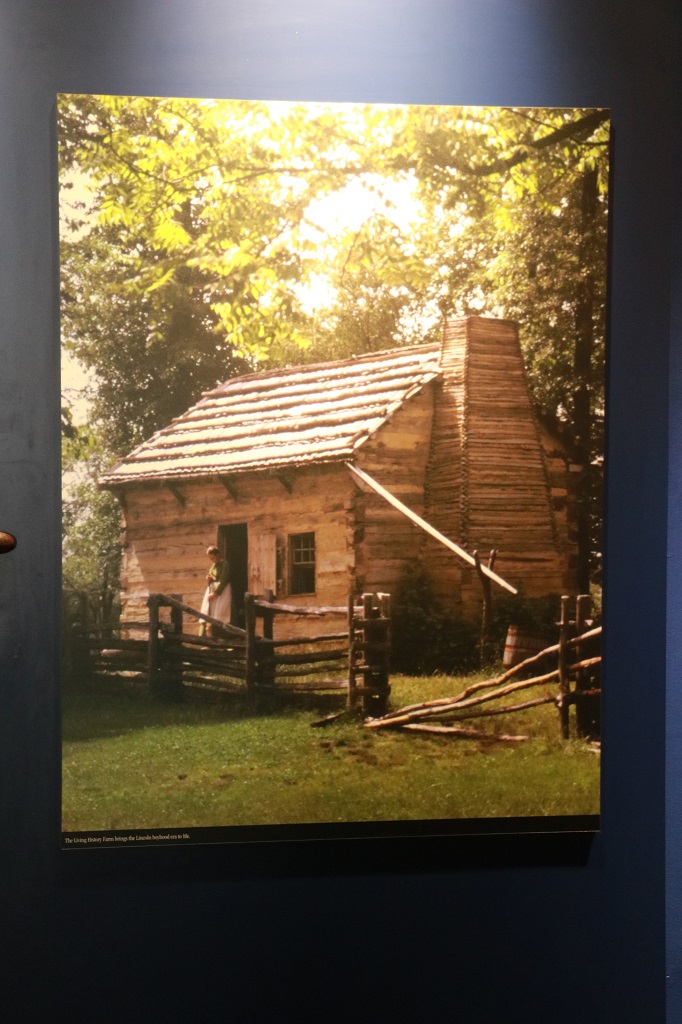
This is an image taken at the Frontier Farm to show what Nancy Lincoln’s home was like.
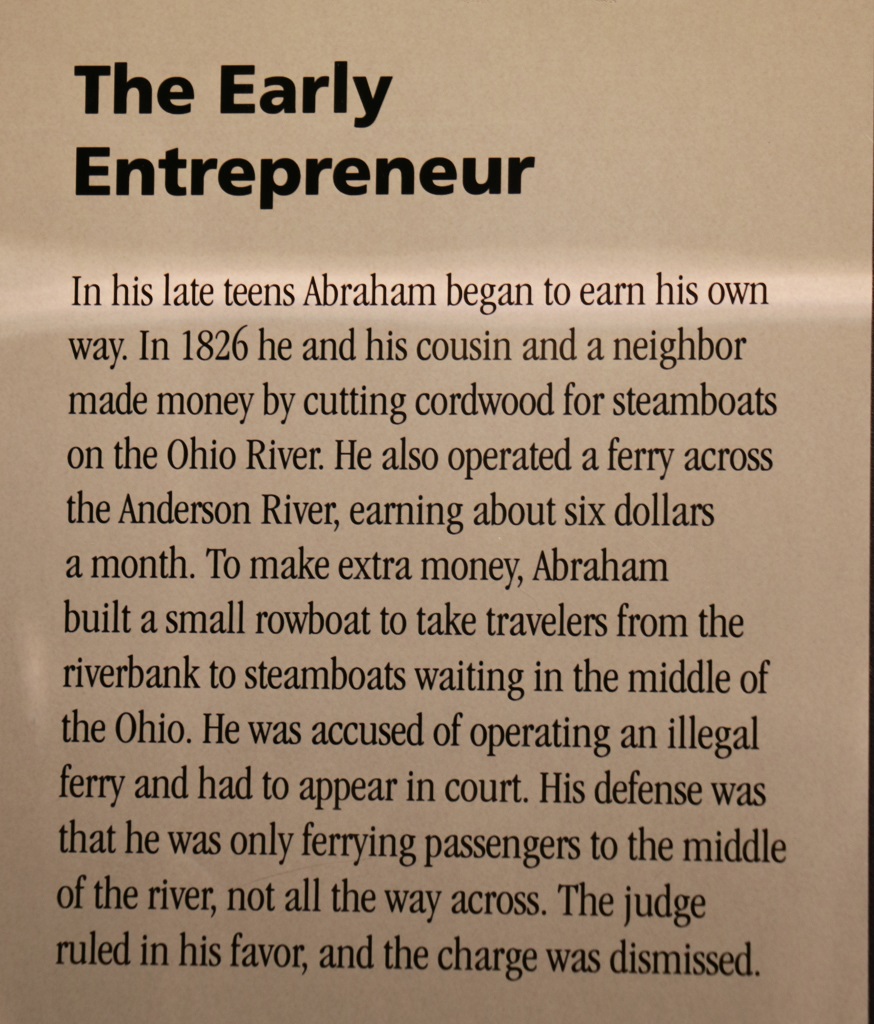
There were many small cards with details or points of interest about Lincoln’s life. I only photographed a few and I have posted fewer still.
The east wing hall was a church sanctuary named after Abraham Lincoln.
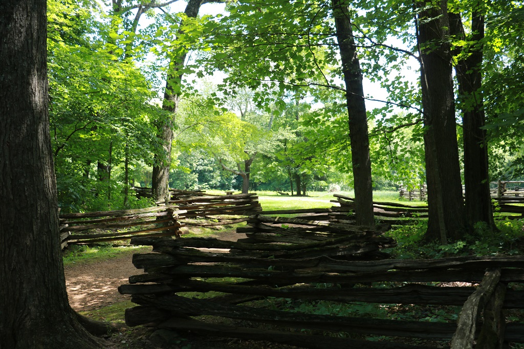
We walked the gravel path through the woods past split rail fences to the Cabin Memorial that is on the edge of the replica Frontier Farm.
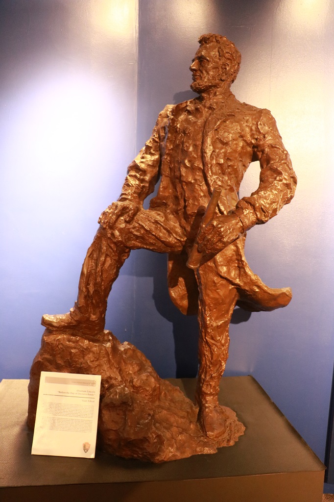
This is a bronze sculpture.
We left the memorial at 10 minutes to 12 and headed southeastward to Elizabethtown, Kentucky, from which we would go east to Paris, which is a bit northeast of Lexington. We drove through a lot of farmland on some nice quiet roads.
We drove through Santa Claus while still in Indiana. They had a Kringle’s store, Christmas Lake, Jingle Way Road, and a huge – and very popular – theme park called Holiday World. There were large parking lots on both sides of the road that were full of cars.
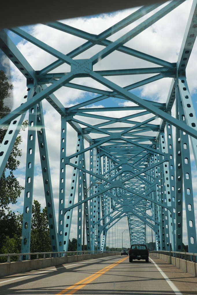
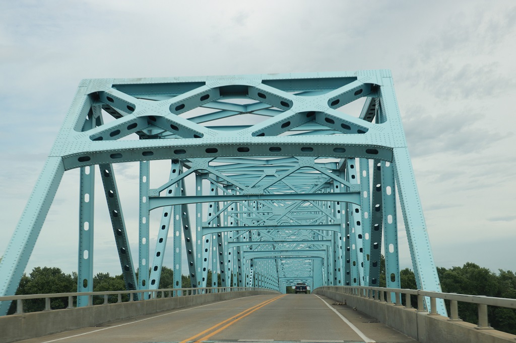
We again drove through one of these nice blue bridges across the Ohio River to re-enter Kentucky.
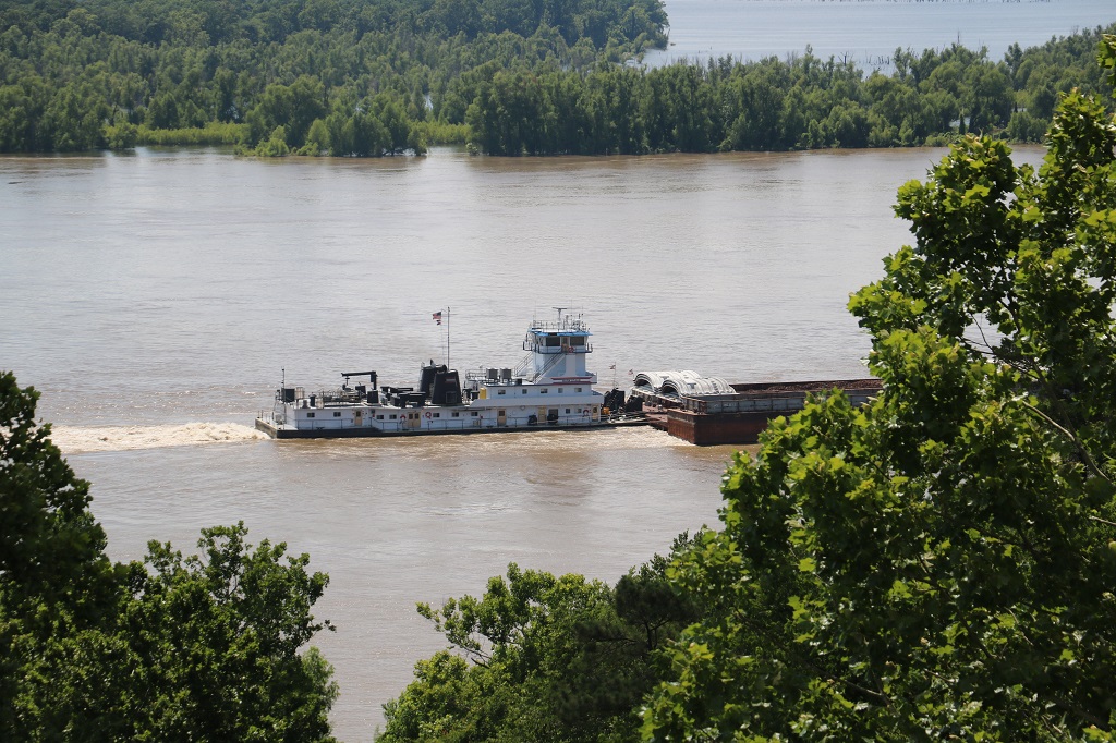
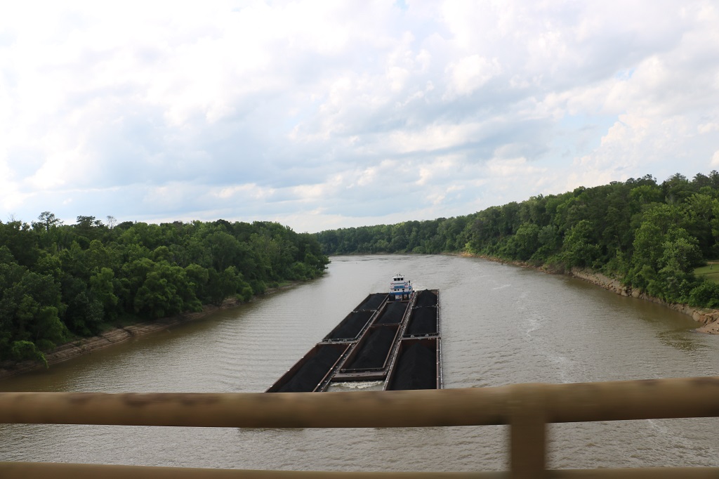
The big barge tugs move goods on the Ohio, just like they do the Mississippi.
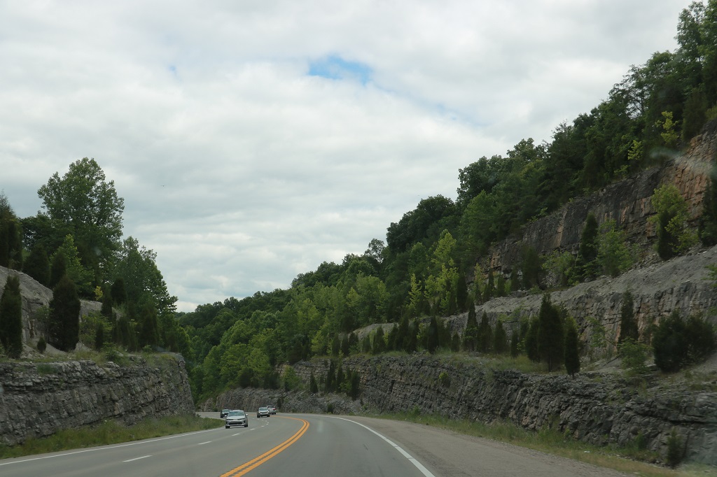
We actually encountered rocks that had to be cut through for the road. We have been on flat land or rolling hills so long it almost felt like home to see some rock cliffs beside the road.
Hartford, KY is the state capital and there was viewpoint overlooking a part of the town that had a really nice view (this is zoomed in. It was quite aways distant). They are refinishing and/or replacing the rock on the top. It is expected to take the rest of the year to finish. I asked a fellow where they got all the scaffolding and he said they brought it in from all over. How would you like to climb those stairs to work every day?
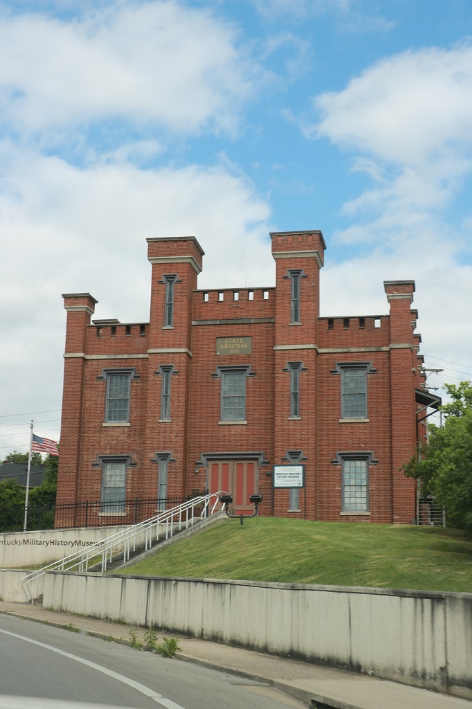
This is the Kentucky Military History Museum. It is in the former Arsenal building.
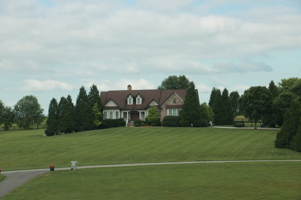
Estate-type properties like this with masses of lawn to mow have been very frequent sights the last few days. As we drove between Hartford and Paris this was almost the norm.
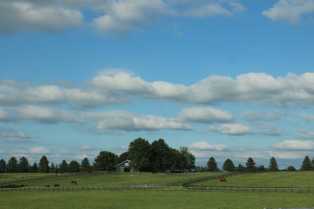
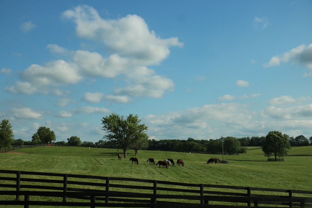
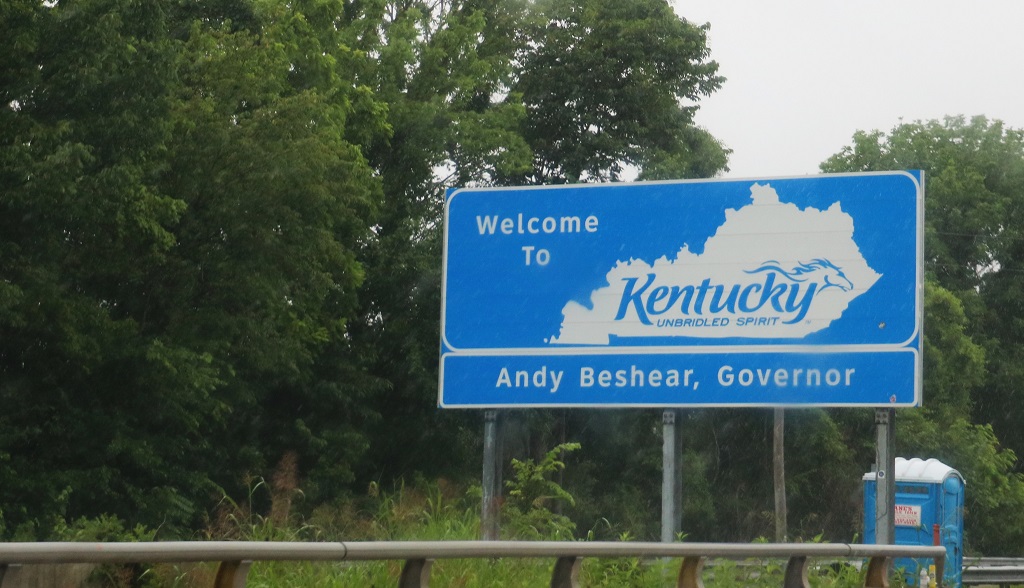
We are in Kentucky horse country! Yay! This is also Kentucky Bourbon country and we drove by quite a few large distilleries including Jim Bean.
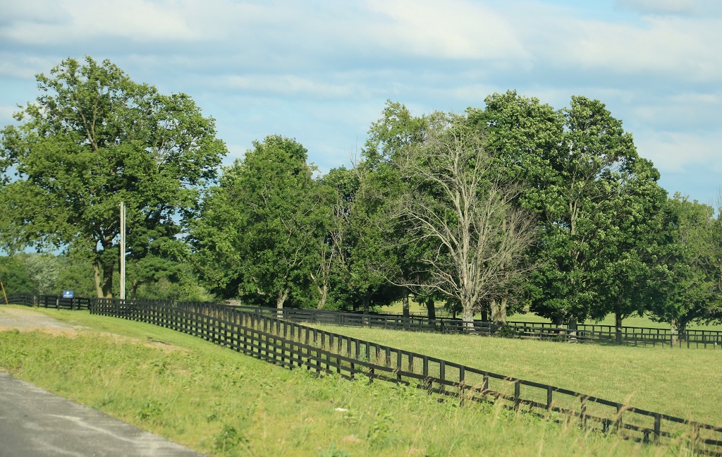
Many of the sprawling farm properties had this type of double fencing around really large acreages. I will ask about it at Clairborne tomorrow.
We arrived in Paris at 6:30, which was 7:30 local time due to having entered a new time zone. We are back to being three hours ahead of home again.
The owners of the hotel in Union City were renovating. They were going through all 84 rooms and removing the carpet and putting in Luxury Vinyl Tile. Their son was helping as well. The room they were currently working on was between our room and the parking lot so we chatted with them as we went out for dinner and back, and again as we prepared to leave this morning. He and his wife ride a Harley so he and John had bikes in common and their son geocaches. We had a few nice visits.
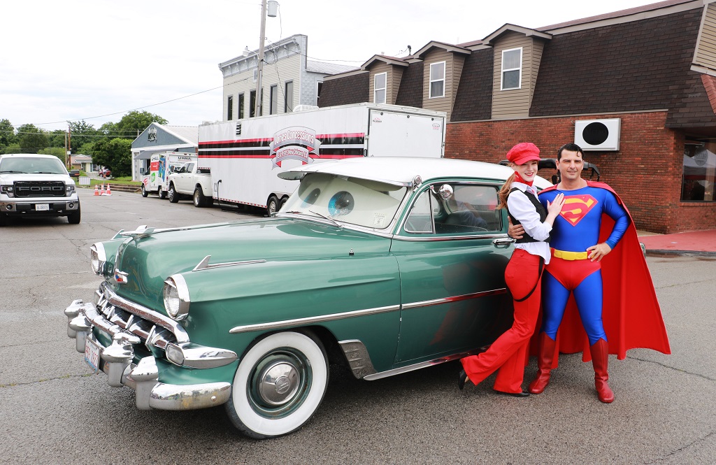
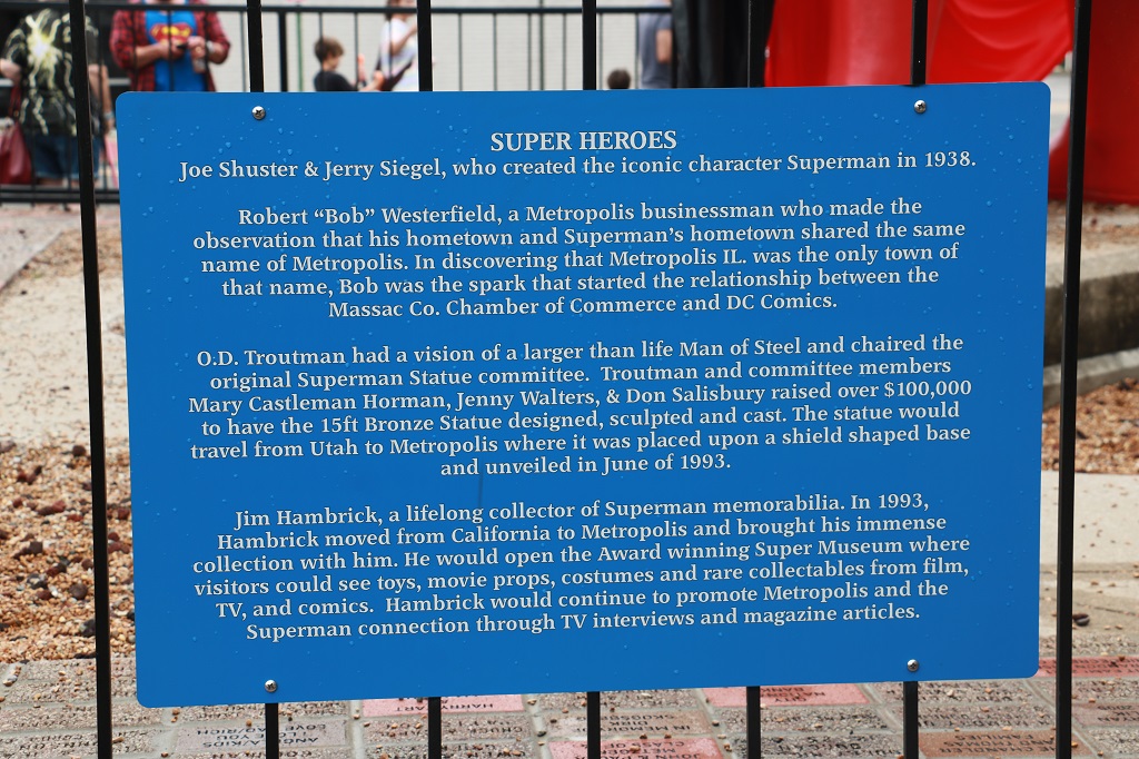
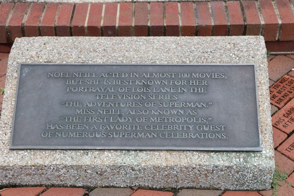
The gals in the breakfast room were also friendly and found out we geocached so the one lady says, “You have to go to Metropolis. The Superman Fesitval is on this weekend.” It is only about an hour and a half from here. Well. I loved Superman as a kid, so that became a must see.
The other lady told us about a geocache in a cemetery that was very unique and was also in the direction we planned to drive. We had no real plans for sightseeing today and only had a three hour drive to Evansville if we just drove so we were happy to have some diversions. We had just planned to find some geocaches to do along the way anyway because today was to be a Three State Day.
Union City is about 11 miles south of the border between Tennessee and Kentucky and the geocache was in Mayfield on the Kentucky side – which gave us state number 8.
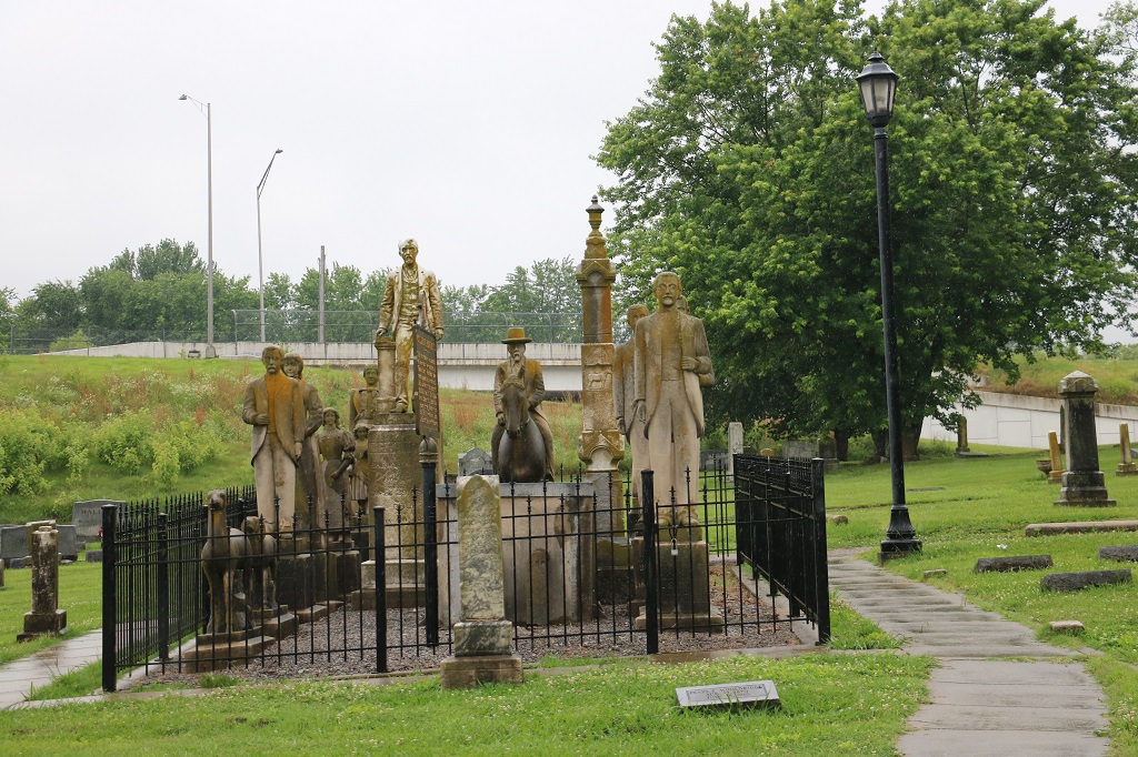
We had a thunderstorm at 1 am that continued unabated for about an hour. There was only a few seconds now and again between the loud rumbles and lightning flashes. Most of the hour was just a steady rolling thunder. It was quite something. John slept right through it. It was very overcast as we left the hotel and the rain began shortly thereafter. While we were in the cemetery it just poured.
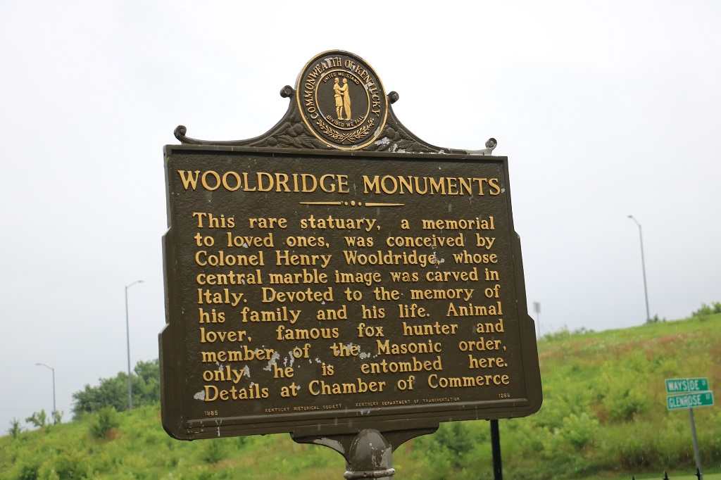
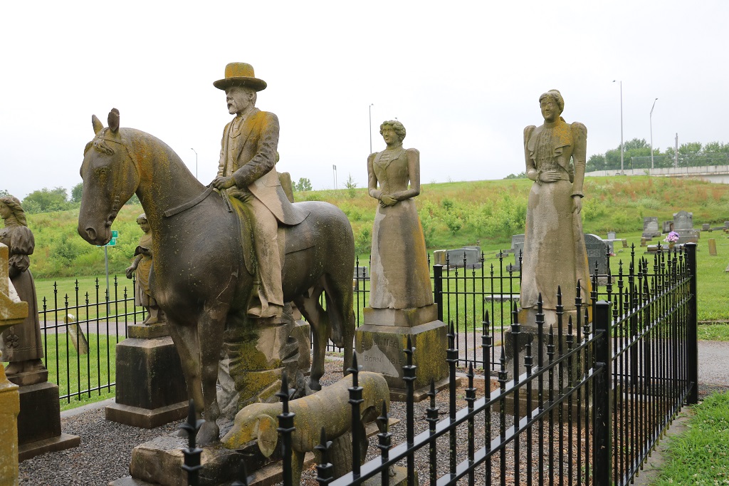
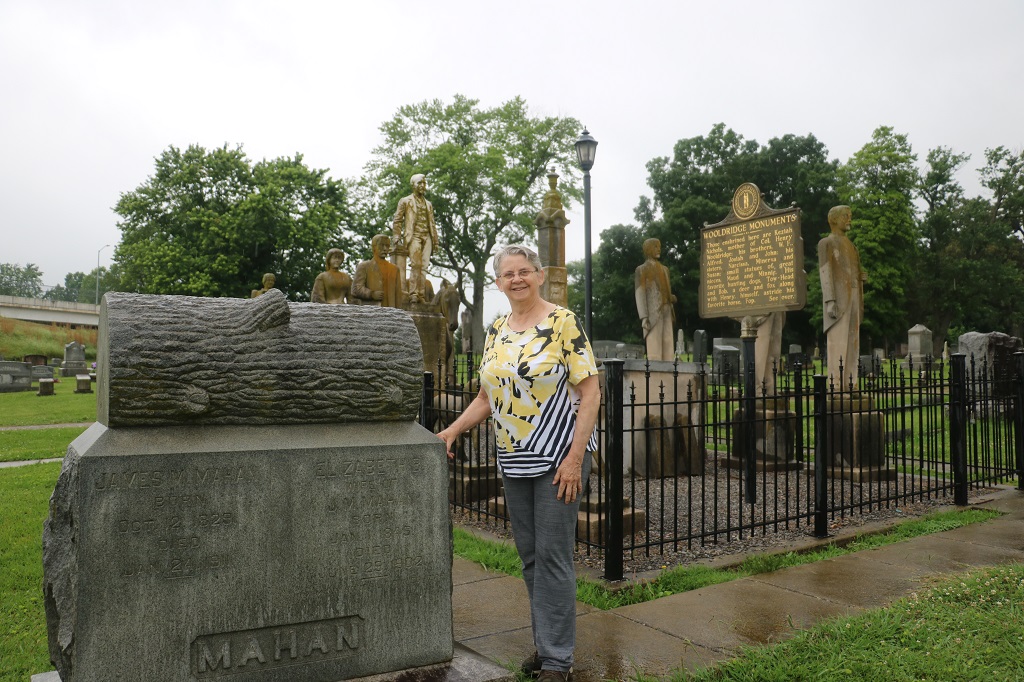
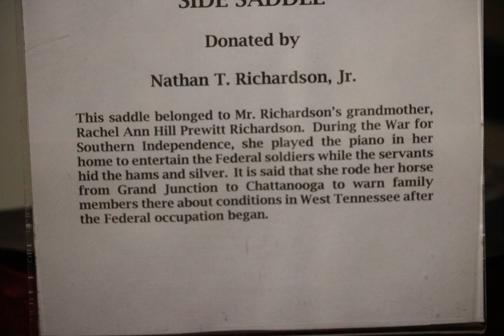
This is the information that was given for the geocache site: “Commissioned by Colonel Henry G. Wooldridge and built over the course of seven years until Wooldridge’s own death on May 30, 1899, the monuments commemorate family members and other loved ones Wooldridge lost over the course of his lifetime. After more than a century of visitation by a public fascinated by the spectacle, the site has acquired an unofficial, completely disconcerting name: “The Strange Procession Which Never Moves.”
Prompted by no one but his own aching heart, the man spent his last years pouring his fortune into immortalizing all that was irretrievably lost in stunning fashion. Unfortunately, this gesture was just as fundamentally lost on its earliest viewers, who mistook his monument as a literal money pit worthy of attempted plundering (the deer’s antlers for example have been broken off), rather than appreciating it for the gorgeously metaphoric treasure chest it simply is.
Populated with likenesses of those from Woolridge’s past, including a childhood sweetheart or his great-niece (depending on the lore), all of his sisters, his horse named “Fop,” plus his mother, brothers, as well as other creatures great and small who had been close to his heart. And while it may look like a small, very creepy private cemetery within the larger Maplewood Cemetery, Wooldridge is the only person actually entombed within the cordoned-off site.”
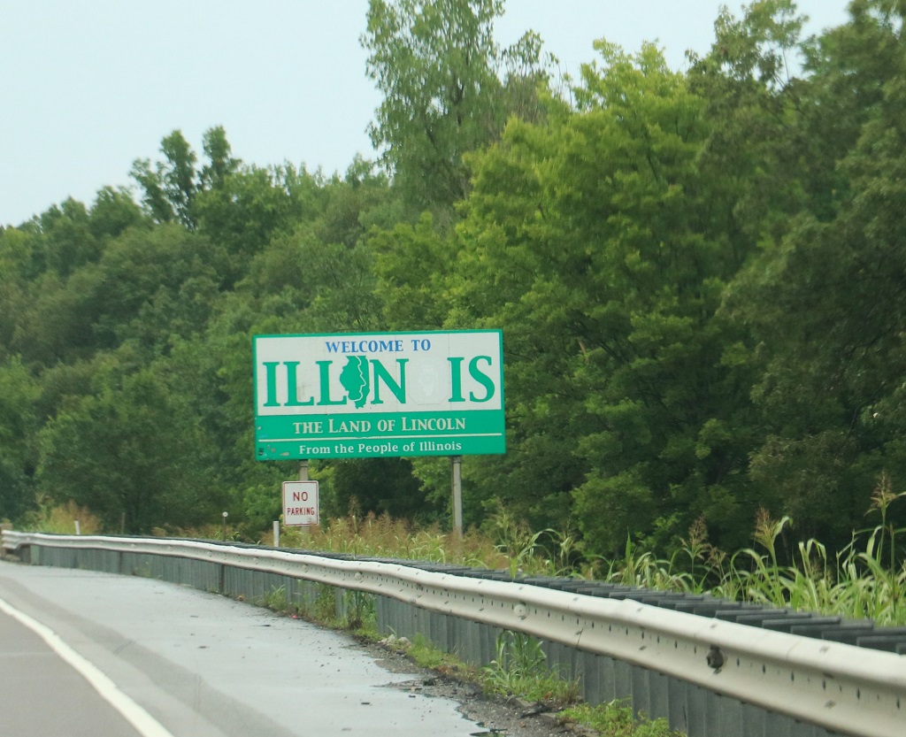
We cut across Kentucky and into Illinois when we crossed the Ohio River where the state dips southward with a bit of a bump and also borders Indiana to the east.
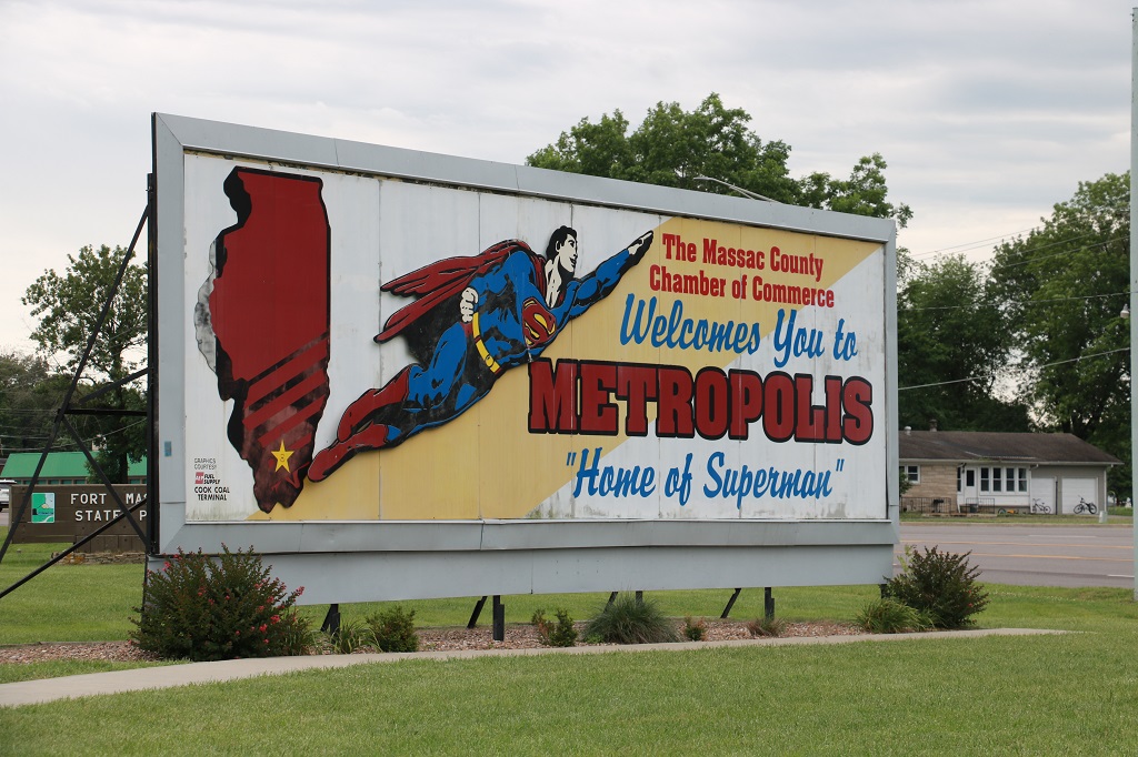
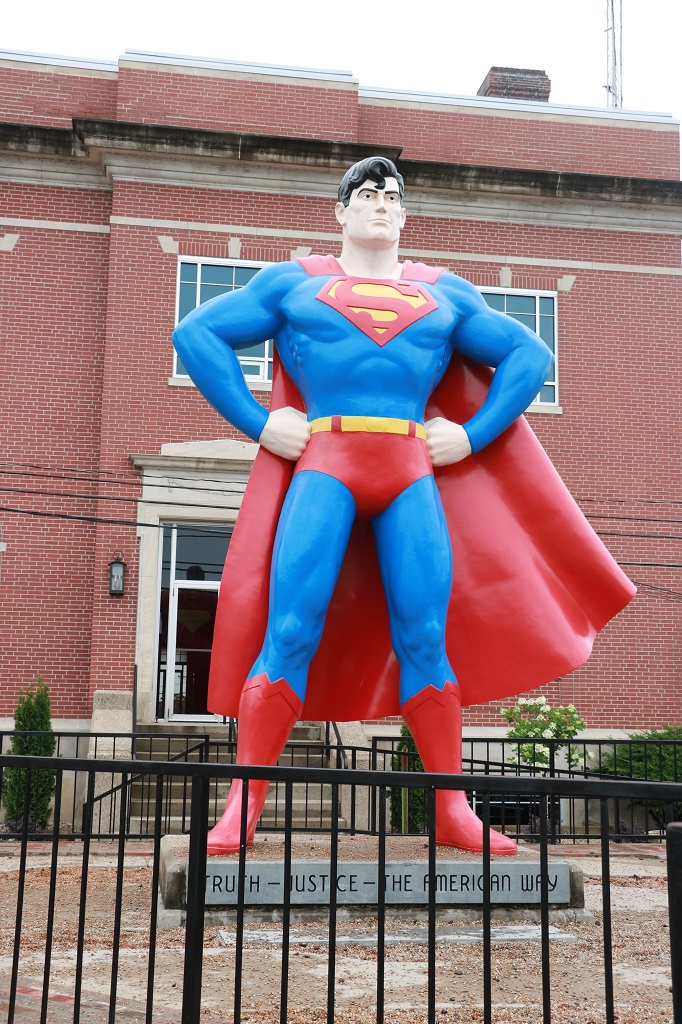
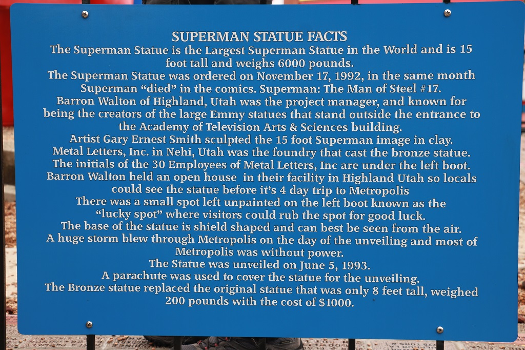
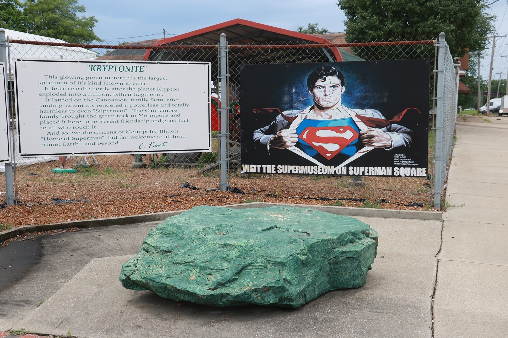
Metropolis, Illinois is not too far NW of the border and we followed along the river to get there. State #9.
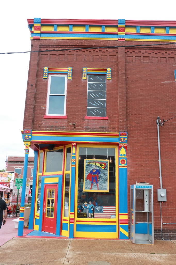
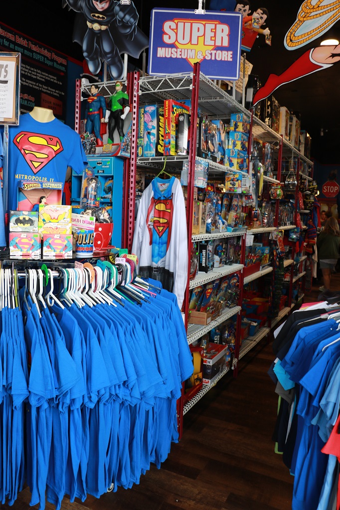
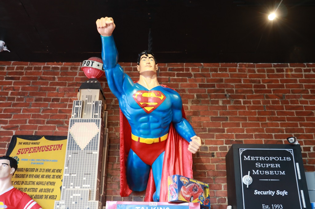
The streets near the 15′ Superman statue and the Super Museum were closed to traffic so we parked a couple of blocks away and walked over. We thought about seeing the museum, but when we peaked through the doorway it just looked like a bunch of Superman memorabilia from years past so for $8.00 per person we decided to give it a pass. The advertising said it was a massive collection of Superman memorabilia but John was not a Superman fan we felt it was likely not worth the cost. The store was packed with stuff though and fun to look around. I wanted to find some Superman playing cards to take home, but we didn’t see any.
There was a comi-con convention going on along with the Superman Festival and we saw quite a few people dressed up as different comic or video game characters. There was a large tent by the big Superman statue that was full of people playing Superman Trivia. It was amazing the things they knew about specific episodes of the various TV series or movies or the comics. I can a barely remember what I watched on TV a day later let alone details about shows decades old.
An Adventure Lab (relatively new feature on Geocaching.com) that took us to five different “Superman” locations and the last one gave you coordinates to a cache.
The Daily Planet Globe was sitting in a closed attraction.
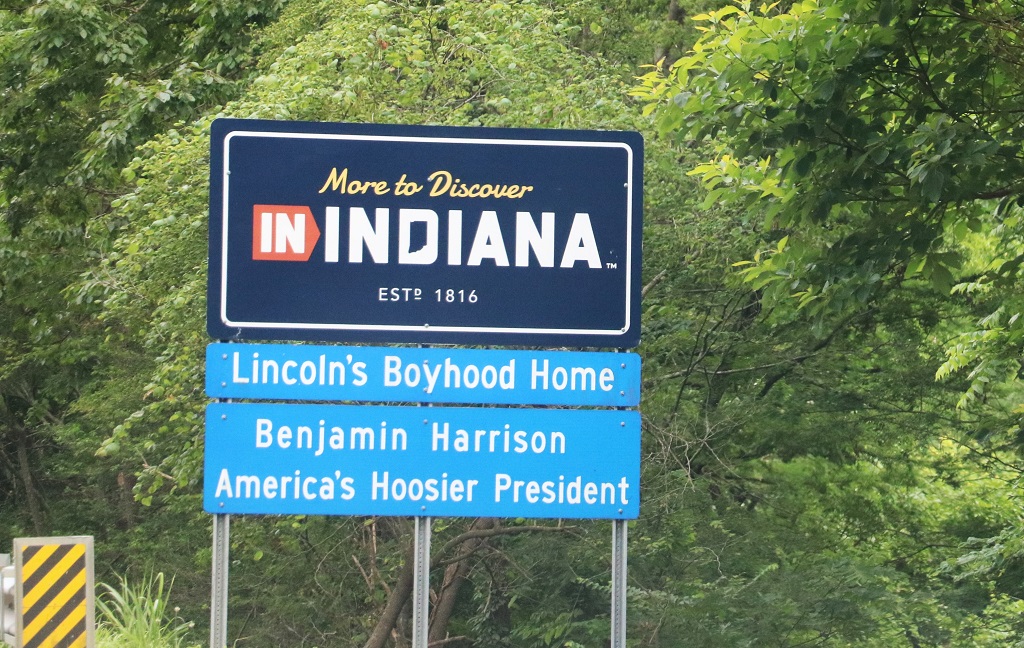
We left Metropolis and located some quiet roads to find a few geocaches as we traveled east to cross the Wabash River into Indiana – State #10.
We got double Welcome to Indiana signs today.
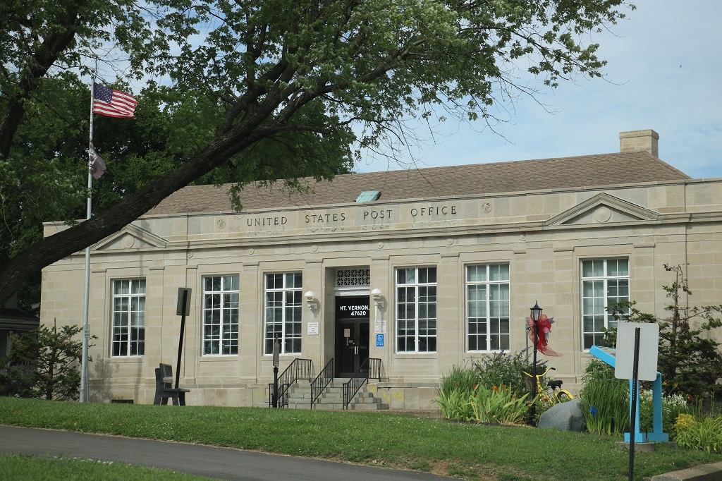
There was a geocache at the courthouse in Mt. Vernon. They had several nice looking buildings and a very clean and attractive downtown center so after we found the cache we took a little drive around. Nice place. A few big factories and a port so they have employment opportunities it seems.
The Garden Club plants and cares for quite a few flower beds and boxes.
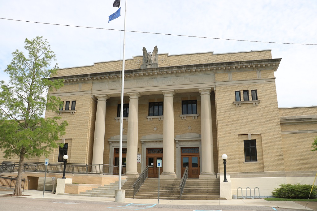
This buildling is City Hall and it is also a War Memorial. It is written along the top of the columns and above the doors are carved: sailors, soldiers, marines.
We found a couple more geocaches nearby (one in a little ‘free library’ – I love those – and I found two dog stories to read.) From Mt. Vernon it was a simple drive into Evansville for the night. Dinner at the Texas Roadhouse and blogs and bed. See you tomorrow.
As we were heading east away from Memphis and Graceland, I was looking through my map books, both of which have some attractions or museums or heritage sights printed on them, and I came across an item I had made a note to go see if the driving route allowed. With a slight adjustment going east a bit further than we planned before heading north we headed for Grand Junction, Tennessee.
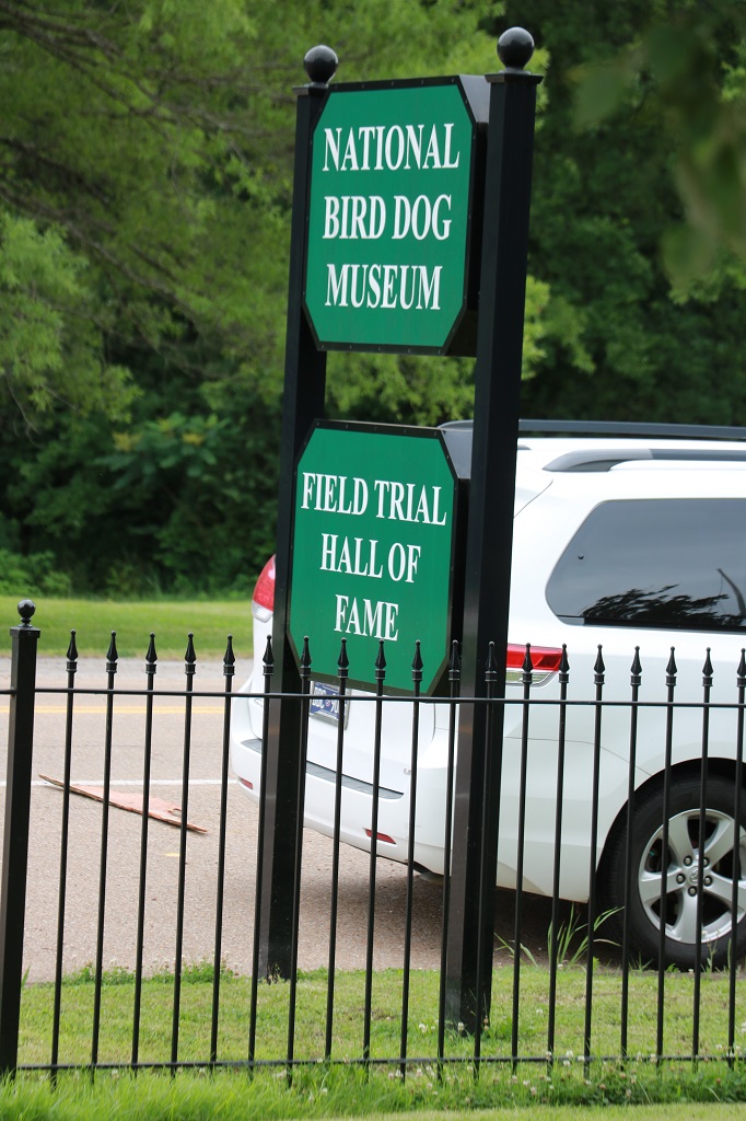
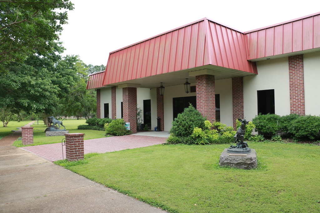
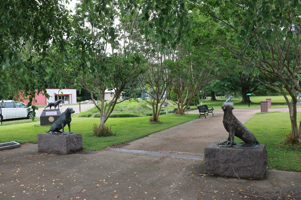
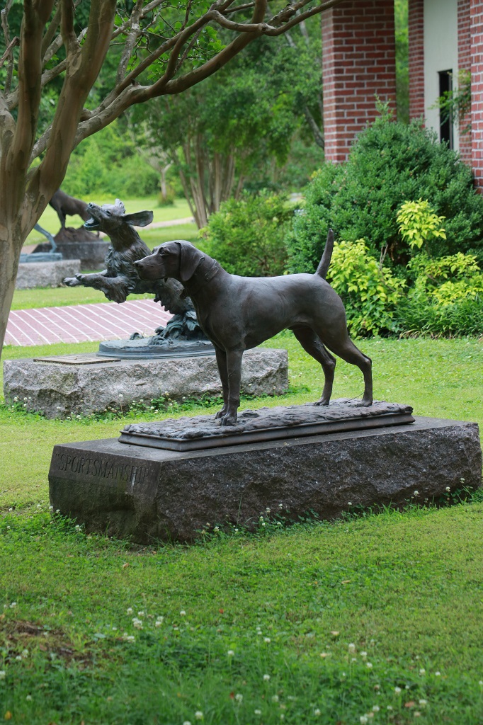
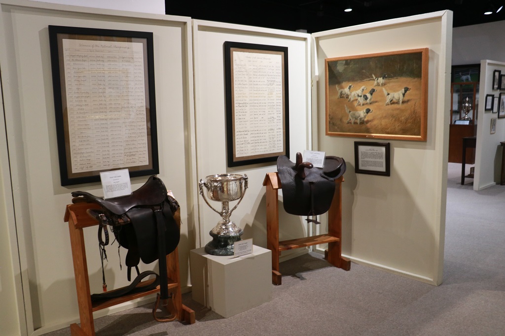
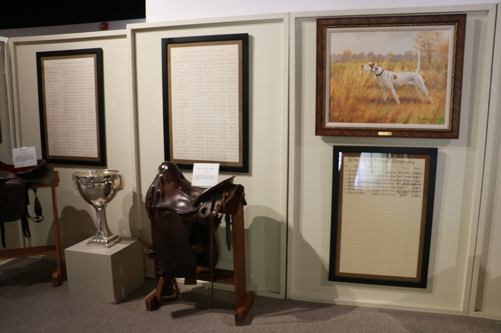
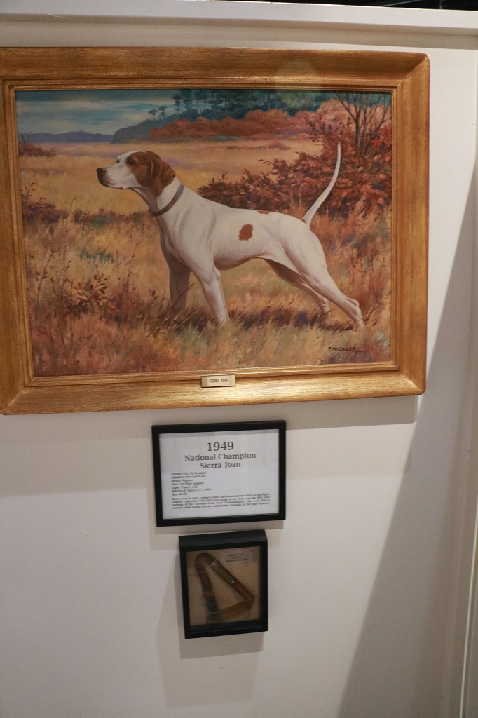
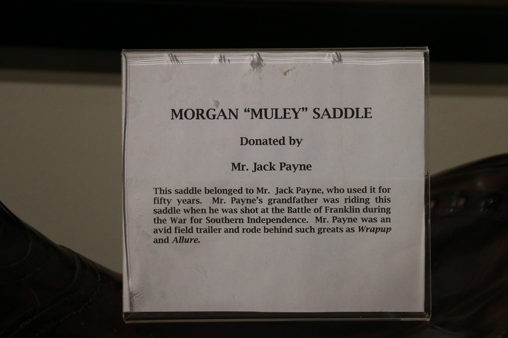
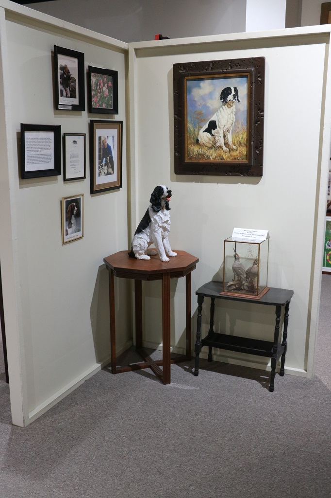
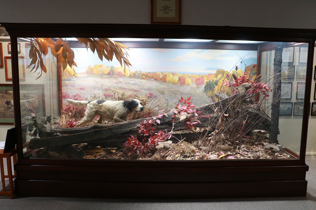
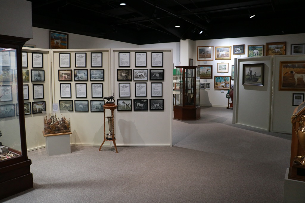
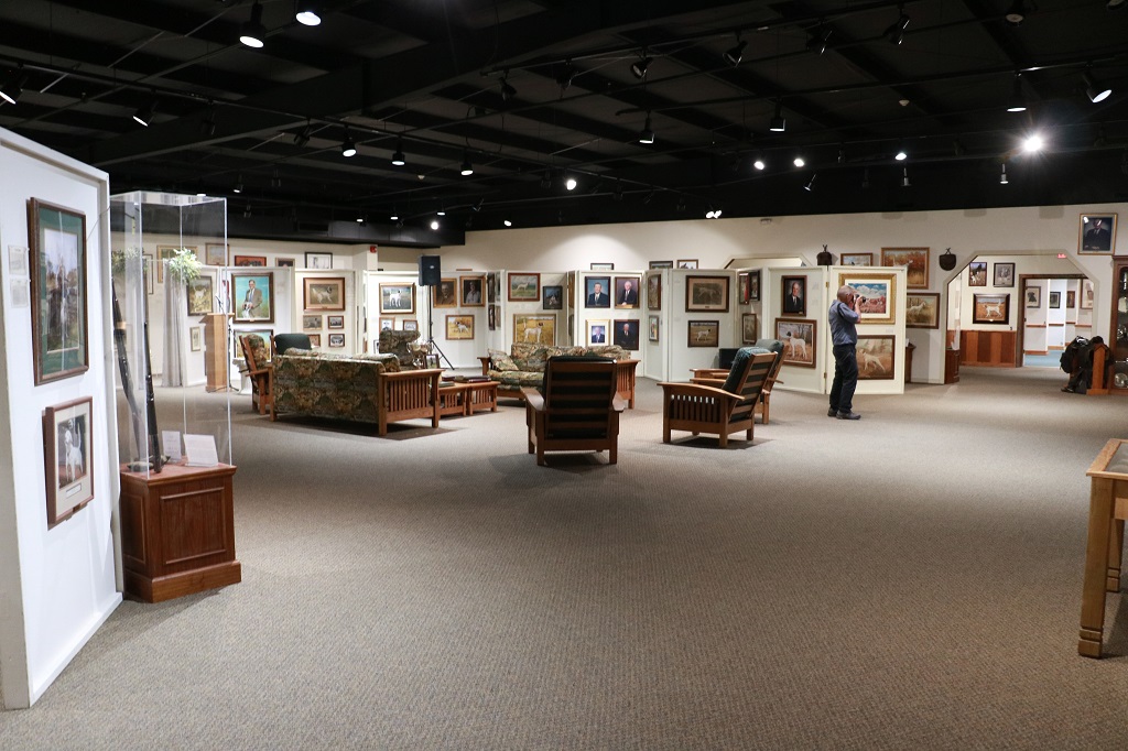
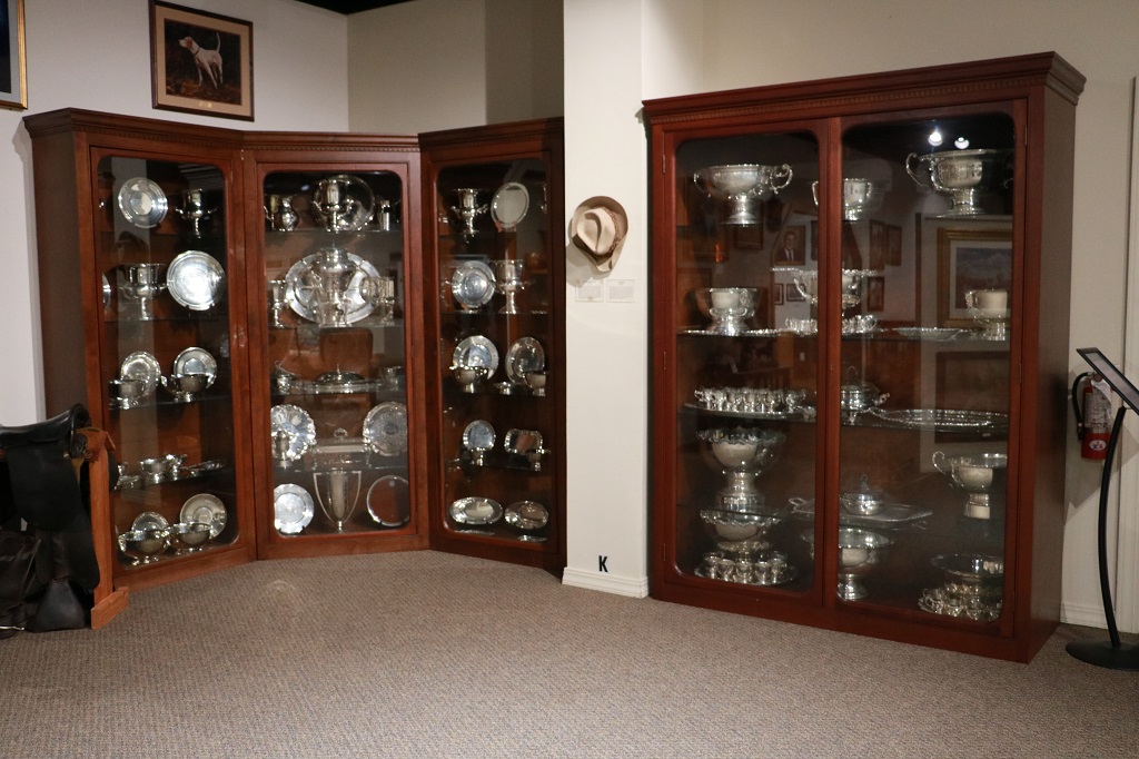
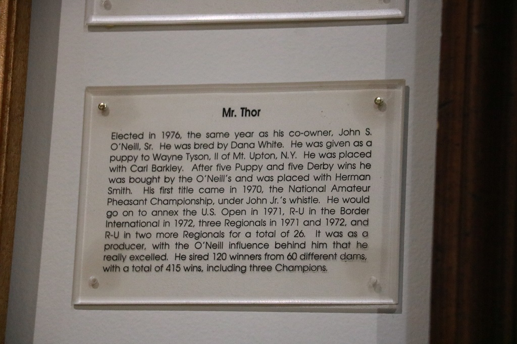
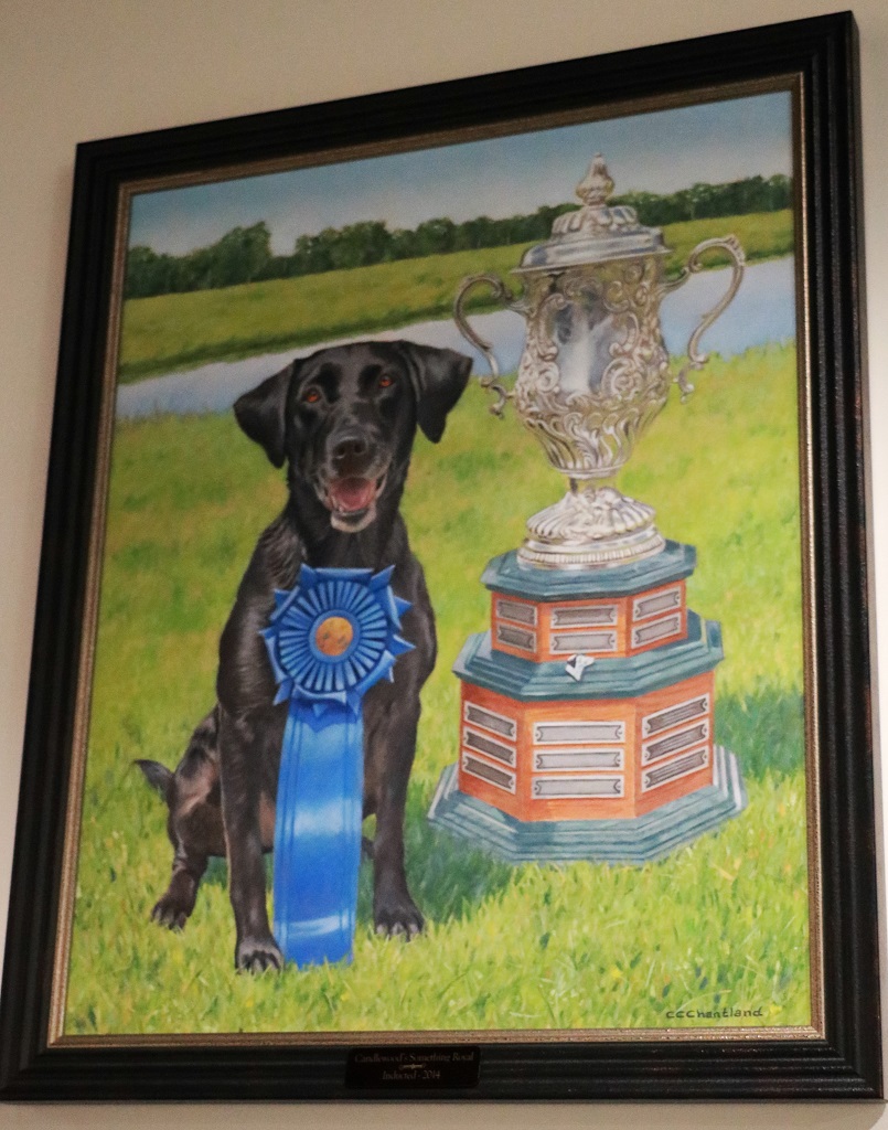
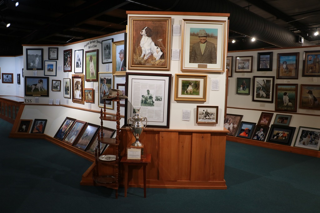
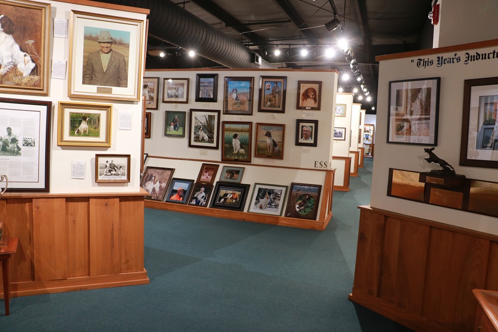
Grand Junction is home to the National Bird Dog Museum and Field Trial Hall of Fame, which is 30,000 sq. ft. of photos, paintings (gorgeous paintings of dogs and trainers), cabinets bursting with all sizes of silver cups and trophies, record books, sporting guns, and other information about the sport. It was an awesome place! I was more excited by the vastness of it and the meticulous displays and the wonderful artwork than I was walking through Graceland!
The long pathway you can see on the very left side of the photo is a memorial walk with the graves of many Field Trial Champions along each side.
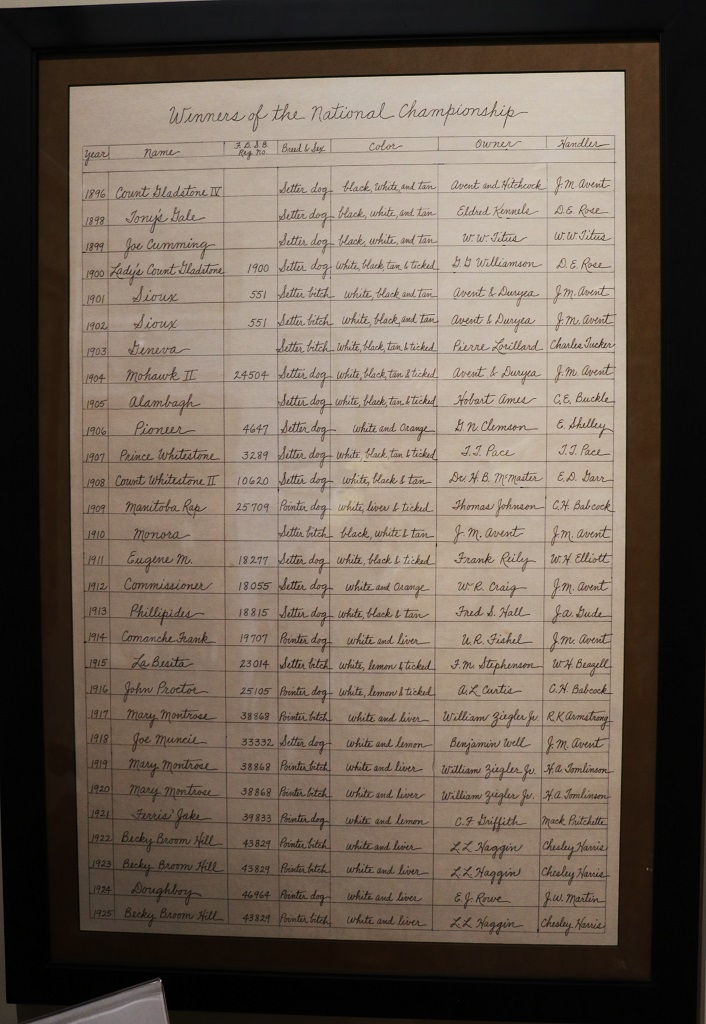
There are five of these large framed lists of every winner of the National Championship going back to 1896 and up to 2022.
The place was huge! There were separate rooms for: the Field Trial Hall of Fame, Retriever Field Trial Hall of Fame, English Springer Spaniel Hall of Fame, and a Sporting Dog Wing.
The woman that was there caring for the place used to have six staff working with herbut since COVID hit she can get no one to work with helping her keep the silver polished, the floors vacuumed and things dusted. She has tried to find helpers with no success. She is on her own and run ragged. There is no entry fee to tour the building, just a donation box. I am sure the annual fees for the 1000s of members pay for the building’s needs and her wages. But the woman seriously needs some help.
Barbara Bush’s “Millie”
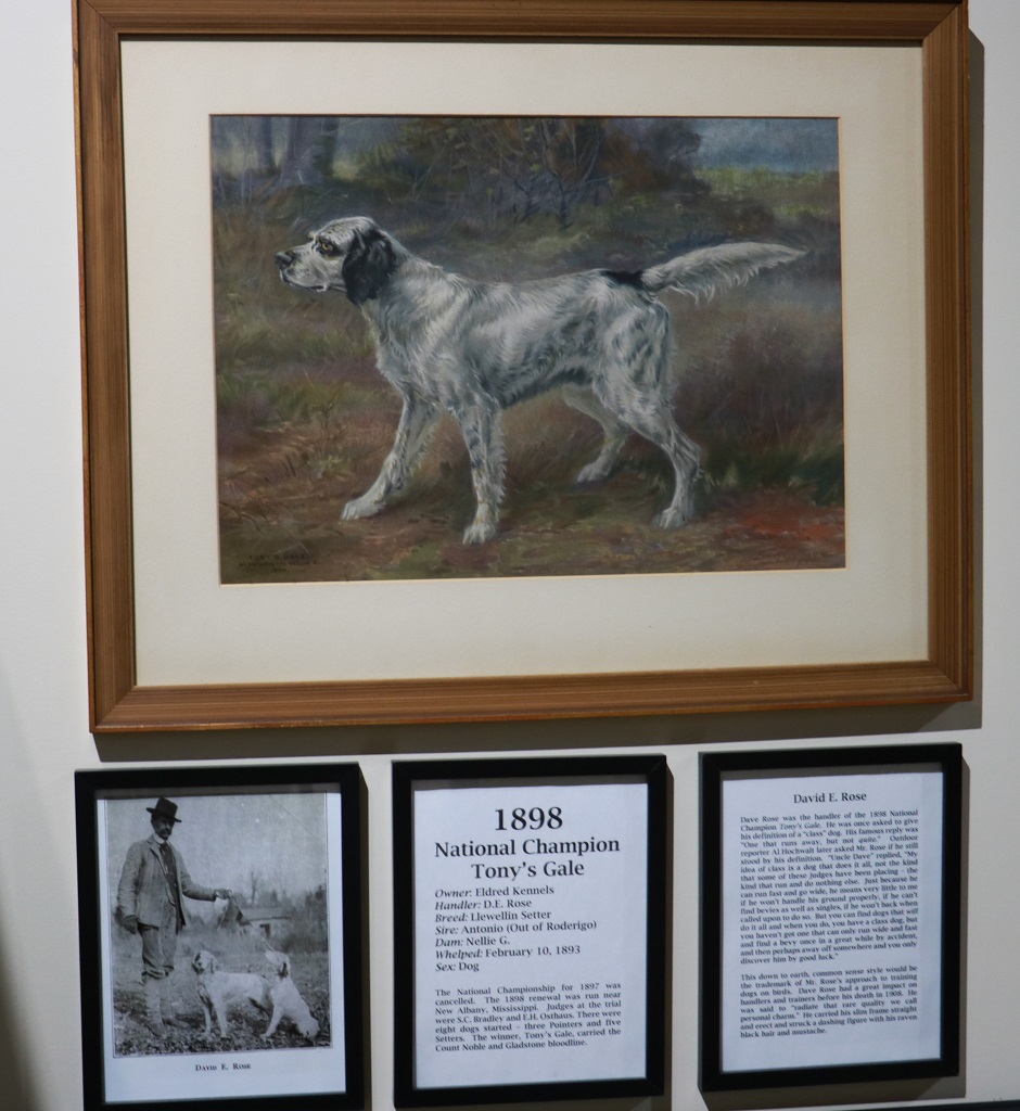
Count Noble. 1879-1891. A gift from the Museum of Natural History in Pittsbugh, PA
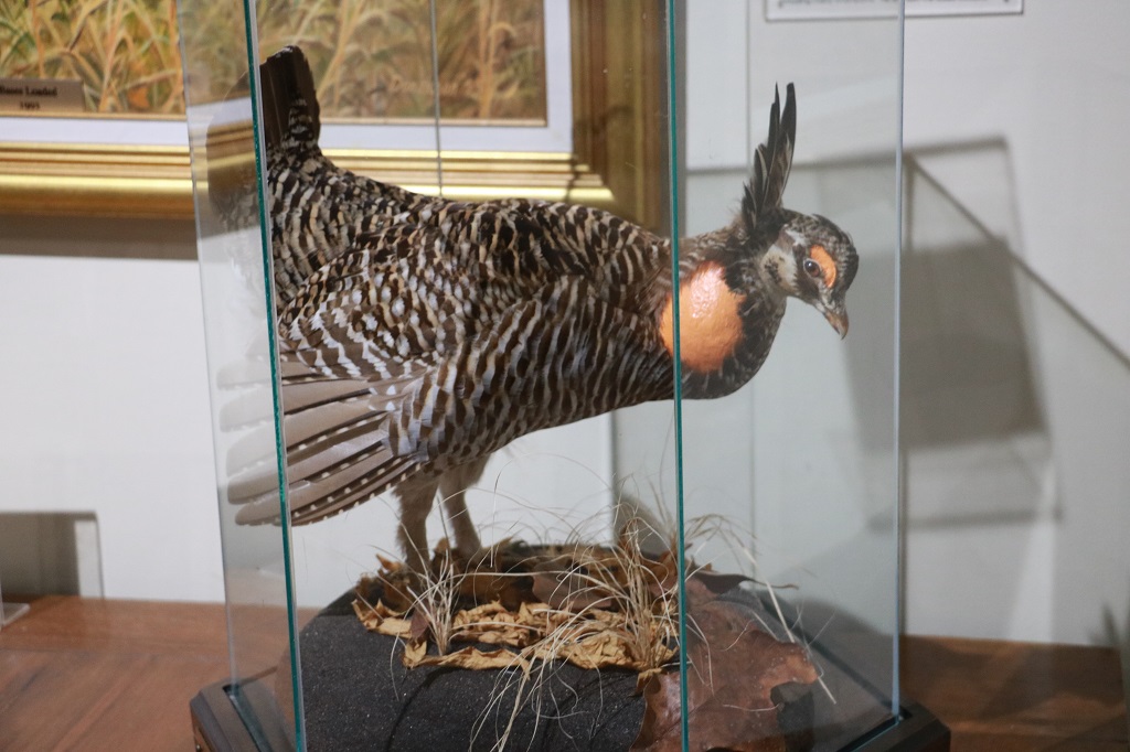
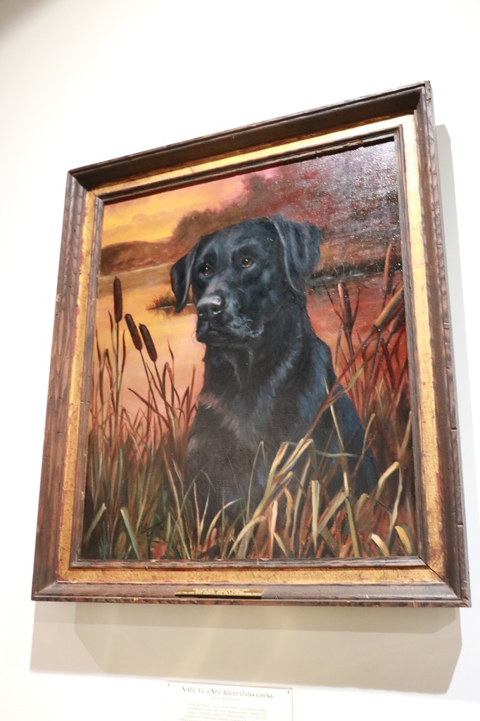
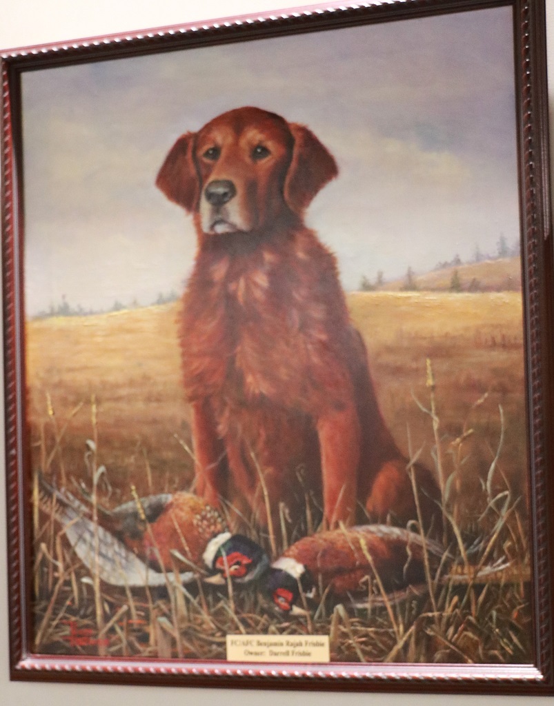
There were so many gorgeous paintings of dogs!
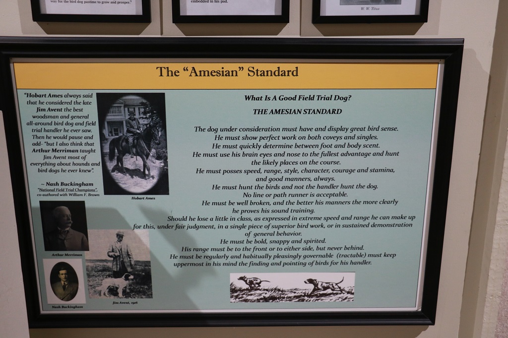
Since we don’t know anything about famous sporting dogs or field trials we just wandered through most of the rooms and looked at things we passed by. We did not spend a lot of time reading about individuals that had been inducted into the Hall of Fame or about the Championship dogs. It still took us over an hour to do that. Amazing place.
We were only an hour away from Memphis and it was after 2:30 so we hit the road and did a bunch of driving; only stopping to find one geocache. Our hotel for the night was booked at Union City, which is right on the Tennessee/Kentucky border; just over 2 hours north of Memphis if you took the Interstate. We wander back roads, or at least quiet divided highways as much as possible.
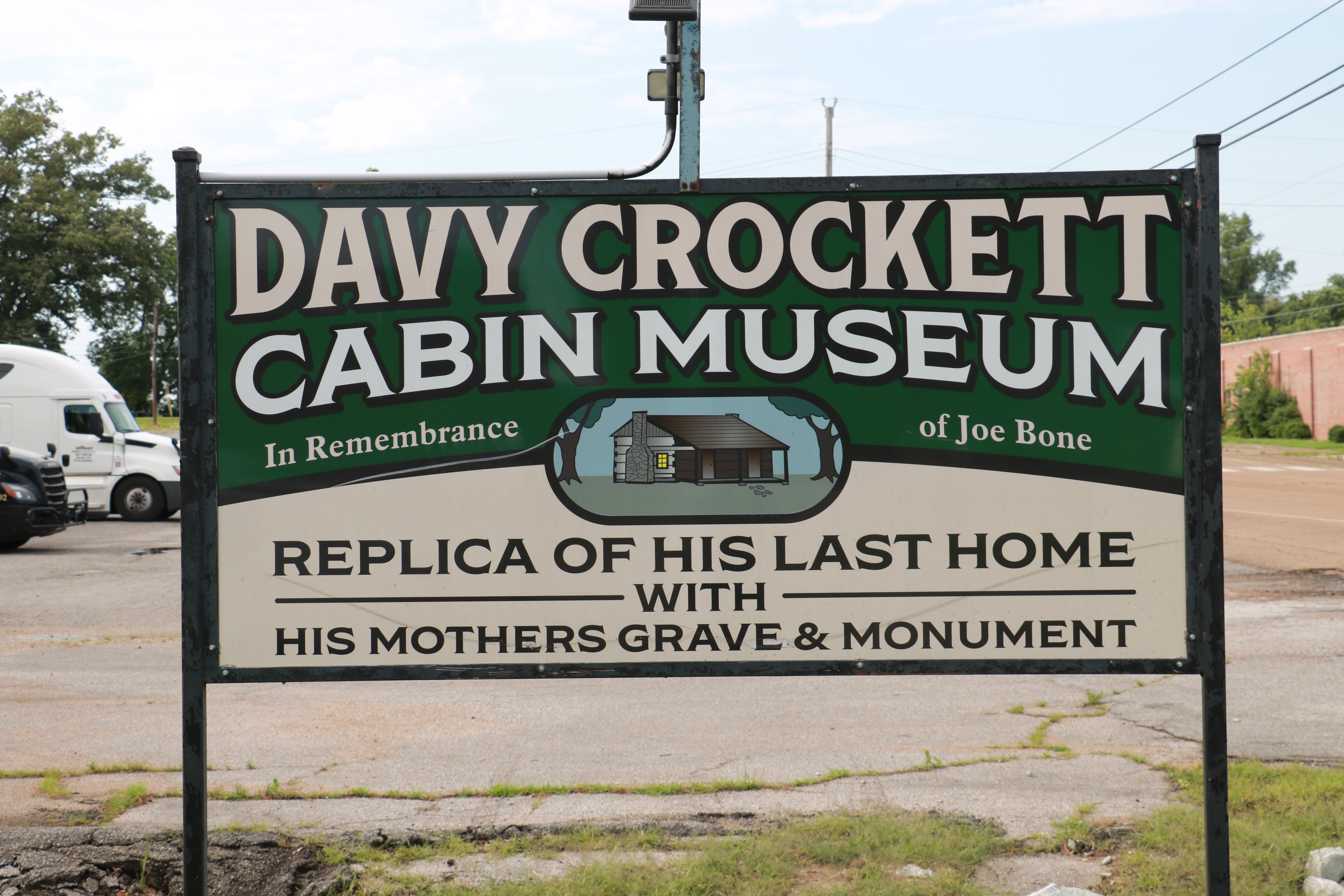
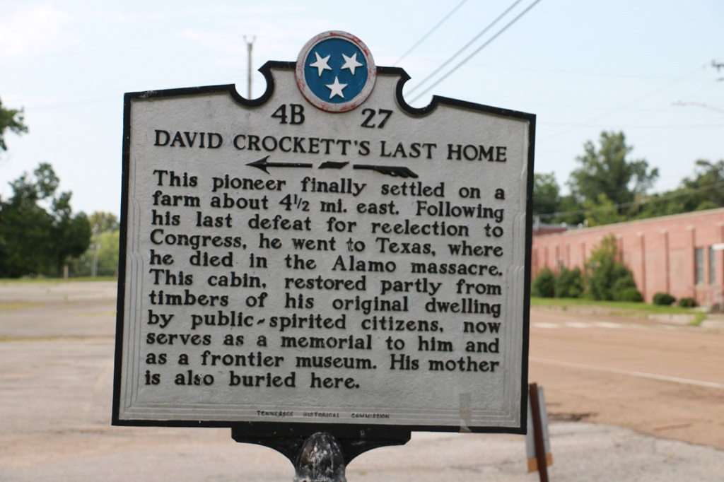
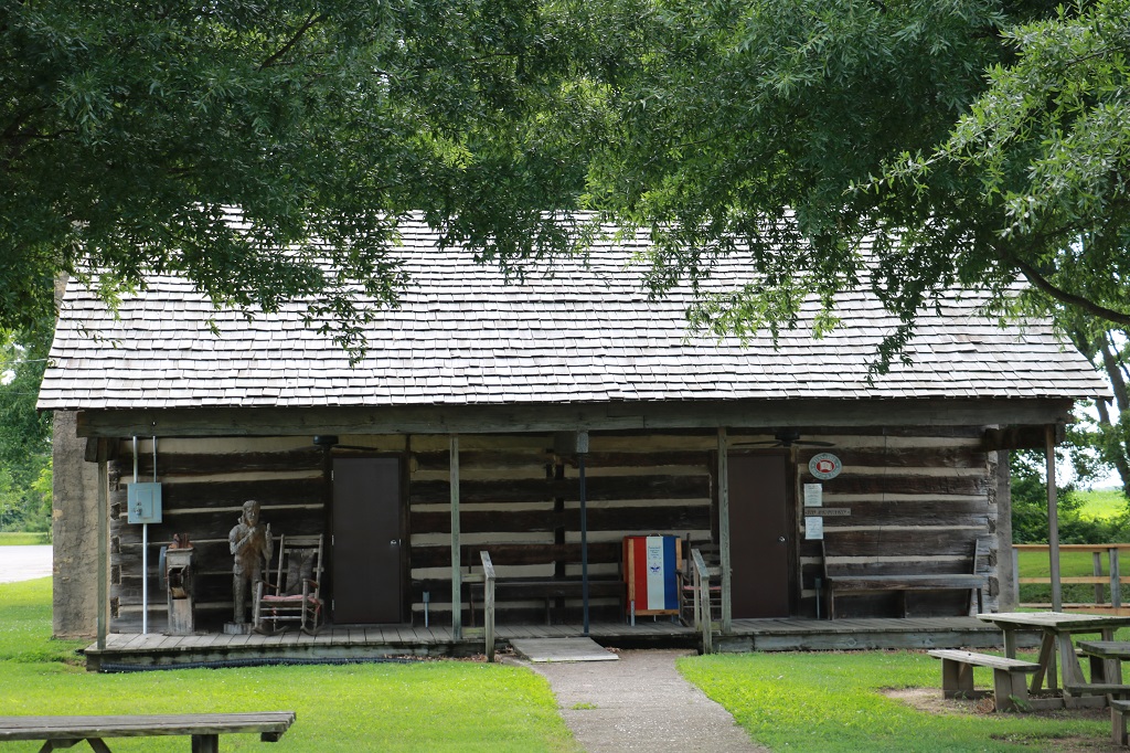
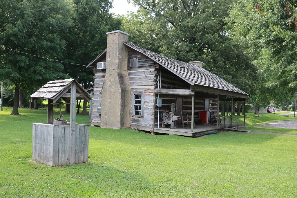
About 20 miles south of Union City is a town called Rutherford, that has Davy Crockett’s ‘Cabin’. It was about 4:30 when we took the turn-off and I expected it to be closed, which it was, but we were able to take a few photos of the outside.
We drove into Union City about 5:30 and found our hotel and dinner. You can now see why the day was split into two parts! It was a full fun day with tons and tons of photos to go through.
We had a jam-packed day today. So much so that I am going to split today into two parts. Part 2 will be posted tomorrow. It is getting late here in Tennessee and I need my beauty sleep – or just any sleep really.
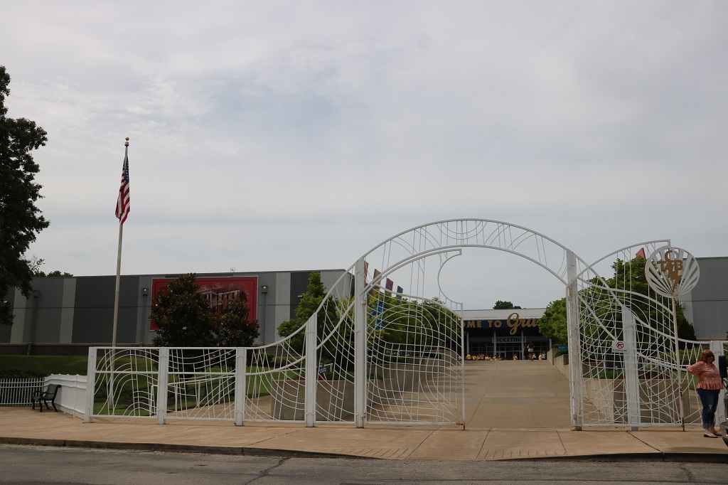
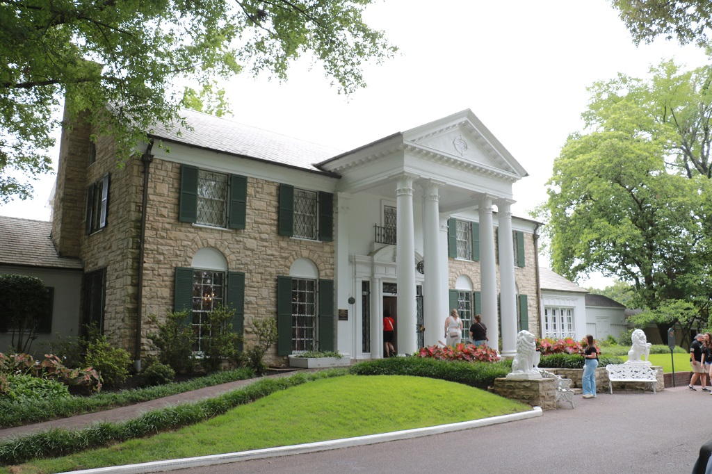
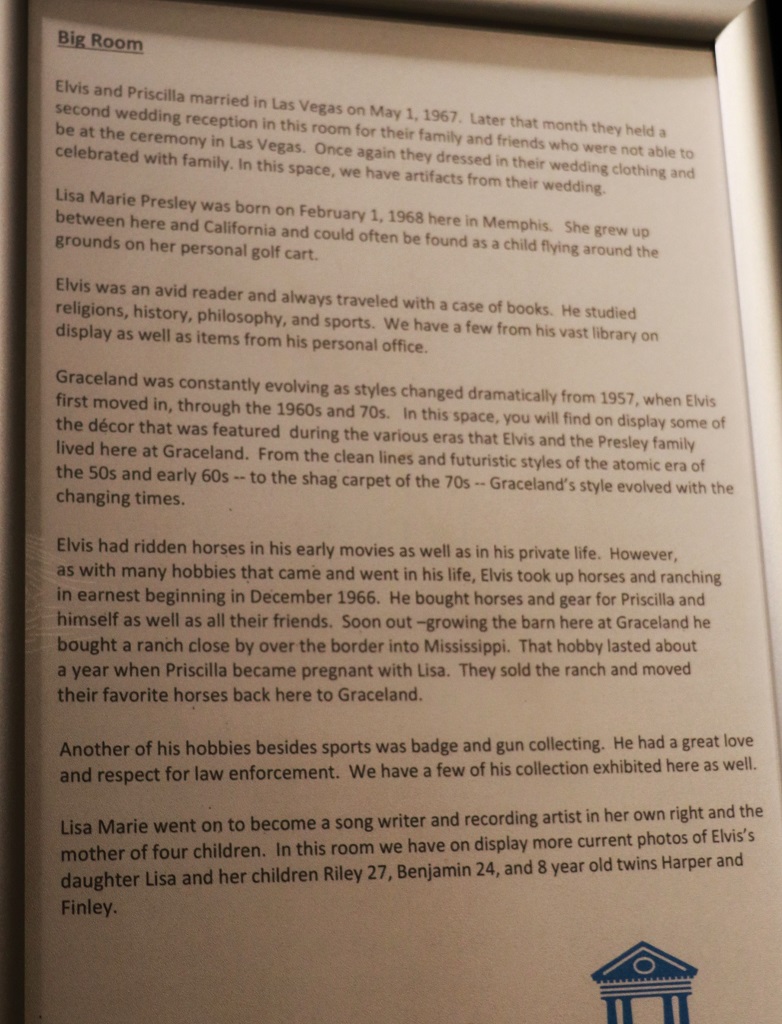
We had tickets for Graceland at 10:45. They time them for every 15 minutes. We woke up early and were at the estate a little before 10. We thought we may have to wait for our allotted time, but we were ushered right in.
They have a 7-minute intro film in one of the two theaters and they just let as many ticketholders as are in the line to fill all the seats in each theater.
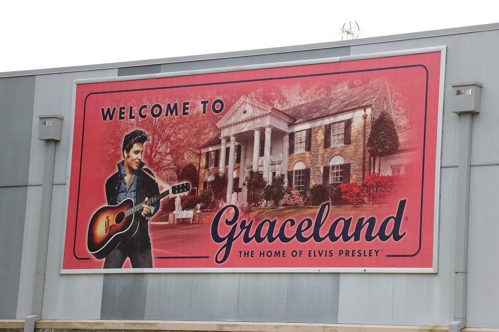
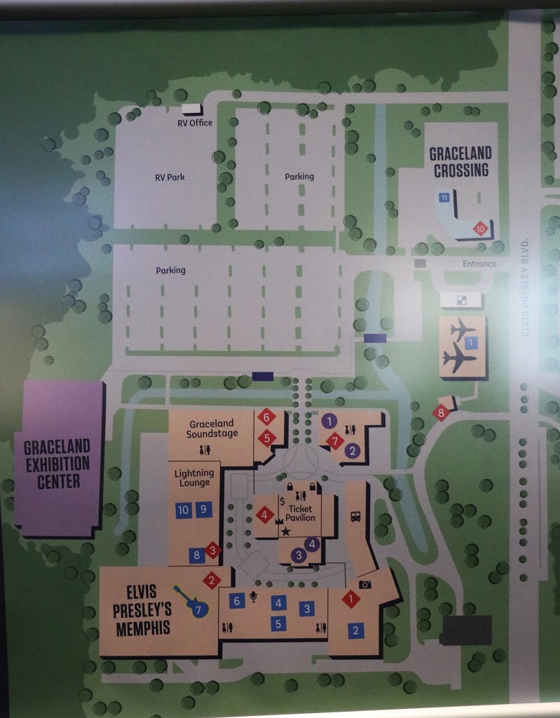
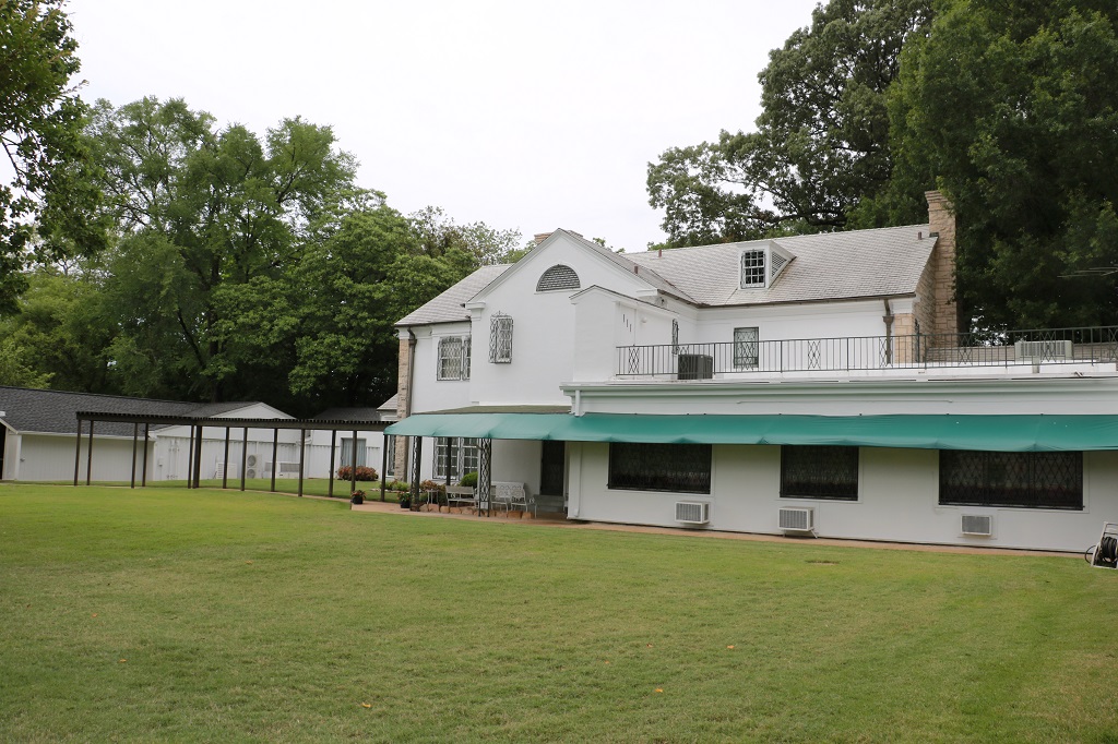
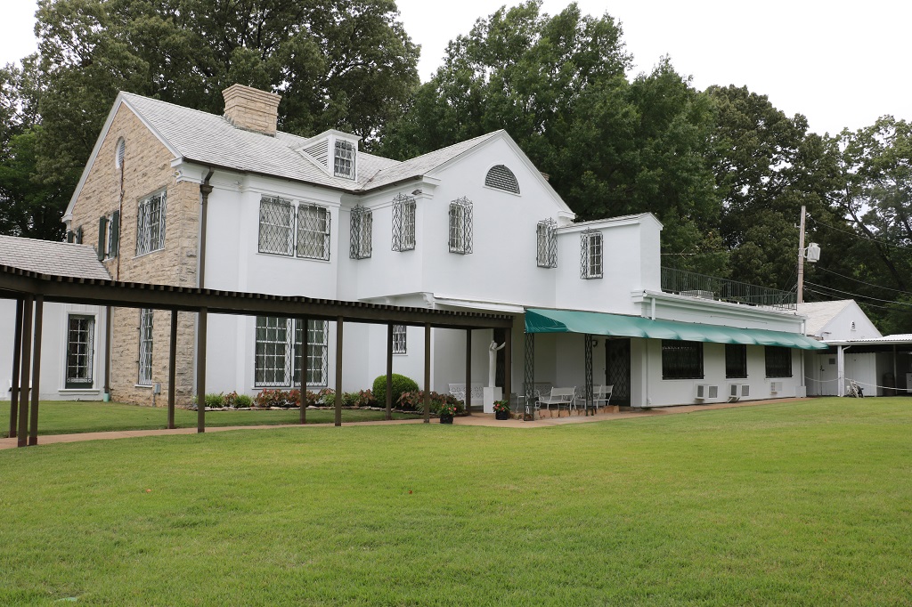
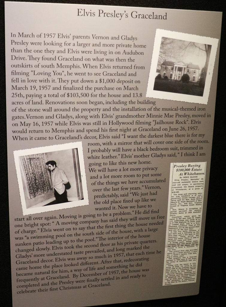
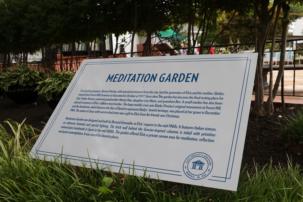
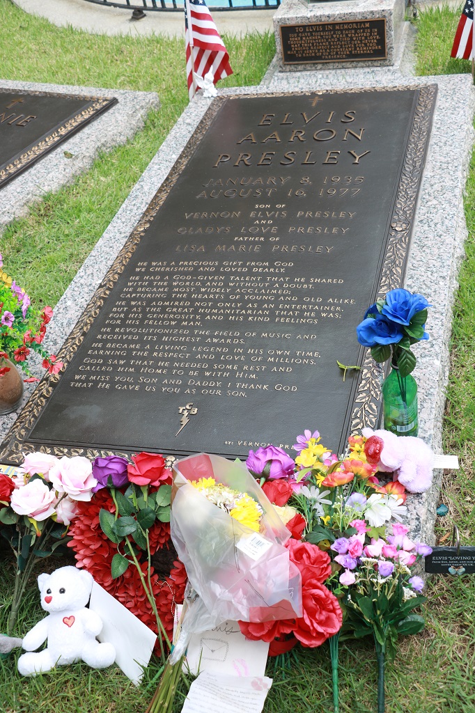
Elvis purchased 13.8 acres of what was a larger property on the outskirts of Memphis called Graceland Farm. The first thing he did was install a rock fence around it and add the famous music gates. The property is now a huge complex with restaurants, theaters, the car display, costume display, etc.
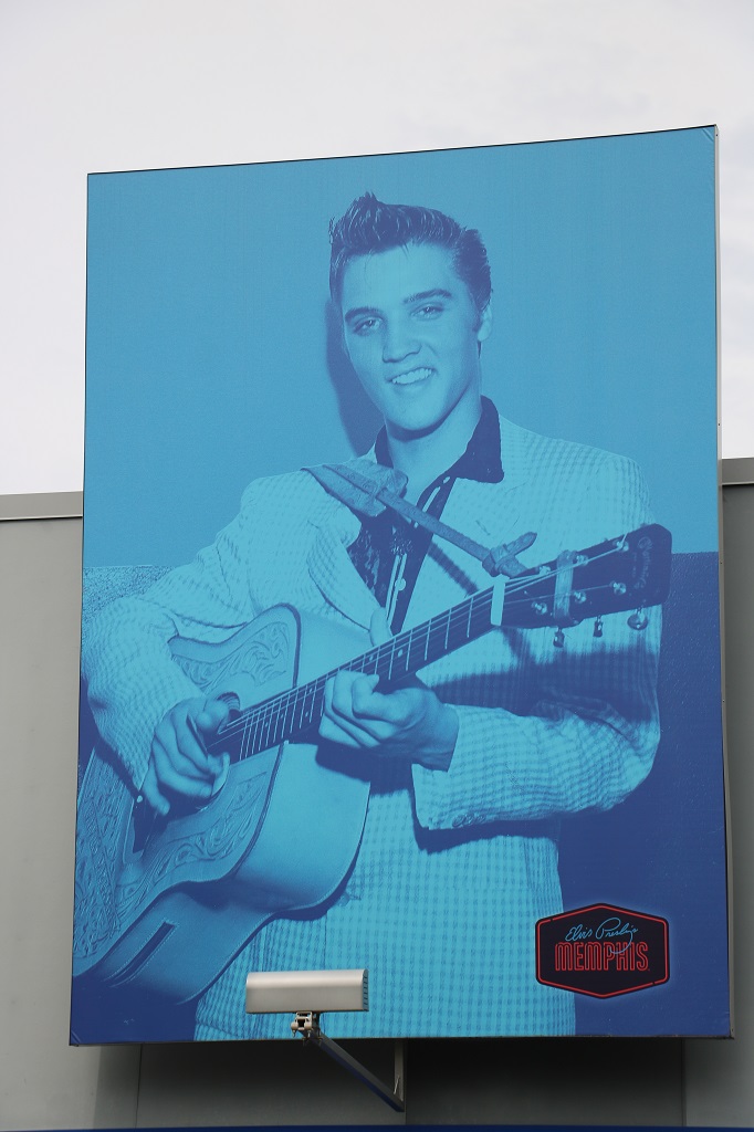
Our tickets gave us access to the complex – stores, restaurants, etc, the Graceland mansion and Elvis’s airplanes. By the time the cost was converted to Canadian $ we paid $125.00 each. If we wanted to see Elvis’ Memphis, or the garage with his cars, or any of the other venues they had their own tickets. $86.00 US to see the cars. If you wanted to spend a lot of money you could spend the entire day there. I really just wanted to see the mansion. It was an expensive house tour for sure (we skipped the planes) but we grew up listening to Elvis music and watching Elvis movies – of which he starred in 41 – so it was on my ‘must see’ list.
The mansion is across the road from the entertainment complex and they have shuttles that hold 30-35 people each and run back and forth all day in 15 minute intervals. So every 15 minutes another 35 or so people enter the house.
We only toured the main floor of the main house. Not the wings or the upstairs where the bedrooms are. That was Elvis’s space and it is kept private out of respect. If any family comes to Memphis they stay in the upstairs bedrooms.
There is no big fancy gardens between the road and the house.
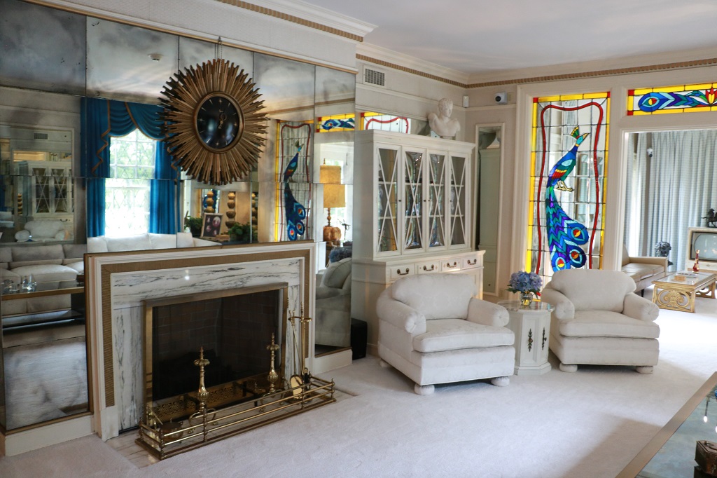
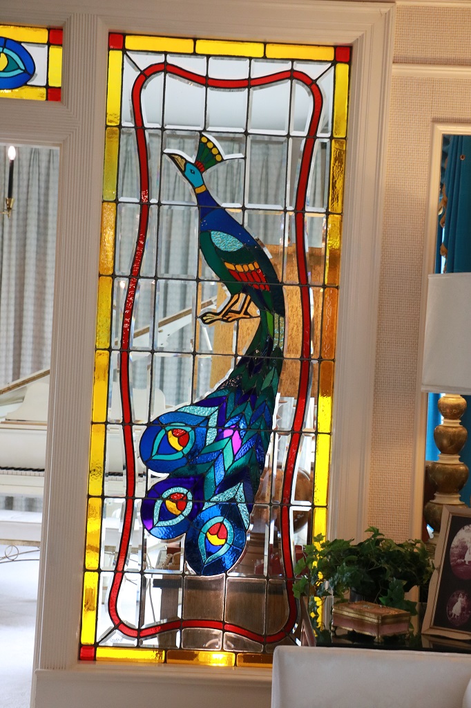
There were information signs for every room and guests also had an audio guide that told most of the same information about each one. They are all quite detailed so lots of print.
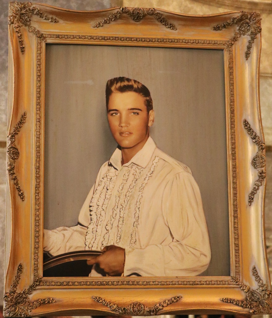
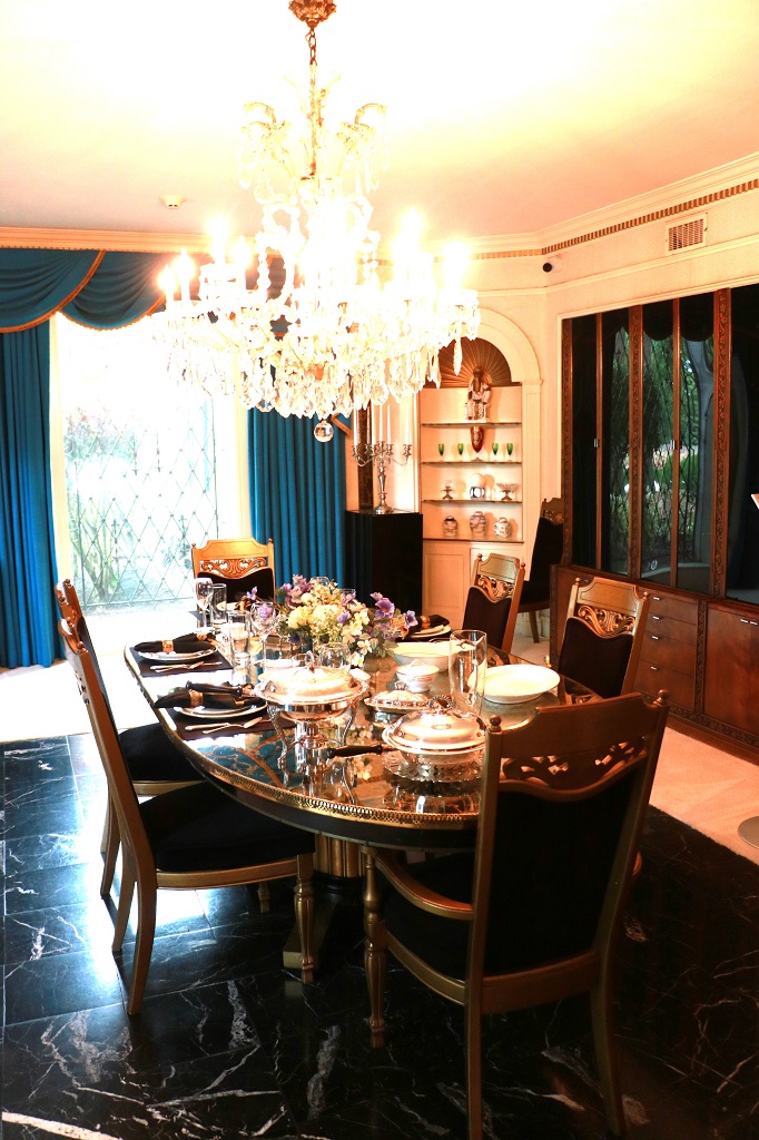
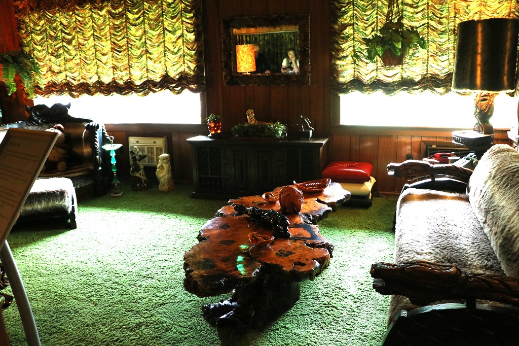
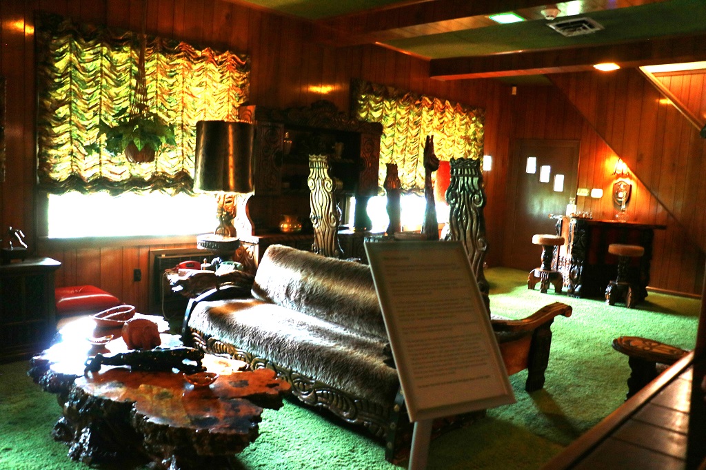
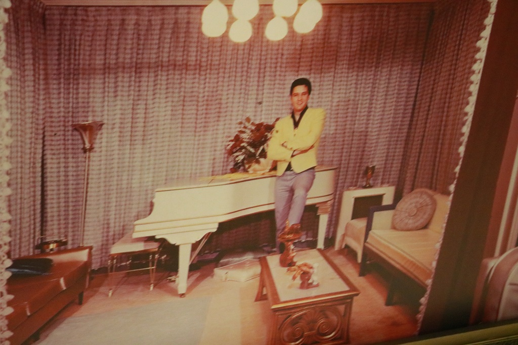
There were four different stairwells you could take from various rooms to access the upstairs. This one is in the main hall. The living room is on the right and the dining room is on the left. The mansion was not huge. There were five bedrooms – four upstairs and one on the main floor and none of the rooms were really big.
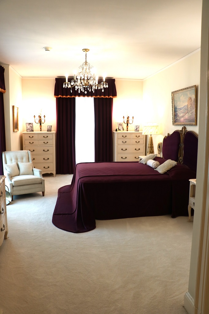
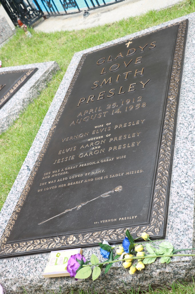
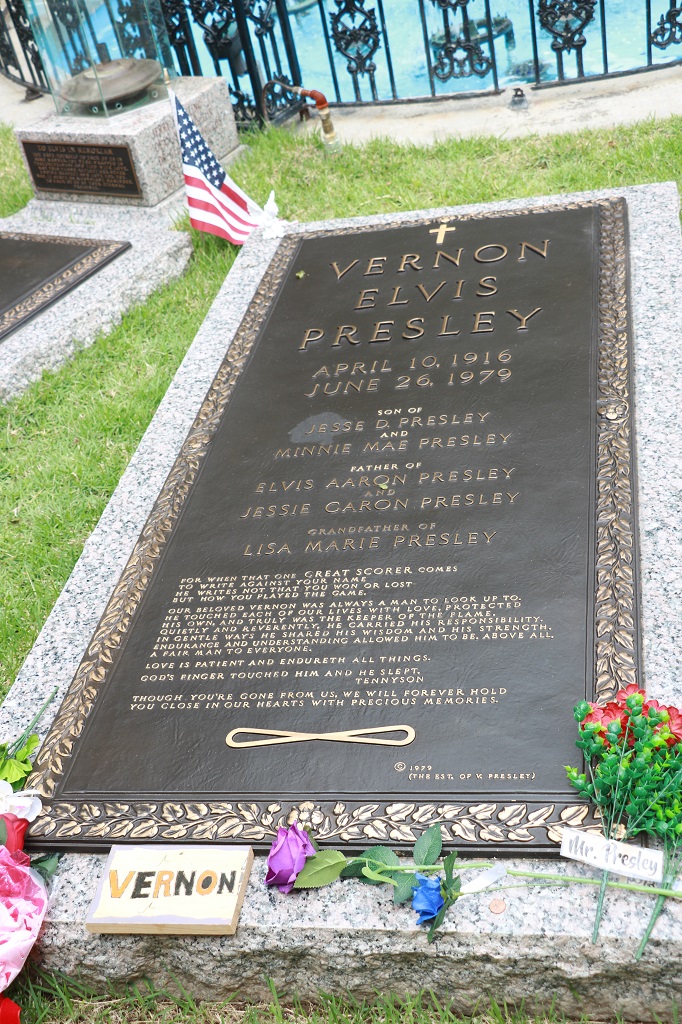
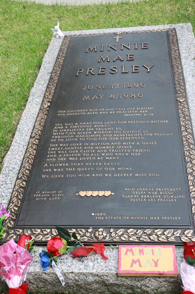
This was Grandma Minnie Mae’s room. She had the bedroom on the main floor. Elvis’ parents Vernon and Gladys also lived in the house. I suspect in the east wing.
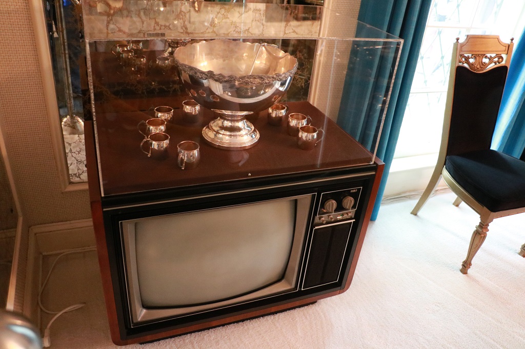
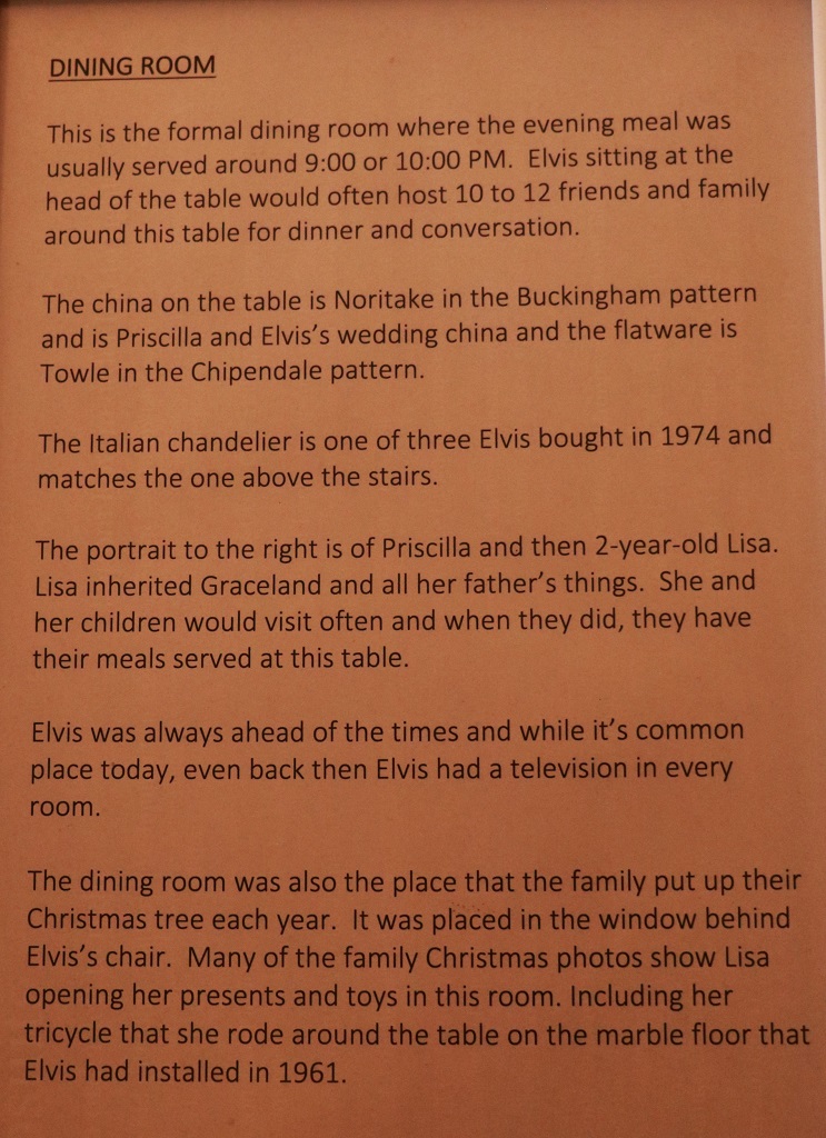
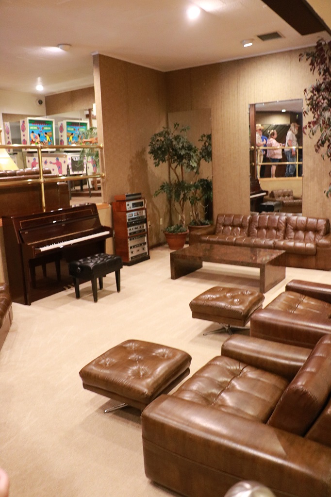
There are 14 televisions in the house. At least one in every room. This one is in the dining room.
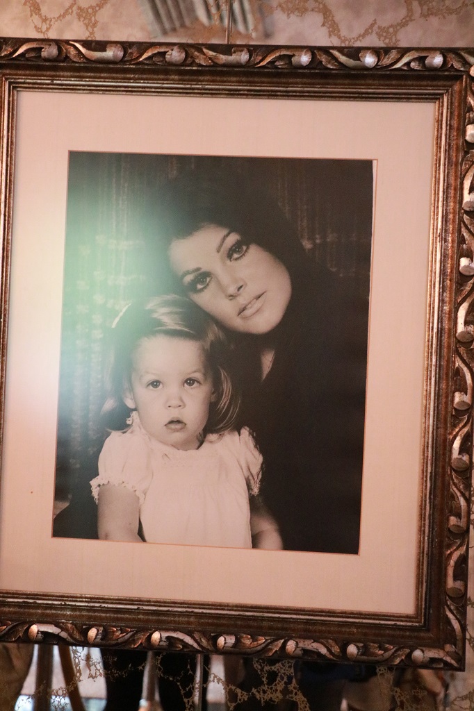
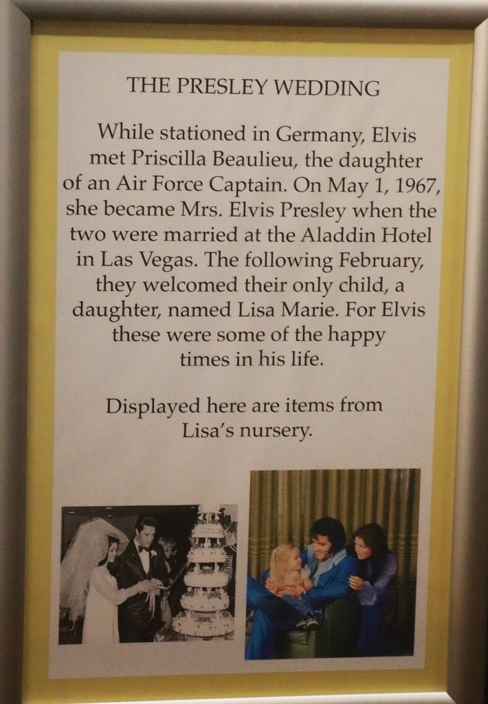
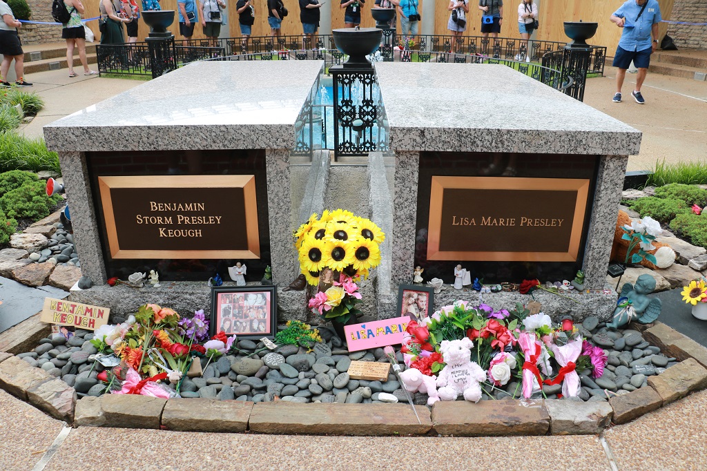
Priscilla and Lisa-Marie
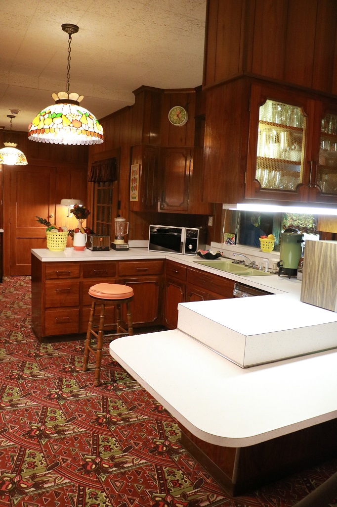
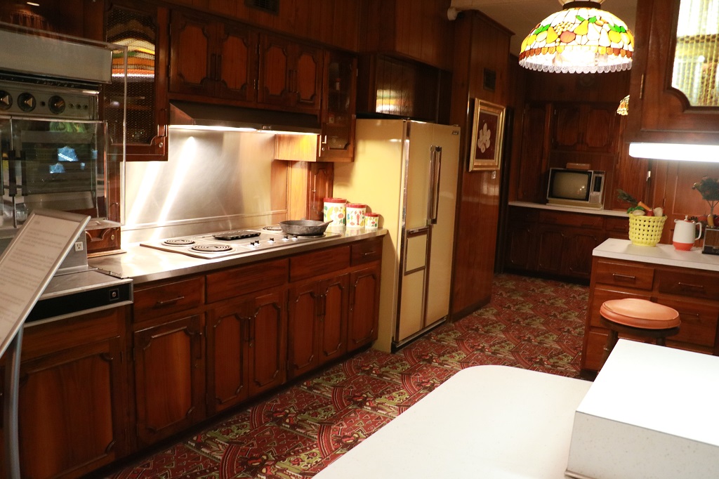
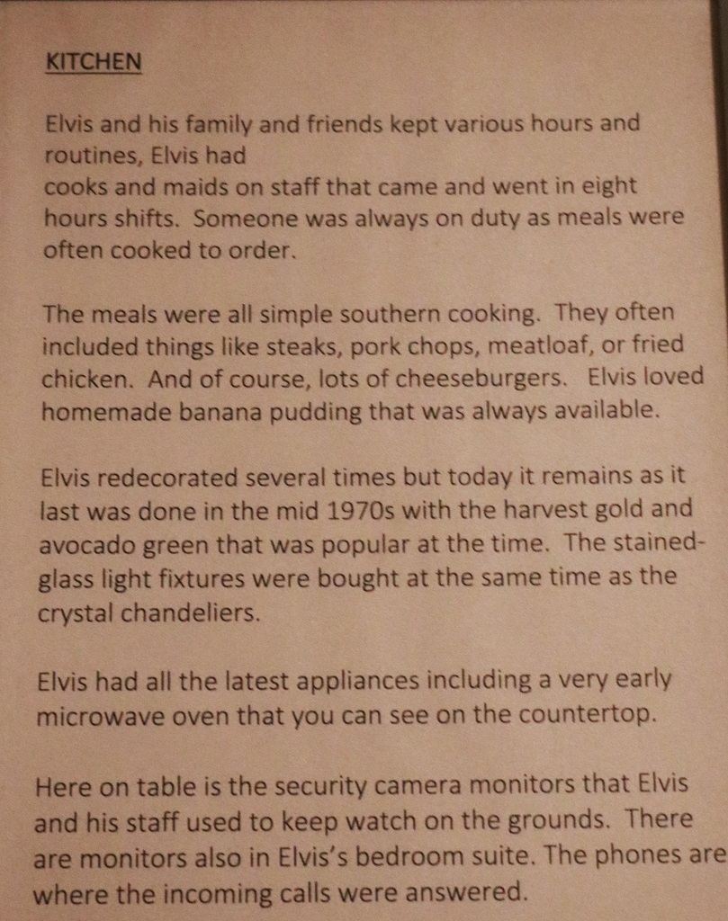
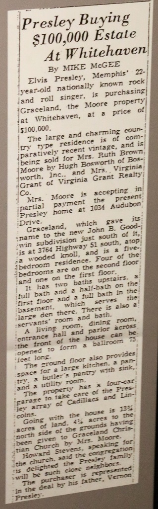
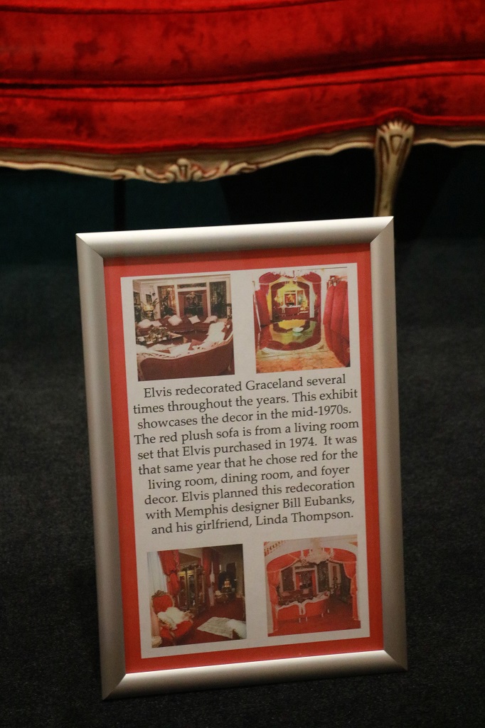
Elvis bought Graceland in 1957 when he was 22-years old. He paid $103,000 for it and spent $500,000 remodeling and renovating. The house was redecorated a number of times over the years as styles and his tastes changed.
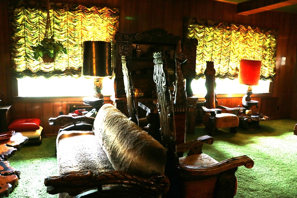
The ‘Jungle Room” was a sitting room just past the kitchen. Unfortunately my photo of the description is out of focus and unreadable. All I remember is that it was used a lot when Elvis entertained, which he did often. It was also quite a dark room so neither my photos nor John’s are very good.
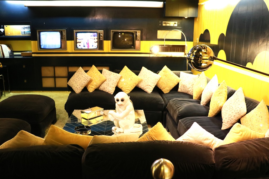
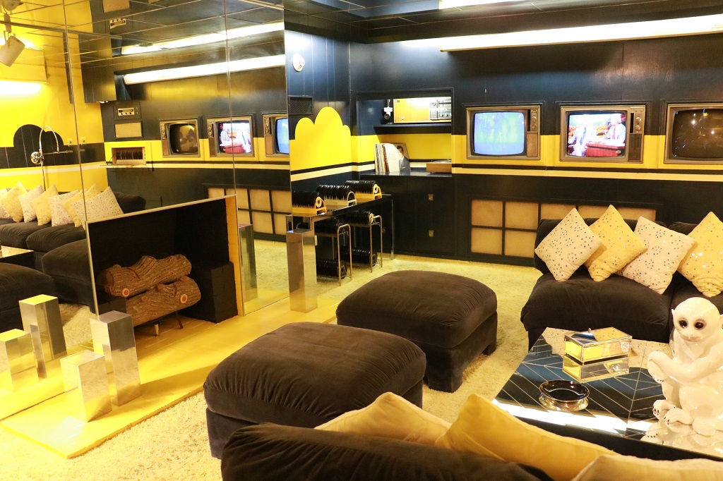
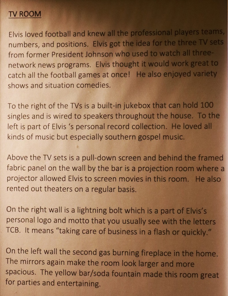
In the basement was the TV room
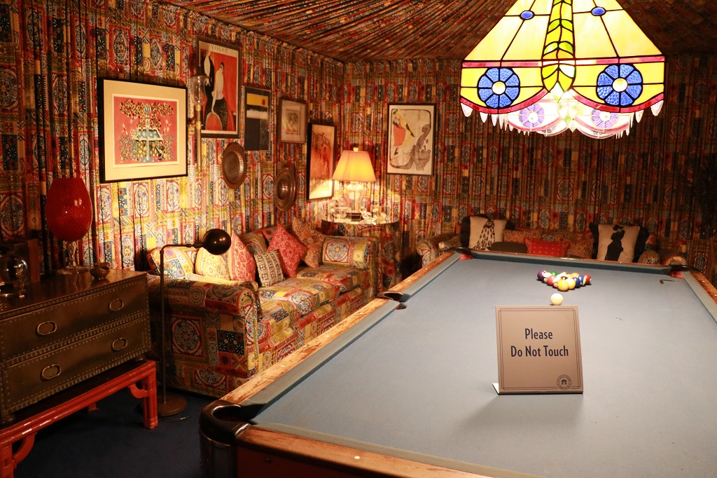
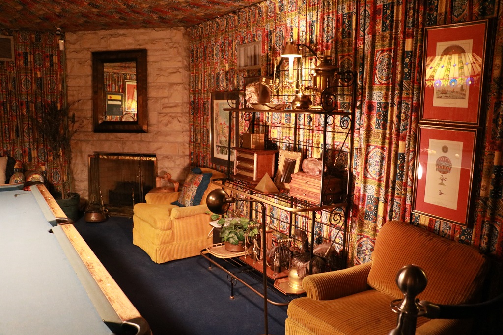
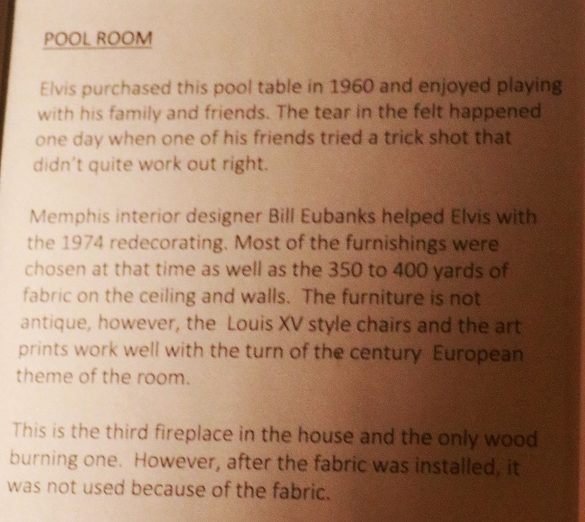
And the pool room.
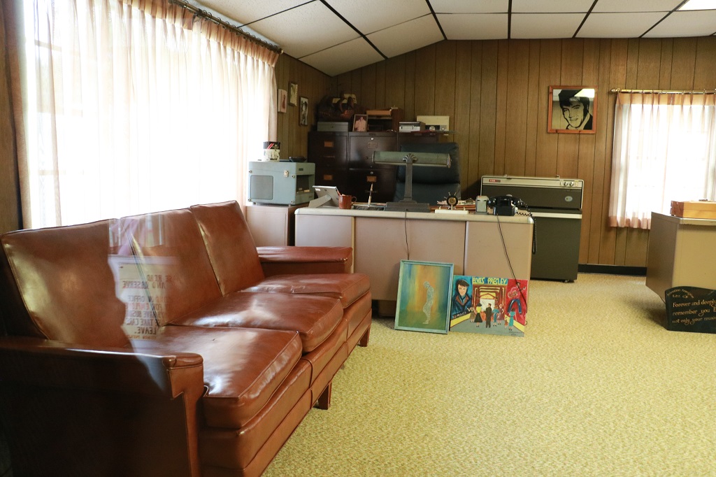
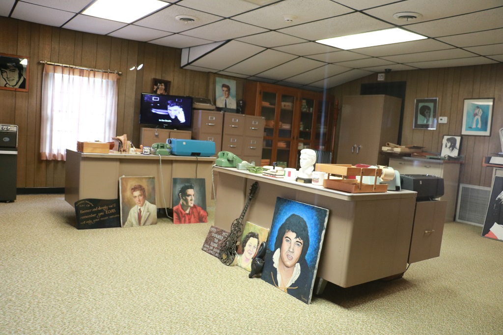
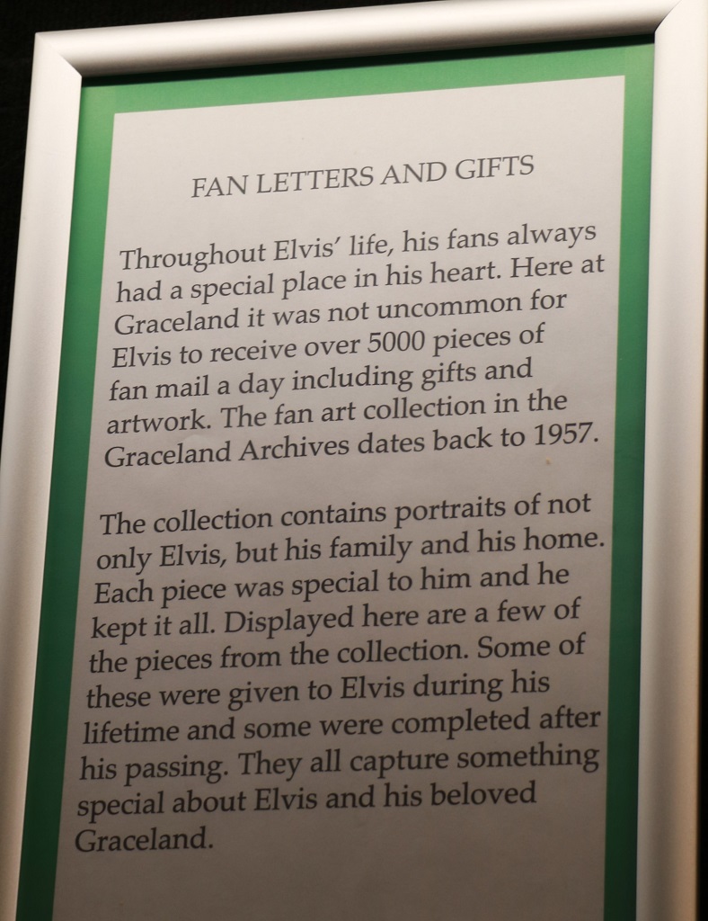
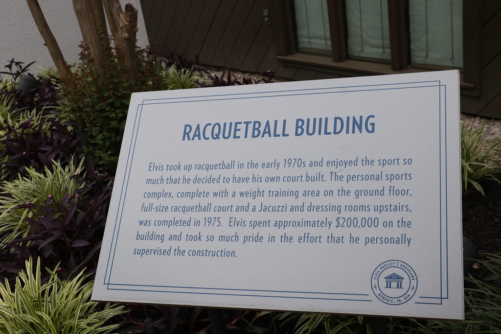
The tour took us out to the back yard and Elvis’ dad’s office. Elvis had his own office in the main house on the upper floor. His father and two secretaries worked in the backyard office. They answered incoming phone calls, paid bills, made donations (Elvis had 50 charities in Memphis that he supported annually plus other worthy causes. There was a cheque he wrote to Bob Hope’s charity for $5,000 on the wall in the Trophy room), and handled upwards of 5,000 pieces of mail each day at the height of Elvis’ career.
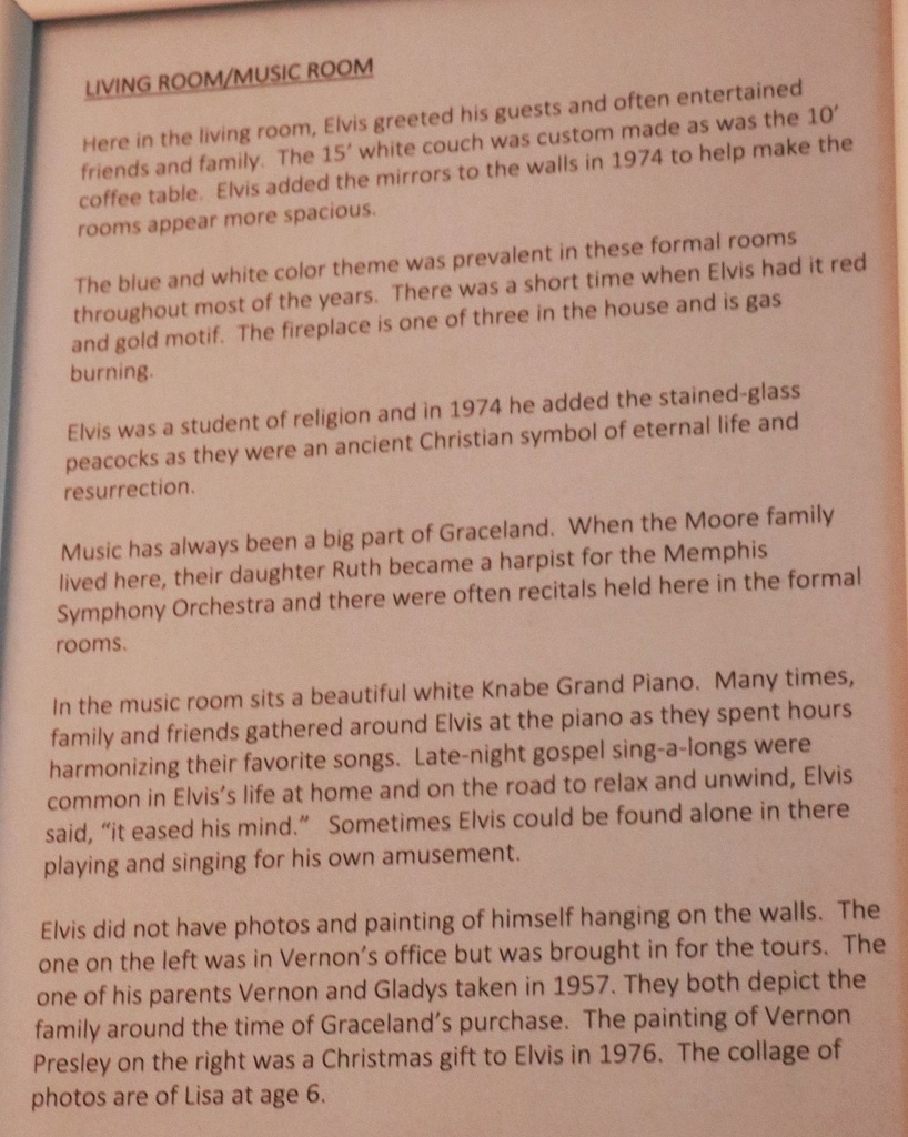
Elvis did not have photos and paintings of himself in the house or other rooms. Many of them are gifts from fans and are on display for the tours.
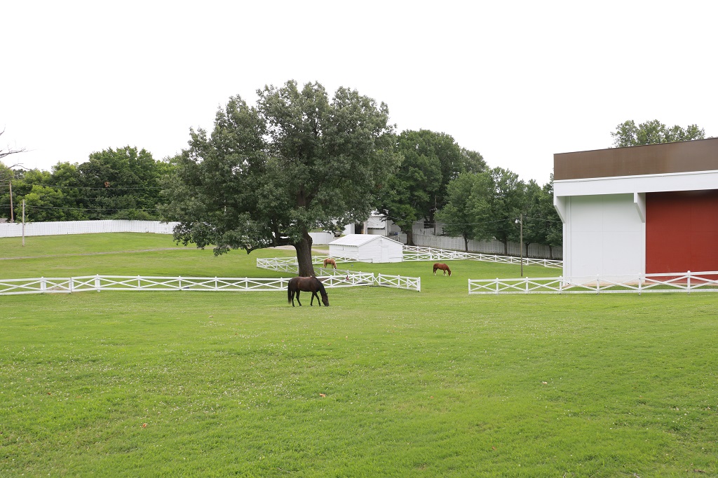
Elvis loved to ride horses and he kept several of them on the property. The building on the right is the stable. He had horses for himself, Priscilla and others that could be ridden by friends. His favourite horse was a palomino and they keep horses of the same breeds and colors as he owned.
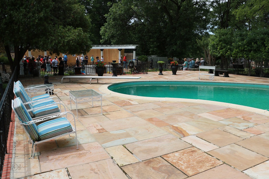
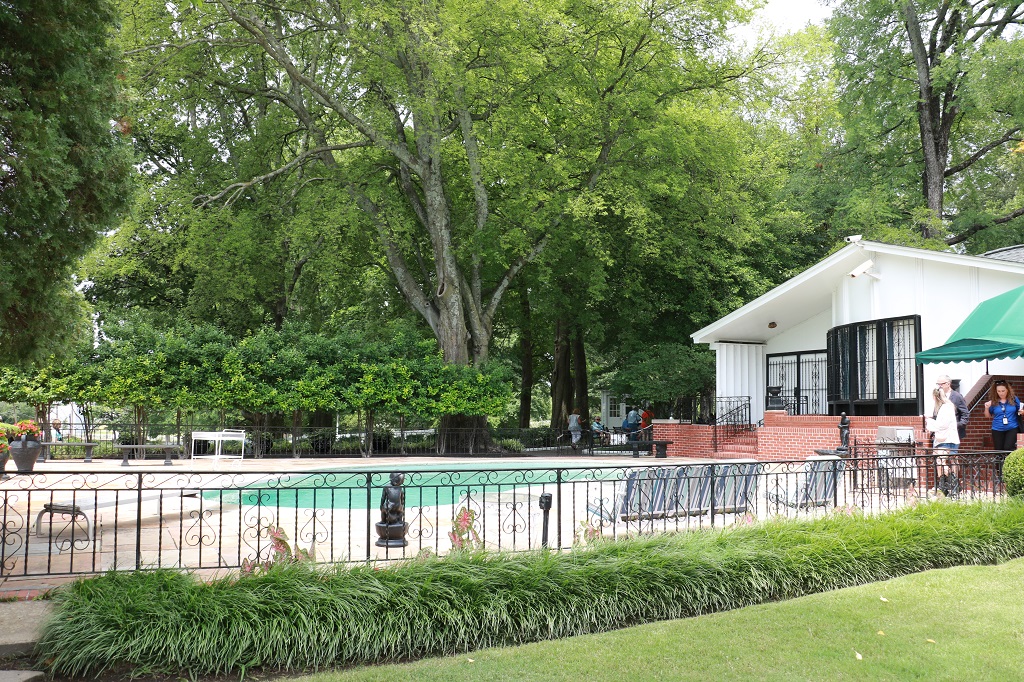
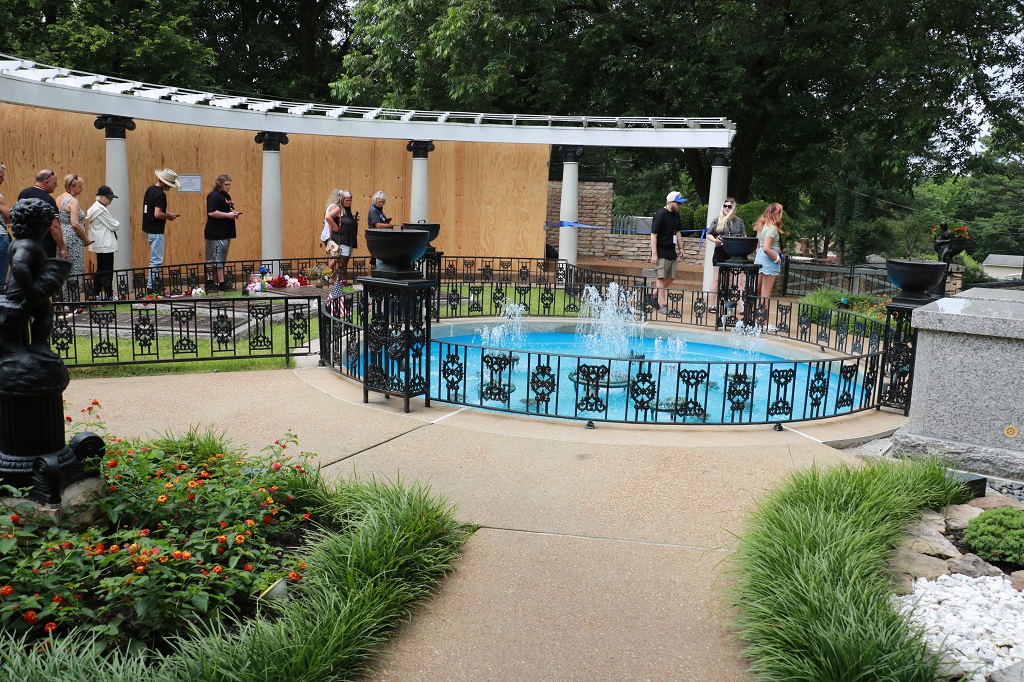
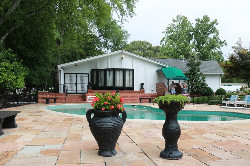
The swimming pool was one of the first things added after Elvis bought Graceland.
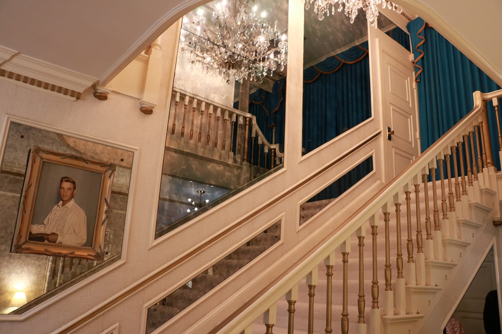
There were lots of mirrors and mirrored walls in the mansion. Elvis installed them to make the rooms look more spacious.
We caught the shuttle back to the complex and headed for the car. When we arrived there were lots of empty spots in the main parking lot near the gates but by the time we left 2+ hours later it was almost full and people were still arriving. You had to pay for parking as well.
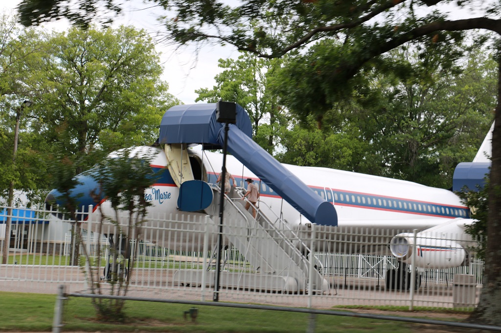
As we left I snapped a couple of quick pics of the planes. Notice the lightning bolt with TCB on the tail. This was Elvis’ logo – Taking Care of Business in a flash or quick.
I do not like busy multi-lane freeways so we did not drive north through Memphis. Southaven is in Mississippi, right on the Tennessee border. As a matter of fact it is vitually a suburb of Memphis and our hotel was only a 15 minute drive to Graceland. We headed back on the highway we came up and then went east along a quiet road before heading north to Union City, which is about an hour or so drive south of the Tennessee/Kentucky border – about 2 hours north if you take the interstate. We did not. And we did not arrive in Union City until 5:30. What we did not see because of the proximity of the two communities along the border was any kind of Welcome to Tennessee sign.
But Graceland was not all we saw today. Stay tuned for June 8 Part 2.
We were up early (for us) and on the road by 9 am. It was another driving day, so not a lot of sightseeing. We even only found one geocache.
Natchez is in the lower SW corner of Mississippi, right on the Mississippi River across from Louisiana. Southhaven is on the Mississippi/Tennessee border in a northeastern line from Natchez – a distance of 298 miles (479 km). We pulled into the hotel at 4:15.
We really liked Natchez. The setting along the river was lovely and they have spectacular sunsets every night. There was not a ton of traffic on the roads so John found it quite easy to get around. Since it is an old city, built long before automobiles that required two lanes, plus parkng spots, there were one-way streets everywhere that were mostly clearly marked. It would have been nice to be able to see some of the mansions, even from the outside, but since they were all ‘estates’ there are long driveways through forested land to get to the house and the ticket booth is at the gate. We did not need to pay $30-$40 to go take a photo of the outside of a big house.
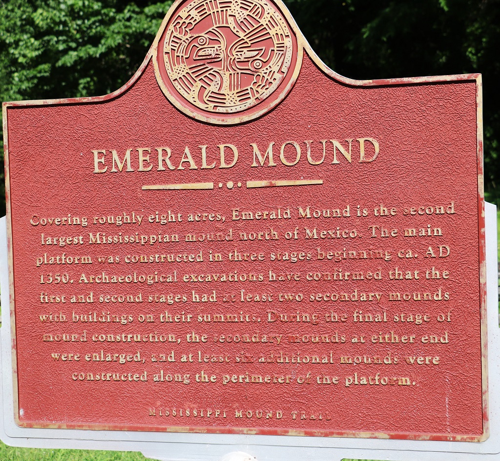
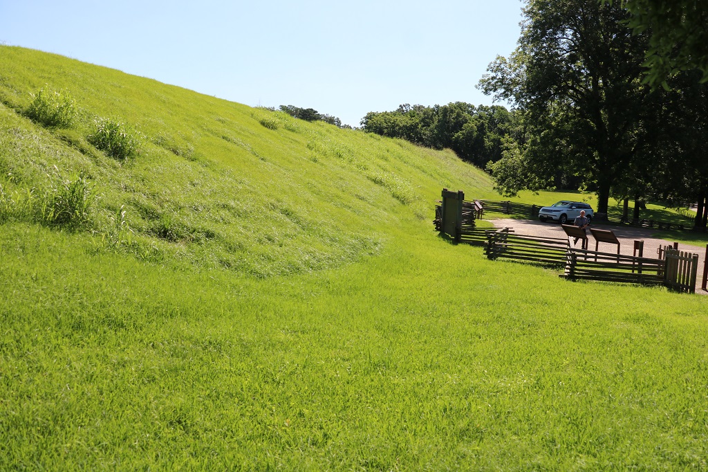
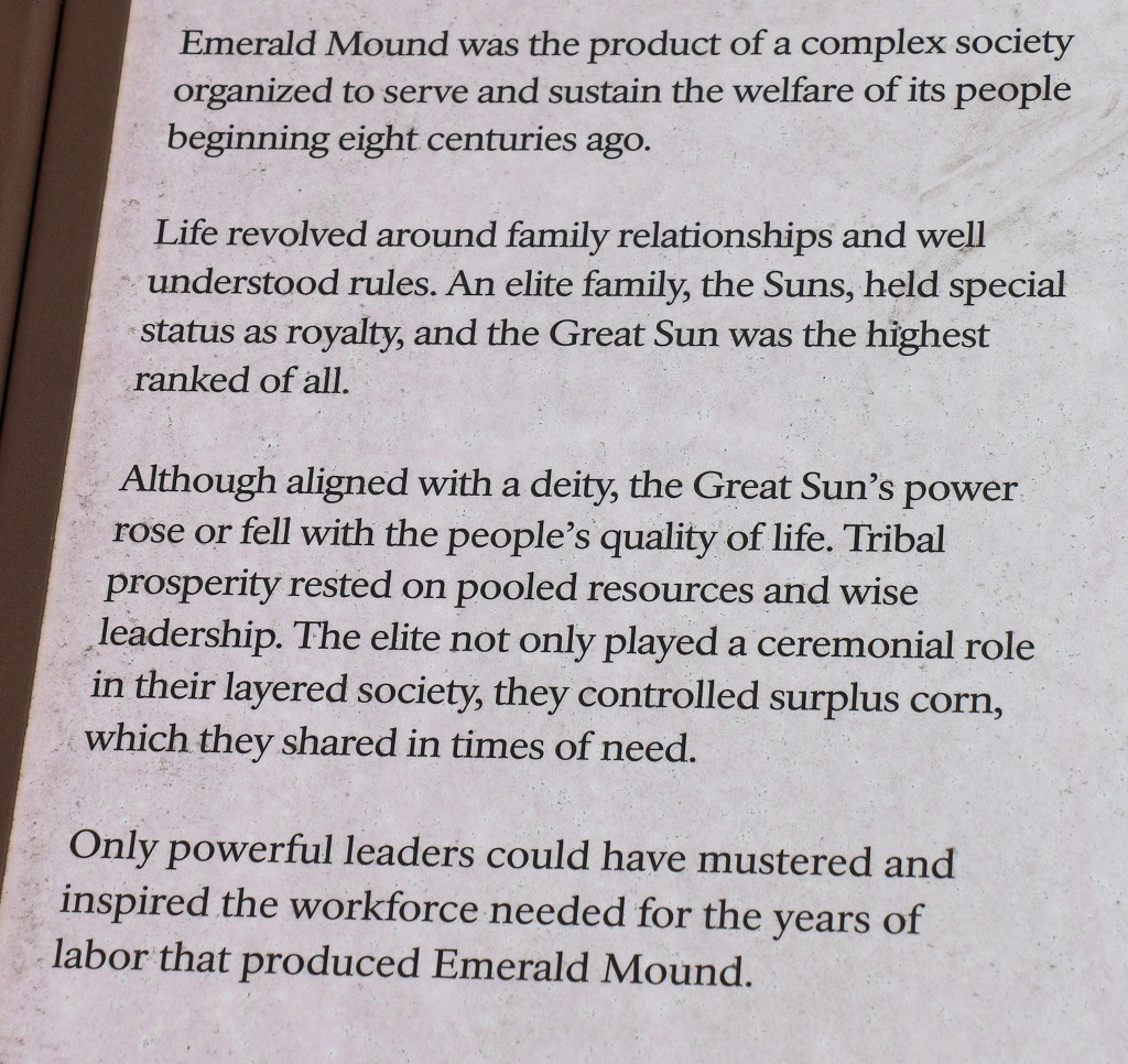
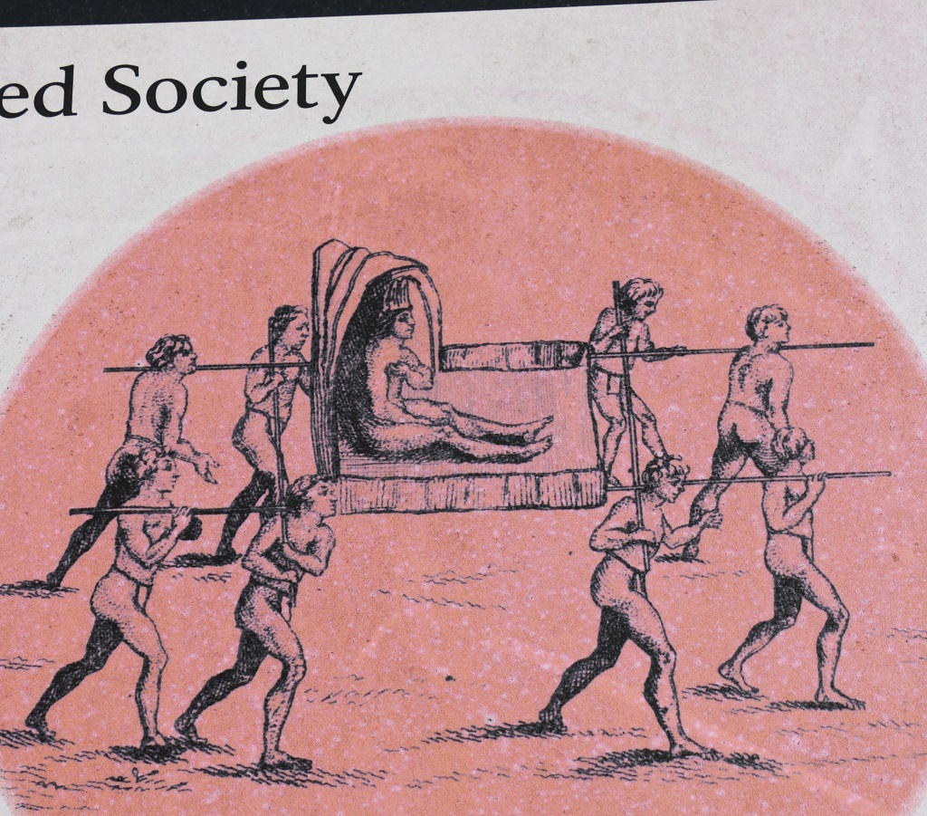
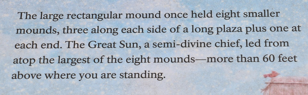
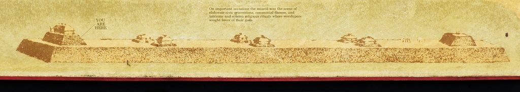
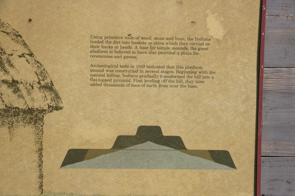
Not far out of Natchez is Emerald Mound, another Native American ceremonial and sacred site. There are quite a few of them in the SE US. Emerald Mound covers 8 acres. There are others that are over 125-150 acres.
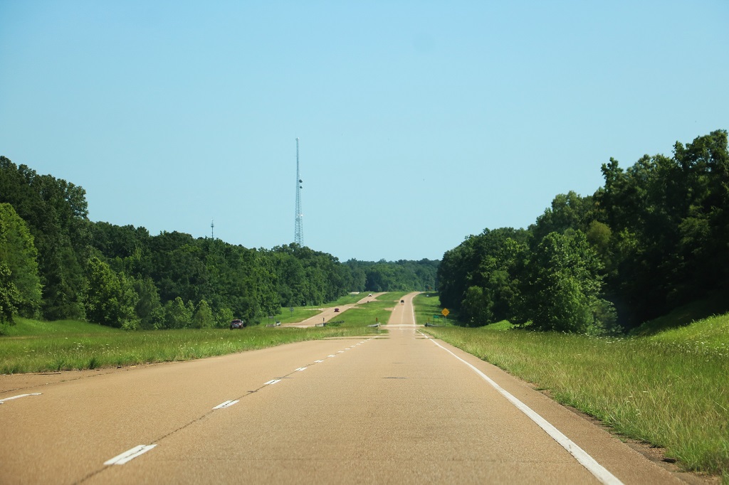
Highway 61 is a divided two-lane highway that goes all the way from Natchez to Southaven and most of the time it was as empty as this.
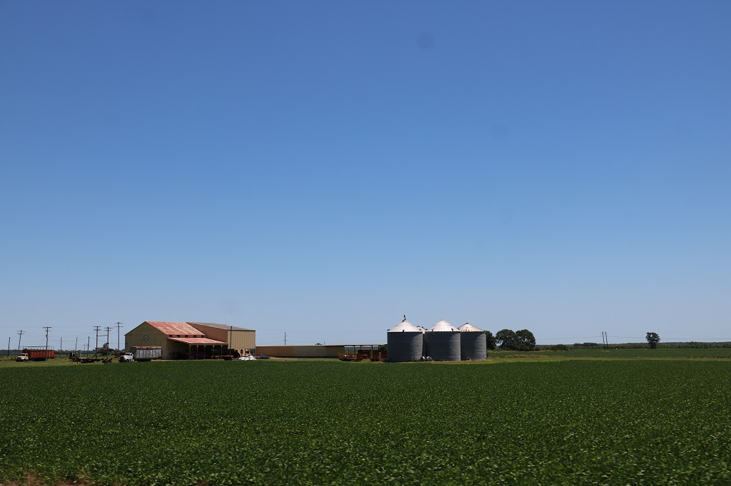
As we drove north we entered the Mississippi delta farmlands. So we were back to flat land, but this time with crops – we identified rice and soybean. Also a coarse-looking corn-type plant – perhaps just a forage corn.
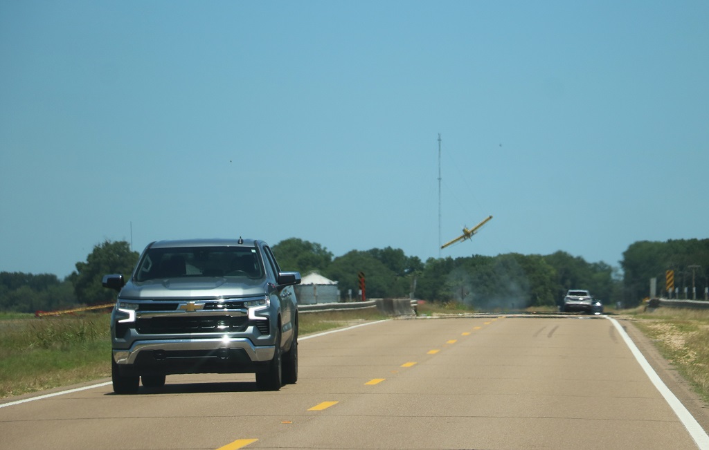
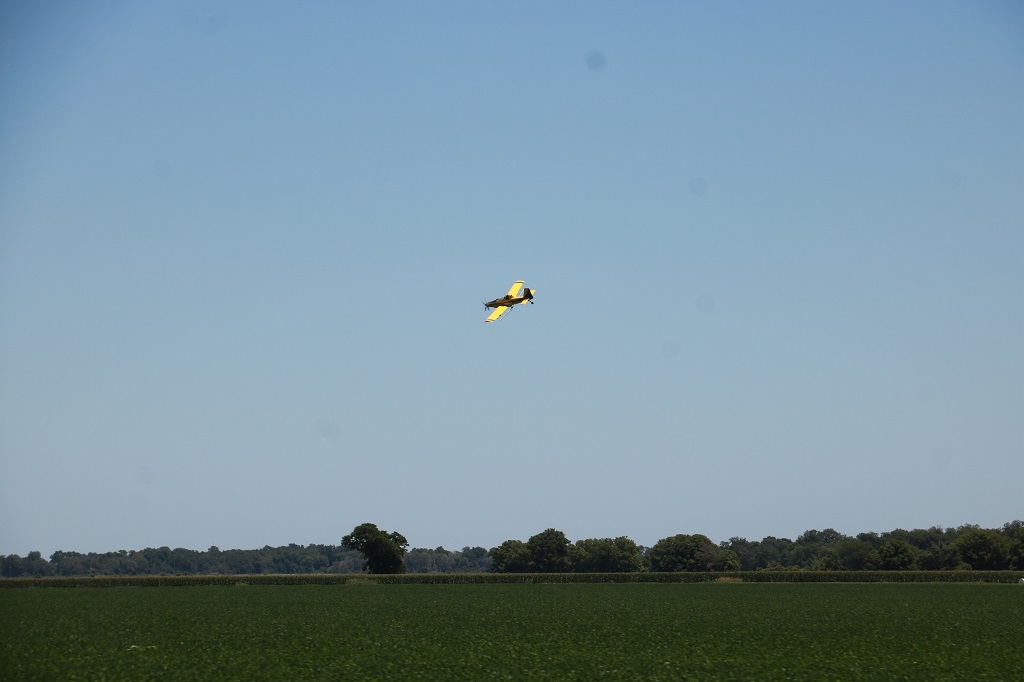
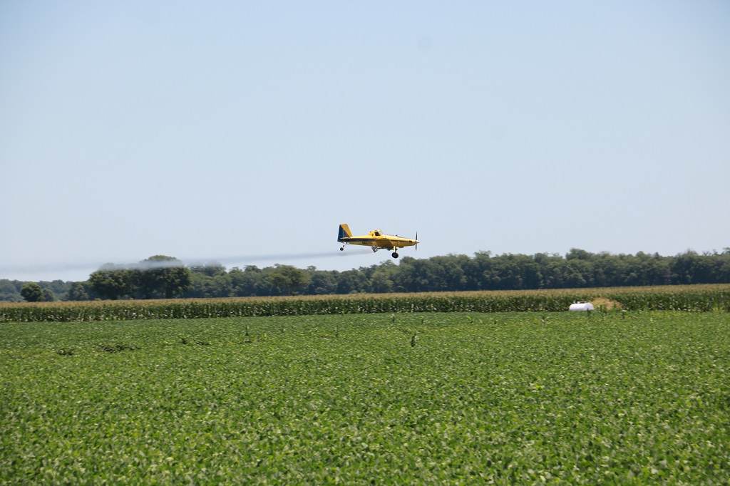
A fun thing we saw for several miles were crop dusting airplanes. They fly like birds, swooping over the fields, banking quickly at the end of a run after they drop their spray, then circling back for another run. Great flying to watch.
Tomorrow we go to Graceland – a most expensive place to visit, but as a product of the 50s and 60s I am going to go! Photos are allowed inside and out so there should be a bunch of pics in tomorrows blog.
We have plans to visit a Thoroughbred stable in Kentucky – Claiborne farms where Triple-crown winner Secretariat was born and raised and raced from – and if we manage our trip as we hope I also plan to visit Gettysburg. But those are the only ‘tourist’ things we have on the agenda. Most of the balance of our time until we get to Kill Devil Hill on the Outer Banks of North Carolina on June 19, in time for the June 21 wedding we have been invited to, will be spent driving into as my different states as we can wiggle and finding at least one geocache. If I discover some interesting places or historic sights to see along the way that will fit in with the number of days we have left we will go see them. As of now on our tentative agenda we have 2 free days that we can use to adjust distances or routes. If we are able to go where we hope in the time we have we will be visiting 17 different states on this journey. So far we have: North Carolina, South Carolina, Georgia, Florida, Alabama, Mississippi and, as of tomorrow, Tennessee. That makes 7. 10 more to go. Hopefully.
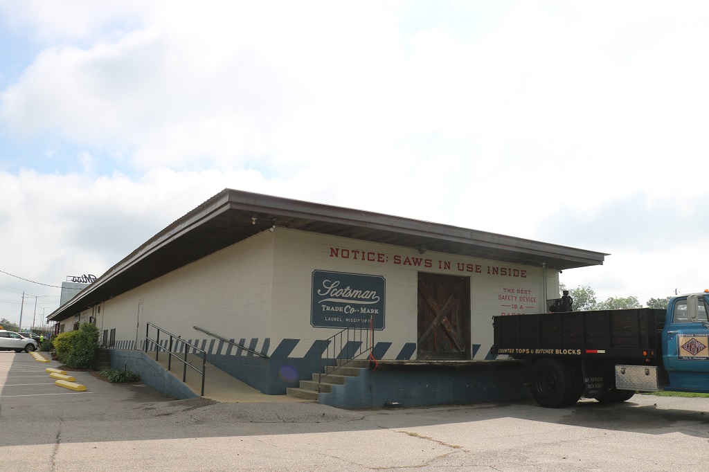
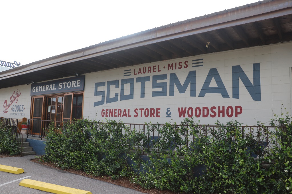
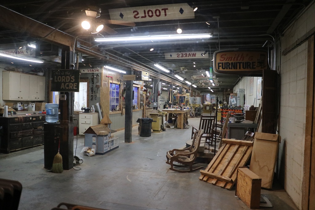
Our first stop of the day in Laurel was to go to The Scotsman wood shop and gnereral store. The segments of the Hometown show where Ben is making special woodwork pieces for the house being renovated all take place here. Inside the store is a large window where people can watch the TV show being filmed in the woodshop. They were due to do some filming at 1 pm today and apparently the store gets very busy during filming days.
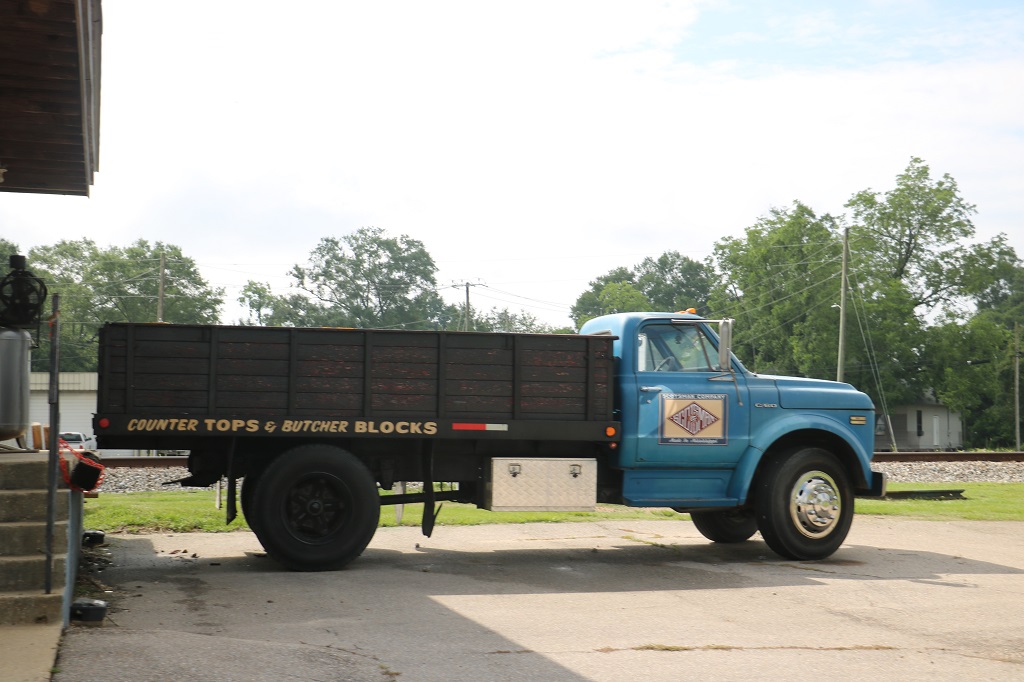
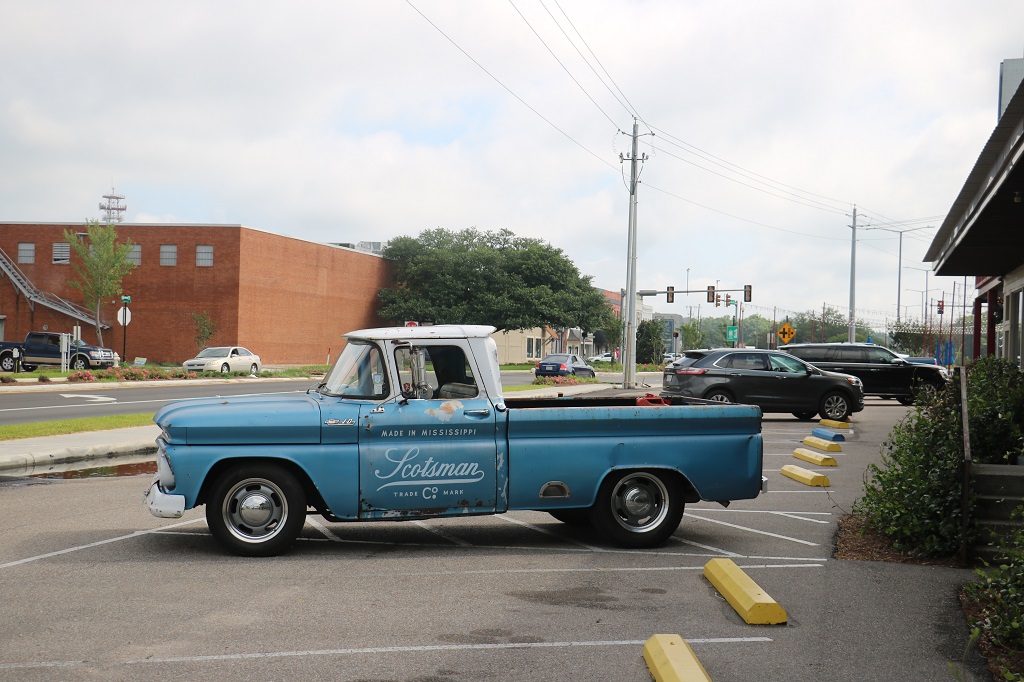
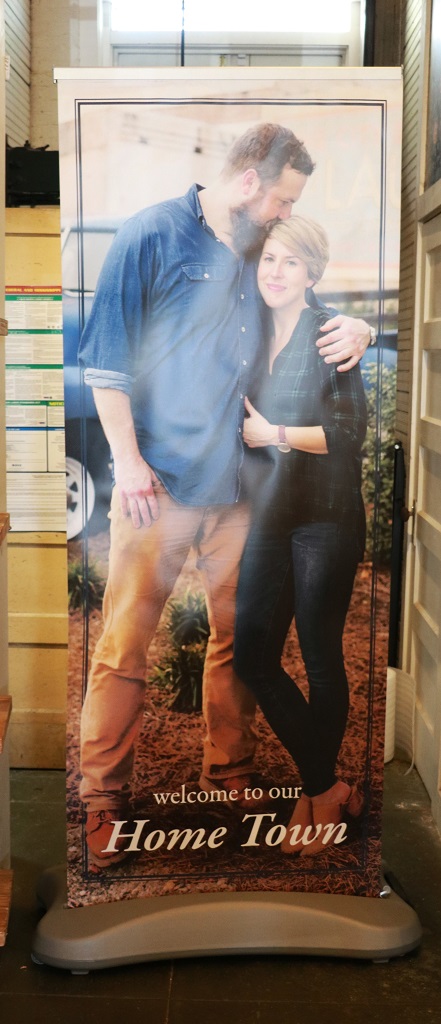
The following images are very familiar to anyone who watches Hometown. We see Ben and his friends Jim and Josh driving around in the big truck to pick up wood for projects or they will be in the Ben’s pickup Clint.
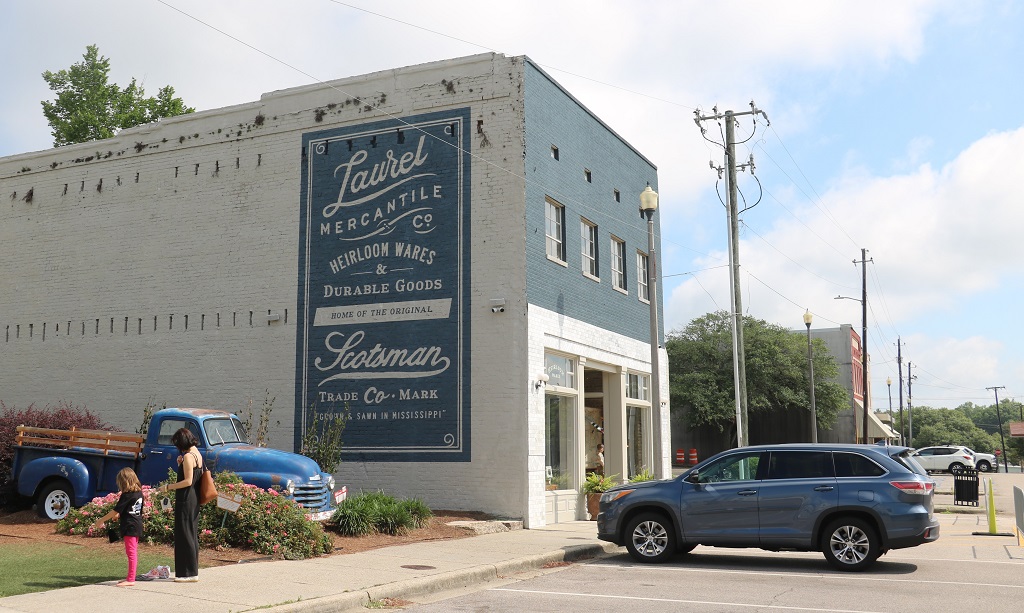
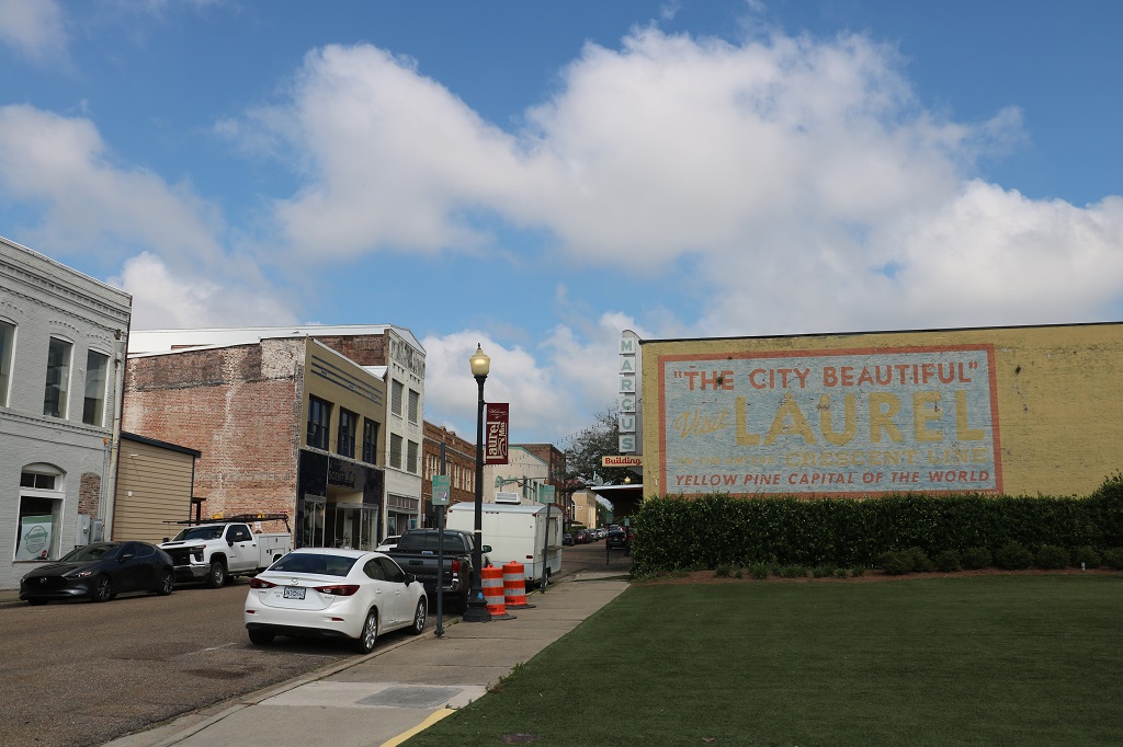
This mural is on the roof of the Scotsman store. With the revitalizing that has been going on in Laurel they have added quite a few nice murals around town.
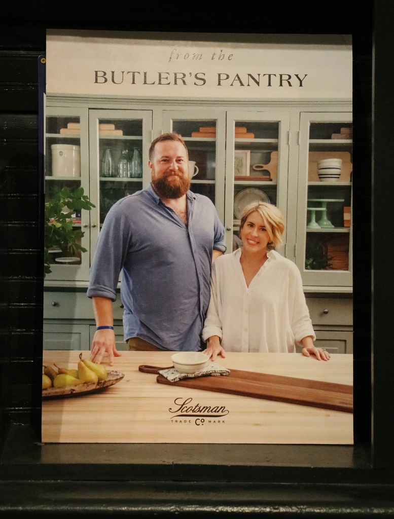
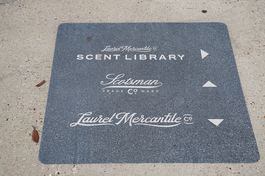
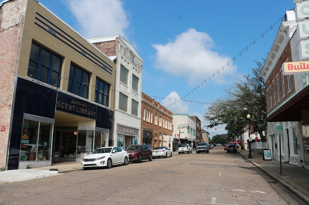
Ben and Erin own three businesses in town – The Scotsman store, the Laurel Mercantile and the Scent Library. Erin sells her watercolour art and has written several books about design or recipes like the one in the photo above. She has also written a children’s book.
We went to the Mercantile but I did not dare go into the Scent Library or my asthma would have been triggered by all the candles, oils, etc.
Marketing and promotion are strong suits of the couple. This was painted on the sidewalk at the crosswalk by the mercantile and the Scent Library was across the street.
The renovation of the exterior and upper floor of this building was on one of their shows.
We left Laurel at 11 and headed west on Highway 84 toward Natchez which is about 2 hours drive away.
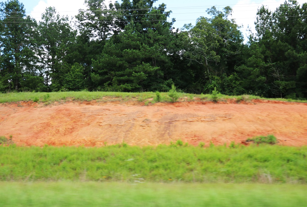
The SE states seem to have very sandy soil. In South Carolina and Georgia it was a lovely deep cream colour. In Alabama and here in Mississippi it is red. Reminded us of Prince Edward Island’s red soil.
We arrived in Natchez about 2 o’clock. We had stopped at an old church to find a geocache on the way and had our lunch before moving on.
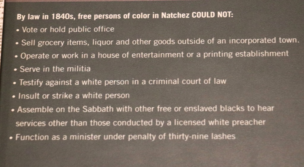
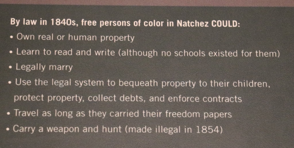
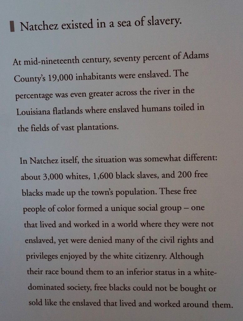
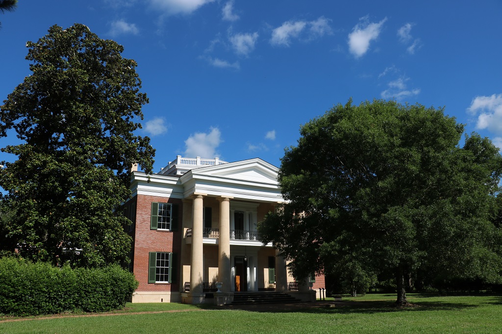
We went to the Visitor’s center to get some information about the Antebellum Mansions that Natchez is famous for. I learned that the word antebellum comes from the Latin ‘ante’ meaning ‘before’ and ‘bellum’ meaning ‘war’. These beautiful homes were built by wealthy plantation owners, called nabobs. They rivaled each other in building the biggest, grandest homes. There are over 500 antebellum mansions in the Natchzez area and over a dozen are open for tours. Like all of the nation, particularly the south, Natchez suffered during and after the Civil War.
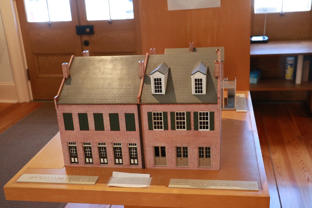
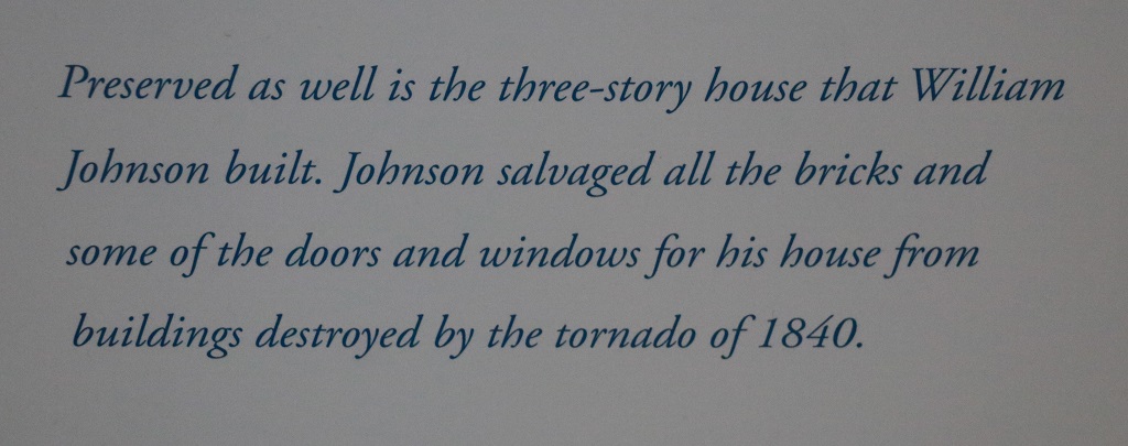
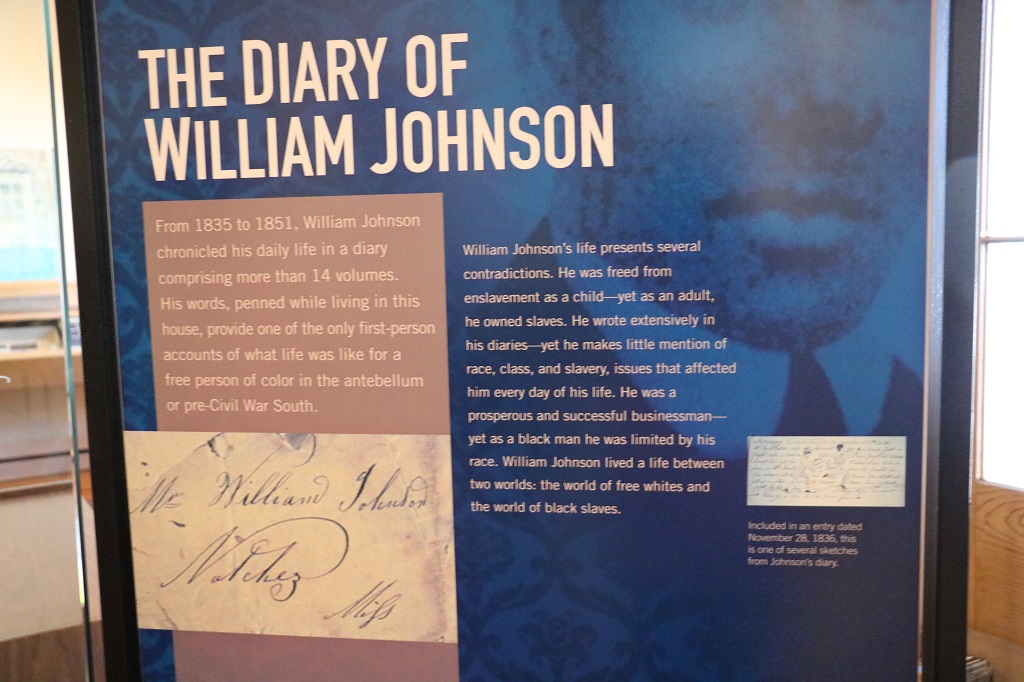
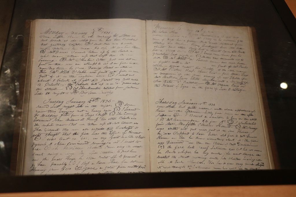
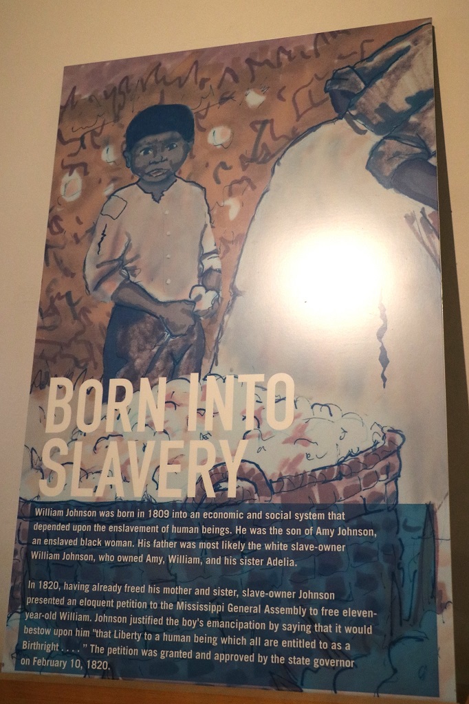
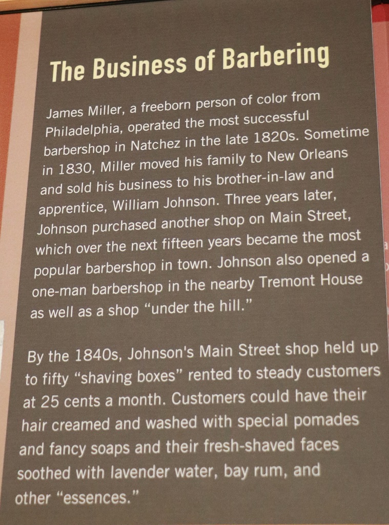
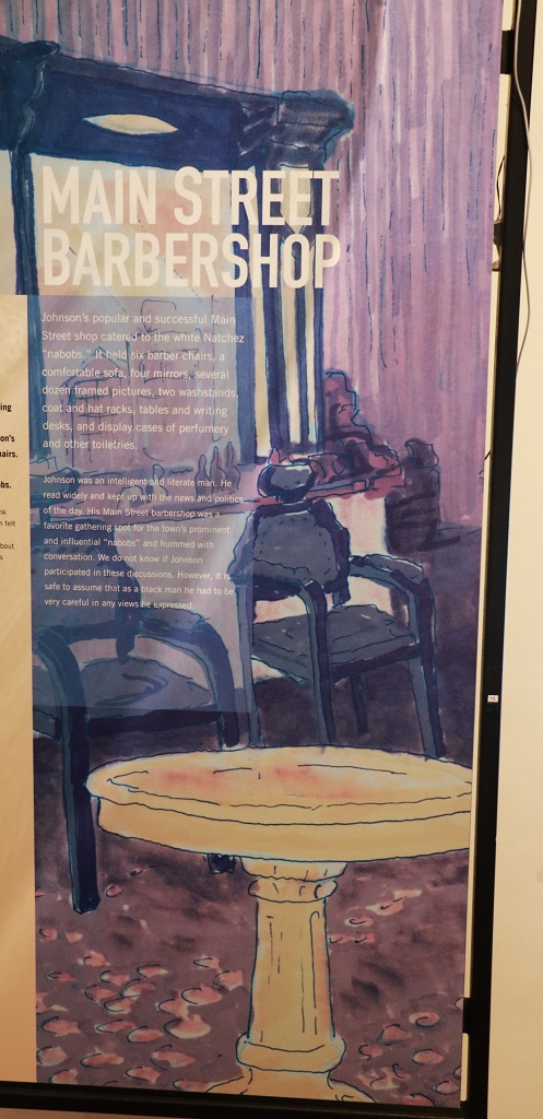
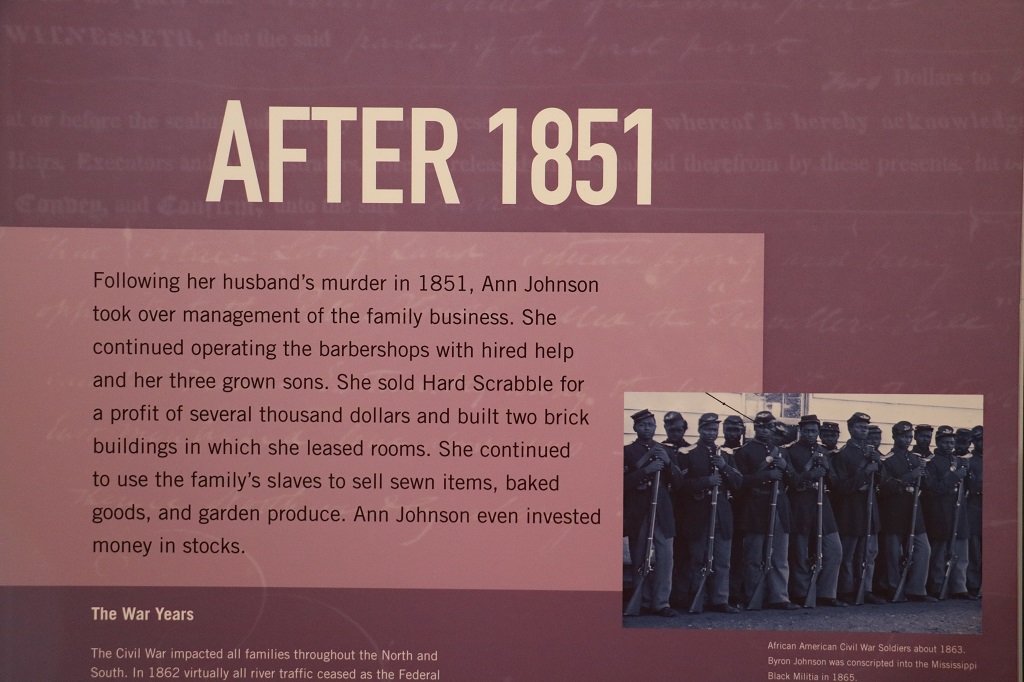
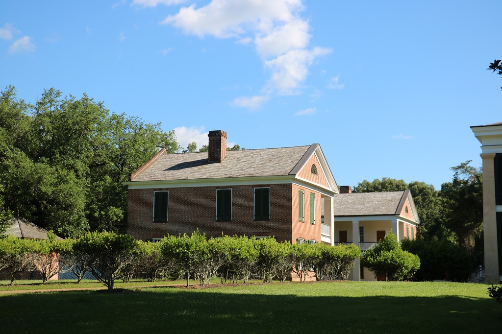
The Vistor’s Center has moved temporarily into the William Johnson house, which is one I wanted to visit. Unfortunately the two upper stories are no longer deemed safe for people to tour. One of the big rooms on the main floor had a large dispaly of placards about William Johnson, the barber of Natchez.
He rented out the rooms on the street level for commercial businesses and he and his family lived in the two floors above. His parents and his wife’s mother lived with them, as well as their 11 children.
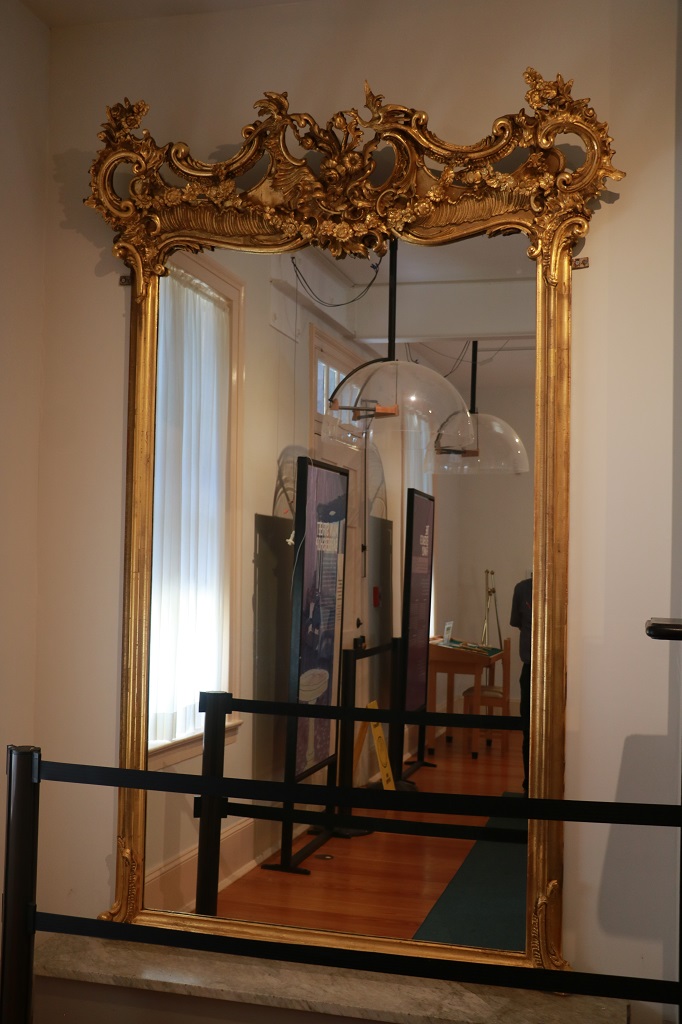
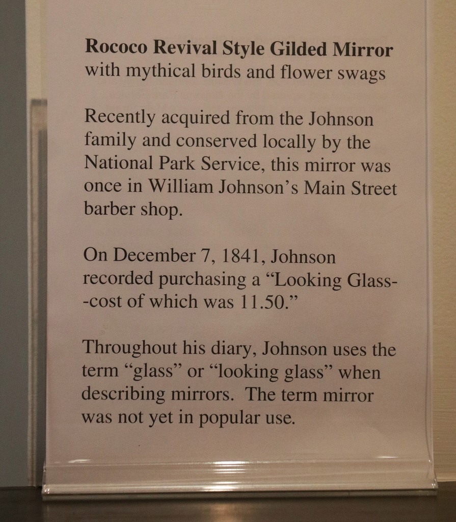
This large mirror is in it’s original pristine condition from when he bought it in 1841.
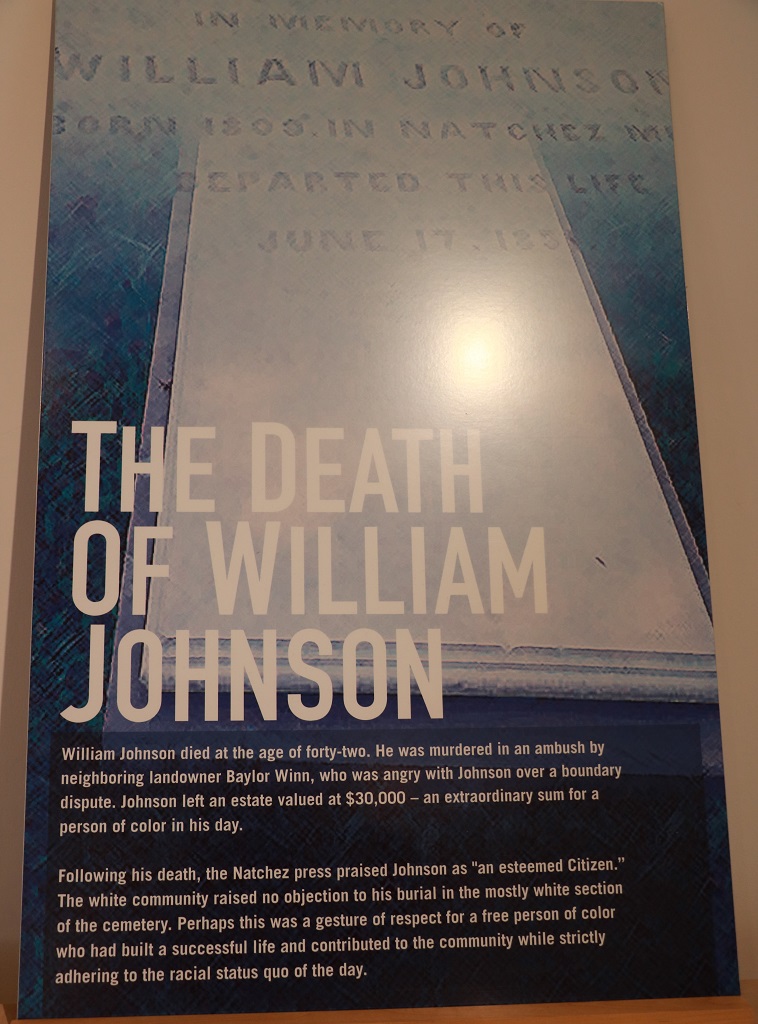
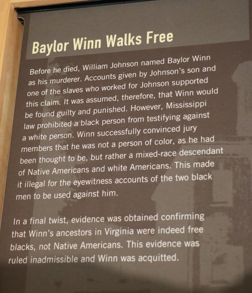
The youngest of her 11 children was only a few weeks old when William was murdered. He twice named his neighbour as the man who shot him before he died.
Before we drove around the town to see some of the houses and mansions, we went north to the National and City Cemeteries. We passed lots of nice houses like these on the short drive. These are not antebellum mansions, just nice houses.
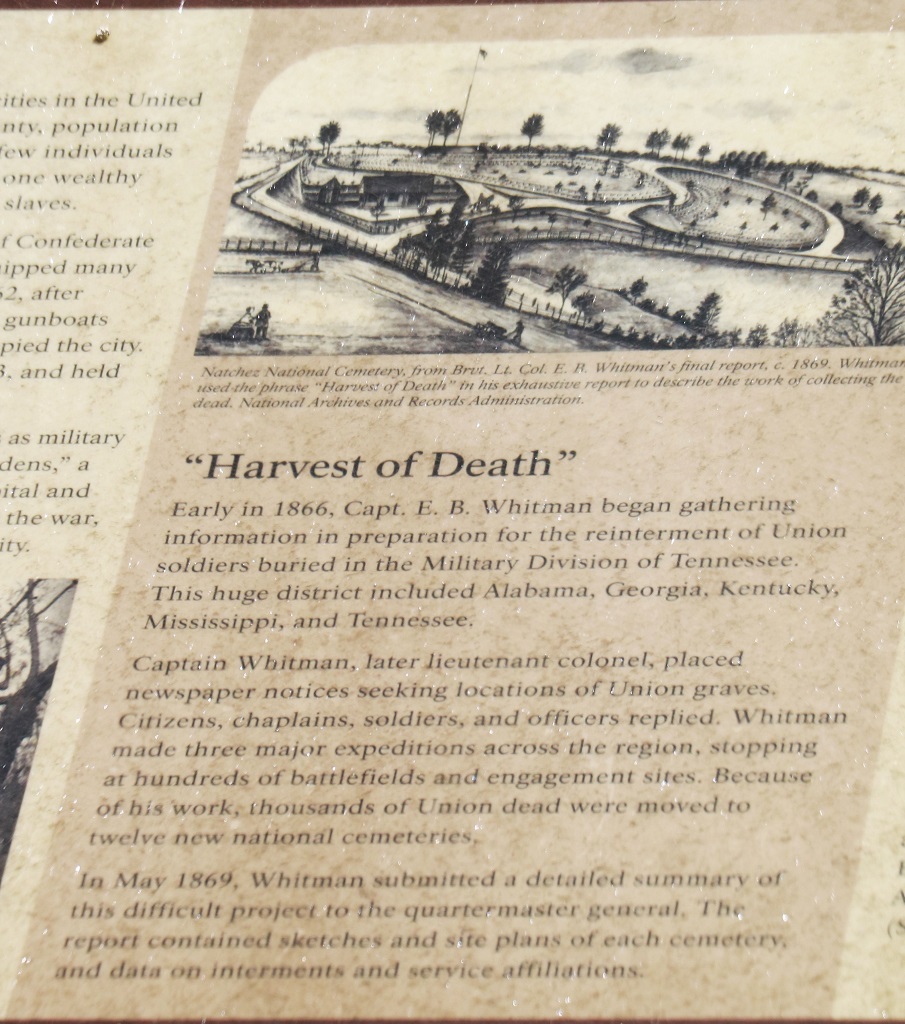
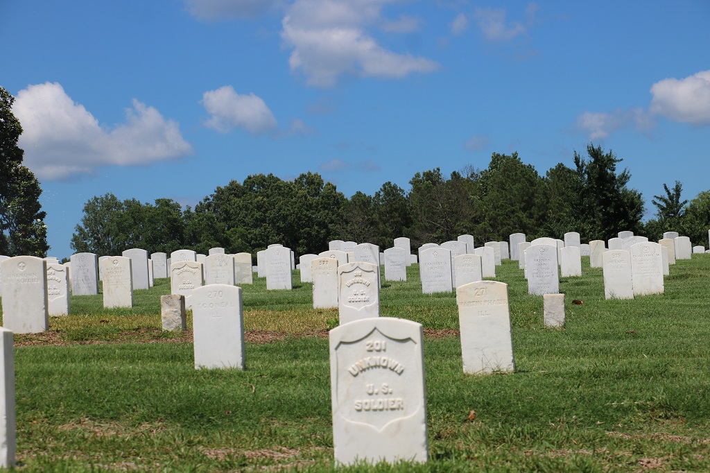
3085 fallen soldiers from Mississippi and Louisiana were buried in the National Cemetery here, of those only 305 are identified. The short little posts you can see beside some of the markers contain only some unidentified body parts.
The National Cemetery overlooks the Mississippi River. There were some large barge loads going up and down. The river has quite a current. Tugs pushing multiple barges hooked together upriver have to work very hard.
Louisiana is across the bridge. A lot of the weathy nabobs had plantations on that side.
The City Cemetery was about a half mile closer to Natchez on the opposite side of the road. There was an audio tour you could access with a QR code on your phone that would take you to about 22 graves of interest. With Canadian phones on a limiited USA data plan we did not bother. The lady at the Visitor’s Center told us about one of the graves on the tour so we did go find it.
This is the grave of a young girl that died not long before her 10th birthday. She was afraid of the dark, so the parents had a flight of stairs installed at the back of her grave and whenever there was a storm her mother would come to the cemetery and go down the stairs and sit with her.
We headed back town to do some driving around. We passed the Grand Hotel which is about a quarter mile long.
So many of the mansions are on large gated estates or half-hidden behind trees so we could not get photos. This one is Stanton Hall.
St. Mary Minor Basicilica, the first Roman Catholic cathedral in the Mississippi dioceses. It served mostly Irish and Italians when first built.
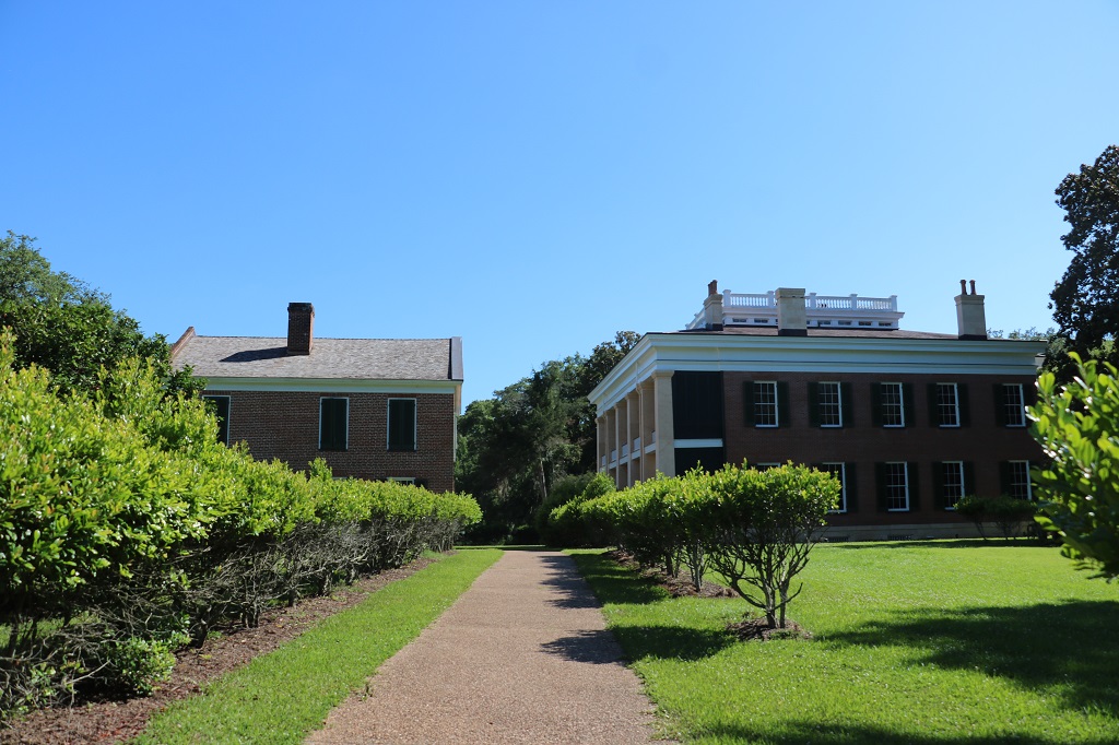
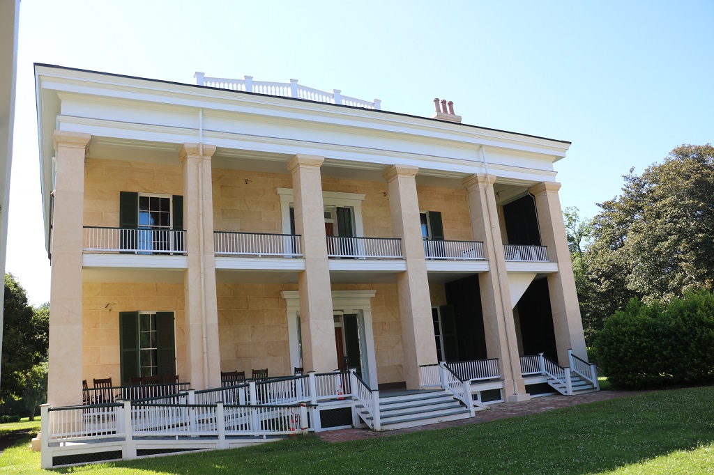
The one mansion we were able to drive in to see was Melrose. It is owned by the National Park Service and was open until 5. The tours of the inside were finished for the day but we had a half hour to wander the grounds.
The building on the left is the Visitor’s Center. It was once the kitchen. The mansion is on the right.
The back of Melrose. You can’t see it very well, but all the columns and the block on the walls are viened like marble. In truth it is hand painted plaster. Melrose represents one of the most completely preserved Antebellum estates in Natchez with many original furnishings and out buildings.
The building in the front was the kitchen, the one in the back was the dairy/laundry.
The front of Melrose. When the McMurrans bought the land for their estate it was just a rolling hill with deeply eroded ravines, called ‘bayous,’ on three sides The tree on the left is a Magnolia. There are still blossoms on the top.
After a long and fun day we headed to our hotel and checked in. It was dinner time and we were recommended to go to the Magnolia Grill down by the water side about 4 minutes drive from the hotel. We both ordered port loin and baked potatoes. The potatoes were huge, which isn’t that unusual, but half of the plate was heaped with big chunks of delicious, tender pork. By the time I had eaten all I was able you could barely tell I had eaten any. We filled a take out container with the leftovers for lunch tomorrow. It was served with a delicious sauce and our server was kind enough to give us a couple of extra containers of it to go with the meat. A wonderful meal, but, my goodness, there had to be two pounds of meat on each plate – an entire pork loin each!
We left the hotel under cloudy skies; the first we have seen on this trip. We had about a five hour drive across Alabama and into Mississippi ahead of us today – 247 miles or 397 kilometers. We had no ‘tourist’ stops planned but had made a geocache list to take some breaks and find some caches.
One of the nice things about the geocaching hobby is that local people hide caches in their area and often take you to places you would never otherwise know about – like the smallest city block in the world in Dothan. Most caches are hidden in trees or bushes or signs, but there are always a few that show you something interesting.
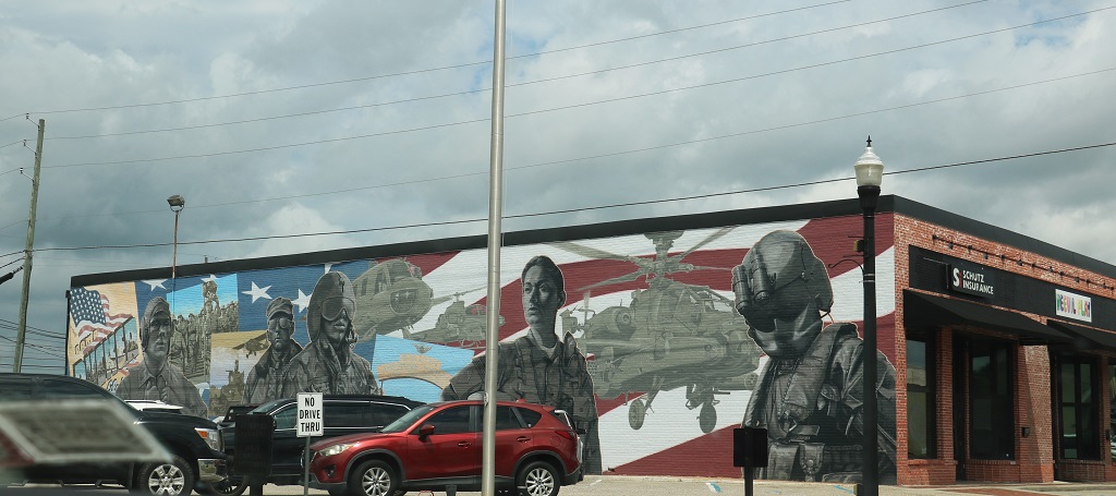
There was a cache hidden at the base of the flag pole at this mural. It was painted on both sides and just at the edge of a parking lot. There was no plaque or sign telling why it was made or by whom.
I snapped a quick pic of this nice mural as we went through one of the towns along the way.
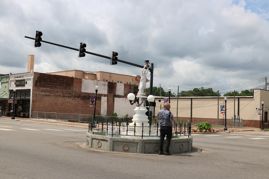
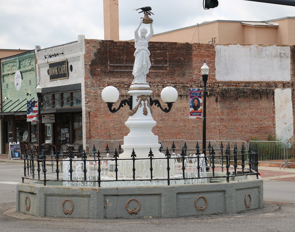
At Enterprise, Alabama, in the center of the Main Street=College Street intersection there is this statue. It is dedicated to the Boll Weevil and is the first statue ever made honoring an insect pest. It was erected by the citizens of Enterprise on Dec. 11, 1919, hailing the beetle as a ‘herald of prosperity.” Cotton was king in the area and all the farmers grew it. The boll weevil made it’s way up from Mexico in 1915 and by 1918 was destroying entire cotton crops. A man named H. M. Sessions saw this as an opportunity to convert the area to peanut farming. In 1916 he convinced C. W. Baston, an indebted farmer, to back his venture. The first crop paid off their debts and was bought by farmers seeking to change to peanut farming. Cotton was grown again, but farmers learned to diversify their crops, a practice which brought new money to Coffee County.
We drove by a lot of peanut fields as we traversed Alabama.
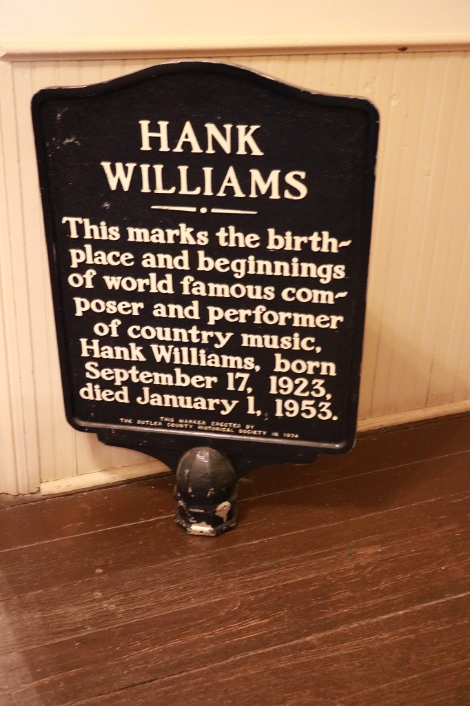
I have a large Canada/USA map book that I take on all our road trips and pencil the roads we travel. The maps of each province and state show the locations of quite a few colleges and military bases and museums. As I was coloring in a new section of Hwy 84 that we were driving I noticed that there was a Hank Williams, Sr. House and Museum in Georgiana about 20 or so miles north on Highway 55. We had plenty of time to get to Laurel so a detour was made.
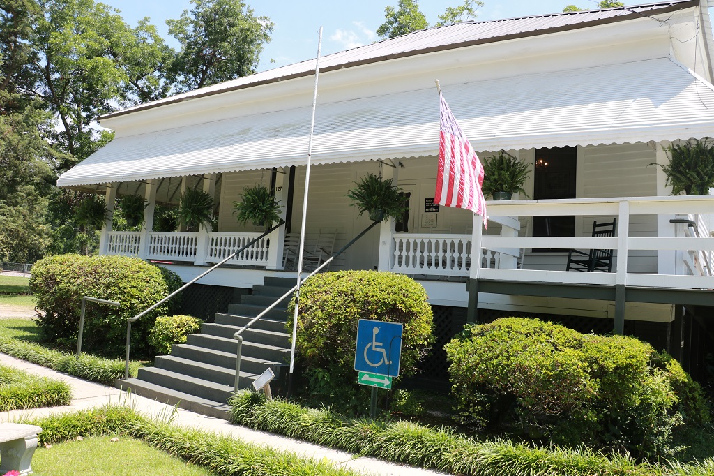
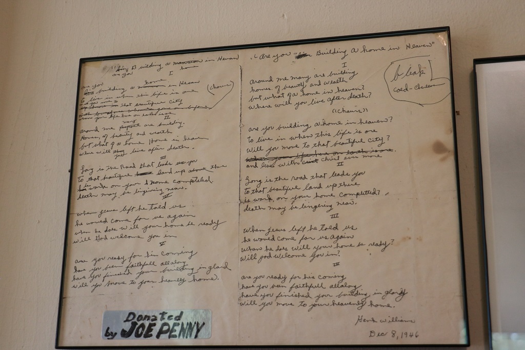
I have alway said that I have been a country music fan for so long I have Hank William’s albums so I thought it was kind of neat to wander through the house he grew up in. He was born in a log cabin near the Mount Olive Baptist Church in Butler County. The family moved serveral times as his father progressed from a day labourer in the lumber mills to engineer on the log train. When Hank was in first grade his father had to be admitted to the veteran’s hospital and his wife moved with her children, Hank and Irene to Georgiana. They lived in a four plex until it was destroyed by fire. A local businessman who owned houses that he rented out offered her used of the house on Rose Street until she got back on her feet. They lived in this house for 4 years – Hank was 7 when they moved in.
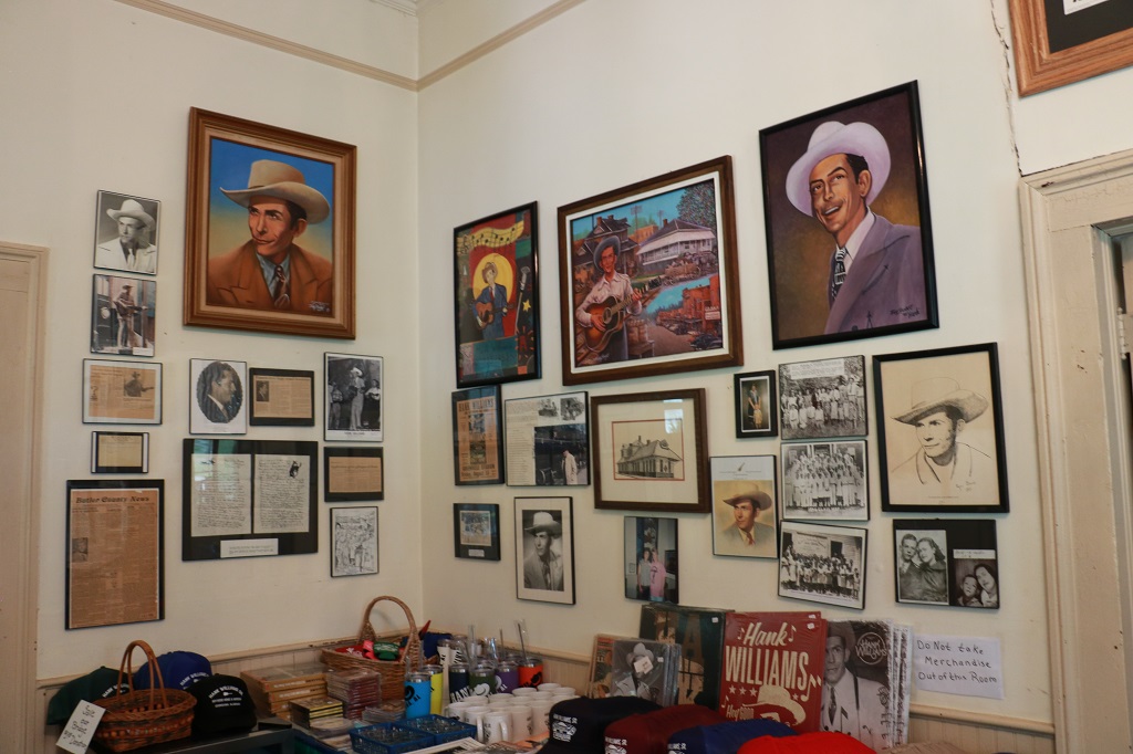
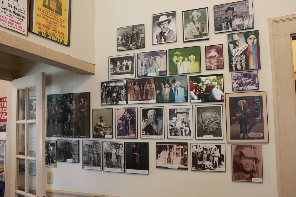
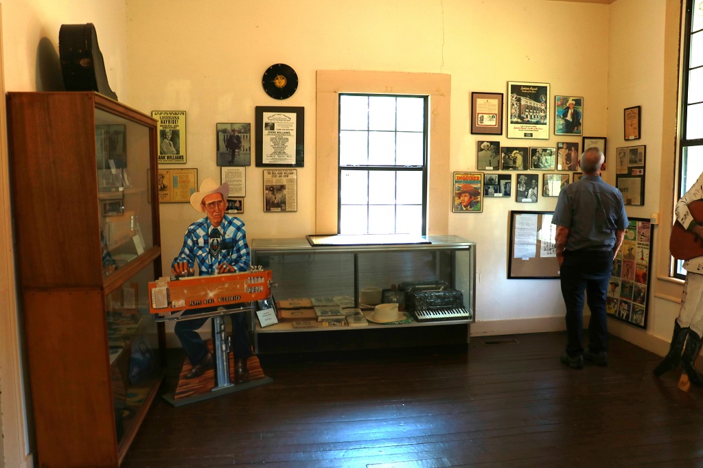
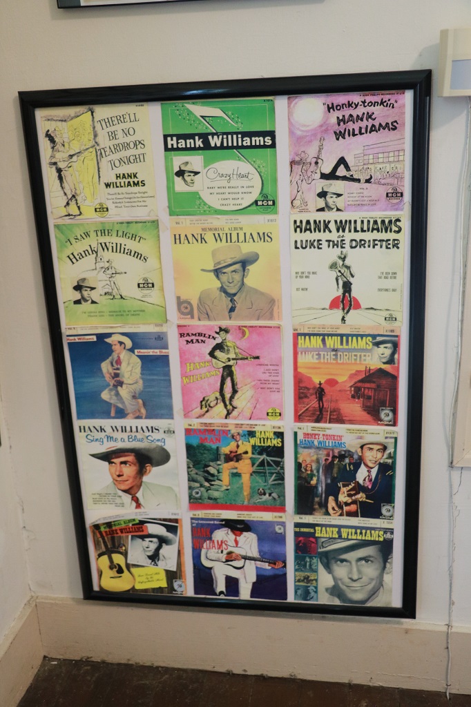
Every wall in every room was covered with photos, paintings, record covers, music sheets, etc. It was not a professional collection at all. There was hand-written papers with names or dates below things. There is a ‘proper’ Hank Williams museum in Montgomery I think. Still I enjoyed wandering around and looking at all the pictures. I even spotted the record albums I have among all his recordings.
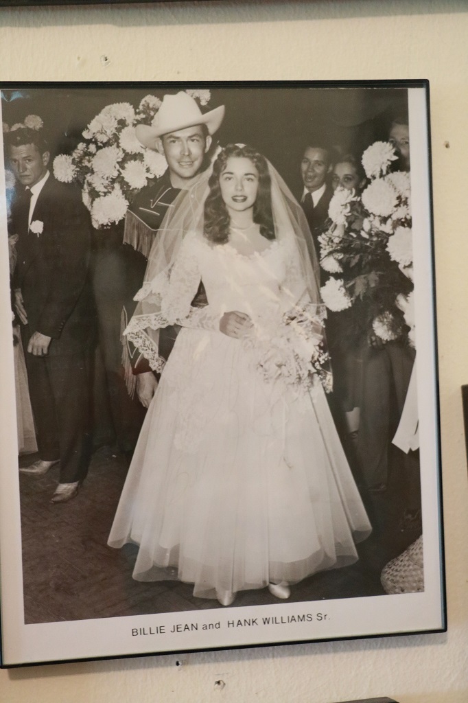
Billie Jean was his second wife. His first wife Audrey divorced him in 1952 due to his alcohol abuse. They had been married almost 10 years. Hank and Billie Jean had only been married a couple of months before he died on Jan 1, 1953 from a heart attack in a drug and alcohol induced stupor as his driver drove him through West Virginia on the way to a concert in Canton, Ohio. He was 29. Hank had 11 #1 hits songs in his short career.
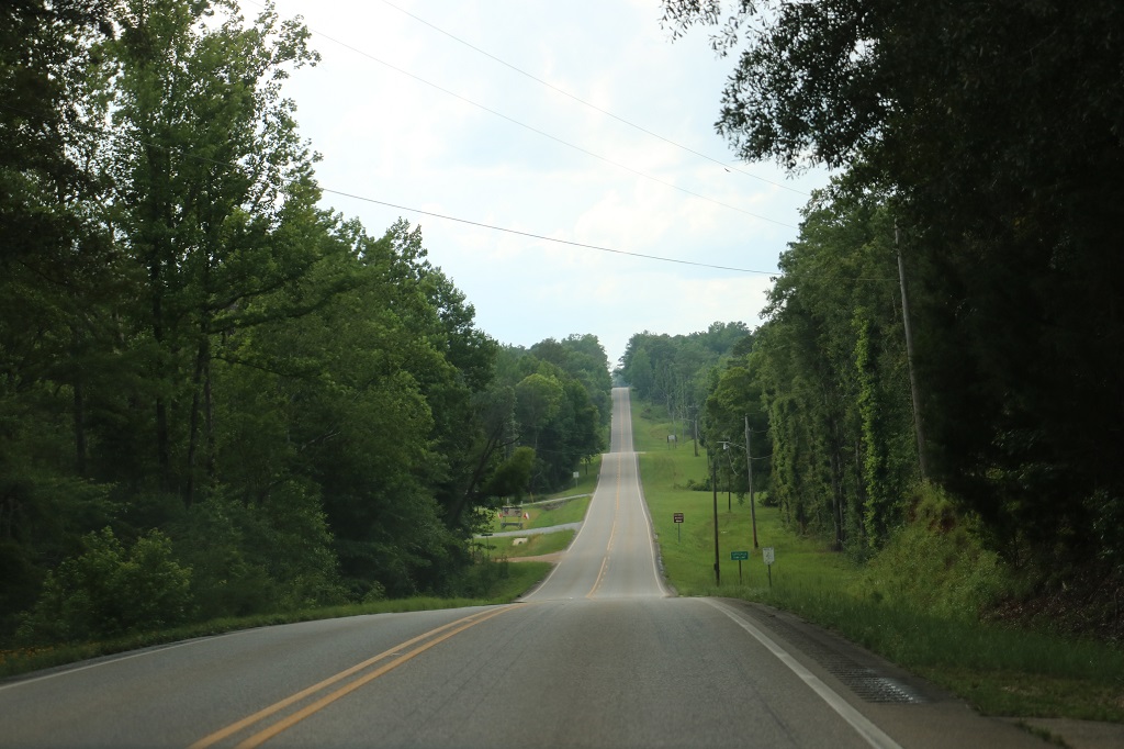
We drove up and down hills today!
This massive coal barge was sailing down the Tombigbee River.
I finally got got a photo of the pink flowers we often see along the roadside.
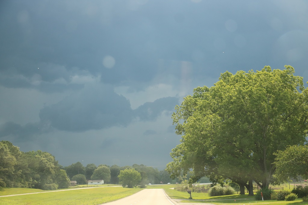
We crossed the border into Mississippi at 4 o’clock and not long after we were nearing some very dark clouds.
And then it started to rain – heavily and the wind was so strong it almost shifted the car on the road.
But by the time we entered Laurel about a half hour later, the storm was done. There was a lot of leaf and other debris on the ground and road as we made our way to the hotel for the night.
“Hometown” is a renovation show on HGTV that we really enjoy and stars Ben and Erin Napier of Laurel, Mississippi. The downtown of Laurel was dead before Hometown began, but now it has been revitalized due to interest created by the TV show. Ben and Erin fix up old houses in Laurel for people in the town or who are moving to the town. The show is in its 8th season and since it began they have renovated over 100 homes. More than 45 new businesses have begun in Laurel and over 250 new jobs have been created.
Tomorrow we drive around Laurel for awhile, go visit Ben & Erin Napier’s General Store and see Ben’s woodworking shop before we head to Natchez.