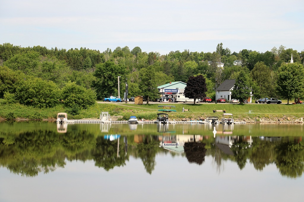
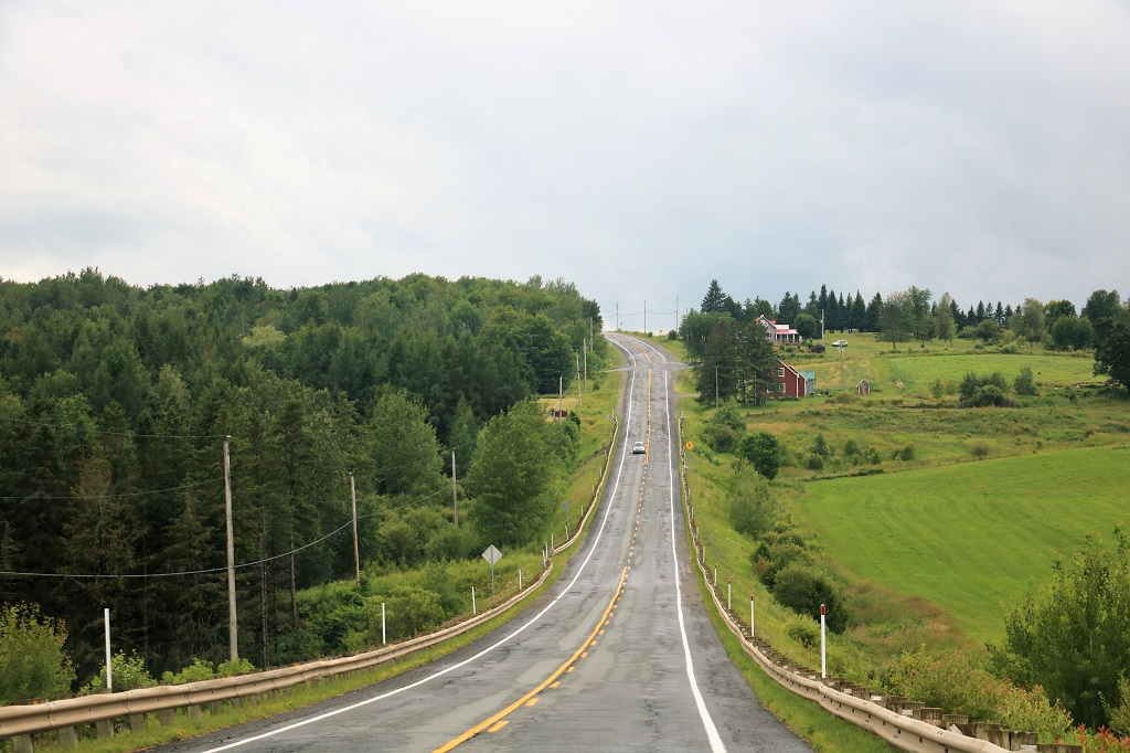
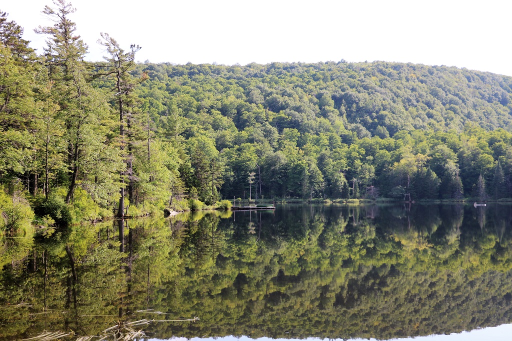
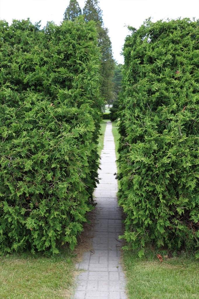
Today involved the least stops of interest so far on this trip. We drove one of the backroads south to Fredericton and arrived in town quite early because there was only one place we stopped, other than to photograph some lovely reflections.
There is a McCain factory at Grand Falls and the first part of our morning was driving past potato farms. They obviously stagger the planting because we saw everything from small plants to full bloom to harvesting.
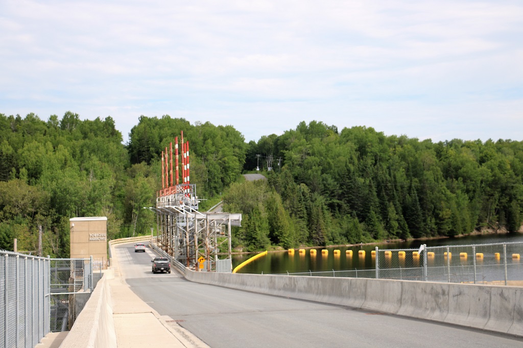
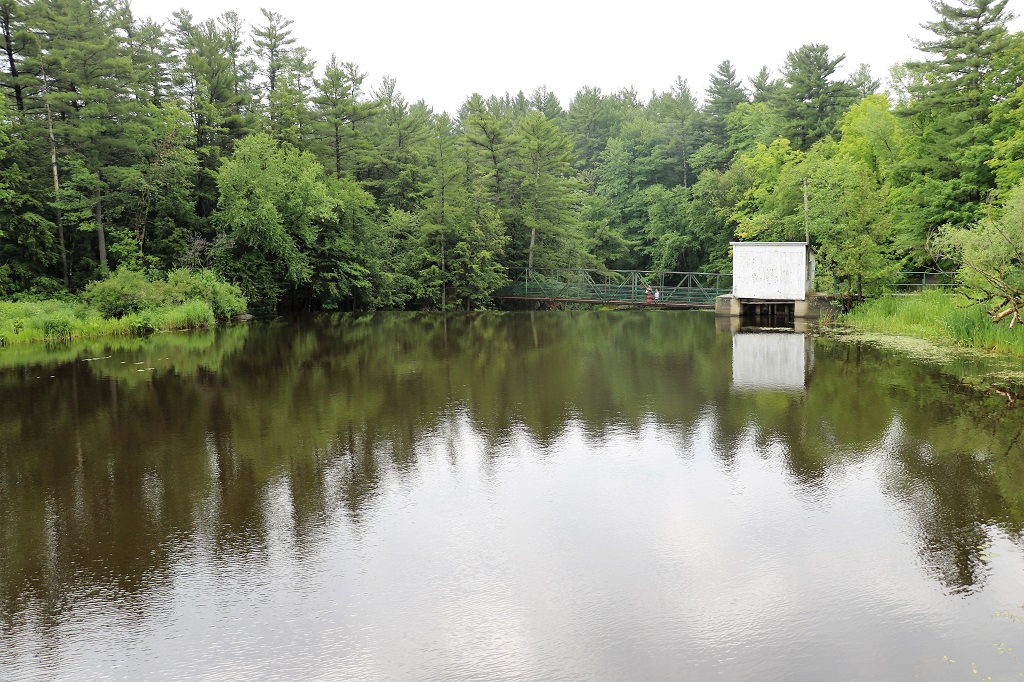
There is a dam at Tobique Narrows where the Tobique Rive joins the St. John River and the road goes right over the top of it. We stopped on the far side and walked back to take some pictures.
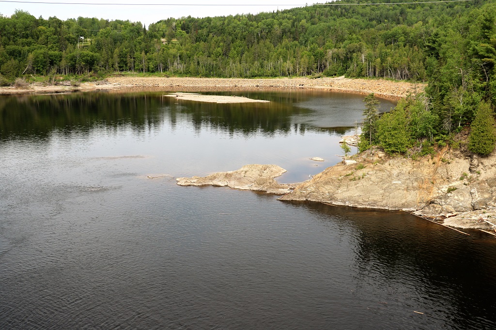
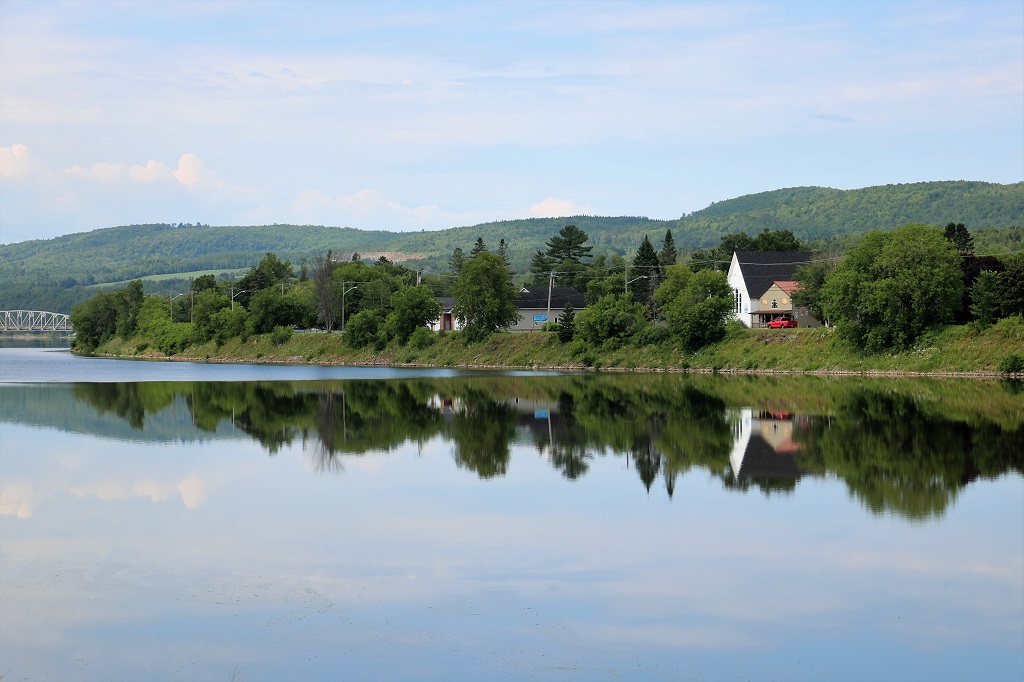
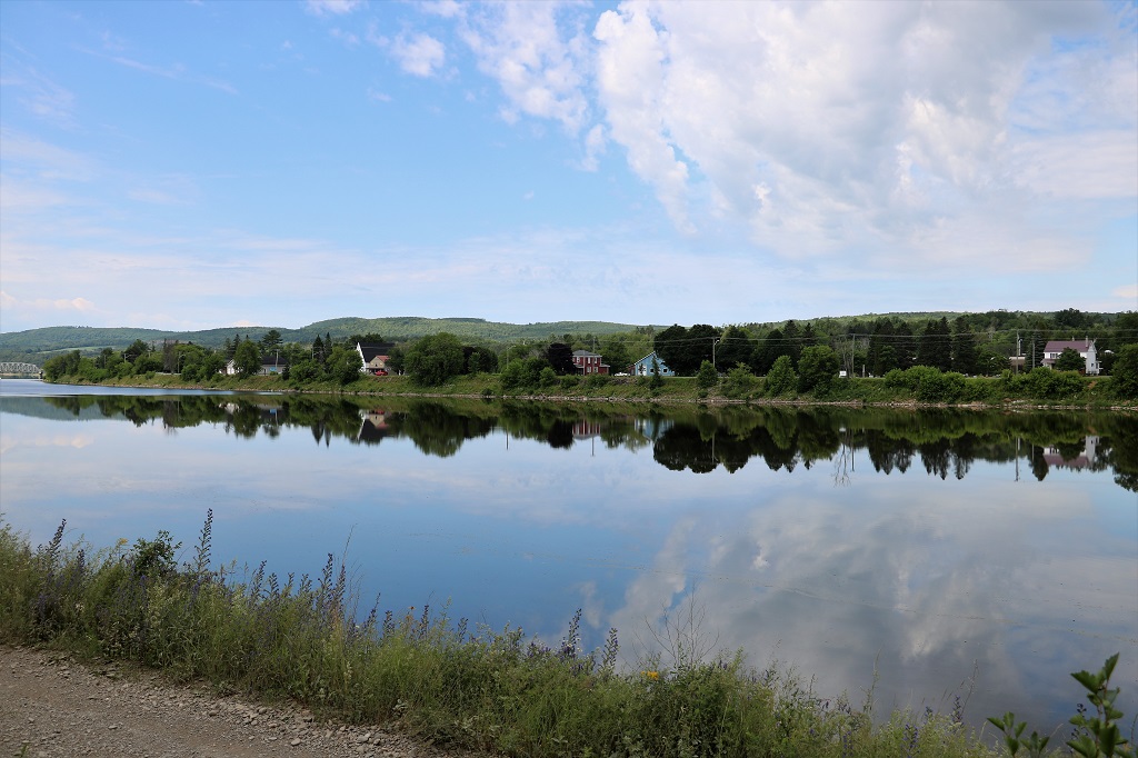
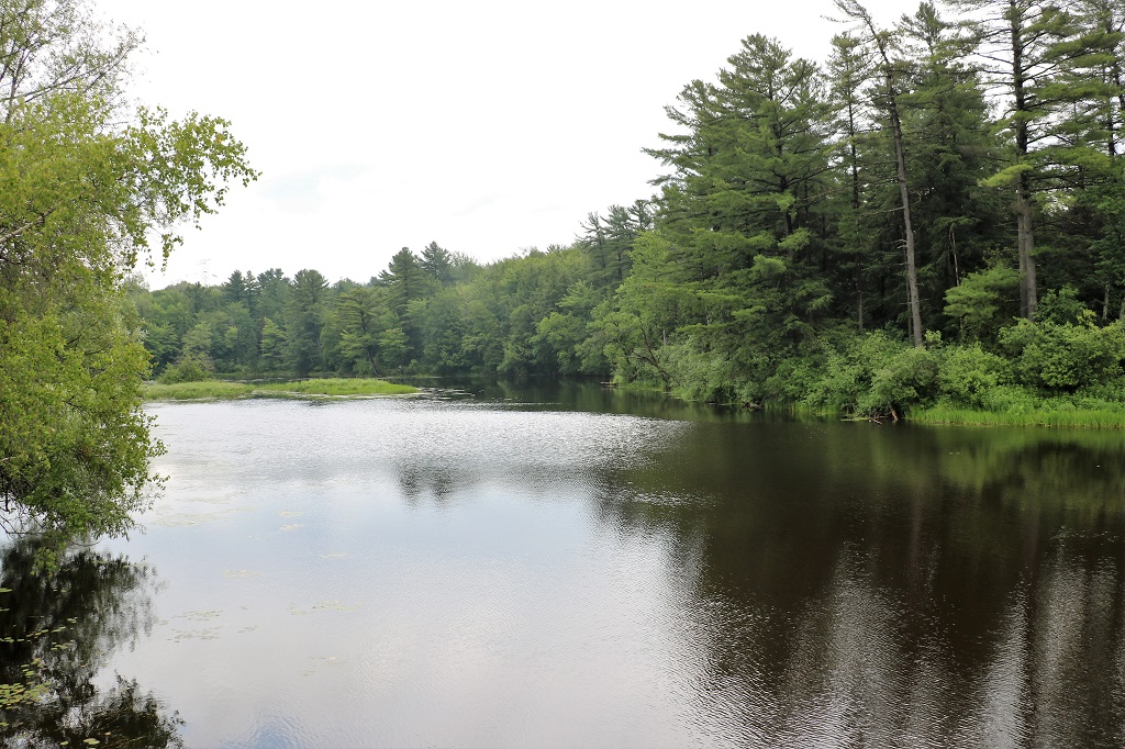
The light was lovely for long stretches of the river further down the road so we pulled over a couple of times to capture the reflections.
Near Perth.
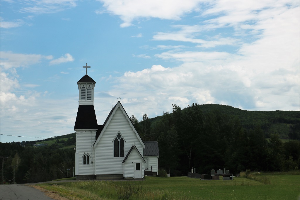
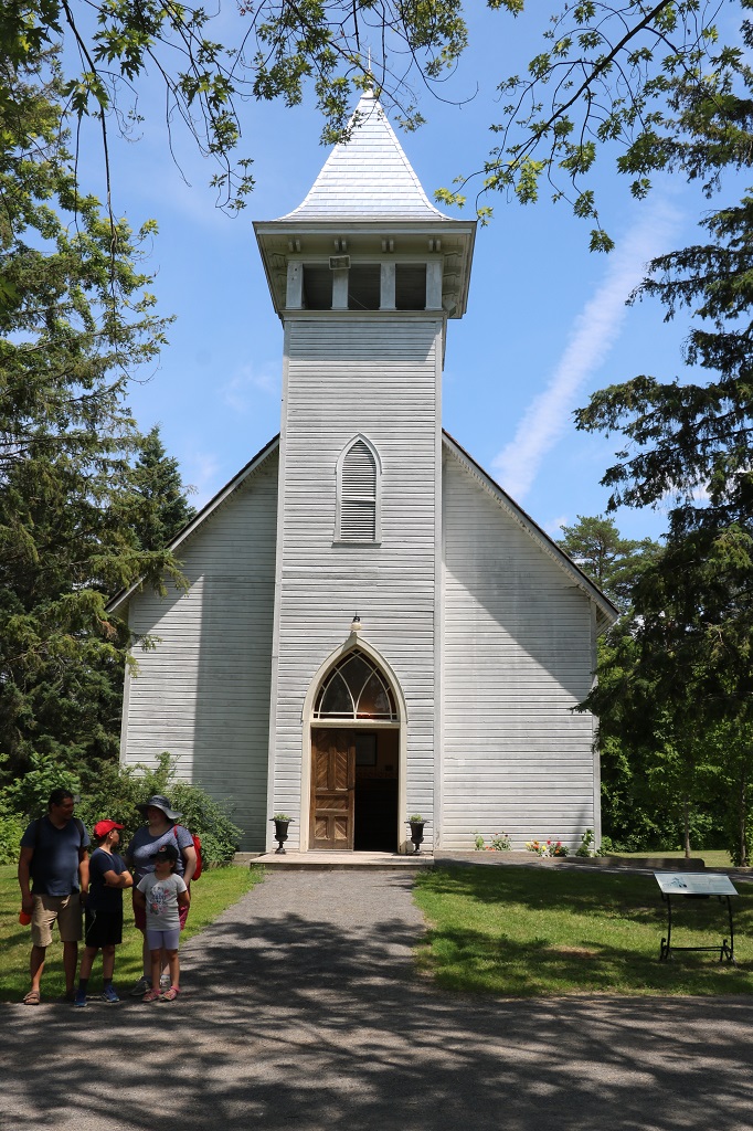
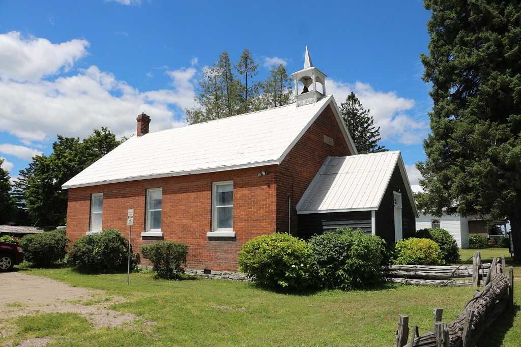
Christ Church Anglican
Atop a rise we made another stop to check the forest view.
This was a favourite spot to drop a kayak or fishing boat. There was a home-made launch slide set down the bank.
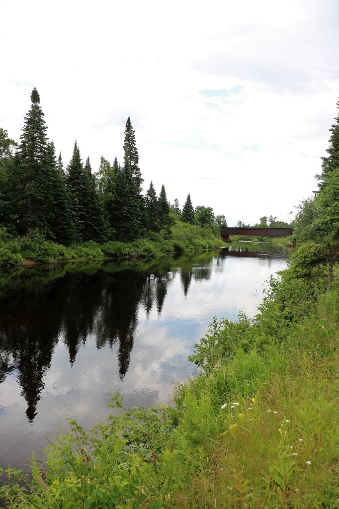
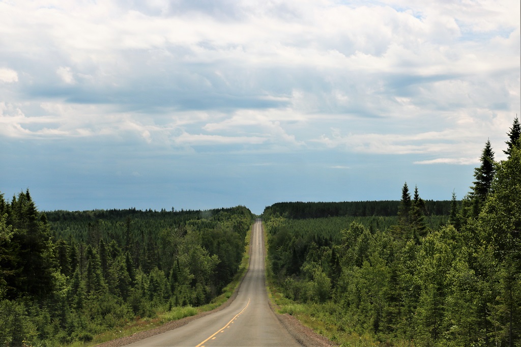
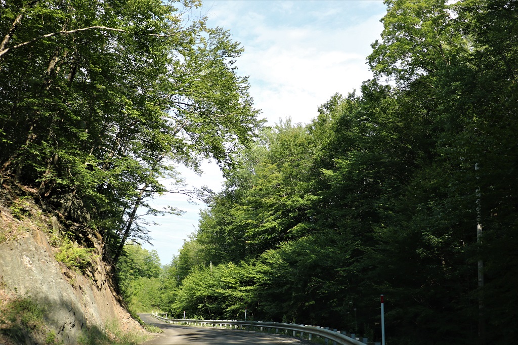
Up and down hills again, but this time with forest on both sides and not farms.
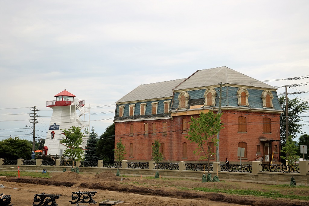
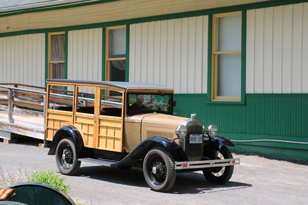
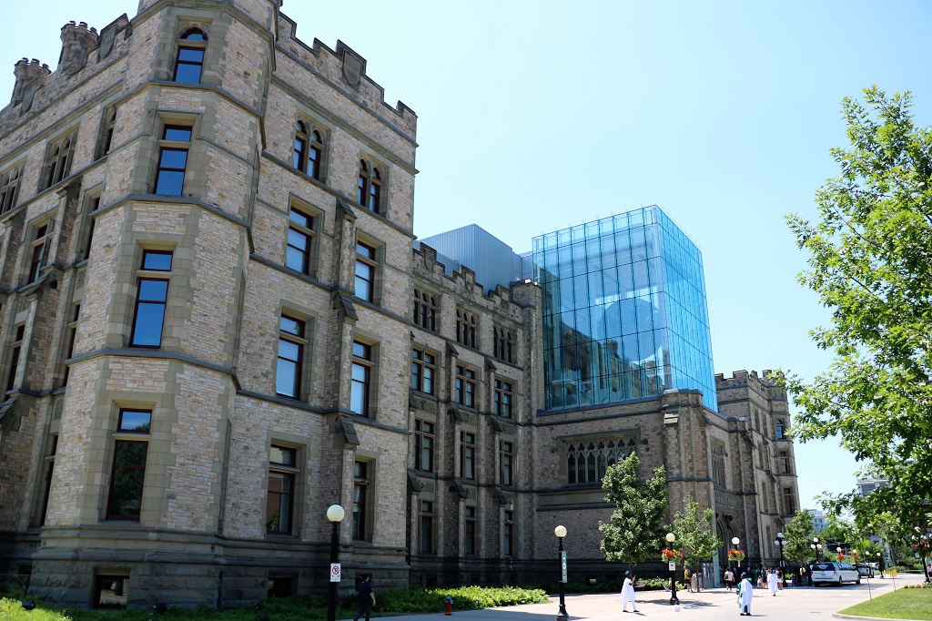
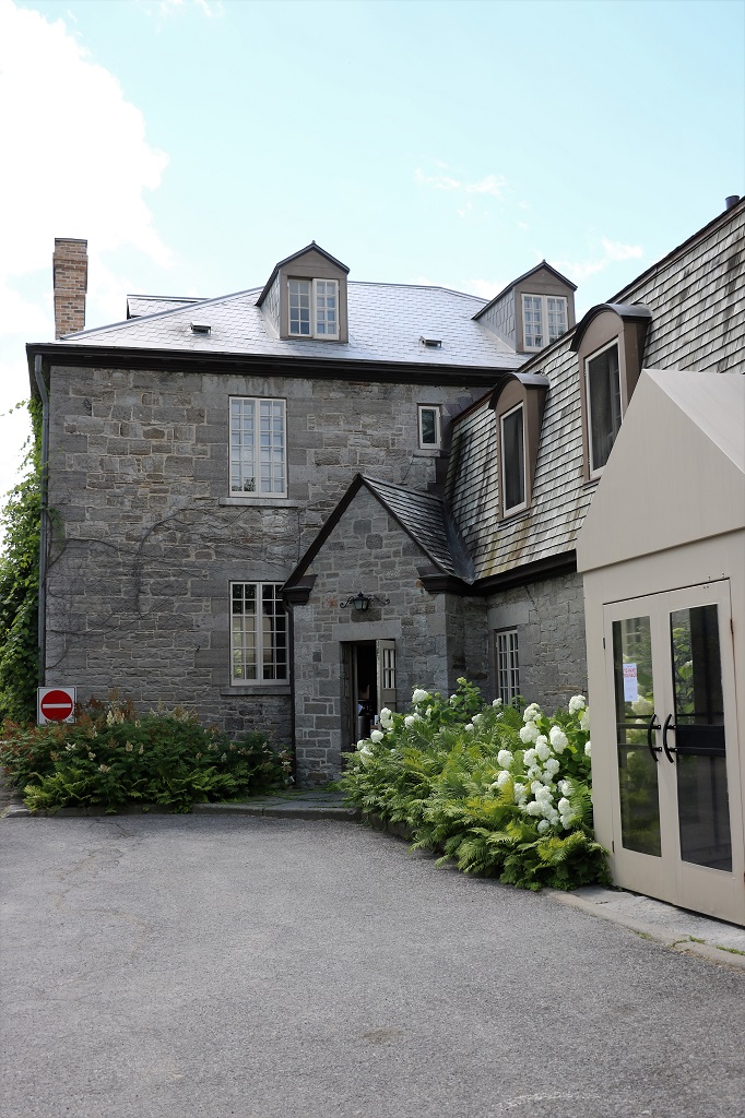
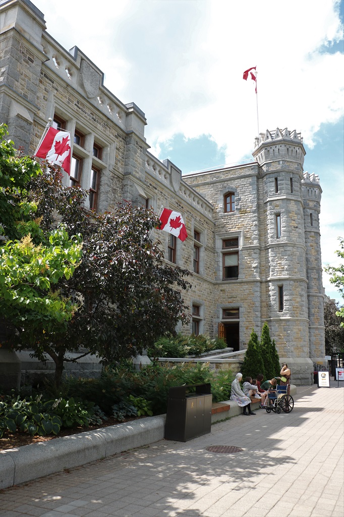
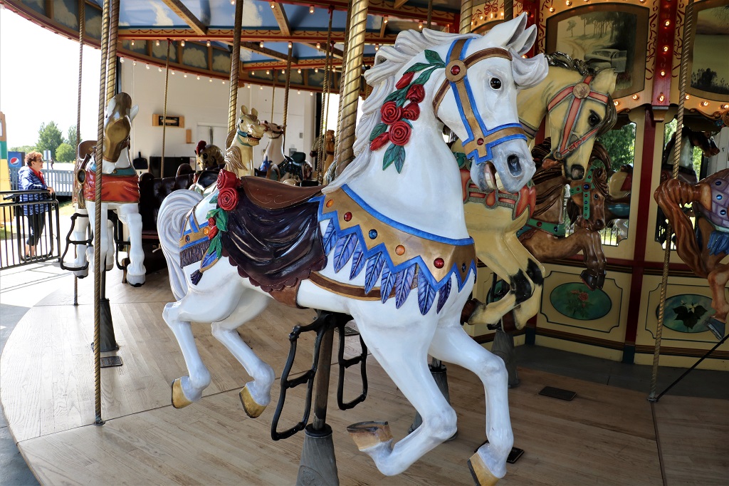
We arrived in Fredericton about 1:30 and drove right downtown to Queen Street to see Garrison Square.
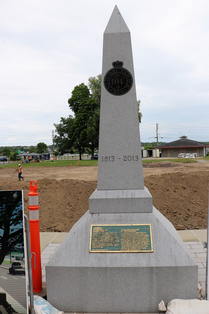
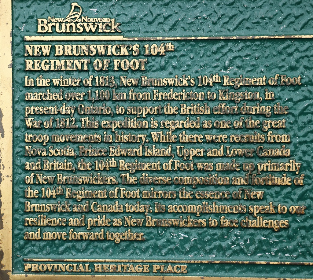
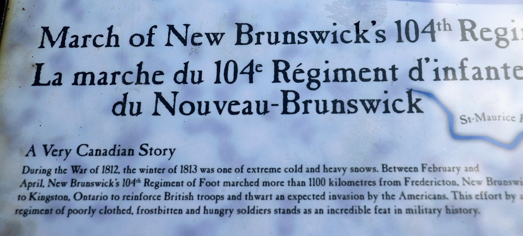
The parade ground was torn up and under renovation to make a nice park but there was a monument there commemorating the 200th anniversary of the New Brunswick 104th Regiment of Foot and their epic winter march to Kingston, Ontario that we had just read about at the blockhouse yesterday.
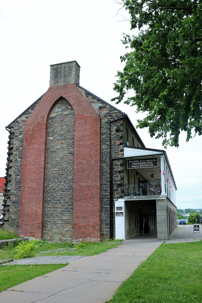
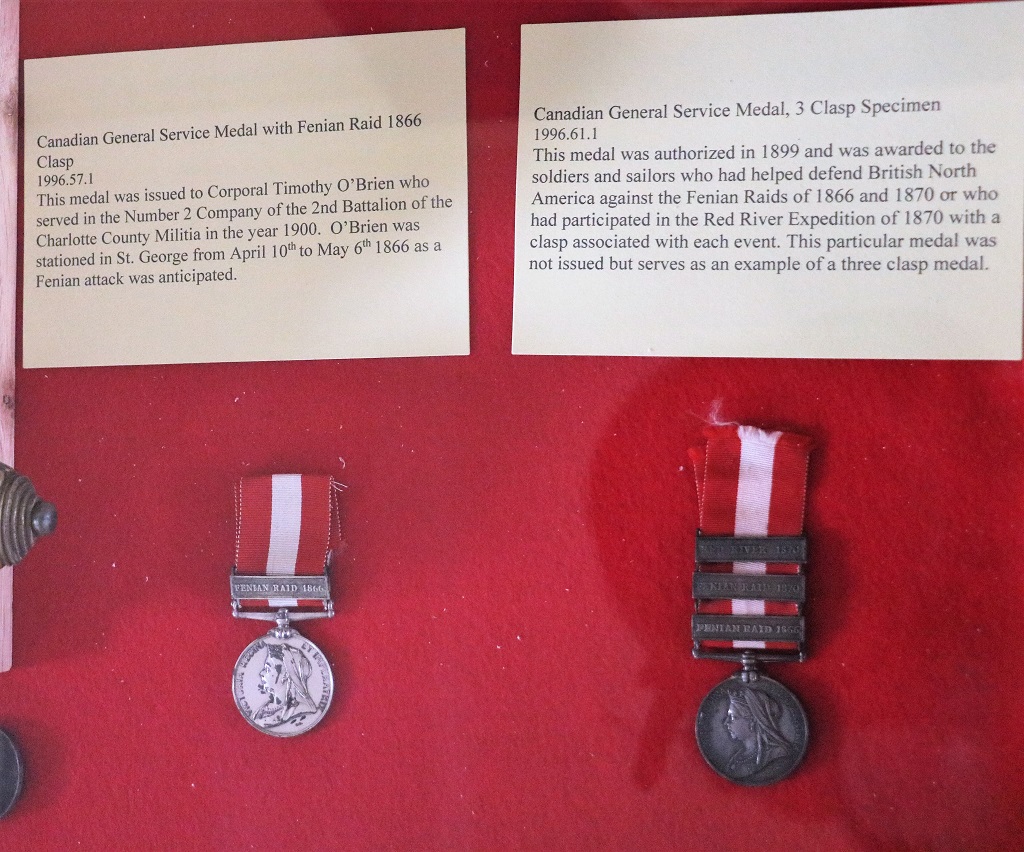
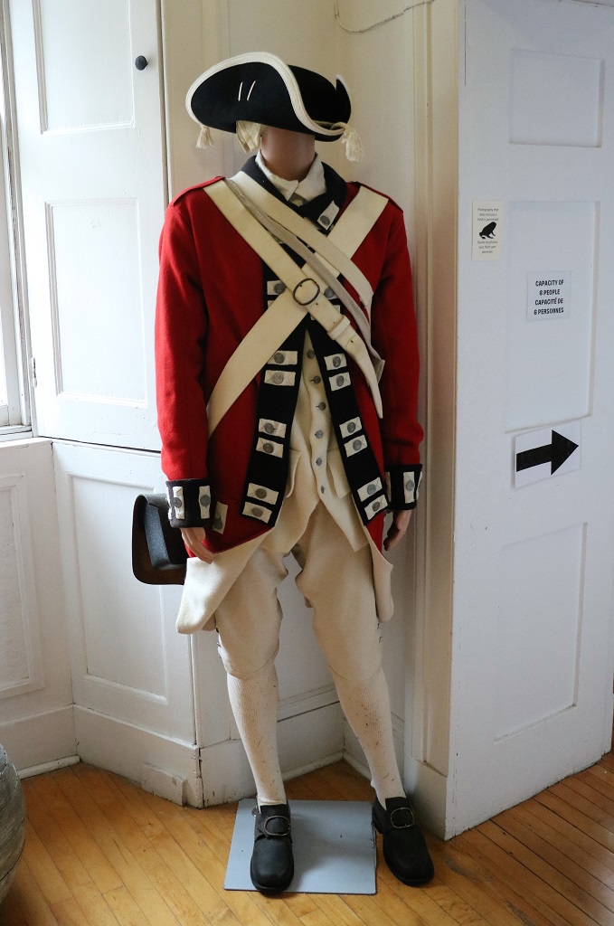
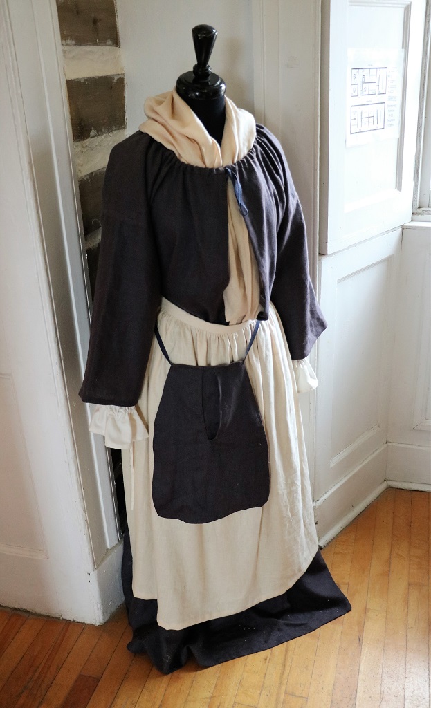
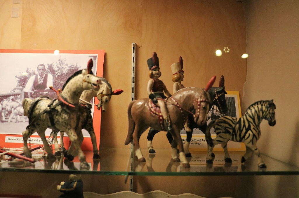
We walked next door to the Regional Museum of Fredericton which is located in one of the old garrison buildings. Neither of us was hugely impressed with it but they did have some interesting things and stories. The strangest was two rooms devoted to a ufologist who gave lectures and wrote books on alien encounters. I assume he was a local professor. We did not read too much of it. He was very famous though.
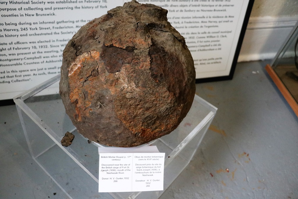
This 17th Century British mortar round was discovered near the site of the British seige of Fort St. Joseph (1696), which is near the mouth of the Nashwaak River.
One room was devoted to the various Accords and meetings that led up to Canada’s Confederation.
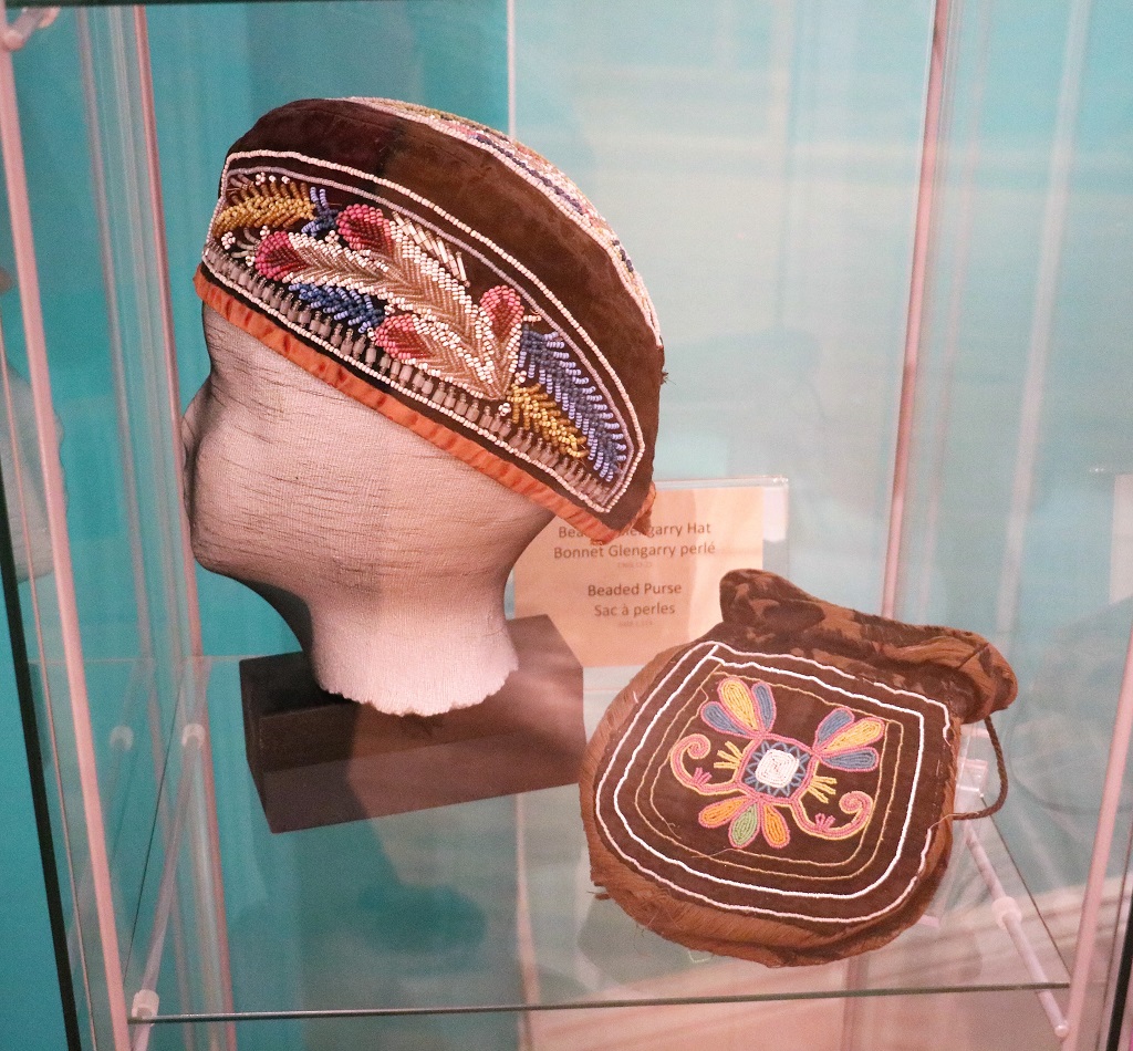
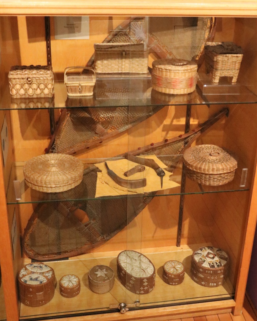
There was a room displaying lovely articles made by the aboriginal Madawaska.
It did not take us too long to tour the museum so we wandered down Queen Street to see more of the old buildings. However, there is a Thursday night market in the summer and all the vendors were setting up their tents so all the buildings were blocked by them. We may go back tomorrow and take another look.
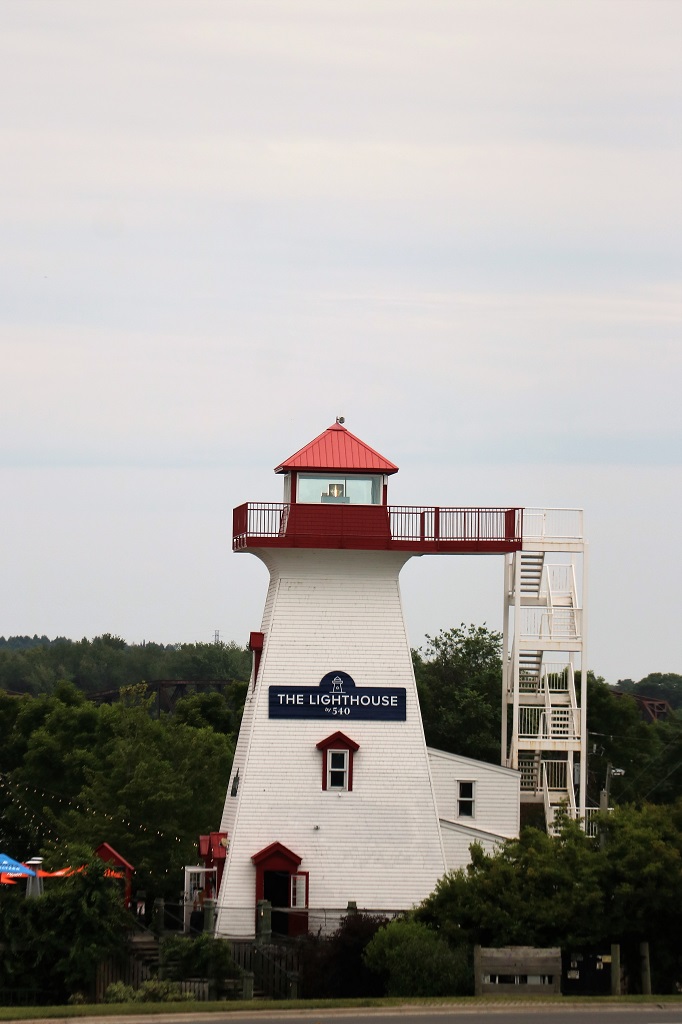
We walked through the square and up the steps to the pedestrian overpass to get a photo of the old lighthouse.
It was after 3:30 as we drove the rest of the way down Queen Street and out of town to our hotel. So, all in all a pretty laid-back day.
We have realized we don’t do cities well. We don’t shop, we don’t picnic in parks, or go to art galleries (except once in awhile) and we don’t wander down streets looking in windows at things we don’t want or need. Once we have checked out the museums that interest us we are pretty much done. Does that make us terrible tourists, I wonder?
It had been about an hour and a half after leaving Montmagny this morning when I saw a small waterfall from my window as we crossed a short bridge and entered the town of St. Pascal. This elicitied, “Halt. Turn around. Go back,” instructions. John pulled into a small parking lot and out we climbed to see the falls.
There was a sign at the edge of the parking area, which was only in French. I was able to figure out that it was about a flour mill, but I took a photo and had Google translate it for me this evening.
It says, “The second site of the Seigneurial mill. The first mill (1799) located west of the river was destroyed by fire. In 1854 Lord Ivanhoe Tache had Edouard Ennis build a second flour mill on the east side of the river. The mill, called “Lajoie” served the Lord during reconstruction. The new mill, a three-storey wooden structure, remained in operation from late August to late March, twenty-four hours a day, seven days a week until 1920. It was primarily used for the production of wheat flour, buckwheat and barley.”
After we took our photos and were heading back to the truck John noticed we were parked in the lot of an ice cream shop. Ice cream for lunch. Perfect. John ordered a three-fruit blend, similar to a DQ Blizzard. It was made with fresh strawberries, raspberries and blueberries. I had a banana split, also made with fresh local strawberries. The chocolate layer was not a syrup but a thick, rich (not sweet) fudge and the pineapple was also yummy. The ice cream was very smooth and creamy. When we had finished eating at a picnic table outside I went back and stuck my head in the door and told the two young men that that was by far the best banana split I had ever had. So good!
Another sign directed us four kilometers off the road to see a covered bridge.
As soon as we crossed the border from Quebec into New Brunswick we entered the Atlantic Time Zone, which now makes us four hours ahead of home in BC.
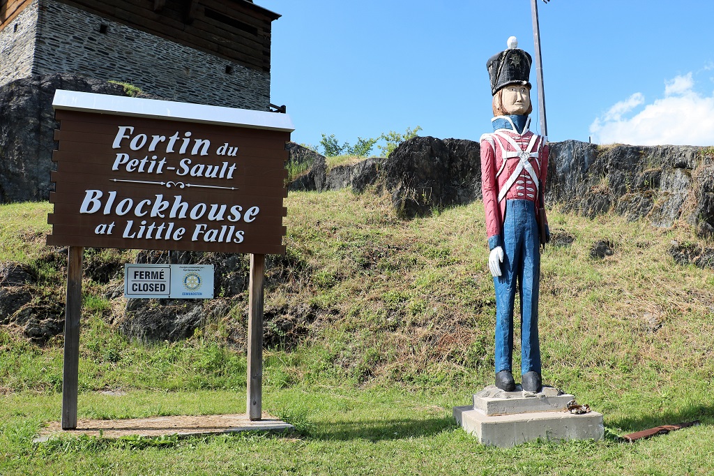
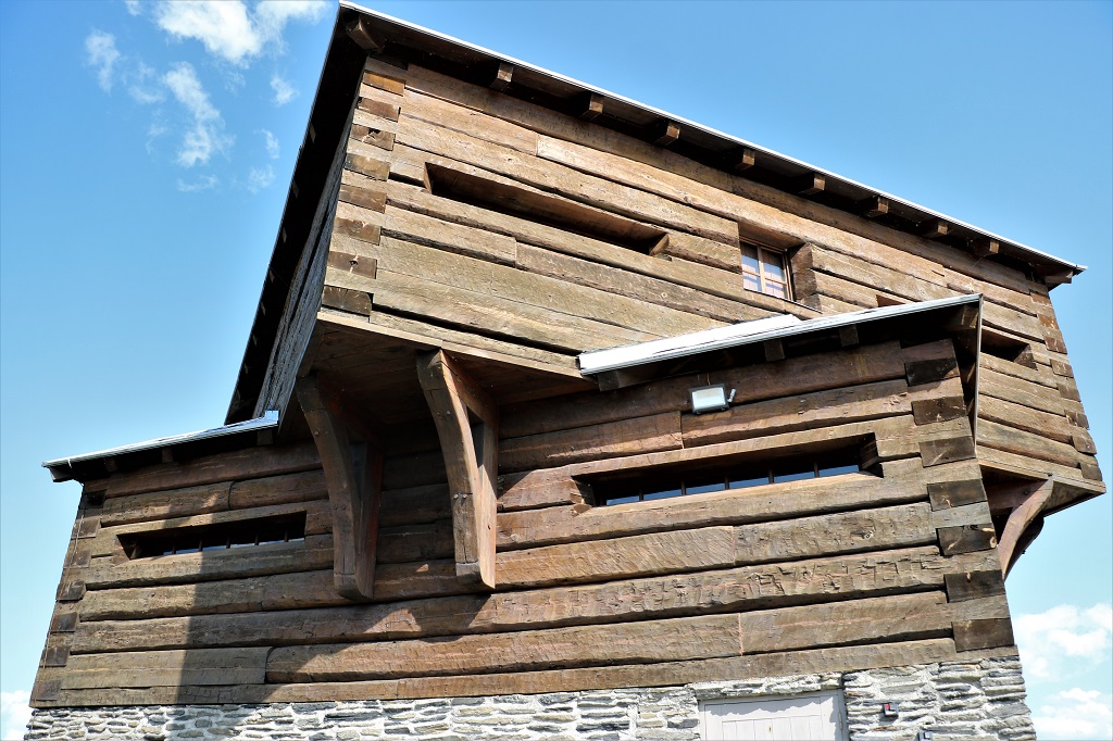
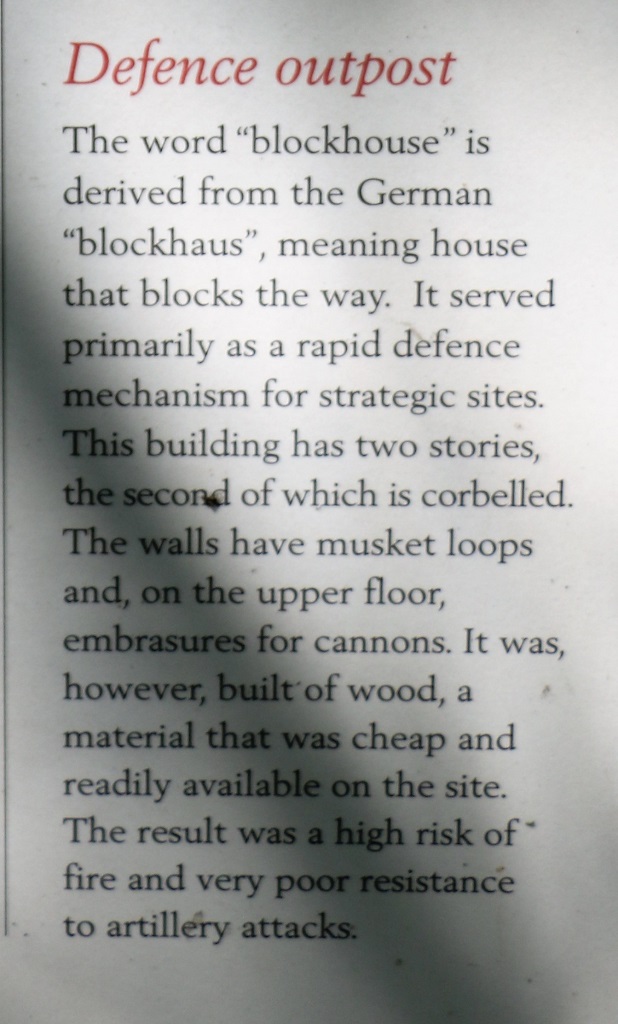
As we entered the village of Little Falls we spied an old block house on a hill near the road. And another turn around to go see it. It was closed but the information signs were in good condition and the gate at the bottom of the stairs was broken so I was able to climb up. Back in the day they would have a had an excellent view in all directions. Today it was rooftops and trees and a pulp mill and trees so I didn’t take any photos.
With the second story rotated atop the first story there would have been no part of the countryside that could not be watched.
Also at the blockhouse was a story about the remarkable trek of the New Brunswick 104th Regiment, in the winter of 1813, that walked a distance of 1100 kilometers from Fredericton, NB to Kingston, ON to reinforce the British troops as an American invasion was expected to happen there.
If you can make it out, the red line is the route they travelled. The yellow dots are known overnight stopping points and the blue dots may have been overnight stops – as determined by an average travel distance on foot in winter conditions.
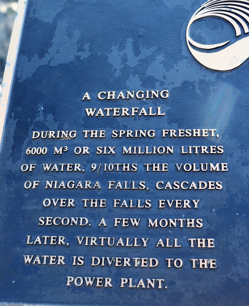
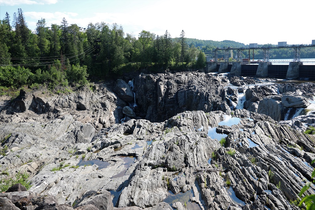
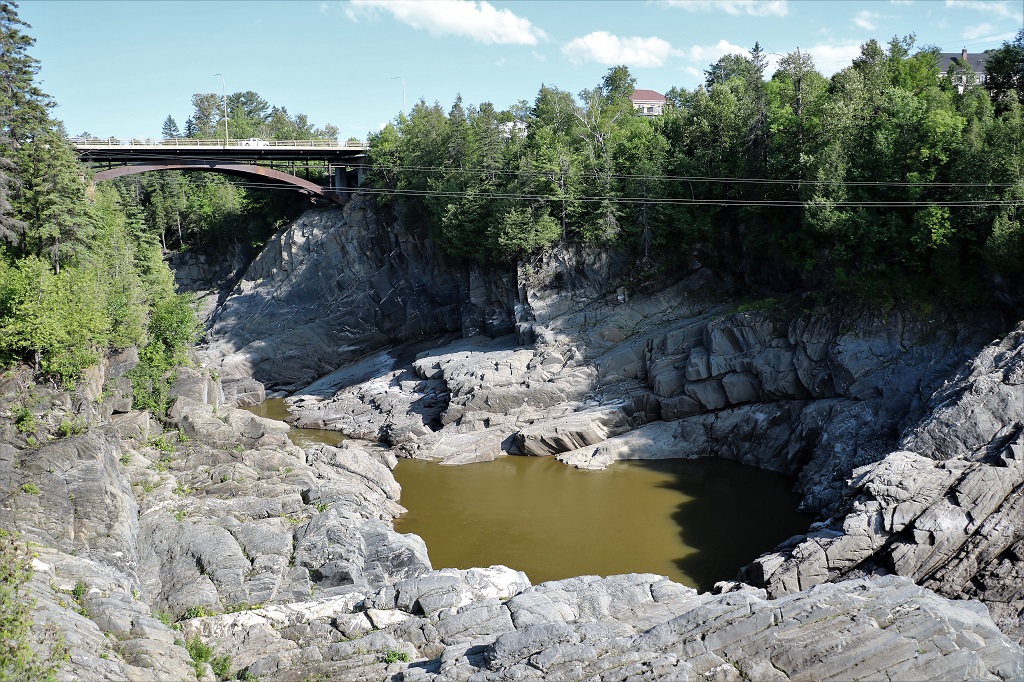
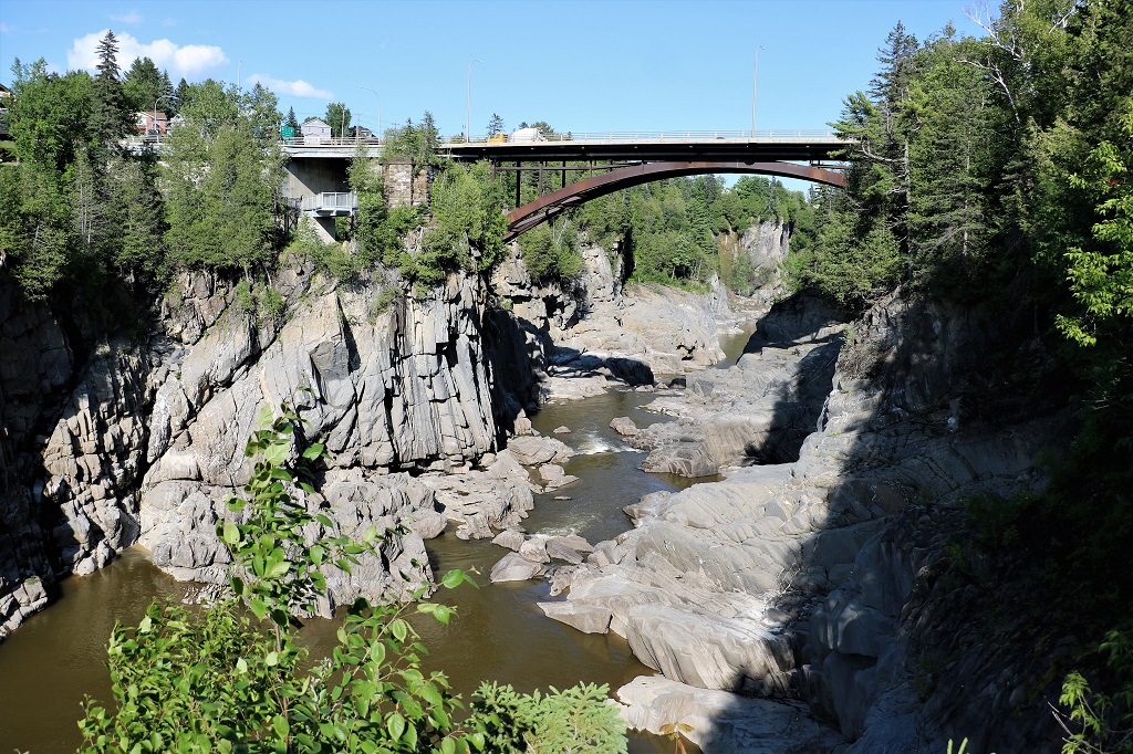
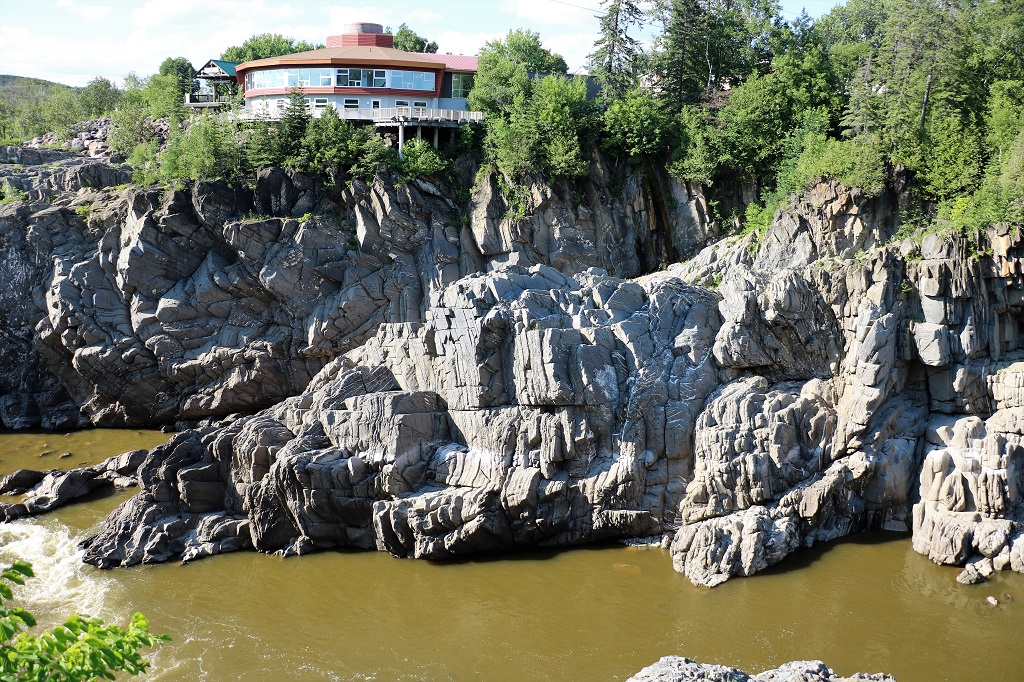
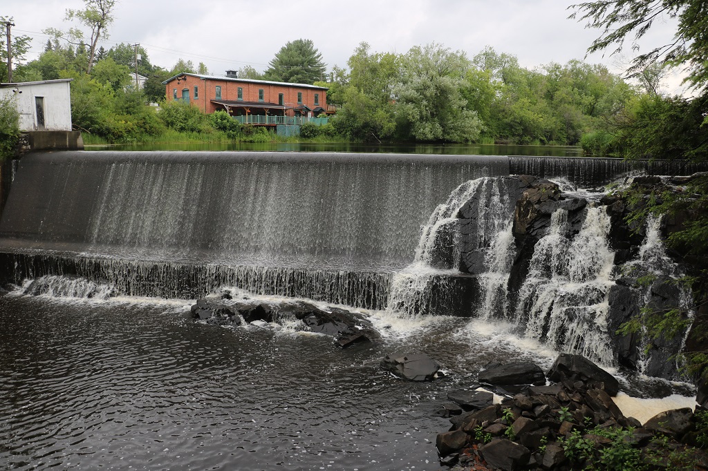
We are spending the night in Grand Falls. We stayed here in December 2019 when we flew to Ottawa to help our daughter-in-law, who was six-months pregnant at the time, set up her art work at a gallery for a show. After the show opening she flew back to Texas and we rented a car and drove to New Brunswick and Prince Edward Island to find a geocache in each of the province because they were the only two we had not yet made a find. We spent the night at Grand Falls and went to see the Grand Falls but everything was encased in ice and snow. Today it was not, but it is only during the spring melt run-off that there is much water flowing over the rocks.
There are two ziplines across the gorge. You ride over on one and ride back on the other.
The walkway along the front of the Visitor’s Center takes you far enough that you can even see the downriver part of the gorge.
We drove across the bridge and went down to the viewing platform we could see by the zipline shack in the photo above. This allowed us to see more of the falls and a better angle on the gorge under the bridge.
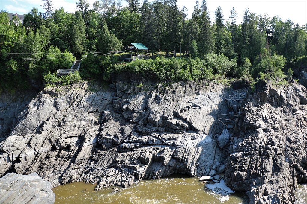
This is the Little River Falls. Even though it appears to be part of the same system, it is actually a waterfall where another river – the Little River – joins the St. John River wherefrom comes the Grand Falls when the water flows over the dam in the spring.
Tomorrow we continue south and east to Fredericton, the capital of New Brunswick, where we plan to spend two nights.
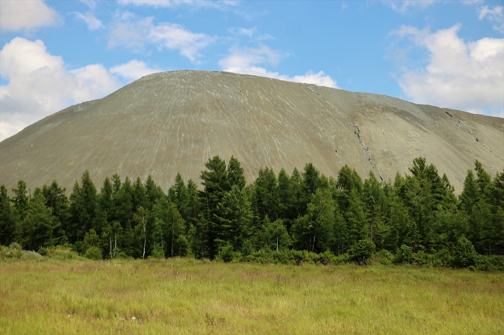
Our destination today was Montmagny which is located on the south side of the St. Lawrence River and further east than Quebec City on the north side. Once again we skipped all the major highways and followed a roadmap route winding through country municipalities and small towns. We drove almost all day through gorgeous farm country – mostly dairy farms. And we went up and down some VERY steep hills – as in 8% -14% grades.
We drove north of Sherbrooke first to the town of Windsor where there was a building still surviving from an old powder mill – as in black powder for explosions and guns. I was hoping there would be information plaques or a brochure available but there was only the empty building. The property is now a popular hiking area and the lady at the desk just collects a fee to use the trails. She let us in for half price because we only wanted to walk down to the bridge that we could see from the mill building.
Look closely at the picture above. You can just make out a smooth water line a tiny bit below the bridge. It is like the edge of an infinity pool, completely straight, no ripples or waves. This is because there is a sloped concrete wall for the water to flow over which creates a smooth waterfall.
Since there was no information about the powder mill available at the site I found this write-up on the Township Heritage Webmagazine: “Three components make up the explosive combination of black powder: saltpeter (potassium nitrate), sulphur, and charcoal (carbon). In its heyday, black powder had two primary applications: blasting powder for use in mining operations, and gunpowder for hunting. In 1864, three American entrepreneurs, Thomas Sheldon, Seth Andrews, and Jarvis Marble, decided they would profit from the mining boom that was happening in the Eastern Townships. They established a powder mill in Windsor, on the banks of the Watopeka River, calling it “Sheldon, Andrews, & Company” Over the next half-century, the mill would change hands, and expand in size, several times.
In 1869, with the arrival of a Montreal businessman, George Davies Ferrier, the mill became the “Windsor Powder Company.” It manufactured both blasting powder and gunpowder. In 1873, the mill became the first in Canada to manufacture dynamite, a powerful nitroglycerine-based explosive. Purchased by the “Hamilton Powder Company” in 1877, the facility comprised some forty buildings. Bought in 1911 by “Canadian Explosives Ltd.,” it underwent a number of modifications to both its product line and equipment. By the end of the First World War, the operation had grown to fifty-six buildings, an enormous complex.
In 1922, a violent explosion rocked the facility, killing a number of workers. This was not the first such accident (since opening, twenty workers had lost their lives on the job). It would, however, be the last. The plant closed its doors that same year.”
Looking down river from the bridge
We saw a sign indicating there was a viewpoint a kilometer up the road so we pulled in even though the sky was low and we did not expect to see far. We had been driving through rain since leaving Sherbrooke and even though it had stopped the clouds had not risen much.
Who cares if you can’t see a view. Isn’t this the most awesome viewpoint you have ever seen?
The view of the distant hill was indeed negligible and not worth photographing but it made a cute image between the ears.
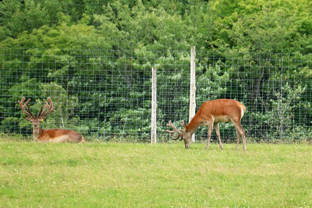
An elk farm
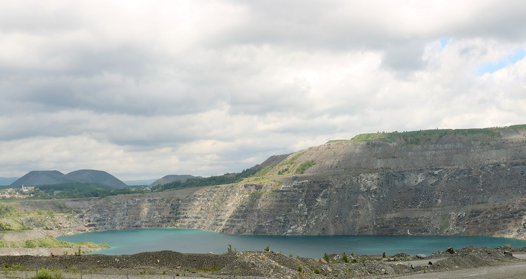
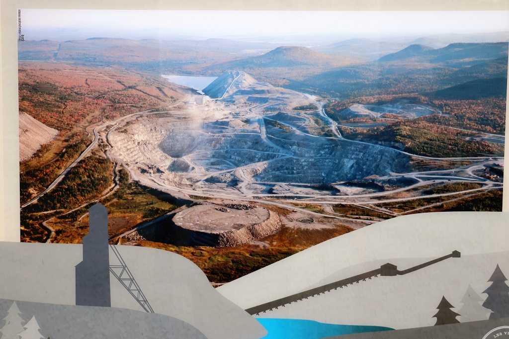
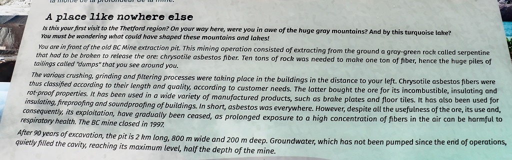
Just before the main town of Thetford Mines is a suburb-sort of town called Black Lake. It actually refers to the groundwater that has filled a massive open pit asbestos mine. I managed to snap a photo from the road as we drove by.
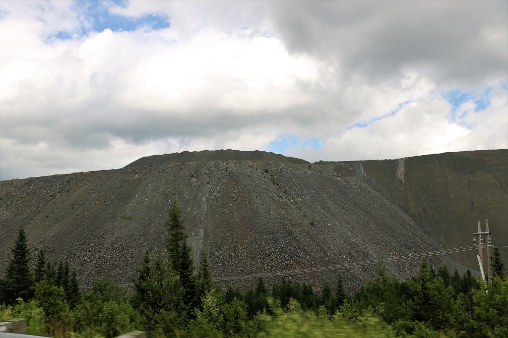
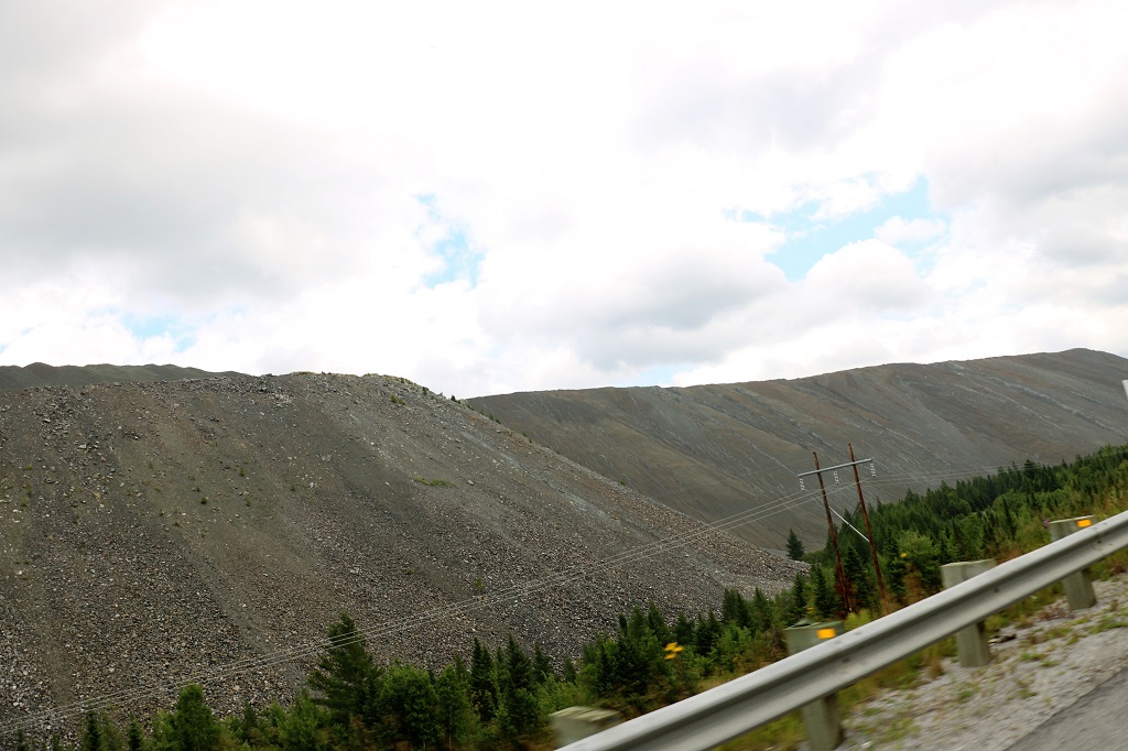
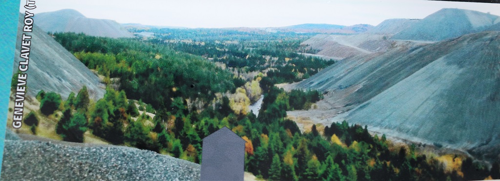
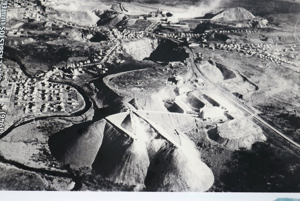
The most amazing thing were the mountains of tailings from the many mines. They stretched for a long distance out of the two towns in all directions. This area had the largest high-grade pocket of serpentine ore in the world. (You break the serpentine to extract the chrysotile asbestos fiber.)
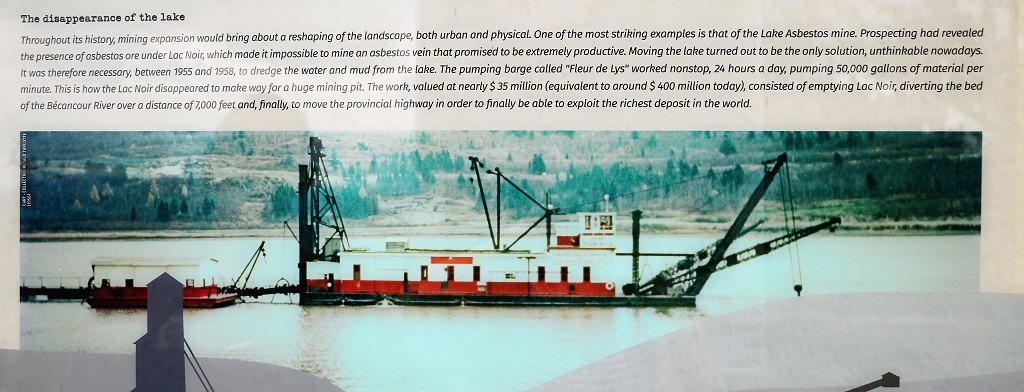
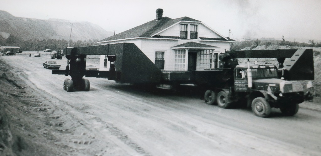
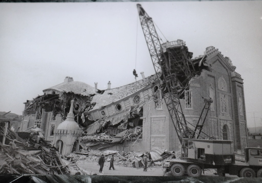
We managed to find a viewing platform in Black Lake that overlooked the Black Lake and had good information boards. I have attached photos and text from them in this blog because the story is so amazing.
How horribly heartbreaking for the community to see their beautiflul church turned into rubble!
Because the lake has been created from groundwater, rain, and snow melt there are no impurities as would be the case if there were input and output water access. This makes it look a lovely turquoise when the sun is out. Crater Lake in Oregon is the same and on a sunny day it is a gorgeous sapphire. We were not blessed with a clear sky but there were enough breaks in the clouds to show some of the colour.
We arrived in Montmagny at 4:30. Tomorrow we spend the night in Grand Falls, New Brunswick.
Today was primarily a driving day. There were not a lot of things to see along the way and we avoided the major highway and drove along lots of country roads through many towns, farms, orchards and vineyards.
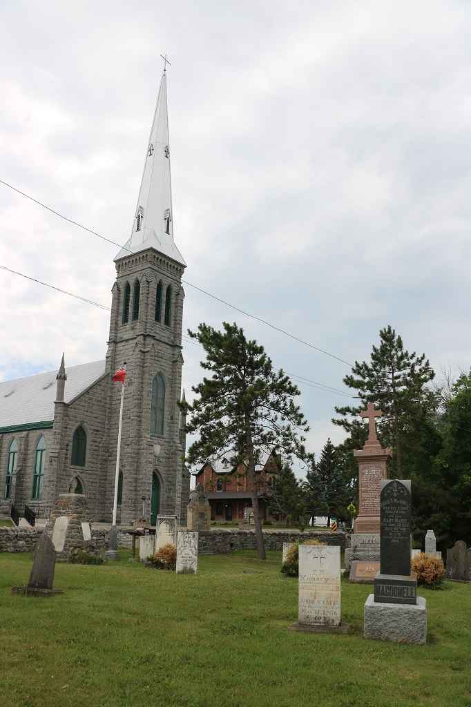
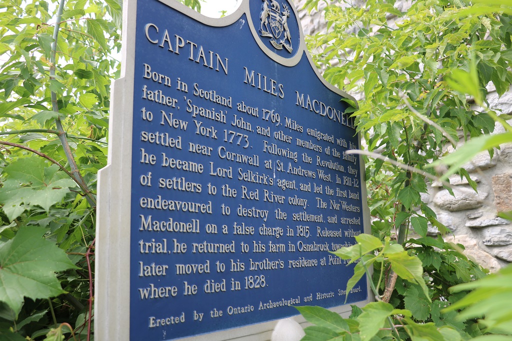
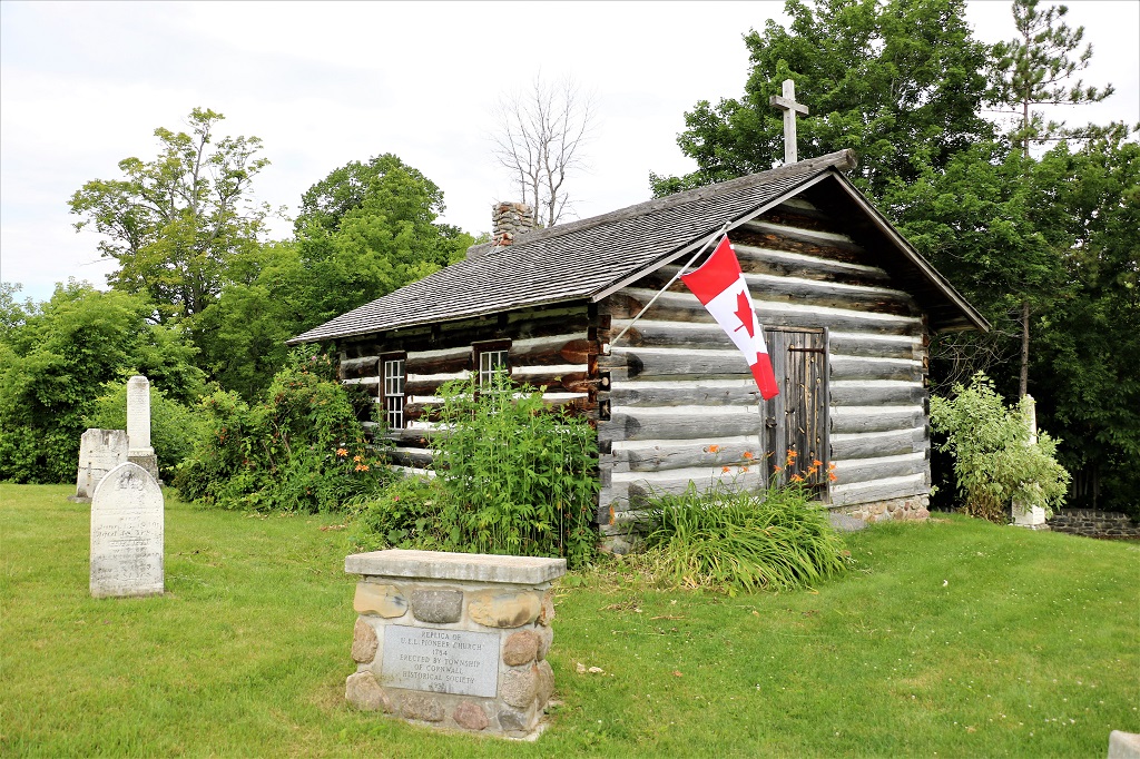
We only made three short stops. First was into the parking lot of a Roman Catholic Church that had a really tall spire in Cornwall, ON. We also noticed a historic marker half hidden in the plants on the side of the hall building.
The church turned out to be the oldest remaining stone structure in Ontario. It was built in 1801.
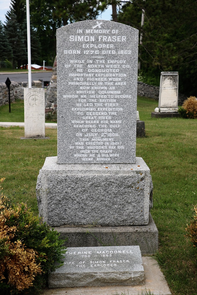
We crossed the street to check out the historic cemetery and find the grave of Simon Fraser, whom we learned all about in elementary school history and geography.
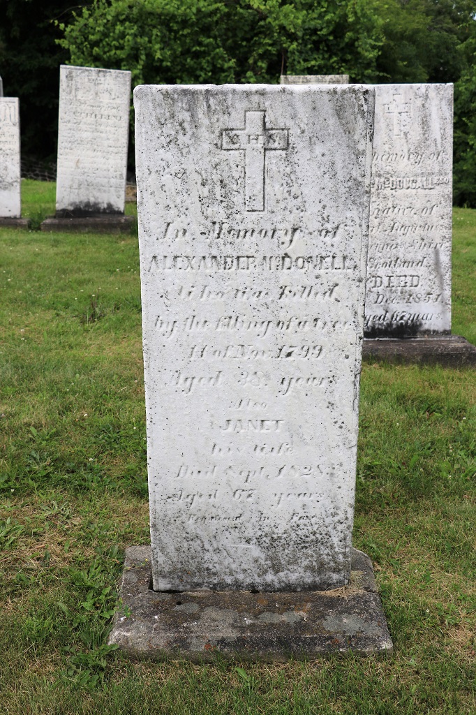
Simon Fraser’s wife was a MacDonell. The historic marker we noticed beside the church spoke of an early settler named MacDonell who arrived from America with his father and the rest of his family. The cemetery was full of the graves of MacDonell’s. They were Loyalists and received land for their military service against the Americans
The marker says he was ‘killed by the falling of a tree’ in 1799. This is the oldest tombstone in the cemetery that is still legible.
This is a replica of the first Roman Catholic church that was built on this site in 1784.
There was a low stone wall around the cemetery and a plaque that said that it had been restored in 2007 with financial assistance from the Province of Ontairo, the Hudson’s Bay History Foundation (many of the people buried here would have been fur trappers and traders for the Hudson’s Bay Co.), Simon Fraser University (in BC) and many private donations from the community of Cornwall. I thought it interesting that the University in British Columbia that bears his name would send money to Quebec to help restore a wall around Fraser’s burial site.
Our second stop was a bit of a detour. While passing through LaColle we went 8 km off our route to drive up to Fort Lennox National Historic Site. We were able to go into the visitor’s center but the actual site of the fort was closed for restoration. It was planned to be re-opened in 2020 but Covid hit and that delayed the work for two years. Tentative opening is now next summer. The Fort is on an island and when it is open you can take a boat from the Visitor’s Center over to see it. The restorations will be quite extensive to the original buildings to repair foundations and deteriorating stone blocks and fix old windows.
The French built a wooden fort on the island to protect themselves against a possible British invasion via Lake Champlain during the Seven Years War in 1759. Britain took the fort after a 12-day seige 1760 and promptly abandoned it because there was no longer a threat. After the Americans attempted to capture Quebec City in 1775-1776 they retreated to Lake Champlain so the British, worried about another attempt, built a fort that was smaller than the French original. Between 1819 and 1829 a few hundred soldiers and workers built Fort Lennox. All of the buildings on the site are the original ones from that time. The Fort was surrounded by a Star moat.
This is as much as we could see of it across the water with a zoom lens.
The Fort Lennox Visitor’s Center was at the end of a spit of land that jutted between two waterways with houses and many beautiful boats.
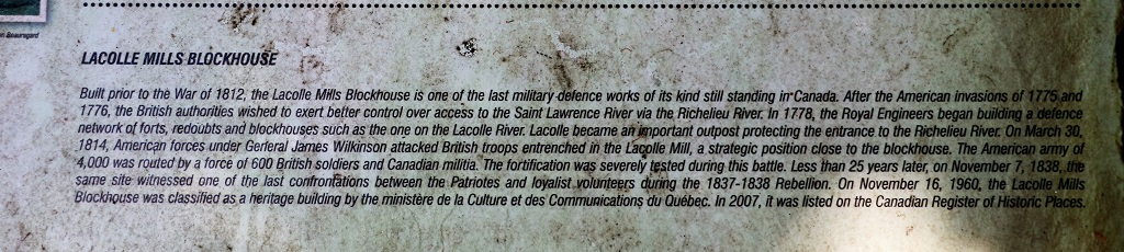
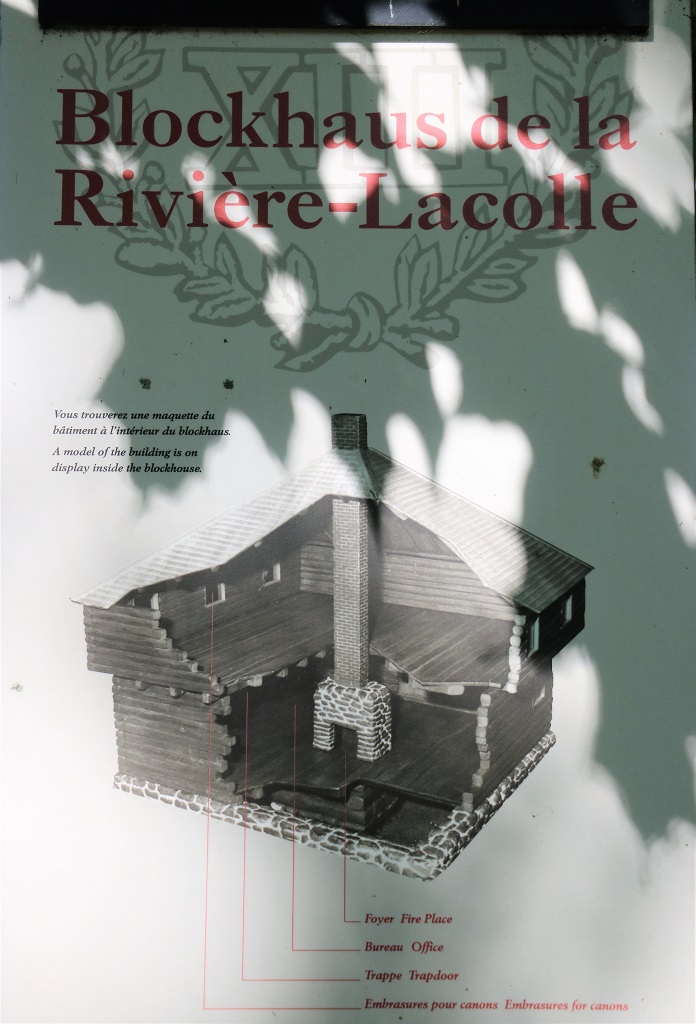
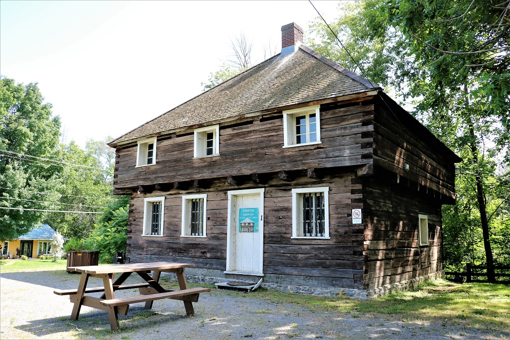
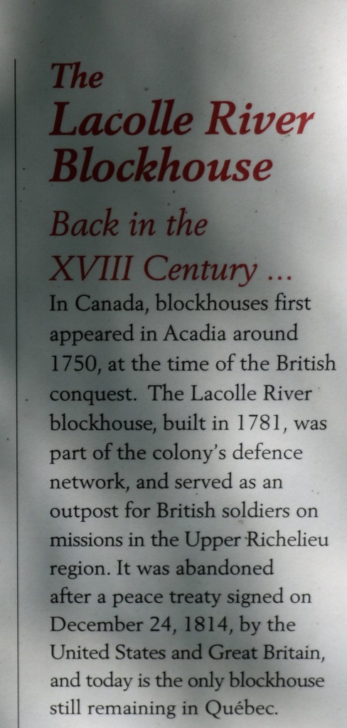
We backtracked the 8 kilometers back to our required road but made a quick photo stop at an old wooden Blockhouse located almost at the junction.
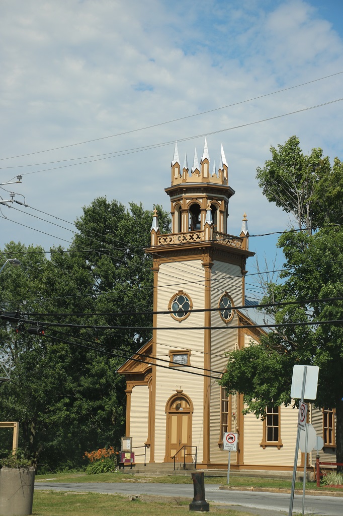
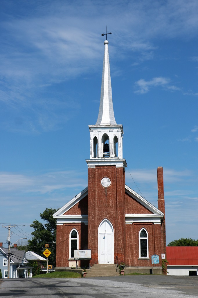
These two churches were side by side at a road junction. I did not have time to see the denomination of the one above. The one below is Baptist.
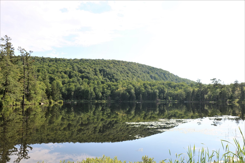
We were on a narrow winding road and there was no traffic so when we saw this lovely reflection we just stopped and took a couple of photos.
Most of the roads we drove today were normal two-lane roads but for about 20 km were on this one that was quite narrow and had lots of turns. The road had been prepped for re-surfacing so was pretty rough, otherwise it would have been a great motorcycle road. I bet the local bikers like it.
We arrived in Sherbrooke at 5:30, checked in to our hotel and headed down the road to find a restuarant for dinner. At the time of this writing we have not decided where we will spend tomorrow night.
We had a really nice day today. The weather was awesome; nice and warm. We drove over to the Garden of the Provinces and Territories, but it looked like a nice green space with lots of big trees. We did not see any flower gardens so headed off to our chosen second place of the day.
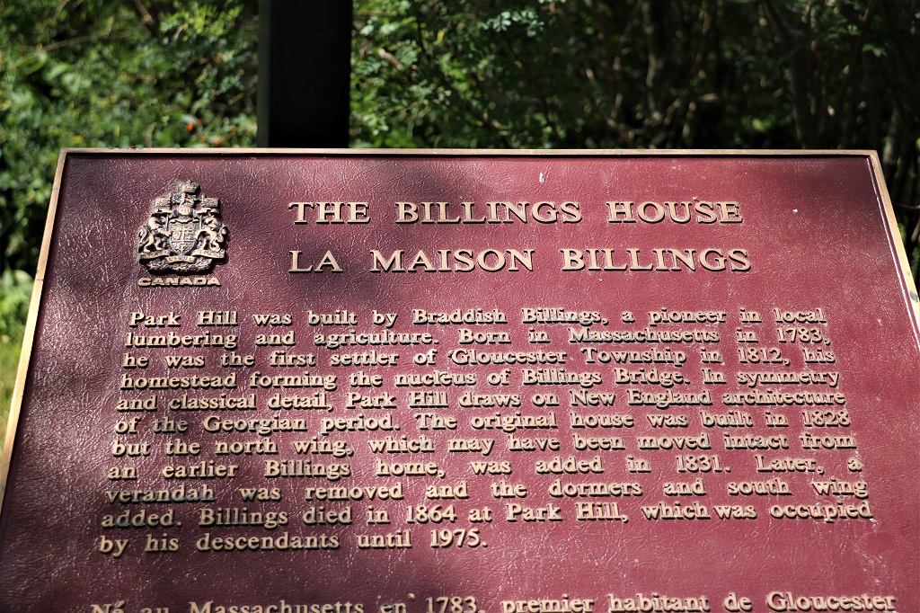
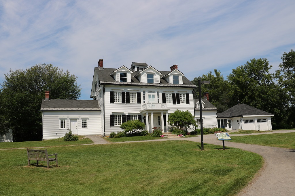
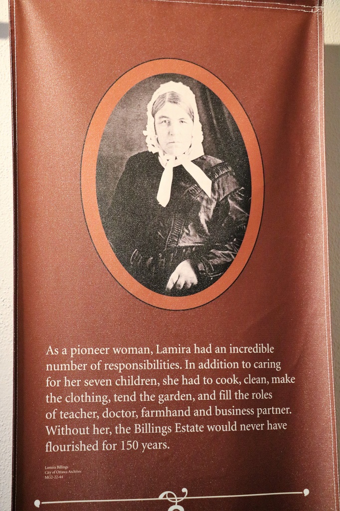
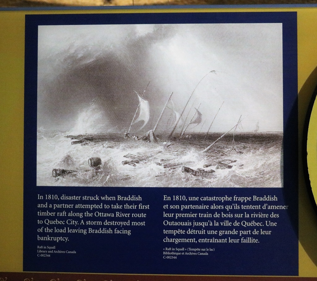
The Billings Estate Historic Site is the home of the first settlers in Glouchester Township. They came north from the USA based on the promise of free land in Upper Canada. Braddish & Lamira were newly married when they arrived in 1813. He was 30. She was 17.
With hard work and determination they raised seven children and built a prosperous farming enterprise. Five generations of the family lived here and when the last of the Billings moved away local heritage groups and the City of Ottawa saved the house and the remaining land. Over the years they had built the property until it encompassed 1200 acres.
They had nine children but Cynthia died after a lengthy painful illness at age 3. They still have the letter Lamira wrote to Braddish telling him of the death of his daughter. They also had a son who died at ten months.
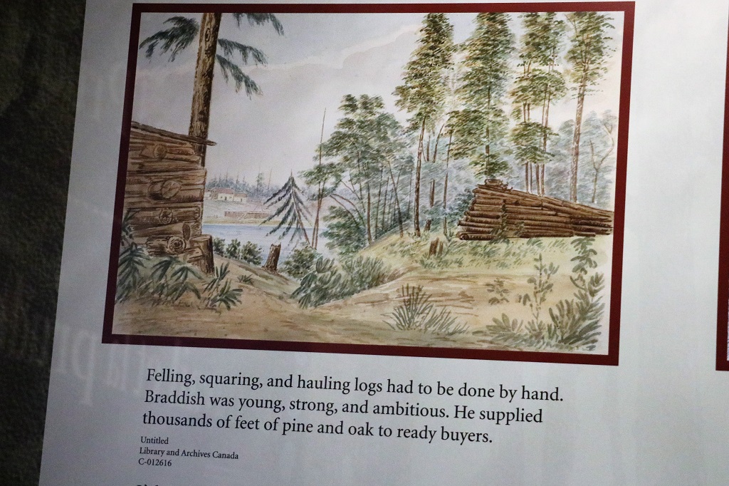
As they increased their holdings they had a sawmill and the farm raised produce which was sold at Byword market as well as eggs, cream, butter, and cheese. Many of their children pursued careers and interests outside of the family farm but the Billings estate would remain in the family for almost 150 years.
The family was very philanthropic. They donated land for a school, and a hospital, and financed the building of them. They contributed to the construction of a bridge that enable the growing community to easily get their produce and products to the market. Lamira built a church and two of her daughters also financed the construction of churches. Braddish acted as an unofficial banker and supplied land and financing for the first post office and general store. He leased land and loaned money to other area residents. Between 1825 and 1850 Braddish filled a number of leadership roles in the community, including warden. town clerk, assessor, collector, pound-keeper, overseer of highways, councilor and justice of the peace.
A very industrious, community minded family that included a son who was Canada’s first paleantologist, a proflific scientific writer, who discovered 60 new genera and over 1000 new species of fossils – which made him world famous. Two of his sons were architects and amateur paleantologists as well and one of them donated his fossils to the British Museum. Braddish II founded the Botanical Society of Canada and was vice-president of the Entomological Society of Canada. He identified 2000 species of plants in the Prescott area alone. Some of his collections went to the Smithsonian Institute in Washington. Another son was a geologist and enginner. Even the females in the family had careers. It was two of the daughters that continued to run the farm and businesses after Braddish and Lamira died. Of the 14 women in the family generations only three of them ever married.
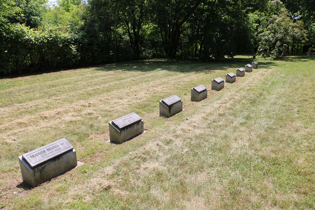
The estate contains the oldest cemetery in Ottawa. The original gravestones deteriorated over time and were replaced in the 1930s with these white marble ones. Most of them have a weeping willow at the top as a symbol of sorrow and eternal life. Some are cracked and have been repaired so they have all been brought to this building to preserve them and small markers are now in the cemetery.
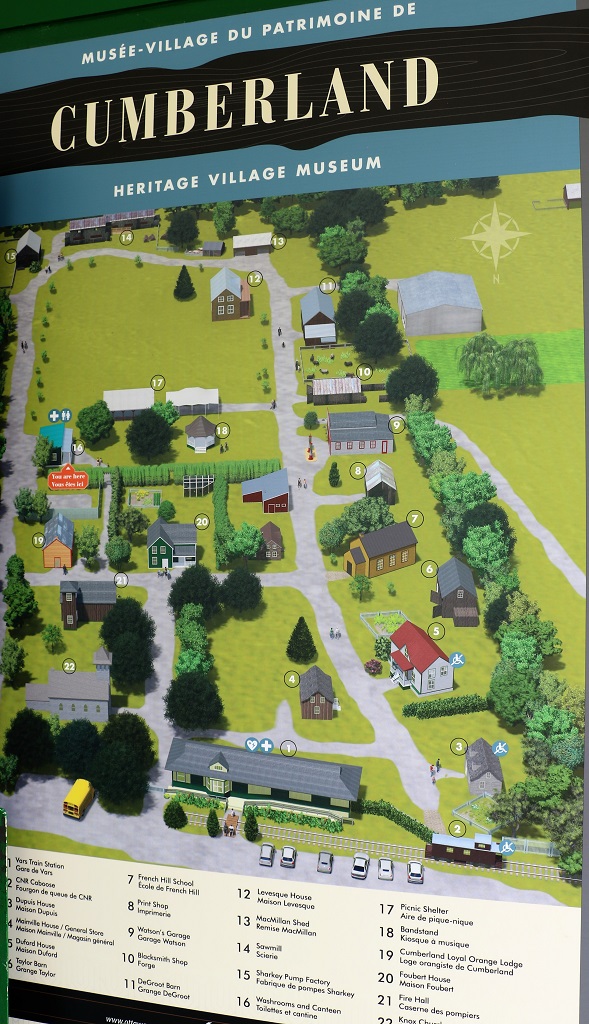
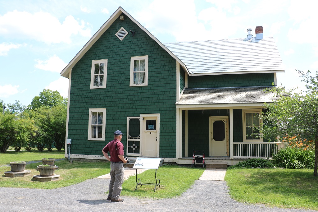
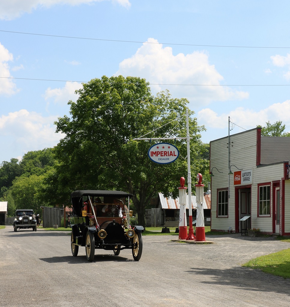
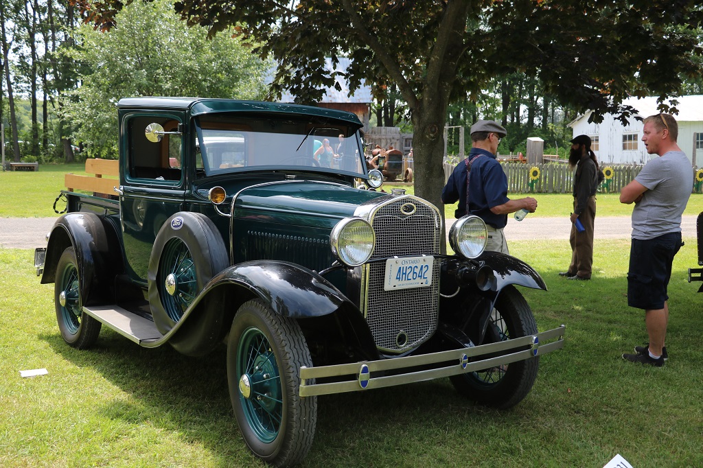
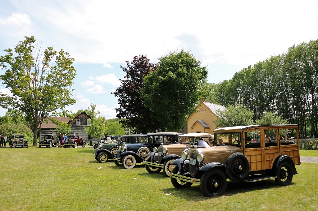
On the window at the ticket counter at the Billings Estate was poster for a Vintage car show at the Cumberland Heritage Village. All pre-1940 vehicles. We had lots of time before we had to be at John’s cousin’s so we got directions from Google and off we went.
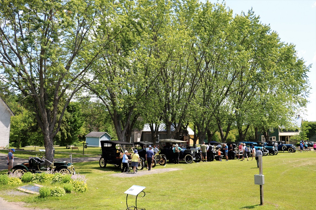
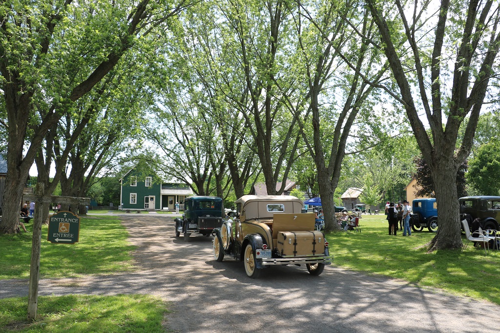
It was a large park with many buildings that have been moved to the site from the surrounding area since the mid-1970s. The cars were all in a large grassy area at the park entrance. The car owners would take turns pulling out of their display spot and drive the big loop road in the park. And they often would offer rides to children or adults. Very cool.
We wandered past a few cars, then checked out a few buildings, then a few cars, then a few buildings until we had seen them all.
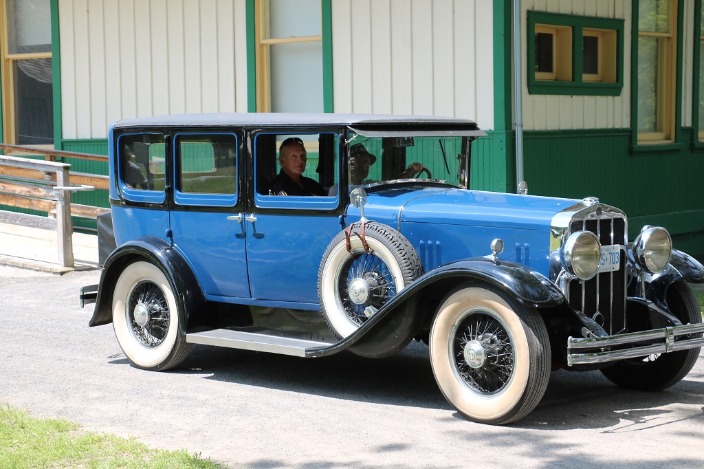
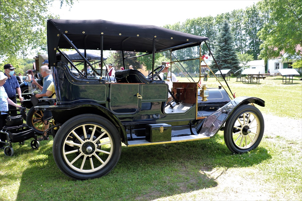
The cars were displayed clockwise around the lawn with the oldest being the REO on the left of the photo above. I did not take note of models, makes or year of any of the cars. Nor did I photograph every one of them.
Knox Church of Vars. It was a Presbyterian Church from 1904 until union with the Methodist Church in 1925 to become the United Church. The church, complete with furnishings and stained glass windows was decommissioned and moved to the village museum in 1977.
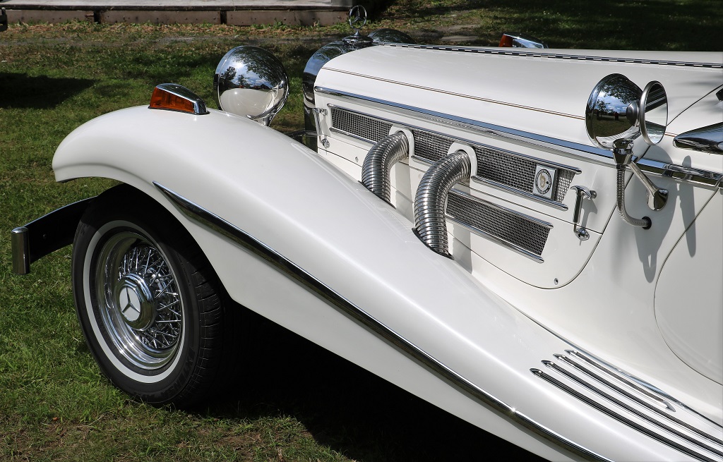
I loved this gorgeous Mercedes-Benz.
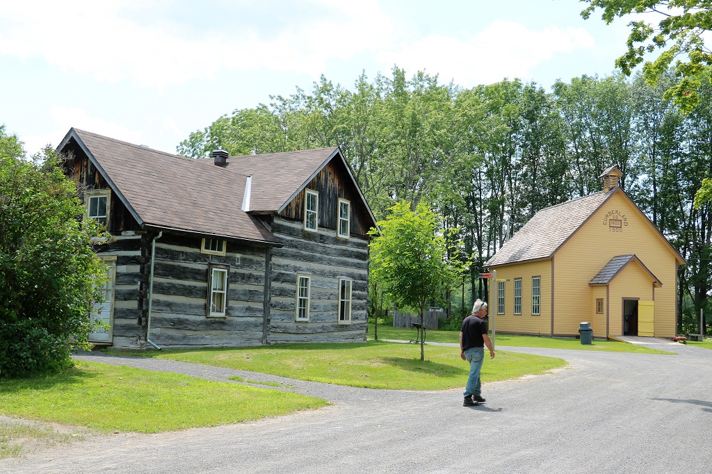
This is the most modern house in the museum. It is the Foubert house of 1915 and was a kit house ordered from a catalogue.
The Grier-Spratt House of 1857 and the Cumberland School. The house was originally owned by Anabel Foubert, one of the first settlers in the Village of Cumberland and later the home of the Griers and then the Spratts. For a brief time in the 1860s the house was the home of Dr. James Ferguson, the community’s first medical practitioner. It was disassembled and moved here in 1977.
The French Hill school built in 1900. Nearly 40 students, French and English speaking, in one room, grades 1-8, received a very British education with French taught as a subject. When a French school was built all the French-speaking children moved to that school. Throughout its use it was never equipped with electricity or plumbing. There were two outhouses, one for the boys and one for the girls. The school was closed in 1936 and remained empty until it was moved to the museum.
The front of the Grier-Spratt house.
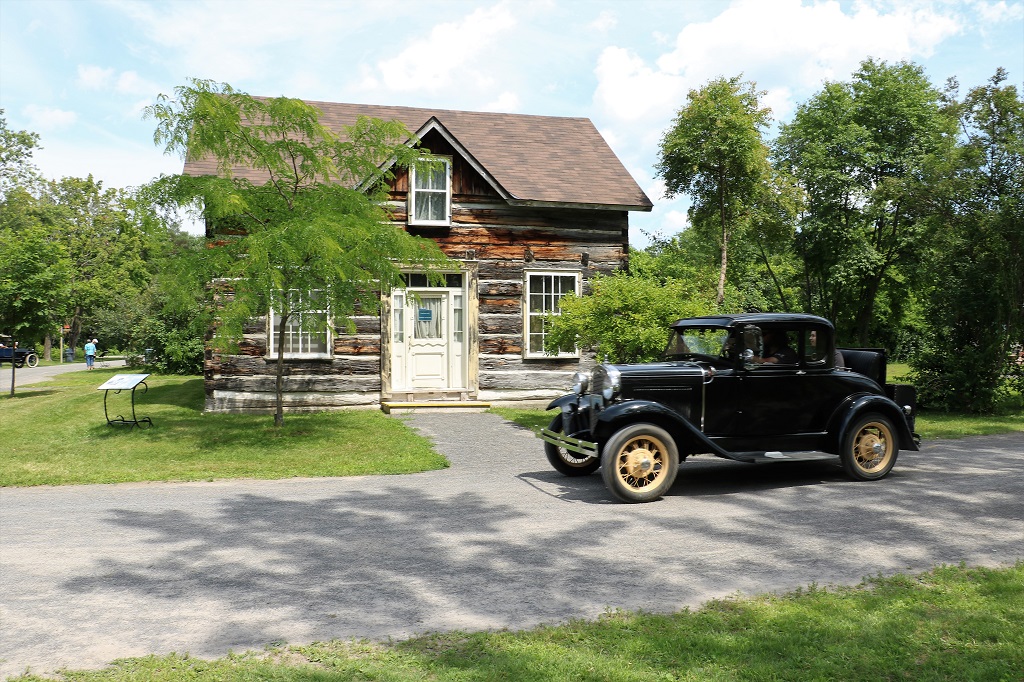
This tiny little house sat on St. Joseph Boulevard in the center of Orleans until the owner willed it to the museum in 1984. It is a one and a half story house with one room on the main floor that served as kitchen, dining and sitting room and a bedroom in the half attic. The house never had electricity or running water or plumbing. Built in 1820 it was originally located on 200 acres of land owned by Francois Dupuis, a former member of the Regiment des Voyageurs and one of the first settlers in the area. The house served four generations of the Dupuis family.
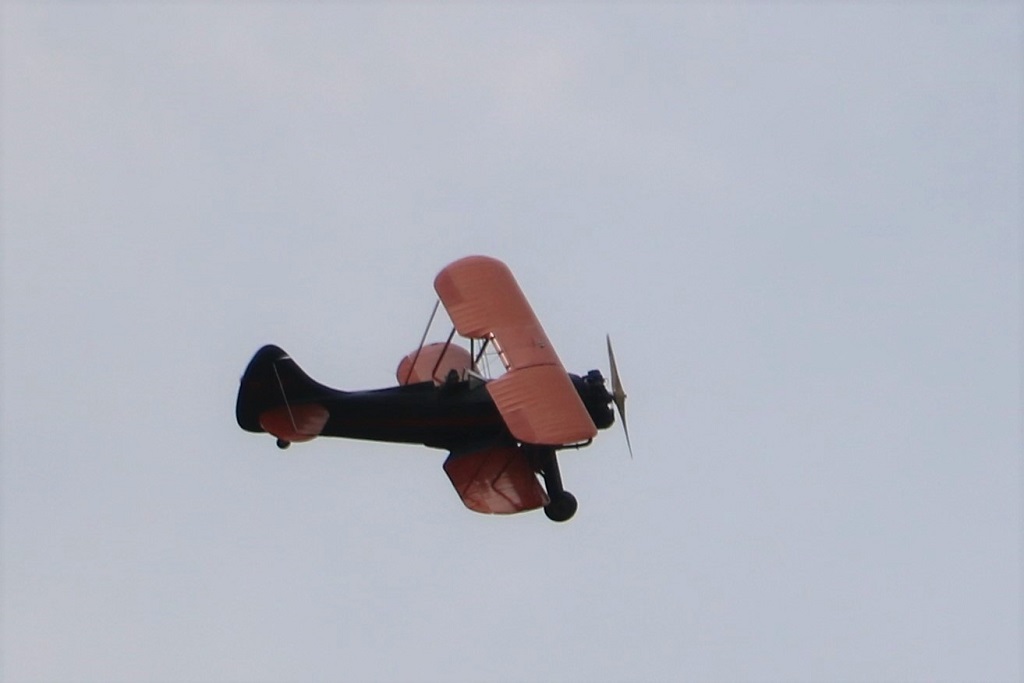
As we were walking back to our truck we stopped to chat to a fellow at the gate and during our conversation he suddenly stopped and looked to the sky and said, “Here’s our bi-plane.” Apparently someone at the village knew some who knew someone who had a 1938 bi-plane and was attending some function nearby. He agreed to do a couple of flying loops over the car show area. The era of his plane fit right in with the vintage cars.
We drove back to our room at the University of Ottawa and I sorted and edited photos until it was ready to head over to John’s counsin’s for another dinner and visit. We had a great day.
Tomorrow we leave Ottawa and drive down to Cornwall before crossing the St. Lawrence River and heading to Sherbrooke, Quebec for the night. We have really enjoyed our four days in Ottawa. There are still sites to see here so we may have to come back.
Today was quite a lazy day. We stayed in our room until noon. I wrote and posted yesterday’s blog because the internet was down all day yesterday and John had received the text of Sunday’s worship service so he found the music videos to embed and got it ready to post.
We had visited the Museum of Nature in 2014 but we figured it was worth another look. I bet if I looked back on the blog for that day I would find I photographed almost the exact same things! We do know what we like.
There are four levels to the museum with two gallerys on each. First floor is Owls and Fossils, which we skipped. Second floor is Mammals and Water. Third floor has Earth and Birds and the fourth floor has an exhibit on the Arctic and how it is being effected by climate change, plus a special exhibit you need to buy a separate ticket for which is a journey across more than 80,000 years of Earth’s history – AKA more dinosaurs so we did not go there either.
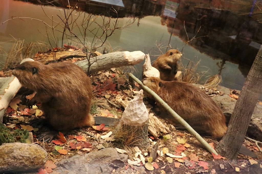
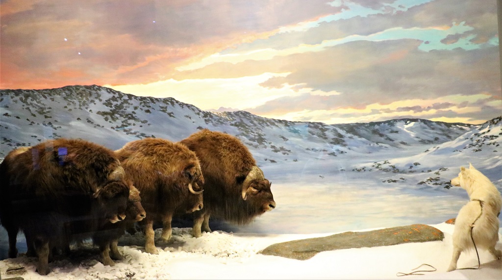
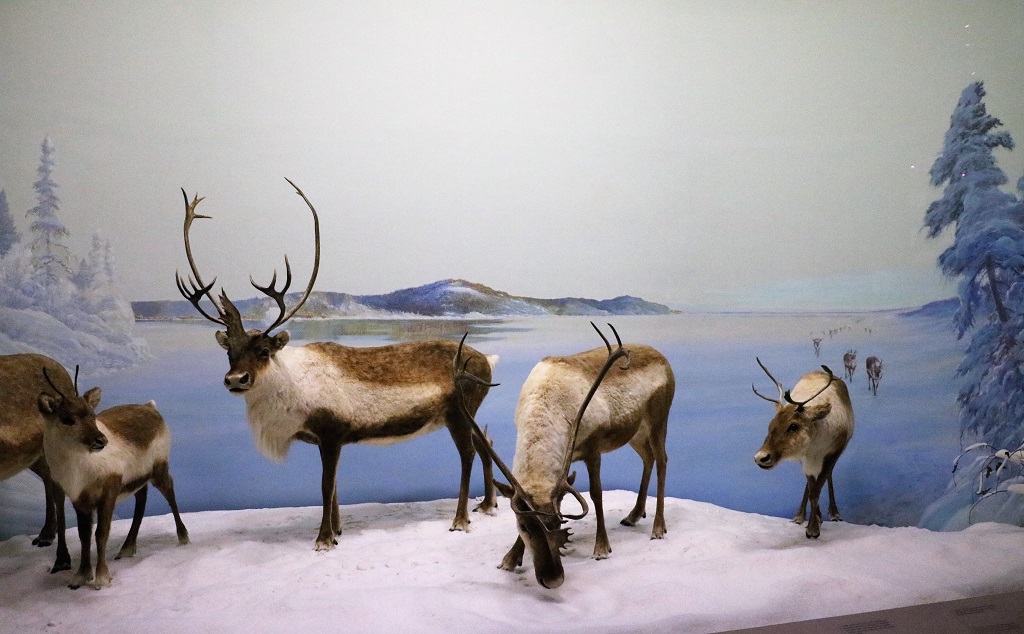
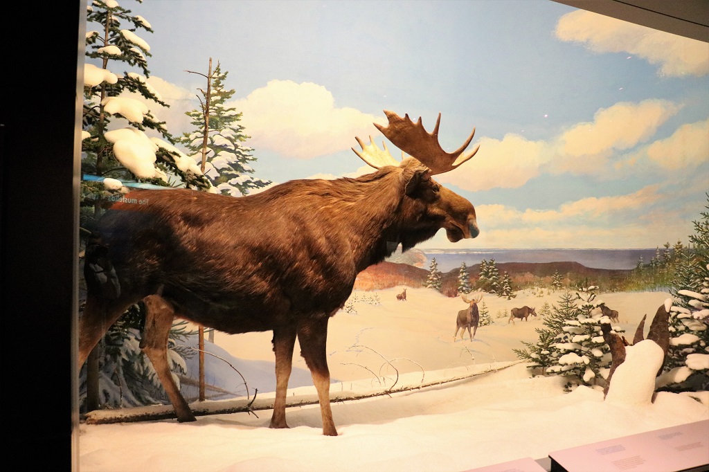
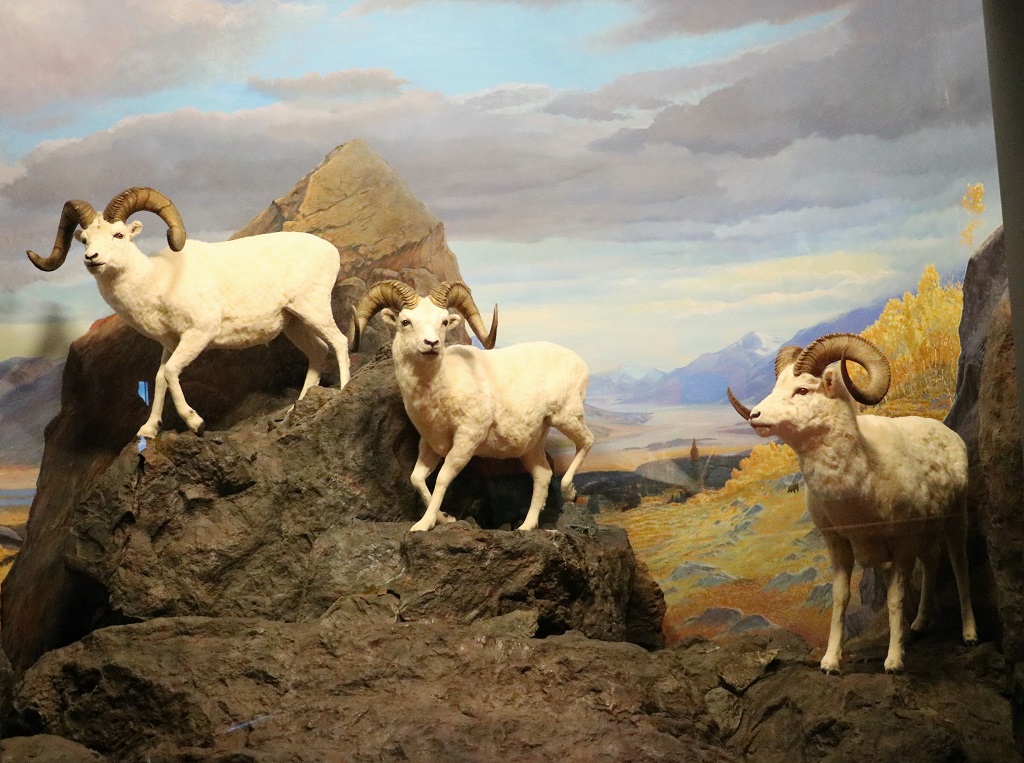
We spent about 2 1/2 hours in the museum. Suprisingly I did not take as many photos as I often do. Some galleries, like Birds, I did not take any at all. I do love the dioramas in the Mammal Gallery though. Although I always feel bad that all these lovely animals have died and then been stuffed for these things.
Polar BearBeaverMuskoxCaribou
Both of the males in the diorama had the distinctive ‘shovel’ horn down the front of the muzzle. We always thought each side of the antlers formed a shovel, but each Caribou only had one and the horn from the other side had thin branches. One had the ‘shovel’ come from the right antler and the other from the left.
BisonMooseBighorn Sheep
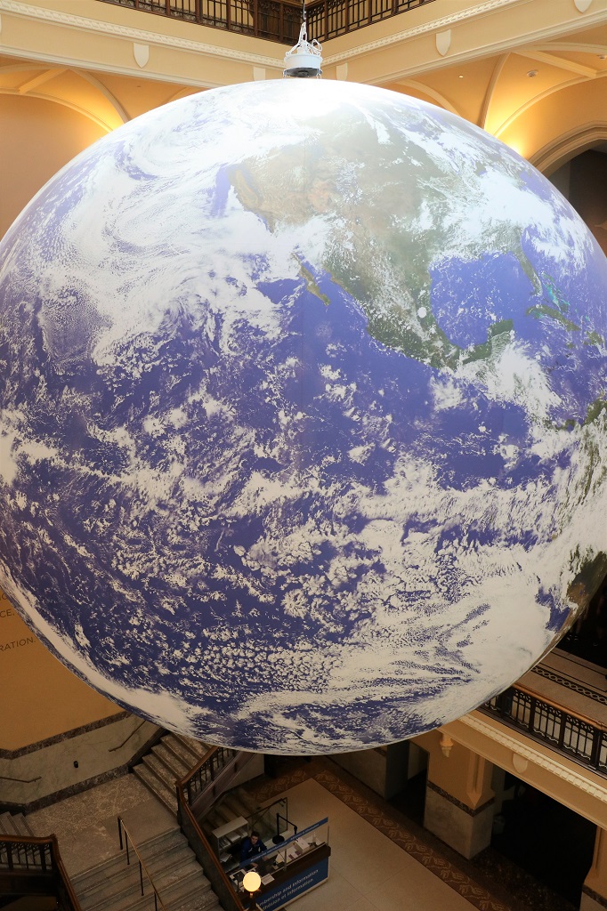
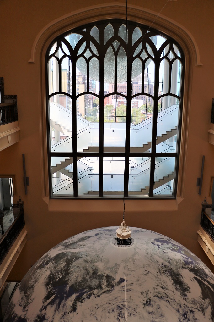
Hanging from the ceiling in the open middle of the museum’s four levels is an image of the earth taken from space and put on a gi-normous balloon, which revolves at the same speed as the earth does.
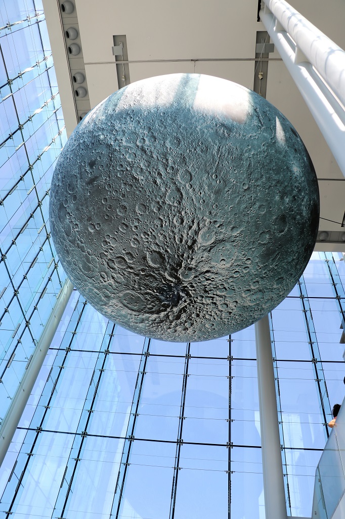
In the Queen’s Lantern, which is the glass tower added to the old building when the original tower was removed, hangs the moon. The original tower was torn down because it was leaning and they were worried it would do damage to the rest of the building as well if it fell.
I tried to get a photo of the earth and the moon, but the angle made it hard to get in the limited space and the difference in the light didn’t help either.
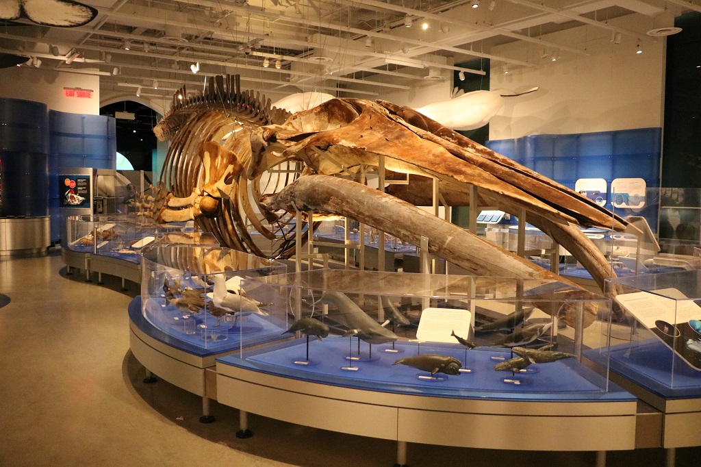
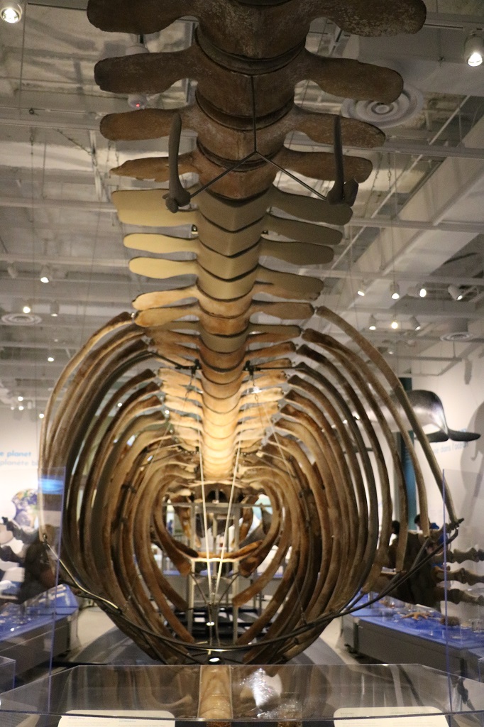
You can’t see much of it – again due to angle and limited space but this immature blue whale extends the full length of this room and into the next.
Beluga
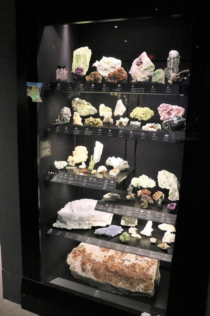
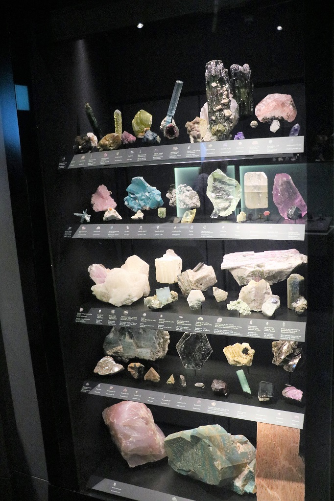
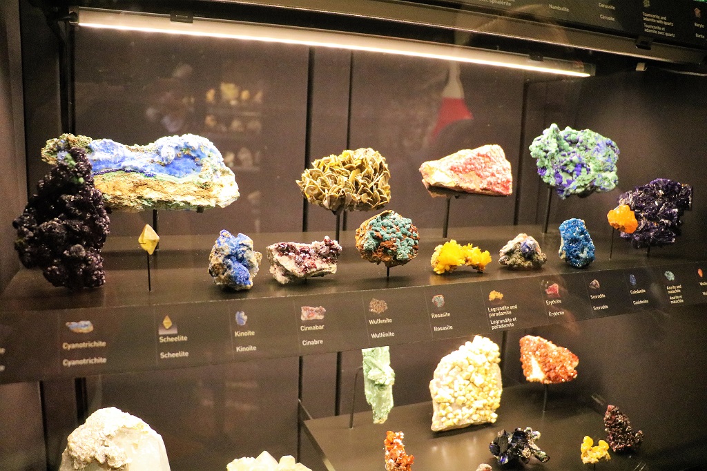
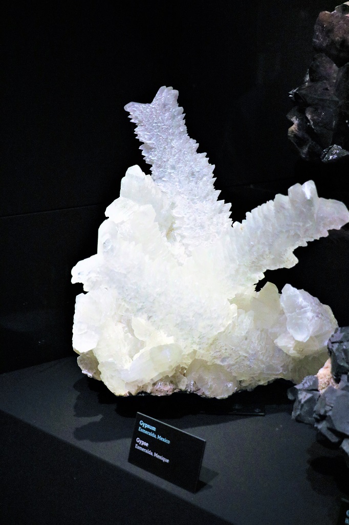
I am not very interested in rocks and minerals but I took quite a few photos in that gallery because the cases of different samples were so colourful. I have no idea what these all are or what they may be used for. Every case told the name of each mineral and where it came from. I have never heard of 99% of them and could not pronounce many of them either.
Each case displayed examples of the different classification of minerals.
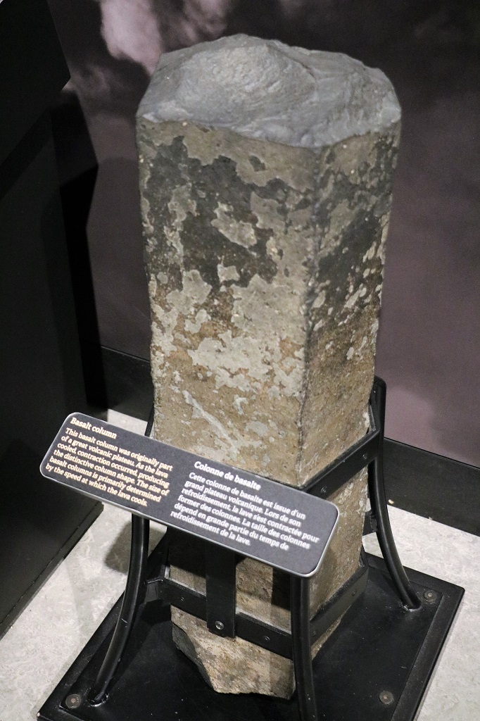
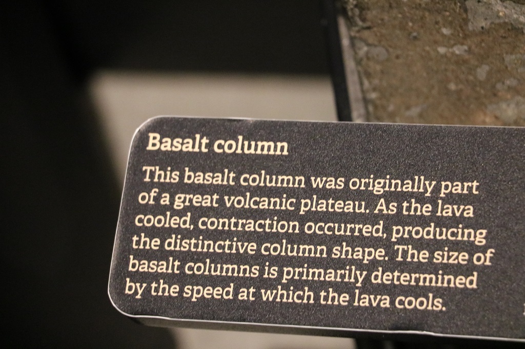
We have seen a lot of walls of basalt columns in our various travels, the largest of which is the amazing Giant’s Causeway in Northern Ireland.
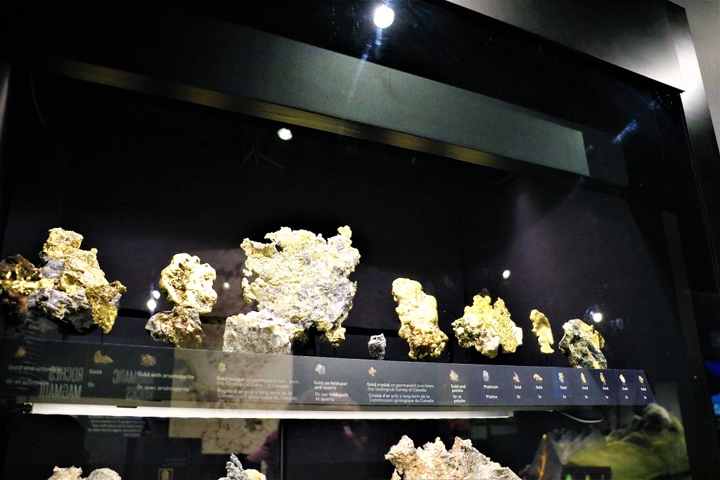
Gold, gold, and more gold in all its different mineral incarnations.
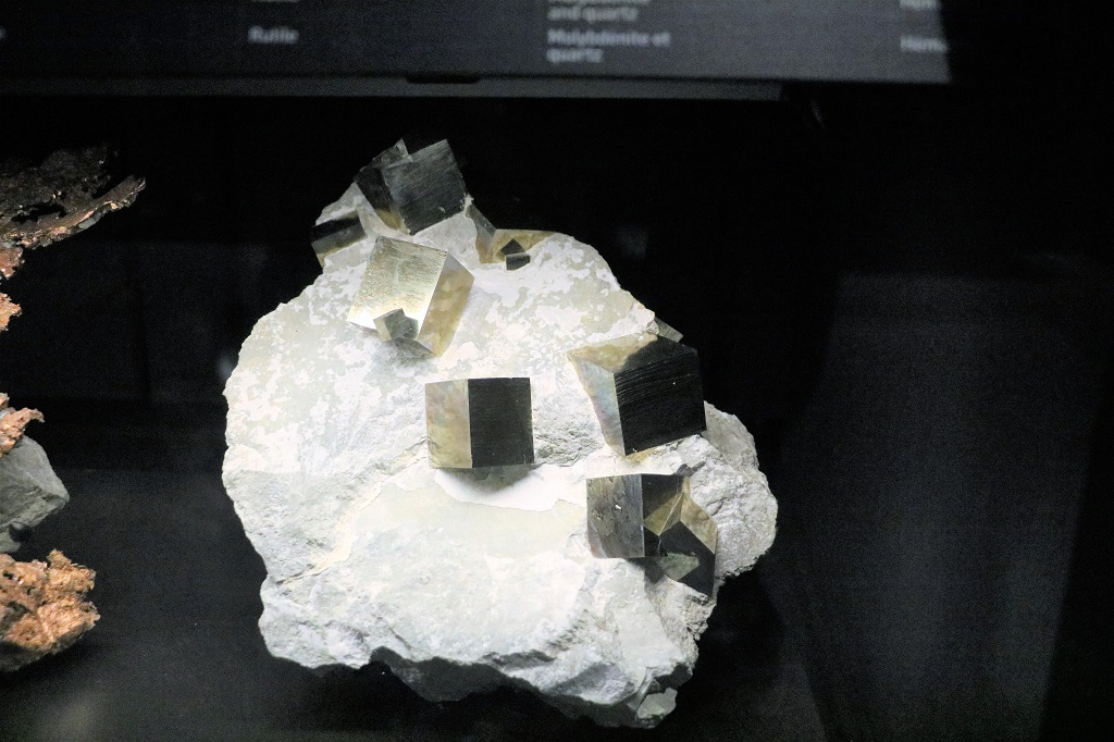
Pyrite natually forms perfect cubes.
I liked this one. It is a very soft mossy green and looks like a rock covered with mold.
Gypsum, like several other minerals forms long arms.
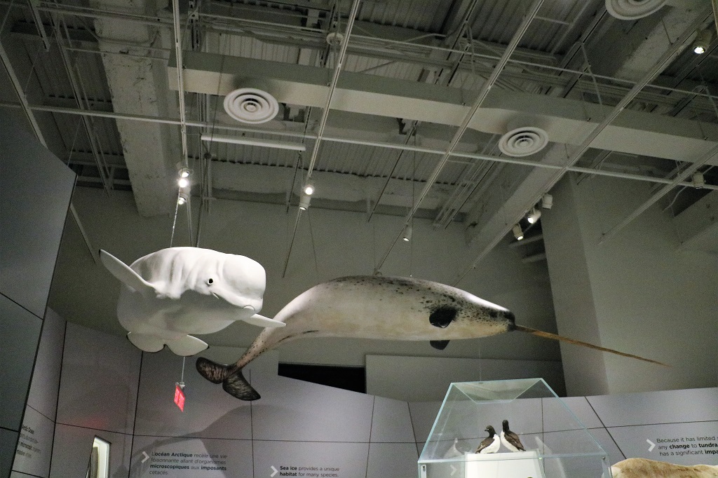
A Beluga and a Narwhal
We had lunch at about 3 and headed back to our room to enjoy our weekly video chat with our son and his wife and daughter.
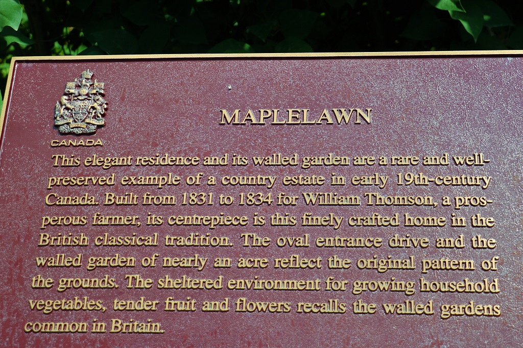
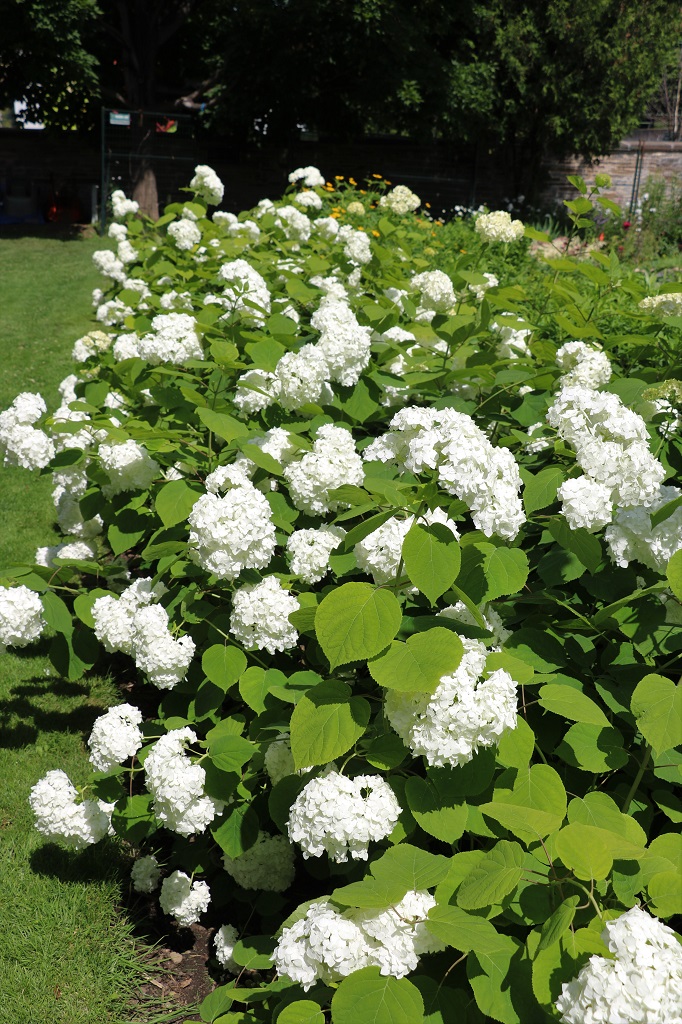
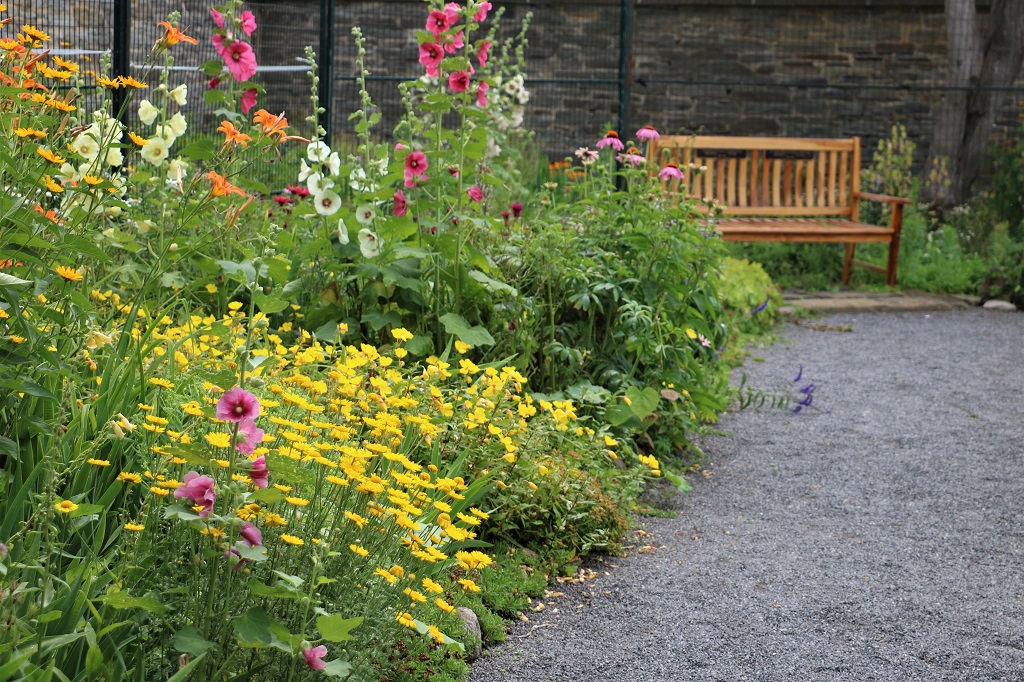
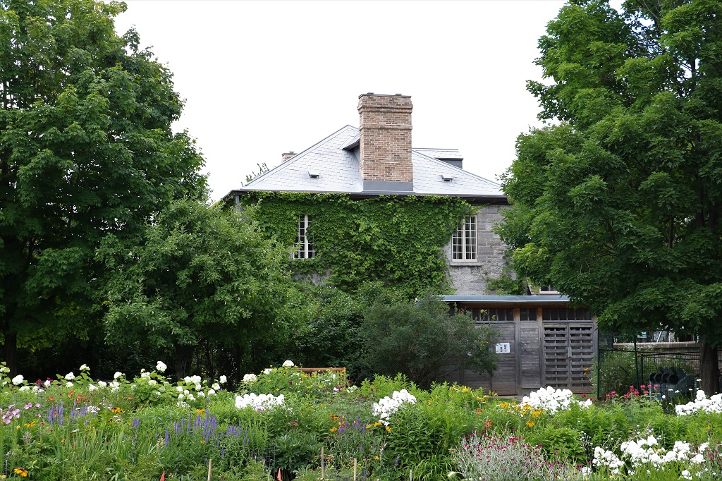
As promised yesterday there are flowers today. It was time to go to a garden. We drove out to Maplelawn and wandered around thier English Garden. It is cared for by volunteers, I think, and was a lot ‘bushier’ than most manicured walled gardens in Britain, but it was really nice to just stroll among the colours and photograph the fleurs.
You can’t tour the house unfortunately and part of it is a Keg restaurant.
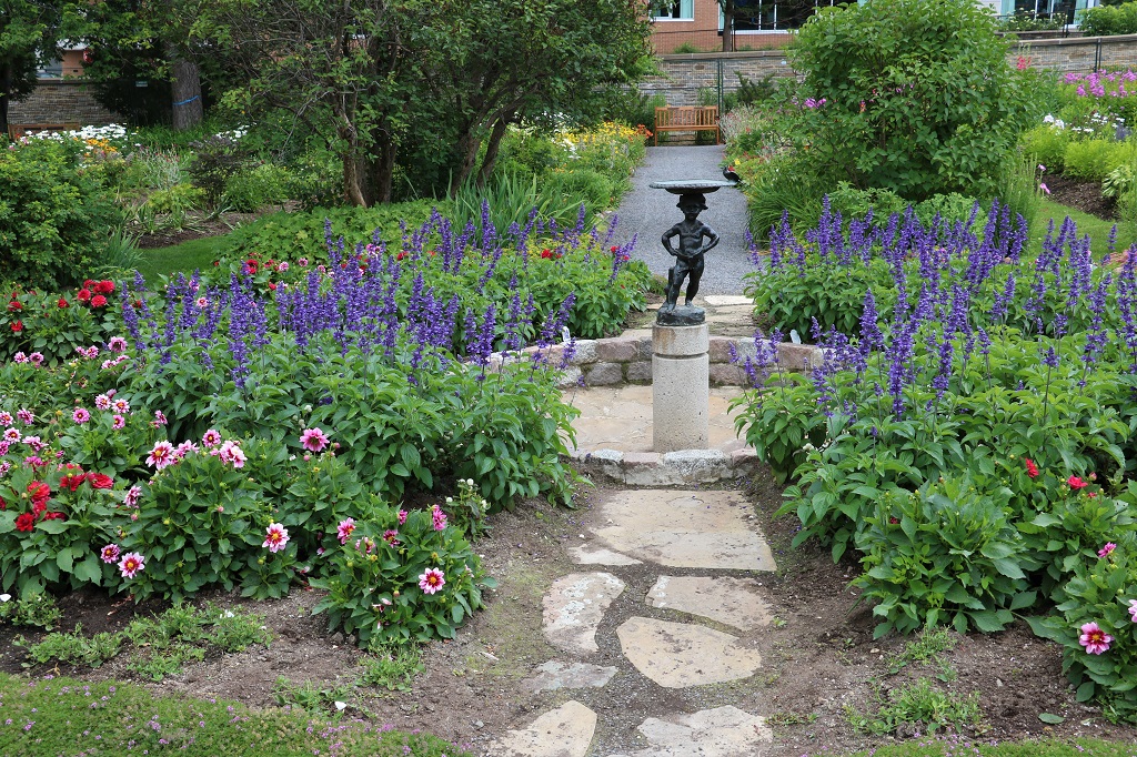
The garden was laid out in the typical box format with bisecting X paths and a central floral/fountain feature.
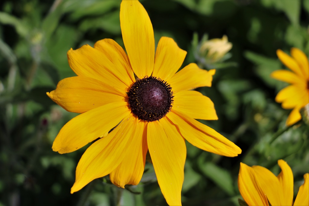
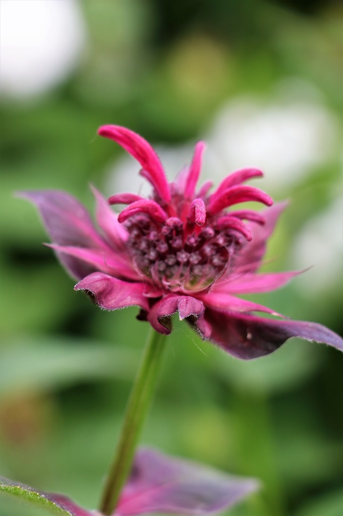
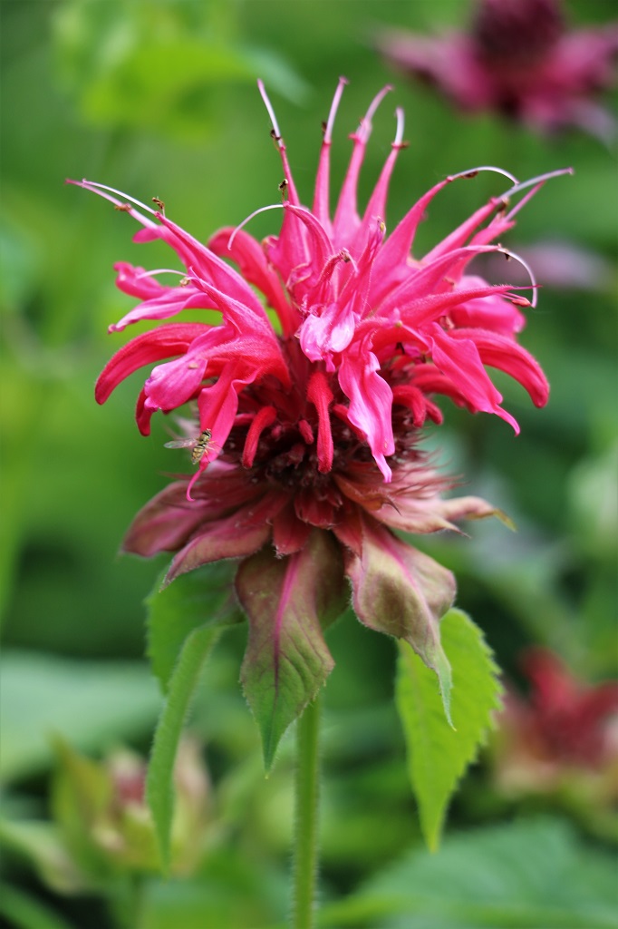
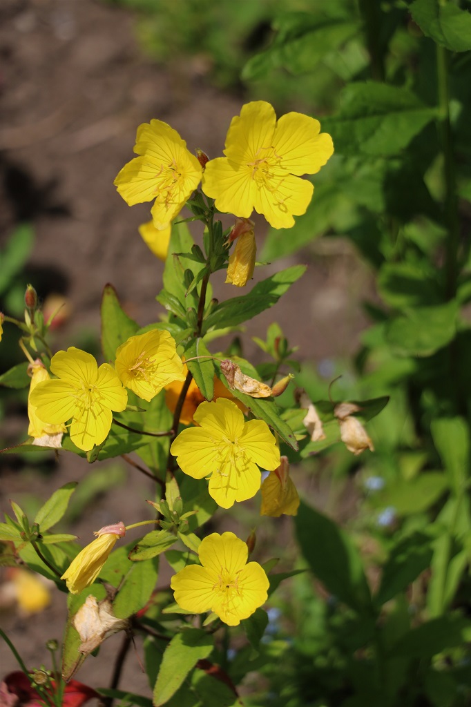
I impressed myself with the number of blooms I could identify as I am not a gardener even though I love flowers. The ones I did not know Google Lens identified for me. This partially-open Beebalm was one of them.
Scarlet BeebalmEvening PrimroseHollyhock
My dad showed my sisters and I how to connect a bud to a blossom and make a ‘lady’ with Hollyhock blossoms.
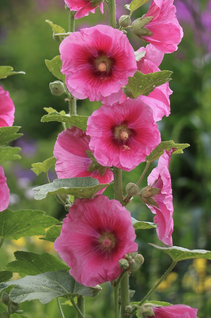
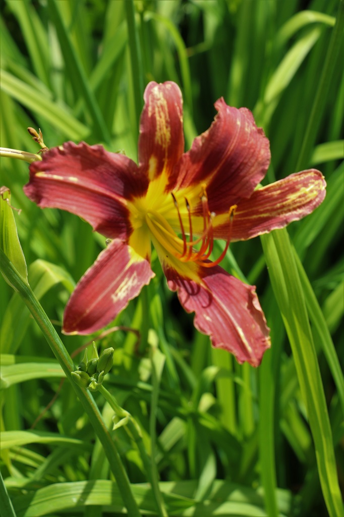
Day Lily
Google Lens did not identify this one for me.
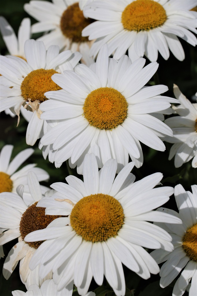
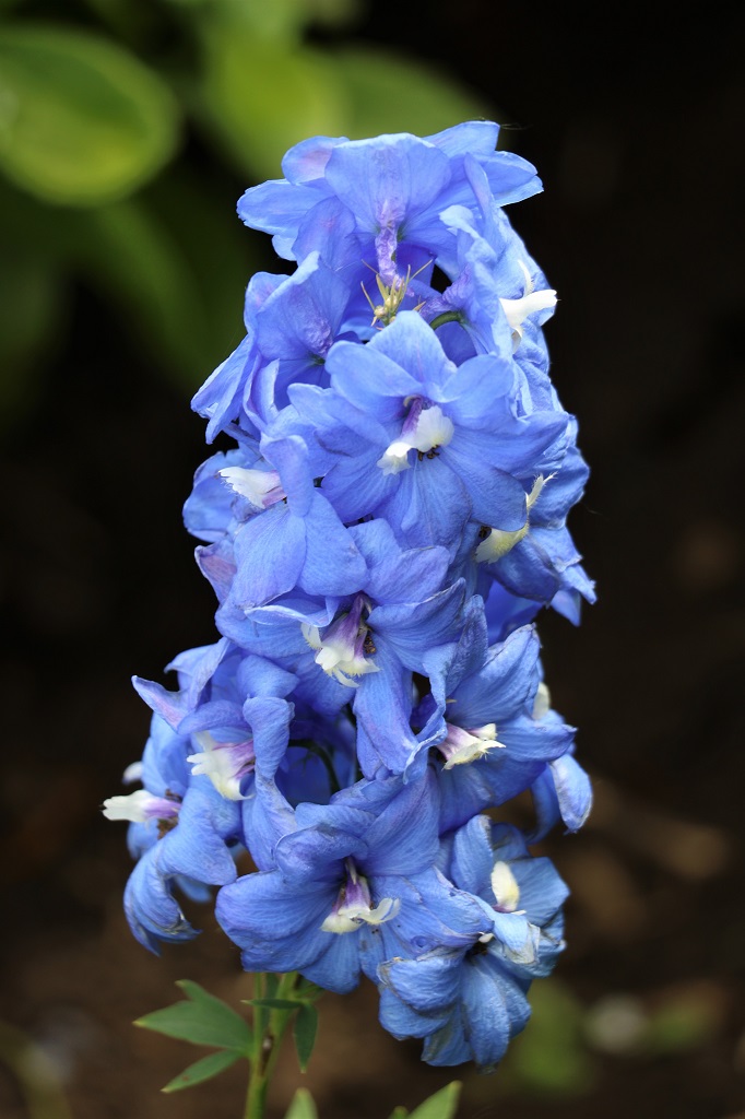
Common DaisyLarkspur
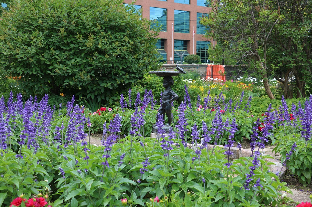
Maplelawn wasn’t very big so we drove to the Experimental Farm that is situated in the middle of Ottawa and wandered around the Ornamental Garden as we had planned to do the day before.
Chinese Bellflower
Clearly the Hosta are happy in this location.
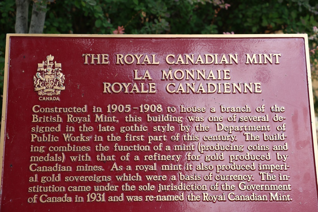
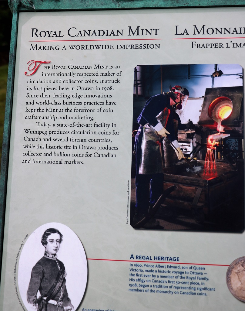
It was only about 1:30 when we finished walking around the Ornamental Garden so we went into town to tour the Royal Canadian Mint. Because Rogers Telecommunication had some huge glitch in their system and the internet was out nation-wide, we had free parking and free admittance to the Mint.
We toured the mint in Winnepeg on our first drive across the country in 2014. All of our circulation coins, plus coins for dozens of other countries are made there. (Canada is an innovator in the manufacture of high quality coinage and we get contracts from many nations to make their coins.)
The Mint in Ottawa makes all the specialty coins, medallians and tokens and items like the 2010 Olympic medals and all military medals. They use silver, gold, and platinum. Many of the machines have been designed and patented by the Royal Canadian Mint. It was no surprise that no photos were allowed.
The other major manufacturer of coinage is Australia and our guide told us there are literally thousands of lawsuits back and forth arguing about who developed what technique or equipment first. Currently Canada is winning the most. Quite a few years ago when Australia wanted to become a world leader in coins they got contracts from so many countries they had no time to make their own coins so they contracted Canada to do it. All the coins were immediately bought by collectors and never reached circulation so Australia did not do that again.
To make the coins they cut ingots into three pieces and melt them, then run the melted metal on narrow conveyors and spray it with room temperature water to cool it before coiling it into large rounds. A round of gold is worth $43,000,000 on today’s gold market. The face value of the coins made from it will be much less.
The rounds are then fed through cutters to make the proper-size circles before being edged (which makes them last much longer if they are in circulation), buffed, weighed and stamped. Every gold and platinum coin is individually weighed and any extra metal is shaved off. All the left-over pieces from the molds and the slivers shaved are all put back in the melting pot and reused for coins.
The silver coins are machine stamped by one of two machines – one of which is rated 100% accurate and the other is 99.999999….% accurate because they purposefully made an error with it for a test so it can no longer be rated 100%. The gold and platinum coins are individually stamped by a person. Each station had an image of the coin currently being made by that person. These are not general circulation coins, they are purchased by collectors or persons or companies with an interest in the image or history imprinted, and investors. These are $20.00, $50.00 or $100.00 (or larger) commemorative coins. These coins actually have a small stamp of a maple leaf on them with their DNA. Recorded is the date it was made, the time it was stamped – to the second, it’s inspection time, which stamper imprinted it, etc. Every detail about every individual coin is recorded on it.
The Mint website says: “The most secure bullion coins in the world, our Gold and Silver Maple Leaf bullion coins are universal symbols of innovation, ingenuity and excellence. The beautiful design and purity of our bullion is instantly recognized by dealers and investors worldwide.”
We saw the mold for the $100,000 coin they made of .59 gold. Canada created this virtually pure form of gold and are the only country in the world to do so. 24-carart gold, 14-carat gold and all the gold we use for jewellry and things has additives in it. Normal ‘pure’ gold coins in Canada and elsewhere in the world are. 49. .59 had never been done. The .59 $100,000 coin was the size of a large pizza. The mold can still be used to make more if they choose.
Canada was first to make many other special coins like the “Poppy” quarter for Remembrance Day that has a red poppy on it, they made a quarter with the Northern Lights that acutally glows in the dark (they have become worth about $10.00), and special coins with Swarovski crystals on them, ceramic images and many other things.
The largest coin by far was the mold for the million-dollar coin – called the Big Maple Leaf. The only country to make such a thing. In 2007 they made 6 of them and they were huge – about 2 feet across and weighed 100 kilograms (220 lbs). They are 999.99/1000 percent pure gold. The original is still at the mint, two others are elsewhere in Canada and three were bought by people overseas. One by a man in Austria who has loaned it to a museum, one by a fellow in Germany that also loaned his to a museum in Berlin were it was promptly stolen three months later and has never been found (the thieves were caught, tried and sentenced but it is suspected the coin was melted down) and one was bought by a fellow in Dubai that had it encased in glass and made into a coffee table. Each of them sold for over $2 million when offered and are now worth over $8 million. The Big Maple Leaf remained the largest gold coin ever minted until 2011, when the 1 tonne Austrailain Gold Nugget (“Gold Kangaroo”) was minted.
You could stand in front of this image of an open vault and lift the pure silver ingot for a photo-op. They, like the Mint in Winnepeg, also have a gold ingot but they did not have enough security on staff today to have the gold one out. Even though the ingot is bolted to a base, when the gold one is on display a guard stands beside it at all times.
We went back to our dorm room at Ottawa University and since there was still no internet I just my sorted photos until we left to go to John’s cousin’s house for a family BBQ.
Before we left Pembroke this morning we went over to the Champlain Trail Museum and Heritage Village. They had nice displays inside the musem and then we a lady took us on a tour of the buildings on the site.
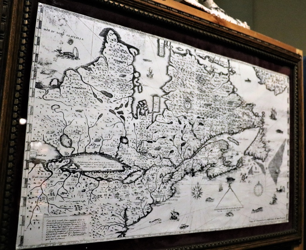
French explorer Samuel de Champlain discovered and mapped the St. Lawrence River and most of Quebec and Ontairo when he ‘got lost’ looking for China. Below is a copy of his 1632 map which is incredibly accurate. A replica of the astrolobe he used for his measurements was in the museum.
There was no information placard by this display of handcarved circus wagons and horses.
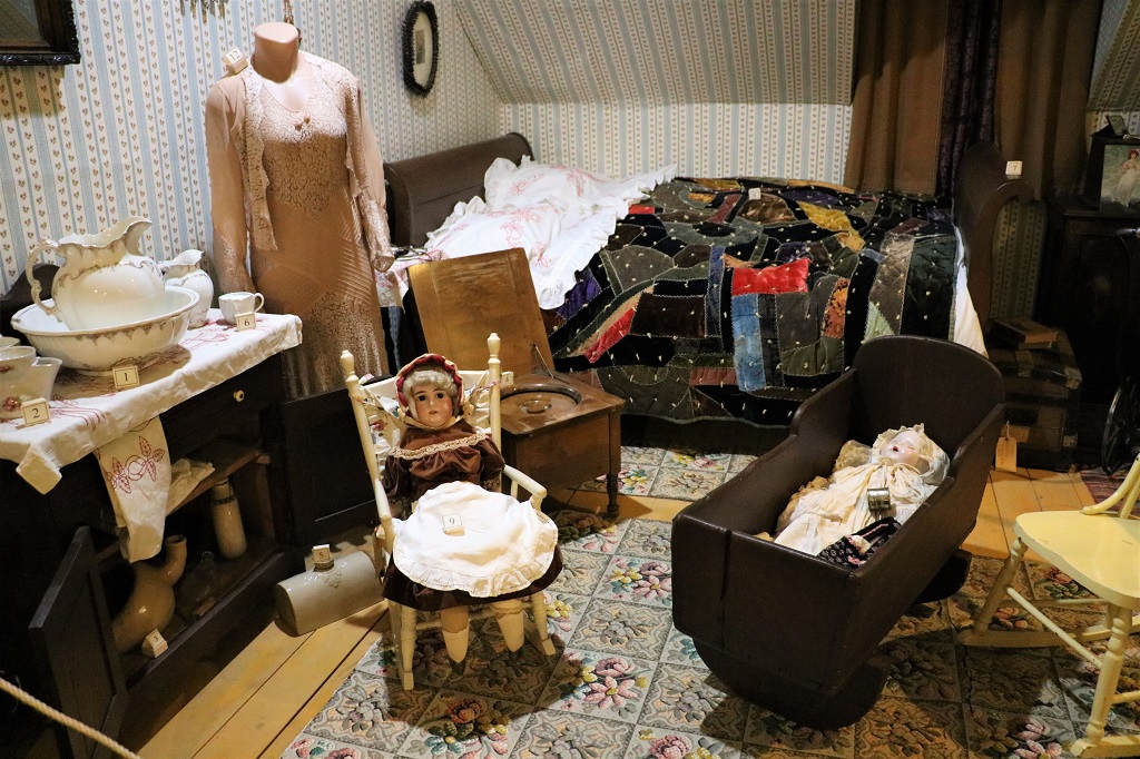
There were rooms of a typical Victorian era house to walk past.
The parlour, which would never have been used except for weddings, funerals or if the minister/priest or a politician came calling. The stained glass window is original from a local pioneer family’s house.
The dining room.
This corner cupboard was the first item placed in the museum ‘house.’ It came from a local hotel.
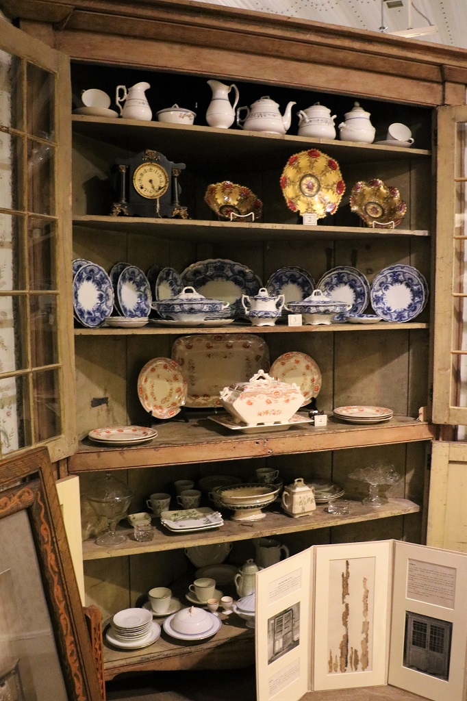
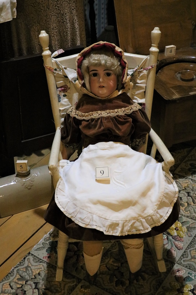
This porcelian-head doll came from England. It has an uncanny resemblance to my stepmother.
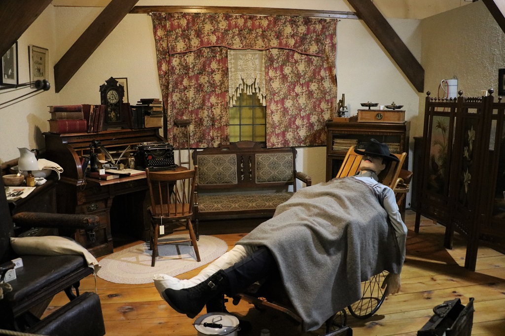
The doctor’s office.
This tie rack from the late 1800, early 1900’s was carved from the back of a dynamite crate with a nail by a lumberman in Mattawa. It took him an entire winter to do.
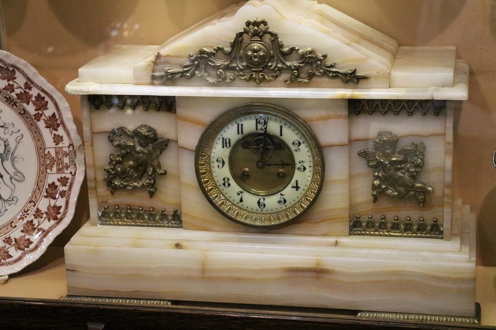
I loved this gorgeous clock.
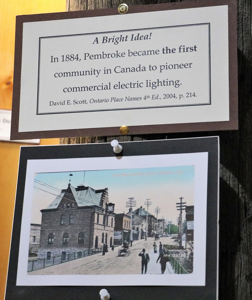
The building for the electric company is still standing in Pembroke.
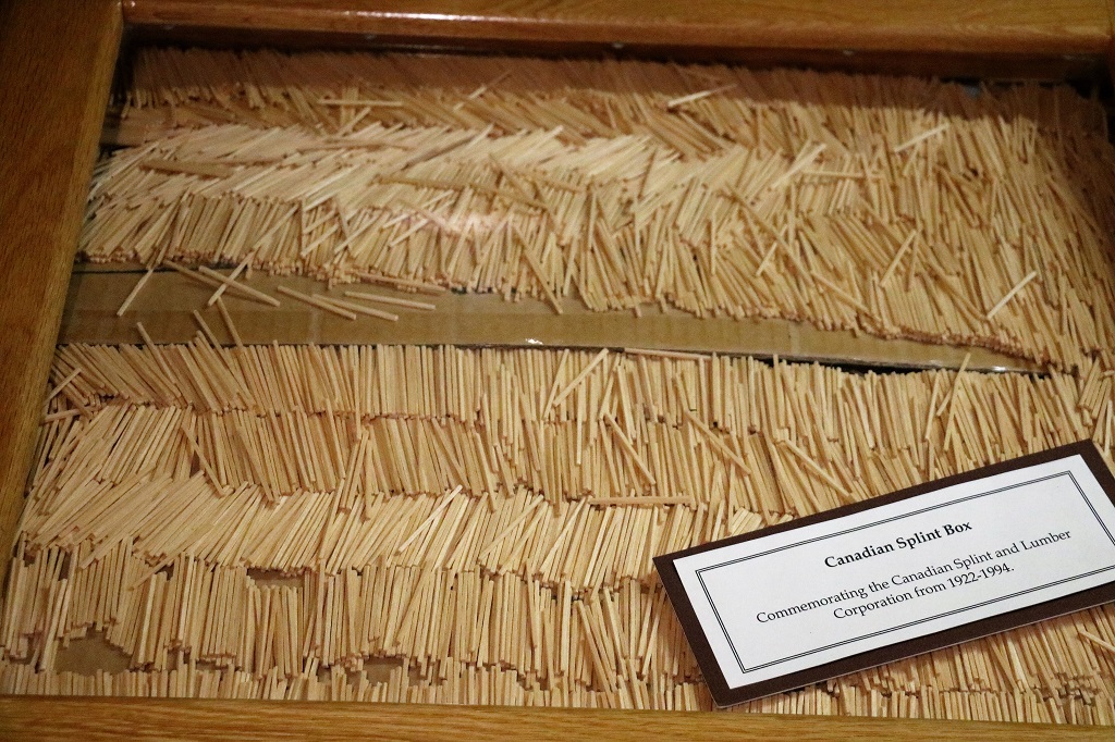
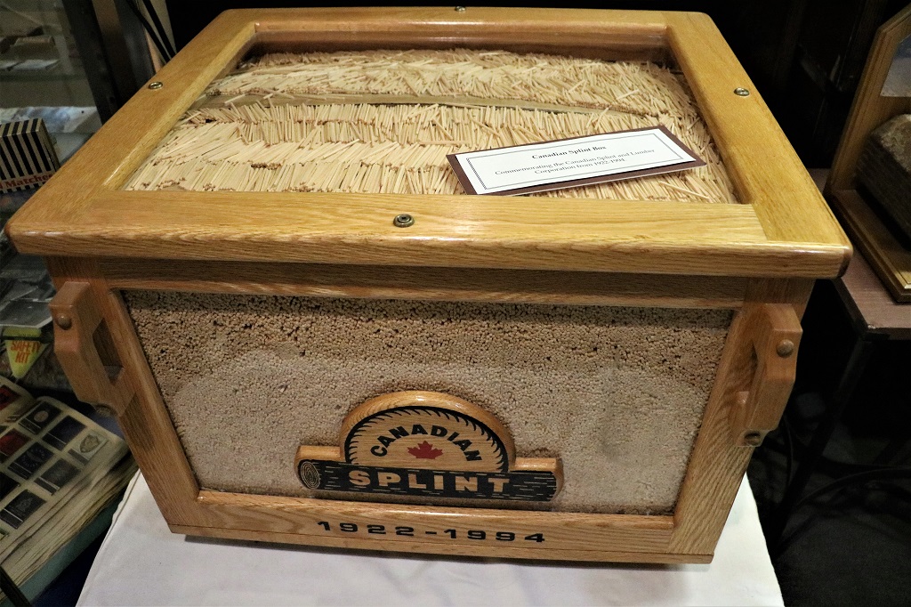
The Canadian Splint and Lumber Company made the sticks for matches. They were treated with a special substance then sent to the Eddy company to have the match heads put on. One 16′ log produced 500,000 match sticks. The short video said how many the company produced in a year out of the number of trees they used but I did not have a pen and paper to write it down. Lets just say it was LOTS!
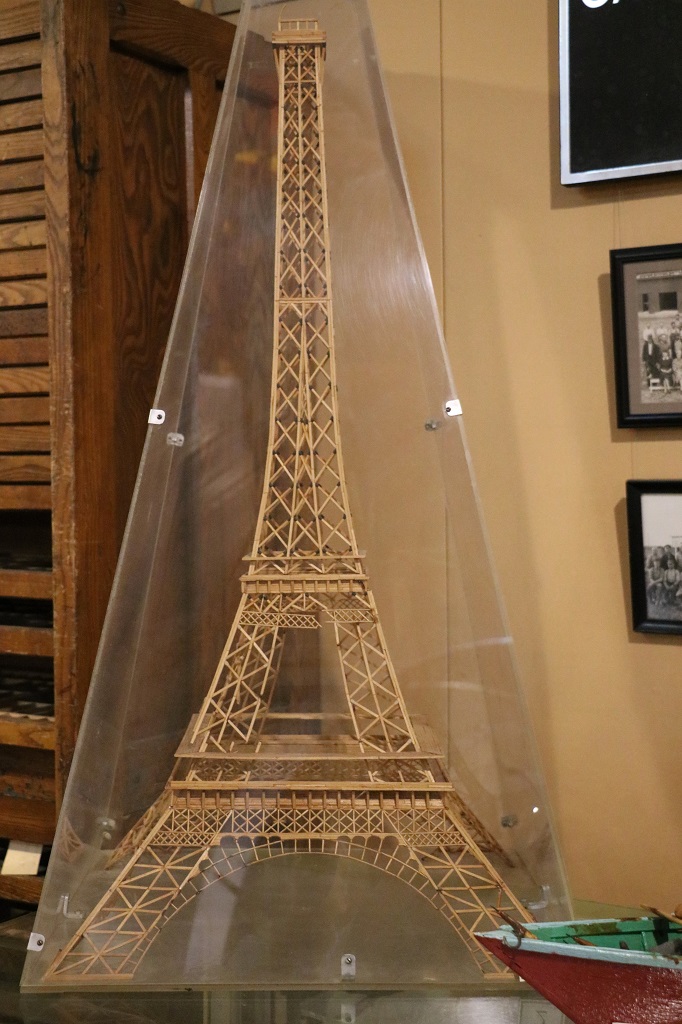
The EiffelTower made from match splints.
This beautiful 1880 log house was lived in by three generations of the family. It was dismantled and moved to the museum property in 1965.
They were a German famiy (many immigrants from Germany settled in the Ottawa Valley). This is a homemade sausage maker. Sausage making involved the entire family.
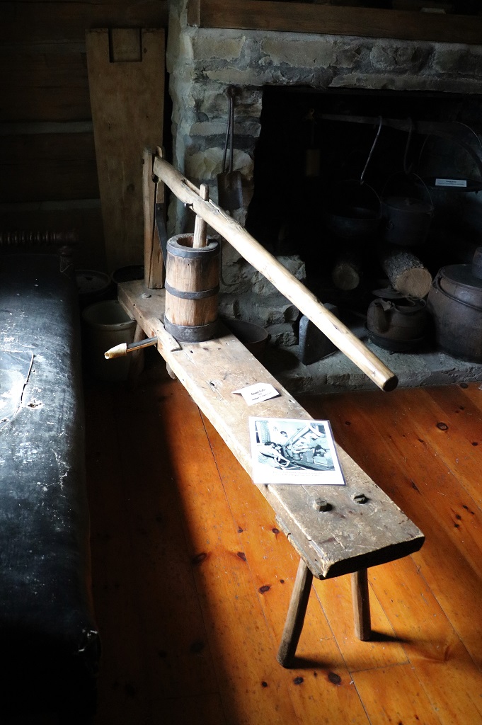
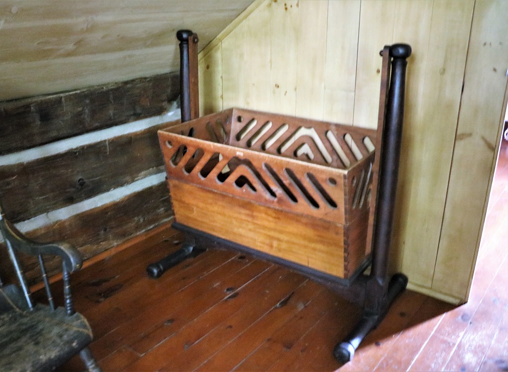
This 1916-1918 handmade wooden baby walker was just gorgeous. As was the cradle below.
We left Pembroke at 1 o’clock and headed to Ottawa.
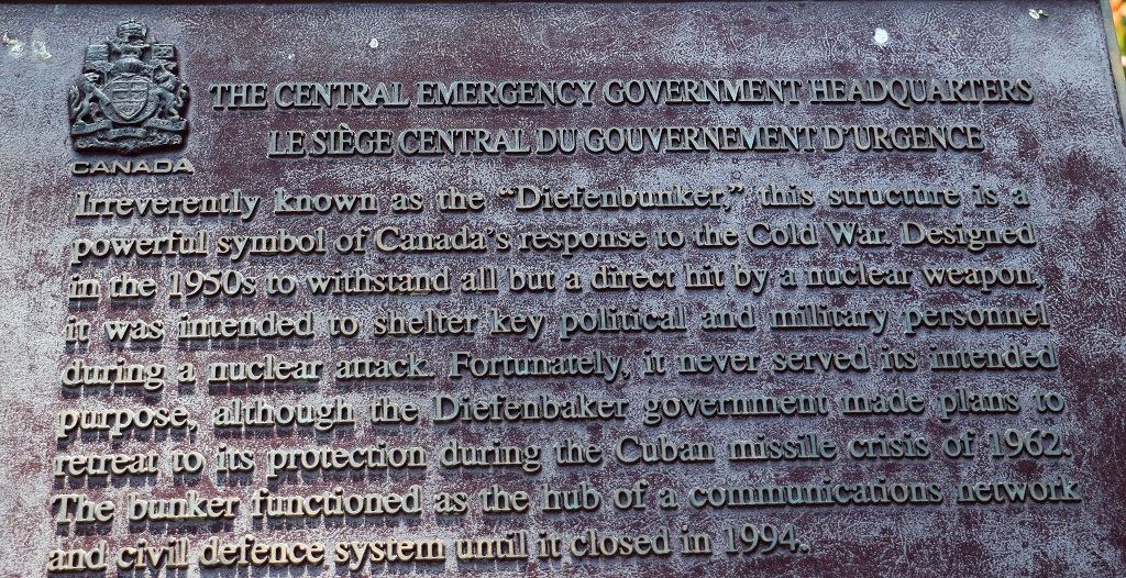
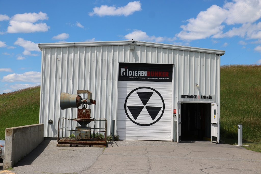
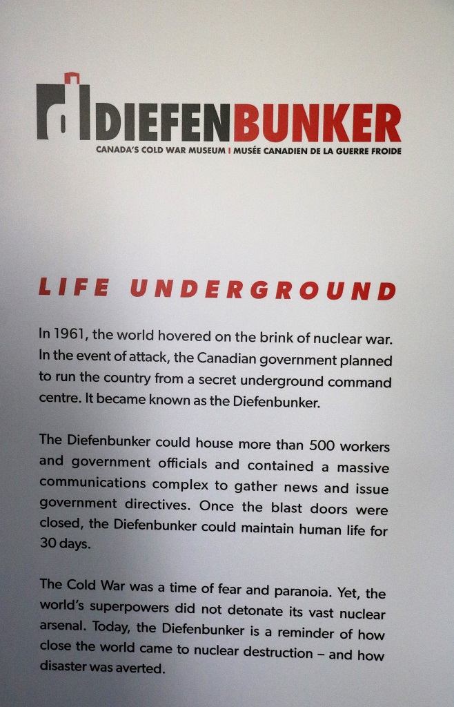
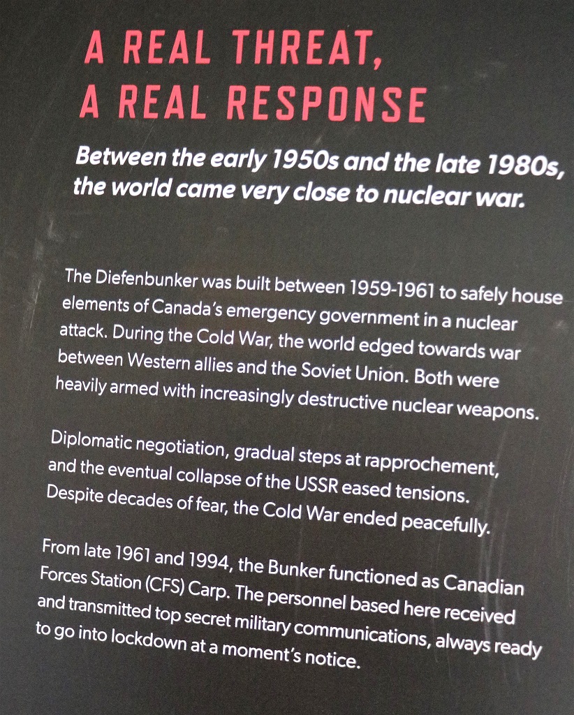
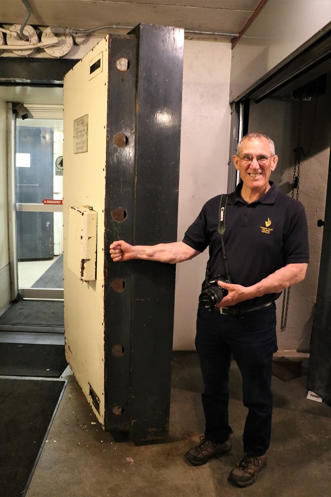
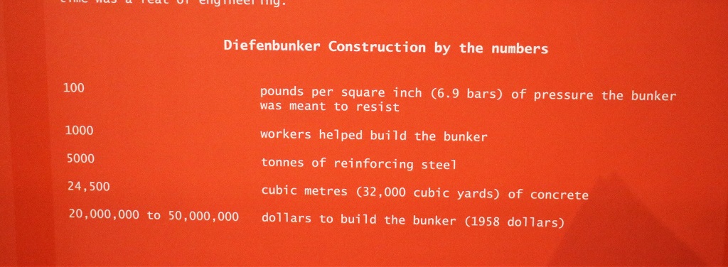
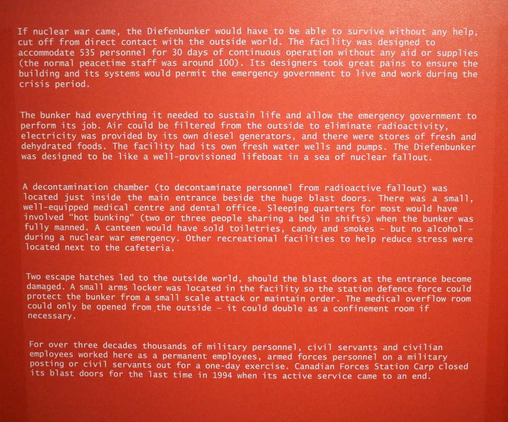
Once we arrived in Ottawa we planned to go to the Ornamental Garden at the Experimental Farm, but about 25 or so kilometers outside the city were signs to the Diefenbunker – the Canadian Government bomb shelter in the event of a nuclear attack during the Cold War of the 60’s to 80’s. We had planned on visiting it not realizing it was so far out of the city so we decided to go since we were so close and save a trip back out another day.
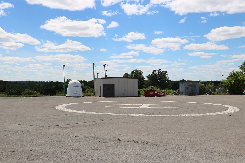
The heli-pad that would have brought the Prime Minister and high-ranking government officials to the site was only 50′ from the entrance to the bunker.
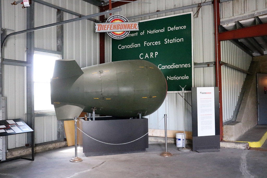
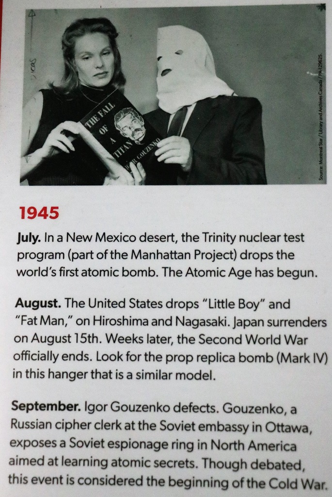
A replica bomb of a similar model as the ones the USA dropped on Hiroshima and Nagasaki to end WWII.
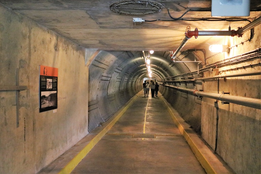
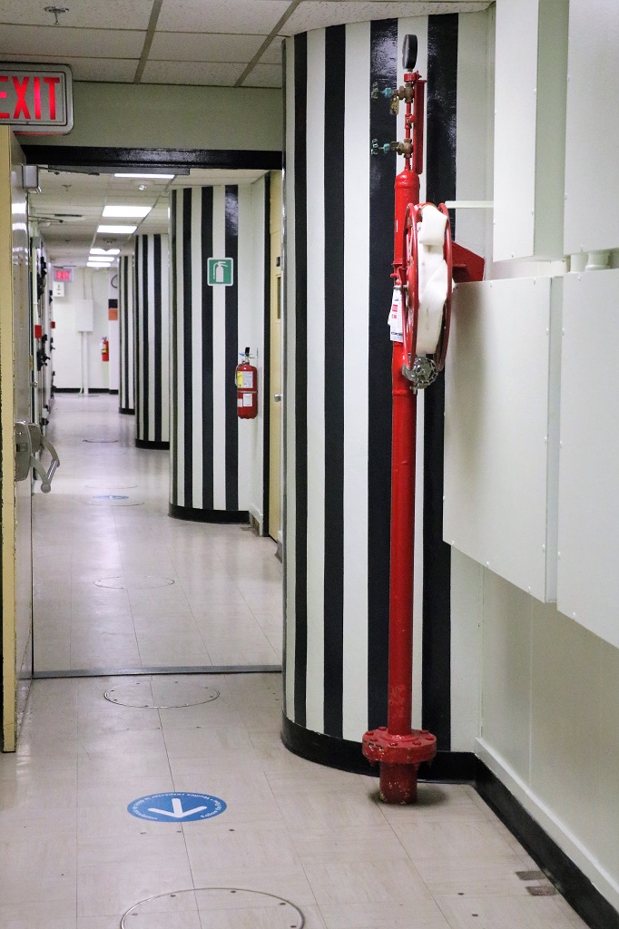
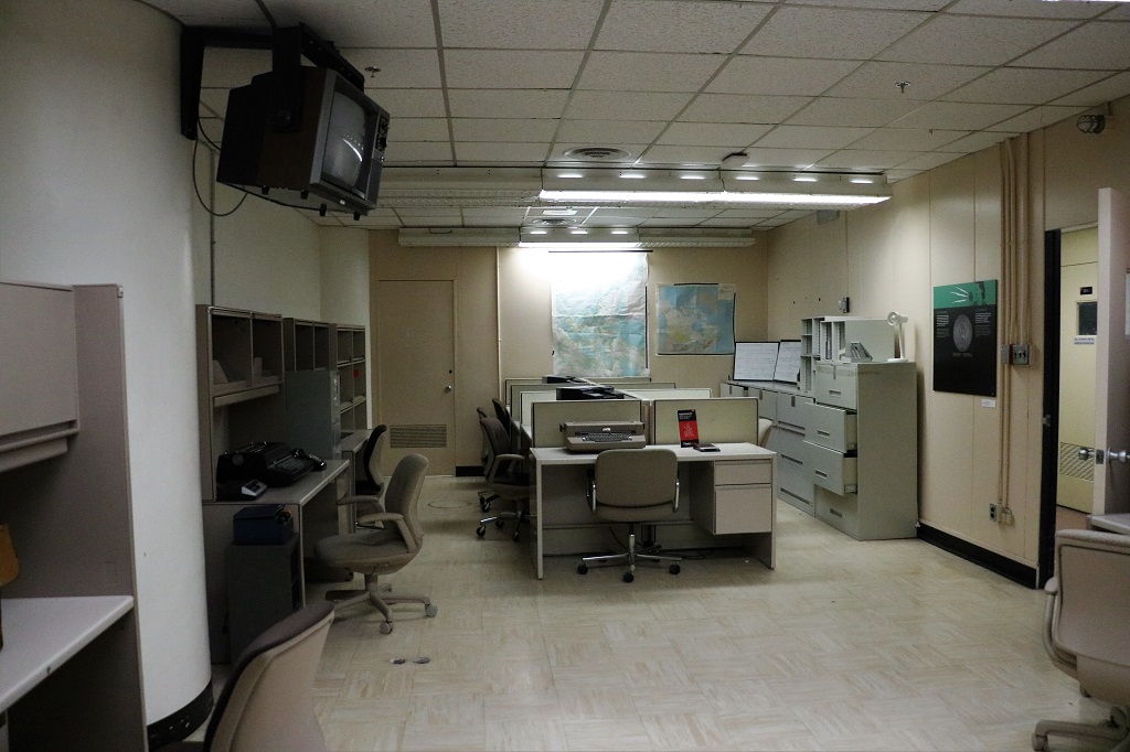
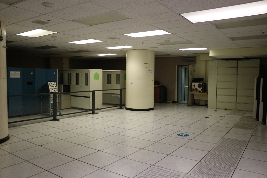
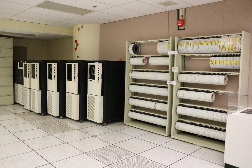
At the end of the tunnel we passed through two sets of these solid steel doors. The Diefenbunker had four levels underground. We were given a map outlining all the levels and the things we could see on each one. We only got through the first two levels which had the most rooms to see before we had to make our way topside again because they closed at 4.
A model of the four levels of the Bunker.
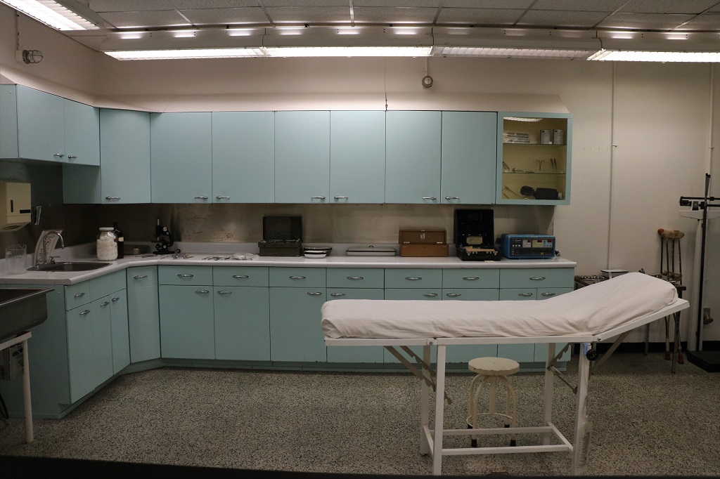
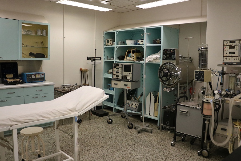
In the case of a nuclear event, this compact medical centre had to keep all personnel inside the Bunker healthy and functioning – without outside help or additional supplies. It only served as an ordinary medical clinic during the operation years of CFS Carp, but it was outfitted for a nuclear attak.
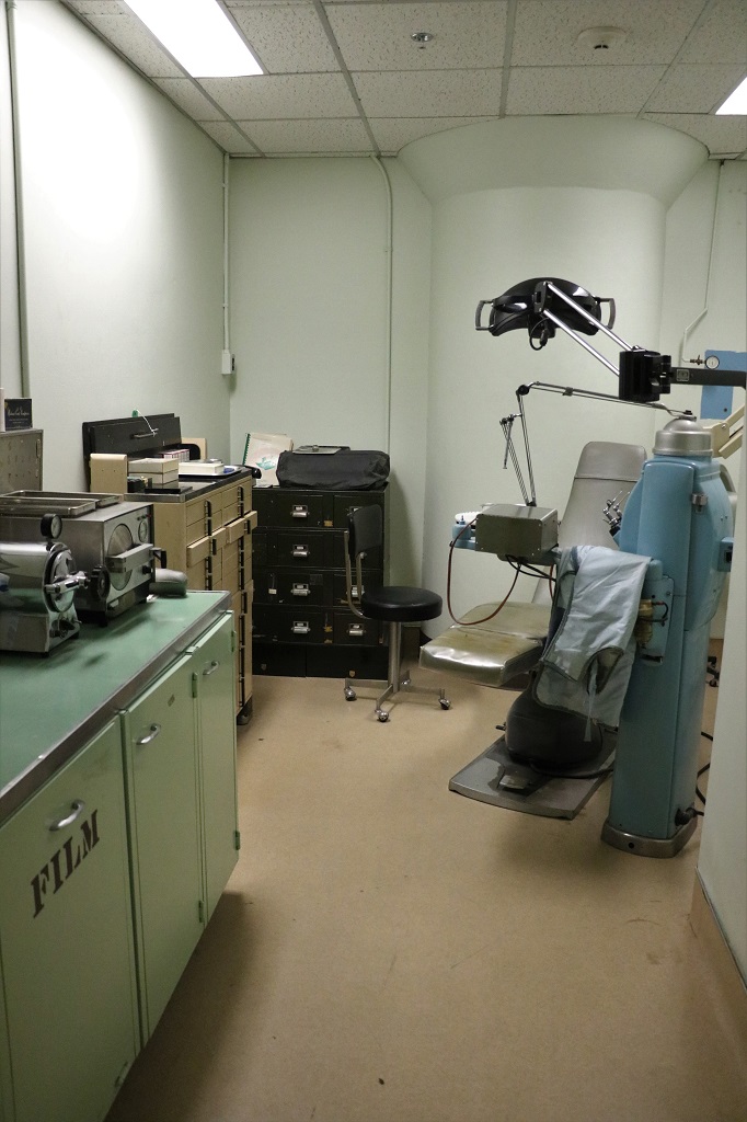
There was also a fully equipped dental office.
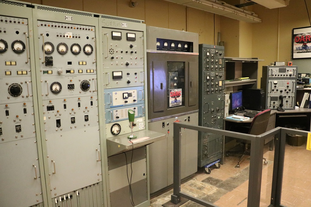
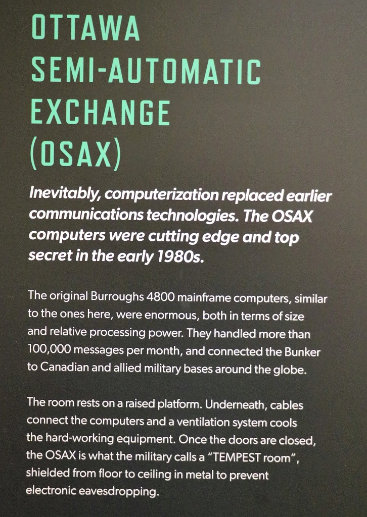
The radio room. All the equipment had been removed by the military when they closed the facility but local ham/short wave radio club members donated all the different years radios from the 50’s to 2000. Club members are in the Bunker regularly to talk about the radio room and maintain the equipment.
Today’s cell phones have more transmitting power than these radios. But it is impossible to get a cell signal inside the Bunker.
The War Cabinet Room.
The Secretariat.
We drove the remaining distance to Ottawa and found our lodging for the next four nights at a University of Ottawa campus dormitory. Tomorrow will be flowers. I promise. Unless it rains. And tomorrow night we have a BBQ with John’s cousin and his daughters, their spouses and children.
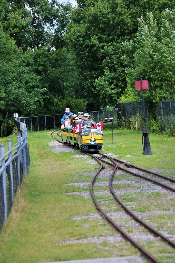
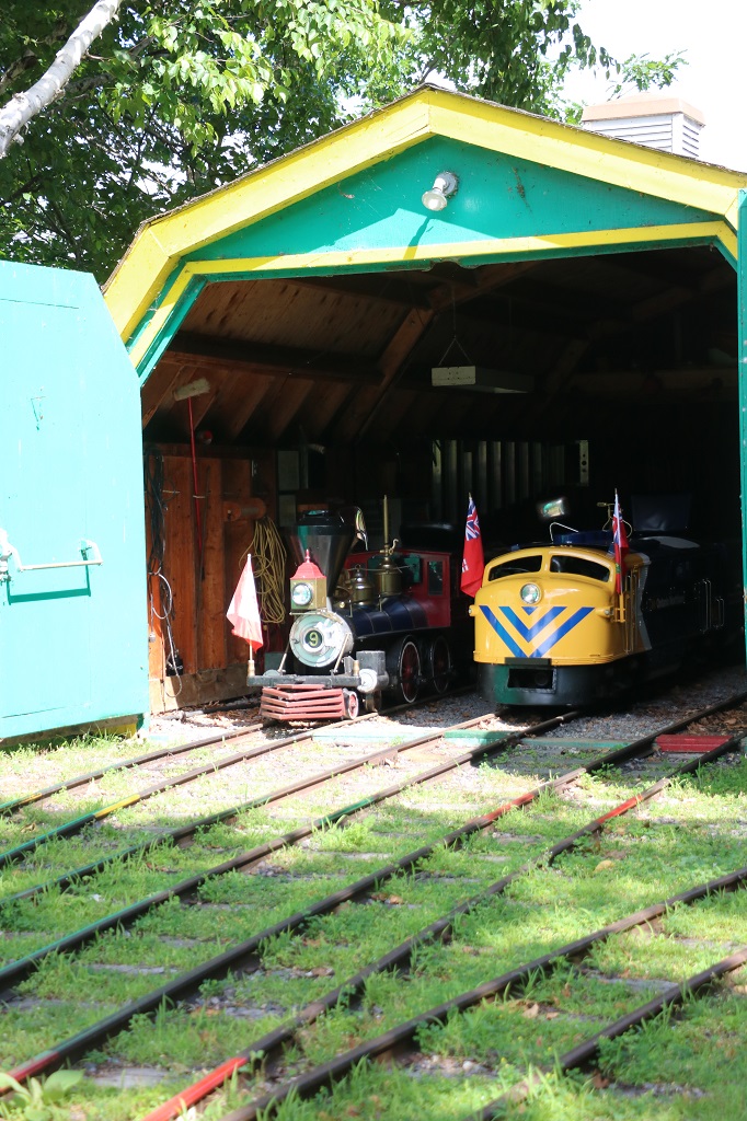
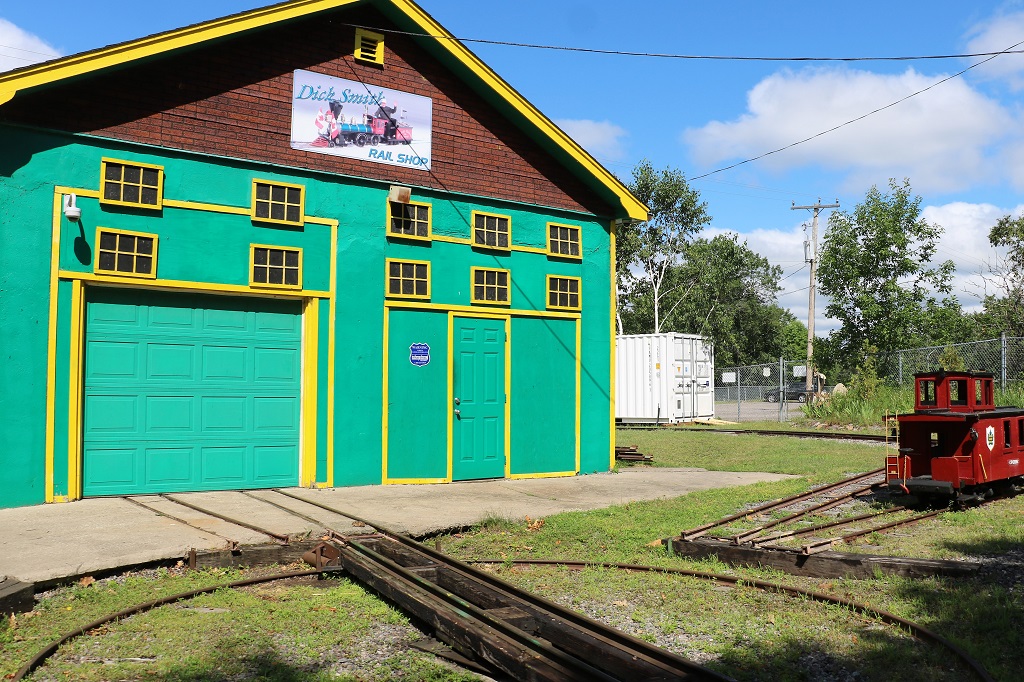
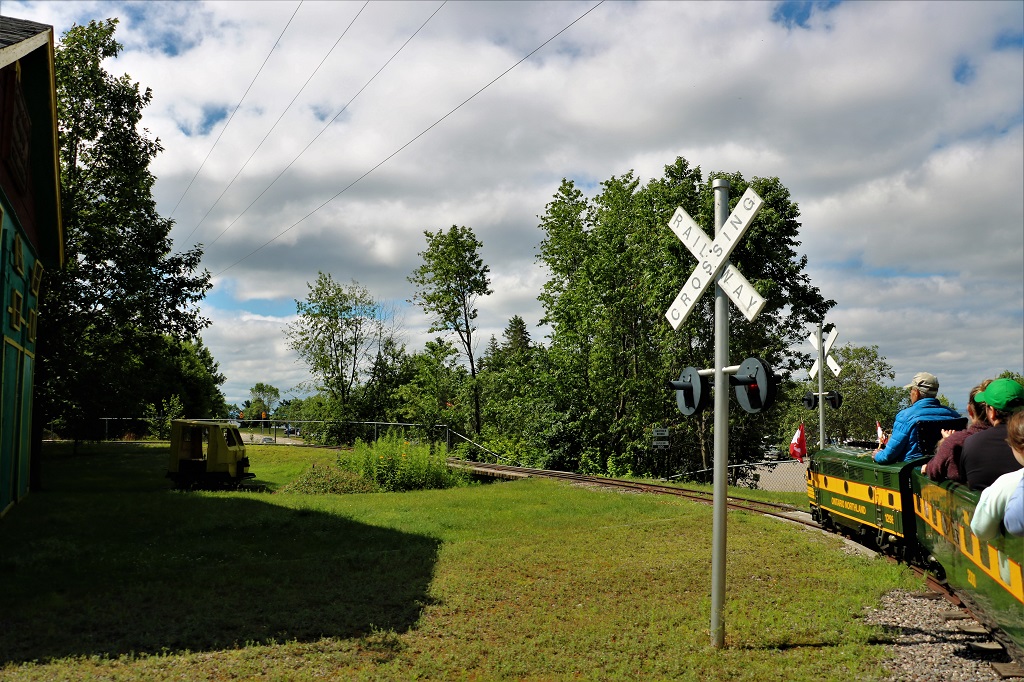
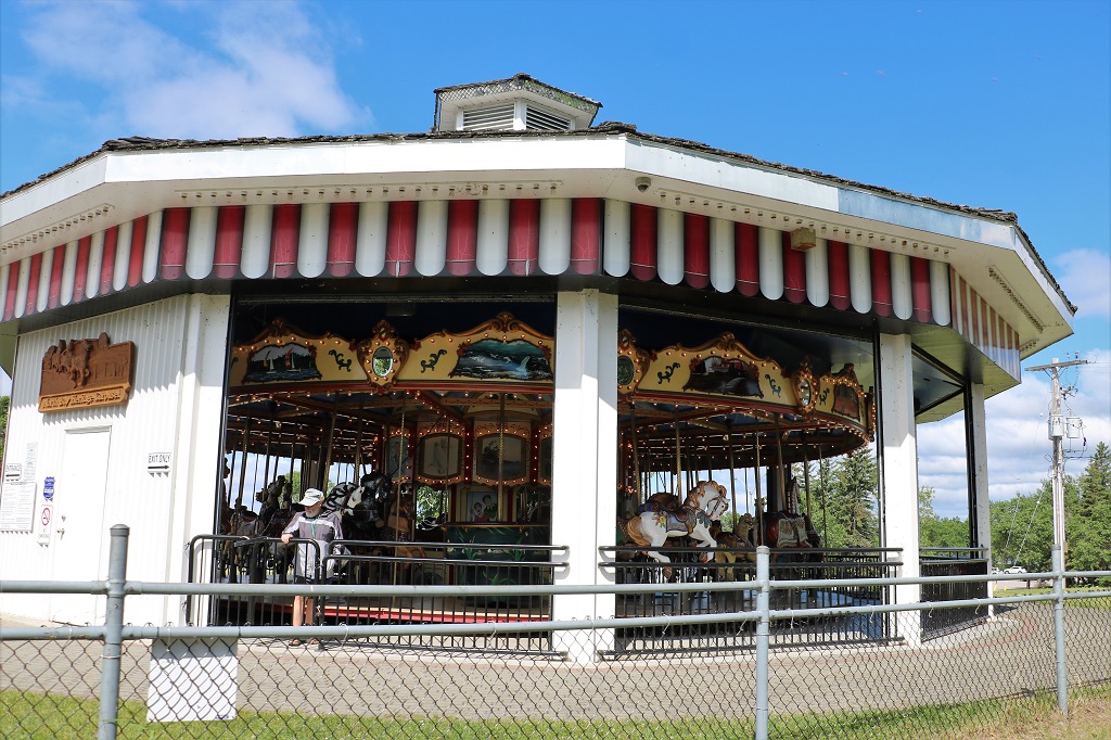
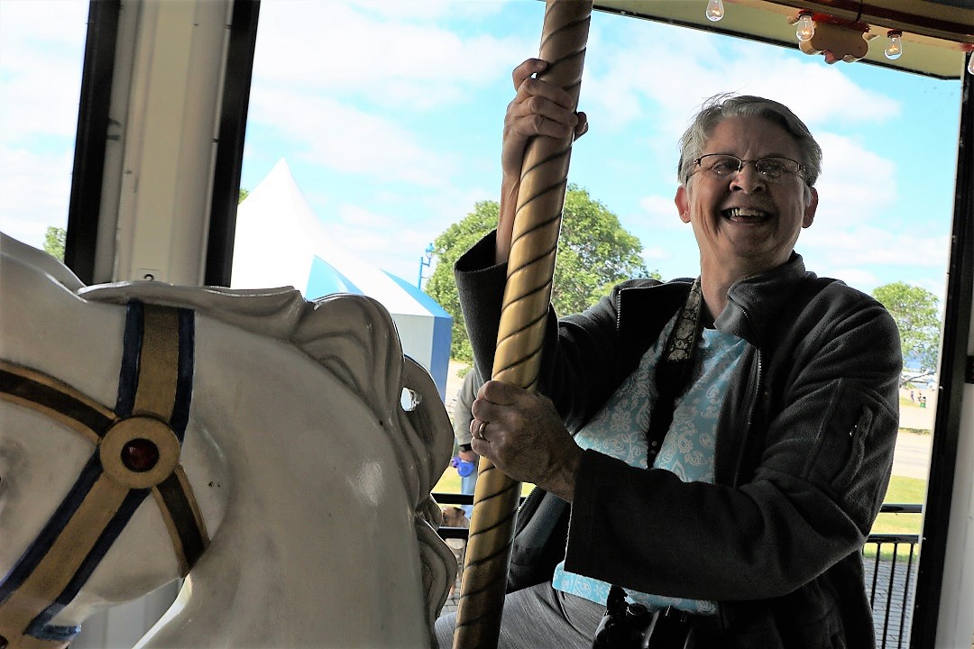
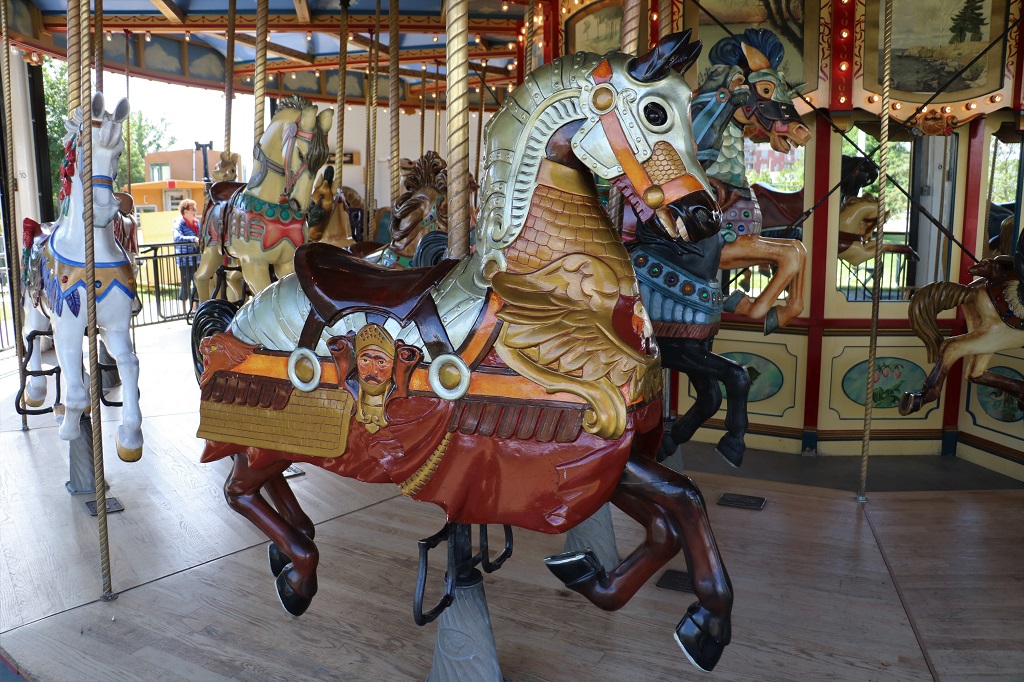
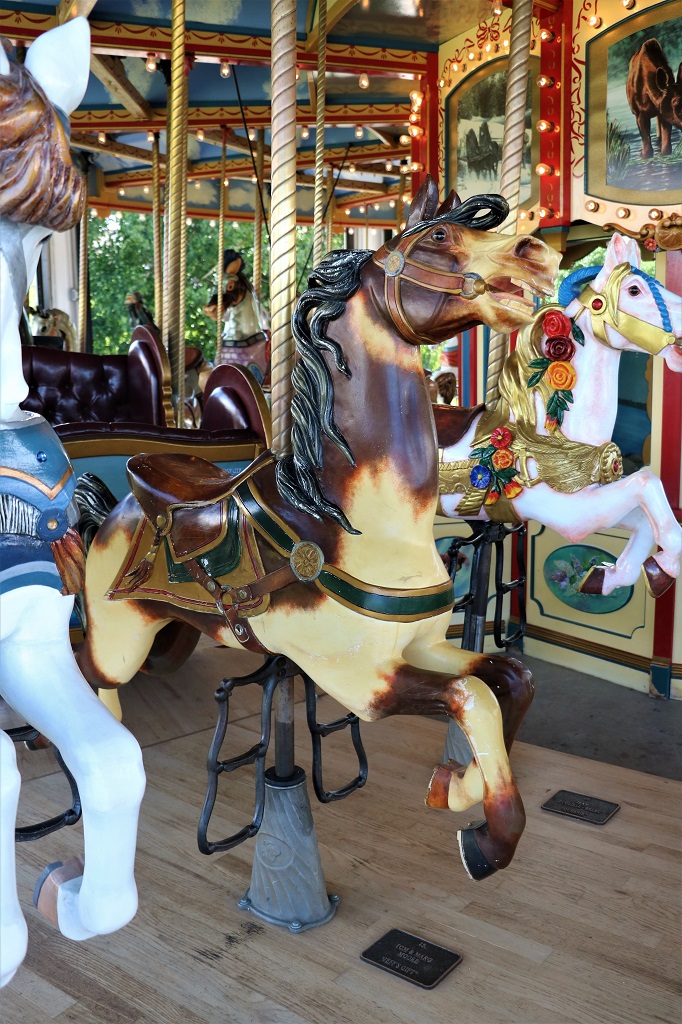
We started our day in North Bay doing a couple of fun things. We went to the Heritage Railway and Carousel and had a ride on each.
They use a diesel engine to pull the train. Replacement cost would be $450,000. They also have in this shed an eletric engine and a gas engine. The train and the carousel are operated and maintained completely by volunteers.
Local carvers made, and local artists painted, all the horses on the carousel. When they had finished this one they started on a smaller one that is made of northern Canada animals. It was not open and operating but there were pictures of all the animals they had made. Moose, fox, lynx, deer, elk, raccoon, etc. They were adorable.
This was my lovely steed.
John rode the buckskin beside me.
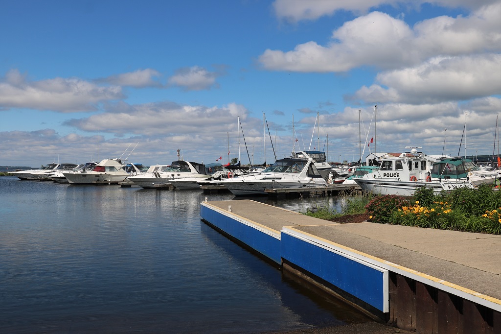
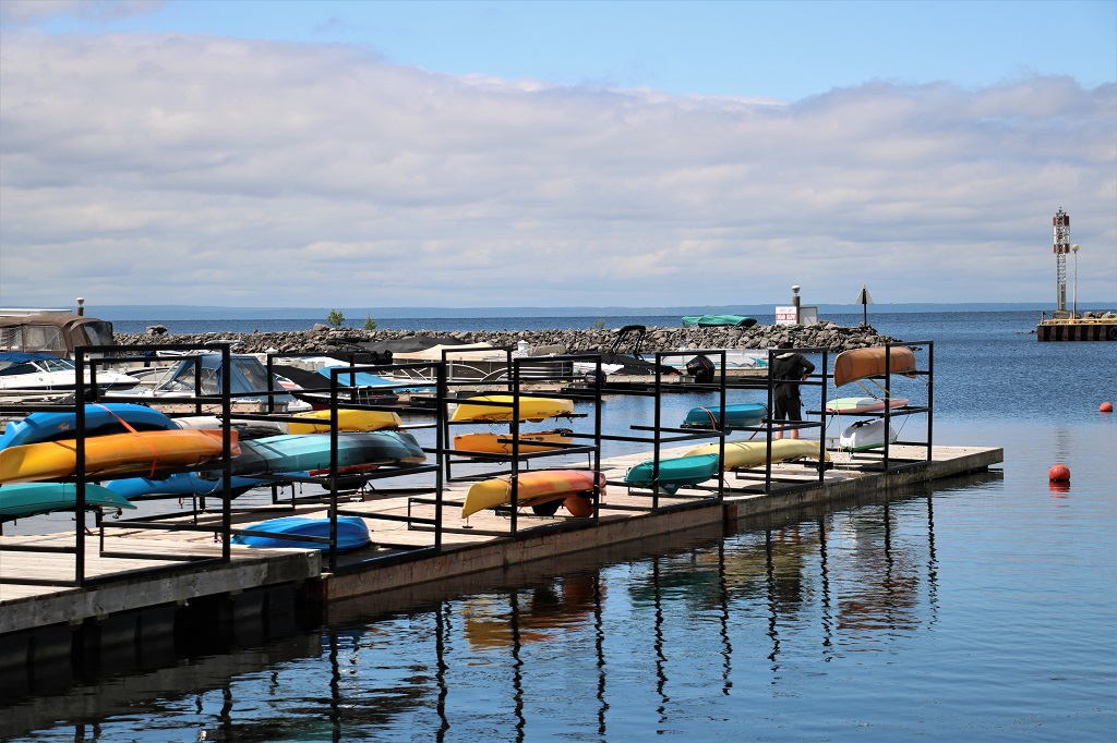
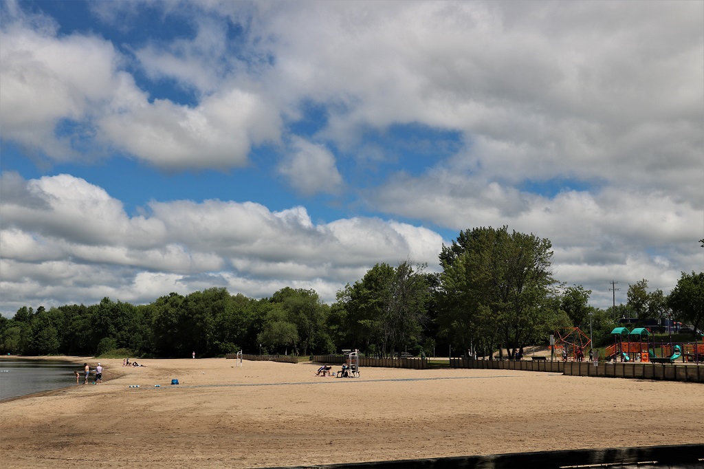
When we had finished our rides we crossed the street and walked along the waterfront marina.
There was a beautiful sandy beach and a large playground beside the marina.
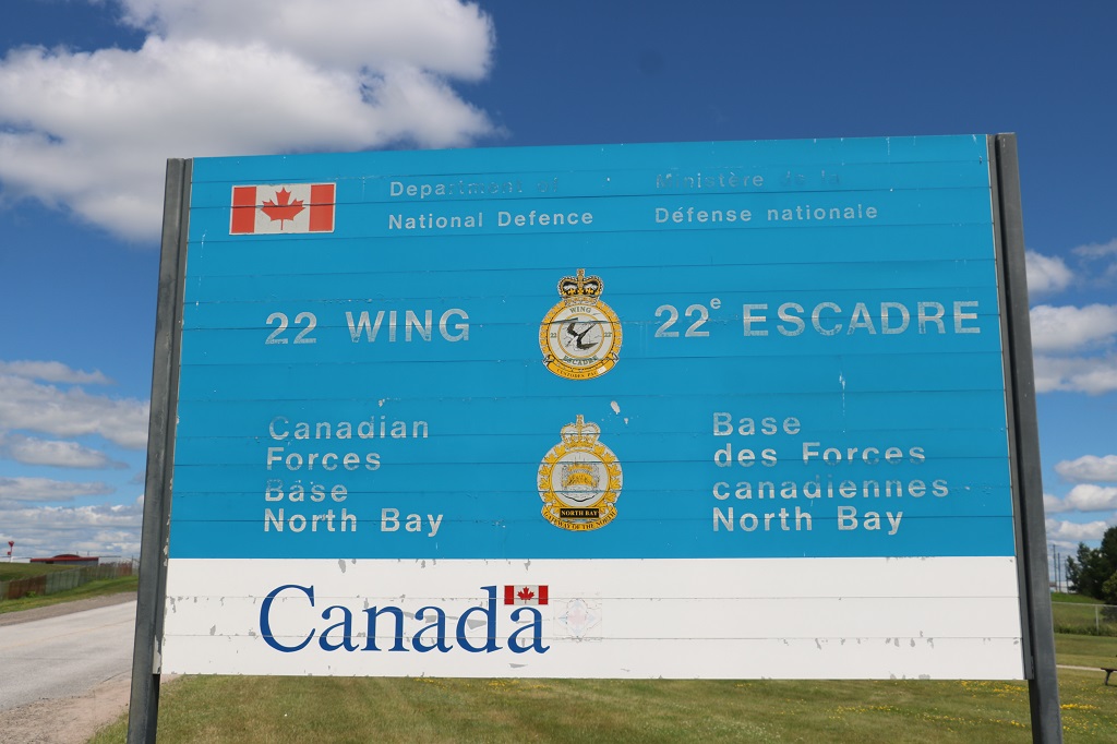
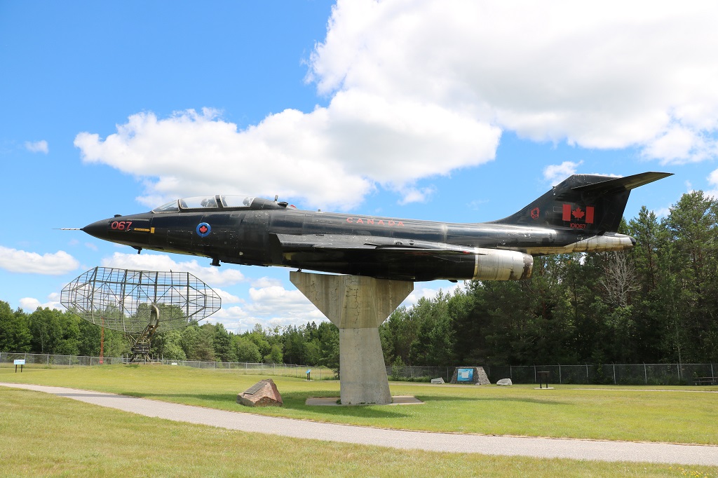
Then we drove over to Wing 22 CFB North Bay where the Canadian Aerospace Defense Museum was located. I did not know there was a Canadian Forces base in North Bay. They are a unique airbase because they have no airplanes. They used to, but now they just do airspace reconnaissance, checking on all flights over Canada – domestic, foreign, and military.
They had a much smaller museum than Cold Lake but since North Bay was part of the same radar control system there was some overlap. They had displays on the wartime battles of WWI and WWII since both of those engagements led up to the airspace control measures now in place all around the world.
As usual I took tons of pictures of all the information signs and things that interested me. I have tried to not bore you by posting too many.
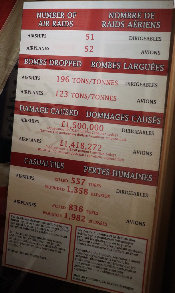
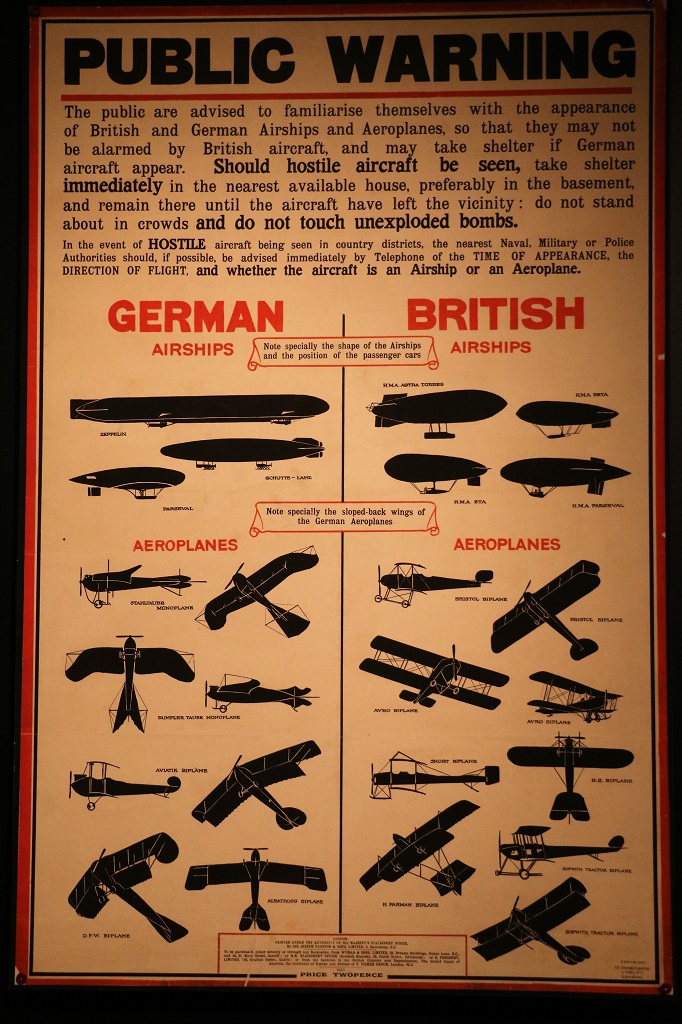
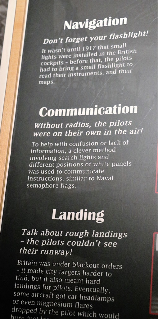
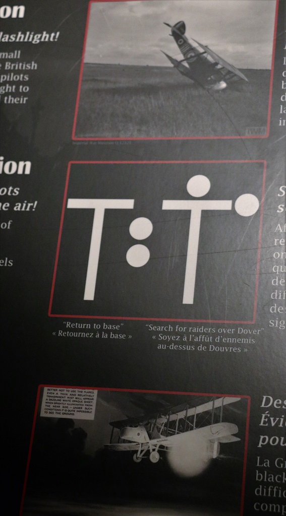
I have heard so much about the WWII Battle of Britain with the German bombing night after night that I forgot that the Germans also sent huge zepplins across the English Channel to bomb Britain in WWI. The British did not even have an air force at the time. But in a very few months after declaring war on Germany they did. Many pilots were from Canada, and half of the takedowns of 12 of Germany’s big Zepplins were done by Canadians; some with British crew.
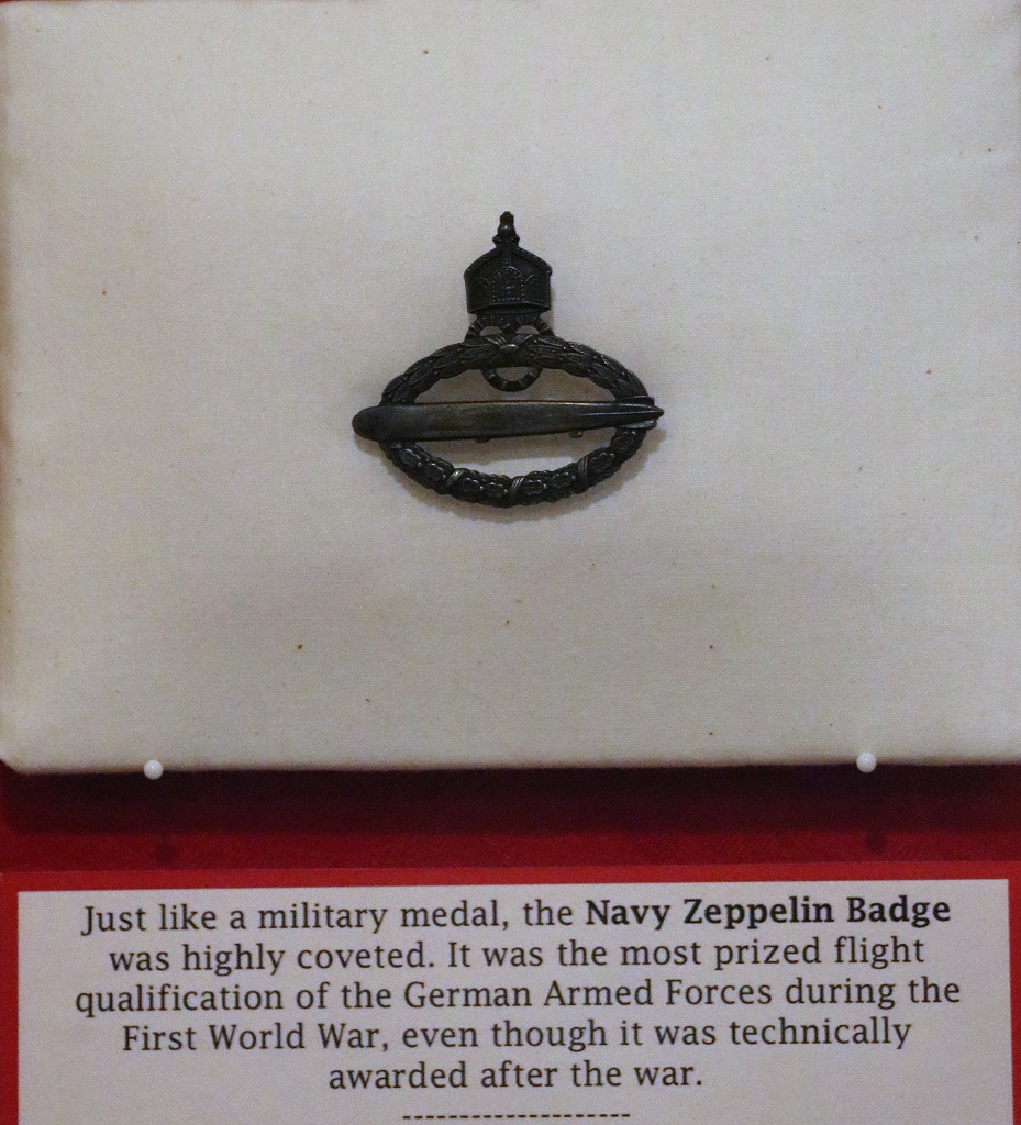
The number one ace of WWI was Canadian Billy Bishop who logged an astonishing 72 confirmed kills. He did not fly against the zepplins though. There were write-ups on all the Canadian flyboys who did destroy them. One of them got two. He was the only pilot to do so.
The image below goes alongside the one above.
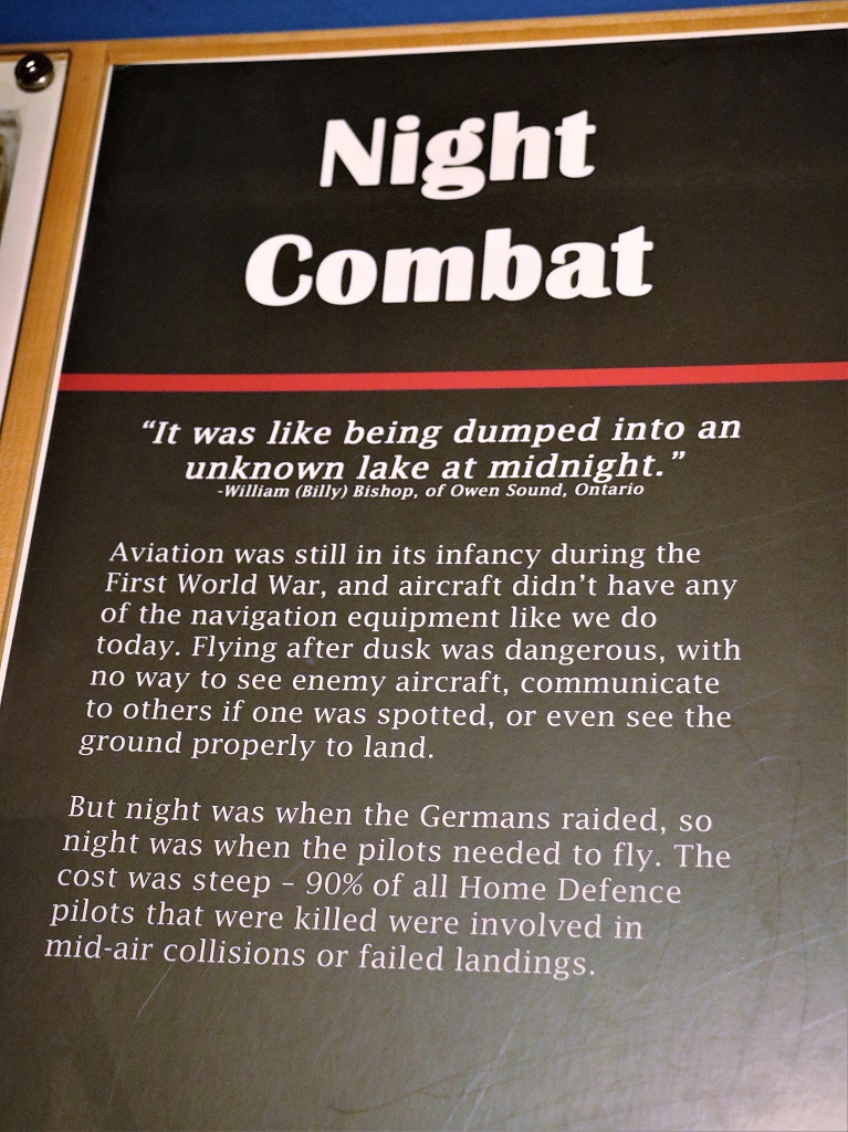
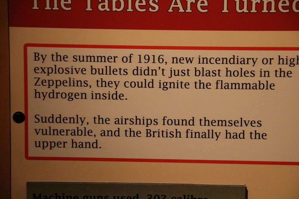
Although the pilots attacked the huge zepplin airships, their bullets did not penetrate all the layers to do much damage. It wasn’t until they created incendiary bullets that went through to the gas that the zepplins could be destroyed. Up until then all they did really was harrass them.
The WWII section also included a good short film about the bombing of Britain.
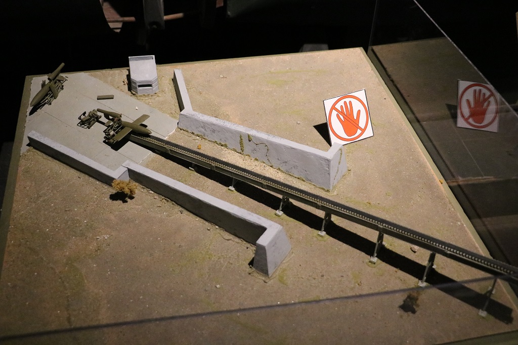
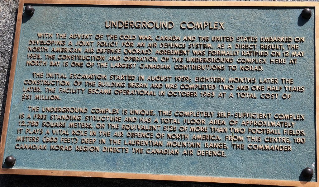
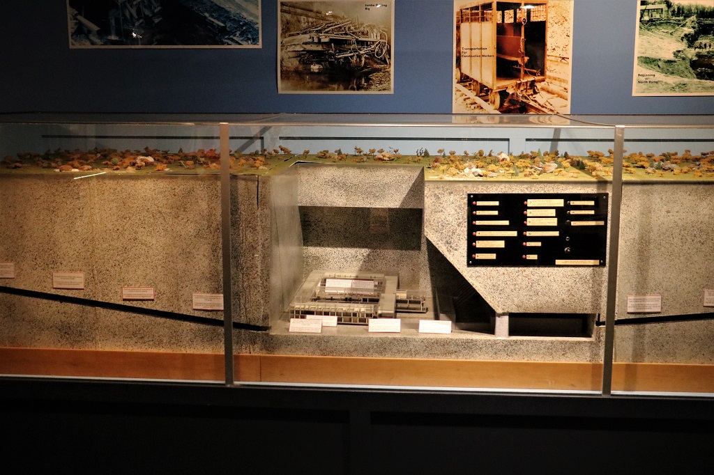
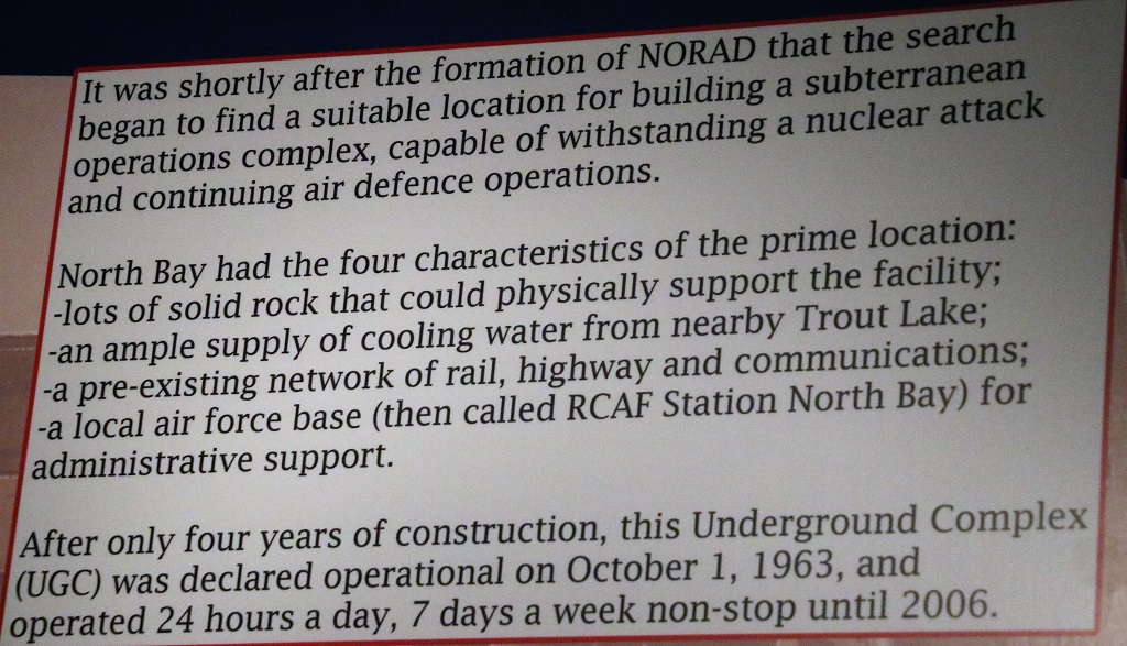
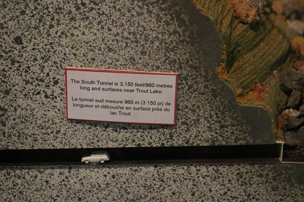
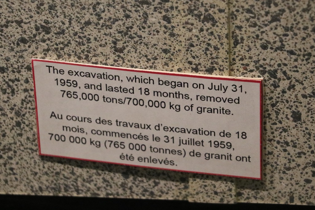
The most surprising thing to me was the model of the underground complex at North Bay. It is no longer in use. They moved everything above ground in 2006 but the installation is still there and maintained. The military has not yet figured out how to decommission it and until that is done it is a military base and must be maintained even though it is empty of all equipment and furnishings, etc.
The little car looks like it is on a gradual slope but in reality that road is on a 10% grade. The North Tunnel entrance is on the base.
It was three o’clock by the time we drove out of the base. After that it was just a drive past trees, rocks, water and some farm land to Petawawa where we had dinner and then drove to Pembroke for the night. The two communities are spread out along the shore of the Ottawa River and just run from one town right into the other.
Tomorrow we reach Ottawa. John has cousins there and we will be visiting them and touring around the city. I have a whole list of things to see even though we have been there several times. We are staying four nights at rooms on the Universtity campus. $100 per night as opposed to all the hotels that are between $180 and $250.
We did manage to turn our two hour drive into a six hour day, but we were worried for awhile that it may actually be about two. Three of the four things we planned to do today we were unable to do. Two because both of the museums we wanted to see in Cobalt were only open Wed-Sat and it was raining all day so a climb up a 400′ fire tower in Temagami was not appealing since the spectacular view would have been grey clouds.
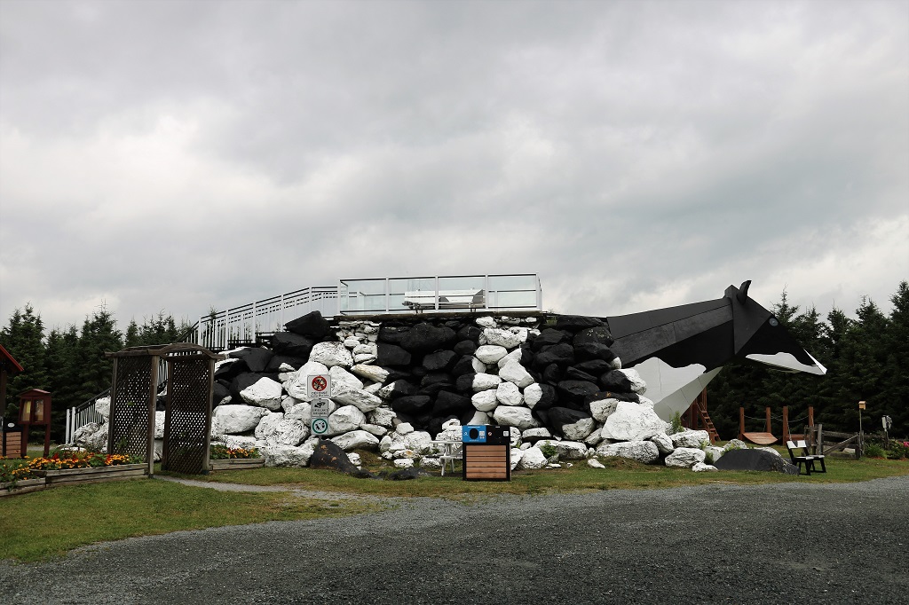
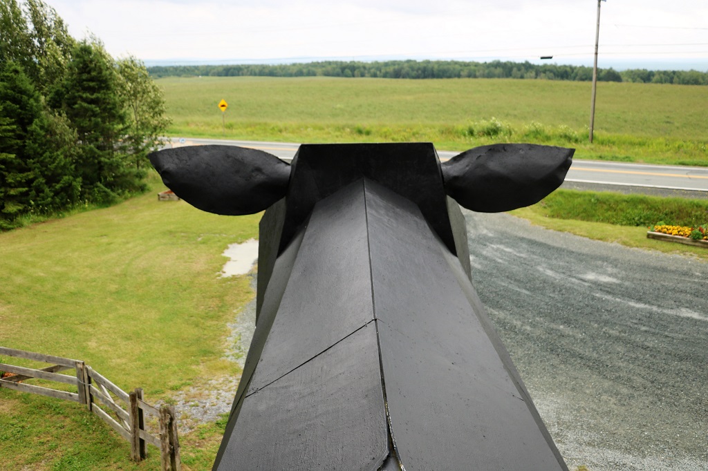
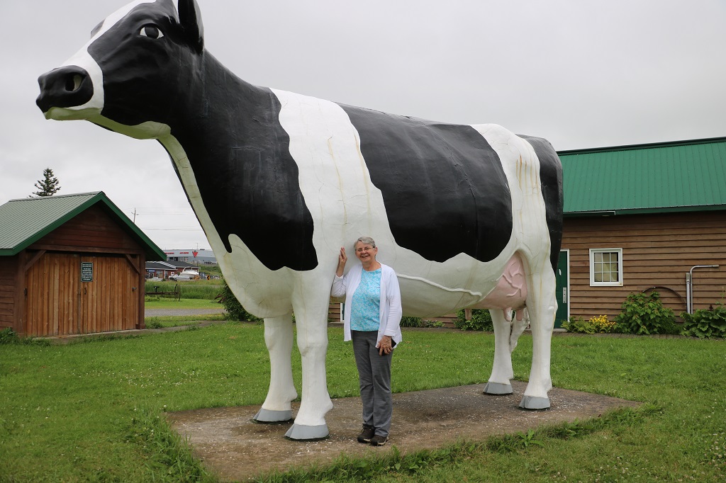
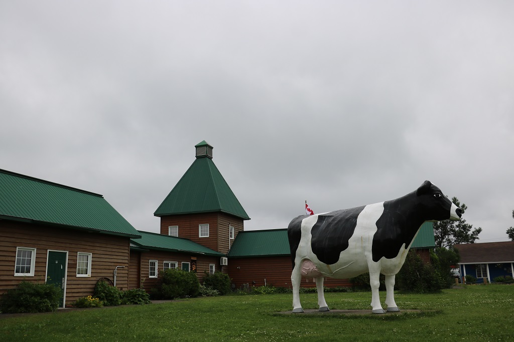
Before we left the Tesikaming Shores area we drove back up the road to New Liskeard and found Ms. Claybelt, the huge Holstein cow that is at the Visitor’s Center. Despite so much mining activity in the area, agriculture is still a major contributor to jobs and the economy so Ms. Claybelt is a reminder of that.
She is named Ms. Claybelt because this area is a vast tract of fertile soil stretching between the Cochrane District in Ontario and Abitibi County in Quebec covering around 29,000,000 acres (120,000 km2).
I don’t ask to have my picture taken very often, but who could resist a photo with such a lovely cow?
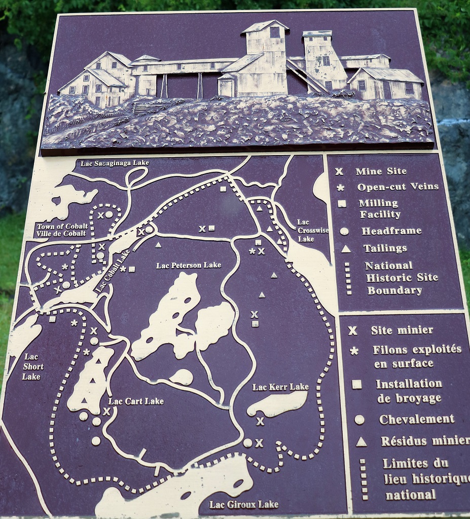
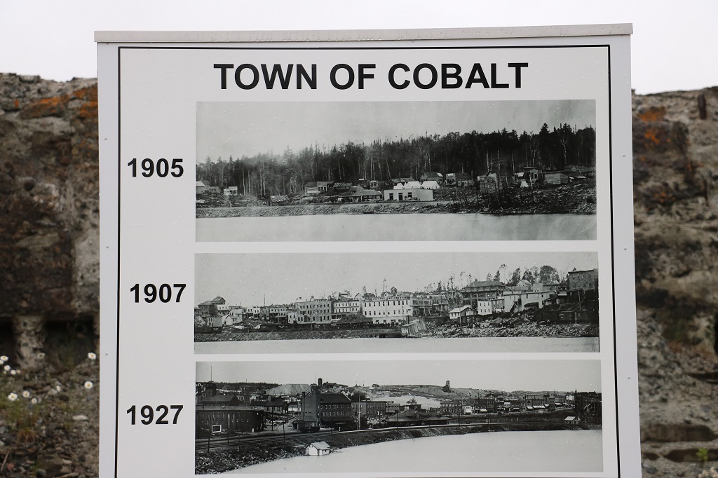
We drove south again to Cobalt, a small town transformed by the discovery of silver in the early 1900’s. The town is now a National Historic Site. We had hoped to tour their Cobalt Mining Museum where you could also arrange to get a tour down one of the mines, and their Military Bunker Museum but both were closed today. We walked around the small display of mining equipment at the headframe across the street and then headed toward North Bay.
Note the number of X’s and *’s that denote mine sites or open vein sites.
We were a few kilometers out of Cobalt and we spotted a Heritage Mining Trail #3 sign with an arrow pointing to a side road to the left. Off we went. You could pick up maps for the 15 or so points on the tour at the mining museum but since it was closed we could not do that and figured we were out of luck. I was able to pull up the map on my phone so we set out to locate several of the sites around where we were. We did not go back into town to see the ones there.
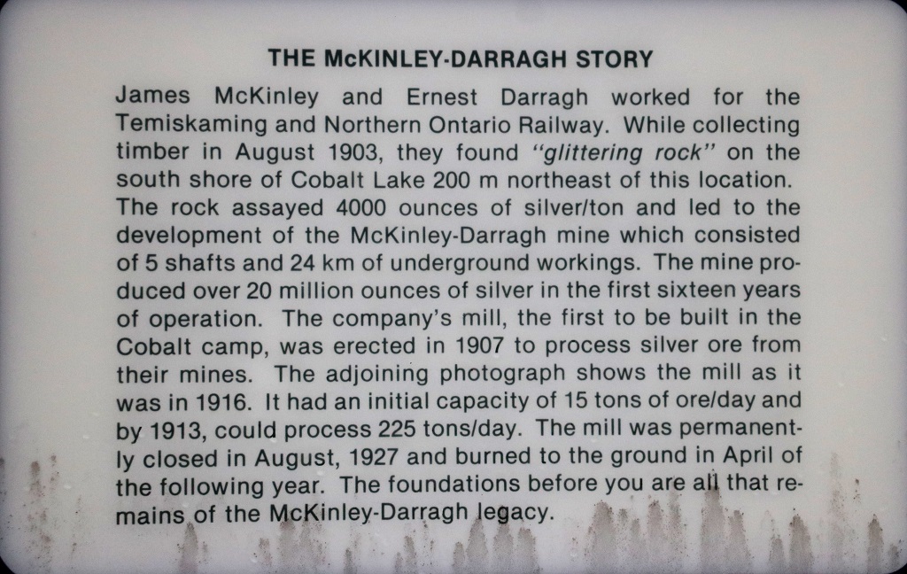
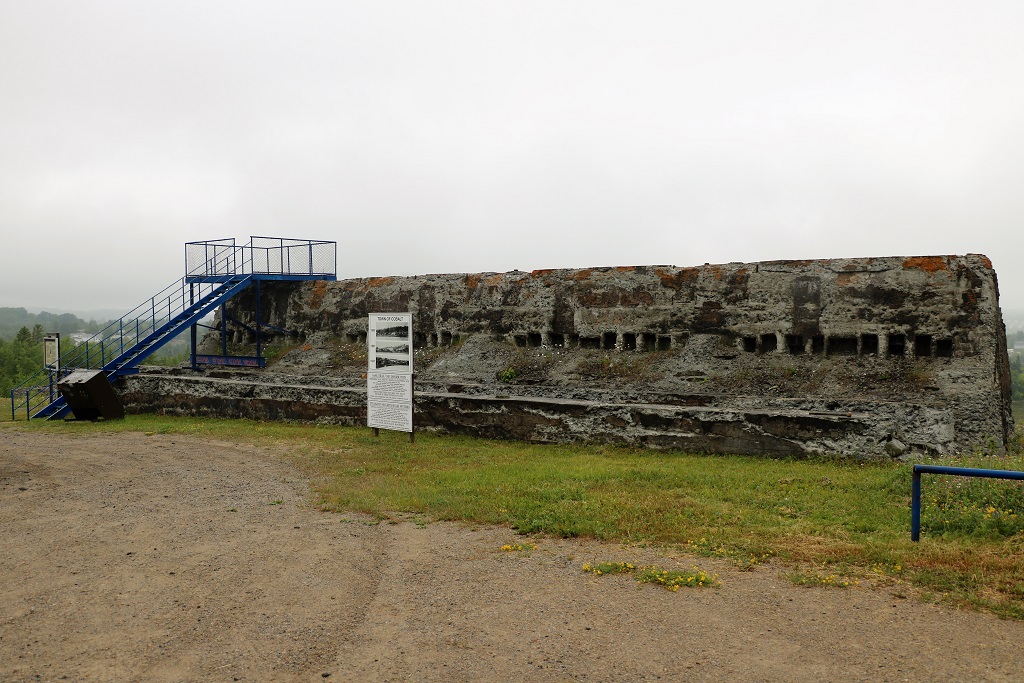
This is all that is left of the massive mill. It was closed in August of 1927 and burned to the ground the following April.
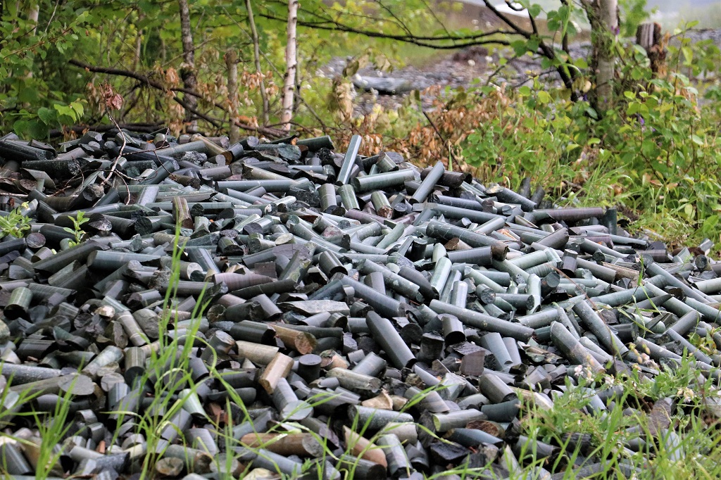
This pile of core samples was beside the foundation remains of the Cobalt Lake and Hellens Mill. None of the buildings of the various mills or head frames, except the one ln downtown Cobalt have survived.
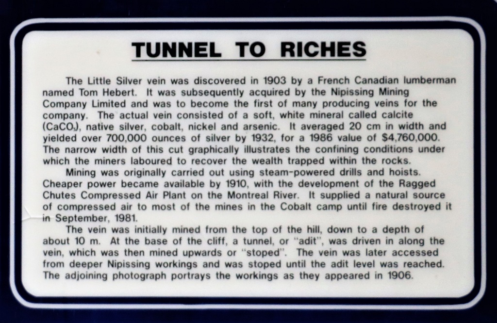
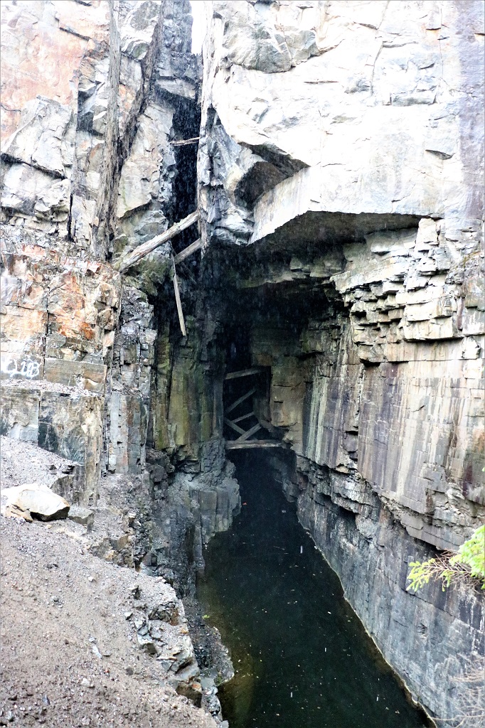
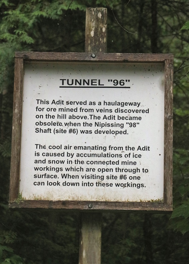
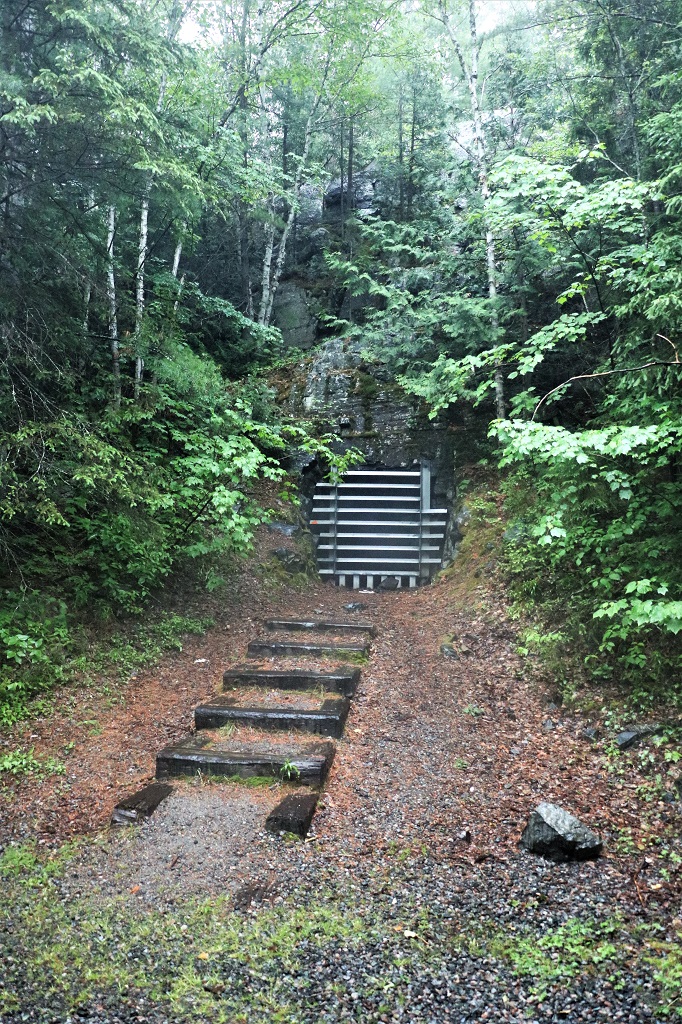
This was the entrance to the Little Silver mine. They just followed the silver vein down narrow channels of rock. I would not want to be a miner in one of those!
The sign is true. As we came out of the forest into the small glade before the mine entrance the air temperature dropped several degrees and we were instantly cold. It was raining steadily but it was not cold except in that spot.
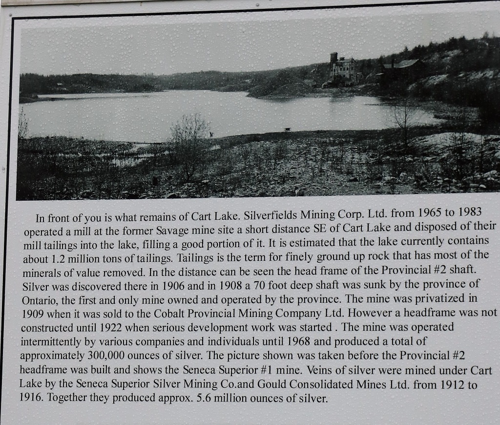
Can you imagine being able to just fill a lake with mine tailings today? But read the bottom line above.
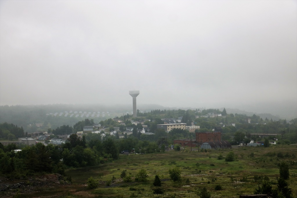
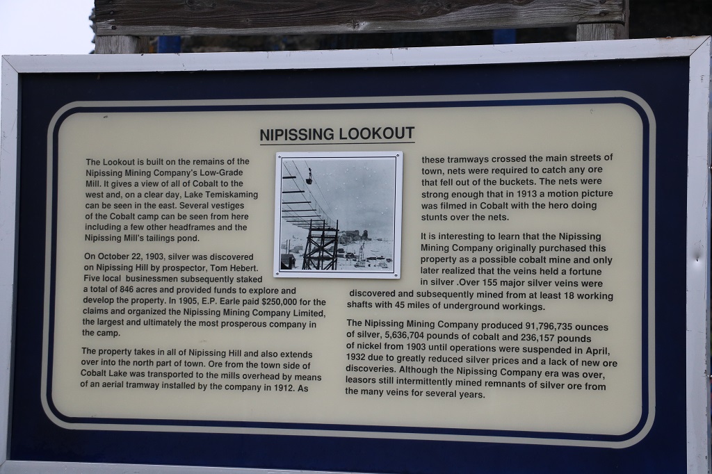
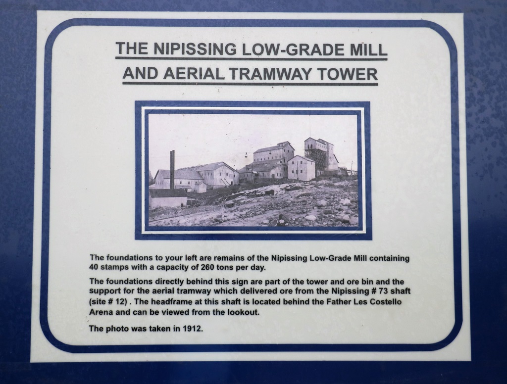
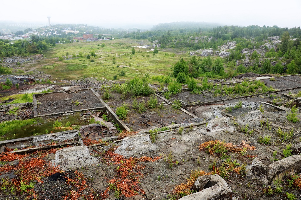
The final stop we did of the Heritage Mine Tour was the Nipissing Hill Lookout which was the site of another mill and a tramway. The view looking over Cobalt would have been awesome on a nice day!
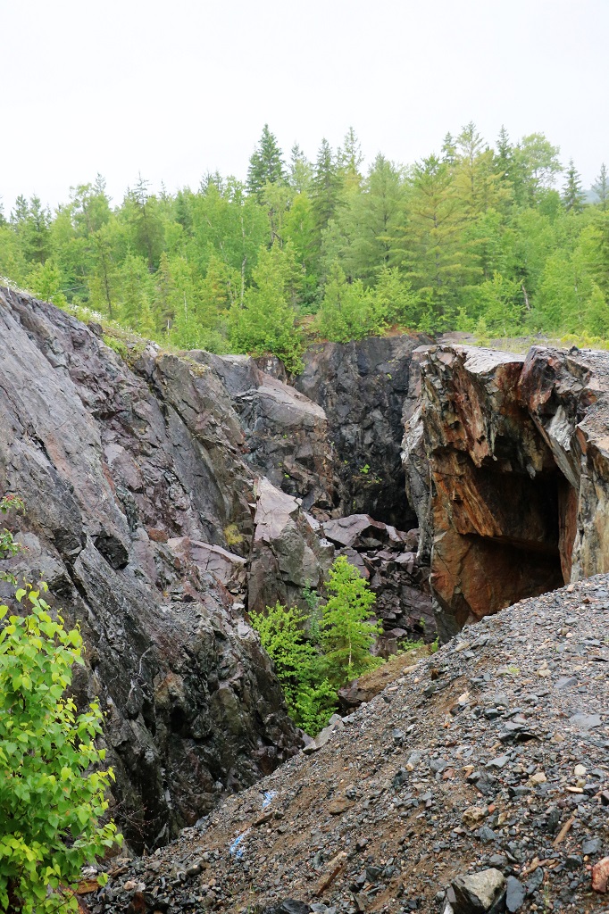
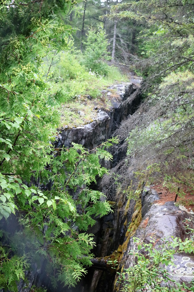
As we headed back down we located a few geocaches hidden along the road and there was one at this vein cut. It was hard to get a photo of it between the high fence and the rain but it would have been a nightmare to work in there or the other even narrower vein just a few feet away.
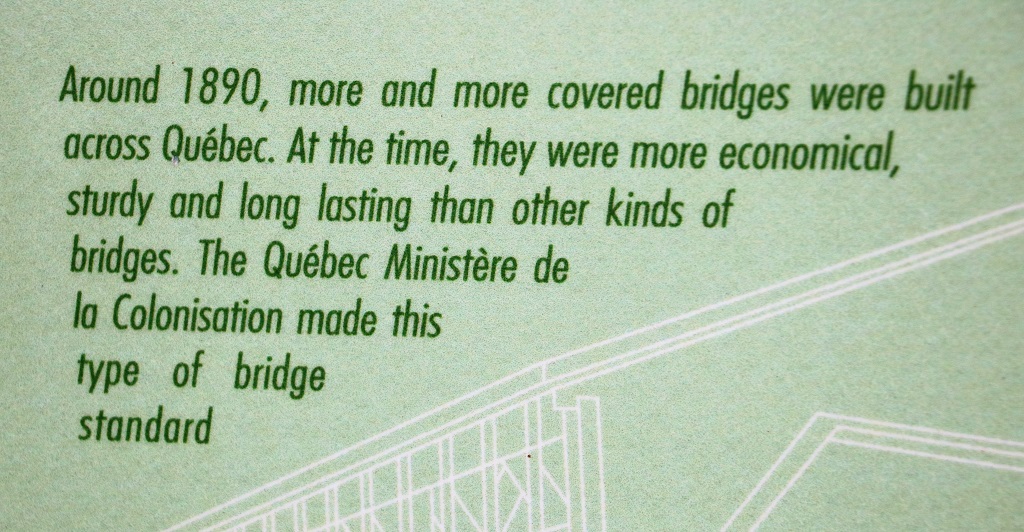
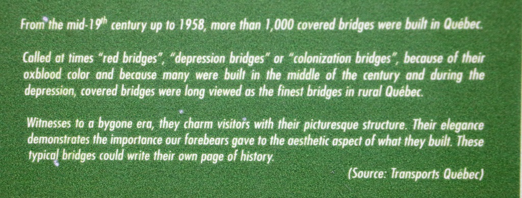
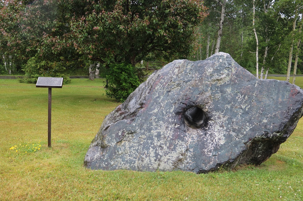
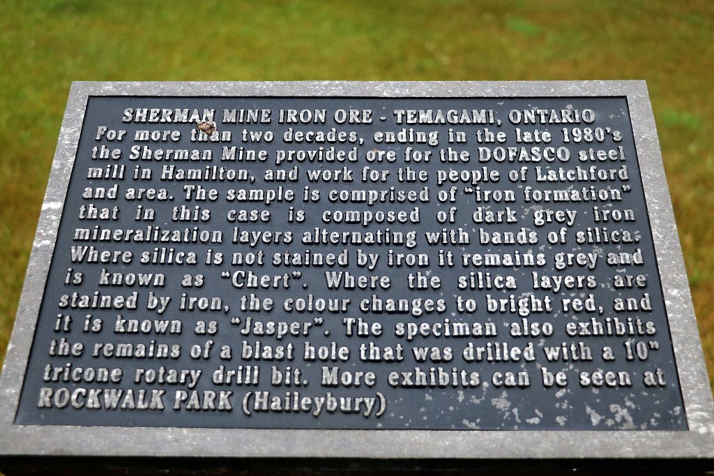
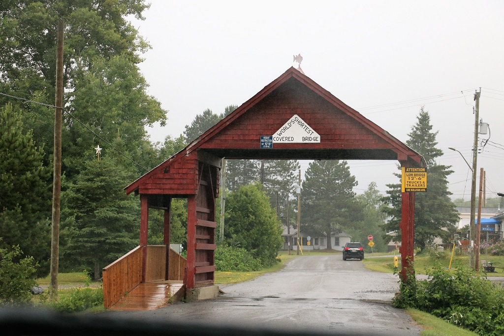
The Visitor’s Center at Latchford had this huge boulder out front. We stopped here to find the location of the world’s shortest covered bridge – as verified by the Guiness Book of World Records.
The bridge spans a small creek and is 11′ 3″ long. We have now driven through the world’s shortest covered bridge and walked through the world’s longest covered bridge. In 2019 we went to the 1282′ bridge in Hartland, New Brunswick.
We stopped at a small park with a covered shelter in Latchford and had lunch. This bridge is named for a local man who was the recipient of the Victoria Cross.
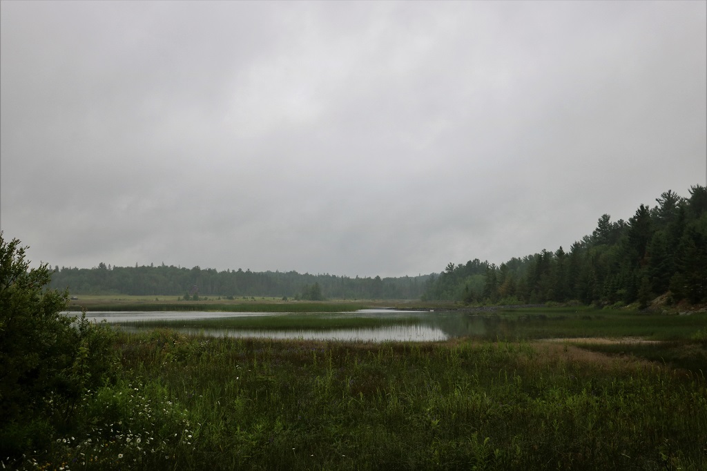
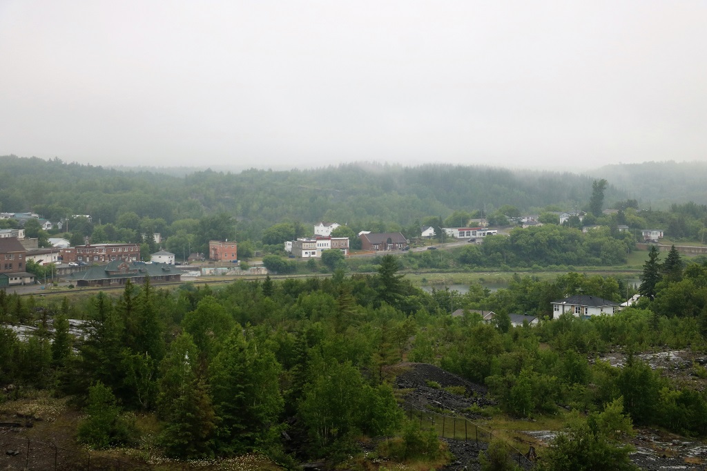
Everything was so grey and dark and wet today this is the only scenic picture I took.