Category Archives: Hanna Travels

Day 48 – July 24 – Dartmouth, NS

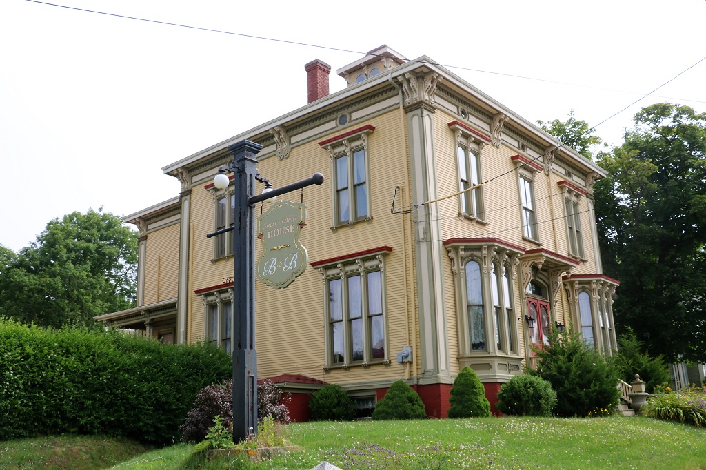
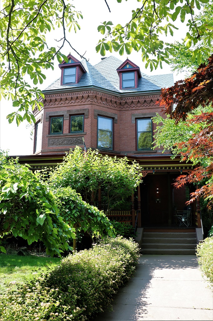
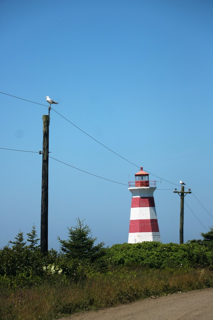
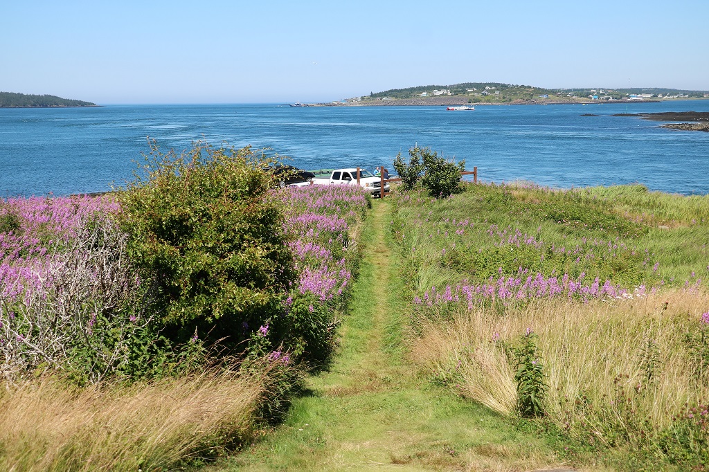
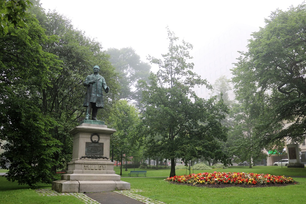
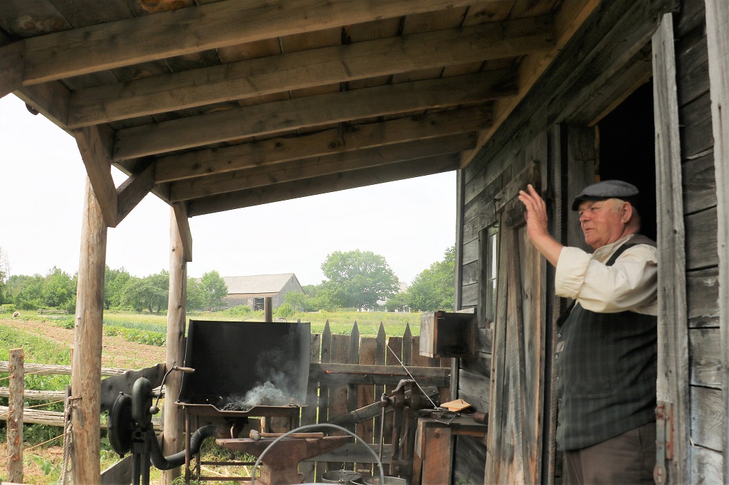
Today was only a half day. We took the morning off from touring and spent it in our hotel room working on our itinerary for the next few days.

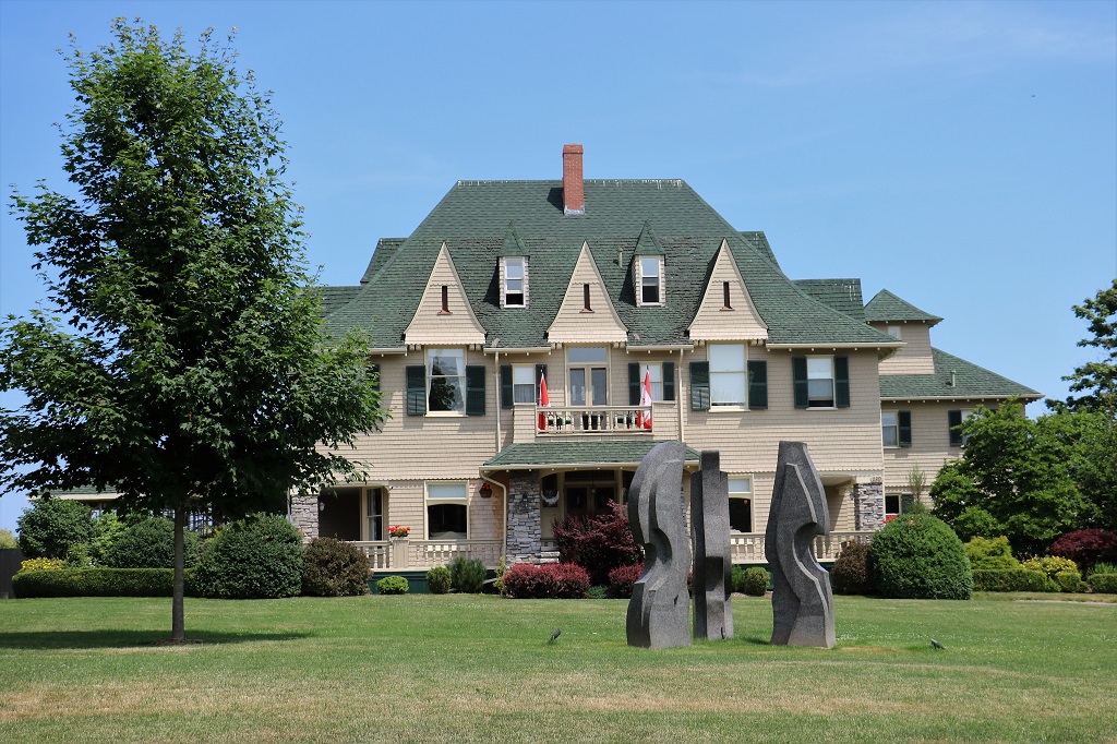
We headed out about noon and drove to the Halifax International Airport. Nearby is the Atlantic Canada Aviation Museum.

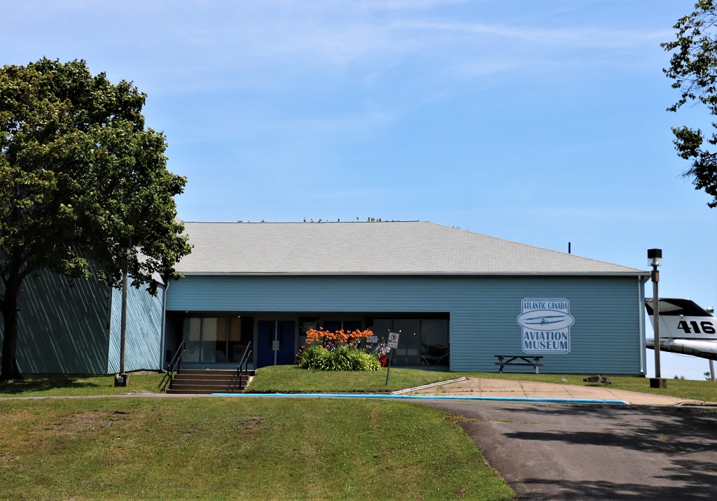
When you drive in the parking lot it does not look like much, but what you do not notice is the huge hanger attached on the left of the building half-hidden behind a row of tall trees.

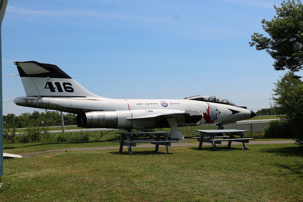
I am not a huge airplane person but there are always interesting stories attached to some of these planes.

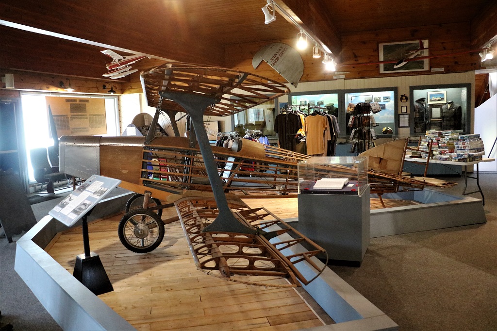
This one was found in several pieces in the attic of a house where it was sitting incomplete for almost 50 years. It is the oldest known homebuilt aircraft in Nova Scotia.

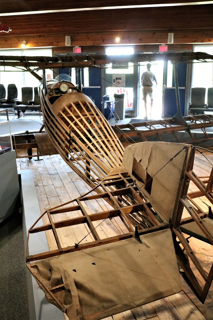
When it was brought to the museum and restored they intentionally left the fabric covering off in order to show the construction methods and operating control surfaces, as well as Mr. Craig – the original builder’s -workmanship. The plane is frequently used as an educational tool to demonstrate how the control surfaces on an aircraft work and how an aricraft is built.

A model of the Bell Hydrodome – a hydrofoil watercraft designed and built by scientist Alexander Graham Bell. A full scale replica of this hydrofoil is in the Bell Museum in Baddeck. We saw it on our 2014 trip.

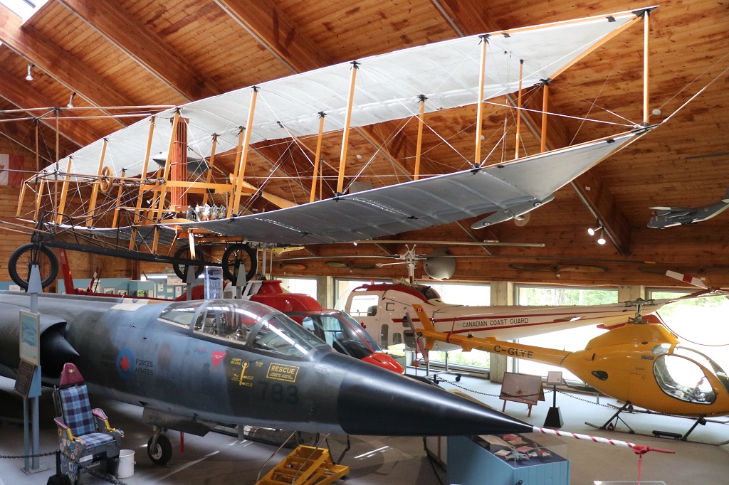
The plane at the top is a replica of the Silver Dart also built by Alexander Graham Bell. The team who built it used the original drawings from the Bell Museum. The plane underneath is a Starfighter, a single seat reconnaissance-strike aircraft built by Canadair in Montreal. It flew at Cold Lake, Alberta and in 1967 a CF-104 climbed to 100,100 feet (30,000 m), still a Canadian record.

The museum intentionally displayed the Silver Dart above the Starfighter to demonstrate what a remarkable change had occured in aviation during its first 50 years.

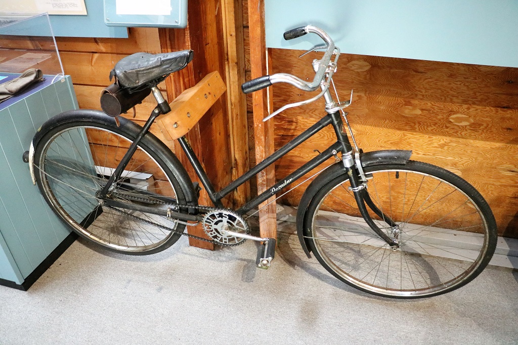
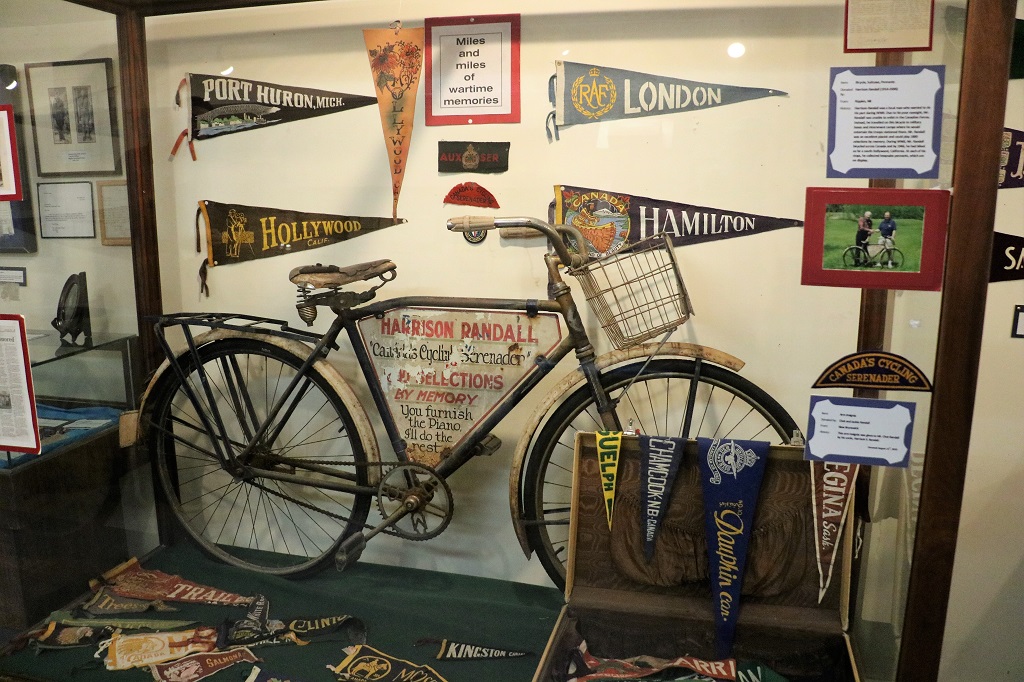
This is a Hercules bicycle. It was used on all airbases in England and Canada during WWII. It was built in England. The thing I liked about this was the very secure wooden bolted lock that ensures this bike will not go missing.

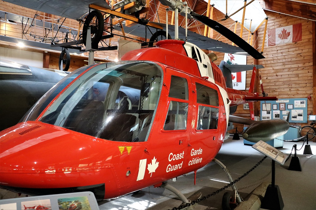
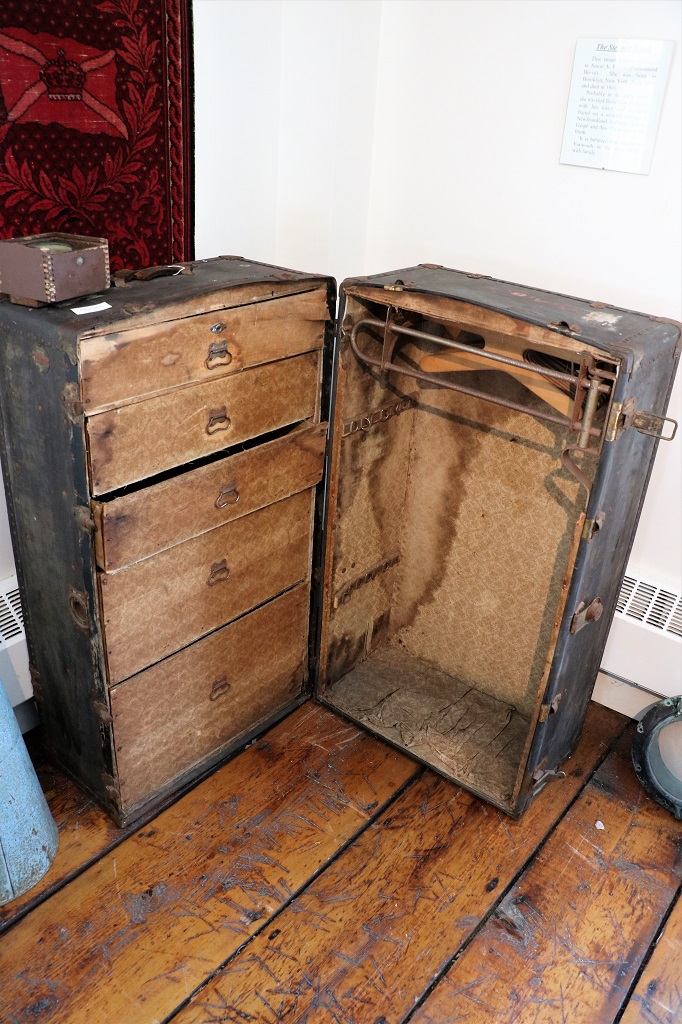
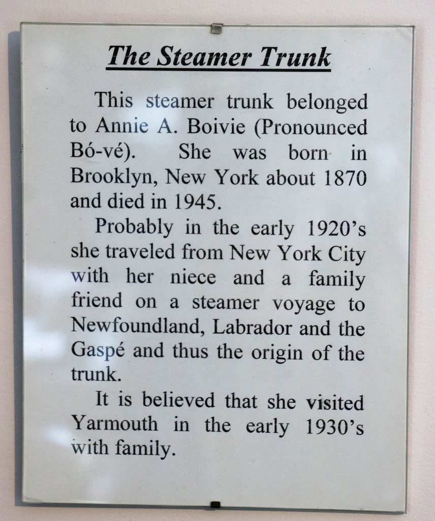
On June 2, 1977, the Canadian National Ferry “William Carson” was making its first trip of the season to Labrador with 37 passengers, 90 crew and 950 tons of supplies. While traveling through icefields 16 miles east of Square Islands it started to take on water. Within 30 minutes the captain gave orders to abandon ship. Just as the first rescue helicopter arrived, the “William Carson” sank. A very skillfull Bell helicopter pilot off the Coast Guard Ship, “Sir Humphrey Gilbert” rescued 42 of the survivors in 50 minutes. Everyone on the ferry was accounted for, without injuries.

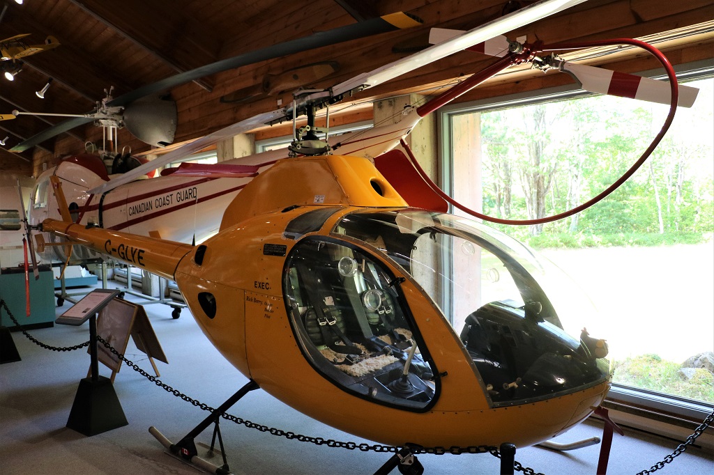
The Rotorway Exec is a family of two-bladed skid equipped, two-seat kit helicopters that could be built by amateurs at home. Completed in 1993, it was the first of its kind in Nova Scotia.

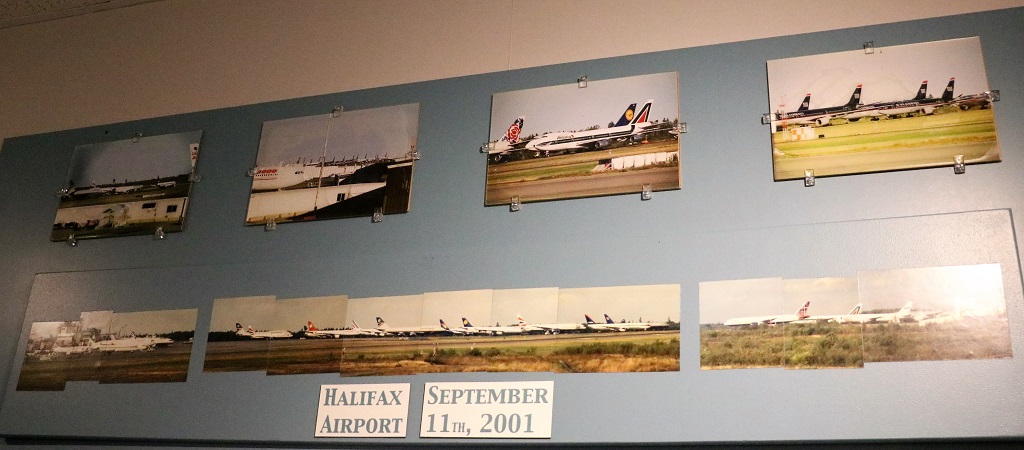
Just as happened in Gander, Newfoundland; Halifax, Nova Scotia and Moncton and St. John, New Brunswick’s airports were deluged with flights from all over the world when US airspace was closed after the horrendous terrorist attacks on September 11, 2001. Halifax received its first plane within 35 minutes after the Trade Center buildings were struck and over the next few hours had 40 international airplanes carrying 6,978 passengers and approximately 580 flight crew land at the airport. It was four days before the last one left again and all the people were fed and housed and cared by the people of Halifax coming together in a time of deep distress to be of assistance to thousands of unexpected strangers.

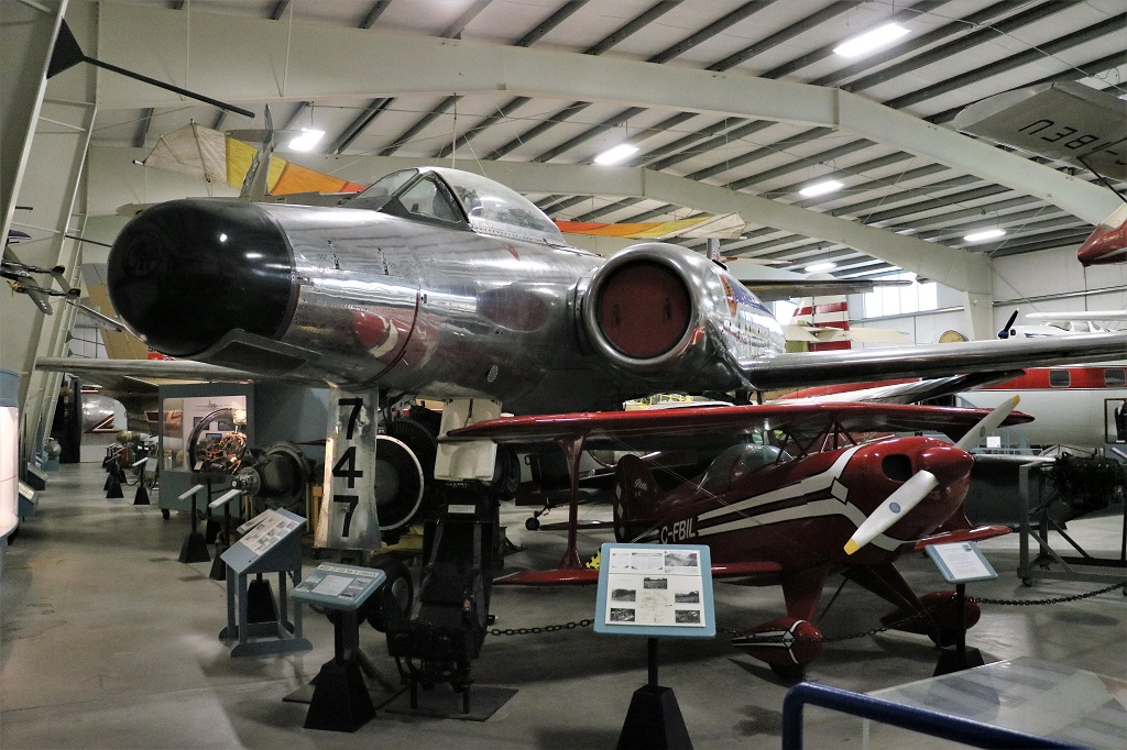
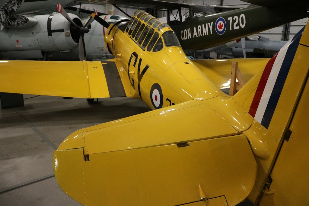
If you have limited room to house aircraft you just tuck the little ones under the wings of the big ones.

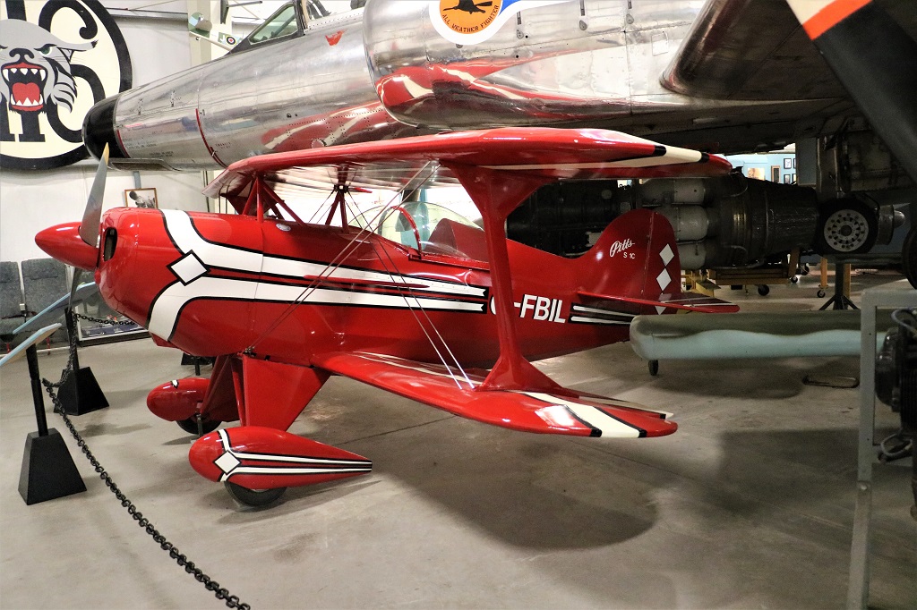
This is a Pitts Specical S-1C. It was built in the US in the 1970s and brought to Canada in 1978, but could not be flown here so the owner donated it to the museum.

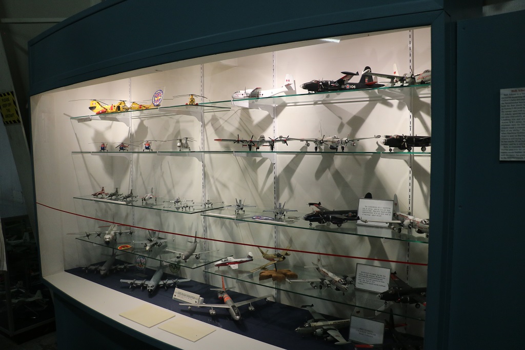
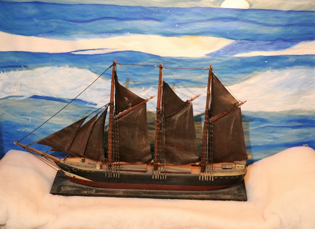
There were displays of model airplanes all around the building and the gift shop has a gigantic supply of model airplane kits, plus tanks and spacecraft and a few other things. They get orders from all over the place. I had no idea model-making was still popular.

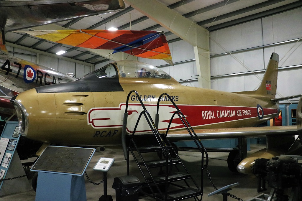
The Golden Hawks were the RCAF Aerobatic Team from 1959-1963. They performed in 317 public air shows and became very famous in Canada and the United States.

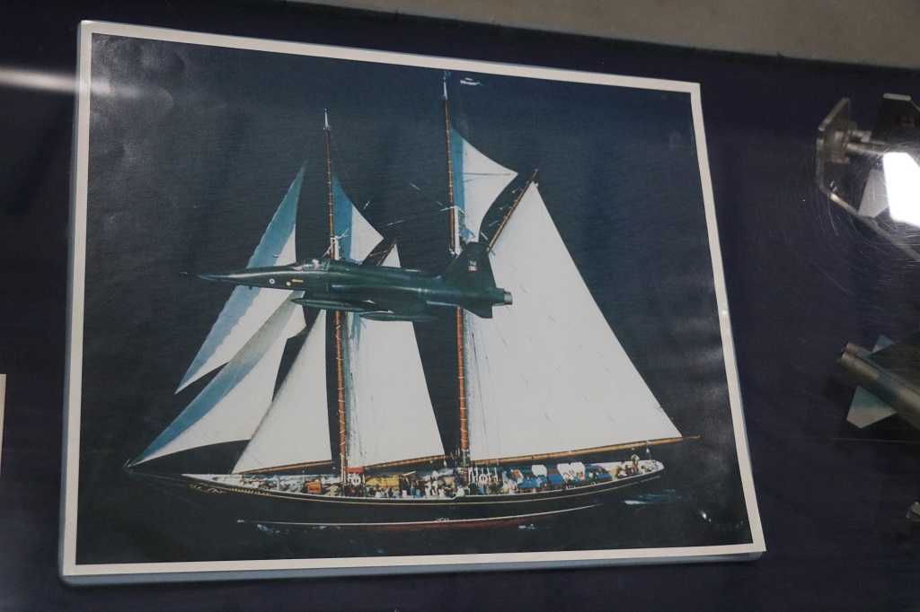
The Sabre, seen here flying past “Bluenose II”, was the best jet fighter of its time and was first used in the Korean War in the 1950s. They were built in Montreal by Canadair.

I had noticed that all the planes were very clean and shiny so when I saw one of the staff I asked what day was dusting day and he immediately replied, “Wednesday, unless we have been very busy and then the planes will be cleaned every day.” There are four fulltime staff in the summer months and they use very long-handled dusters to keep the planes looking nice.

This is a Scamp 1. It is a homebuilt aircraft designed, built and flown by a man called Donnie MacDermid of Cape Breton. Mr. MacDermid built 13 other aircraft as well using only one hand having lost his other hand at a young age.

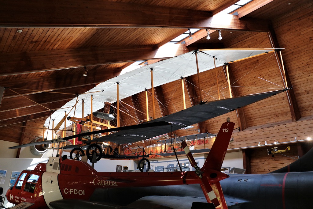
A bit better photo of Alexander Graham Bell’s Silver Dart.

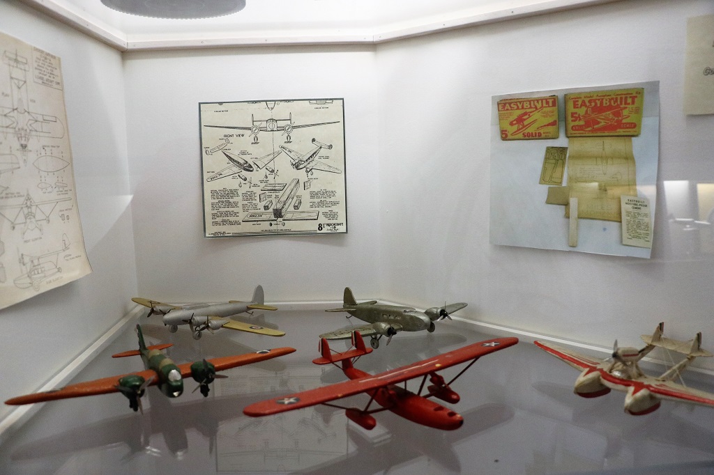
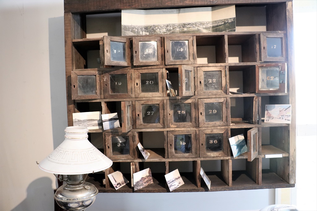
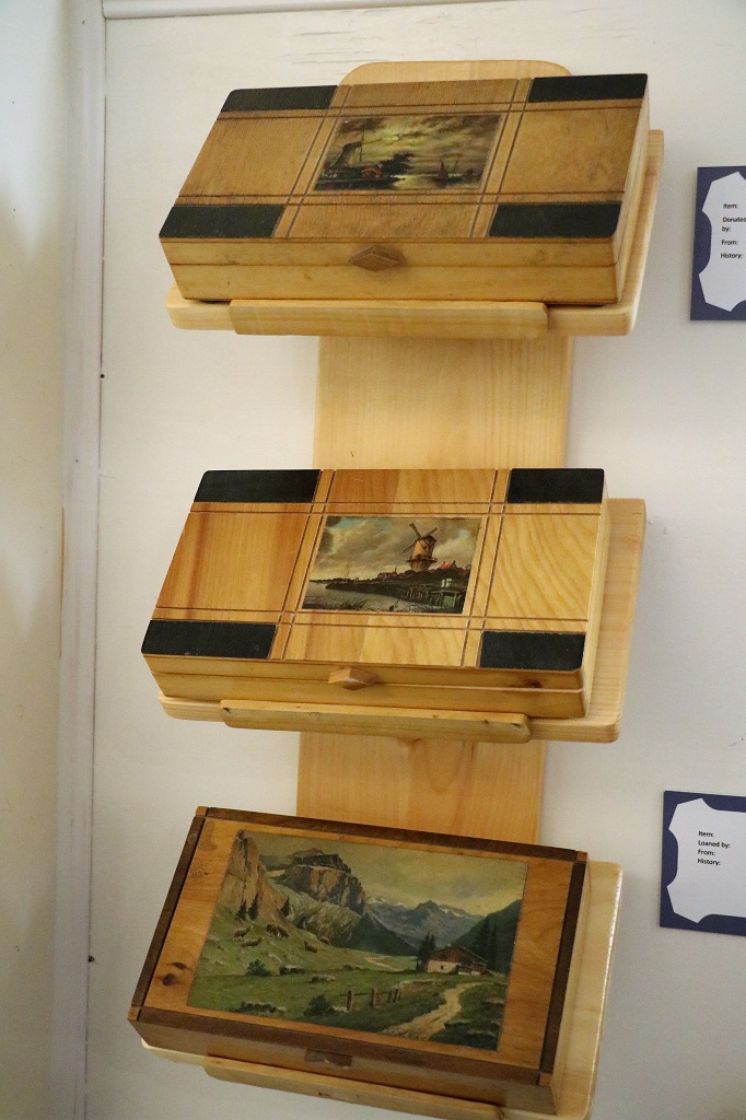
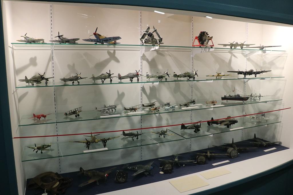
There was a four-shelf display case of wooden airplane models made from kits during the 1930s.

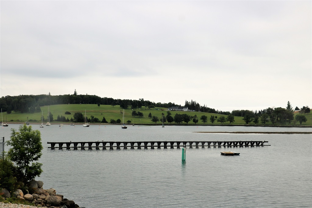
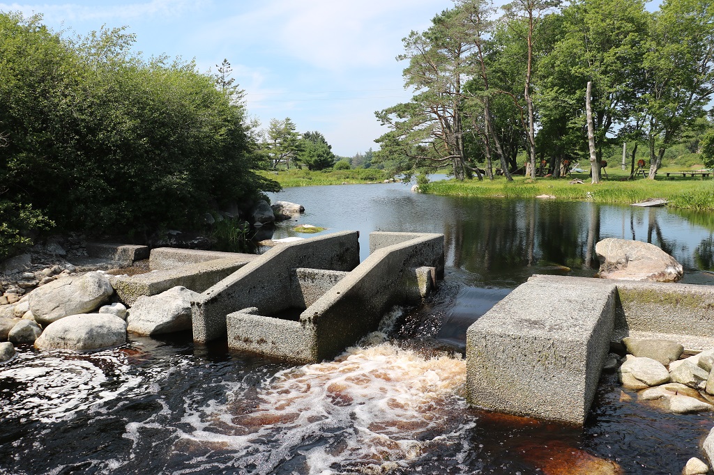
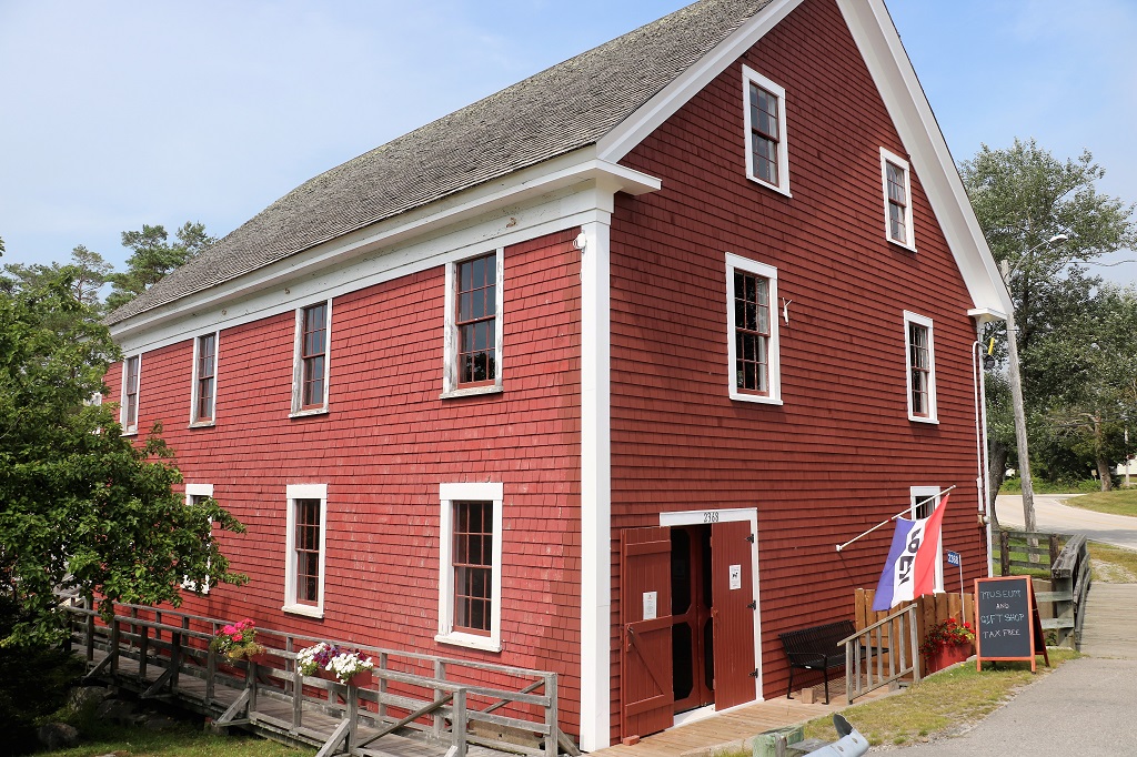
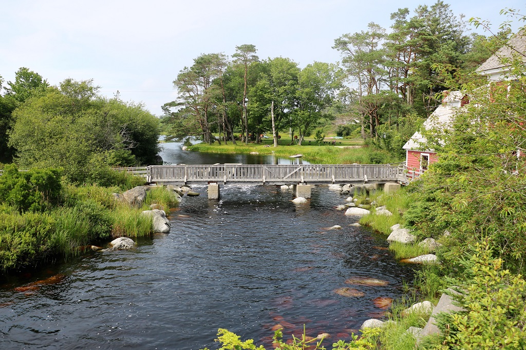
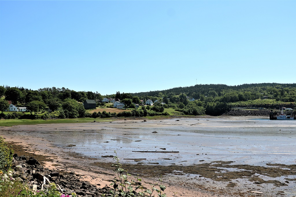
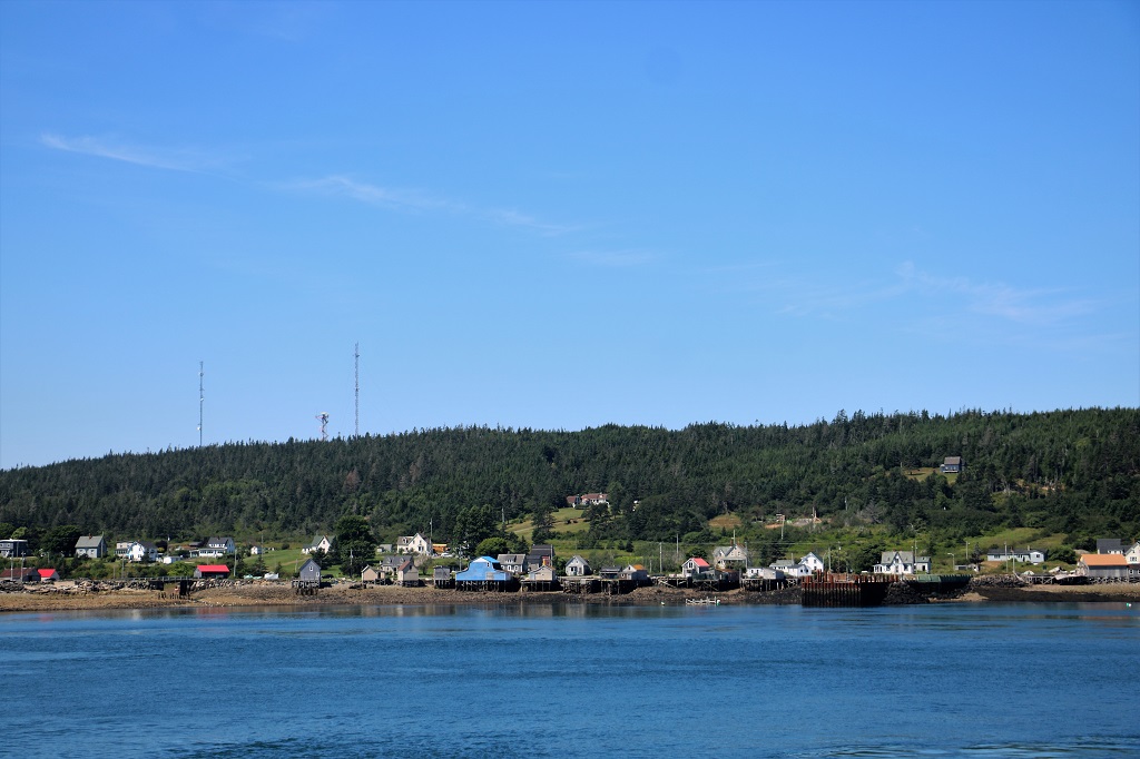
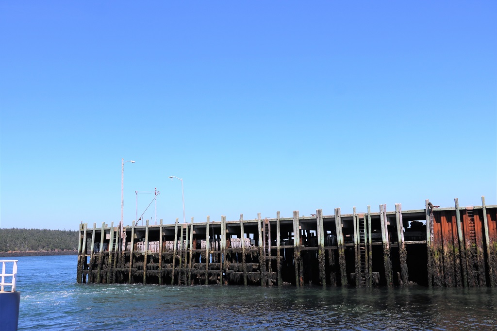
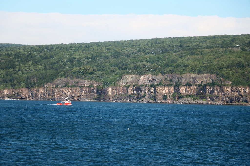
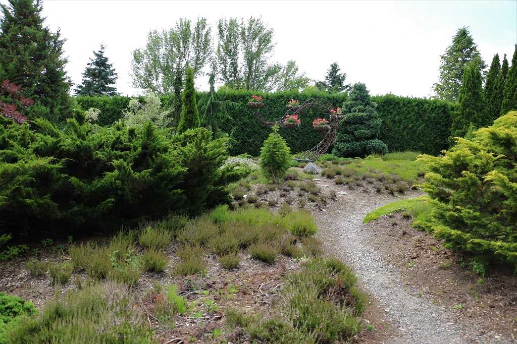
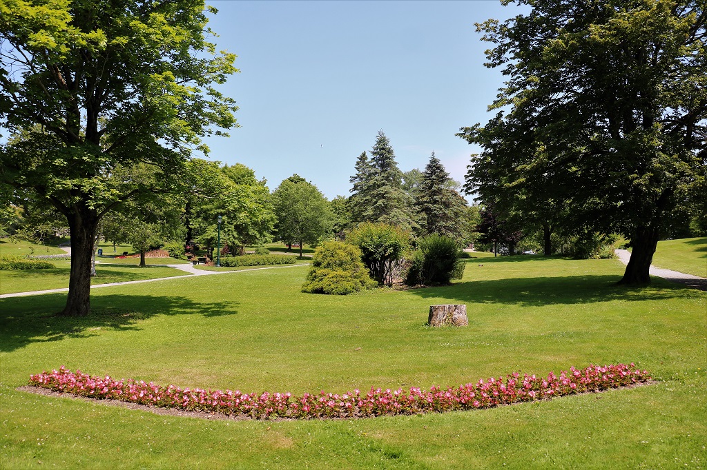
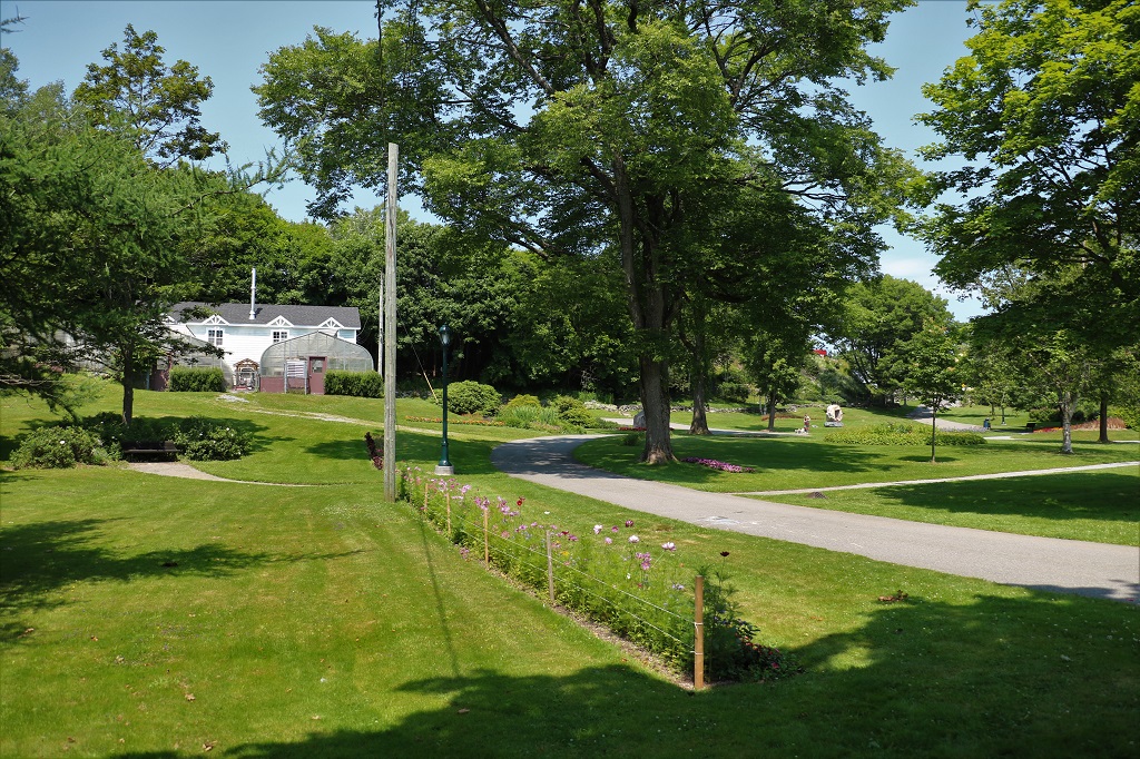
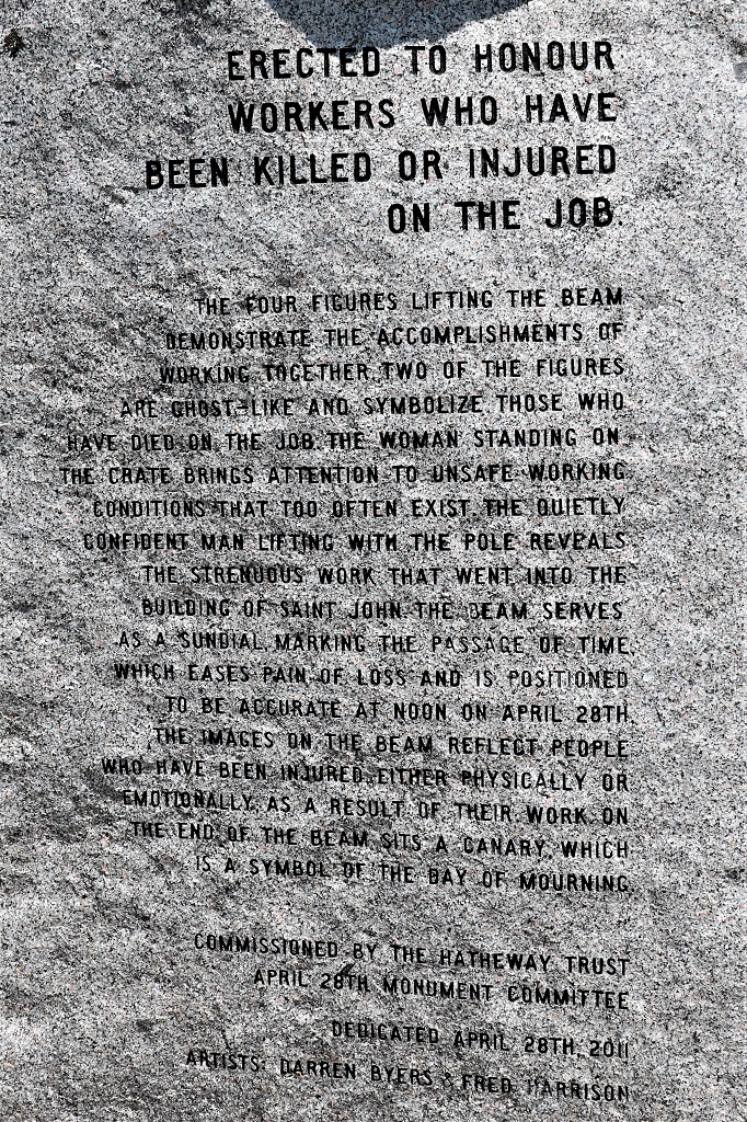
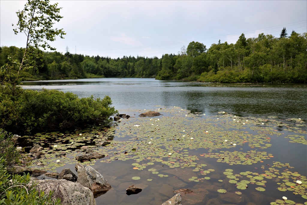
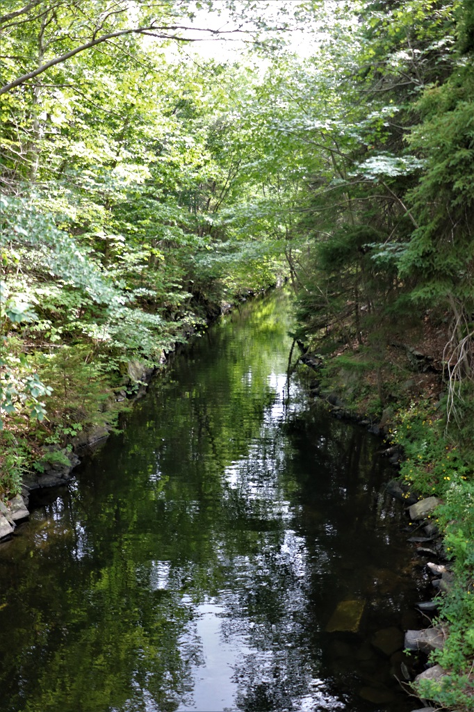
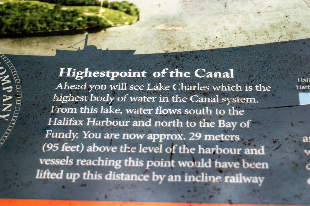
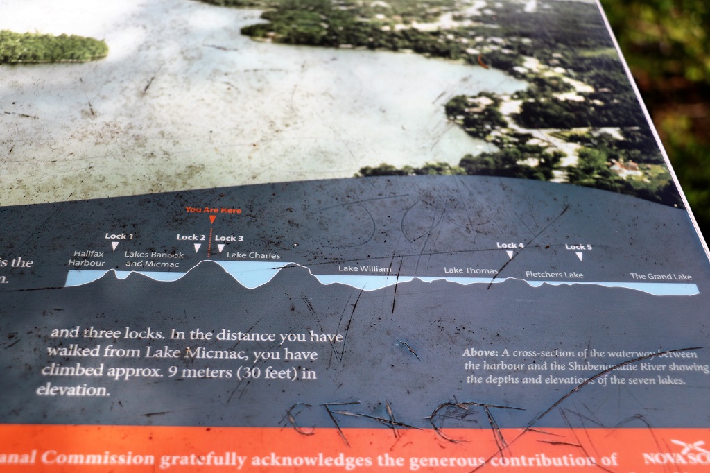
We had some lunch in the parking lot of the aviation museum and then drove to Shubenacadie (pronounced “Shoo-ben-ack-a-dee”) Canal. It links Halifax Harbour with the Bay of Fundy by way of the Shubenacadie River and Shubenacadie Grand Lake. Begun in 1826, it was not completed until 1861 and was closed in 1871. Currently small craft use the river and lakes, but only one lock is operational. Three of the nine locks have been restored to preserve their unique fusion of British and North American construction techniques. 

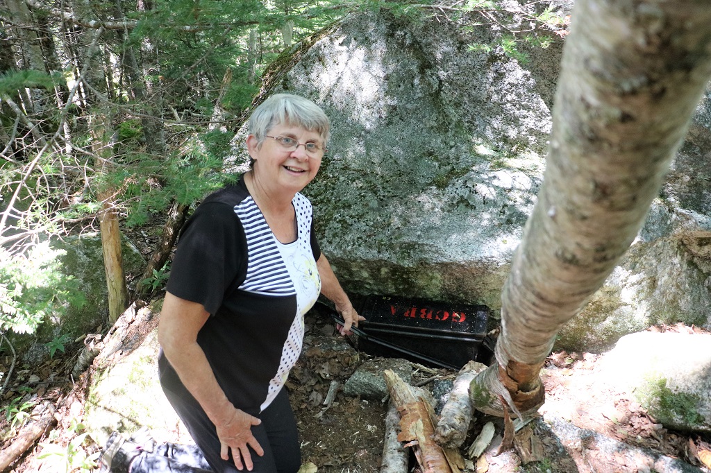
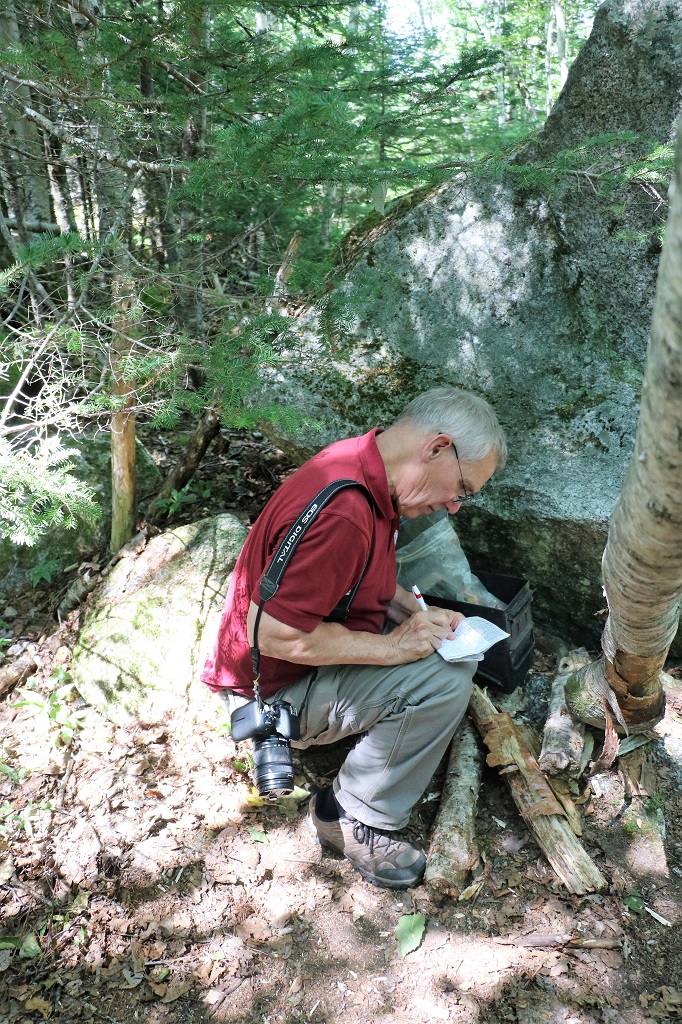
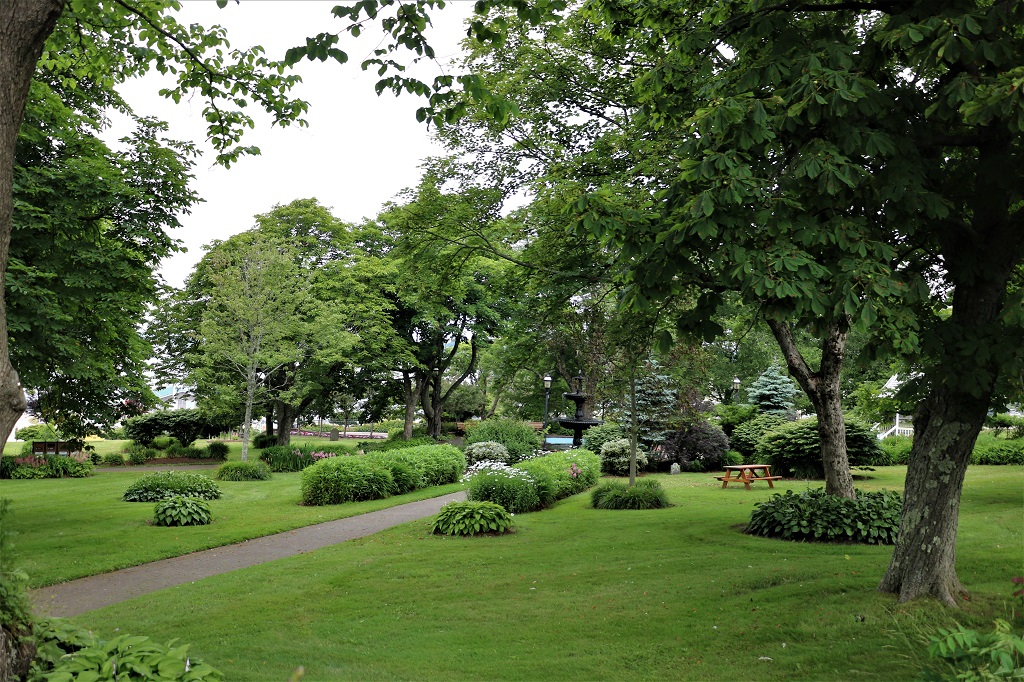
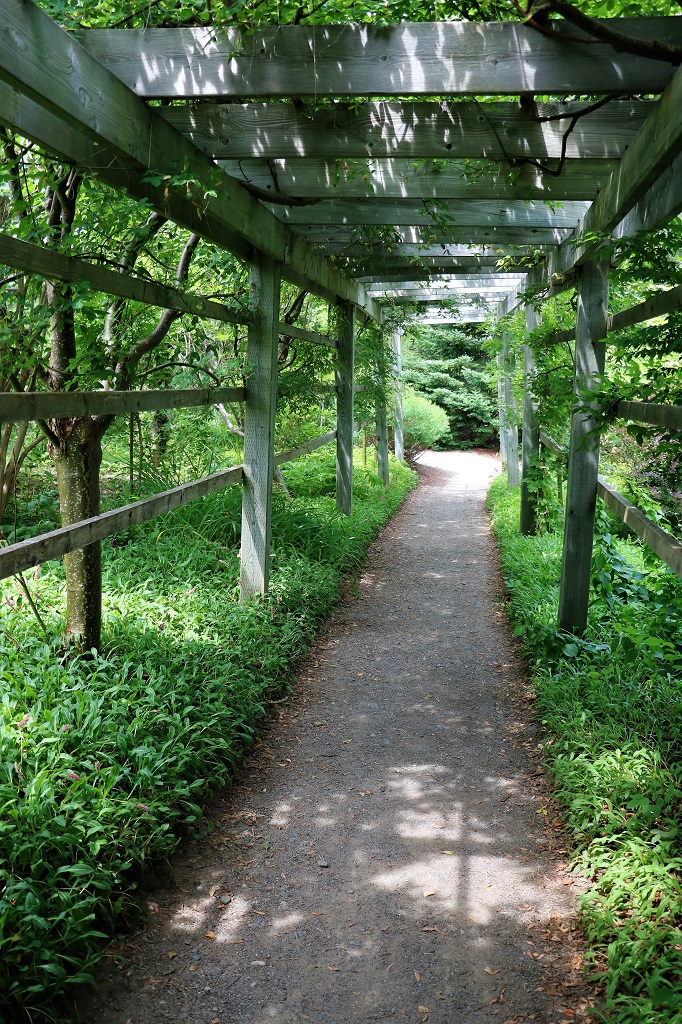
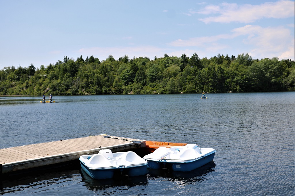
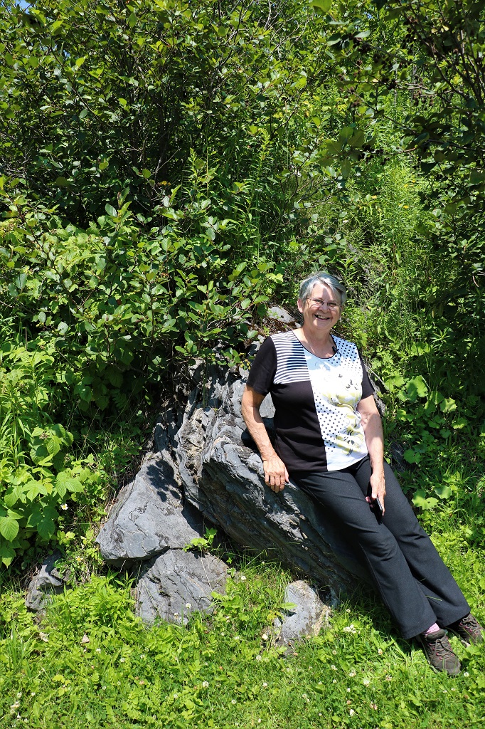
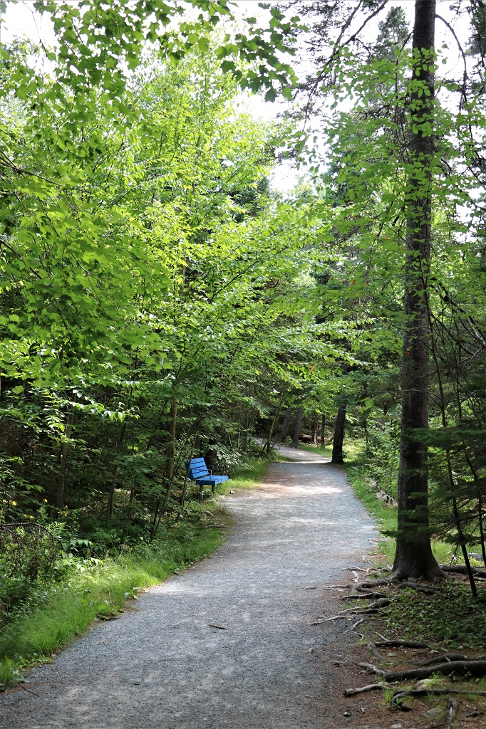
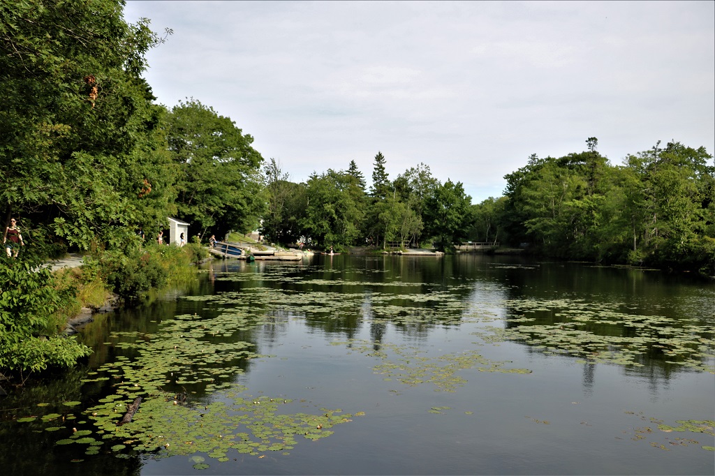
Shubie Park where one of the old locks is located is a popular hiking area and water playground. On a summer day like today there were many canoes and waterboards plying the slow-moving water of the canal.

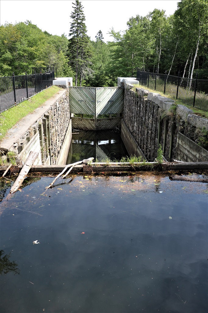
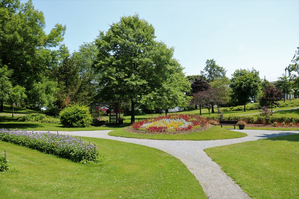
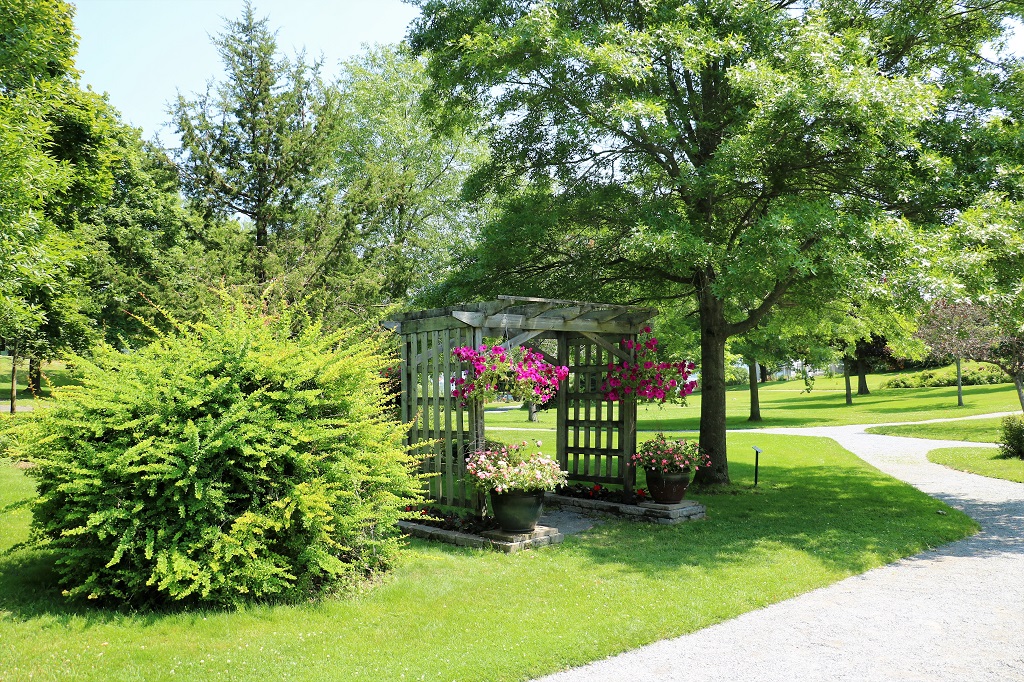
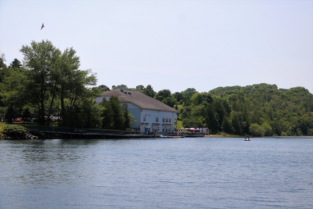
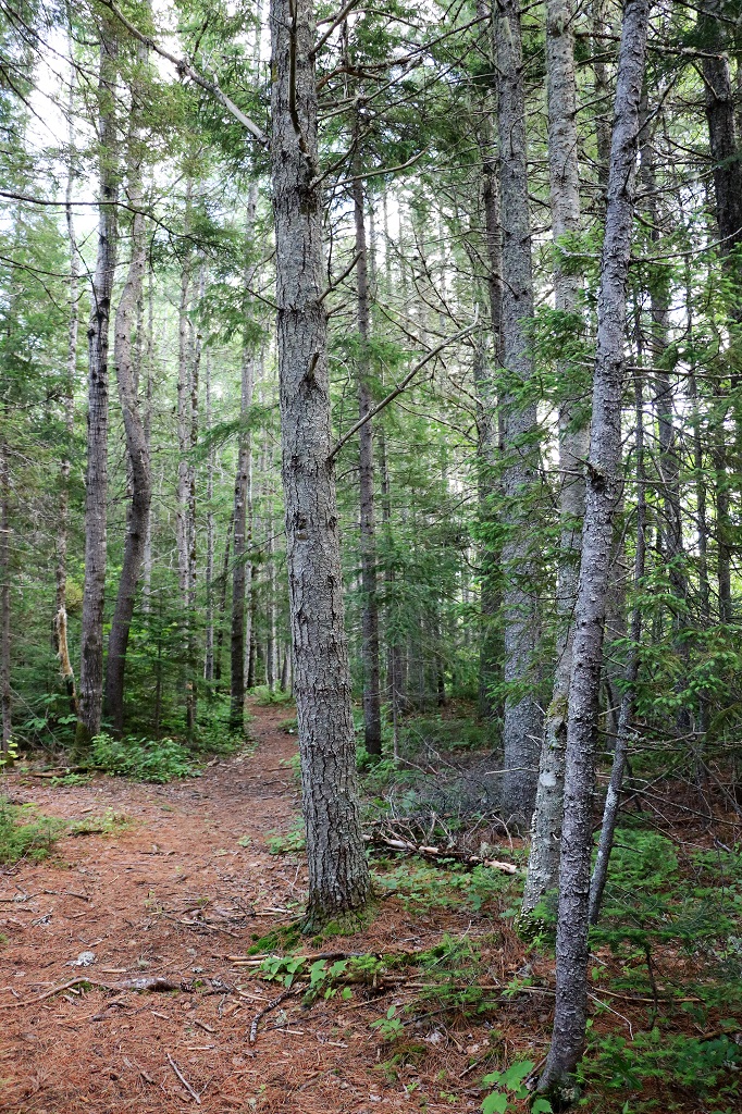
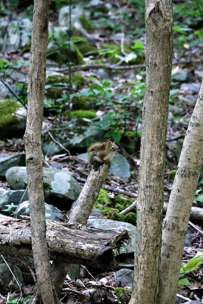
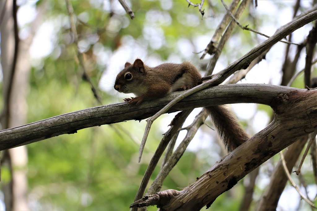
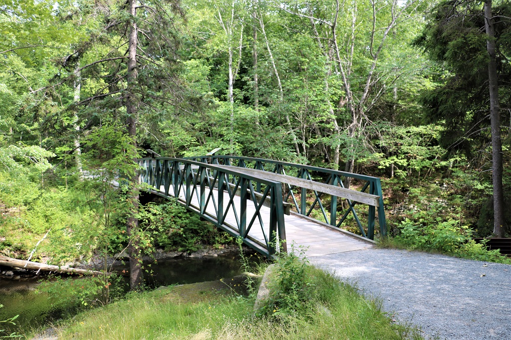
We walked from this lock to Lake Charles, crossed over the canal on the bridge, and came back down the other side. It was a very pleasant walk through the trees.

American Black Ducks

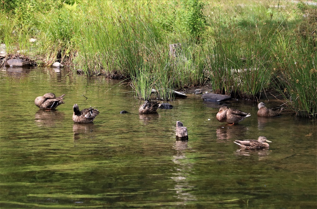
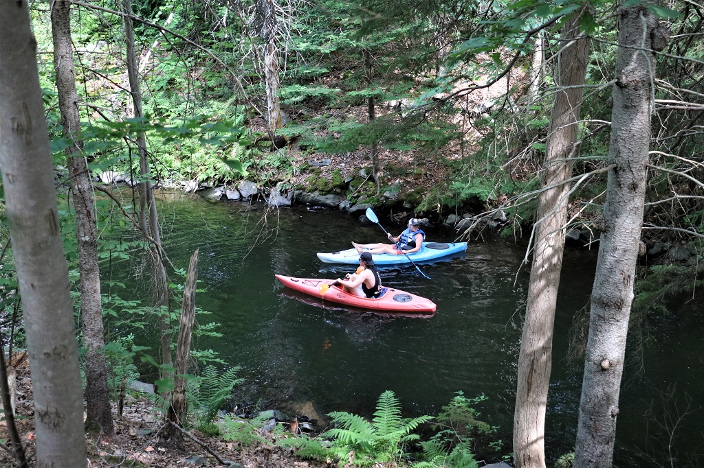
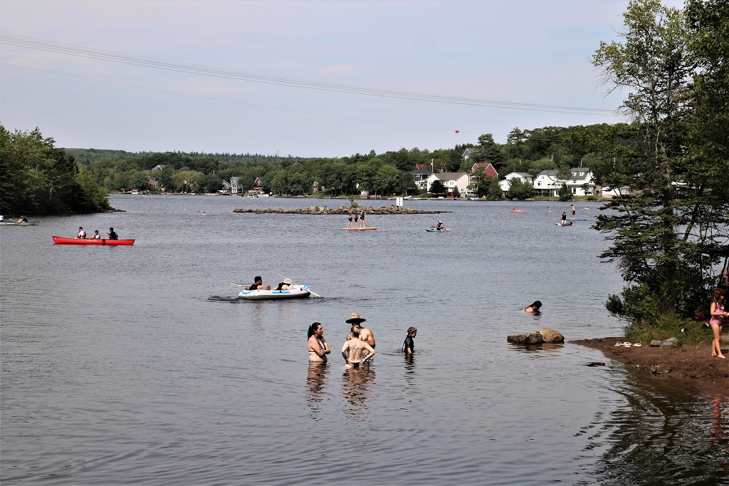
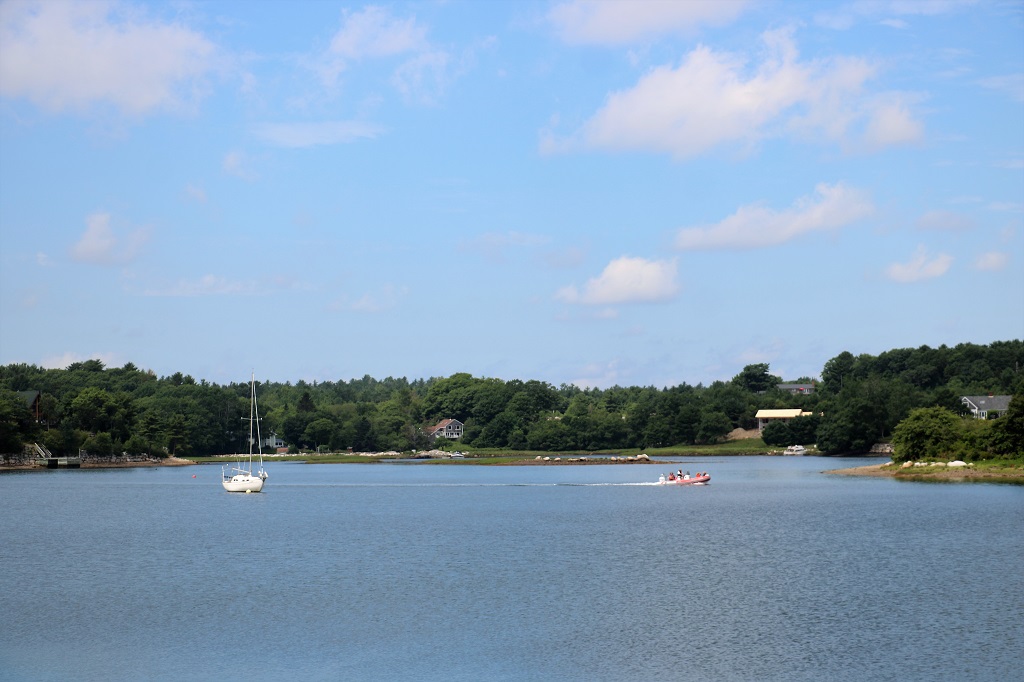
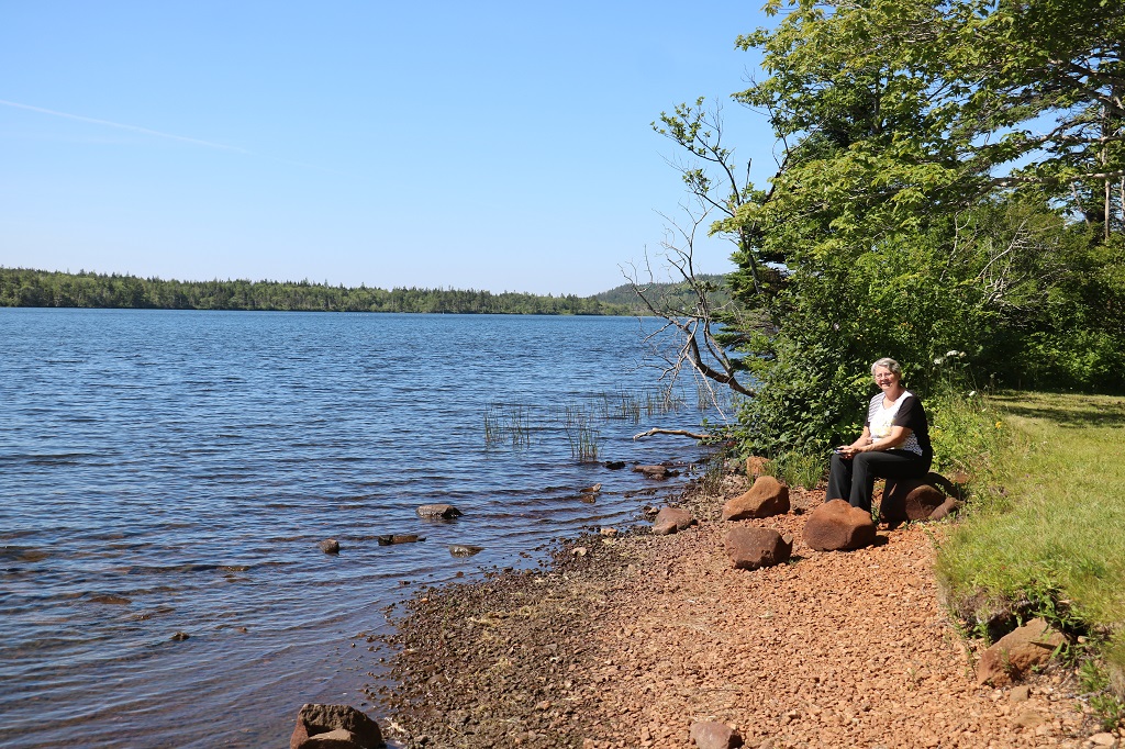
Lots of people were enjoying the lake on this sunny Sunday afternoon.

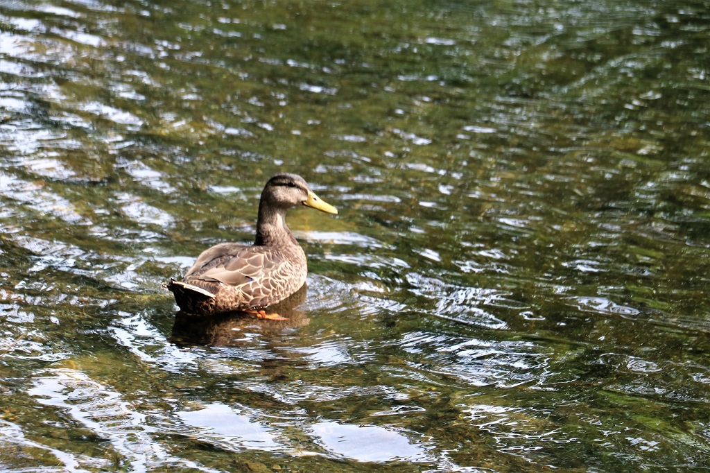
This American Black Duck is displaying a bit of the bright blue they have along their sides.

Tomorrow we head up the coast road to Sherbrooke.

Day 47 – July 23 – Halifax, NS

The A. Murray Mackay bridge between Halifax and Dartmouth. It is a toll bridge ($1.25), built in 1970. 52,000 vehicles cross it every day. It is the only harbour bridge that allows semi-trailers and large trucks. Pedestrians and bicycles are not allowed.

We left for Pier 21 after breakfast. Pier 21 opened in 1928 and witnessed the arrivial of approximately one million immigrants. It served as one of Canada’s principal reception centers until it closed in 1971. The staff of Pier 21 handled large volumes of immigrants rapidly, checking their citizenship, medical records and providing quarantine, detention, customs or social services.

We have been here twice before, in 2014 on our first cross-Canada trip, and again in 2015 when the ship docked in Halifax on the return to Boston at the end of the Voyage of the Vikings cruise. Each time we have visited the Bank of Nova Scotia Family Center at the Immigration Museum at Pier 21. The very helpful staff will search for passenger lists of ancestors that have immigrated to Canada via Halifax, Quebec City, or Montreal.

There was only one of my family members who had arrived in Canada that I did not have the information about and that was my grandmother Mina (Charlotta Vilhelmina) Anderson who came to be a nanny to a family in Revelstoke when she was 21. I learned she arrived from Sweden via Liverpool in 1912. I had also brought along information on John’s maternal grandparents who came from England in 1913 (Grandfather) and 1914 (Grandmother and three children).

The other thing I was hoping they could find for me was the ship’s manifest for the return trip to Scotland made by my mother and her three older sisters in 1937 after their parents had both died. Aunty Anne was 16 at the time and my mom, the youngest, was 7. I did not hold out much hope that they could get the information because the girls were not immigrating; they were going back to Scotland. But Lara located the ship registry very quickly and she was also able to print me a copy of the Duchess of York passenger list that my mom was on as a 9-year old returning to Canada again on her own to live in Winnepeg with the couple who fostered her after her mom and dad died.

The only information I was unable to get was the arrival date for John’s Great-Grandfather. He came from Ulster, Northern Ireland in the 1840’s and Pier 21 immigration archives only go back to the 1860’s. But I was very happy to get everything else.

My mother’s two eldest sisters came back to Canada as war brides.

We had heard a sad tale about a community called Africville that was destroyed by the city of Halifax in 1964 to make way for industrialization along the shore of Bedford Bay. It wasn’t too far from the Immigration Center so we went to check it out.

Africville was originally 500 acres of privately owned houses and land and a very tight-knit community. The black residents paid taxes like everyone else in Halifax but never got the services – like clean water after their water was contaminated by the encroaching industrial businesses, or proper sanitation, or electricity. Finally in the early 1960’s the City decided to re-locate all the residents in the interest of urban development and for their own ‘betterment.’ Despite their best efforts and pleas the 400 remaining resident’s land was expropriated, they were moved mostly to low-cost housing, and their homes, church, school, and businesses were bulldozed.

The City of Halifax, after lawsuits and protests, officially aologized in 1988 and returned 2.5 acres to the Africville Society for a park along with $3 million dollars in reparation. The park is maintained by the Society and they have built a replica of the church which is open as a museum to tell their story.

We drove next to the National Historic Site of the York Redoubt that guarded Halifax harbour from 1798 to 1956.

A map of the historic site as it is today.

The Redoubt was first fortified in 1793 when war broke out between Britain and France. The defences were improved between 1794 and 1800, and again in 1873

1800

By 1867, when Canada was born, technology was changing rapidly. Warships were now built of iron, rather than wood, and protected by thick armour which cannon could not penetrate. New guns firing heavier, pointed shells were built to pierce armour plate. York Redoubt was rebuilt and expanded to mount the new guns.

In 1900 new weapons were again available. Breech-loading guns, loaded from the rear, gave much greater range and accuracy. Once again the Redoubt was re-fortified and re-armed.

The final changes came when Canada declared war on Germany. By 1942 the York Redoubt was overhauled. The Fire Command Post was built on Position Hill, the highest point in the fort. Below the fort, in the main shipping channel, a heavy wire net prevented submarines from slipping into the harbour. The net was protected by York Shore Battery, with its six-pounder guns and three searchlights.

These guns were first built in the 1860s. They fired 256 pound, pointed shells that had to be lifted by a crane into the gun. They could smash through nine inches of wrought-iron on an enemy ironclad warship. It took nine men to operate. A good rate of fire was one shot every 1 minute 45 seconds.

The Artillery Store and Canteen was built in the 1870s to hold equipment needed to maintain and operatate the guns.

The Cookhouse was built in 1873 to serve a variety of needs. All the lamps were stored in one room, the blacksmith’s forge was in another, one was actually the cookhouse that prepared meals, two other rooms were a bathhouse where the soldiers washed and a bread and meat store where rations were kept.

This building is a Caponier. It is a protected position which projects from a fortified wall. It allowes defenders to shoot at attackers trying to climb the wall, without exposing themselves to fire.

The view from the top of the wall was pretty spectactular and verified why the Redoubt was built here. The following three images show a majority of the sightline from left to right, which pretty much covers the entire harbour.

A short drive took us back across the bridge to Dartmouth and our hotel.

Day 46 – July 22 – Lunenburg, NS to Dartmouth, NS

We had breakfast at the Dockside Restaurant and as we were eating, the Bluenose II loaded up with passengers and motored into the harbour for a tour. The Bluenose II was built in 1963. The Oland Brewery paid for the project and used the ship to advertise its beer. It was gifted to province of Nova Scotia in 1971 and is Nova Scotia’s sailing ambassador.

The original Bluenose was a fishing and racing schooner built in 1921. It won almost every race it entered and hauled in the largest catch of fish brought into Lunenburg. With the decline of the salt fishery and the rise of engine power it was sold in 1942 to the West India Trading company as a hauler of rum, sugar, bananas and war supplies to the United States. Sadly it hit a reef and sank near Haiti in 1946.

The ship was immortalized when the Royal Canadian Mint put her image on the dime in 1937; where it remains to this day. In 2021 Canada Post issued a commemorative stamp and the Royal Canadian Mint issued the first-ever coloured dimes for the 100th anniversary of her launch. It was double dated with 1921-2021.

Before we left Lunenburg this morning we took a walk around to see some of the more noteworthy buildings. Lunenburg was a planned British town, established in 1753. It is a UNESCO World Heritage Site.

The Bank of Montreal (right)and the Masonic Hall (left).

Also on Lincoln Street with the War Memorial, City Hall, and the Bandstand, was the Central United Church.

The orginal spire ‘rotted away’ and was replaced with the domed one in the 1930’s. No idea when and why the brick chimney was added. Can’t say it does much for the look of the outside.

It was open so we went inside to take a look. It was originally a Methodist Church and built by shipmakers between 1883 and 1885. And it was absolutely gorgeous!

The ceiling is like an inverted ship’s hull.

All the stained glass windows were added by families in memorium over about 40-50 years.

The gorgeous Casavant organ is from Quebec and is still played every Sunday. A couple of years ago the bellows gave up and they called the company. They still had the original plans from when they built it for the church in 1904 and they sent a new bellows and a technicion to install it, so it was back in operation within a month. (Casavant Frères is an organ building company in Saint-Hyacinthe, Quebec, which has been building pipe organs since 1879. The company has produced about 4,000 organs.)The fellow from Casavant had never seen one painted like this one and took a photo of it. It is now featured on his business card and the company website.

This is called “The Wedding Cake House.”

The Bluenose Golf Course sits across the harbour.

We left Lunenburg about 11:30 and drove along Highway 3 which follows the Mahone Bay coastline. We stopped in the town of Mahone Bay to take a few photos and have some ice cream.

Mahone Bay is well know for it’s three churches (which you can just make out in the photo above). On the way into town there is a signboard with an aerial photo that shows them well.

A few kilometers up the road from Mahone Bay is Crandall Road which will take you to the causeway to Oak Island. We knew the island was closed this summer and not doing any tours but we decided to drive down and at least see it across the causeway.

It turned out you could drive over to the island but you could not get out of your car and all you could do was take some photos as you did a big turn-around in the parking lot. They have not opened for tours since 2020 when Covid hit and the fellow that greeted us said they were about to do some filming in the area as well. Still, as fans of the show it was neat to get to the island.

The grey building is the Oak Island Interpretive Center.

The man in the blue t-shirt at the back of the truck we are pretty sure is Laird Niven, the archaeologist. The fellow walking away on the left looks like Dan Henskee who is a fellow treasure hunter and lives on the island and the bald fellow at the end to the trailer looks like Jack Begley, a producer of the show, drone pilot and owner of Remote Energy Solutions.

And, just like that back we go across the short causeway.

The first geocache hidden in Canada is in the middle of a large forested area at the round-about junctions of Nova Scotia Highways 103 and 3. The first ever geocache was hidden in a park in Oregon on May 2, 2000 after “the great blue switch” controlling selective availability was pressed. Twenty-four satellites around the globe processed their new orders, and instantly the accuracy of GPS technology improved tenfold. Tens of thousands of GPS receivers around the world had an instant upgrade. The Canadian cache was hidden June 28th, 2000 and I had made a note to be sure we went to find it. And we did!

Beside the Administration Building at Graves Island Provincial Park there is a ‘geostone’ commemorating Canada’s first geocache which was unveiled at a geocaching event in 2006.

We arrived in Dartmouth at 4 o’clock and are spending three nights here, We are just across the bridge from Halifax and tomorrow will be going to Pier 21, Canada’s Immigration Center and Museum where we hope to get copies of the ship’s records for several of our relatives.

Day 45 – July 21 – Yarmouth, NS to Lunenburg, NS

We spent the morning in Yarmouth. The town was an important shipbuilding and shipping centre during the Golden Age of sail. Yarmouth and St. John, New Brunswick had more ship tonnage in their harbours than anywhere else in the world. And, at one time, Yarmouth had more millionaires than anywhere else too.

Frost Park is named for a local man that worked through the ranks to become CEO and President of the Bank of Nova Scotia. The park was originally named after Queen Victoria and is actually a cemetery. There are still grave markers scattered throughout the space.

There is a large memorial on the waterfront street to all those lost at sea. There are over 1200 names on it and many family names are repeated throughout the years. There is space to add more names, sadly, and also a few names have been added out of sequence that have been learned about since the memorial was made.

We walked around several city blocks and past some of the old ship’s captain’s or ship builder’s fancy houses. There are a lot of them in Yarmouth.

Because of the unique roof on the tower, this one has become an iconic symbol of Yarmouth. The three-story tower is open all the way up and there is a huge chandelier hanging from the ceiling.

The tall tower at the entrance is a repeated theme on quite a few of the homes. They all date from the 1830’s-1890’s or so.

This one and four others in the area have been purchased by an American who has restored many of the old houses in Boston and he is fixing them up. This one has recently been re-painted and restored.

The only brick house we walked past.

Another of the being-restored houses. The fellow is spraying insulation into the wall. There was no insulation of any kind on these houses and the walls are 5-6 inches thick. It takes about 3 minutes for the hose to blow insulation to the top through each hole they have made along the wall.

Our last stop in Yarmouth was the Killam Brothers Shipping Office on Water Street. The brothers managed sailing fleets for more than 200 years. The office is now a museum containing 19th century office furnishings and ledgers.

All the Killam men that ran the company. There is one more on the far wall. He died in 2007. That is an awfully long business legacy.

Ledger page from November 1899. Many of the entries are made in beautiful handwriting.

A Castilian piano salvaged from a shipwreck.

Upstairs in the shipping building was a display about the Black Loyalists that fled the US, either as free men and women or as escaped slaves. The British promised land to any escaped or freed slaves that wanted to come north in a bid to disrupt the Colonial economy. Close to 3000 came to Nova Scotia in 1783.

We left Yarmouth at 12:30 and headed toward Lunenburg. We only made one stop – in Barrington to see the old Woolen Mill built in 1882. The mill was in use until 1962.

The women that give tours of the mill also spin and dye yarn, work on the looms to make table runners and place mats and other items that are sold at the gift shop, and give classes on spinning, weaving and felting. The tour does not take you through the process in order but I saw this sign that shows all the steps so I will add my photos in this order. I took photos of all the descriptions of the machines as well so you can read about it all if you choose.

Our guide called this Mrs. Flintstones wringer washer. It was used to press all the excess moisture out of the wool.

The carding machine separate the wool fibers and set them all in the same direction so it spins evenly. The big brown rollers at the back of the photo is the carding machine.

John is using a hand carder. The fluffed wool is put on a tray at the back off the big wheel and cranked through. The wheel has many tiny picks on it so it puts all the wool fibers into the same direction. The bats are cut off where you can see that break in the wool on the carder and the ‘sheets’ are spun into 1-ply yarn.

The looms would be used to make lengths of fabric. They usually made woolen fabric, but also used cotton and linen.

It is hard to see a lot of the writing on the notes, but the ledger page is from 1896.

Fabric samples from 1896.

Once we finished our tour of the woolen mill we drove toward Lunenburg with a drive through Shelbourne and Mahone Bay on our way.

When we were here in Lunenburg in 2014 they were doing some work on the Bluenose II sailing ship that was built here (as was the famous Bluenose) and is docked in the harbour. You can now climb aboard and look around so we intend to do that tomorrow, and maybe see a couple of things here or in nearby Bridgewater before we head to Halifax where we will spend three nights. We were 25 kilometers west of Bridgewater when our trip odometer turned over 10,000 kilometers. And we are not done yet.

Day 44 – July 20 – Digby, NS to Yarmouth, NS

Today was strictly a scenic day. No heritage villages, houses or museums. We toured around Digby a bit after checking out of our bed and breakfast and then headed down the Digby Neck. The Neck is a long narrow peninsula running parallel to the south-west shore of mainland Nova Scotia. It measures roughly 40 km long and 5 km wide. With the Saint-Mary’s Bay on one side and the Bay of Fundy on the other, Digby Neck is nearly surrounded by water. There is a lake midway that, surprisingly, is called Midway Lake. We stopped there to find a couple of geocaches.

The tide was coming in as we were driving back up the Neck to go to Yarmouth for the night and this bay was full of water. The tides are high and come in fast.

When you get to the end of the Digby Neck you can take a 10 minute ferry over to Long Island and the town of Tiverton. Long Island is separated from Digby Neck by Petit Passage. The ferry is supposed to run on the hour and half hour but they were going back and forth every time there were a number of vehicles waiting at each side.

Tiverton, Long Island, NS

It is easy to see the high tide mark on the ferry dock.

The ferrymen wasted no time. As soon as the last car was on board, the ramp was raised and off you went. There is quite a strong current in Petit Passage between Digby Neck and Long Island and the ferry looks like going sideways as it comes across.

We drove the length of Long Island which is 15 km long and 5 km wide and is primarily made of basalt rock. No nice beaches on these shores. At the end of Long Island you cross Grand Passage on another ferry to Westport on Brier Island. Brier Island is 6 km long and 2 km wide. Both Long Island and Brier Island are well known whale watching spots. 12 different species of whale enter the Bay of Fundy during the summer.

A young couple from the Czech Republic stayed at the B & B in Digby last night and we chatted to them at breakfast. They are heading home to Prague after a 2 1/2 year work/tourist stay in Canada. They did a whale watching tour yesterday and saw 16 whales and three breaches and were pretty happy about that.

When you get off the ferry at Westport on Brier Island you must immediately turn right or left. We went left and drove up to the end to the Coast Guard station and the Westport lighthouse.

On our way back to the town of Westport we saw one of the whale watching zodiaks heading back from a tour. Everyone is wearing full-body survival suits for protection from the frigid water in the event anyone falls overboard.

The ferry is heading back to Long Island with another batch of vehicles.

Every hydro pole had a seagull perched on it as we approached Western Light.

Since Bier Island is the most westerly point of Nova Scotia and juts into the Bay of Fundy with a very rocky coastline there are three lighthouses on it. One on the north, one on the west and one on the south. This is the Western Light. At this point the Bay of Fundy officially begins to the right and the water to the left is the Gulf of Maine. It is the third oldest lighthouse in Nova Scotia and still operational through a fully automated system. This is also a popular sunset watching spot.

We had lunch at Western Light and then drove back to Westport and over to Peter’s Light which guards the mouth of Grand Passage between Brier Island and Long Island.

Peter’s Light is inaccessible but has welcomed ships to Westport Harbour for generations. There are very rapid currents surrounding it from Southern Point. It is a bird sanctuary.

We headed back into Westport in time to catch the 2:30 ferry back to Long Island, then the ferry back to the community of East Ferry at the end of Digby Neck.

Once we got back to the top again we left the peninsula and headed down to Yarmouth for the night. Tomorrow we drive to Lunenburg which is on Mahone Bay where Oak Island is. We watch the Curse of Oak Island treasure hunt series on History channel and were planning to go on one of their tours, but this summer it is closed. Maybe after 10 years and who knows how many millions of dollars spent on the search they may be finding something? We will have to wait for the next season to find out but are disappointed we could not go to the island.

Day 43 – July 19 – St. John, NB to Digby, NS

It would take six hours to drive from St. John, New Brunswick to Digby, Nova Scotia. Or….you can take the ferry and arrive in 2 1/2 hours. Which we did. But the ferry was not scheduled to leave until 2:15 so we did some exploring in St. John after breakfast.

We went to the Loyalist House, which was closed when we were in St. John in 2014. It is the oldest house in the city. Built in 1810 by David Daniel Merritt. A wealthy American who left the USA after it ceded from British rule. Most people feel the United Empire Loyalist disliked the USA and that is why they left, but they left because they preferred to remain under the British system of government by monarchy. The Loyalists were the first settlers of St. John and David Daniel Merritt and his family arrived from New York with all their household furnishings, contents and wealth. His brother was the wealthest man in St. John and when he died David Daniel was his heir. Five generations of the family lived in the house.

The family eventually sold the house and it was bought by the Irving Corporation, who wanted to build a skycraper on the lot. Local historians declared it was the oldest building in the city and it had to be saved. Irving said, “Prove it.” So the house was scoured from attic to cellar to find evidence. A newspaper clipping was found in the kindling box in the kitchen that had an article that said Mr. Merritt’s new house was completed. It was dated 1810. The Irvings accepted that and either donated or sold the house to the St. John Historical Society. Sadly the newspaper article was put back in the kindling box and later burned.

We were given a tour by a nice young lady who had many interesting details about the contents of the house. Pretty much all of the contents were original. The majority of the furniture was made from mahogany. The ships of the day would keep mahogany in the hold for weight ballast and when it was no longer needed they would just toss it on the shore. Woodworkers would go down and collect it to make their furniture.

This is a piano that is also an organ. You just move a switch to change it from one to the other. This is one of two existing in the world. The other is in New York.

Sitting on the desk are two leather fire buckets. Every house in St. John was issued a fire bucket and in the event of a fire in the neighbourhood everyone was expected to take their buckets to help extinquish the fire. Most of the houses in the late 1800’s were built of wood. In 1877 a devastating fire destroyed 2/5 of the city. The fire stopped about a block from the Merritt house. It is told that the servants saved the house by wrapping it in wet cloths. This is a three-story house so not sure how that could be done but they may have put the wet cloths on the roof to prevent embers from taking hold. After the big fire houses and buildings were made predominantly of brick. The hat hanging on the wall is a leather fire hat.

The Merritt family tree.

The dishes were a donated set but the cabinet in the corner had Merritt dishes that are painted with gold and have no indication of ever having been used.

The big fireplace in the kitchen had been bricked over when gas was installed in the house. When the historical society was restoring the house they un-bricked it and discovered all the large cast iron cooking pots that were no longer needed stacked inside. Needless to say they were happy about that.

The rug under the bed in the guest bedroom is original. The Prince of Wales came to St. John and, it is said, did not want to stay in any of the city hotels so asked who was the wealthest man in town and went to stay with him. This would have been his bed.

At one time the Loyalist House had costumed guides and these two dresses were made by the costume department for the women to wear. The crib is for a toddler and the cradle across the room was for the babies.

There were some unique – to us anyway – items in the house.

This lift was strapped to a lady’s shoes when she went out to keep her hem from dragging in the mud of the street.

This is a storm lantern. There were two of them, maybe three because they are not sure if the wood-framed square one below is a storm lantern or something else. All the holes allow the light to come out, but prevent the wind from getting in to blow out the candle.

The slender pointy thing is a hair curler. I don’t think I would want to use it as the handle as well as the curler part are made of iron so would get equally hot. I have no idea how they would prevent scorching their hair.

This is a collar crimper. Collars were removable and put on separate from the shirt. This gadget would press them and crimp them which was the fashion of the day.

This strange item was sitting beside the fireplace. No one knows what it was used for. It would make sense that the round platform could be used to place things on to put in the fireplace but what would the spiked H frame be used for? And it appears to swivel.

After we left the Loyalist House we wandered around a few blocks looking at the old brick buildings. Many have been gutted and modernized inside and are lawyers office, yoga studios, and all manner of other buinesses.

These two churches were directly across the street from each other.

We drove a few blocks over and wandered through the Loyalist Cemetery which was established in 1873, not long after the Americans arrived.

The fire fighters museum was closed in 2014 and when I checked on the web the other day it said it was still closed. When we walked from the Loyalist Cemetery to King’s Square we noticed it was open, but by then we did not have enough time before we had to be at the ferry terminal to go look through it.

The bandstand in the center of King’s Square was donated by the City Cornet Band in 1909. King’s Square was established in 1785.

The Saint John City Market, the oldest continuing farmer’s market in Canada, is a National Historic Site. It dates back to the 1870s with vendors carrying local produce, meats, seafood & crafts.

We had to be at the ferry terminal an hour before sailing so we headed over and got in line. The fog had not lifted all day and was very thick at the harbour. The ferry was supposed to leave at 2:15 but we did not start boarding until after 3.

These two tugs were waiting for the container ship to get close to them so they could escort it into St. John harbour. They both hugged right up to the side of it and kept it in the correct shipping lane as it approached it’s berth.

The lighthouse was casting its beam but the fog was not so thick that fog horns were needed. The further we sailed from St. John the nicer the sky became and by the time we arrived in Digby it was a beautiful afternoon.

Towing in the fish farm.

It was only a 15 minute drive into Digby and our Bed & Breakfast. We got settled and went into town to find some dinner.

Tomorrow we begin exploring new things in Nova Scotia. The roads will not be new as we drove all the way around the peninsula in 2014. There are only about four roads that cross the middle and the places we want to visit again, or for the first time, are on the coast road.

Day 42 – July 18 – St. John, NB

We actually set an alarm this morning. We had tickets to go to Minister’s Island at St. Andrews-by-the-Sea, which is just over an hour west of St. John across the bay from Maine.

Around the turn of the 20th century St. Andrews flourished as Canada’s first seaside resort town. More than 250 homes in the historic district are 100 or more years old. We stayed in St. Andrews on our first drive across Canada in 2014 and loved it.

Minister’s Island is a 500-acre tidal island, only accessible for 6 hours a day during low tide, so the opening and closing time to visit changes throughout the tourist season. Today it was open from 8:30 to 1:30 and we did not want to arrive too late to be able to take our time so we were on the road by 8 and arrived about 930. The drive was a little slower than we planned because a fog bank rolled into St. John last night and did not lift.

The island was a summer hunting ground for the First Nation Passamaquoddy dating back thousands of years. First settled by a couple of United Empire Loyalists in 1777 who were seeking a new beginning after the American Revolution, the island was later sold to Rev. Samuel Andrews in 1790. He was an Anglican minister and bought the island for £250 sterling. He built his house on the island which I thought very strange as it would make it very difficult to go see his parishoner’s and to the church office in town since the bar that provides access is submerged under 14-17 feet of water at high tide. It has been called Minister’s Island ever since then, and, except for a brief interlude, remained the sole property of the Andrews family until 1891 when a large plot was sold to Sir William Van Horne. His daughter bought the final part of the island in 1926. Today, after changing hands several times, being neglected and falling into disrepair, the now National and Provincial designated park is leased and managed by a local, non-profit charitable group and has been undergoing significant restoration and development as a leading tourist destination in New Brunswick.

After Van Horne bought the land, he had an architect draw up plans for a modest summer home; but over the years the house was remodeled and enlarged several times until it became a 50-room mansion. There are 17 bedrooms and 11 bathrooms.

It was still quite foggy when we arrived, but you literally drive across the ocean floor to get to the island. When we arrived at the mainland side parking lot a young man came up to the truck and asked if we had a tow rope. He was driving across the bar and went to the left where it is sandy and got stuck. (Many people leave their cars on the mainland and walk because they are afraid of straying off the harder gravel part of the bar and getting stuck.) We do have a tow rope so we pulled him out on our way across. He was so thankful. It would have cost $200 to get a tow truck from St. Andrews and it literally took John five minutes.

Up the hill from the ticket booth on the island you arrive at a massive building which turns out to be the barn.

Van Horne bred prize winning Clydesdale horses, cows, sheep and pigs. The men caring for the livestock stayed all year, but all the servants and the family only came to the island for the summer or sometimes as long as May to October. The butler, cook and 6 staff from their Montreal house would arrive two weeks before the family to get the house ready and then stay after the family returned to Montreal and closed the house up again until the next spring.

The windmill over the well which provided running water to the house and the gas shack where acetylene gas was made to power the lights.

The side of the house and the carriage porch.

The front of the house faces Passamaquoddy Bay, not that you could see it when we arrived.

The house had been sold several times after Van Horne’s great-niece inherited it and sold it and in 1973 the owners were struggling financially and held an auction of the furnishings and contents of the house. Over 95% were sold. Over the years several items have been donated back but the majority of the age-appropriate furnishings are not original. All of the items have been donated though. The large carpet came from the Algonquin Hotel in St. Andrews. You walk directly into this room from the covered porch.

The pillars flanking the fireplace were gold painted mahogany. At one time someone painted them white. It look a year to remove the paint from the one of the right and restore it. The one on the left is just painted to match.

This huge painting hangs on the left wall as you enter the sitting room. This is a very familiar image to us. This is a painting of the driving of the ceremonial last spike that connected the Canadian Pacific Railway from coast to coast across Canada. The original photo was taken at Craigellachie, British Columbia, at 9:22 am on November 7, 1885. The man driving is company director Donald Smith, Lort Strathcona. The man to his left in the top hat is general manager Sir William Van Horne. CPR had a 10-year timeline to complete the railway. Under Van Horne’s direction it was done in 6 years and under budget. He was given a one million dollar bonus – equal to $29 million today. The man with the white beard also wearing a top hat is Sanford Fleming, who created Standard Time and all the world’s time zones.

A model of a 64-gun galleon.

Van Horne was a self-taught artist and many of his paintings and sketches adorn the walls of the house.

All of the items in the nursery are original to the house.

The plans for the original house. On this wall also were detailed blueprints of the various additions.

The fog had lifted by the time we finished looking at all 50 rooms and we walked down to the bath house.

When they quarried out the sandstone to make the bath house it created a large rectangular depression in the rock. This became the swimming pool. The tide would fill it every day, the sun would warm it and the tide would clean out again in the evening.

By the time we got back to the truck it was after 12 so we headed back to the barn and down the hill to cross the bar to the mainland.

Rev. Samuel Andrews house from 1791. It is being restored.

You can just make out three cars driving back across the bar to the mainland and if you look closely at the treeline on the left you can see cars parked that belong to the people that walked over.

We had our lunch at the mainland parking lot and then decided to drive into St. Andrews and visit Kingsbrae Gardens again. We went there in 2014, but it was pretty and we felf it was a nice day to wander among flowers.

The Algonquin Hotel encompasses both sides of the street going into St. Andrews.

The Algonquin Hotel

There are some very nice homes in St. Andrews.

Kingsbrae Gardens. Just a bunch of pretty flower photos.

The meditation circle.

There were two Monarch butterflies flitting through the milkweed, but they were too fast for me to catch in a photo.

They seemed to really like Astilbe this year. There was not nearly as much of it in 2014.

Catalpa tree. My Uncle Hjalmar had one and he would regularly write in his diary how many blossoms were on it each spring.

The former house at Kingsbrae, now the adminstraion building and the restaurant.

We drove north again, following the western road of the spit that St. Andrews sit at the end of, and made a quick stop at the St. Croix Island National Historic Site. There only a few sign boards telling about St. Croix Island as the island sits on the Canada/US border in the bay between New Brunswick and Maine. There are no visitors allowed on the island and it is administered by the US National Park Service.

We arrived back in St. John at 4 and rest our weary feet until dinner. According to John’s counter we did 6836 steps today.

Day 41 – July 17 – St. John, NB

We had a slower, lazier day today. It was overcast but still pleasant outside.

We went first to Place Fort La Tour. A new heritage site on an ancient land spit in St. John habour.

As we walked the pathway to the fort we stopped to see a new Naval Memorial that was unveiled last month.

The area at Place Fort La Tour has been used by the First Nations people for over 4000 years and there is a burial site near the replicated fort.

While her husband was away, Madame La Tour and her 45 men defended the fort from an attack by D’Aulnay’s war ship for three days but eventually she had to make terms of surrender. She agreed to let D’Aulnay (who was a fellow Acadian and former associate of La Tour’s from Port Royal in Nova Scotia) have the fort in exchange for freedom for her men. D’Aulnay agreed, but he was so enraged that the La Tour men had forced a retreat of his forces a few weeks earlier that he reneged on the terms and forced Mme La Tour to watch as he hanged them. Only two survived. She was so distraught at the betrayal and the death of her loyal men that she died a few weeks later.

The freight port at St. John is building a second crane to offload containers. The federal government contributed $220 million towards the project. They hope it will be completed by the end of the year. The long row of pilings in the photo below is where the new crane will be.

After we visited the fort we walked along the path to the end of the spit and then drove to the St. John Public Garden.

It took me a minute to figure out the letters in the flowers but finally realised they are E R for Queen Elizabeth’s Platinum Jubilee.

It was nice to sit on a bench for awhile and just enjoy the lovely space.

In St. John there is a huge greenspace called Rockwood Park that was donated to the city and is a very popular place to hike, bike, and spend time on the water. The area is also a designate geopark.

This is the Fallen Worker’s Memorial to honor all who have been injured or died in the workplace. It sits outside a small Labour Museum near the entrance to Rockwood Park.

We had our lunch beside Fisher Lake in Rockwood Park and then headed back to our hotel to do nothing until dinner.

Even though we are not rushing here and there and worried about going too far in a day, or trying to see everthing there is to see, we still enjoyed having a quieter day.

Day 40 – July 16 – Fredericton, NB to St. John, NB

Before we headed to St. John this morning we went over to King’s Landing, which is SW of Fredericton. King’s Landing is situated along the Wolastoq (St. John River), and is a 300-acre museum that is home to over 70,000 artefacts and full of costumed characters, farm animals and 70 historic buildings. The museum opens in June each year and closes at Thanksgiving. It is open Wednesday to Sunday from 10 to 5. Over 100 people are employed to keep the village running, about half of them play the roles of the people that had the businesses, like the blacksmith, or lived in the homes. They speak as if it is about 1860 and will tell you about ‘their’ family that lived in each of the buildings.

All of the buildings come from an area upriver on the St. John that was lush farming country and villages but was flooded by a dam in the mid-1960’s. There are many buildings, churches and schools now underwater. Some farmers lost generational farms by the flooding.

King’s Landing is huge. It is in two parts, the upper section which was the original location and the lower ‘village’ which has the majority of the buildings. There are two or three horse-drawn wagons that go from the top to the bottom all day and you can hop on and off anywhere you like.

They host special events throughout the season, plus Hallowe’en and Christmas.

This awesome willow branch moose was a project of the New Brunswick School of Design in Fredericton.

We had an awesome day. We arrived a few minutes after opening at 10 and caught the second to last wagon to the entrance at 4:15. We wandered into almost every building; I think we missed only 3 and had some very interesting chats with the ‘residents.’

The lady in this house was waiting for her biscuits to finish cooking and had half-made molasses cookies ready to go in the oven when the biscuits came out. A young man and woman arrived at the back door who had brought her some firewood so she gave them a cold glass of water and a piece of cake she had made yesterday.

The dog’s name is Finnegan. He is a working dog at the museum. His job is to chase the Canada Geese from the property and when his is not doing that he rides on one of the taxi wagons.

Just before we left the school teacher arrived to talk to the missus.

This is one of the buildings we did not get to. It is a sash and door factory. We also missed the grist mill (which was not working) and the stone house.

The woodworker was about to make the legs for a table he was working on. He made his toolbox that is on the floor beside him and had several projects to work on throughout the summer. Many of the items that the staff make are put into the end-of-season auction. All the men and women in the buildings are full-time paid employees. Most are retired or semi-retired from other jobs and work at the Landing to earn extra money or to work in a skill or trade they enjoy.

This young stallion is going to sire the Landing’s next horses.

This fellow sired all the current horses so he can’t be used on any of the mares because they are all related, so he was gelded last week and they bought a new stud.

These young ox calves are three months old and are already being trained to work together. They are always led around the grounds tied together so they will automatically work in step when they are hitched to wagons or plows or whatever. Today was the first day they wore the wooden yoke that will later be replaced by harness. They will not be fully grown until about two, but could be working before that if they are strong enough. They were born the same day to twin momma cows. The Landing held a contest to name them and I forgot the name of the one the lady is leading, but the other one’s name is Buckwheat.

The Landing has a photographer that records things at the village for advertising and promotions and social media. She took lots of photos of the calves today.

Every house has a garden and there is also a large village garden. The King’s Head Inn uses the produce for the menu, and the some of the staff takes it home as well since they have so much. Every house in that period would have had a garden so to keep the property as authentic as possible they plant a garden at all the properties. One of the gardeners was having a lot of fun making this scarecrow coming out of a tree.

I took only a few photos of the many, many rooms we toured today, but I did love this four-poster bed. All the drapery and linens and quilts are made at the Landing by the staff. As are all the costumes they wear. They have a design and costume shop that researches styles and fabrics and makes – by hand or old period sewing machine – all the clothes worn on the site.

His and hers outhouses.

Only two churches were saved from the flooding of the dam -this one, which is Riverside Presbyterian and St. Mark’s Anglican.

This scarecrow is guarding a garden and a plot of flax. The lady of the house will break it into fiber and then have it spun into yarn (her house was not big enough for a spinning wheel).

The man in the print shop showed us all the steps to set type and we learned the origin of some popular expressions in the process. All the letters in the different sizes and fonts were kept in a large cabinet. The capital letters were on the top and the small letters were in drawers underneath: therefore ‘upper case’ and ‘lower case.’ Lines of type were called ‘sorts.’ When you put all the rows of type into a frame and fill it you are now “out of sorts.” An image placed among type (such as a picture of a person in a Wanted poster, is called a chase. If you need to remove it you “cut to the chase.” When you have all your sorts, or lines of type set into a frame, called a phrase, you are “filling out the form” and when you have the phrase full and it is ready to set in the press to print you lock all the lines and corners with a type of key mechanism called a ‘quoin’. Thus you ‘quoin – or as we spell it – coin a phrase’. After you have inked your press and put the initial paper into it you “make your first impression.”

About two o’clock we made it to the King’s Head Inn and enjoyed a delicious lunch.

As we were leaving these men were singing a capella. Lovely voices. And they sang a song about animals and mixed up the animal desciption and the animal name all the time and had a little boy correct them. He never missed a single one either. It was very cleverly done.

When this hook rug is done it is going to be placed at her backdoor.

My mom made braid rugs like this out of fabric scraps.

The blacksmith had designed a beautiful ornate wrought-iron gate and was busy filing the verticals. The gate will be put in the fall auction.

St. Mark’s Anglican Church and the Perley farm.

I had never seen a table loom. She was making a guitar strap for the man that runs the theater and when it was done she was going to make suspender straps for another of the men.

This large loom was in the attic. The lady had been working on this turquoise and purple and blue bolt of fabric for a couple of years.

The broom lady made over 100 brooms last month. She makes scrub brushes and children’s brooms and several sizes and different types of brooms. They are made from sorghum straw.

This is the man that runs the theater. Every once in awhile he goes wandering and singing down the village lanes. One of the ladies I was speaking with said you will know who he is when you see him, “He doesn’t have an ‘inside’ voice.” Haha.

Walking into this house the last few weeks must have been fabulous with all the wild roses in bloom. There were only a few left and it still smelled wonderful.

I took this shot from the wagon we were riding back to the entrance. The two wagons will make two loops of the site to pick up people to get them to the front before the park closes. Last call for a wagon is 4:30. If you miss it you have a long hilly walk back before closing at 5.

It was an hour and a half drive to St. John from King’s Landing. As usual we took the back roads and we saw our first covered bridge in New Brunswick. Still no moose though.

Day 39 – July 15 – Fredericton, NB (Minto)

We drove northeast out of Fredericton today to the small town of Minto. Minto was the site of the only Internment Camp in the Maritimes during WWII and they have a museum about life at the camp and those who were interned there.

When we arrived we discovered that the museum was located in the municipal building with several other departments and groups. We thought that this won’t take long then; it can’t be very big. Well, it wasn’t very big, although it did take up the majority of the lowest level of the building, but it had so many interesting items and stories that we were there for about 2 1/2 hours.

The museum guide was a young man named Ryan who is a Biology student at the University of New Brunswick and has worked there the past three summers. He loved sharing the stories and telling us about the many items on display.

He also told us about his first driver’s education lesson. The first thing he was taught was not about stop signs or signalling or anything to do with the rules of the road. His very first driving lesson was how to “correctly hit a moose so as to sustain the least damage.” The lesson was: Moose are tall. Taller than cars. When you see a moose in the road you brake. This will lower the front of the vehicle so if you hit the moose you will connect with the lower legs. This will cause the moose to fall over onto your vehicle where you will likely be seriously injured or killed. So…. if you cannot stop your car in time to avoid hitting the moose – speed up. This will raise the front of your car and you will hit the moose above the knees and knock it away from you. Driving lesson from New Brunswick. The home of many, many moose.

The actual camp was located about 20 km south of Minto in the forest. After we left the museum we stopped there and read the signs. I am going to post them here first because they explain so much about the camp and then I don’t have to type it all.

One side of the big room was information and items specifically from the Ripples Camp. The other side contained things from some of the other camps in Canada. Since the guards were rotated among the various camps in Canada they acquired items made by internees from the other camps they were sent to and many of those have been donated or loaned to the museum.

As usual in museums I took a ton of photos and I am going to post a lot of them here. I will pass along the stories for any items Ryan told us about and that I remember. Otherwise, just lots of photos of things and their museum label so I don’t have to type it all out.

The most severe punishment was 28 days in solitary. The prisoners in this camp were well taken care with food and shelter and an arts and craft building, sports, etc. The work details were comprised of cutting down trees and bucking it up for firewood to keep the huts warm in the winter. There was only a sheet of tarpaper between the inside and outside boards of the huts. They would cut and stack 2500 cords of firewood for each winter that was required to keep the 100 wood stoves of the camp burning. They were paid 20¢ per day in POW money that could be used at the canteen. They were not paid in legal currency.

The prisoners made the birch branch fencing, arbours and benches around the garden.

No prisoners died from abuse or murder at the camp. The few deaths were from illness like pneumonia or accidents.

There was a fellow who enlisted but was turned down due to bad eyesight. He was a piano player and knew 1800 songs from memory, so he decided to provide entertainment to the troops – and he visited all the internment camps. He travelled all across Canada and down the American coast to Hollywood on his bicycle. Along the way he collected pennants from the communities he passed through. There we many of them hanging above this display, plus the pile in the trunk and lots more in storage. Front and center was a pennant from Salmon Arm, BC!

Many of the prisoners were skilled craftsment and they made a large variety of items, some they gave away, some they traded for items in the canteen and some were sold for actual money.

The actual size is the postage-stamp sized one in the lower right.

The peace sign and 007 and LSD were written on the shirt by Poelmann’s grandaughter during the 60s.

The sails are made from shoe leather.

There were several of this type of elaborately carved picture frames. The interesting thing about this one is the back – it was carved from a box of apples that came from the Okanagan Fruit Grower’s Association. They may have even come from one of our family orchards.

John and I immediately recognized the apple box label. I told Ryan I would try find him a good photo of one so he can put it in his display. My cousin is going to check their collection and books for me and send a photo I can pass along if she can find one.

This is a photo of the POW cooks who were all prisoners. They were excellent cooks and the food served to the internees was better than that served to the guards. The local farmers would supply them with whatever they wanted. The food was so good that guards would pay real money to get their meals from them.

There was a prisoner who was an animal trainer and he trained puppies and kittens and would put on circus acts for entertainment. None of the prisoners kept in the camp were actual war soldiers. Even the Germans or Italians were from merchant ships that were in the wrong place at the wrong time – like in one of the Canadian harbours when war was declared. As citizens of nations with whom Canada and Britain were at war they were not allowed to go back and join their nation’s armies to fight. Many of then had no sympathy for the Nazi regime anyway.

After we left the museum we headed back to Fredericton with a brief stop at the site of the camp. We walked along the trail for awhile and came to the location of the sports equipment building, but the black flies and mosquitoes were already attacking in droves so we headed back to the truck.

This is what the camp area looks like today. There are a few foundations of buildings but everything was demolished and the forest has taken over.

Once we got back to Fredericton we went to the Botanical Garden to see some flowers. They have seven specialty beds so we though it would be a nice wander. However the garden is situated in a forest that also has lots of hiking trails branching off in all directions and no signs to show where the gradens were. According to the map at the entrance they were very spread out. We walked for well over half an hour and never found one of them so we took a trail and headed back to the parking lot and then to our hotel.

Tomorrow we drive to St. John and are spending three nights. There are things to see and places to go.