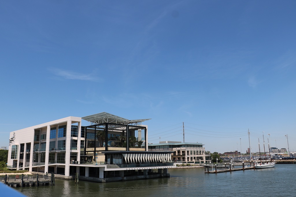
Today was a driving day. We only stopped to find a few geocaches and eat a sandwich for lunch. John plotted a route that avoided freeways and toll roads so we drove on some quieter roads through quite a few towns. We left our hotel at 9:30 and checked into our hotel at 3 Alabama time. We lost an hour when we crossed the Chatahoochee River which forms the border between Georgia and Alabama.
From St. Augustine we drove about half way across the top of Florida then entered Georgia again as we had to go north before we could go west to Alabama. We drove about halfway across the south end of Georgia before we reached the border. Dothan is only about 30 miles from the Georgia/Alabama state line. Tomorrow will also be a driving day and we will go all the way across Alabama into Mississippi.
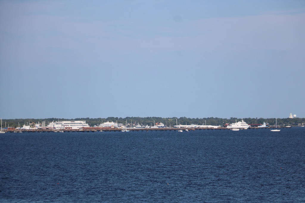
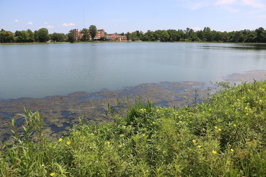
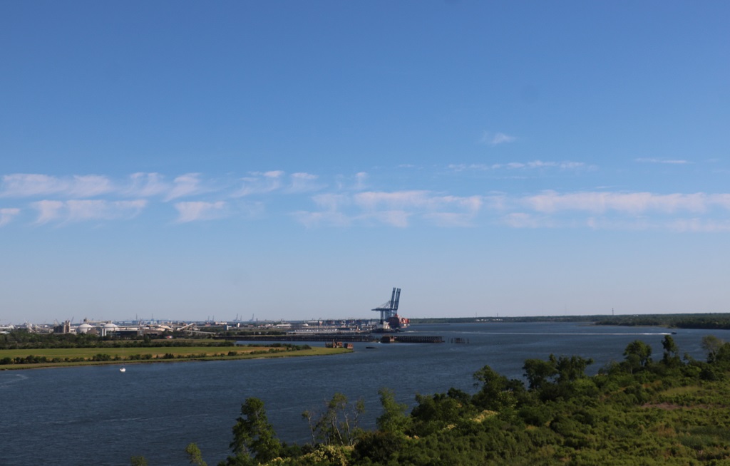
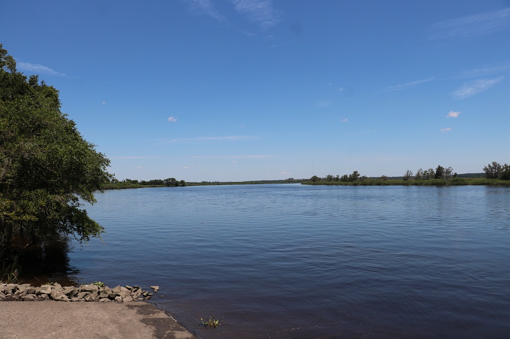
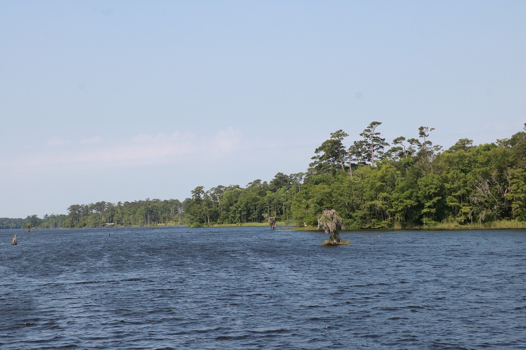
Green Cove Springs on St. John Lake in Florida. It flows up to Jacksonville and opens into the Atlantic.
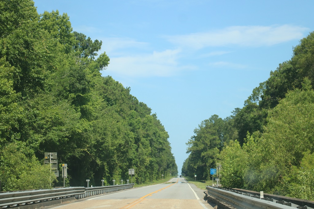
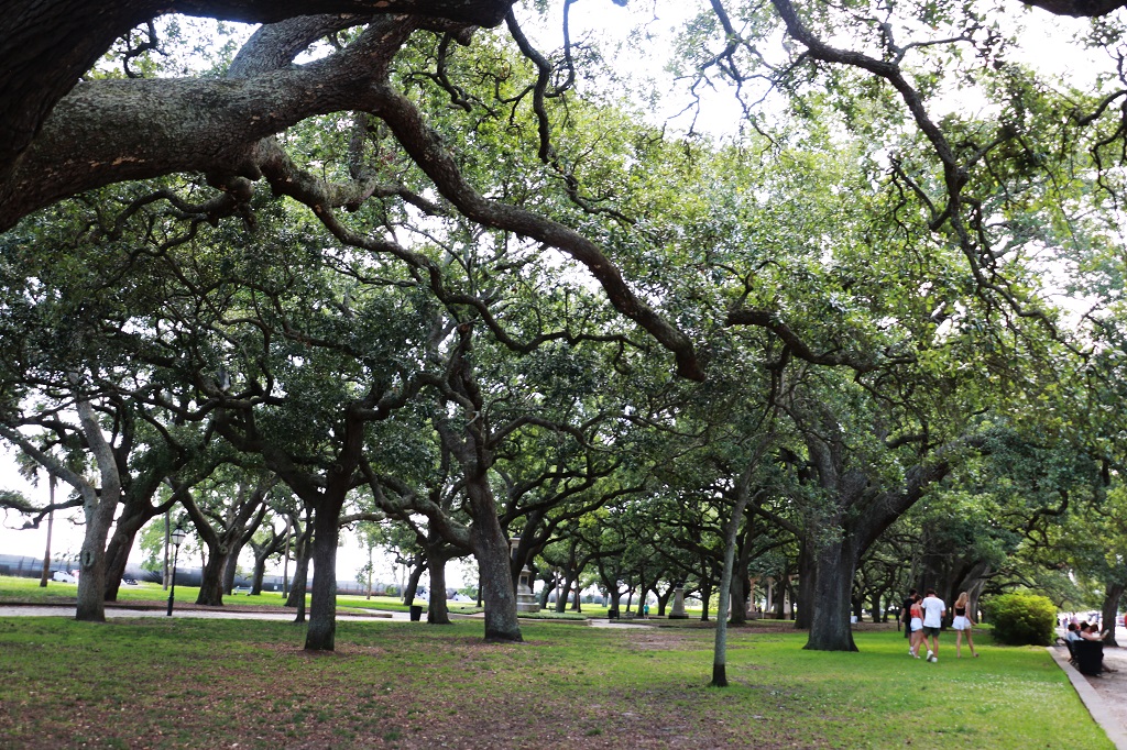
We are still in flat, tree country. Other than going through towns this was the view most of the day. Sometimes the trees changed from whatever these are to Long Leaf Pines. We passed quite a few large tracts of land that had been planted in the pines.
There was a geocache hidden in the fence across the road from this nice little lake in Cairo, Georgia. There a couple of guys fishing from the shore so it must have fish. Although it also has….
I don’t know what this tree is but we have seen quite a few of them here in the south. There is another one we see a lot of that has pink flowers. I haven’t managed to snap a photo of it yet.
Some people keep interesting things in their yards.
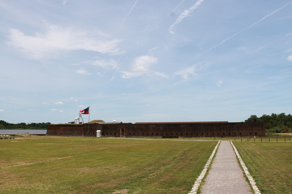
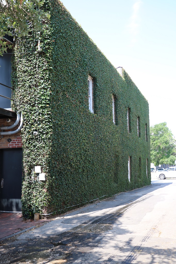
I do not know what this building is, nor do I remember what town we were passing through, but all along the perimeter of the property were American flags with a name in memorium for service men and women from various conflicts. They may have all been from the town or county. They were obviously put up for Memorial Day. It was a nice touch. We saw the same thing in another town a bit further down the highway.
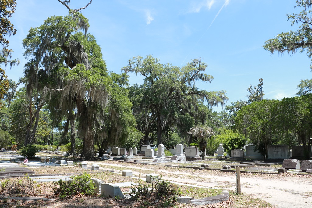
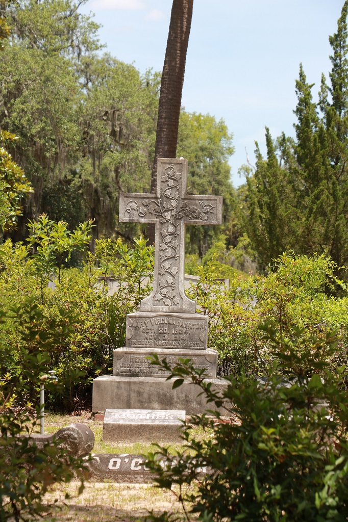
There was a geocache hidden at a small cemetery just west of Cairo, Georgia. The crypt is for Dr. Joseph H. Griffith who was born in 1888 and was a black surgeon in Decatur County, GA during the 1920s to 1960s. He established a hospital for black citizens and has had two books written about his interesting life. All of the graves on both sides of the crypt as well as the one in front belong to Griffin descendants.
There were only a few other graves in the cemetery and they were all in clusters. A Davis family, and a Williams family and some right up at the back that the names had worn off. Other than those dozen or so graves it was all just a nice park, so we stopped by the shade of a tree and had lunch.
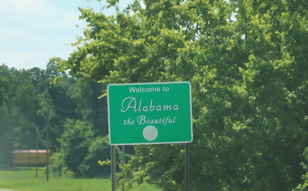
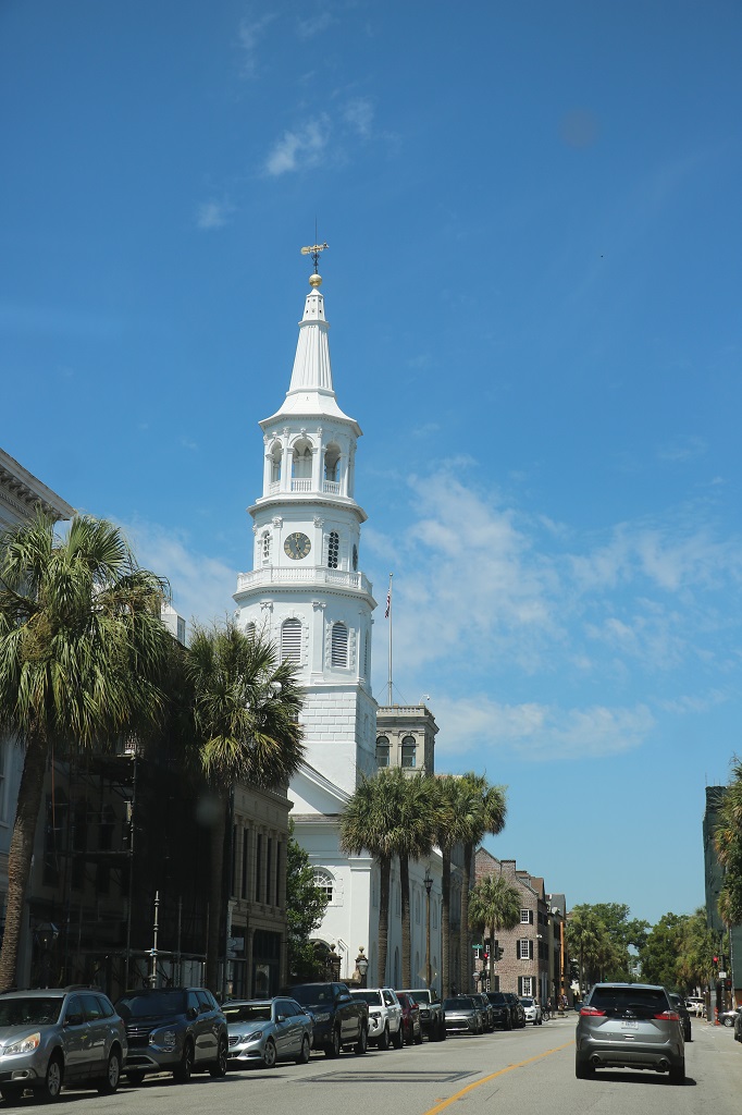
We crossed the bridge over the Chatahochee River and left Georgia to enter Alabama. The Welcome sign was just a small highway sign on the far side of the bridge. We drove right past it before we processed that we were in a new state. John kindly did a U-turn a bit futher up the road and U-turned again so we could cross the bridge again and I could snap a pic. This is the most non-descript “Welcome to” sign we have ever seen.
The US is full of Interstate highways with varying numbers of lanes. They connect every single city or town of any size. We were on Route 84 a lot today and it is a double lane divided highway. But it, like many others we have driven while down here. have periodic left turn lanes that give access to the opposite direction so you can safely U-turn without worrying about getting rear ended by the traffic behind you. They are wonderful. They even have them going through the towns; seems to be wherever there are barriers between the opposing traffic lanes they make a safe spot to U-turn. As we are driving to our hotels or a restaurant Mary Lou, our navigations system, regularly says: “Make a U-turn” to get us going in the opposite direction to access our destination.
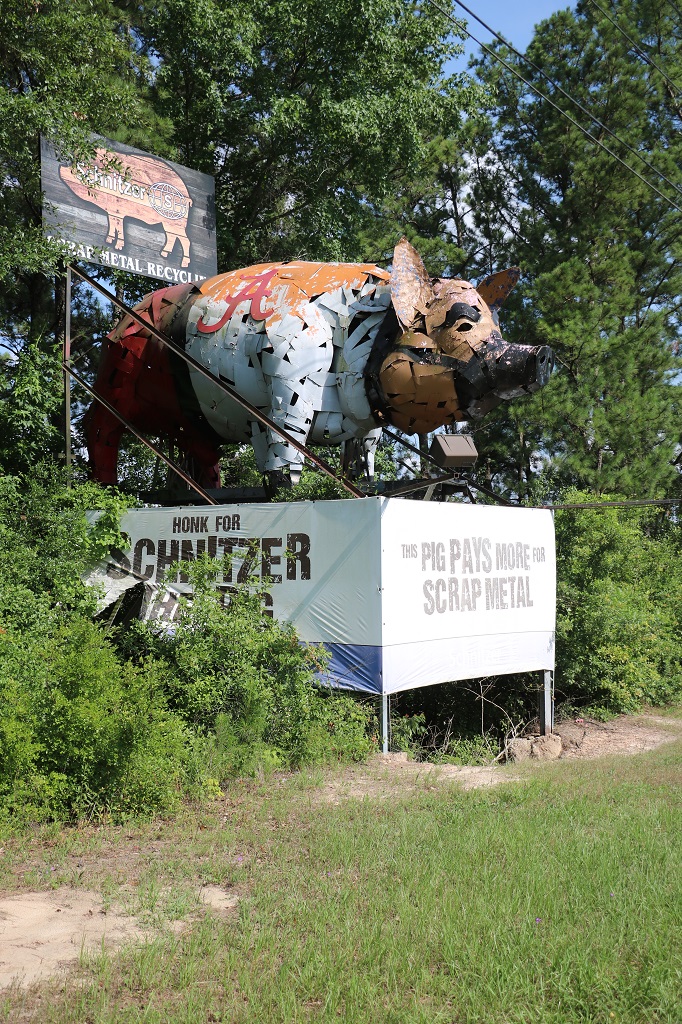
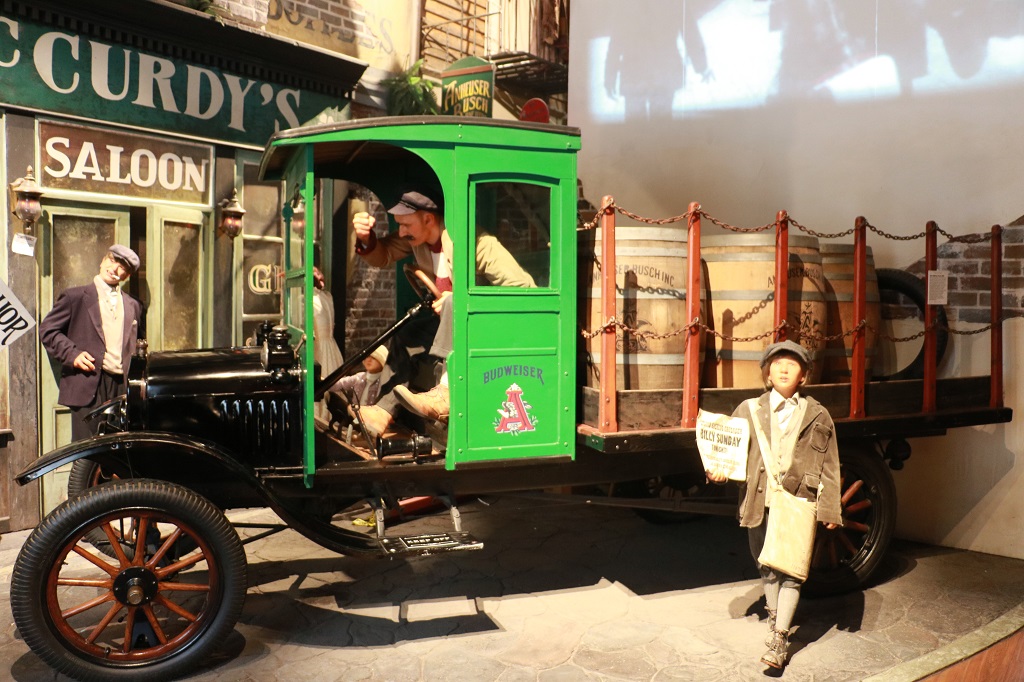
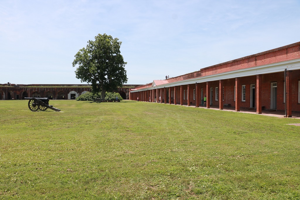
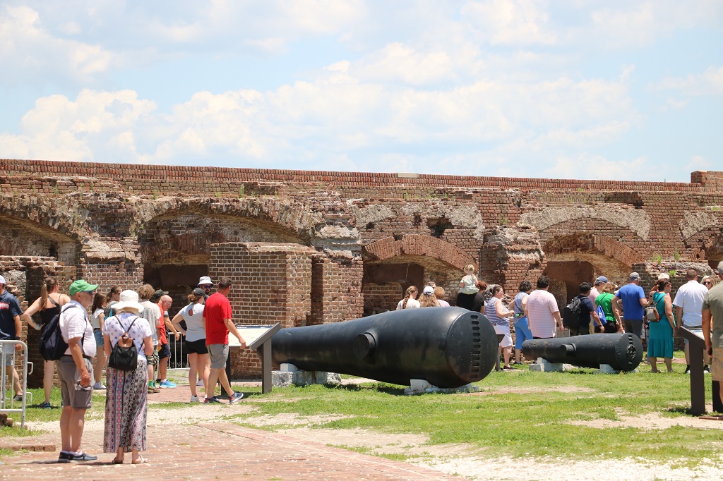
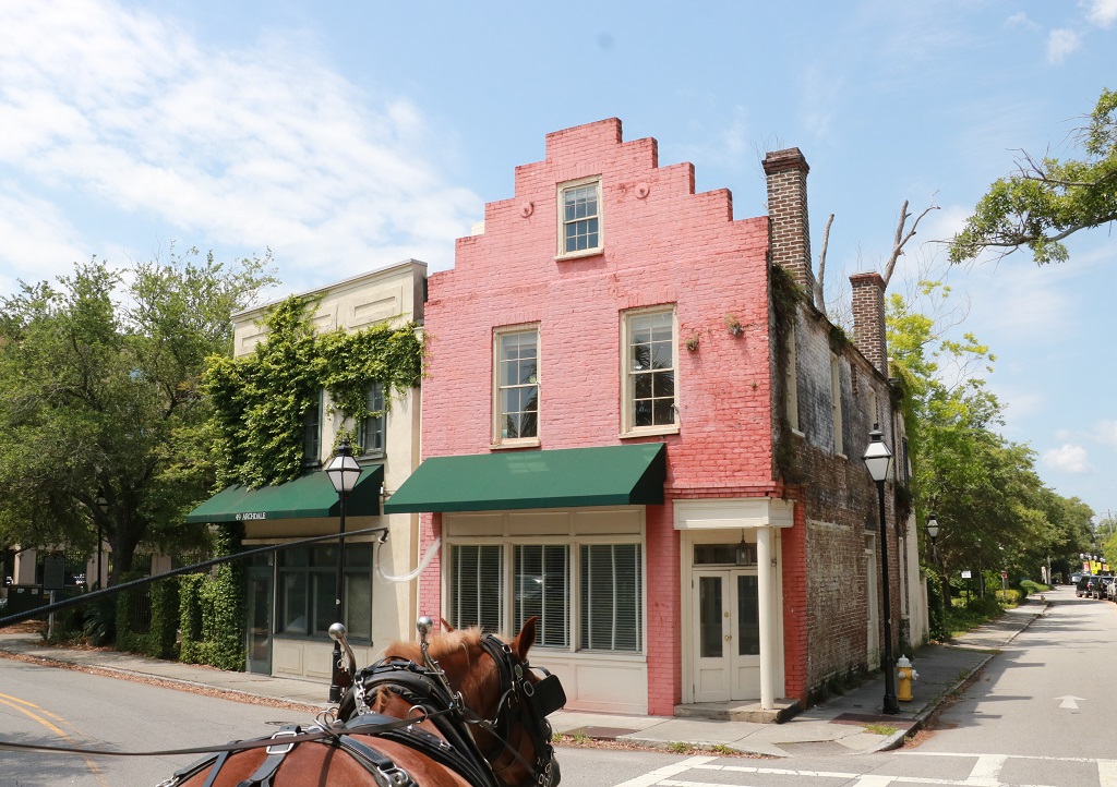
We were able to check into our hotel even though it was only 3 pm in Dothan. We took in the bags and then went to find a few geocaches. This one was not far up the road and had been made by the people in the big scrap metal yard beyond the trees as a monument to a major industry in this area. They wrap the sculpture in lights at Christmas. Dothan also bills itself as the peanut capital of the world.
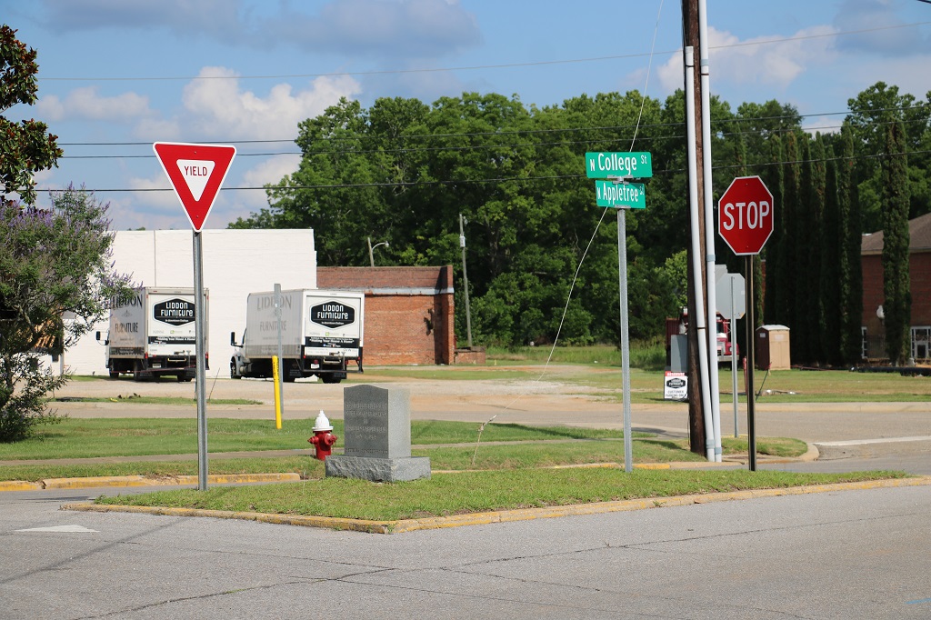
Another cache we found in Dothan was at the “Smallest City Block in the World.” This land triangle has street names, a yield and a stop. It has been officially recognized by the Guiness Book of Records.
Thus ends our first driving day. We spend tomorrow night in Laurel, Mississippi and then head to Natchez the next day.
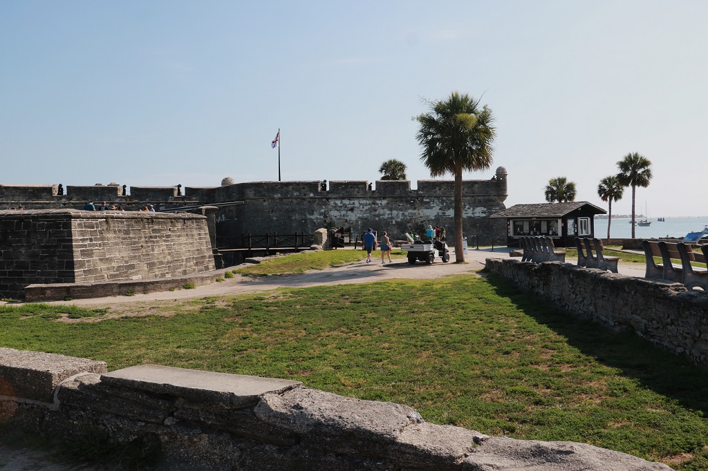
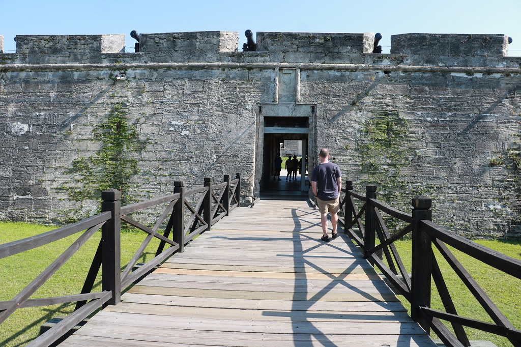
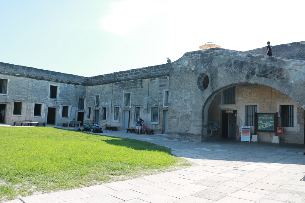
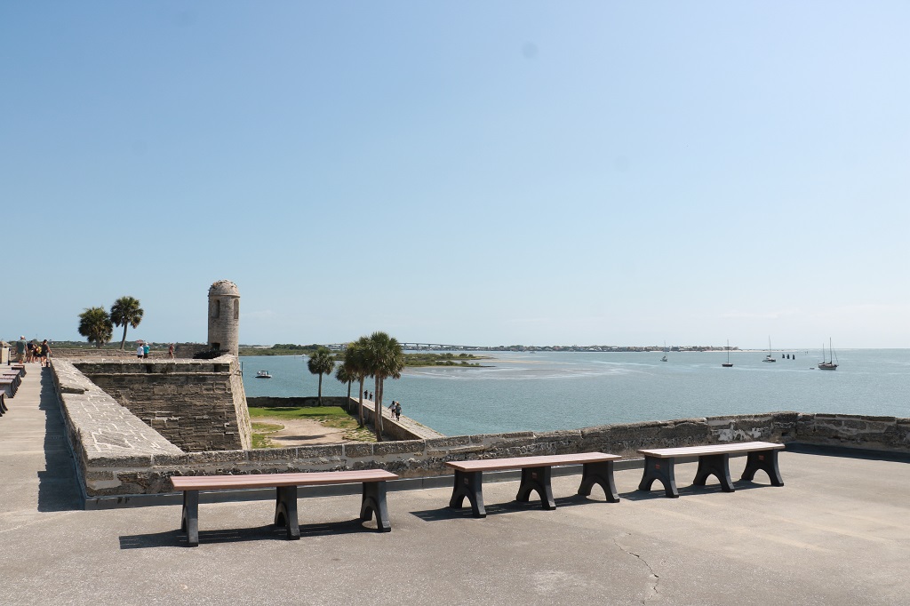
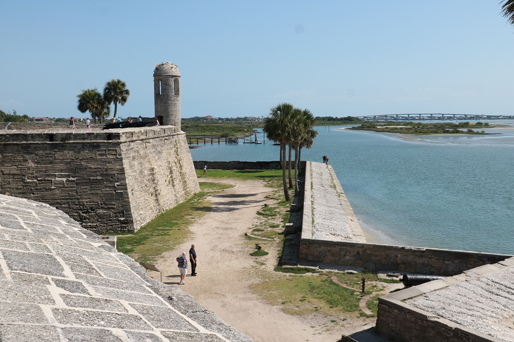
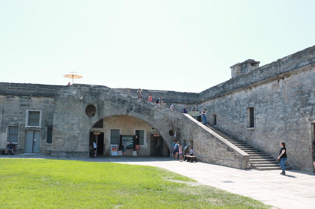
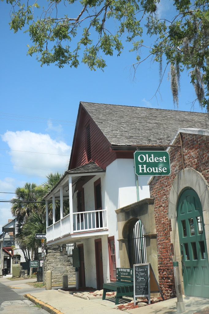
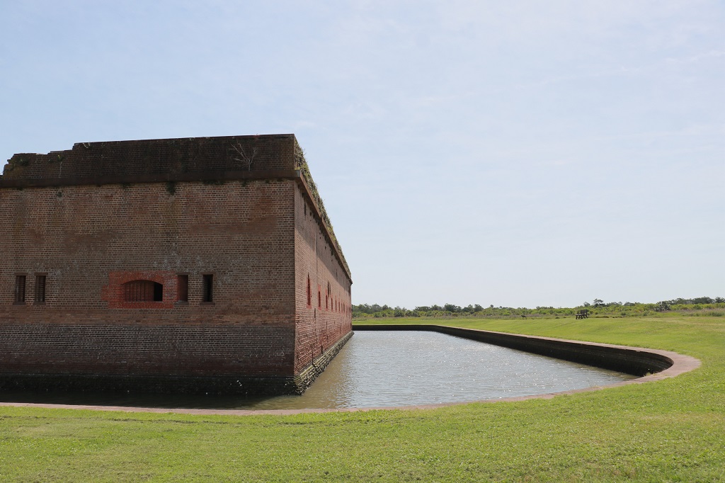
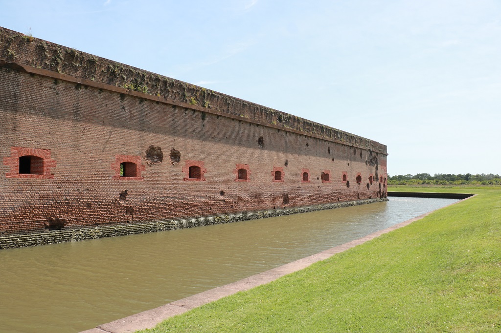
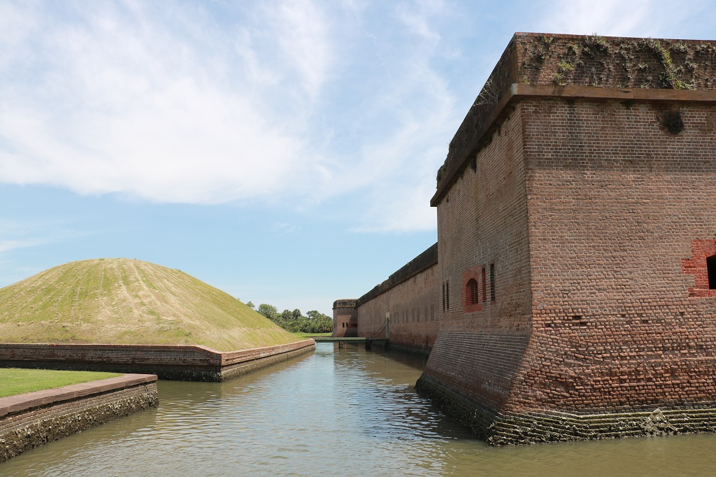
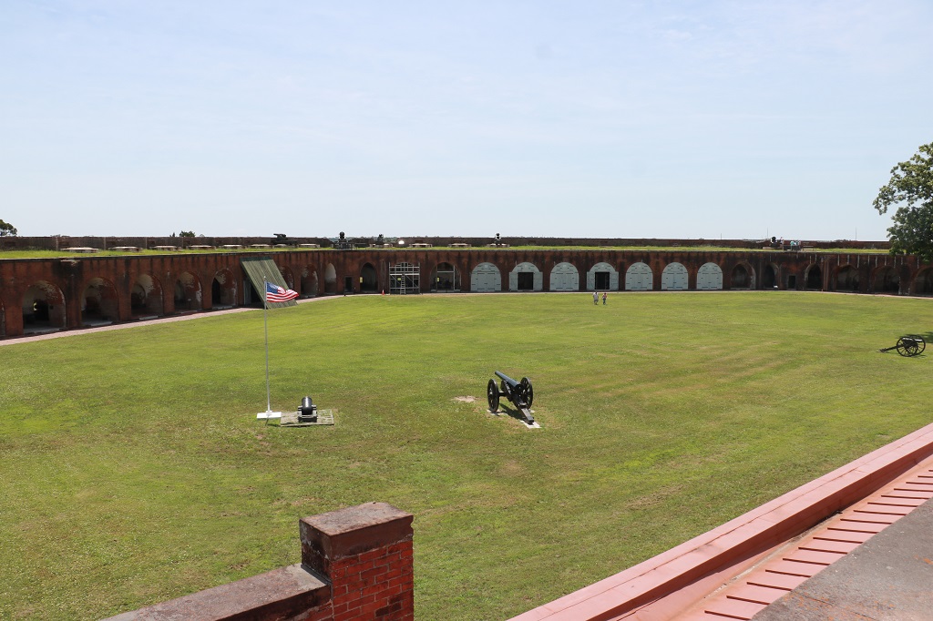
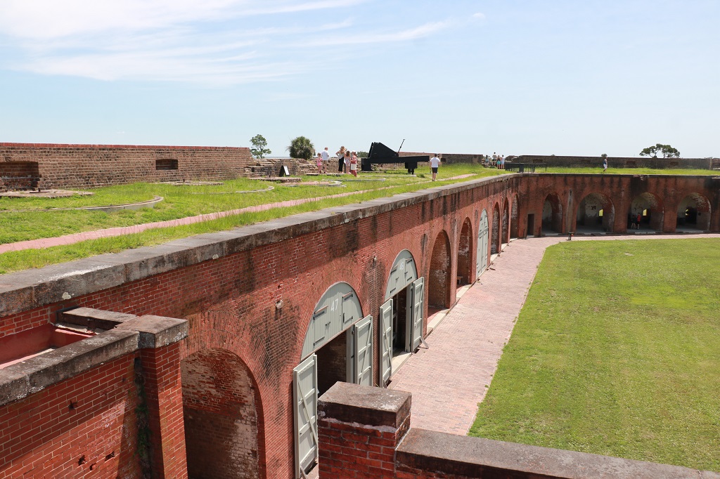
We were up early and headed right to the Castillo de San Marcos. And we were glad we did because by the time we left there was not a parking spot to be had and there were many visitors wandering around.
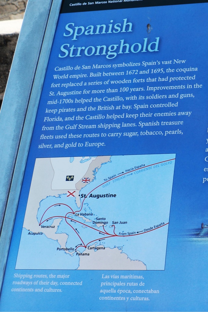
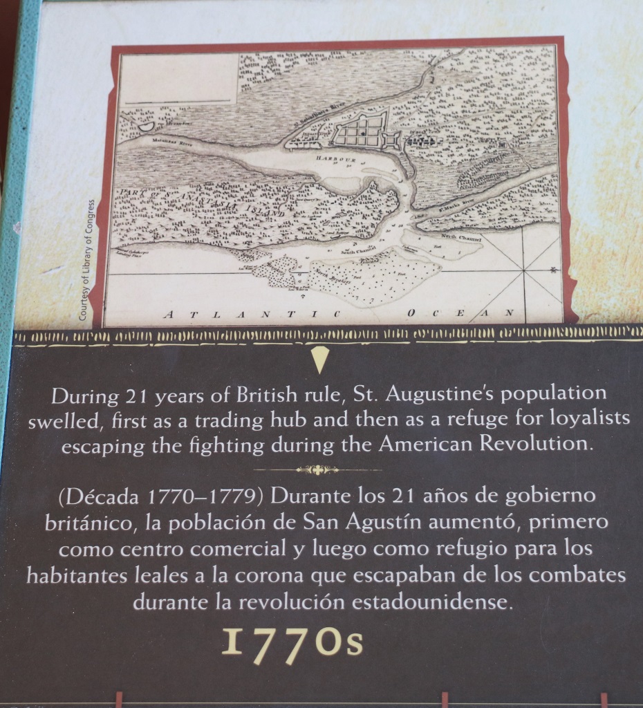
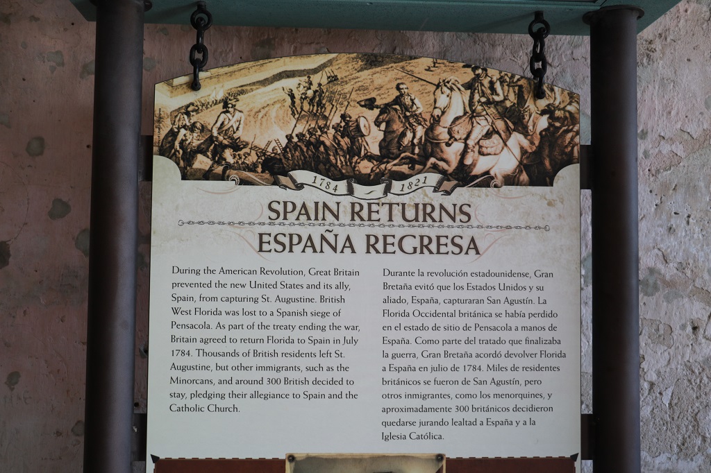
Founded on September 8, 1565 by Spanish admiral Pedro Menéndez de Avilés, Florida’s first governor, it is the oldest continuously inhabited European-established settlement in what is now the contiguous United States. The first European known to have explored the coasts of Florida was Juan Ponce de Leon, the explorer and governor of Puerto Rico, who likely ventured in 1513 as far north as the vicinity of the future St. Augustine, naming the peninsula he believed to be an island, “La Florida” and claiming it for the Spanish crown.
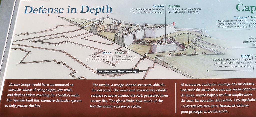
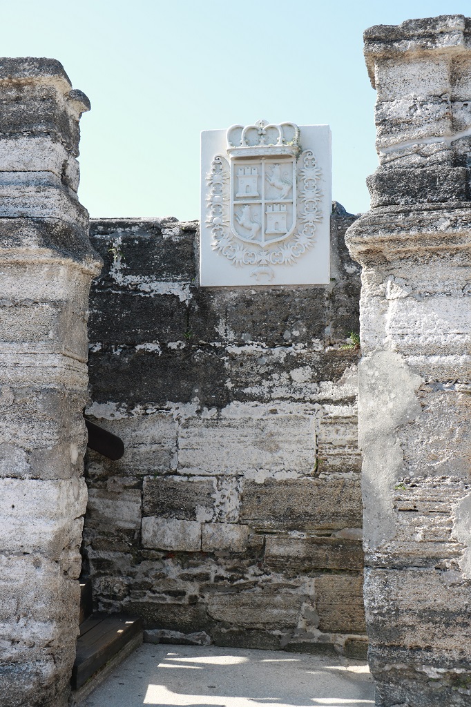
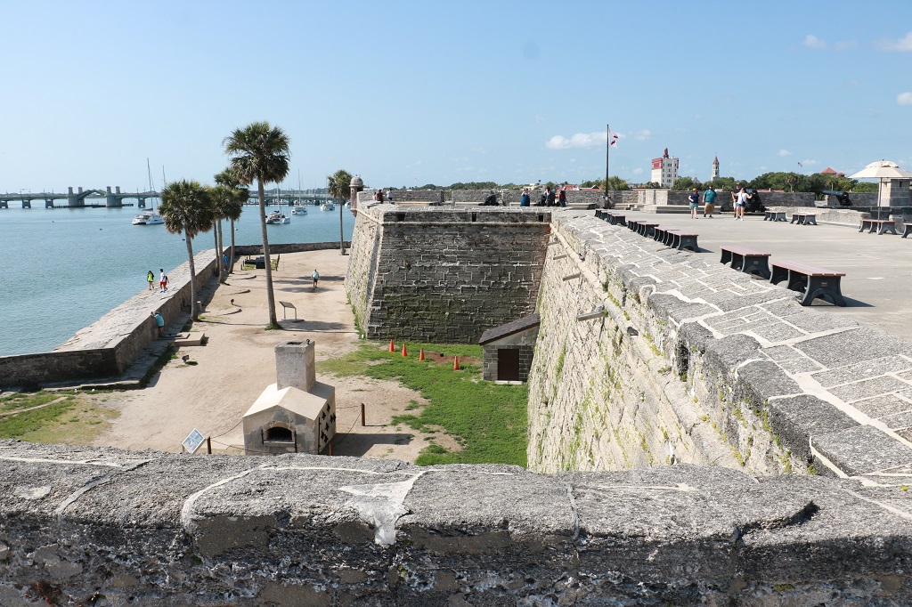
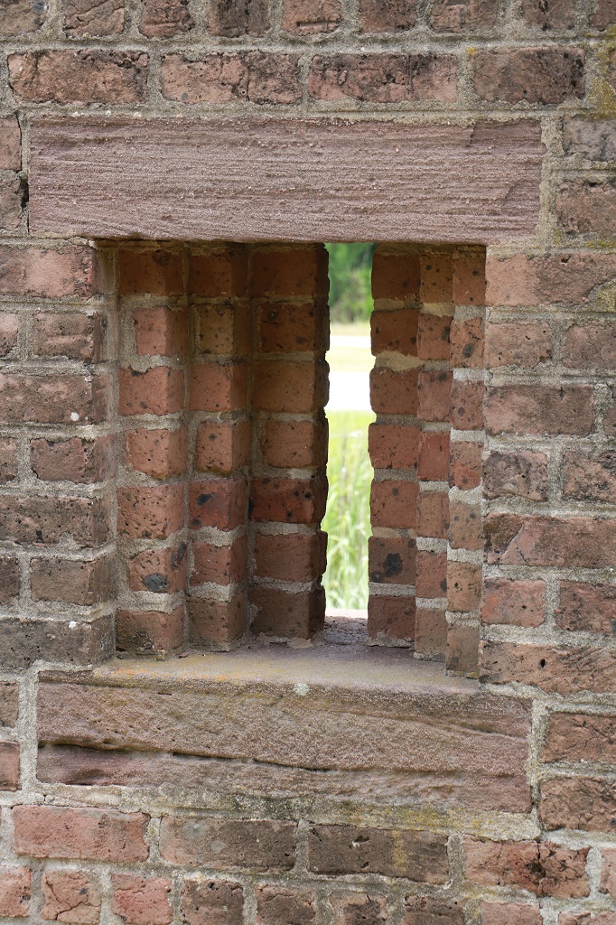
The Castillo is built out of blocks of coquina. It is a form of limestone composed of the shell fragments of ancient mollusks and other marine invertebrates. This native sedimentary rock was used in the construction of nearly every East Florida plnatation and sugar mill. Coquina is soft and easy to cut in the ground, but it hardens when exposed to the open air, making the stone suitable for building.
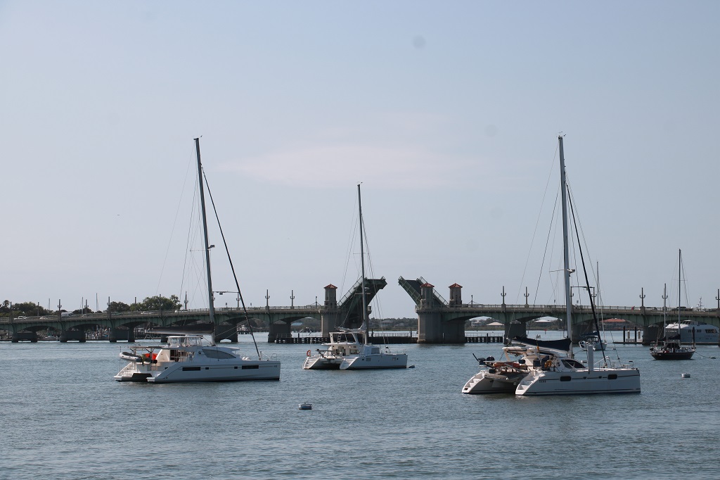
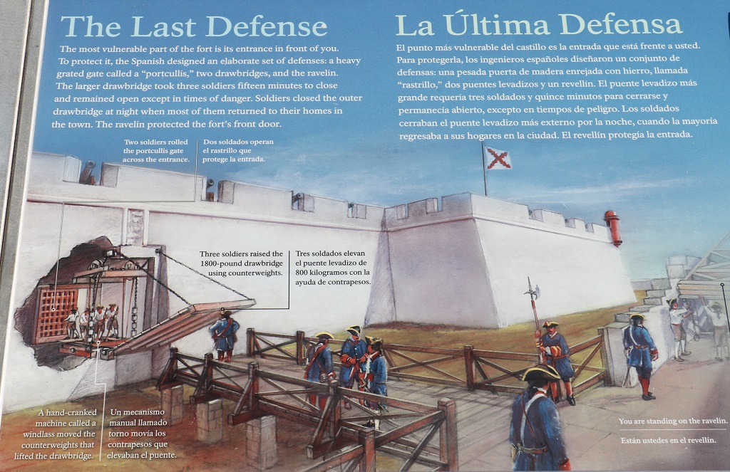
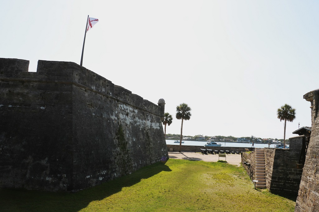
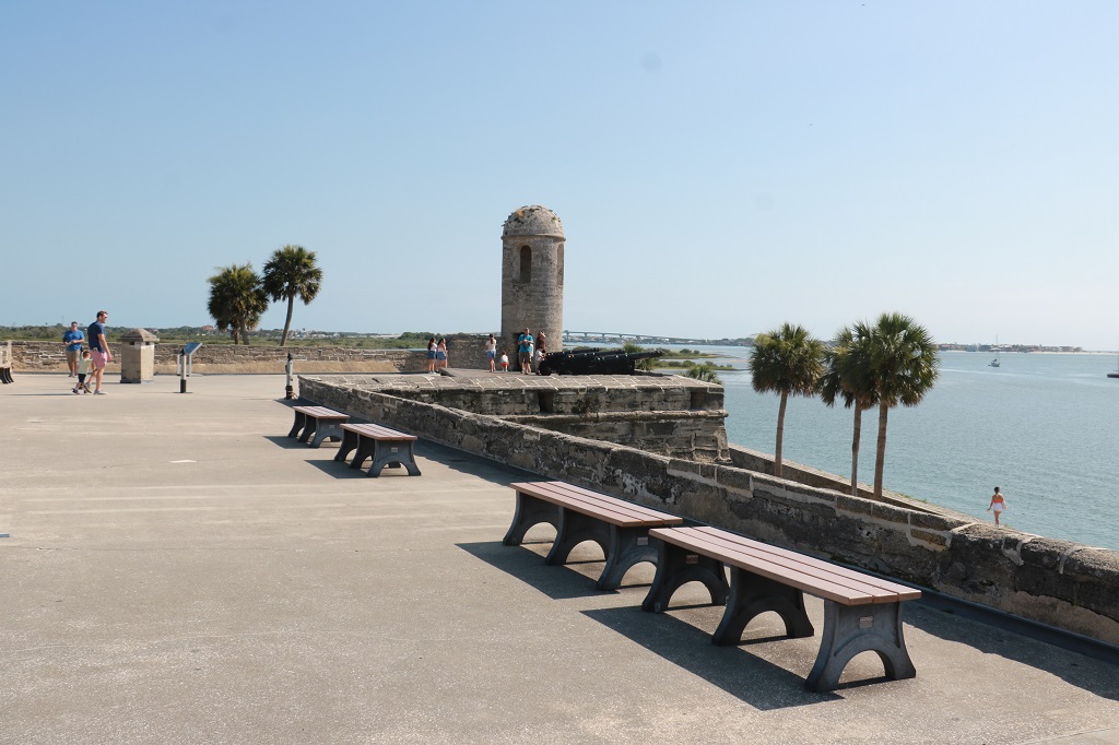
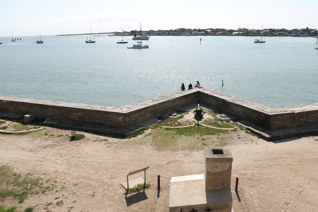
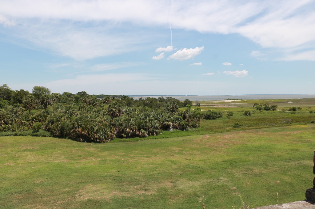
The views of the water from the fort were lovely. The drawbridge went up on the bridge just as we were entering the fort.
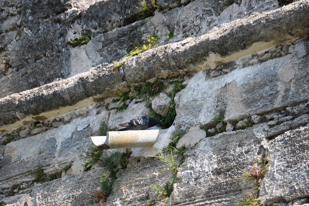
This dove was cooing away outside the drain hole. I suspect it had a nest in there.
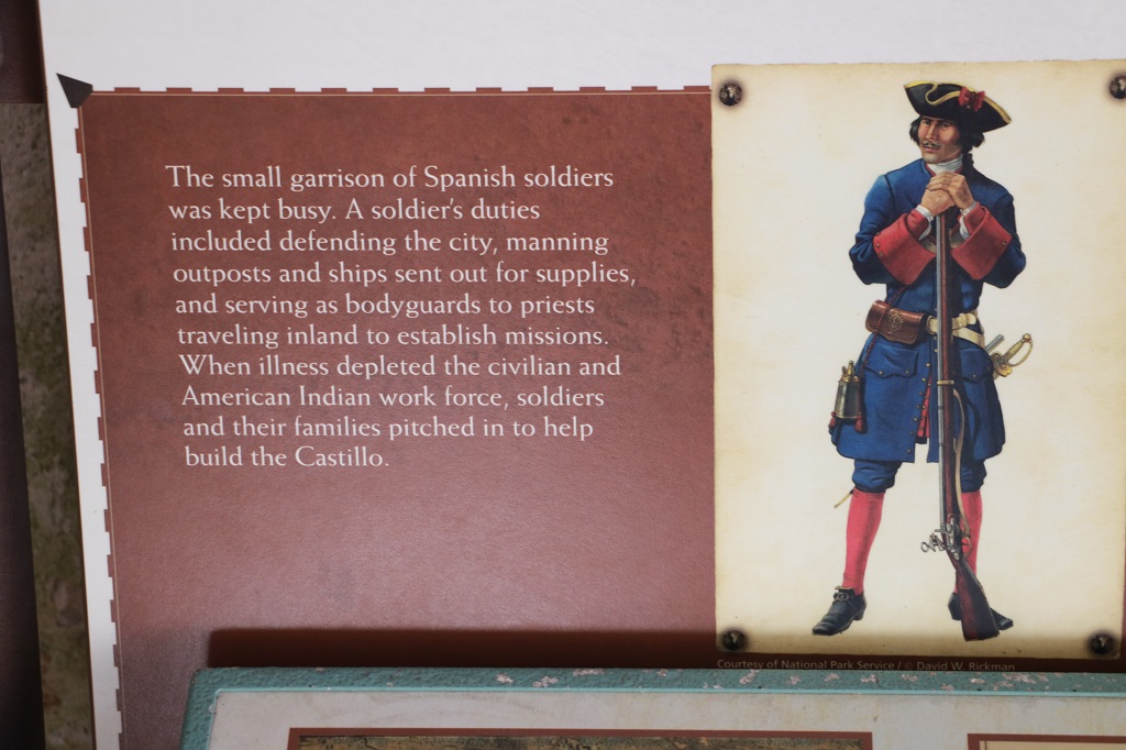
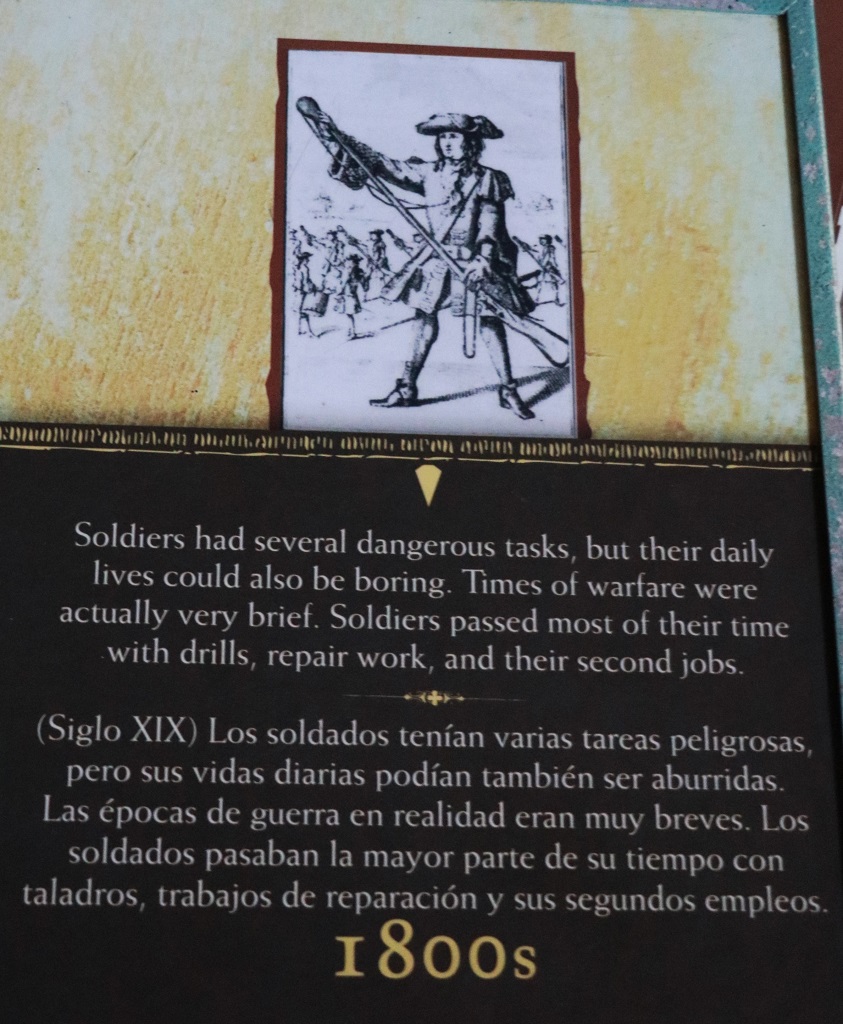
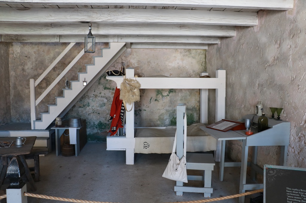
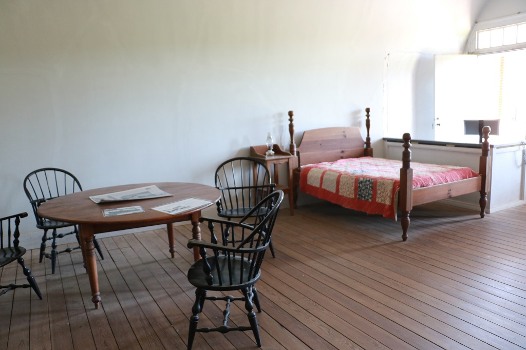
Spanish soldiers in St. Augustine lived in homes in town but stayed in the Castillo overnight when assigned guard duty. They cooked and ate their meals in this room and slept here before and after shifts on guard duty. Soldiers staying here also guarded the Castillo’s prison, located in the next guard room.
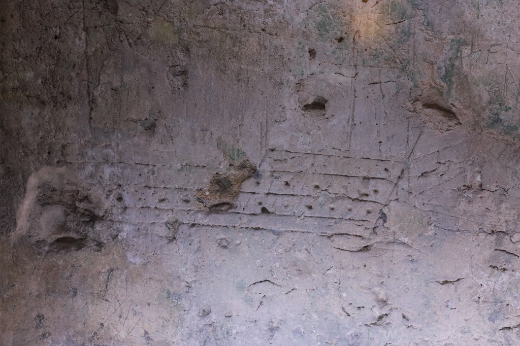
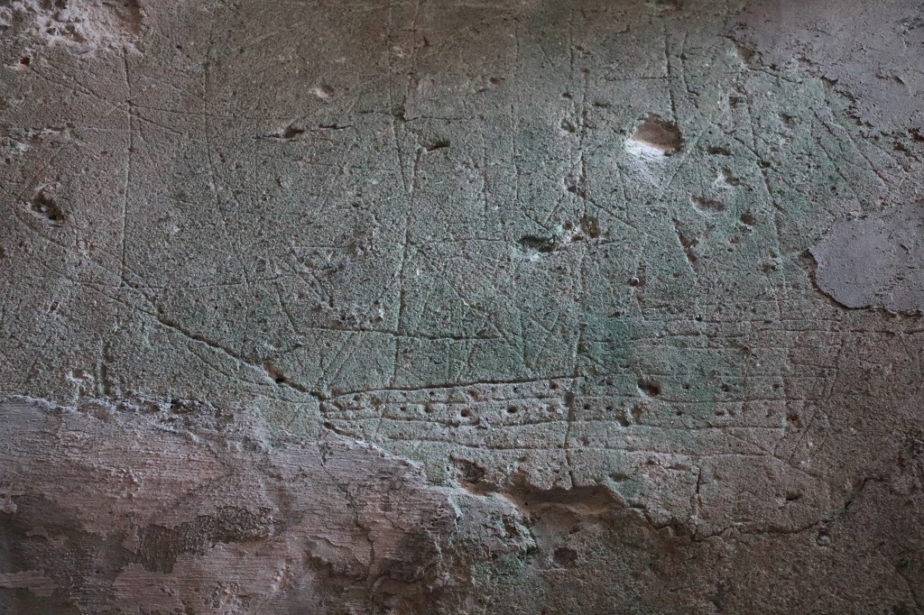
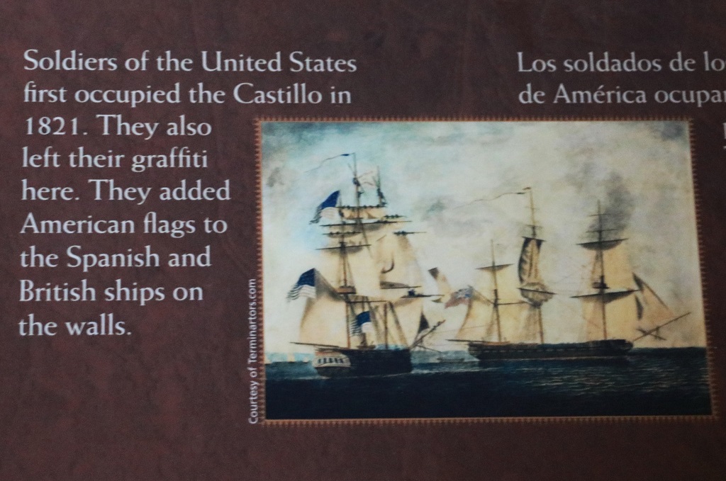
The plaster on the inside walls of the various rooms of the Castillo was quite easy to carve. There are over 20 depictions of ships (British and Spanish) and names and other carvings still somewhat legible on the walls of many of the rooms.
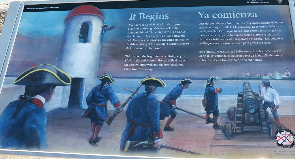
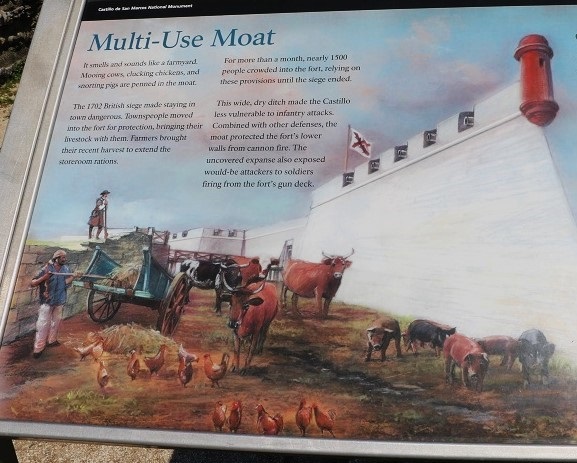
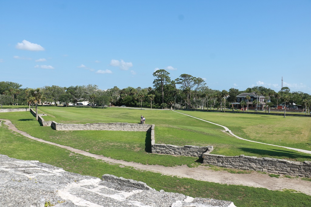
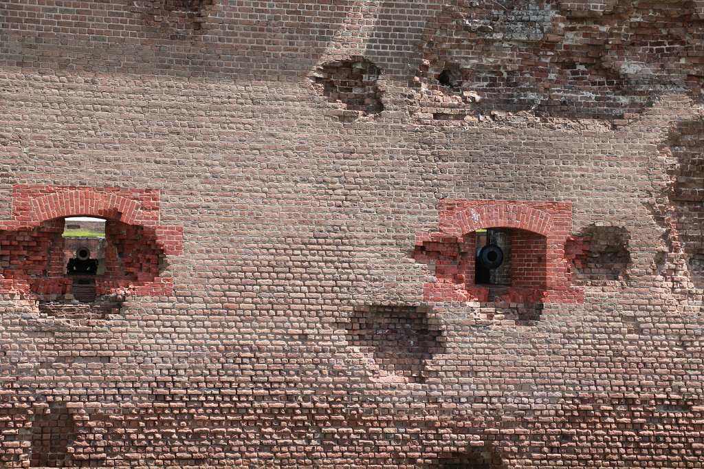
There were no living quarters in the fort. It was only manned by the soldiers on guard duty each day. And the courtyard space is not that big and all of the storage and armament rooms are quite small as well. I have no idea where they would have put 1500 people for 38 days!
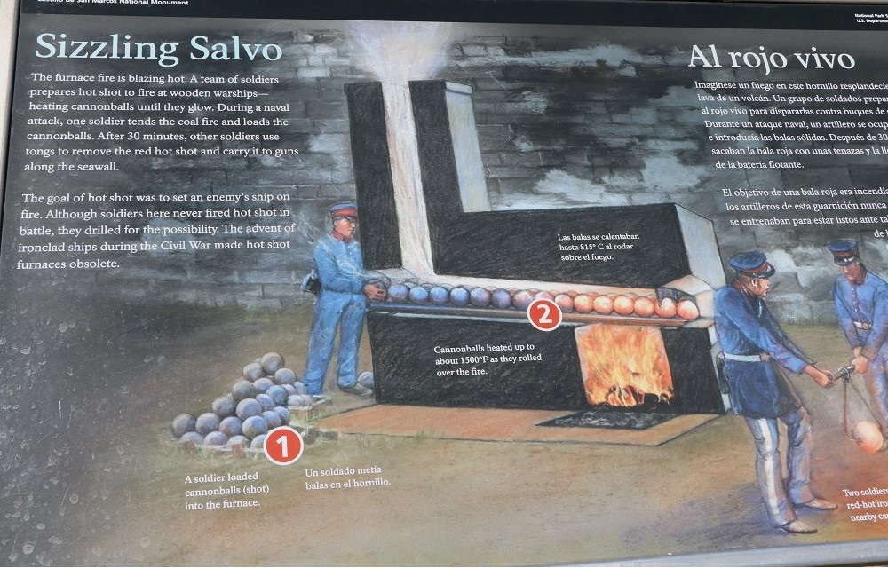
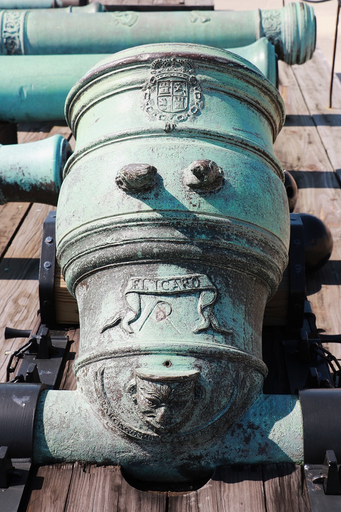
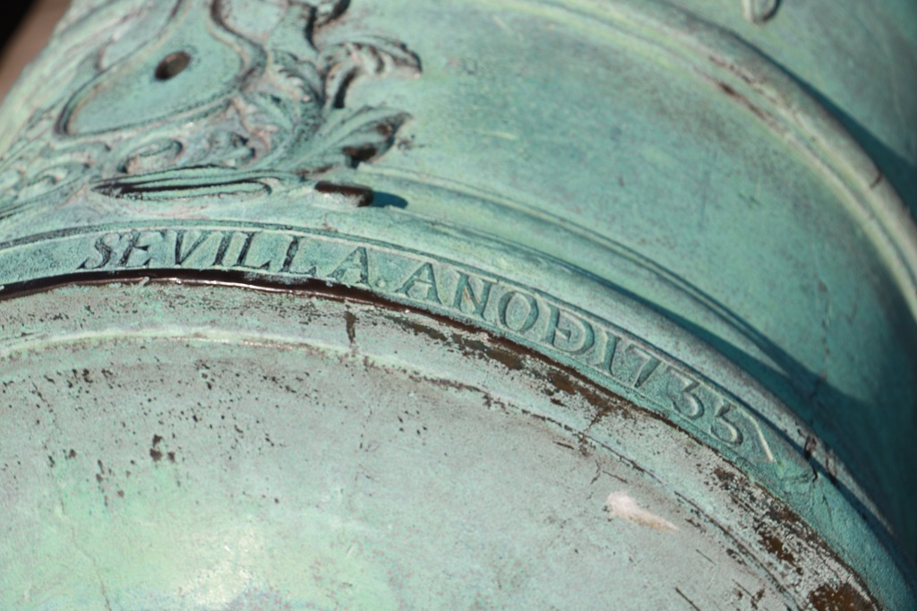
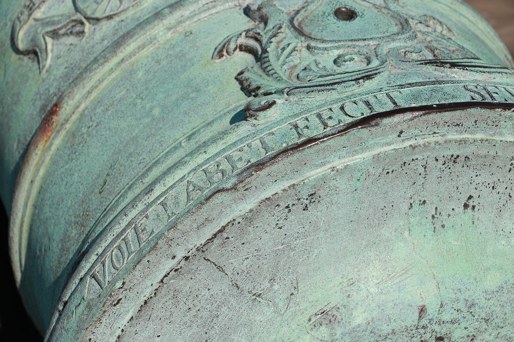
We were surprised at how decorated some of the cannons and mortars were. We learned that each of the bronze ones were individually made by artisans in Spain and the year of manufacture and the name of the gunsmith was on them, as well, often, the Spanish coat-of-arms.
Made in Sevilla in the year 1735.
This one has a raised Spanish coat-of-arms. Others just have it etched on.
Made by Voie and Abet who were well-known 18th century bronze artisans.
We left the Castillo after two hours.
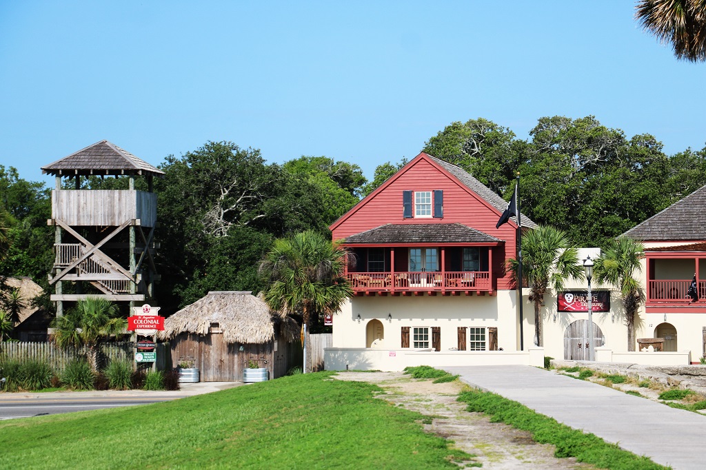
There are at least 12 different museums – from classic cars to a Wax museum, to a Medieval Torture museum, to a Pirate and Treasure museum and museums in special buildings, plus a couple of big reenactment attractions, an aquarium, six or eight Spanish houses you can tour, a Golf Hall of Fame and a pirate ship or schooner cruise. There is even an alligator farm. This is a tourist town for sure!
Which is great, but everything has at least a $15 per person admittance fee. There is very little metered street parking – if you are lucky enough to find an open space (which we could not) and the big parking lots had a $20 flat fee. To go see things would cost us $50 with the parking ($68 when converted to Canadian dollars) and I would have to walk quite a long way to get to anything from the central parking lots. After all the walking on the hard surfaces of the Castillo my legs could not take a quarter mile to a museum plus the museum itself. This getting old and arthritic sucks! And even if I could do the walking we were not prepared to spend $30 US per to see a few small museums; interesting as they may be. We had decided we would like to do the Pirate & Treasure museum since St. Augustine was a place often visited by pirate marauders, but we could find absolutely no place near it to park.
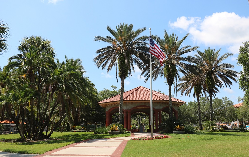
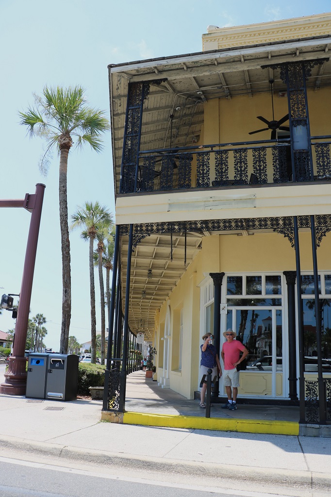
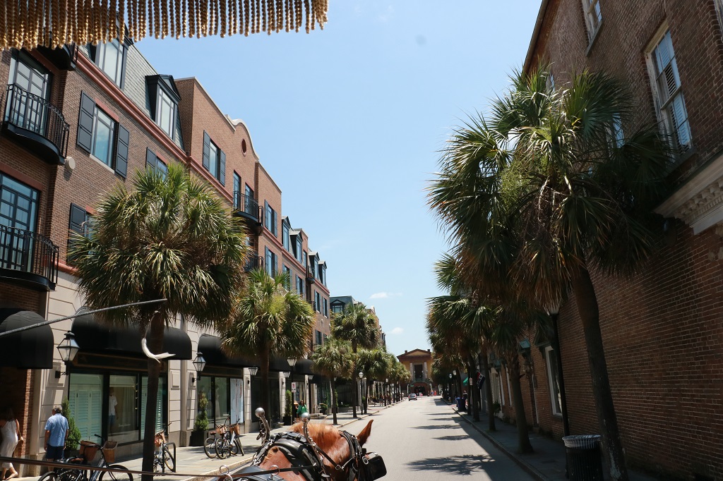
Instead we took a driving tour up and down a lot of the streets. It was a bit hard to get pictures of many of the buildings from the car, but I managed to capture quite a few nice ones.
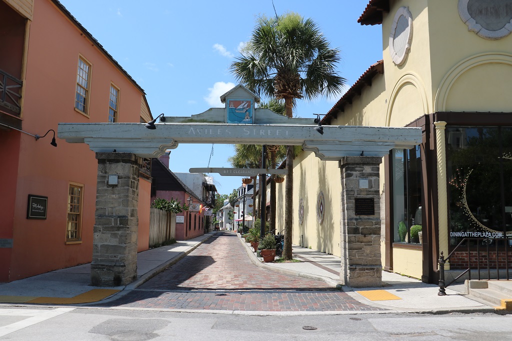
These are the old City Gates. In 1808, St. Augustine residents built the structure entirely out of coquina and used it as a line of defense against attacks. It was historically used for access into the city and protection for people living there at the time.
This is one of the immersive reenactment attractions. The St. Augustine Colonial Experience.
I loved the wrought iron scroll work on the railings of this building.
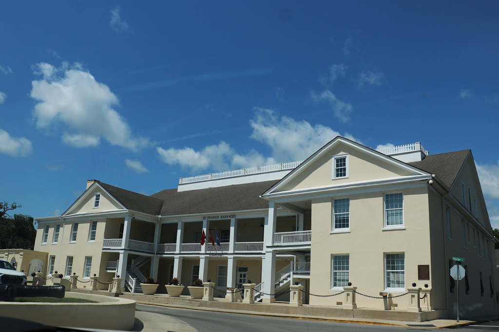
This is the National Guard’s St. Francis Barracks.
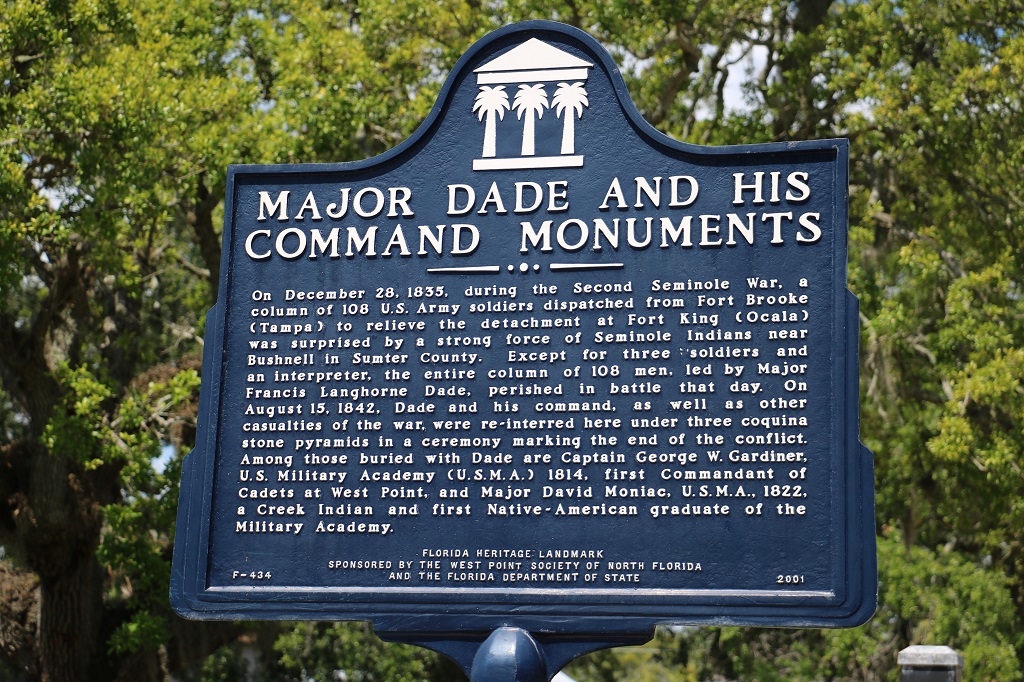
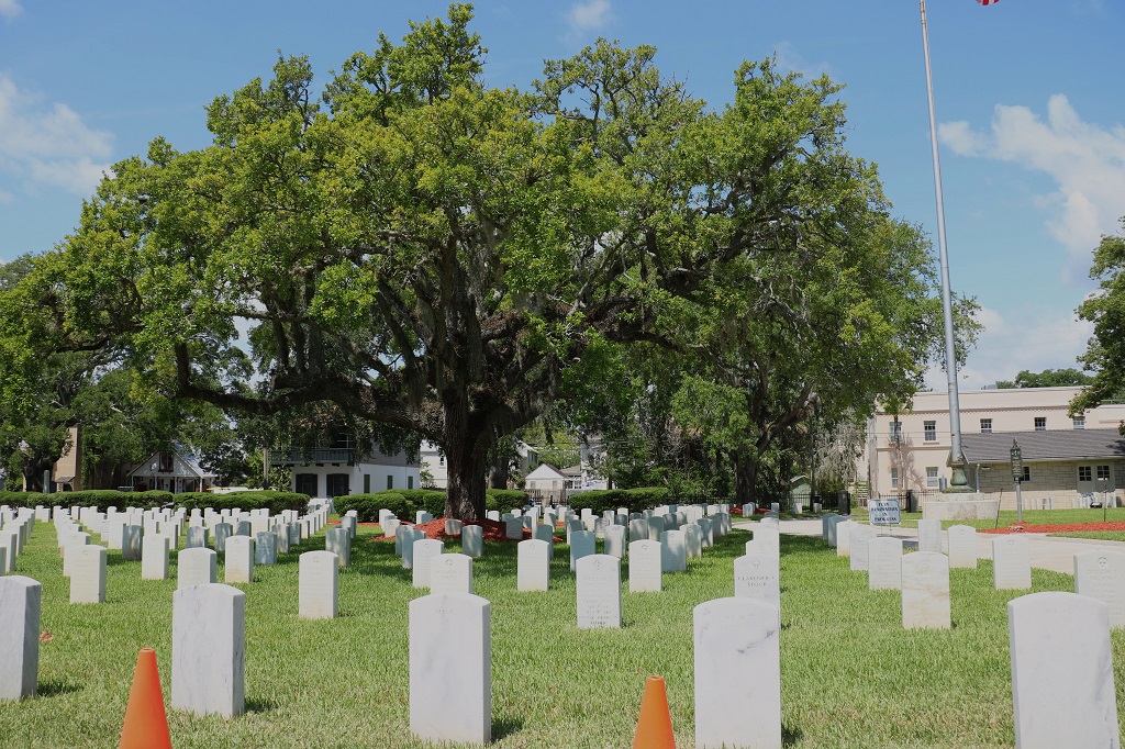
St. Augustine National Cemetery where Major Dade and his men were re-interred.
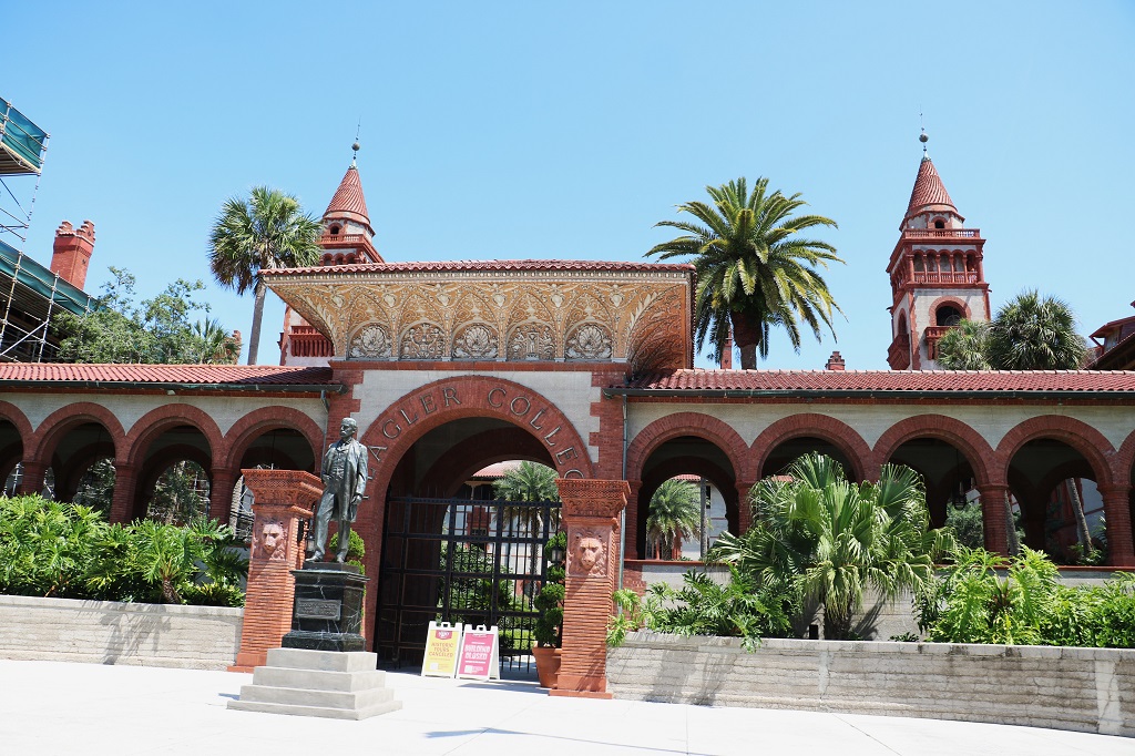
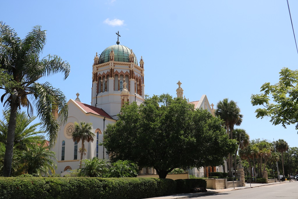
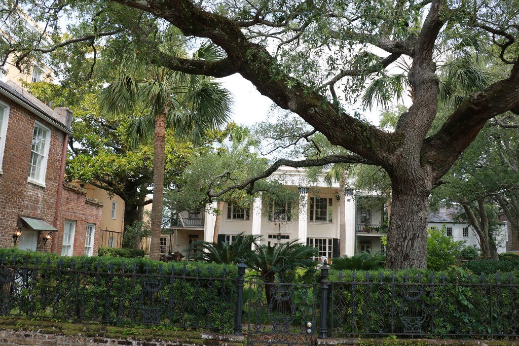
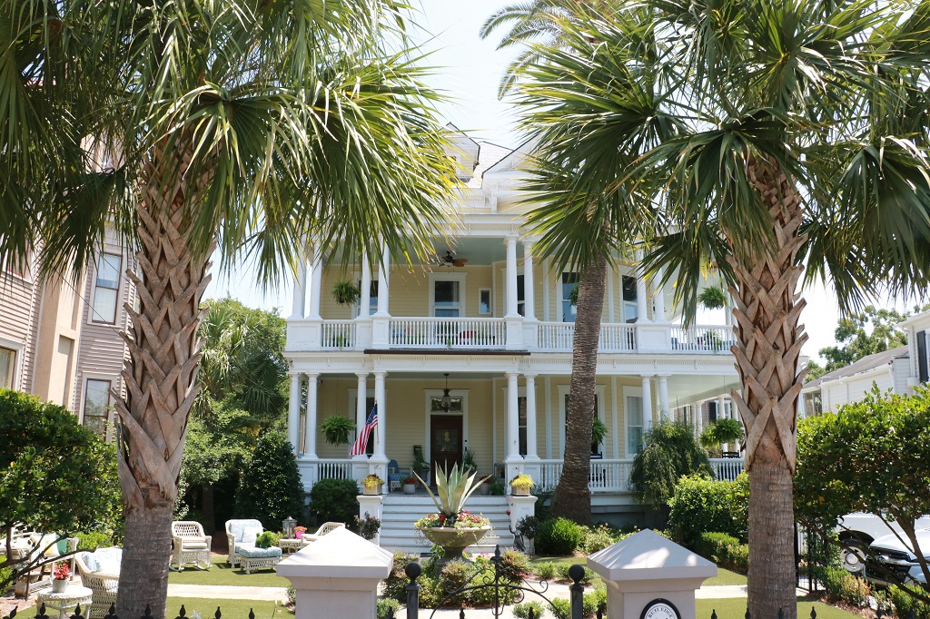
St. Augustine is the prettiest and most scenic place we have visited on our trip so far. We really liked it. Thanks Cousin Carol for suggesting we come for a visit.
After our drive around we went back to our hotel and spent some time before dinner planning a tentative route through all the states we want to get into to get a geocache on our circuitous route back to the North Carolina Outer Banks by June 19.
Tomorrow is primarily a driving day westward. We spend the night in Dothan, Alabama on our way to Laurel, Mississippi and Natchez from which we will head north.
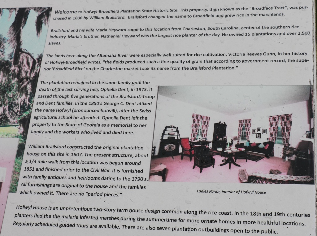
We were on the road southward by 10 am and drove down Highway 95, turning off onto Highway 17 to go visit the Hofwyl-Broadfield Plantaion. Hofwyl is pronounced Hofwill and was taken from the Swiss agricultural school that Mr. Brailsford’s son-in-law had attended.
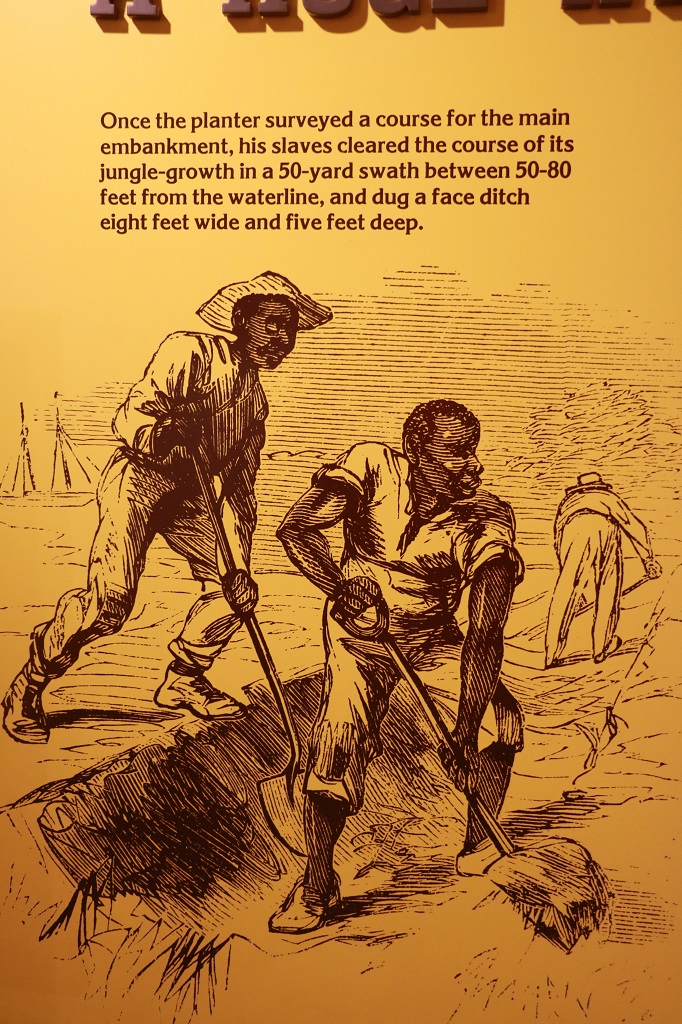
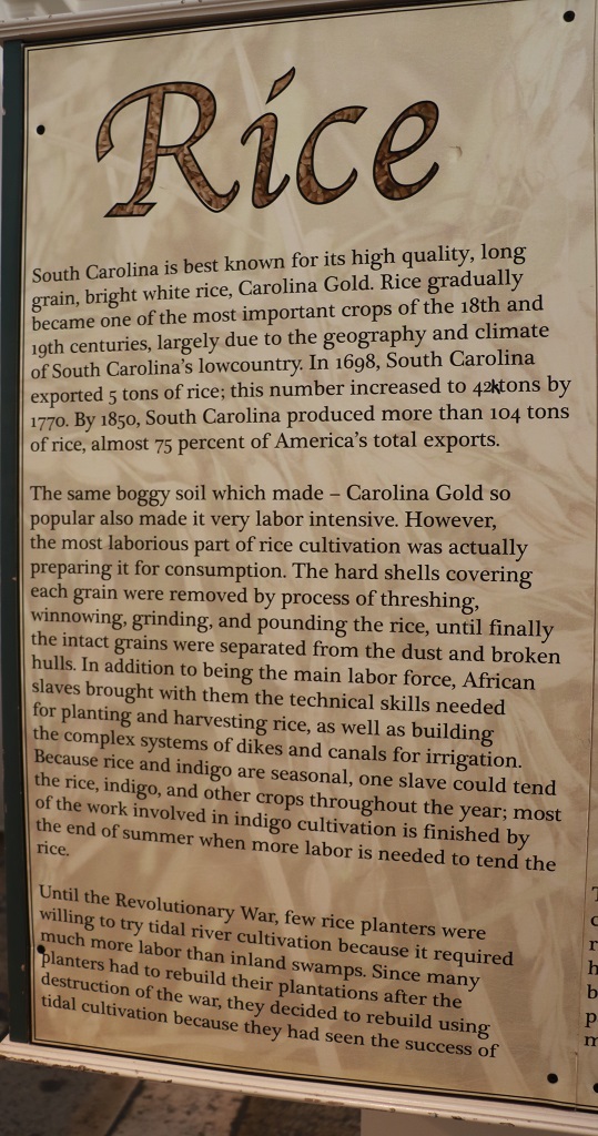
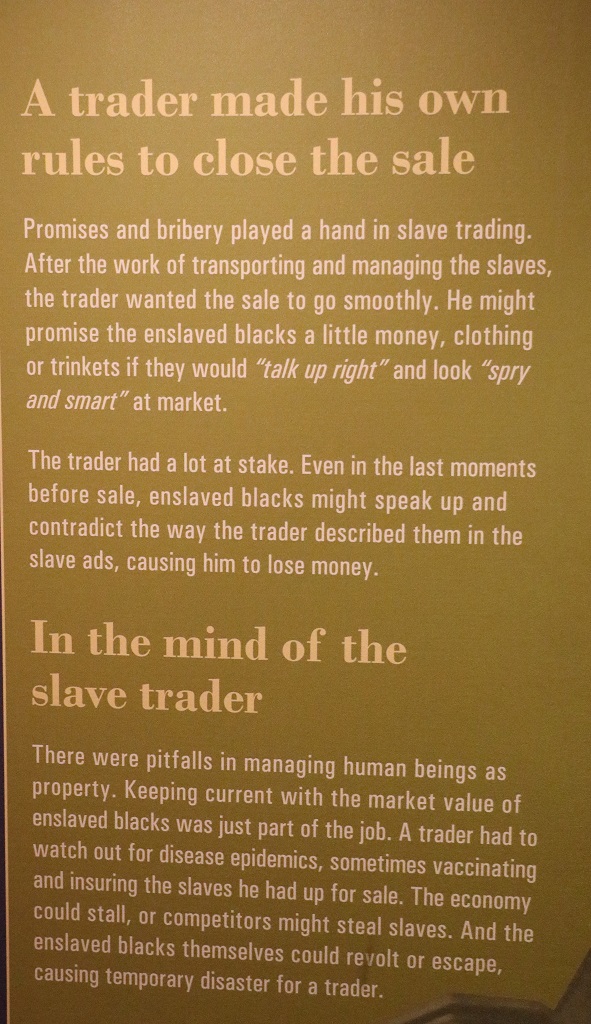
There were two videos to watch at the Visitor’s Center and a large display about the growing of rice in the marsh Low Country of the southeast coast. I have only put in a few of the information boards to show some of the strenuous work the slaves had to do to prepare the land for rice. The slaves Mr. Brailsford purchased came from West Africa where they grew rice. It was the knowledge of the slaves that created the rice plantations and made it the number one crop in Georgia for a hundred years. The rice production was crippled by emancipation. The plantation owners could not afford the necessary laborers and the marshy mucky ground would not support the new machinery that made the crop less reliant on manpower. The commercial propogation of rice ended here in 1915. The plantation had been in debt for many years and the three remaining family members converted the plantation into a dairy farm. It was the hard work and industriousness of the two sisters that finally paid off the debt.
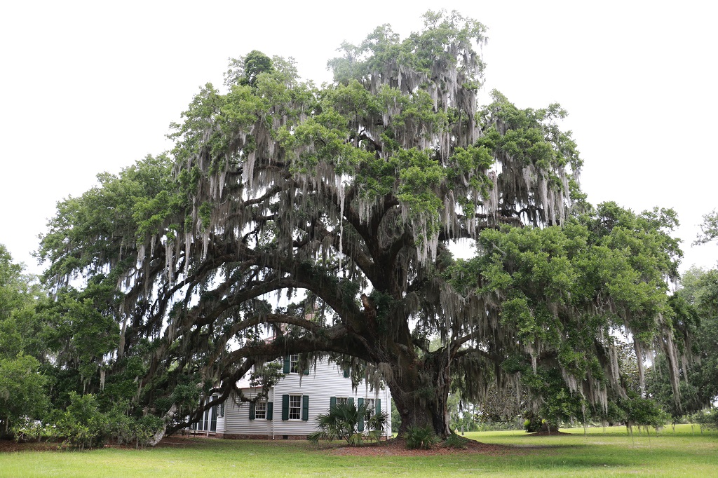
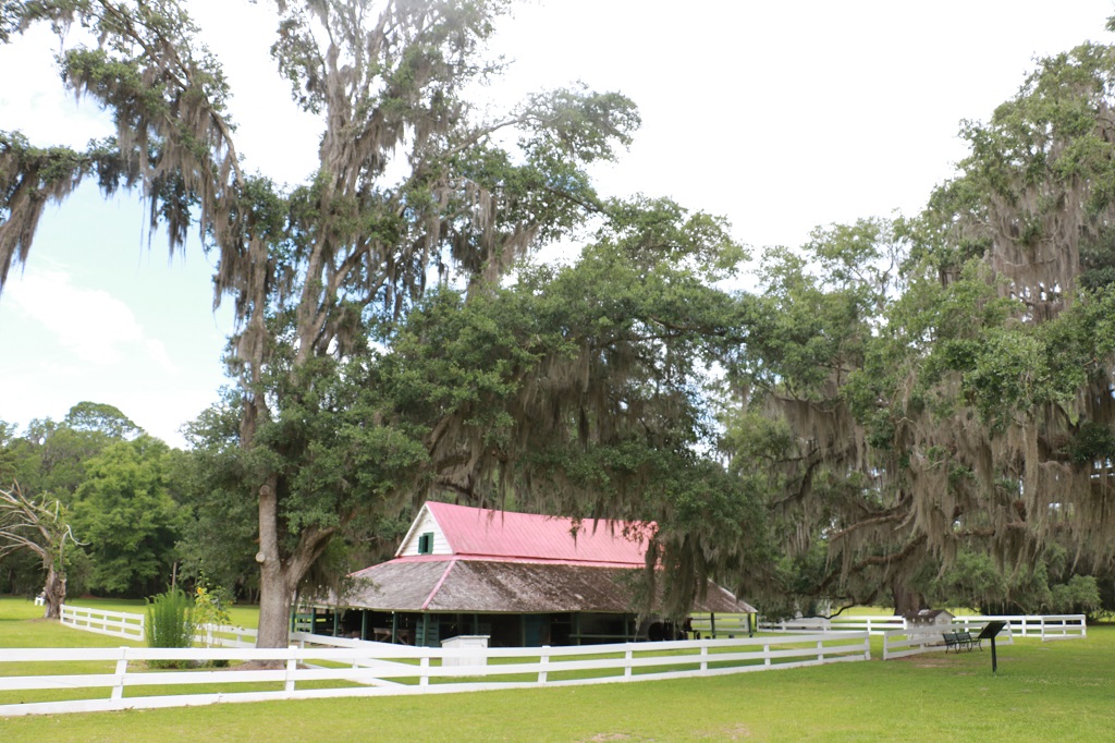
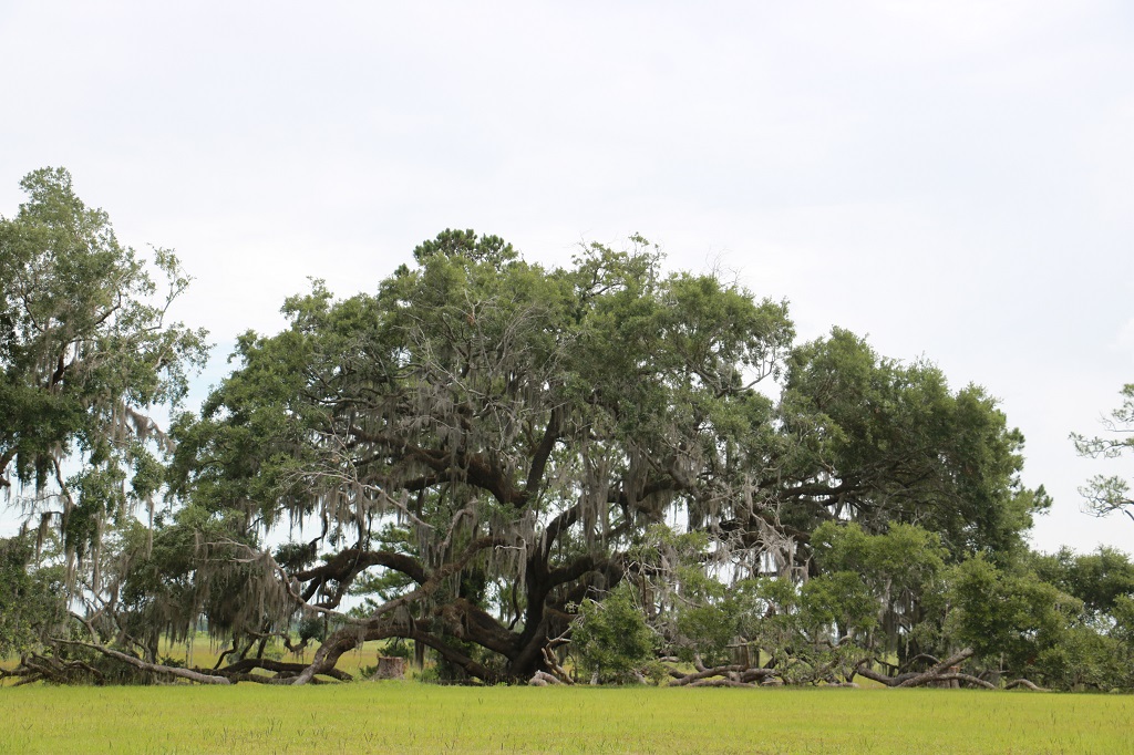
This Live Oak is named Ophelia’s tree and is estimated to be 650-800 years old. It was the practice to build your house under or near the huge trees to provide some shade during the humid, hot summer months.
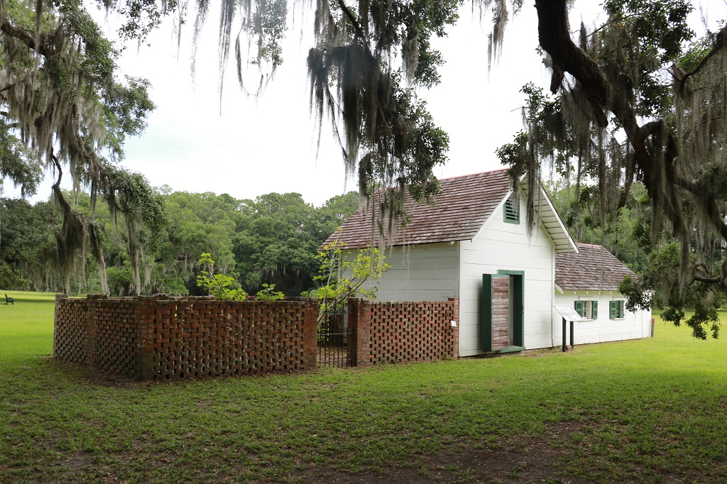
The lattice brick area was the laundry yard. The air could circulate through the fencing while it also protected the laundry from wandering cows and pigs. The small building was the ice house where meat would be kept after butchering.
Behind this huge Live Oak are the former rice fields, now returned to marsh.
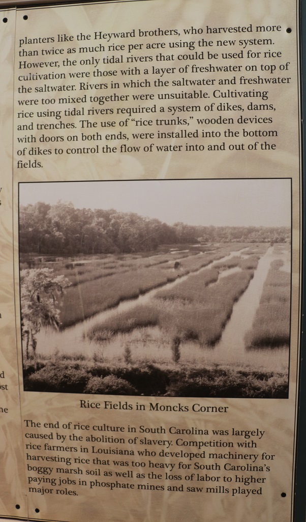
This is an areial photo of the land that was in rice cultivation during the heyday of the plantation before the Civil War. They had 385 slaves that worked the fields. After the war the family had to sell quite a bit of their 7,500 acres to pay taxes.
A charming Georgia Parks workernamed Dillon was our guide through the house. Five generations of the Brailsford-Troupe-Dent families lived in the house. The last surviving member was Ophelia Dent. She and her sister Miriam never married and the brother Grantz had no children. Miriam died 20 years before Ophelia in 1953 and Ophelia left the property and all its contents to the Nature Conservancy of Geogia when she died in 1973. The Nature Conservany turned it over to the State and it is a designated Historic Park.
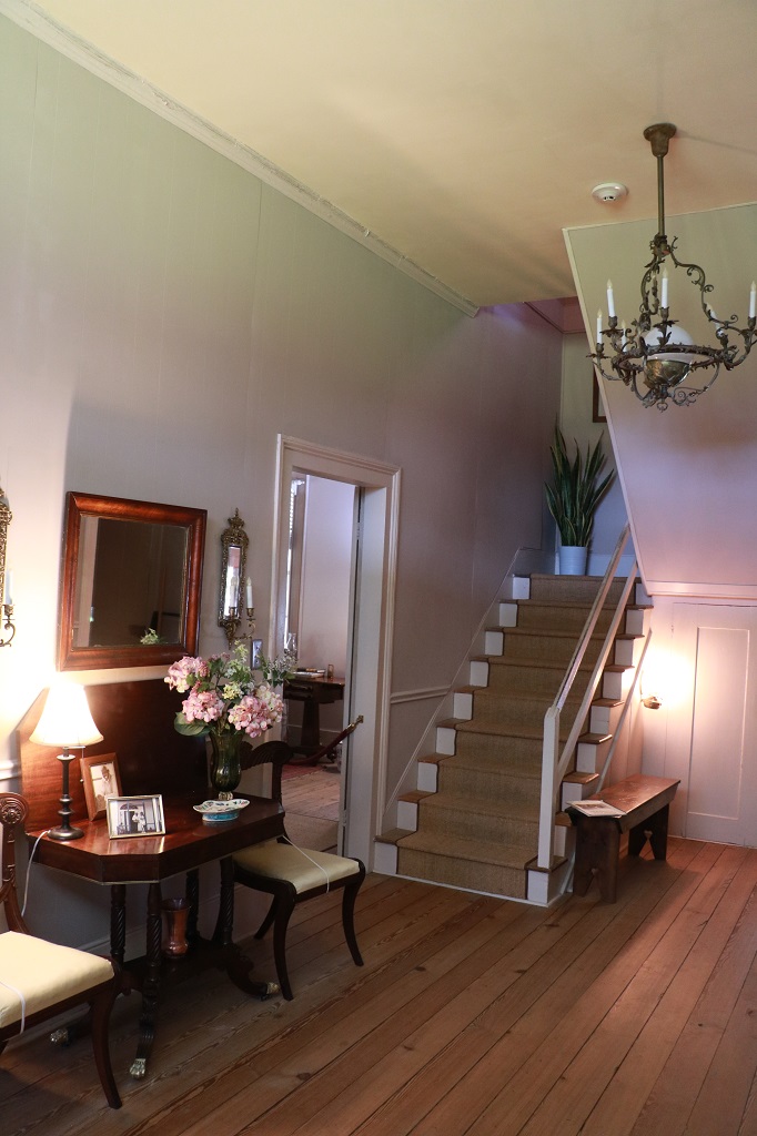
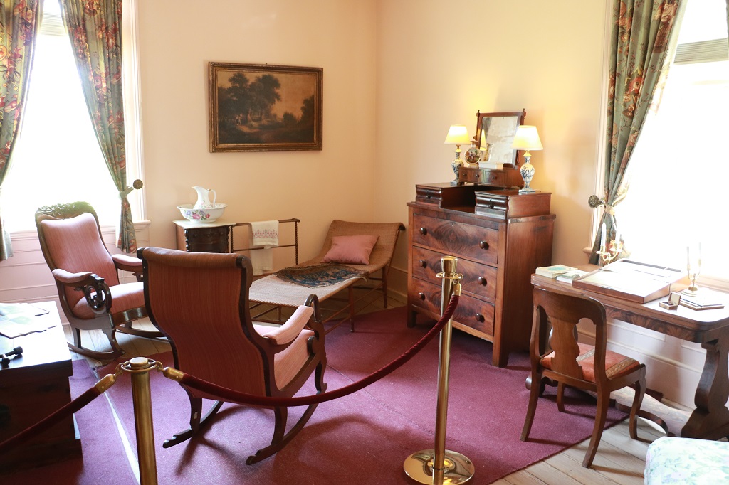
The house is fully furnished with the family’s possessions as they were when Ophelia died. Many of the items are from the 18th century and early 19th century and are in pristine condition. There are no reproduction items in the house and most things are still in the same place as they were when Ophelia died. Only a few things have been moved around. It was very cool to know that everything was original; some things as old as 1797. So many historic houses and buildings are furnished with reproductions or period items collected from other places.
The floors are all Heart Pine and are in beautiful condition. The chandelier was purchased from the Wormsloe Plantation that we visited in Savannah.
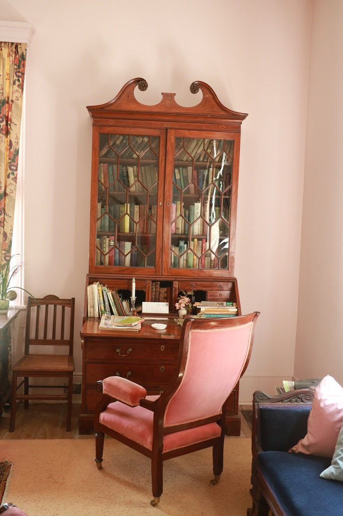
These two photos are from the Ladies Parlour. I could not get far enough back to take a good picture of the tables and chairs in the room.
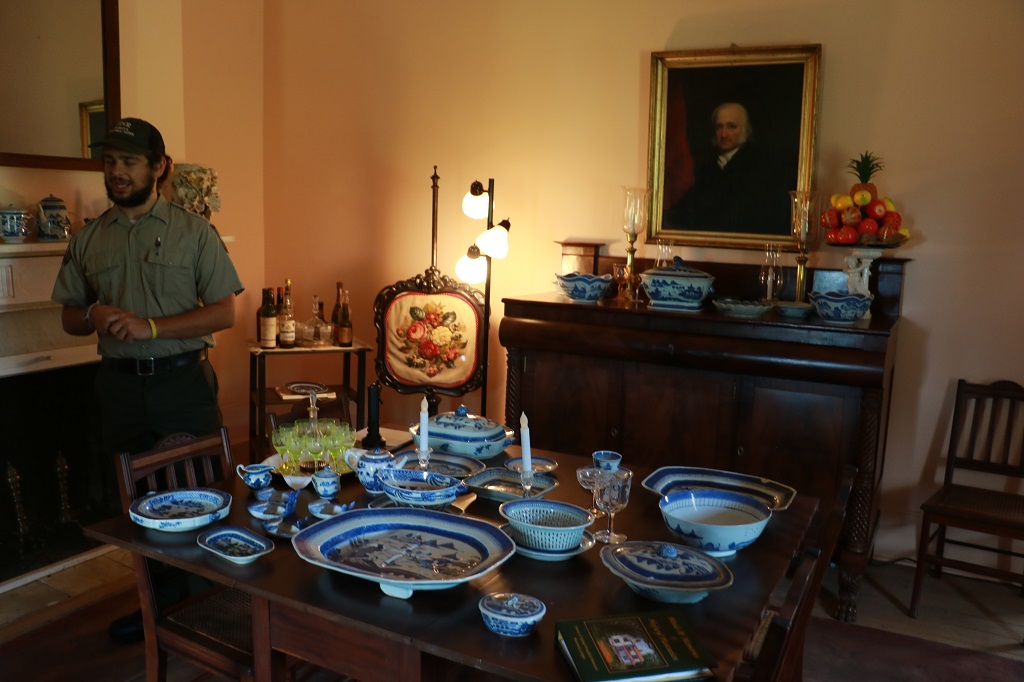
The trading ships that came from the orient used crates of china dishes for ballast and when they arrived all the crates would be unloaded and the dishes sold cheaply as they were no longer needed. In this way, many well-to-do homes had large sets of china from China.
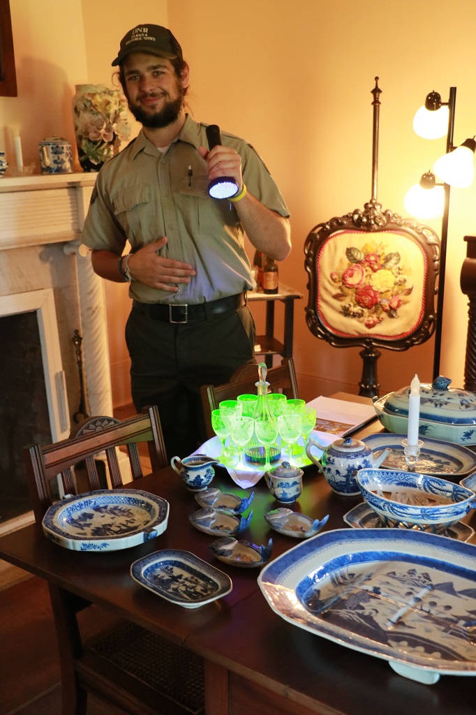
I did not catch the name of this glassware set, and it was not an expensive item at time of purchase. What made it desirable was the yellow-green colour (you can see it sitting on the table in the photo above). What people did not know at the time was the ingredient that gave the glass the unique colour was uranium. Dillon used a black light to show how it glowed. There was not enough uranium to harm the people using the glasses but it was deadly for the people making them.
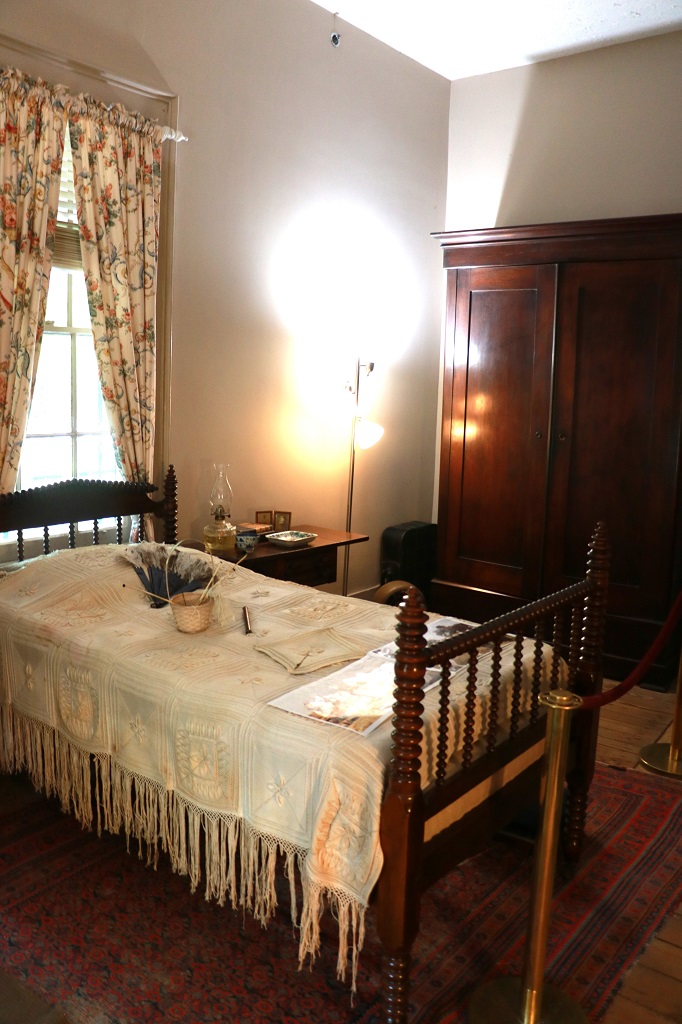
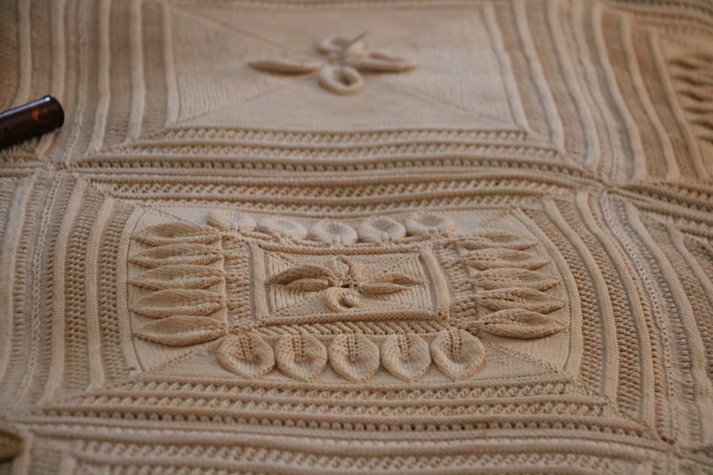
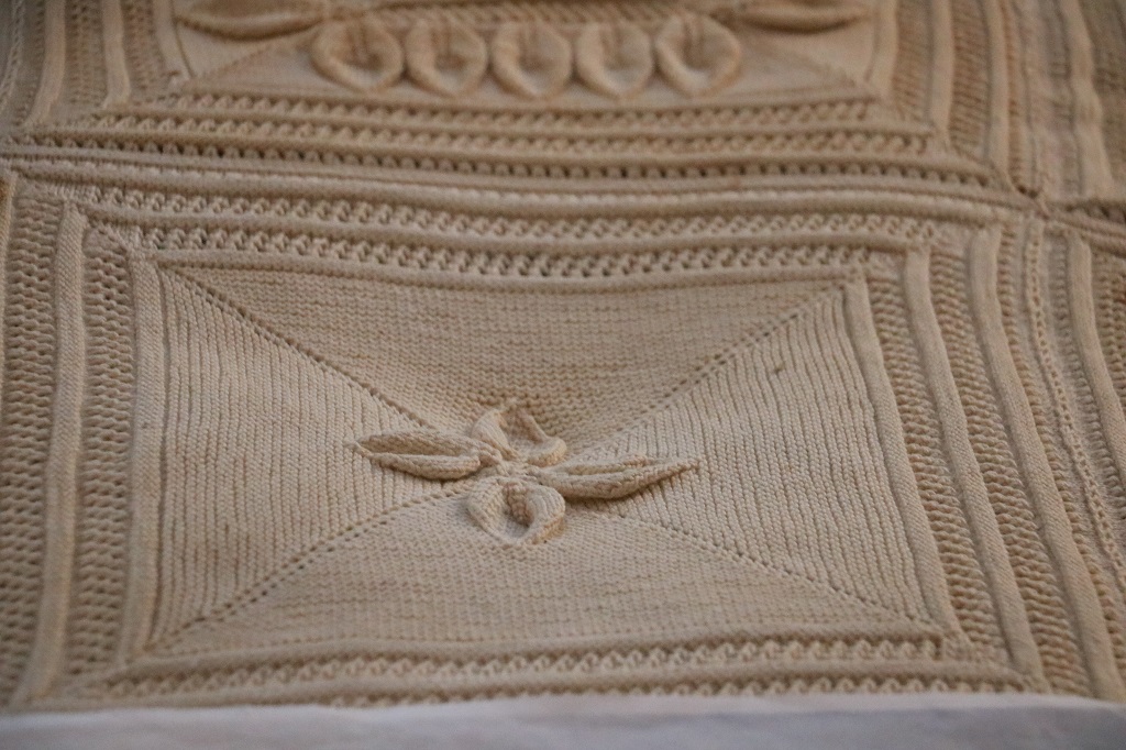
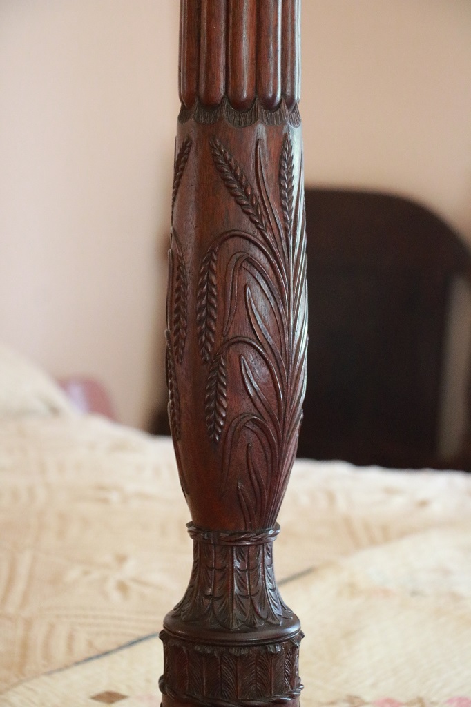
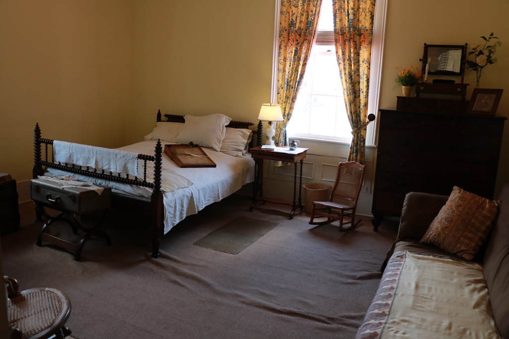
When Miss Ophelia was elderly she had her bedroom moved downstairs into what was once the Gentleman’s Parlour. She made the bed covering. It looks like a type of crochet and it is estimated it would have taken her about 10 years to complete due to the very fine needles and thread that was used, not to mention the detailed pattern.
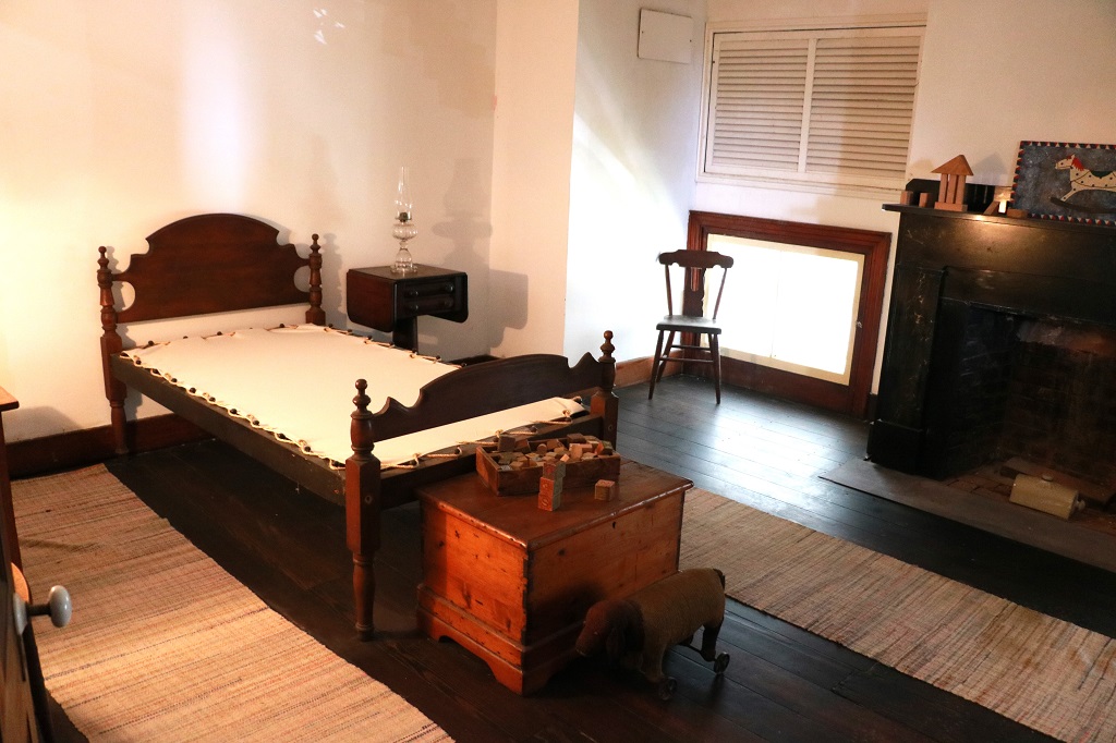
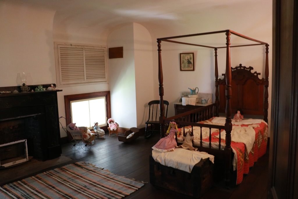
There were three bedrooms upstairs, including the master that had a custom made bed with rice carved in the foot posts. Against the wall are the pieces of an 18th century crib that was in the attic, as was the trundle bed underneath. It would have been common practice for infants and young children to sleep in the parent’s bedroom so they could be gathered up quickly and taken to safety in the event of hurricane, storm, or fire.
At the foot of the bed on the chest there are two lead ‘keys’. Barely visible is a round dark spot on the bedpost just a little below the top of the chest. The ‘keys’ fit into the hole and were used to tighten the ropes that supported the mattress as they would begin to sag after sustained use. The expression “Night, night, sleep tight, and don’t let the bed bugs bite” comes from this era. The first part of the little rhyme refers to having tight ropes holding up your bed and the second part refers to the red bugs that would be in the moss that was picked up off the ground and used as filler for mattresses, pillows, etc. and would bite you in the night.
This small corridor space was used for many purposes over the years and has a closet at the end which was unusual for the time. The space also connected to one of the other bedrooms which was probably used as a nursery for young children.
We had arrived at the plantation at 11 and left at 1:15. We crossed the state line into Florida at 2 and a short distance later left Highway 95 and drove down A1A along the coast to St. Augustine.
We had a 15 minute ferry ride from Fort George Island to Mayport along the way.
It was a much slower road through many beach areas with lots of stop lights quite a distance past Jacksonville. After that it was a nice quiet two-lane road along a very narrow spit all the way to St. Augustine. We arrived about 6, checked into our hotel and went to find dinner. We explore tomorrow.
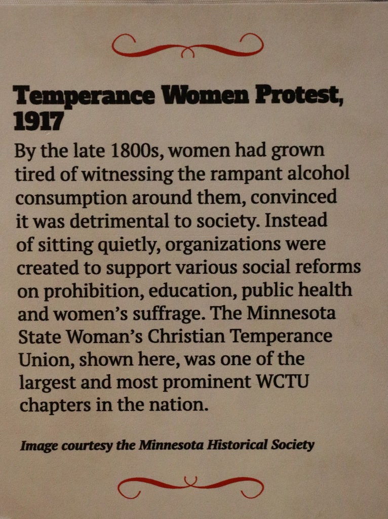
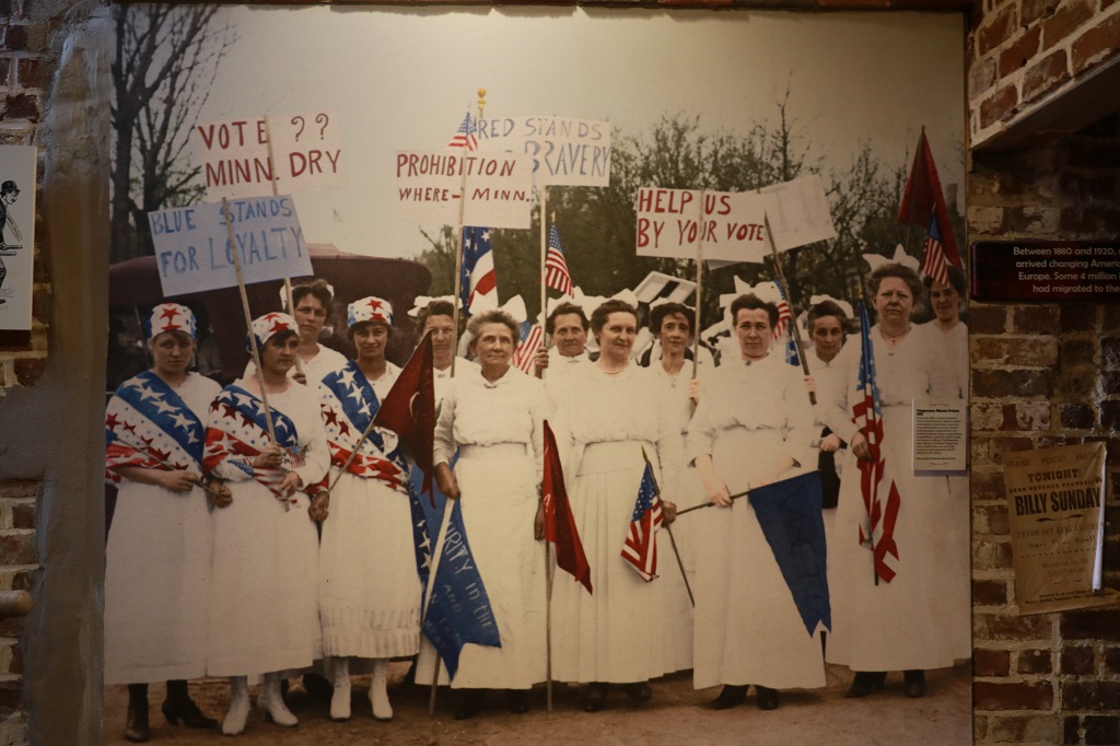
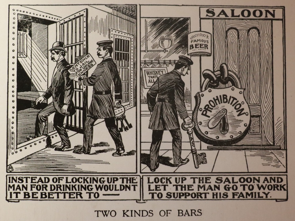
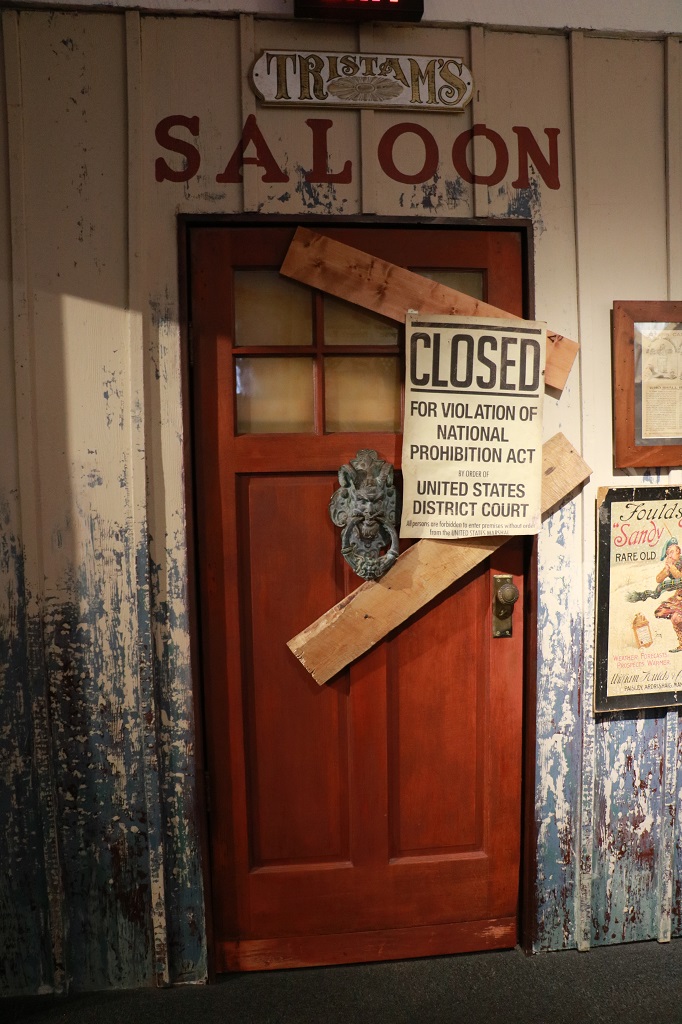
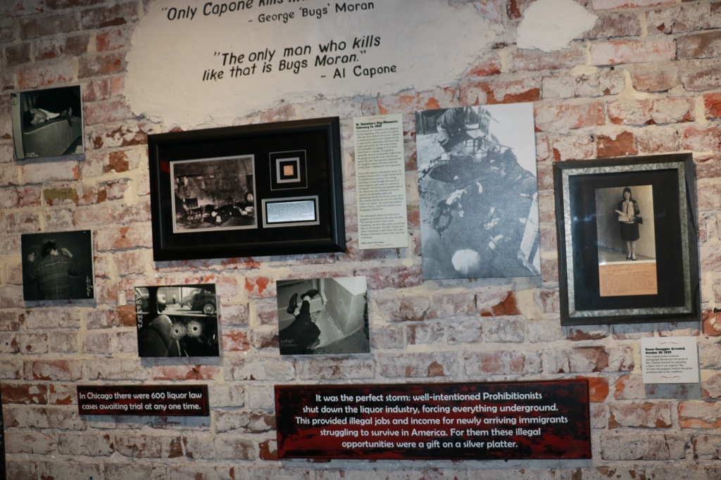
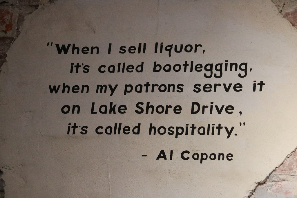
We had another day full of things to see today and were following Mary Lou’s Nav directions by 10 am. First stop was to be Forsythe Park, which has a lovely fountain and is said to be a very nice place. We drove around the area a couple of times trying to find a parking spot but there were none to be had. And the park was full of people. It is graduation weekend and many, many grads were at the park with their families having photos taken. We did not see any pretty flower gardens so we waved at the fountain on the way past and headed to the Prohibition Museum.
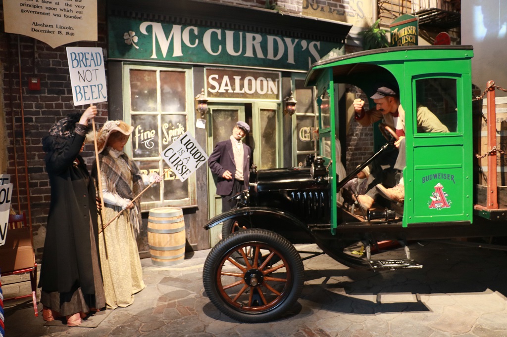
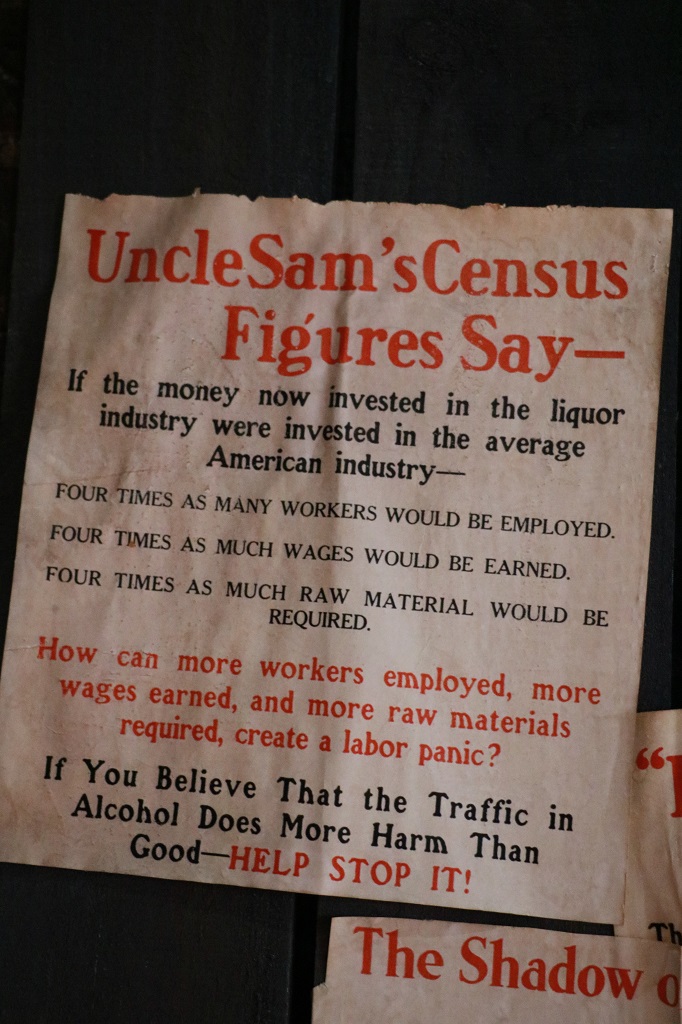
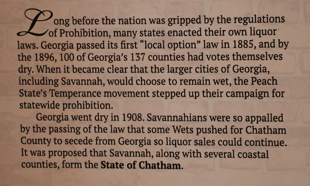
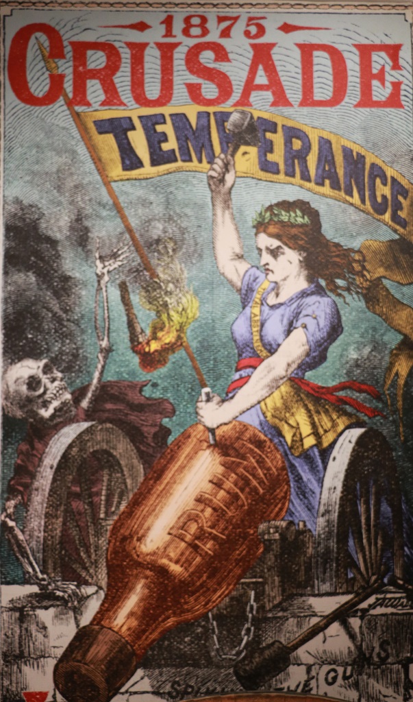
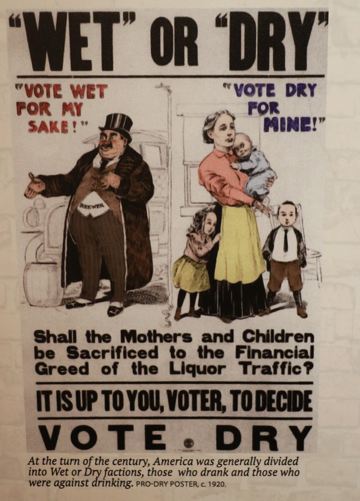
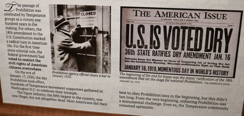
Prohibition was not a new concept when the Temperance Movement got so strong and the US was declaired dry with the passing of the 18th Amendment on December 18, 1917 and ratified by the requisite number of states on January 16, 1919. The fight had been going on for a hundred years in one way or another.
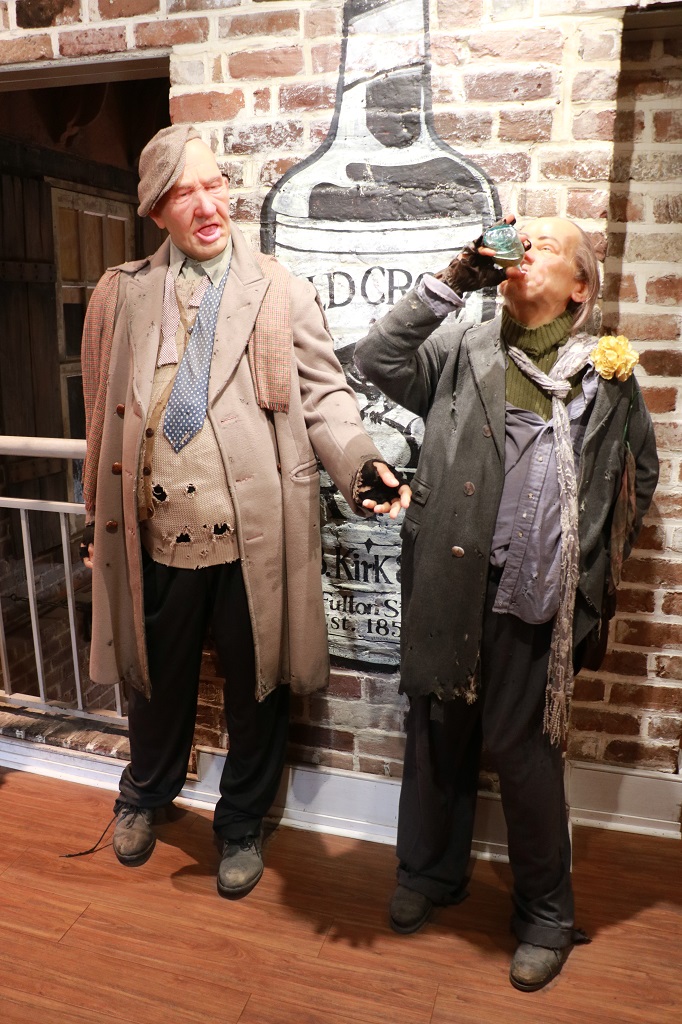
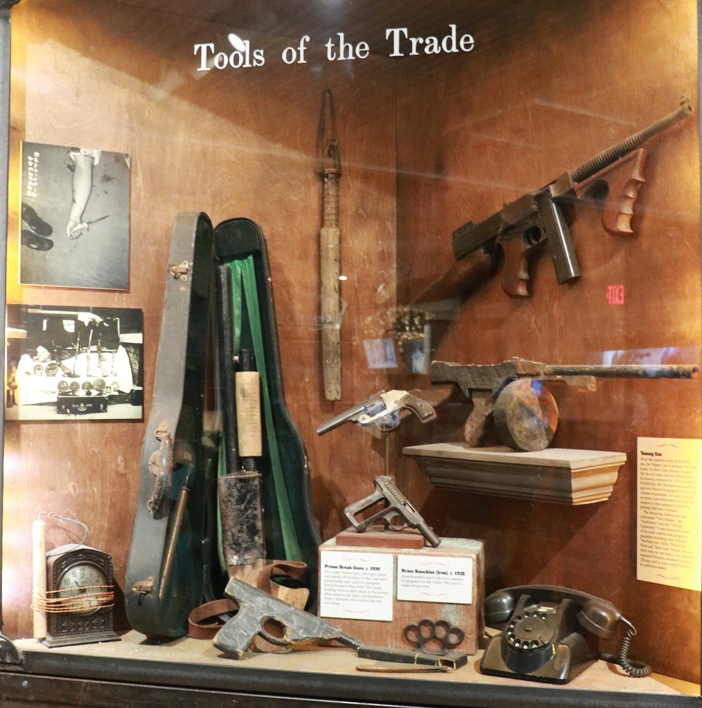
The museum had a wonderful collection of posters, photographps, newspaper clippings, wax figures, cars, and collectible of all kinds from the era. It was very interesting. And we even learned some new things, which I always like.
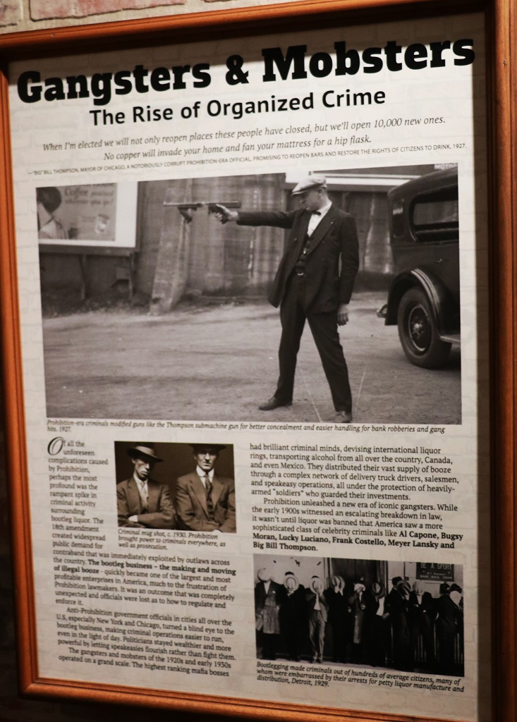
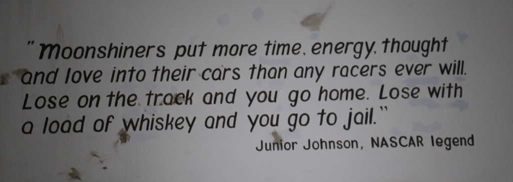
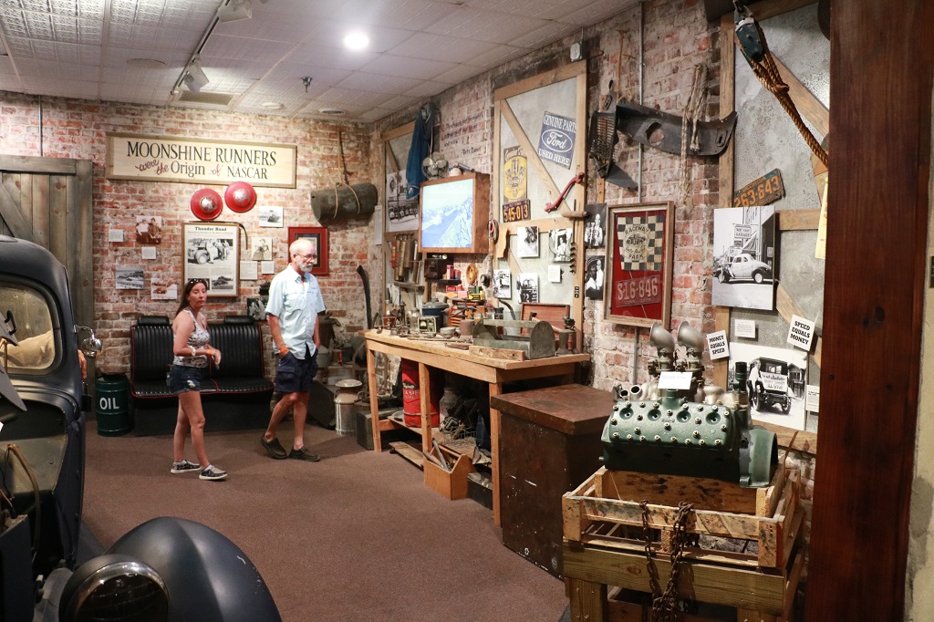
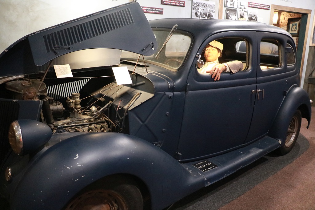
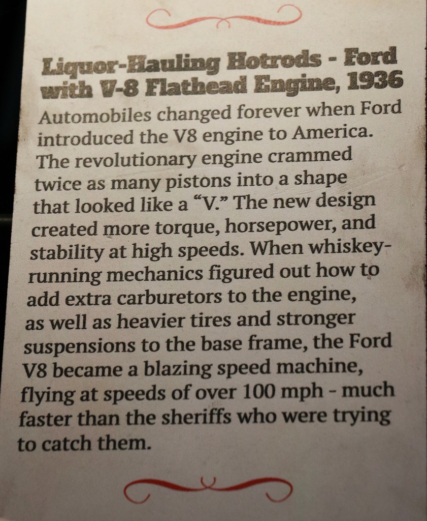
The museum took you through the efforts of individuals and Temperance Unions to get the sale of alcohol deemed illegal in the USA, to the affects on the economy, the rise of bootleg liquor which contributed to powerful organized crime syndicates., and the creation of NASCAR. The 21st amendment rescinded the 18th on Dec. 5 1933 and there were displays of articles and items celebrating the rights of people and companies to make beer and liquor again.
All the walls in all the rooms were covered with posters and photos and memorabilia. I have no idea where they got it all but we were told most of it was original with only a few reproductions. It was a wonderful collection of an almost forgotten time.
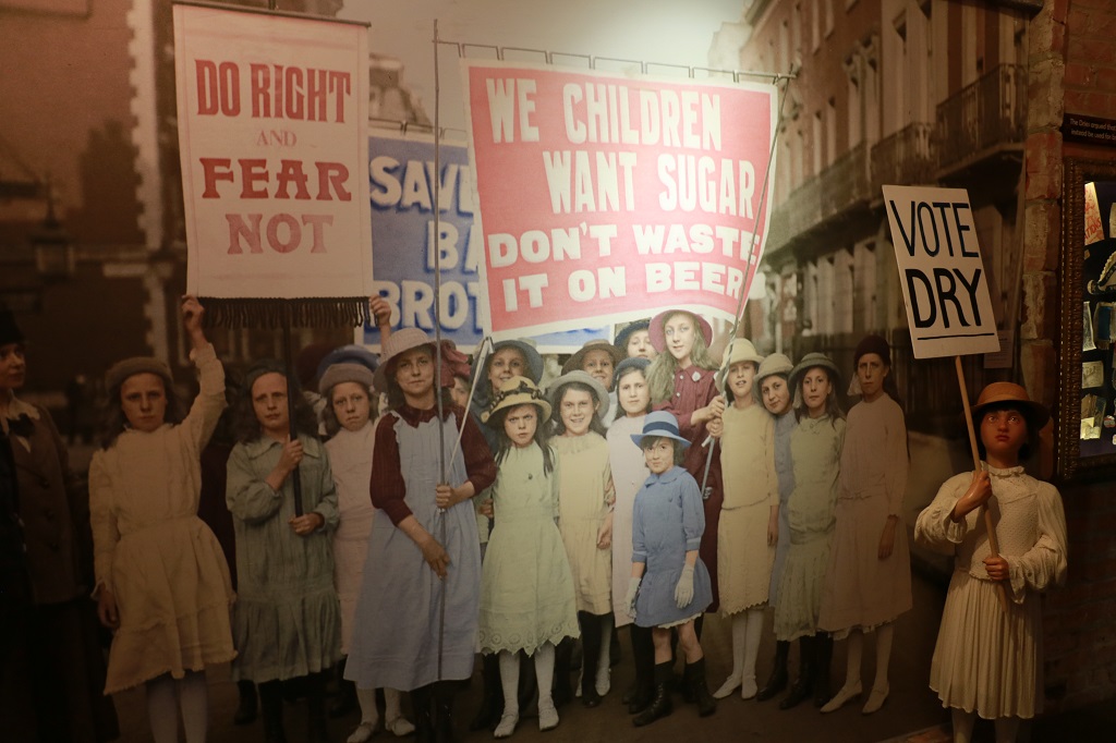
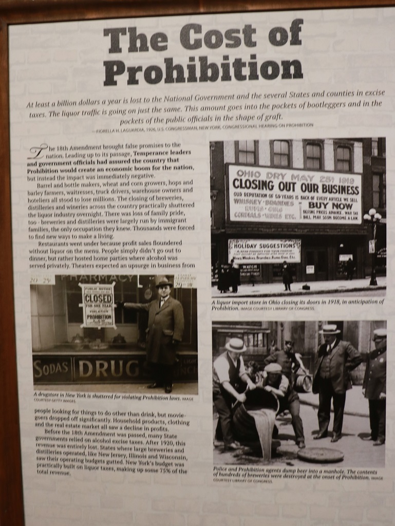
Obviously all these children did not get the memo about how bad sugar is for you. After prohibition the production of cane sugar rose from 152 million pounds in 1921 to 960 million pounds in 1929.
Also the first income tax was was passed the year before Prohibition to replace lost revenue from liquor. Prior to Prohibition 40% of all US taxes were paid by distillers and brewers. The minute the 18th amendment was ratified thousands of farmers, distillers, brewers, coopers, distributors, truck drivers, warehouse workers, and clerks were put out of work.
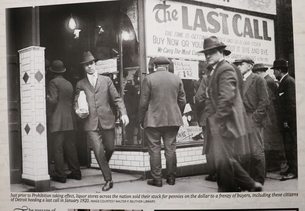
People stocked up on liquor at great savings the days before Prohibition came into affect. Many of them thought the laws would not last long and their extra purchases would see them through. Besides the stores and pubs, etc were selling all their stock for pennies on the dollar.
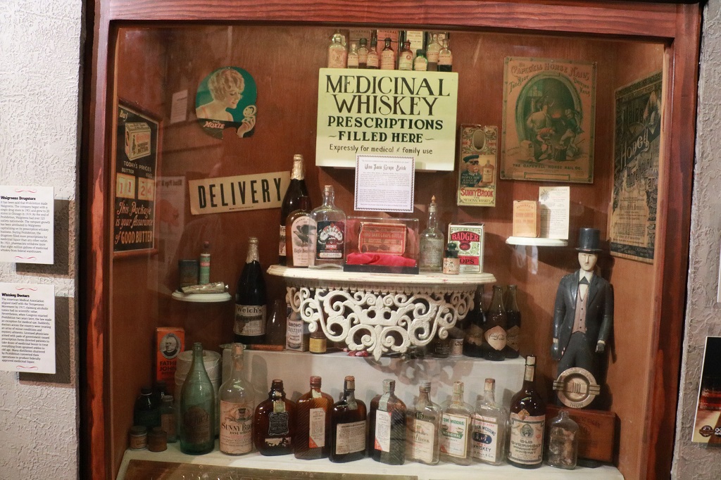
You could get a prescription for whiskey for a variety of medicinal conditions. Doctors became very busy. Veterinarians and Dentists could write them also. Rabbis could get kosher wine for services. The number of rabbis increased dramatically. There were even rabbis with names lile Rabbi O’Leary and Rabbi McDonough. (see details in the 10 ways to drink below)
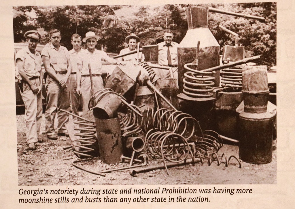
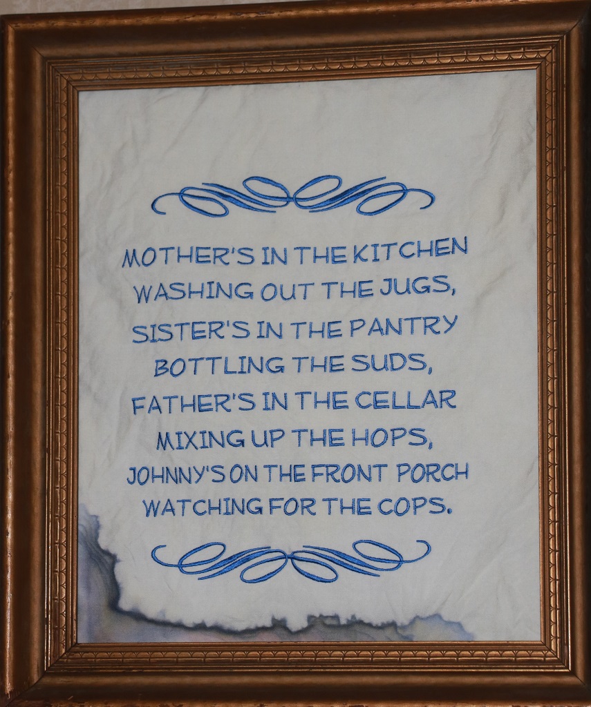
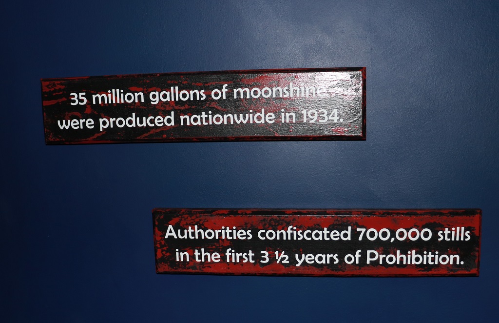
40% of all illegal alcohol was made in the home.
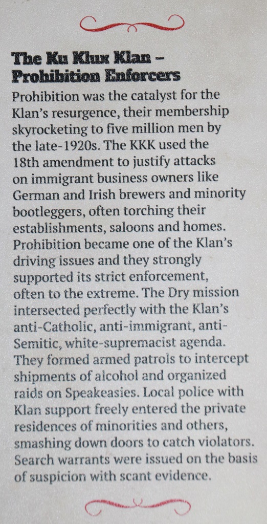
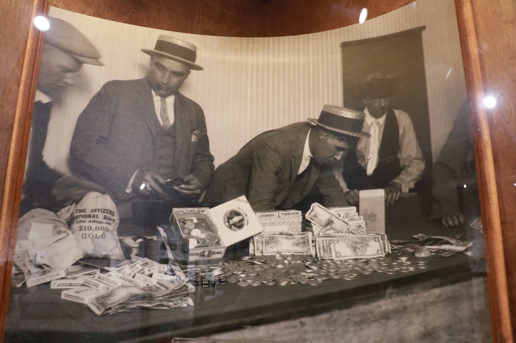
Organized crime came about in strength as a direct result of Prohibition. Criminals created a vast network for the production, storage, and distribution of bootleg alcohol. And the violence over territory and staggering profits ensued.
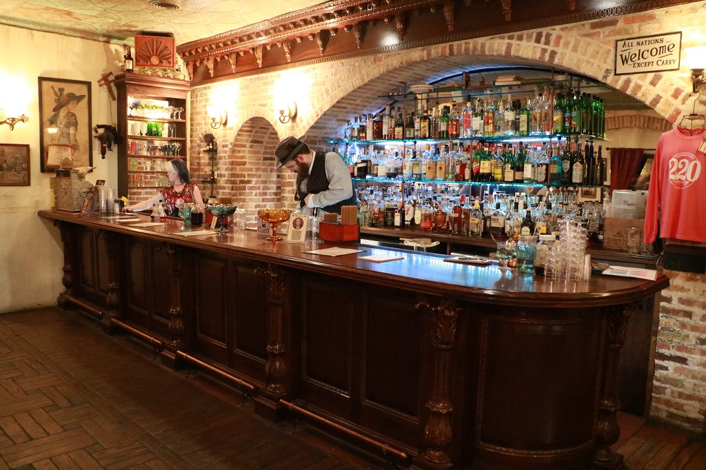
In 1929 there were 32,000 Speakeasies in New York. There was one in the museum as well, where bartenders in period costume would mix you a drink of your choice (an add on to your entrance ticket).
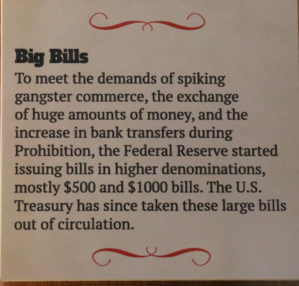
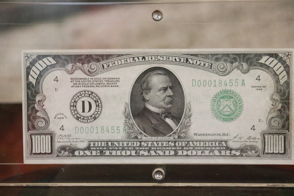
A 1928 $1000 bill.
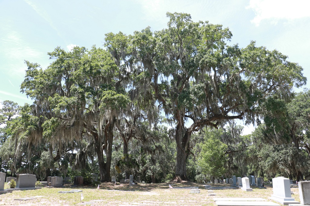
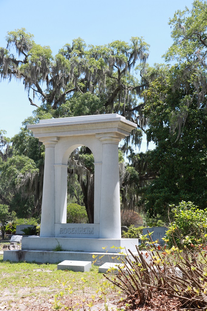
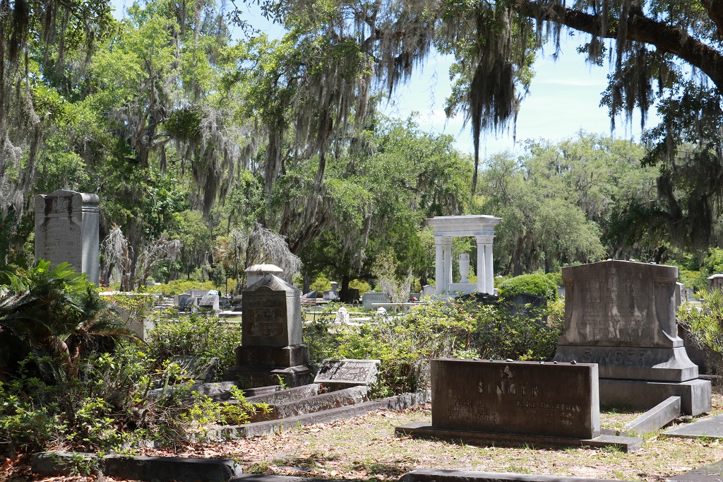
We left the museum at noon and drove over to Bonaventure Cemetery. We drove around quite a few of the roads and I took a few photos of some of the larger or more interesting markers/crypts, but it did not look like the most beautiful cemetery in the world as it was hailed to be. The only thing that set it apart from other cemeteries we have been to were the lovely big Live Oak trees with their Spanish Moss drapery.
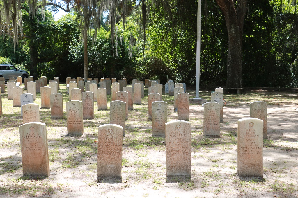
This was an American Legion section where veterans from about five different Legions were buried.
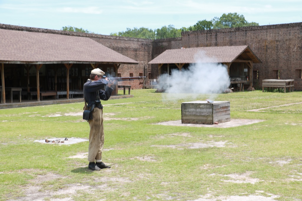
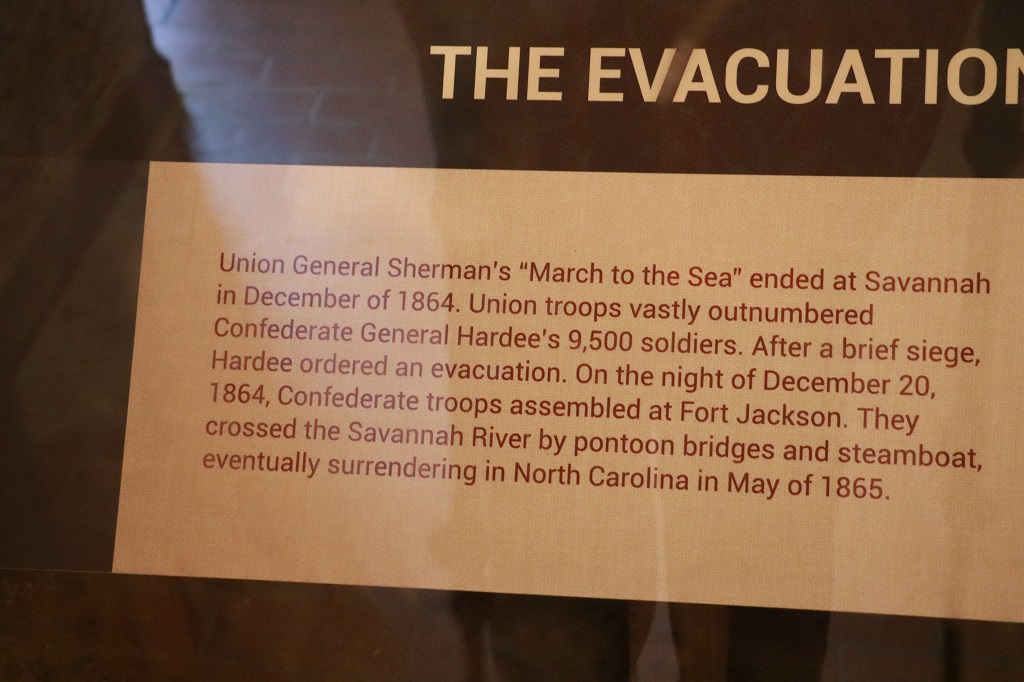
Our last stop was Old Fort Jackson which was built right beside the Savannah River and became the Confederate headquarters after the Union took Fort Pulaski. It was surrendered i 1864.
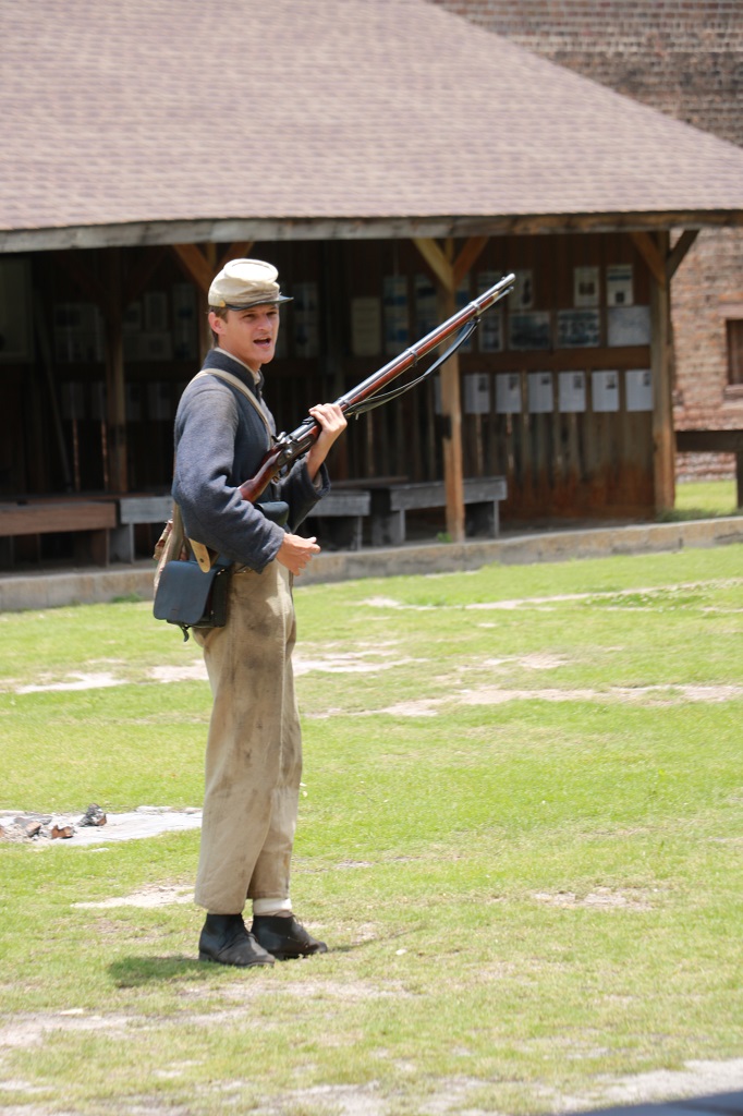
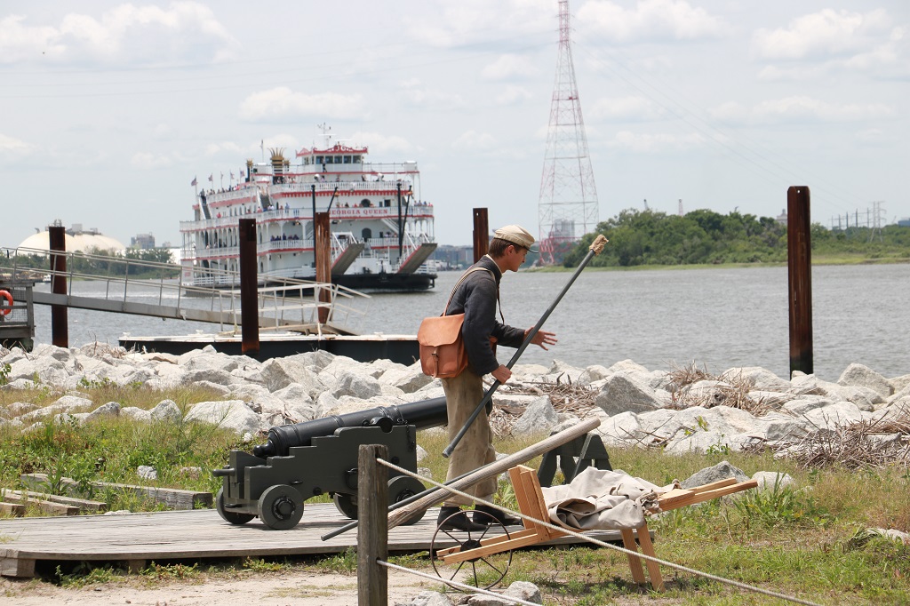
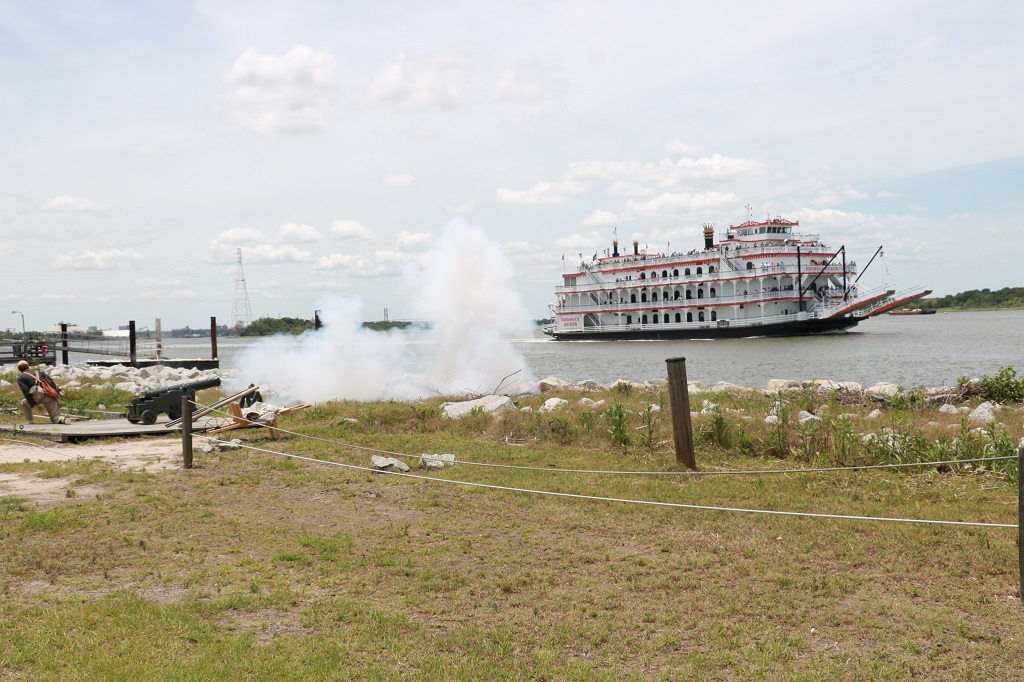
This young man did an excellent job of explaining the loading and firing of his rifle and how it and it’s bayonet, plus the fort’s cannons were used to fight the foe.
The fort is RIGHT beside the river. This big container ship sailed past as we were watching the rifle demo.
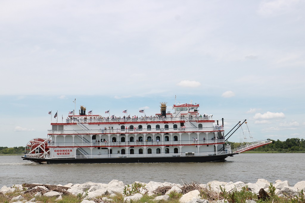
At 2 o’clock the Georgia Queen riverboat cruise reaches Fort Jackson before turning around to go back to port. The tour company pays the fort’s non-profit (at one time it was State run, but the state backed out) to fire the cannon across the bow. The people on board loved it. It is just a short range cannon that makes noise but does not actually fire a cannon ball. Still it is effective and loud and a crowd pleaser for those at the fort and on the boat.
It was only mid-afternoon but after all the walking we did yesterday and then again today, my poor legs had had it. The heat and humidity don’t help the old bones either. But it was a good day. We enjoyed our time in Savannah and head for Ft. Augustine, Florida tomorrow. When my cousin heard we were taking this road trip in the south she said we had to go to Ft. Augustine. So we will.
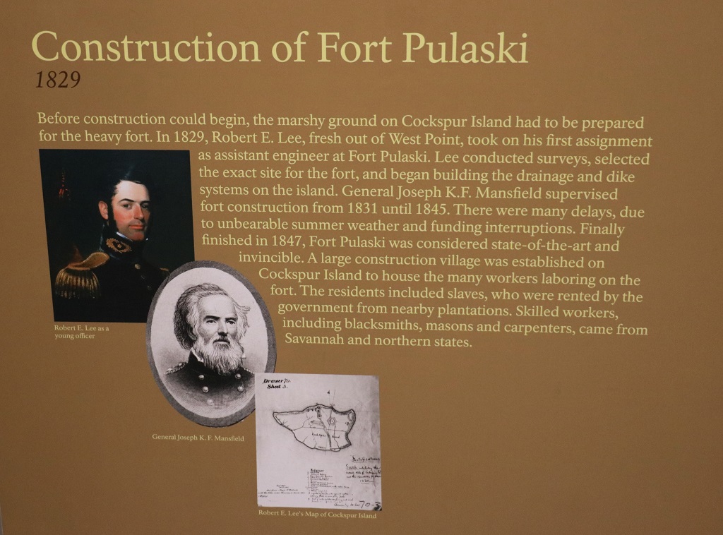
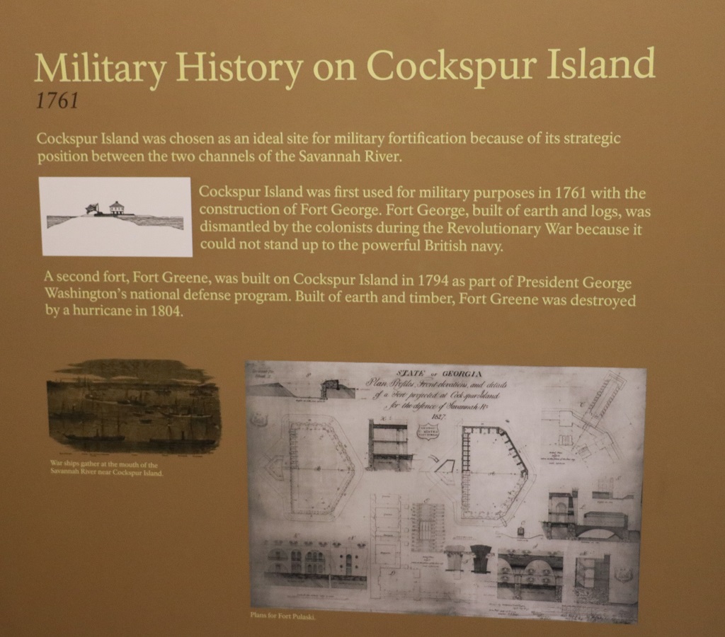
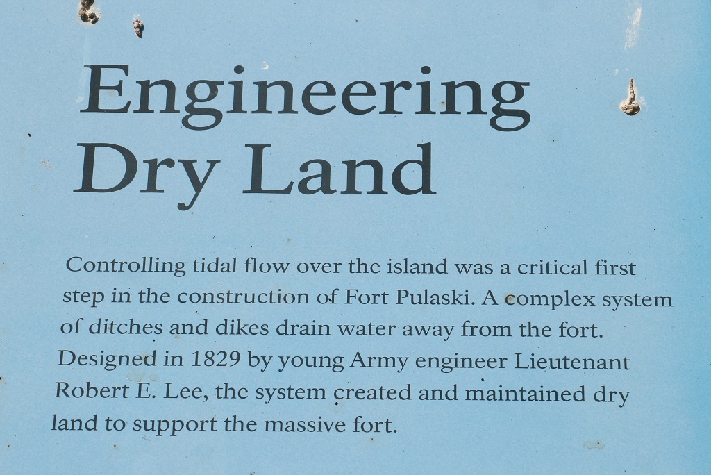
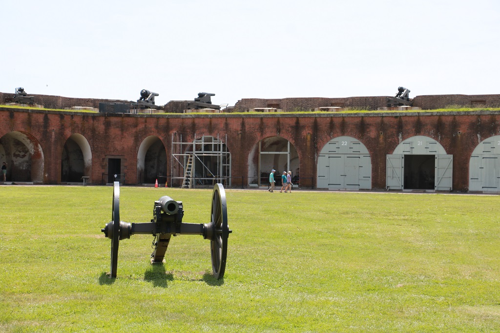
After breakfast we headed to the coast to visit Fort Pulaski. This coastal area of Georgia is comprised of low wetlands and dozens of small interconnected islands. Fort Pulaski is on Cockspur Island.
We arrived at the fort about 11 and did not leave until after 1. I took my two walking sticks and with the double stability was able to walk the entire fort.
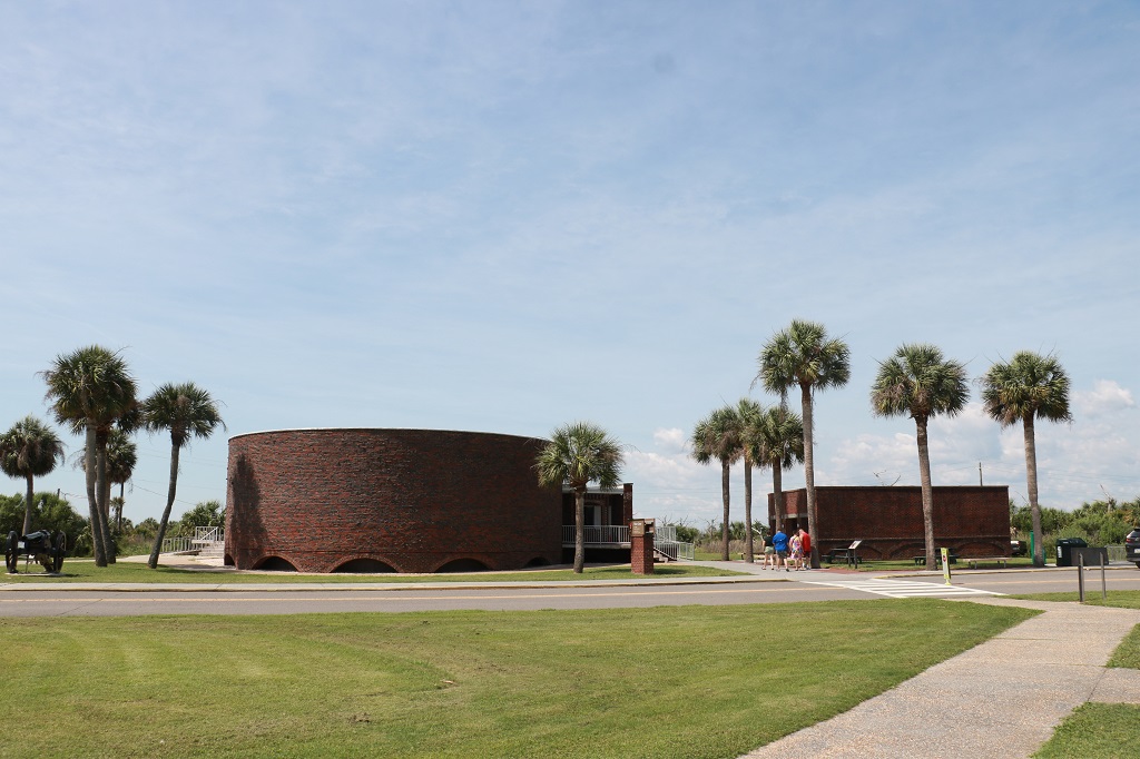
The Visitor’s center was built in the 1950s and the brick was made to look similar to that of the fort.
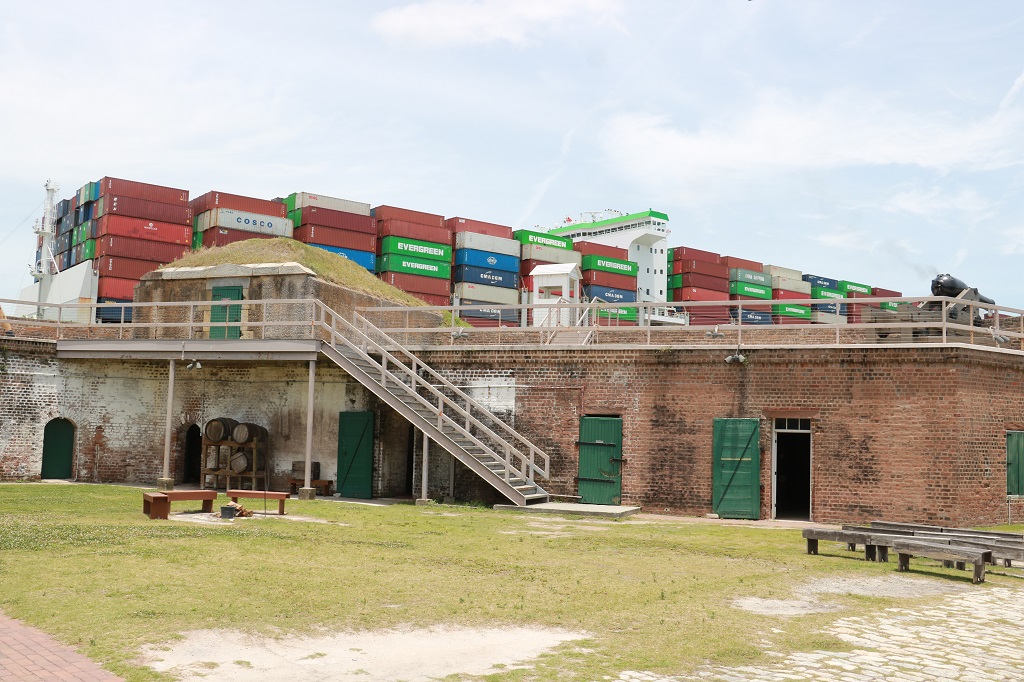
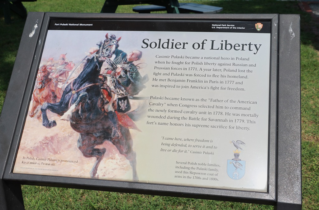
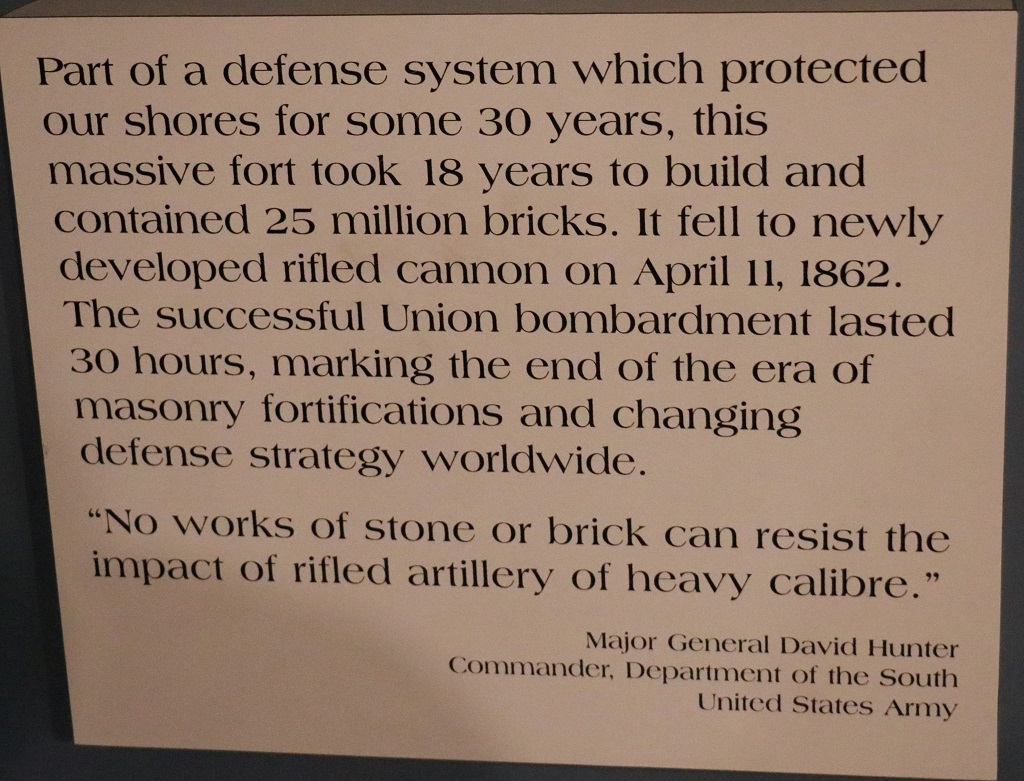
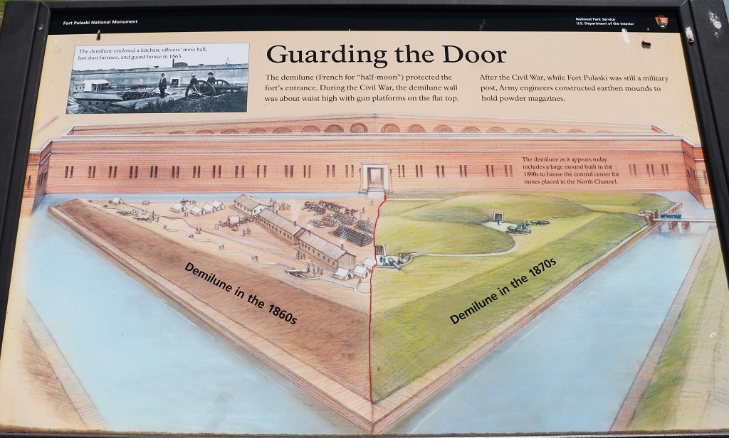
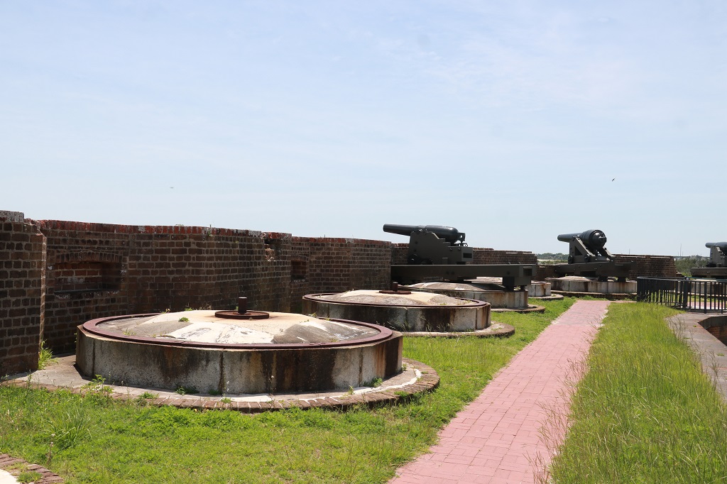
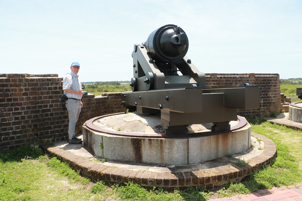
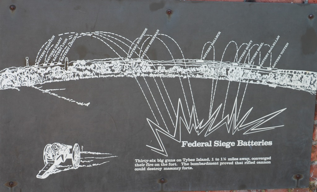
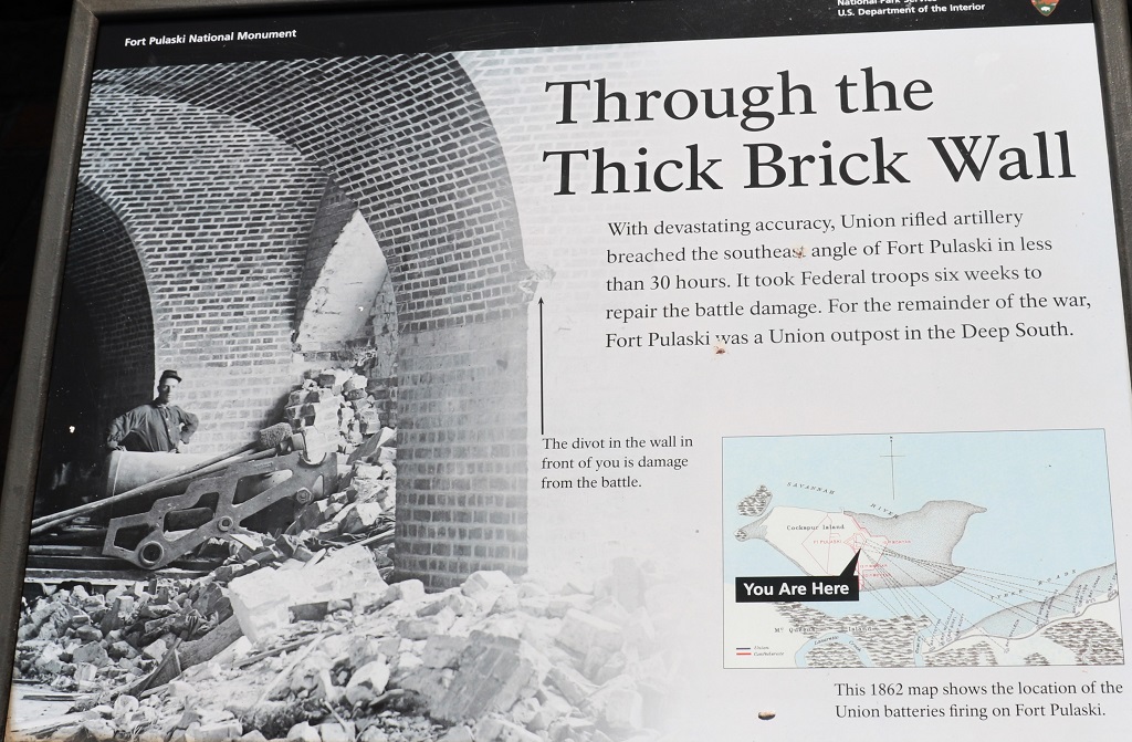
The fort was named for Casimir Pulaski who died during the Revolutionary War. The fort saw no action until the Civil War when it was occupied by the Confederates who surrendered it to the Union Army after a 30-hour bombardment of the new rifled artillery cannon which had a range of 1 to 1 1/2 miles; twice as far as the guns of the time.
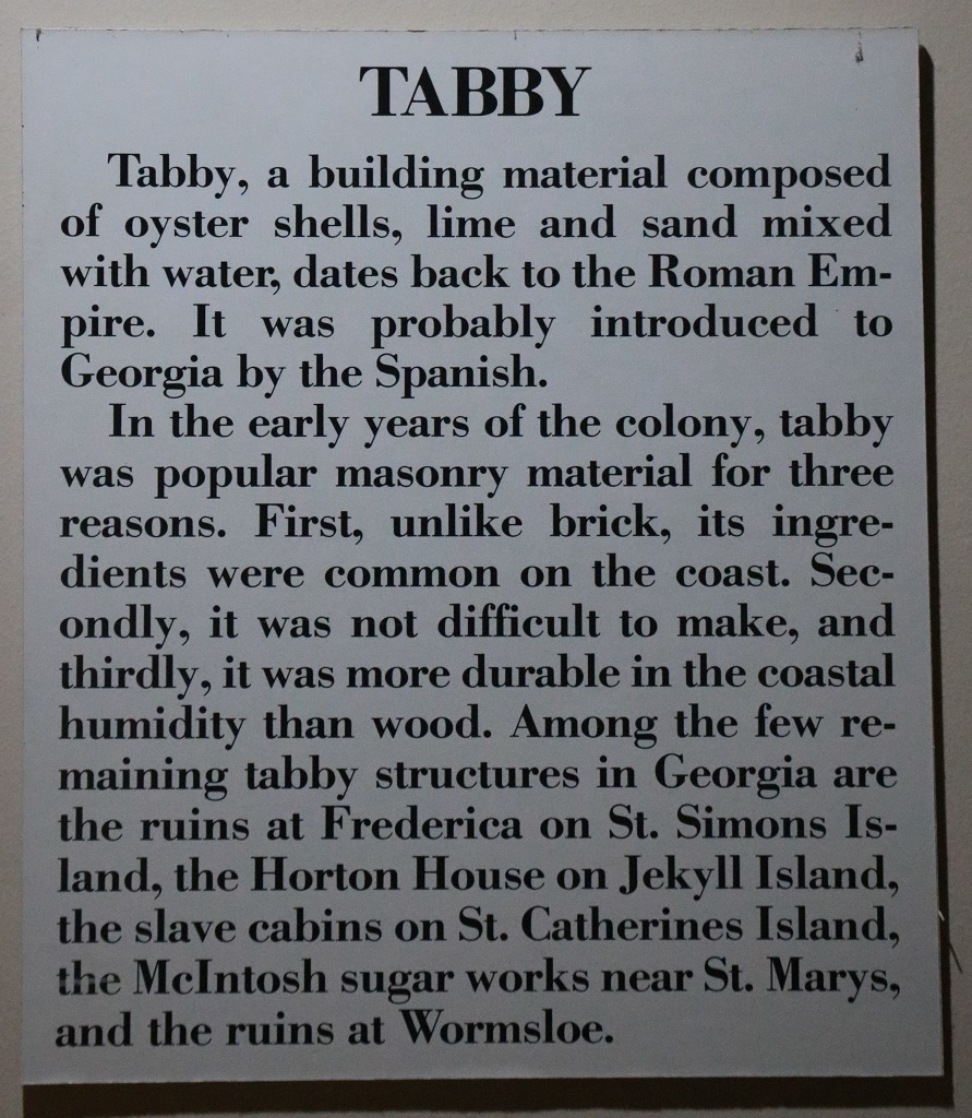
There are rooms under all those earthwork hills which housed the power magazines during the Civil War. They are made with ‘tabby’, which is a cement-like substance made from oyster shells, lime, sand mixed with water. All of the needed ingredients were plentiful on the southeast coast and it, like cement, can be molded and shaped.
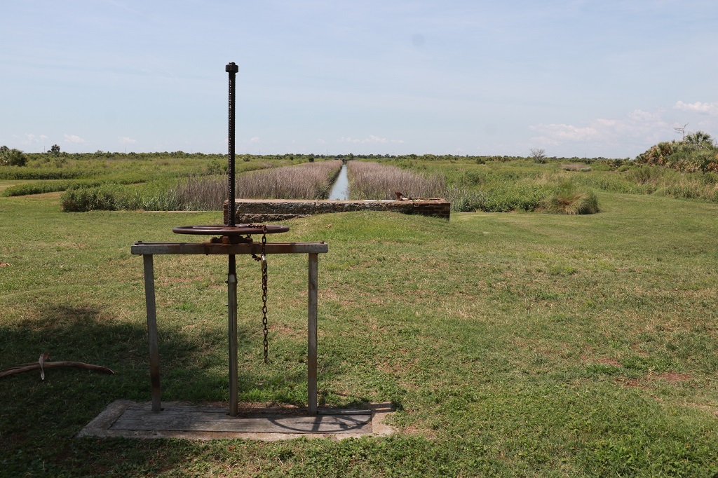
The canals are still used to control the flow of water to the fort moat.
Two sides of the fort are riddled with divots from the Union artillery fire the breached the SE wall and convinced the Confederate Colonel Olmstead to surrender.
There are still a few cannon balls stuck in the wall.
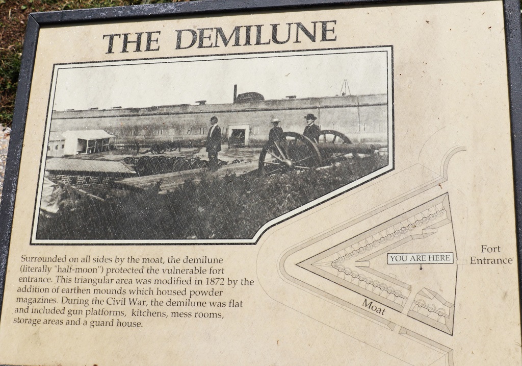
There are two drawbridges to access the fort. The first is from the ‘shore’ to the demilune (where all the dirt hills now are) and the other is from the demilune to the fort. They required two men to work the mechanisms to raise and lower them.
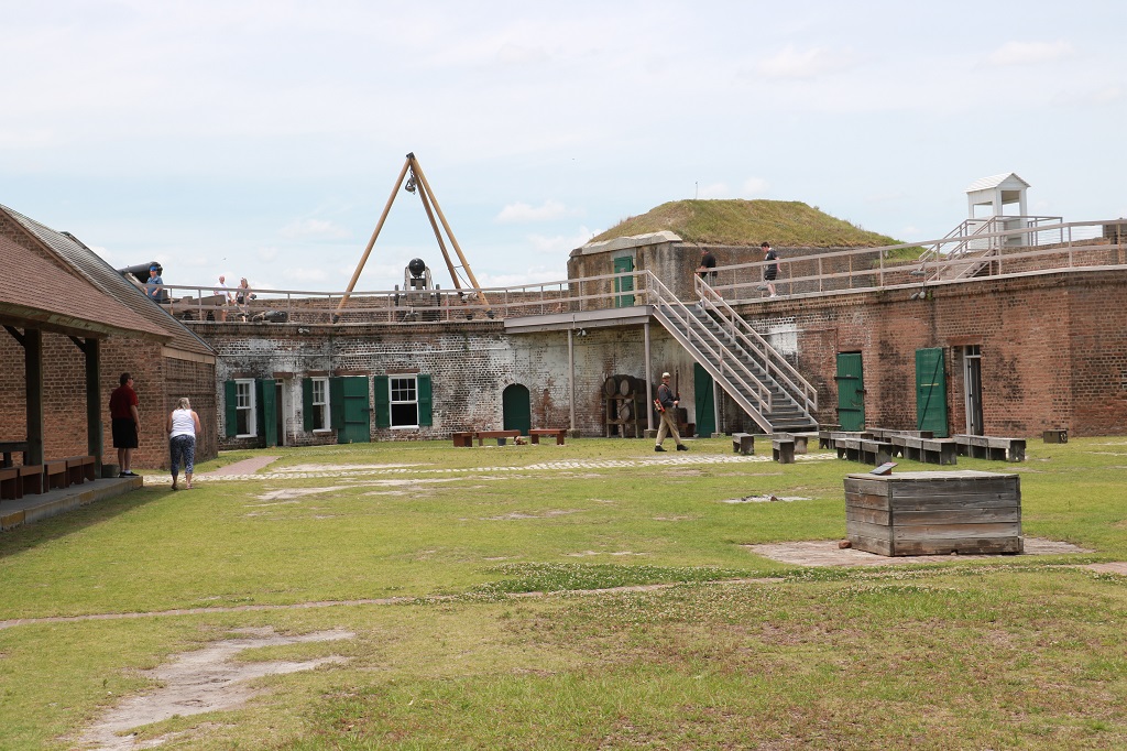
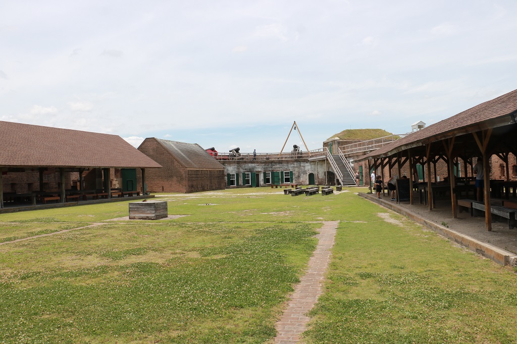
The fort was designed to have 146 guns. It never had more than 100, which was a good thing because with a full compliment of guns there would have been no where for the soldiers to sleep except tents on the parade ground. As it was the men made small barracks in the various rooms that housed – or were made to house – guns. Even sleeping in the spaces around the guns they practice with. 385 Conderates manned the Fort under Colonel Olmstead but after the Union took it over there were over 1000 soldiers here.
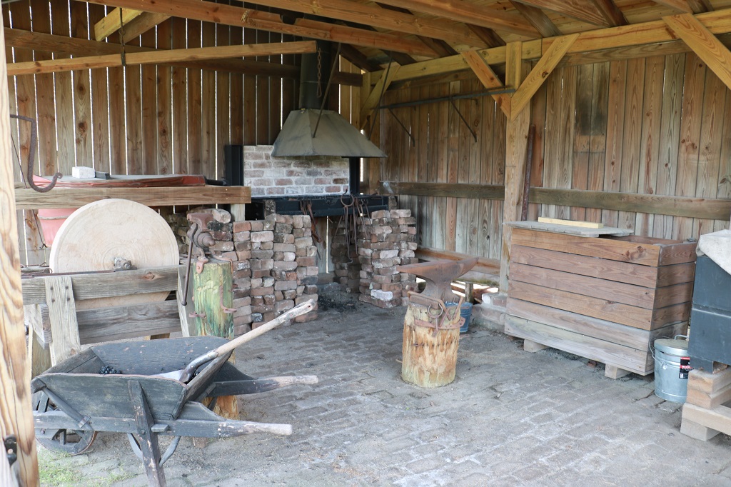
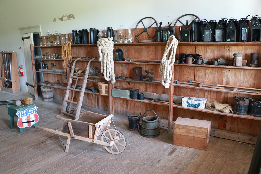
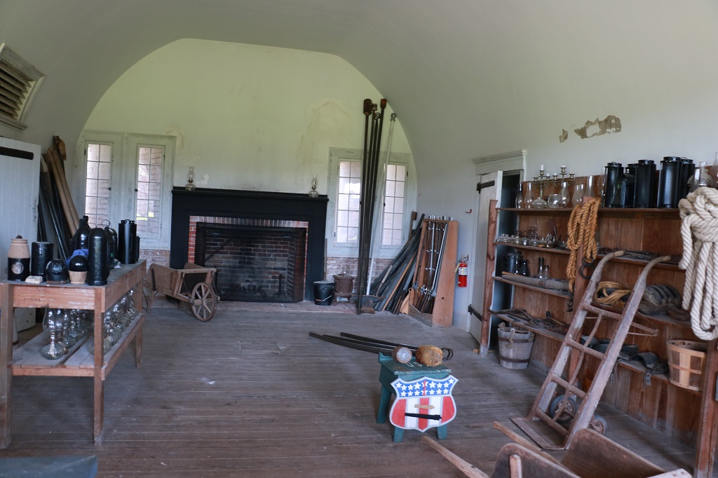
These two pics are set up to give an idea of a typical Quarter Master’s store rooms.
The view toward the ocean and inland was unobstructed from the top of the fort. There were gun placements along all the walls up and down.
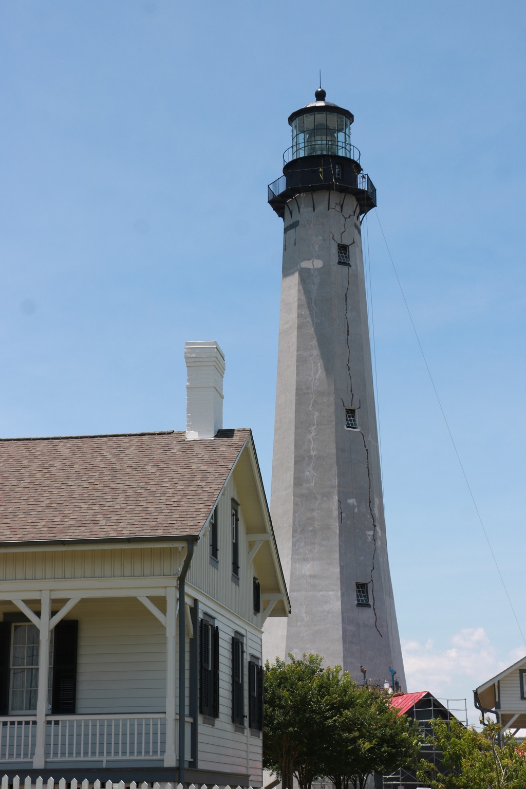
We left Fort Pulaski at one and drove further down the causeways to Tybee Island where there is a well-known lighthouse that has been re-built about 3 times. I had read that it was red and white but there was no colour on it at all.
As we passed by people came out and stood at the rail at the top. There are several ropes hanging down the sides as well. Not sure if they are used for rappeling or what, but I was sure surprised to see the big crack that runs from top to bottom.
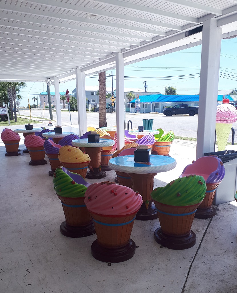
We stopped at the Sugar Shack – a candy and ice cream store that has an amazing variety of sweets and ice cream – for cones for lunch. I liked the outdoor tables and chairs.
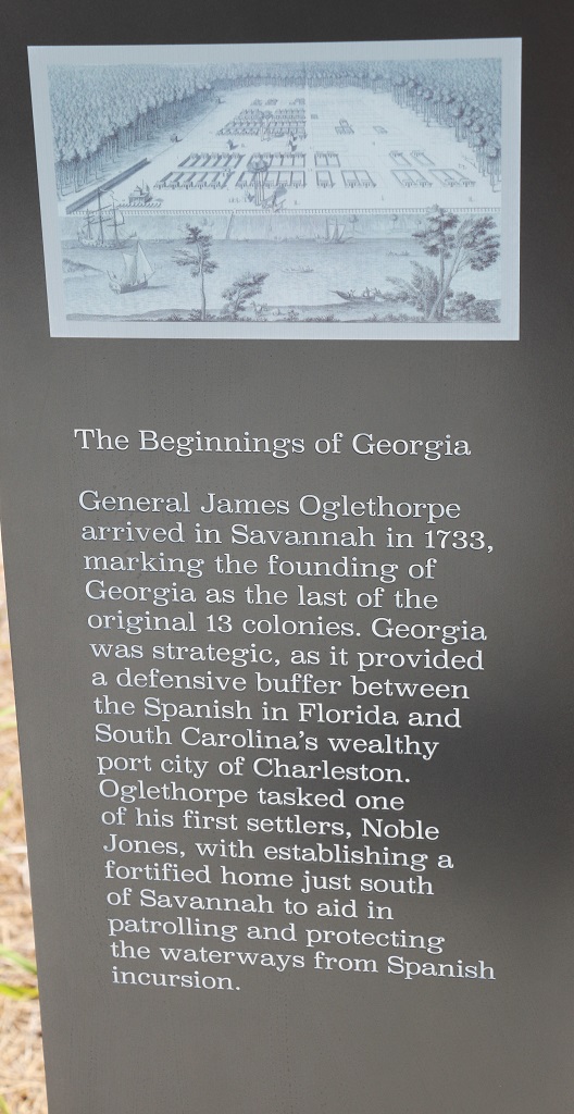
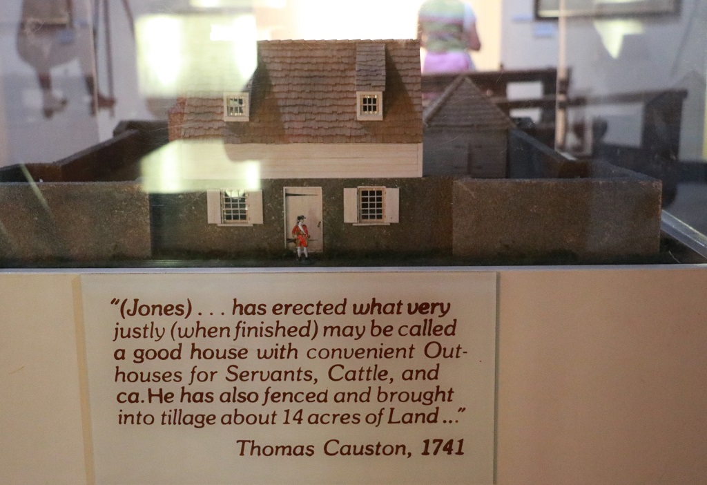
After our nutritious lunch we drove to the Wormsloe State Park. Wormsloe was the name of the village in Wales that Mr. Noble Jones hailed from and that he called his estate. He tried unsuccessfully to grow several types of crops on the marshy low country but finally settled on a dairy. He was granted 500 acres of land by King George III if he promised to raise a small militia force to protect the area from raiding Spanish. Over time he acquired 1400 acres. Several generations later the family created a Foundation but lost their charitable tax status and made a deal with the State of Georgia in 1977 to retain the mansion, several guest cottages and the dairy barns along with 75 acres of land and donate the remaining 1325 acres in lieu of back taxes with the provision the land be kept in it’s natural state in pertutuity. The Department of Resources did build a Visitor’s center by the road but other than that the land is untouched and undeveloped. The 8th generation of Noble Jones still live in the big house and are very involved in many area and state preservation societies. Noble Jones told his children and grandchildren they were never to sell the land – It had to be kept forever and through the State Park system it now will be.
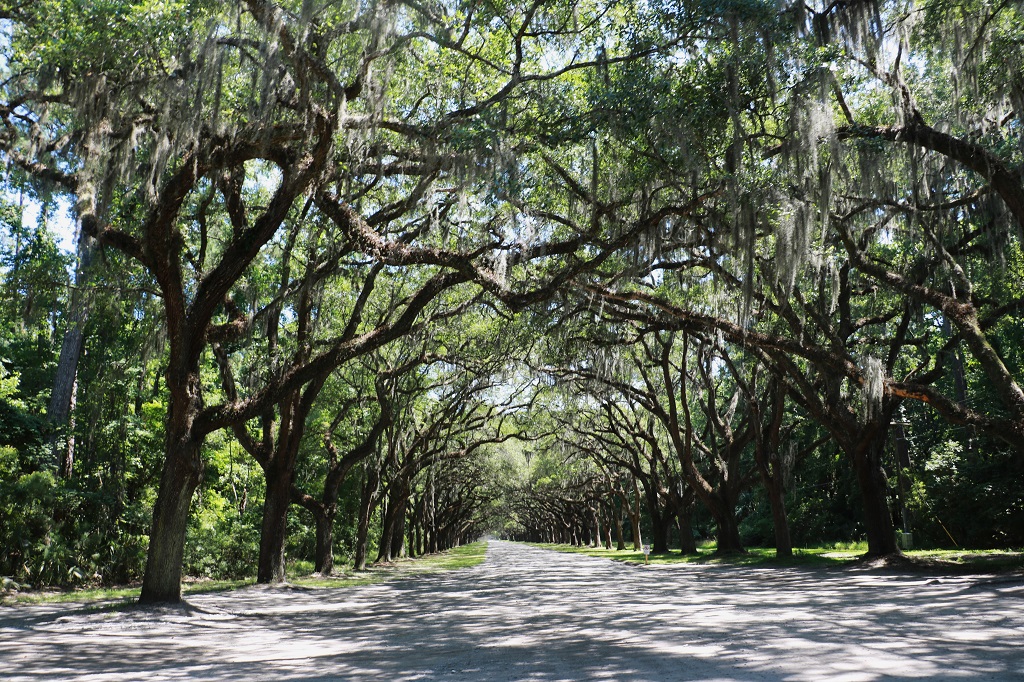
Noble Jones planted 400 Live Oak trees on the property. The one and a half mile lane is now lined with 130-year old trees. Live Oaks mature at about 300 years and can live up to 500. Their branches spread out great distances from the truck (sometimes they will touch the ground and then the tree is referred to as an Angel Tree) and the roots underground also spread long distances. This means the bumpy gravel roadway to the museum and the tabby ruins will never be paved as the disturbance to the roots would kill the trees.
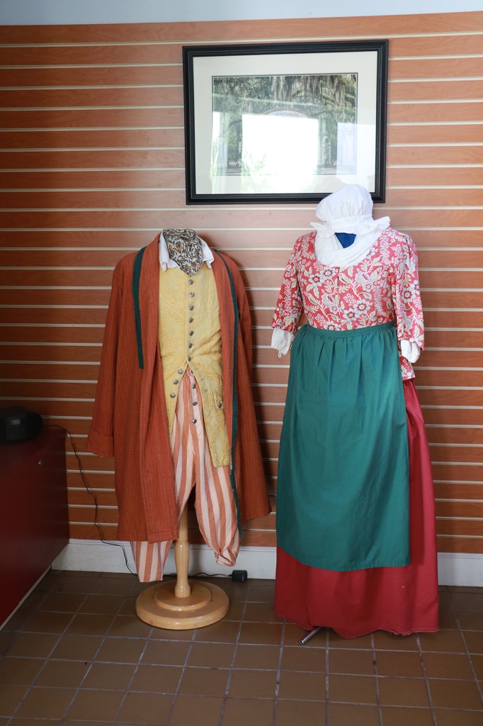
I just took a few photos in the museum. John walked the extra distance to the tabby ruins but there were only a few foundations to show where all the oyster shell bricks that were used in the Jones house, and later mansion, and barns, etc. had been made.
We got the last shuttle back to the Visitor’s Center at 4:45 and drove over to Bonaventure Cemetery, which is called ‘the most beautiful cemetery in the world’ but they were just locking the gates. If we have time after we visit the Prohibition Museum and Old Fort Jackson tomorrow we will try again to take a drive through it.
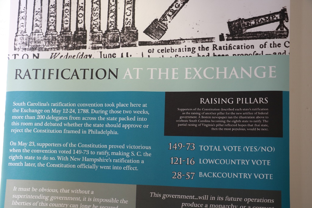
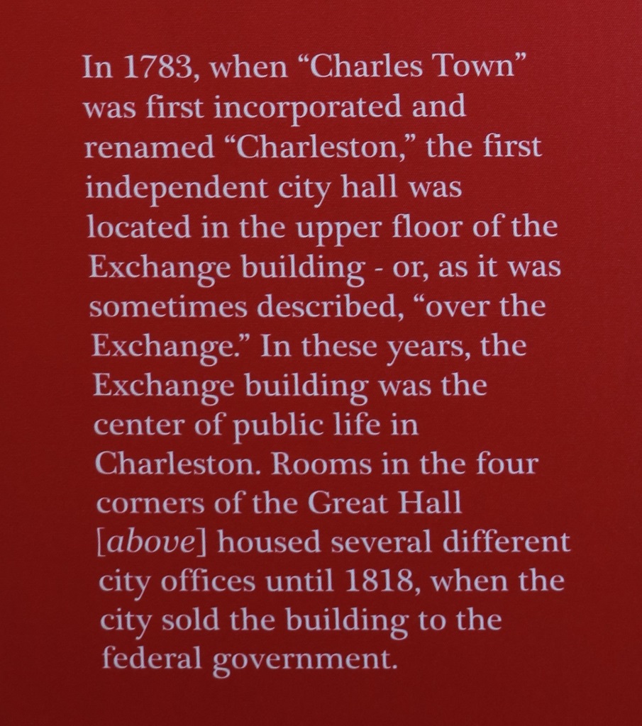
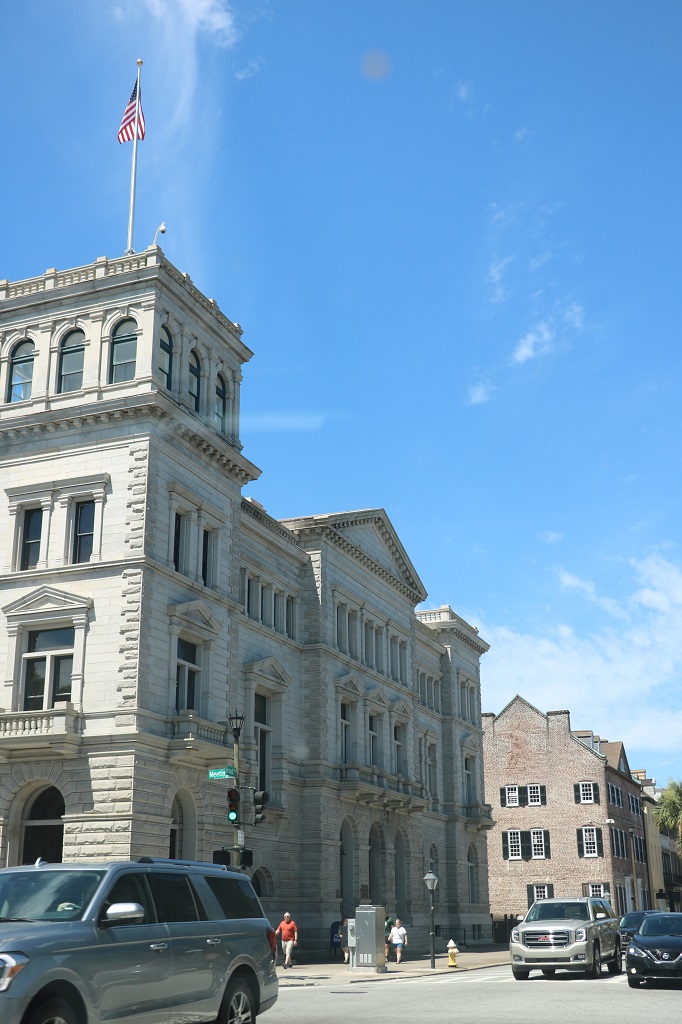
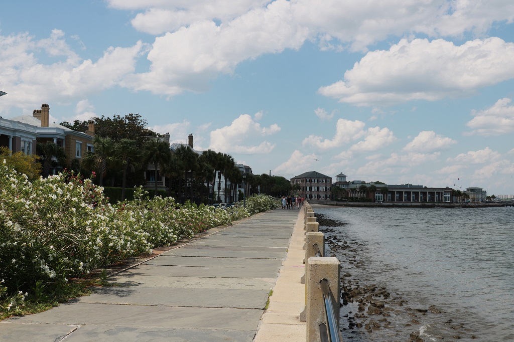
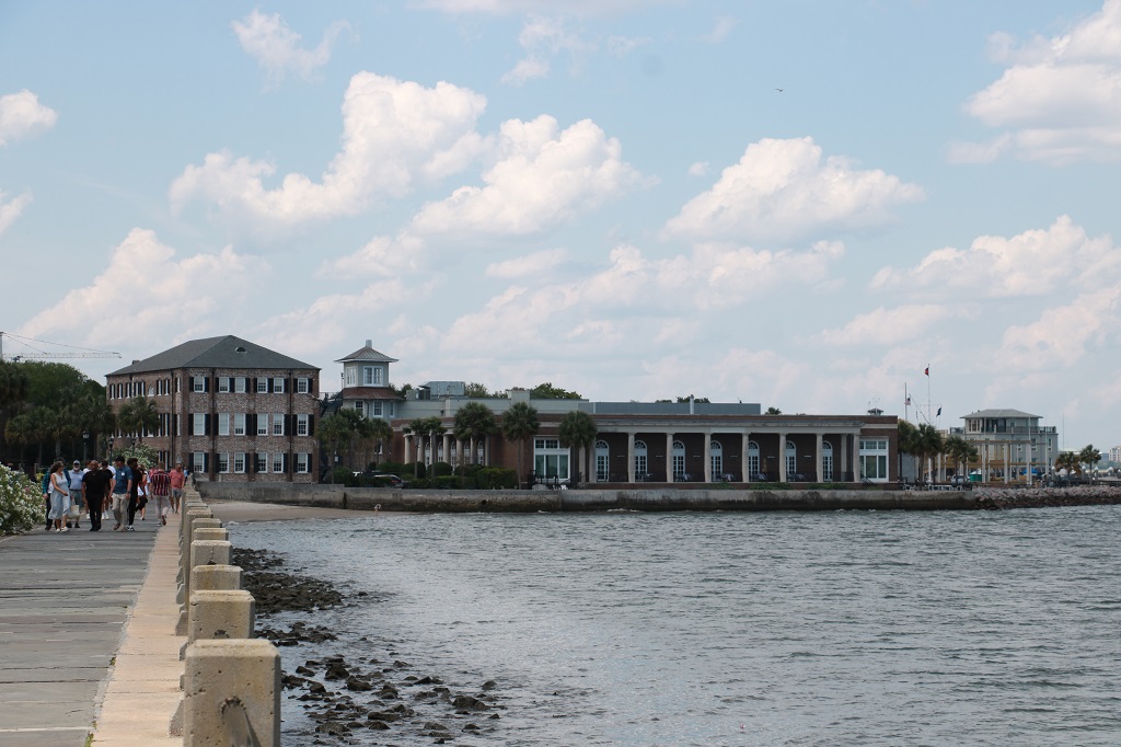
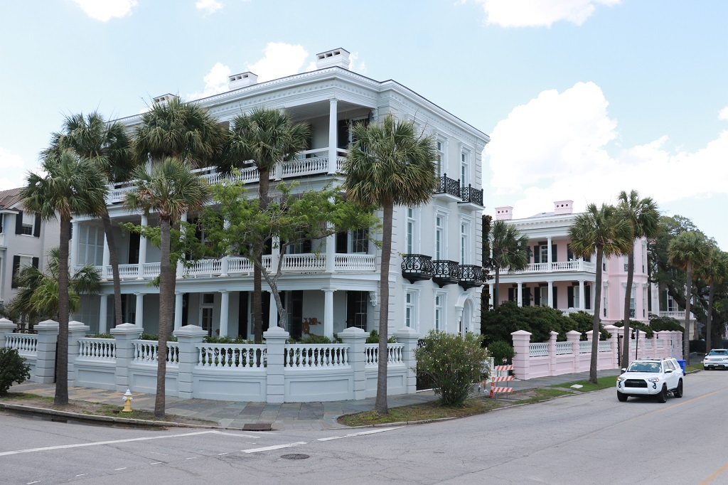
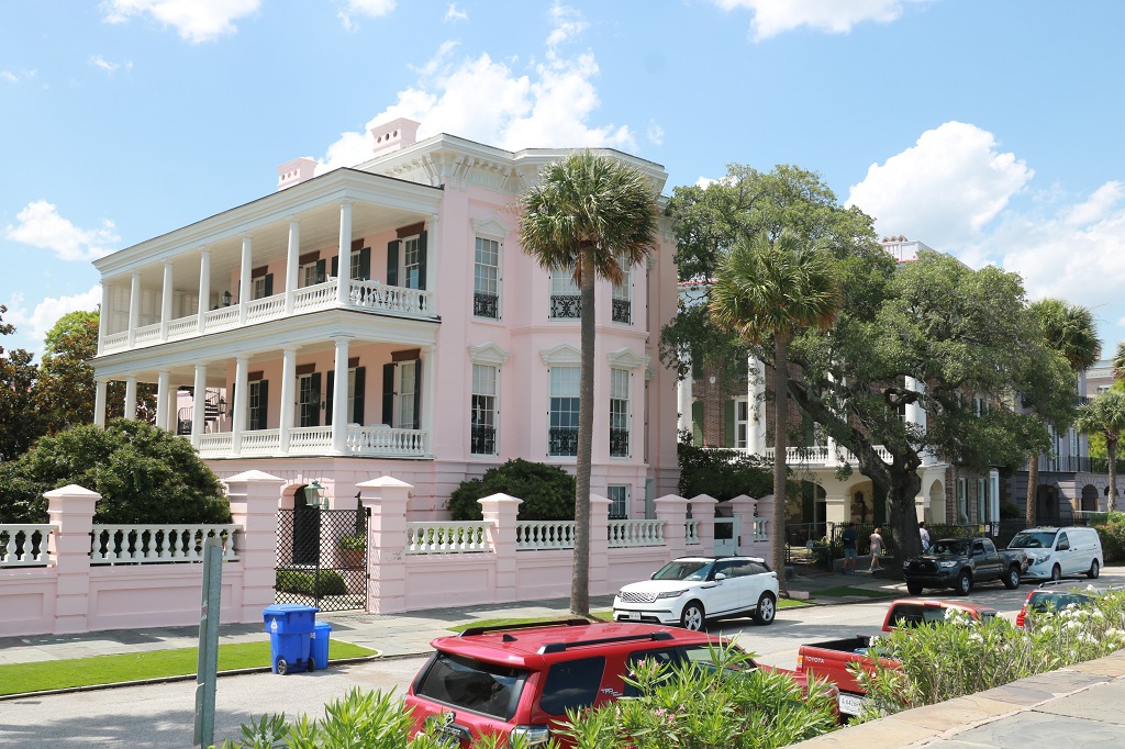
Before we left Charleston we went to see the iconic Pineapple Fountain at Vendue Wharf and the Exchange House & Provost Jail.
This is the view as we drive from our hotel in Mt. Pleasant and cross the bridge to Charleston. The area is very flat. This whole coastline is called the Low Country and the water table is very high. Water and marshland are everywhere. The city skyline is not high either. There are no skyscrapers in Charleston. There is a law that no building can be higher than the highest church steeple. And there are lots of steeples to choose from. Historic Charleston had 182 churches.
The Pineapple Fountain was built in 1990 and quickly became a favourite image of Charleston.
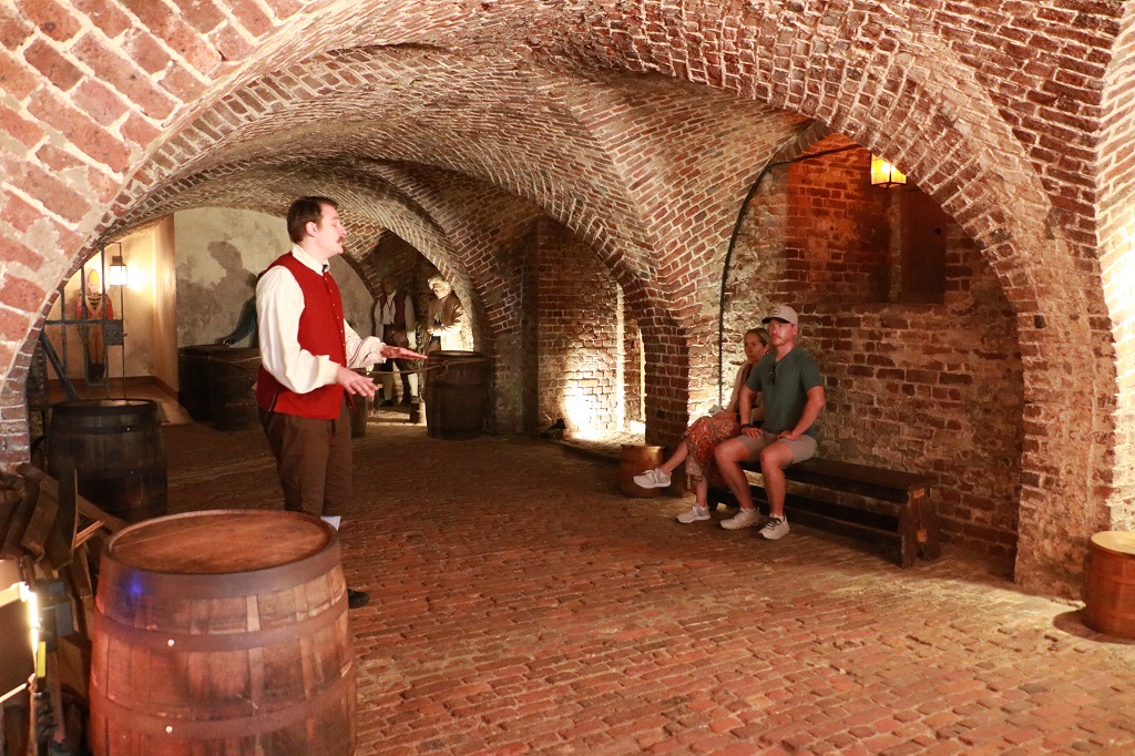
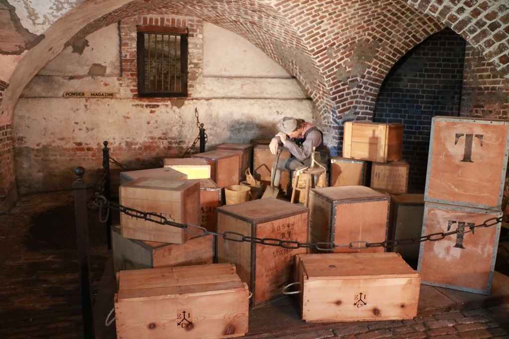
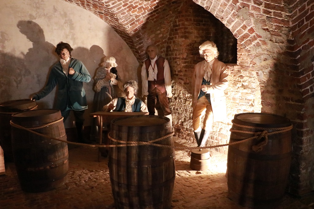
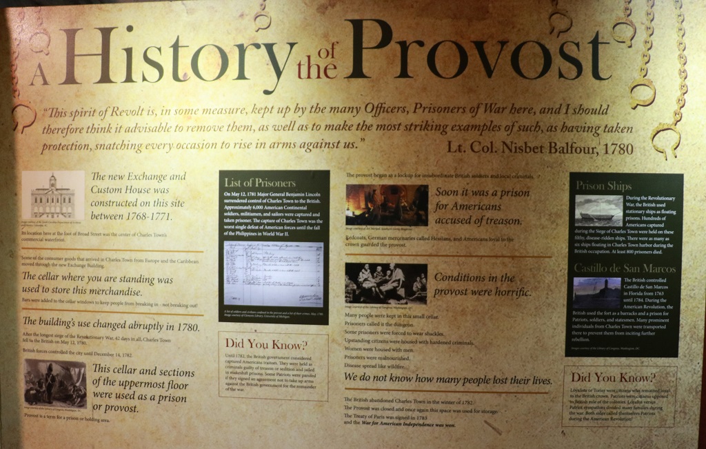
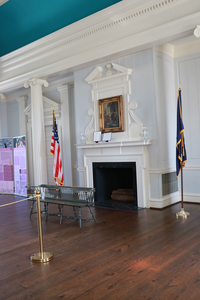
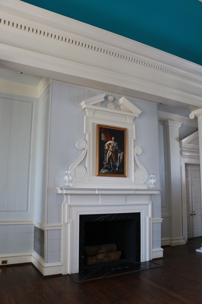
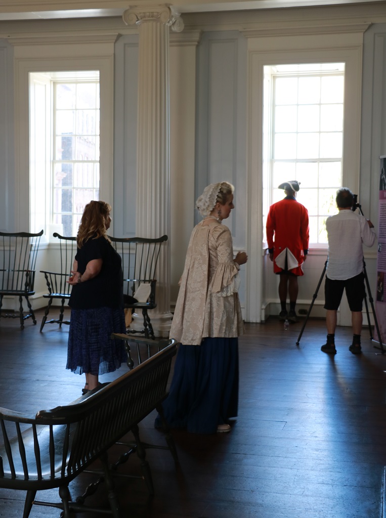
We arrived at the Exchange House and Provost Dungeon just as the tour was beginning so we hustled down to the lowest level. The jail (called a dungeon by the prisoners, not the city) was where everyone from someone who gave insult to a prominant citizen to murderers and career criminals, to slaves and women were all kept together in one not-very-big open space. The original use for the rooms under the Exchange House were to store the goods that were being bought on the exchange floor above. The guide gave a very interesting talk about all the different uses that had been made of area over the many years of the building’s lifetime.
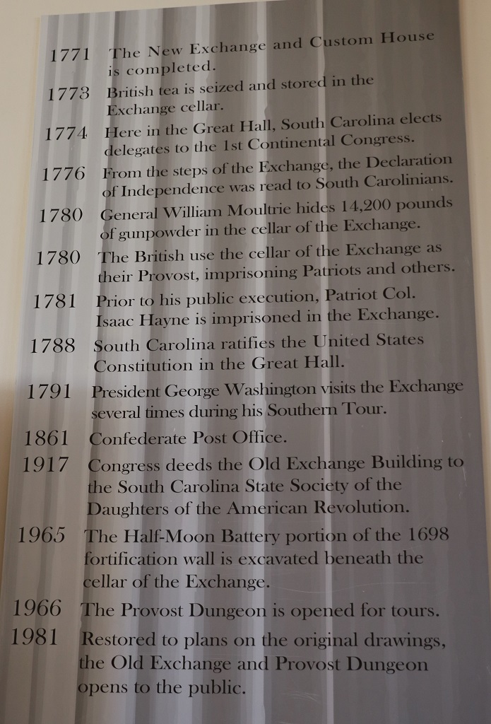
During the siege of Charleston in 1780, General William Moultrie moved 14,200 pounds of gunpowder that had been stored in the Powder Magazine to the basement of the Old Exchange and bricked it up to keep it safe. It was hidden in a room behind the grated window. They built a false wall in front of it and stacked crates in front of the wall. When the British commandeered the building for their headquarters and made the cellar into a prison they never discovered the false wall and hidden gunpowder. After the Americans liberated the Exchange in 1782 the gunpowder was discovered. Two-thirds of it was dry and still good!
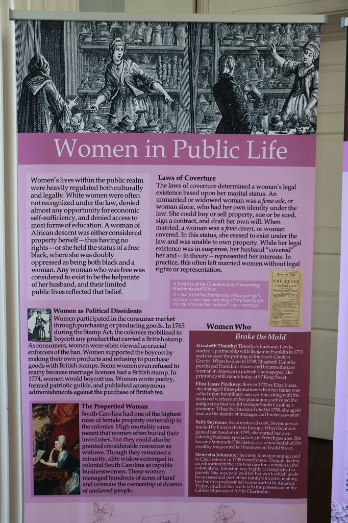
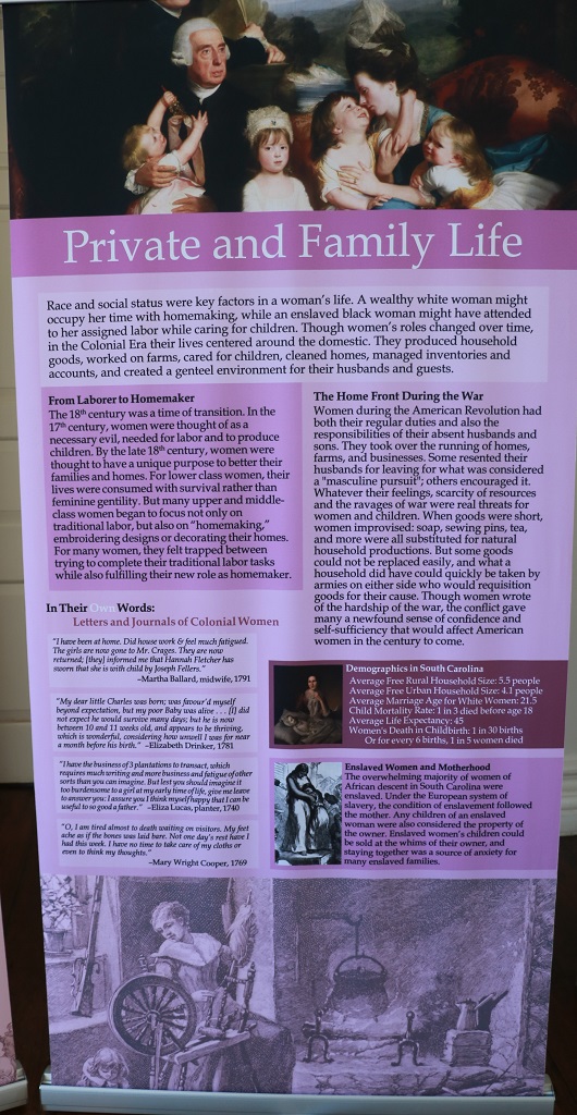
After the dungeon tour we walked through the other two floors that contained various information boards and artifacts from the buildings many and varied uses.
These next two information boards have quite a bit of stuff on them. If you want to read it all you may have to zoom in. I found it very interesting but I was too lazy (and it was getting late) to crop all the bits into separate images.
The Exchange House was being used to film a new season of a TV show and the “soldier” and woman were about to be filmed for a short shot. She looked so nice we asked if we could take her photo and she happily agreed
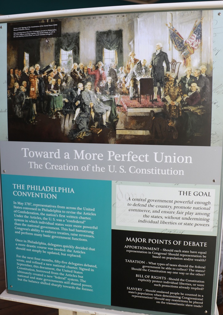
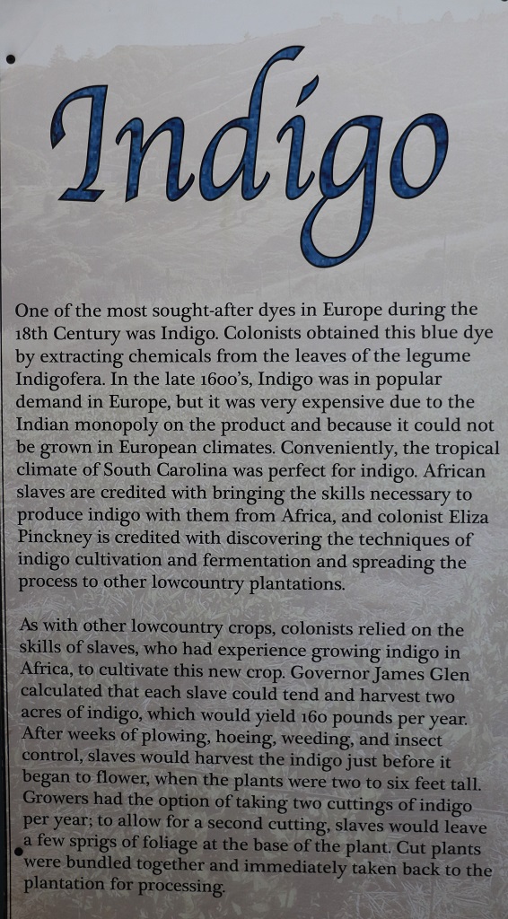
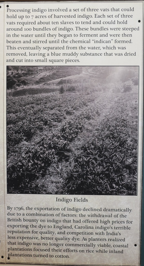
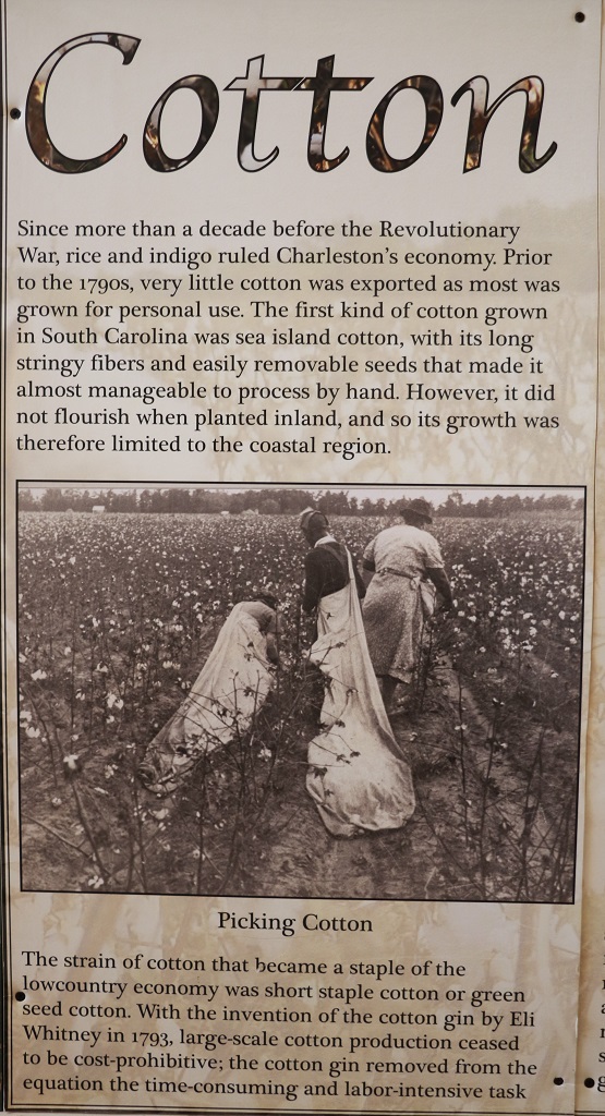
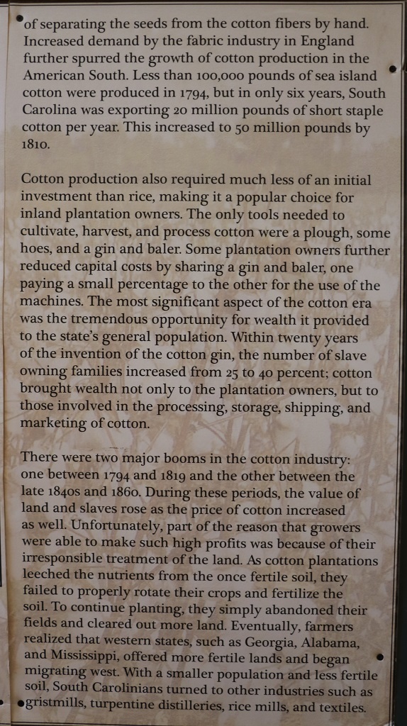
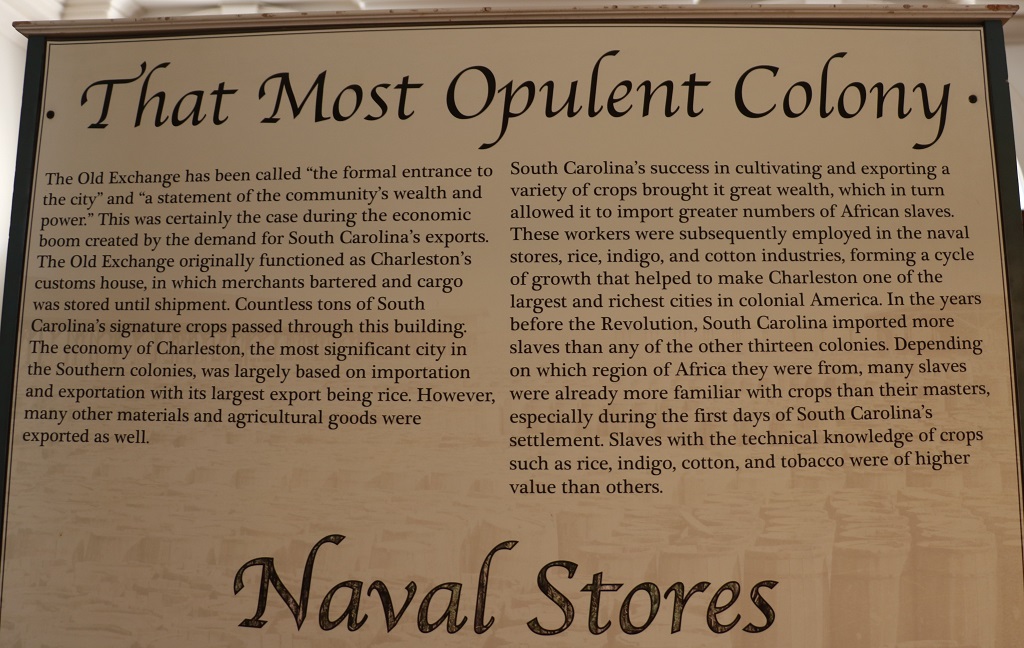
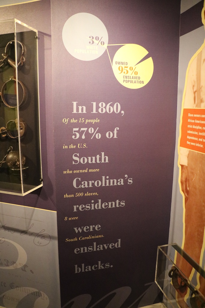
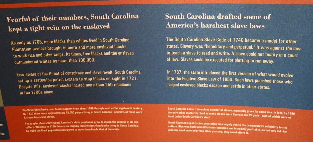
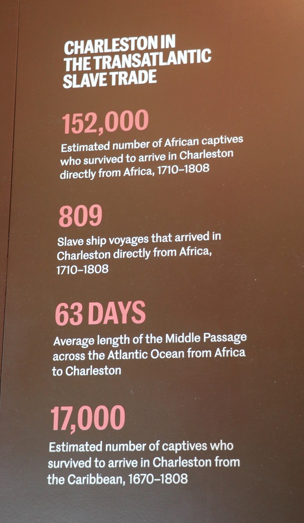
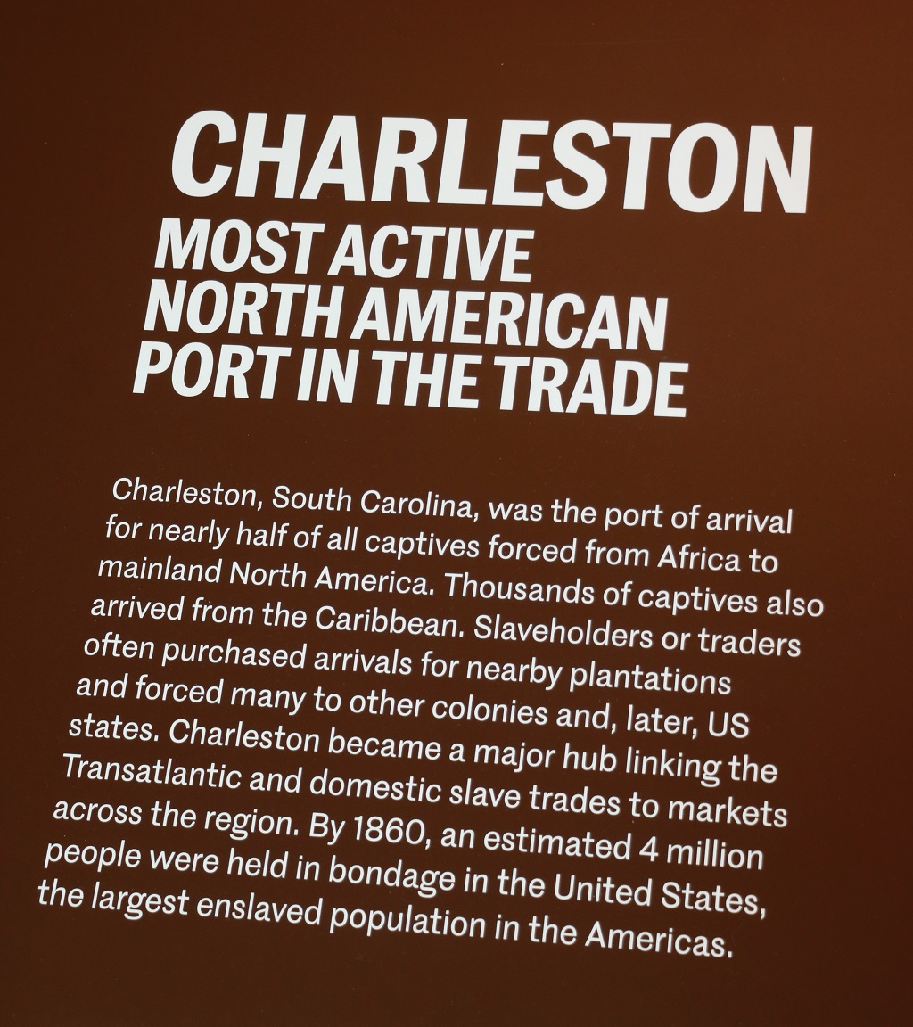
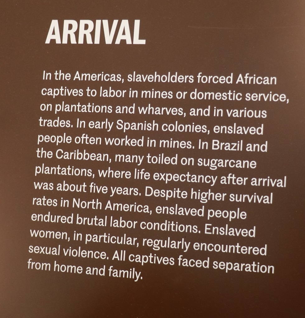
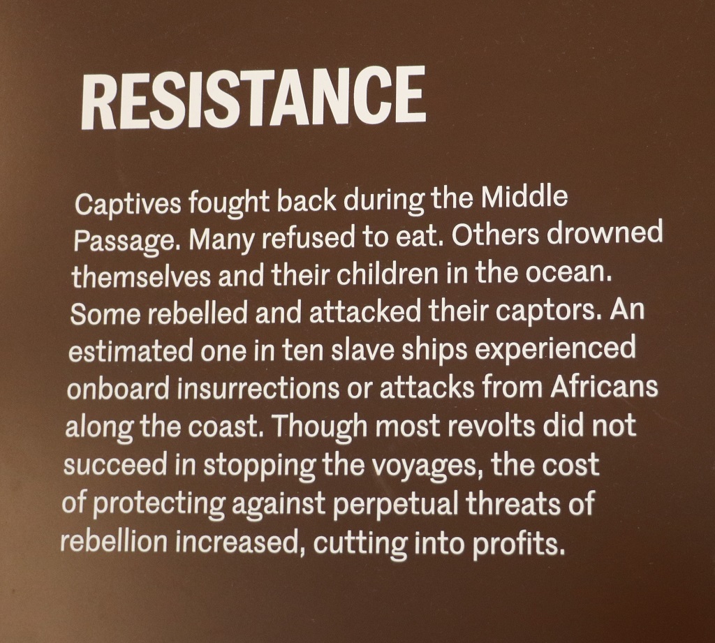
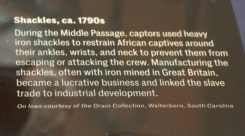
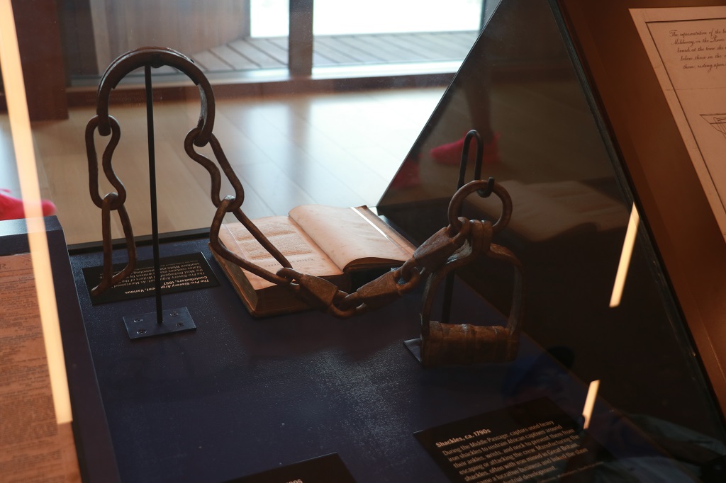
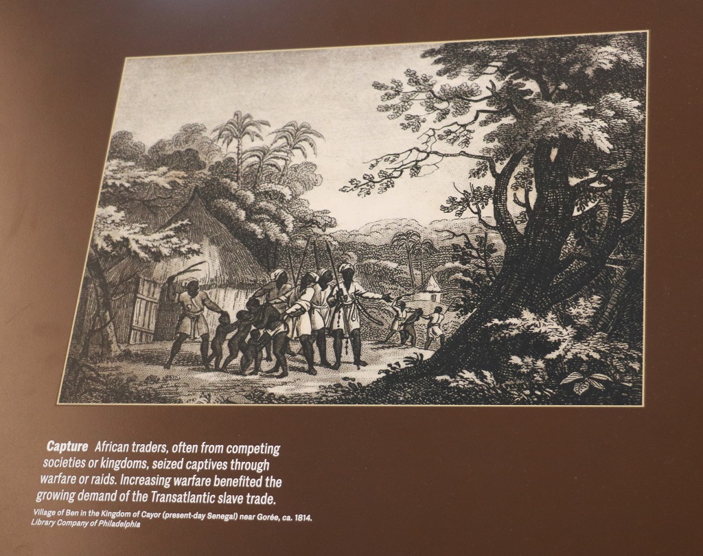
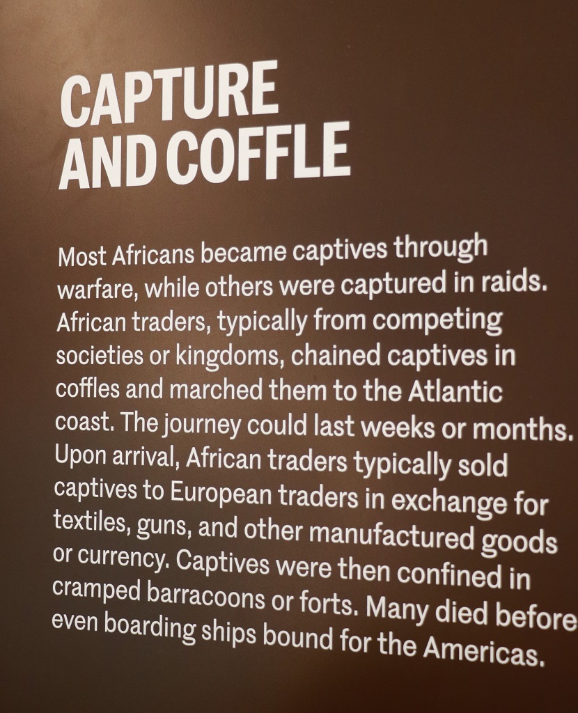
I have included the next several information boards because they tell a lot about the three crops that made Charleston the wealthiest city in the country. All of them were produced on the backs and using the knowledge of the slaves.
The top paragraph of this last photo tells about the massive increase in the production of cotton in South Carolina. This was due to the invention by Eli Whitney of the cotton gin. It would take a slave all day to clean one pound of cotton by hand. With a cotton gin he could clean 50 lbs in a day!
We drove out of Charleston at 11:30 and headed south.
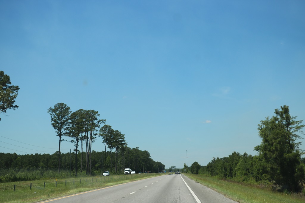
Driving down here in the south is like driving across the prairies – with trees. Long straight roads and very flat.
And marshes all along the road. Or the road goes through a big marsh.
It is about a two-hour drive from Charleston to Savannah, Georgia. We stopped at the Steel Bridge Landing (a boat launch area) and had our peanut butter and jam sandwich lunch and stretched our legs a bit. This is the Ogeechee River.
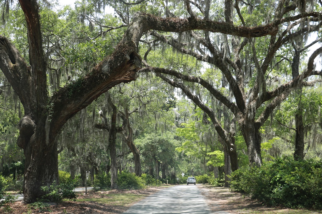
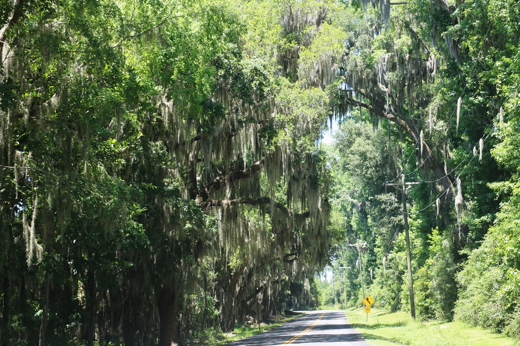
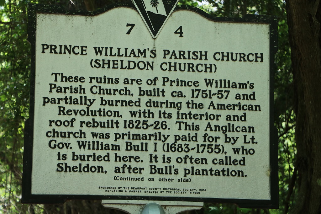
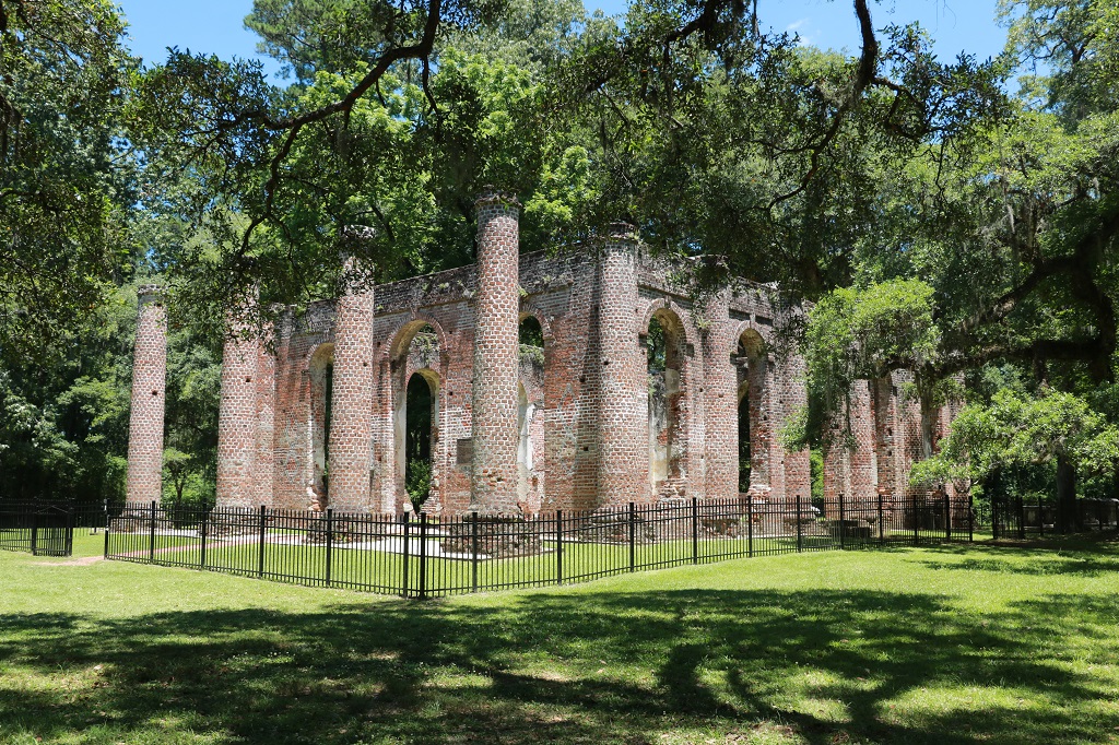
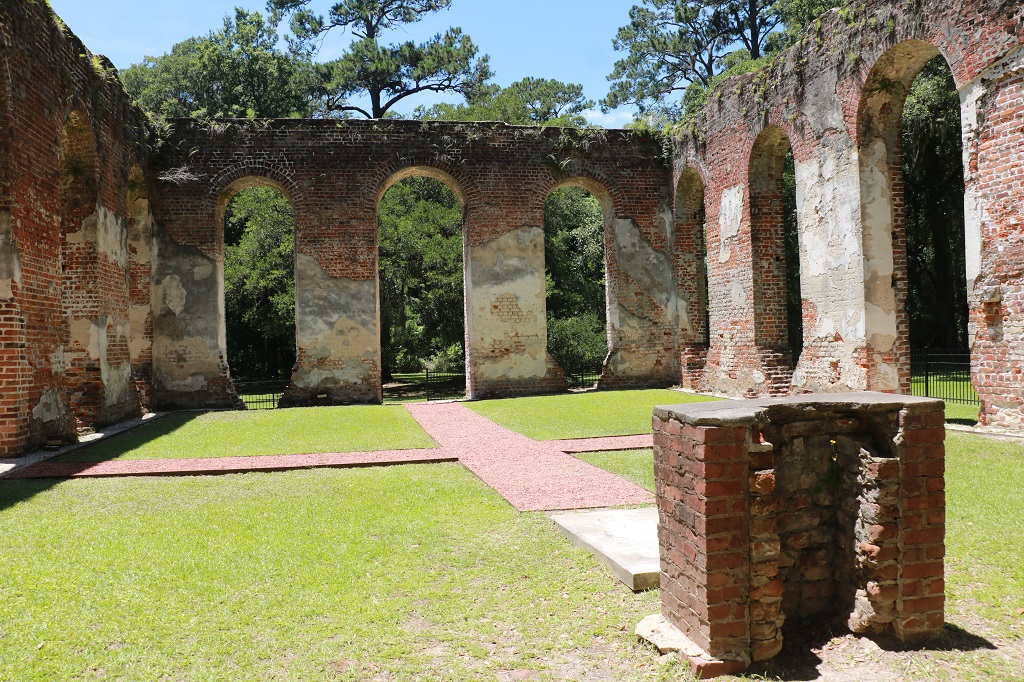
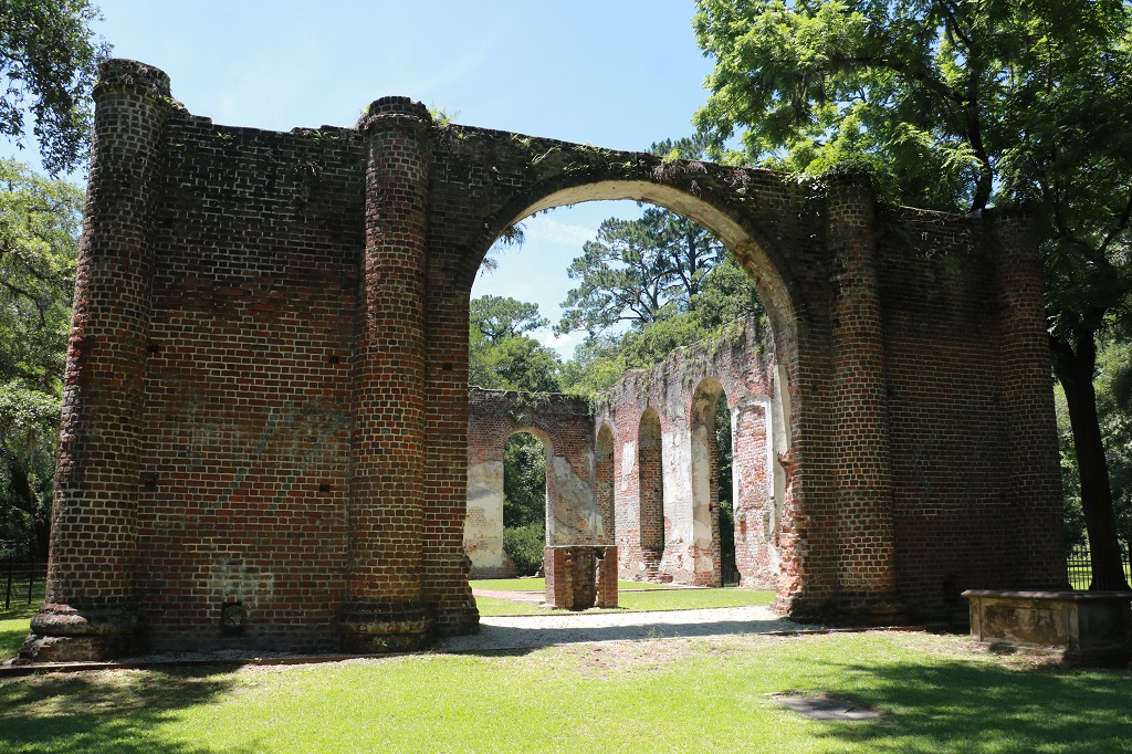
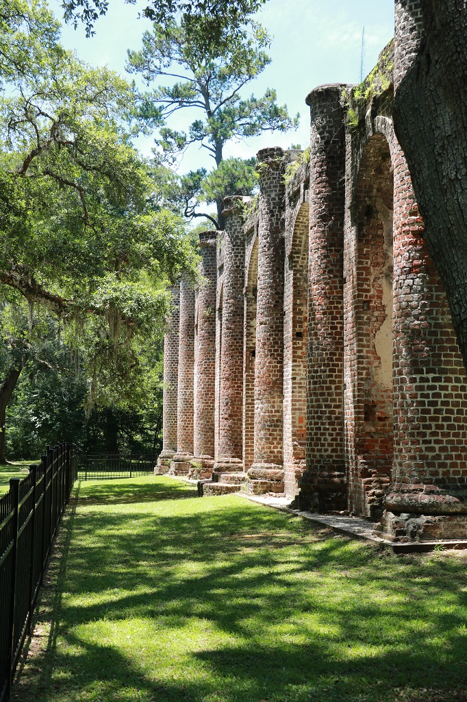
We wanted to see the Old Sheldon Church ruins so we put the name into Mary Lou’s system. My notes said it was located 2 miles off Highway 17 but Mary Lou had us drive 8.9 miles down River Road, then she directed us up about 2 miles and then back the way we had come for almost the 8 miles again along the Old Sheldon Church Road. We got a nice tour of the countryside and I did like the Spanish Moss hanging off the Live Oaks.
We left the church at 2:30 or so and drove about 2 miles further down the road to regain the highway. We assume Mary Lou took us the long way so we would arrive with the church on the right side of the vehicle and we would not have to turn around. That’s what we came up with anyway. It was about another hour to Savannah, which is very near the South Caroline/Georgia border. Another new state. We need to find a geocache…
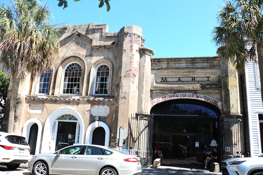
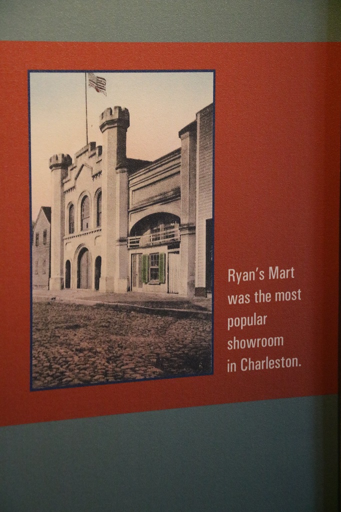
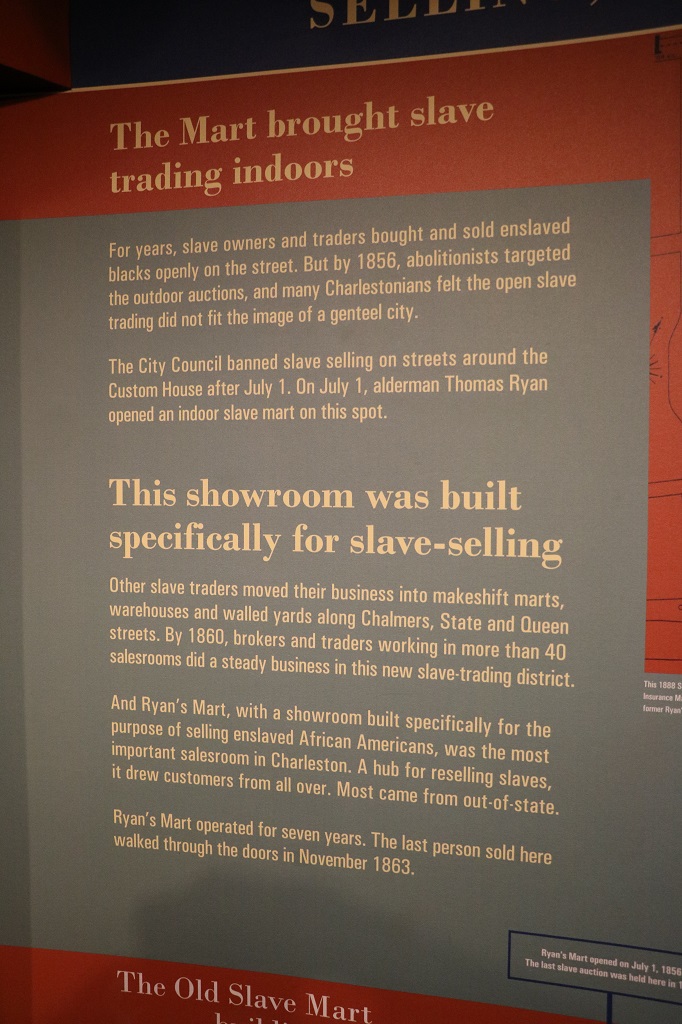
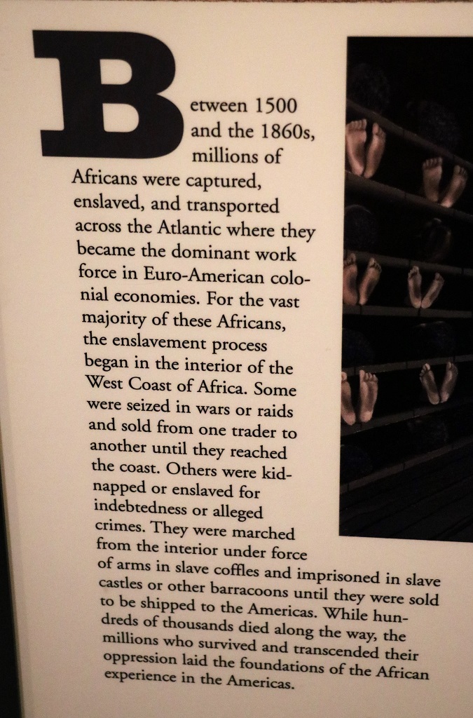
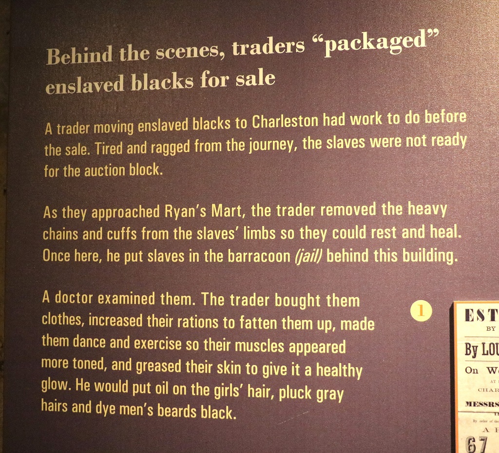
We had tickets for the ferry and access to Fort Sumter for noon so we had time to go to the old Slave Mart first. It, like the International African-American Museum had lots and lots and lots of informational placards and few artifacts. So, apologies, this part of the blog is mostly reading. We arrived at the same time as 50 Grade 6 students on a field trip. The museum was two floors so the kids were split up half up and half down, still the space is not that big so we had to do some dodging. They were polite kids with attentive teachers so there was no problem wandering around with them.
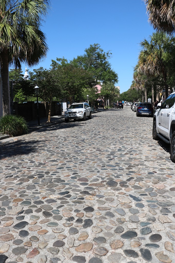
Not too far from the Old Slave Mart we had to traverse a bumpy cobblestone section of street.
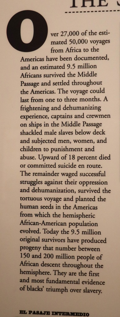
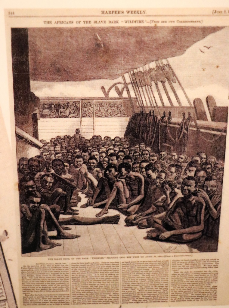
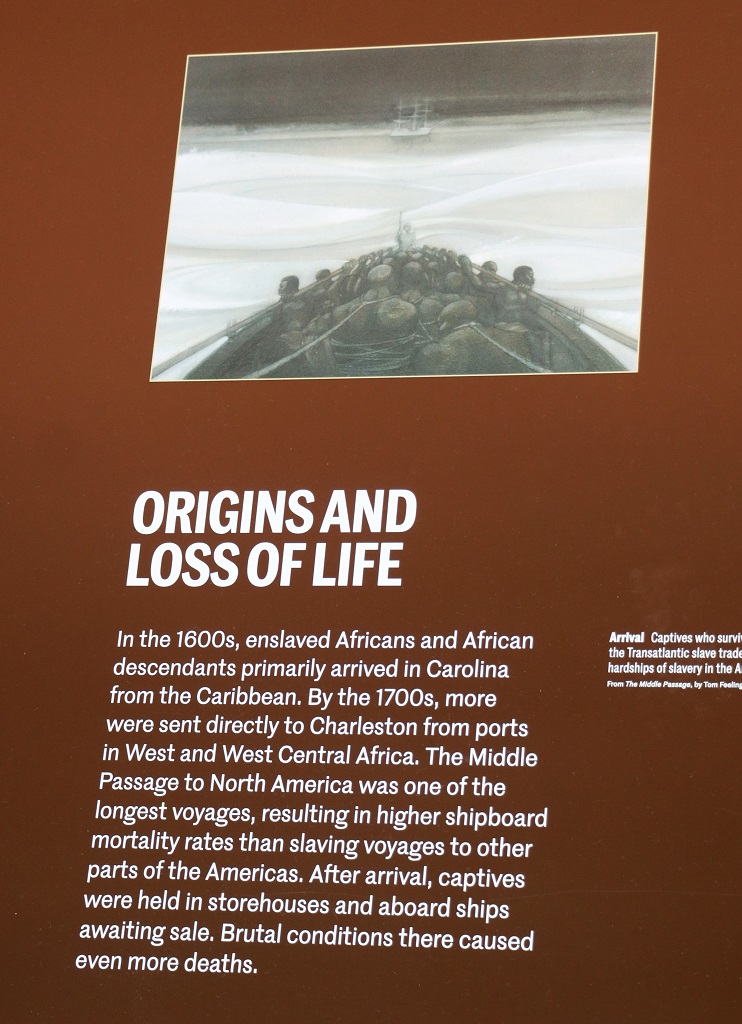
Below is a horrifing rendition of the lower decks of a slave ship. The trip across the Atlantic could take from one to three months. Thousands died.
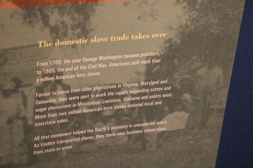
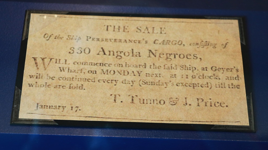
What I did not know was that there was a thriving market for American-born slaves.
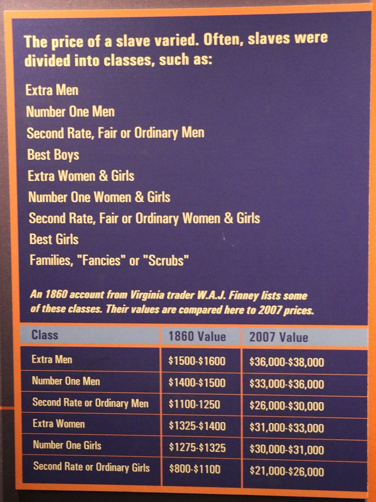
Slaves, especially young strong ones, or women in child-bearing years were expensive. It was not uncommon to pay half the price at the time of purchase and carry a loan for the other half that was payable in a year. The bar along the left side of the image below shows the price per age beginning with a 1-year old for $100 down to 60-years old for $50. Thr most expensive was a 20-year old. The longer your ‘earning’ potential or the better your skill the higher the price. Since many of these slaves came from the north they had training in many things like carpentry or blacksmithing. The African slaves were prized for the plantations because they knew how to cultivate rice that quickly became a lucrative cash crop for plantation owners.
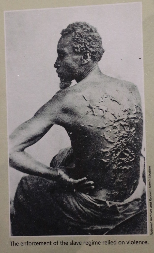
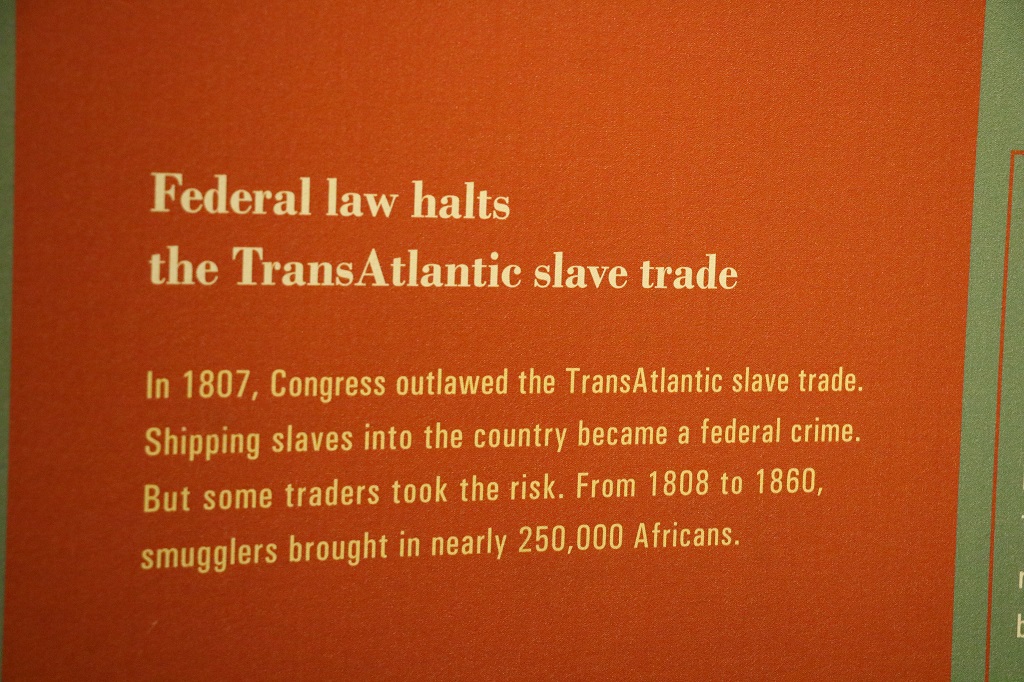
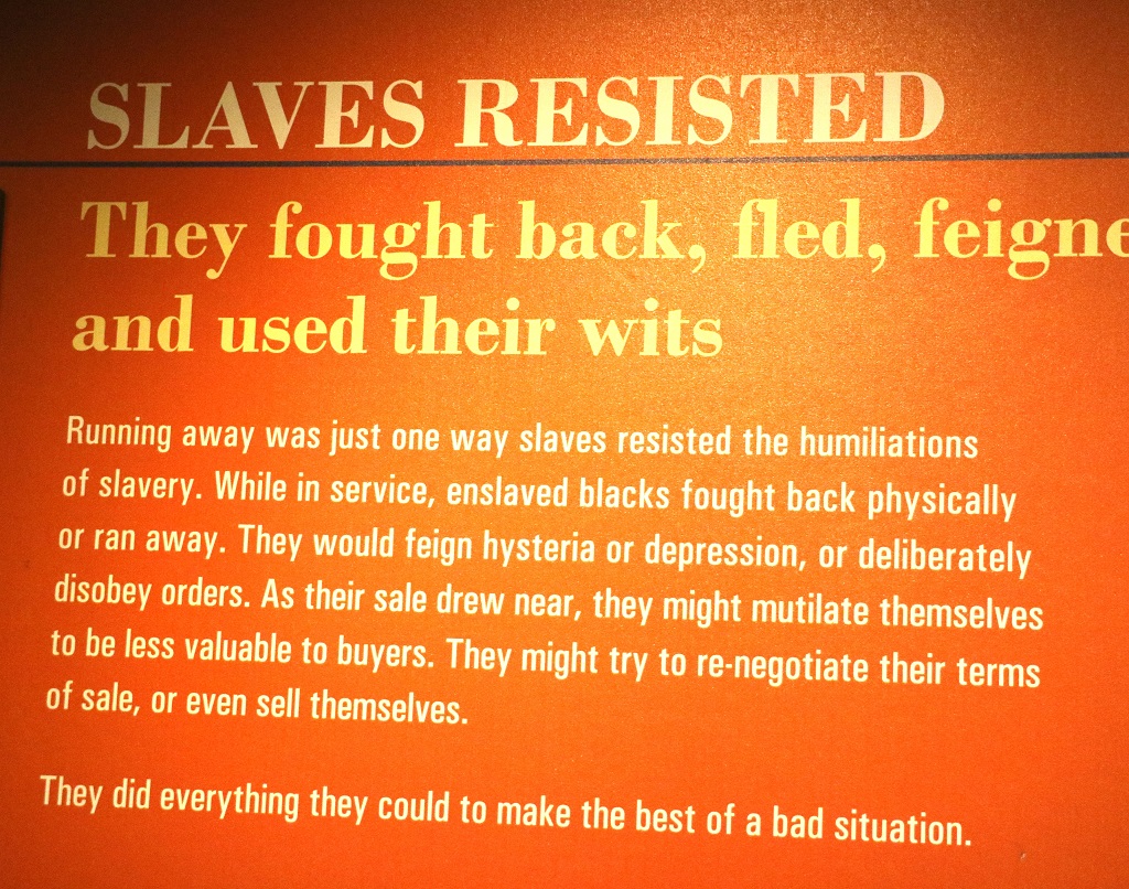
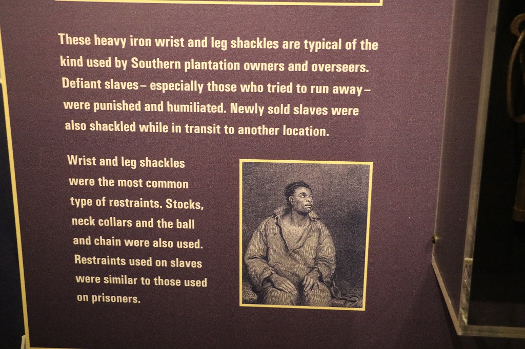
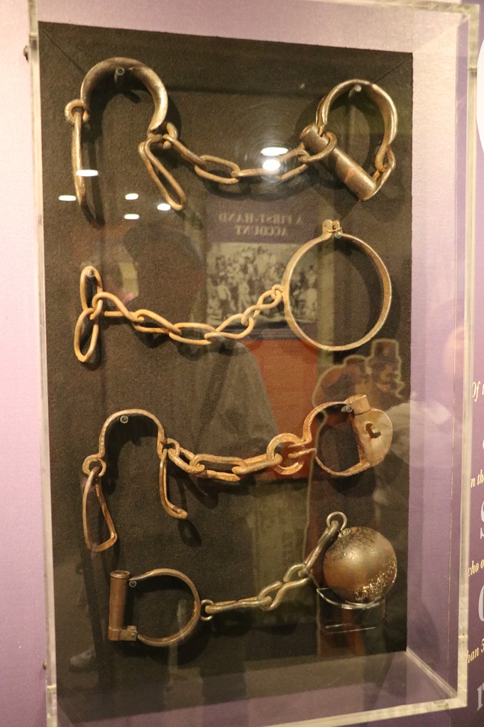
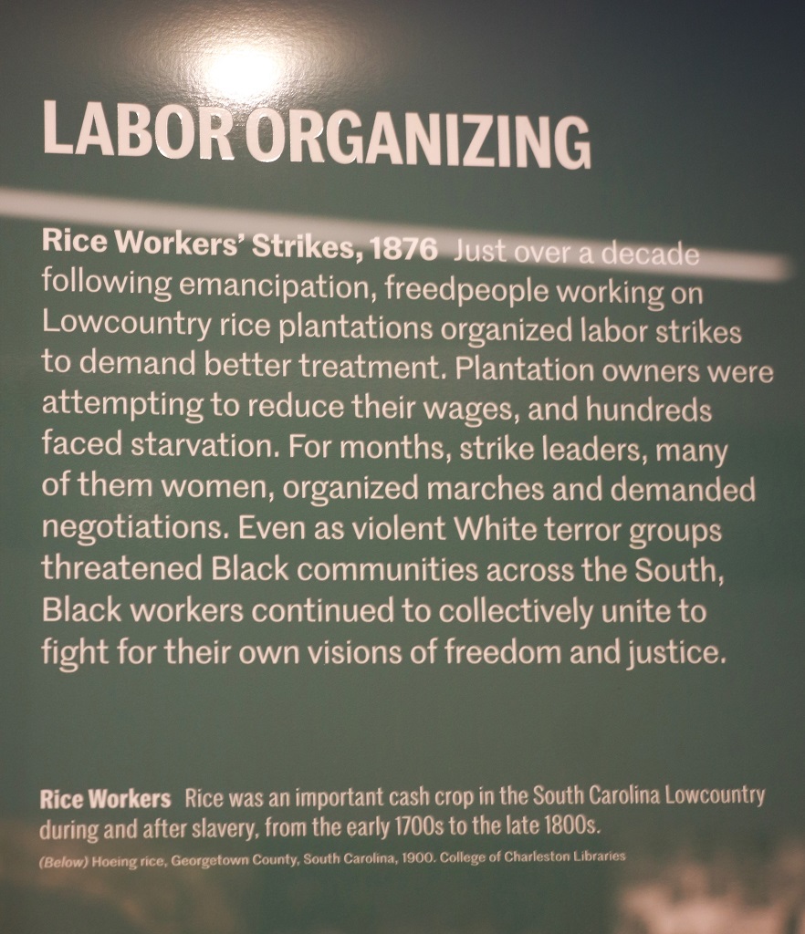
There were many uprisings and strikes among slaves in factories and on plantations. Nothing changed in their lives – if they survived the punishment – but there was often resistance and attempts to improve their situation.
We left the Slave Mart at 11:15 and had to be at the ferry dock at 11:45. Good thing our Nav system – who we have named Mary Lou – is good at directing us to parking garages. We arrived with enough time to gather in the long line to await permission to board.
It is a fifteen minute ride to Fort Sumter. Along the way a National Park guide noted points of interest along the shore and then gave a succinct short lecture on the significance of Fort Sumter.
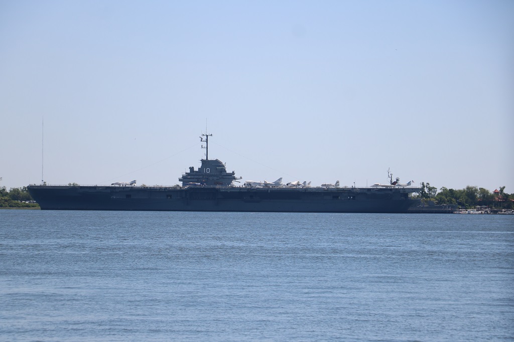
This isn’t a very good photo – long lens and glaring sun. The U.S.S Yorktown aircraft carrier and a WWII destroyer and a submarine are moored at Patriot’s Point and can be toured.
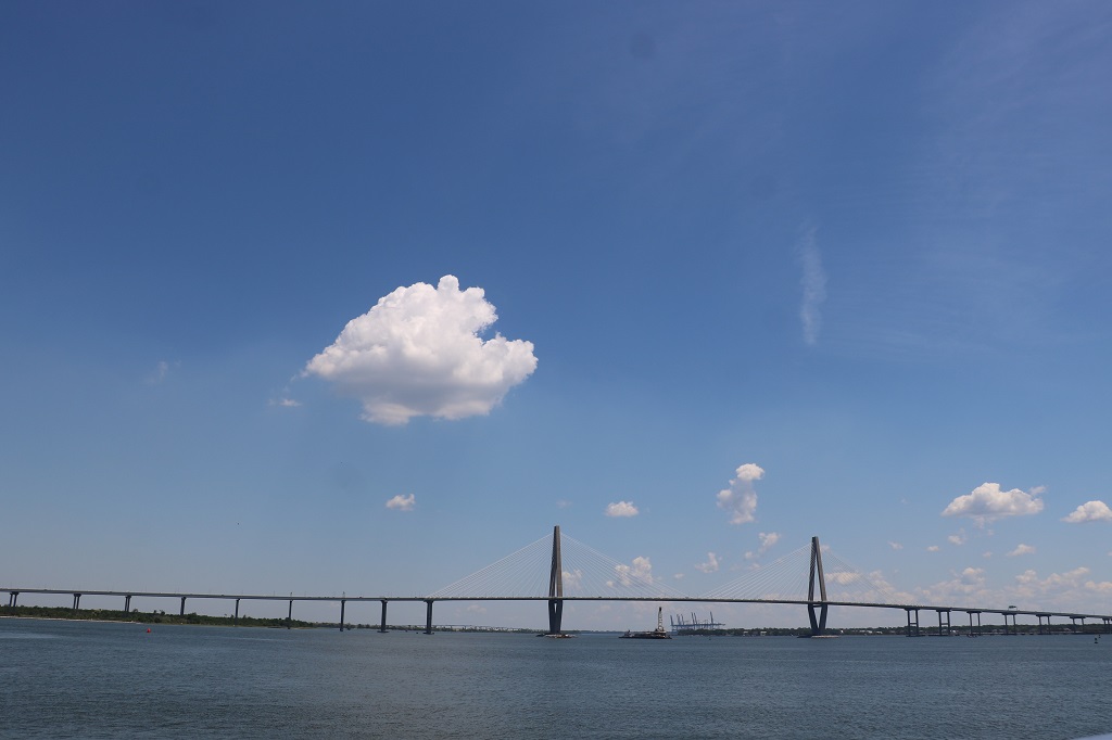
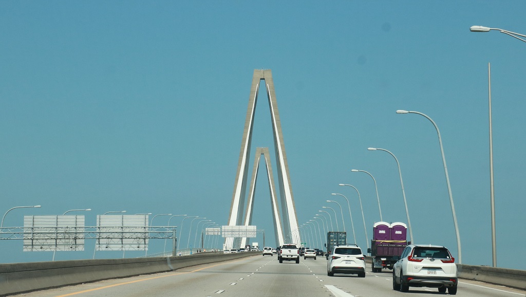
The Arthur Ravenel Jr. Bridge that connects Mt. Pleasant with the peninsula on which Charleston is built.
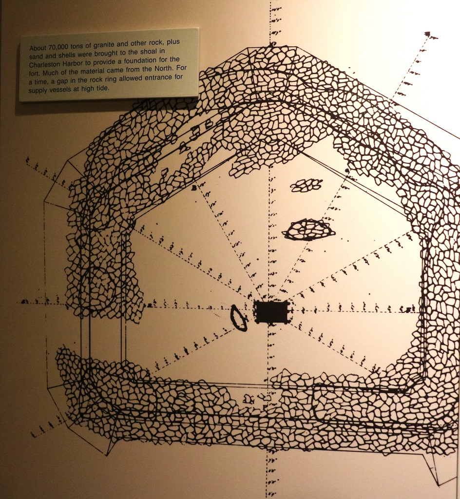
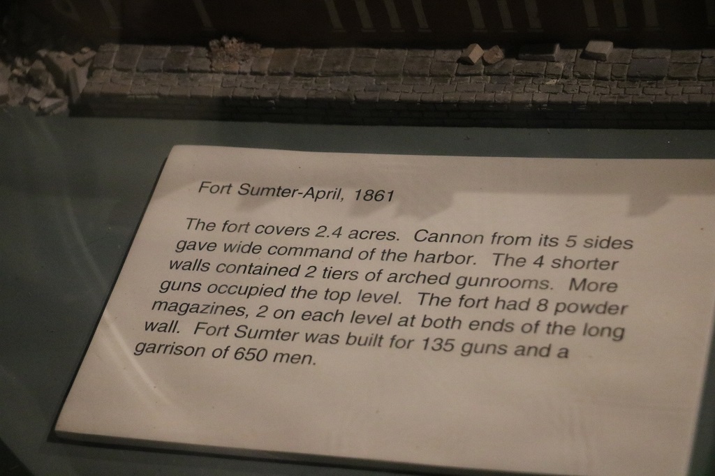
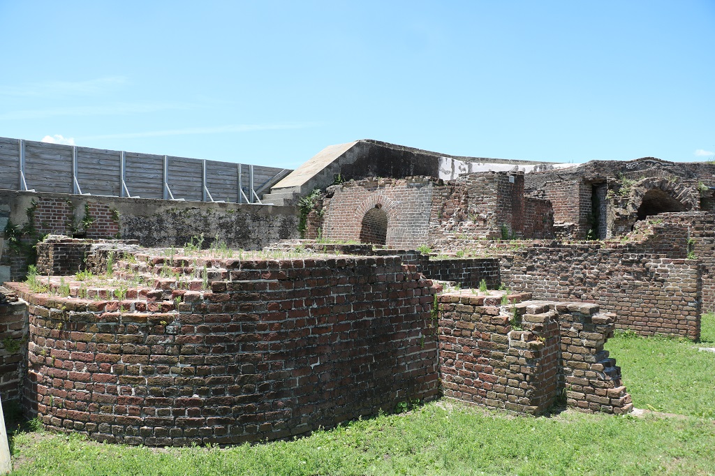
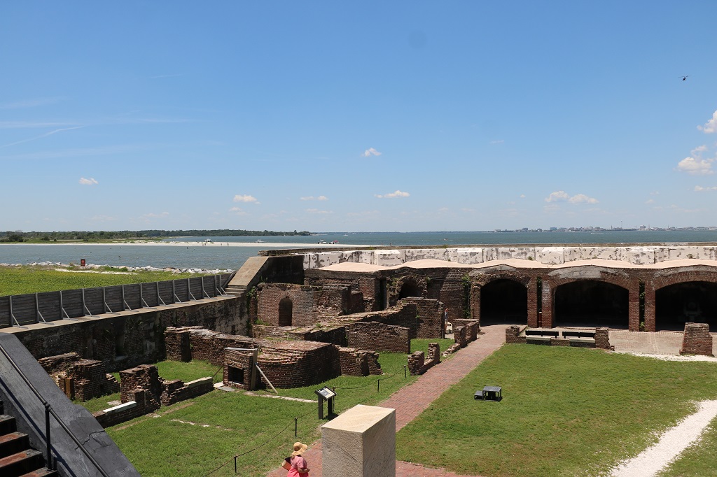
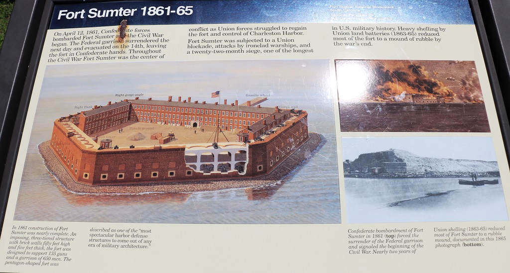
Fort Sumter is a National Park but you can only access it by taking a Fort Sumter Tour that runs the ferry to the island. The fort itself is the island. There is almost no additional land outside the walls. The current walls are about a third of the original height afterthe damage caused by all the shells that were lobbed at it during the Civil War.
It took 15 years for enslaved men to dump 70,000 tons of granite and other rock, sand and shells into the Charleston harbour to create the foundation for the fort. And another 15 years to build it.
The walls were 50′ feet high and 15′ thick. Enslaved men did not build the walls but they did make the approximately 4 million bricks that were needed.
Amazingly no one was killed during those 34 hours.
This huge installation was added to the middle of the fort much later. There were two massive guns on top. By the time WWII came about they were obsolete so were removed and melted down for war material.
We arrived back in Charleston at 2:20. When we purchased our tickets to the Old Slave Mart we were able to buy a double ticket that also lets us into the Old Exchange and Provost Dungeon. We had thought to do that after we returned from Fort Sumter but my legs and feet were too sore so we headed back to the hotel to rest, sort photos, and make some decisions about our time in Savannah. We plan to go to the Exchange in the morning before we leave Charleston. We will be spending three nights in Savannah.
Good day. Long blog. You might want to split it into two sittings.
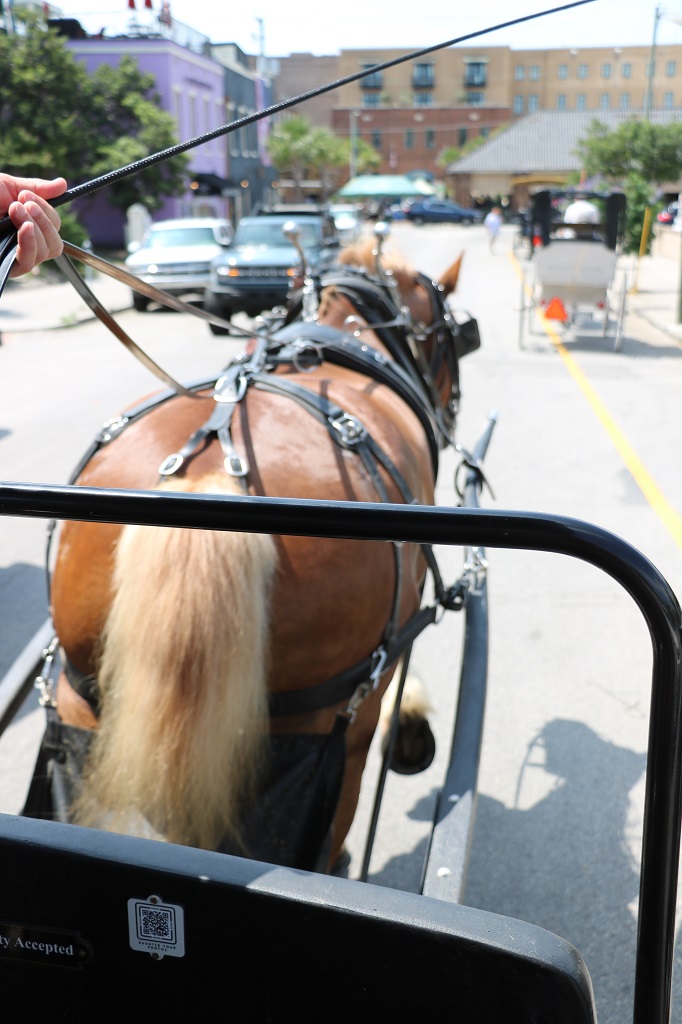
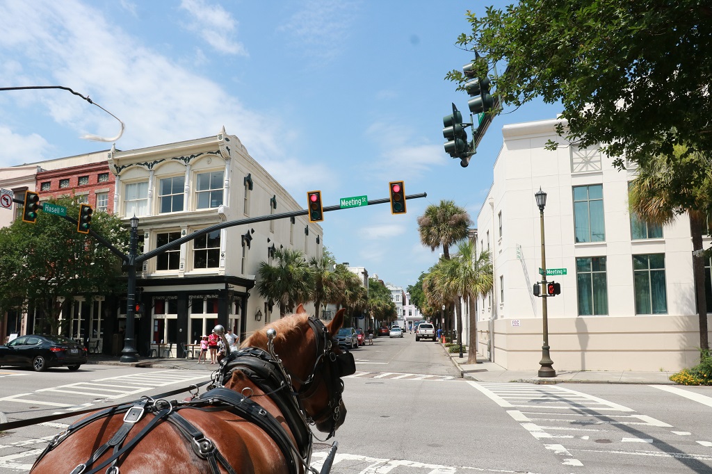
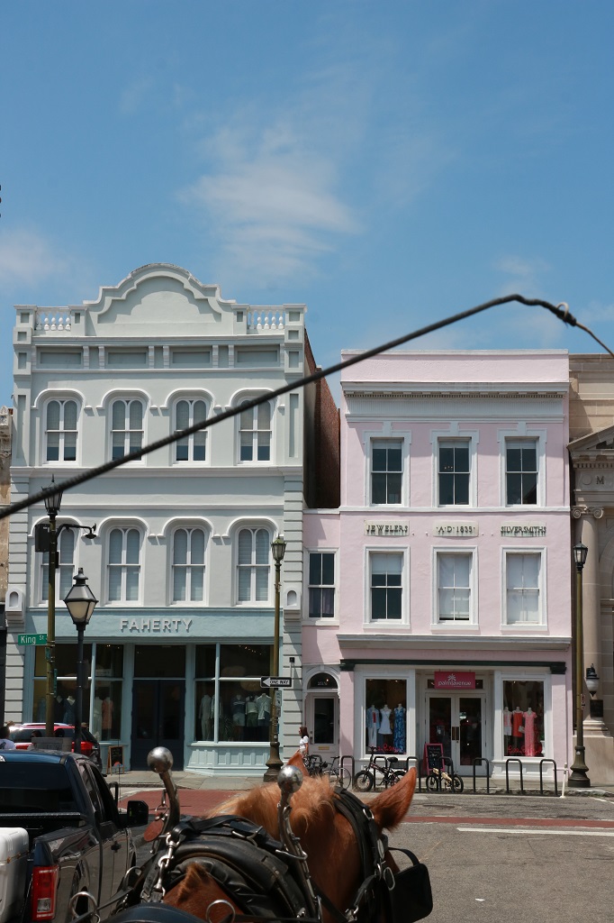
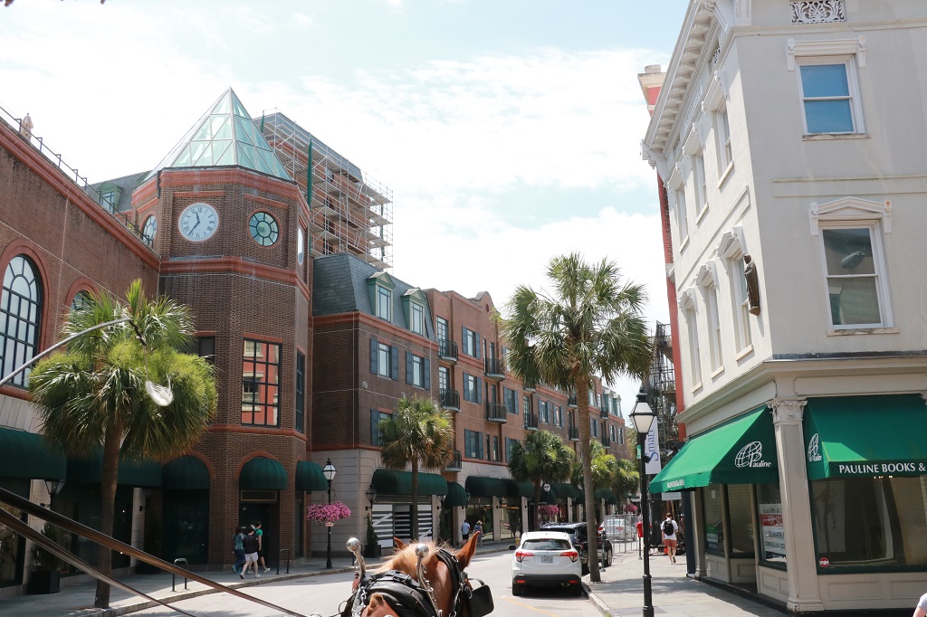
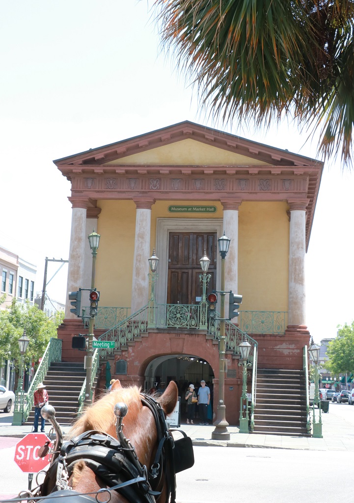
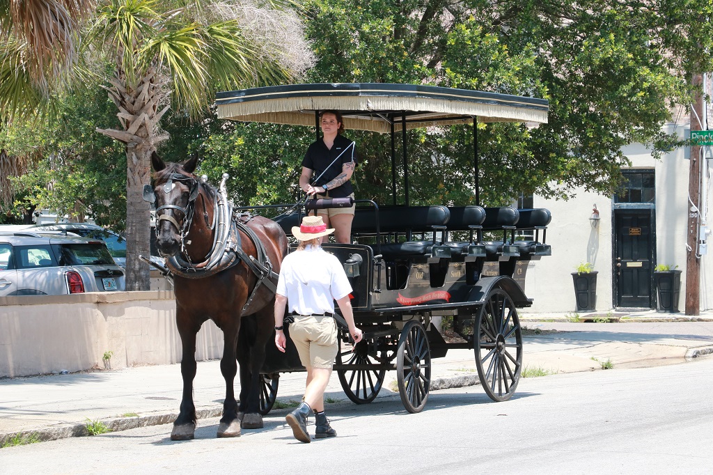
We made a reservation for the 12 o’clock horse carriage tour so we would have lots of time to drive across the bridge into Charleston from our hotel in Mt. Pleasant, find a parking spot, and arrive the designated 15 minutes early.
We actually arrived a little after 11 so they fit us onto the 11:30 tour. Each horse pulls a carriage with 14-15 passengers, plus driver. They make 3-5 runs only per day.
This is our Belgian Brian. He is 13 years old and weighs 1390 lbs. He did a really good job. He even, on his own, averted some potholes and moved to the other lane until past them. Janice, our guide, was facing the carriage and giving information and did not even notice.
There are four equine tour companies in Charleston and the city has the largest horse carriage services in the USA. The horses are purchased from the Amish in northern states. They are all draft horses that have worked in the fields of the Amish farms – Belgians, Percherons, or Amerian Draft Horses. They are retired from farm work at 4-5 and then sold. The carriage companies buy them and bring them south As Janice, our guide said, “They still work, but this is much easier work.”
Our tour company was Old South Carriages. They are a family-run business. All four companies have stables and acreages outside the city as well as their tour barns in Charleston. The city barns only hold 10 horses so on busy days when they may need up to 22 horses to do tours they will truck the others in and back.
Since there are so many horse carriages moving around the historical downtown, the City of Charleston made up route rules. They divided the district into 5 zones. When a carriage is ready to start a tour they go over to a city kiosk and tell them the guide’s name, the horse’s name and how many people are on the carriage. This keeps a record of how much weight the horses pull and how many trips they do in a day. The man in the kiosk will then spin a bingo ball-like cage and a number between 1 and 5 will drop. Whatever number he gives is the zone your tour is. This way they spread the horses out among the various streets and things are not so congested.
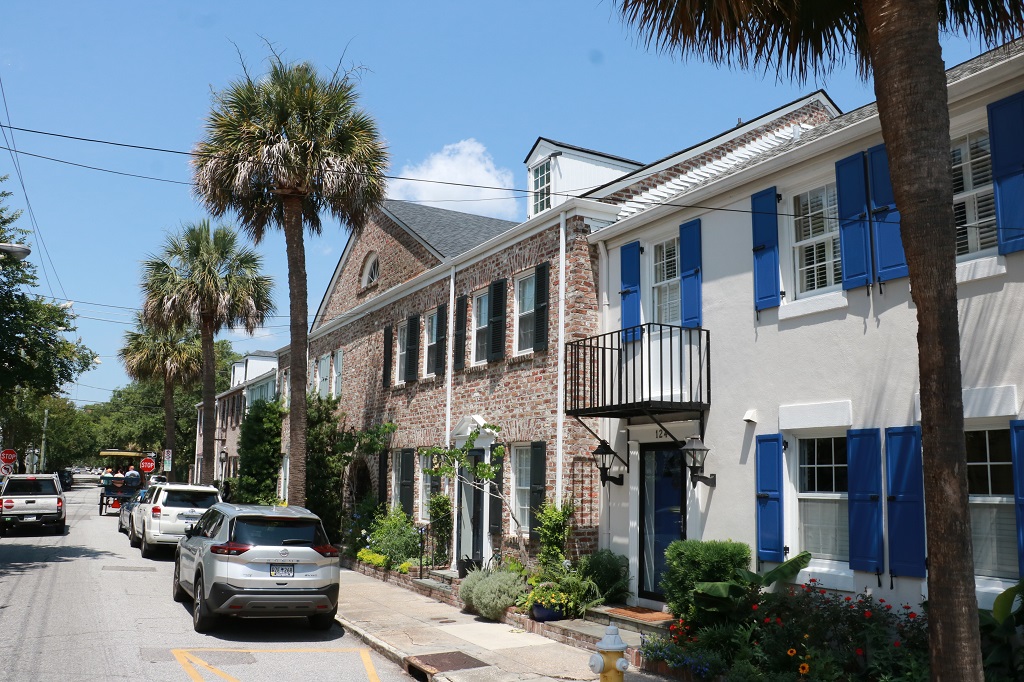
Many years ago it was decided that Charleston had to keep its historic look. They passed the 75-year Rule which states that anything that has been in existance for 75 years or more cannot be changed or taken down by man. If you have bought an old building for an apartment complex or modern store or parking garage the first 12′-15′ has to remain historic and the back can be modernized. This has created many small stores along the street fronts.
There was a major earthquake in Charleston in 1886. 80-90% of the brick and masonry buildings were damaged. Not all collapsed of course. Someone came up with the idea of earthquake bolts and we passed many buildings that had about 4 -6 large round black discs on the exterior walls between floors. They were used to anchor rods that went from side to side of the buildings and the discs would be tighted to pull the structure back into alignment and stabalize it. The bolts were supposed to be a temporary measure but they realized that they had stiffened over time and now feel the building would destablize if they were removed.
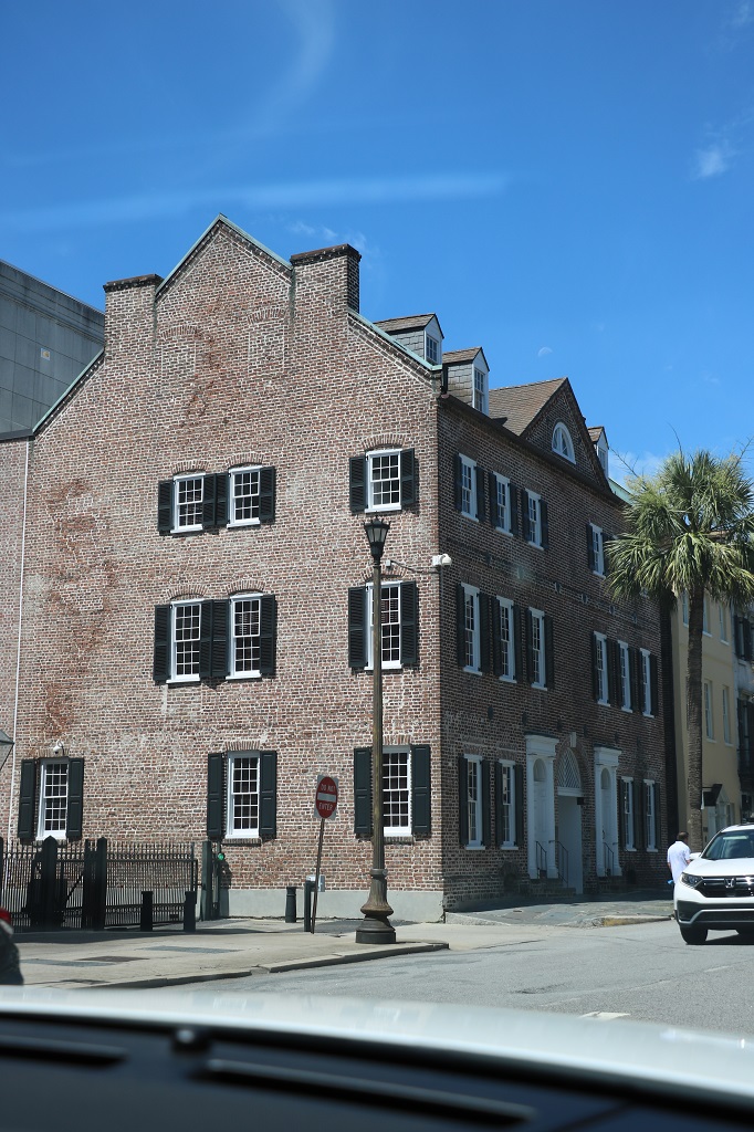
Brick was a poor man’s building material so the wealthy would plaster the front of their houses and then have them painted with lines to look like rock. There are no rocks to build with here. The sides and backs were left brick but the fronts looked fancy. After years went by nobody cared anymore and brick buildings were just brick.
With so many houses damaged in earthquakes a new building material was wanted. They discovered that Dark Cypress wood repelled insects. an excellent quality to have, so many buildings were made with it. However Charleston had 3 Great Fires (aGreat Fire has to destroy 100 or more buildings) in the 1830s and the devastating fire of 1861 that burned 1/3 of the city – 540 acres and 575 homes and businesses and 5 churches. Part of the problem was that the Dark Cypress wood contained oil so those buildings went up like chimneys.
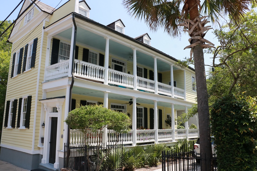
This is a Charleston Single House. so named because the house is only the width of one room but can stretch back for quite a length. The main door was located along the side of the piazzo (veranda). The door on the street was the Privacy Door. The houses were situated so as to capture either a south or west breeze so the main door was on that side of the building. Men wore wool coats as wool was plentiful and it was durable. Women had multiple layers to all their outfits. On a hot day the family would strip to their underwear and sit in the breeze on the piazzo and close the Privacy Door to the street so everyone knew not to come visit. If the door was open at the street you were welcome. A Double Charleston house is a Single House turned sideways and is two rooms deep.
Notice the light blue ceilings on both the upper and lower verandas. This is called haint blue and you can get several different shades of it. Gullah folklore tells us that ghosts, also referred to as haints, were not able to cross water. So, in order to prevent evil spirits from coming into homes, porch ceilings were painted a soft blue. The color was meant to simulate water in an effort to keep any haints or spirits at bay. Another belief is that if the ceilings were blue the bees would think it was the sky and not come into your veranda area.
The Wentworth Mansion is now a hotel. It was built by Silas Rogers a wealthy cotton plantation owner for his family of 13 children. It is 25,000 square feet and is famous for its open arm staircase.
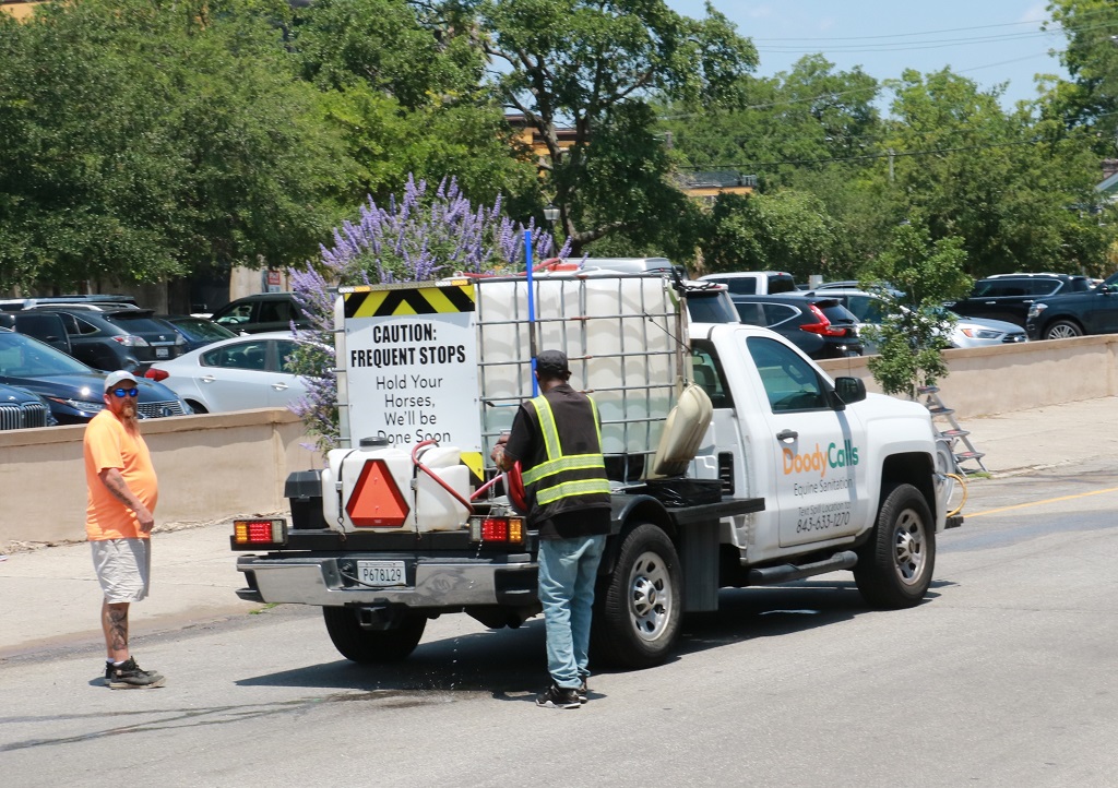
Bruce, like all the carriage horses on the streets of Charleston have diaper bags under their tails to capture droppings. If, however the diaper gets missed, or the horse stops to urinate, the carriage drivers all have small clickers. They press the button and an alert will be sent via satelitte with the GPS coordinates to the specific location needing to be cleaned. A Doody Calls truck will be dispatched to the scene to do immediate cleanup. This service is paid for by the four carriage companies and keeps the streets clean at all times.
They name a human and an equine employee of the month at Old South. The monthly winners will each get a spa treatment, but not at the same spa.
After our carriage ride we walked over to the City Market and went through one of the ‘sheds’s. The market was established in the 1790s, and stretches for four city blocks in five separate buildings. It was the main trading center in the city. Plantation owners could sell their crops, beef was kept and slaughtered on site, so fresh meat was always available. Eggs, chickens. all manner of fruits and vegetables as well as household goods, clothes, etc. etc. were offered. Today every building is full of tables of crafts, art, household goods, sweetgrass baskets, jewelry, sweets, etc. etc. etc. Since there are no glass or bars on the windows the vendors must pack up all their merchandise every evening and reset it for sale the next day. They also do night markets with different vendors.
“Charles Pinckney, a signer of the US Constitution, donated land around Major Daniel’s Creek to the City of Charleston for use as a public market in 1788. An ordinance in 1807 mandated that the area known as the Center Market must always be used as a city market, with no slaves sold there. It was to be open every day but Christmas Day. Rules for the market and enforcement of these rules were left to the Commissioner of Markets. Stalls at the Center Market were rented for 25 cents per week. If either of the rules were broken the land will immediately be reverted back to the Pinckney heirs.”
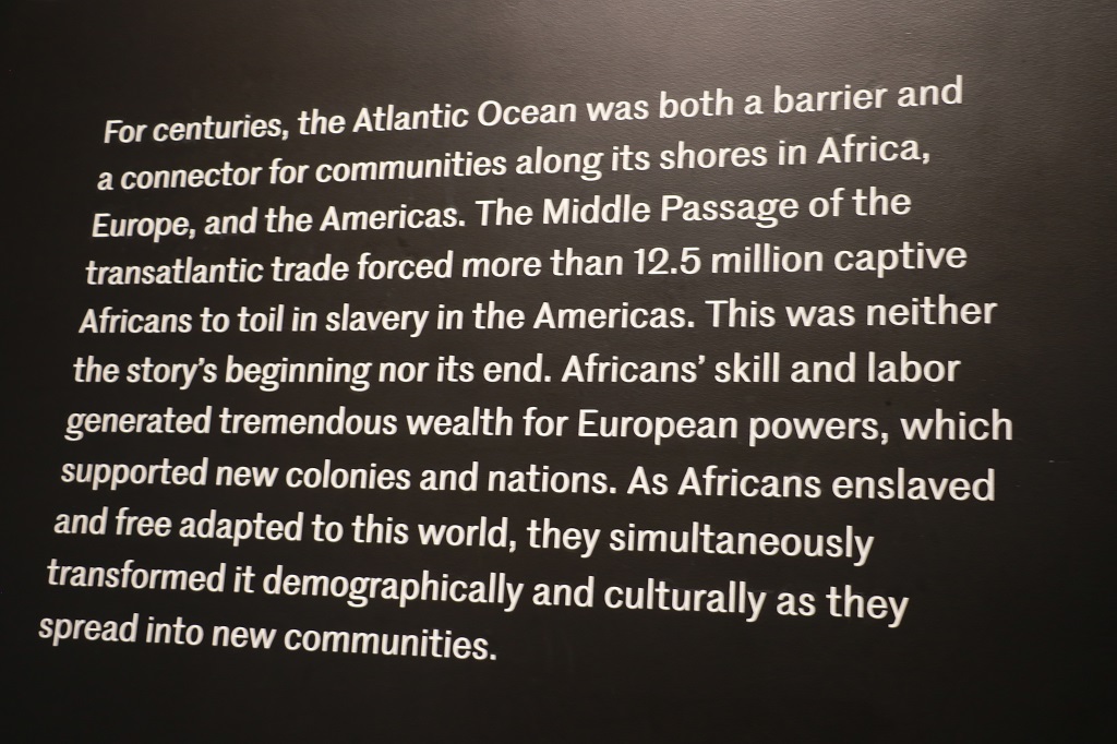
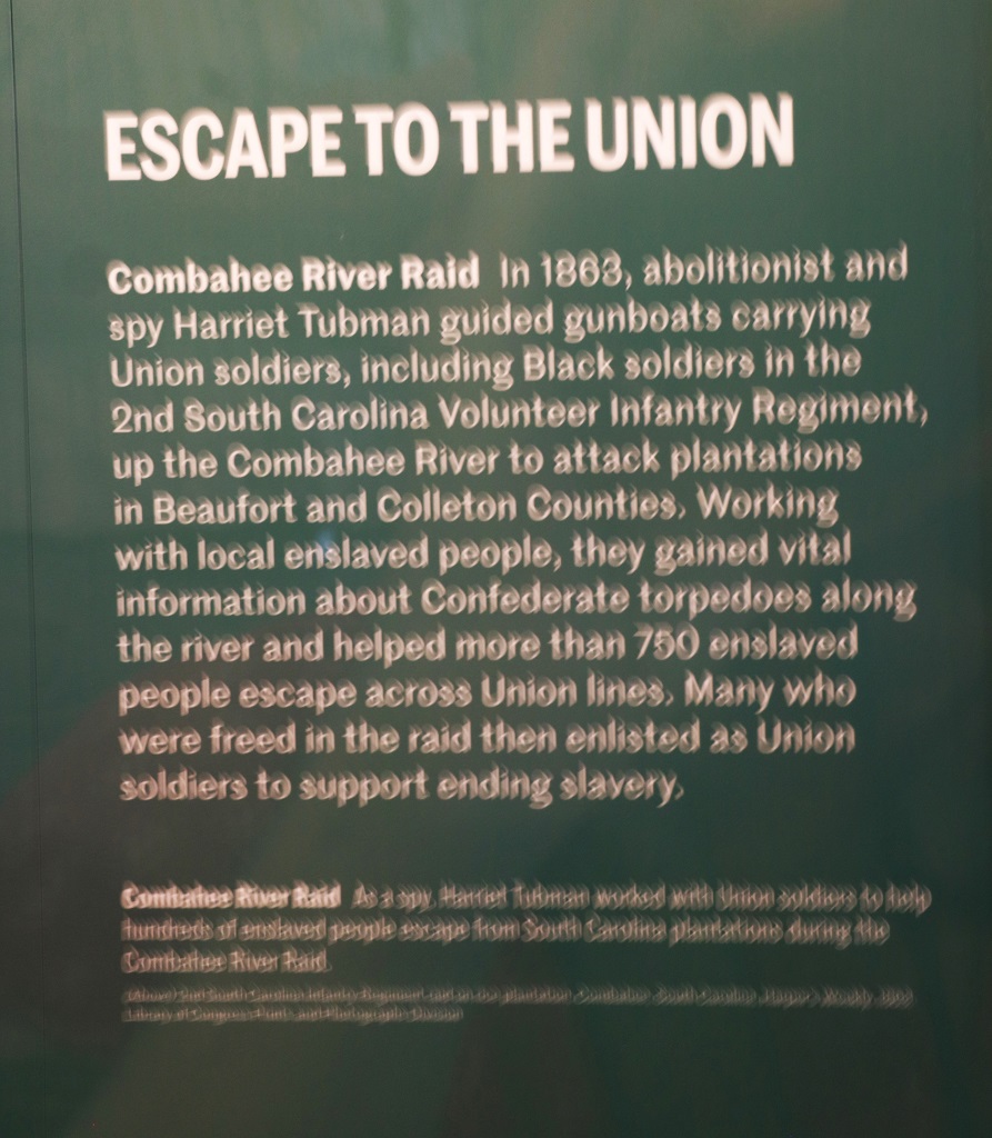
Next we drove over to the International African American Museum. It was opened in 2023. It was a long building up on massive concrete pillars for hurricane damage prevention. There were quite a few information videos about the impacts and changes made over the years by the various Black peoples spirituality, sense of community, faith and culture. They were very interesting. There were lots and lots of displays of prominent or influencial people from all walks of life. Many of them had such small print or so many images and quotes on them they would have been hard to read. There were very few artifacts display. Obviously the main focus was information. I have posted here the clearest information about the slave trade and its affects. They are not in any particular order as we moved back and forth quite a bit. I really tried to not post too many, but there was so much interesting information it was hard. They had complimentary wheelchairs so my legs really appreciated that.
It was about 3 when we left the museum and we drove down to White Point. Along the way we passed what is called Rainbow Row. It is a long street of houses all painted different colours. They are all pastel blue, pink, peach, etc. but I could get no photos because there are large trees all along the street that block them from the road. Pretty though and one of the ‘extra’ things I wanted to see.
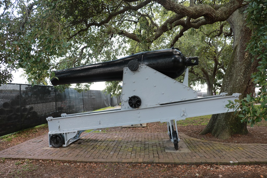
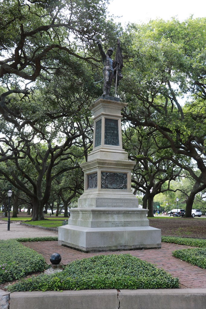
White Point is another of my ‘extras’. It is at the very bottom of the peninsula on which the city of Charleston is situated. All around the edge of the small park are different cannons as the area was the seaward protection for the city. There are also several statues. It is a beautifully shaded area with many Live Oak trees.
Then it was back in the car and back to the hotel and off to find somewhere for dinner. Awesome day.
Another day in Charleston tomorrow. Fort Sumter and the Old Slave Mart for sure.
Today was strictly a driving day. Not because the distance was so very far – it is about 3 1/2 hours from Wilmington to Charleston – but we took a few sections of backroads along the way and arrived at our hotel at 3:30. We decided to check in and John would do some ticket and tours research and I would work on my blog to try catch up.
We left Wilmington at 9:45 and headed south to Old Brunswick Town and Anderson Farm to see if, on the off chance they would be open. But no. All State Historic Sites and Parks in North Carolina are closed Sunday, Monday and all major holidays. We had a nice wander through countryside though.
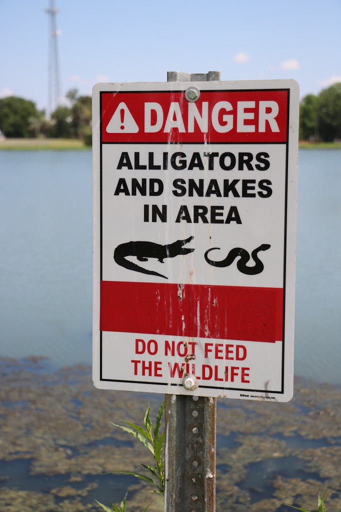
We stopped beside a lake to take a photo of a pair of eagles nesting in a tree in a lake. The lake is posted with No Trespassing signs and apparently belongs to Orton Camp. I have never seen No Trespassing signs in a lake before. There was also a sign that said “Do no feed the alligators.” Why would you want to? We met a fellow at Bellamy house that said, “I knew what an alligator looked like long before I knew what a dog looked like.”
We rejoined the main south-bound freeway until we crossed into South Carolina at 11:45 and then diverted again inland to Conway and south to Georgetown where we joined Highway 17 again as far as Mt. Pleasant where our hotel is located. We have a short drive across the bridge to Charleston to make tomorrow. We did the detour into Conway to avoid the stretch of highway from North Myrtle Beach to Georgetown. This 60 mile stretch is an extremely popular holiday area with beaches and resort towns one after another along the coast. I was afraid it would be bumper to bumper creeping traffic as people head home after the long weekend so we avoided it all together just in case.
This is our first time in South Carolina so we found a geocache in Georgetown to record the state on our map.
These are all the photos I took today. As I said, it was a driving day.
We drive past thick tall forests on both sides of the road, broken by some marshes, creeks, rivers or small lakes. Nothing really scenic or different. Lots and lots of trees. The trees grow very tall and the undergrowth is extremely thick. One would really have to work hard to take a walk in the woods down here.
When John booked our rental car before we left home he selected a Rav 4. At the counter in Charlotte airport we were given a 2022 fully loaded Range Rover. It is a very nice roomy vehicle and has an awesome Nav system. We just input a place name or address and the kind lady voice directs us where to go. It took awhile to learn to ignore some of the directions because if you pass any exits along the way she will say “turn slightly left”, then “follow the highway”, then “drive the highway.” I guess some people decide to leave the direction they want to go and take exits they don’t want. We found it a bit redundant and confusing the first couple of days, but we have learned to just ignore it. Other than that it is a great system and we have used it a lot already.
We are staying three nights in Charleston. I have four things for sure I want to do: Visit the newly opened (2023) International African-American Museum, see the Old Slave Mart, take a horse-drawn carriage ride through the Historic Downtown and take the ferry to tour Fort Sumter where the first shots of the Civil War were fired. Any other things will be done after those are completed.
We left the hotel at about 11 and drove to the waterfront in Wilmington. We were hoping to take a horse drawn carriage ride around the Historic District but we could find no evidence the horses were working the area. Perhaps the late spring and summer months are too hot for them.
We took Option B and drove up and down the streets. There were some really nice old buildings but photos through a windscreen with sun glare do not turn out well. I did get a few though.
There were several streets that were closed for markets on this Memorial Day weekend.
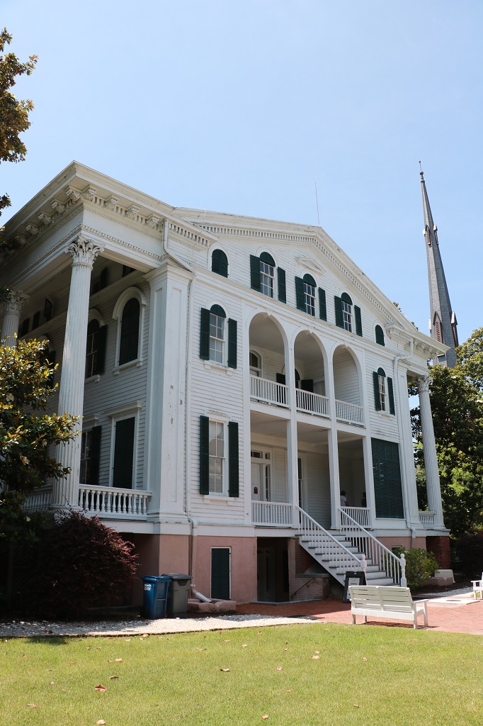
As we were driving around I noticed a sign for Bellamy House, which was the historic house I most wanted to see out of the three I had listed in my notes.
John D. Bellamy was a successful physician, planter, and merchant. In 1859 he hired an architect to design a new townhouse in the city. Enslaved workers, free Black artisans, and White laborers built the mansion and outbuildings between late 1859 and early 1861.
This magnolia tree is over 150 years old. It had just finished blooming but there were still a few huge flowers to be seen.
Dr. Bellamy’s plantation was right across the Cape Fear River but the new house became the main residence for his family of nine children and they moved in just before the beginning of the Civil War. There were 10 enslaved workers on the property as well. A yellow feaver epidemic ravaged Wilmington in 1862 so everyone left the city leaving the property in charge of Sarah, the enslaved cook.
Wilmington fell to Federal troops in 1865 and the Union army commandeered the Bellamy mansion as their headquarters. Dr. Bellamy was able to regain possession in the fall of that year after he traveled to Washington, DC and obtained a pardon from President Andrew Jackson.
The mansion remained a family residence until 1946 when the last of John & Eliza’s children died and it gradually fell into disrepair. By the early 1970s the city planned to condemn the building but Bellamy descendants formed a non-profit to restore it and open it as a museum. A few weeks later an arsonist threw gasoline cans into the library and the family parlour on the main floor. The ensuing fire did severe damage to those two rooms but due to the thick walls and floors the fire could not escape those rooms and had no fuel to go further throughout the building. The cost of restoration after the fire put the project on hold until the family deeded the property to Preservation North Carolina in 1989. Restoration work began in 1992 and the mansion was opened to the public in April 1994.
As a tourist you enter Bellamy House through the basement breezeway which is the dark space left of the stairs. There were three floors above that, plus the Belevdere’s 12′ square room on the rooftop. All the windows in the Belvedere open and help draw the heat up the center stairwells and out of the house. They have installed air conditioning but it only keeps the first couple of floors cool. The third floor and the Belvedere were very hot. And it is only May. I shudder to think what August would be like in the pre-air conditioning days.
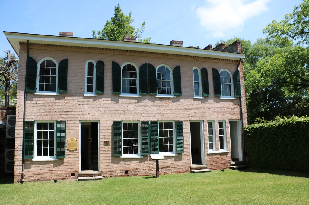
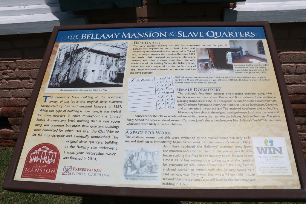
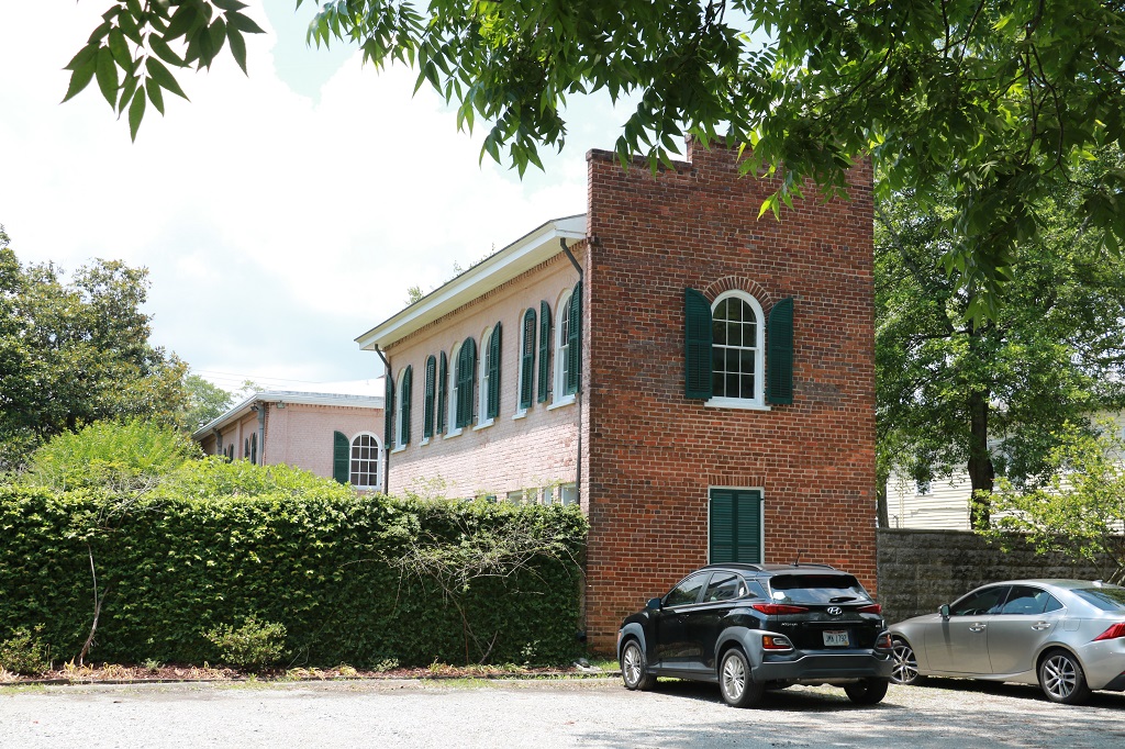
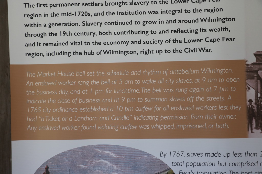
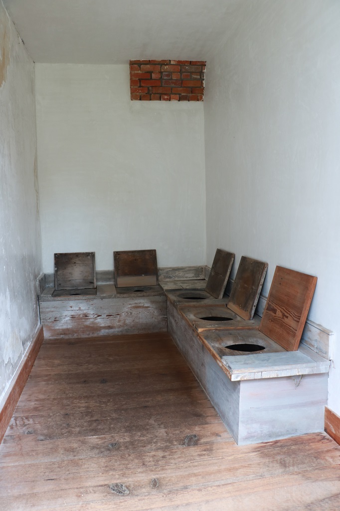
The first building on the site to be built was the slave quarters. This original building contains the laundry, two privies, and four sleeping quarters. “It is a rare surviving example of an urban slave quarters and one of the only in the US completely restored and open to the public. It is a sharp contrast from rural slave cabins but is typical of many urban slave quarters and does not reflect benevolence on the part of the slave owners.” There were only straw pallets on the floor and several women and children shared the small rooms. The restoration of the building took over decade. It was opened in 2014 completely restored to its orginal 1859 look.
It is believed that Sarah, the cook had the first floor sleeping chamber. Rosella the laundress, and Joan the nanny slept upstairs with the five enslaved girls who ranged from age 14 to one year.
The Slave Quarters is only the depth of the rooms on each floor.
There are two privies on the right side of the Slave quarters. The male and female slaves used the one on the left. It had three adult and two child-size holes. John Bellamy, his sons, and male guests used the privy on the right. Women used chamber pots in the house that were emptied into the privy by 14-year old Mary.
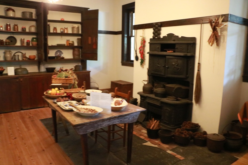
All the floors of the house each contained four interconnected rooms through a central hallway with stairs to the next level. The kitchen and ironing rooms were on the left of the entrance in the basement with the butler’s pantry and formal dining room on the right. It is believed the younger Bellamy children ate their meals in the ironing room and the older ones joined their parents (and and guests) in the dining room.
The butler’s pantry
The next floor was the main entrance to the house. The rooms on the left were the library/study and the family parlour. These were the rooms hit by the arsonist and were mostly empty.
The other side’s two rooms are the double parlours and almost everything in them is original. Dr. and Mrs. Bellamy purchased much of the furnishings and decor while on a trip to New York City in 1860.
The second floor originally boasted four large bedrooms, one of which had a bathroom. There were no furnishings in the rooms as the space is now used as a gallery to feature traveling exhibits and local artists.
The third floor contained four children’s bedrooms. The room on the north end is the tank room that held water above the bathroom and a small room was perhaps used by Joan the enslaved nanny.
We exited the house off the second floor back terrace and walked around to the front on the way to the parking lot and the car. It was impossible to get a good picture as the front yard was close to the sidewalk with a divided street but we had to drive past it as we left so I was able to snap a pic from the car window.
We drove a few miles out of town to Airlie Gardens thinking we could see some nice flowers in the 46 acres but it was mostly a botanical garden with long paved winding pathways and my decrepit knees and legs would not have taken me too far. We elected to head back to the hotel for an early end to the day and a rest before dinner.
I have told myself that I will not tour very many Antebellum and Plantation houses on this road trip. Other than the personal stories of all the owners they were built in a similar style, during a similar period and will have similar decor. Much as I love history and historic houses I am going to try refrain from going through too many of them. I do not promise to not see some though.