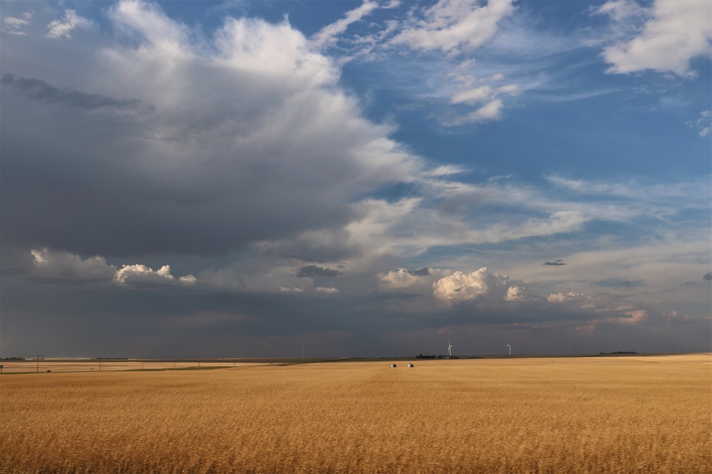
My husband and I retired in 2007 and decided to spend the kid's inheritance by travelling as much as we could until either the money or our health runs out. So far so good.
A straight drive from Charlotte to Wilmington takes about 3 1/2 hours. As usual it took us all day.
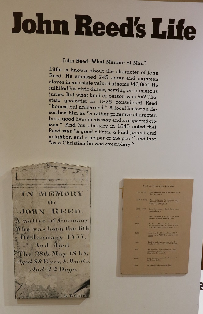
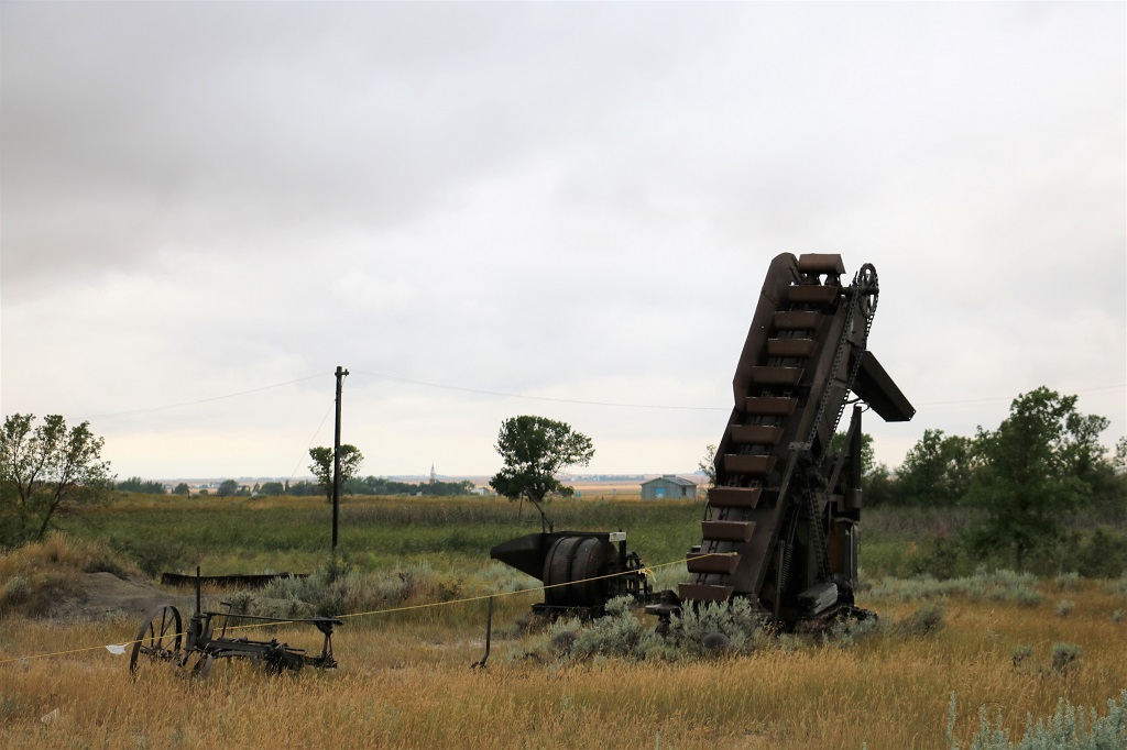
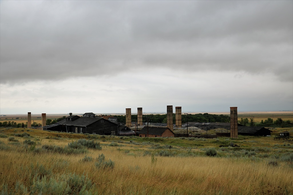
The brochure says; “According to local history, in 1799, Conrad Reed found a 17-lb gold nugget while skipping church and fishing with his brother and sister. Curious about the heavy, shiny rock Conrad took it home and showed it to his father John.
John did not know what it was and took it to a silversmith in Conrad who also failed to identify it. He kept the rock as a doorstop until taking it to Fayetteville market in 1802. A jeweler there identified it as gold and John sold it to him for $3.50, a week’s wage for a farmer. It was actually worth about $3,600!”
Upon his return home, Reed and three of his neighbours formed a partnership to dig the creek and flood plain. Each partner supplied himself, three slaves and a horse. In 1803 the first authenticated discovery of gold in the United States was made by a slave named Peter. The nugget weighed 28-lbs and is still the largest found east of the Mississippi River.
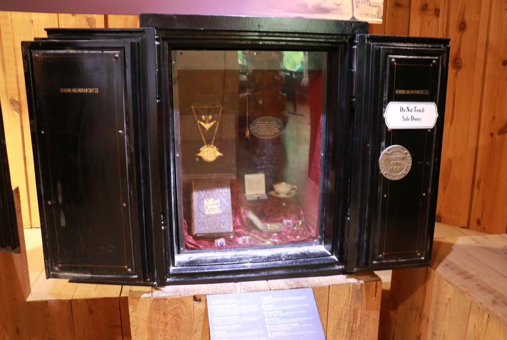
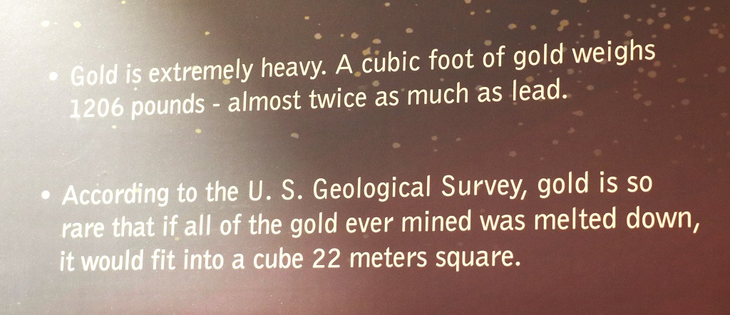
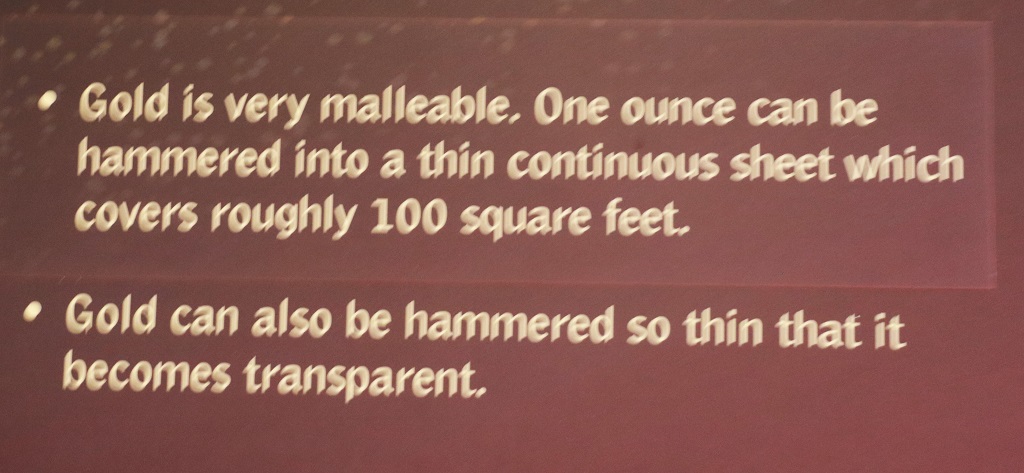
The Visitor’s Center had a very interesting display about the properties and uses of gold. The display cases for articles were old safes, even though the jewelry and icons, etc were reproductions.
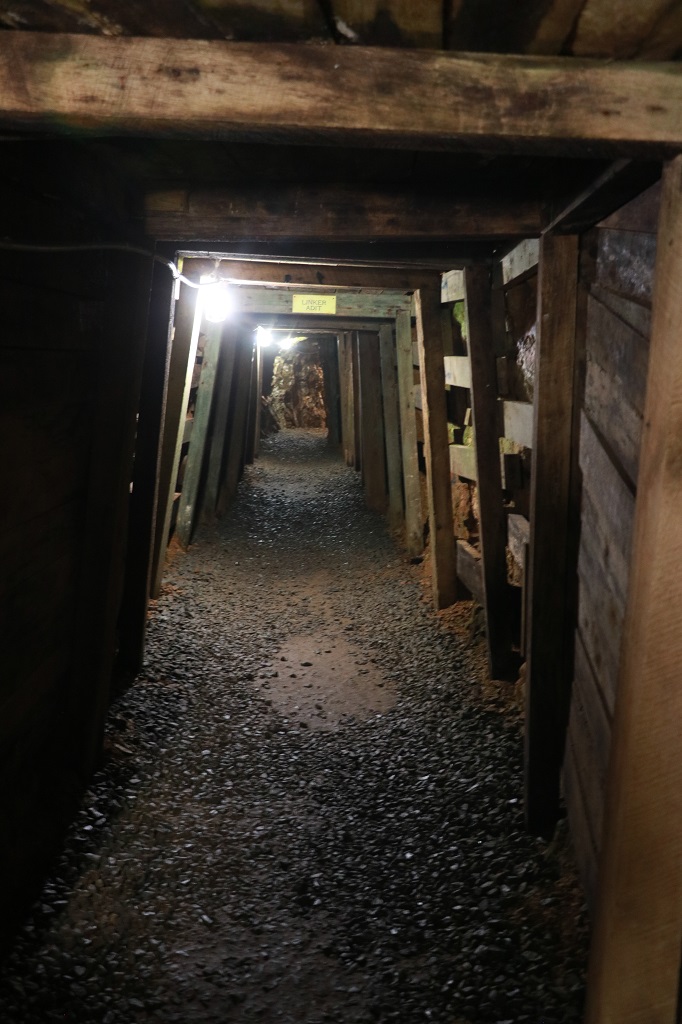
It was a short walk through the woods to the mine adit.
They just dug out the rock and picked out the gold nuggets.
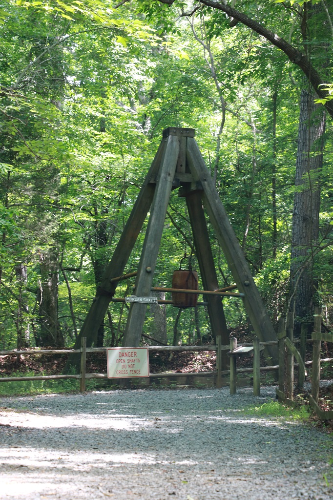
The Morgan Shaft was 50′ deep.
Looking up the shaft from inside the mine.
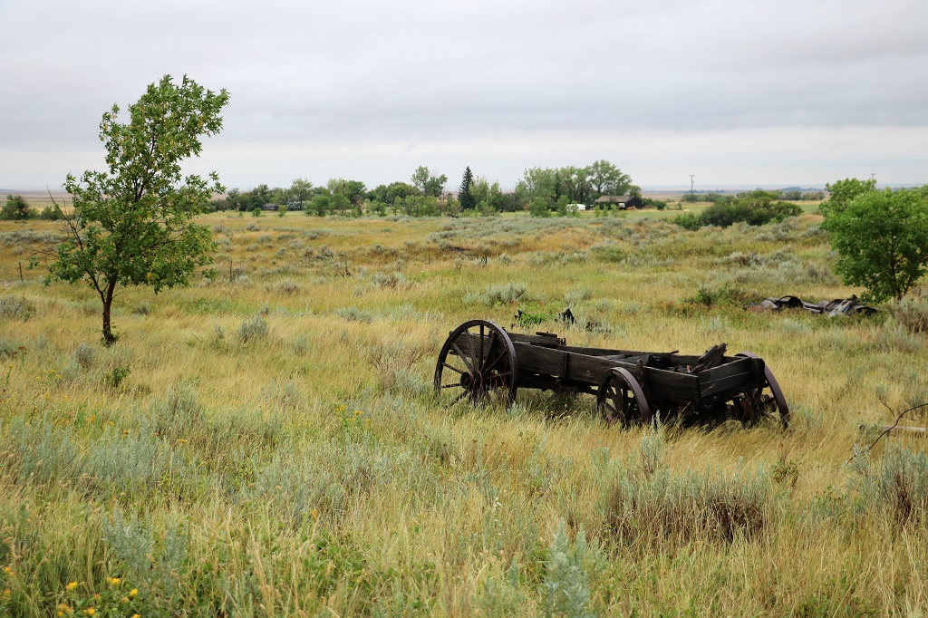
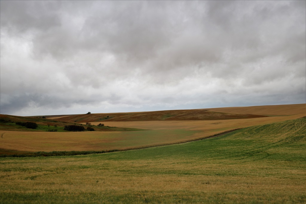
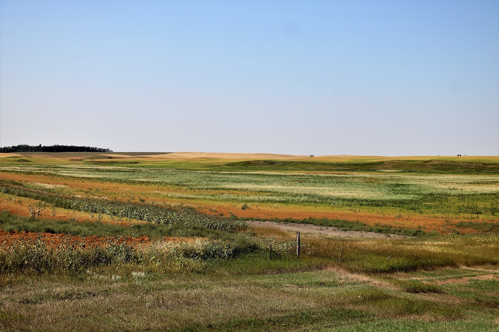
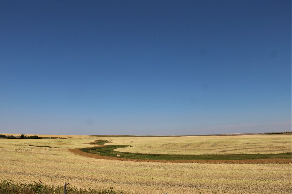
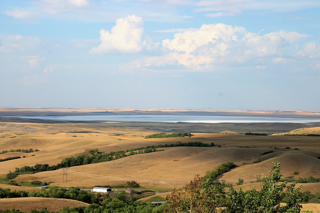
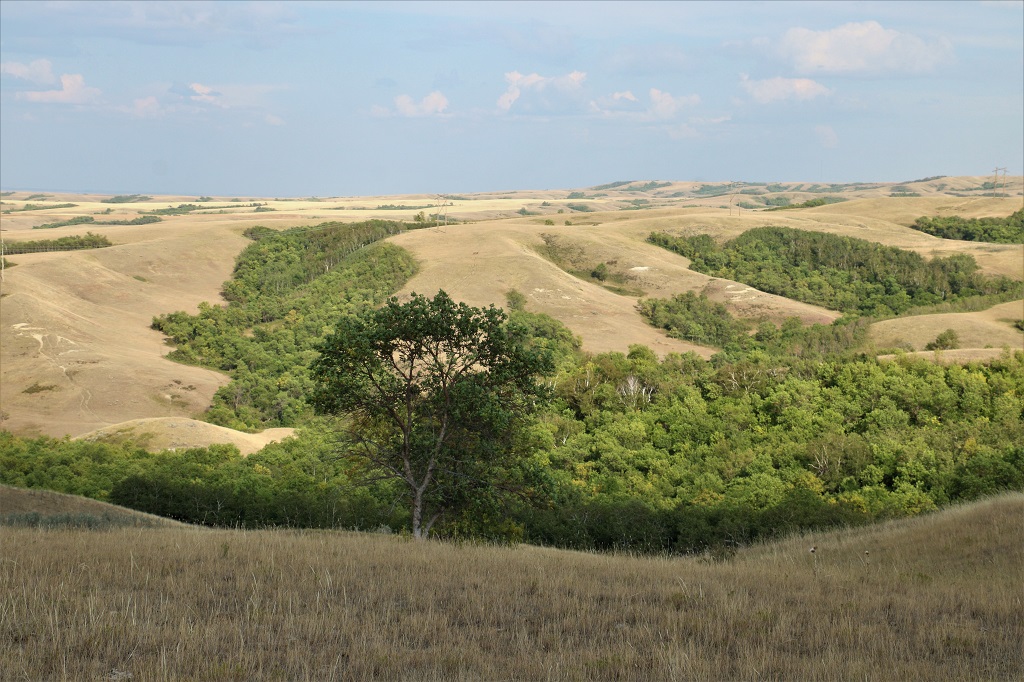
Both of our stops on the way to Wilmington were a distance off the main highway with lots of turns through pretty green forested countryside.
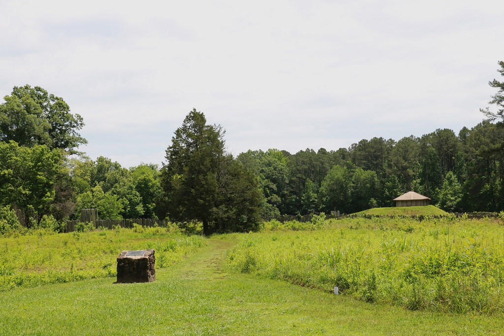
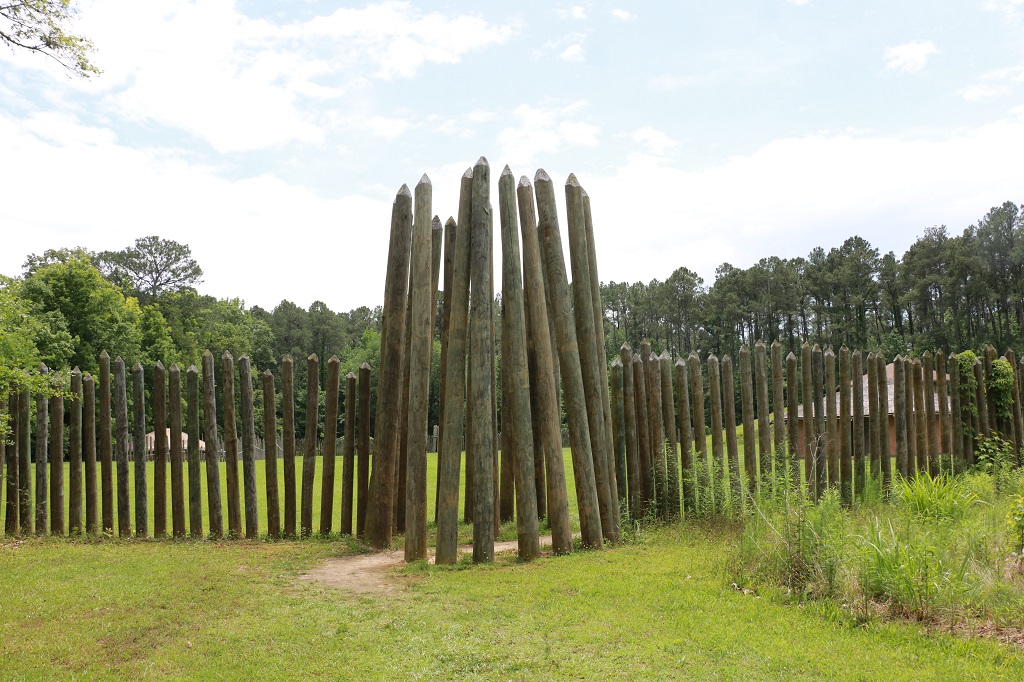
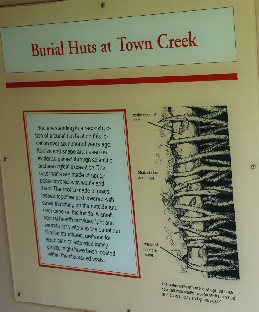
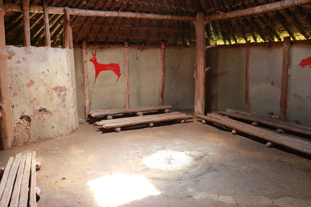
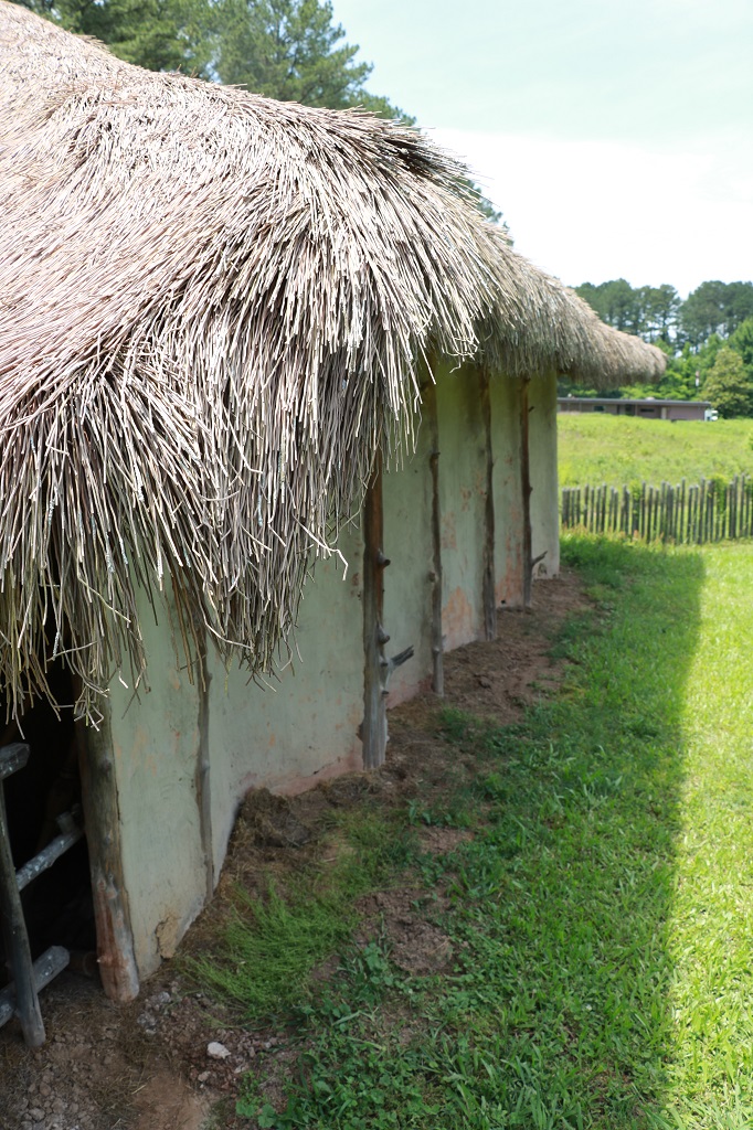
The second visit we made was to the Town Creek Indian Mound Historic site, an area that has seen many years of archaeological work. The compound is a prehistoric Native American site that featured a platform mound with a surrounding village and wooden defense pallisade. It was built by the Pee Dee, a South Appalachian Mississippian culture that developed in the region as early as 980 CE. The Town Creek site was an important ceremonial site occupied from about 1150—1400 CE. It was abandoned for unknown reasons. It is the only ceremonial mound and village center of the Pee Dee located within North Carolina.
The hut on the mound was used as a meeting chamber.
When we left Anne and Mike’s at 10 in the morning and we thought we would get to Wilmington early enough in the day to see one of the things on our list, but all the country road winding around to the mine and the indian mound took up a lot of time and we did not arrive at our hotel until after 5 so we had dinner and called it a day.
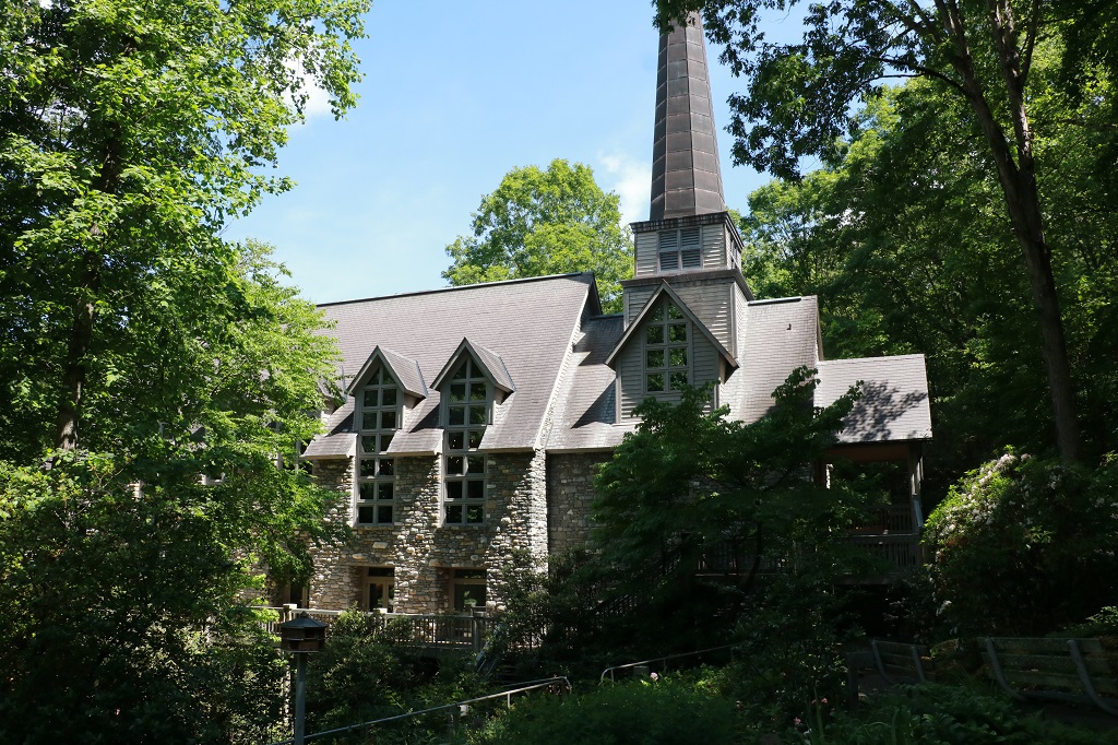
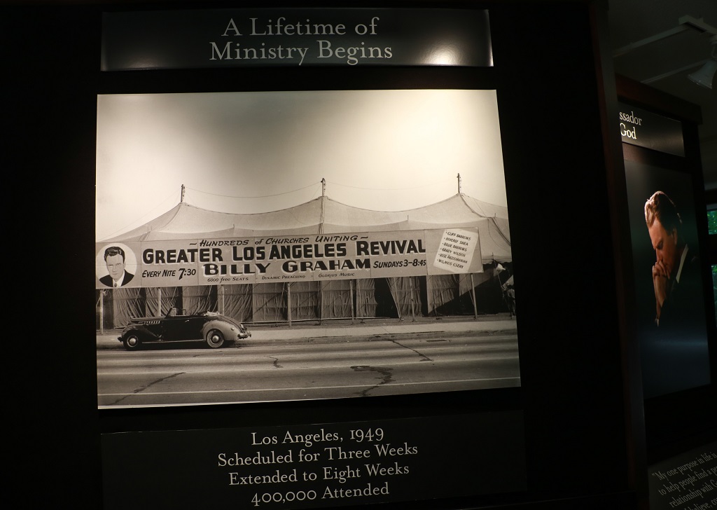
We were having dinner and spending the night with our daughter-in-law’s sister and her husband and only had a couple of ‘quick’ stops to make on our way back to their house in Charlotte. We left Asheville at 10 and made our first stop at the The Cove – The Billy Graham Conferene and Training Center.
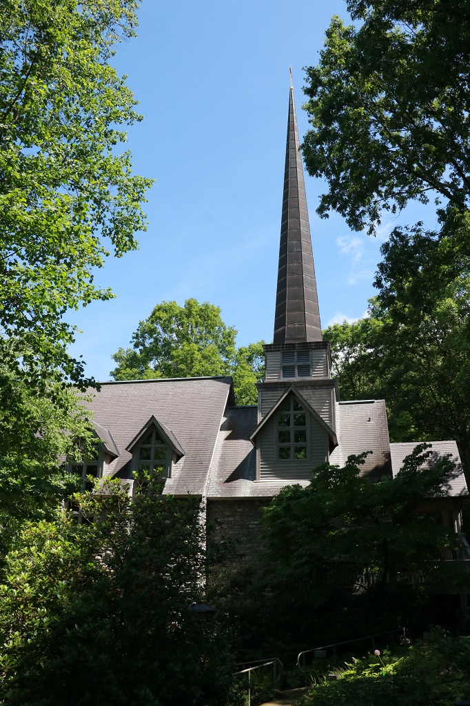
We wanted to stop here and see the Chatlos Memorial Chapel. We had watched a couple of Bill Gaither Homecoming Concert shows that were filmed there.
The property comprises 1100 acres and contains the chapel with a large meeting room suitable for conferences or retreats in the basement and a prayer room upstairs, several clusters of lodgings buildings for those participating in events on site and the large Training Center that has a 400 seat auditorium, dining room and information and collections display in the lower level.
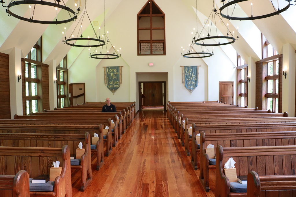
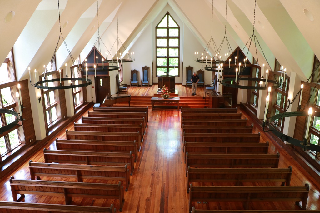
We thought we would check out the chapel and be on our way in about 20 minutes but we were there a couple of hours.
The steeple was supposed to be 65 feet tall but Ruth Graham said it was not tall enough so they made it 87 feet. It was lifted in place with a huge crane.
The pews are over 200 years old and came from England.
All of the chandeliers in the chapel and the training center were made by a local female blacksmith.
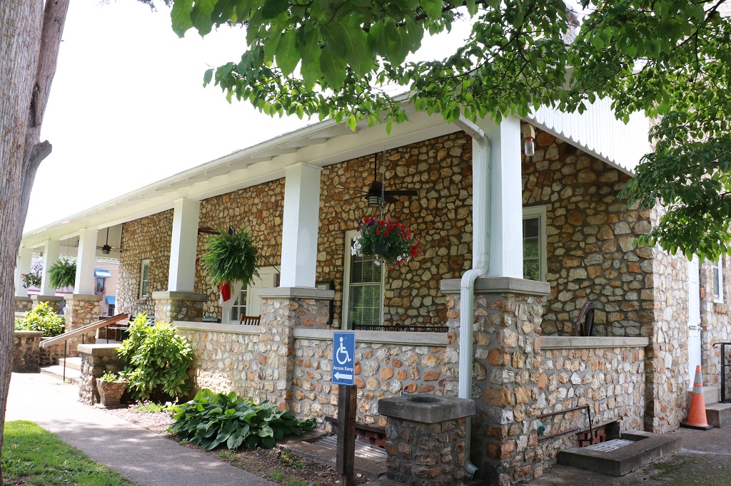
The Training Center was a short distance up the road from the Chapel.
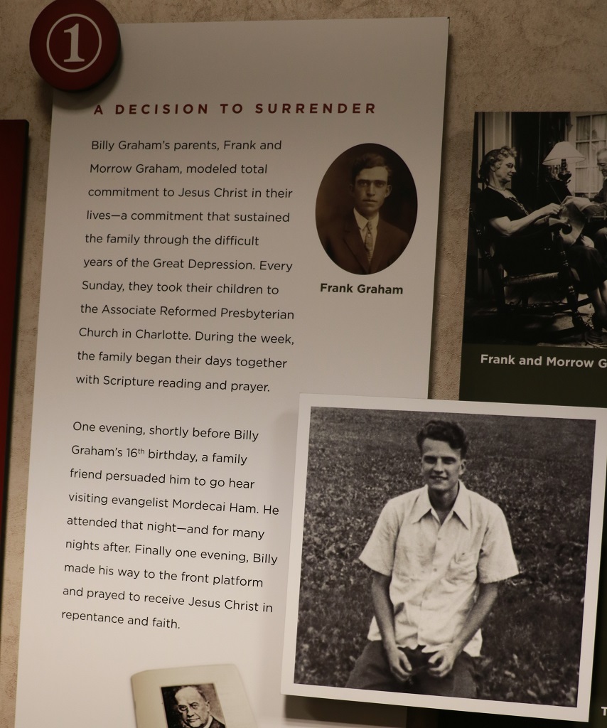
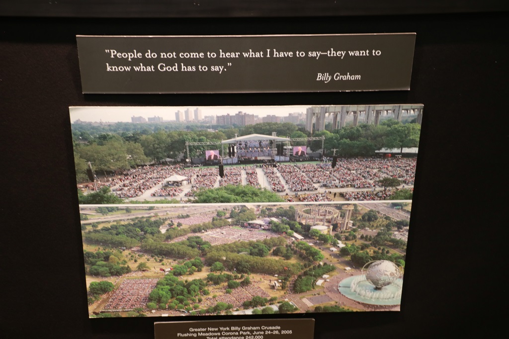
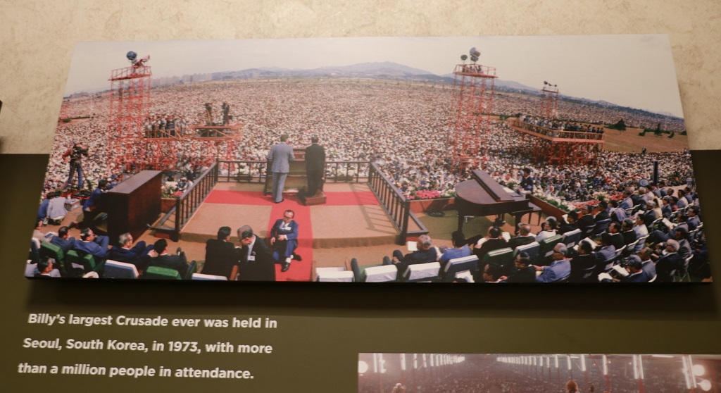
The displays in the lower level contained much information about Billy Graham’s life, family and ministry, as well as info about his son Franklin and grandson Will who are both continuing in ministry. There were display cases of many of the small gifts and mementos that Billy Graham had been given on his many, many travels. As a young man his new wife Ruth said, “You have been called to evangelism. I will keep the house, take care of the kids, and support you in any way I can.”
In 185 countries and territories over 210 million people have heard Bill preach in person the love of God.
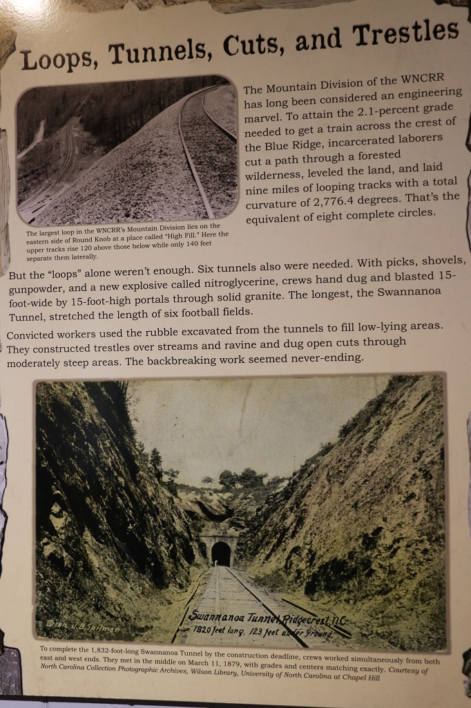
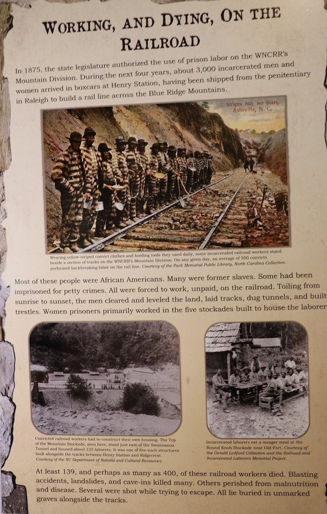
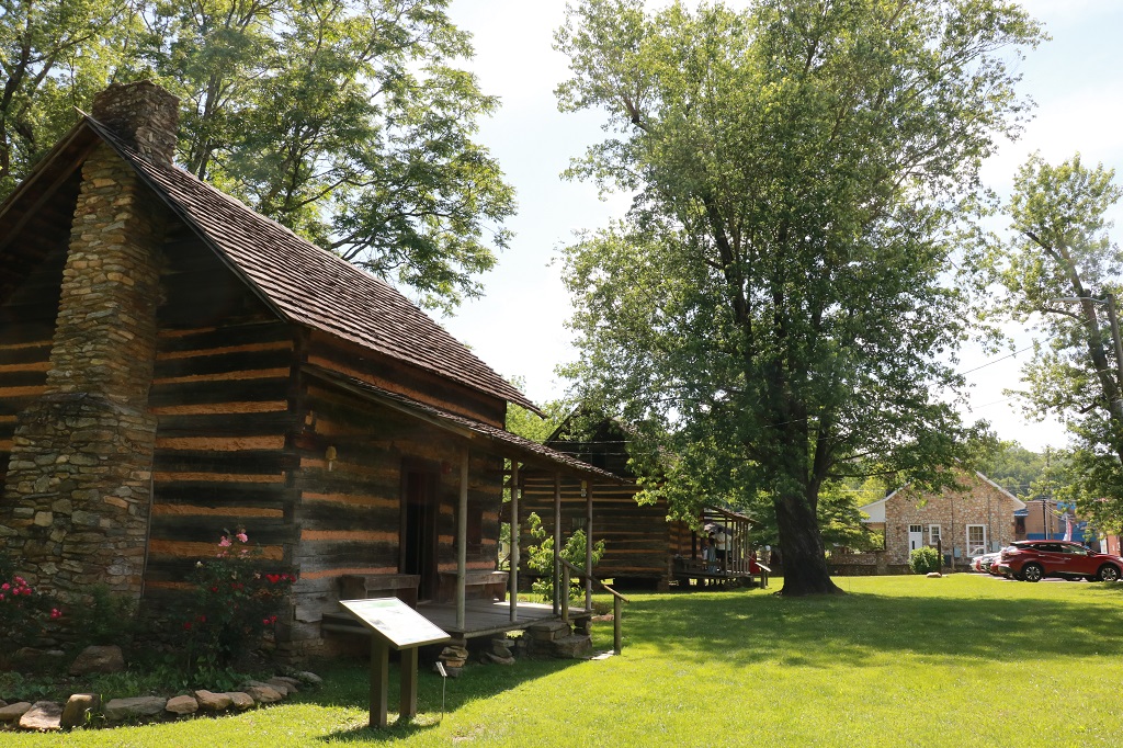
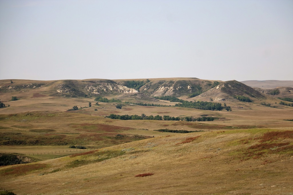
We drove through a bunch of winding back roads to the Mountain Gateway Museum at Old Fort.
Inside were many information boards and displays about the area, especially the construction of the Western North Carolina Railroad.
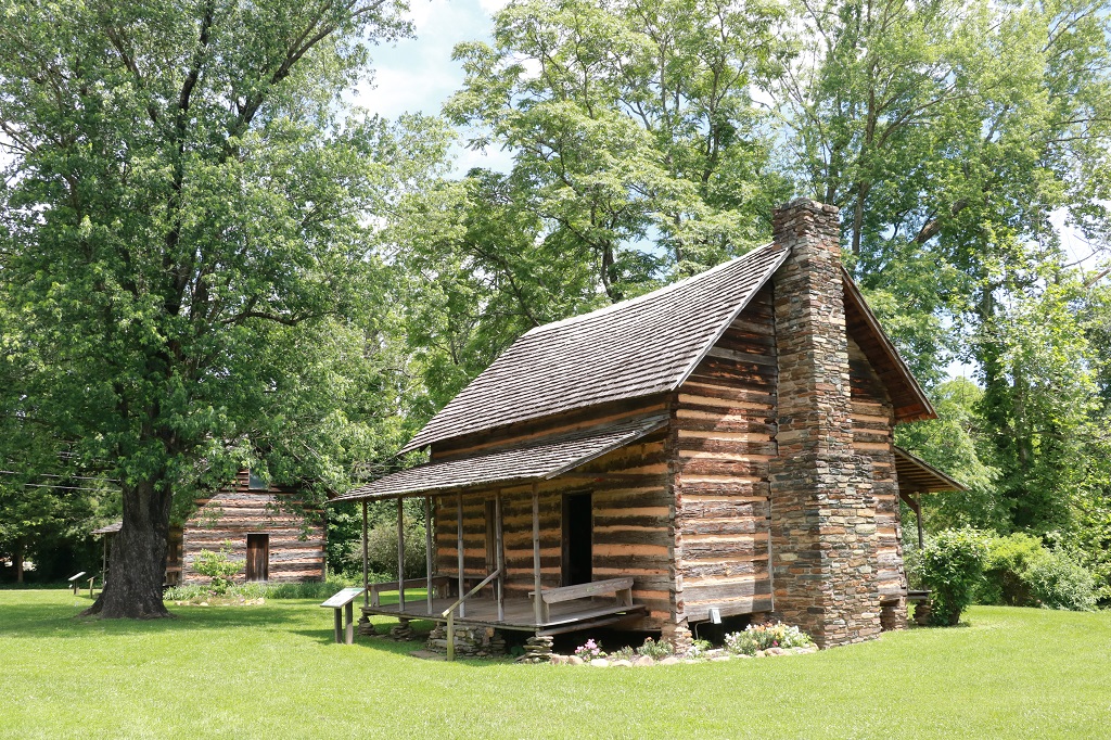
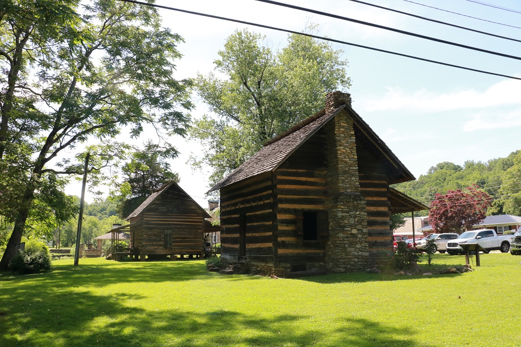
On the museum property there were two cabins that had been brought to the site from other locations. The Morgan Cabin was dismantled and then reconstructed. The Stepp Cabin was brought as a whole building on a trailer. The Morgans raised 10 children in their cabin.
By the time we left the museum it was after 3 o’clock and we had a two-hour drive ahead of us to Charlotte. It is Memorial Day weekend in the states and traffic was quite heavy as we approached the city. Thankfully the worst lines were the ones heading out but we were still much later arriving at Anne and Mike’s than we planned. She had made dinner reservations for 6 o’clock, but we were about 15 minutes late. Sorry about that.
We had a lovely dinner and a great visit later at the house. They have two dogs so I was happy. It was a good ‘dog’ day. We met Gus – an Australian Sheepdog – in the Gateway Museum and Peanut – a long-haired dachsund/long-haired Chihuahua mix as we left. And Anne and Mike have two Standard Poodles – Hilo and Kona. Days with dogs are always the best days.
We have been invited to a wedding that is to be held on June 21 on the Outer Banks of North Carolina. We decided, since we are flying to the US South, to do a 30-day road trip before the wedding and check out some of the states we have not visited before.
We flew to Charlotte, NC on Wednesday, May 22. Our day began at 2 am to be ready for our 3 am ride to the airport to begin the first of the three flights we took that day. We arrived in Charlotte at 7:30 pm (3 hours ahead of our home time, but still it was a long day), picked up our rental car and drove to a nearby hotel for the night.
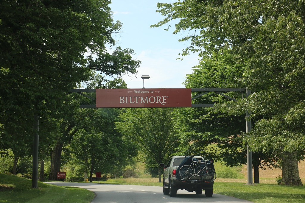
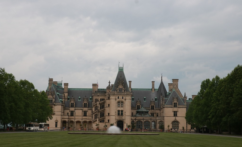
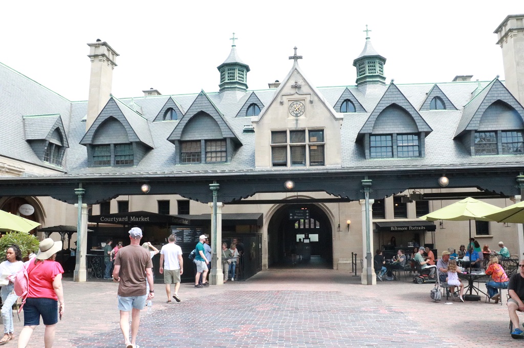
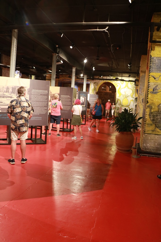
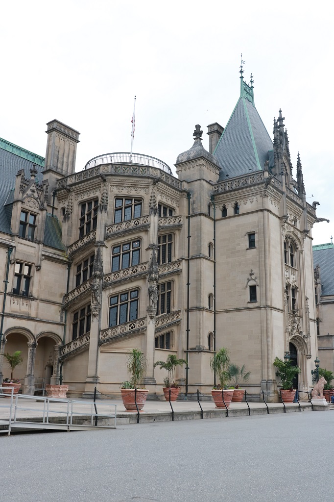
The next day we drove 2 1/2 hours west to Asheville to visit the Biltmore Estate. We had seen a Hallmark Christmas movie that was filmed at the Biltmore and decided that we would go see it since we would be in the ‘neighbourhood.’
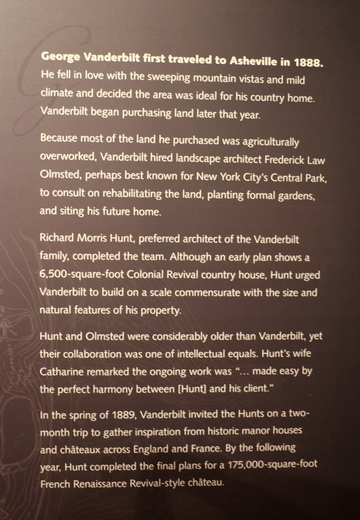
The Biltmore was the summer home of George Washington Vanderbilt. He fell in love with the Asheville area when he visited as a young man in his mid-twenties and decided to build a retreat for family and friends far from the hustle and bustle of the big cities. He immediately began purchasing land, much of which was overworked farm land, and within a couple of years he owned 125,000 acres.
For all of the family’s great wealth they were well known philanthropists with a stong work and social ethic. All of the workers on the estate were paid during construction.
The view from the south terrace.
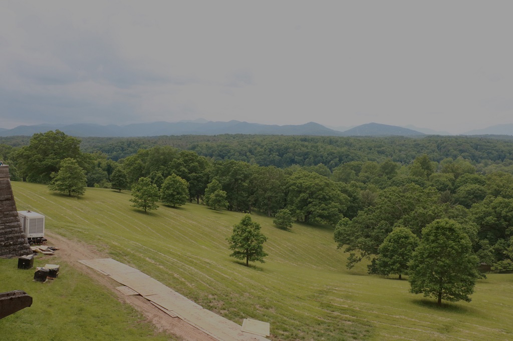
The hills in the distance are 4 miles away as the crow flies. George owned all the land to them, and a mile beyond.
He hired a landscape architect to re-forest the land. They planted over 1 million trees and other plants, becoming one of the first scientific forests in the USA.
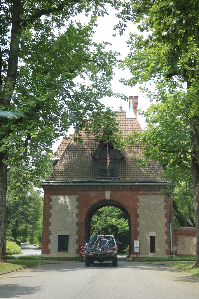
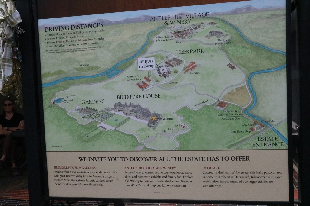
From the front gate in the town of Asheville, it was a 3-hour carriage ride to the house and at no point along the way was the house visible until you went through the gate at the end of the long lawn. Today it takes about 45 minutes to drive through the created thick forest to the house gate. There are parking spaces in five different lots that hold over 1000 cars and shuttles run from them all every 20 minutes. During the peak summer months all of the lots are full. The estate is now a National Heritage site but it is still owned and operated by descendants of George Vanderbilt.
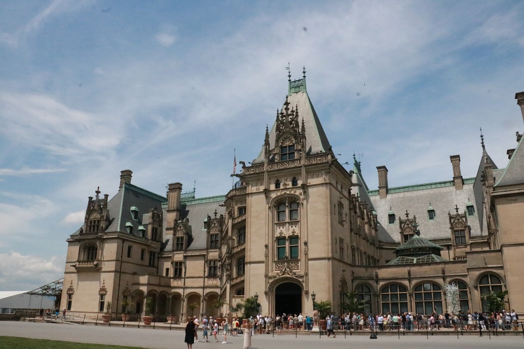
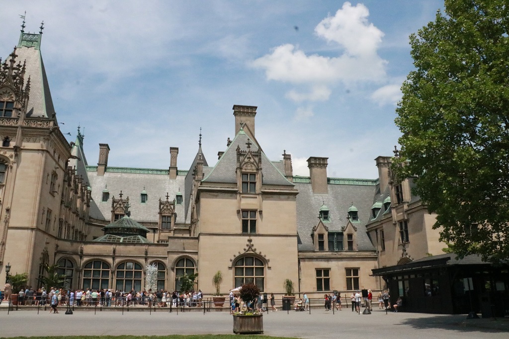
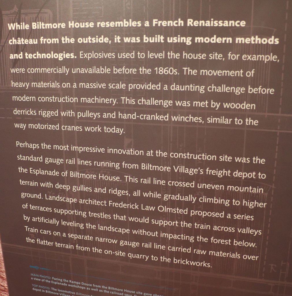
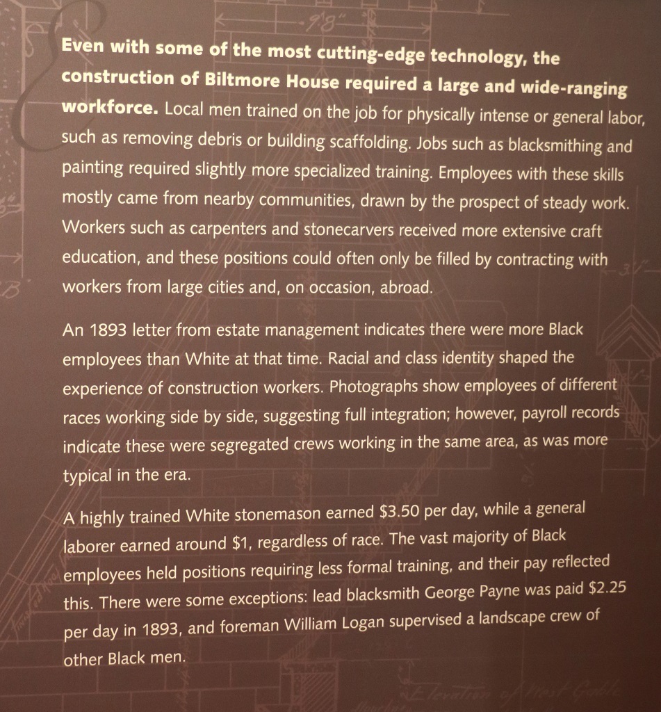
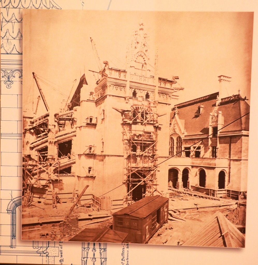
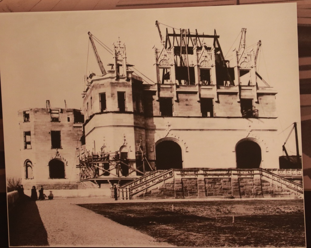
Mr. Vanderbilt originally had plans for a 6,500 sq. ft. French Renaissance-revival house, but when the architect saw the property he said George need to build something in keeping with the scope of the area. The house became a sweeping chateau of 175,000 sq. feet with 35 bedrooms, 43 bathrooms, and 65 fireplaces. It took 1000 men, working 6 days a week, 6 years to complete. There are 4 acres of floors space and 250 rooms.
We had a booked time to enter the house at 1 pm but arrived in time to visit the shops that are now located in the various rooms of the former stable block. The tack room, harness room, repair room, etc all contain small specialty shops and a book store, and the massive horse stable is a restaurant with all of the stalls holding tables for guests. The carriage house is 12,000 acres and housed Vanderbilt’s prized driving horses as well as 20 carriages.
George Vanderbilt began the project when a bachelor of 26. He brought his bride to the house for their honeymoon and their only daughter was born here. He died from complications following an emergency appendectomy at the age of 52 in 1914. His daughter Cornelia at age 25 inherited. As per his wishes to have the land preserved in its natural state, his widow later sold 82,000 acres to the Federal Government for a National Forest at a price of $5.00 per acre.
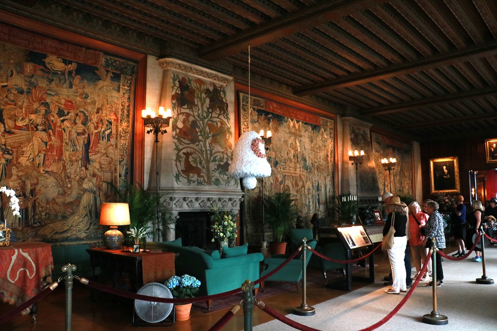
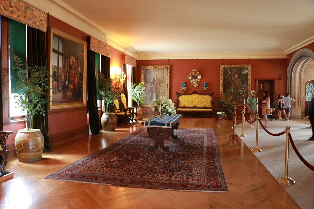
There were 34 information stops on the audio-guide and took us about 2 hours to see the rooms on the three floors, plus the staff areas in the basement.
The Winter Garden located to the right of the grand entrance hall.
The billiard and smoking room. The pool tables were custom-made for Mr. Vanderbilt and weighed over a ton each.
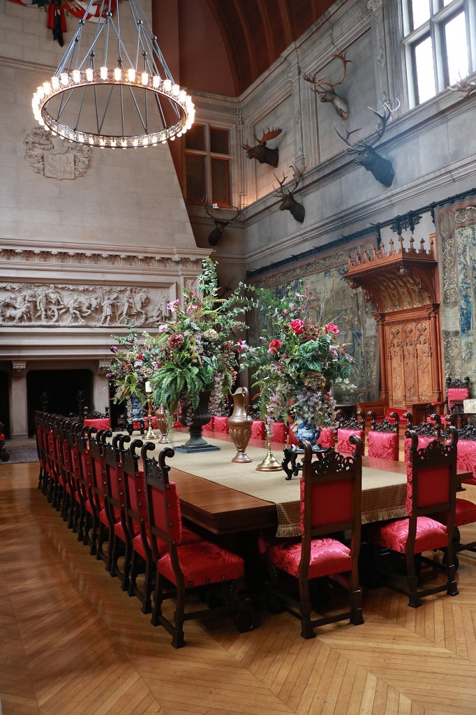
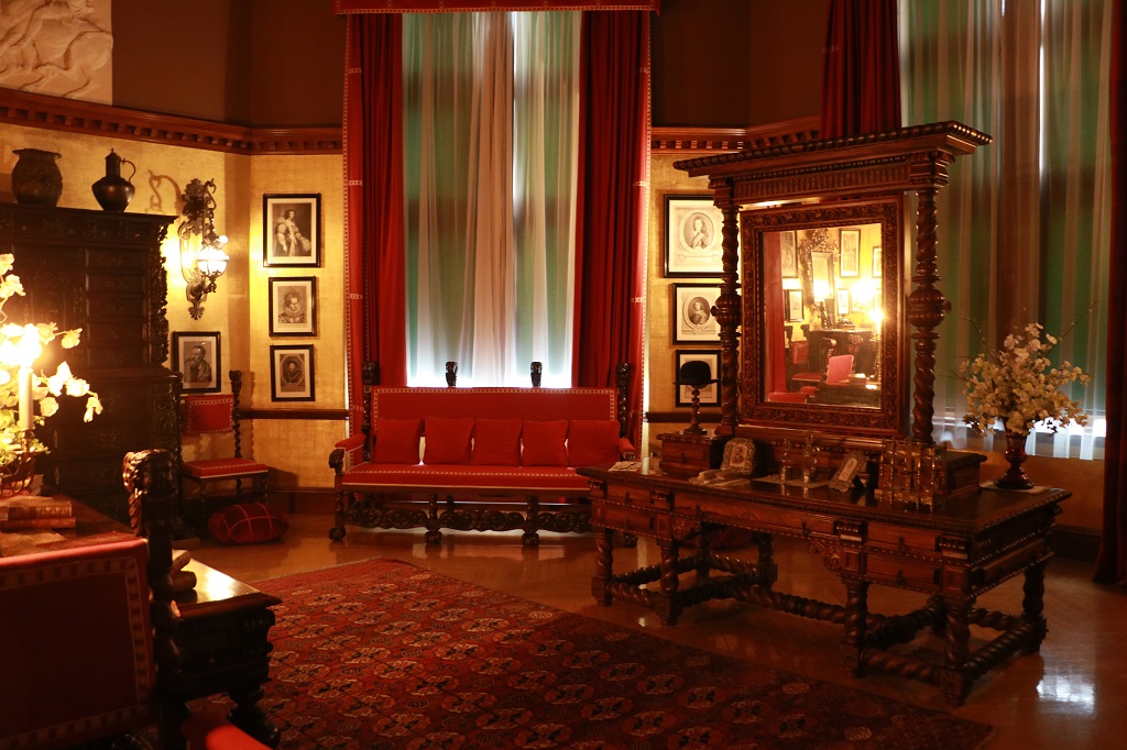
The formal dining room. There were as many more chairs as these sitting along the walls of the room. All were hand made and designed by the architect Richard Morris Hunt. He designed most of the rooms and furnishing in the chateau as well as the building itself. He and Mr. Olmsted, the landscape designer became good friends of George Vanderbilt, and almost father figures.
Candlesticks for the dining room.
The Music and Sitting room.
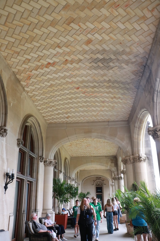
The South Terrace.
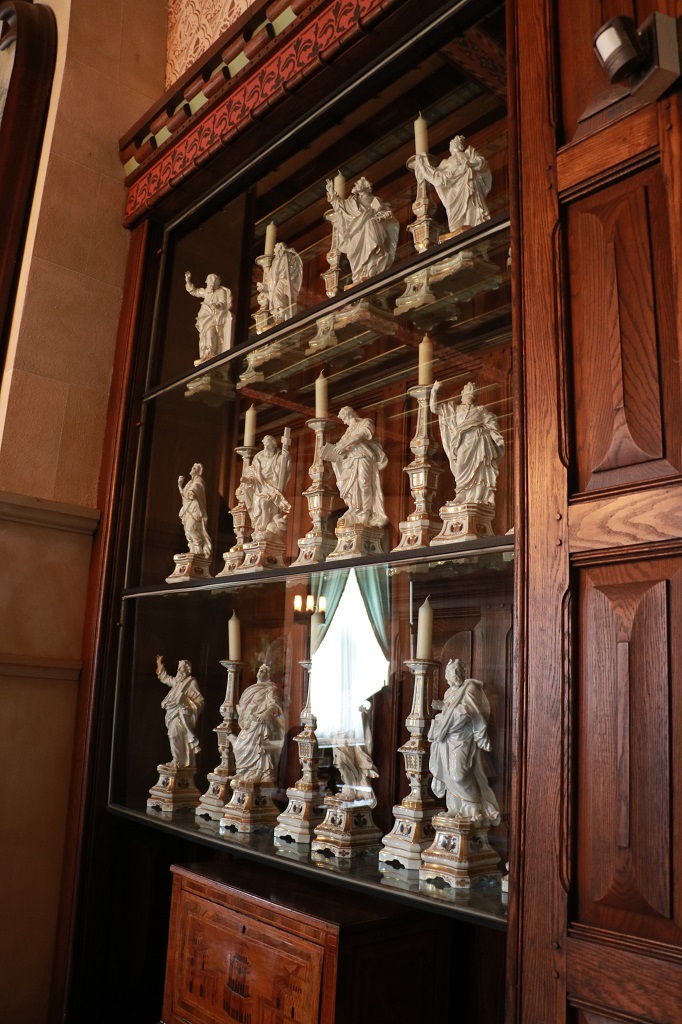
The Tapestry Room. The three Flemish tapestries were made in the 1500’s. The family had several St. Bernard dogs that would go running through the house happily wagging their tails, dangerously close to toppling priceless pieces of art, or vases, or china. There are children’s books about Cedic the St. Bernard from Biltmore available in the bookshop.
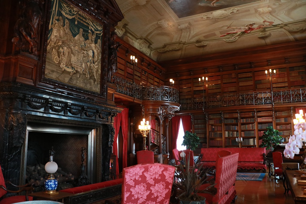
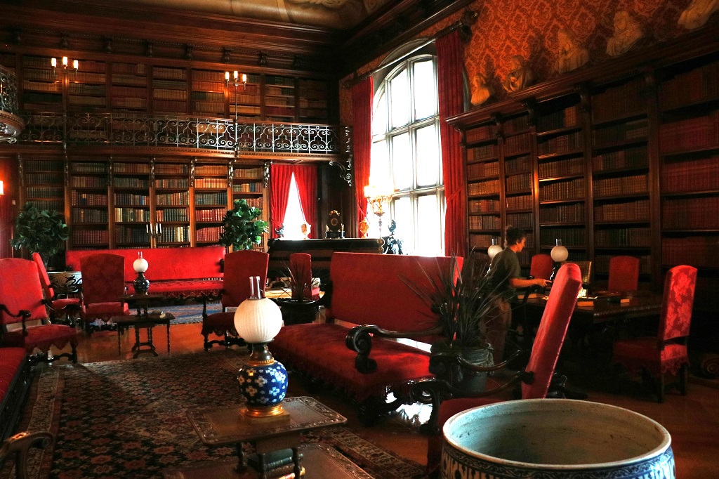
The Library. The house has a collection of 24,000 books.
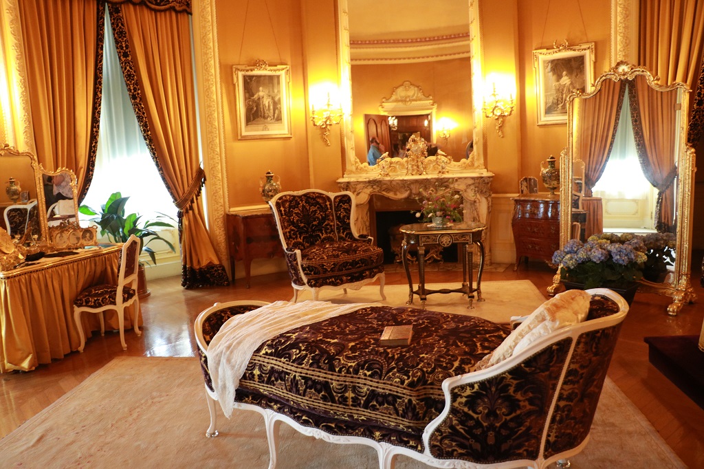
Mr. Vanderbilt’s bedroom. This room was not finished when he moved into the house and he stayed in one of the bedrooms in the bachelor wing until it was complete. There were a few rooms in the house – like the Tapestry Room – that did not get finished until after he died.
He and his wife entertained many friends at the Biltmore and George was very protective of their privacy and that of his family. He never allowed photos to be taken of the inside of the house so it has been quite a challenge for restorers to recreate wall paper pattens from tiny swatches on the walls.
Mrs. Vanderbilt’s bedroom
The Third Floor Living Hall where the guests would congregate and share stories, play games, write nonsense verses for their hosts, etc. The guest bedrooms, each with a bathroom were all on the third floor.
There were 27 large bedrooms in the basement for the female staff, none of whom had to share a room and 32 rooms above the stables for the male staff.
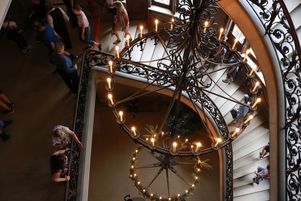
Looking down the Grand Staircase from the third floor.
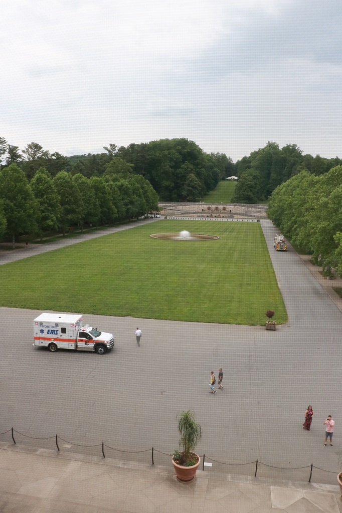
The entrance gate to the house is located on the left at the base of the terrace stairs. (A lady collapsed near the elevator (the house has two small electric ones) and needed medical attention – hence the ambulance.
There was a large display in the Hallowe’en Room in the basement with information boards about the construction of Biltmore House. The walls of the room were painted by young Cornelia for a New Year’s Eve party she held one year with about 100 guests. It is only called the Hallowe’en room because of the many crows and bats she put on the walls.
As usual I photograph the information boards and post the ones I find the most informative or interesting. That way I don’t have to remember so much stuff.
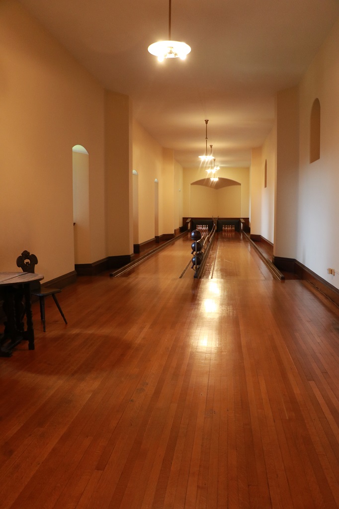
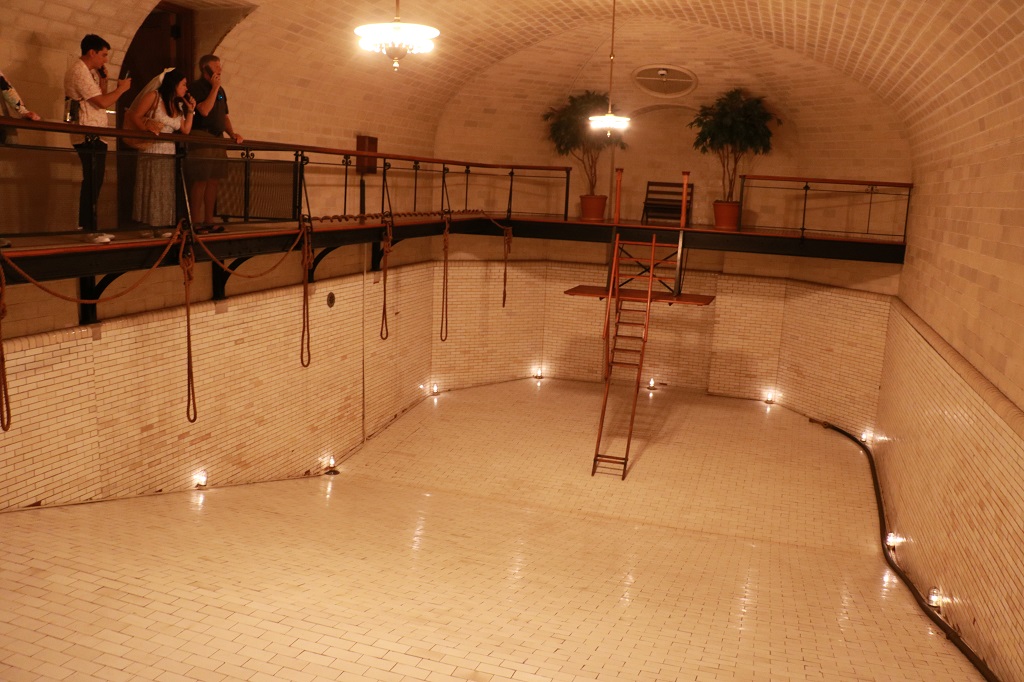
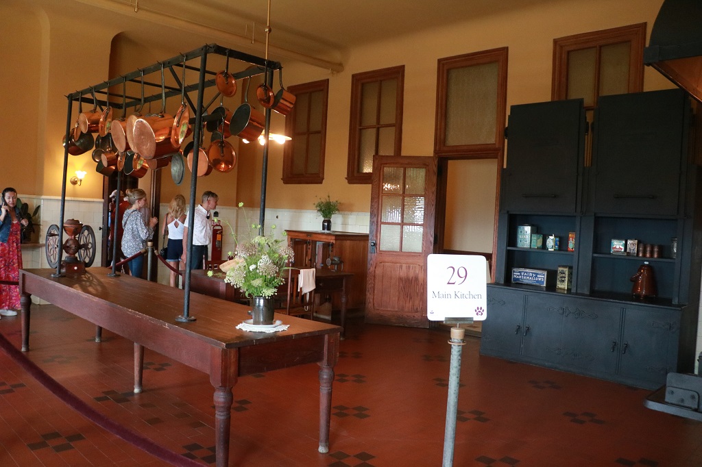
The basement contained the Houskeeper’s rooms, the kitchen, pantry and storage rooms, female staff bedrooms, laundry, a two-lane bowling alley and a 70,000 gallon heated, lighted 9′ deep swimming pool that had to be drained and cleaned after every use as these were the days before chorination systems.
A staff person sat in a tiny alcove near the pins to reset them after each ball.
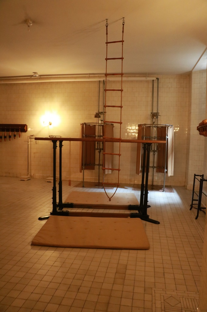
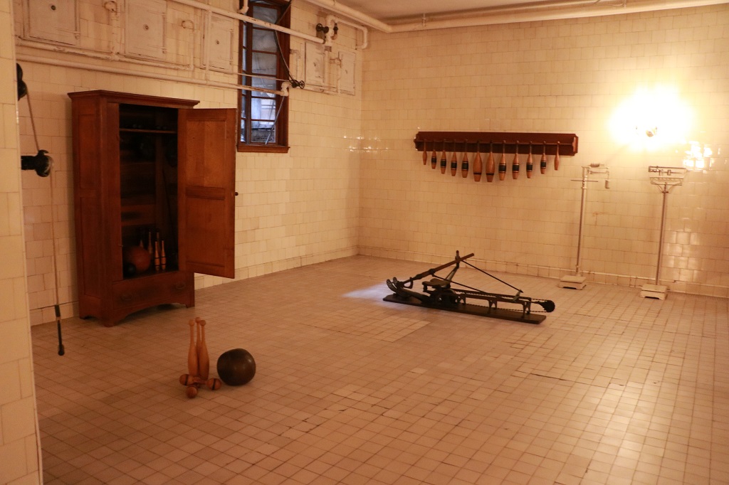
The Vanderbilt’s and many of their guests were very health conscious so there was also a gymnastion with two needle showers that would send highly compressed jets of cold water against your skin to rejunenate you.
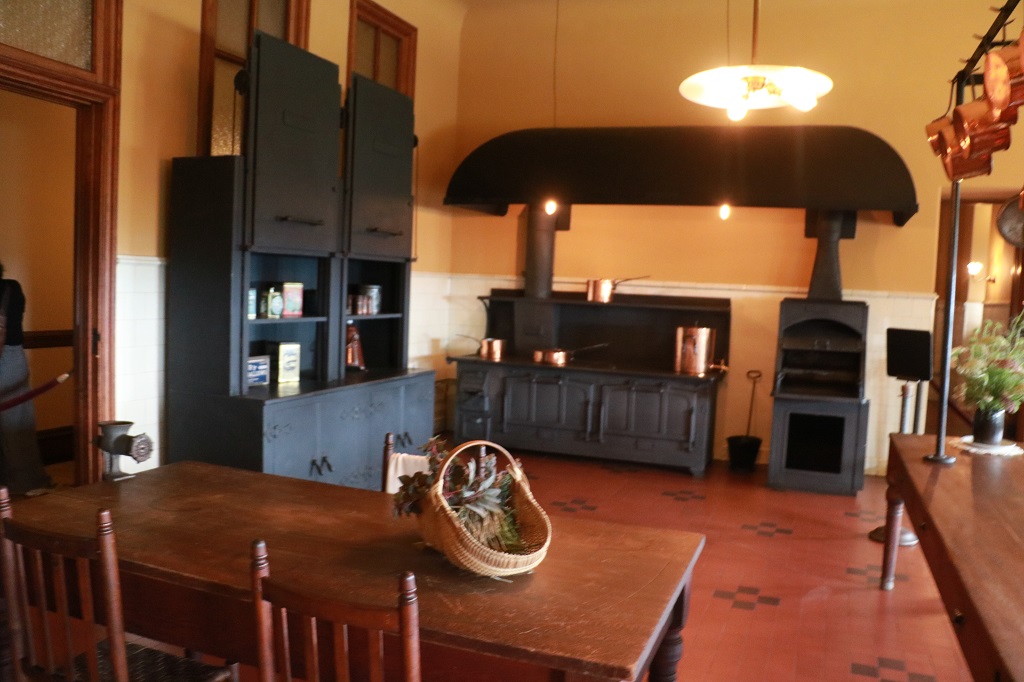
The main kitchen. They would prepare breakfast, lunch, tea, dinner, plus any special requests from guests, and the all the meals for the staff.
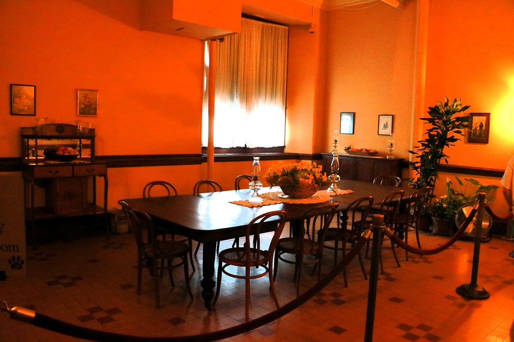
The staff dining room. They ate in shifts, served by other staff members and according to the strict heirarchy of precedence of the day. The housekeeper was at the top in American houses, whereas the butler was the main authority in British households. The head housekeeper was never married but referred to as Mrs. King. She worked in the house from 1895 to 1914.
There were many, many storage rooms for food stuff and dishes, etc.
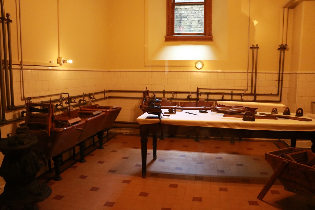
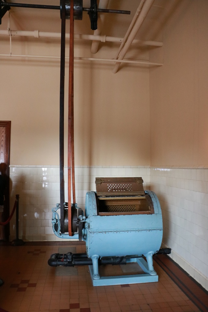
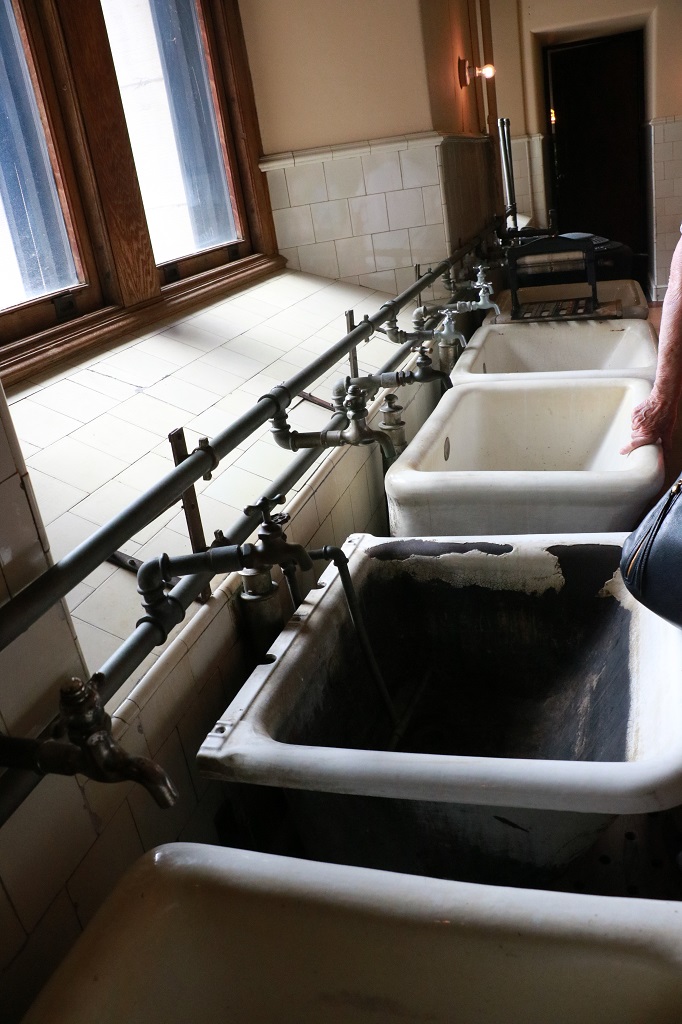
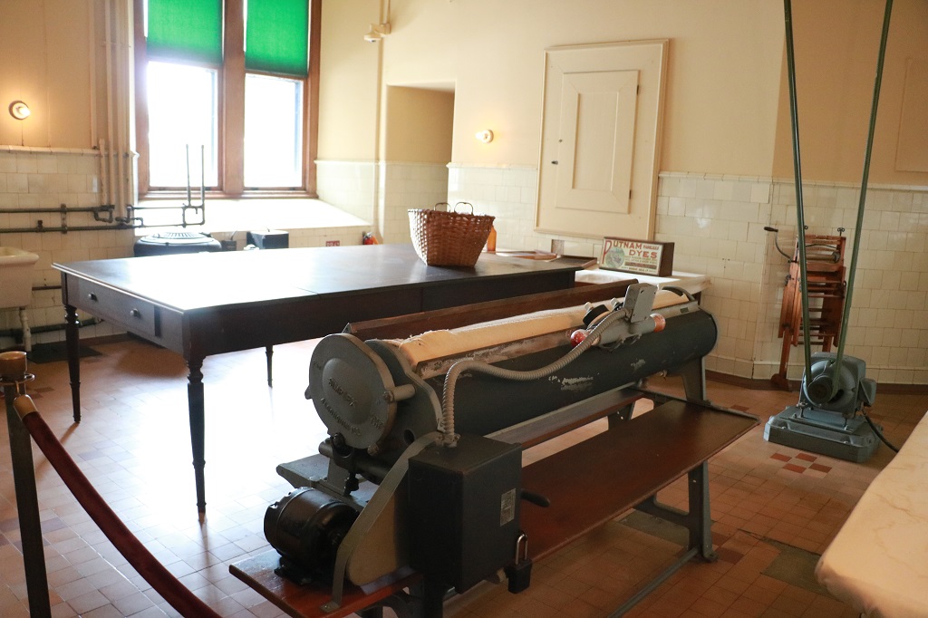
Laundry and ironing.
Any and all ‘new fangled’ inventions or innovations were installed at Biltmore. The house was wired for electricity from the beginning and contains thousands of lights and a butler call button system.
The outside windows along the inside Grand Staircase followed the angle of the stairs.
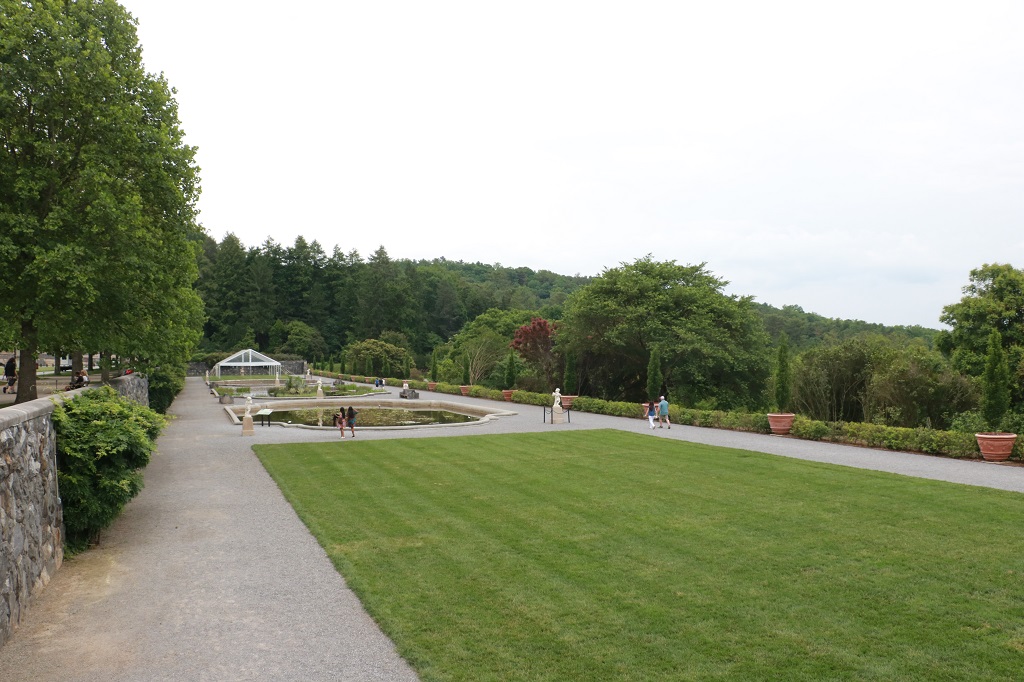
The Italian Garden. We had planned to tour the gardens, but they were all on a long downhill path and my arthritic hip and knees would not have been able to do it after all the walking and stairs in the house. We intended to stop at a parking area near the walled garden as we exited the grounds but missed the turn on the one-way road. It was starting to rain anyway.
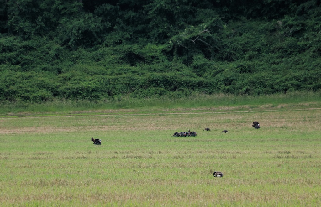
They are hard to see but, these are wild turkeys. We saw quite a few of them as we drove through the forest on the Biltmore estate.
It was a gorgeous house to tour and we had a great first day. Back to Charlotte tomorrow.
My final blog for this trip is nothing but dirt with a bit of water thrown in for variation.
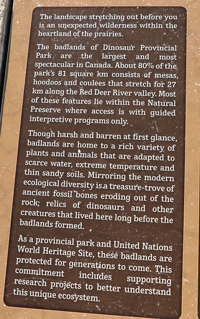
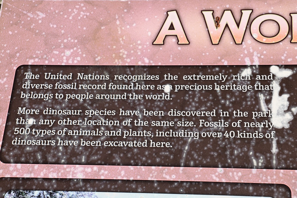
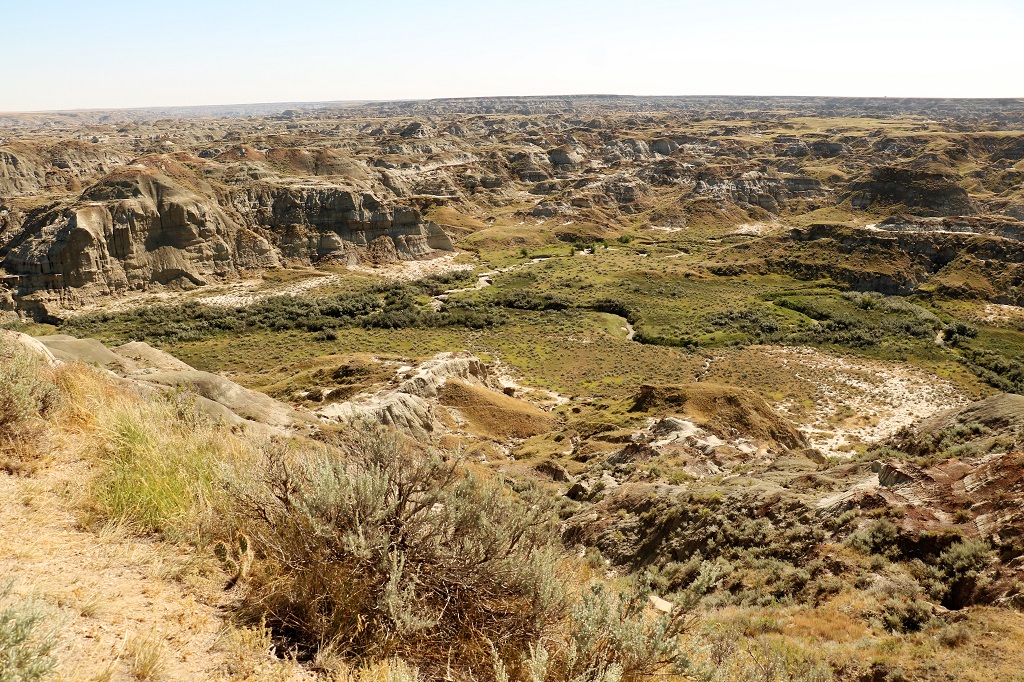
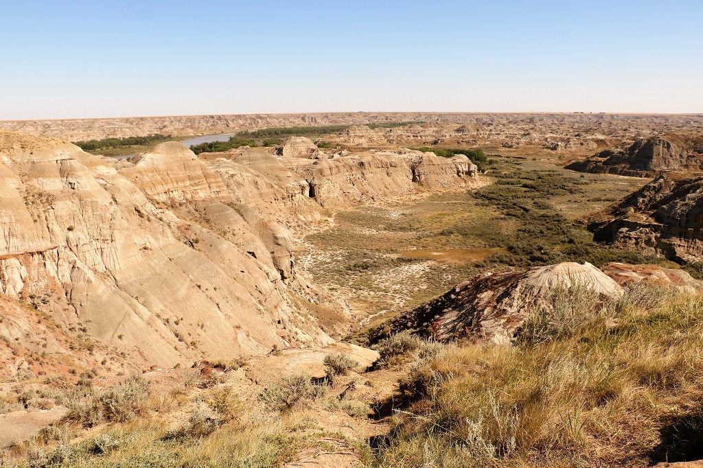
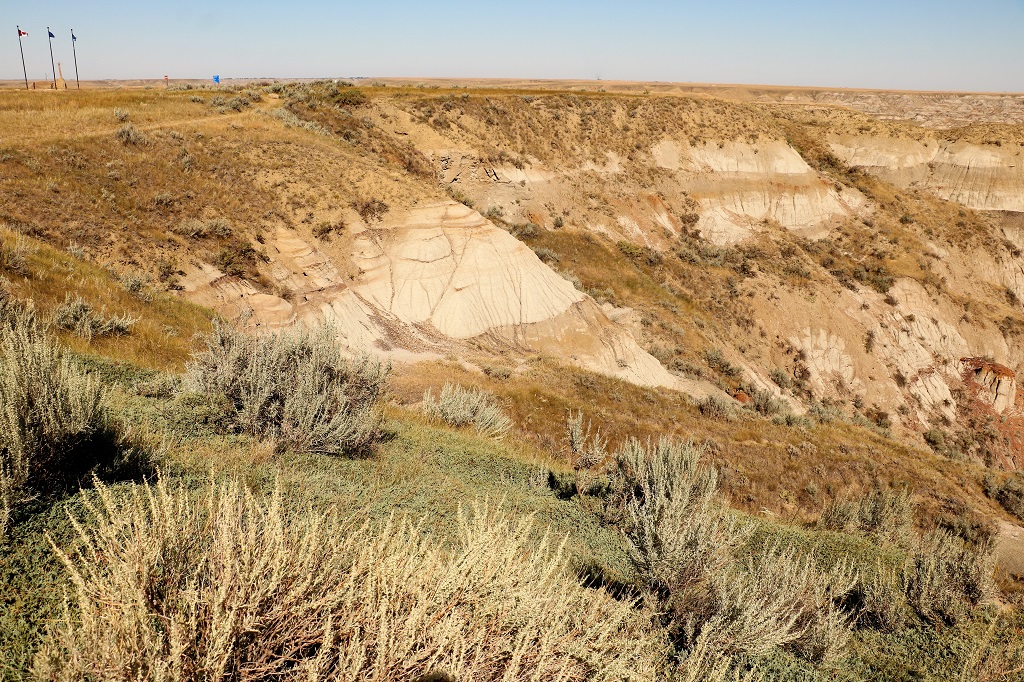
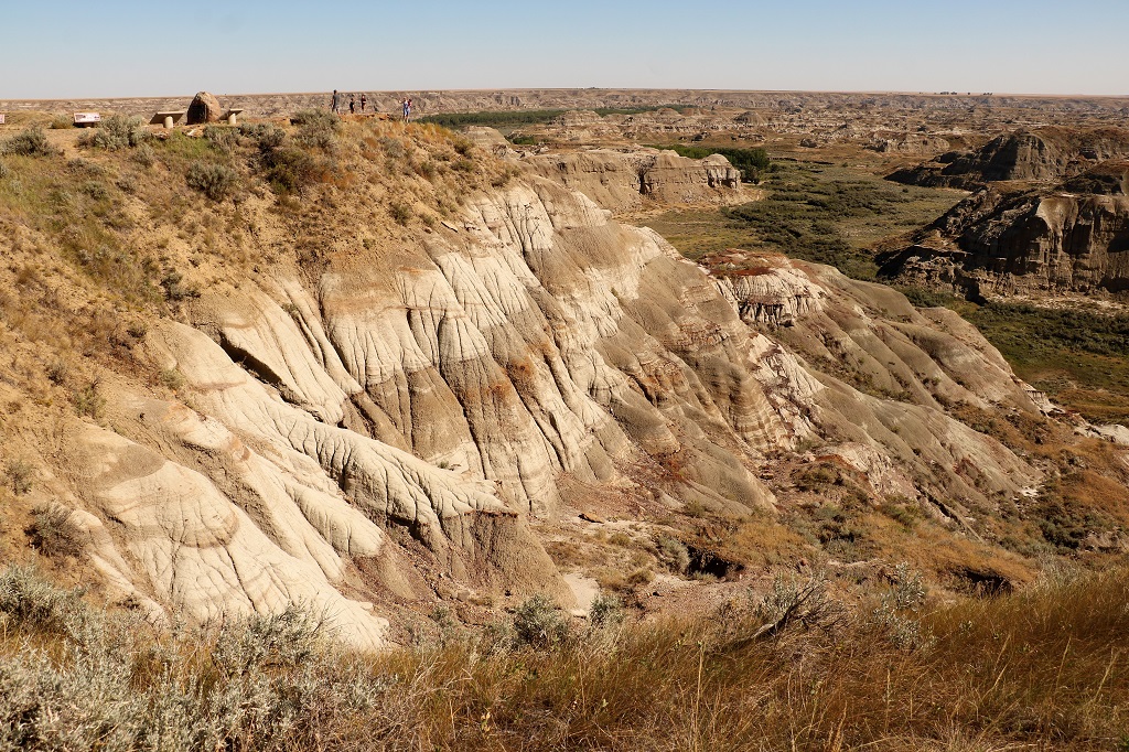
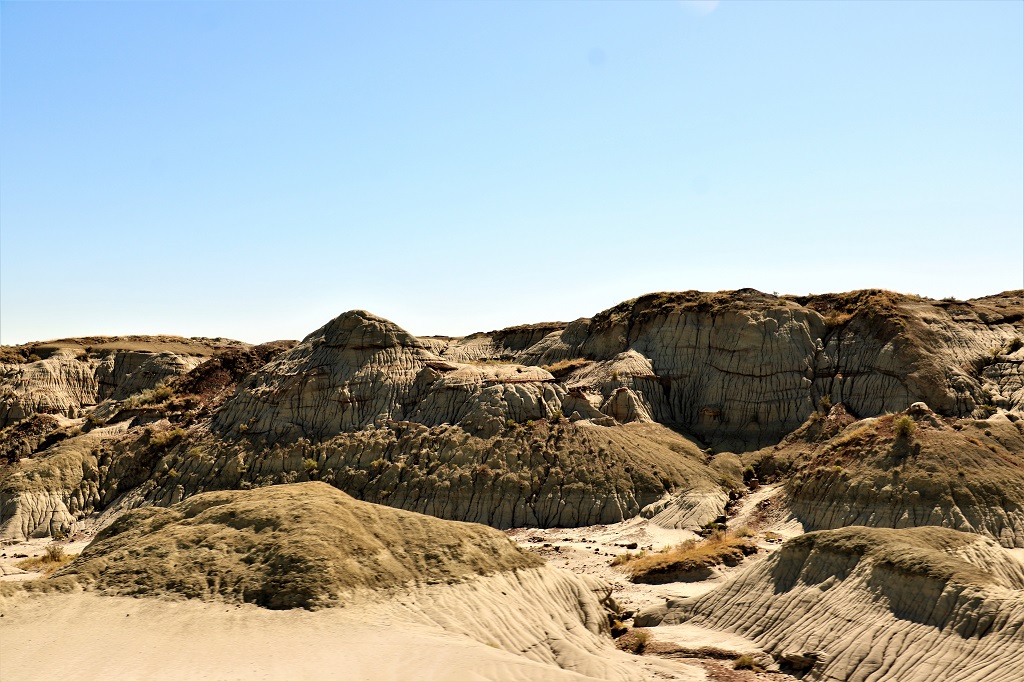
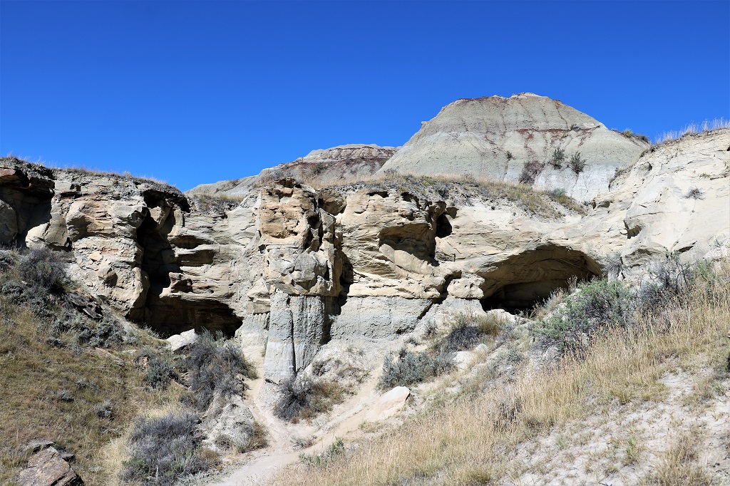
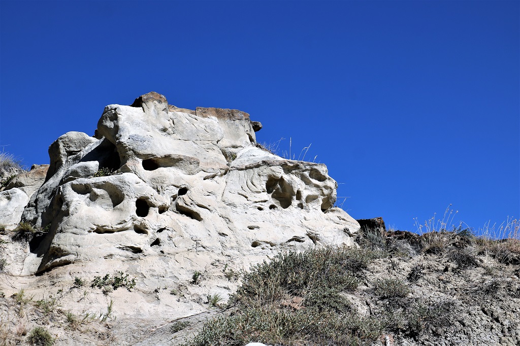
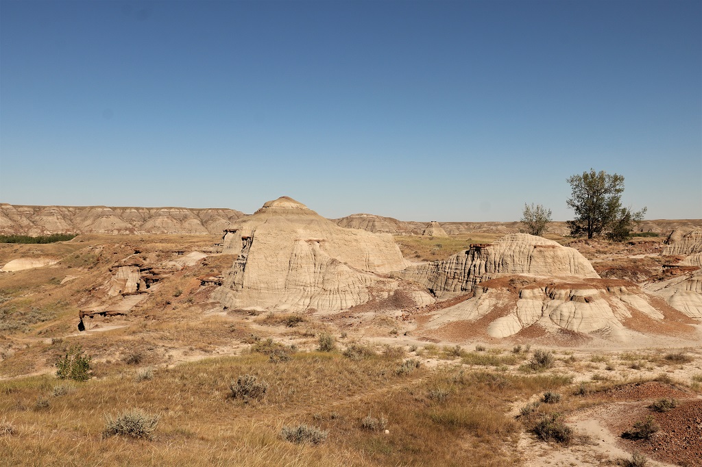
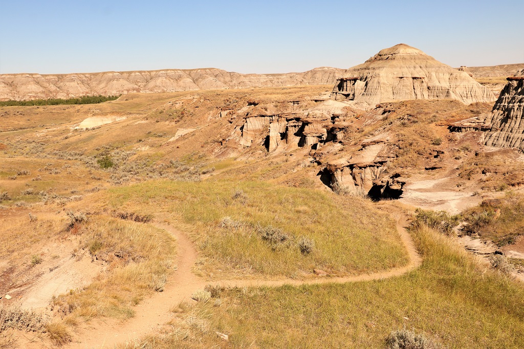
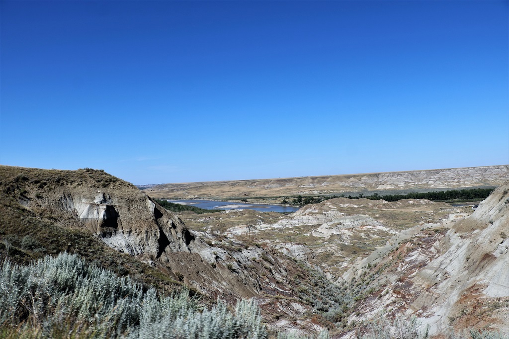
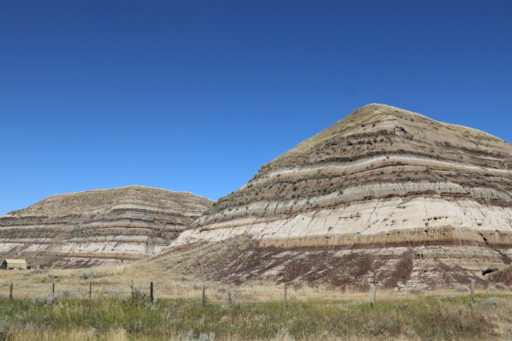
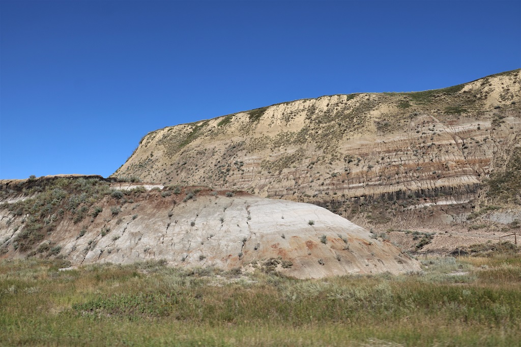
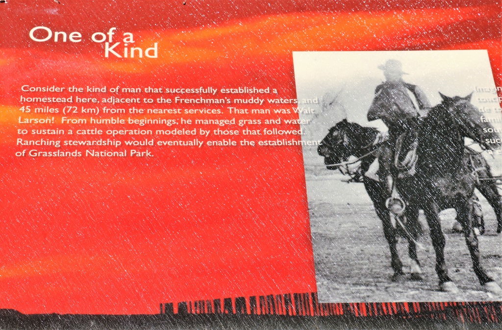
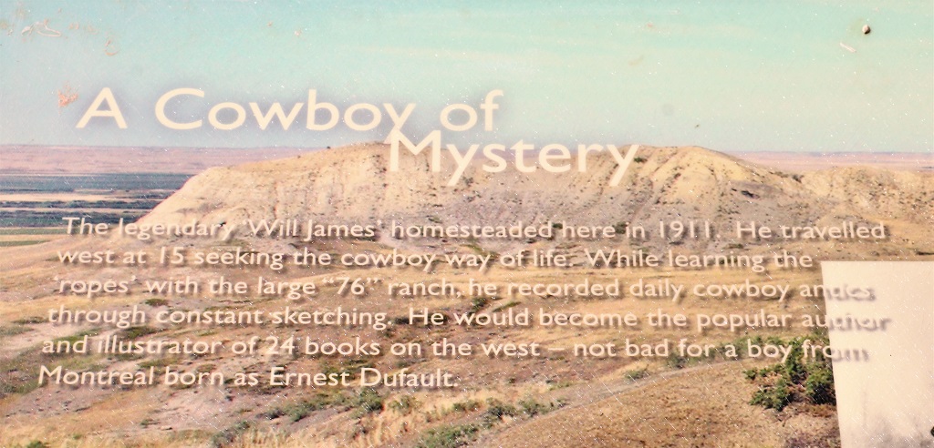
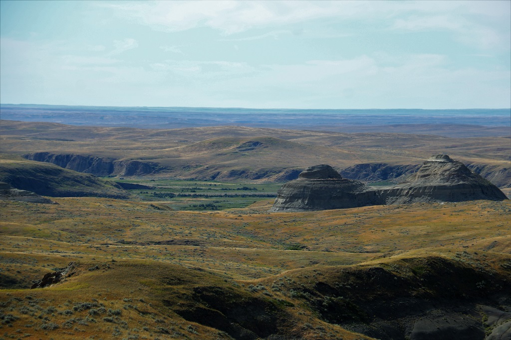
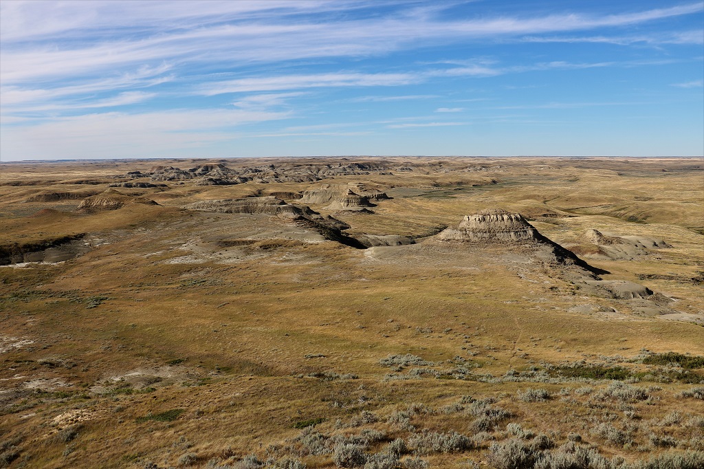
We left Medicine Hat and headed west far enough to connect to the road north to Dinosaur Discovery Provincial Park, a United Nations World Heritage site near Patricia.
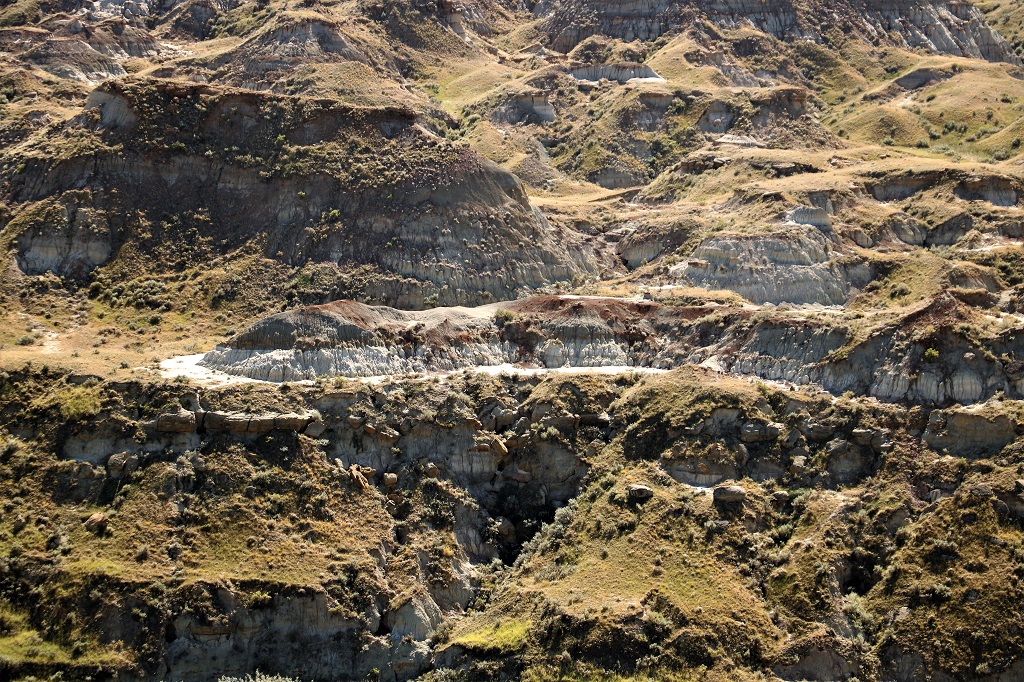
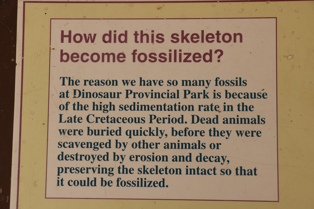
This area in the Alberta Badlands is an incredibly rich fossil site.
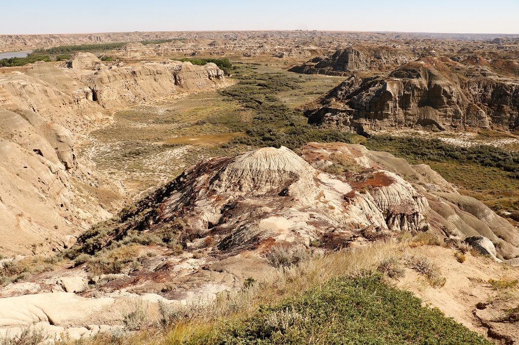
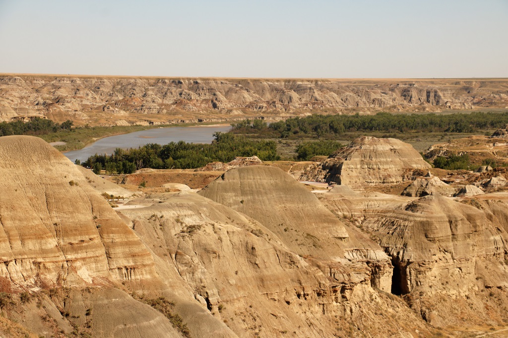
Before we descended into the valley to the Vistors Center we walked along the ridge at the viewpoint at the top of the hill.
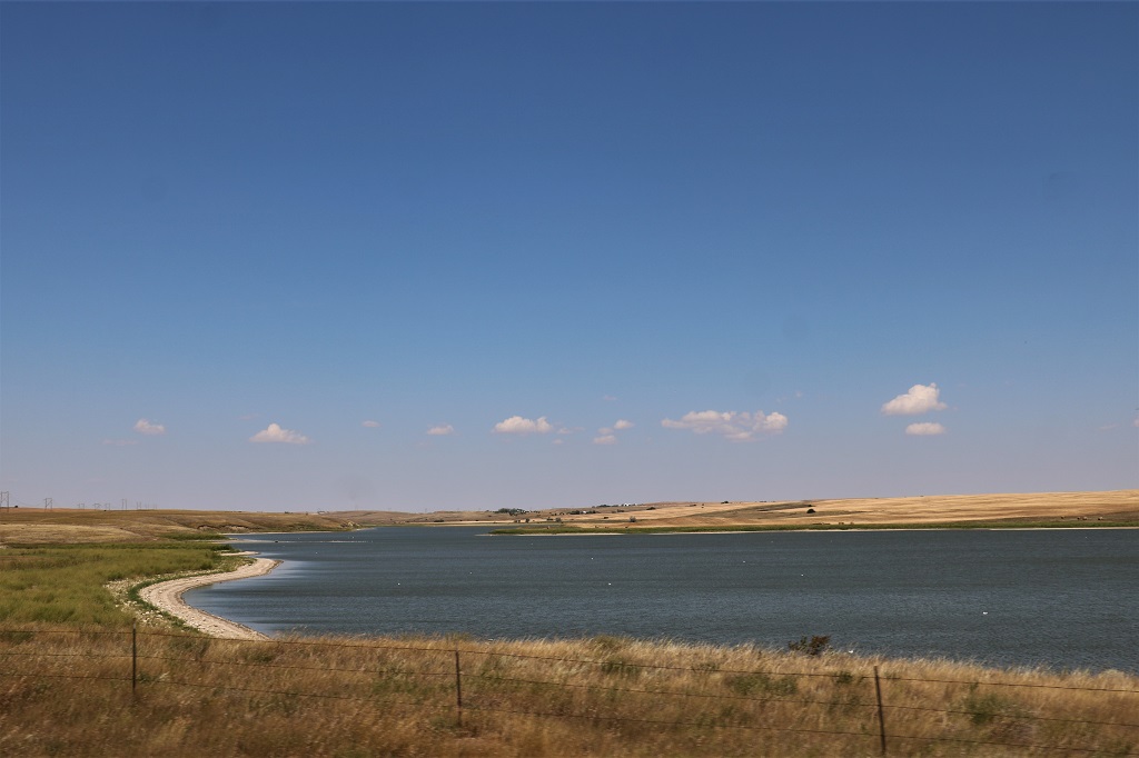
The distant meandering water source is Sandhill Creek.
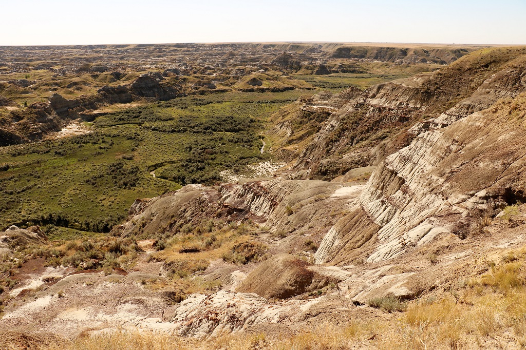
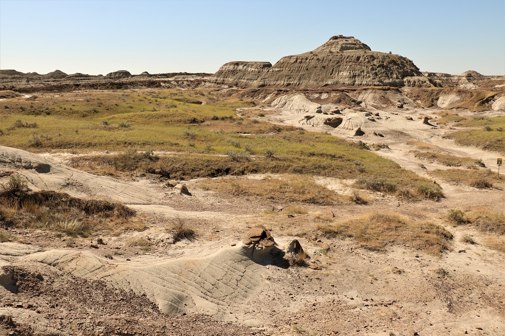
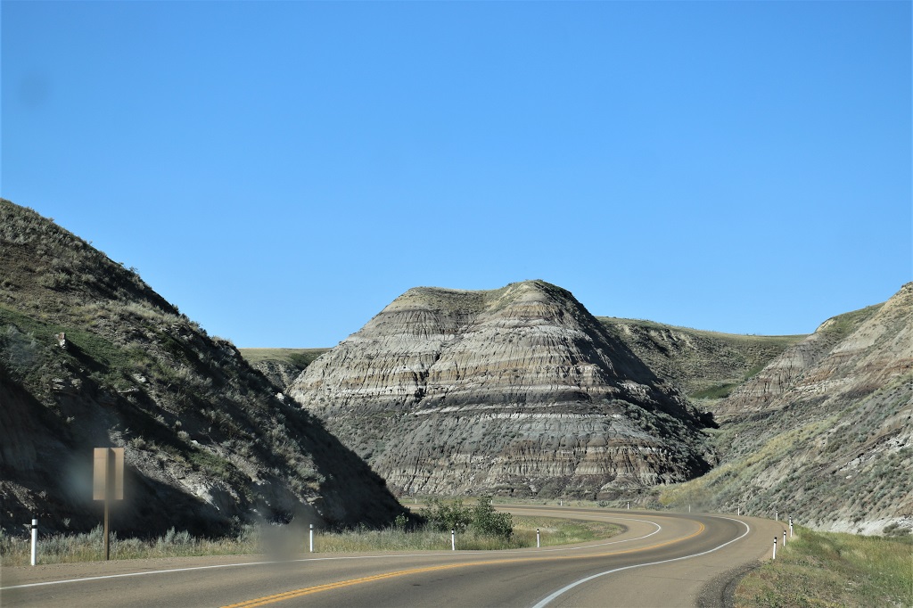
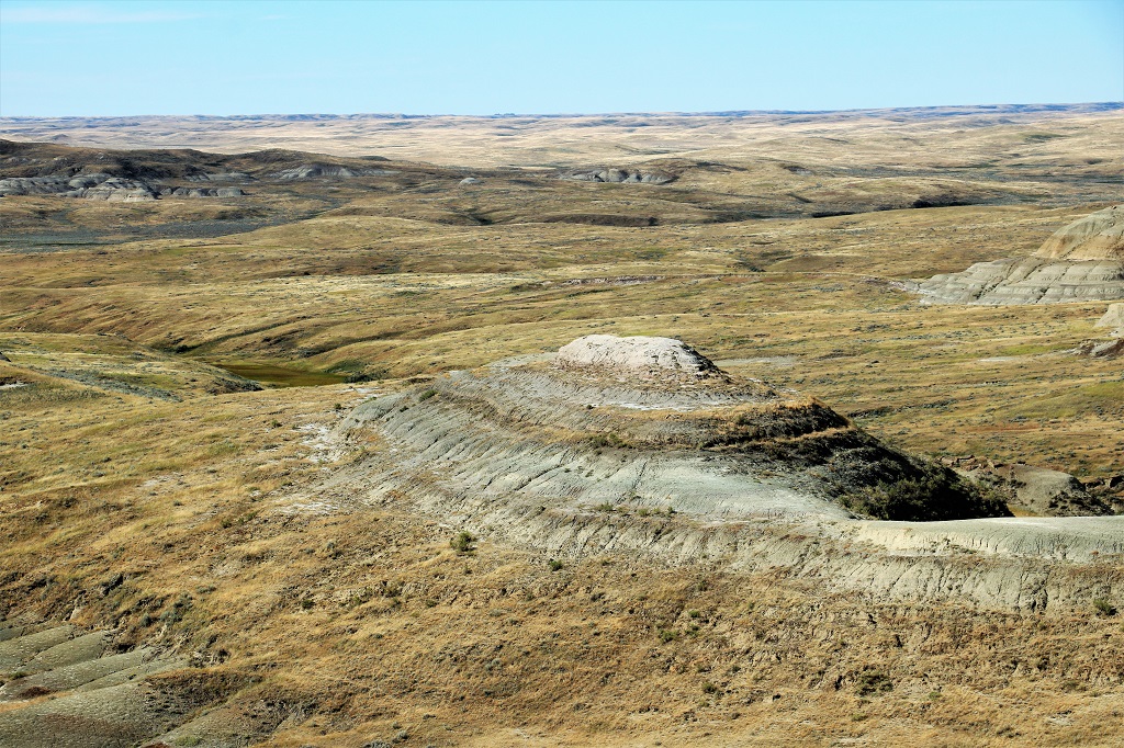
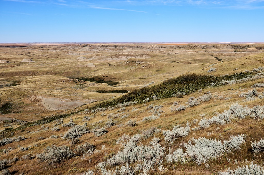
The road to the valley floor was very steep and winding and the roadside was posted with many signs saying No Stopping on the Hill. Too much risk of being hit by a car coming around a corner if you decide to stop and take a photo.
We stopped at the Visitors Center briefly. They had a large dinosaur display but we gave it a pass. They sell 2 hour bus tours with a few different themes and also provided guided hikes. There are warnings at the trail heads to beware of rattlesnakes, black widow spiders, northern scorpions and cactus.
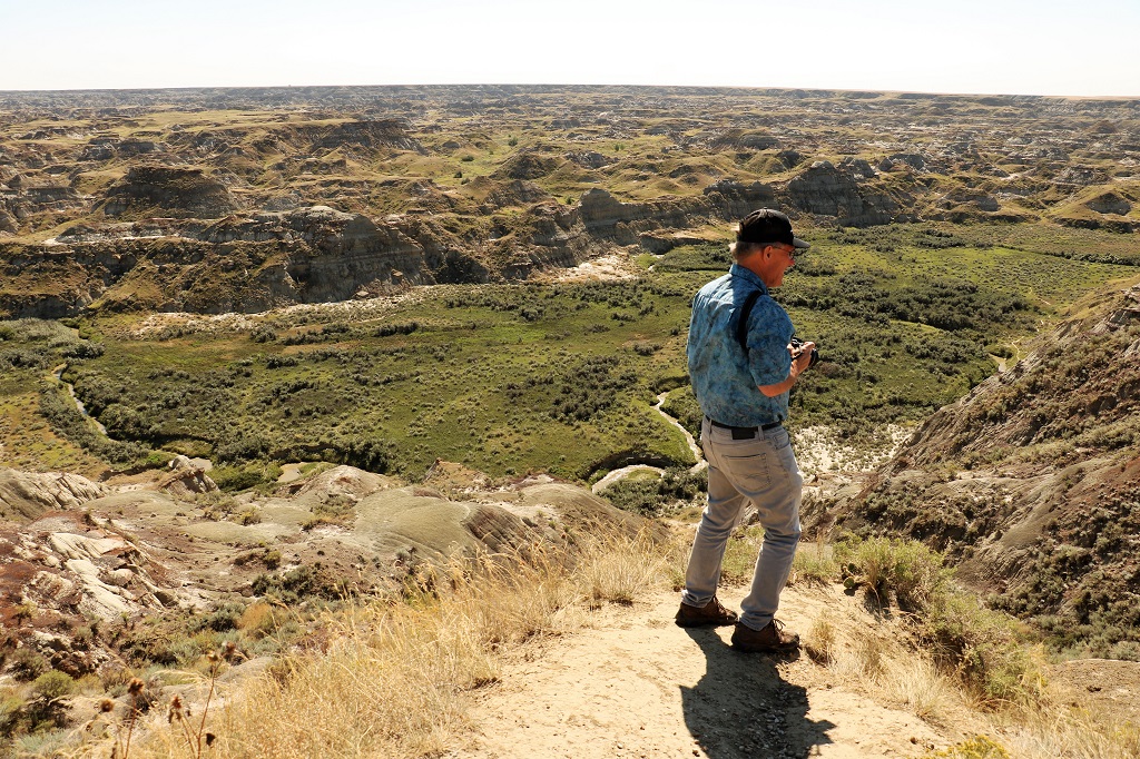
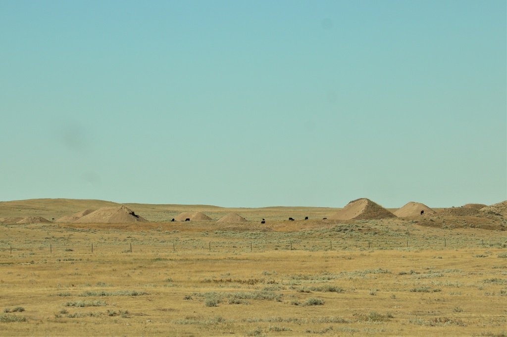
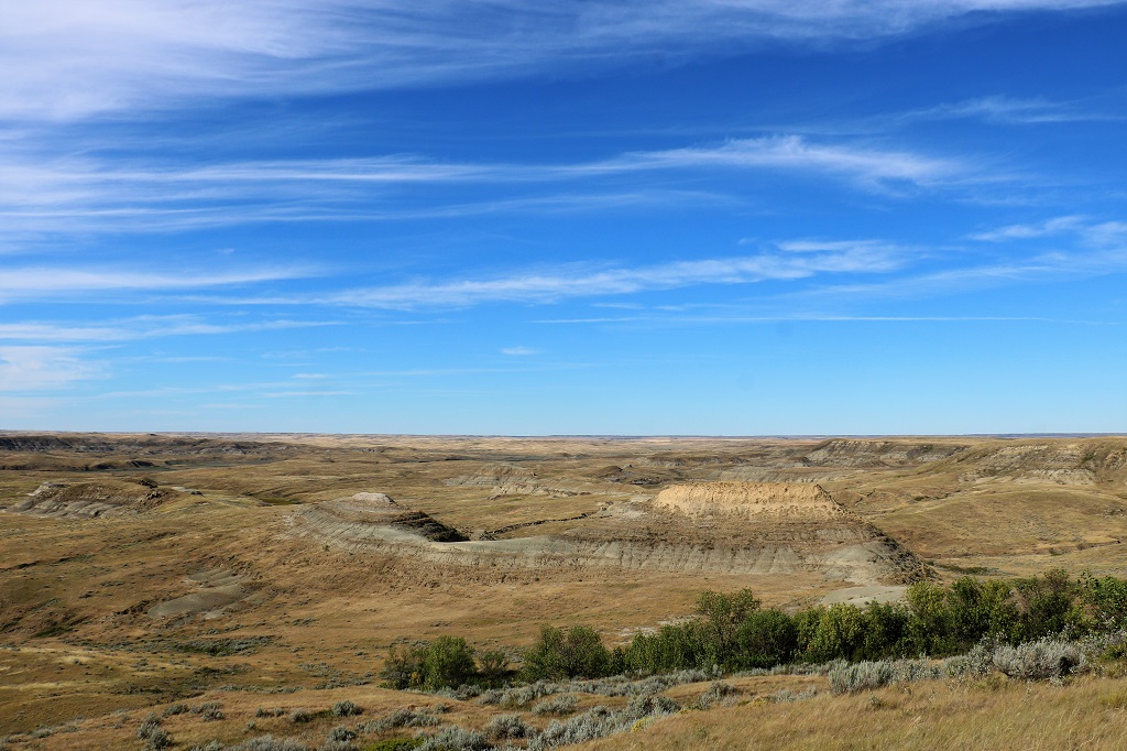
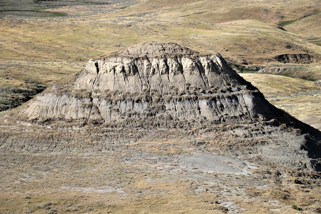
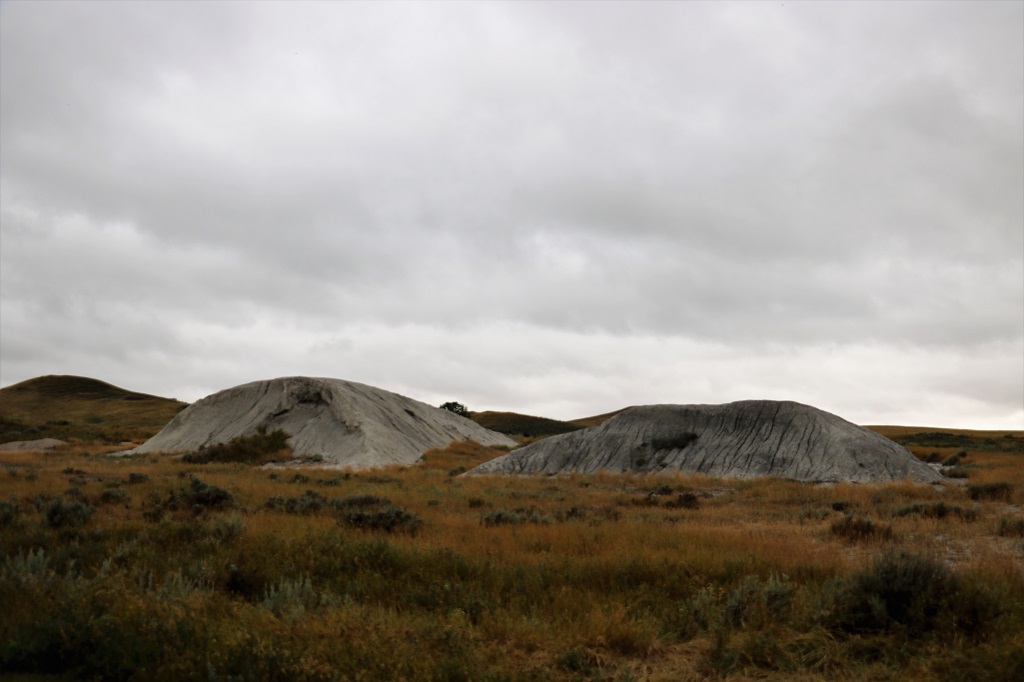
The scenic drive was only three kilometers long but there were still lots of different dirt piles to photograph.
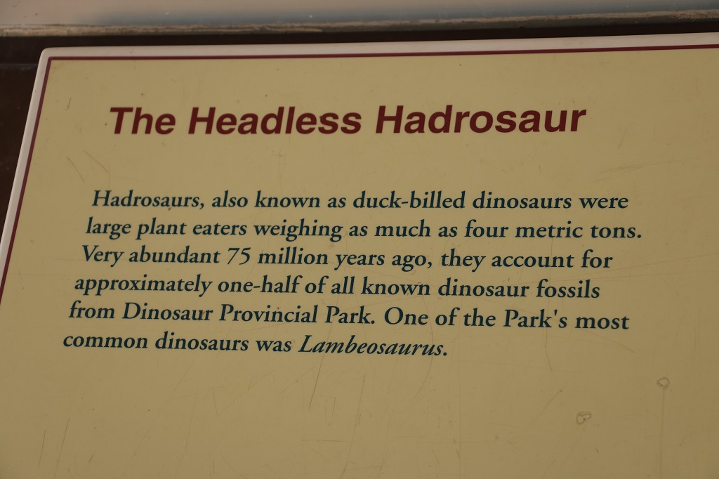
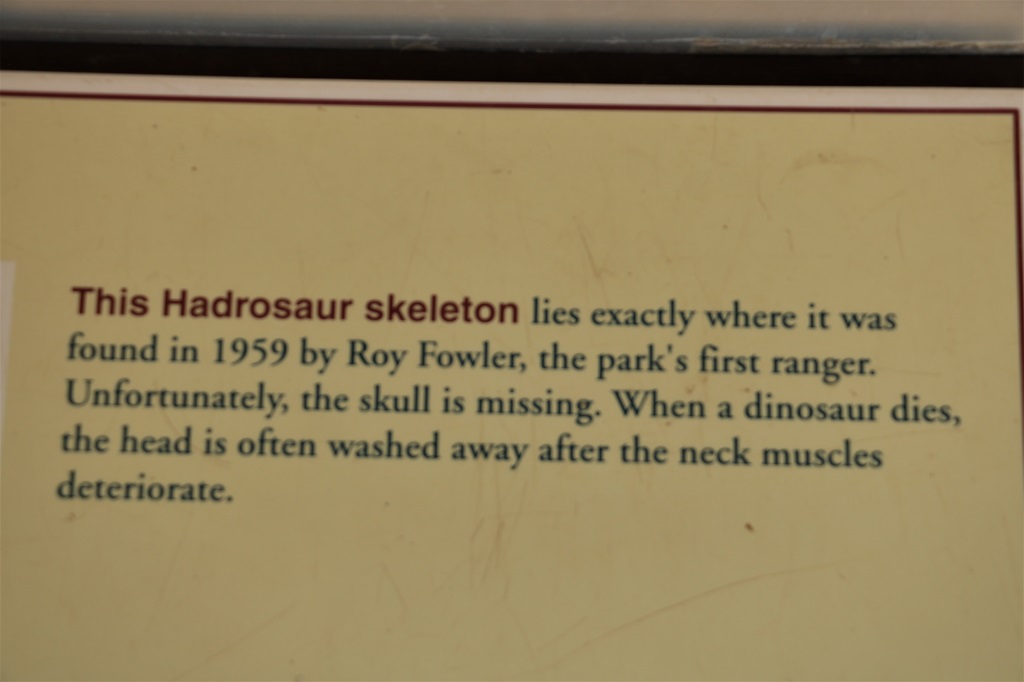
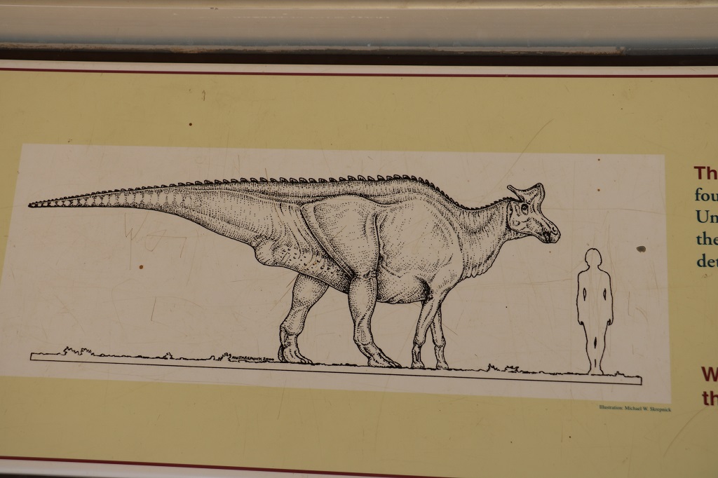
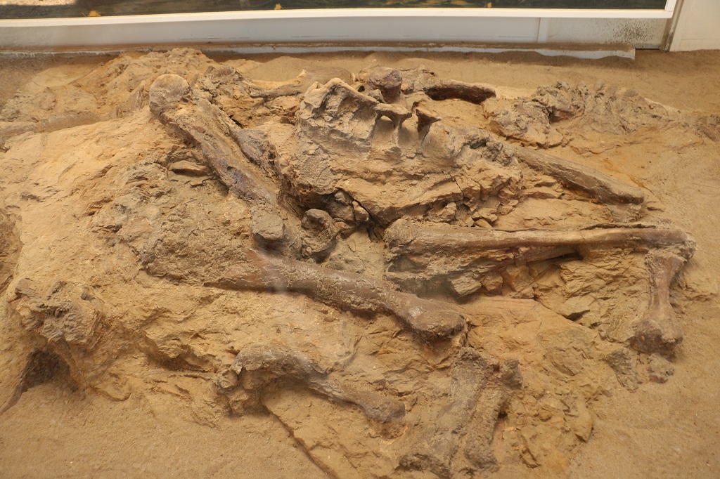
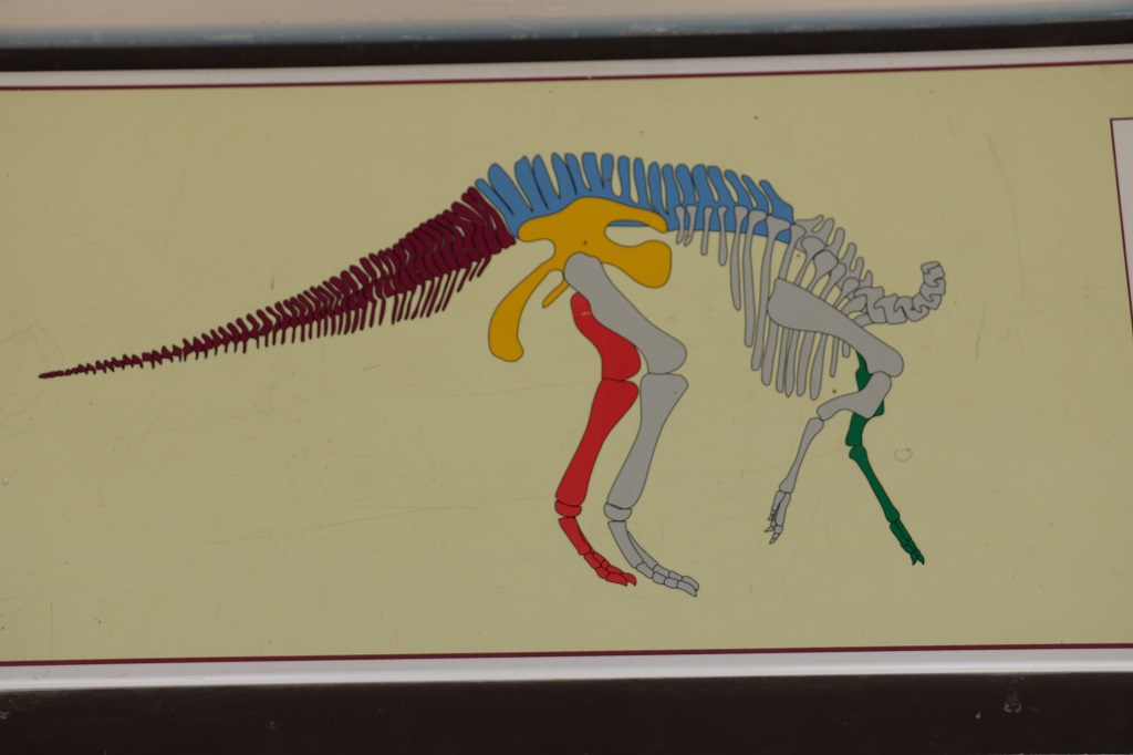
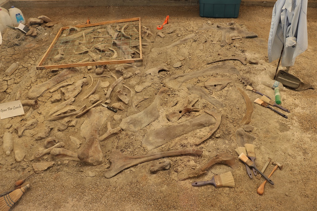
There were two special fossil sites along the road. In each a collection of fossilized bones was protected by a plexi-glass walled shed.
Aided by the drawings above and below you could look at the bones and see which ones belonged where.
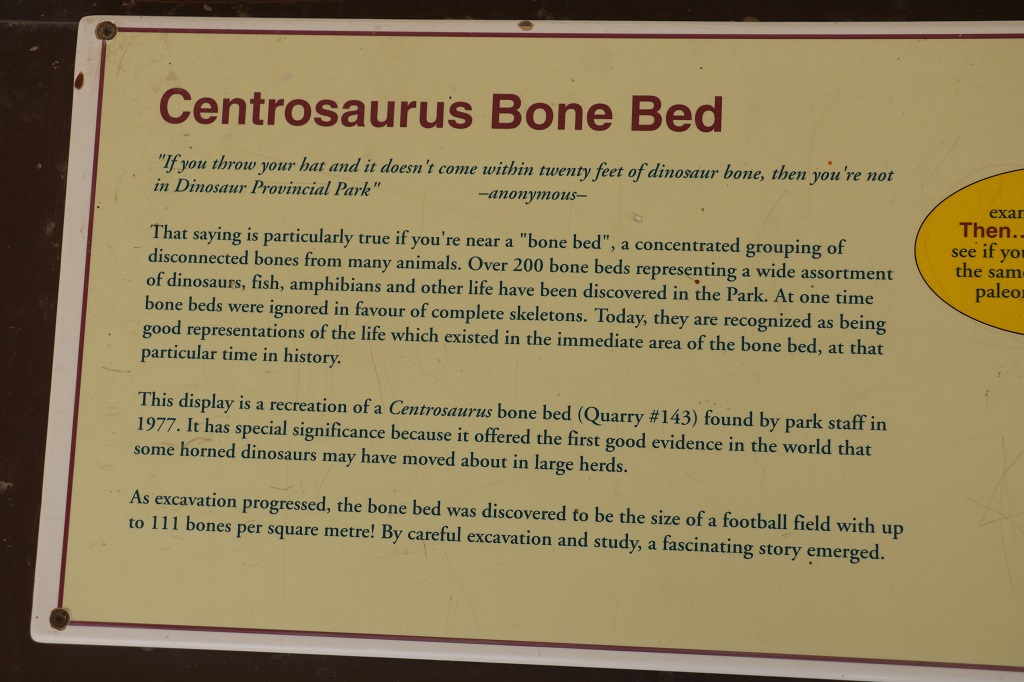
The second fossil site was a repiicated section of a large bone bed that was discovered here.
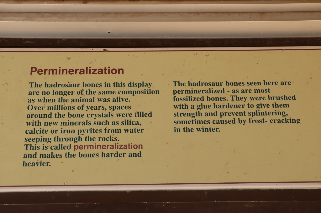
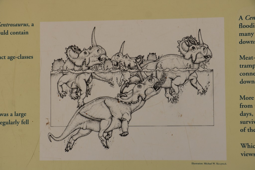
There were two theories about how so many bones ended up in such a muddled pile (the paleantologists think about 300 animals). One was a flash flood and the other was a disaster caused by so many large animals crossing a deep river at once and having many of them jostled off their feet and swept away. The majority of the bones belong to Centrosaurus, but there are also teeth from a flesh-eating dinosaur that broke off when they were feeding on the drowned ones. Many of the bones of the Centrosaurus show tooth marks and breaks.
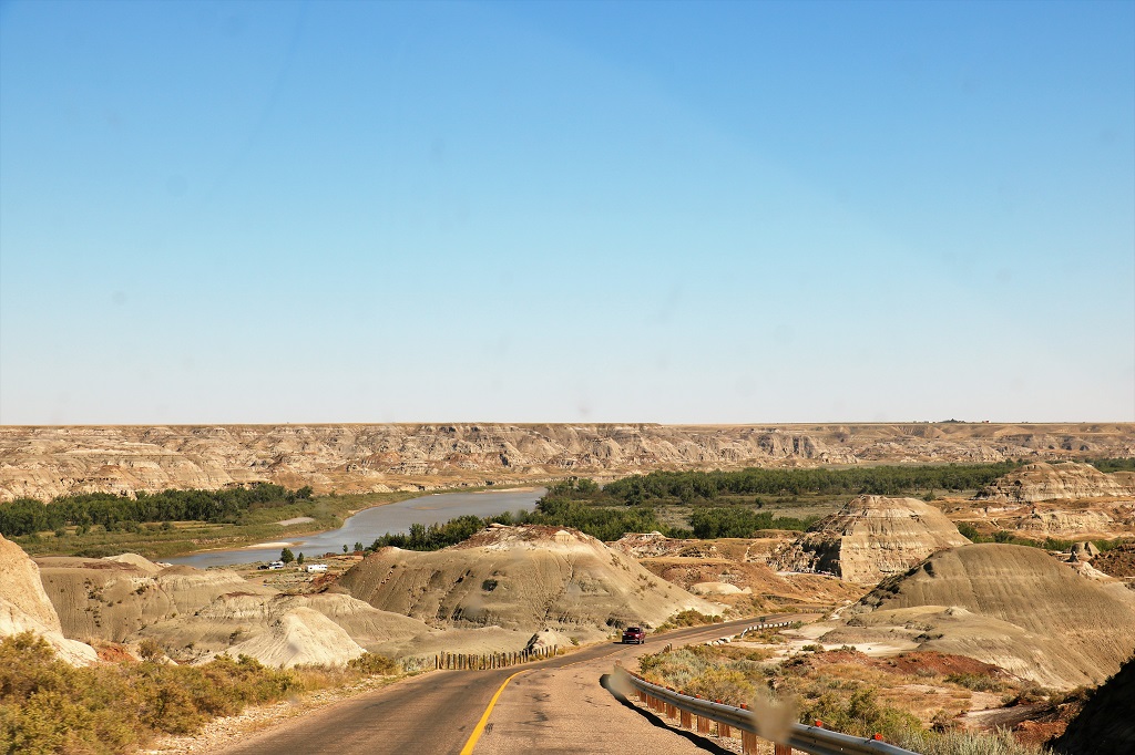
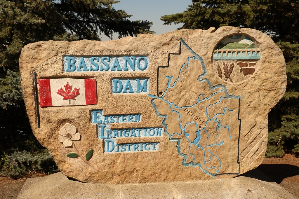
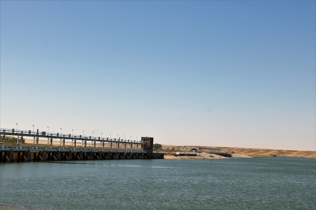
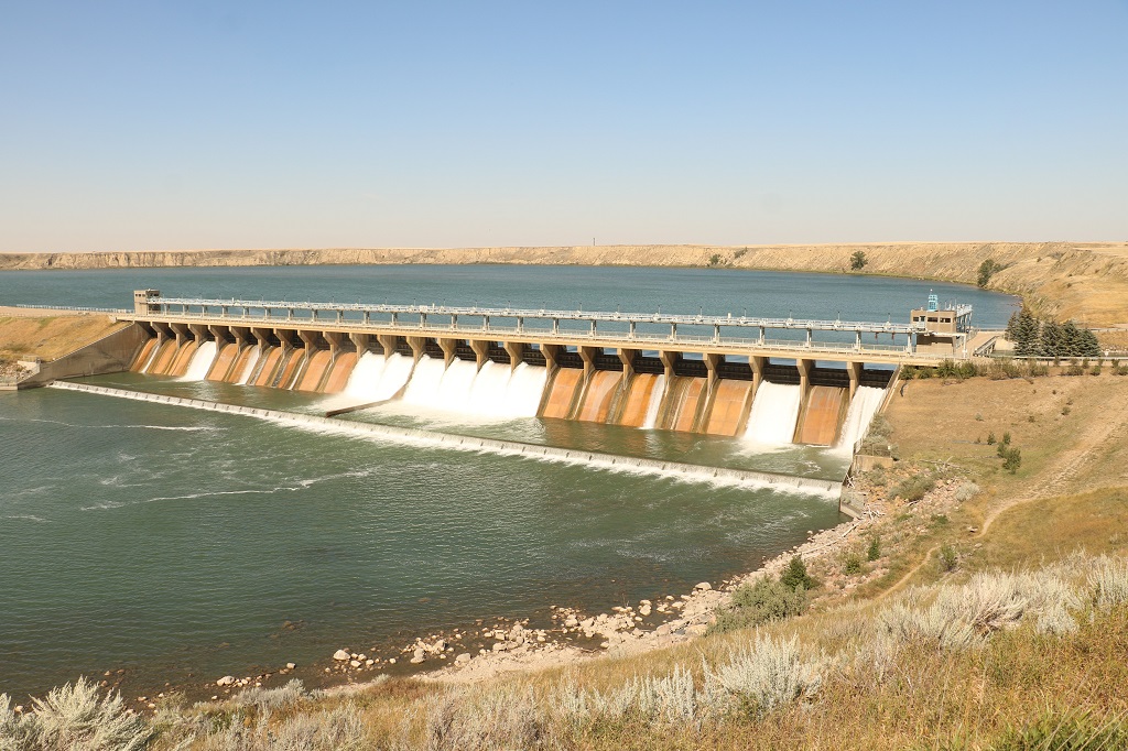
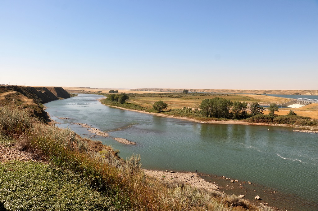
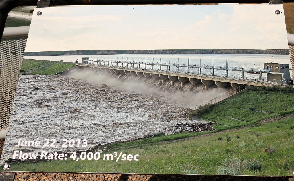
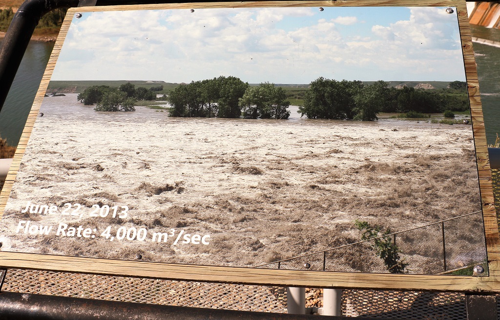
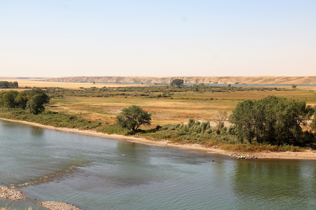
Once we had driven the loop road we had lunch at the cafe and then drove to the Bassano Irrigation Dam.
2013 was a bad flood year and they had a couple of poster boards showing the dam during that time.
Every gate wide open and the water is covering the lower level and up past the fence on the side.
The trees in the center and right of this photo are the same ones with the water up to the lower branches in the photo above this.
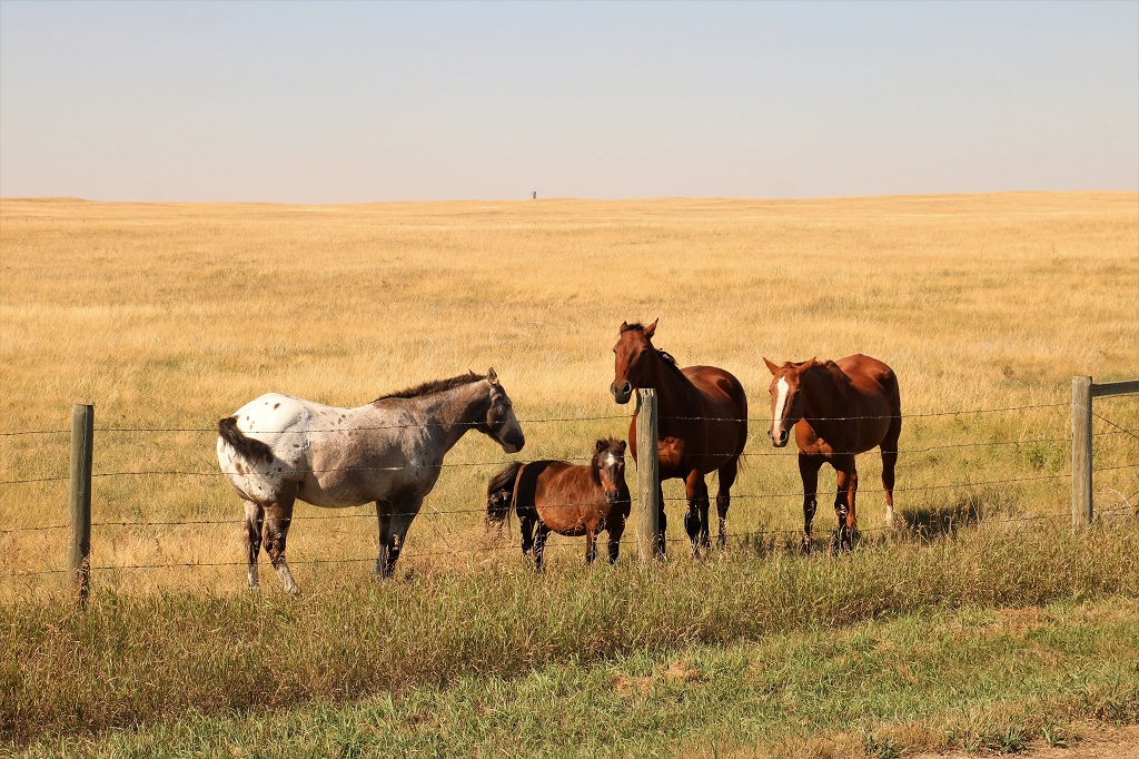
We stopped for a few minutes so I could pick some grass for these horses. The Appaloosa and the foal would not come near me, the bay took one handful, and the sorrel happily ate all the rest.
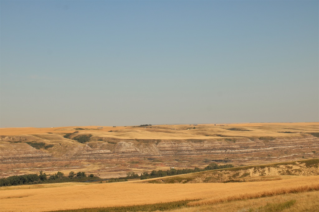
Driving north towards Three Hills took us through Drumheller country where the famous Tyrell Dinosaur Museum is located. We have been there a couple of times so did not stop, but the scenery is very similar to that in Dinosaur Park about two hours drive southwest.
So, that’s a wrap folks. My final blog of this wonderful trip. We begin visiting Alberta relatives tomorrow and then will drive south to enter BC through the Crowsnest Pass and drive near the US border over to the bottom of the Okanagan Valley so I can visit my stepmother in Osoyoos on the way home. It has been a great journey. Thanks for coming along. Hopefully it won’t be two years before we can do another one.
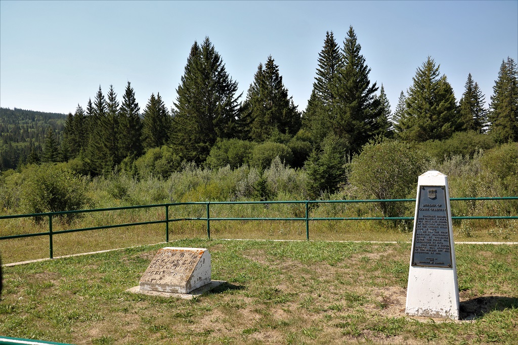
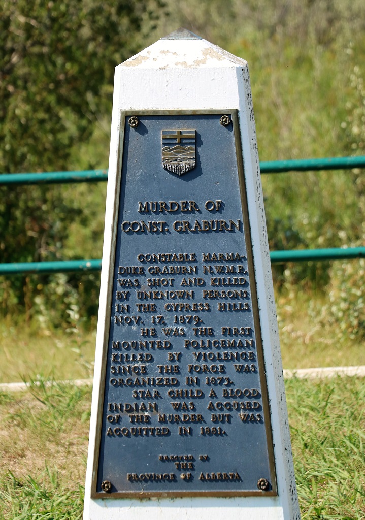
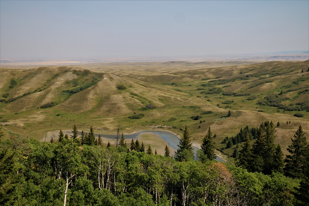
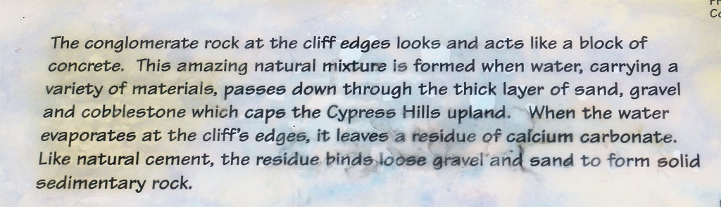
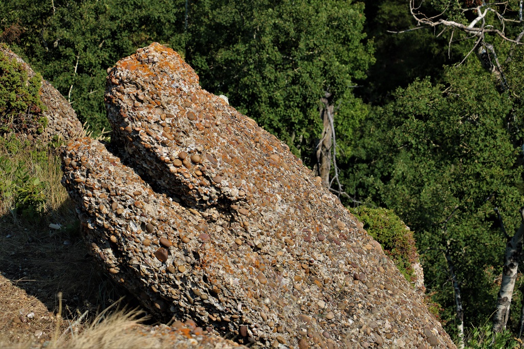
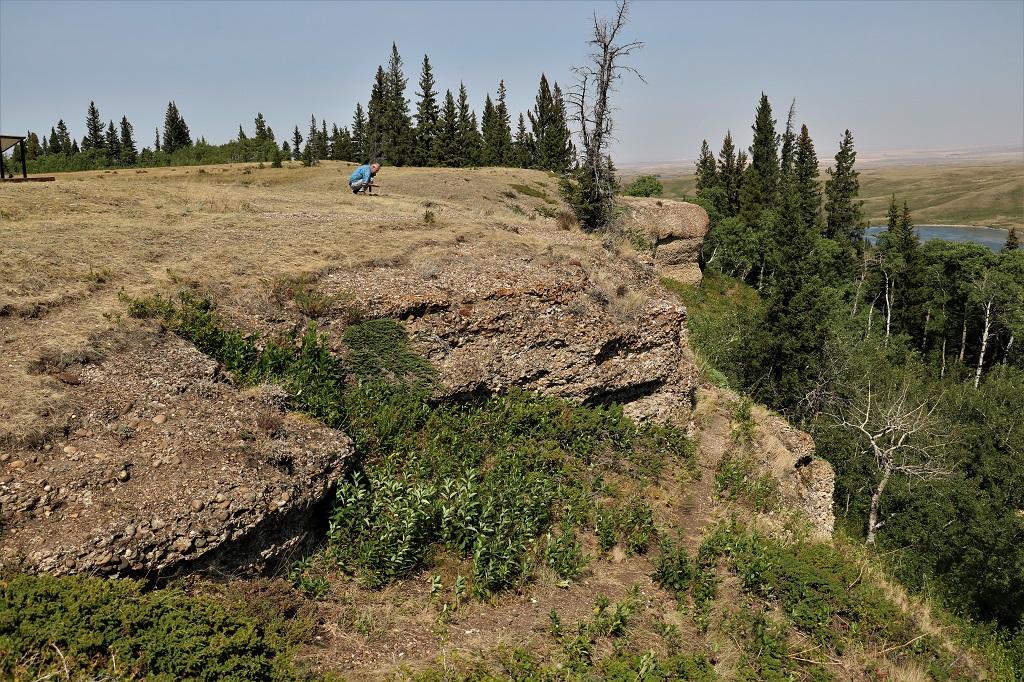
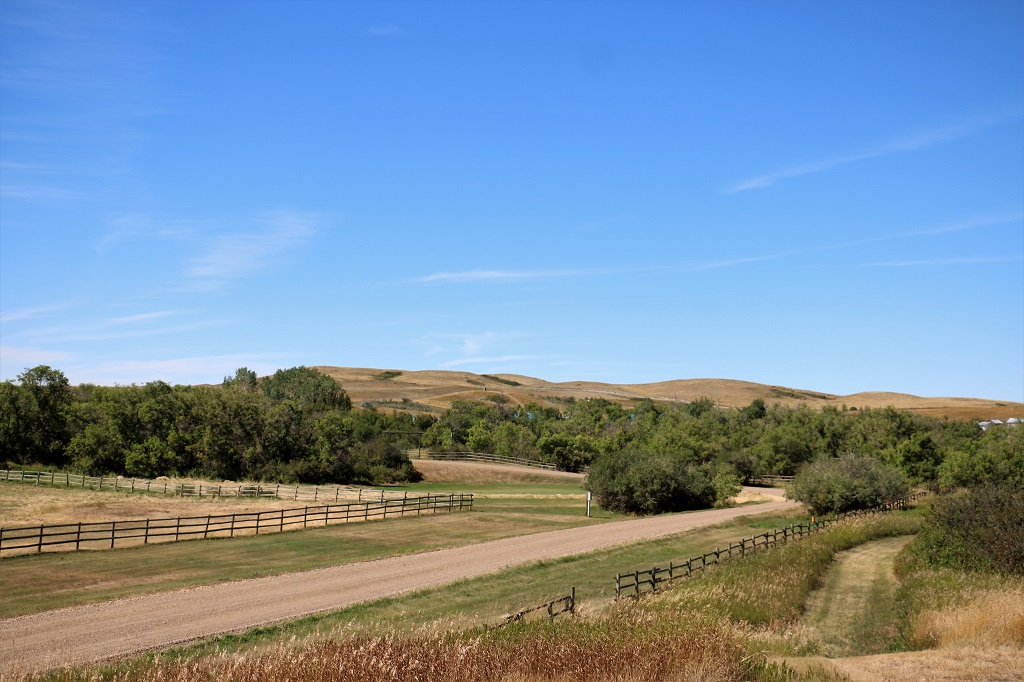
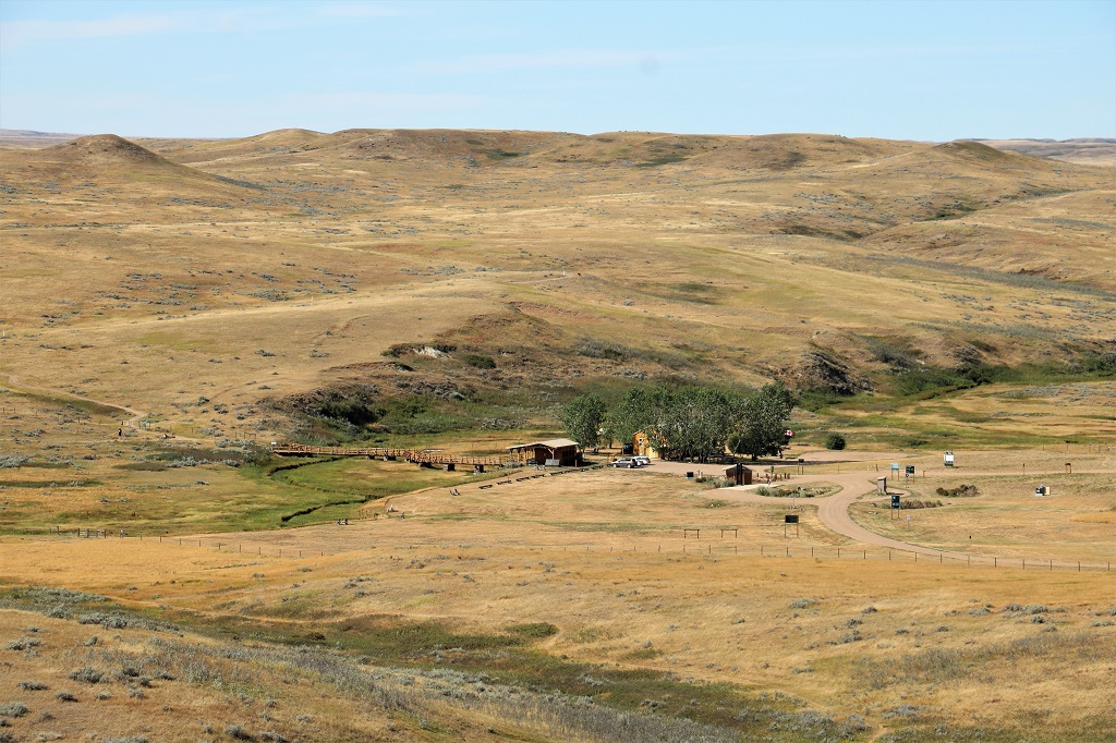
We had driven through the eastern side of Cypress Hills Interprovincial Park yesterday on the way to Fort Walsh, Saskatchewan. Today we drove the western Alberta side, although we crossed into Saskatchewan again as we drove through the park to go to the Conglomerate Cliffs.
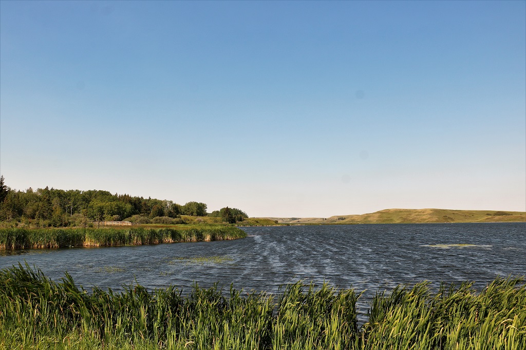
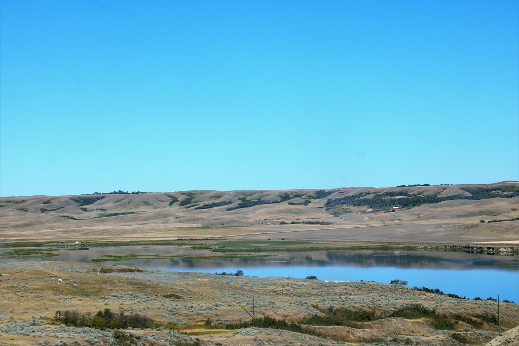
Elkwater Lake
The marina at the town of Elkwater.
The beach at the town of Elkwater.
As we were having dinner last night I looked out the restaurant window and noticed a very familiar mauve/grey haze in the sky. I said to John that it looked very much like forest fire smoke. When we woke up this morning we discovered I had been correct and Medicine Hat was very smoky. We drove through smoke about half the way to the cliffs. The smoke covered a lot of the distance at this viewpoint, which normally allows you to see into Saskatchewan.
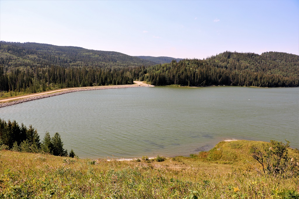
Reesor Lake was created when a dam was constructed at the valley end where two small lakes were located. It is a managed rainbow trout fishery.
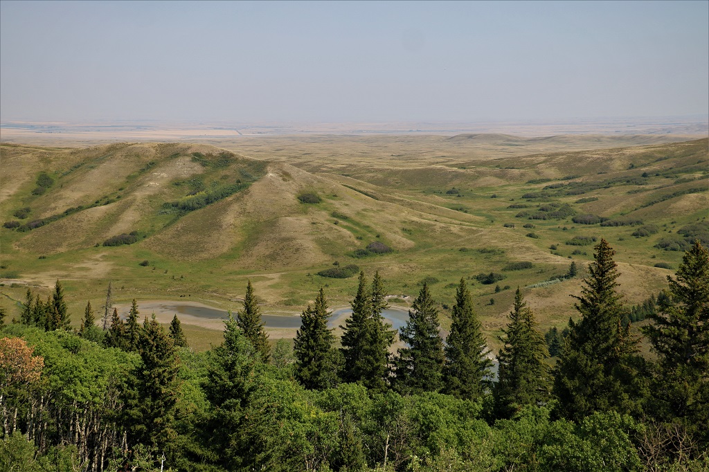
The Conglomerate Cliffs are at the end of about 40 km of primarily gravel road. We could have seen them yesterday by driving 10 km out of Fort Walsh and then taking another road about 10 km to the cliffs. We didn’t think of it so today we drove up through the trees on the Alberta side, across the very flat plateau and over to the cliff and the view over the Battle Creak Valley.
Battle Creek Valley and Adams Creek.
I was happy that this area was not smokey. The view was pretty amazing. Someone told us the smoke was coming from fires in Oregon.
We ate our lunch at the cliff top and then headed back toward Elkwater via the loop road across the plateau again and exited the park.
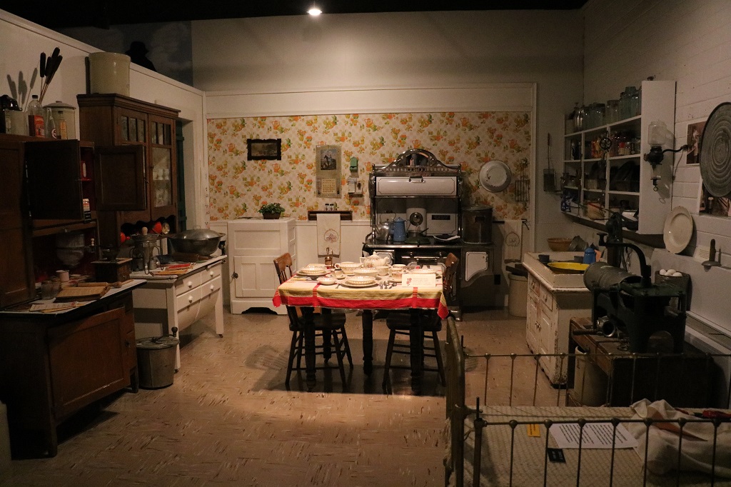
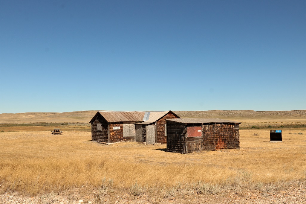
Our second planned stop for the day was the small community of Etzikom, population about 32-40. I had read in my CAA guide book that they have a windmill museum and wanted to check it out. The museum is located in an old school that was going to be torn down because it was no longer being used even though it was structually sound. A ‘heritage group’ formed and turned it into a museum with different displays in each of the classrooms.
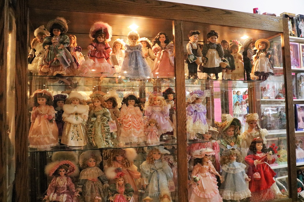
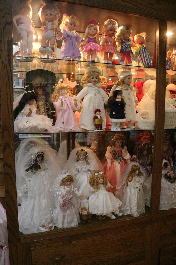
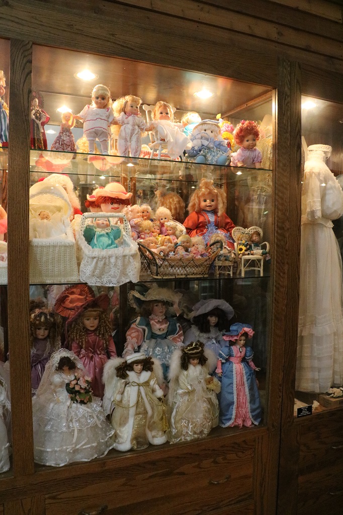
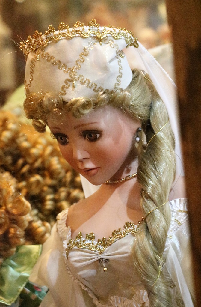
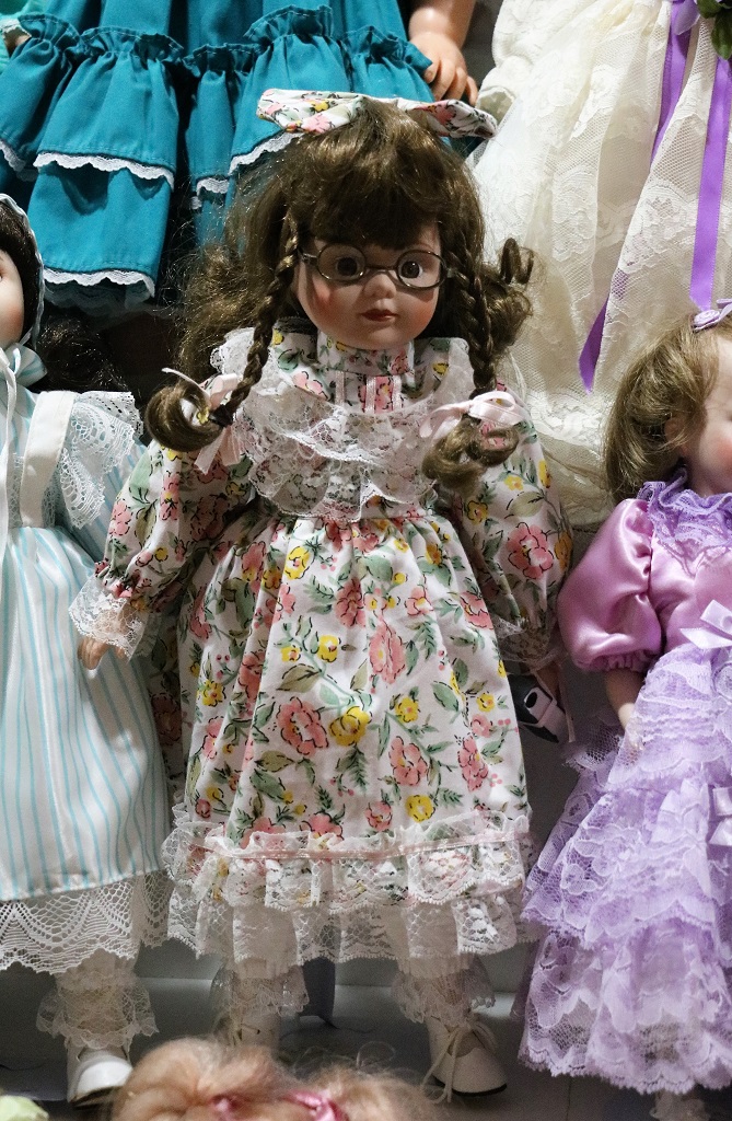
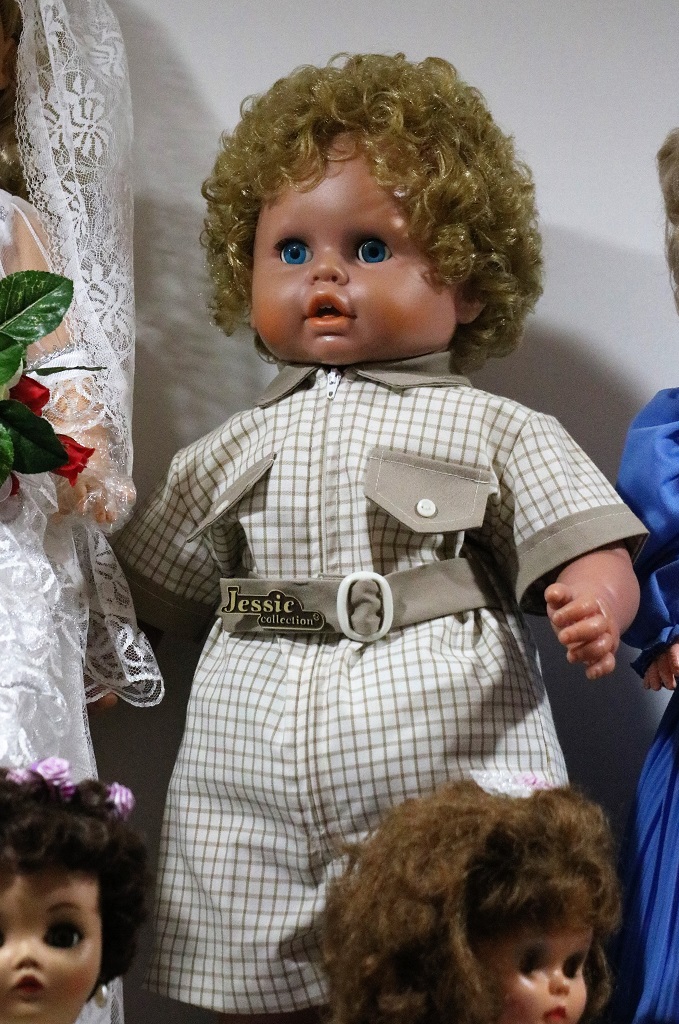
The stage area in the gym was dedicated to a lady’s doll collection that was given to the museum after she passed away. All three walls were full of beautiful dolls.
I didn’t get a good photo of all the Holiday Barbie dolls. I think she bought every one that came out and they were all still in their original boxes.
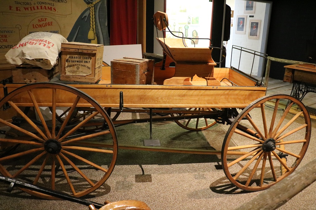
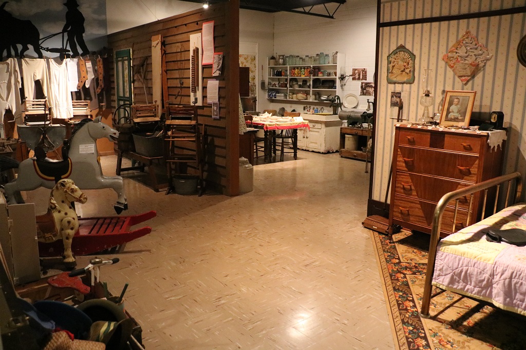
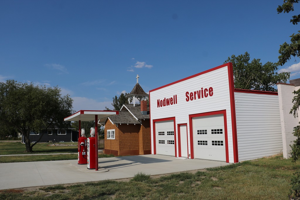
The old gymnasium was a heritage display with blacksmith area, mercantile, school room, and a two-room ‘house.’
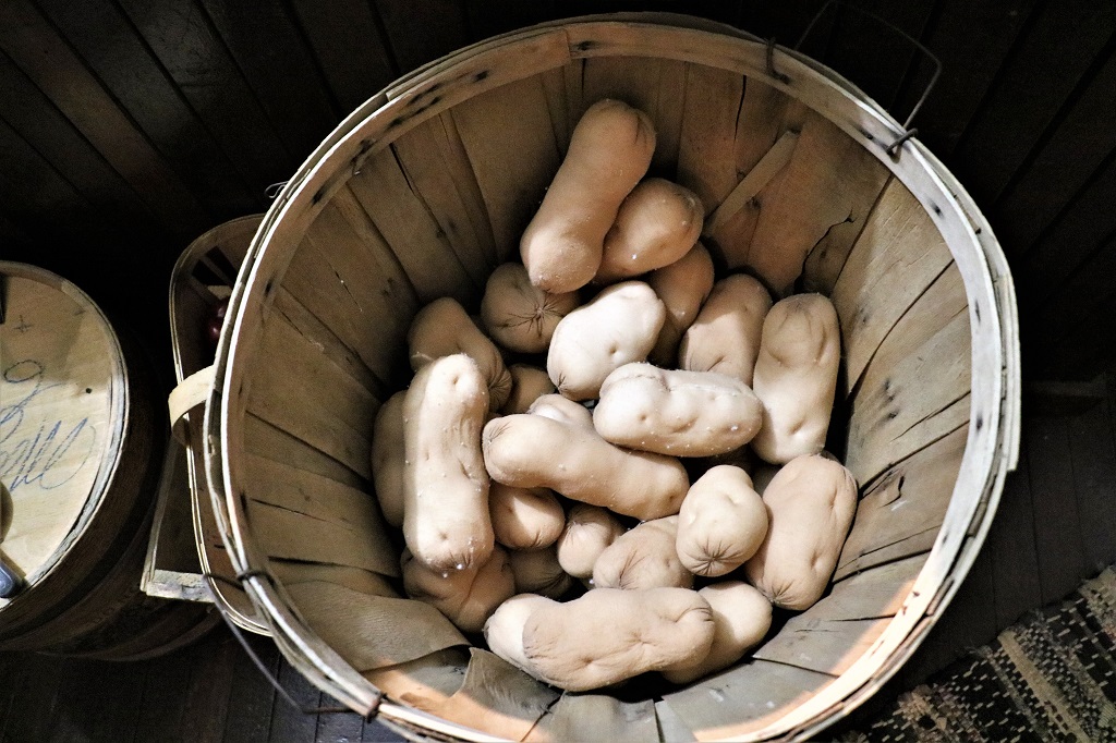
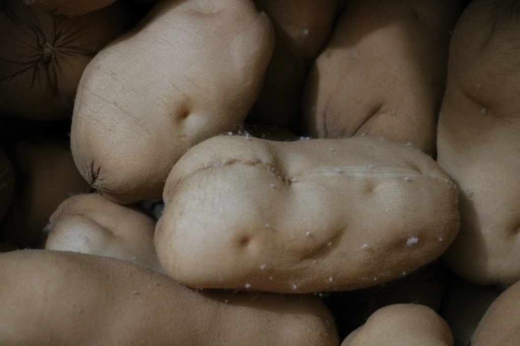
There was a basket of potatoes in the mercantile.
They had been made out of old nylon stockings. Very realistic looking spuds they were too.
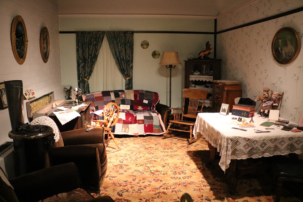
One of the classrooms had partitions to create rooms of a house.
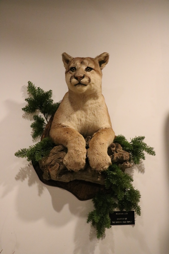
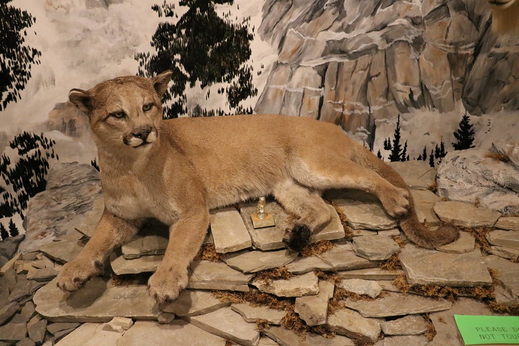
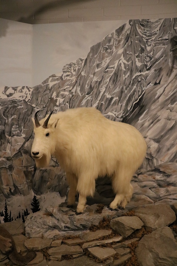
Another classroom was the wildlife exhibit with many birds and animals of the Alberta plains.
Cypress Hills is cougar country. Just like at Grasslands where they warned you what to do if confronted by a bison or rattlesnake there were instructions about what to do if you encounter a cougar. Running was not one of the suggested responses. Make yourself big and intimidating, use your bear spray and if attacked fight back. My tactic would be to not go hiking in cougar country.
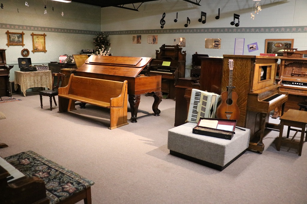
There was a display of First Nations artifacts, and a geology display with rocks and minerals, and a paleantology display with fossils found in the area. There was also a room full of organs and pianos, accordians, a concertina and old record players with 78 RPM records.
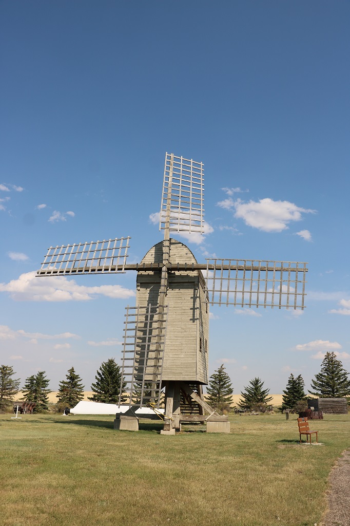
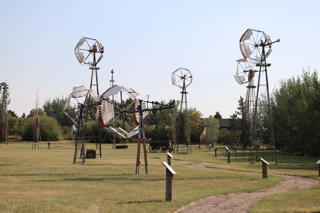
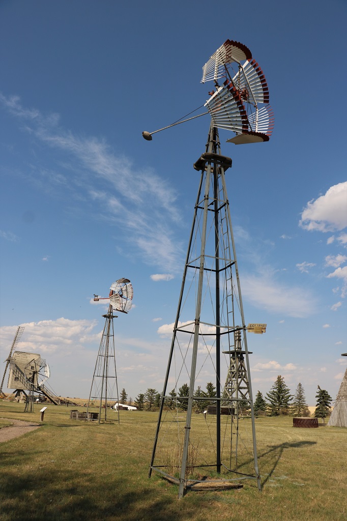
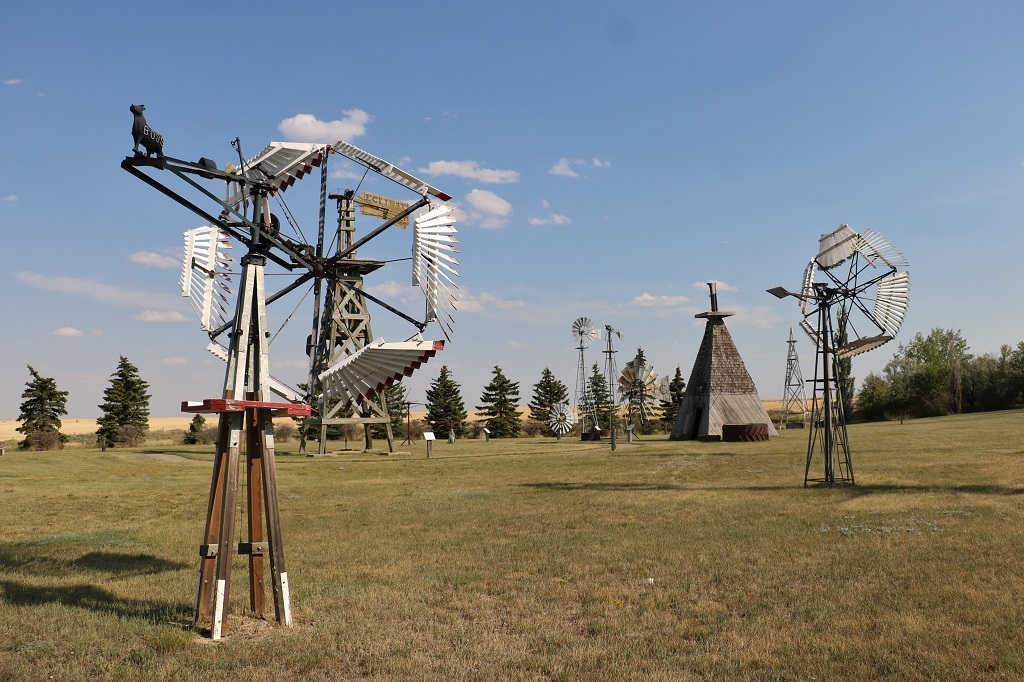
Once we had viewed all the classroom displays we went outside to see the windmills. A historian named Walter J. Webb said, “It wasn’t the gun that settled the west – it was the windmill.” Before the introduction of windmills for pumping water, much of the west was barely habitable. Early settlement on the windswept plains was confined to areas which possessed springs, streams or shallow groundwater. The upland areas were unoccupied until windmills and mechanically drilled wells tapped the resources of the unidentified groundwater.
Windmills have all but disappeared now, but in the late 1800s and early 1900s they could be found on almost farm and in every town.
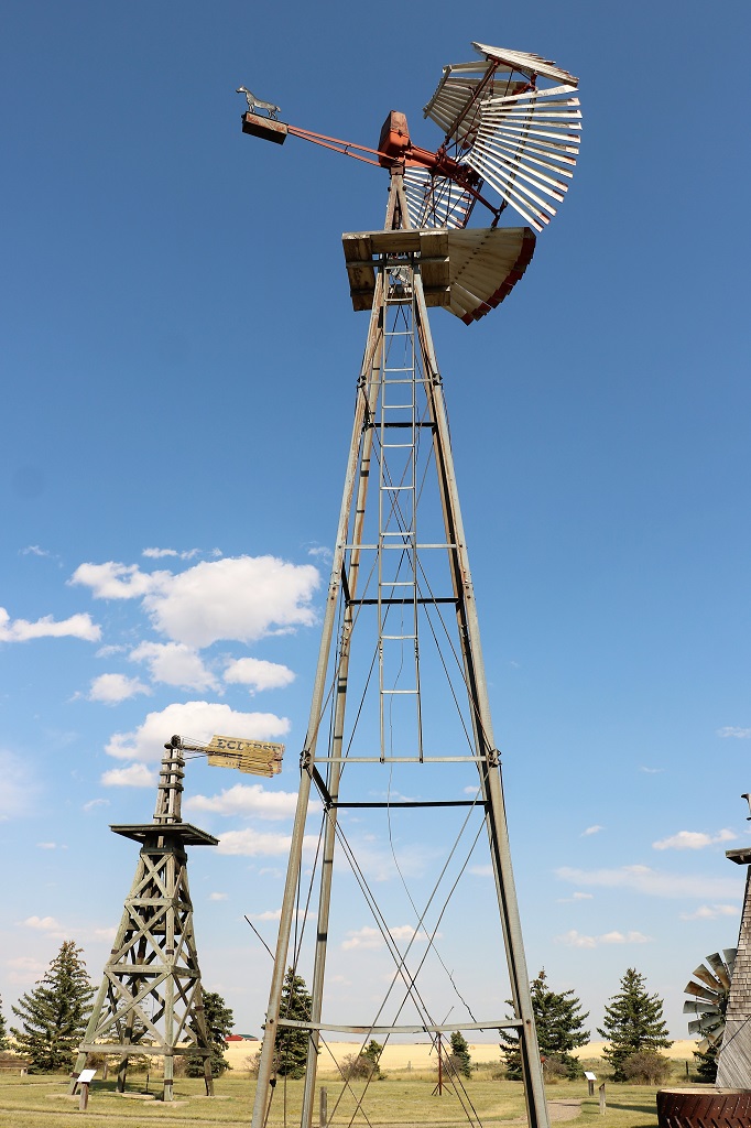
This mill – called the “Wild Rose Mill” was designed and built for a museum on a vineyard in Massachusetts. In 1993 the owners gifted it to the Canadian National Historic Windpower Museum in Etzikom, Alberta.
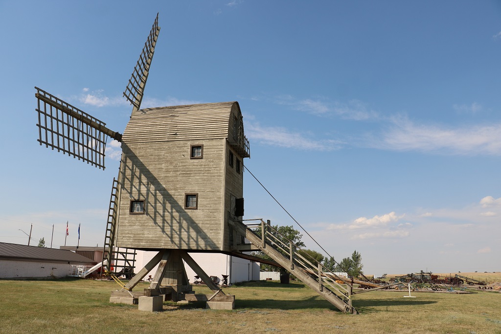
The Leduc-Blacksmith windmill was produced in limited numbers in a blacksmith shop in Leduc and they were only used in that area.
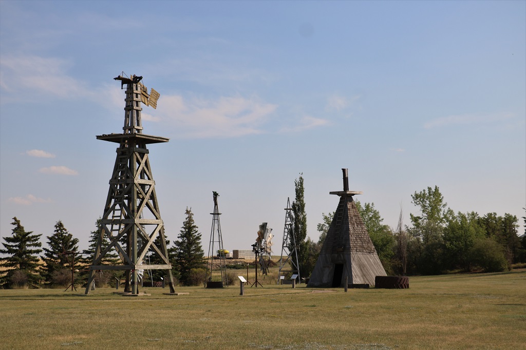
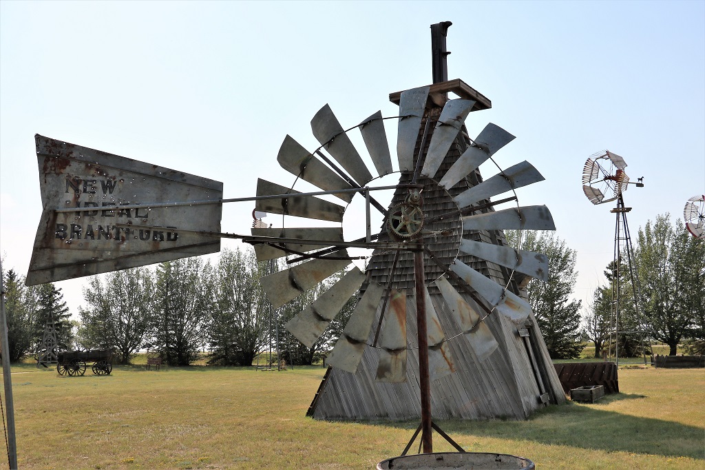
The pyramid shaped one on the left is the “New Ideal” power mill. It was manufactured in Brandford, Ontario from the 1890s to the 1920s. It is also a post mill – the windmill itself is mounted on a center post and the building was built around it primarily to keep dry the grain that was stored in the hopper inside. This mill also ran a stone sharpener, a saw, a washing machine, etc.
There were about six or seven windmills that all looked the same to us but were in fact different models manufactured by different companies. The only real difference we could see was the counter-weights.
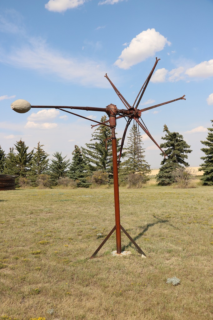
The one above was The Monitor (Vaneless), one of the most common vaneless mills. It is recognized by the distinctive ‘football’ shaped cement counter-weight. The name “Monitor” is after the shape of the counter-weight. It resembles the first submarine used during the American Civil War – the USS Monitor. They were made from 1918 to 1940.
The Dempster No. 14 was the last vaneless windmill produced by Dempster Mill Manufacting Company of Beatrice, Nebraska. It was produced from 1923 to 1941. These mills may often be found ‘defaced’ with the ‘horse-shaped’ counter-weights pirated by windmill weight collectors. (Who knew that hobby even existed?)
Same sort of windmill, different counter-weight, different manufacturer. The Challenge Spearpoint came on the marked in 1912 and was sold until 1920. It was made by the Challenge Company and was a self-oiling vaneless.
The Boss was one of the more common mills made in the late 1800s and early 1900s. It’s Bull counter-weight stands proudly with his nose always pointed toward the wind.
St. Savior’s Anglican Church. Build in Foremost in 1914 and moved to Etzikom in 1990.
We left the museum at closing time and drove back to Medicine Hat to find dinner and settle in for the night.
We left Shaunavon at 9:30 and headed southwest as far as Climax before going north to the east entrance of Cypress Hills Cenral Block and Fort Walsh.
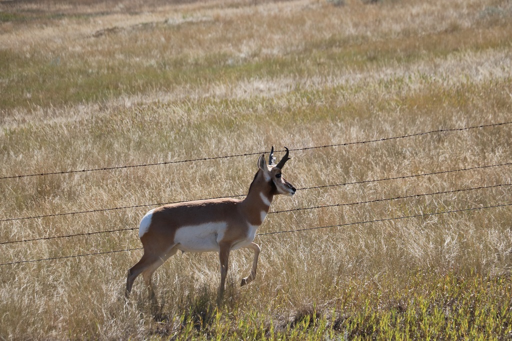
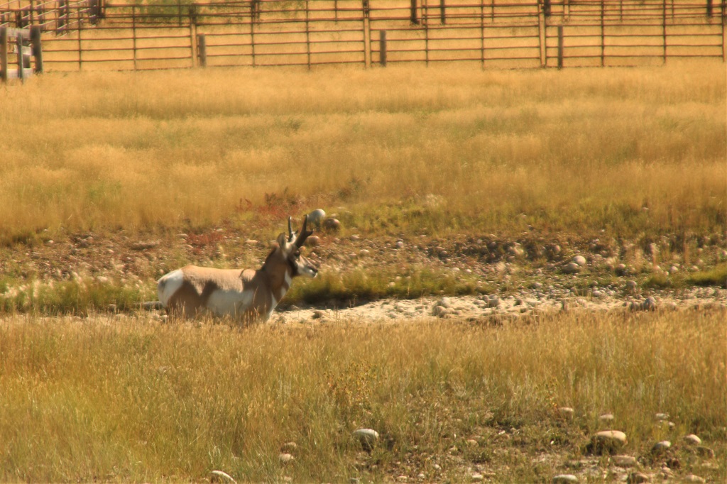
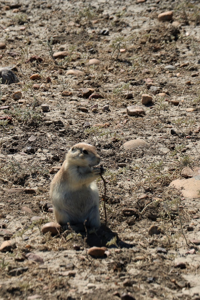
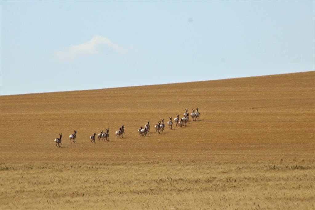
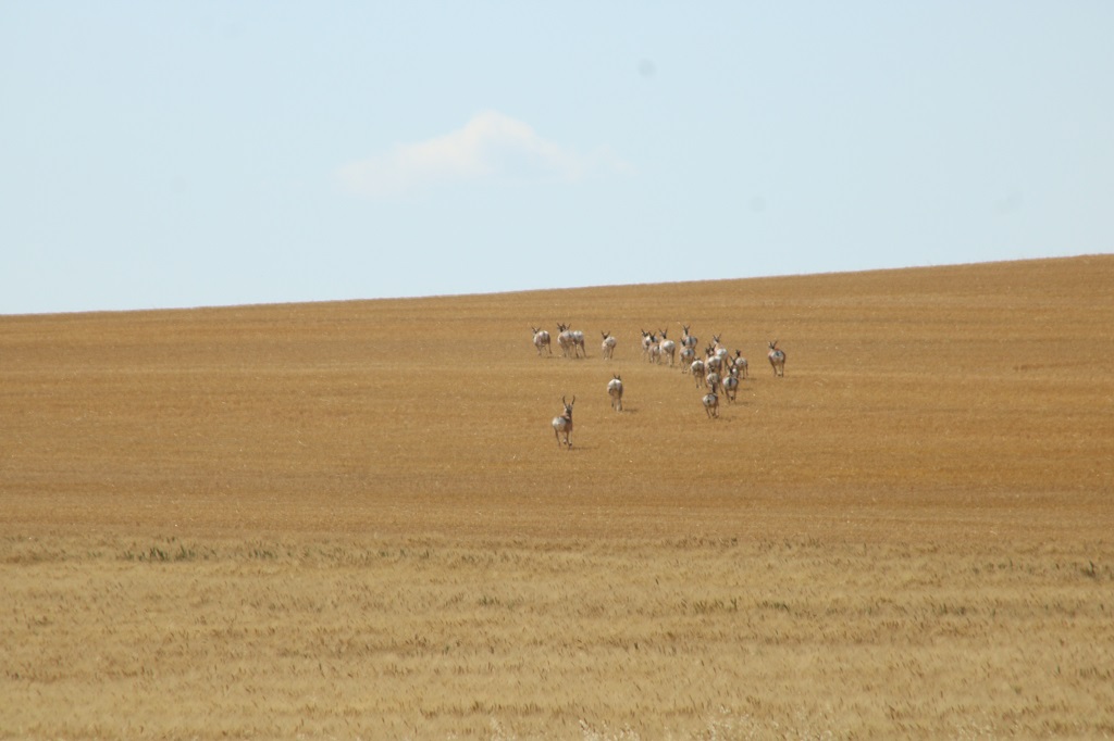
Pronghorn
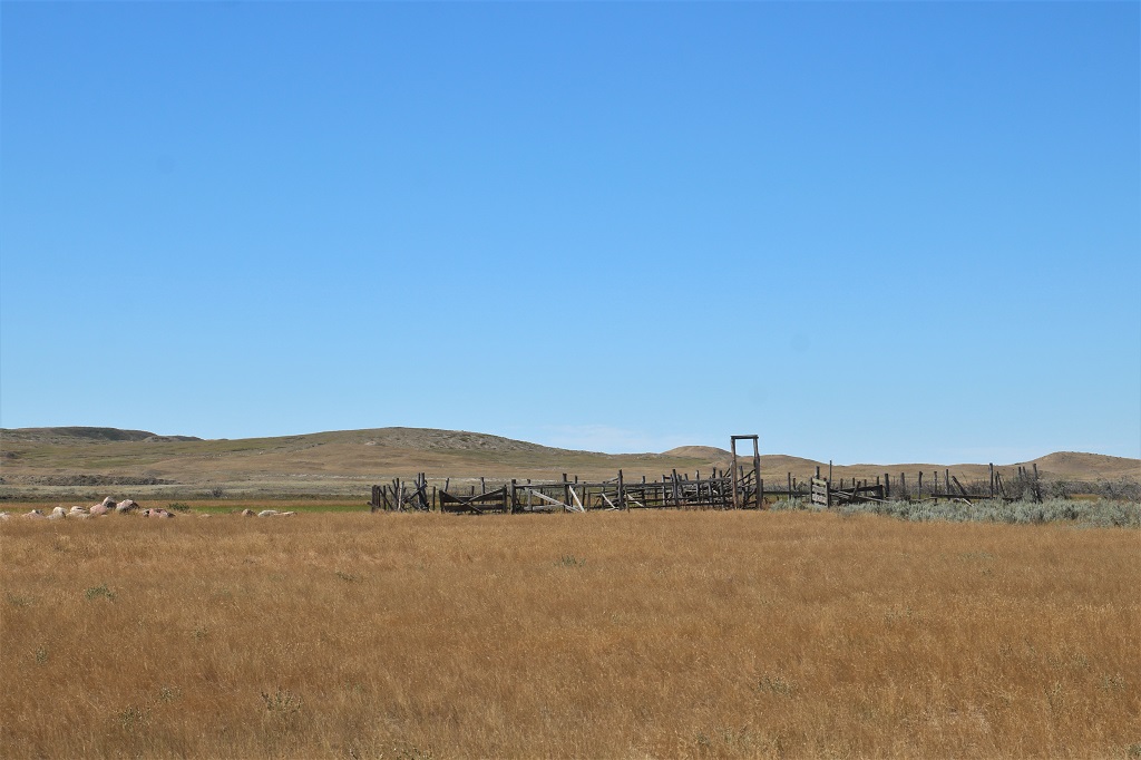
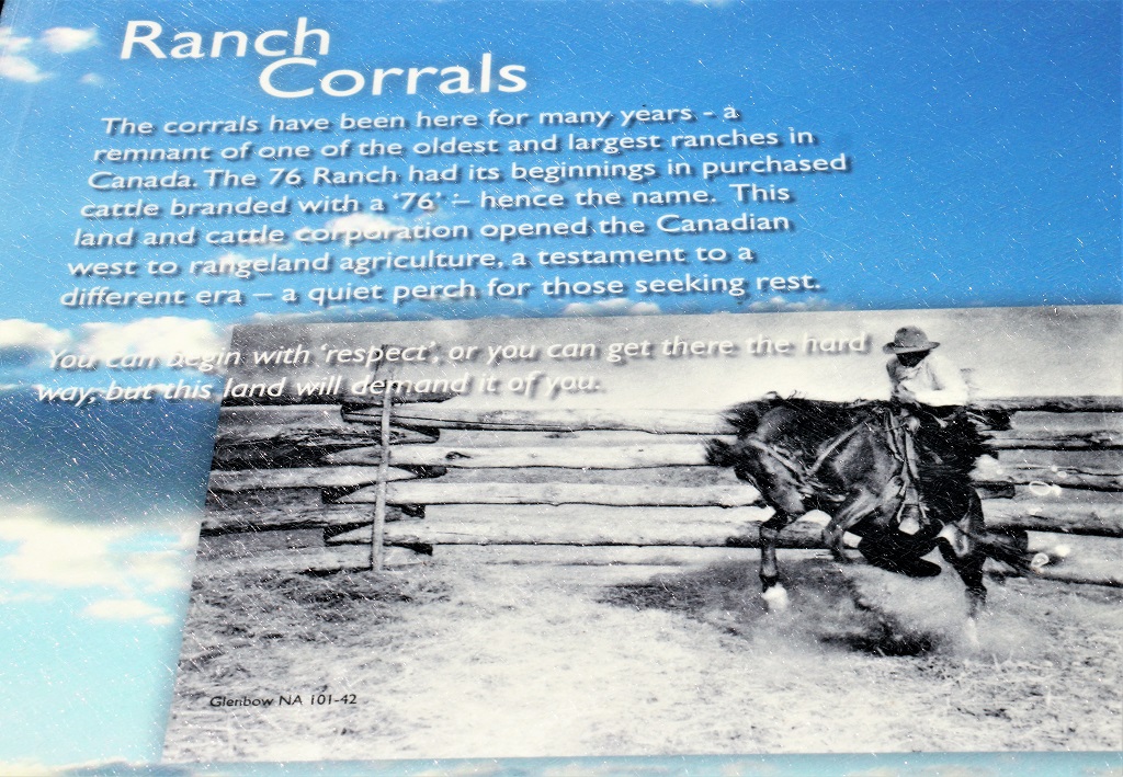
The Cypress Hills are a 250 kilometer long strip of forested plateau that rises 600 meters (2000′) above the surrounding plains. During the last ice age the glaciers parted and split to both sides of the area so it is nonglaciated land and quite an astonishing contrast to all the flat prairie that surrounds it. Ranching became important in the area after the Canadian Pacific Railway arrived at Maple Creek in 1883. Beginning in 1906, part of the Cypress Hills was protected as a federal forest reserve.
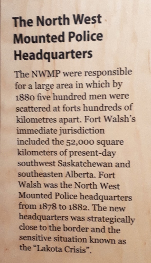
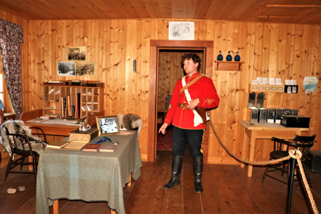
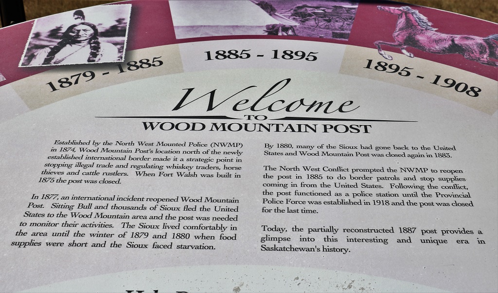
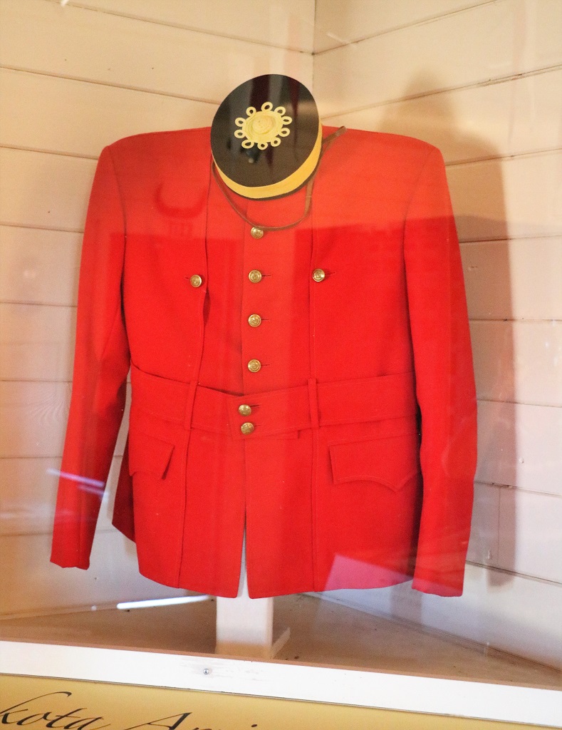
We have been following the Red Coat Trail for many days and keep building on the early days of the Northwest Mounted Police and Fort Walsh is a very important part of the story.
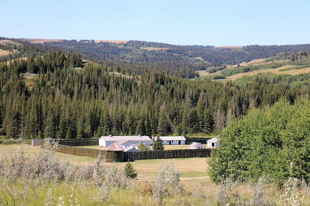
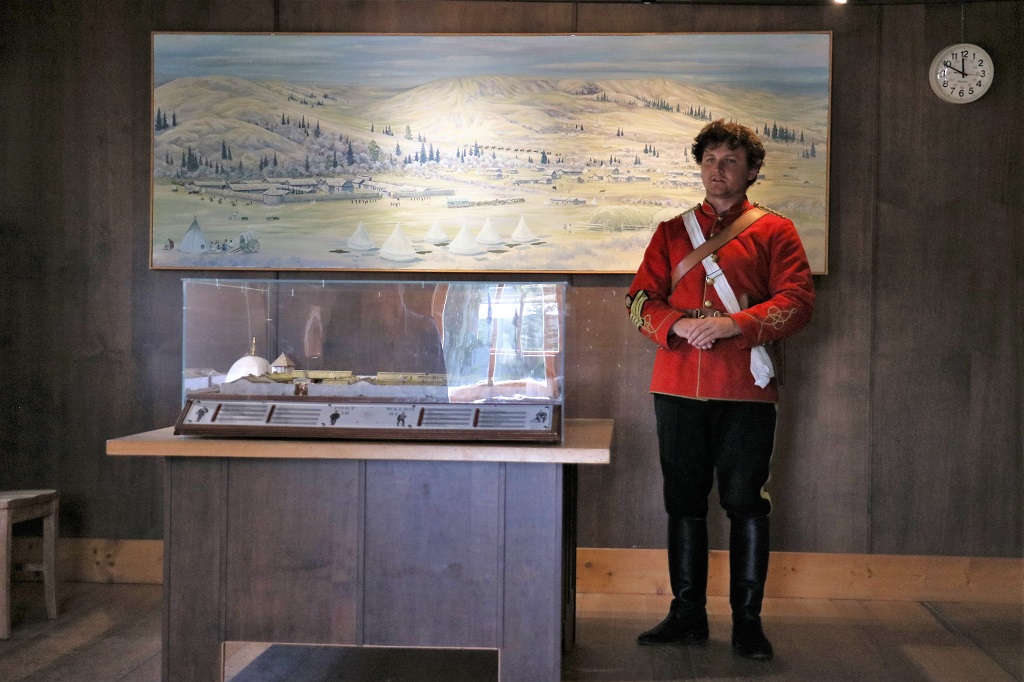
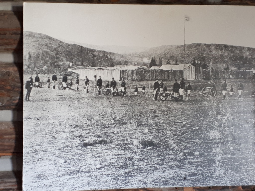
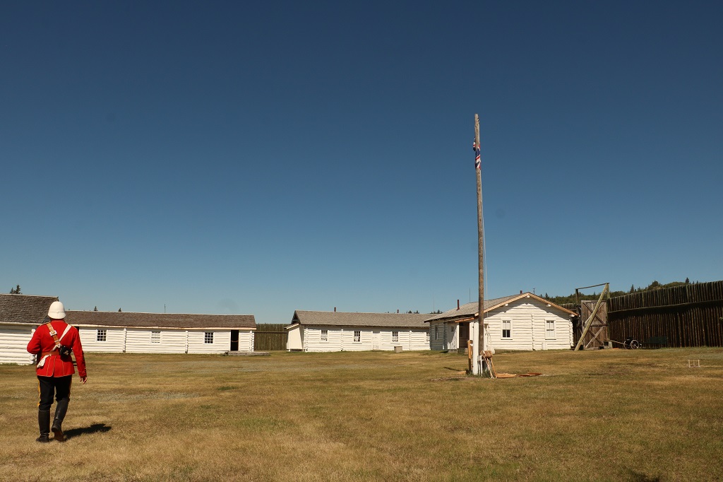
Fort Walsh Visitor’s Center.
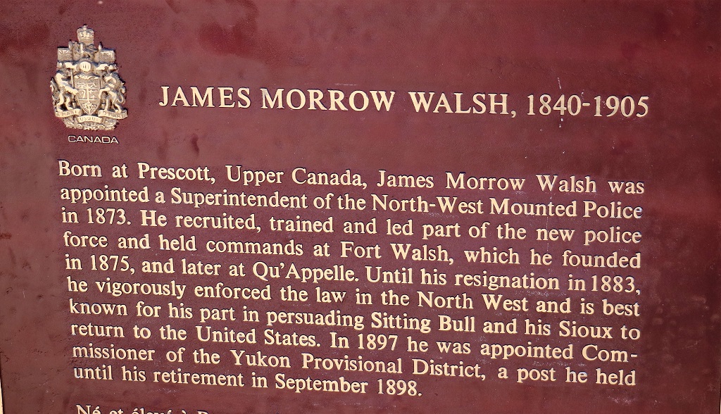
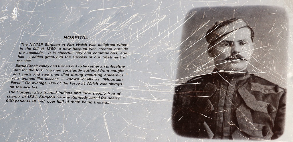
We heard quite a bit about Superintendent Walsh when we were at Wood Mountain Post the other day. Wood Mountain was one of several outposts where men from Fort Walsh were sent for tours of duty and area patrols.
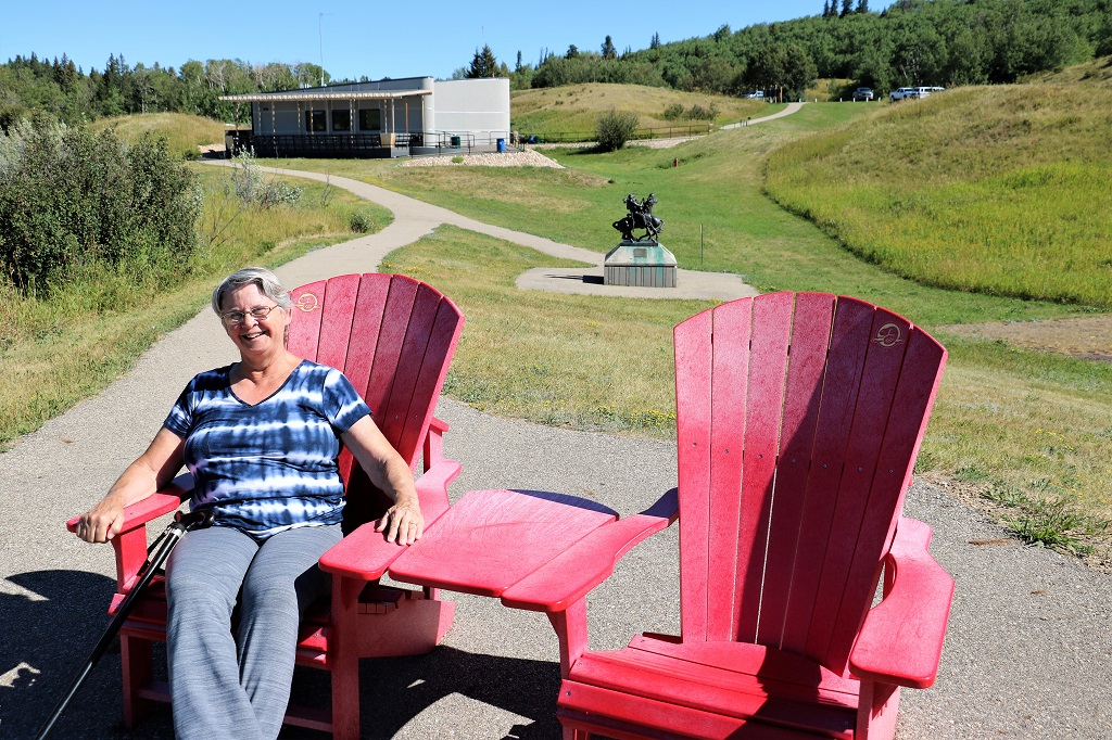
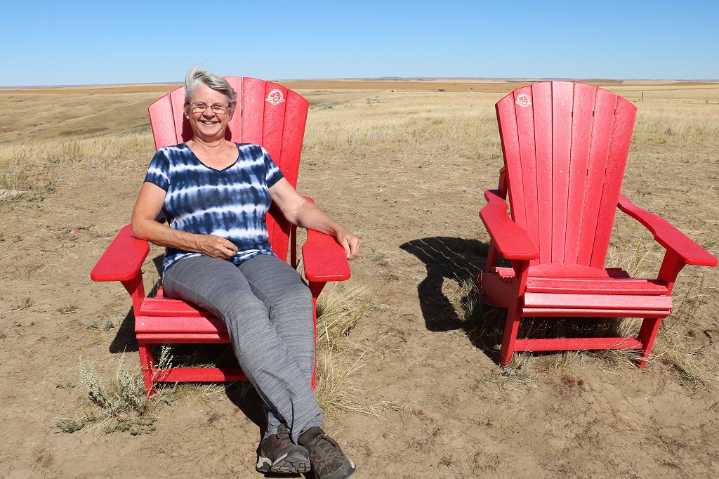
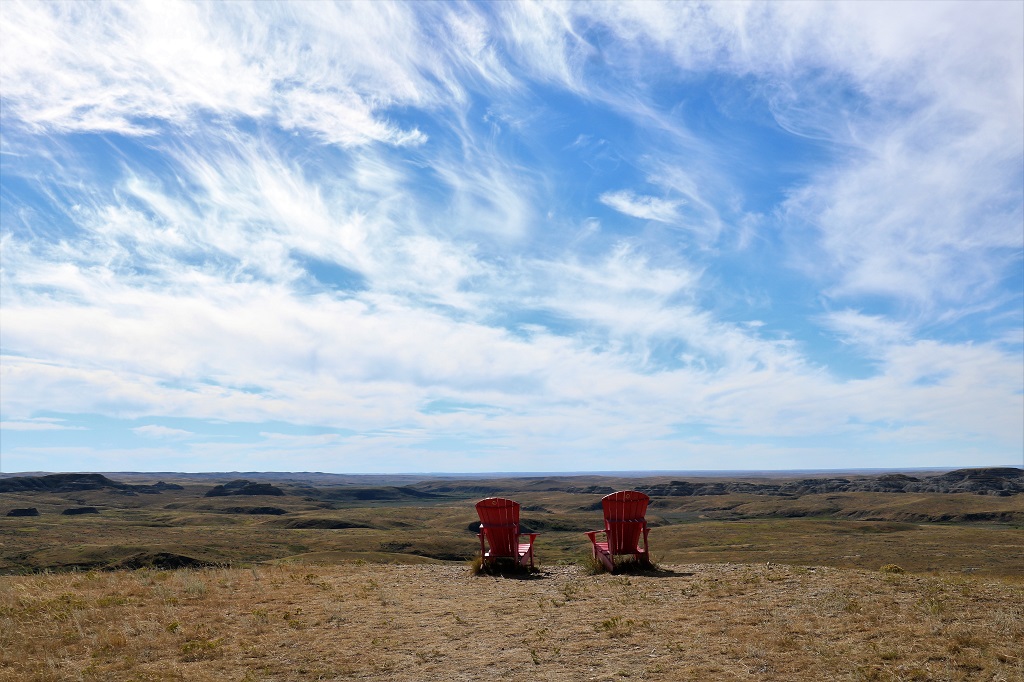
A Parks Canada National Historic Park is a red chair event. This will be my last ‘sitting’ on this trip. No more stops at National Parks are planned.
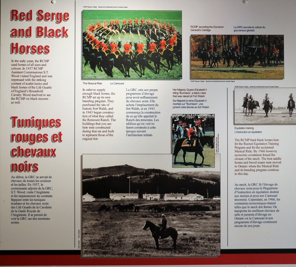
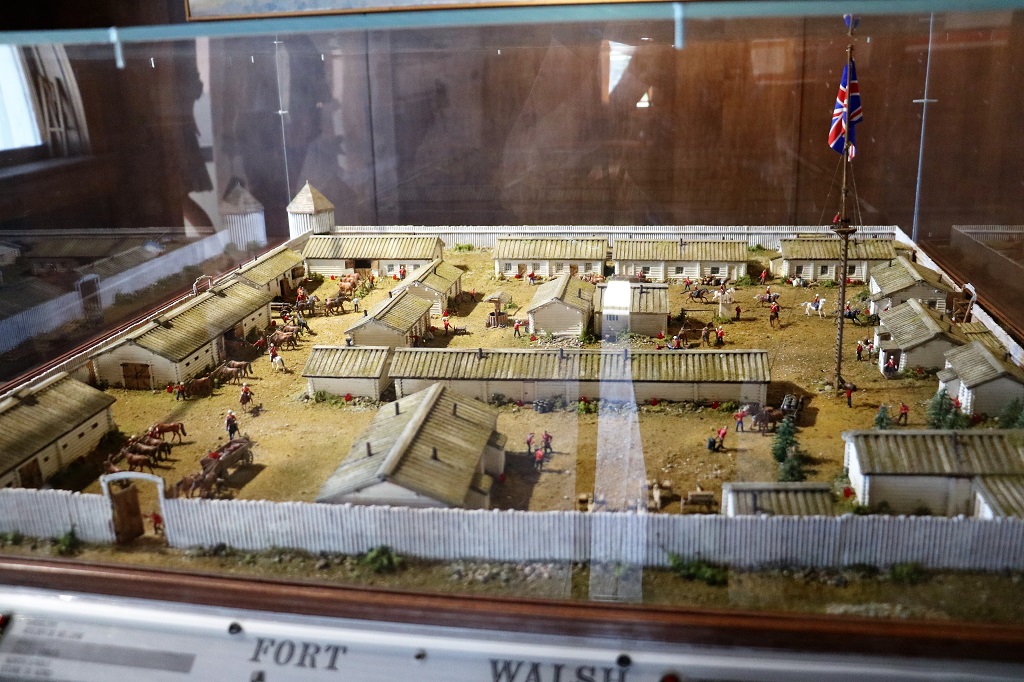
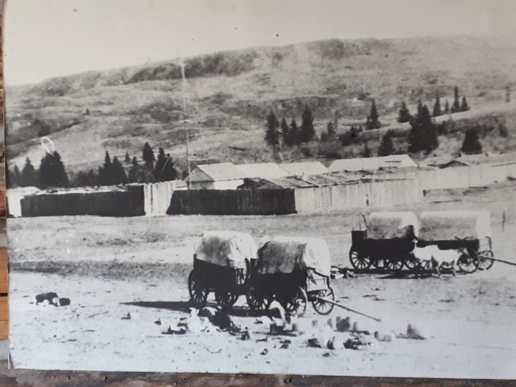
The fort as it is constructed now was built by the Royal Canadian Mounted Police when they bought the former Fort Walsh property for a breeding stable for the horses of the Musical Ride. A rancher in the area had marked where all the old buildings had been at Fort Walsh so the RCMP built their buildings to mimic the old fort ones at the same places.
When it became an historic site, Parks Canada finished the interiors to reflect what the buildings would have been like during the years of active duty of the fort. There would have been twice the number of buildings back then.
We were just in time for a guided tour. We learned near the end of the tour, that the young man had only started working here a month ago. He was former Canadian Military and had worked for Parks Canada at Pacific Rim National Park on Vancouver Island before moving from the expensive westcoast and buying a house in Saskatchewan. He came to the fort on Canada Day as a tourist and heard they were looking for staff so applied and immediately got hired. He gave one of the most comprehensive and interesting tours we have ever had. He really knew his history. Not just about Fort Walsh but about other events that were going on in the world at the same time that he tied all together. Really, really well done.
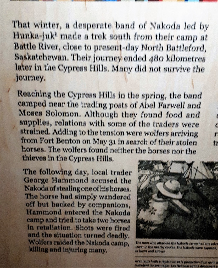
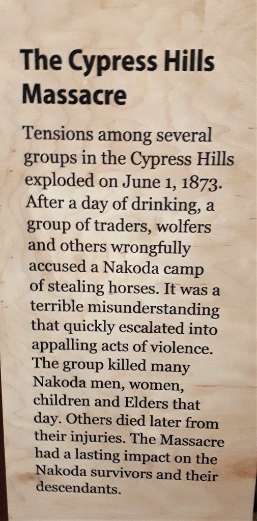
The new Canadian Government in Ottawa had been receiving reports of the tensions between traders and First Nations peoples, especially the deterimental affects of the American whisky traders who came across the border to do business after the US outlawed selling alcohol to the Indians. Also the loss of the buffalo due to overhunting was creating severe food shortages for the First Nations people who for centuries had relied on the buffalo for much of their food, tools, warmth, etc. Wolfers from the US came up and killed bison with poison to use as bait to kill wolves for the pelts which also caused issues with the indigenous people. But Ottawa was slow to act. They did not want to start a war with America and Britain (that Canada was part of) was engaged in a war in South Africa so arms and supplies were in short supply. However all that changed quickly when news reached the east about the Cypress Hills Massacre.
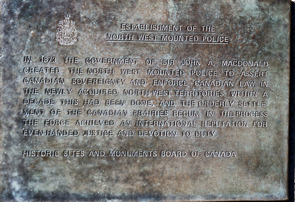
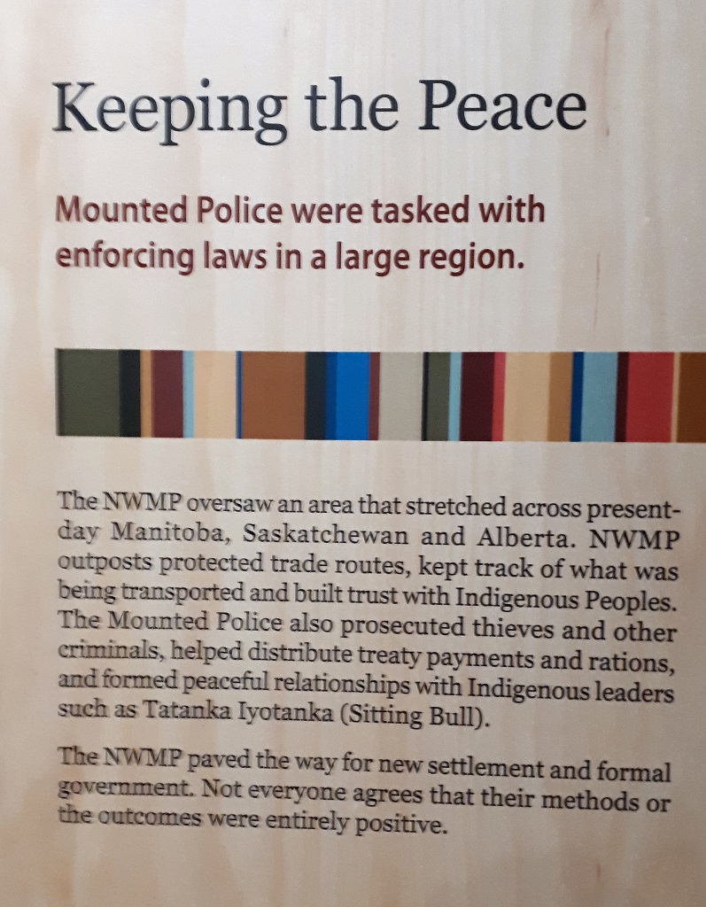
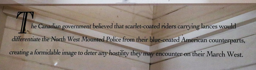
Prime Minister John A. MacDonald had formed the Northwest Mounted Police the year before and, to prevent further blood shed and to establish law and order and destroy the whisky trade, sent troops set up forts and depot posts and work with the First Nations people to make treaties before settlers moved in. Fort Walsh was establised in 1875.
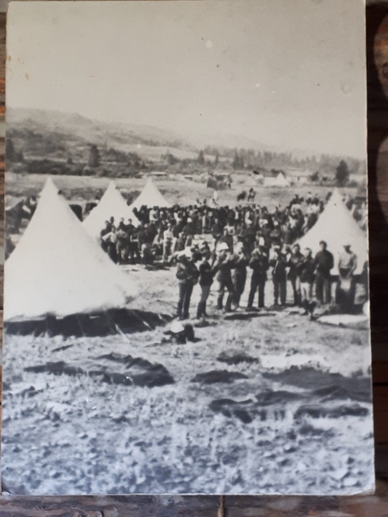
There were about 250 men at Fort Walsh and at any one time there could be as many as 5,000 people in the surrounding area; either in the trading post town that grew up near by or First Nations people that came to trade and collect food after the treaties were signed.
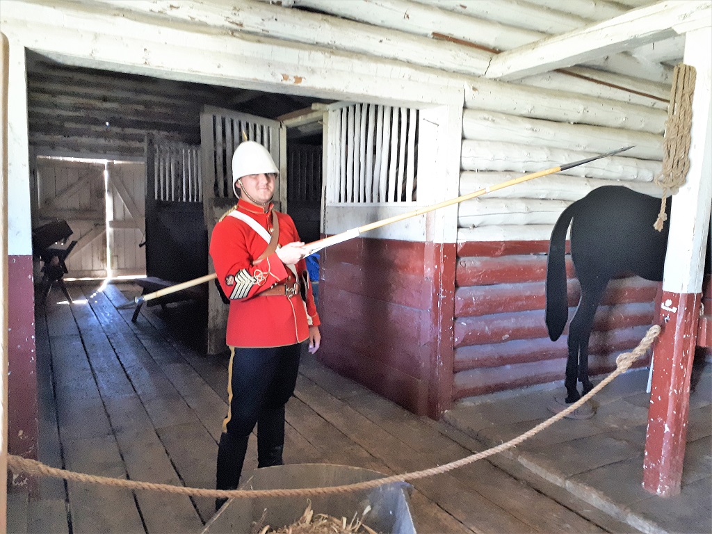
Von, our guide, had recently found one of the forgotten RCMP Musical Ride lances in a corner of the stable. They are made of bamboo to be light for the many manouvers required during each performance.
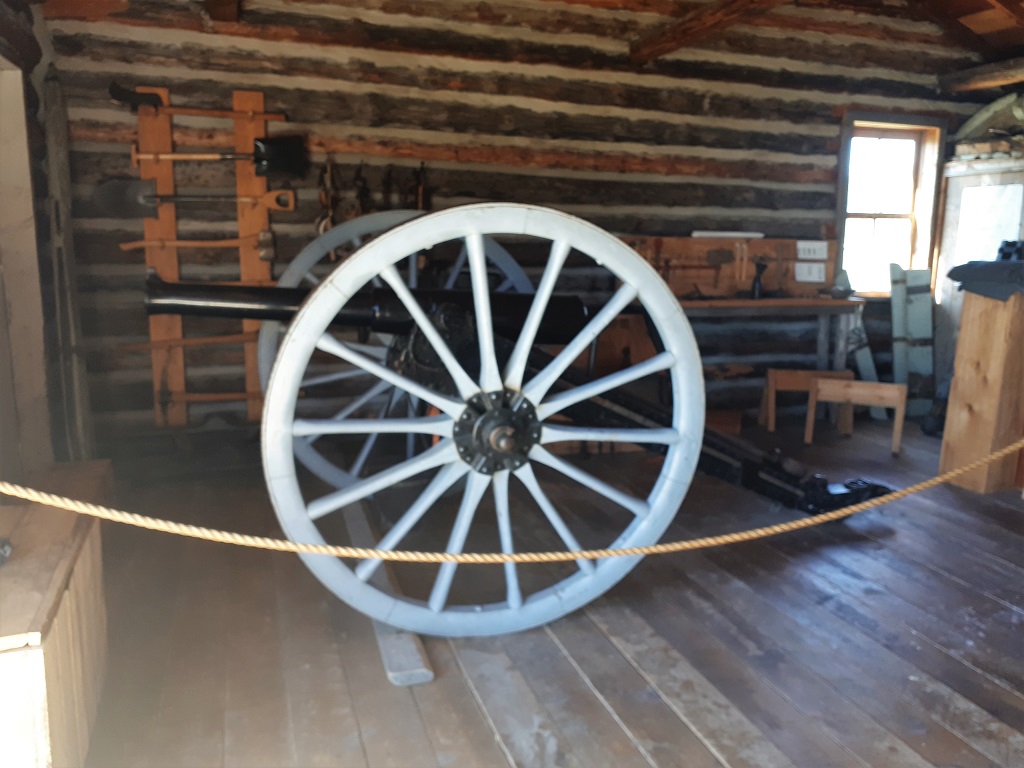
When the Northwest Mounted Police were sent from Fort Dufferin in Manitoba to establish law and order in the west they brought cannons, however they were never needed as there were never any armed conflicts. It still fires though.
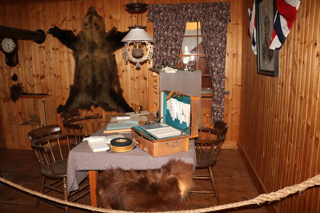
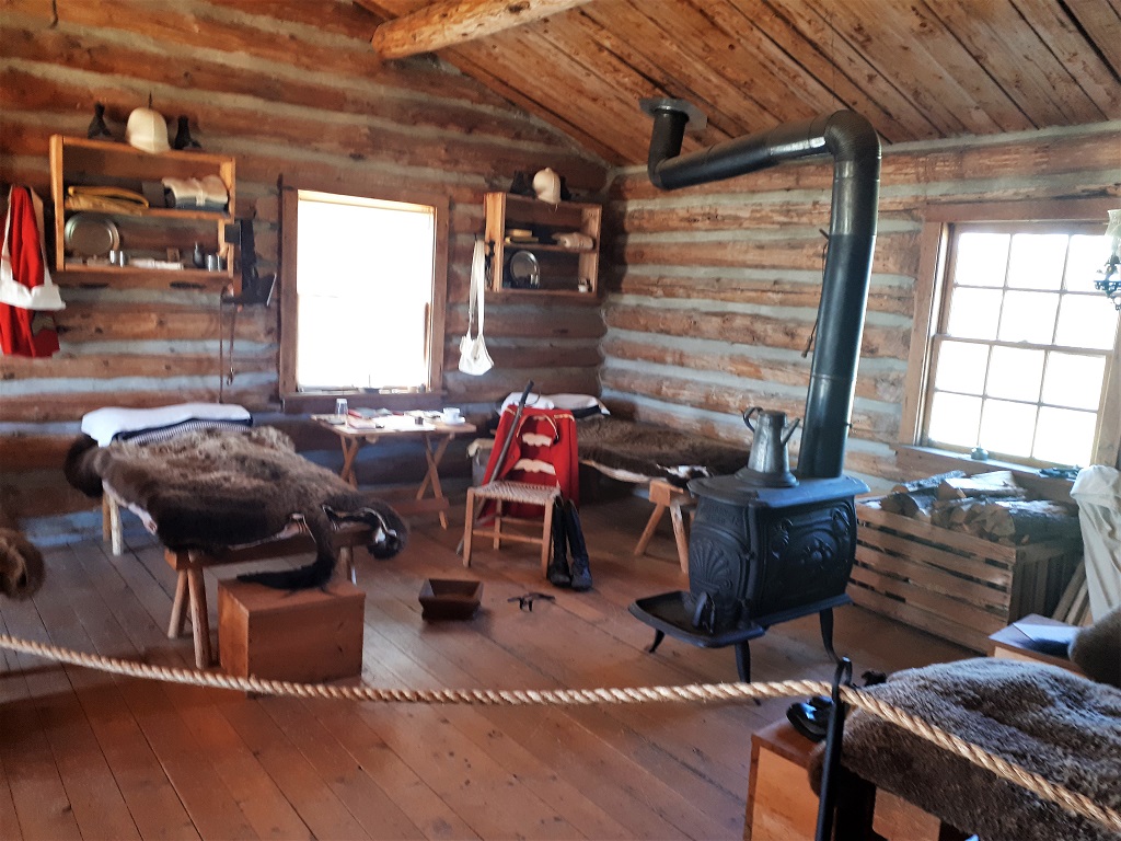
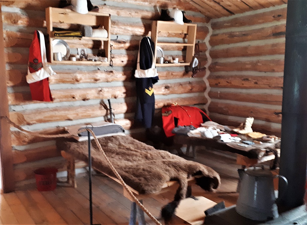
The men’s mattresses were a buffalo hide laid on a wooden pallet.
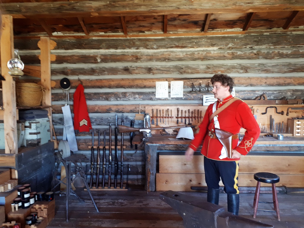
The bunk on the right is laid out with the man’s kit for inspection. The required brushes and items to care for his horse are at the foot of the bed, his personal items and clothing are arranged above it. There was a specific place for every item and it was inspected every day. They also did marching and firearms drills everyday. Walsh believed that displaying readiness and discipline to those they had come to govern would help garner respect for the police force and make it easier to do their jobs. Members of the NWMP were all educated. They had to be able to read and write and be listeners and negotiators. They were empowered to perform marriages, to collect customs, to assign tariffs, and officiate in land registries, handle disputes, mete out justice and many other duties.
With the coming of the railroad the headquarters of the Northwest Mounted Police was moved to Regina and the fort was closed. A forest fire destroyed most of it and the land became private ranchland until purchased by the RCMP for their Remount Ranch. When the breeding stable was moved to Ontario in 1966 they transfered the Fort Walsh property to Parks Canada. In 1989 the governments of Alberta and Saskatchewan joined forces and created Canada’s first interprovincial park – Cypress Hills. The Interprovincial Park Agreement was amended in 2000 to formally include Fort Walsh National Historic Site. The two provincial governments and the Government of Canada cooperate in the management of this unique geographical feature and ecosystem.
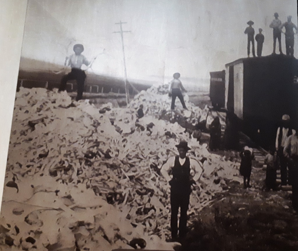
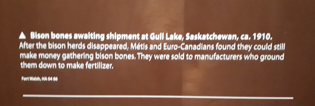
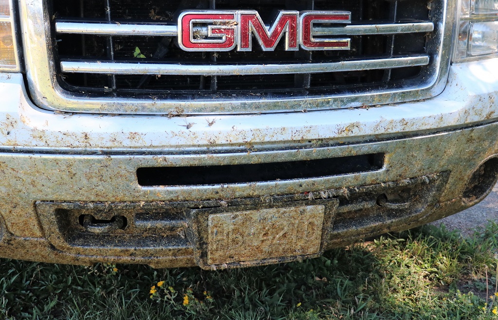
John washed the truck two days ago in Assiniboia. It was covered in gumbo mud from the drive to the Claybank Brick Plant. We have accumulated a LOT of dead grasshoppers in two days!
We are staying in Medicine Hat two nights. Tomorrow we will drive to the Alberta portion of Cypress Hills and do a loop through a few small towns on the way back to Medicine Hat. After that we have one more day of ‘touristing’ before getting to Red Deer to visit my niece. That will be my last blog post. After we leave Red Deer we are on old familiar roads and will just be going to a few places to visit family as we make our way home.
We were up early this morning so were on the road by 9:30. We took the same road as yesterday from Assiniboia to Wood Mountain, but from there we veered west on Highway 18 to access the east entrance to the West Block of Grasslands National Park.
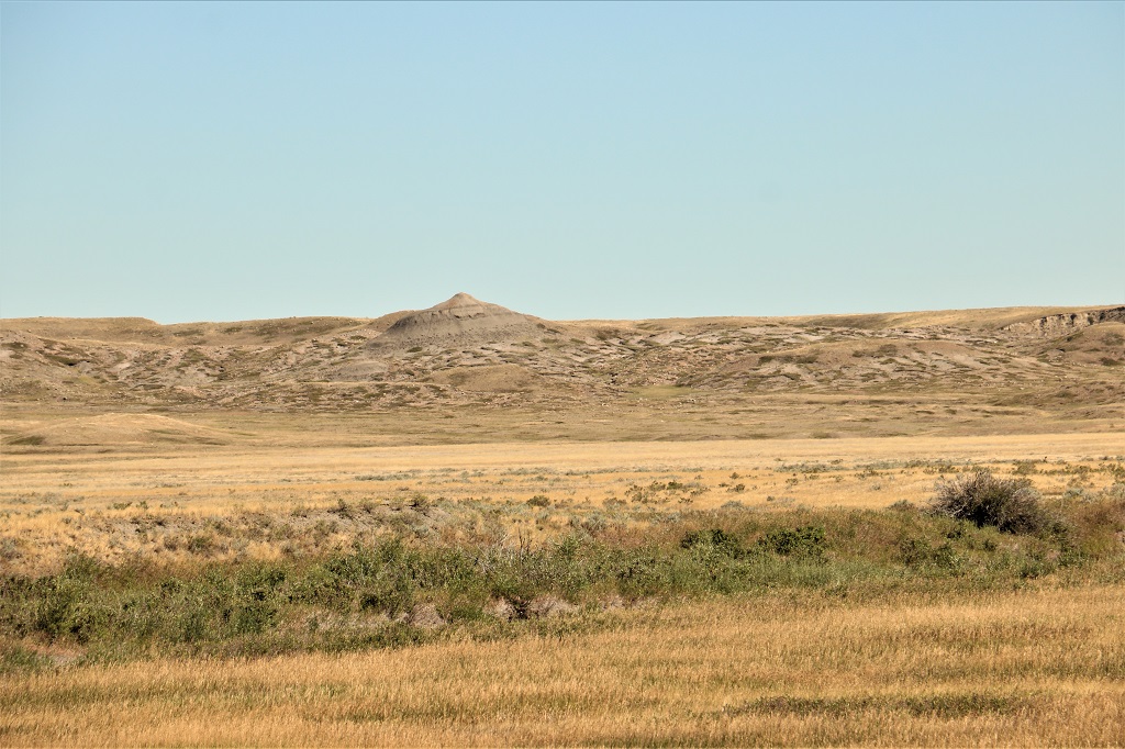
We passed this clay hill on the way to Wood Mountain yesterday but were past it before we thought to take a photo. We were looking out for it today, so were able to make the stop.
There is a very large scrap car lot in Wood Mountain with some cars that appear worthy of restoration. The one I liked though was this old Pinto. My first car was a sapphire blue 1970 Pinto. The very first one in town. I ordered it in November of 1969 when the model was brand new. I loved that car. We went everywhere in it. I was tempted to go find the fellow and see how much he wanted for it and take it home to fix up.
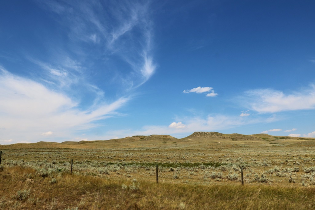
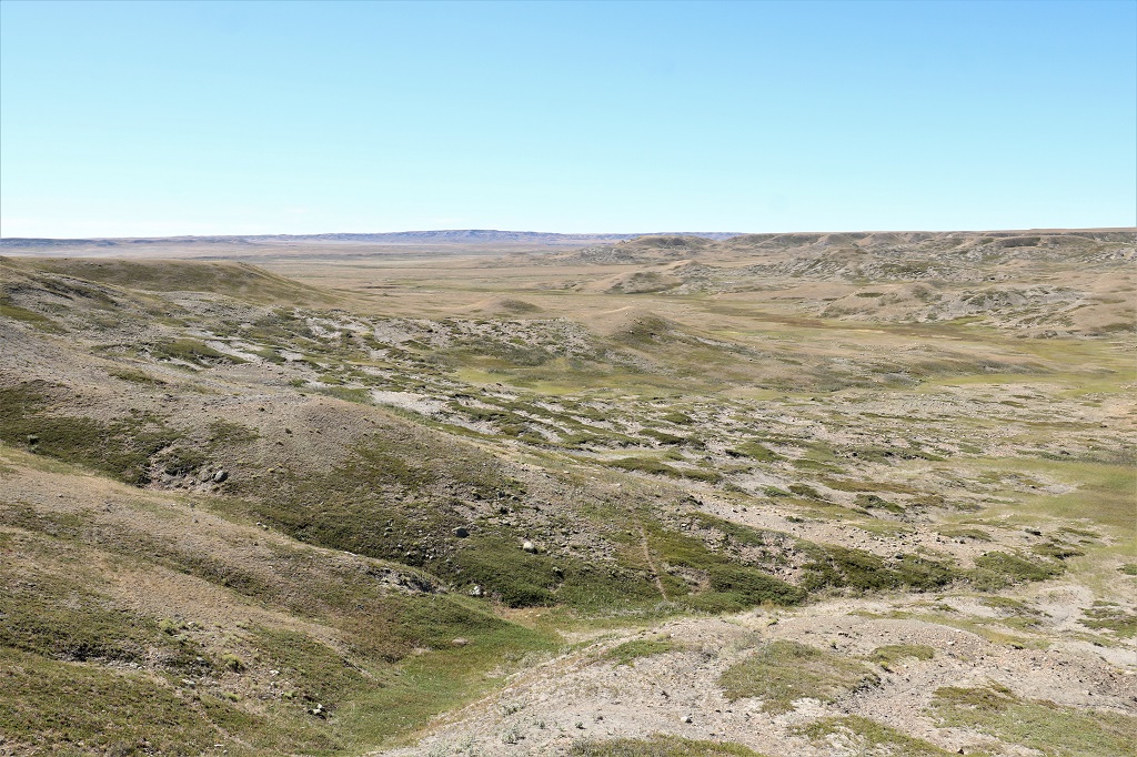
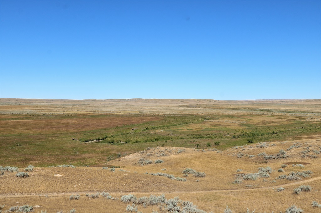
The West Block of Grasslands also has a scenic drive. There were not as many walks out to overlooks and more information boards about the grasses, or bison, or rattlesnakes, etc. This part of the park was more what I was expecting – lots of wide open spaces and grass and scrub. The Badlands in East Block were definitely more photo-worthy. Most of today’s expanses looked very similar. Still it was a lovely day and a nice drive – and there is always something new to learn.
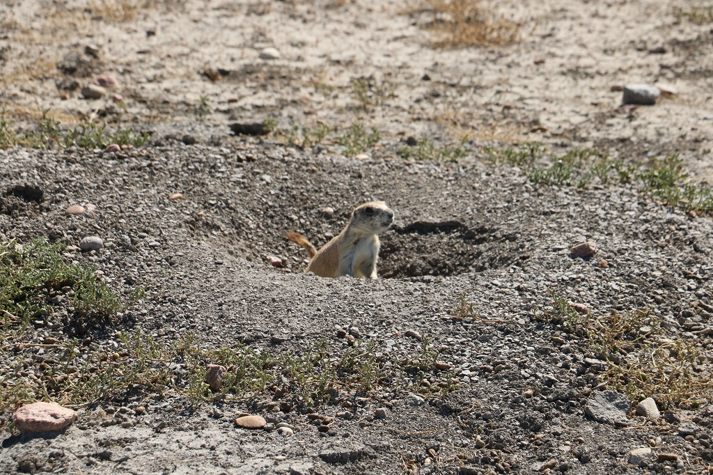
Dog Town is one of several very large prairie dog colonies in the park. You have to slow to 30 kph as they are constantly crossing the road.
There we quite a few very long hikes available as well. Although with all the rattlesnake warnings I am not sure I would want to wander around out here. Not to mention lack of water, high heat and sudden fierce wind changes. This view was at the trailhead for the 9.6 km (one way – non-loop) Timbergulch Trail.
The gal we chatted with yesterday at Wood Mountain Post said that last year was quite a bad drought year and that this year is a bit better, but not much. Parts of it certainly look very dry!
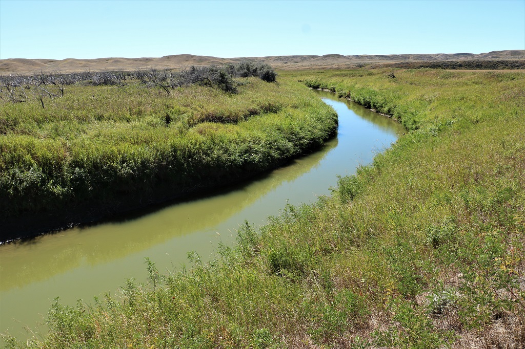
The Frenchman River winds through the West Block. The campground on this side of the park is named the Frenchman River.
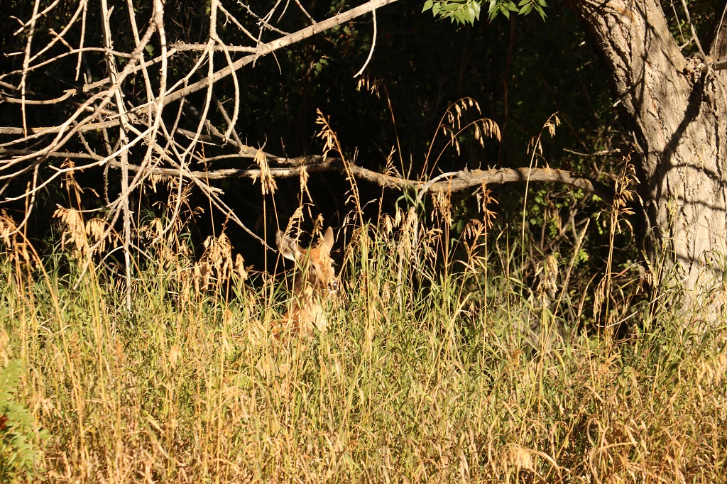
This was our view from Melva picnic site where we stopped for lunch. Way, way off in the distance there is a lone big bison. You could only see him with the telescope viewer or binoculars. He was the only one we saw. We have seen several herds of pronghorn and a couple of deer and lots of prairie dogs, of course.
There were a couple of Parks Canada red chairs, but they were way off on a hillside and John said he did not want to walk all the way over there in the heat. So no photo op for those ones.
Our lunch stop was very reminiscent yesterday and today, of our times in Death Valley when the wind is so warm it dries the bread for your sandwich by the time you have put the PB & J on it.
We finished the scenic drive and continued on the gravel road out the south end of the West Block and then connected again to Highway 18 going west. When we reahed Climax, Saskatchewan we headed north on Highway 37 right into Shaunavon where we spend the night.
An early arrival time of 4 PM allowed me to see how bad the internet might be as the hotel said it wasn’t very good, but it managed to load my photos and allow me to write my blog just fine so all my work was done before dinner.
Tomorrow we visit Fort Walsh and Cypress Hills National Park on our way to Medicine Hat where we will spend two nights.
On our way to the East Block of Grasslands National Park we stopped at Wood Mountain Post Provincial Park. There were many information boards about the beginnings of the fort and the closing and re-opening again. Very interesting information, but too many posters to put in a blog. The Boundary Trail Commission stopped there during their Canada/US border marking in 1874.
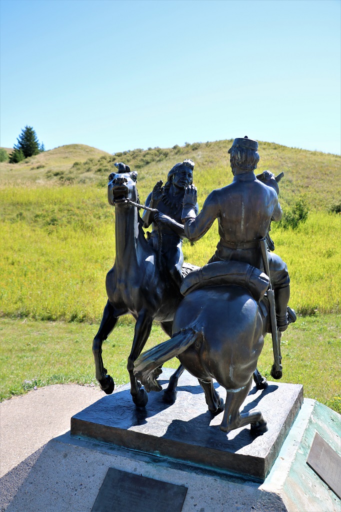
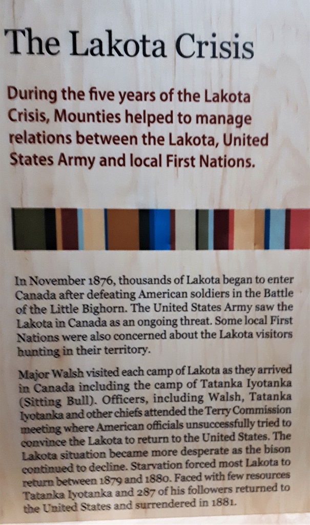
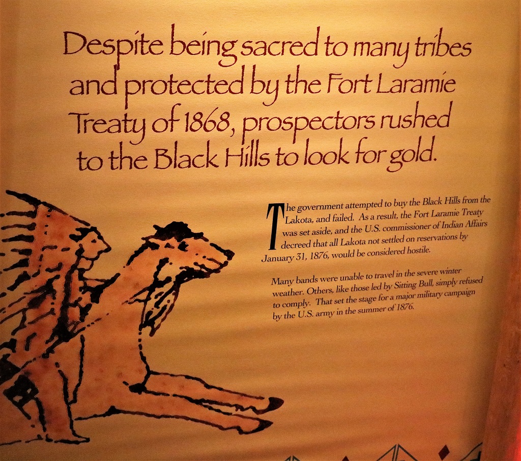
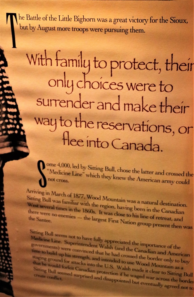
The post came into prominence and was most heavily manned when Chief Sitting Bull and several thousand of his warriors fled across the Medicine Line into Canada after the Battle of Little Big Horn.
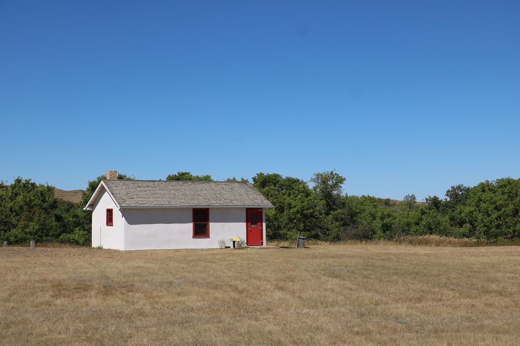
Only two of the old buildings have been reconstructed. This was the soldiers barracks.
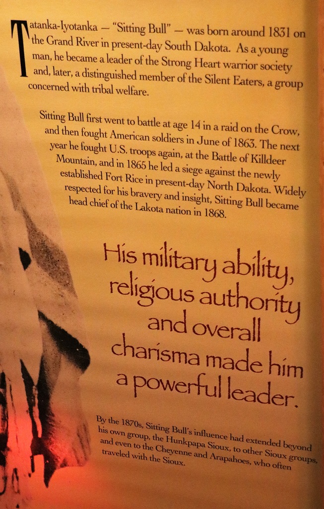
These are the few information boards I felt told the most pertinent parts of the Sitting Bull story.
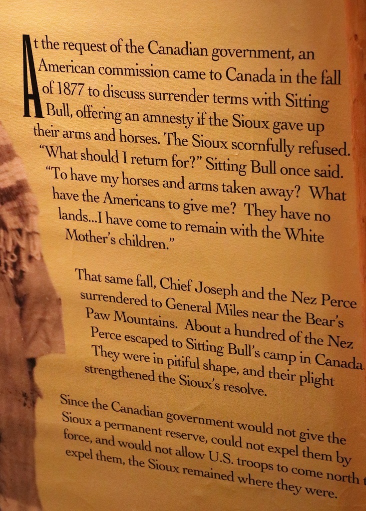
By January of 1881, only 40 lodges – about 250 people – remained at Wood Mountain. A few more Lakota surrendered in April. Sitting Bull and a few followers trekked to Fort Qu’Appelle to see Superintendent Walsh who had been re-assigned there. By the time they arrived Walsh had already been sent back to Ontario so they returned to Wood Mountain where Sitting Bull finally agreed to go back to the US. The Canadian government would not authorize supplies for the journey but the fellow that ran the trading post at Willow Bunch provided generous amounts of food and equipment for the journey south.
Sitting Bull wanted to be given a reservation of his own for his people and have the right to go back and forth to Canada whenever he wished. These requests were not granted and he was sent to the Standing Rock Reservation, and from there to Fort Randall where he and his followers were held for nearly two years as prisoners of war, before returning to Standing Rock.
In 1885 he joined Buffalo Bill’s Wild West show, earning $50 a week for riding once around the area. He could also keep whatever money he charged for his autograph and picture. He only lasted 4 months because he could no longer tolerate white man society and returned to Standing Rock living in a cabin near where he was born.
In the fall of 1890, afraid of Sitting Bull’s influence if he joined an upcoming Ghost Dance ceremony (that promised to rid the land of white people and restore the traditional way if life), Indian agents sent 43 Lakota policemen to arrest him. In the ensuing gunfight between Sitting Bull’s followers and the police, Sitting Bull was shot in the head.
A model of Wood Mountain Post during its heyday.
We were at Wood Mountain for quite awhile having a great chat with the Parks lady. Today was the last day the buildings would be open so we timed our visit well.
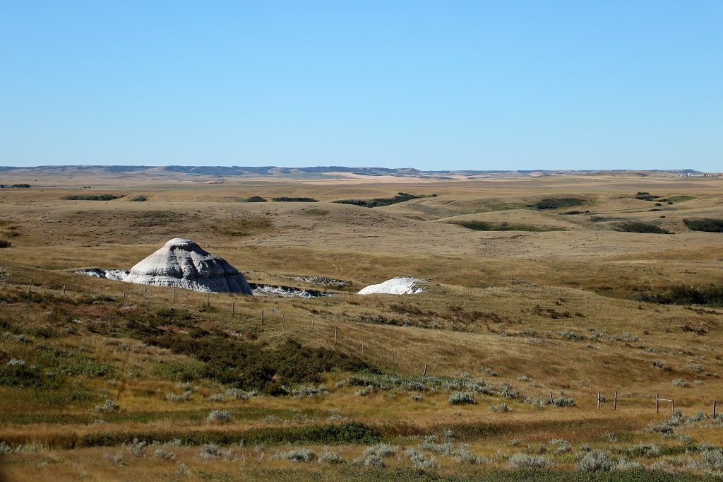
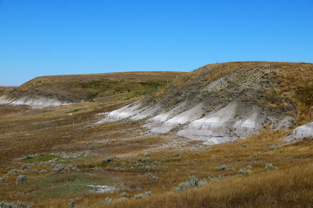
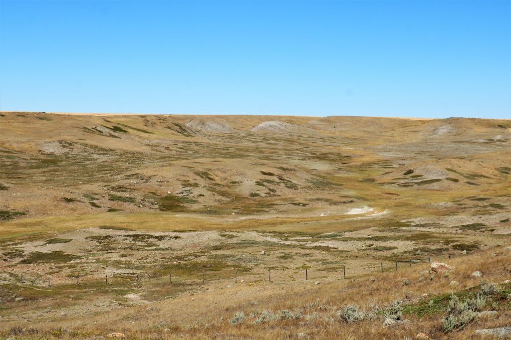
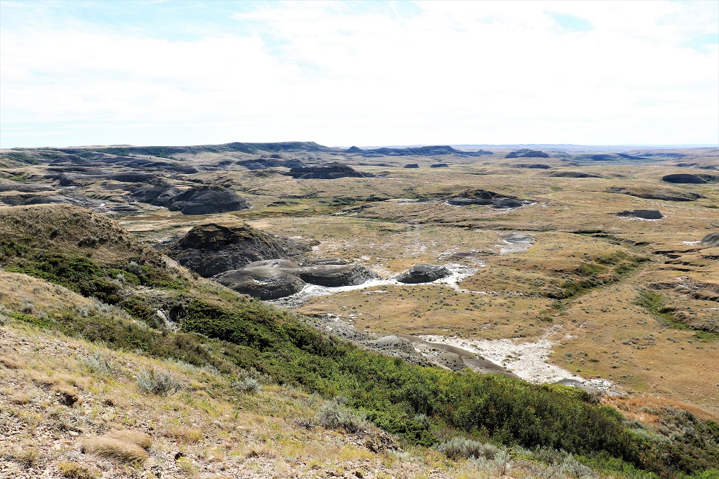
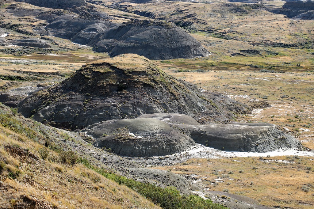
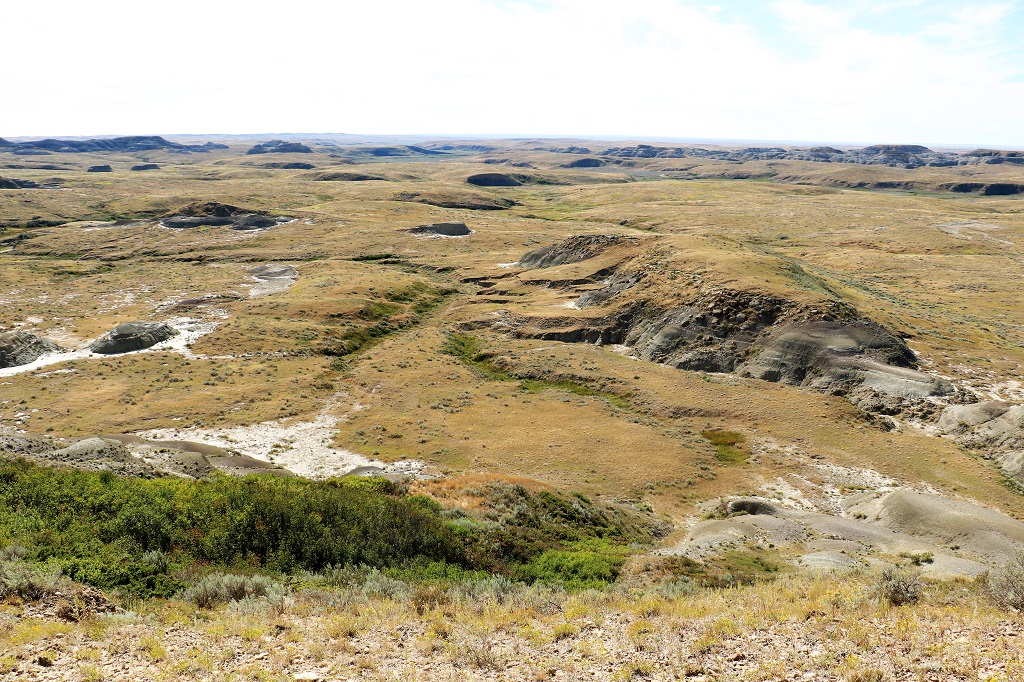
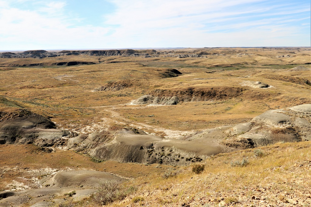
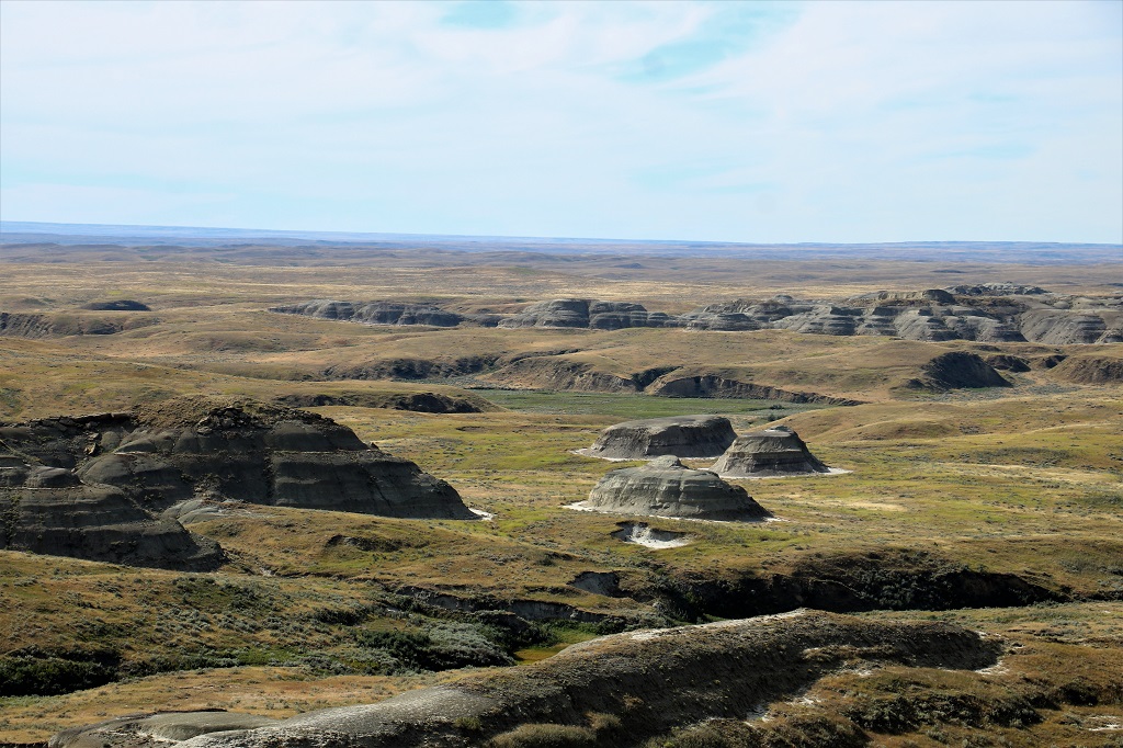
It was another 30 kilometers from Wood Mountain to the entrance of the East Block of Grasslands National Park. Grasslands has two sections, divided by about 35 km, that have been set up to preserve the natural prairie. Over 50 varieties of grass and plants are protected here and bison roam. We did not see any though.
There is an 11 km scenic road with six viewpoints that overlook the Saskatchewan Badlands. The road is only one lane wide with small pullouts to allow vehicles to pass. Parks Canada built it to be as unintrusive as possible. There are defined trails to each of the viewpoints and it is illegal to drive other than on the roads. There are hiking trails and horse trails throughout the park, but only one small campground in the East Block.
The first viewpoint was “The Gateway to the Grasslands” and overlooked Rock Creek Campground and the beginning of the badlands. There was a nice large sign with information about various hazards you may encounter in the park and what to do about each: Getting lost, being charged by a bison, bitten by a rattlesnake, see a prairie fire approaching or stepping in quicksand. Good to know…
I took quite a few photos at each of the viewpoints but have done my best to pare them down.
Gateway to the Grasslands viewpoint:
Rock Creek Campground.
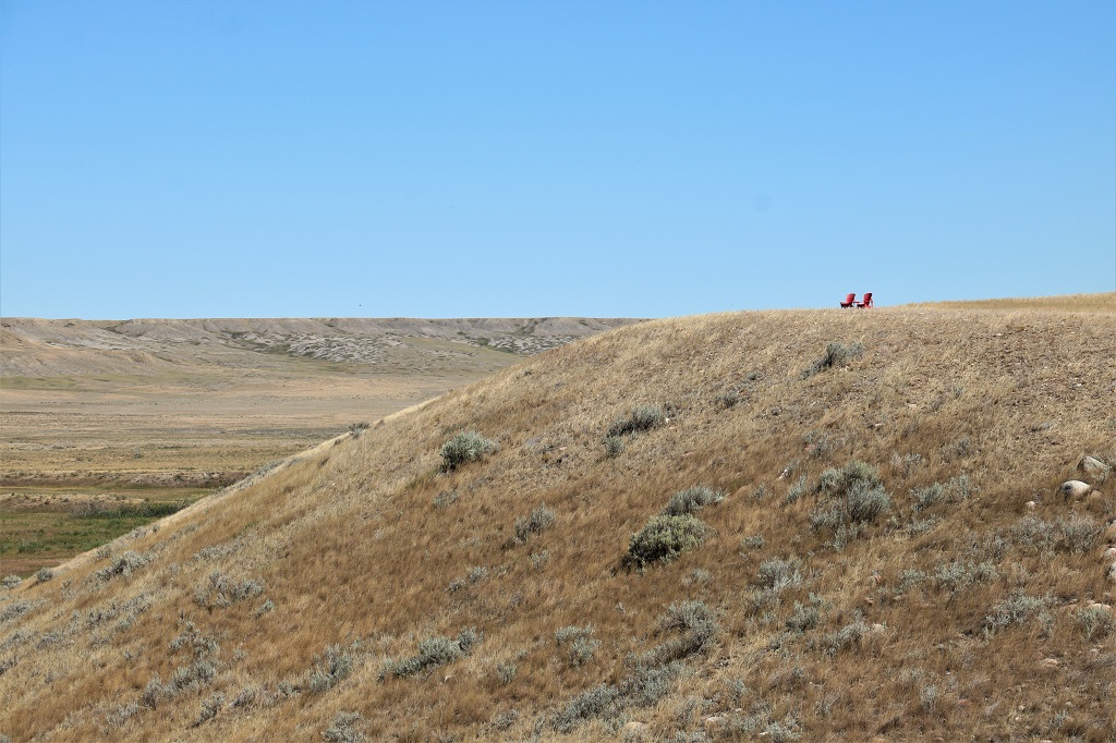
A National Park means a Red Chair picture.
Crackerjack viewpoint:
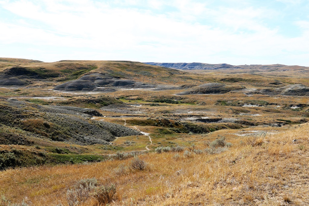
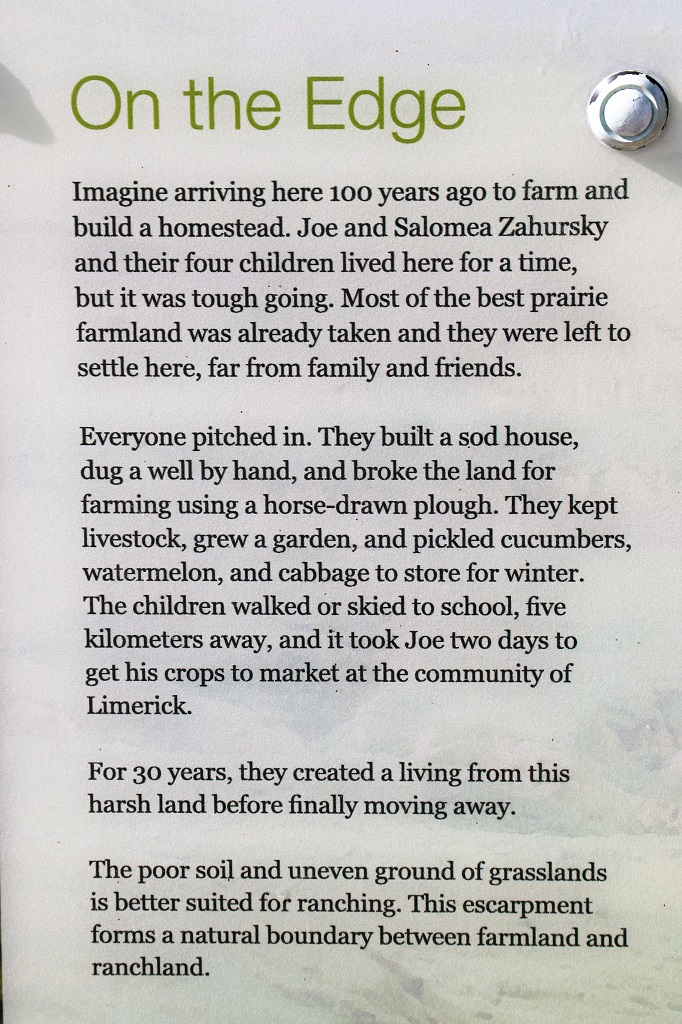
Zahursky Point viewpoint:
Before they dug the well they had to carry buckets to collect water from Rock Creek over a kilometer away and lug them back up the hill.
More red chairs, but I didn’t sit in these two for a photo.
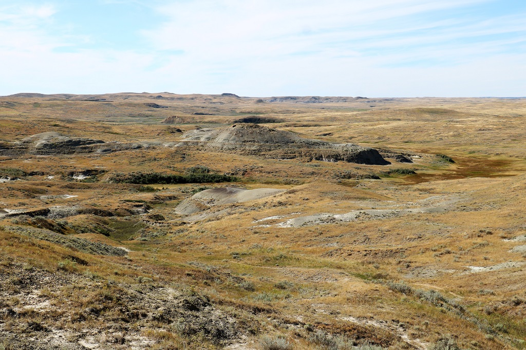
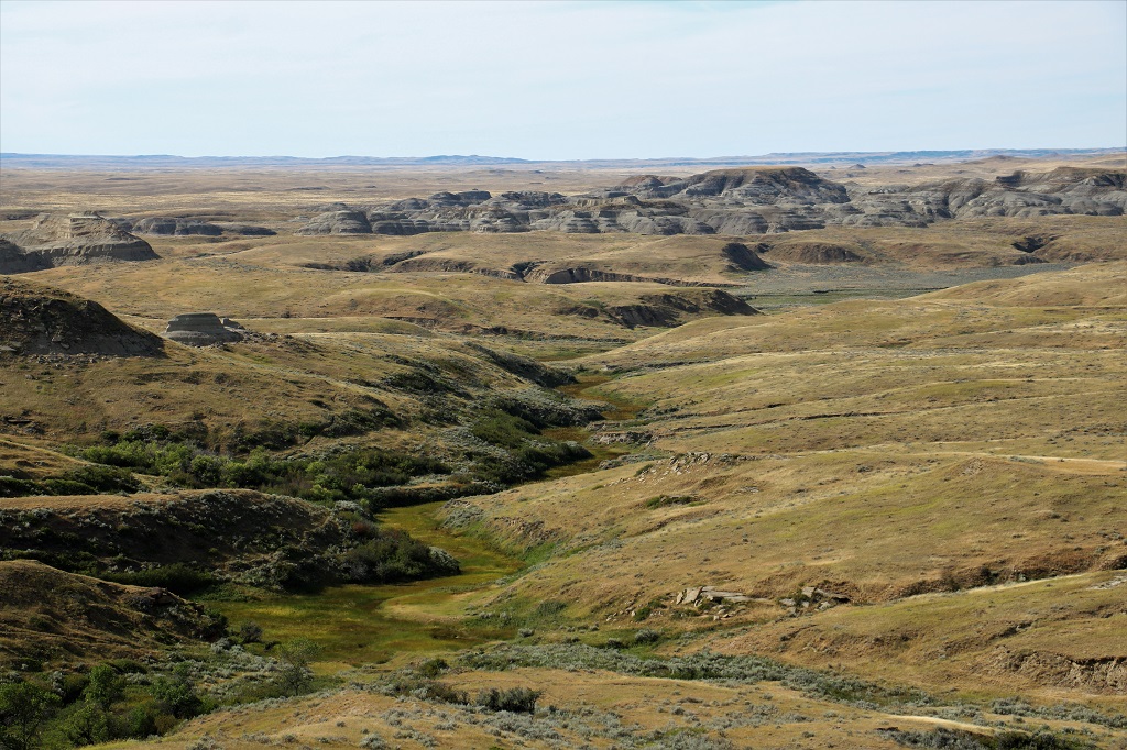
Kapêsiwin viewpoint:
Kapêsiwin was a stopping place for the First Nations for over 3,000 years due to the proximity of water and game.
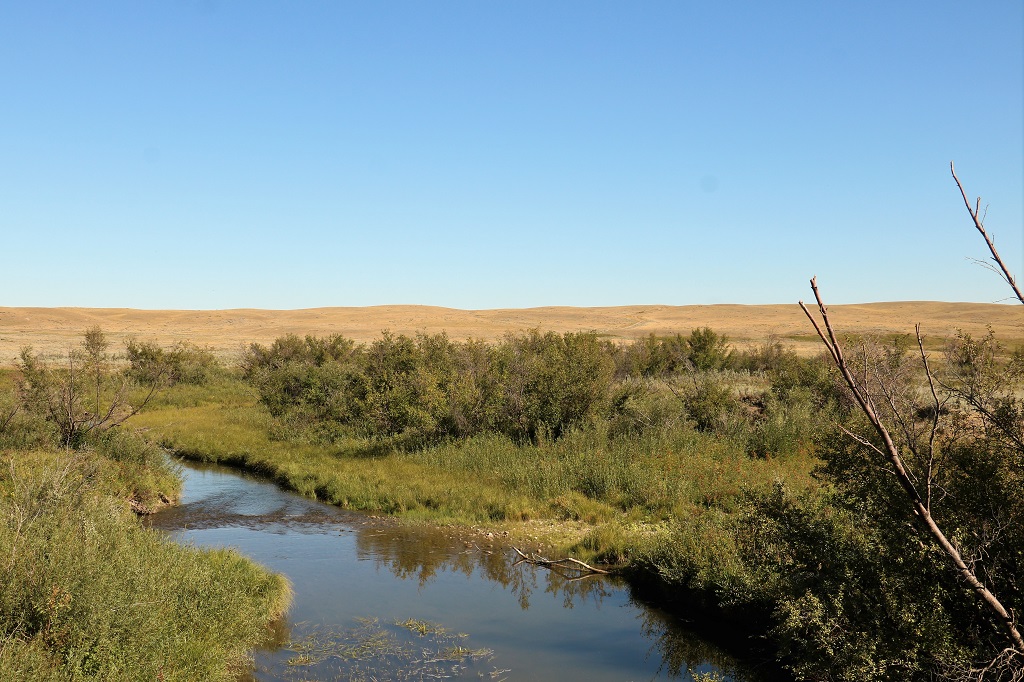
Rock Creek snakes its way through most of the park.
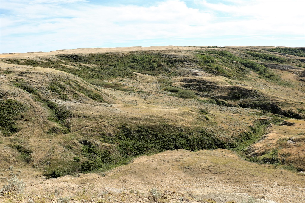
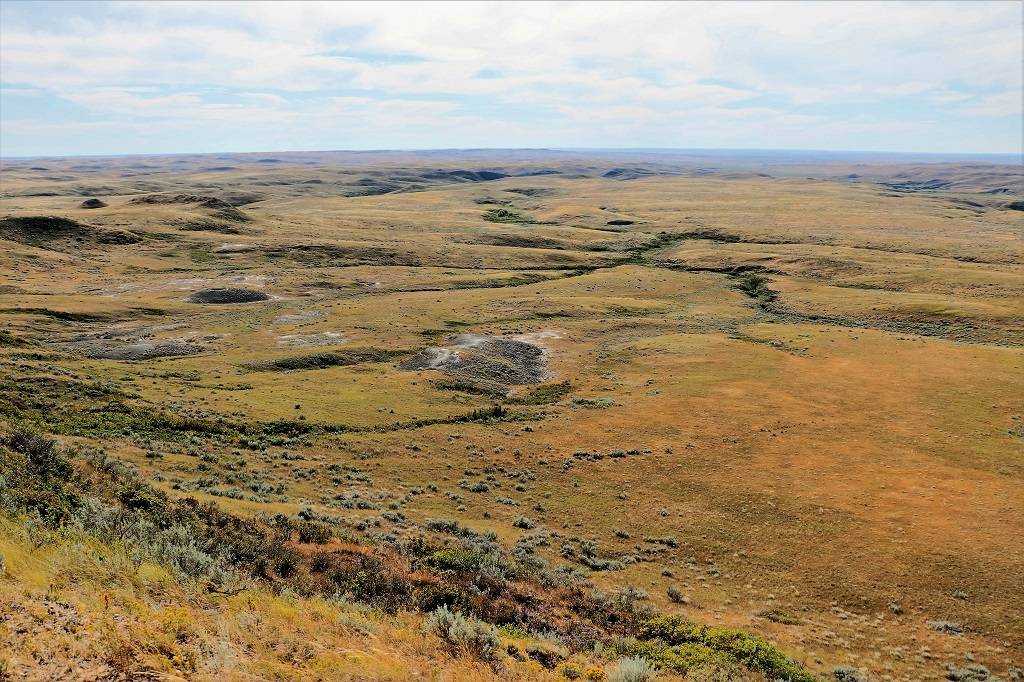
Typical grassland prairie.
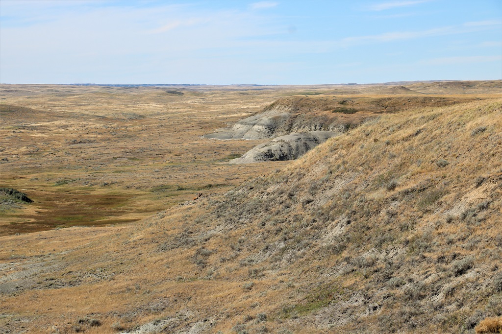
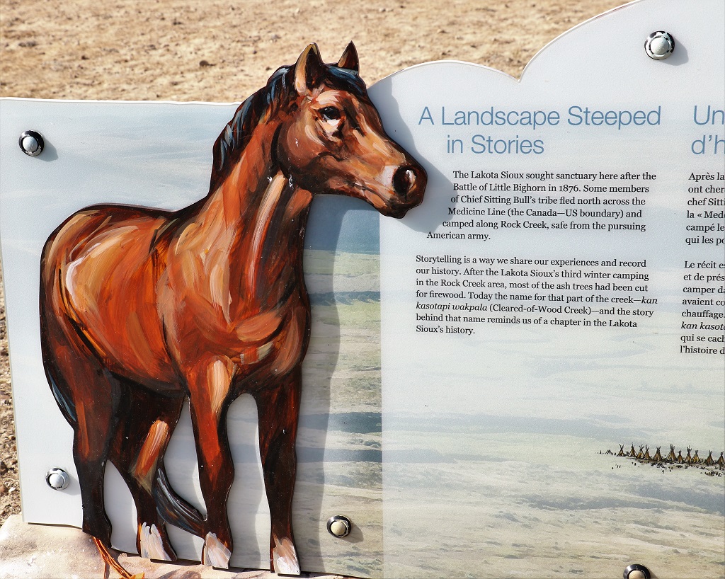
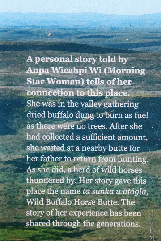
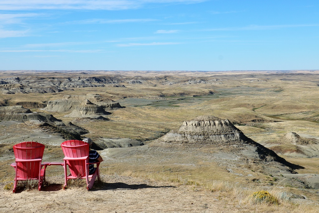
Ta Sunka Watógla viewpoint:
I did sit in the third set of red chairs though.
By the time we drove the 11 km back to the main entrance road it was after 5 and we had an hour and a half drive back to Assiniboia.
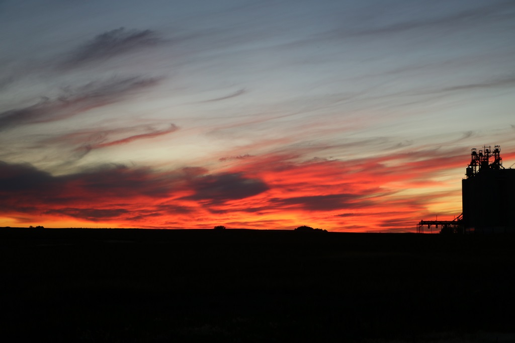
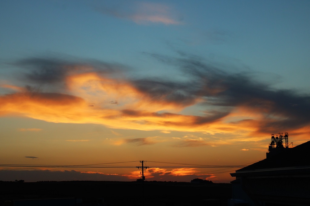
Our room faces west and the sunset was gorgeous. There are too many wires in the way looking out the window for a good photo. I hate wires in photos. John went out and walked across the road and got this lovely shot while the sky was the reddest.
We leave Assiniboia tomorrow and will go to the West Block of Grasslands on our way to Shaunavon for the night. The hotel has given notice that their internet is poor so there may not be a blog tomorrow.
There was heavy rain as we prepared for bed last night and it was still raining this morning, with a strong cold wind. We dawdled in our hotel room for an hour or so and ventured out just as the rain stopped.
Claybank is just over an hours drive from Assiniboia via some paved and some gravel roads. Up to now the gravel roads in Manitoba and Saskatchewan have been really good; no washboard or potholes. This morning however the tire tread lines were extremely slippery and even though John tried to keep the truck on the gravel in the middle the slick muck kept trying to pull us into the mire. There was quite a bit of sliding going on. Good thing there was virtually no traffic.
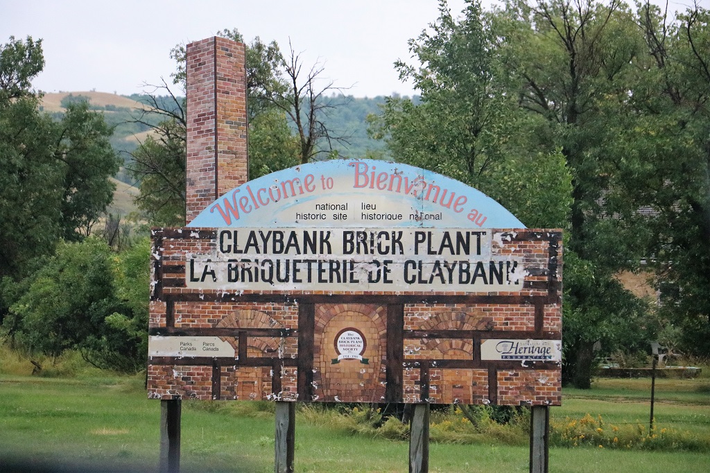
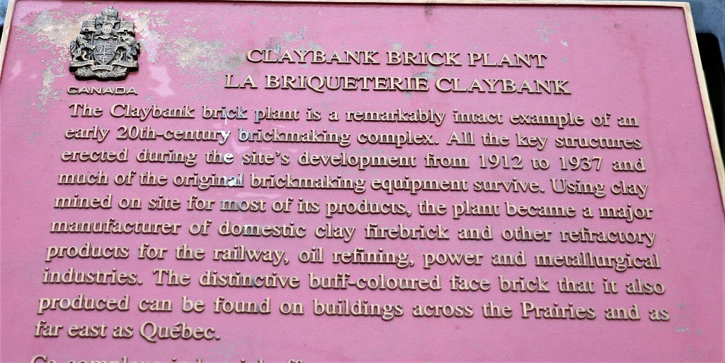
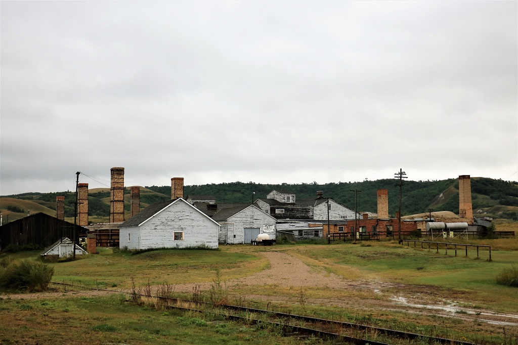
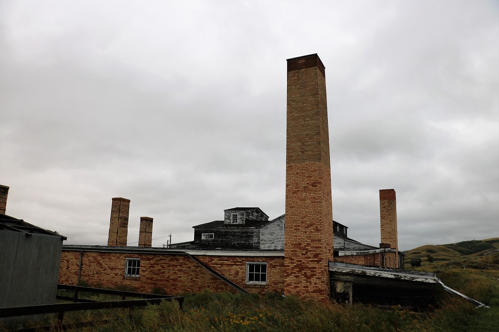
The clay was discovered in 1886 by Tom McWilliams, a local homesteader, when he was using a spyglass to search for his missing cattle. He sent a sample of the clay to an assay office and learned he had found a rare and rich deposit of ‘refractory’ or heat resistant clay. He moved his homestead claim to the property and over the next few decades dug the clay by hand and shipped it to a brick plant in Moose Jaw. In 1912 he sold the property to a new company formed by five prominent Moose Jaw men and the brick plant was built .
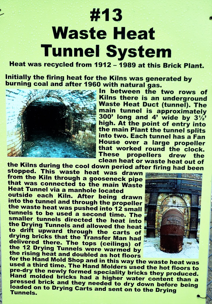
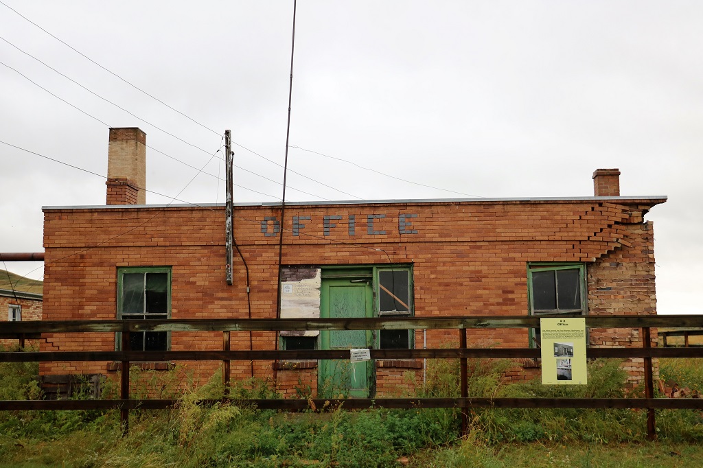
Refractory clay is well suited for manufacturing fire bricks which are used in fireplaces, and to insulate boilers, furnaces, steam engines, etc. Anywhere high heat is generated. The plant was in production from 1912 to 1989.
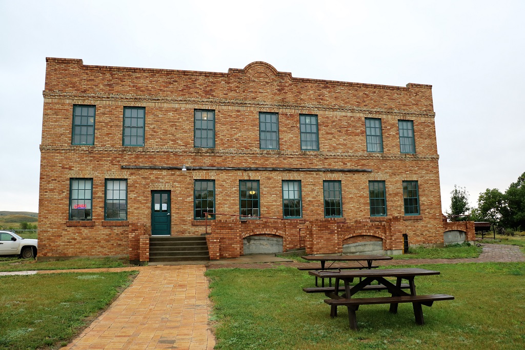
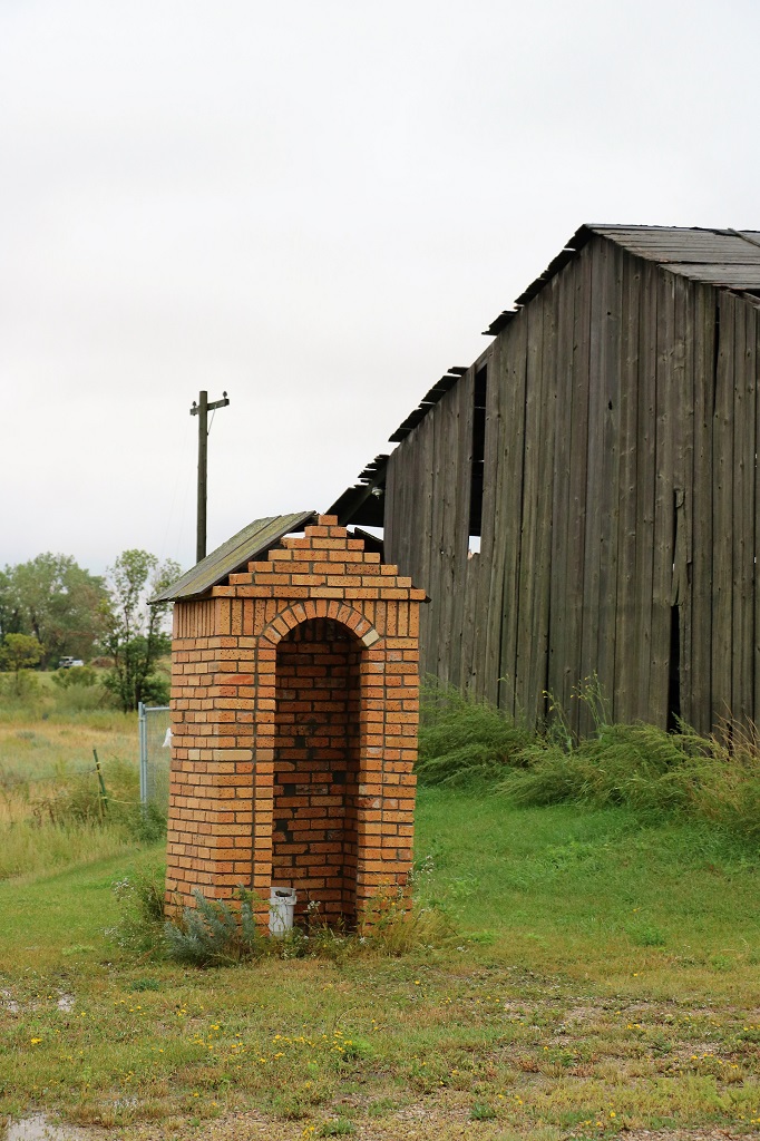
The information center is located on the first floor of the old bunkhouse. Up to 40 men boarded here. The staff had rooms on the first floor where the kitchen and dining room were located but the labourers were housed in one of the eight rooms on the second floor. Three-tiered bunks could accommodate up to 12 men in a room. Meals cost $1 per day and the average wage in 1945 was $138 per month.
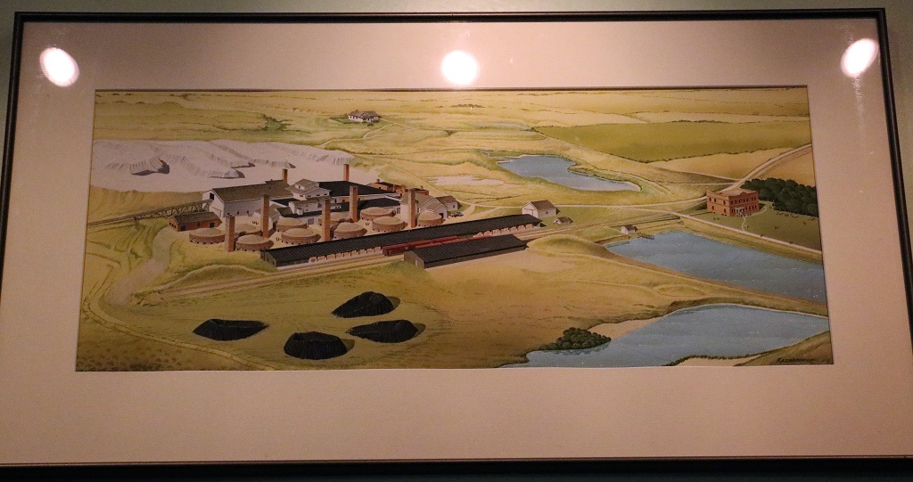
When the property became a Saskatchewan Heritage Site, and later a Parks Canada Historic Site, it was still possible to tour the buildings. Time however is taking its toll and you cannot go in them anymore. 90% of all the machinery from the 80 years of production of the Brick Plant is still inside – and some of it still works too.
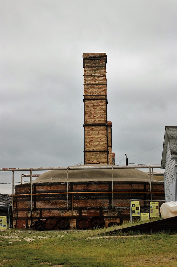
For many years the dry kilns were heated with coal and the impurities in the coal gave Claybank Bricks a very distinctive colouration. After the plant was converted to steam the bricks were much lighter in colour and no matter how hard the chemists tried they could not get the old colour replicated.
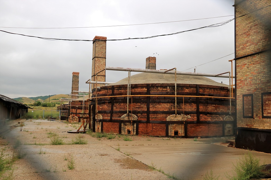
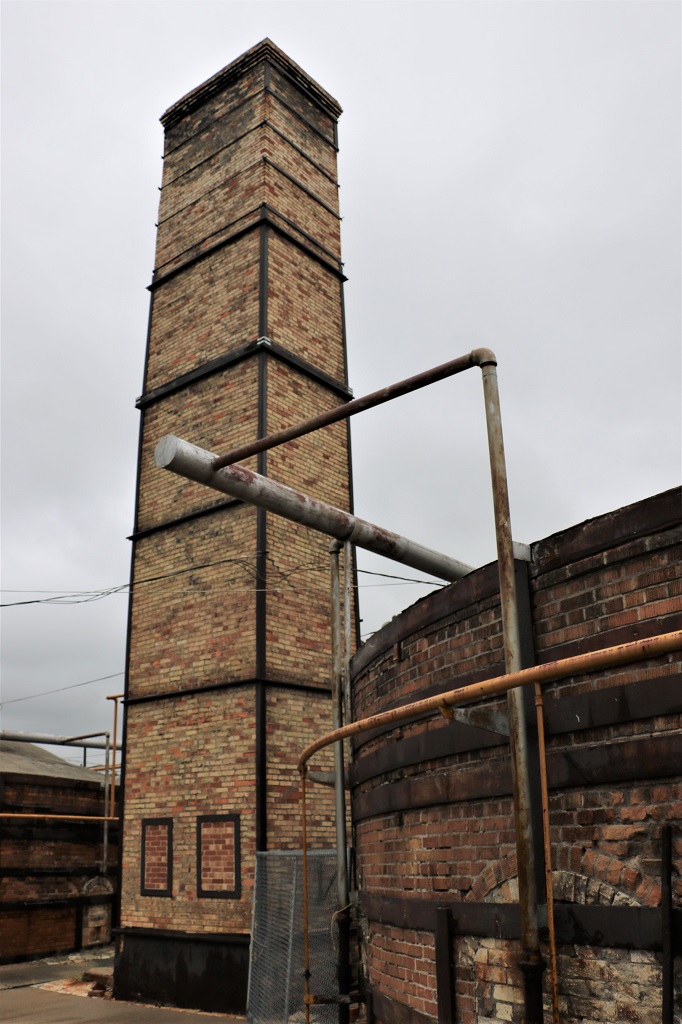
One of ten kilns. There was one smokestack for every two kilns.
All of these sign boards used to be located within the various buildings to describe what went on in each place to make the bricks. Now that the property is gated they were hung in the one place.
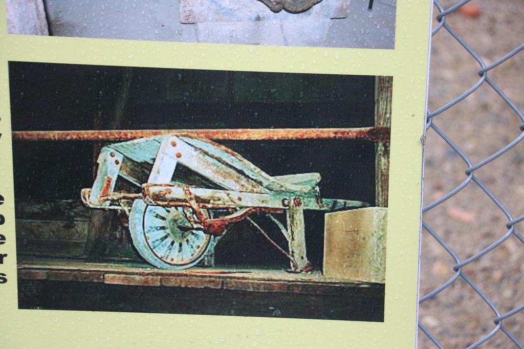
This is the only wheelbarrow that provided clay to the handmold shop during all the years of production. The hand molded bricks had to be perfect, no blemishes, chips or cracks. If even a fingerprint was visible it was discarded.
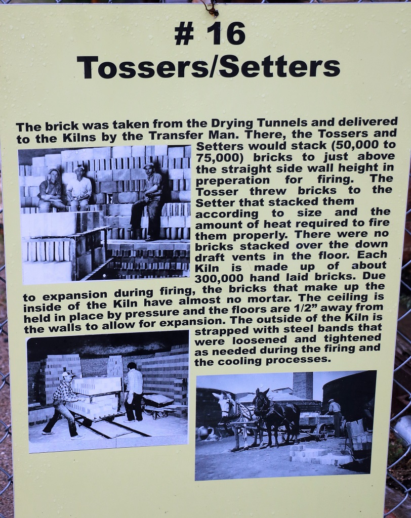
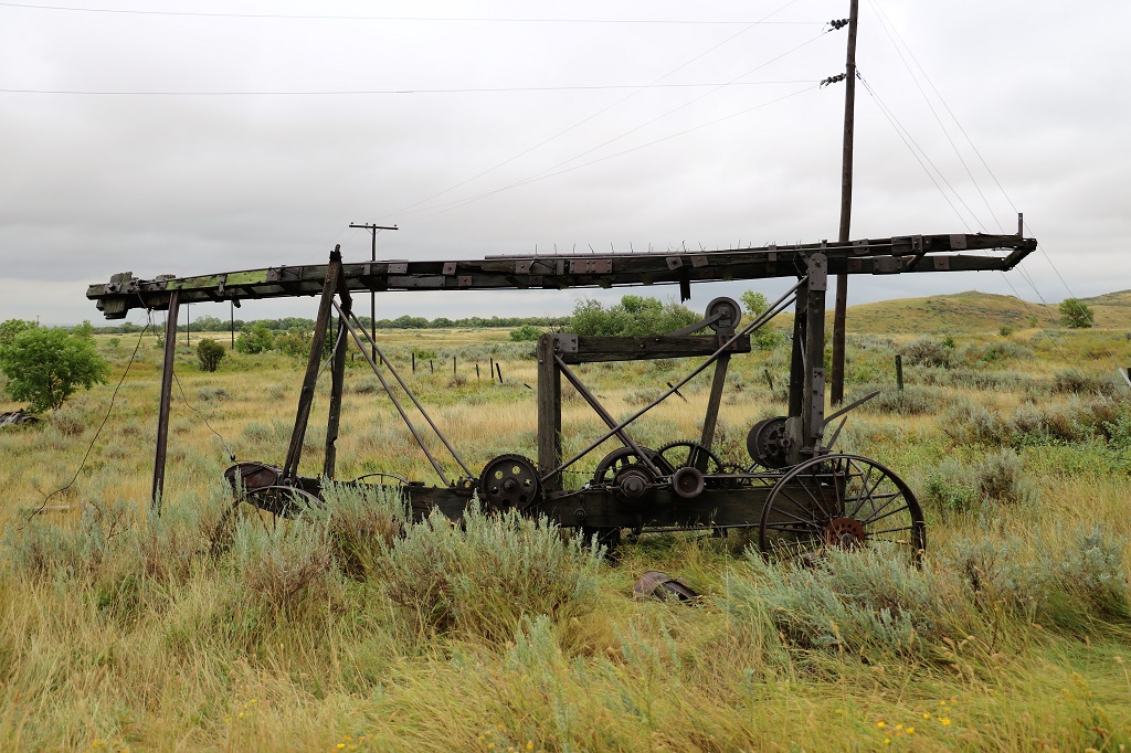
The making of the bricks was extremely labour intensive with almost every part done by hand. These men really earned their pay! Four bricks would come out of the dry press every 8 seconds and two men would pick up two each, flip them in the air and then stack them on the carts in rows on edge with space between for them to air dry before being put in the kilns by the tossers and setters.
Clay piles were made outside but there was also a lot of clay stored inside big sheds to be used during wet days or the cold months. The dry press method of brickmaking used at the plant required the clay have very little moisture in it.
We walked past the plant to the back of the property and climbed the small hill to get a bit of a view of the old clay digs. There was another large deposit of similar high-grade refraction clay located 12 miles from Claybank so the plant had an ample supply.
Claybank face brick and fire brick was delivered all over the globe. Bricks produced here went to places like Algeria, Cuba, Europe and across North America. These lined the fireboxes of railway steam locomotives and were used to ensure the efficient operation of steam-powered boilers which powered the warships manufactured in Canada during World War II. They were also used at British Commonwealth Air Training Program bases across western Canada where pilots from across the Commonwealth were trained for military action in Europe, the Middle East and Asia. The best quality firebrick was used in the blasting test bays and the launch pads at Cape Canaveral, Florida for the moon shots in the 1970’s.
Face brick from Claybank was used on many notable buildings such as the central tower of the Chateau Frontenac in Quebec City, The Gravelbourg Cathedral complex, the Bessborough Hotel in Saskatoon, the Hotel Saskatchewan, and Balfour Apartments in Regina, and many other buildings across Canada.
You can hike out to Massold Clay Canyon but it was too cold and too wet and muddy today. The map had a clear warning on the quicksand area. It looks like dry clay but underground springs keep it wet and you will sink if you are unwise enough to walk there.
As we returned to the Bunkhouse we scuffed our shoes in as much wet grass as we could to remove the mud from the treads. There is a cafe in the info center so we had a coffee and a cinnamon bun before watching the virtual tour that showed the inside of the buildings.
We took a different route back to Assiniboia with a different combination of paved and gravel roads. Thankfully the rain had stopped most of the time we were at the brick plant so we did not have as much slip-sliding to endure.
We arrived back about 4 and warmed up in our hotel room until going out for dinner. By then the clouds had moved on, the wind had died down, and blue sky was overhead once again.
Tomorrow we go southwest to Wood Mountain Post and the eastern block of Grasslands National Park. The weatherman promises sunny skies and 27°.
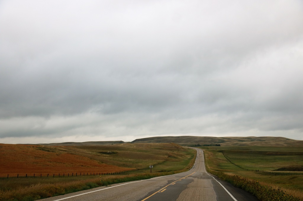
It is not too far between Weyburn and Assiniboia if you go directly west (about 163 km or101 miles), but we headed south to highway 18 not far from the American border before going west. We only had one thing we planned to see – the St. Victor petroglyphs about 20 kilometers south of Assiniboia and were taking a bit of a longer route since they were best viewed in late afternoon or early evening.
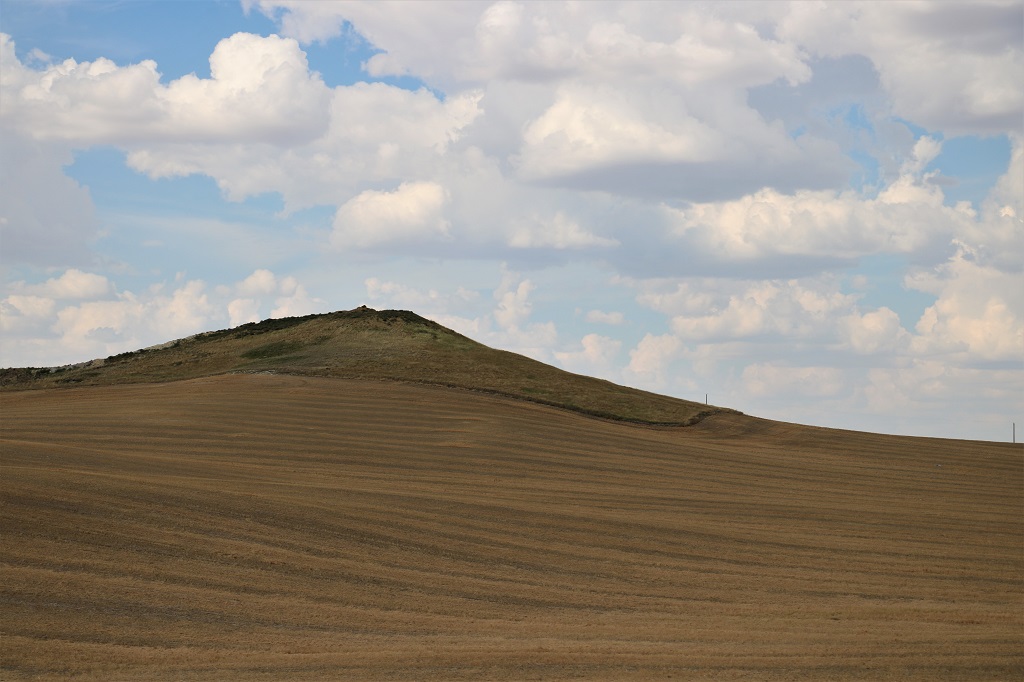
We puttered along on patchy paved roads through rolling hills, wheat fields and other crops. It was a gorgeous day and we took a ton of scenery photos.
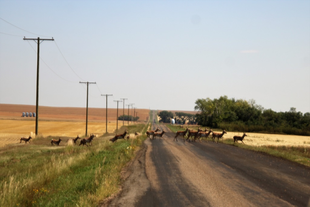
A herd of pronghorn were feeding in the field on my side and they got spooked when John stopped the truck.
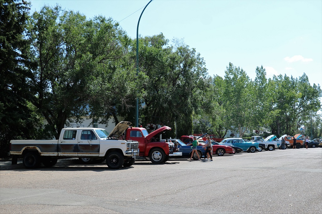
We drove into the small town of Conorach and turned onto the main street to go to the visitors center to ask the best route to St. Victor only to discover the whole street closed for a Street Fair.
We were not in any rush so we parked and went wandering.
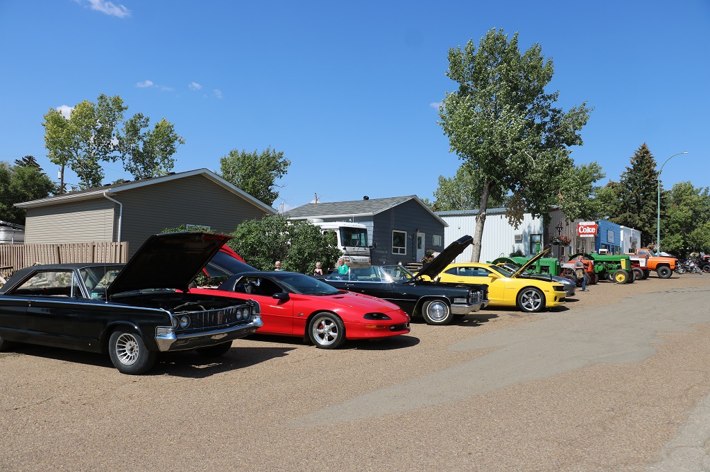
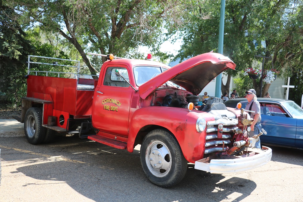
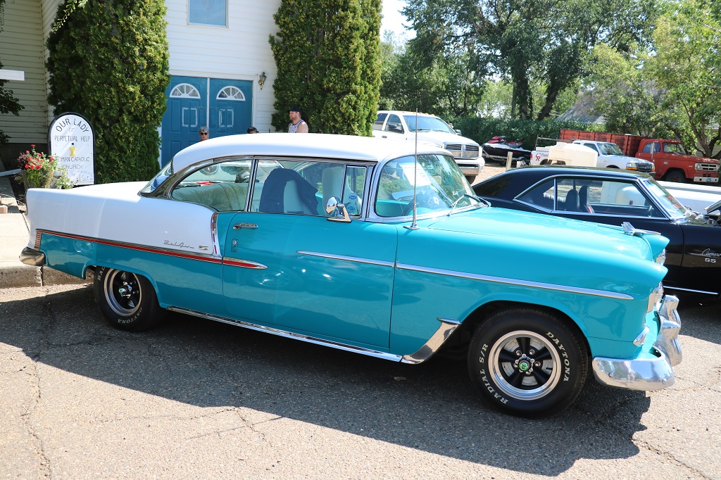
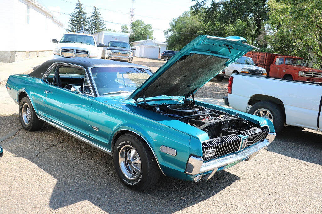
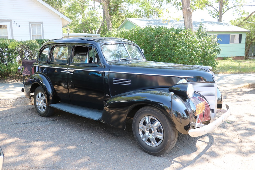
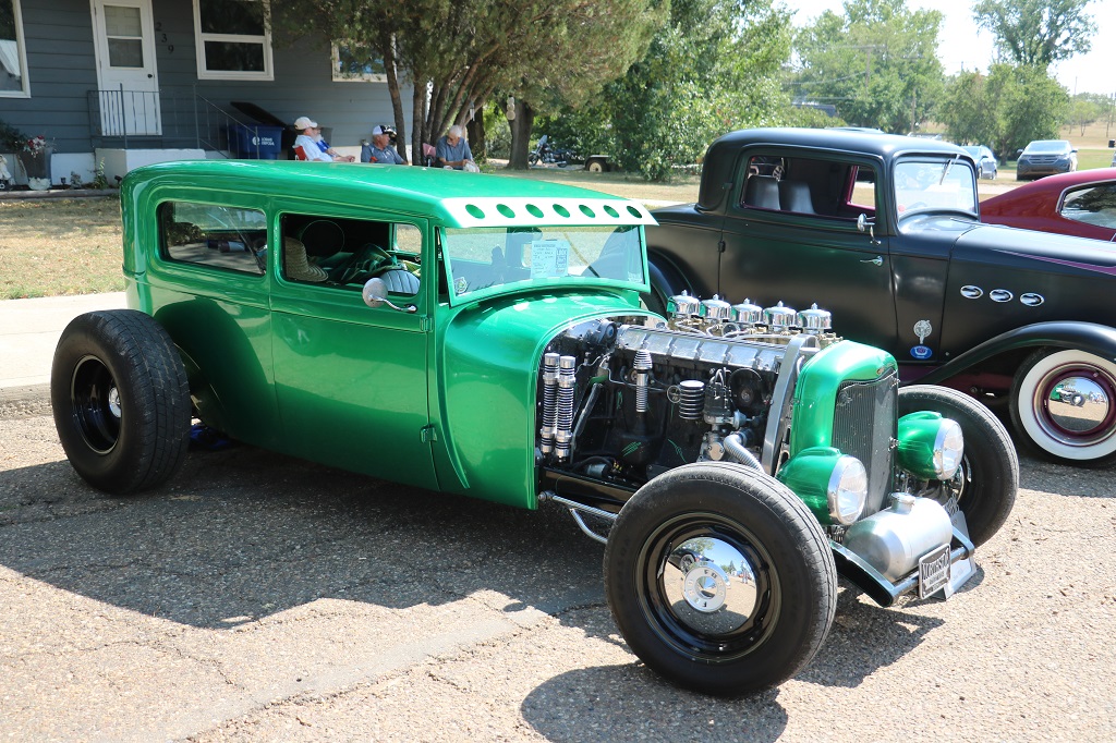
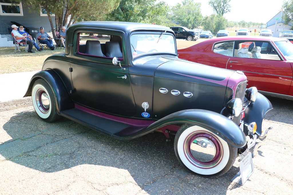
At the end of the street past all the vendor’s tents there was a car show.
My favourite.
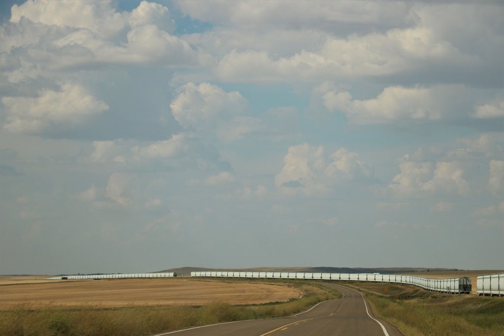
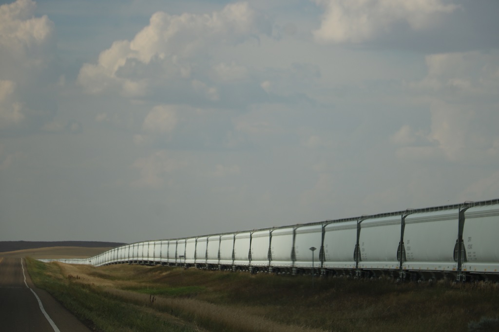
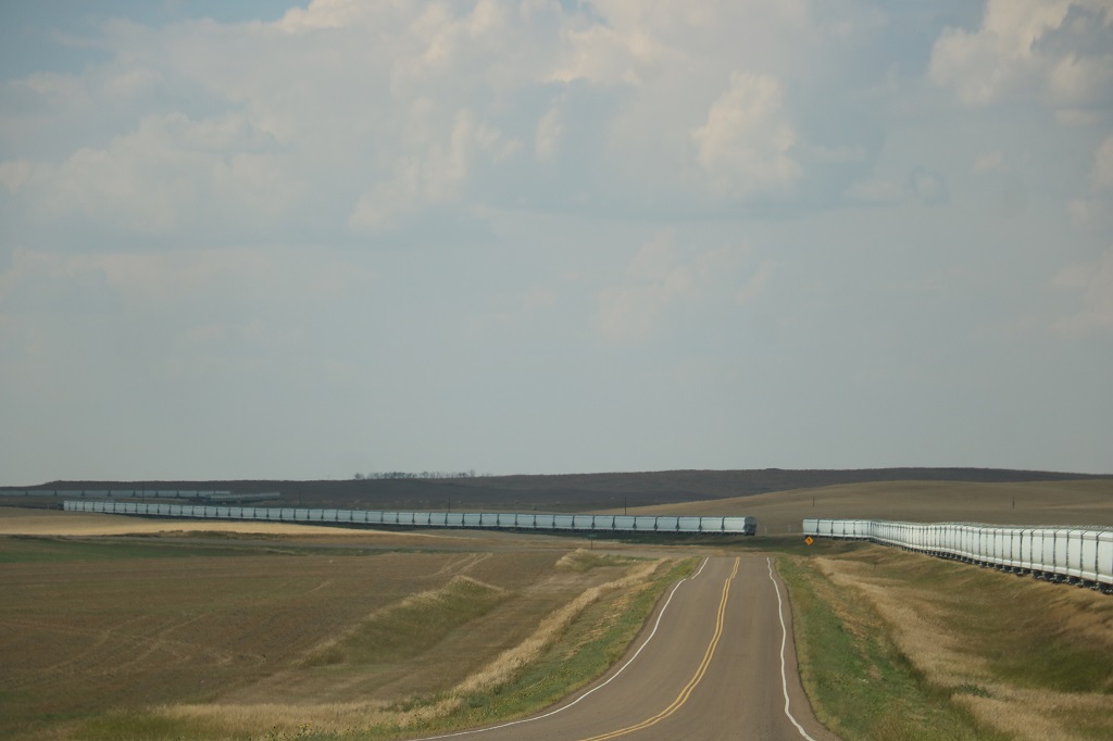
As we left Coronach we saw a long row of new grain cars sitting waiting for the harvest to be brought in. They stretched alongside the highway for almost 16 km. The line was broken whereever there was a road crossing the track.
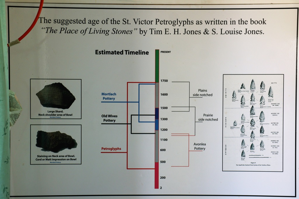
We arrived in St. Victor about 4, knowing it was not late enough to have the best view of the petroglyphs, but we have seen several examples of them in other places so felt we would be okay with what we able to see.
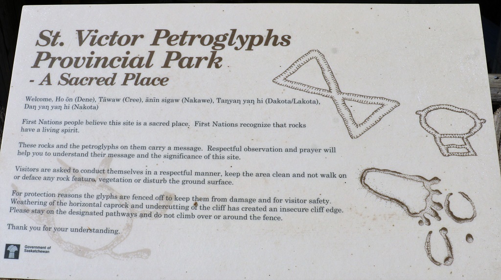
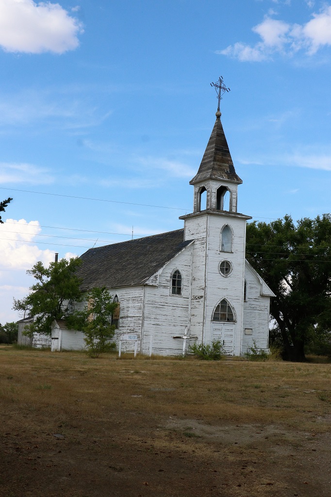
On the outskirts of St Victor (population 20-30) was a little log cabin with a Red River ox cart beside it, and a sign above the door saying “Friends of St. Victor Petroglyphs.” We decided to stop and see what information they may have. The fellow came outside as we were getting out of the truck and started talking to another couple of men who arrived the same time as us. John thought to himself that the man’s voice sounded familiar. After he finished his conversation with the other fellows he sat on a chair on the deck and asked me where we were from. When I told him he laughed and laughed and told us his name. John had just been thinking to himself that this fellow sounded like Glen, a schoolmate of ours who used to work at the same sawmill as John. And that is who it was. Glen moved to Willow Bush (population 300), which is a few kilometers east of St. Victor, 13 years ago. We had a wonderful chat for about an hour. He helps man the Petroglyph information center in the summertime.
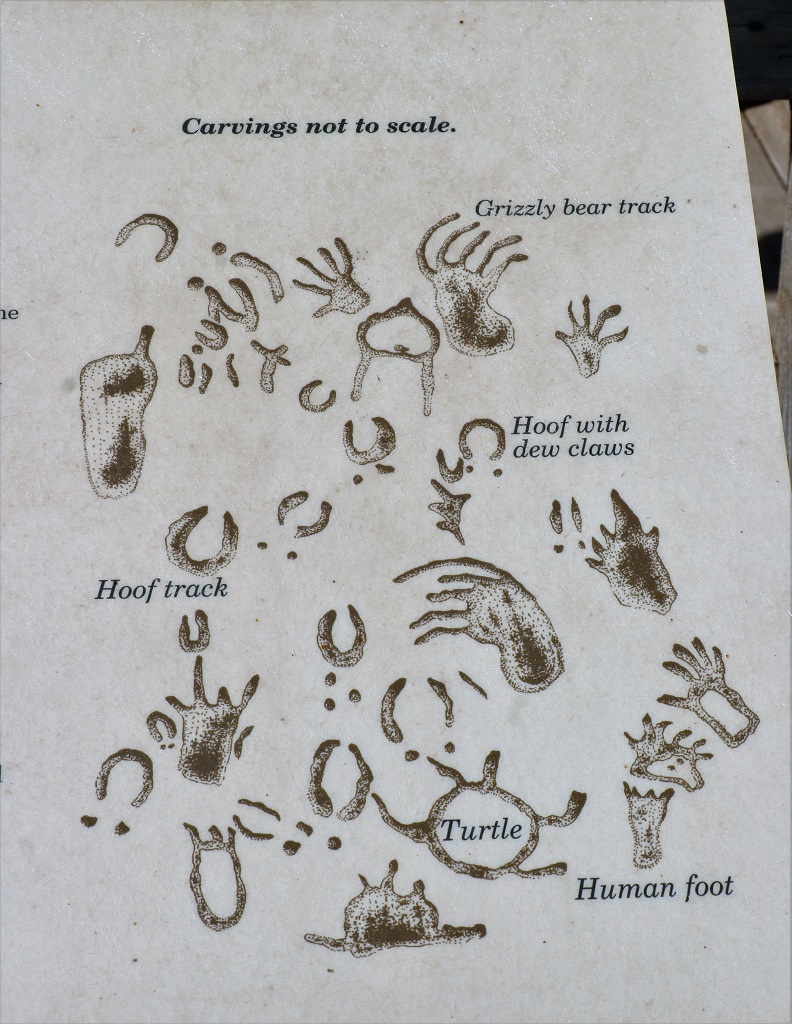
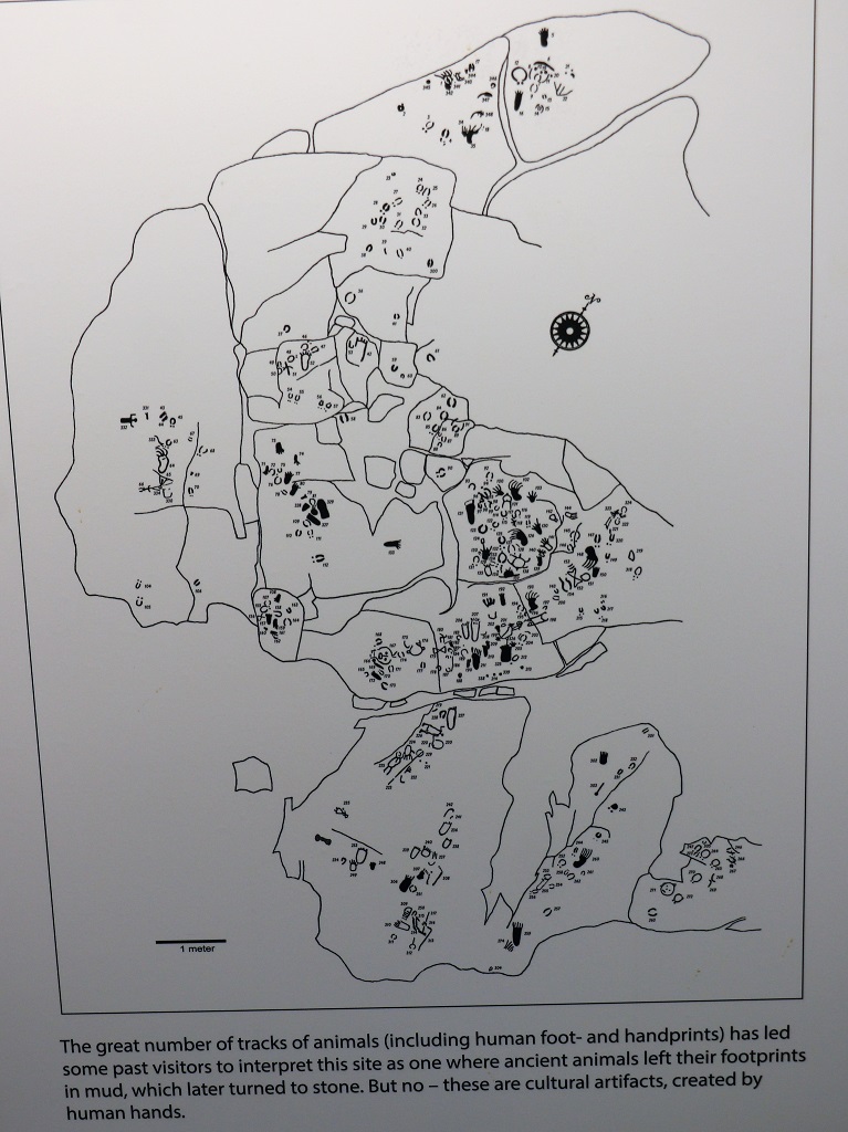
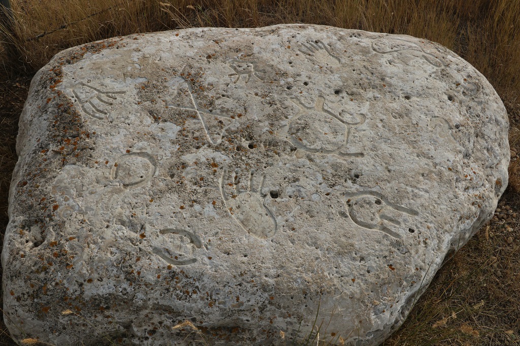
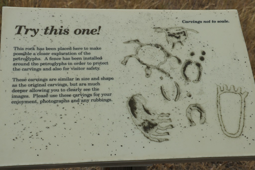
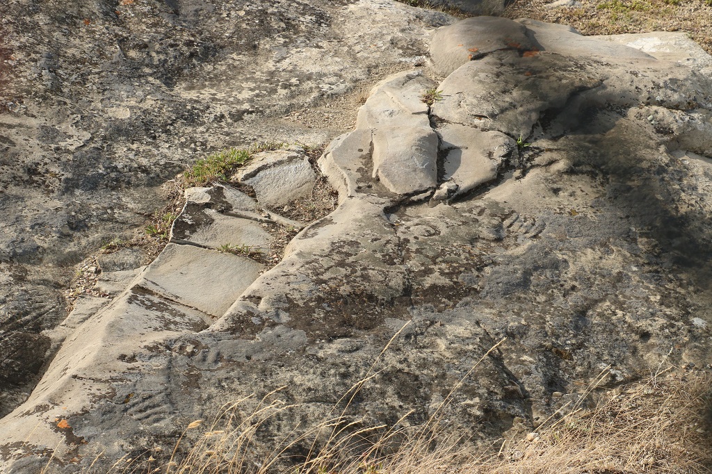
It was only 2.5 km from the info center to the petroglyphs. The information I had said there were 165 steps to climb to the glyphs but the government has since fenced the area and you can now drive to the top. At the gate to the path there was a large stone with copies of some of the petroglyphs on it that shows clearly what they look like and that you could use for rubbings if you like.
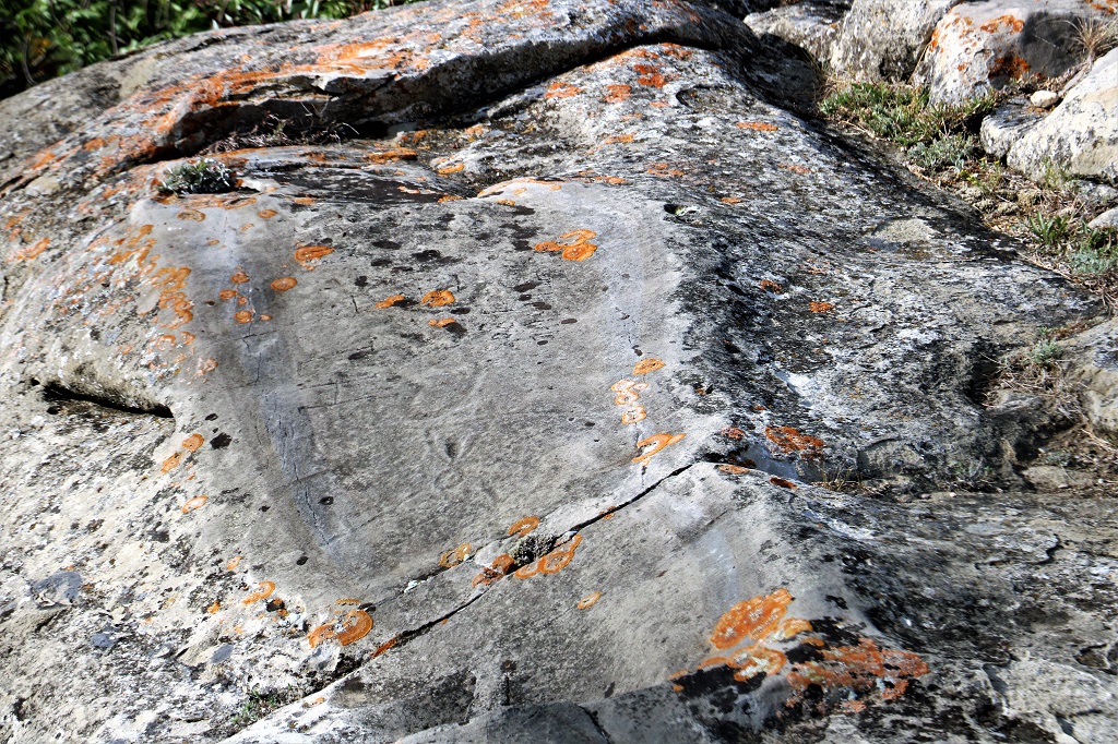
Human graffiti, walking, and touching have damaged many of the petroglyphs. Lichens have started growing on the sandstone and acid rain and ash from the eruption of Mt. St. Helens in Washington in 1980 have caused further damage. It was very hard to make out many of them. The best time Glen said was to go at night with a flashlight.
The view atop the hill was amazing.
I think this is Twenty Mile Lake.
I had climbed through a fence to go to the edge of the hill to get a better photo of the lake and when I was walking back I spotted a geocache sitting right beside one of the fence posts. That was a pleasant surprise and the only cache we found today.
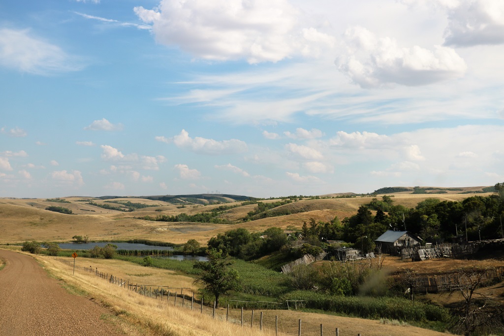
When we left St. Victor we drove a gravel road for awhile before connecting to Highway 2 north to Assiniboia.
Since it was now after 6 o’clock we found a restaurant for dinner before checking into the hotel. We are staying here three nights and doing some exploring with Assiniboia as our homebase. Tomorrow is a trip northeast to Claybank to visit an old Brick Plant.