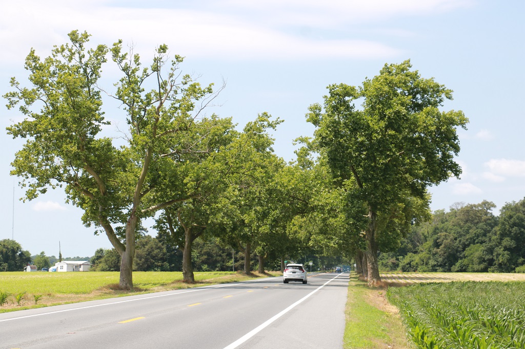
It is a 30 minute drive across the Delaware-Maryland border to get to Delmar, which is practially on the border (hence the name Del for Delaware and Mar for Maryland) and where we were to spend the night. But we planned to tour around Maryland a bit and find a few geocaches while we went along. We found a few regular geocaches on our way to an earthcache at the southernmost point of Delaware and then headed north and west to explore roads and find some more geocaches.
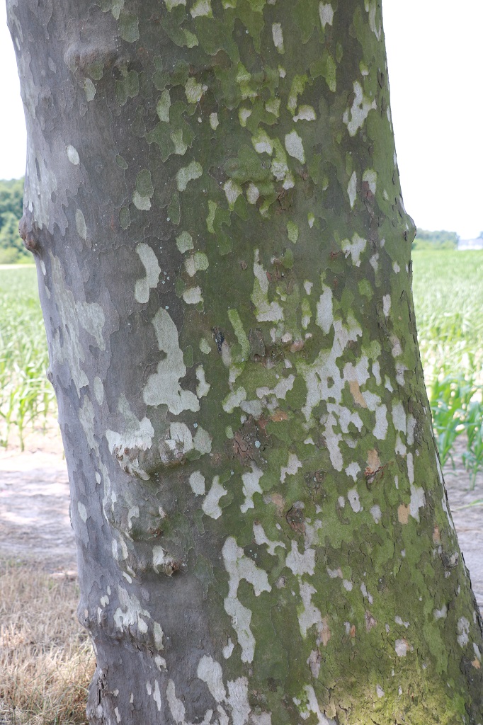
I don’t know the name of these trees, but I liked the bark.
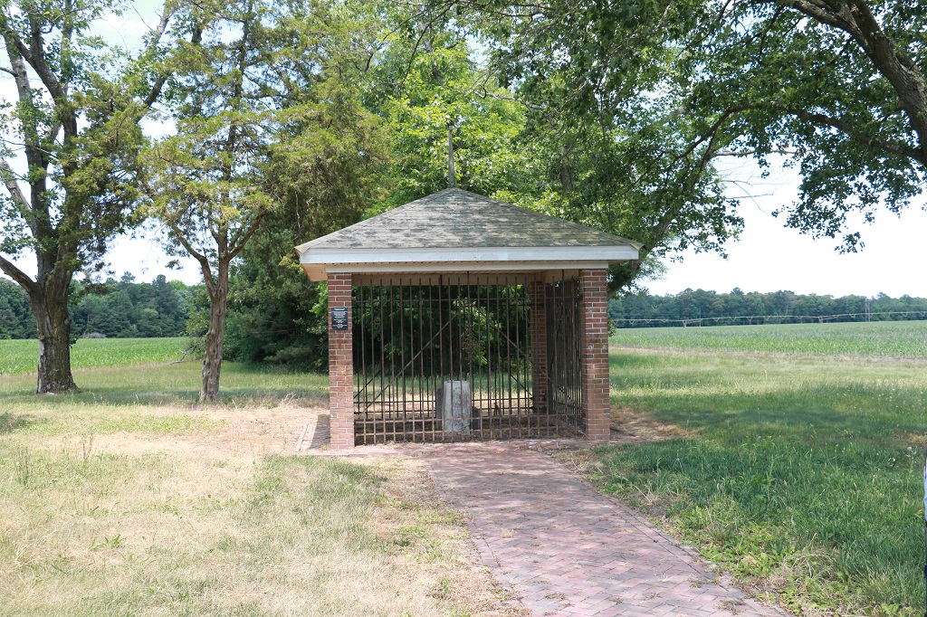
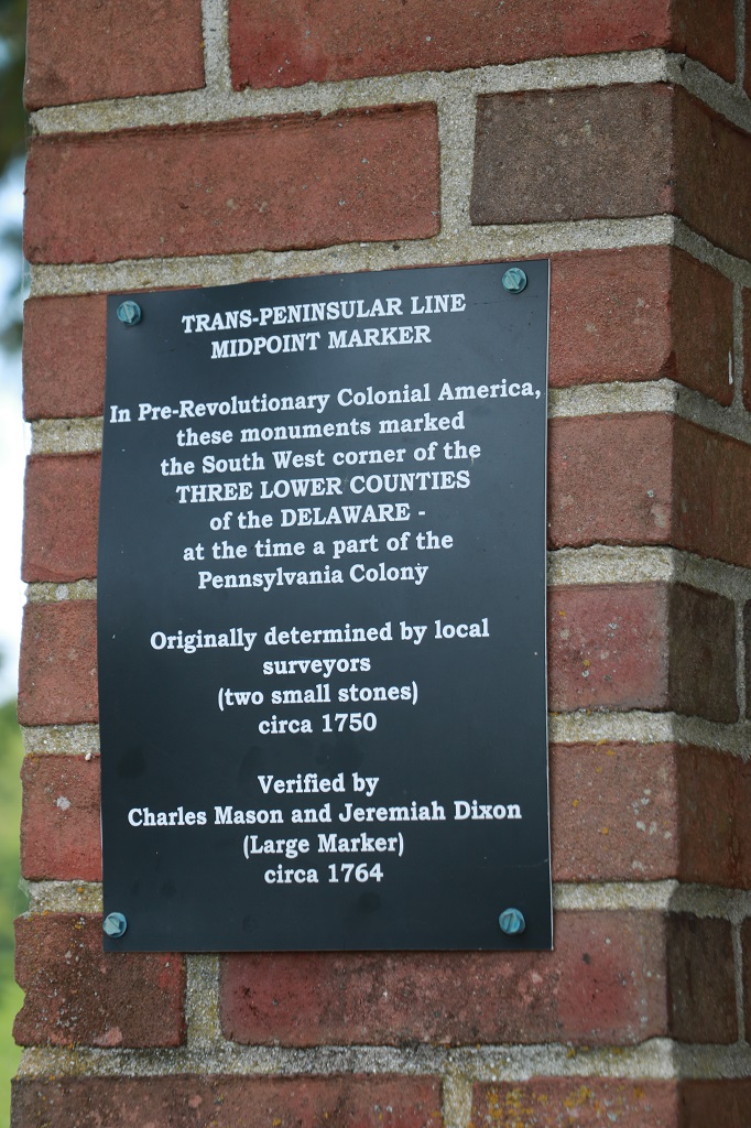
The earthcache was called Middle-Point Mason-Dixon Marker. Earthcaches are points of geological or historical interest (there is no container with a log paper to sign) and you must send the cache owner the answers to the questions they ask based on the information given in the cache description or from your observations at the site. I like them because you always learn something new.
Charles Mason and Jeremiah Dixon were surveyors. The Mason-Dixon line is a demarcation line separating four U.S. states, constituting parts of the borders of Pennsylvania, Maryland, Delaware and West Virginia. They did the survery between 1763 and 1767 as part of the resolution of a border dispute involving Maryland, Pennsylvania and Delaware. This dispute was caused almost a century earlier because of the somewhat confusing proprietary grants by King Charles I to Lord Baltimore (Maryland) and by his son King Charles II to William Penn (Pennsylvania and what later became parts of Delaware). Considering the simple tools they had to work with the line is remarkably straight.
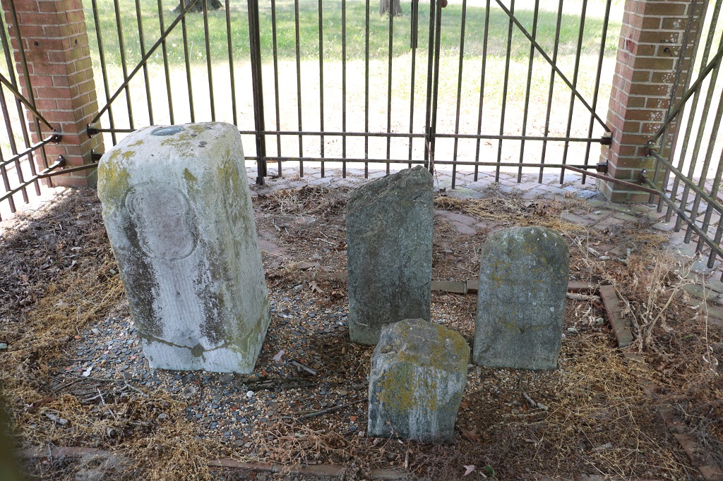
The official stone is the large white limestone one. The other three were placed near it by others. One was found in a field, one was a marker that was dug up nearby when a road was being worked on and the third was an original marker for the boundary that was off by about 32″.
This was the first monument marker for what became known as the Mason Dixon line and marks its southernmost point. They set stones like this every mile and would place a ‘crownstone’ every five miles. (It was called a crownstone because there was a crown on the crest of Lord Baltimore who was given the land of Maryland by the king.)
Mason and Dixon set about 300 of these large limestone markers along the boundary they surveyed. They were quarried in England on the Isle of Portland. Each weighed about 500 lbs and stood from 3 1/2′ to 5′ high before being set.
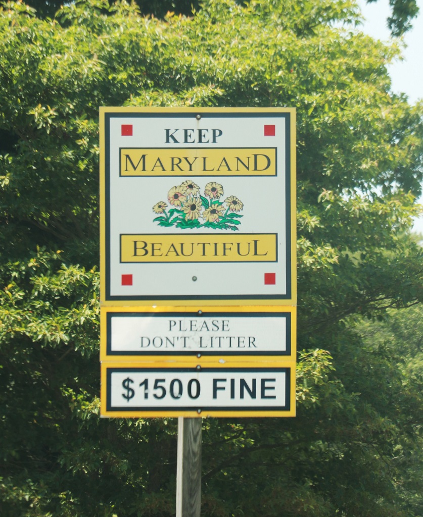
We did not see a Welcome to Maryland sign but this will count. State #16.
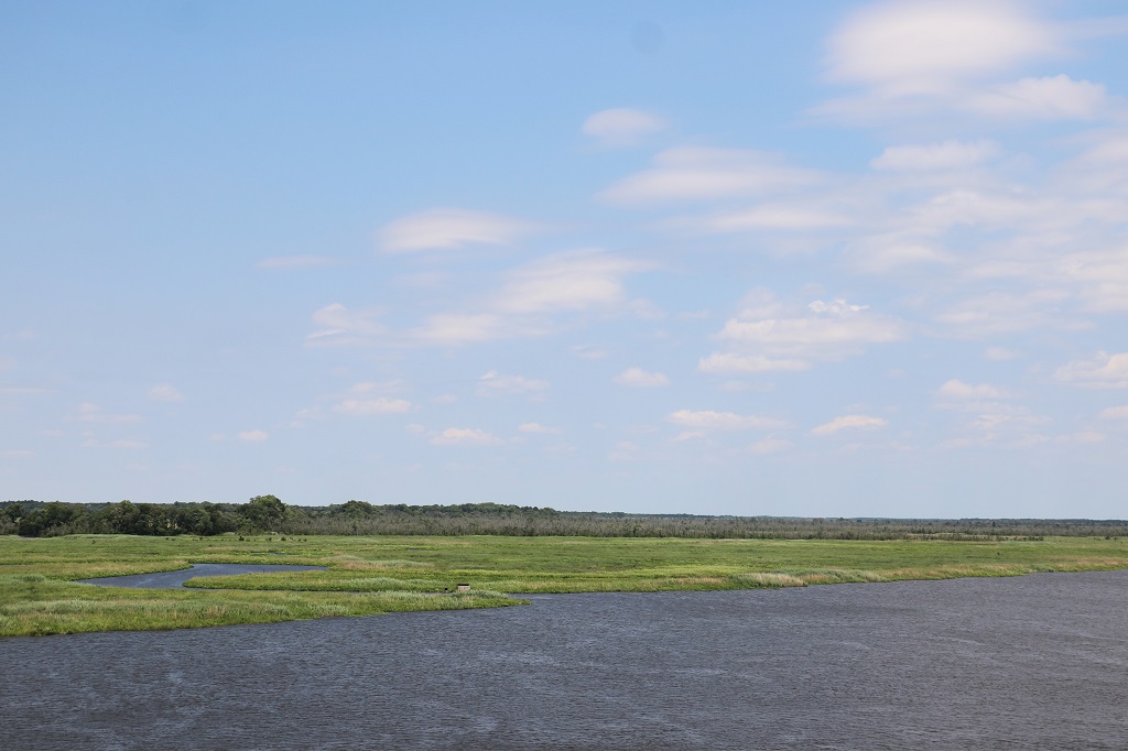
There is a massive marshland that runs along the east side of Maryland. It stretches in and out for miles. Most of the area is protected as the Blackwater National Wildlife Refuge. We drove past and through it off and on all day.
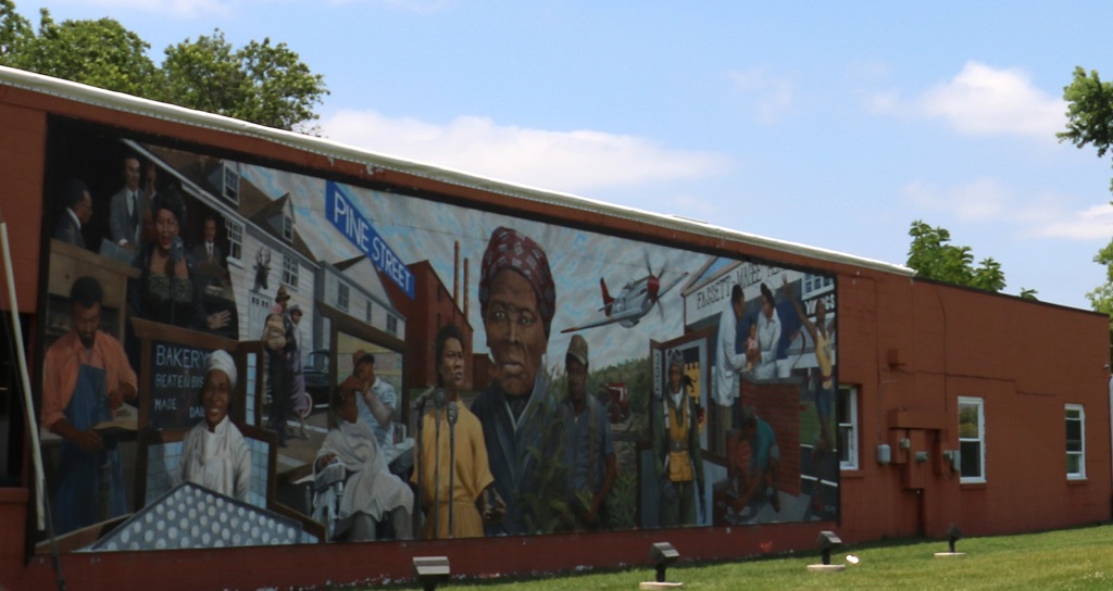
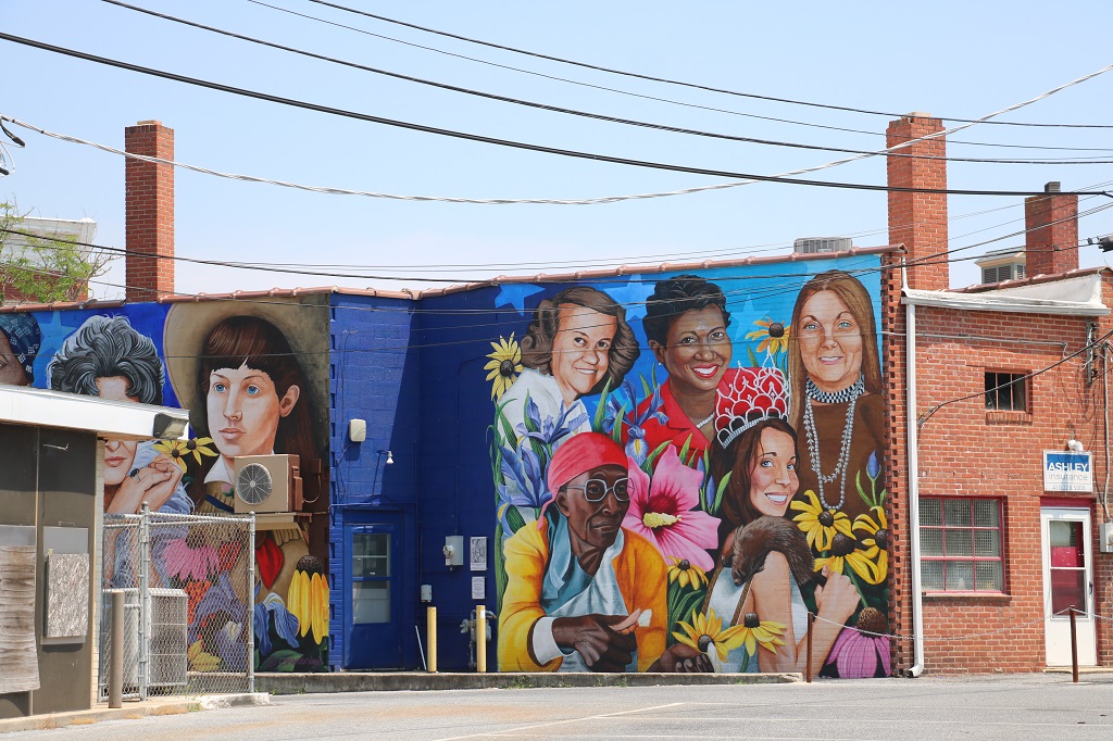
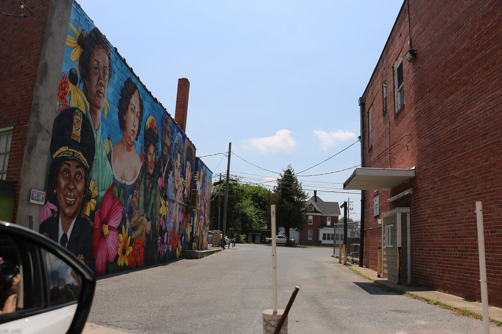
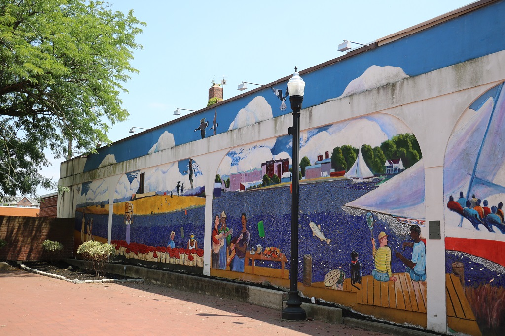
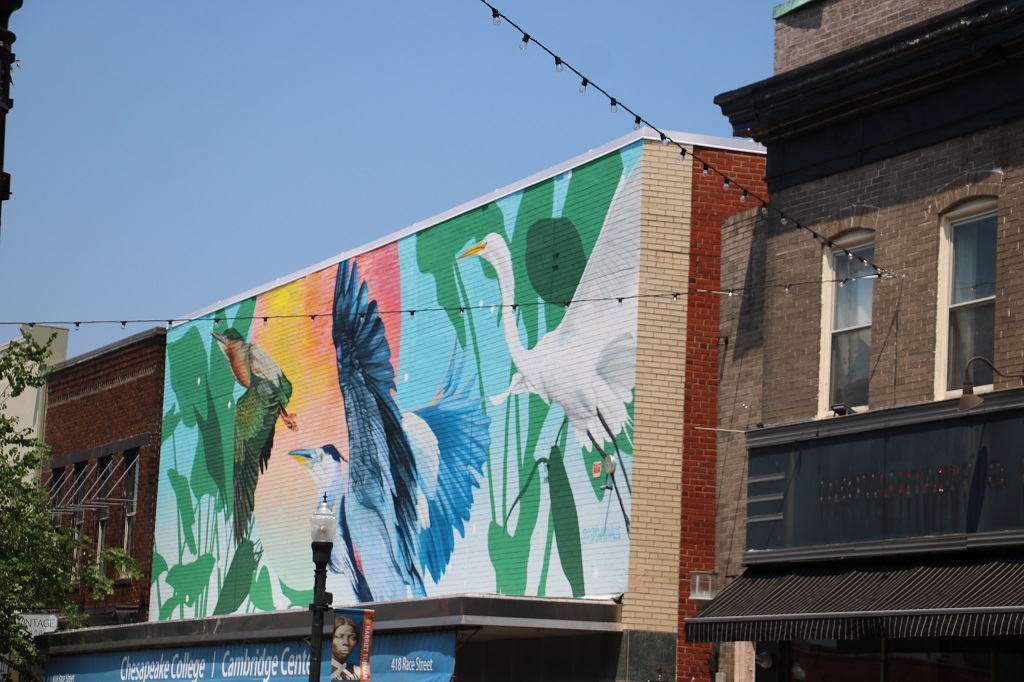
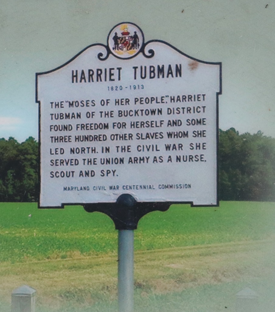
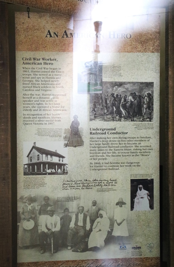
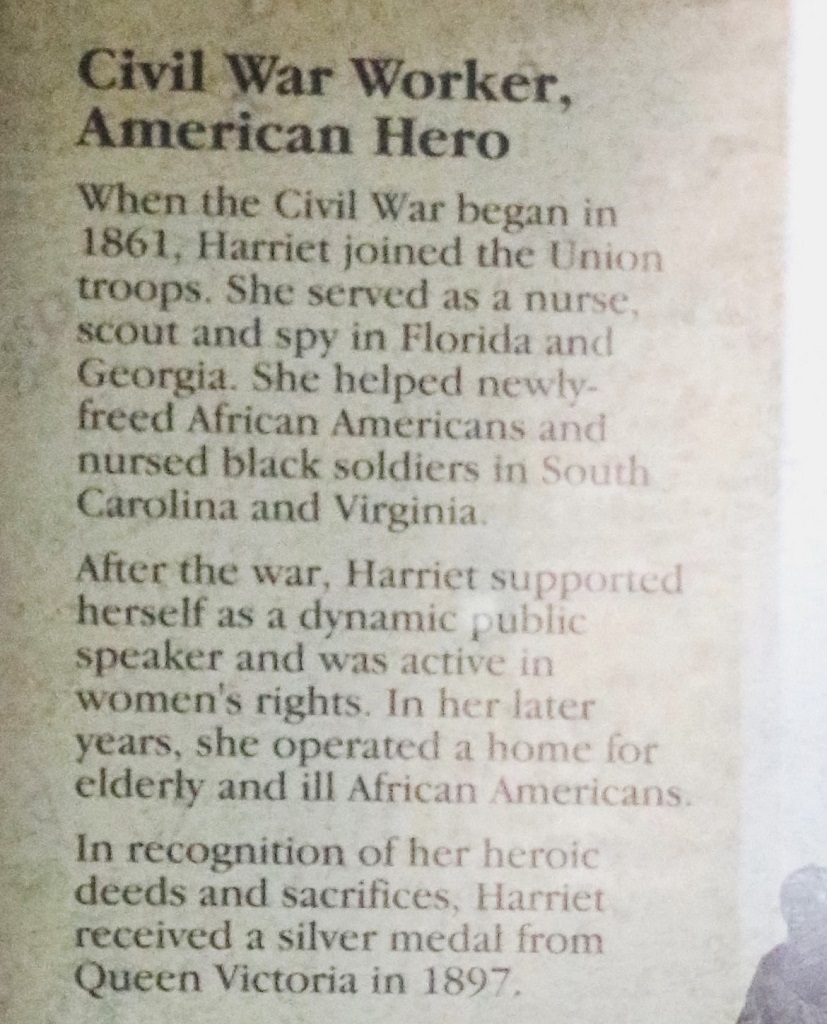
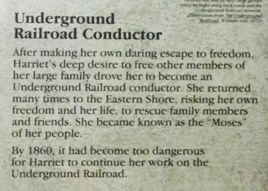
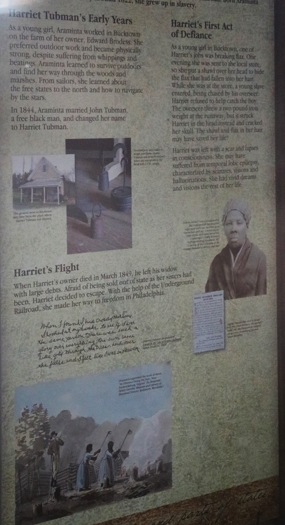
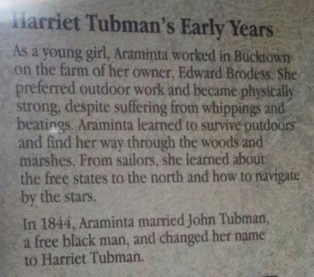
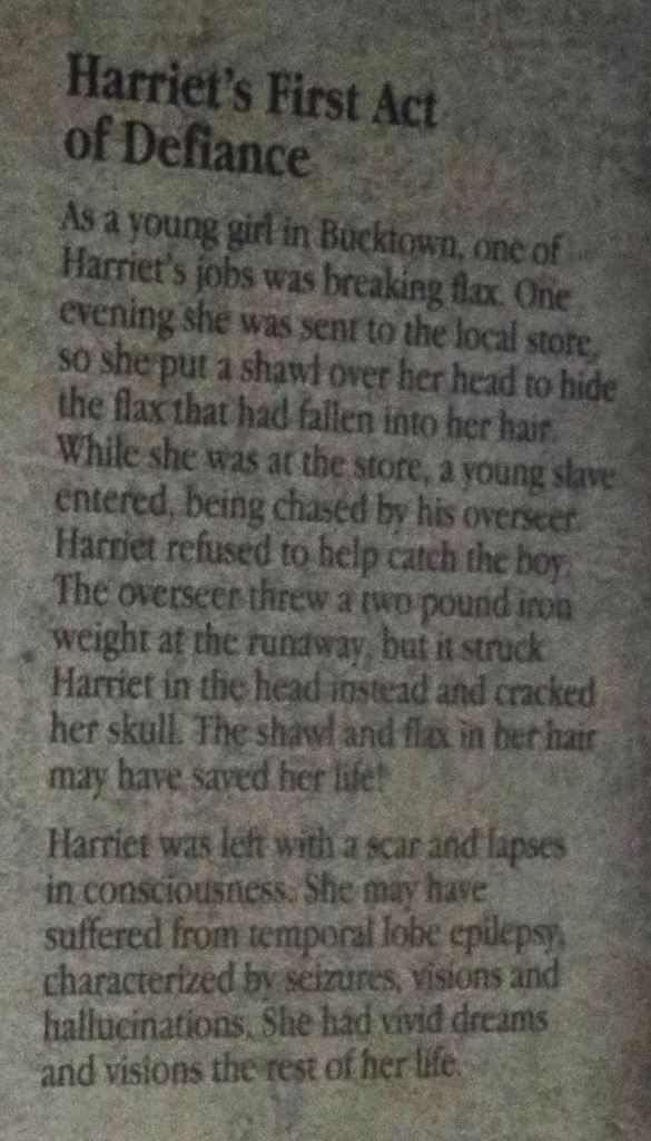
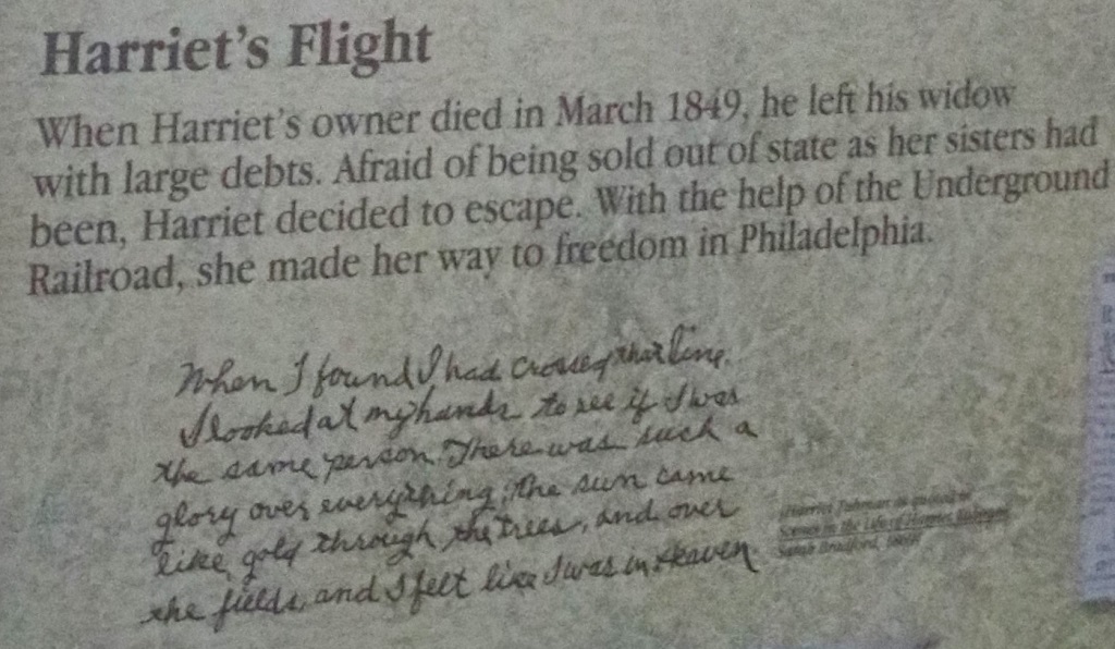
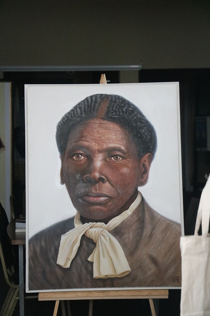
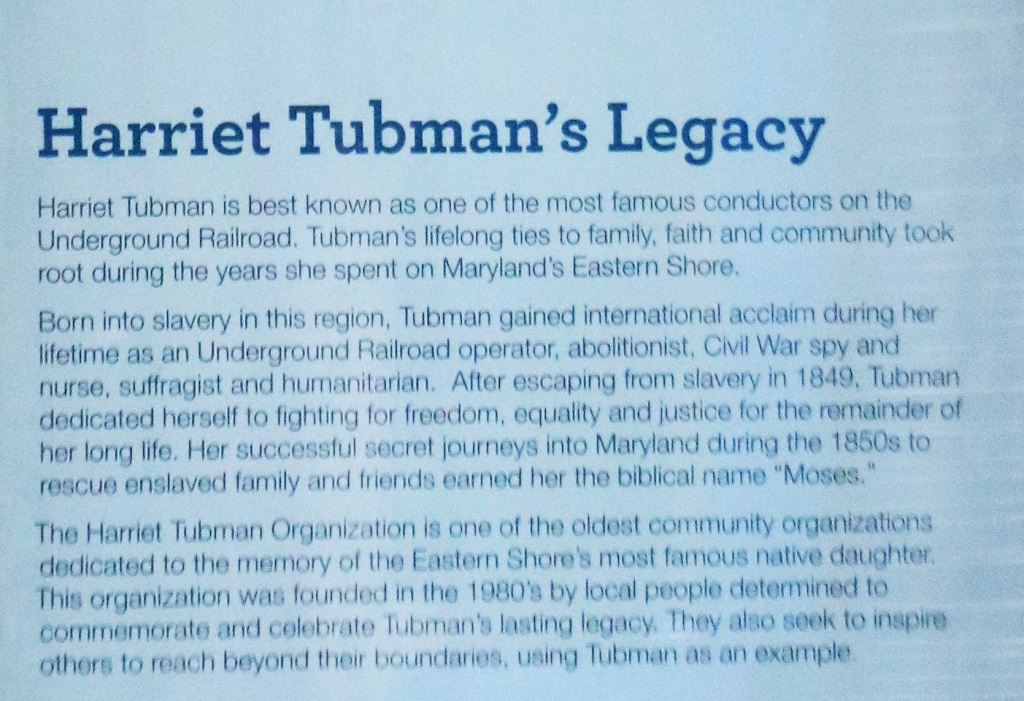
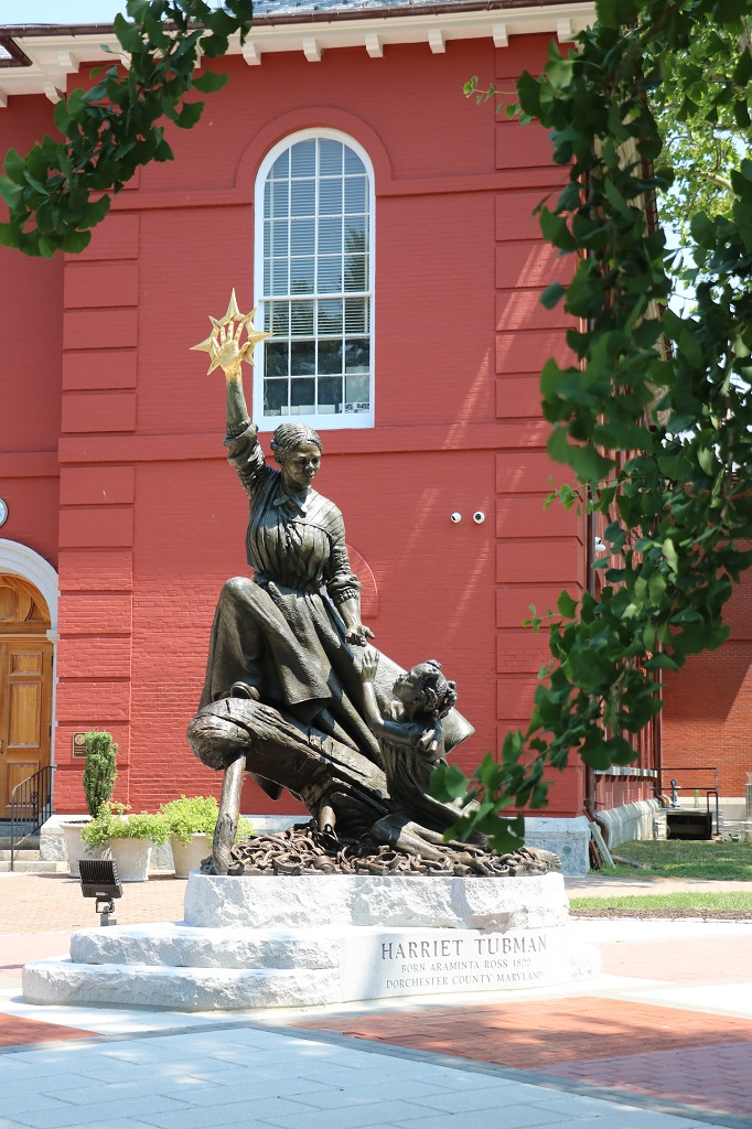
We followed a line of geocaches and ended up in Cambridge. A fortuitous location as this is where Harriet Tubman was born a slave and escaped and became the “Moses” of the Underground Railway that helped slaves from the south escape to the north and freedom. There are about 30 lovely murals around the town and many of them have her featured in them.
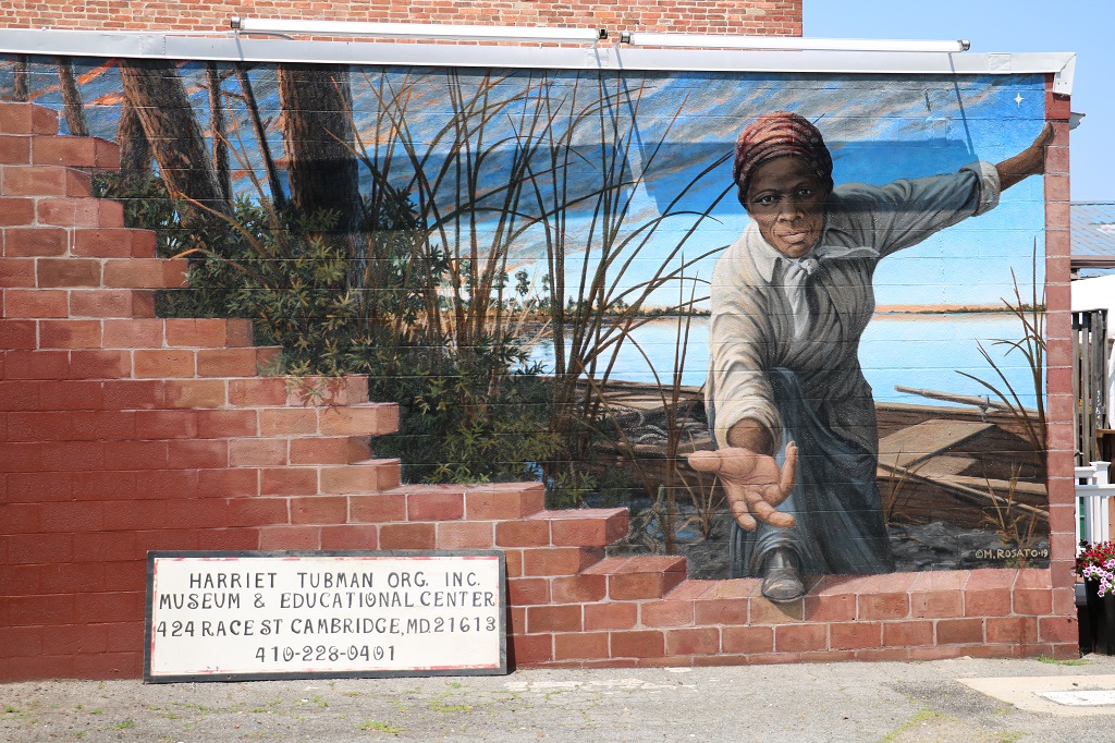
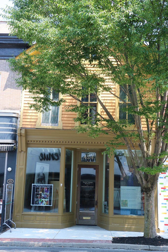
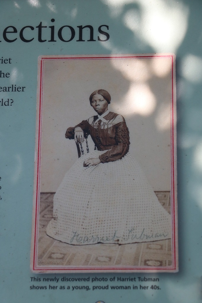
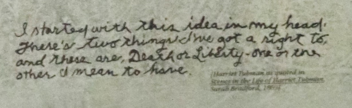
There was also a Harriet Tubman museum, but it was closed and we later drove past a National Park Harriet Tubman Visitor’s Center that was also closed. Nonetheless I found quite a bit of information about her life by taking photos of the posters through the glass of the museum door. They are not the clearest pics but I tried to sharpen them up a bit. Some bits were unreadable though.

Harriet was her mothers name.
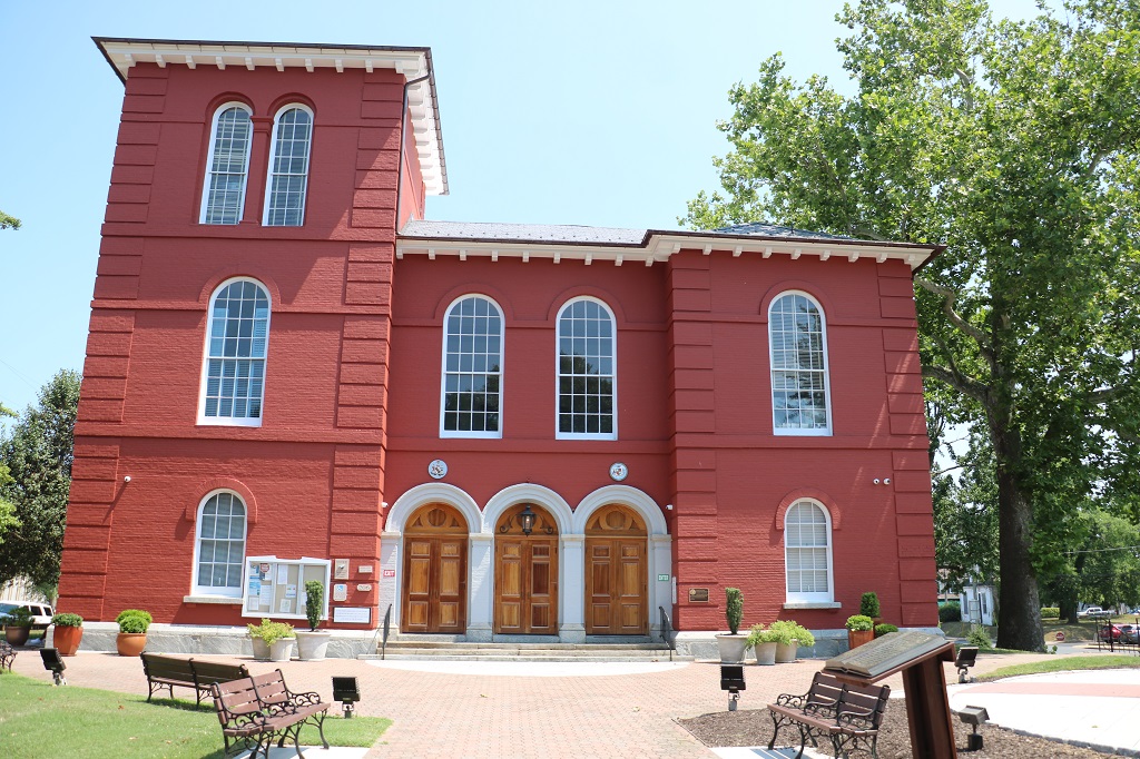
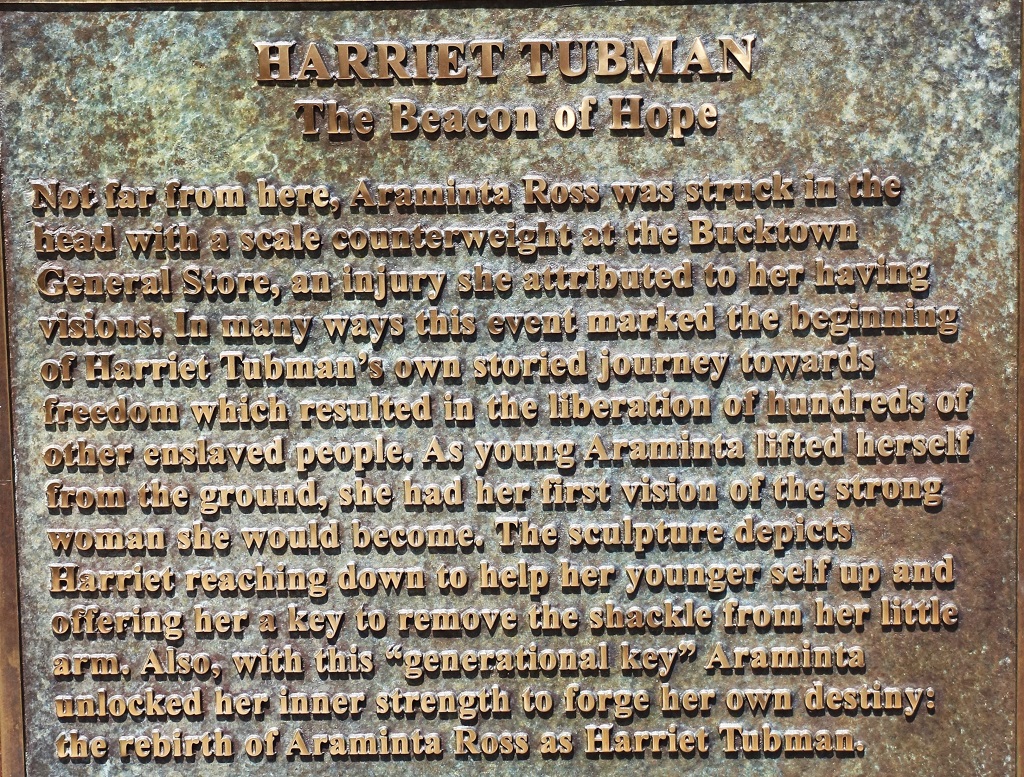
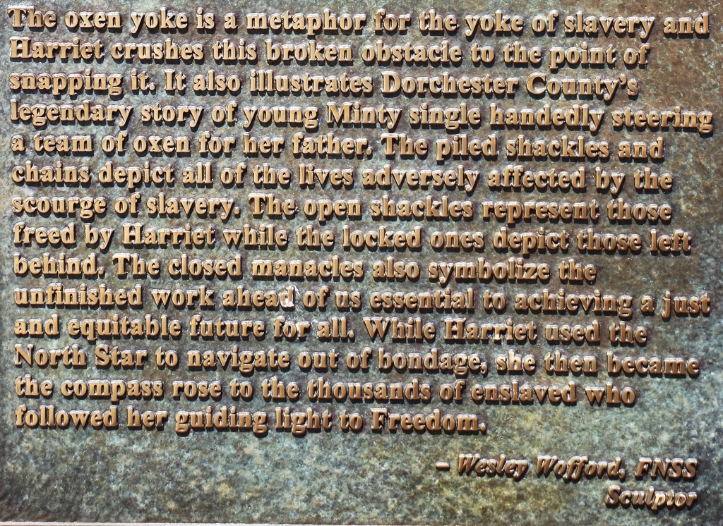
In honor of the bicentennial year of Tubman’s birth (2022), a sculpture called, A Beacon of Hope, has been permanently installed at the Dorchester County Courthouse, a place where enslaved ancestors were auctioned, and Tubman’s niece was rescued.
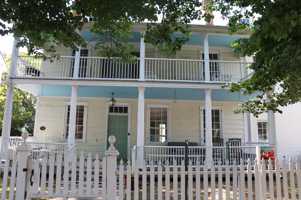
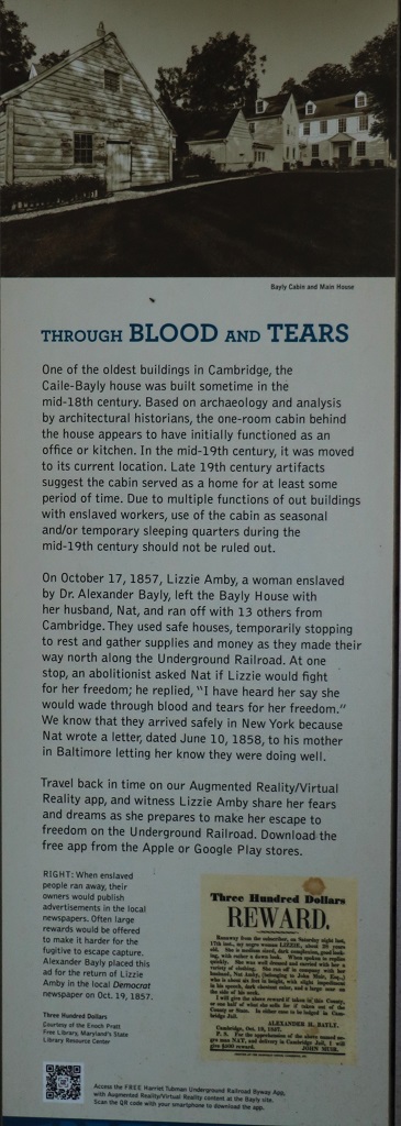
Just up the street and on the other side from the courthouse I noticed there was an information sign in front of this house. So, of course, I had to go see what it said.
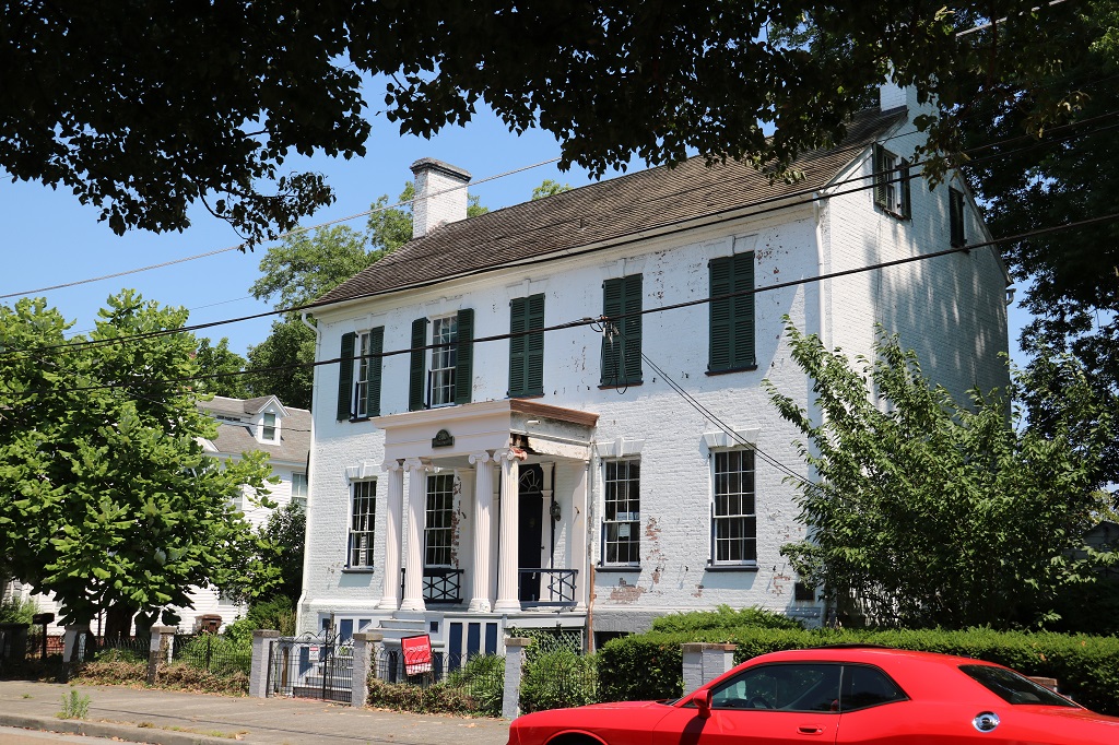
This nice house was across the street and for sale.
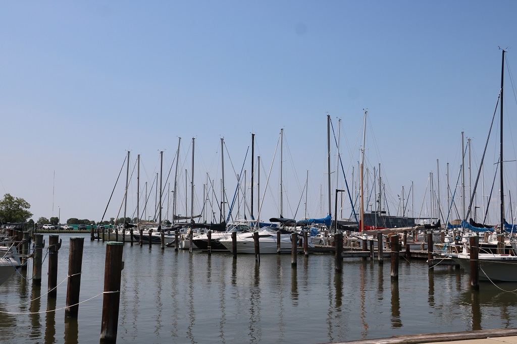
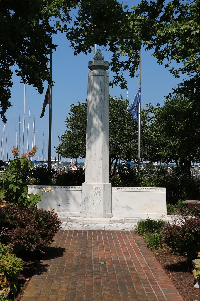
We drove up to the marina and found another cache at the WW I and II memorial.
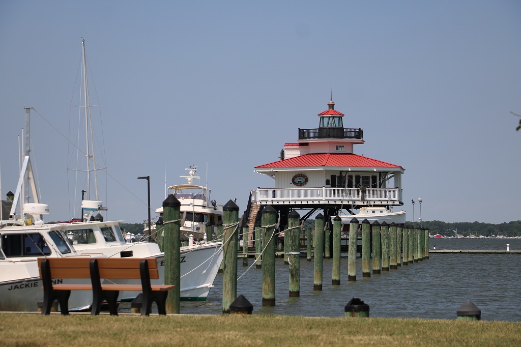
The Choptank River lighthouse
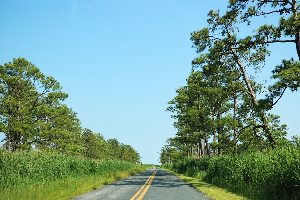
After a Dairy Queen ice cream treat for lunch we headed a bit further west and ended up wandering through the Blackwater Marsh for over an hour trying to find the road that would take us south to Salisbury and nearby Delmar where our hotel is.

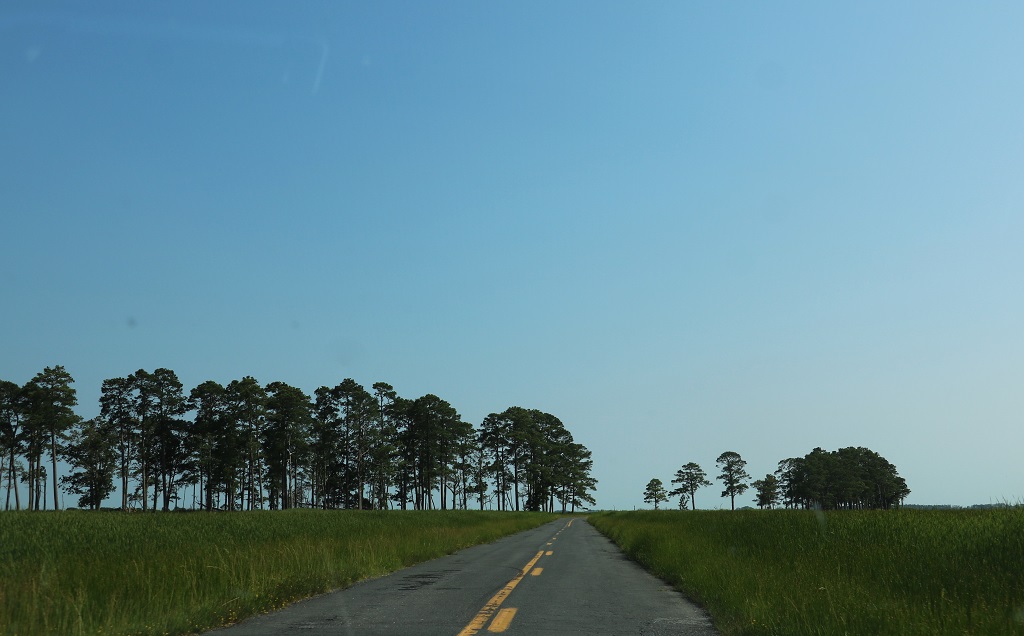
There were portions of the road that were covered in water and you could easily see water right at the edges. I took a couple of photos but the windshield was so wet from navigating the water that they did not turn out. Definitely not a good place to go off the road.
We eventually found our way back to the main road and headed south to Salisbury and then up to Delmar near the border for the night. Another good day of exploring and information.
