After breakfast we headed to the coast to visit Fort Pulaski. This coastal area of Georgia is comprised of low wetlands and dozens of small interconnected islands. Fort Pulaski is on Cockspur Island.

We arrived at the fort about 11 and did not leave until after 1. I took my two walking sticks and with the double stability was able to walk the entire fort.

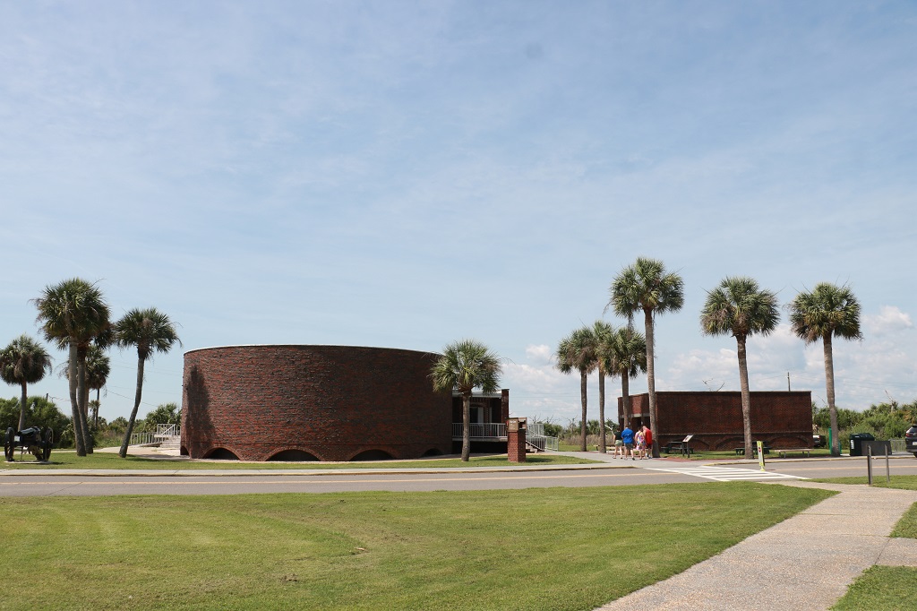
The Visitor’s center was built in the 1950s and the brick was made to look similar to that of the fort.
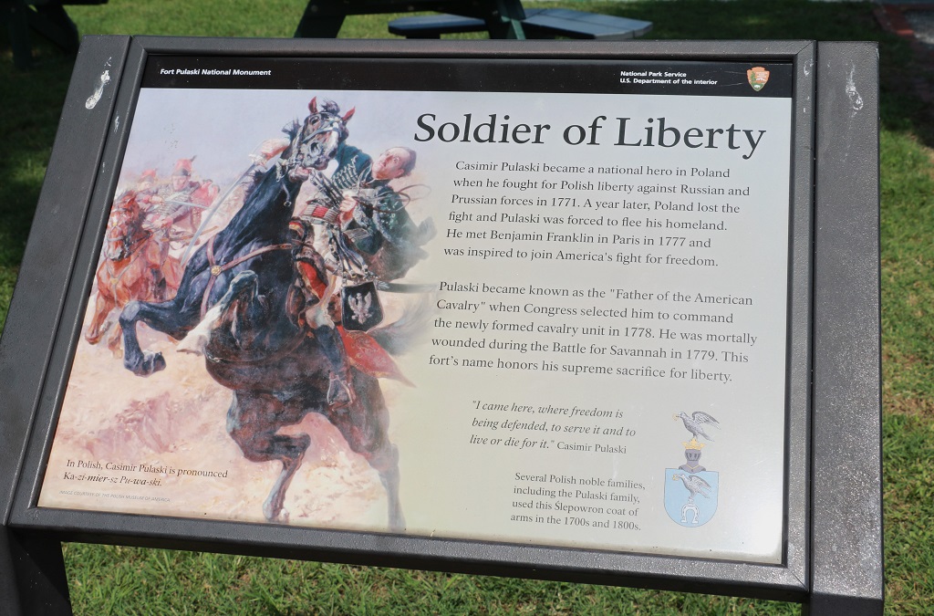
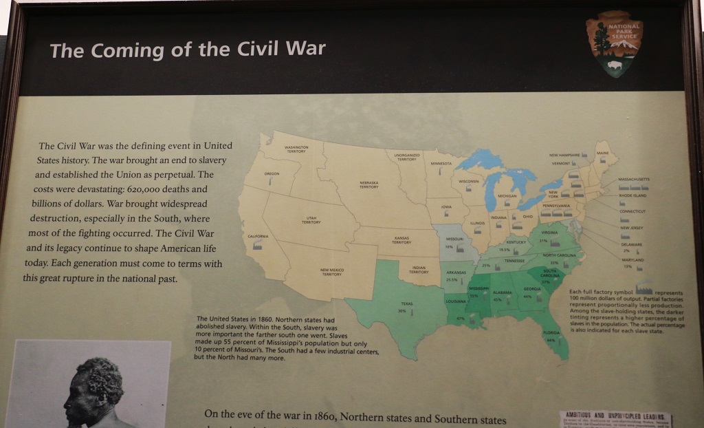
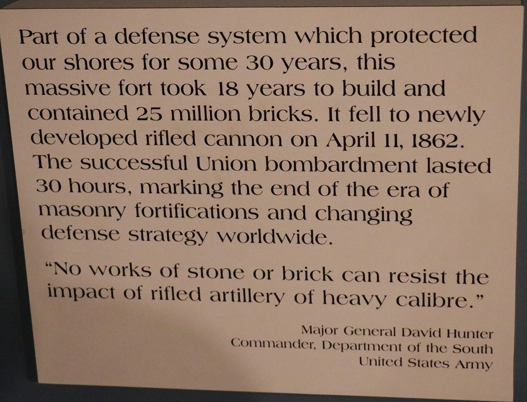
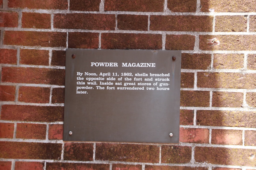
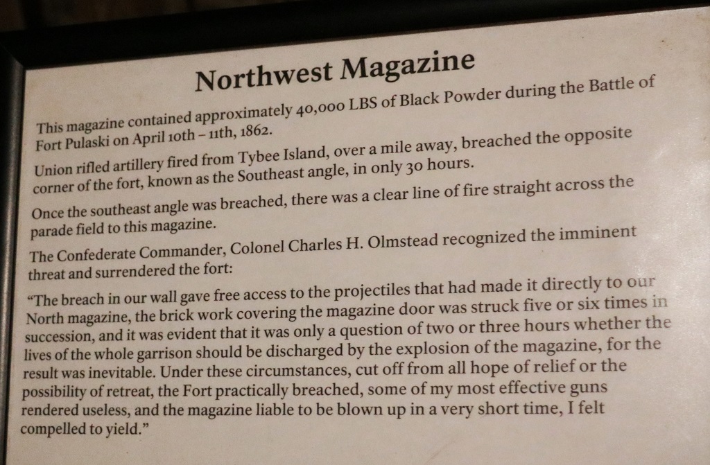
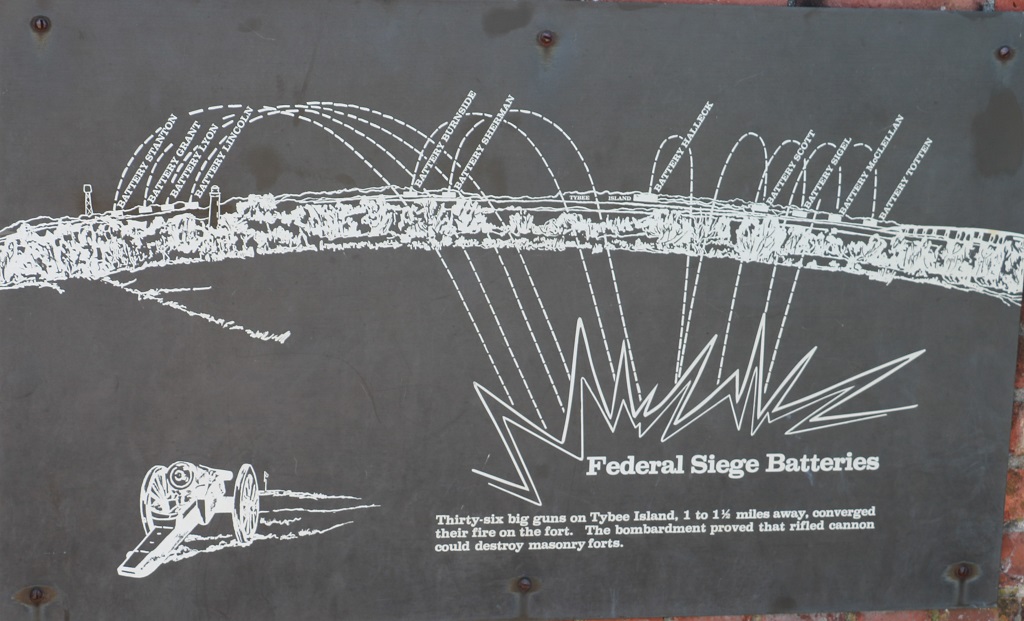
The fort was named for Casimir Pulaski who died during the Revolutionary War. The fort saw no action until the Civil War when it was occupied by the Confederates who surrendered it to the Union Army after a 30-hour bombardment of the new rifled artillery cannon which had a range of 1 to 1 1/2 miles; twice as far as the guns of the time.


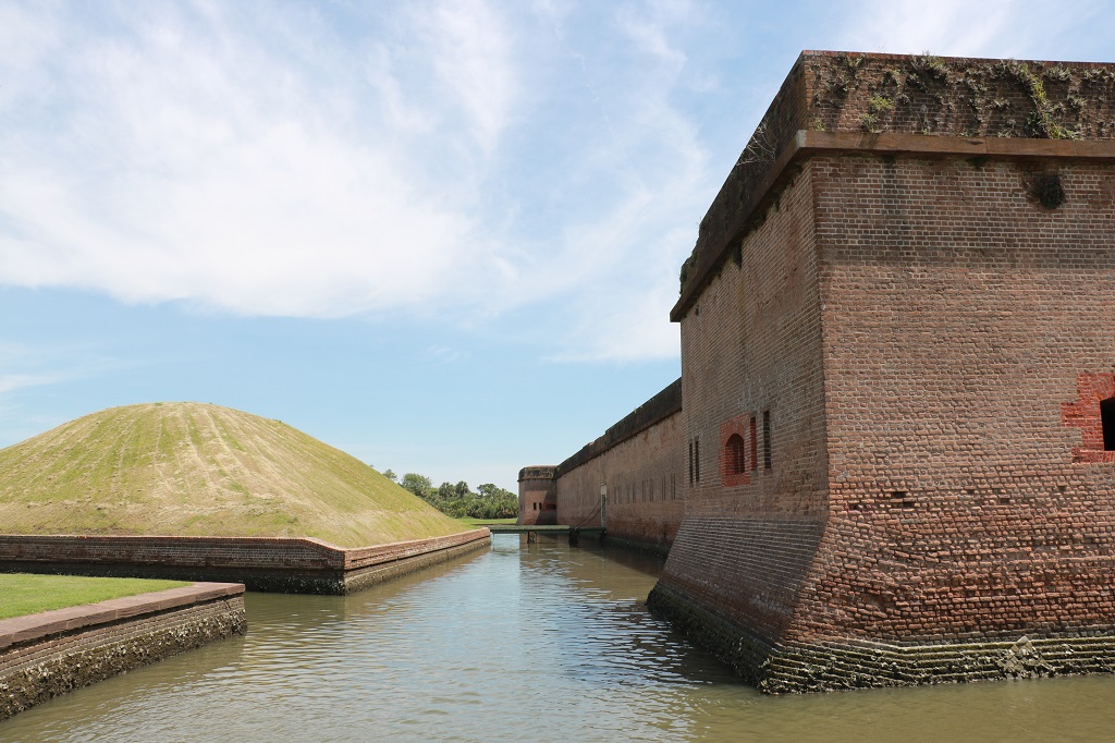
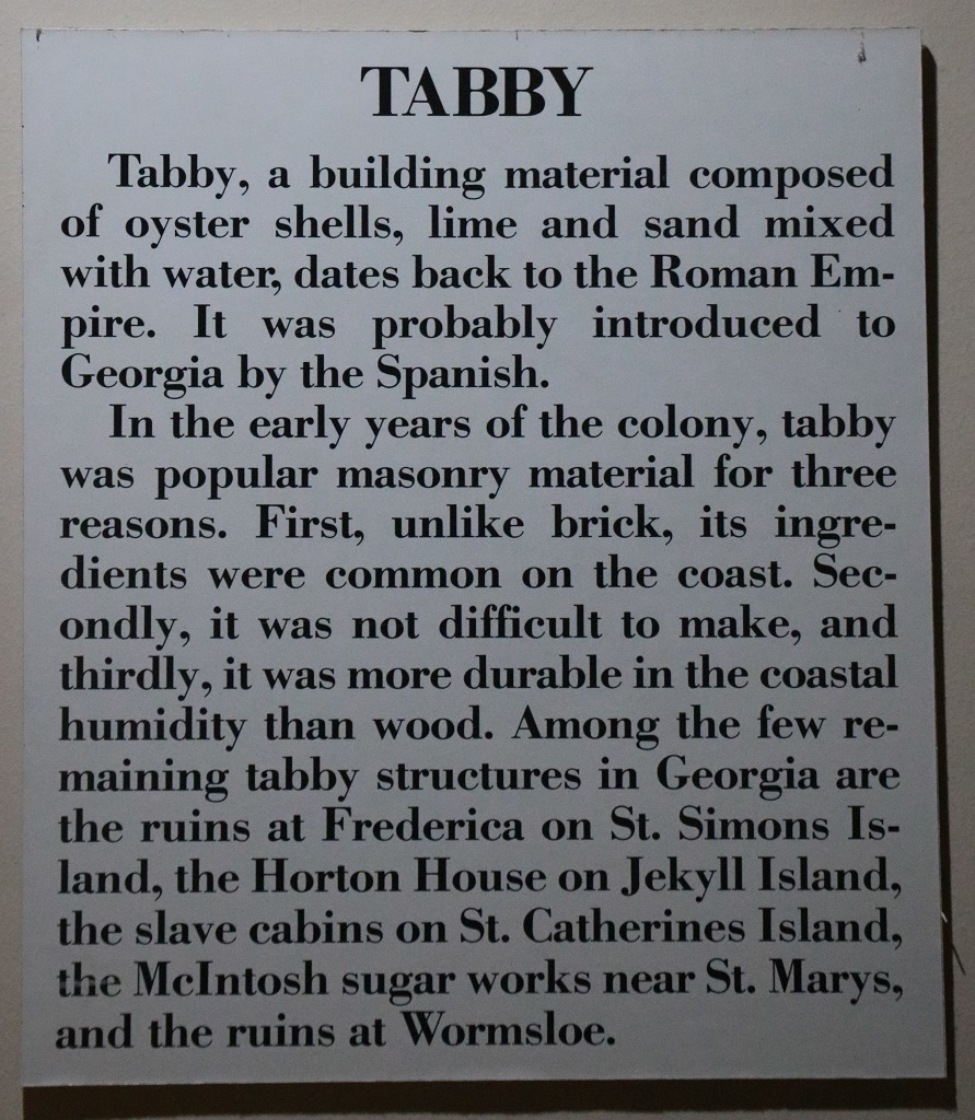
There are rooms under all those earthwork hills which housed the power magazines during the Civil War. They are made with ‘tabby’, which is a cement-like substance made from oyster shells, lime, sand mixed with water. All of the needed ingredients were plentiful on the southeast coast and it, like cement, can be molded and shaped.
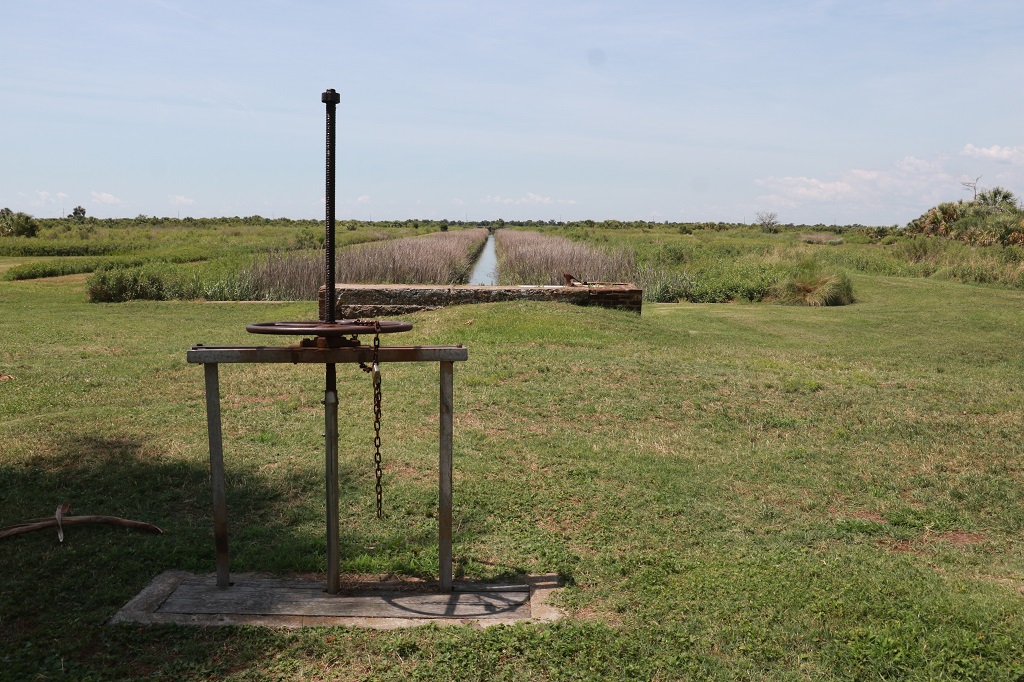
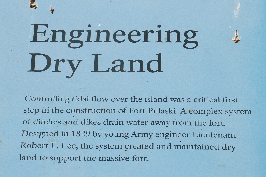
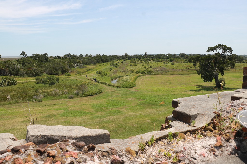
The canals are still used to control the flow of water to the fort moat.
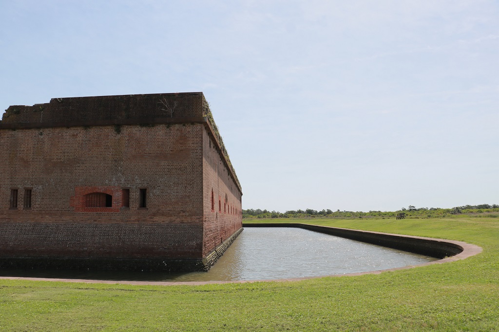
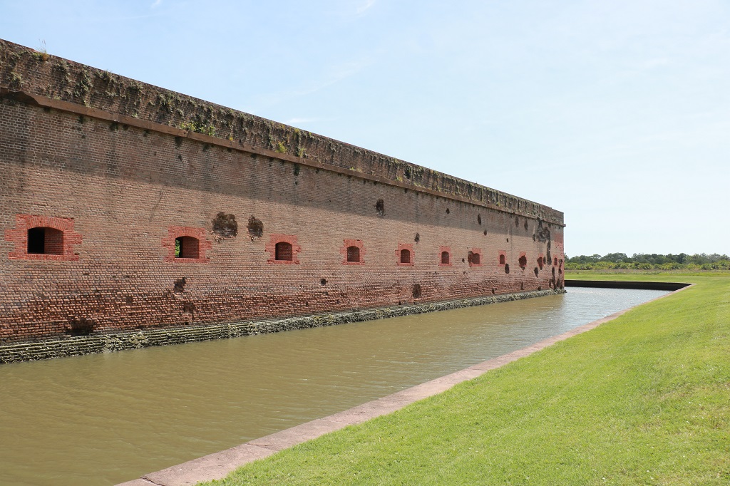
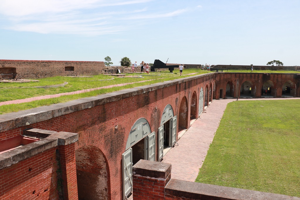
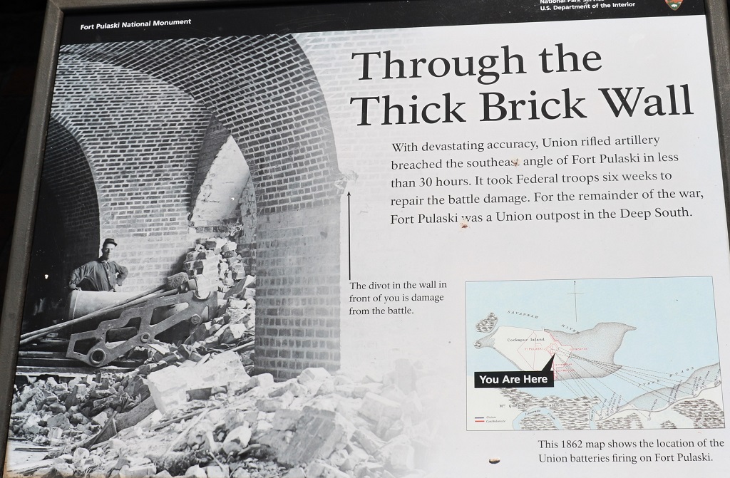
Two sides of the fort are riddled with divots from the Union artillery fire the breached the SE wall and convinced the Confederate Colonel Olmstead to surrender.
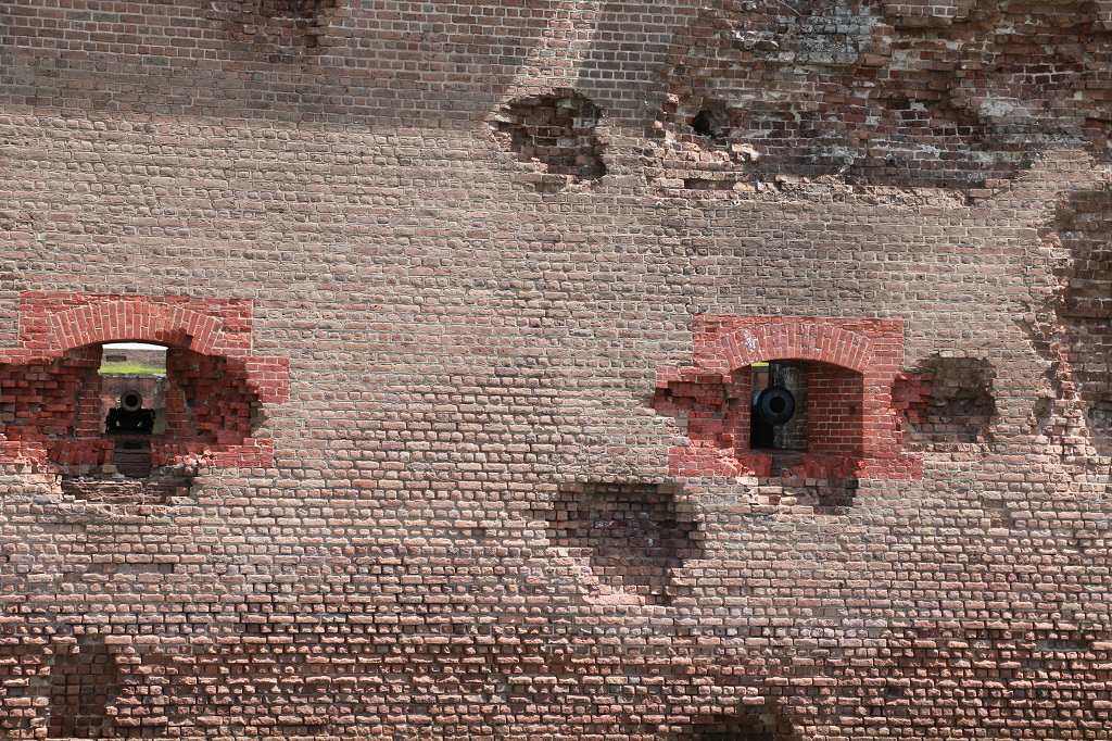

There are still a few cannon balls stuck in the wall.
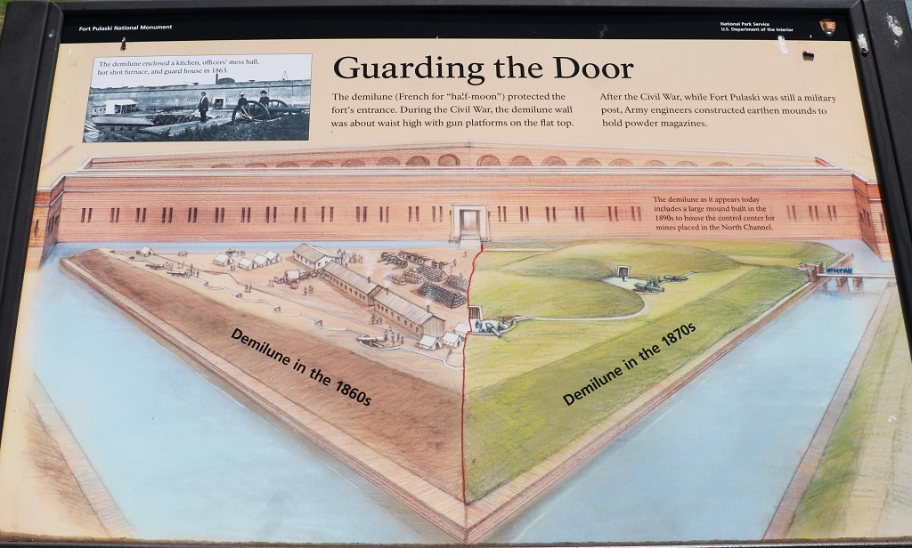
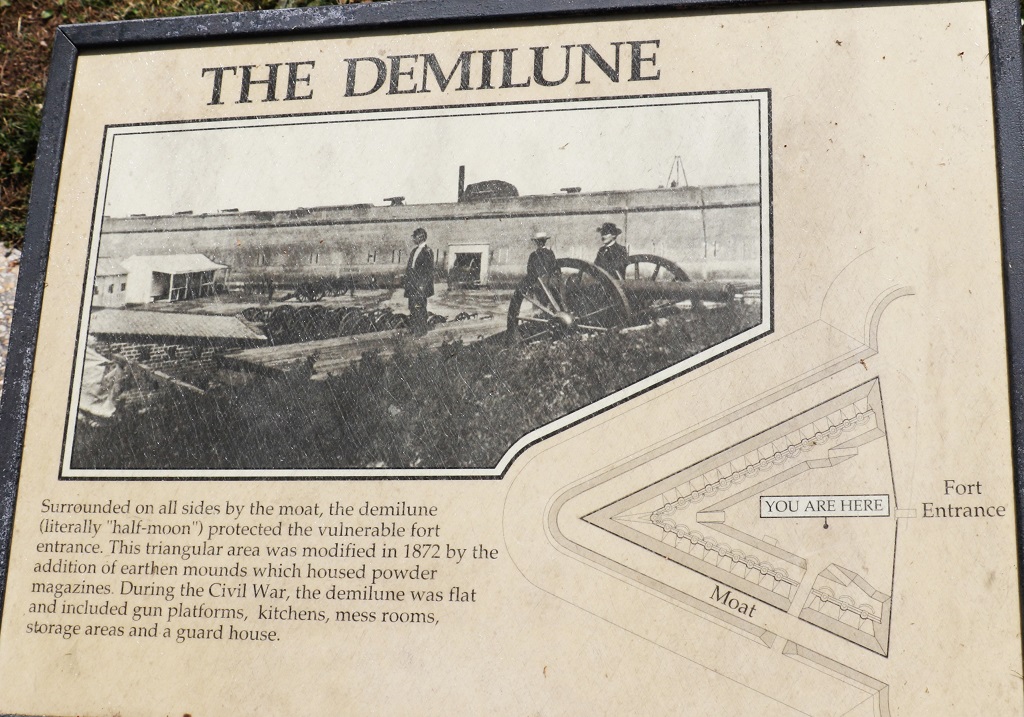
There are two drawbridges to access the fort. The first is from the ‘shore’ to the demilune (where all the dirt hills now are) and the other is from the demilune to the fort. They required two men to work the mechanisms to raise and lower them.
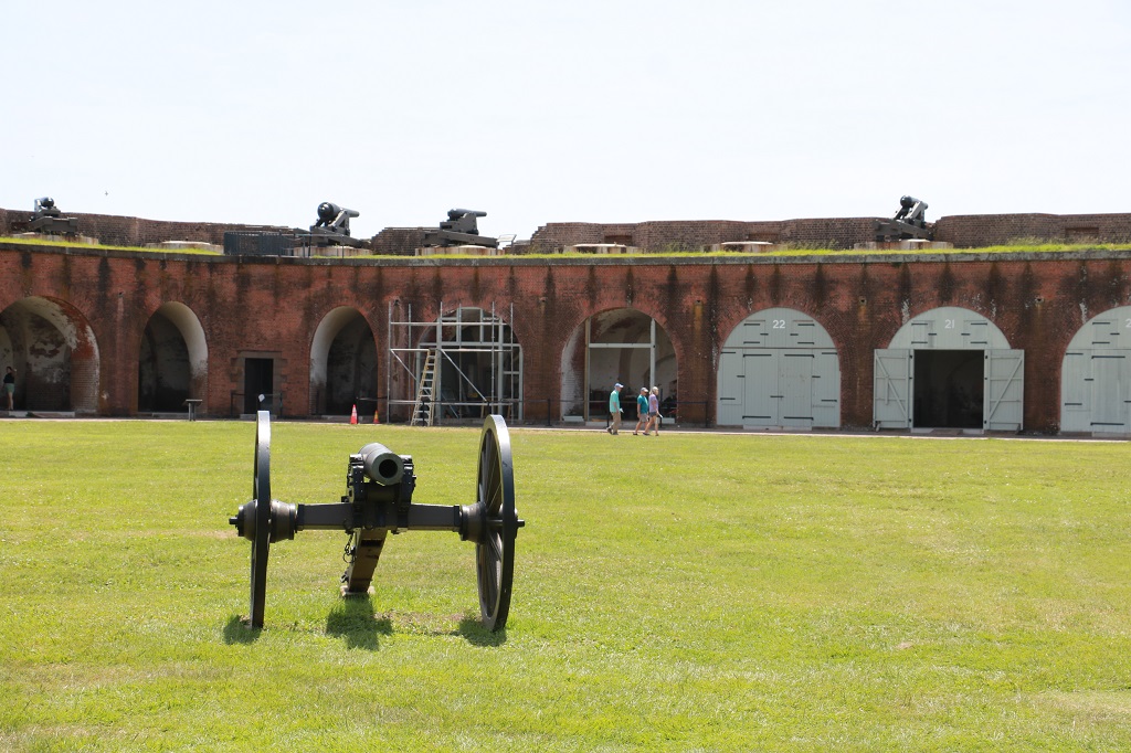
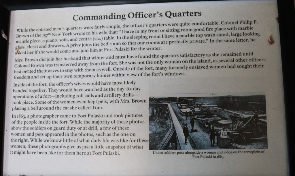
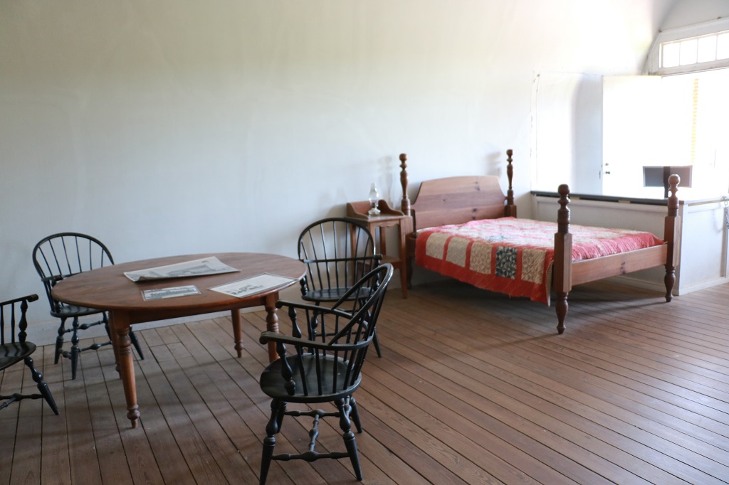
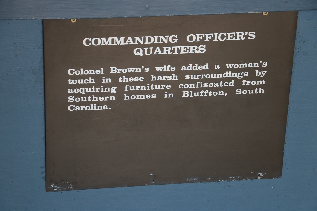
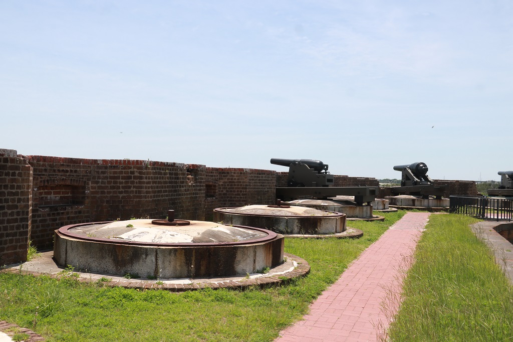
The fort was designed to have 146 guns. It never had more than 100, which was a good thing because with a full compliment of guns there would have been no where for the soldiers to sleep except tents on the parade ground. As it was the men made small barracks in the various rooms that housed – or were made to house – guns. Even sleeping in the spaces around the guns they practice with. 385 Conderates manned the Fort under Colonel Olmstead but after the Union took it over there were over 1000 soldiers here.
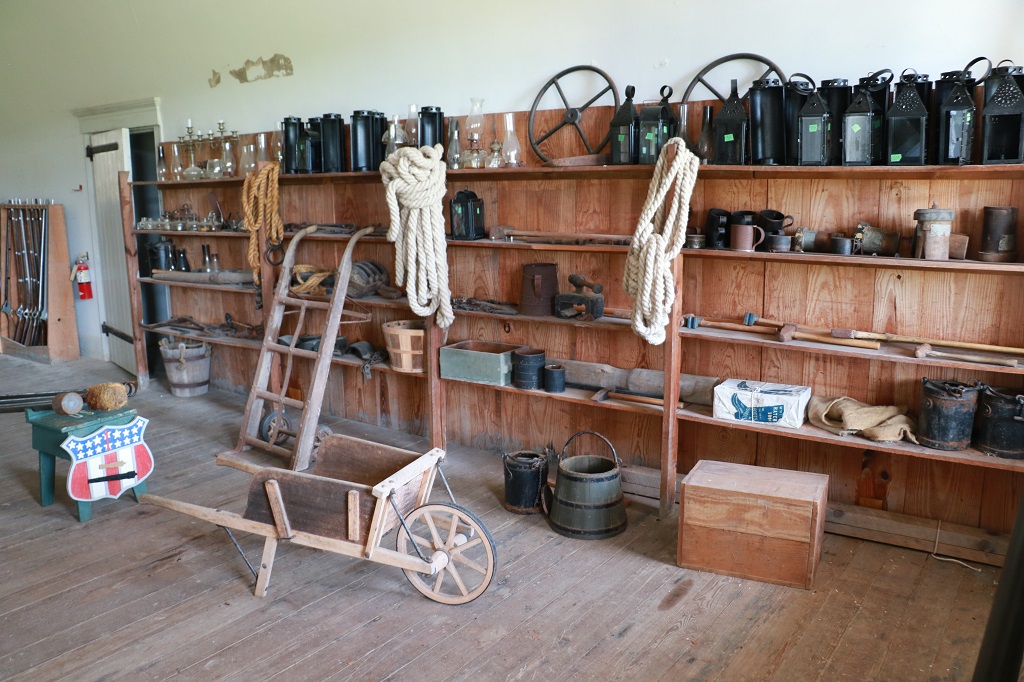
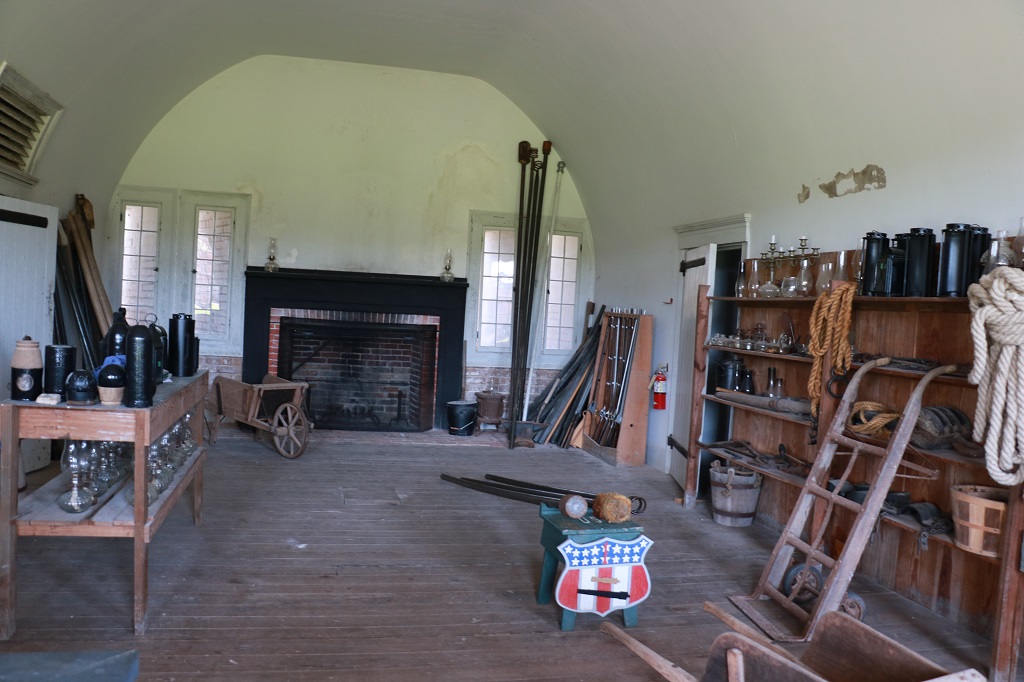
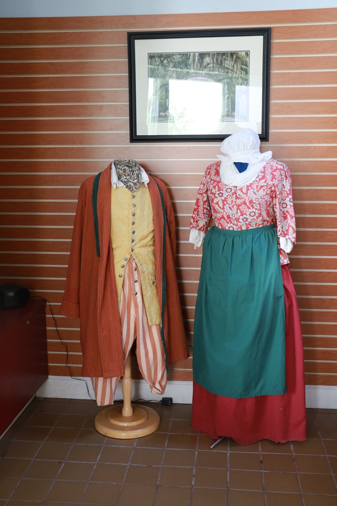
These two pics are set up to give an idea of a typical Quarter Master’s store rooms.


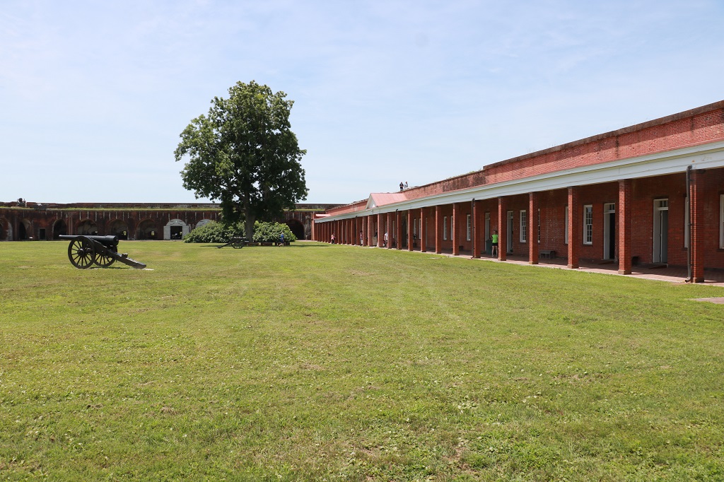
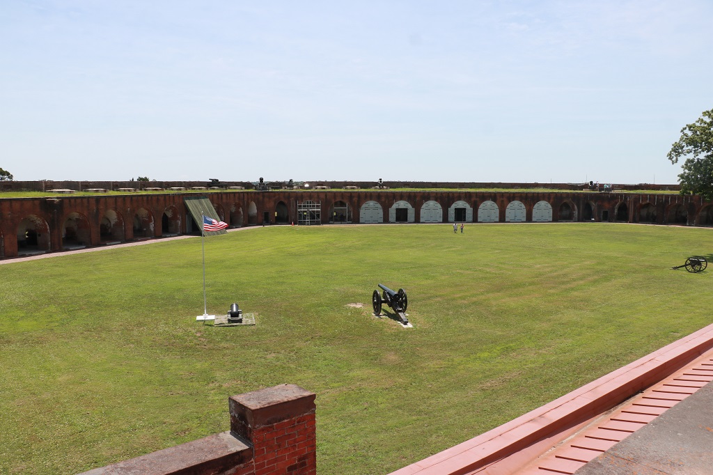
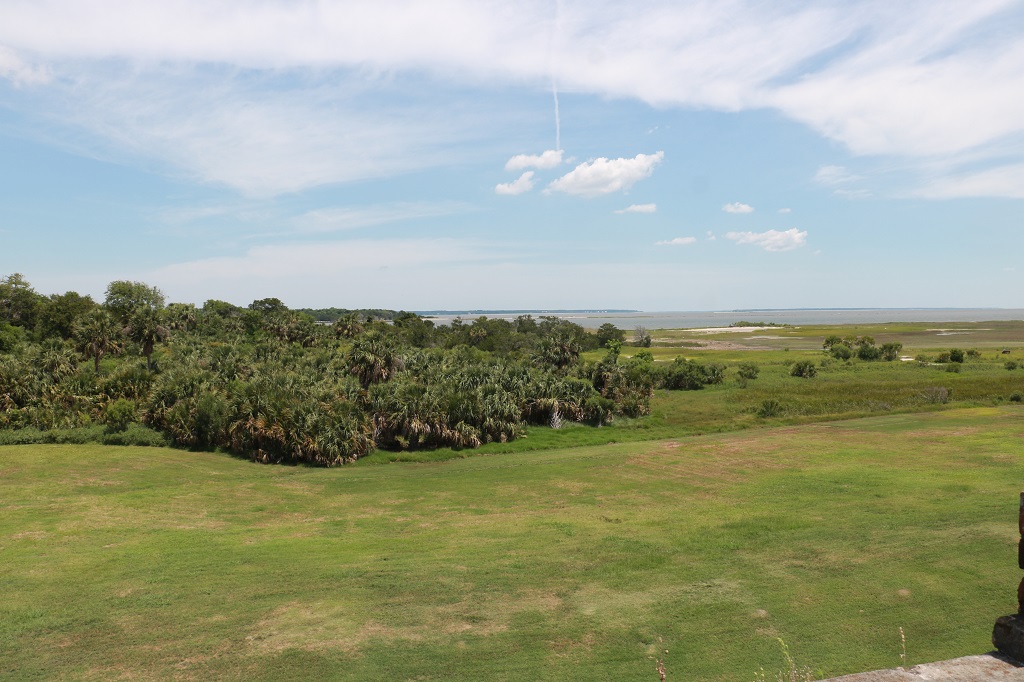
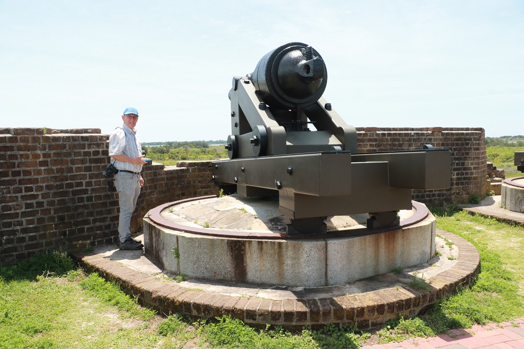
The view toward the ocean and inland was unobstructed from the top of the fort. There were gun placements along all the walls up and down.

We left Fort Pulaski at one and drove further down the causeways to Tybee Island where there is a well-known lighthouse that has been re-built about 3 times. I had read that it was red and white but there was no colour on it at all.

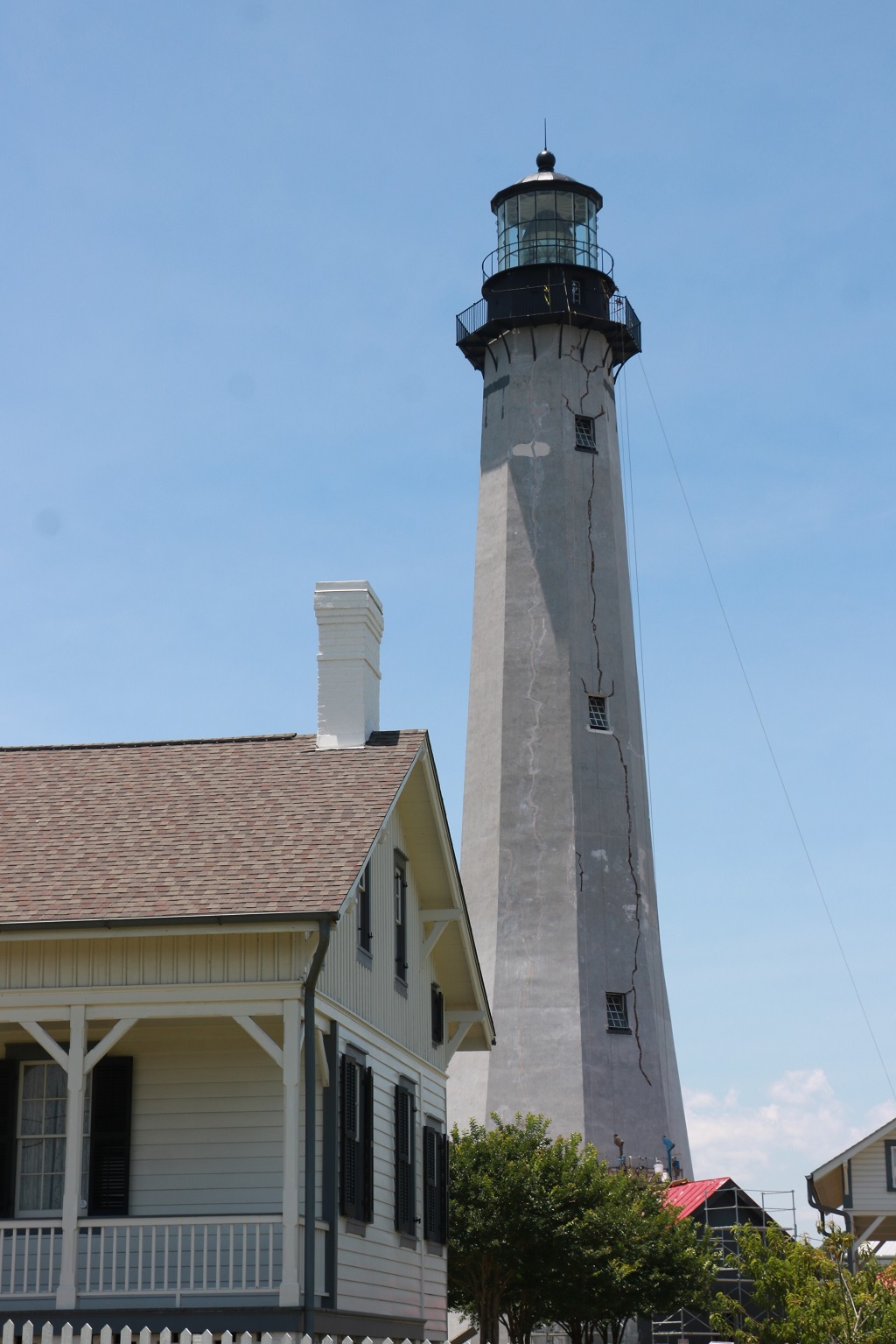
As we passed by people came out and stood at the rail at the top. There are several ropes hanging down the sides as well. Not sure if they are used for rappeling or what, but I was sure surprised to see the big crack that runs from top to bottom.
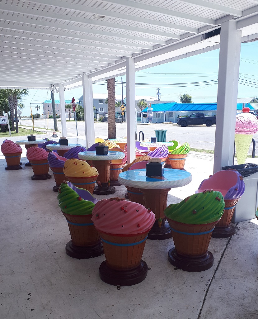
We stopped at the Sugar Shack – a candy and ice cream store that has an amazing variety of sweets and ice cream – for cones for lunch. I liked the outdoor tables and chairs.
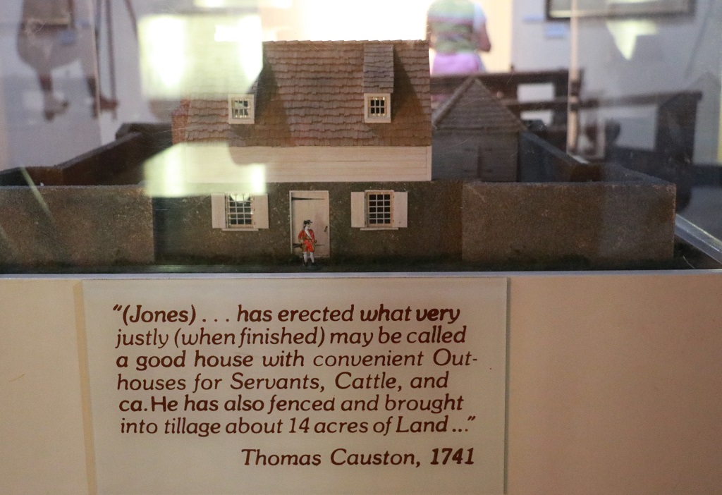
After our nutritious lunch we drove to the Wormsloe State Park. Wormsloe was the name of the village in Wales that Mr. Noble Jones hailed from and that he called his estate. He tried unsuccessfully to grow several types of crops on the marshy low country but finally settled on a dairy. He was granted 500 acres of land by King George III if he promised to raise a small militia force to protect the area from raiding Spanish. Over time he acquired 1400 acres. Several generations later the family created a Foundation but lost their charitable tax status and made a deal with the State of Georgia in 1977 to retain the mansion, several guest cottages and the dairy barns along with 75 acres of land and donate the remaining 1325 acres in lieu of back taxes with the provision the land be kept in it’s natural state in pertutuity. The Department of Resources did build a Visitor’s center by the road but other than that the land is untouched and undeveloped. The 8th generation of Noble Jones still live in the big house and are very involved in many area and state preservation societies. Noble Jones told his children and grandchildren they were never to sell the land – It had to be kept forever and through the State Park system it now will be.

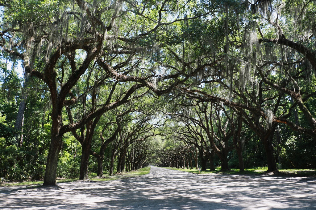
Noble Jones planted 400 Live Oak trees on the property. The one and a half mile lane is now lined with 130-year old trees. Live Oaks mature at about 300 years and can live up to 500. Their branches spread out great distances from the truck (sometimes they will touch the ground and then the tree is referred to as an Angel Tree) and the roots underground also spread long distances. This means the bumpy gravel roadway to the museum and the tabby ruins will never be paved as the disturbance to the roots would kill the trees.
I just took a few photos in the museum. John walked the extra distance to the tabby ruins but there were only a few foundations to show where all the oyster shell bricks that were used in the Jones house, and later mansion, and barns, etc. had been made.
We got the last shuttle back to the Visitor’s Center at 4:45 and drove over to Bonaventure Cemetery, which is called ‘the most beautiful cemetery in the world’ but they were just locking the gates. If we have time after we visit the Prohibition Museum and Old Fort Jackson tomorrow we will try again to take a drive through it.
